ecological and floristic inventory of birch creek fen, lemhi and
TRANSCRIPT

ECOLOGICAL AND FLORISTIC INVENTORY OF BIRCH CREEK FEN, LEMHI AND CLARK COUNTIES, IDAHO
by
Robert K. MoseleyConservation Data Center
Nongame and Endangered Wildlife Program
November 1992
Idaho Department of Fish and Game600 South Walnut, P.O. Box 25
Boise, Idaho 83707Jerry M. Conley, Director
Cooperative Challenge Cost-share Project:Targhee National ForestSalmon District BLM
Idaho Department of Fish and Game
Procurement Request No. 15-SO-92-117 (TNF)

i
ABSTRACT
Wetlands at the head of Birch Creek, located on the Lemhi County - Clark County line, contain uniquelow-elevation, peatland communities, collectively referred to here as the Birch Creek Fen. One indicationof this uniqueness is the presence of seven rare plant species, including the narrow endemic and federalcandidate for listing, alkali primrose (Primula alcalina). The ownership of the fen is complex with at leastthree private landowners, as well as the Targhee National Forest, Idaho Department of Fish and Game, andBureau of Land Management. Recognizing the biological importance of the area, the three public land-managing agencies cooperated on this ecological inventory of Birch Creek Fen.
I first review the physical setting of Birch Creek Fen, including geological, hydrological, paleoecological,and climatic considerations. In the next section I discuss the biological and environmental attributes of theupland, wetland and aquatic communities of the fen. I also review the flora of the area, providing adetailed discussion of the taxonomy and identification, range and habitat, conservation status, andmanagement recommendations for each of the seven rare plants. In the final section, I make generalmanagement recommendations for land managed by the three public agencies. Appendices includephotographs and drawings of the seven rare species and their habitats, as well as a list of the 90 vascularplants known from the fen.

ii
TABLE OF CONTENTS
ABSTRACT . . . . . . . . . . . . . . . . . . . . . . . . . . . . . . . . . . . . . . . . . . . . . . . . . . . . . . . . . . . . . . . . . . . . . . . . . . . . . i
TABLE OF CONTENTS . . . . . . . . . . . . . . . . . . . . . . . . . . . . . . . . . . . . . . . . . . . . . . . . . . . . . . . . . . . . . . . . . . ii
LIST OF TABLES. . . . . . . . . . . . . . . . . . . . . . . . . . . . . . . . . . . . . . . . . . . . . . . . . . . . . . . . . . . . . . . . . . . . . . . . iii
LIST OF FIGURES. . . . . . . . . . . . . . . . . . . . . . . . . . . . . . . . . . . . . . . . . . . . . . . . . . . . . . . . . . . . . . . . . . . . . . . iii
LIST OF APPENDICES. . . . . . . . . . . . . . . . . . . . . . . . . . . . . . . . . . . . . . . . . . . . . . . . . . . . . . . . . . . . . . . . . . . iii
INTRODUCTION . . . . . . . . . . . . . . . . . . . . . . . . . . . . . . . . . . . . . . . . . . . . . . . . . . . . . . . . . . . . . . . . . . . . . . . . . 1
PHYSICAL SETTINGGeology . . . . . . . . . . . . . . . . . . . . . . . . . . . . . . . . . . . . . . . . . . . . . . . . . . . . . . . . . . . . . . . . . . . . . . . . . . . 2Hydrology . . . . . . . . . . . . . . . . . . . . . . . . . . . . . . . . . . . . . . . . . . . . . . . . . . . . . . . . . . . . . . . . . . . . . . . . . 4Paleoecology. . . . . . . . . . . . . . . . . . . . . . . . . . . . . . . . . . . . . . . . . . . . . . . . . . . . . . . . . . . . . . . . . . . . . . . 4Climate . . . . . . . . . . . . . . . . . . . . . . . . . . . . . . . . . . . . . . . . . . . . . . . . . . . . . . . . . . . . . . . . . . . . . . . . . . . 6
COMMUNITIES . . . . . . . . . . . . . . . . . . . . . . . . . . . . . . . . . . . . . . . . . . . . . . . . . . . . . . . . . . . . . . . . . . . . . . . . . . 7Upland Community. . . . . . . . . . . . . . . . . . . . . . . . . . . . . . . . . . . . . . . . . . . . . . . . . . . . . . . . . . . . . . . . . 10Aquatic Communities. . . . . . . . . . . . . . . . . . . . . . . . . . . . . . . . . . . . . . . . . . . . . . . . . . . . . . . . . . . . . . . 10Wetland Communities. . . . . . . . . . . . . . . . . . . . . . . . . . . . . . . . . . . . . . . . . . . . . . . . . . . . . . . . . . . . . . 11 Carex simulata (short-beaked sedge). . . . . . . . . . . . . . . . . . . . . . . . . . . . . . . . . . . . . . . . . . . . . . . . . 11 Eleocharis pauciflora (few-flowered spikesedge). . . . . . . . . . . . . . . . . . . . . . . . . . . . . . . . . . . . . . . 11 Juncus balticus (Baltic rush) . . . . . . . . . . . . . . . . . . . . . . . . . . . . . . . . . . . . . . . . . . . . . . . . . . . . . . . 12
FLORA . . . . . . . . . . . . . . . . . . . . . . . . . . . . . . . . . . . . . . . . . . . . . . . . . . . . . . . . . . . . . . . . . . . . . . . . . . . . . . . . 12Rare Species. . . . . . . . . . . . . . . . . . . . . . . . . . . . . . . . . . . . . . . . . . . . . . . . . . . . . . . . . . . . . . . . . . . . . . 13 Astragalus diversifolius (meadow milkvetch). . . . . . . . . . . . . . . . . . . . . . . . . . . . . . . . . . . . . . . . . . 13 Astragalus leptaleus (park milkvetch) . . . . . . . . . . . . . . . . . . . . . . . . . . . . . . . . . . . . . . . . . . . . . . . . 14 Lomatogonium rotatum (marsh felwort). . . . . . . . . . . . . . . . . . . . . . . . . . . . . . . . . . . . . . . . . . . . . . 16 Phlox kelseyi (Kelsey's phlox). . . . . . . . . . . . . . . . . . . . . . . . . . . . . . . . . . . . . . . . . . . . . . . . . . . . . . . 17 Primula alcalina (alkali primrose). . . . . . . . . . . . . . . . . . . . . . . . . . . . . . . . . . . . . . . . . . . . . . . . . . . 18 Salix candida (hoary willow) . . . . . . . . . . . . . . . . . . . . . . . . . . . . . . . . . . . . . . . . . . . . . . . . . . . . . . . 19 Salix pseudomonticola (false mountain willow). . . . . . . . . . . . . . . . . . . . . . . . . . . . . . . . . . . . . . . . 21
MANAGEMENT . . . . . . . . . . . . . . . . . . . . . . . . . . . . . . . . . . . . . . . . . . . . . . . . . . . . . . . . . . . . . . . . . . . . . . . . 22Forest Service. . . . . . . . . . . . . . . . . . . . . . . . . . . . . . . . . . . . . . . . . . . . . . . . . . . . . . . . . . . . . . . . . . . . . 23Fish and Game. . . . . . . . . . . . . . . . . . . . . . . . . . . . . . . . . . . . . . . . . . . . . . . . . . . . . . . . . . . . . . . . . . . . . 24Bureau of Land Management. . . . . . . . . . . . . . . . . . . . . . . . . . . . . . . . . . . . . . . . . . . . . . . . . . . . . . . . . 24
REFERENCES. . . . . . . . . . . . . . . . . . . . . . . . . . . . . . . . . . . . . . . . . . . . . . . . . . . . . . . . . . . . . . . . . . . . . . . . . . 25

iii
LIST OF TABLES
Table 1. Climatic Records for Dubois Experiment Station, Idaho. . . . . . . . . . . . . . . . . . . . . . . . . . . . . . . . . . 7
LIST OF FIGURES
Figure 1. General location of Birch Creek Fen in east-central Idaho. . . . . . . . . . . . . . . . . . . . . . . . . . . . . . . . 3
Figure 2. Conceptual model of the ground-water hydrology framework at Birch Creek Fen. . . . . . . . . . . . . 5
Figure 3. Map of Birch Creek Fen showing limits of fen habitat, ownership, selected rare plant populations, and location of alkali primrose monitoring plots. . . . . . . . . . . . . . . . . . . . . . . . . . . . . . . . . . . 9
LIST OF APPENDICES
Appendix 1 ........... Line drawings of rare plants found in Birch Creek Fen.
Appendix 2 ........... Occurrence records for rare plants occurring in Birch Creek Fen.
Appendix 3 ........... List of vascular plants in Birch Creek Fen.
Appendix 4 ........... Slides of rare plants and communities in Birch Creek Fen.
1
INTRODUCTION
The fen at the head of Birch Creek has been of floristic interest for at least 20 years. Around 1970, C.Leo Hitchcock recognized that the Primula (primrose) species occurring in the fen was possibly a distincttaxon (Hitchcock and Cronquist 1973). It had been previously identified as P. incana, but had a whitecorolla instead of the usual lavender. Hitchcock retired and passed this taxonomic mystery on to hisformer student, Doug Henderson, who at the time was the newly appointed Director of the University ofIdaho Herbarium. Henderson's floristic investigations of the basins and ranges of east-central Idaho duringthe 1970's, revealed this plant to be a new species. He and student Anita Cholewa (Cholewa andHenderson 1984) later described it as P. alcalina (alkali primrose), in recognition of the highly alkalinesoils to which it is restricted.
Up until the mid-1980's, alkali primrose was the major floristic focus at Birch Creek Fen. It became acandidate for federal listing (U.S. Fish and Wildlife Service 1990) and Forest Service and Bureau of LandManagement Sensitive Species (Spahr et al. 1991; Moseley and Groves 1992). As botanists beganexploring Birch Creek Fen more, especially during mid- to late summer, after the primrose was finishedflowering, they found several other rare plants. Hoary willow (Salix candida) and Kelsey's phlox (Phloxkelseyi) were discovered relatively early, but four species, park milkvetch (Astragalus leptaleus), meadowmilkvetch (A. diversifolius), marsh felwort (Lomatogonium rotatum), and false mountain willow (Salixpseudomonticola) have all been discovered in the fen since 1983.
This high concentration of rare species indicates an environment that is unique in many respects. Most ofthe rare species are restricted to saturated, organic soils called peat. We have found that statewide,wherever peatland ecosystems occur in low elevation, glaciated or fault-block valleys, there are nearlyalways from one to several rare plants associated with it. Approximately 12% of Idaho's rare vascularflora is more or less restricted to these low-elevation Valley Peatlands (Bursik and Moseley 1992). Valley Peatlands are always associated with low-gradient, generally spring-fed creeks, such as at BirchCreek Fen, and represent a rare and sensitive ecosystem in Idaho.
Recognizing the sensitivity of the communities and rare plant populations, the three public land-managingagencies at Birch Creek Fen, the Salmon District BLM, Targhee National Forest, and Idaho Department ofFish and Game, are cooperating on this ecological inventory of Birch Creek Fen. The objectives aretwofold: (1) conduct a thorough botanical and community inventory of Birch Creek Fen, includingdelimiting the extent of the peatland ecosystem and rare plant populations; and (2) make recommendationsconcerning the long-term management of rare plant populations and habitats. I use the name Birch CreekFen to describe the general area at the headwaters of Birch Creek. As explained in later sections, a largeportion of Birch Creek "Fen" is not underlain by a peat substrate and is therefore not a fen. The fen,however, is the ecological highlight and gives the area its unique character, both visually and floristically.

2
PHYSICAL SETTING
Geology
Birch Creek Fen occurs in the center of a large intermontane valley between the Lemhi Range, to the west,and the Beaverhead Mountains, to the east (Figure 1). The Lemhi and Beaverhead massifs contain anassortment of folded and faulted Precambrian, Paleozoic, and Mesozoic sedimentary rocks, all deformedwhile the northern Rocky Mountains rose during late Cretaceous time. Large thrust plates moved off thegranite of the southern part of the Idaho batholith, and came to rest in east-central Idaho. Thosemovements left the thrust slices stacked on each other to form part of the overthrust belt. Birch Creek Fenlies on the Hawley Creek thrust plate. The Birch Creek Valley is a block of the northern Rocky Mountainoverthrust belt that dropped along Basin and Range faults during the last several million years, while themountains on either side rose. Those movements continue to raise the mountains and drop the valleys. These faults are relatively obvious in the remarkably straight mountain fronts on either side of the valley(Scholten and Ramspott 1968; Skipp and Hait 1977; Alt and Hyndman 1989).
As the mountains were rising, the Birch Creek Valley began accumulating deep deposits of valley-fillsediments, beginning probably in the Pliocene and continuing until the late Pleistocene. The resultingalluvial fans now dominate the landscape of the Birch Creek Valley. They are primarily comprised ofsediments derived from carbonate bedrock, the major bedrock type of the surrounding massifs. Funk(1976) concluded that the Birch Creek alluvial fan systems were deposited in a high-energy, braided,stream system characterized by fluctuating water and sediment discharges, high flows and rapidaggradation (filling and raising the level of the stream bed). The alluvial-fan systems of the Birch CreekValley are inactive under prevailing climatic and hydrologic regimes (Funk 1976).
Pierce and Scott (1982) suggest the following scenario of alluvial-gravel deposition for southeastern Idaho,in general, and Birch Creek, in particular. The Pleistocene and older gravel fans were deposited bystreams with sustained seasonal flows probably at least ten times larger than the discharge of presentstreams. Glacier meltwater is only locally a factor in increased discharge because gravels in unglaciateddrainages of the Birch Creek Valley are similar in age and character to those in glaciated drainages of thevalley. High flows caused by an increase in precipitation do not seem likely because during glacial timesthe northern Pacific Ocean, which was the moisture source for southern Idaho, was colder than at presentand would probably have provided less moisture to the western U.S. Factors thought to be responsible formarkedly increased seasonal discharges are (1) a thicker snowpack resulting from climates much colderthan at present, (2) later and more rapid seasonal melt of this snowpack, and (3) surface runoff, rather thanground-water flow, of most of this increase in seasonal discharge. They also suggest that the periglacialconditions of the Pleistocene produced a greater supply of gravelly debris to the streams. In contrast,much of the sediment now transported by streams is derived from erosion of loessal deposits that mantlemuch of the landscape. At Birch Creek Fen, the modern creek has now carved an erosional valley into those deposits, leavingremnants of the original basin-fill surface on the high benches on either side of the fen. Rember andBennett (1979) have mapped the Birch Creek Fen area as stream alluvium surrounded by alluvial fans, allof Quaternary age. Younger basalt flows, associated with the Basin and Range faulting during the lateTertiary and/or early Quaternary, erupted within the last few million years and outcrop in several places inthe valley, including at the southern end of Birch Creek Fen (Alt and Hyndman 1989; Rember and Bennett1979).

3
Figure 1. General location of Birch Creek Fen in east-central Idaho.
BIRCH CREEK WATERSHED BOUNDARY
UPPER BIRCH CREEK WATERSHED (above fen)
BIRCH CREEK FEN

4
Hydrology
The Birch Creek basin encompasses approximately 370,000 acres, of which approximately 51% (189,000acres) occurs in the basin upstream from Birch Creek Fen (Figure 1). In this hydrological source area, nostreams flow across the alluvial fans to the center of the valley. Many drainages in the bordering massifshave no permanent streams and those that do, sink into the alluvium as they exit the mountains. PassCreek, a small creek 8.5 miles downstream from Birch Creek Fen, appears to be the only stream thatreaches the center of Birch Creek Valley.
Birch Creek, therefore, is almost entirely of spring-fed origin, with nearly all of the springs occurring inBirch Creek Fen. I counted 51 springs in the fen and it appears from the USGS quadrangles (Blue Dome,Eightmile Canyon, Scott Butte) that only two other springs emanate along Birch Creek below the fen. Allof the springs emanating in the fen are upstream of a basalt ridge that is oriented perpendicular to thevalley. In fact, the downstream limit of Birch Creek Fen coincides with the point where this ridge bisectsBirch Creek. The ridge, which has a shallow dip to the north (upvalley) and a steep side to the south(downvalley), probably controls groundwater depth in the upper basin and is responsible for the presenceof Birch Creek Fen. Presumably the lower part of the ridge was buried by deep alluvial fill. As thegroundwater flows downvalley through the alluvial fans, it encounters the bedrock ridge lyingperpendicular to the direction of flow. This forces the aquifer to maintain a higher level than if it wereunconstrained by the bedrock dam, resulting in surfaces flows from springs on the upvalley side (Figure2). This hypothesis is borne out by stream-flow data from two stations on Birch Creek below the fen. The first station is at Blue Dome, approximately 9 miles downstream of the fen, and the second is wherethe entire flow is diverted into a canal for hydropower and irrigation, eight miles below Blue Dome. Reported flows at the Blue Dome gauge are 75 cfs, while the diversion gauge measures just 29 cfs; a lossof 41 cfs in just eight miles. Also interesting is the depth to the water table at the two gauges; 90 feetdeep at Blue Dome and 500 ft deep at the diversion (data from Ted Sorensen via Roy Heberger, U.S. Fishand Wildlife Service, Boise). It appears then, that the damming action of the basalt ridge, which forcesground water to the surface, is not only responsible for the presence of Birch Creek Fen, but also fornearly the entire flow of Birch Creek.
Paleoecology
Archeological excavations of a cave at the mouth of Indian Head Canyon, approximately three miles eastof Birch Creek Fen in the Beaverhead Mountains, provide a glimpse of the late glacial-early postglacialenvironment of the Birch Creek Valley (Kurten and Anderson 1972; Sadek-Kooros 1972; Dort 1975). Although human artifacts were found, it is the fossil animal remains found in Jaguar Cave, so calledbecause of the remains of an extinct giant jaguar or Pleistocene lion (Panthera atrox), that provide a finerecord of the faunas that lived in the area from about 20,000 to about 9,000 years ago.
The earliest remains are termed the "black bone fragments" by Sadek-Kooros (1972) and probablyrepresent the Late Pleistocene or early Holocene, possibly 20,000 to 15,000 years ago (Dort 1975). Species found at this level include American kiang (Equus conversidens), large horse (Equus sp.), direwolf (Canis sp. cf. dirus), Pleistocene marten (Martes nobilis), coyote (Canis latrans), badger (Taxideataxus), cottontail rabbit (Sylvilagus nuttallii), grizzly bear (Ursus arctos), and red fox (Vulpes vulpes). The first four taxa listed are now extinct.

5
Figure 2. Conceptual model of the ground-water hydrology framework at Birch Creek Fen.
Qf = alluvial fan
CTv = basalt ridge
BIRCH CREEK FEN

6
Remains of the Pleistocene marten, western camel (Camelops sp. cf. hesternus), and collared lemming(Dicrostonyx torquatus) were discovered at a higher level of the excavation, and have been radiocarbon-dated at 11,580 +/- 250 years ago. The presence of collared lemming, which presently occurs in the arcticregions of North America and Asia, suggests tundra-like conditions were present in the Birch Creek Valleyat that time.
Somewhat higher in the excavations are species such as bighorn sheep (Ovis canadensis), American kiang,large horse, Pleistocene marten, western camel, giant jaguar, dire wolf, domestic dog (Canis familiaris),coyote, gray wolf (Canis lupus), cougar (Felis concolor), longtail weasel (Mustela freneta), black-footedferret (Mustela nigripes), caribou (Rangifer tarandus), spotted skunk (Spilagale putoris), badger, and redfox. This level has been dated at 10,370 +/- 350 years ago. Many of these species suggest a landscapewith plains or open woodlands, although the caribou suggests that the tundra element was still present.
The highest level of the cave excavations revealed the presence of many of the same species listed for theprevious level plus wolverine (Gulo gulo), lynx (Lynx canadensis), bobcat (Lynx rufus), and strippedskunk (Mephitis mephitis). This level was not dated. Dort (1975) speculated that the cave closedapproximately 9,000 years ago, prior to the warm temperatures experienced during the Altithermal periodof the Holocene.
Overall, the fauna from this period is predominantly plains-dwelling (Kurten and Anderson 1972). Noyounger records or records of plant fossils are known.
Climate
The climate of the Birch Creek Valley area is influenced by moist air masses from the Pacific Ocean andGulf of Mexico and dry, often cold continental air from Canada. During winter months, either cyclonicstorms from the Aleutian low or dry continental air from Canada dominate. Air masses from the Pacific,however, moving through California, Nevada, and Utah, also bring moisture during winter and at othertimes of the year. In the summer, air masses from the Gulf of Mexico bring moisture. As a result, theweather of eastern Idaho is transitional between areas to the north and west that are affected primarily bymoist Pacific air, and to a lesser extent by continental air from Canada, and areas to the east and south thatare influenced strongly by moist Gulf of Mexico air. The resulting precipitation in the Birch Creek Valleyis relatively uniform throughout the year. The valleys and foothills receive as little as 10 inches ofprecipitation annually while at the highest elevations, precipitation may exceed 40 inches annually. Average annual temperatures range between 30 and 40 F, but may approach 45 F in the lower valleyso o o
(USDA Forest Service 1985).
No climatic data are available for the Birch Creek Valley, however, the record for Dubois ExperimentStation, Idaho, 40 miles east of Birch Creek Fen and 1,000 feet below its lower boundary gives anindication of climatic trends (Table 1). Precipitation may be somewhat greater and temperatures lowerthan at Dubois Experiment Station.

7
• • • • • • • • • • • • • • • • • • • • • • • • • • • • • • • • • • • • • • • • • • • • • • • • • • • • • •Table 1. Climatic Records for Dubois Experiment Station, Idaho, elevation 5452 feet, 1925 -1981 (from
NOAA records summarized by Johnson 1981).
Mean MeanMonth Temperature Precipitation
F ( C) inches (mm) o o
January 17.9 (-7.8) 0.75 (19.1)February 23.6 (-4.7) 0.60 (15.2)March 29.2 (-1.6) 0.64 (16.3)April 40.8 (4.9) 1.05 (26.7)May 51.2 (10.7) 1.73 (43.9)June 59.2 (15.1) 1.91 (48.5)July 68.5 (20.3) 1.04 (26.4)August 66.6 (19.2) 1.00 (25.4)September 57.2 (14.0) 1.02 (25.9)October 45.5 (7.5) 0.72 (18.3)November 31.3 (-0.4) 1.04 (26.4)December 21.1 (-6.1) 0.91 (23.1)Mean Annual 42.7 (5.9) 12.41 (315.2)
Mean April-September 57.3 (14.0) 7.75 (196.8)Mean October-March 28.1 (-2.2) 4.66 (118.4)Maximum 96.0 (35.6) 17.6 (447.0)
date July, 1977 1944Minimum -27.0 (-32.8) 5.6 (142.2)
date December, 1963 1926 • • • • • • • • • • • • • • • • • • • • • • • • • • • • • • • • • • • • • • • • • • • • • • • • • • • • • •
COMMUNITIES
A majority of the vegetation of the Birch Creek Valley is dominated by sagebrush-steppe, with low(Artemisia arbuscula) and black (A. nova) sagebrush being the most abundant. These two speciesdominate large areas of the valley on the well-drained, windswept alluvial fans. Lesser amounts ofWyoming big sagebrush (A. tridentata spp. wyomingensis) occur where soils are deeper, generally inswales and along drainages. Small stands of mountain mahogany (Cercocarpus ledifolius) and Douglas-fir (Pseudotsuga menziesii) are scattered throughout the valley on rock outcrops and bedrock ridges. Riparian vegetation along most of the length of Birch Creek is dominated by its namesake, water birch(Betula occidentalis). The water birch community begins at the lower edge of the fen and continuesdownstream to the diversion canal. Three tall willows, Bebb's willow (Salix bebbiana), yellow willow (S.lutea), and coyote willow (S. exigua), are the only other large woody plants associated with birch alonglower Birch Creek.
Although the water birch community dominates below its lower limit, only isolated water birch plantsoccur in Birch Creek Fen. This lack of birch may be explained by substrate differences between the two

8
areas. The fen substrates are highly organic (peaty) and anaerobic while they are predominately sand andgravel substrates with better aeration along the lower creek. Another factor may be the presence of a moredynamic hydrologic system below the fen, favoring the establishment and growth of water birch; throughthe fen, Birch Creek drops approximately 32 ft/mile, while between the fen and the diversion canal itincreases to approximately 54 ft/mile. The upstream limit of water birch and the change in gradientcoincides with the lower limit of the fen and the previously-mentioned basalt ridge that bisects the creek.
The limits of the Birch Creek Fen are indicated in Figure 3. The upvalley limit of the fen indicates wherethe highest spring was located, above which no fen vegetation occurred. The downstream limit is whereBirch Creek becomes confined to an incised channel in the alluvium, with an abrupt transition from aquaticto upland and no intervening fen communities. Of the three major type of communities present in this1278 acre area, a majority is upland vegetation that occurs on the higher alluvial terraces between thestream channels. The aquatic community is associated with the flowing water habitats of the springs andcreeks. Fen communities generally occur as narrow bands along the creek channels, however, there areseveral extensive subirrigated wetland areas away from creeks.
Birch Creek Fen is a relatively stable wetland ecosystem. Because the water source for the fen is entirelyspring-fed, very little seasonal or annual flow fluctuations occur. This is unlike most wetland and riparianareas of the mountainous west, where high spring flows due to rapid snow-melt runoff are the norm. Thestability that characterizes Birch Creek Fen today has probably existed since the Late Pleistocene or EarlyHolocene. Based on evidence presented in earlier sections, a possible scenario for the early developmentof Birch Creek Fen follows. The alluvial fans that fill Birch Creek Valley toady were actively beingdeposited during the late glacial, but became inactive soon after. At the same time, mountain streamsemanating from the crests of the Beaverhead Mountains and Lemhi Range began sinking into the alluviumbefore reaching the center of the valley. The resulting ground-water flow from the upper Birch CreekValley were constrained by the basalt ridge and surfaced to create a spring-fed Birch Creek. The streamcut through the alluvial fans creating the broad bottomland in which Birch Creek Fen developed; littleerosion and downcutting takes place in the drainage today. Paleoecological evidence indicates that duringlate glacial and early post-glacial, at least, the valley was an open plains with at least some tundra-likeattributes.
As the fen developed in the Late Pleistocene and early Holocene, many boreal plant species specificallyadapted to peatland conditions were available to colonize this new habitat. Some of them have persistedafter the retreat of continental ice sheets and now occur in Idaho as widely disjunct populations from theirmain range in boreal North America. At Birch Creek Fen three rare species, hoary willow, false mountainwillow, and northern felwort, fall into this category, as well as several common species, such as few-flowered spikesedge (Eleocharis pauciflora) and northern grass-of-Parnassus (Parnassia palustris).
The evolutionary story of alkali primrose also suggests that the fen has been relatively stable throughoutthe Holocene. Alkali primrose is a diploid, obligate outcrosser (Kelso 1987; 1991). This combination ofattributes is more often found in narrowly distributed primroses restricted to a narrow set of ecologicalconditions and may indicate the lack of ability to adapt to new and changing habitats. Conversely, selfingpolyploids are generally more widely distributed and were probably better able to

9
Figure 3. Map of Birch Creek Fen showing limits of fen habitat, ownership, selected rare plantpopulations, and location of alkali primrose monitoring plots.
(USGS 7.5' quads Blue Dome and Italian Canyon, reduced 75%)

10
exploit newly deglaciated areas during the Late Pleistocene (Kelso 1992). Primrose section Aleuritiacontains three narrow endemics that are all diploid: alkali primrose, P. anvilensis restricted to the SewardPeninsula, Alaska, and P. specuicola of southern Utah and northern Arizona. Most of the remaining NorthAmerica representatives of this section are relatively widespread polyploids (Kelso 1991). Kelso (1991)suggests that prior to late Quaternary glaciation, a diploid primrose similar to Primula mistassinica waswidespread across North America in the boreal regions. As the climate became warmer, this formerlywidespread taxon was fragmented into disjunct populations. The restricted diploids represent remnants ofthe Pleistocene distribution of the P. mistassinica progenitor. Upland Community
The upland community described here differs from other upland communities in the upper Birch CreekValley by occurring on deep, fine-textured alluvium, instead of the coarse alluvial gravels that occurthroughout the rest of the area. Although this type of community covers the largest area, it is the mosthomogenous. It largely consists of gray rabbitbrush (Chrysothamnus nauseosus) stands with a grass-dominated understory. On the heavily grazed private land, the understory is dominated by either westernwheatgrass (Agropyron smithii) or salt grass (Distichilis spicata). These rhizomatous species occur inrelatively low cover and biomass. There are few herbs in this community. This contrasts sharply with theTarghee NF and Fish and Game parcels that are only lightly grazed by horses in the winter. Basin wildrye(Elymus cinereus) codominates many of the rabbitbrush stands here, in some areas with nearly completecover. Virtually no basin wildrye occurs on private land. Forb diversity also appears higher in thesestands.
This community comprises much of the habitat for the rare species, meadow milkvetch, and to a lesserextent, Kelsey's phlox. See Appendix 4 for slides of the upland community at Birch Creek Fen.
Aquatic Communities
I counted 51 springs discharging in Birch Creek Fen, forming at least 22.6 miles of stream channel. Thesechannels coalesce at the lower end of the fen forming the main Birch Creek channel for the rest of itslength. Trout and possibly other fish species inhabit the aquatic community of the fen. I observedospreys, great blue herons, black-crowned night herons, and humans preying on the fish. Vascular plantsform thick beds on and in the streams of the fen. Mimulus guttatus and Rorippa nasturtium-aquaticumform dense beds around springs and smaller creeks, that in places cover the entire water surface. Pondweed (Potamogeton vaginatus), and hornwort (Ceratophyllum demersum), with lesser amounts ofwater buttercup (Ranunculus aquatilis), form thick mats in the swiftly flowing sections of the largercreeks. The carnivorous species, common bladderwort (Utricularia vulgaris) occurs in small pools on themarl surfaces of the few-flowered spikesedge community. In 1992, Fred Rabe collected the moss,Drepanocladus sp. cf. uncinatus, and three algal species, Chara sp., Cladophora sp., and Enteromorphasp., in aquatic habitats at Birch Creek Fen. The latter species is a filamentous algae typically found inmarine and estuarian habitats, rarely in highly alkaline aquatic habitats of the interior. No rare vascularplants are known from aquatic habitats. See Appendix 4 for slides of the aquatic communities at BirchCreek Fen.
I am not aware of any thorough studies of the invertebrate component of the aquatic community. Apparently, the best studied is the aquatic snail fauna. Terry Frest (personal communication, 1992)recently discovered an undescribed species of Pyrgulopsis at Birch Creek Fen. Taylor (1985; Malde 1991) used the presence of three aquatic snails in Birch Creek as evidence that a Birch Creek progenitoronce drained to the Snake River before the flow was blocked by eruptions of basalt on the eastern SnakeRiver Plain. The molluscan evidence of this connection includes: a species of Fontelicella, of southern

11
affinity; Lymnaea hinkleyi, elsewhere in Idaho known only in the main-stem Snake River and Henry's Fork;and the regional creek and river snail Lithoglyphus hindsi. In October 1992, Fred Rabe measured selectedwater chemistry attributes from water samples taken from springs in Birch Creek Fen. He found that thepH was 8.4, alkalinity was 75 mg/l, and the conductivity was 255 micromhos.
Wetland Communities
Wetlands occur throughout upper Birch Creek, generally as narrow bands on alluvial terraces along thecreeks, although extensive subirrigated areas occur in a few places. Wetland cover types or communitiesgenerally occur as relatively small areas within a wetland mosaic. The change in dominant speciesappears to be driven by changes in the groundwater hydrology; just a couple inches in elevation betweenterraces can result in the soil surface being saturated season-long or dry, at least late in the summer. Many different cover types exist in the wetlands of Birch Creek Fen, but only three cover extensive areas. These are briefly described below. Two communities, short-beaked sedge and few-flowered spikesedge,occur on Histosols, which is the soil order for organic soils (peats or mucks ) that generally have greaterthan 50% organic matter in the upper 32 inches of the profile (USDA Soil Conservation Service 1975). These are the fen or peatland communities from which Birch Creek Fen gets its name. Steve Brunsfeld(unpublished data; Brunsfeld and Johnson 1985) found varying amounts of peat over a layer of saturated,silty muck that was greater than three feet deep in his plots at Birch Creek. All the wetland communitiesare dominated by graminoids, with varying amount of forbs. Although shrubs are present in allcommunities, they are generally widely scattered and less than three feet tall. Exceptions include a few,widely scattered Bebb's willows, which are up to 12 feet tall, and shrubby cinquefoil (Potentillafruticosa), which is locally dominant.
Carex simulata (short-beaked sedge)
This community type, dominated by a dense sward of short-beaked sedge occurs on highly organic soilsand is saturated to the surface throughout the year. The microtopography is flat, and generally nothummocky. Hairgrass (Deschampsia cespitosa), Nebraska sedge (Carex nebraskensis), and arrow-grass(Triglochin maritimum) are common associates. Alkali primrose, hoary willow, and marsh felwort arerare species that occur in this habitat. See Appendix 4 for slides of the short-beaked sedge community atBirch Creek Fen.
Cattle usually do not enter this community because of the highly unstable peat substrate. There are areasof the fen, however, that receive intense grazing pressure and cattle are forced to travel through or evengraze in this community; travel is difficult for a cow because they usually sink 1-2 feet into the substratewith each step. The short-beaked sedge community is widely distributed in the northern and centralRocky Mountains, where it is considered a relatively stable wetland community (Tuhy and Jensen 1982;Youngblood et al. 1985; Hansen et al. 1988; Padgett et al. 1989).
Eleocharis pauciflora (few-flowered spikesedge)
This is the most distinctive community in the fen. Few-flowered spikesedge forms dense monocultures,usually occurring as islands on a very quaky, unstable marl substrate. Marl is a special peat comprised ofa mixture of organic matter, clays, and carbonates of calcium and magnesium. The

12
open marl surface is so unconsolidated and water saturated that it is essentially a colloidal ooze, rangingfrom several inches to a couple of feet deep. I caution visitors to the fen to step on the vegetated islandsand not the open marl. In places, pools have formed on the marl surface. Areas of extensive marl areindicted on Figure 3, but other smaller areas also occur in the fen. Species diversity is very low in thiscommunity, although small amounts of short-beaked sedge and the rare species alkali primrose, marshfelwort, and hoary willow occur here. See Appendix 4 for slides of the few-flowered spikesedgecommunity at Birch Creek Fen.
Several studies have described few-flowered spikesedge-dominated communities in the Northern andCentral Rocky Mountains, but all have been in circumneutral or acid fens and not the rich, alkaline fenfound at Birch Creek (Tuhy and Jensen 1982; Mattson 1984; Hansen et al. 1988; Padgett et al. 1989).
Juncus balticus (Baltic rush)
The Baltic rush community occurs in mineral soil and not peat. The water table fluctuates widelythroughout the year in this community and soils are generally not saturated to the surface for very long. The microtopography can be level, gently sloping, or with very large, deep hummocks. Baltic rush formsdense, nearly monotypic stands. In areas of only moderate density of Baltic rush, a diverse forbcomponent occurs, with golden-pea (Thermopsis montana) being the most common associate. The rarespecies, park milkvetch and Kelsey's phlox, are most often found in this community. See Appendix 4 forslides of the Baltic rush community at Birch Creek Fen.
Areas where Baltic rush forms very dense stands are more common in the upper sections of the fen wherelivestock grazing is and has been very heavy. This community is less common on Targhee NF and Fishand Game portions of the lower fen, which have received less grazing pressure. In the lower fen, areasoccurring in a similar landscape position as the Baltic rush community described above are dominated byshrubby cinquefoil. Baltic rush is a common associate of shrubby cinquefoil, along with golden-pea andhairgrass. Hansen et al. (1988) found that in stands with palatable species such as hairgrass, it drops outof stands under heavy grazing and is replaced by Baltic rush and Poa pratensis (Kentucky bluegrass). This appears to have happened at Birch Creek, although the degradation may be more advanced andshrubby cinquefoil has also dropped out of the heavily grazed stands. Other studies have alsodocumented the grazing-induced nature of the Baltic rush community (Youngblood et al. 1985; Padgett etal. 1989).
FLORA
Ninety species of vascular plants have been collected in the upland, wetland and aquatic communities atBirch Creek fen (Appendix 3). Ray Davis of Idaho State University, was probably the first to collect atthe fen in the 1940's. C. Leo Hitchcock and colleagues associated with the University of Washington werethe next group to actively collect plants in the fen in the 1960's. The 1970's saw several collections byDoug Henderson and students from the University of Idaho, as part of their floristic exploration of east-central Idaho. Steve Brunsfeld and Fred Johnson collected plants in the fen in the early 1980's, as part oftheir treatment of the willows of east-central Idaho. Roger Rosentreter of the BLM briefly visited BirchCreek and made collections in the mid-1980's. Collections by Michael Mancuso and myself in 1992,represent the first time that a thorough catalogue of vascular plants of the fen was attempted and ourcollections comprise a majority of those cited in Appendix 3.

13
Rare Species
Following is a discussion of each of the seven rare species known from Birch Creek Fen, includinginformation on their taxonomy and identification, range and habitat, conservation status, andrecommendations concerning their management.
Astragalus diversifolius (meadow milkvetch)
Nontechnical Description: Meadow milkvetch plants are solitary or form entangled masses. The stemsare procumbent from a thick taproot. It has a few cream-white to light yellow flowers on loose racemes. The calyx is distinctly reddish, with white to mostly black strigulose hairs. Stems are sparsely leafy, withthe terminal leaflet of each leaf being longer than the rest. The lateral leaflets are sometimes absent onlower and middle leaves. In general, the leaves look grasslike.
Distinguishing Features and Similar Species: Meadow milkvetch is quite distinctive, but occurs with fourother Astragali and one Oxytropis in the wet meadows and riparian areas of east-central Idaho (Moseley1991), although not all occur at Birch Creek Fen. The following key, modified from Hitchcock (1961),will help distinguish park milkvetch from similar-looking riparian legumes of east-central Idaho:
A. Keel of the corolla abruptly narrowed to a beaklike point; plants without leafy stems.................................................................................................................Oxytropis deflexa
A. Keel of the corolla not abruptly beaked; plants with leafy stems.B. Terminal leaflet is confluent (continuous) with the rachis; plants robust with prostrate
stems from a taproot; flowers white; calyx red ................... Astragalus diversifoliusB. All leaflets jointed to the rachis, including the terminal one.
C. Banner (measured along the curvature of the midvein) over 15 mm long; flowerspurple, strongly erect, crowded into ovoid heads; stems arising from a buriedrootcrown ....................................................... A. agrestis
C. Banner not over 15 mm long; flowers not strongly erect or crowded into ovoidheads.D. Keel petals 2.5-6 mm long; herbage dark green; flower deep purple; pods
pendulous ................................................... A. eucosmusD. Keel petals over 6 mm long.
E. Stipe of the pod 1.4-3.5 mm long, the valves inflexed as anarrow but evident septum 0.2-0.7 mm wide; racemes (5) 7-23-flowered, occurring at the ends of the stems and usuallyexceeding the leaves; petals lavender.................. A. alpinus
E. Stipe of the pod not over 1.5 mm long, often obscure andreduced to a narrow stipe-like neck, the valves not inflexed;racemes mostly 2-3, rarely 5-flowered, occurring at about themiddle of the stem, the leaves far surpassing the raceme; petalswhite, with purple keel tip .................... A. leptaleus
See Appendix 1 for a line drawing and Appendix 4 for slides of meadow milkvetch.

14
Range: Meadow milkvetch is known from the intermontane valleys of east-central Idaho and the upperSnake River Plain near Springfield, Idaho, and is remotely disjunct at the southwestern edge of the SaltLake Desert in western Juab and southwestern Toole counties, Utah, and in the Spring Valley in southernWhite Pine County, Nevada (Barneby 1989). It may also occur in the Green River and Platte Riverdrainages of Wyoming, but these very early collections had vague location data and it has not been foundthere in recent years. In Idaho, it is known from the Big Lost River Valley, Little Lost River Valley, LemhiValley, Pahsimeroi Valley, and the Birch Creek Valley, as well as an historical collection from theSpringfield area near American Falls Reservoir.
Only one occurrence is known from the Birch Creek Valley, that being at Birch Creek Fen. Thisoccurrence consists of two widely separated populations in the fen (Figure 3). Both populations consist ofonly a few individuals, and more populations may be found as additional work is conducted in the area.
Habitat and Associated Species: In Idaho, meadow milkvetch occurs in moist, alkaline, generallyhummocky meadows along spring-fed creeks. In Birch Creek Fen it occurs in mesic sites in the uplandhabitats, generally in areas with high amounts of bare ground, although this habitat differs with known siteselsewhere in Idaho. At Birch Creek, associated species included rabbitbrush, saltgrass, Kelsey's phlox,and greasewood. See Appendix 2 for the element occurrence record from the Conservation Data Centerdata base, containing additional location and habitat data for the meadow milkvetch occurrence at BirchCreek Fen.
Conservation Status: This species has only recently been considered to be of conservation concern inIdaho. It has no conservation status with the Forest Service or BLM (Moseley and Groves 1992), althoughit should be added to the Idaho BLM and Intermountain Region Forest Service lists. Meadow milkvetch isan Idaho Native Plant Society Priority 1 species (Idaho Native Plant Society 1992).
Once considered extirpated from Utah (Welsh et al. 1975), meadow milkvetch was recently rediscoveredthere (Barneby 1989) and is now ranked S1 by the Utah Natural Heritage Program. Recently discoveredin Nevada (Barneby 1989), it is also ranked S1 by the Nevada Natural Heritage Program (Morefield andKnight 1991).
Management Implications: A more thorough survey of the Birch Creek Fen area needs to be conducted forthis species before management recommendations can be made. Only two small populations are known,but much of the 1992 survey work was focused on the wetland communities along the creeks and not theintervening upland habitats. The upstream population occurs on a heavily grazed portion of private land,while the downstream population is on lightly grazed Forest Service land.
Astragalus leptaleus (park milkvetch)
Much of the following information is from Moseley (1991).
Nontechnical Description: Park milkvetch is a delicate perennial from a deeply buried taproot andcreeping underground caudex. Stems are 2-8 inches long, bearing flowers from near or well below themiddle. The flowers are white, with the tip of the keel being purplish. Leaflets 15-27 in number, brightgreen, thinly hairy, and mostly lanceolate and acute. The pod is 0.5-1 inch long, oblong-ellipsoid in shapeand somewhat obcompressed, with thin, black and white hairs (Caicco and Henderson 1981).

15
Distinguishing Features and Similar Species: Park milkvetch has a delicate habit, with bright greenleaflets, and only two or sometimes three white flowers at the middle of the stem. The most distinguishingfeature is the slightly obcompressed, one-celled pods that are not visibly stipitate. The stipe, if present, isconcealed by the calyx. In our area, park milkvetch is most similar to alpine milkvetch (Astragalusalpinus), but at least three other milkvetches and an Oxytropis also occur in the riparian communities ofthe region that could be confusing. See the key in the meadow milkvetch section to help distinguish parkmilkvetch from similar-looking riparian legumes of east-central Idaho. See Appendix 1 for a line drawingand Appendix 4 for slides of park milkvetch.
Range: Park milkvetch is endemic to the Rocky Mountains, where it occurs sporadically and apparentlynever in abundance. It is most widespread in Colorado, with several disjunct stations north in the Rockiesto western Wyoming, east-central Idaho, western Montana, and reportedly from Alberta (Hitchcock 1961;Barneby 1964; Isley 1985). Field work in the 1980's and 1990's by Steve Caicco of the University ofIdaho (Caicco and Henderson 1981; Caicco et al. 1983), Caryl Elzinga of the Salmon District BLM, andmyself (Moseley 1991) is responsible for our current knowledge of the distribution and abundance of parkmilkvetch in Idaho. It is currently known from 14 occurrences, plus two historical sites that we wereunable to relocate. The center of its distribution is in the upper Big Lost River and adjacent East ForkSalmon River drainages (14 occurrences). Two occurrences are disjunct from this, occurring 50 miles tothe east in the Texas Creek and Birch Creek fens in Lemhi and Clark counties.
The outlying occurrence at Birch Creek Fen encompasses six small populations scattered on Targhee NF,Fish and Game, and private property (Figure 3). See Appendix 2 for the element occurrence record,containing additional location and habitat data for the park milkvetch occurrence at Birch Creek Fen. Itshould be noted that, because park milkvetch has a highly branched caudex (underground stem) and occursin relatively dense clones or patches, it is difficult to count the number of plants in a population. Therefore, the estimates in Appendix 2 are gross, and areal extent of the population is a better indicationof viability. Because it occurs in such small patches, additional populations of park milkvetch may beencountered in the fen.
Habitat and Associated Species: The habitat of park milkvetch is best characterized as being the mesicecotone between saturated riparian communities and dry, upland sagebrush-steppe. At Birch Creek Fenthis habitat is largely the tops and sides of hummocks dominated by shrubby cinquefoil and Baltic rush. The substrate is fine-textured, mineral soil that, in August, was dry at the surface, but somewhat moist justbelow the surface.
Conservation Status: Although park milkvetch occurs in Wyoming, Colorado, and possibly Alberta, it isof conservation concern only in Montana and Idaho. Park milkvetch was overlooked initially as being ofconservation concern in this state. It was Caicco's 1981 "rediscovery" of the species in Idaho, as part ofthe Challis NF rare plant study, that first focused conservation attention on the species. At that time itwas recommended for State Threatened status (Caicco and Henderson 1981; Henderson and Caicco1983). Park milkvetch is on the Forest Service's Intermountain Region Sensitive Species list for theChallis NF (Spahr et al. 1991). It is also on the Idaho BLM Sensitive Species List (Moseley and Groves1990). The Idaho Native Plant Society has placed park milkvetch in their Sensitive category of Idaho rareplants (Idaho Native Plant Society 1992) and the Conservation Data Center currently ranks park milkvetchas G4 S2 (Moseley and Groves 1992).
Lesica and Shelly (1991) have summarized the conservation status of park milkvetch in Montana. It is

16
considered Sensitive there, that is, it is a taxon that is known from a limited number of populations inMontana, or that occurs principally in restricted habitats considered vulnerable to man-causeddisturbances. These taxa may have a restricted range in Montana, or they may be sparsely distributedover a larger area. The Montana Natural Heritage Program ranks park milkvetch as S1 in Montana. Theonly collections of park milkvetch within the last 70 years are from Beaverhead County.
Management Implications: The Fish and Game population, which occurs at an isolated spring away fromthe fen area, is the smallest, most heavily grazed, and appears to have the lowest vigor of any population. Very little flower and fruit production was seen in 1992, possibly resulting from very heavy and constantcattle grazing. If cattle grazing is having an impact on population viability, the effects are subtle in thisspecies that can spread by branching underground stems. Other Idaho populations that are heavily grazedappear dense and vigorous, although few flowers and fruits are produced. The long-term affects oflivestock grazing on these populations is unknown, however, research on another rare Astragalus (Sugden1985) found that livestock grazing may have considerable long-term effects on population viability. Long-term viability can be assessed my establishing a population monitoring program on the grazed populationand one or more of the ungrazed Forest Service populations.
Lomatogonium rotatum (marsh felwort)
Nontechnical Description: Marsh felwort is a small annual up to about 10 inches tall, with stronglyascending branches. The leaves are opposite, entire, and slightly fleshy. The lower leaves are spatulate,while the upper are linear-lanceolate, sharp-pointed and about 1 inch long. The flowers are borne near thetops of the branches in the leaf axils. The 2 to 5 sepals are similar to the upper leaves, nearly equallingor exceeding the corolla. These are conspicuous features both in flower and fruit. The corolla isspreading, porcelain-blue and conspicuous, approximately 1 inch wide. At Birch Creek, marsh felwortflowers in late July through September. See Appendix 1 for a line drawing and Appendix 4 for slides ofmarsh felwort.
Distinguishing Features and Similar Species: Marsh felwort is one of the only annual species to occur inthe fen. Another annual member of the Gentian Family, northern gentian (Gentiana amarella), also occursin wetland habitats of Birch Creek Fen and also flowers late in the season. The two species aresomewhat similar in size and stature, but the corolla of northern gentian is darker purple and a narrow tubewith lobes at the end, instead of the larger, widely-spreading petals of marsh felwort.
Range: Marsh felwort has a circumboreal distribution, occurring from Greenland to Alaska in NorthAmerica, south in the Rocky Mountains to Colorado, and Maine in the east. It is also known fromnorthern Europe and northeastern Asia. In Idaho, it is known only from the same three wetland systemsinhabited by alkali primrose, Summit Creek in the Little Lost River Valley, Texas Creek in the LemhiValley, and Birch Creek Fen in the Birch Creek Valley. Within Birch Creek Fen, marsh felwort occursthroughout the fen; precise locations were not mapped for this species in Figure 3 because of itswidespread distribution. See Appendix 2 for the element occurrence record, containing additional locationand habitat data for marsh felwort at Birch Creek Fen.
Habitat and Associated Species: Throughout its range marsh felwort occurs in wet, often saline soil(Hitchcock 1959). In the study area, it occurs in subirrigated, peatland sites, including the few-floweredspikesedge and short-beaked sedge communities, and to a lesser extend the mineral soils of the shrubby

17
cinquefoil/baltic rush sites.
Conservation Status: Henderson (1981), in reviewing its status as part of the Idaho rare plant project ofthe Idaho Natural Areas Council, found no evidence that marsh felwort occurred in the state even thoughIdaho is included within its range by Hitchcock (1959). In 1986, I discovered it at Summit Creek and in1988, Doug Henderson found it at Birch Creek Fen. Marsh felwort is now considered Sensitive by theIdaho BLM (Moseley and Groves 1992). The Idaho Native Plant Society considers marsh felwort aPriority 1 species (Idaho Native Plant Society 1992), while the Idaho Conservation Data Center currentlyranks it as G5 S1 (Moseley and Groves 1992). It has no Forest Service status, although it should beadded to the Sensitive Species List for the Intermountain Region due to its presence at Birch Creek.
Management Implications: No long-term population data exist from which to make informed managementrecommendations, but marsh felwort is locally abundant throughout the fen, under various grazingintensities. Population trend data are needed before and management strategies can be developed.
Phlox kelseyi (Kelsey's phlox)
Nontechnical Description: Kelsey's phlox is a taprooted, caespitose perennial with numerous stems up toapproximately 5 inches long. The stems can be crowded and somewhat erect, but are more often looser,elongate, and more or less prostrate. Leaves are somewhat hairy-glandular, stiff and succulent, withthickened margins. Flowers are light blue to white, occurring solitary at the ends of the branches. Flowering peaks in late spring and early summer, although a few flowers are still present in August.
Distinguishing Features and Similar Species: Although several species of phlox occur in the mountainsand valleys of eastern Idaho, Kelsey's phlox is the only one inhabiting moist meadows. In addition, it hasthe most succulent leaves of any eastern Idaho phlox, and is generally larger in all features, especially the leaves and flowers, than others in the region. See Appendix 1 for a line drawingand Appendix 4 for slides of Kelsey's phlox.
Range: Kelsey's phlox is irregularly distributed from Montana to Wyoming, eastern Idaho, and centralColorado, with disjunct populations in White Pine and Eureka counties Nevada, and the AlbionMountains, Cassia County, Idaho (Cronquist 1984). It's range in Idaho is not well understood, but appearsto be restricted to valley bottoms in the east-central and southeastern portion of the state, as well as theAlbion Mountains. At Birch Creek Fen, it is widely distributed throughout the area and has not beenprecisely mapped in Figure 3.
Habitat and Associated Species: Throughout its range, Kelsey's phlox occurs in vernally moist, alkalinemeadows and seepy alkali flats, as well as around hot springs (Cronquist 1984). In Idaho, Kelsey's phloxoccurs in moist alkaline meadows along spring-fed creeks, a very similar habitat to meadow milkvetch. InBirch Creek Fen it occurs in mesic sites dominated by baltic rush and shrubby cinquefoil. To a lesserextent it also occurs in the upland habitats dominated by rabbitbrush. Vegetative cover can range fromvery dense to very open, with large areas of bare ground. At Birch Creek, associated species includerabbitbrush, saltgrass, elk thistle (Cirsium scariosum), blue-eyed grass (Sisyrinchium idahoense), andtobacco root (Valeriana edulis).
Conservation Status: Kelsey's phlox was only recently considered to be of conservation concern in Idaho. It has no Sensitive status with the Forest Service or BLM (Moseley and Groves 1992). It is an Idaho

18
Native Plant Society Review species (Idaho Native Plant Society 1992) and is ranked G4 S2 by the IdahoConservation Data Center (Moseley and Groves 1992).
Management Implications: Kelsey's phlox is very little studied in Idaho, and no long-term population dataexist from which to make informed management recommendations. Kelsey's phlox is locally abundantthroughout the fen and population trend data are needed before any management strategies can bedeveloped.
Primula alcalina (alkali primrose)
Much of this information is summarized from Moseley (1989a).
Nontechnical description: Alkali primrose has an erect, naked scape (flowering stem) 2.5 to 10 incheslong, subtended by a rosette of numerous, crinkled leaves that are light green. Leaves are about one inchlong, with a generally elliptical blade that gradually narrows to a winged petiole. The umbellateinflorescence has 3 to 10 mostly erect flowers, with farinose calices and white corollas.
Distinguishing Features and Similar Species: No other primroses occur at Birch Creek Fen. The basalrosettes of alkali primrose do appear similar to another member of the primrose family at Birch Creek,few-flowered shooting-star (Dodecatheon pulchellum). While the leaves of the rosette are similar in sizeand shape, shooting-star leaves are not farinose and do not have crenulate margins. See Appendix 1 for aline drawing and Appendix 4 for slides of alkali primrose.
Range: Alkali primrose is known from meadows at the headwaters of three spring-fed creeks in east-central Idaho: Summit Creek in Custer County; Texas Creek in Lemhi County; and Birch Creek in Lemhiand Clark counties. An historical collection is known from meadows near Monida, Montana. Thepopulation from which this 1936 collection is made is considered to be extirpated.
In Birch Creek Fen, alkali primrose occurs in the bands of wetland vegetation bordering many of the springcreeks (Figure 3). I estimate that it occurs discontinuously along approximately 11.5 miles, or about halfof the 22.6 miles of stream in the fen. Of this total, 1.2 miles are on the Targhee NF, 0.2 miles on BLMland, and the remaining 10.1 miles are on private land. Stream miles are used to estimate population sizebecause of the linear and discontinuous nature of its distribution. It does, however, occur onapproximately 34.8 acres of more extensive fen habitat (Figure 3), with 21.1 acres of that total beingprivate, 2.2 acres BLM, 4.1 acres Targhee NF, and 7.4 acres Fish and Game. See Appendix 2 for theelement occurrence record, containing additional location and habitat data for alkali primrose at BirchCreek Fen.
Habitat and Associated Species: Alkali primrose occurs in the lowest topographic positions in themeadows, where the soil is saturated to the surface throughout the growing season. These subirrigated,sites include the few-flowered spikesedge and short-beaked sedge communities. Common associatesinclude shrubby cinquefoil, hairgrass, mat muhly (Muhlenbergia richardsonis), and alpine meadowrue(Thalictrum alpinum). The alluvial soils of these communities are fine-textured and light in color. SoilpH as high as 9.3 has been measured near Kaufman Guard Station (D.M. Henderson, 1986, personalcommunication).
Alkali primrose appears restricted to the relatively stable habitats existing along spring-fed creeks that
19
have a relatively constant flow of water and, therefore, little fluctuation in the water table of adjacentmeadows. It was never found in meadows along creeks that have any seasonal fluctuations and channelscouring, such as that caused by flooding during spring and early summer snow-melt. Geomorphicprocesses that take place along streams of this type appear to preclude alkali primrose habitat. Within themeadows containing alkali primrose, however, it appears that a certain degree of small-scale disturbance isnecessary to support viable primrose populations. Alkali primrose generally occurs on patches of baresoil within relatively dense graminoid communities. Frost heaving appears to have been the primaryprocess that historically created this small scale disturbance. Grazing by native ungulates probably alsocontributed to this process. This corresponds well with Kelso's (1987) investigations of North Americanspecies of Primula, which show a preference for cool, moist, open habitats, often with small-scaledisturbance including frost action.
Conservation Status: Alkali primrose is a category 2 candidate for listing under the Endangered SpeciesAct (U.S. Fish and Wildlife Service 1990). The Service has determined that listing may be warranted andhas prepared a draft listing package to list alkali primrose as Threatened. It is a Forest Service SensitiveSpecies for the Intermountain Region (Spahr et al. 1991) and is a BLM Sensitive Species for Idaho(Moseley and Groves 1992). The Idaho CDC currently ranks alkali primrose as G1 S1 (Moseley andGroves 1992).
Management Implications: Since no long-term data exist, the effect of past and current management canonly be speculated on. The first collection of alkali primrose was made at the heavily grazed portion ofupper Birch Creek Fen in 1941. The population in this area is dense and appears viable after 40 years. Presettlement (pre-livestock grazing) population levels of alkali primrose are unknown.
Several studies are currently underway at the three primrose populations, funded by the Salmon BLM, toanswer questions about the long-term persistence and management of this rare species. These studiesinclude population monitoring under differing management regimes by ecologists from Oregon StateUniversity and the Conservation Data Center (Muir and Moseley 1992), pollination and reproductivebiology by Utah State University botanists, and soil and groundwater hydrology by Albertson College ofIdaho researchers. The location of the permanently located primrose monitoring plots are indicated inFigure 3. Data from these studies will help in developing management and conservation strategies for thisspecies.
Salix candida (hoary willow)
Much of the following has been summarized from Moseley (1989b; 1990) and Moseley et al. (1991).
Nontechnical Description: Hoary willow is a low- to medium-sized willow, up to approximately four feettall. The lanceolate leaves have contrasting upper and lower surfaces. The upper surface is shiny, darkgreen, while the lower surfaces are covered with a dense, white, felt-like tomentum, comprised of fine,tangled hairs. The catkins are nearly sessile, but may have several, small leafy bracts. See Appendix 1for a line drawing and Appendix 4 for slides of hoary willow.
Distinguishing Features and Similar Species: Hoary willow is one of our most distinctive willows, duelargely to leaf its characteristics. In their study area, which includes Birch Creek Fen, Brunsfeld andJohnson (1985) report that the thinly tomentose early leaves are evidently glaucous beneath, and so, earlyin the season these plants somewhat resembles short-fruit willow (Salix brachycarpa), which is similar in

20
its habitat, stature and floral morphology. Hoary willow, however, has notably longer and narrowerleaves. Other willow species occurring in the fen, including Bebb's willow, planeleaf willow (Salixplanifolia), false mountain willow, and Geyer's willow (Salix geyeriana) (Brunsfeld and Johnson 1985),all have strikingly different leaf and stature characteristics from hoary willow.
Range: Hoary willow is distributed from Labrador to Alaska, south to New Jersey, Iowa, South Dakota,and in the Rocky Mountains to Colorado, Idaho, and southern British Columbia. Cronquist (1964) notesthat it is seldom collected in our range. In the Northern Region of the Forest Service, the EcosystemClassification Handbook (USDA Forest Service 1987) lists it as occurring in Idaho, Montana, NorthDakota, and South Dakota. Until 1983, the only known populations of hoary willow in Idaho were inLemhi and Fremont counties. Johnson and Brunsfeld (1983) reported the discovery of two populations inBoundary County. Hoary willow is now known from eleven, widely scattered populations in Idaho, inBoundary, Caribou, Lemhi, Bonner, Teton, Fremont, and Custer counties.
Within Birch Creek Fen, hoary willow occurs throughout the fen; precise locations were not mapped inFigure 3 for this species because of its widespread distribution. See Appendix 2 for the elementoccurrence record, containing additional location and habitat data for hoary willow at Birch Creek Fen.
Habitat and Associated Species: Throughout its range, hoary willow occurs in bogs and swampy places(Cronquist 1964). In the study area, hoary willow occurs in subirrigated peatland sites, including the few-flowered spikesedge and short-beaked sedge communities. Associated species include alkali primrose,hairgrass, planeleaf willow, mat muhly, northern grass-of-Parnassus, arrow-grass, and alp meadowbutterweed (Senecio cymbalarioides).
Conservation Status: The rarity of hoary willow in Idaho was reviewed by Brunsfeld (1983) as part of theIdaho rare plant project of the Idaho Natural Areas Council. He recommended that it be placed on theState Watch List, noting that only four populations were known (then), but that no threats were apparent. Hoary willow is a Sensitive Species in the Intermountain Region of the Forest Service, where it is knownfrom the Targhee NF (Spahr et al. 1985), and is Sensitive for the Idaho BLM (Moseley and Groves 1992). The Idaho Native Plant Society considers hoary willow a Sensitive species (Idaho Native Plant Society1992) and Conservation Data Center currently ranks hoary willow as G5 S2 (Moseley and Groves 1992).
Hoary willow is considered a Sensitive species in Washington, which includes taxa that are vulnerable ordeclining, and could become endangered or threatened in the state without active management or removalof threats (Washington Natural Heritage Program 1990).
Management Implications: In general, hoary willow appears to be more common on the Forest Service andFish and Game sections of Birch Creek Fen, and less common in the heavily grazed upper portion of thefen. This needs to be tested further, however. The two communities in which it occurs are generally notused much by cattle because of the very unstable nature of the substrate and general unpalatability of thevegetation. No herbivory of hoary willow was observed at Birch Creek, although it has been observedelsewhere.
Salix pseudomonticola (false mountain willow)(S. monticola in Flora of the Pacific Northwest)
Nontechnical Description: False mountain willow is a rounded shrub from three to 15 feet tall. The twigs

21
of the season are very scarcely to densely spreading-hairy on dark red to brown second-year twigs. Mature leaves are rather thick and leathery, green and generally shiny above, glaucous beneath, withmargins that are coarsely to finely toothed. Expanding leaves are red-tinged and pubescent, but becomeglabrous at maturity. Stipules are well-developed on most shoots, generally larger than 0.1 inch and up to0.5 inch on vigorous shoots. Aments are 0.5 to 2 inches long, expanding before the leaves and are sessileor occur on short flowering branchlets that generally do not have bracts. The capsule is glabrous, borneon short stipes subtended by brown to black floral bracts, that are scarcely to densely long hairy on bothsurfaces and are persistent (Brunsfeld and Johnson 1985).
Distinguishing Features and Similar Species: Yellow willow strongly resembles false mountain willow butdiffers in having glabrous twigs, which become pale gray with age, smaller stipules, expanding leaves thatare not red-tinged, pistillate aments on short, leafing, flowering branchlets, longer stipes, shorter styles, andgrowing on warmer, better drained sites. Barclay willow (S. barclayi) differs in having smaller stipules,aments on long, leafy, flowering branchlets, longer styles, and in occurring in different, generally higher-elevation habitats. Bebb's willow has red-tinged expanding leaves but differs, along with Scouler's willow(S. scouleriana), in having entire, pubescent leaves of a different shape, and pubescent capsules(Brunsfeld and Johnson 1985). Color photographs of false mountain willow are on page 86 of Brunsfeldand Johnson (1985).
Range: This willow has been considered conspecific with S. monticola, a morphologically similar speciesof the central and southern Rocky Mountains. Cronquist (1964) chose to treat false mountain willow assynonymous with S. monticola. It has since been determined that they are genetically and morphologicallydistinct. False mountain willow is distributed in the boreal regions of North America from Alaska, east toLabrador and Quebec, south in the Rocky Mountains to Idaho and Wyoming. In Idaho, false mountainwillow is known from three areas in eastern Idaho: wetlands at the head of Texas Creek, Lemhi County,the north shore of Henry's Lake, Fremont County, and at Birch Creek Fen.
I did not observe false mountain willow at Birch Creek Fen, but it is treated in Brunsfeld and Johnson(1985). Location data from their Birch Creek specimen (Brunsfeld 2345, at ID) was not specific. Because its distribution in the fen is unknown, it is not included in Figure 3.
Habitat and Associated Species: Habitat information given by Brunsfeld and Johnson (1985) and fromherbarium information, indicate that false mountain willow occurs in a range of habitats from wet, quaking,hummocky peat substrates to mesic sites on slightly higher ground with a mineral substrate. At BirchCreek Fen, it occurs in peat habitats with planeleaf willow, Geyer's willow, Bebb's willow, hoary willow,alpine meadow-rue, and shrubby cinquefoil. Most plants occur on raised hummocks and attain a height ofthree to six feet. Soils in these habitats are highly organic for one foot or more at the surface, below whichlies wet silty muck generally more than one three feet deep. The Henry's Lake population also occurs in apeatland, while the Texas Creek population occurs in mineral substrates adjacent to peat.
Conservation Status: The limited distribution of false mountain willow in Idaho only came to my attentionwhile compiling this report. It currently is assigned no conservation status by any agency or organizationin the state, but because of it's restricted distribution, deserves consideration by the Forest Service, BLM,and Idaho Native Plant Society for special status.
Management Implications: Little is known of its distribution at Birch Creek Fen, but because myinventory did not pick it up, it must be rather limited. No specific management recommendation can be

22
made, but an additional inventory should be conducted in the fen to determine the extent of the population.
MANAGEMENT
Birch Creek Fen encompasses approximately 1278 acres, with 86% of that (1098 acres) being private. The remainder is publicly-owned and managed by two federal and one state agency. The Targhee NFmanages 118 acres (9%), 31.5 acres (3%) are Idaho Fish and Game property, 29.4 (2%) acres aremanaged by the Salmon District BLM, and 1 acre (0.1%) is managed by the Idaho Falls BLM District(Figure 3). Although most of the fen is privately owned, the 14% in public ownership will provide most ofthe opportunities for managing the fen to sustain wetland and aquatic communities and rare species. These opportunities evolve from various laws, regulations, and policies governing land management by thethree public agencies.
Current land-use of Birch Creek Fen includes a Forest Service administrative site and winter horse pasture(Kaufman Guard Station), cattle grazing on private and BLM lands, and fishing on all ownerships,especially on Fish and Game and Targhee NF lands. All of these have varying degrees of impacts to thecommunities of Birch Creek Fen. Cattle grazing is having the greatest impact to the ecosystem by causingsoil compaction, streambank instability, and reduction of vegetative cover around springs and streams. Because the distribution of rare plants appears to be sensitive to slight changes in ground-water hydrology,maintaining stream flow and high water quality through the fen should be the primary management focus. If these two attributes can be maintained, then the adjacent wetland and upland communities are usuallybeing managed in a sustainable way. Water diversions anywhere in the fen would be particularly harmful. A small diversion on private land along the eastern edge of the fen appears to have been abandoned forsome unknown reason. Private landowners, because of their upstream position, play a crucial role inmaintaining the integrity of the fen and should be encouraged to enter into conservation agreements or landexchanges with appropriate agencies.
In areas where fen communities have been degraded, restoration should be the management focus, usingthe little-disturbed Fish and Game and Targhee NF land as the baseline comparison for setting recoverygoals. Weed invasion appears to be minimal. Ongoing studies of the population and reproductiveecology of alkali primrose, as well as hydrologic studies of its fen habitats, will soon begin to providemanagers with models to maintain or recover at least that portion of the biological resources of BirchCreek Fen. Other studies of fen ecology may be needed to fill in management information gaps notcovered by the primrose studies. Although no long-term ecological data are yet available, certainmanagement recommendations for the three public land managers, the Targhee NF, Idaho Fish and Game,and BLM, are outlined below.

23
Forest Service
The National Forest Management Act and Forest Service policy require that Forest Service land bemanaged to maintain populations of all existing native animal and plant species at or above the minimumviable population level. A minimum viable population consists of the number of individuals, adequatelydistributed throughout their range, necessary to perpetuate the existence of the species in natural,genetically stable, self-sustaining populations. The Forest Service, along with other Federal and Stateagencies, has recognized the need for special planning considerations in order to protect the flora andfauna on lands in public ownership. Species recognized by these two agencies as needing suchconsiderations are those that (1) are designated under the Endangered Species Act as endangered orthreatened, (2) are under consideration for such designation, or (3) appear on a regional Forest Servicesensitive species list.
The Targhee NF manages a quarter section of land in the center of the Birch Creek Valley, isolated fromother Targhee NF land occurring several miles distant in the Beaverhead Mountains and Lemhi Range. This administrative site was formerly BLM land and is shown as such on the Targhee NF map (1984),although the 1978 BLM Surface-Minerals Management Status (SMMS) Map, Dubois Quadrangle, showsthe area as National Forest land. The BLM SMMS map also shows that the Forest Service quarter sectionis under a Federal Agency Protective Withdrawal, meaning that the land cannot be sold or traded and maynot be able to have mineral claims filed on it. The SMMS map also shows that the mineral rights to hisparcel are held by the federal government.
The 118 acres of Birch Creek fen managed by the Targhee NF is of extraordinary biological importance, containing at least six of the seven rare plant species known from Birch Creek Fen. Four populations ofpark milkvetch and one population of meadow milkvetch are known from Forest Service land. Approximately 1.25 miles of streamside wetlands, as well as 4.1 acres of marl, contain alkali primrose(Figure 3). Hoary willow, marsh felwort, and Kelsey's phlox occur throughout the fen on Forest Serviceland. In addition, permanent plots monitoring primrose demography (Figure 3), as well as study sites ofprimrose reproductive ecology and fen hydrology are located on Forest Service land.
The area is currently used as an administrative site, with two buildings, an outhouse, and a recentlyconstructed horse barn/shelter comprising Kaufman Guard Station. All these developments are in theupland community or at the wetland - upland interface, and it is not known whether or not they havedestroyed any rare plant populations. The entire 180-acre site is fenced and several horses are pasturedduring the winter. A small amount of fishing takes place on the parcel, especially on the downstream endadjacent to Fish and Game land.
The horse grazing and recreational use of Targhee NF land do not appear to be adversely affecting all butrelatively minor amounts of the sensitive wetland habitats and rare plant populations. Horses were left inthe pasture later than usual in 1992, well after the vegetation began to green-up and some species began toflower, including alkali primrose. The effects of this early growing-season use on the vegetation and rareplants is unknown, but it is probably better to take them off prior to flowering of alkali primrose to limitthe effect of horse grazing on reproductive fitness. Horses also appear responsible for trampling andbreaking PVC pipes used a plot markers. Although all plot centers were relocated, it is essential that themarkers remain intact. The part of Birch Creek Fen managed by the Forest Service and Fish and Gameamounts to only about 12% of the area, but represents the least disturbed part. Additional use over andabove what already occurs should not be encouraged.

24
Fish and Game
The Idaho Department of Fish and Game owns approximately 160 acres, south of the Forest Service land. Of this, approximately 31.5 acres are in Birch Creek Fen, occurring in two areas; most being east of BirchCreek, but also including about one to two acres west of Highway 28 (Figure 3). Although currently usedas an access site to provide fishing and camping opportunities along upper Birch Creek, it was originallypurchased as a fish hatchery site in 1947. Supposedly the water source for the hatchery was to be thespring on the eastern end of the property, outside the boundary of the fen (Figure 3). The small springsurfaces on the alluvial fan and flows for approximately 50 yards before it uneventfully sinks into thealluvial gravels, well before reaching Birch Creek. Judging from the morphology of the stream channeland alluvial fan surface, this small spring appears to have never had much flow. The only permanentstructure on the Fish and Game property is an outhouse and part of the parcel is fenced. Management ofthe Birch Creek Access site is administered by the Region 6 office in Idaho Falls. The BLM SMMS mapshows that the mineral rights to this parcel are held by the federal government.
Even though Fish and Game only manages 3% of Birch Creek Fen, it is some of the most undisturbed andharbors at least five of the seven rare species. The extensive, 7.4-acre area of the few-floweredspikesedge marl community on the east side of Birch Creek contains a thriving alkali primrose populationand two permanent monitoring transects (Figure 3). In addition, hoary willow, marsh felwort, and Kelsey'sphlox occur throughout the area. Steve Brunsfeld (personnel communication, 1992) indicated that thephotos of false mountain willow appearing in his willow guide (Brunsfeld and Johnson 1985, page 86)were taken at the eastern edge of the fen on Fish and Game land below Forest Service Road 298.
A park milkvetch population occurs below the spring on the eastern side of the Fish and Game parcel,outside of the fen (Figure 3). The population is very small and the habitat is extremely heavily grazed bycattle. Although most of the Fish and Game land is fenced and not grazed, the eastern end, including thespring and associated creek is grazed along with adjacent BLM land. Also see recommendations in thepark milkvetch section.
The main part of the fen managed by the Department, on the east side of Birch Creek, is very littledisturbed. All the development and use at this access site occurs on the west side of the creek, where thealluvial fan steeply descends to the edge of the creek and no fen habitat occurs. Also, anglers can easilycast across Birch Creek negating any need to create paths through the fen on the east side. There appears to be no need to encourage any increase of use on the east side Birch Creek.
Bureau of Land Management
It is the policy of the BLM to conserve threatened and endangered species and the ecosystems they dependupon primarily by prescribing management for conservation of lands these species inhabit. The primarygoals of the Threatened and Endangered Species Program are inventory, monitoring, plan preparation, andplan implementation to insure the maintenance and recovery of these species. It is also BLM policy tocarry out management of the conservation of state-listed species, assisting the states in achieving theirmanagement objectives for those species. The BLM, along with other Federal and State agencies, hasrecognized the need for special planning considerations in order to protect the flora and fauna on lands inpublic ownership. Species recognized by these two agencies as needing such considerations are those that

25
(1) are designated under the Endangered Species Act as endangered or threatened, (2) are underconsideration for such designation, or (3) appear on a state BLM sensitive species list.
The Salmon District BLM manages approximately 29.5 acres of the fen, occurring in four disjunct areas(Figure 3). The two largest areas, 7.7 and 18.6 acres in size, occur on the western edge of the fen, whiletwo smaller areas occur at the northeast corner. The BLM-administered areas of the fen appear to beincluded in the same pastures as adjacent private land and are heavily grazed by cattle. Approximately0.15 miles and 2.2 acres of alkali primrose habitat occur on the two larger BLM parcels (Figure 3). Hoarywillow, Kelsey's phlox, and marsh felwort also occur on these parcels.
Although no alkali primrose monitoring transects occur on BLM land, they do occur on adjacent privateland that has a similar management regime. Results of this study will help determine if the current level ofcattle grazing is having any deleterious effects on population viability. At present they appear vigorous. The effect of heavy cattle grazing on water quality and the aquatic and wetland communities, however,should be assessed by the BLM.
The Idaho Falls District BLM manages a small, one acre, portion of the fen adjacent to the Fish and Gameproperty. It contains alkali primrose and probably marsh felwort, hoary willow and false mountain willow. It is currently managed in a similar manner as the Fish and Game property, that is, it is relativelyundisturbed. Additional use by livestock or recreationists should not be encouraged.
REFERENCES
Alt, D.D., and D.W. Hyndman. 1989. Roadside geology of Idaho. Mountain Press Publishing Company, Missoula, MT. 393 pp.
Barneby, R.C. 1964. Atlas of North American Astragalus. The New York Botanical Garden, Bronx, NY. 1188 pp.
Barneby, R.C. 1989. Fabales. Intermountain Flora: Vascular plants of the Intermountain West, U.S.A., Vol. 3, Part B. The New York Botanical Garden, Bronx, NY. 279 pp.
Brunsfeld, S.J. 1983. Salix candida. Page 18 In: 1983 status changes and additions to: Vascular plant species of concern in Idaho, by the Rare and Endangered Plants Technical Committee of the Idaho Natural Areas Council, Bull. No. 34, Forest, Wildlife and Range Experiment Station, University of Idaho, Moscow.
Brunsfeld, S.J., and F.D. Johnson. 1985. Field guide to willows of east-central Idaho. Bull. No. 39. Forest, Wildlife and Range Experiment Station, University of Idaho, Moscow. 95 pp.
Bursik, R., and B. Moseley. 1992. Prospectus: Valley peatlands ecosystem project. Unpublished report on file at the Idaho Department of Fish and Game, Conservation Data Center, Boise, ID. 16 pp.

26
Caicco, S.L., and D.M. Henderson. 1981. A survey of the rare plants of the Challis National Forest, Lost River Ranger District - west side, with recommendations and management implications. Unpublished report on file at the Idaho Conservation Data Center, Idaho Department of Fish and Game, Boise. 45 pp., plus supplement.
Caicco, S.L., J. Civille, and D.M. Henderson. 1983. Noteworthy collections: Idaho. Madrono 30:64.
Cholewa, A.F., and D.M. Henderson. 1984. Primula alcalina (Primulaceae): A new species from Idaho. Brittonia 36:59-62.
Cronquist, A. 1964. Salix. Pages 37-70 In: Hitchcock, C.L., A. Cronquist, M. Ownbey, and J.W. Thompson; Vascular Plants of the Pacific Northwest, Part 2; University of Washington Press,Seattle.
Cronquist, A. 1984. Phlox. Pages 95-107 In: A. Cronquist, A.H. Holmgren, N.H. Holmgren, J.L. Reveal, and P.K. Holmgren, Intermountain Flora: Vascular plants of the Intermountain West,U.S.A., Vol. 4. The New York Botanical Garden, Bronx, NY.
Dort, W. 1975. Archeo-geology of Jaguar Cave, upper Birch Creek Valley, Idaho. Tebiwa 17(2):33-57.
Funk, J.M. 1976. Climatic and tectonic effects on alluvial fan systems, Birch Creek Valley, east-central Idaho. Unpublished Ph.D. Dissertation, University of Kansas, Lawrence. 246 pp.
Hansen, P., S. Chadde, R. Pfister, J. Joy, D. Svboda, J. Pierce, and L. Meyers. 1988. Riparian site types, habitat types, and community types of southwestern Montana. Draft Version 1. Universityof Montana, Montana Riparian Association, Missoula, MT. 140 pp.
Henderson, D.M. 1981. Lomatogonium rotatum. Page 118 In: Vascular plant species of concern in Idaho, by the Rare and Endangered Plants Technical Committee of the Idaho Natural AreasCouncil, Bull. No. 34, Forest, Wildlife and Range Experiment Station, University of Idaho,Moscow.
Henderson, D.M., and S.L. Caicco. 1983. Astragalus leptaleus. Page 8 In: 1983 Status changes and additions to: Vascular plant species of concern in Idaho, by the Rare and Endangered Plants Technical Committee of the Idaho Natural Areas Council, Bull. No. 34, Forest, Wildlife and Range Experiment Station, University of Idaho, Moscow.
Hitchcock, C.L. 1959. Lomatogonium. Pages 73-74 In: Vascular Plants of the Pacific Northwest, Part 4, By C.L. Hitchcock, A. Cronquist, M. Ownbey, and J.W. Thompson. University ofWashington Press, Seattle.
Hitchcock, C.L. 1961. Astragalus. Pages 197-272 In: Vascular Plants of the Pacific Northwest, Part 3, By C.L. Hitchcock, A. Cronquist, M. Ownbey, and J.W. Thompson. University of Washington Press, Seattle.

27
Hitchcock, C.L., and A. Cronquist. 1973. Flora of the Pacific Northwest, University of Washington Press, Seattle. 730 pp.
Idaho Native Plant Society. 1992. Results of seventh annual Idaho Rare Plant Conference. Unpublished manuscript on file at the Idaho Conservation Data Center, Idaho Department of Fish and Game, Boise. 6 pp.
Isley, D. 1985. Leguminosae of United States. Astragalus L.: III. Species Summary F-M. Iowa State Journal of Research 60:183-320.
Johnson, F.D. 1981. Idaho climate/vegetation/life zone data. University of Idaho, College of Forestry, Wildlife and Range Sciences, Moscow.
Johnson, F.D., and S.J. Brunsfeld. 1983. Noteworthy collections: Idaho. Madrono 33:259.
Kelso, S. 1987. Systematics and biogeography of the arctic and boreal species of Primula. Unpublished Ph.D Dissertation, University of Alaska, Fairbanks. 213 pp.
Kelso, S. 1991. Taxonomy of Primula sects. Aleuritia and Armerina in North America. Rhodora 93:67-99.
Kelso, S. 1992. The genus Primula as a model for evolution in the Alaskan flora. Arctic and Alpine Research 24:82-87.
Kurten, B., and E. Anderson. 1972. The sediments and fauna of Jaguar Cave: II - The fauna. Tebiwa 15:21-39.
Lesica, P., and J.S. Shelly. 1991. Sensitive, threatened and endangered vascular plants of Montana. Montana Natural Heritage Program, Occasional Publication No. 1. Helena, MT. 88 pp.
Malde, H.E. 1991. Quaternary geology and structural history of the Snake River Plain, Idaho and Oregon. Pages 251-281 In The Geology of North America, Vol. K-2, Quaternary nonglacialgeology: conterminous U.S., R.B. Morrison, ed. The Geological Society of America, Boulder,CO.
Mattson, D.J. 1984. Classification and environmental relationships of wetland vegetation in central Yellowstone National Park, Wyoming. Unpublished M.S. Thesis, University of Idaho, Moscow. 409 pp.
Morefield, J.D., and T.A. Knight. 1991. Endangered, threatened, and sensitive vascular plants of Nevada. Bureau of Land Management, Nevada State Office, Reno, NV. 46 pp.
Moseley, R.K. 1989a. Report on the conservation status of Primula alcalina, a proposed candidate species. Unpublished report on file at the Idaho Department of Fish and Game, ConservationData Center, Boise, ID. 32 pp., plus appendices.

28
Moseley, R.K. 1989b. Field investigations of 16 rare plant taxa occurring in wetlands on the Bonners Ferry Ranger District, Idaho Panhandle National Forests. Unpublished report on file at the Idaho Department of Fish and Game, Conservation Data Center, Boise, ID. 75 pp., plus appendices.
Moseley, R.K. 1990. Field investigations of eight rare plant taxa occurring in wetlands on the Sandpoint Ranger District, Idaho Panhandle National Forests. Unpublished report on file at the Idaho Department of Fish and Game, Conservation Data Center, Boise, ID. 41 pp., plus appendices.
Moseley, R.K. 1991. A field investigation of park milkvetch (Astragalus leptaleus) in Idaho. Unpublished report on file at the Idaho Department of Fish and Game, Conservation Data Center, Boise, ID. 12 pp., plus appendices.
Moseley, R.K., and R. Bursik, and M. Mancuso. 1991. Floristic inventory of wetlands in Fremont and Teton counties, Idaho. Unpublished report on file at the Idaho Department of Fish and Game,Conservation Data Center, Boise, ID. 60 pp., plus appendices.
Moseley, R., and C. Groves. 1992. Rare, threatened and endangered plants and animals of Idaho. Idaho Department of Fish and Game, Conservation Data Center, Boise, ID. 38 pp.
Muir, P.S., and R.K. Moseley. 1992. Status of Primula alcalina, a threatened species of alkaline seeps, in relation to site and grazing. Manuscript in review, submitted to Great Basin Naturalist.
Padgett, W.G., A.P. Youngblood, and A.H. Winward. 1989. Riparian community type classification of Utah and southeastern Idaho. R4-Ecol-89-01. USDA Forest Service, Intermountain Region,Odgen, UT. 191 pp.
Pierce, K.L., and W.E. Scott. 1982. Pleistocene episodes of alluvial-gravel deposition, southeastern Idaho. Pages 685-702 In B. Bonnichsen and R.M. Breckenridge, eds., Cenozoic geology ofIdaho, Bulletin 26, Idaho Bureau of Mines and Geology, Moscow.
Rember, W.C., and E.H. Bennett. 1979. Geologic map of the Dubois Quadrangle, Idaho. Geologic Map Series. Idaho Bureau of Mines and Geology, Moscow.
Sadek-Kooros, H. 1972. The sediments and fauna of Jaguar Cave: I - The Sediments. Tebiwa 15:1-20.
Scholten, R., and L.D. Ramspott. 1968. Tectonic mechanisms indicated by structural framework of central Beaverhead Range, Idaho-Montana. Geological Society of America Special Paper 104.
Spahr, R., L. Armstrong, D. Atwood, and M. Rath. 1991. Threatened, endangered, and sensitive species of the Intermountain Region. USDA Forest Service, Intermountain Region, Ogden, UT.

29
Skipp, B., and M.H. Hait. 1977. Allocthons along the northeast margin of the Snake River Plain, Idaho. Pages 499-515 in 29th Annual Field Conference, Wyoming Geological Association Guidebook.
Sugden, E.A. 1985. Pollinators of Astragalus monoensis Barneby (Fabaceae): New host records; potential impact of sheep grazing. Great Basin Naturalist 45:299-312.
Taylor, D.W. 1985. Evolution of freshwater drainages and mollusks in western North America. Pages 265-321 In C.J. Smiley, ed., Late Cenozoic history of the Pacific Northwest, Pacific Division of the American Association for the Advancement of Science, San Francisco, CA.
Tuhy, J.S., and S. Jensen. 1982. Riparian classification for the upper Salmon/Middle Fork Salmon River drainages, Idaho. White Horse Associates, Smithfield, UT. 183 pp.
USDA Forest Service. 1985. Final Environmental Impact Statement for the Land Management Plan for the Targhee National Forest. USDA, Forest Service, Targhee National Forest, St. Anthony,Idaho. 589 pp.
USDA Forest Service. 1987. Ecosystem Classification Handbook; Appendix K. FSH 12/87 R-1 Suppl. Northern Region, Missoula, MT.
USDA Soil Conservation Service. 1975. Soil Taxonomy. Agricultural Handbook No. 436. U.S. Department of Agriculture, Washington, D.C. 754 pp.
U.S. Fish and Wildlife Service. 1990. Endangered and threatened wildlife and plants; review of plant taxa for listing as endangered and threatened species; notice of review. Federal Register 55(35):6184-6229. February 21, 1990.
Washington Natural Heritage Program. 1990. Endangered, threatened, and sensitive vascular plants of Washington. Washington Department of Natural Resources, Olympia, WA.
Welsh, S.L., N.D. Atwood, and J.L. Reveal. 1975. Endangered, threatened, extinct, endemic, and rare or restricted Utah vascular plants. Great Basin Naturalist 35:327-76.
Youngblood, A.P., W.G. Padgett, and A.H. Winward. 1985. Riparian community type classification of eastern Idaho - western Wyoming. R4-Ecol-85-01. USDA Forest Service, IntermountainRegion, Odgen, UT. 78 pp.

Appendix 1
Line drawings of rare plants found in Birch Creek Fen.
Astragalus diversifolius (from Barneby 1989)
Astragalus leptaleus (from Hitchcock 1961)
Lomatogonium rotatum (from Hitchcock 1959)
Phlox kelseyi (from Cronquist 1984)
Primula alcalina (from Cholewa and Henderson 1984)
Salix candida (from Brunsfeld and Johnson 1985)
Salix pseudomonticola (from Brunsfeld and Johnson 1985)

Appendix 2
Occurrence records for rare plants occurring in Birch Creek Fen.
NOTES: Phlox kelseyi is an Idaho Native Plant Society Review speciesand occurrences have not yet been entered into the Conservation DataCenter data base, so it is not included here. It was only recentlydiscovered that Salix pseudomonticola has a limited distribution in Idaho,and its occurrences have also not been entered into the data base.
Three digit code refers to the species' occurrence number in theConservation Data Center data base.
Astragalus diversifolius 011
Astragalus leptaleus 015
Lomatogonium rotatum 002
Primula alcalina 001
Salix candida 004

Idaho Conservation Data CenterElement Occurrence Record
ASTRAGALUS DIVERSIFOLIUSMEADOW MILKVETCHOccurrence Number: 011
Survey Site Name: BIRCH CREEK FEN
County: Lemhi
USGS quadrangles: BLUE DOME, ITALIAN CANYON
Survey Date: 1992-08-06Last Observed: 1992-08-06First Observed: 1992-08-06
Population Data:1992: ca 20 genets in flower. Very meager populations - low density and with small plants.
Habitat Description:Level alluvial deposits; white, fine-textured alkaline soil. Soil is moist in the spring, but dries out at thesurface later in the season. Chrysothamnus nauseosus upland community with Phlox kelseyi, Agropyronsmithii. Fair overall site quality.
Minimum Elevation: 6400 feetMaximum Elevation: 6480 feetSize: >1 acre
Land Owner/Manager:Targhee NF, Dubois RD; Private.
Comments:The land in private ownership is heavily grazed and population is depauperate.

Idaho Conservation Data CenterElement Occurrence Record
ASTRAGALUS LEPTALEUSPARK MILKVETCHOccurrence Number: 015
Survey Site Name: BIRCH CREEK FEN
County: Lemhi
USGS quadrangles: BLUE DOME, ITALIAN CANYON
Survey Date: 1992-08-06Last Observed: 1992-08-06First Observed: 1991-08-10
Population Data:1991: (one population) dense, robust patch; plants are 10% in flower and 90% in immature fruit. 1992:Five additional populations found. Similar, characteristically dense patches. Phenology similar. Clonalnature makes it difficult to count individuals, but from about 100 to over a thousand stems are discernablein each of the populations.
Habitat Description:Bottom; flat aspect; 0-3% slope; open light; Potentilla fruticosa-Juncus balticus community; saturatedorganic substrates to somewhat drier mineral substrates; associated with Zigadenus elegans, Thermopsismontana, Smilacina stellata, Deschampsia cespitosa, Salix planifolia.
Elevation: 6400 feetSize: Less than one acre total. Each population is only a few square feet to a few square yards in size.
Land Owner/Manager:Targhee NF, Dubois RD; Idaho Department of Fish and Game Access Site; Private.
Comments: Lower Targhee NF site possibly threatened by trampling by fishermen. Fish and Gamepopulation small and heavily grazed by cattle.
Specimens: Moseley 2434 (ID)

Idaho Conservation Data CenterElement Occurrence Record
LOMATOGONIUM ROTATUMMARSH FELWORTOccurrence Number: 002
Survey Site Name: BIRCH CREEK FEN
Counties: Lemhi, Clark
USGS quadrangles: BLUE DOME, ITALIAN CANYON
Survey Date: 1992-08-06Last Observed: 1992-08-06First Observed: 1988 08-28
Population Data:1988: confined to lower area just above water level. 1991: few plants seen, ca 6 in flower, ca 15 in bud;may be more in area. 1992: complete survey of fen; ca. 5,000+ genets widely scattered throughout fenfrom near northern edge to the southern edge.
Habitat Description:Saturated (wet-mesic); flat aspect; open light; saturated organic (mostly) substrate; Potentillafruticosa/Juncus balticus, Carex simulata, and Eleocharis pauciflora communities; associated withAstragalus leptaleus, Salix planifolia, Thermopsis montana, Primula alcalina, Salix candida,Dodecatheon pulchellum.
Elevation: 6560 - 6370 feetSize: Fen is 1278 acres and marsh felwort is widely scattered throughout, but occupying only a fraction ofthat total.
Land Owner/Manager:Targhee NF, Dubois RD; Salmon District BLM, Lemhi RA; Idaho Falls District BLM, Big Butte RA; IdahoDepartment of Fish and Game Access Site; Private.
Specimens:D.M. Henderson 7575 (ID)

Idaho Conservation Data CenterElement Occurrence Record
PRIMULA ALCALINAALKALI PRIMROSEOccurrence Number: 001
Survey Site Name: BIRCH CREEK FENCounties: Lemhi, ClarkUSGS quadrangles: ITALIAN CANYON, BLUE DOME
Survey Date: 1992-08-06Last Observed: 1992-08-06First Observed: 1941-05-17
Population Data: 1965: flowers all past bloom and faded to almost pure white. 1988 (lower Birch Creek):occurs in several small subpopulations scattered along creek, ca 2000 individuals. (upper Birch Creek):1000-2000 plants, meadow is very heavily grazed. 1989 (lower Birch Creek): ca 10,000 individuals in 20subpopulations. 1991: Long-term demographic monitoring plots established on Fish and Game, ForestService and Private lands. 1992: Most thorough survey to date - ca. 10,000 individuals concentrated(linearly) in wetlands along 11.5 miles of stream and an additional 34.8 acres of more extensive fenhabitat. Of these totals, 1.2 miles are on the Targhee NF, 0.2 miles on BLM land, and the remaining 10.1miles are on private land. Of the more extensive acreage, 21.1 acres are private, 2.2 acres BLM, 4.1 acresTarghee NF, and 7.4 acres Fish and Game.
Habitat Description: Moist alkaline meadows along Birch Creek in Carex simulata and Eleocharispauciflora communities associated with Valeriana edulis, Dodecatheon pulchellum, Potentilla fruticosa,Salix candida.
Elevation: 6550 - 6370 feetSize: Fen is 1278 acres and alkali primrose is widely scattered throughout, but occupying only a fractionof that total.
Land Owner/Manager: Targhee National Forest; Dubois Ranger District; Salmon District BLM, LemhiRA; Idaho Falls District BLM, Big Butte RA; Idaho Department of Fish and Game Access Site; Private.
Specimens: Henderson and Cates 1372 (holotype: ID; isotype: NY); Rosentreter 4948 (BLM); Bond 20232(ID); Christ s.n., 51-301 (ID); Cholewa 858 (ID); Davis 3118 (ID); Hitchcock 23860 (RM, WS);Henderson 4221, 6530 (ID)

Idaho Conservation Data CenterElement Occurrence Record
SALIX CANDIDAHOARY WILLOWOccurrence Number: 004
Survey Site Name: BIRCH CREEK FEN
Counties: LemhiClark
USGS quadrangles: BLUE DOME, ITALIAN CANYON
Survey Date: 1992-08-06Last Observed: 1992-08-06First Observed: 1965 06-06
Population Data:1965: plants 1 dm tall. 1989: 740+ normal genets, 100% seed dispersing; several other members of thisgenus occur here. 1992: complete survey of fen; ca. 1,000 to 2,000 genets widely scattered throughoutfen from near northern edge to the southern edge.
Habitat Description: Occurs in subirrigated, peatland sites; Eleocharis pauciflora and Carex simulatacommunities. Associated with Primula alcalina, Deschampsia cespitosa, Salix planifolia, S.brachycarpa, Parnassia palustris, Muhlenbergia richardsonis, Senecio cymbalarioides, Triglochinmaritima.
Elevation: 6560 - 6370 feetSize: Fen is 1278 acres and hoary willow is widely scattered throughout, but occupying only a fraction ofthat total.
Land Owner/Manager: Targhee NF, Dubois RD; Idaho Falls District BLM, Big Butte RA; Salmon DistrictBLM, Lemhi RA; Idaho Department of Fish and Game Access Site; Private.
Comments: Appears to be more common on the Targhee NF and Fish and Game parcels, possibly due toless grazing pressure.
Specimens: Brunsfeld 2057 (ID, NY); C. L. Hitchcock 23864 (WS); 23865 (NY)

Appendix 3
List of vascular plants in Birch Creek Fen.
PLEASE NOTE: Species are arranged alphabetically by family,genus and species. Nomenclature generally follows Hitchcock andCronquist (1973), except for Primula alcalina (Cholewa andHenderson 1984) and Salix (Brunsfeld and Johnson 1985).
Collections are deposited in the University of Idaho Herbarium, Ray J. Davis Herbarium atIdaho State University, University of Washington Herbarium, New York Botanical Garden,Rocky Mountain Herbarium at the University of Wyoming, among others.

APIACEAEBerula erecta - Moseley 2577
ASTERACEAEAntennaria microphylla - Moseley 2483Aster eatonii - Henderson 7576; Moseley 2603A. occidentalis - Moseley 2562; 2570; 2572A. pansus - Brunsfeld 2110; Moseley 2571Chrysothamnus nauseosus - Moseley 2588Cirsium scariosum - Moseley 2566Erigeron lonchophyllus - Moseley 2565Haplopappus uniflorus - Moseley 2474, 2563Helianthus nuttallii - Moseley 2573Senecio debilis - Henderson 1043; Moseley 2561; Rosentreter 4339Solidago canadensis - Moseley 2590S. nana - Moseley 2548Taraxacum officinale - Moseley 2484
BETULACEAEBetula occidentalis - Brunsfeld 2062
BRASSICACEAEArabis sp. - Moseley 2476Rorippa nasturtium-aquaticum - Moseley 2492
CARYOPHYLLACEAEStellaria sp. - Moseley 2487
CERATOPHYLLACEAECeratophyllum demersum - Moseley 2608
CHENOPODIACEAEChenopodium sp. - Moseley 2545Sarcobatus vermiculatus - Mancuso 739; Moseley 2583; 2607
CYPERACEAECarex aurea - Moseley 2579C. lanuginosa - Moseley 2555; 2585; C. nebrascensis - Moseley 2543; 2600C. oederi - Moseley 2580C. rostrata - Moseley 2554C. scirpoidea - Mancuso 731C. scopulorum - Moseley 2594C. simulata - Mancuso 732; Moseley 2567; 2569; 2578; 2599Eleocharis pauciflora - Mancuso 730; Moseley 2436
EQUISETACEAEEquisetum laevigatum - Mancuso 729; Moseley 2586
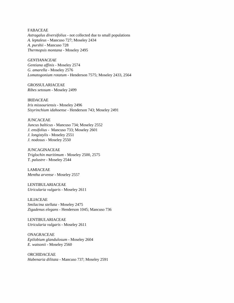
FABACEAEAstragalus diversifolius - not collected due to small populationsA. leptaleus - Mancuso 727; Moseley 2434A. purshii - Mancuso 728Thermopsis montana - Moseley 2495
GENTIANACEAEGentiana affinis - Moseley 2574G. amarella - Moseley 2576Lomatogonium rotatum - Henderson 7575; Moseley 2433, 2564
GROSSULARIACEAERibes setosum - Moseley 2499
IRIDACEAEIris missouriensis - Moseley 2496Sisyrinchium idahoense - Henderson 743; Moseley 2491
JUNCACEAEJuncus balticus - Mancuso 734; Moseley 2552 J. ensifolius - Mancuso 733; Moseley 2601J. longistylis - Moseley 2551J. nodosus - Moseley 2550
JUNCAGINACEAETriglochin maritimum - Moseley 2500, 2575T. palustre - Moseley 2544
LAMIACEAEMentha arvense - Moseley 2557
LENTIBULARIACEAEUtricularia vulgaris - Moseley 2611
LILIACEAE Smilacina stellata - Moseley 2475Zigadenus elegans - Henderson 1045; Mancuso 736
LENTIBULARIACEAEUtricularia vulgaris - Moseley 2611
ONAGRACEAEEpilobium glandulosum - Moseley 2604E. watsonii - Moseley 2560
ORCHIDACEAEHabenaria dilitata - Mancuso 737; Moseley 2591

POACEAEAgrositanion saxicola - Moseley 2541Agrostis exarata - Moseley 2542, 2553A. stolonifera - Moseley 2585Calamagrostis neglecta - Moseley 2549; 2593Catabrosa aquatica - Henderson 6531; Moseley 2568Deschampsia cespitosa - Moseley 2605Distichilis stricta - Moseley 2581Muhlenbergia richardsonis - Moseley 2602Poa juncifolia - Moseley 2584Puccinellia distans - Moseley 2596
POLEMONIACEAEPhlox kelseyi - Moseley 2493, 2556Polemonium occidentale - Mancuso 735; Moseley 2489
POLYGONACEAERumex occidentalis - Moseley 2598
POTAMOGETONACEAEPotamogeton vaginatus - Moseley 2610
PRIMULACEAEDodecatheon pulchellum - Moseley 2490Primula alcalina - Bond 20232; Christ s.n., 51-301; Cholewa 858; Davis 3118; Henderson 1372,
4221, 6530; Hitchcock 23860; Rosentreter 4948
RANUNCULACEAERanunculus aquatilis - Moseley 2609R. cymbalaria - Moseley 2488, 2559R. natans - Moseley 2486, 2547
ROSACEAEGeum macrophyllum - Moseley 2546Potentilla fruticosa - Moseley 2497P. gracilis - Moseley 2592Rosa woodsii - Moseley 2582
SALICACEAESalix bebbiana - Brunsfeld 2060; Moseley 2481S. brachycarpa - Moseley 2478, 2479S. candida - Brunsfeld 2057; Hitchcock 23864, 23865; Moseley 2480S. geyeriana - Brunsfeld 2061; Moseley 2482S. planifolia - Brunsfeld 2059S. pseudomonticola - Brunsfeld 2058
SAXIFRAGACEAEParnassia palustris - Moseley 2558

SCROPHULARIACEAEMimulus guttatus - Moseley 2597Orthocarpus luteus - Moseley 2589Veronica americana - Moseley 2498, 2606
VALERIANACEAEValeriana edulis - Henderson s.n.; Moseley 2494
VIOLACEAEViola adunca - Moseley 2485

Appendix 4
Slides of rare plants and communities in Birch Creek Fen.
Slide 1. Upland community (grazed by cattle) - Chrysothamnus nauseosus with Agropyron smithiiand Distichilis stricta.
Slide 2. Upland community of Targhee NF (ungrazed by cattle) - Low cover of Chrysothamnusnauseosus with high cover of Elymus cinereus.
Slide 3. Aquatic community - Thick bed of Ceratophyllum demersum in swift water.
Slide 4. Aquatic community - Small spring creek entering main Birch Creek with complete cover ofRorippa nasturtium-aquaticum (white flowers) on lower part of creek and Mimulusguttatus (yellow flowers in center) around the spring.
Slide 5. Eleocharis pauciflora marl community on Fish and Game property.
Slide 6. Detail of Eleocharis pauciflora marl; note small pools with Utricularia vulgaris (linear,purplish plants) on right.
Slide 7. Carex simulata community on low alluvial terrace next to creek. Note lack of hummocks.
Slide 8. Astragalus diversifolius.
Slide 9. Astragalus leptaleus.
Slide 10. Lomatogonium rotatum.
Slide 11. Phlox kelseyi.
Slide 12. Primula alcalina.
Slide 13. Salix candida.