eco-logical: i-75 transportation planning i-75 corridor ... · pdf fileobjectives for...
TRANSCRIPT
I-75 Corridor Conservation Action Plan in
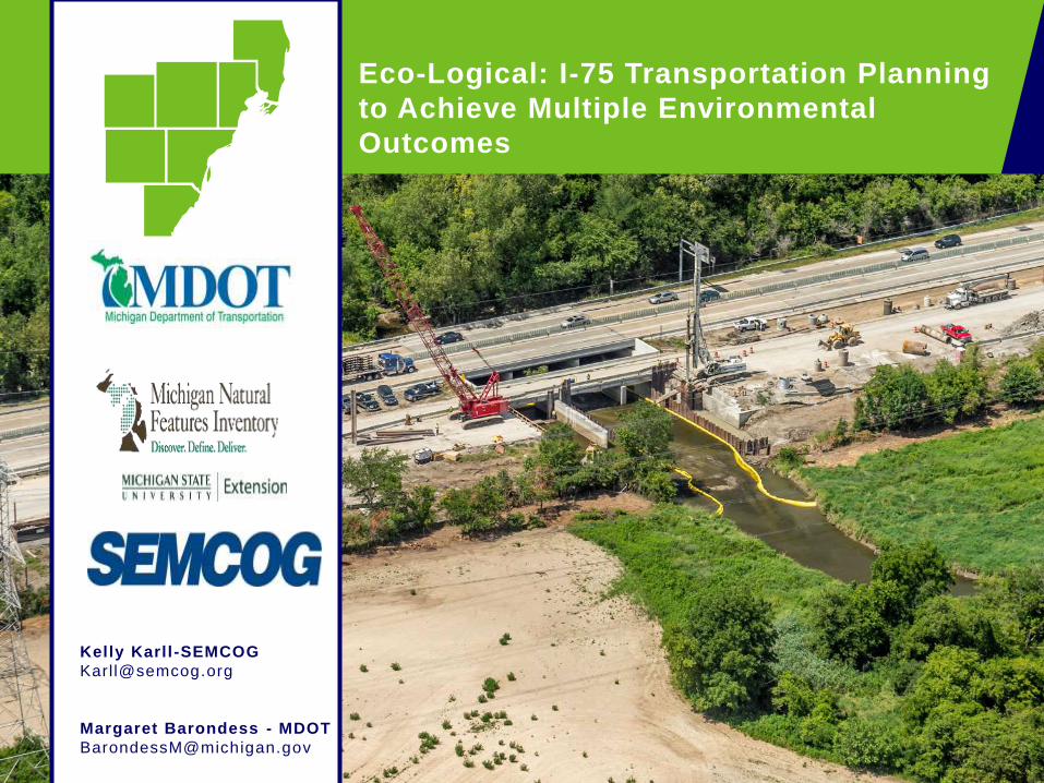
Monroe County: Stormwater Considerations Eco-Logical: I-75 Transportation Planning
to Achieve Multiple Environmental
Outcomes
Kelly Karll -SEMCOG
Margaret Barondess - MDOT
Project Overview
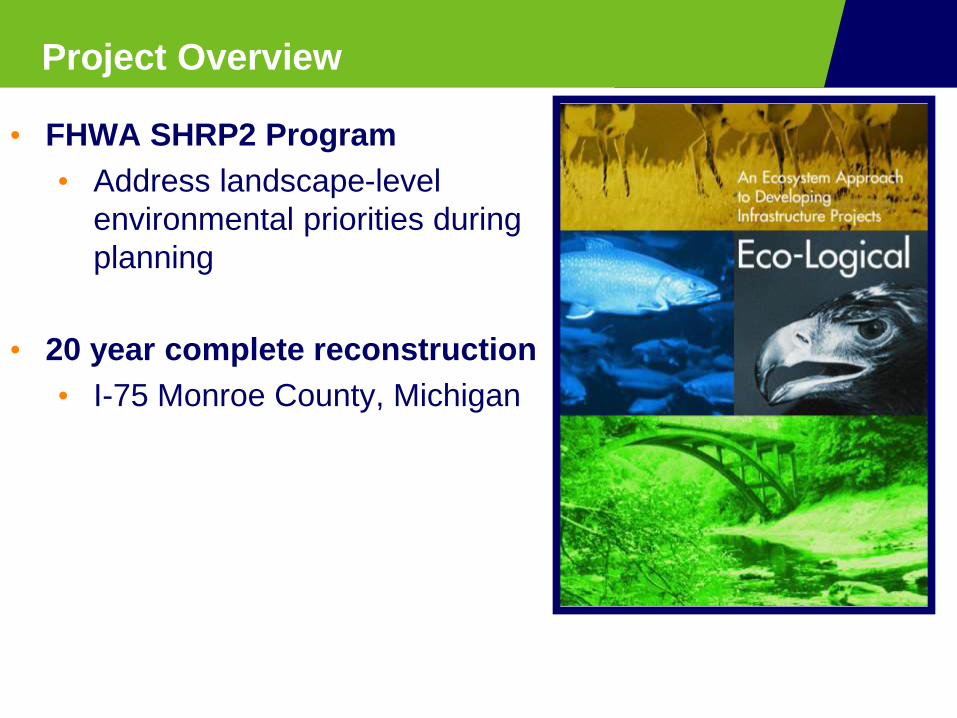
• FHWA SHRP2 Program
• Address landscape-level
environmental priorities during
planning
• 20 year complete reconstruction
• I-75 Monroe County, Michigan

Monroe County, Michigan
• Corridor of Highest
Significance
• Critical component of North
American freight network
• International connection• Ambassador bridge
• 40% of all trade with Canada
transported through region
• 2.5 million truck trips per year
• 21%of all U.S. exports to
Canada
• Opening of Gordie Howe Bridge

• 20 year reconstruction of I-75
in 5 phases enables:
• Partnerships
• Data collection
• Consider environment
• Design
• Engineering
• Construction
• Align transportation plans
with watershed plans
• Adaptive management
• Cost savings
20 Year Reconstruction in Five Phases

Conservation Action Planning
Identify Stakeholders & Create a Vision
Select Geographic Scope & Conservation Targets
Evaluate Viability of Targets & Establish Goals
Characterize Stressors
Develop Strategies & Objectives for
Implementation
I-75
Corridor
Conservation
Action Plan
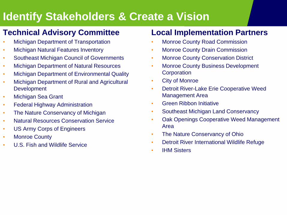
Identify Stakeholders & Create a Vision
Technical Advisory Committee • Michigan Department of Transportation
• Michigan Natural Features Inventory
• Southeast Michigan Council of Governments
• Michigan Department of Natural Resources
• Michigan Department of Environmental Quality
• Michigan Department of Rural and Agricultural
Development
• Michigan Sea Grant
• Federal Highway Administration
• The Nature Conservancy of Michigan
• Natural Resources Conservation Service
• US Army Corps of Engineers
• Monroe County
• U.S. Fish and Wildlife Service
Local Implementation Partners• Monroe County Road Commission
• Monroe County Drain Commission
• Monroe County Conservation District
• Monroe County Business Development
Corporation
• City of Monroe
• Detroit River-Lake Erie Cooperative Weed
Management Area
• Green Ribbon Initiative
• Southeast Michigan Land Conservancy
• Oak Openings Cooperative Weed Management
Area
• The Nature Conservancy of Ohio
• Detroit River International Wildlife Refuge
• IHM Sisters

Vision
“Develop and implement a collaboratively based,
landscape-scale conservation plan, that facilitates
rebuilding the I-75 corridor while maximizing
conservation and restoration outcomes in the region”

Select Geographic Scope
Geographic Scope
• Primary Zone:
• Defined by historic lake level
fluctuation
• 575 ft. elevation contour
• US-24/ Historical Native American
trail
• Secondary Zone:
• HUC-12 subwatersheds – western
boundary
• Northern boundary: Lower Huron
River Watershed
Water Resources were
considered from the beginning!

Data collection for planning
• Landscape Level Functional
Wetland Assessment (LLFWA)
• Water Quality Data
• Land Use/ Landcover Analysis
• Conservation Targets

Conservation Action Planning Process
Identify Stakeholders & Create a Vision
Select Geographic Scope & Conservation Targets
Evaluate Viability of Targets & Establish
Goals
Characterize Stressors
Develop Strategies & Objectives for
Implementation I-75
Corridor
Conservation
Action Plan
Conservation Targets:
• Coastal Tributaries - Fair
• Coastal Wetlands - Fair
• Migratory Fish - Good
• Herpetofauna Connectivity - Fair
• Globally Rare Natural Communities -Poor
• Aerial Migrants - Fair

Conservation Action Planning Process
I-75
Corridor
Conservation
Action Plan
Top Stressors & Strategies:
• Agricultural Drainage and Runoff
• Urban Development and Runoff
• Poorly Functioning Road Stream
Crossings
• Invasive Species
Identify Stakeholders & Create a Vision
Select Geographic Scope & Conservation Targets
Evaluate Viability of Targets & Establish
Goals
Characterize Stressors
Develop Strategies & Objectives for
Implementation
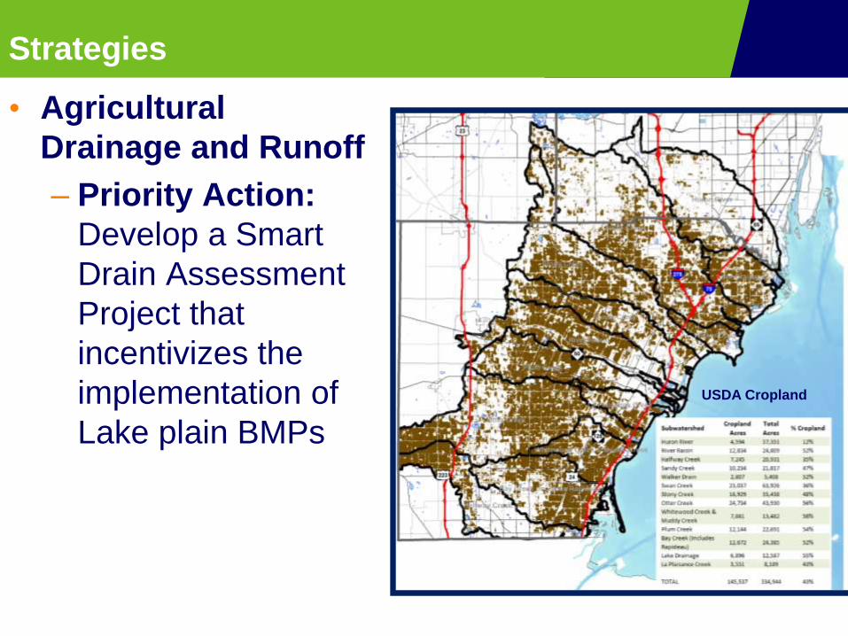
Strategies
• Agricultural
Drainage and Runoff
– Priority Action:
Develop a Smart
Drain Assessment
Project that
incentivizes the
implementation of
Lake plain BMPs
USDA Cropland

Strategies
• Urban Development &
Runoff
– Priority Action: Create
a new County initiative
that takes an integrative
approach to economic
development and
ecological enhancement
Impervious land cover, I-75 at River Raisin

Strategies
• Invasive Species:
– Priority Action:
Enhance the impact and
capacity of existing
Cooperative Weed
Management Areas
(CWMAs) in the I-75
Eco-Logical study area
Strategies
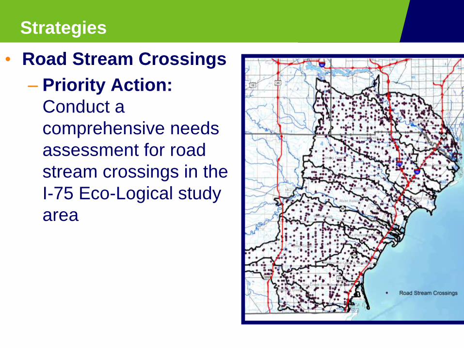
• Road Stream Crossings
– Priority Action:
Conduct a
comprehensive needs
assessment for road
stream crossings in the
I-75 Eco-Logical study
area

Implementation

MDOT Implementation
• Urban & Agricultural Runoff
• To manage runoff:
• Widened ditches to install
BMPs
• Swales for water quality
volume and conveyance
• Small infiltration
component
• Check dams

MDOT Implementation
• Urban & Agricultural Runoff• Estimated annual volume and pollutant reductions*
• Water quality volume: approx 1-inch over
drainage area
• Runoff Volume: 24% reduction
• Total Phosphorous (TP): 44% reduction
• Total Suspended Solids (TSS): 58% reduction
*Center for Watershed Protection Watershed Treatment Model
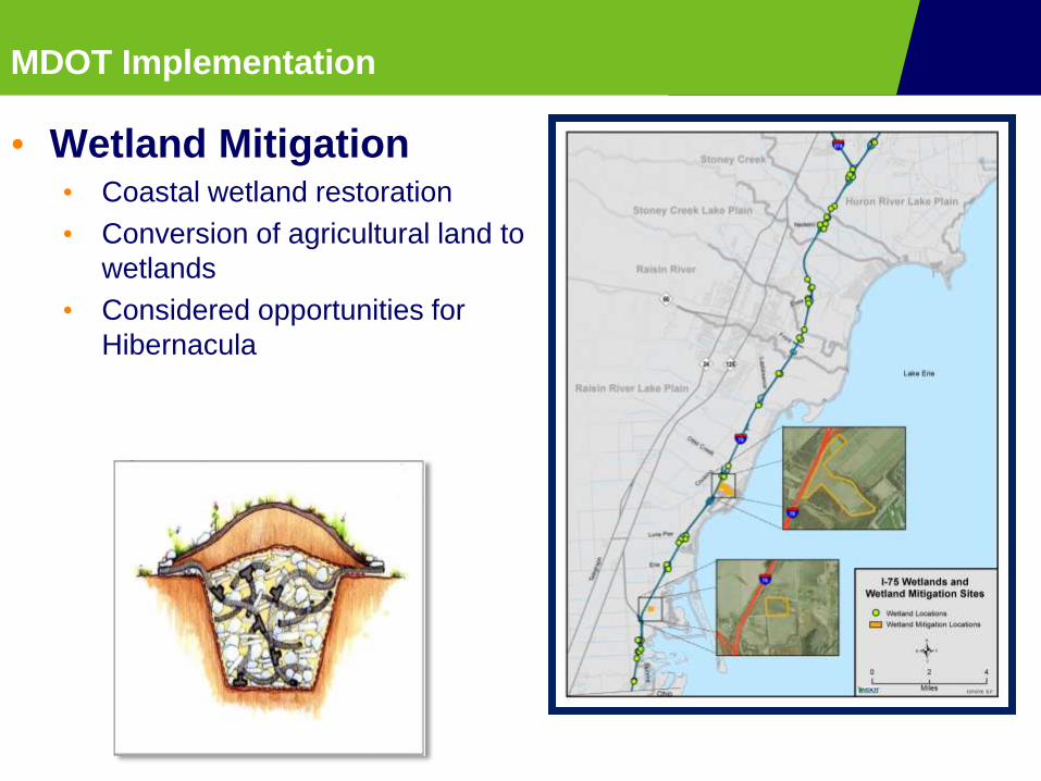
MDOT Implementation
• Wetland Mitigation• Coastal wetland restoration
• Conversion of agricultural land to
wetlands
• Considered opportunities for
Hibernacula

MDOT Implementation
• Invasive Species• MDOT joining local CWMA
• Creating management plan
for I-75 corridor
• Prioritizing control
locations
• Work with partners who seek
access to ROW for treatment
MDOT Implementation
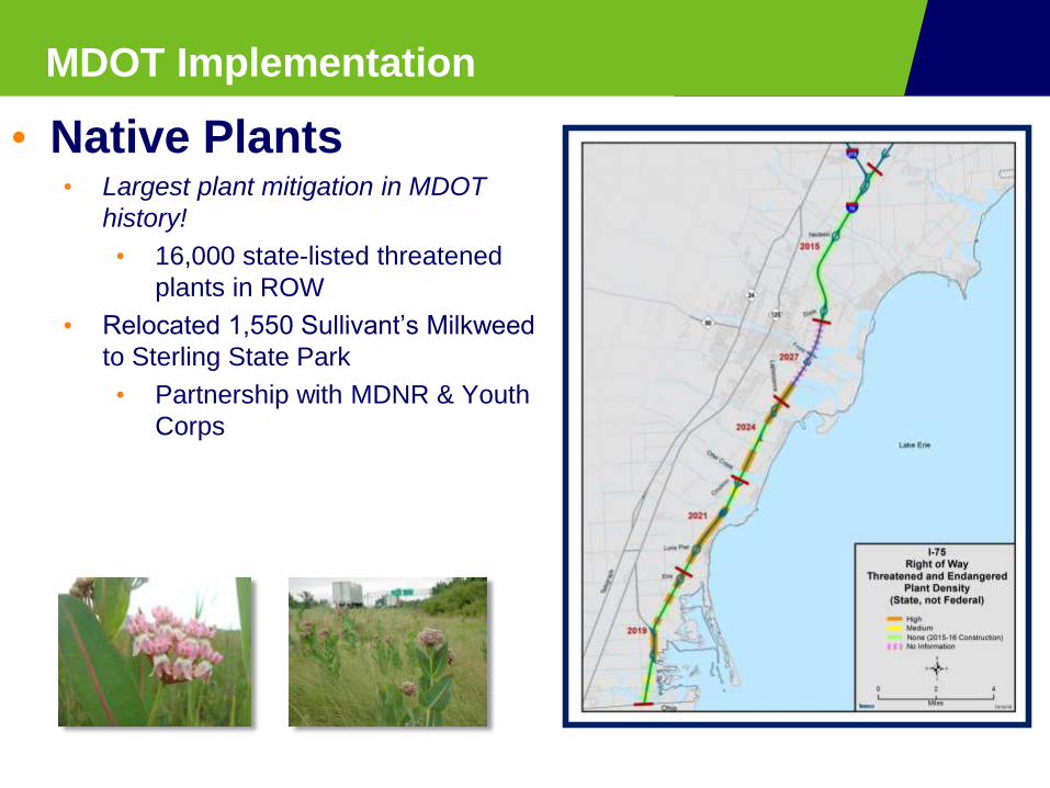
• Native Plants• Largest plant mitigation in MDOT
history!
• 16,000 state-listed threatened
plants in ROW
• Relocated 1,550 Sullivant’s Milkweed
to Sterling State Park
• Partnership with MDNR & Youth
Corps

MDOT Implementation

MDOT Implementation
• Road Stream
Crossings• Monroe County has over
2,000 RSXs!
• Most miles of county
drain in Michigan!
• Survey on culvert
passability
• Established priorities for
migratory fish
MDOT Implementation
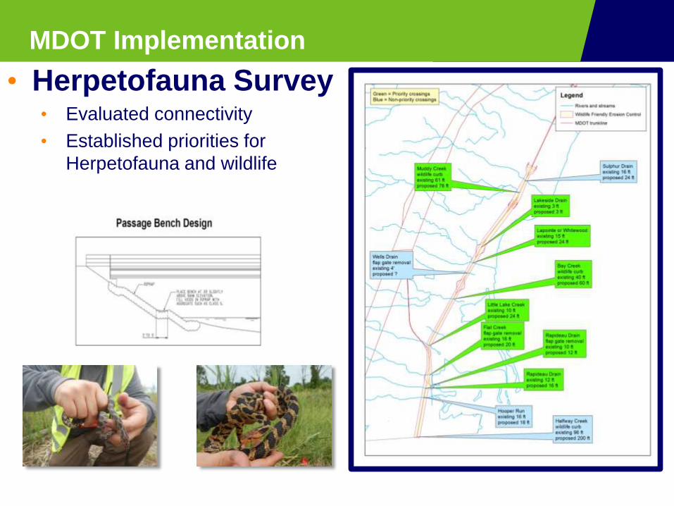
• Herpetofauna Survey• Evaluated connectivity
• Established priorities for
Herpetofauna and wildlife

MDOT Implementation
Water Course Previous
size or span
length
(1952)
New size or span
length (2016)
I-75 over Sandy Creek 30 feet 80 feet
I-75 over Stony
Creek
130 feet 167 feet
I-75 over Miller and
Malosh Drain B
6 feet 10 feet
I-75 over Webb &
Reisdorf Drain
8 feet 10 feet
• Improved Culvert Design
• Removal of Priority Flap Gates
• Extended Bridge Lengths
• Wildlife curbs and shelves
• Wildlife friendly erosion control
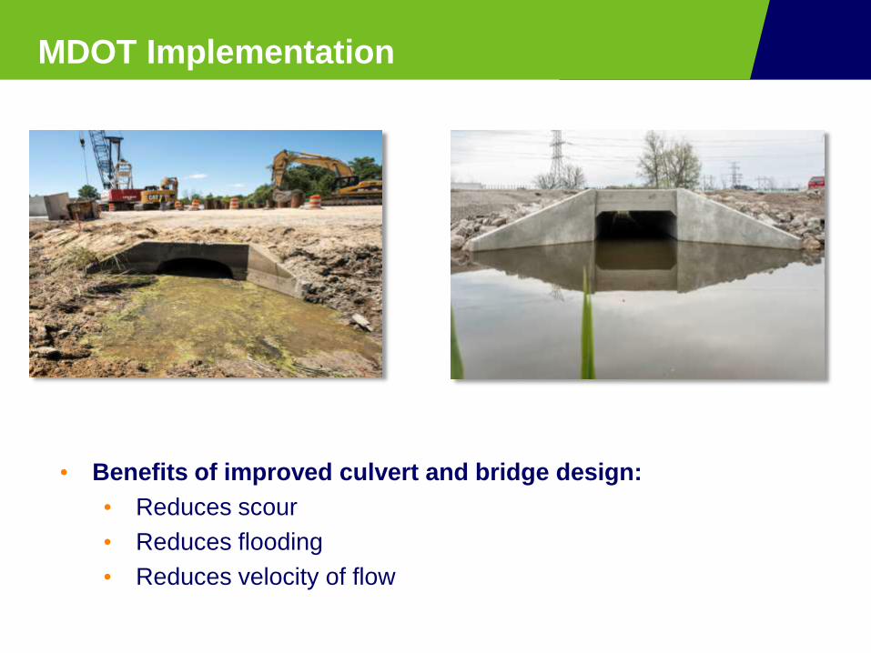
MDOT Implementation
• Benefits of improved culvert and bridge design:
• Reduces scour
• Reduces flooding
• Reduces velocity of flow

MDOT Implementation
• Considering Recreation• Otter Creek Water Trail:
• Planned to reduce bridge clearance,
but now increasing to accommodate
water trail use!
• Added a bridge span and smaller beam
to increase clearance
• Bridge Clearance:
• 8’11” to 6” → 8’11” to 7’11
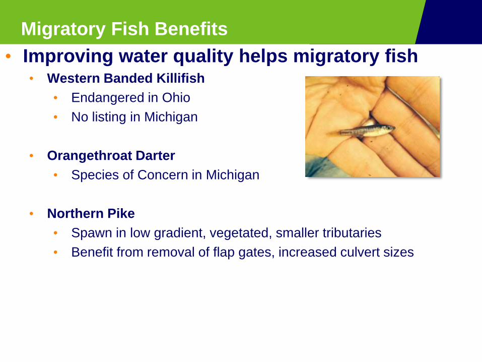
Migratory Fish Benefits
• Improving water quality helps migratory fish• Western Banded Killifish
• Endangered in Ohio
• No listing in Michigan
• Orangethroat Darter
• Species of Concern in Michigan
• Northern Pike
• Spawn in low gradient, vegetated, smaller tributaries
• Benefit from removal of flap gates, increased culvert sizes

MDOT Implementation
• Public Education
• NOAA B-WET Grant• Year 1: Piloting transportation and
environment curriculum
• Topics: water quality, invasive
species, etc.
• Monroe & Wayne County High
School students creating
interpretative material for MDOT
Welcome Center
• Year 2: Training more teachers on
curriculum

MDOT Implementation
• Cost Savings– Saved $1,000,000 in land acquisition
costs through MDNR partnership
– 50% Transplant Sullivant’s milkweed
to Sterling State Park
– 50% from constructing 34 acres of
coastal wetlands at Erie State Game
Area
– Partnership opened door for
future MDOT/MDNR
partnerships on wetland
mitigation
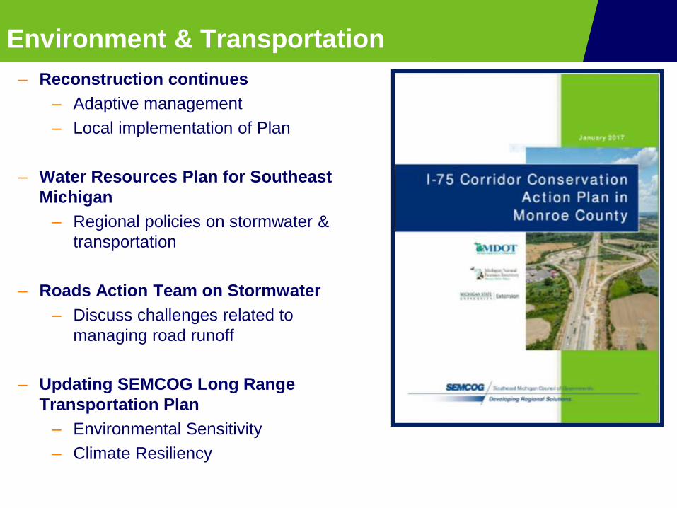
Environment & Transportation
– Reconstruction continues
– Adaptive management
– Local implementation of Plan
– Water Resources Plan for Southeast
Michigan
– Regional policies on stormwater &
transportation
– Roads Action Team on Stormwater
– Discuss challenges related to
managing road runoff
– Updating SEMCOG Long Range
Transportation Plan
– Environmental Sensitivity
– Climate Resiliency

How else is SEMCOG Linking Watershed & Transportation Planning?

SEMCOG Long Range Transportation Plan
• SEMCOG 2045 Long Range
Transportation Plan (LRP)
– Complete early 2019
– Guides transportation investments in
SE Michigan
– Improve quality and reliability pr
transportation system to:
– Increase economic prosperity,
– Achieve fiscal sustainability
– Increase accessibility,
– Protect the environment
– Make communities desirable
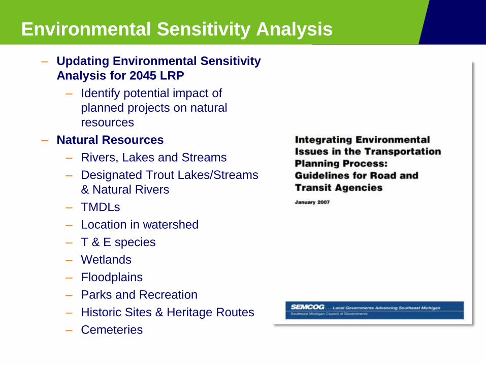
Environmental Sensitivity Analysis
– Updating Environmental Sensitivity
Analysis for 2045 LRP
– Identify potential impact of
planned projects on natural
resources
– Natural Resources
– Rivers, Lakes and Streams
– Designated Trout Lakes/Streams
& Natural Rivers
– TMDLs
– Location in watershed
– T & E species
– Wetlands
– Floodplains
– Parks and Recreation
– Historic Sites & Heritage Routes
– Cemeteries

Water Resources Plan for Southeast Michigan
DRAFT TRANSPORTATION POLICY #1: Support
coordinated efforts to align water, natural resources and
transportation priorities.
ACTIONS:
a. Enhance environmental considerations within the regional
transportation planning process.
b. Utilize the environmental sensitivity analysis to inform
transportation agencies of potential impacts.
c. Support and facilitate collaboration between road agencies and
local jurisdictions regarding stormwater management opportunities
that work towards water quality standards.

Water Resources Plan for Southeast Michigan
TRANSPORTATION POLICY #2: Integrate multiple outcomes,
including mobility, recreation and habitat, into road stream
crossing and culvert designs.
ACTIONS:
a. Inventory and conduct condition assessments of road stream
crossings.
b. Categorize road stream crossings and prioritize improvements for
multiple transportation modes, water trails, streamflow condition and
fish migration.
c. Evaluate adaptive capacity of high priority road stream crossings.

I-75 Corridor Conservation Action Plan in
Monroe County: Stormwater Considerations Eco-Logical: I-75 Transportation Planning
to Achieve Multiple Environmental
Outcomes
Kelly Karll -SEMCOG
Margaret Barondess - MDOT
[email protected] http://www.semcog.org/Plans-for-the-Region/Transportation/Environmental