dynamic acoustic mapping -...
TRANSCRIPT
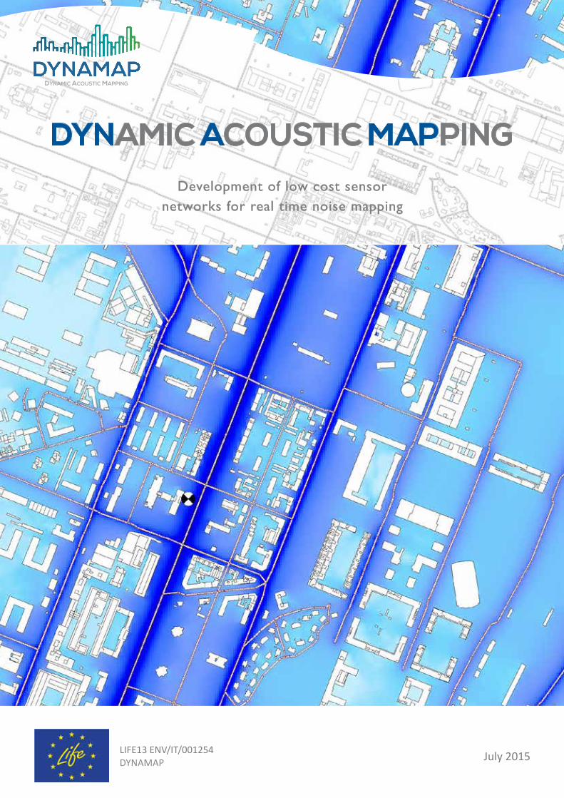
DYNAMIC ACOUSTIC MAPPINGDevelopment of low cost sensor
networks for real time noise mapping
LIFE13 ENV/IT/001254DYNAMAP July 2015
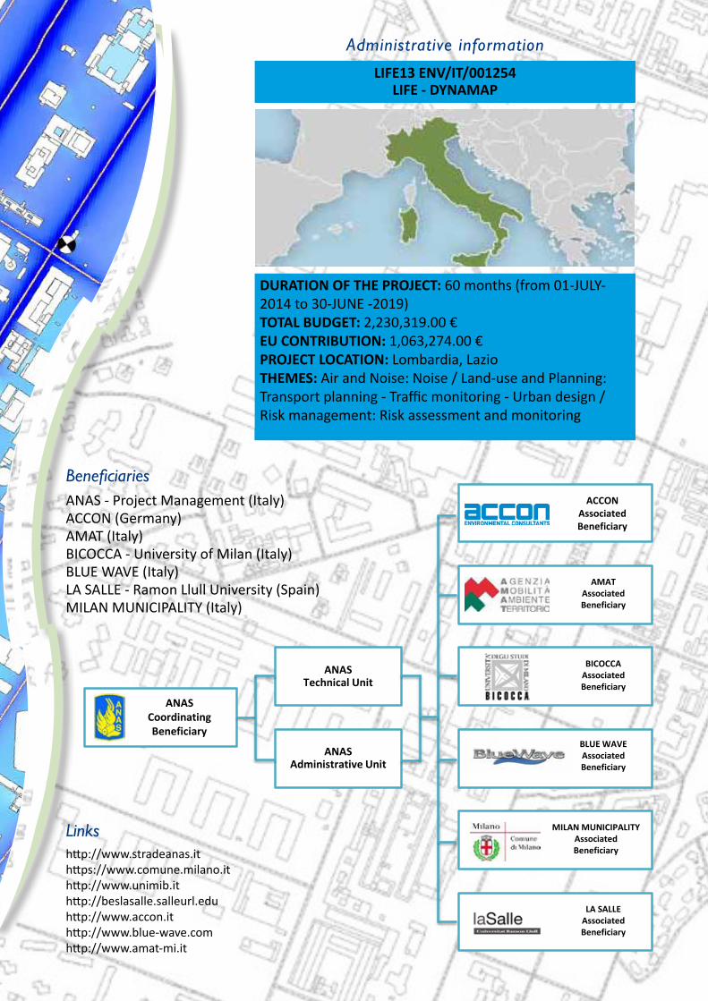
Administrative information
LIFE13 ENV/IT/001254LIFE - DYNAMAP
DURATION OF THE PROJECT: 60 months (from 01-JULY-2014 to 30-JUNE -2019) TOTAL BUDGET: 2,230,319.00 €EU CONTRIBUTION: 1,063,274.00 €PROJECT LOCATION: Lombardia, LazioTHEMES: Air and Noise: Noise / Land-use and Planning:Transport planning - Traffic monitoring - Urban design /Risk management: Risk assessment and monitoring
Beneficiaries ANAS - Project Management (Italy)ACCON (Germany)AMAT (Italy)BICOCCA - University of Milan (Italy)BLUE WAVE (Italy)LA SALLE - Ramon Llull University (Spain)MILAN MUNICIPALITY (Italy)
Linkshttp://www.stradeanas.it https://www.comune.milano.it http://www.unimib.it http://beslasalle.salleurl.edu http://www.accon.it http://www.blue-wave.comhttp://www.amat-mi.it
ANAS Technical Unit
ANAS Administrative Unit
ANASCoordinatingBeneficiary
ACCON AssociatedBeneficiary
AMATAssociatedBeneficiary
BICOCCAAssociatedBeneficiary
BLUE WAVEAssociatedBeneficiary
MILAN MUNICIPALITYAssociatedBeneficiary
LA SALLEAssociatedBeneficiary
ACCON AssociatedBeneficiary

DYNAMAP is a LIFE+ project aimed at de-veloping a dynamic noise mapping system able to detect and represent in real time the acoustic impact of road infrastructures. Scope of the project is the Directive 2002/49/EC (END) of the European Par-liament and of the Council relating to the assessment and management of environ-mental noise. Aim of the Directive is to define a common approach intended to avoid, prevent or reduce the harmful ef-fects due to exposure to environmental noise. To that end, noise maps must be provided and updated every five years in order to report about changes in envi-ronmental conditions (mainly traffic, mo-bility and urban development) that may have occurred over the reference period.However, the updating of noise maps using a standard approach requires that authori-ties responsible for providing noise maps collect and process new data related to such changes. This procedure is time con-suming and costly and has a significant impact on the financial statements of the authorities responsible for providing noi-se maps. As a matter of fact, many road administrations and local authorities are complaining about the huge financial ef-fort of noise mapping activities. For this reason, the need for reducing costs, espe-cially in conjunction with the current eco-nomic crisis affecting several European
countries, has become a primary objective. To facilitate the updating of noise maps and reduce their economic impact, noise map-ping can be automated by developing an integrated system for data acquisition and processing that is able to detect and report in real time the acoustic climate due to noi-se sources. This approach seems quite pro-mising in areas where noise sources are well identified, such as those close to main ro-ads. In complex scenarios, such as in agglo-merations, further considerations and te-sting are needed to make the idea feasible.Furthermore, the END states that sim-plified and easy-to-read noise maps are made available to inform the public about noise levels and actions to be underta-ken by local and central authorities to reduce the noise impact on the environ-ment. To that end, a suitable on-line da-tabase will be equipped with different access levels to deliver simplified data for the public and different levels of infor-mation to skilled and authorized users.Finally, the Dynamap System will be de-signed so as to be adaptable to other kinds of sensors collecting information requiring periodic assessment, such as air quality, meteorological and road condi-tions, traffic volumes, to provide a more comprehensive and integrated overview of the environmental impact of noise sources present in the monitored areas.
The Dynamap Project

The project idea
The main project idea is focused on the research of a technical solution able to ease and reduce the cost of periodically updating noise maps, through an automa-tic monitoring system, ba-sed on customized low-cost sensors, and a software tool implemented on a ge-neral purpose GIS platform
performing the update of noise maps in real time (dynamic noise maps).The update of noise maps can be rapidly accompli-shed by scaling pre-calcula-ted basic noise maps, pre-pared for different sources, traffic and weather condi-tions. Basic noise maps are selected and scaled using the information retrieved from low-cost sensors con-
tinuously measuring the sound pressure levels of the primary noise sources present in the area to be mapped. In order to gua-rantee the accuracy of the updating process, noise levels are first cleaned up from anomalous events be-fore being used to scale the basic noise maps. Scaled basic noise maps of each primary source are then
Schematic representation of the DYNAMAP system
summed-up to provide the overall noise map of the area. In this way, the need for several and expensive software license is extre-mely reduced and limited only to the preparation of the basic noise maps.The system foreseen in the DYNAMAP project inclu-
des the development of customized low cost devi-ces to collate and transmit data, and the implementa-tion of a simple GIS based software application for maps scaling with reduced calculation load. Such a standalone dynamic map-ping software (no need of
running modelling softwa-re), together with low cost noise monitoring stations, makes the DYNAMAP sy-stem a very efficient and versatile noise mapping tool, virtually able to inter-face any existing or future noise modelling software.

State of art on real time noise
mapping
SW Development
ROME: System implementation
Public responseassessment
HW Development
Pilot areaslocation
Sizing the monitoring
network
MILAN: System implementation
System test and fault analysis
System upgrade
Cost/Benefit Analysis
Future vision on system
applications
Guidelinepreparation
Objectives
The main objectives of the projects are:
1
2
3
4
5
6
Project structureThe project will be accomplished through four main steps:
development of low-cost sensors and tools for managing, processing and reporting re-al-time noise maps on a GIS platform;
design and implementation of two demonstrative systems in the cities of Milan and Rome. The first will cover a significant portion of the agglomeration of Milan, while the second will be located along a major road surrounding the city of Rome;
systems monitoring for at least one year to check criticalities and analyze problems and faults that might occur over the test period. The test results will then be used to suggest system upgrades and extend implementation to other environmental parameters;
provision of a guideline for the design and implemetation of real-time noise mapping.
To automate the noise mapping pro-cess using the information retrieved from a low-cost monitoring network;
To develop low-cost sensors and commu-nication devices to collect the information needed to update noise maps in real time;
To implement and test the system in two sites with different characteristi-cs: an agglomeration and a major road;
To demonstrate that the automation pro-cess will lead to a significant reduction in the resources needed to update noise maps (time, costs and dedicated personnel);
To improve and ease public information through different system access levels to provide user-friendly information;
To check the possibility of improving the sy-stem with additional information to report multiple environmental data dynamically (air quality, meteorological conditions, etc.).

The pilot areas
The implementation of the DYNAMAP system requires the identification of suitable sites to be used as pilot are-as for project demonstration activities. Two pilot areas are foreseen to test the different requirements associa-ted to major roads and agglomerations.The first pilot area is located in the city of Milan and will cover a significant portion of the town, including different type of ro-ads and acoustical scenarios. Roads will be classified and assigned to a suitable num-ber of clusters, on the basis of traffic cha-racteristics. Twenty four roads representa-tive of these clusters will be continuously monitored to provide noise levels for the
update of noise maps. Traffic data col-lected by on site available vehicles coun-ting devices will be integrated in the dyna-mic noise mapping system to improve and refine noise maps with real traffic information.The second pilot area is located along a major road, i.e. the ring road (Motorway A90) surrounding the city of Rome. Sen-sors devices will be installed in hot spots where traffic counting is unavailable to feed the dynamic mapping system with real time information on noise levels. About 25 devices will be used to provi-de information on noise levels generated by the motorway and dynamically upda-te noise maps. About one quarter of the ring road, for a total length of 25 km, will be equipped with the new sensors.
Monitoring on Milan pilot area
Monitoring on Rome pilot area

Expected results
1
2
3
4
5
6
7
The project is expected to provide seven main deliverables:
AcknowledgmentsThis research has been partially funded by the European Commission under
the project LIFE13 ENV/IT/001254 DYNAMAP.
Development of low cost sensors - The project includes the development of low-cost sensors to measure the noise levels generated by the sources included in the mapping areas.
Development of a software tool for dynamic noise mapping - Data retrieved from sensors will be sent to a data management system, through a dedicated software application for real-time data management and processing.
Implementation of two demonstrative sy-stems - The system will be installed and tested at two different sites: the first lo-cated within the agglomeration of Mi-lan (Italy) and the second along a major road surrounding the city of Rome (Italy).
Test results of the systems - The system will be tested for one year in order to assess its reliability, detect and solve problems, determine its accuracy and calculate the uncertainty associated with noise maps.
System upgrade feasibility - The possibility of strengthening the systemm with applica-tions for dynamic reporting of integrated en-vironmental impacts (noise, air quality, mete-orological conditions, etc.), will be analyzed.
Test results on public response and user ability in consulting and managing the sy-stem - The software tool will be structu-red with different data access levels assi-gned to authorized users. The tool will be tested to check public response and user abi-lity in consulting and managing the system.
Dissemination - The project will provide for an extensive dissemination campaign based on traditional and web communication chan-nels, such as conferences, seminars, work-shops, papers, a dedicated internet site, social networks, smart-device applications and fora.

ContactsPATRIZIA BELLUCCI (PROJECT MANAGER)ANAS S.p.A. Centro Sperimentale StradaleVia della Stazione di Cesano, 31100123 CESANO DI ROMA (RM) – ITALY
Tel. 0039 06 44463713 Fax 0039 06 3038585
e-mail: [email protected] http://www.life-dynamap.eu