draft drecp and eir/eis – appendix l, bureau of land ... · red rock poppy (eschscholzia...
TRANSCRIPT
Jawbone/Butterbredt
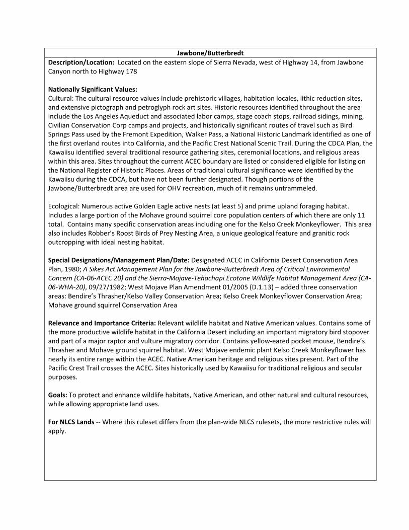
Description/Location: Located on the eastern slope of Sierra Nevada, west of Highway 14, from Jawbone Canyon north to Highway 178 Nationally Significant Values: Cultural: The cultural resource values include prehistoric villages, habitation locales, lithic reduction sites, and extensive pictograph and petroglyph rock art sites. Historic resources identified throughout the area include the Los Angeles Aqueduct and associated labor camps, stage coach stops, railroad sidings, mining, Civilian Conservation Corp camps and projects, and historically significant routes of travel such as Bird Springs Pass used by the Fremont Expedition, Walker Pass, a National Historic Landmark identified as one of the first overland routes into California, and the Pacific Crest National Scenic Trail. During the CDCA Plan, the Kawaiisu identified several traditional resource gathering sites, ceremonial locations, and religious areas within this area. Sites throughout the current ACEC boundary are listed or considered eligible for listing on the National Register of Historic Places. Areas of traditional cultural significance were identified by the Kawaiisu during the CDCA, but have not been further designated. Though portions of the Jawbone/Butterbredt area are used for OHV recreation, much of it remains untrammeled. Ecological: Numerous active Golden Eagle active nests (at least 5) and prime upland foraging habitat. Includes a large portion of the Mohave ground squirrel core population centers of which there are only 11 total. Contains many specific conservation areas including one for the Kelso Creek Monkeyflower. This area also includes Robber’s Roost Birds of Prey Nesting Area, a unique geological feature and granitic rock outcropping with ideal nesting habitat. Special Designations/Management Plan/Date: Designated ACEC in California Desert Conservation Area Plan, 1980; A Sikes Act Management Plan for the Jawbone‐Butterbredt Area of Critical Environmental Concern (CA‐06‐ACEC 20) and the Sierra‐Mojave‐Tehachapi Ecotone Wildlife Habitat Management Area (CA‐06‐WHA‐20), 09/27/1982; West Mojave Plan Amendment 01/2005 (D.1.13) – added three conservation areas: Bendire’s Thrasher/Kelso Valley Conservation Area; Kelso Creek Monkeyflower Conservation Area; Mohave ground squirrel Conservation Area Relevance and Importance Criteria: Relevant wildlife habitat and Native American values. Contains some of the more productive wildlife habitat in the California Desert including an important migratory bird stopover and part of a major raptor and vulture migratory corridor. Contains yellow‐eared pocket mouse, Bendire’s Thrasher and Mohave ground squirrel habitat. West Mojave endemic plant Kelso Creek Monkeyflower has nearly its entire range within the ACEC. Native American heritage and religious sites present. Part of the Pacific Crest Trail crosses the ACEC. Sites historically used by Kawaiisu for traditional religious and secular purposes. Goals: To protect and enhance wildlife habitats, Native American, and other natural and cultural resources, while allowing appropriate land uses. For NLCS Lands ‐‐ Where this ruleset differs from the plan‐wide NLCS rulesets, the more restrictive rules will apply.

Designation and Acreage by Alternative:
Alternative BLM Acres of NLCS
within ACEC or Wildlife Allocation
BLM Acres within ACEC
BLM Acres within Wildlife Allocation
ACEC Disturbance Cap
No Action 0 147,800 0 NA
Preferred Alternative
85,600 153,200 0 1%
1 20,900 153,200 0 1%
2 137,500** 137,500 0 1%
3 86,800 153,200 0 1%
4 67,200 153,200 0 1%
* Acreage values are for BLM managed lands **Includes overlap of existing designated Wilderness
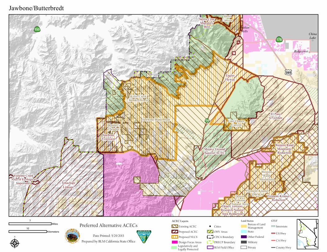
Alternatives: All Action Alternatives‐‐ The overlapping designation of the two open OHV areas(the Dove Springs OHV Open Area and Jawbone Canyon OHV Open Area) will be removed from this ACEC. There are overlapping designations of the Bendire’s Thrasher ACEC and the Kelso Creek MonkeyFlower ACEC. Both of these smaller ACEC designations will be removed, but they will remain in this ACEC and their conservation purposes and management actions will be incorporated here. There is overlap with two wilderness areas (Bright Star Wilderness and Kiavah Wilderness ) this overlap area will be removed from this ACEC, the areas will remain designated wilderness and managed for conservation values. The south west corner of ACEC will be expanded to the Forest Service boundary. Alternatives Preferred, 1, 3, 4– under this alternative this ACEC would continue to be managed as it is currently managed with the above corrections in overlapping designations. Alternative 2‐‐ A portion of currently designated area (~16,000 acres) would become a renewable energy development focus area (see following maps). If designated as DFA, it would be removed from the ACEC and would not be managed for the conservation of species. The remaining portion would continue to meet the stated conservation purposes and would remain as an ACEC. No Action – this existing ACEC would continue to be managed as it currently is.
Objectives (desired future conditions)/Allowable Uses/Management Actions Resource
Objective: Protect water sources and associated riparian habitat Allowable Uses: No construction or recreation in riparian areas Management Action: Restrict construction and recreation activities where water resources will be impacted Objective: Soils exhibit functional biological and physical characteristics that are appropriate to soil type, climate, and land form. Allowable Uses: Restrict construction activities when soils are susceptible to
Soil, water, air

heightened risk of erosion. Management Actions: Ensure soils to meet or exceed the Soil Standard of Rangeland Health, as indicated by ground or plant cover, diversity of plant species, minimal evidence of accelerated wind and water erosion and the presence of biological soil crusts where appropriate.
Objective: Maintain or improve condition of habitat for the following sensitive plant species: Spanish Needle Onion (Allium shevockii) [CNPS 1B.3] BLM Sensitive Kern County Evening‐Primrose (Camissonia kernensis spp. kernensis) [CNPS 4.3] White Pygmy‐Poppy (Canbya candida) {CNPS 4.2] Death Valley Sandmat (Chamaesyce vallis‐mortae) [CNPS 4.2] Peirson’s Spring Beauty (Claytonia lanceolata var. peirsonii) [CNPS 3.1] Mojave Tarplant (Deinandra mohavensis) [CNPS 1B.2] – BLM Sensitive Species Dwarf Goldenbush (Ericameria nana) {CNPS 4.3] Red Rock Poppy (Eschscholzia minutiflora ssp. twisselmannii) [CNPS 1B.2] BLM Sensitive Species Pinyon Blazingstar (Mentzelia eremophila) [CNPS 4.2] Kelso Creek Monkeyflower (Mimulus shevockii) [CNPS 1B.2] BLM Sensitive Species Hubby’s Phacelia (Phacelia hubbyi) [CNPS 4.2] Charlotte’s Phacelia (Phacelia nashiana) [CNPS 1B.2] BLM Sensitive Species Mojave Indigo‐bush (Psorothamnus arborescens var. arborescens) [CNPS 4.3] Unique plant assemblage – Kelso Valley Oak Woodland Assemblage Management Action: Maintain stable or increasing population trends of special status species to ensure persistence Management Action : Provide continued opportunities for research by BLM, scientific institutions, and individuals Management Action: Implement a monitoring program to evaluate protective measures
Vegetation (incl. special status species)
Objective: Maintain and protect sensitive species and their habitat Management Action: Stabilize or increase population trends of special status species to ensure persistence: American Badger (Taxidea taxus) State Special Animal Desert Tortoise (Gopherus agassizii) Federally and State threatened Mohave ground squirrel (Spermophilus mohavensis) State threatened BLM CA Sensitive Species Tehachapi slender salamander, State Listed Threatened Yellow‐eared pocket mouse ( Perognathus xanthonotus) BLM sensitive Prairie Falcon (Falco mexicanus) USFWS Bird of Conservation Concern Burrowing Owl (Athene cunicularia) BLM Sensitive Le Conte’s Thrasher (Toxostoma lecontei) State Species of Special Concern Loggerhead Shrike (Lanius ludovicianus) BLM Sensitive Bendire’s Thrasher Conservation Area within this ACEC (see write‐up).
Fish and Wildlife (incl. special status species)

POTENTIAL: California Condor habitat Management Action: Seasonal closure – February 1 to July 1 for raptors (Prairie Falcon) nesting at Robbers Roost Butterbredt Spring: Currently managed as an Audubon bird sanctuary for the high volume of migrating neo‐tropical birds every year. Objective: Protect and enhance wildlife habitat Management Action: Continue to manage and protect Butterbredt Springs as a Bird Sanctuary Management Action: Designate approved routes of travel, block non‐authorized routes Management Action: Create and install interpretive signs Management Action: Restore areas disturbed by OHV use Management Action : Increase patrols Butterbredt Spring: All of the above including increased patrols during the peak of migration and monitoring fences and barriers.
Objective: Limit motorized vehicles to open designated routes and prevent user‐created routes from developing. Allowable Uses: Motorized, non‐motorized, Non‐mechanized, etc. Management Action: All designated open routes will be signed, all routes identified as closed will be rehabilitated/restored, restore all undesignated OHV routes Management Action: Use minimization criteria for designating routes in Mohave ground squirrel and Desert tortoise habitat. Management Action: Increase information to public and LE patrols Refer to Jawbone SRMA Protect and maintain the Pacific Crest National Scenic Trail (PCT) to protect from motorized use. Note refer to the Pacific Crest National Scenic Trail SRMA
Trails and Travel Management
Objective: Administer and manage trail resources in accordance Pacific Crest Trail Comprehensive Management Plan, NTSA, FLMPA, local RMPs, and agency policy and direction. Allowable Uses: Research, interpretation, recreation. Management Action: Designate Trail Management Corridor
National Historic Trails
Objective: Provide dispersed opportunities for enjoyment of the ACEC attributes Allowable Uses: All forms of recreational use are allowed including but not limited to dispersed camping, hunting, photography, picnicking, climbing, rock hounding, astronomy/ star gazing, nature study and viewing as long as these activities due not degrade the relevant and important values that the ACEC is being established for.
Recreation

Dispersed camping. In Horse, Sage, & Cow Heaven Canyons, camping is allowed only in designated camp areas. No camping within 600 feet of water sources. Management Action: Increase information to public and LE patrols, maintain signs, vehicle barriers and kiosks, and work with volunteers to clean‐up parking and camping areas on a regular basis. Refer to Jawbone SRMA
Objective: Consolidate habitat management Management Action: Acquire inholdings from willing sellers
Land Tenure
Objective: Provide for existing and new ROWs while protecting the sensitive resources. Allowable Uses: 3 ROWs exist – 2 for aqueducts owned by City of Los Angeles, 1 for high voltage electrical transmissions lines owned by the Southern California Edison Company Management Actions: New proposals will need to be analyzed at on a case‐by‐case basis and cumulatively, to assess whether they can be accommodated within the area and its management goals.
Rights of Way
Not an allowable use. Renewable energy development is not compatible with NLCS and ACEC unit values and criteria Geothermal: Area is closed to geothermal leasing and development
Renewable Energy
Objective: Support the national need for reliable and sustainable domestic minerals while protecting the sensitive resources in the area. Management Actions: New proposals will need to be analyzed at on a case‐by‐case basis and cumulatively, to assess whether they can be accommodated within the ACEC and its management goals.
Locatable Minerals Mineral Materials Non‐energy Leaseables
Objective: Provide for livestock grazing opportunities in a manner that limits impacts on other resources Allowable Uses: Adjust livestock use where monitoring data indicate changes are necessary to meet resource objectives. Management Actions: Manage grazing authorizations to meet or exceed the Standards for Rangeland Health.
Livestock grazing
178
155
14
£¤395
TehachapiLinkage
Sierra CynsMigratory
Bird
Caliente CreekArea of Ecological
Importance
El Pasoto Golden
EaglesFlyway
Western RandMountainsReduction
Desert TortoiseResearch NaturalArea Reduction
JawboneExtension
Fremont-KramerReduction
Mojave GroundSquirrel ACEC
WesternRand
Mountains
ShortCanyon
Last ChanceCanyon
Jawbone/ButterbredtBendire'sThrasher
DesertTortoise
Natural Area
Fremont-KramerDWMA
Kelso CreekMonkeyflower
ChinaLake
IndianWells
Ridgecrest
ÆN
Preferred Alternative ACECsDate Printed: 5/29/2013
Prepared by BLM California State Office
7Miles
10Kilometers
Jawbone/Butterbredt
GTLFInterstateUS HwyCA HwyCounty HwyBLM Field Office
CDCA BoundaryDRECP Boundary
CitiesOHV Areas
ACEC Layers
Proposed NLCSProposed ACECExisting ACEC
Legislatively andLegally ProtectedDesign Focus Areas
State
PrivateMilitary
Land Status
Other Federal
Bureau of LandManagement

178
155
14
£¤395
WesternRand
Mountains
ShortCanyon
Last ChanceCanyon
Jawbone/ButterbredtBendire'sThrasher
DesertTortoise
Natural Area
Fremont-KramerDWMA
Kelso CreekMonkeyflower
ChinaLake
IndianWells
Ridgecrest
ÆN
Alternative 1 ACECsDate Printed: 5/29/2013
Prepared by BLM California State Office
7Miles
10Kilometers
Jawbone/Butterbredt
GTLFInterstateUS HwyCA HwyCounty HwyBLM Field Office
CDCA BoundaryDRECP Boundary
CitiesOHV Areas
ACEC Layers
Proposed NLCSProposed ACECExisting ACEC
Legislatively andLegally ProtectedDesign Focus Areas
State
PrivateMilitary
Land Status
Other Federal
Bureau of LandManagement

178
155
14
£¤395
WesternRand
Mountains
ShortCanyon
Last ChanceCanyon
Jawbone/ButterbredtBendire'sThrasher
DesertTortoise
Natural Area
Fremont-KramerDWMA
Kelso CreekMonkeyflower
ChinaLake
IndianWells
Ridgecrest
ÆN
Alternative 2 ACECsDate Printed: 5/29/2013
Prepared by BLM California State Office
7Miles
10Kilometers
Jawbone/Butterbredt
GTLFInterstateUS HwyCA HwyCounty HwyBLM Field Office
CDCA BoundaryDRECP Boundary
CitiesOHV Areas
ACEC Layers
Proposed NLCSProposed ACECExisting ACEC
Legislatively andLegally ProtectedDesign Focus Areas
State
PrivateMilitary
Land Status
Other Federal
Bureau of LandManagement

178
155
14
£¤395
WesternRand
Mountains
ShortCanyon
Last ChanceCanyon
Jawbone/ButterbredtBendire'sThrasher
DesertTortoise
Natural Area
Fremont-KramerDWMA
Kelso CreekMonkeyflower
ChinaLake
IndianWells
Ridgecrest
ÆN
Alternative 3 ACECsDate Printed: 5/29/2013
Prepared by BLM California State Office
7Miles
10Kilometers
Jawbone/Butterbredt
GTLFInterstateUS HwyCA HwyCounty HwyBLM Field Office
CDCA BoundaryDRECP Boundary
CitiesOHV Areas
ACEC Layers
Proposed NLCSProposed ACECExisting ACEC
Legislatively andLegally ProtectedDesign Focus Areas
State
PrivateMilitary
Land Status
Other Federal
Bureau of LandManagement

178
155
14
£¤395
WesternRand
Mountains
ShortCanyon
Last ChanceCanyon
Jawbone/ButterbredtBendire'sThrasher
DesertTortoise
Natural Area
Fremont-KramerDWMA
Kelso CreekMonkeyflower
ChinaLake
IndianWells
Ridgecrest
ÆN
Alternative 4 ACECsDate Printed: 5/29/2013
Prepared by BLM California State Office
7Miles
10Kilometers
Jawbone/Butterbredt
GTLFInterstateUS HwyCA HwyCounty HwyBLM Field Office
CDCA BoundaryDRECP Boundary
CitiesOHV Areas
ACEC Layers
Proposed NLCSProposed ACECExisting ACEC
Legislatively andLegally ProtectedDesign Focus Areas
State
PrivateMilitary
Land Status
Other Federal
Bureau of LandManagement

178
155
14
£¤395
WesternRand
Mountains
ShortCanyon
Last ChanceCanyon
Jawbone/ButterbredtBendire'sThrasher
DesertTortoise
Natural Area
Fremont-KramerDWMA
Kelso CreekMonkeyflower
ChinaLake
IndianWells
Ridgecrest
ÆN Date Printed: 5/29/2013
Prepared by BLM California State Office
7Miles
10Kilometers
Jawbone/Butterbredt
GTLFInterstateUS HwyCA HwyCounty Hwy
State
PrivateMilitary
Land Status
Other Federal
Bureau of LandManagement
ACEC LayersExisting ACEC
Legislatively andLegally Protected BLM Field Office
CDCA BoundaryDRECP Boundary
Cities
OHV Areas