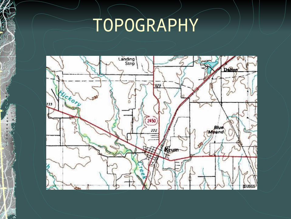
TOPOGRAPHY
What is a Topographic Map?
Earth's surface shape shown by contour linesContour lines - lines connecting points of equal elevationmeasure mountain height, ocean depths, slope steepnessAllows planning for –
parkshiking/ridingbuilding/constructiondrainage
Reading Topographic Maps
Contours – lines of different widths
Contours never cross
Used to determine elevations – index contours are wider
Elevations printed along index contours
Narrower contours found between index contours – help show more details of land surface
Contours close together = steep slopes
Widely spaced contours = fairly level/flat ground slope relatively level
contour interval = elevation difference between adjacent contour lines
Reading Topographic Maps (continued)
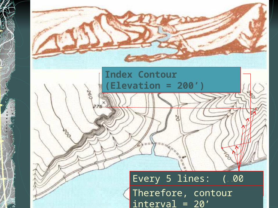
Index Contour (Elevation = 100’)Index Contour (Elevation = 200’)
Every 5 lines: (200-100)/5 = 20’
Therefore, contour interval = 20’
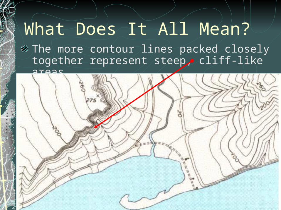
What Does It All Mean?The more contour lines packed closely together represent steep, cliff-like areas
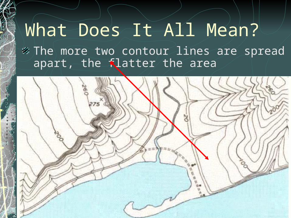
What Does It All Mean?The more two contour lines are spread apart, the flatter the area
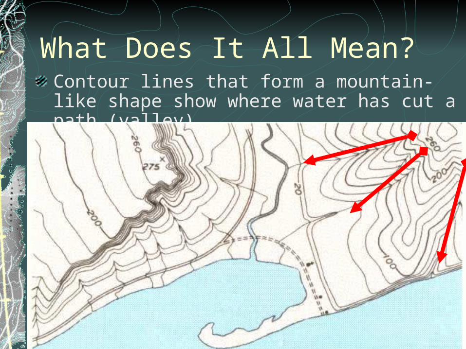
What Does It All Mean?Contour lines that form a mountain-like shape show where water has cut a path (valley)
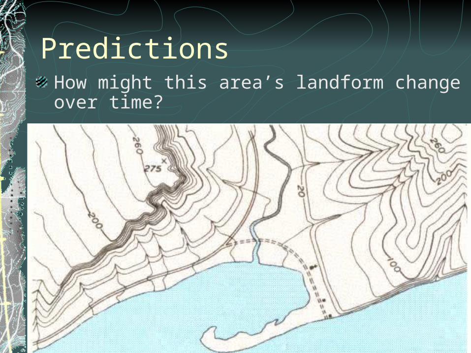
PredictionsHow might this area’s landform change over time?
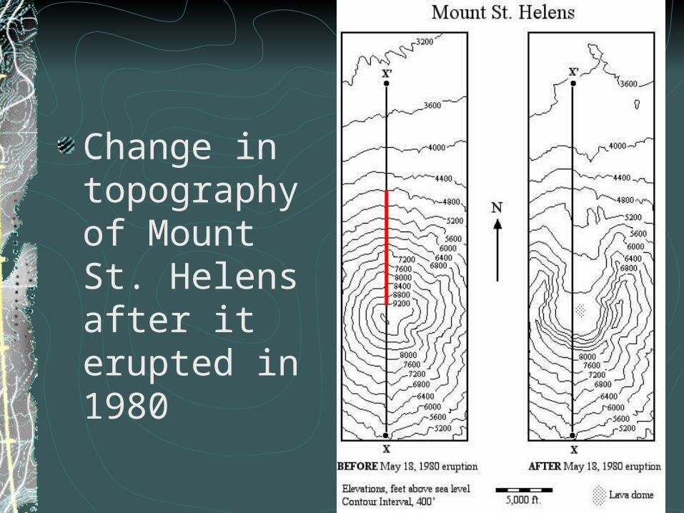
Change in topography of Mount St. Helens after it erupted in 1980
Causes of Change
Weathering – Break down of rock into smaller pieces – sediment (sand and soil)
Erosion – movement of sand, soil and rock
Deposition – settling and layering of sand, soil and rock.
Causes of weathering, erosion and deposition of Earth
WindWater – rivers, waterfalls, streams, oceans, rain, icePlate tectonics – Mountains, trenches, ridges, rift valleys, fault linesEarthquakesVolcanoesPlants and animals including humans
Remember…Topographic maps can help you find elevations, Trails, and Places to climb
Topographic maps show you the “lay of the land” (landforms) by connecting points of equal elevation
Index contour lines are darker and have an elevation associated with it
The ‘Contour Interval’ is the elevation distance between two adjacent lines
Scales are usually shown in inches or feet


