The Islamic University of Gaza
Faculty of Engineering
Civil Engineering Department
Water Resources Msc.
Groundwater Hydrology- ENGC 6301
lecture 4
Groundwater Exploration
Instructor: Dr. Yunes Mogheir ([email protected])
Semester: 1st/2016-2017
GEOHYDROLOGICAL STUDIES
The representation of the physical reality, its conceptual
description and determination of hydrogeological
parameters (like permeability) are essential steps in
the groundwater modelling process.
In groundwater studies three distinctive phases may be
considered:
1. definition of the hydrogeological system
2. simulation of the proposed activity
3. evaluation of side effects
GEOHYDROLOGICAL STUDIES
The first phase in a groundwater study is the exploration
phase phase including
• collection and interpretation of existing data and
reports
• field visits to the study area
• preliminary assessment of the hydrogeological
situation
Use will be made of:
• topographical, hydrological and geological maps
• areal photographs and satellite images
• borehole logs and water quality data
• accessible literature
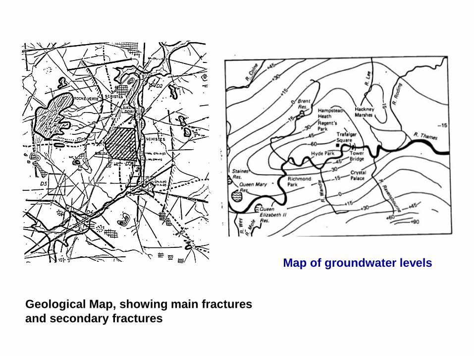
Geological Map, showing main fractures
and secondary fractures
Map of groundwater levels
GEOHYDROLOGICAL STUDIES
Based on the available information a programme of
additional field investigations will be prepared. These
field surveys may include:
• inventory of existing wells;
• geophysical surveys;
• test drilling, including borehole logging, installation of
piezometers for groundwater level observation, water
quality and temperature analysis;
• pumping tests;
• other investigations.
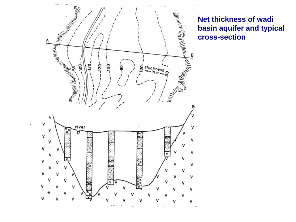
Net thickness of wadi
basin aquifer and typical
cross-section
GEOHYDROLOGICAL STUDIES
Based on the available information a programme of
additional field investigations will be prepared. These
field surveys may include:
• inventory of existing wells;
• geophysical surveys;
• test drilling, including borehole logging, installation of
piezometers for groundwater level observation, water
quality and temperature analysis;
• pumping tests;
• other investigations.
GEOPHYSICAL METHODS
• Geophysical surveys will result in estimates of the
thicknesses of the various subsurface layers.
• Also, information can be obtained regarding the aquifer
material, anisotropy, and the degree of fracturing.
• However, additional investigations like well drilling and logging will be required for final assessments.
The most common methods are: -
• geo-electrical
• electro-magnetic (EM)
• seismic
• geophysical bore-hole logging
GEO-ELECTRICAL METHOD
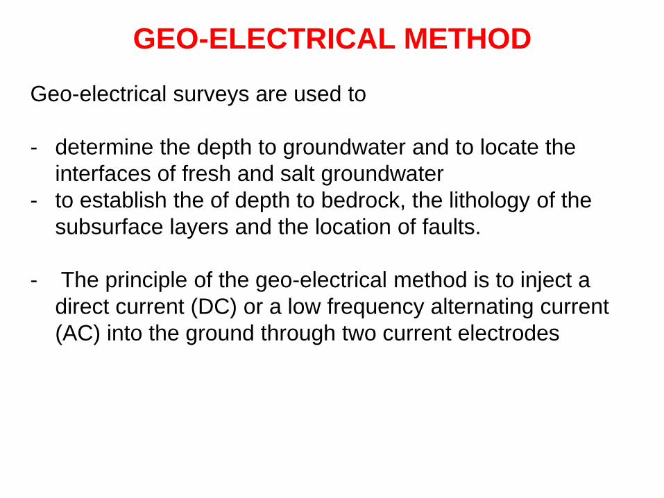
Geo-electrical surveys are used to
- determine the depth to groundwater and to locate the
interfaces of fresh and salt groundwater
- to establish the of depth to bedrock, the lithology of the
subsurface layers and the location of faults.
- The principle of the geo-electrical method is to inject a
direct current (DC) or a low frequency alternating current
(AC) into the ground through two current electrodes
GEO-ELECTRICAL METHOD
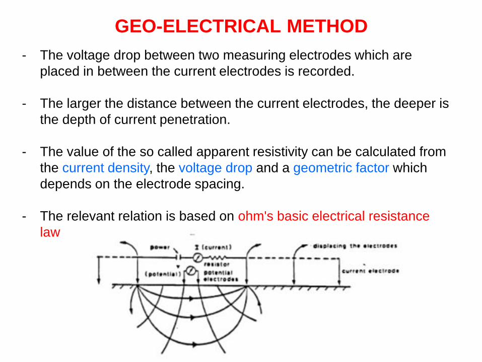
- The voltage drop between two measuring electrodes which are
placed in between the current electrodes is recorded.
- The larger the distance between the current electrodes, the deeper is
the depth of current penetration.
- The value of the so called apparent resistivity can be calculated from
the current density, the voltage drop and a geometric factor which
depends on the electrode spacing.
- The relevant relation is based on ohm's basic electrical resistance
law
Vertical Electrical Sounding (VES) curve
- is obtained by plotting the apparent resistivities against half the current
electrode spacings.
- The interpreted graph will indicate the number of subsurface layers and
their specific resistivities and thicknesses.
- The specific resistivity depends on the lithology and porosity of the
layer (formation factor) and the conductivity of the pore water.
- Additional information of the subsoil is essential for a proper
interpretation of the soundings.
- In sedimentary basins, high resistivities may indicate the presence of
fresh groundwater in sandy aquifers, while low resistivities are
characteristic for brackish water and/or clays.
- Areas of high resistivity are, therefore, target for further exploration
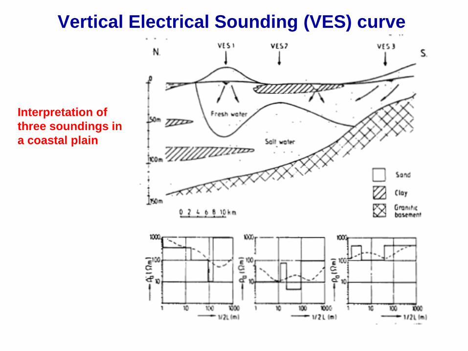
Vertical Electrical Sounding (VES) curve
Interpretation of
three soundings in
a coastal plain
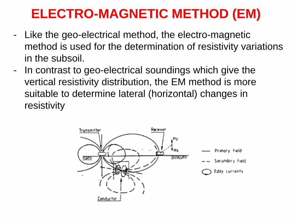
ELECTRO-MAGNETIC METHOD (EM)
- Like the geo-electrical method, the electro-magnetic
method is used for the determination of resistivity variations
in the subsoil.
- In contrast to geo-electrical soundings which give the
vertical resistivity distribution, the EM method is more
suitable to determine lateral (horizontal) changes in
resistivity
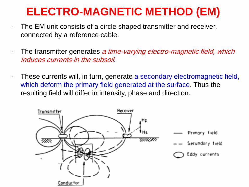
ELECTRO-MAGNETIC METHOD (EM)
- The EM unit consists of a circle shaped transmitter and receiver,
connected by a reference cable.
- The transmitter generates a time-varying electro-magnetic field, which induces currents in the subsoil.
- These currents will, in turn, generate a secondary electromagnetic field,
which deform the primary field generated at the surface. Thus the
resulting field will differ in intensity, phase and direction.
ELECTRO-MAGNETIC METHOD (EM)
- The resulting field may reveal the presence of areas of high
conductivity.
- The penetration depth of an EM measurement depends is a function of
the resistivity of the subsoil, the distance between transmitter and
receiver and the operating frequency.
- The EM method is in particular suitable to determine narrow fracture
zones which can hardly be found by resistivity alone.
- Moreover the measurements can be carried out quickly as no
electrodes have to be installed.
SEISMIC METHOD
- In the seismic method elastic waves are generated by a source of
energy (e.g. a dynamite explosion).
- These waves are reflected and refracted at boundary planes between
different soil or rock layers.
- The travelling times of the waves are recorded by sets of geophones,
which are located at increasing distances from the impact point.
- This method is not often used in groundwater prospecting due to the
large capital investment and high running costs.
- Nevertheless the seismic method is often the only method for deep
investigations ( more than 500 m).
- In shallow investigations seismics can be used to detect fractures and
the depth to bedrock
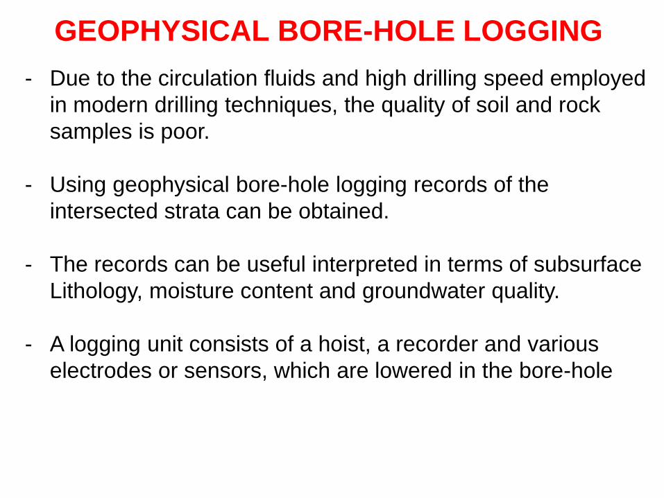
GEOPHYSICAL BORE-HOLE LOGGING
- Due to the circulation fluids and high drilling speed employed
in modern drilling techniques, the quality of soil and rock
samples is poor.
- Using geophysical bore-hole logging records of the
intersected strata can be obtained.
- The records can be useful interpreted in terms of subsurface
Lithology, moisture content and groundwater quality.
- A logging unit consists of a hoist, a recorder and various
electrodes or sensors, which are lowered in the bore-hole
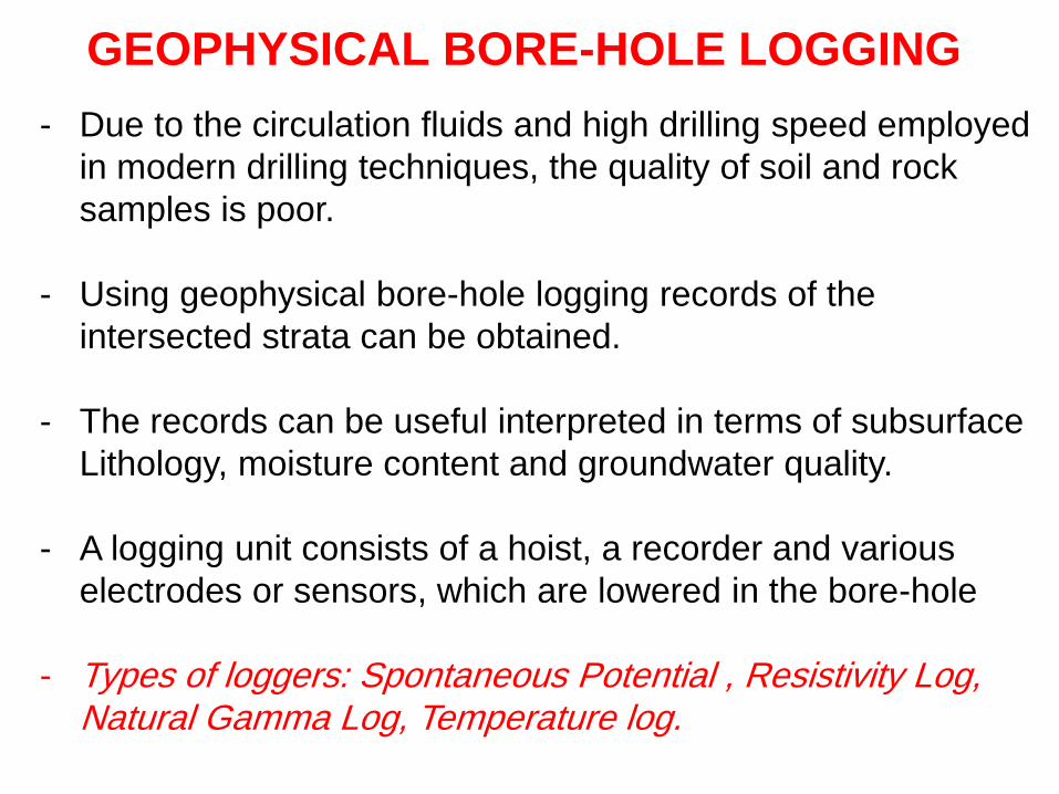
- Types of loggers: Spontaneous Potential , Resistivity Log, Natural Gamma Log, Temperature log.
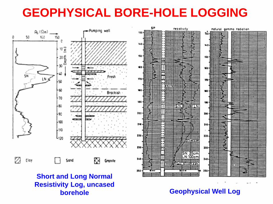
GEOPHYSICAL BORE-HOLE LOGGING
Short and Long Normal
Resistivity Log, uncased
borehole Geophysical Well Log
GEOHYDROLOGICAL STUDIES
An other step for Hydrogeological Exploration is
Pumping Tests …….
You should refer to Part 1 of this course and lecture notes


![Untitled-9 [site.iugaza.edu.ps]site.iugaza.edu.ps/kelkahlout/files/2012/02/CHAPTER2D1.docx · Web viewThere are a number of industrial efl1uents and emissions particularly poisonous](https://cdn.vdocuments.site/doc/165x107/5e4d16efbbf54c74dc3d8ee4/untitled-9-site-site-web-view-there-are-a-number-of-industrial-efl1uents-and.jpg)


