PINER POINT ONMAURY ISLANDConserving Puget Sound Shoreline through Land Acquisition and Restoration
WRIA 9 partners, King County and KCD, have permanently protected over a third of a mile of Puget Sound shoreline at Piner Point, located on the southeast end of Maury Island adjacent to the WA State Maury Island Aquatic Reserve. Historic and current land use practices in King County have degraded nearshore habitats by interrupting habitat forming processes and degrading both water and sediment quality.
• With new 2014 acquisitions, the Piner Point Natural Area, protects over 13.5 acres of coastal bluff backed beach and 2000 feet of ecologically valuable shoreline. Piner Point is in both a landslide and erosion hazard area.
• Increasing the health of the nearshore habitat—including removing the creosote bulkhead that was degrading the beach—is key to salmon recovery. The Maury Island shoreline has documented surf smelt, sand lance, and Pacific herring spawning grounds. The overhanging vegetation at the Creates quality habitat for these forage fish consumed by juvenile salmon.
For more information: http://www.govlink.org/watersheds/9/
K I NG CO .
P I E RCE CO .
21st
Ave
SW
SW 320th St
Wax
Orc
hard
Rd
SW
SW 232nd St
SW Point Robinson Rd
99
th A
ve S
W
Hoyt R
d SW
47t
h A
ve S
WE 11
th S
t
Doc
kt
on Rd
SWVas
hon
Hwy
SW
TACOMA
FEDERALWAY
TACOMARUSTON
Puget Sound
CommencementBay
VASHONISLAND
MAURYISLAND
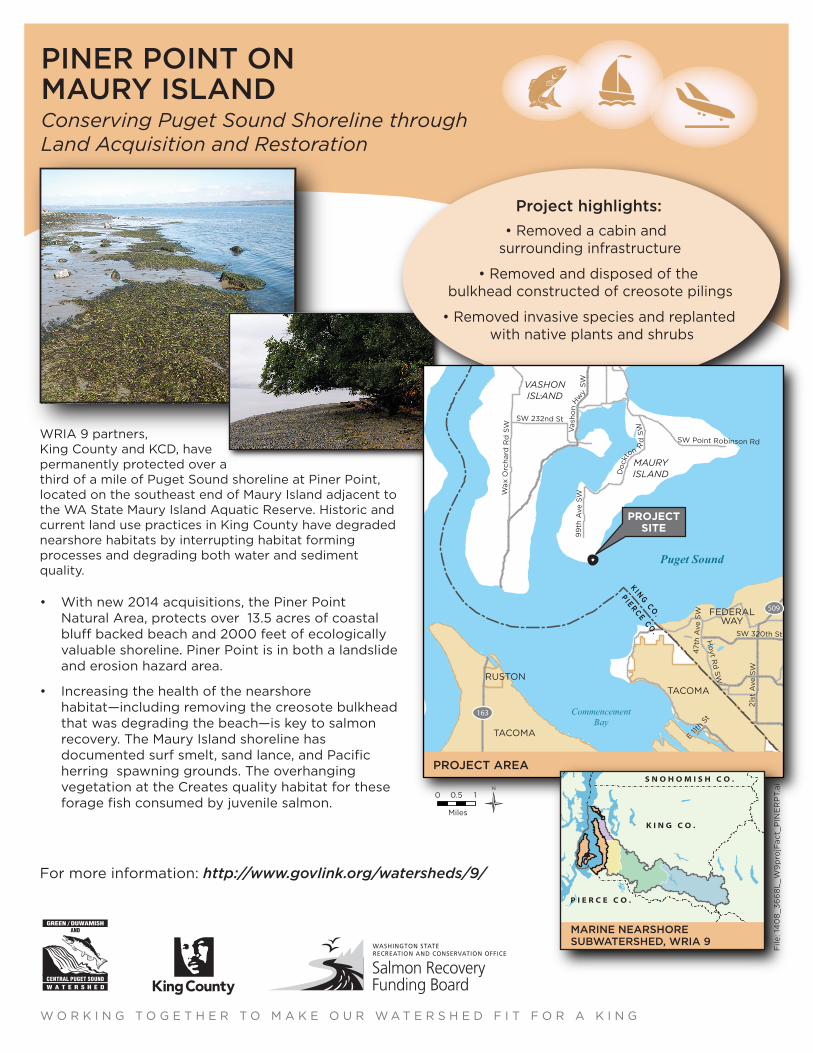
PROJECT AREA
0 10.5
Miles
PROJECTSITE
163
509
N
S N O H O M I S H C O .
K I N G C O .
P I E R C E C O .
15
26
MARINE NEARSHORESUBWATERSHED, WRIA 9
W O R K I N G T O G E T H E R T O M A K E O U R W A T E R S H E D F I T F O R A K I N G
Project highlights:
• Removed a cabin andsurrounding infrastructure
• Removed and disposed of thebulkhead constructed of creosote pilings
• Removed invasive species and replanted with native plants and shrubs
File
: 14
08
_36
68
L_W
9p
rojF
act_
PIN
ER
PT.
ai


