
New York State New York State Accident Location Information Accident Location Information System Analyzing the Past System Analyzing the Past
to to Provide a Safer Future Provide a Safer Future
Kevin Hunt NYS Department of Transportation
Jackie Magnant ESRI
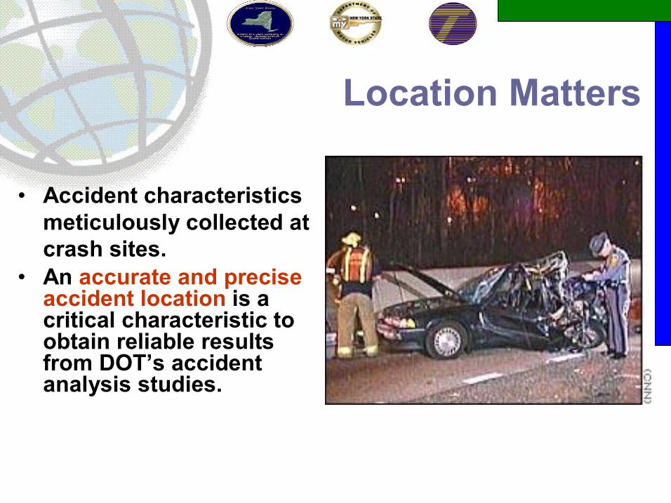
Location Matters
• Accident characteristics meticulously collected at crash sites.
• An accurate and precise accident location is a critical characteristic to obtain reliable results from DOT’s accident analysis studies.

ALIS Project Objectives
• Establish New High Accuracy Statewide Basemap § Reduce Duplication of Mapping Initiatives § Share Common Road Network
§ State & Federal Agencies § Local Agencies § Citizens
§ Centralize Data Maintenance & Standards • Custom Accident Location Applications § Vastly Improve Efficiency and Accident Location
Coding and Editing § Provide Basic Query and Reporting Tools § Meet Consumer Information Requests § Sophisticated Accident Analysis (Phase V) § WebBased Executive System for Decision
Makers
Project Stakeholders
A MultiAgency Initiative: • NYS Department of Motor Vehicles (NYSDMV) § Project lead; project and contract management § Initial data and location coding from accident reports
• NYS Department of Transportation (NYSDOT) § Accident data analysis, query and reporting § Mitigation studies, federally mandated reporting
• NYS Office of Cyber Security and Critical Infrastructure Coordination (NYSOCSCIC) § Primary responsibility for construction and maintenance of the Statewide GIS Framework datasets
§ NYS Office for Technology (NYSOFT) § Hosting applications in NYS Data Center

Project Stakeholders
• Other NYS Stakeholders § County Governments § Municipalities § Metropolitan Planning Organizations (MPO)
• Contractors § ESRI (Prime Contractor) § Tele Atlas – GIS data development and maintenance § fountains spatial, inc – application testing and training
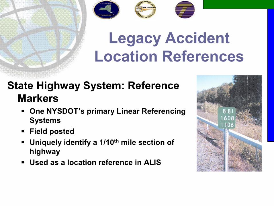
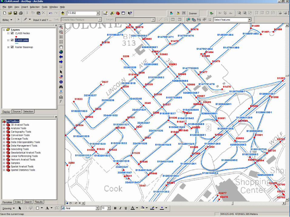
Legacy Accident Location References
State Highway System: Reference Markers § One NYSDOT’s primary Linear Referencing Systems
§ Field posted § Uniquely identify a 1/10 th mile section of highway
§ Used as a location reference in ALIS
Legacy Accident Location References
• Local Roads: CLASS street network § Constructed in the early 1980s § Attributed with street names and route numbers § Link/node topology § Stored intersection and segment midpoint locations § Not actively maintained after early 1990s


NYS Data Product (a.k.a. “Statewide GIS Framework Data ”)
• A new high accuracy statewide basemap • Constructed by TeleAtlas in cooperation with NYS and
ESRI • The NYS Data Product is a custom built product § Based on TeleAtlas’s Dynamap product but not the same.
• Built from “best available” local and state sources § Features generated directly from NYS’ Digital Orthoimagery
Program § Supplemented with TeleAtlas sources • Local (county) participation optional § Many more are participating in maintenance now § 27 of 62 counties provided source data for the construction

NYS Data Product (a.k.a. “Statewide GIS Framework Data ”)
• Uptodate street centerlines • Street names, route numbers
& aliases • Address ranges & address
point layer • NYSDOT Linear Referencing
Systems • Thruway Authority Linear
Referencing Systems • Railroads • Bridges • Civil & public land boundaries • Census geography • Zip Code boundaries • Landmark features

Streets

Railroads &
Hydrograp hy

Bridges

Civil Boundarie
s

Public Lands

Census Block
Boundarie s

Zip Codes

Address Points

Landmark s
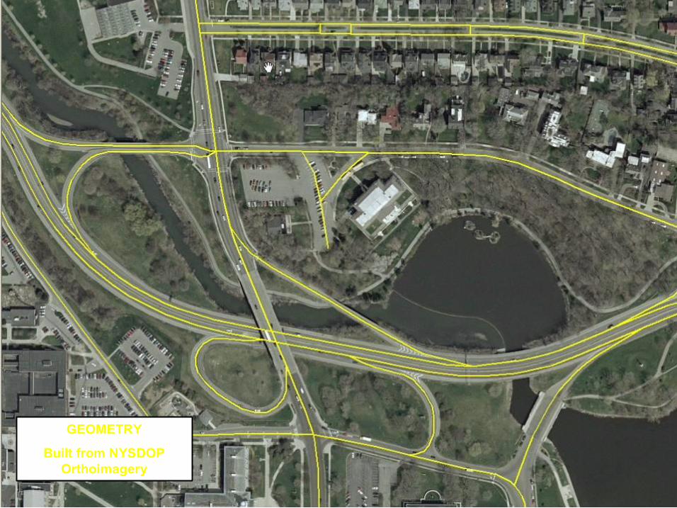
GEOMETRY
Built from NYSDOP Orthoimagery

Long Term Data Maintenance
1. Outreach and cooperation with state and local members of NYS GIS Data Sharing Cooperative
2. Two webbased applications (ArcGIS Server 9.1) built through the ALIS project designed to collect and commit updates to NYS Data Product • Street Name Editor (SNE): Allows NYSDOT and NYSOCSCIC
users to edit/add street names and route numbers on the street layer
• Map Maintenance Notification & Tracking (MMNT): Allows authorized users to submit updates and changes to the NYS Data Product. The status each change is tracked in the system and the submitter is kept aware of the status


TRACS New York State Police
• New York State Police agencies are transitioning to an incar system that electronically collects of accident records
• TraCS includes a location tool with maps based on the NYS Data Product for pinpointing exact accident locations
• ALIS applications designed to accommodate the electronic accident records submitted from TRACS (XML format)

NYSDOT’s ALIS Accident Applications Develop a Develop a “ “State of the Art State of the Art” ” GIS GIS System to Identify Areas of System to Identify Areas of “ “High High Accident Locations (HALS) Accident Locations (HALS)” ” and and
“ “Unusual Concentrations of Accident Unusual Concentrations of Accident Types Types” ” to support Mitigation to support Mitigation
Strategies for Accidents and Road Strategies for Accidents and Road Hazards Reduction and Ensure Safer Hazards Reduction and Ensure Safer Roadways for NYS Roadways for NYS’ ’ Traveling Public Traveling Public
GOAL GOAL

Project Deliverables • New York State Data Product Statewide GIS Data Product
• Based on GDT Dynamap 2000
• Enhanced Statewide Geometry & Attribution (Local Government Source Data)
• Five WebBased Applications
(ASP.NET/ArcGIS Server) • Map Maintenance Notification and Tracking (MMNT)
• Street Name Editor (SNE)
• One Accident Location Server
• Fully integrated into NYS Work Flow
• Captures Business Logic related to all geocoding
• 14 Location Coding Methods
• Scheduler to batch process Accidents after hours
• Legacy Accident Conflation • Batch Processing of 10,000,000 historical Accident records

ALIS Timeline and Changing
Architecture
2001 Client – Server Application •MapObjects, ArcSDE, ArcINFO
2004 ArcGIS Server Beta Released •ArcGIS Server 9.0 Development Begins
2006 – QRA Accident Analysis Application •Development Project Begins
2007 ALIS Applications Final Release •ArcGIS Server 9.1
2007 QRA Final Release Late December •ArcGIS Server 9.2
2 0 0 1
2 0 0 7
Client Client Server Server Architecture Architecture
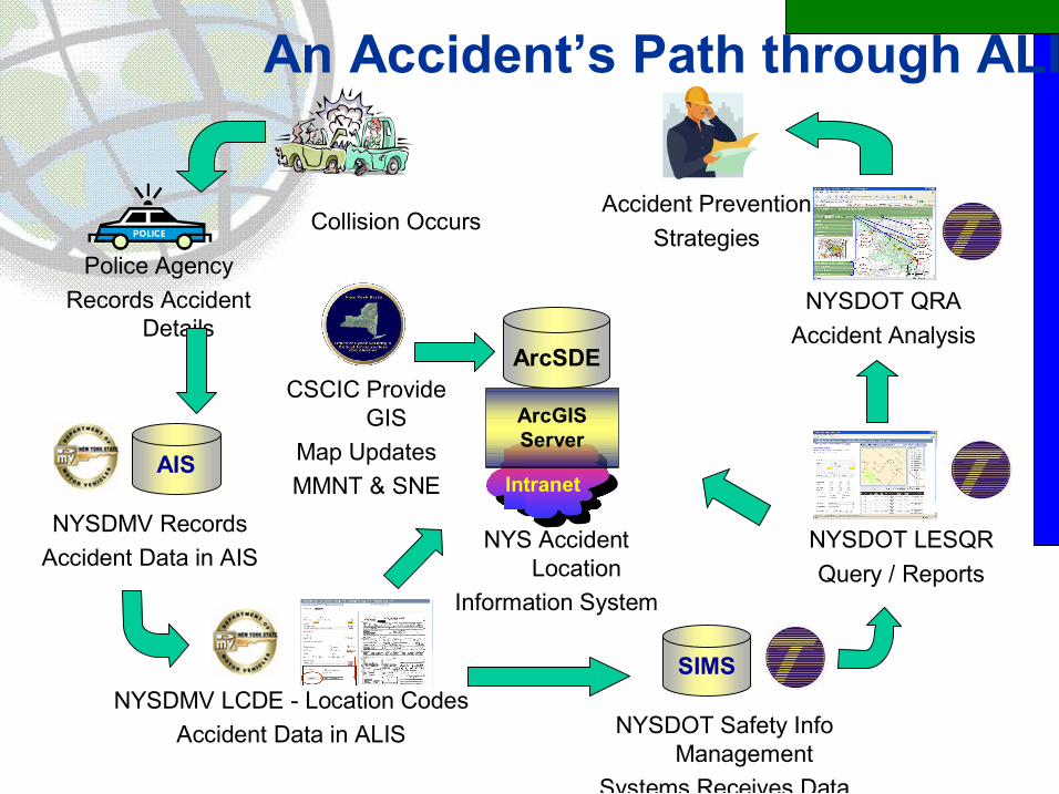
An Accident’s Path through ALIS
Collision Occurs
Police Agency Records Accident
Details ArcSDE
Intranet AIS
NYSDMV Records Accident Data in AIS
NYSDMV LCDE Location Codes Accident Data in ALIS
SIMS
NYSDOT Safety Info Management
Systems Receives Data
ArcGIS Server
CSCIC Provide GIS
Map Updates MMNT & SNE
NYS Accident Location
Information System
NYSDOT LESQR Query / Reports
NYSDOT QRA Accident Analysis
Accident Prevention Strategies
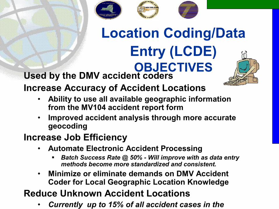
Location Coding/Data Entry (LCDE) OBJECTIVES
Used by the DMV accident coders Increase Accuracy of Accident Locations
• Ability to use all available geographic information from the MV104 accident report form
• Improved accident analysis through more accurate geocoding
Increase Job Efficiency • Automate Electronic Accident Processing
§ Batch Success Rate @ 50% Will improve with as data entry methods become more standardized and consistent.
• Minimize or eliminate demands on DMV Accident Coder for Local Geographic Location Knowledge
Reduce Unknown Accident Locations • Currently up to 15% of all accident cases in the
state are not located.

LCDE Location Coding Methods
• 14 Location Coding Methods possible for incoming accidents based on available data in accident report.
County
Municipality
On Street name match
Landmark
Bridge
Field coordinates Low
Field coordinates Medium
Milepost
Reference marker
Address match
On street/ Railroad intersection
On street/ Bridge intersection
On street/ Cross street intersection
Field coordinates High
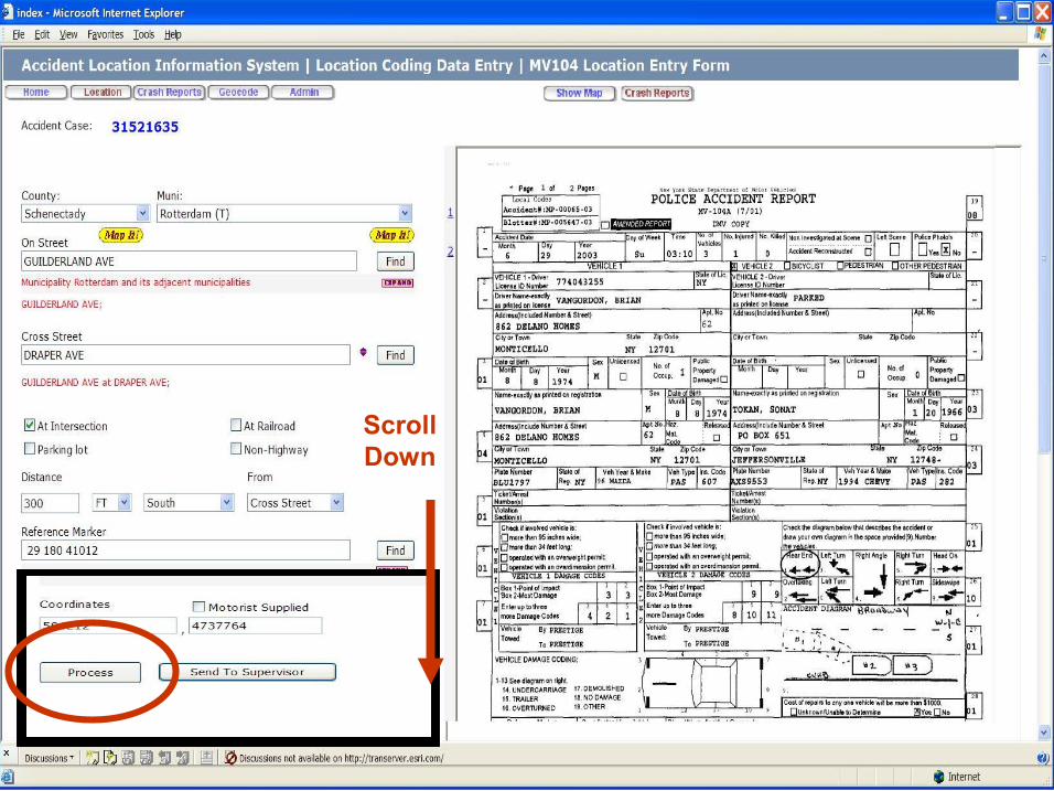
Scroll Down


Location Editing/Simply Query Reporting (LESQR)
Objectives • Used by NYSDOT Safety Group • Refine Location of Accidents Previously Location Coded • Verifying accident locations in an study area of interest • Updated map data available
• WebBased Accident Query and Reporting Capabilities – Select accident records by location
• Proximity to a feature (street segments) • User defined
– Report on accident details by location


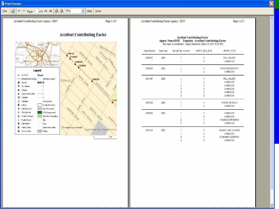

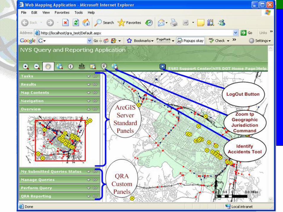
Query Reporting Analysis (QRA)
Objectives Accident Analysis Results Supports • Accident Mitigation Practices • Road Improvement Projects • Safety Policies and Procedures • Funding for Capital Improvement Projects • Increased Law Enforcement • PostImplementation Evaluation System (PIES)
• Review Recommended Improvement Impact QRA Stakeholders
• NYS DOT • Local Governments & Metropolitan Planning Organizations (MPO)

Query Reporting Analysis (QRA) Application Specifics
• Identify High Accident Locations (HALS) • Identify Concentrations of Specific Accident Types
• Conduct Detailed Accident Analysis § Spot/Intersection/Cluster § Strip § Sliding Scale § Corridor
• Produce Reports illustrating Spatial & Tabular Analysis Results
• Provides Query Capabilities against Accident Data

Questions?


