Download - Meteorological Driver for CTM Freie Universität Berlin Institut für Meteorologie Eberhard Reimer

Meteorological Driver for CTM
Freie Universität Berlin
Institut für Meteorologie
Eberhard Reimer
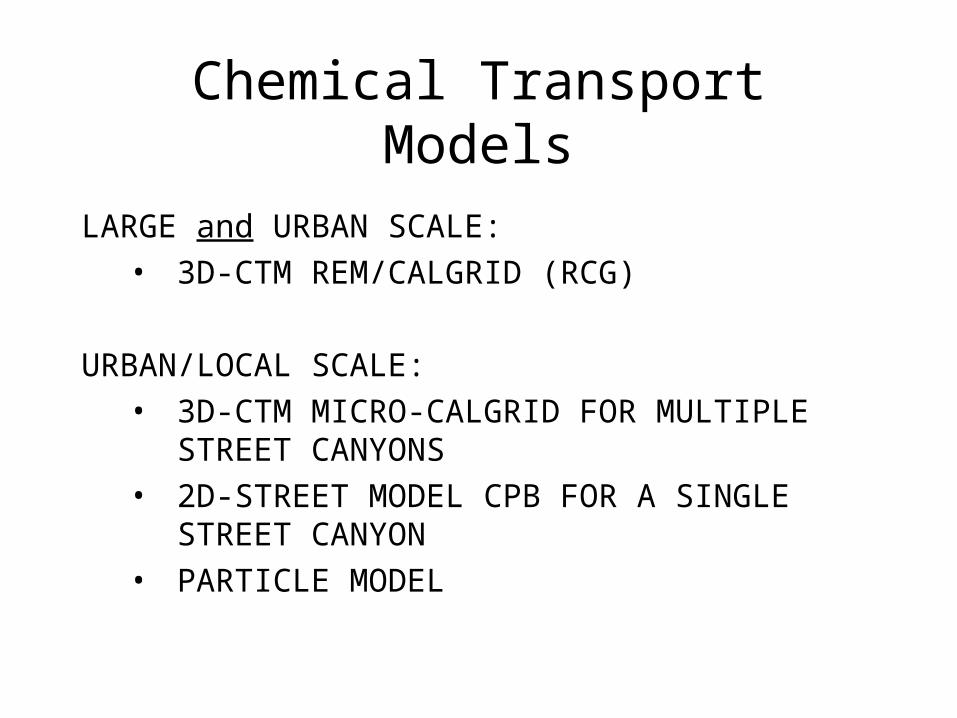
Chemical Transport Models
LARGE and URBAN SCALE:• 3D-CTM REM/CALGRID (RCG)
URBAN/LOCAL SCALE:• 3D-CTM MICRO-CALGRID FOR MULTIPLE
STREET CANYONS • 2D-STREET MODEL CPB FOR A SINGLE
STREET CANYON • PARTICLE MODEL
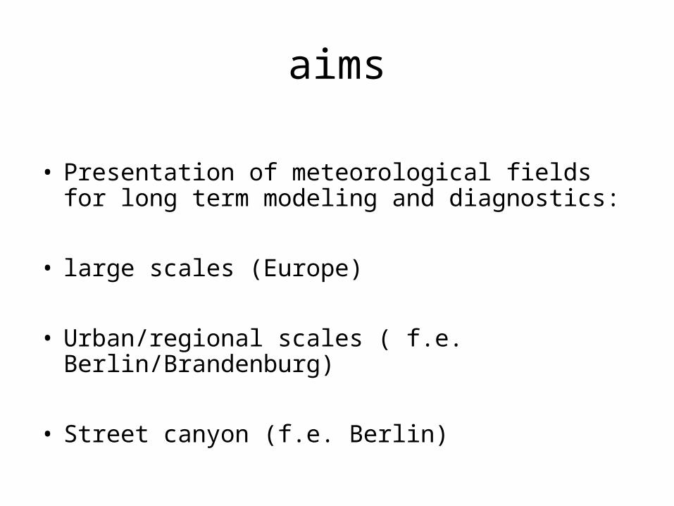
aims
• Presentation of meteorological fields for long term modeling and diagnostics:
• large scales (Europe)
• Urban/regional scales ( f.e. Berlin/Brandenburg)
• Street canyon (f.e. Berlin)

General ProcedureIterative diagnostic procedure:Use of observations: problem is resolution by networkUse of forecasts: problem with forecast errors and cloud param.
• First guess by large scale fields from statistical Interpolation or ECMWF analysis
• Transformation to isentropic coordinates (inversions, local stability..)• Correction by statist. Interpolation, ~ 25km² grid • Correction by statist. Interpolation, ~ 2 or 4km² grid
• Transformation to eta or hybrid coordinates• Adaptation to orography and landuse, ~ 1 to 4 km² grid

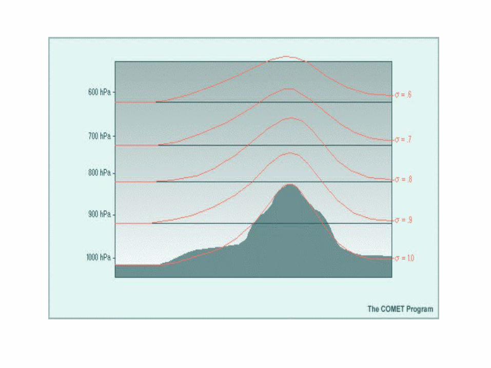


Generalized horizontal coordinate systems, including latitude-longitude
Multi layer system in terrain following coordinates,
fixed heights or
dynamically variing following the time depentent mixing height
CTM Coordinates
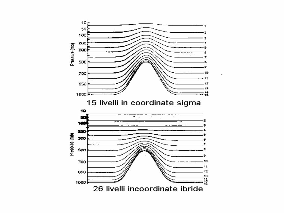
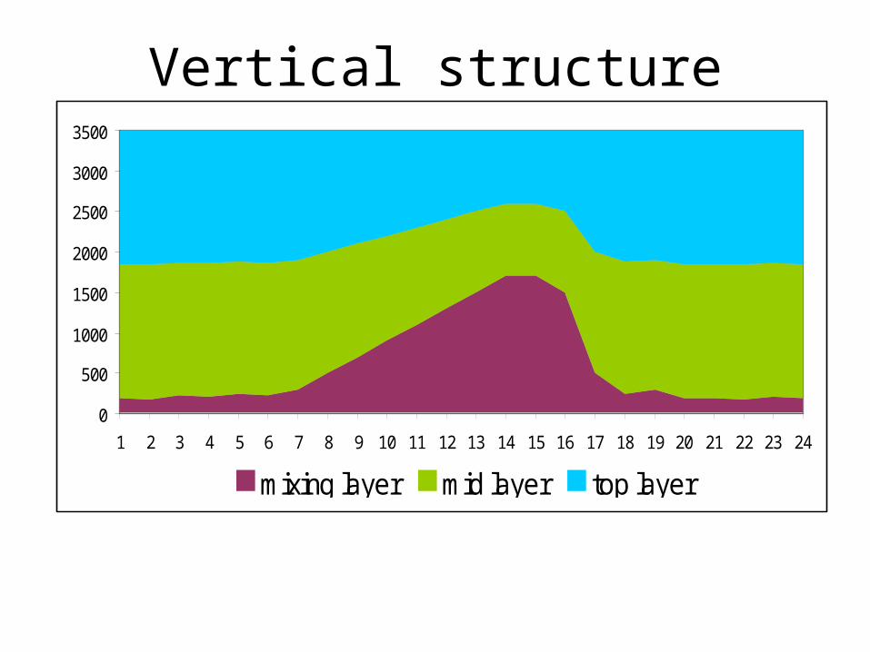
Vertical structure
0
500
1000
1500
2000
2500
3000
3500
1 2 3 4 5 6 7 8 9 10 11 12 13 14 15 16 17 18 19 20 21 22 23 24
mixing layer mid layer top layer
Mixing height spatially varying irregular grid
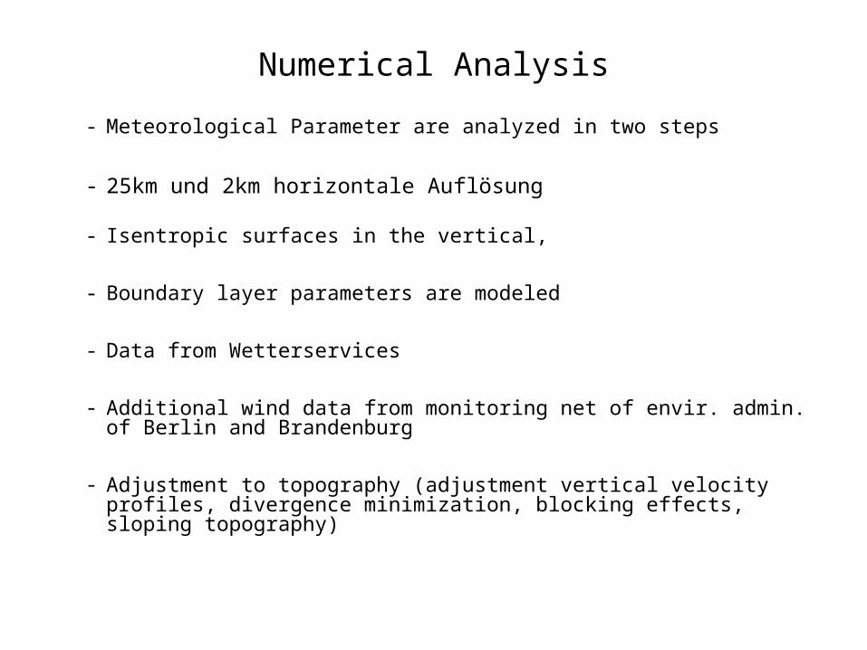
Numerical Analysis
- Meteorological Parameter are analyzed in two steps
- 25km und 2km horizontale Auflösung
- Isentropic surfaces in the vertical,
- Boundary layer parameters are modeled
- Data from Wetterservices
- Additional wind data from monitoring net of envir. admin. of Berlin and Brandenburg
- Adjustment to topography (adjustment vertical velocity profiles, divergence minimization, blocking effects, sloping topography)
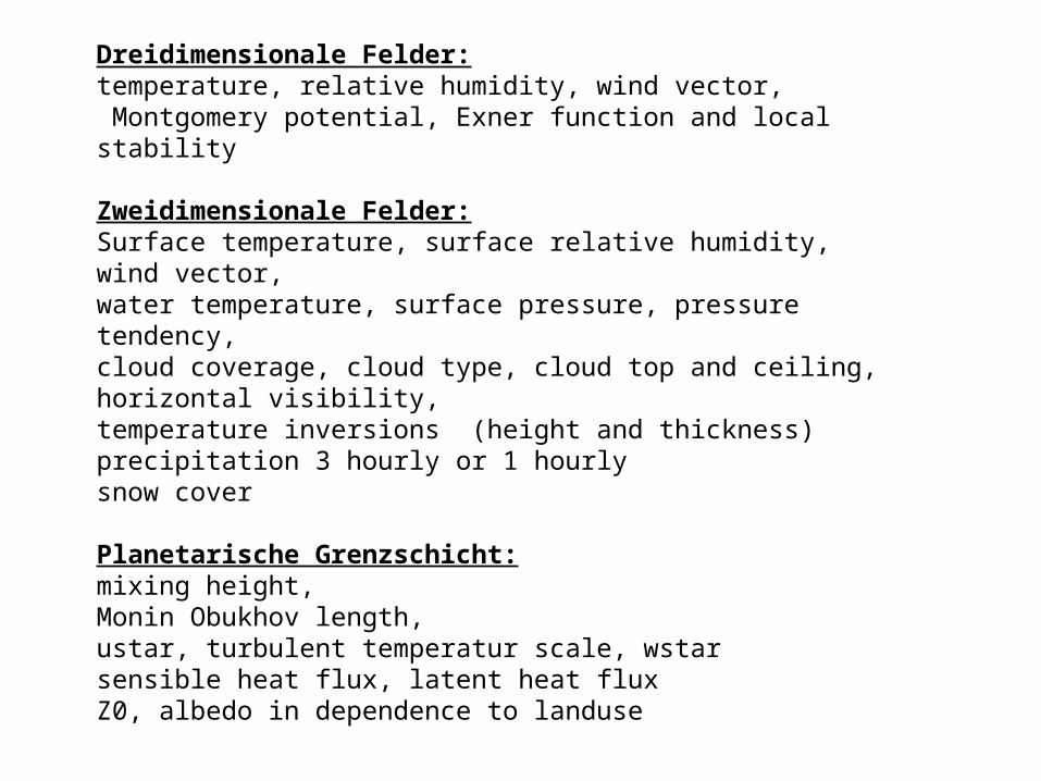
Dreidimensionale Felder:temperature, relative humidity, wind vector, Montgomery potential, Exner function and local stability
Zweidimensionale Felder:Surface temperature, surface relative humidity, wind vector,water temperature, surface pressure, pressure tendency,cloud coverage, cloud type, cloud top and ceiling, horizontal visibility,temperature inversions (height and thickness)precipitation 3 hourly or 1 hourlysnow cover
Planetarische Grenzschicht:mixing height,Monin Obukhov length,ustar, turbulent temperatur scale, wstar sensible heat flux, latent heat fluxZ0, albedo in dependence to landuse
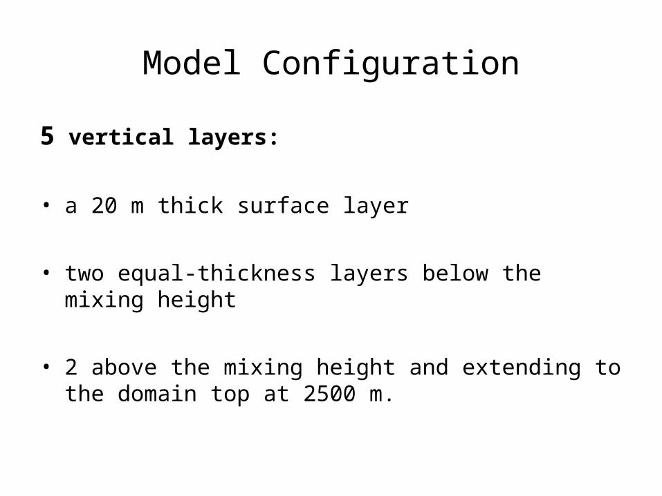
Model Configuration
5 vertical layers:
• a 20 m thick surface layer
• two equal-thickness layers below the mixing height
• 2 above the mixing height and extending to the domain top at 2500 m.
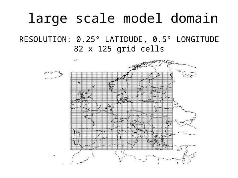
large scale model domain
RESOLUTION: 0.25° LATIDUDE, 0.5° LONGITUDE82 x 125 grid cells

urban/regional scale model domain Berlin-Brandenburg (Nest 1): 4x4 km2
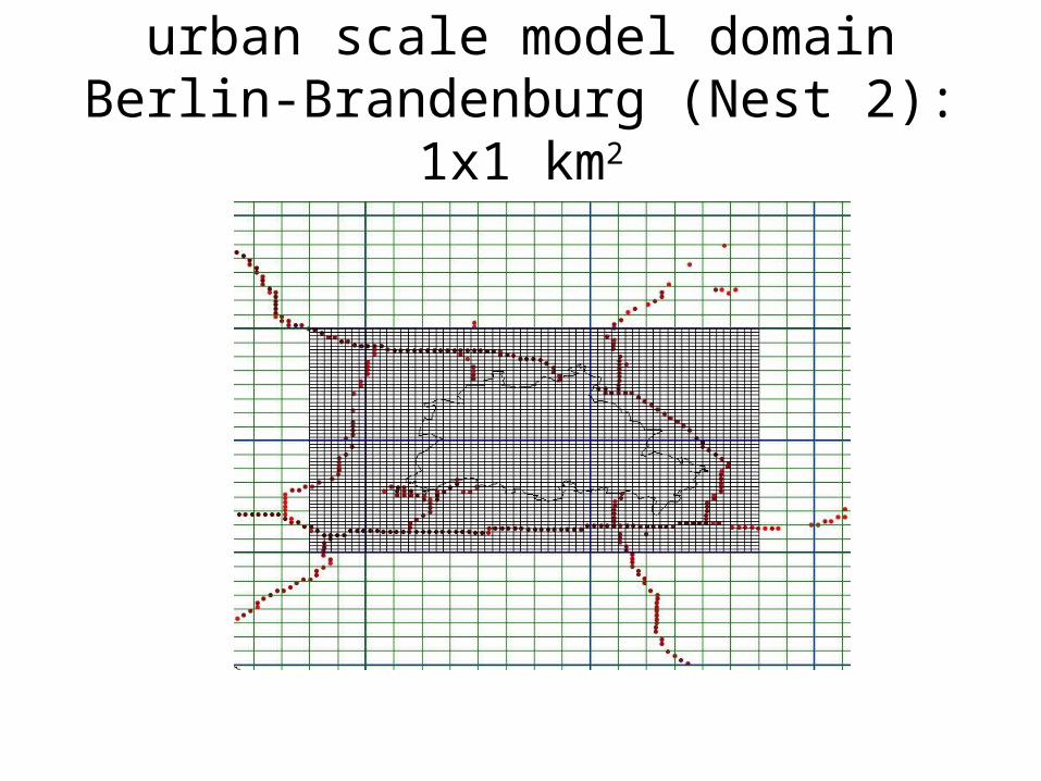
urban scale model domain Berlin-Brandenburg (Nest 2): 1x1 km2
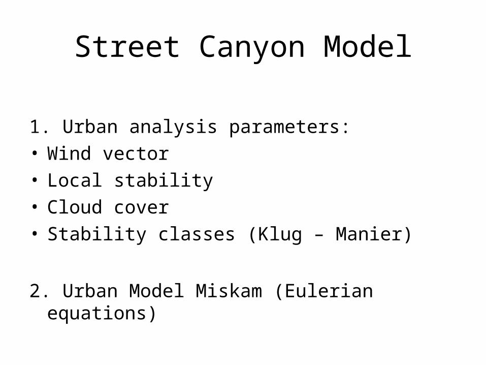
Street Canyon Model
1. Urban analysis parameters:• Wind vector• Local stability• Cloud cover• Stability classes (Klug – Manier)
2. Urban Model Miskam (Eulerian equations)

European Domain

2m Temperature, 26.4.2002 12 UTC
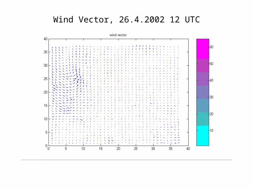
Wind Vector, 26.4.2002 12 UTC
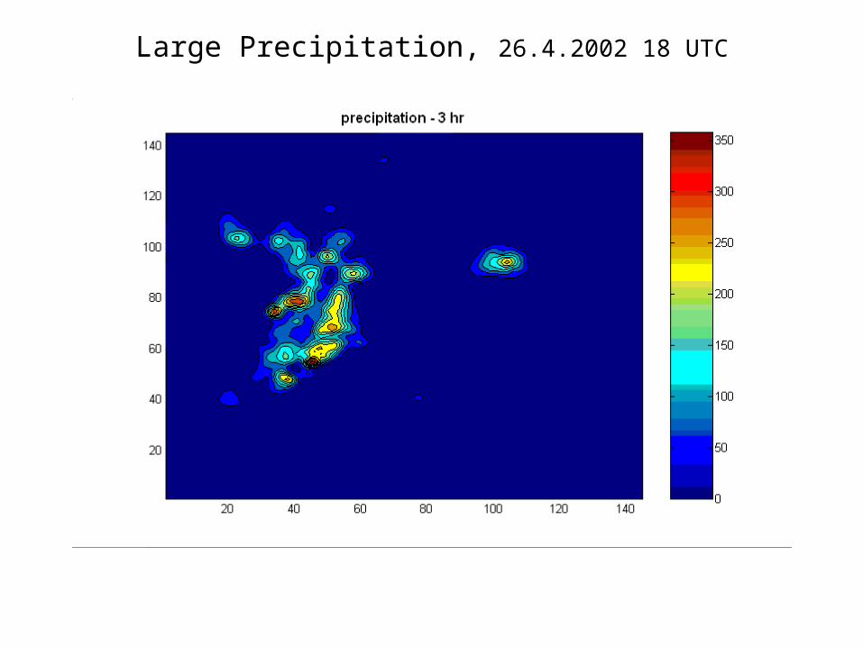
Large Precipitation, 26.4.2002 18 UTC

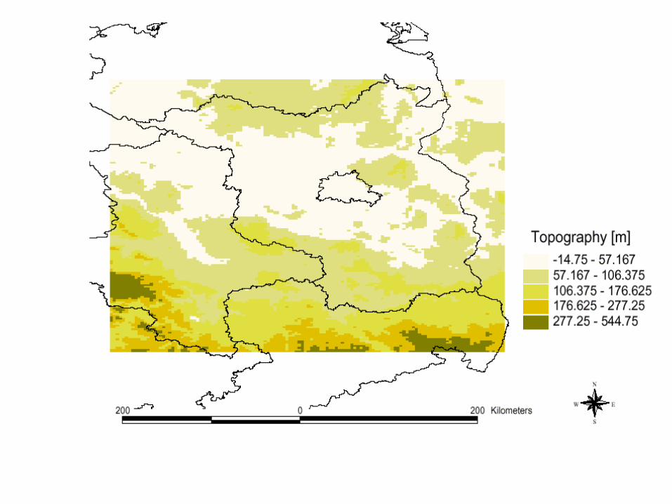
Urban/Regional Domaintopography and met. observations

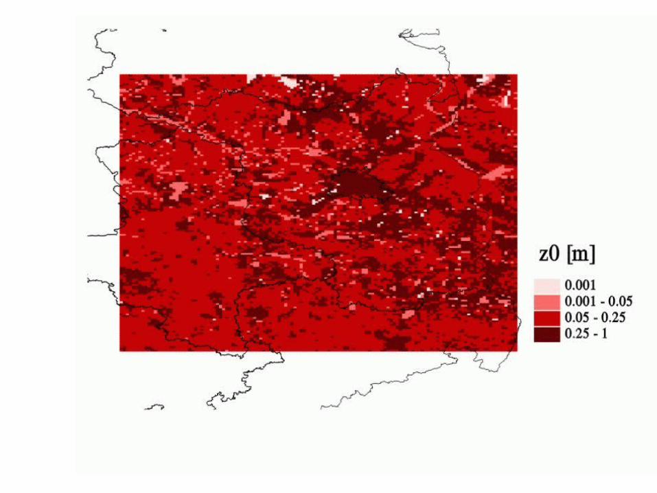
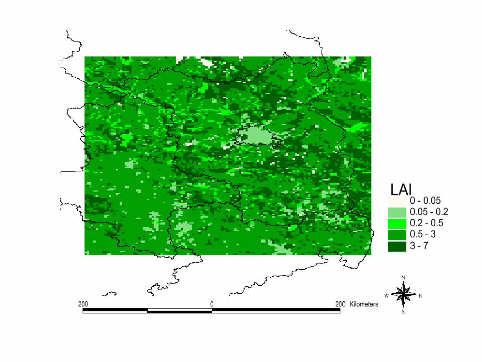
Landuse

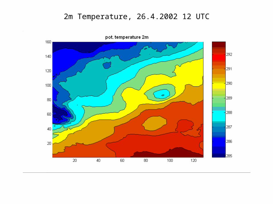
2m Temperature, 26.4.2002 12 UTC
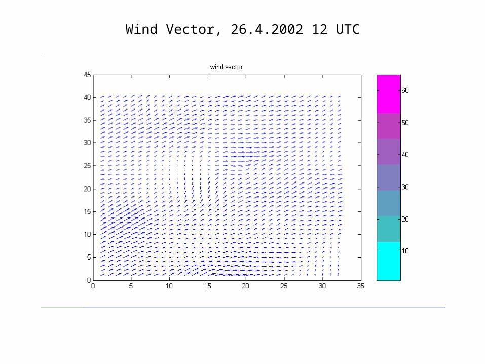
Wind Vector, 26.4.2002 12 UTC
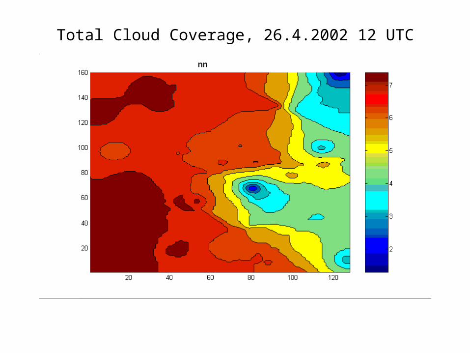
Total Cloud Coverage, 26.4.2002 12 UTC

Low Cloud Coverage, 26.4.2002 12 UTC
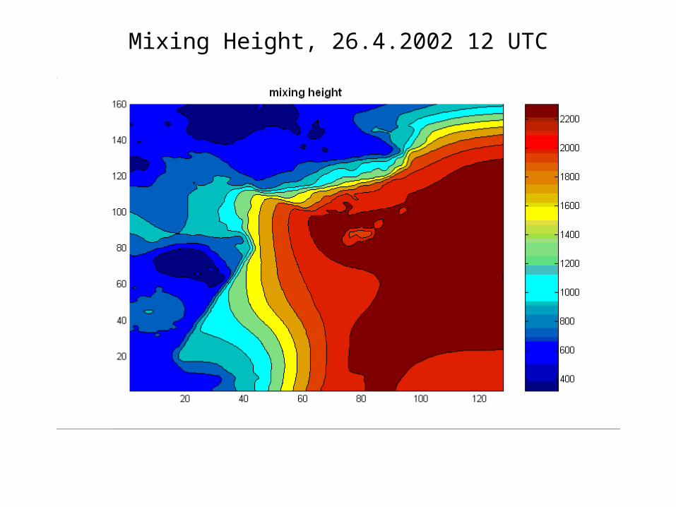
Mixing Height, 26.4.2002 12 UTC

Urban/Regional Precipitation, 26.4.2002 18 UTC

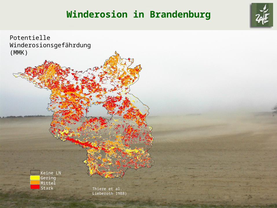
Potentielle Winderosionsgefährdung (MMK)
Keine LNGeringMittel Stark
Winderosion in Brandenburg
Thiere et al. Lieberoth 1988)


