
Development Application for Material Change of Use
– Machinery and Vehicle Sales Showroom / Outdoor Sales Premises Prepared for TAG Property Enterprises Pty Ltd
Lot 10 on SP261504
158 to 160 Maggiolo Drive, Paget QLD 4740 March 2017
2017
Development Planning and Approvals Mackay and Whitsundays, Queensland Australia
07 4944 1008

Ref#: DPA-0777 2 Mar-17
Document Control Date Parenthood Authorised for Issue
Author Reviewer Signature Status
March 17 Justin Peel
A
A – Approval B – Building Approval C - Construction
T- For Tender X - Information R- Revision
Revision Date Amendments Made Initial
A March 17 Nil JP
The content of this document is provided in strict commercial confidence. The content shall not be
discussed within any third party without the express written authority of Development Planning and
Approvals.
Copyright in the whole and every part of this document belongs to Development Planning and Approvals
and may not be used, sold, transferred, copied or reproduced in whole or in part in any manner or form or
in or on any media to any person without the prior written consent of Development Planning and
Approvals.
The applicant/owner is responsible for all matters relating to cultural heritage and native title. This report
does not cover any matters relating to cultural heritage or native title nor is it within the defined scope of
works.

Ref#: DPA-0777 3 Mar-17
Table of Contents
TABLE OF CONTENTS 3
1. EXECUTIVE SUMMARY 5
1.1 SITE DETAILS AND LOCATION 5
1.2 PROPOSAL AND APPLICANT DETAILS 6
1.3 SUPPORTING INFORMATION 7
1.4 ASSESSMENT SUMMARY 8
1.5 RECOMMENDATIONS 11
2. INTRODUCTION 12
2.1 LEVEL OF ASSESSMENT 13
3. SITE CHARACTERISTICS 14
4. REGULATORY FRAMEWORK 16
4.1 STATE PLANNING REGULATORY PROVISIONS 16
4.2 STATE PLANNING POLICY 16
4.3 REGIONAL PLAN 16
4.4 LOCAL GOVERNMENT PLANNING SCHEME 17
5. COMPLIANCE STATEMENTS 18
5.1 STATE PLANNING REGULATORY PROVISIONS 18
5.2 STATE PLANNING POLICY 18
5.3 REGIONAL PLAN 19
5.4 LOCAL GOVERNMENT PLANNING SCHEME 20
6. STATE ASSESSMENT AND REFERRAL AGENCY 30
7. SERVICES AND INFRASTRUCTURE 31
8. CONCLUSION AND RECOMMENDATIONS 32
APPENDIX A: 33
IDAS FORMS 33
Ref#: DPA-0777 4 Mar-17
APPENDIX B: 34
CERTIFICATE OF TITLE AND SITE SURVEY 34
APPENDIX C: 35
PLANS OF PROPOSED DEVELOPMENT 35
APPENDIX D: 36
REGULATED VEGETATION MAP 36
APPENDIX E: 37
MAP OF REFERRABLE WETLANDS 37
APPENDIX F: 38
COASTAL HAZARD MAPPING 38
APPENDIX G: 39
AS CONSTRUCTED INFORMATION 39

Ref#: DPA-0777 5 Mar-17
1. Executive Summary
1.1 Site Details and Location
Table 1: Site Details Address:
158-160 Maggiolo Drive, Paget QLD 4740
Real Property Description:
Lot 10 on SP261504
Registered Owners(s):
TAG Property Enterprises Pty Ltd
Parish:
Howard
County:
Carlisle
Site Area:
3,736m2
Existing Use:
Vacant industrial land
Source: MiMaps
Figure 1: Locality Plan
SUBJECT
SITE

Ref#: DPA-0777 6 Mar-17
1.2 Proposal and Applicant Details
Table 2: Proposal Details Project Description:
Relocation of existing caravan sales and service centre to custom facility in Maggiolo Drive, Paget. Construction of a shed with office, workshop and storage areas, driveways and outdoor sales yard
Planning Scheme Definition:
Machinery and Vehicle Sales Showroom / Outdoor Sales Premises
Proposal:
Material Change of Use
Approval Sought:
Development Permit
Applicant:
TAG Property Enterprises Pty Ltd
Method of Lodgement:
Electronic (Smart EDA)
Development Consultant:
Development Planning and Approvals
Contact Person:
Justin Peel
Mobile:
0409341010
Email:
Address for Correspondence:
PO Box 4499, Mackay South Qld 4740
Our Reference:
DPA-0777

Ref#: DPA-0777 7 Mar-17
1.3 Supporting Information
Section 260 of the Sustainable Planning Act 2009 outlines application requirements for a proposal to be considered Properly Made. In this case the proposed Material Change of Use application is being made to Mackay Regional Council as assessment manager is accompanied by the following supporting information:
IDAS Form 1
IDAS Form 5
Owners Consent Declaration
Appropriate Council Fee
Supporting information the approved form states is mandatory including detailed proposal plans and this report addressing relevant planning instruments.
It is thus considered that all relevant information has been provided. The application will be lodged electronically using an approved e-IDAS system.

Ref#: DPA-0777 8 Mar-17
1.4 Assessment Summary
1.4.1 Assessment Process
The development proposal is within the Mackay Region and is assessable development under the Mackay City Planning Scheme. Under the provisions of the applicable planning instrument, the proposal is subject to Code Assessment. There are no referral agencies triggered by the application. Public notification of the application is not required. Mackay Regional Council will act as Assessment Manager.
1.4.2 Assessment Summary Table
Table 3: Assessment Criteria
a) State Planning Regulatory Provisions Compliant
Region: Mackay, Isaac and Whitsunday
Regulatory Provisions: None Relevant N/A
b) Regional Plan Compliant
Plan: Mackay, Isaac and Whitsunday Regional Plan Yes
Status: Final
Commencement Date: Feb 8 2012
Reflected in the applicable Planning Scheme:
No
Land Use Designation: Urban Footprint Yes
c) State Planning Policy Reflected in the Planning
Scheme:
Applicable Compliant
State Planning Policy December 2013 No Yes Yes
d) Any other applicable Codes Relevant Compliant
- A temporary local planning instrument N/A N/A
- A Preliminary Approval to which section 242 of SPA applies N/A N/A
- A master plan N/A N/A
- A structure plan N/A N/A
- A Planning Scheme See below See below
e) Mackay Consolidated Planning Scheme 2006 Compliant
Locality: Frame Yes
Precinct: Pioneer River (Urban) N/A
Zone: Industry (High Impact) Yes
Applicable Overlays: Nil N/A
Applicable Codes: Industrial Code, Environment and Infrastructure Code
Yes – with conditions

Ref#: DPA-0777 9 Mar-17
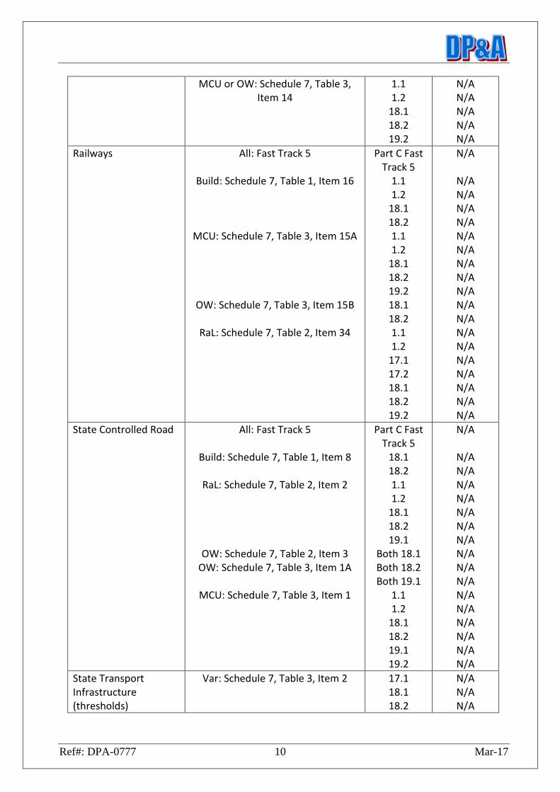
f) State Development Assessment Provisions (matters of interest as a referral agency)
Relevant Provisions of the Sustainable Planning Regulation
Applicable Section(s)
SDAP
Compliant
Regional Plans MCU: Schedule 7, Table 3, Item 12 RaL: Schedule 7, Table 2, Item 39
2.1 (all) N/A
Aquaculture Schedule 7, Table 2, Item 28 3.1 N/A
Environmentally Relevant Activities
MCU: Schedule 7, Table 3, Item 27 4.1 N/A
Fish Habitat Area Build: Schedule 7, Table 2, Item 25 OW: Schedule 7, Table 2, Item 26
5.1 (all) N/A
Marine Plants – Removal or destruction
OW: Schedule 7, Table 2, Item 30 RaL: Schedule 7, Table 2, Item 31
MCU: Schedule 7, Table 2, Item 32 MCU: Schedule 7, Table 3, Item 25
5.3 (all) N/A
Native Vegetation Clearing
OW: Schedule 7, Table 2, Item 5 RaL: Schedule 7, Table 2, Item 4
MCU: Schedule 7, Table 3, Item 10
8.1 (all) N/A
Queensland Heritage Build: Schedule 7, Table 1, Item 12 Var: Schedule 7, Table 2, Item 19
9.1 (all) N/A
Tidal Works or development in a coastal management district
Build: Schedule 7, Table 1, Item 11 OW: Schedule 7, Table 2, Item 13 OW: Schedule 7, Table 2, Item 15 RaL: Schedule 7, Table 2, Item 14 MCU: Schedule 7, Table 3, Item 5
10.1 10.1
14.1 & 14.2 10.1 10.1
N/A N/A N/A N/A N/A
Taking of interfering with water
OW: Schedule 7, Table 2, Item 9 OW: Schedule 7, Table 2, Item 10
7.1 (all) N/A N/A
Removal of quarry material from watercourse of lake
All: Schedule 7, Table 2, Item 12
7.2 N/A
Particular Levees All: Schedule 7, table 3, Item 48 7.3 N/A
Waterway barrier works
OW: Schedule 7, Table 2, Item 29 5.2 N/A
Wetlands OW: Schedule 7, Table 2, Item 43B RaL: Schedule 7, Table 2, Item 43A
MCU: Schedule 7, Table 3, Item 21A
11.1 (all) N/A
Major Hazard Facilities MCU: Schedule 7, Table 2, Item 8 13.1 N/A
Particular Dams OW: Schedule 7, Table 2, Item 11 16.1 N/A
Public Passenger Transport
All: Fast Track 5
Build: Schedule 7, Table 1, Item 14 Ral Schedule 7, Table 2, Item 33
Part C Fast Track 5
18.1 1.1 1.2
18.1 18.2 19.2
N/A
N/A N/A N/A N/A N/A N/A
Ref#: DPA-0777 10 Mar-17
MCU or OW: Schedule 7, Table 3, Item 14
1.1 1.2
18.1 18.2 19.2
N/A N/A N/A N/A N/A
Railways All: Fast Track 5
Build: Schedule 7, Table 1, Item 16
MCU: Schedule 7, Table 3, Item 15A
OW: Schedule 7, Table 3, Item 15B
RaL: Schedule 7, Table 2, Item 34
Part C Fast Track 5
1.1 1.2
18.1 18.2 1.1 1.2
18.1 18.2 19.2 18.1 18.2 1.1 1.2
17.1 17.2 18.1 18.2 19.2
N/A
N/A N/A N/A N/A N/A N/A N/A N/A N/A N/A N/A N/A N/A N/A N/A N/A N/A N/A
State Controlled Road All: Fast Track 5
Build: Schedule 7, Table 1, Item 8
RaL: Schedule 7, Table 2, Item 2
OW: Schedule 7, Table 2, Item 3
OW: Schedule 7, Table 3, Item 1A
MCU: Schedule 7, Table 3, Item 1
Part C Fast Track 5
18.1 18.2 1.1 1.2
18.1 18.2 19.1
Both 18.1 Both 18.2 Both 19.1
1.1 1.2
18.1 18.2 19.1 19.2
N/A
N/A N/A N/A N/A N/A N/A N/A N/A N/A N/A N/A N/A N/A N/A N/A N/A
State Transport Infrastructure (thresholds)
Var: Schedule 7, Table 3, Item 2 17.1 18.1 18.2
N/A N/A N/A

Ref#: DPA-0777 11 Mar-17
19.2 N/A
State Controlled Transport Tunnels
RaL: Schedule 7, Table 2, Item 34A
MCU: Schedule 7, Table 3, Item 15C
1.1 1.2
18.1 18.2 19.2 1.1 1.2
18.1 18.2 19.2
N/A N/A N/A N/A N/A N/A N/A N/A N/A N/A
1.5 Recommendations
Sections 4 to 7 of this report provide more detailed assessment summaries against applicable codes. These summaries indicate the proposal is consistent with relevant planning legislation. It is thus recommended a Development Permit be issued to reasonable and relevant conditions.

Ref#: DPA-0777 12 Mar-17
2. Introduction
Development Planning and Approvals have been commissioned by TAG Property Enterprises Pty Ltd (the applicant) to prepare and lodge a development application for a new industrial facility. The development is proposed at 158 – 160 Maggiolo Drive, Paget (lot 10 on SP261504). Tullmack Caravans currently operate from a small site on the corner of Broadsound Road and Boundary Road, Paget. The site is spatially constrained and access for caravans is problematic. The applicant is seeking to move to a custom facility on a larger vacant industrial land parcel in Maggiolo Drive, Paget. The development will include an office / workshop and large hardstand outdoor sales and display yard for both new and used caravans. The characteristics of the development can be summarised as follows:
Workshop, spare parts storage and office with an area of 480m2
5m wide landscaping strip to frontage
Total landscaped and grassed swale area of 465m2 (12.4%)
Hardstand area for display of vans to be sealed as stage 2 works
Two concrete driveways
10 car-parking spaces including 1 disabled space
Easement at rear of site to remain grassed and maintained
Delineated caravan servicing and staff area
Figure 2: Proposed Site Plan

Ref#: DPA-0777 13 Mar-17
The business has three major components as follows:
Sale of spare caravan parts
Servicing and repairs of caravans in the workshop area
Display and sales of both new and use caravans at the front of the premises
2.1 Level of Assessment
Development applications in Queensland are currently made and assessed under the provisions of the Sustainable Planning Act 2009. The development is proposed within the Mackay, Isaac and Whitsunday Regional Planning Region. The development is proposed within the Urban Footprint as designated in the Mackay, Isaac and Whitsunday Regional Plan. The site is located within the Mackay Regional Council district governed by the Mackay City Planning Scheme 2006 (now consolidated). Given the activities proposed on site the development is defined as both “Machinery and Vehicles Sales Showroom” (shed area) and “Outdoor Sales Premises (sales yard)” by the applicable local planning instrument.
“Machinery and Vehicle Sales Showroom” means any premises used for the
display and sale of agricultural implements or machinery, motor vehicles,
caravans or boats and their accessories within a building and ancillary
outdoor area limited to 25sqm. The term includes, when carried out in
conjunction with such display or sale, the servicing of items sold from the
premises.
“Outdoor Sales Premises” means any premises used for the display and sale of
goods such as agricultural equipment, boats, caravans, large machinery,
motor vehicles, modular swimming pools, trucks and trailers, which:
(i) is conducted in a outdoor setting; and
(ii) includes an ancillary office limited to 25 sqm.
A review of the assessment tables in the Mackay Frame Locality Code indicates that both defined uses require CODE ASSESSMENT. As the application is Code Assessable, the assessment manager must only assess the application against those matters within section 313(2&3) of the Sustainable Planning Act. There are no referral agencies triggered by the development. Public Notification is not required. All required information as outlined in section 260 of the Sustainable Planning Act 2009 has been provided to facilitate assessment of the development proposal.

Ref#: DPA-0777 14 Mar-17
3. Site Characteristics
Location The site is situated just south-east of the city gates, directly west of the Mackay railway station. The Mackay CBD is approximately 5km north of the site (refer to Figure 1 for a locality plan).
Dimensions The site is rectangular with a width of 43.3m and depth of 86.8m, resulting in a site area of 3,736m2.
Easements There is an easement at the rear of the site that contains an overland flow path including associated underground drainage infrastructure.
Topography The survey provided in Appendix B indicates the site grades gently from the road frontage towards the spoon drain at the rear of the site. Levels vary from approximately 8.4m AHD to 7.95m AHD, then lower again with the drainage easement.
Vegetation There is no mature vegetation on the site and no regulated vegetation mapped on the site (see Appendix D).
Site History The land was used for sugar cultivation for many years before being subdivided. The title was created in 2013 but has remained vacant since creation.
Surrounding Land Uses A large engineering firm adjoins the eastern side of the site. The southern, western and northern approaches all contain industrial development or vacant land designated for industrial purposes. The Mackay Railway station is 300m east of the site.
Surrounding Road Hierarchy Maggiolo Drive Sub Arterial Centurion Drive Major Collector Boundary Road Sub Arterial
Land Contamination The site is not known to be listed on either the contaminated land register (CLR) or environmental management register (EMR).

Ref#: DPA-0777 15 Mar-17
Site looking east from Maggiolo Drive
Aerial photo of site
Figure 3: Photographs of site

Ref#: DPA-0777 16 Mar-17
4. Regulatory Framework
Development assessment in Queensland is conducted under the provisions of the Sustainable Planning Act (SPA) via the Integrated Development Assessment System (IDAS). Development should prove consistent with a number of statutory planning tools including Stage Planning Regulatory Provisions, Regional Plans, State Planning Policies and Local Government Planning Schemes.
4.1 State Planning Regulatory Provisions
A list of the State Planning Regulatory Provisions (SPRP) current at 25th September 2014 is provided below:
Yeerongpilly Transit Oriented Development State Planning Regulatory Provision 2014
South East Queensland Regional Plan 2009-2031 State Planning Regulatory Provisions (as amended)
Guragunbah State Planning Regulatory Provision
State Planning Regulatory Provision (adopted charges)
Off-road motorcycling facility on State-owned land at Wyaralong
State Planning Regulatory Provisions (Adult Stores)
South East Queensland Koala Conservation State Planning Regulatory Provisions
4.2 State Planning Policy
State Planning Polices (SPPs) are made under SPA and are used to advance the purpose of the Act. Generally the policies reflect a matter of State Interest. A compliance assessment of the proposal against current SPPs is provided within section 5.2 of this report.
4.3 Regional Plan
The Regional Planning Interests Bill 2013 was passed by parliament on 20th March 2014. The Regional Planning Interests Act (RPI Act) identifies and protects areas of Queensland that are of regional interest. The RPI Act provides the framework for implementing the policies of the governments new generation statutory regional plans, which include:
Central West Regional Plan 2009
Far North Queensland Regional Plan 2009
Mackay, Isaac and Whitsunday Regional Plan 2012 (under review)

Ref#: DPA-0777 17 Mar-17
Maranoa-Balonne Regional Plan 2009
North West Regional Plan 2010
South East Queensland Regional Plan 2009 (under review)
South West Regional Plan 2009
Wide Bay Burnett Regional Plan 2011 (under review) New Regional Plans include:
Cape York Regional Plan
Central Queensland Regional Plan
Darling Downs Regional Plan An assessment of the consistency of the development proposal with any relevant Regional Plan is provided within section 5.3 of this report.
4.4 Local Government Planning Scheme
In accordance with the SPA, the Local Government for any region must prepare a planning scheme as a framework for managing development in a way that advances the purposes of the SPA by:
(a) identifying assessable and self-assessable development; and
(b) identifying outcomes sought to be achieved in the local government area as the context for assessing development.
The planning scheme functions as part of IDAS and must be read together with the SPA and the Sustainable Planning Regulation. An assessment of compliance of the development proposal with the local government planning scheme is provided within section 5.4 of this report.

Ref#: DPA-0777 18 Mar-17
5. Compliance Statements
5.1 State Planning Regulatory Provisions
The proposed Material Change of Use does not trigger assessment nor is it impacted upon by any of the State Planning Regulatory Provisions listed in section 4.1 of this report. Any subsequent infrastructure charges levied on the development should be done so in accordance with a resolution adopted by the local government in accordance with the adopted charges SPRP. Applicable contributions are calculated as follows: Impervious Area 3,271 x $8.50 = $27,803.50 Gross Floor Area Commercial (bulk goods) = office and spare parts storage areas = 132m2 Industry (Low Impact) = car repair workshop area = 348m2 Infrastructure Charge = 132 x $119 + 348 x $42.50 = $15,708 + $14,790 = $30,498 Total ICN levied = $58,301.50 The credits on the site will exceed the ICN charges applicable to the use, with the balance credits remaining attached to the land.
5.2 State Planning Policy
In December 2013 the Queensland government introduced the single State Planning Policy (SPP). The development assessment requirements within the SPP apply only if the applicable local government planning scheme has not yet appropriately integrated the SPP. The SPP has effect throughout the entire state. Where an inconsistency exists between the SPP and a planning scheme, the SPP prevails to the extent of the inconsistency. In this instance the SPP is not reflected in the applicable planning instrument.
The SPP (Part E) contains interim development assessment (DA) requirements for some state interests; however, not all state interests have DA requirements. Interim development assessment requirements have been prepared for the following state interests.
• Mining and extractive resources (not applicable)

Ref#: DPA-0777 19 Mar-17
• Biodiversity (not applicable)
• Coastal environment (not applicable)
• Water quality (APPLICABLE)
• Natural hazards (not applicable – see Appendix F)
• Emissions and hazardous activities (not applicable)
• State transport infrastructure (not applicable)
• Strategic airports and aviation facilities (not applicable)
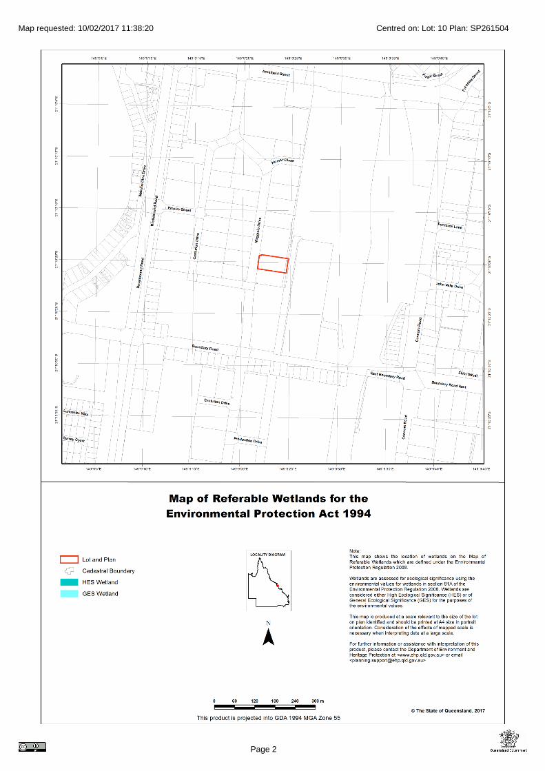
A site based stormwater management plan (SBSMP) was prepared for the subdivision in accordance with the SPP and Council policy (see Appendix G). Rather than provide the improvement devices on site, the applicant is going to make a voluntary contribution to a regional stormwater quality improvement area in keeping with Council Policy 087 “Voluntary Mechanism for Stormwater Quality Management”. Part F of the SPP contains a self-assessable code for development within a wetland protection area in Great Barrier Reef catchments. This code is not applicable to the proposed development as no works are proposed within a defined wetland protection area (see Appendix E).
5.3 Regional Plan
The development site is located within the area governed by the Mackay, Isaac, Whitsunday Regional Plan. The Regional Plan is structured around eight core themes for managing growth and development in the region. These themes are defined by the Desired Regional Outcomes (DROs) for the region which are listed under the following headings:
Sustainability, Climate Change and Natural Hazards
Regional Landscapes
Environment
Natural Resource Management
Strong Communities
Strong Economy
Managing Growth
Urban Form
Infrastructure
Transport There are no specific assessment provisions for development proposals within the Regional Plan however it is considered that this proposed development is generally reflective of the DROs within the Regional Plan. The additional site area facilitates the future expansion of the local business within the Mackay urban footprint. The proposal will therefore strengthen the economy, provide work in a suitable location,
Ref#: DPA-0777 20 Mar-17
can be adequately serviced with infrastructure and will be constructed in an appropriate location.
5.4 Local Government Planning Scheme
The development site is located within the Mackay Regional Council district governed by the Mackay City Planning Scheme 2006 (now consolidated).The proposed Material Change of Use – “Machinery and Vehicles Sales Showroom” (shed area) and “Outdoor Sales Premises (sales yard)”is Code Assessable and triggers assessment against the following Codes within the Mackay Regional Planning Scheme:
Mackay Frame Locality Code
Industrial Zone Code
Industrial Code
Retail and Commercial Code (no assessment will be provided against this code as it is of little relevance to the proposal. There are no high turnover retail or showroom activities proposed on the site).
Environment and Infrastructure Code Due to the structure of the Planning Scheme, compliance with the Code is achieved when development is consistent with the Specific Outcomes contained therein. It is intended that the following assessment summaries be read in conjunction with the relevant section of the Planning Scheme, with pre-fixes referencing the Specific Outcomes within the relevant Code. Assessment summaries should also be referenced against the detailed proposal plans provided within Appendix C of this report.
5.4.1 Mackay Frame Locality Code
P1 Not Relevant The display and sale of caravans including the servicing of caravans and provision of spare parts is not considered a ‘commercial activity’. The use is appropriately located in an industrial setting.
P2 Not Relevant
The development does not involve residential or accommodation uses. P3 Not Relevant
No tourist activities are proposed to be developed. P4 Specific Outcome Satisfied
The proposed development is of an industrial nature and is located on industrial zoned land and surrounded by industrial uses. The proposal does therefore not require any specific buffering measures.

Ref#: DPA-0777 21 Mar-17
P5 Not Relevant No development or land zoned for residential uses is being proposed.
P6 Specific Outcome Satisfied
The proposed development is not proximate to rail transport corridors. A long-established engineering firm separates the site from the nearby rail lines and Mackay railway station.
P7 Not Relevant
The development is not proposed within a rail corridor. P8 Not Relevant
There are no cane tramways in the vicinity of the proposed development. P9 Specific Outcome Satisfied
The vacant industrial land parcel is already serviced with require urban services including reticulated water and sewer, power, telecommunications and stormwater outlet stubs.
P10 Not Relevant
The site does not front the Bruce Highway. P11 Not Relevant
The site is not proximate to the future Port Access corridor. P12 Not Relevant
The development is not being proposed on port land. P13 Specific Outcome Satisfied
The development is proposed within an established industrial neighbourhood with streets designed for industrial vehicles. The road hierarchy in the area is already well established. The development will not jeopardise transport routes or promote industrial traffic in inappropriate areas.
P14 Specific Outcome Satisfied The open space area south of the site is used for stormwater treatment and is a drainage reserve. The adjoining allotment provides sufficient separation to this area.
P15 Not Relevant
The development is not proximate to recreational spaces. Summary The proposed development is consistent with relevant Specific Outcomes within the Mackay Frame Locality Code.

Ref#: DPA-0777 22 Mar-17
5.4.2 Industry (High Impact) Zone Code
P1 Specific Outcomes Satisfied
The allotment area exceeds 3,500m2 within the Industry (High Impact) Zone and can accommodate all required infrastructure, landscaping areas, car parks, vehicle movement areas and buildings.
P2 Specific Outcome Satisfied The site has access directly to industrial streets that distribute to the arterial
road network. P3 Specific Outcome Satisfied Landscaping has been proposed on all road frontages in accordance with the
requirements of the Industrial Code (5m landscaping strip to Maggiolo Drive, a sub-arterial road). No stormwater treatment measures are proposed within the landscape zones. Additional turf areas are also provided to the site in the rear drainage easement. Stormwater quality treatment will be addressed via a voluntary contribution to Council.
P4 Specific Outcomes Satisfied The business proposed to operate from the site will likely not impact upon
similar industrial activities in the area or result in an increase in industrial traffic in residential areas. The business currently operates from the corner of Boundary Road and Broadsound Road, proximate to industrial development without conflict.
P5 Specific Outcome Satisfied The proposed development should have limited impact upon the amenity of
surrounding uses. The easement at the rear of the site will remain grassed and development free. The use does not warrant landscape buffers and the buildings are of a small scale and located centrally within the site.
Summary The proposed development is consistent with relevant Specific Outcomes within the Industry (High Impact) Zone Code.
5.4.3 Industrial Code
Site Suitability P1 Specific Outcome Satisfied
The proposal plans within Appendix C demonstrate that buildings, parking areas, service vehicle areas and landscaping can be appropriately located on the site. The site has an area exceeding 3,500m2 and frontage of over 40m.

Ref#: DPA-0777 23 Mar-17
Landscaping and Building Treatments P1 Specific Outcome Satisfied
A 5m wide landscaping strip has been provided to the road frontage and the rear drain will remain as turf. Additional landscaping has been designated adjacent to the site access. This results in a total landscape area of 465m2 and thus results in a landscape area in excess of 12% of the site area. The landscape areas provided will not impact upon the operations of the site.
Building Setbacks P1 Specific Outcome Satisfied
All enclosed structures are sited over 10m from Maggiolo Drive. Visitor parking is provided at the front of the site, adjacent to the office entrance.
P2 Acceptable Solution Provided
Side and rear setbacks are in keeping with the requirements of the Building Act 1975 for the type of building materials being employed.
Building Scale and Appearance P1 Acceptable Solution Provided
Site coverage and plot ratios are well below the limits specified within the Acceptable Solutions being 60% and 100% respectively. The proposed building height of 5.5m is well below the stipulated 15m maximum height.
P2 Specific Outcome Satisfied Office areas address the street and adjoining visitor parking spaces. The office creates a natural point for public access clear of workshop and servicing areas.
P3 Specific Outcome Satisfied
The new building will use high-quality, modern materials as displayed within Appendix C.
Fences and Walls P1 Specific Outcome Satisfied
A 1.8m high powder coated fence is proposed to secure the site in accordance with the standard provisions for Paget. The impact of this fence near the road frontage will be softened by the 5m landscaping strip immediately behind the fence.
Signage P1 Specific Outcome Provided
No signage is proposed at this time. P2 Unchanged from existing conditions
No major system drainage works are proposed to facilitate the development. No development works are proposed within the overland flow path at the rear of the site.

Ref#: DPA-0777 24 Mar-17
Summary The proposal is consistent with the Specific Outcomes within the Industrial Code and wherever possible the related Acceptable Solutions have been provided.
5.4.4 Environment and Infrastructure Code
Infrastructure P1 Specific Outcome Satisfied
No significant augmentation to existing infrastructure will be required to accommodate the development on the vacant industrial site.
P2 Not relevant Provision of parkland within the development is not warranted in this case.
P3 Acceptable Solution Provided Reticulated water supply will be available from the Maggiolo Drive frontage.
P4 Acceptable Solution Provided The development will connect to the sewerage services on the southern frontage of the site.
P5 Specific Outcome Satisfied The total outdoor uncovered area will exceed 1,000m2 and thus the development will be considered ‘high risk’. The applicant is going to make a voluntary contribution to a regional stormwater quality improvement area in keeping with Council Policy 087 “Voluntary Mechanism for Stormwater Quality Management”. The contribution has been calculated as follows: Development Area = Site Area – Drainage Easement = 3,736– 238m2 = 3,498m2 Adopt Level 2: $42,000/Ha Commercial / Industrial Land Use factor: 2.0 Developer pays: $29,383 and installs gross pollutant traps on site.
P6 Specific Outcome Satisfied
Kerb and channel is already provided to road frontages. When driveways are cut in transitions to the existing kerb and channel will be provided.
P7 Acceptable Solution Provided
No road construction is proposed within the development. Areas outside of landscape zones will all be sealed.

Ref#: DPA-0777 25 Mar-17
P8 Acceptable Solution Provided No major drainage works are proposed to facilitate the development. Existing drainage patterns will be largely retained under the proposal, with the site to be graded to the rear of lot drain and minor flows conveyed to the provided stormwater stub. Major flows will enter the adjoining detention basin.
P9 Acceptable Solution Provided
No street lighting or external road signage will be required to support the development. Driveways have been located clear of infrastructure.
P10 Specific Outcome Satisfied
The development is already provided with appropriate infrastructure. P11 Acceptable Solution Provided
Vehicle parking and access has been provided in accordance with schedule 2 of the Planning Scheme. The following properties have been adopted:
Defined Use Car Parking Ratio Required
Total Car Parks Required
Provided Car Parks
Machinery and Vehicles Sales Showroom
1/100m2 GFA
480m2 4.8
5
Outdoor Sales Premises
1/400m2 sales area Approx. 1400 m2 4
5
Visitors will enter the site, park at the designated parking area then exit the site using the southern driveway. The parking and driveway access is compliant with AS2890.1 and includes a disabled parking space. Larger vehicles and caravans will be able to circulate the site via the shed and exit via the northern driveway which is exit only. Vehicles delivering caravans for display would infrequently access the site. These vehicles largely deliver new caravans for display and can drop off directly to the display area at the front of the site then exit via the northern driveway.
Environmental Amenity P1 Specific Outcome Satisfied
Lighting of the development is unlikely to impact adversely upon the surrounding residents or native fauna.
P2 Not Relevant
The development does not adjoin residential land.
P3 Acceptable Solution Provided Buildings are not proximate to cane tramlines.

Ref#: DPA-0777 26 Mar-17
P4 Specific Outcome Satisfied
Building setbacks will complement the existing streetscape and comply with the 10m setback recommendation for Maggiolo Drive. Having the display of caravans and public areas located on the approach side of the building is desirable.
Noise and Vibration Management P1 Specific Outcome Satisfied
The proposed development is unlikely to generate nuisance noise or vibration in an industrial environment.
P2 Specific Outcome Satisfied The premises are not likely to generate nuisance noise in an industrial environment. There are no residential buildings adjoining the site.
P3 Specific Outcome Satisfied
The proposed development does not involve noise sensitive uses. Air Quality P1 Specific Outcome Satisfied
The activities being undertaken are not likely to adversely or noticeably impact upon air quality. No fabrication or similar will be conducted on site and the surfaces will all be dust free.
Flooding P1 Acceptable Solution Provided
The site is not identified as being prone to inundation during the Design Flood Event (DFE). The site is also not known to be prone to any localized flooding issues which would have been addressed at the time of subdivision.
P2 Specific Outcome Satisfied The development does no result additional people living or working in a flood prone area.
P3 Specific Outcome Satisfied The site is not within a flood plain or known flood area.
P4 Acceptable Solution Provided The applicant does not propose to store hazardous substances in a location subject to flood risk.
P5 Specific Outcome Satisfied The building is unlikely to be impacted by storm surge from cyclones as it is located a significant distance from coastal areas.

Ref#: DPA-0777 27 Mar-17
P6 Specific Outcome Satisfied The development will remain free draining and will not result in ponding on adjoining sites. Existing drainage patterns established at the time of subdivision will be retained including the overland flow path at the rear of the site.
Water Quality
The applicant will elect to pay a voluntary contribution to Council in lieu of providing stormwater treatment on site.
Erosion and Sediment Control P1 Level of Detail yet to be Provided
Only limited earthworks will be required on site to facilitate the development. Construction drawings will detail required erosion and sediment control measures at a later time.
P2 Not Relevant
The site does not warrant staged rehabilitation. Coastal Management P1 Specific Outcome Satisfied
The proposed development is not near coastal areas. Erosion Prone Areas P1 Specific Outcome Satisfied
The proposed development is not within an identified erosion prone area (see Appendix F).
P2 Not Relevant High Impact Activity Areas P1 Specific Outcome Satisfied
The proposed development is not proximate to any identified high impact activities.
P2 Specific Outcome Satisfied
The site is not proximate to the Mackay Southern Water Recycling facility. Landscaping and Fencing P1 Acceptable Solution Provided
Landscaping has been provided to the street frontages in keeping with the requirements of the landscape planning scheme policy.
P2 Acceptable Solution Provided There is no overhead electricity infrastructure within or near the site.

Ref#: DPA-0777 28 Mar-17
P3 Specific Outcome Satisfied All road frontages have been provided with landscaping 5m wide, well in excess of the minimum 2m width required.
P4 Not Relevant The site does not adjoin a residential area.
P5 Not Relevant Limited landscaping is proposed adjoining the building as this would inhibit the operations of the site, drop litter onto displayed caravans and impact the circulation of caravans through the development.
P6 Relaxation Requested
Landscaping on the northern side of the building would inhibit the operations of the industrial site and be inappropriate.
P7 Specific Outcome Satisfied
Landscaping surrounds many driveway access areas to assist in providing shade to external areas.
P8 Relaxation Requested
Shade trees are not desirable adjacent to the parking areas as caravans will also be displayed nearby. Any trees would likely drop material onto new caravans and thus impact their appeal. Visitor parking is also likely to be short term with staff parking provided elsewhere on site. If required, shade trees could be provided to the staff car parks, though this is not preferred.
P9 Standard Conditions will Apply (Detail not yet Provided)
Appropriate landscaping areas have been provided on site. Landscape plans will be prepared by a qualified landscape architect and submitted with Operational Works documentation. Standard conditions within the Decision Notice should suffice to ensure that appropriate plantings are designated for the site.
P10 Specific Outcome Satisfied
There is no existing vegetation on site to retain. Community Safety Design Principles Buildings and front door entrances address the street, parking areas and are identifiable from public areas. The office space overlooks the majority of the site. Visitor parking areas all have unobstructed views from public spaces. The site will be fully fenced for security. Constructed Lakes Not relevant

Ref#: DPA-0777 29 Mar-17
Summary The proposed development has been shown to be consistent with the Specific Outcomes in the Environment and Infrastructure Code where practical and relevant, with only minor relaxations being requested. Where the level of detail is yet to be provided standard conditions on any subsequent approval should ensure compliance with the Code.

Ref#: DPA-0777 30 Mar-17
6. State Assessment and Referral Agency
On 1st July 2013, the Queensland Government launched the State Assessment and Referral Agency (SARA). The Sustainable Panning Act 2009 (SPA) was amended in November 2012 to give effect to SARA, with those amendments taking effect on 1st July 2013. The State Development Assessment Provisions (SDAP) set out the matters of interest to the state for development assessment. The SDAP is prescribed in the Sustainable Planning Regulation 2009, and contains the matters the chief executive administering the ACT may have regard to when assessing a development application. The SDAP is a statutory instrument made under the Act, and has effect throughout the state for development applications where the chief executive is the assessment manager or referral agency. Assessment Table B.3 within the SDAP provides information regarding which modules of the SDAP are applicable to any referral triggers for an application. In this case, there are no referral agencies triggered by the application and as indicated in section 1.4.2 of this report, no modules of the SDAP are triggered.

Ref#: DPA-0777 31 Mar-17
7. Services and Infrastructure
Site Access Two industrial invert crossovers will be provided to the site and both have been located clear of infrastructure within the road verge. The site has been designed to allow for cars and smaller vehicles to enter and exit the site via the southern driveway, whilst caravans and vehicles being service can circulate around the site and leave via the northern driveway. Sewerage Connection The development will connect to the provided sewerage stub in the south-western corner of the site (see Appendices B, C and G). Water Connection The development will connect to the existing water service located in Maggiolo Drive. Stormwater Connection The development will collect stormwater internally and discharge via an underground system to the pit in the south-eastern corner of the easement at the rear of the site. Two 300mm diameter pipe stubs have been provided from this pit (see Appendix G). Stormwater Quality The total outdoor uncovered area will exceed 1,000m2 and as such is considered to be “high risk”. Though there is a stormwater management plan prepared for this subdivision, the applicant will elect to pay a voluntary contribution to Council in lieu of providing stormwater treatment on site. The contribution currently equates to $29,383. Vehicle Parking Parking has been provided in front of the proposed building. A disabled space has been designated adjacent to the building entrance. Three additional staff spaces have been provided at the rear of the site. Sealed Surfaces The applicant is proposing to concrete driveways and visitor parking areas. Due to financial reasons, the balance of the site will remain a dust-free hardstand until stage 2 works seal the entire site. Hardstand areas will be very low speed environments and not see many vehicle movements.

Ref#: DPA-0777 32 Mar-17
8. Conclusion and Recommendations
Tullmack Caravans currently operate from a small site on the corner of Broadsound Road and Boundary Road, Paget. The site is spatially constrained and access for caravans is problematic. The applicant is seeking to move to a custom facility on a larger vacant industrial land parcel in Maggiolo Drive, Paget. The development will include an office / workshop and large hardstand outdoor sales and display yard for both new and used caravans. The proposed development is Code Assessable and has been assessed for consistency with the relevant Codes within the Mackay City Planning Scheme. The assessment concludes the development is consistent with the relevant development Codes. As such, it is recommended a Development Permit be issued subject to reasonable and relevant conditions.
Justin Peel
Director: DP&A

Ref#: DPA-0777 33 Mar-17
Appendix A:
IDAS Forms

IDAS form 1—Application details (Sustainable Planning Act 2009 version 4.3 effective 5 December 2016)
This form must be used for ALL development applications.
You MUST complete ALL questions that are stated to be a mandatory requirement unless otherwise identified on this form.
For all development applications, you must:
complete this form (IDAS form 1—Application details)
complete any other forms relevant to your application
provide any mandatory supporting information identified on the forms as being required to accompany your application.
Attach extra pages if there is insufficient space on this form.
All terms used on this form have the meaning given in the Sustainable Planning Act 2009 (SPA) or the Sustainable Planning Regulation 2009.
This form and any other IDAS form relevant to your application must be used for development applications relating to strategic port land and Brisbane core port land under the Transport Infrastructure Act 1994 and airport land under the Airport Assets (Restructuring and Disposal) Act 2008. Whenever a planning scheme is mentioned, take it to mean land use plan for the strategic port land, Brisbane core port land or airport land.
PLEASE NOTE: This form is not required to accompany requests for compliance assessment.
Mandatory requirements
Applicant details (Note: the applicant is the person responsible for making the application and need not be the owner of the land. The applicant is responsible for ensuring the information provided on all IDAS application forms is correct. Any development permit or preliminary approval that may be issued as a consequence of this application will be issued to the applicant.)
Name/s (individual or company name in full) TAG Property Enterprises Pty Ltd
For companies, contact name c/ Justin Peel
Postal address PO Box 4499
Suburb Mackay South
State QLD Postcode 4740
Country Australia
Contact phone number 0409341010
Mobile number (non-mandatory requirement)
Fax number (non-mandatory requirement)

IDAS form 1—Application details Version 4.3—5 December 2016
Email address (non-mandatory requirement)
@
Applicant’s reference number (non-mandatory requirement)
DPA-0777
1. What is the nature of the development proposed and what type of approval is being sought?
Table A—Aspect 1 of the application (If there are additional aspects to the application please list in Table B—Aspect 2.)
a) What is the nature of the development? (Please only tick one box.)
Material change of use
Reconfiguring a lot Building work Operational work
b) What is the approval type? (Please only tick one box.)
Preliminary approval
under s241 of SPA
Preliminary approval
under s241 and s242 of SPA
Development permit
c) Provide a brief description of the proposal, including use definition and number of buildings or structures where applicable (e.g. six unit apartment building defined as a multi-unit dwelling, 30 lot residential subdivision etc.)
New caravan display, sales and service centre
d) What is the level of assessment? (Please only tick one box.)
Impact assessment
Code assessment
Table B—Aspect 2 of the application (If there are additional aspects to the application please list in Table C—Additional aspects of the application.)
a) What is the nature of development? (Please only tick one box.)
Material change of use
Reconfiguring a lot Building work Operational work
b) What is the approval type? (Please only tick one box.)
Preliminary approval
under s241 of SPA
Preliminary approval
under s241 and s242 of SPA
Development
permit
c) Provide a brief description of the proposal, including use definition and number of buildings or structures where applicable (e.g. six unit apartment building defined as a multi-unit dwelling, 30 lot residential subdivision etc.)
d) What is the level of assessment?
Impact assessment
Code assessment
Table C—Additional aspects of the application (If there are additional aspects to the application please list in a separate table on an extra page and attach to this form.)
Refer attached schedule
Not required

IDAS form 1—Application details Version 4.3—5 December 2016
2. Location of the premises (Complete Table D and/or Table E as applicable. Identify each lot in a separate row.)
Table D—Street address and lot on plan for the premises or street address and lot on plan for the land adjoining or adjacent to the premises (Note: this table is to be used for applications involving taking or interfering with water.) (Attach a separate schedule if there is insufficient space in this table.)
Street address and lot on plan (All lots must be listed.)
Street address and lot on plan for the land adjoining or adjacent to the premises (Appropriate for development in water but adjoining or adjacent to land, e.g. jetty, pontoon. All lots must be listed.)
Street address Lot on plan description Local government area (e.g. Logan, Cairns)
Lot Unit no.
Street no.
Street name and official suburb/ locality name
Post-code
Lot no. Plan type and plan no.
i) 158-160
Maggiolo Drive, Paget QLD 4740 10 SP261504 Mackay Regional
ii)
iii)
Planning scheme details (If the premises involves multiple zones, clearly identify the relevant zone/s for each lot in a separate row in the below table. Non-mandatory)
Lot Applicable zone / precinct Applicable local plan / precinct Applicable overlay/s
i) Industry (High Impact) Frame Locality Nil
ii)
iii)
Table E—Premises coordinates (Appropriate for development in remote areas, over part of a lot or in water not adjoining or adjacent to land e.g. channel dredging in Moreton Bay.) (Attach a separate schedule if there is insufficient space in this table.)
Coordinates (Note: place each set of coordinates in a separate row)
Zone reference
Datum Local government area (if applicable)
Easting Northing Latitude Longitude
GDA94
WGS84
other
3. Total area of land on which the development is proposed (indicate square metres)
3,736m2
4. Current use/s of the premises (e.g. vacant land, house, apartment building, cane farm etc.)
Vacant industrial land
IDAS form 1—Application details Version 4.3—5 December 2016
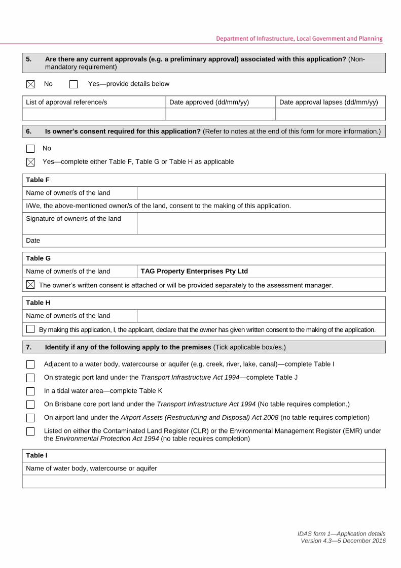
5. Are there any current approvals (e.g. a preliminary approval) associated with this application? (Non-mandatory requirement)
No Yes—provide details below
List of approval reference/s Date approved (dd/mm/yy) Date approval lapses (dd/mm/yy)
6. Is owner’s consent required for this application? (Refer to notes at the end of this form for more information.)
No
Yes—complete either Table F, Table G or Table H as applicable
Table F
Name of owner/s of the land
I/We, the above-mentioned owner/s of the land, consent to the making of this application.
Signature of owner/s of the land
Date
Table G
Name of owner/s of the land TAG Property Enterprises Pty Ltd
The owner’s written consent is attached or will be provided separately to the assessment manager.
Table H
Name of owner/s of the land
By making this application, I, the applicant, declare that the owner has given written consent to the making of the application.
7. Identify if any of the following apply to the premises (Tick applicable box/es.)
Adjacent to a water body, watercourse or aquifer (e.g. creek, river, lake, canal)—complete Table I
On strategic port land under the Transport Infrastructure Act 1994—complete Table J
In a tidal water area—complete Table K
On Brisbane core port land under the Transport Infrastructure Act 1994 (No table requires completion.)
On airport land under the Airport Assets (Restructuring and Disposal) Act 2008 (no table requires completion)
Listed on either the Contaminated Land Register (CLR) or the Environmental Management Register (EMR) under the Environmental Protection Act 1994 (no table requires completion)
Table I
Name of water body, watercourse or aquifer
IDAS form 1—Application details Version 4.3—5 December 2016
Table J
Lot on plan description for strategic port land Port authority for the lot
Table K
Name of local government for the tidal area (if applicable) Port authority for the tidal area (if applicable)
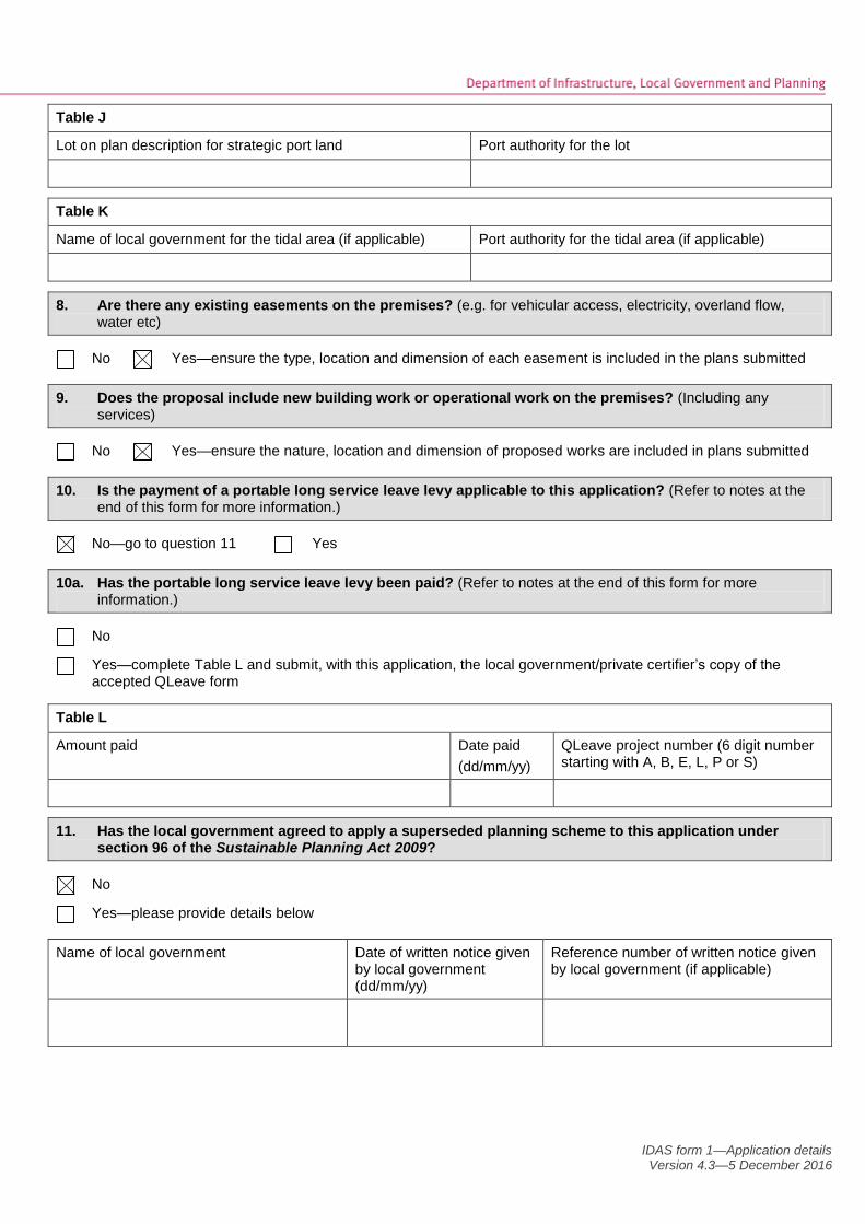
8. Are there any existing easements on the premises? (e.g. for vehicular access, electricity, overland flow, water etc)
No Yes—ensure the type, location and dimension of each easement is included in the plans submitted
9. Does the proposal include new building work or operational work on the premises? (Including any services)
No Yes—ensure the nature, location and dimension of proposed works are included in plans submitted
10. Is the payment of a portable long service leave levy applicable to this application? (Refer to notes at the end of this form for more information.)
No—go to question 11 Yes
10a. Has the portable long service leave levy been paid? (Refer to notes at the end of this form for more information.)
No
Yes—complete Table L and submit, with this application, the local government/private certifier’s copy of the accepted QLeave form
Table L
Amount paid Date paid
(dd/mm/yy)
QLeave project number (6 digit number starting with A, B, E, L, P or S)
11. Has the local government agreed to apply a superseded planning scheme to this application under section 96 of the Sustainable Planning Act 2009?
No
Yes—please provide details below
Name of local government Date of written notice given by local government (dd/mm/yy)
Reference number of written notice given by local government (if applicable)

IDAS form 1—Application details Version 4.3—5 December 2016
12. List below all of the forms and supporting information that accompany this application (Include all IDAS forms, checklists, mandatory supporting information etc. that will be submitted as part of this application)
Description of attachment or title of attachment Method of lodgement to assessment manager
Proposal Plans eDA
Town Planning Report eDA
IDAS forms 1 and 5 eDA
State Searches eDA
13. Applicant’s declaration
By making this application, I declare that all information in this application is true and correct (Note: it is unlawful to
provide false or misleading information)
Notes for completing this form
Section 261 of the Sustainable Planning Act 2009 prescribes when an application is a properly-made application. Note, the assessment manager has discretion to accept an application as properly made despite any non-compliance with the requirement to provide mandatory supporting information under section 260(1)(c) of the Sustainable Planning Act 2009
Applicant details
Where the applicant is not a natural person, ensure the applicant entity is a real legal entity. Question 1
Schedule 3 of the Sustainable Planning Regulation 2009 identifies assessable development and the type of assessment. Where schedule 3 identifies assessable development as “various aspects of development” the applicant must identify each aspect of the development on Tables A, B and C respectively and as required.
Question 6
Section 263 of the Sustainable Planning Act 2009 sets out when the consent of the owner of the land is required for an application. Section 260(1)(e) of the Sustainable Planning Act 2009 provides that if the owner’s consent is required under section 263, then an application must contain, or be accompanied by, the written consent of the owner, or include a declaration by the applicant that the owner has given written consent to the making of the application. If a development application relates to a state resource, the application is not required to be supported by evidence of an allocation or entitlement to a state resource. However, where the state is the owner of the subject land, the written consent of the state, as landowner, may be required. Allocation or entitlement to the state resource is a separate process and will need to be obtained before development commences.
Question 7
If the premises is listed on either the Contaminated Land Register (CLR) or the Environmental Management Register (EMR) under the Environmental Protection Act 1994 it may be necessary to seek compliance assessment. Schedule 18 of the Sustainable Planning Regulation 2009 identifies where compliance assessment is required.
Question 10
The Building and Construction Industry (Portable Long Service Leave) Act 1991 prescribes when the portable long service leave levy is payable.
The portable long service leave levy amount and other prescribed percentages and rates for calculating the levy are prescribed in the Building and Construction Industry (Portable Long Service Leave) Regulation 2013.

IDAS form 1—Application details Version 4.3—5 December 2016
Question 10a
The portable long service leave levy need not be paid when the application is made, but the Building and Construction Industry (Portable Long Service Leave) Act 1991 requires the levy to be paid before a development permit is issued.
Building and construction industry notification and payment forms can be completed on the QLeave website at www.qleave.qld.gov.au. For further information contact QLeave on 1800 803 481.
Privacy—The information collected in this form will be used by the Department of Infrastructure, Local Government and Planning (DILGP), assessment manager, referral agency and/or building certifier in accordance with the processing and assessment of your application. Your personal details should not be disclosed for a purpose outside of the IDAS process or the provisions about public access to planning and development information in the Sustainable Planning Act 2009, except where required by legislation (including the Right to Information Act 2009) or as required by Parliament. This information may be stored in relevant databases. The information collected will be retained as required by the Public Records Act 2002.
OFFICE USE ONLY
Date received Reference numbers
NOTIFICATION OF ENGAGEMENT OF A PRIVATE CERTIFIER
To Council. I have been engaged as the private certifier for the building work referred to in this application
Date of engagement Name BSA Certification license number
Building classification/s
QLEAVE NOTIFICATION AND PAYMENT (For completion by assessment manager or private certifier if applicable.)
Description of the work QLeave project number
Amount paid ($)
Date paid
Date receipted form sighted by assessment manager
Name of officer who sighted the form
The Sustainable Planning Act 2009 is administered by the Department of Infrastructure, Local Government and Planning. This form and all other required application materials should be sent to your assessment manager and any referral agency.


IDAS form 5—Material change of use assessable
against a planning scheme (Sustainable Planning Act 2009 version 3.1 effective 3 August 2015)
This form must be used for development applications for a material change of use assessable against a planning scheme.
You MUST complete ALL questions that are stated to be a mandatory requirement unless otherwise identified on this form.
For all development applications, you must:
complete IDAS form 1—Application details
complete any other forms relevant to your application
provide any mandatory supporting information identified on the forms as being required to accompany your application.
Attach extra pages if there is insufficient space on this form.
All terms used on this form have the meaning given in the Sustainable Planning Act 2009 (SPA) or the Sustainable Planning Regulation 2009.
This form must also be used for material change of use on strategic port land and Brisbane core port land under the Transport Infrastructure Act 1994 and airport land under the Airport Assets (Restructuring and Disposal) Act 2008 that requires assessment against the land use plan for that land. Whenever a planning scheme is mentioned, take it to mean land use plan for the strategic port land, Brisbane core port land or airport land.
Mandatory requirements
1. Describe the proposed use. (Note: this is to provide additional detail to the information provided in question 1 of IDAS form 1—Application details. Attach a separate schedule if there is insufficient space in this table.)
General explanation of the proposed use
Planning scheme definition (include each definition in a new row) (non-mandatory)
No. of dwelling units (if applicable) or gross floor area (if applicable)
Days and hours of operation (if applicable)
No. of employees (if applicable)
Caravan display, sales and service yard
Machinery and Vehicle Sales Showroom and Outdoor Sales Premises
480m2 6am to 6pm 4
2. Are there any current approvals associated with the proposed material change of use? (e.g. a preliminary approval.)
No Yes—provide details below
List of approval reference/s Date approved (dd/mm/yy) Date approval lapses (dd/mm/yy)

IDAS form 5—Material change of use assessable against a planning scheme
Version 3.1—3 August 2015
3. Does the proposed use involve the following? (Tick all applicable boxes.)
The reuse of existing buildings on the premises No Yes
New building work on the premises No Yes
The reuse of existing operational work on the premises No Yes
New operational work on the premises No Yes
Mandatory supporting information
4. Confirm that the following mandatory supporting information accompanies this application
Mandatory supporting information Confirmation of lodgement
Method of lodgement
All applications
A site plan drawn to an appropriate scale (1:100, 1:200 or 1:500 are recommended scales) which shows the following:
the location and site area of the land to which the application relates (relevant land)
the north point
the boundaries of the relevant land
any road frontages of the relevant land, including the name of the road
the location and use of any existing or proposed buildings or structures on the relevant land (note: where extensive demolition or new buildings are proposed, two separate plans [an existing site plan and proposed site plan] may be appropriate)
any existing or proposed easements on the relevant land and their function
the location and use of buildings on land adjoining the relevant land
all vehicle access points and any existing or proposed car parking areas on the relevant land. Car parking spaces for persons with disabilities and any service vehicle access and parking should be clearly marked
for any new building on the relevant land, the location of refuse storage
the location of any proposed retaining walls on the relevant land and their height
the location of any proposed landscaping on the relevant land
the location of any stormwater detention on the relevant land.
Confirmed eDA
A statement about how the proposed development addresses the local government’s planning scheme and any other planning instruments or documents relevant to the application.
Confirmed eDA
A statement about the intensity and scale of the proposed use (e.g. number of visitors, number of seats, capacity of storage area etc.).
Confirmed eDA
Information that states:
the existing or proposed floor area, site cover, maximum number of storeys and maximum height above natural ground level for existing or new buildings (e.g. information regarding existing buildings but not being reused)
the existing or proposed number of on-site car parking bays, type of vehicle cross-over (for non-residential uses) and vehicular servicing arrangement (for non-residential uses).
Confirmed
Not applicable
eDA

IDAS form 5—Material change of use assessable against a planning scheme
Version 3.1—3 August 2015
A statement addressing the relevant part(s) of the State Development Assessment Provisions (SDAP).
Confirmed
Not applicable
When the application involves the reuse of existing buildings
Plans showing the size, location, existing floor area, existing site cover, existing maximum number of storeys and existing maximum height above natural ground level of the buildings to be reused.
Confirmed
Not applicable
eDA
When the application involves new building work (including extensions)
Floor plans drawn to an appropriate scale (1:50, 1:100 or 1:200 are recommended scales) which show the following:
the north point
the intended use of each area on the floor plan (for commercial, industrial or mixed use developments only)
the room layout (for residential development only) with all rooms clearly labelled
the existing and the proposed built form (for extensions only)
the gross floor area of each proposed floor area.
Confirmed
eDA
Elevations drawn to an appropriate scale (1:100, 1:200 or 1:500 are recommended scales) which show plans of all building elevations and facades, clearly labelled to identify orientation (e.g. north elevation)
Confirmed
eDA
Plans showing the size, location, proposed site cover, proposed maximum number of storeys, and proposed maximum height above natural ground level of the proposed new building work.
Confirmed
Not applicable
eDA
When the application involves reuse of other existing work
Plans showing the nature, location, number of on-site car parking bays, existing area of landscaping, existing type of vehicular cross-over (non-residential uses), and existing type of vehicular servicing arrangement (non-residential uses) of the work to be reused.
Confirmed
Not applicable
eDA
When the application involves new operational work
Plans showing the nature, location, number of new on-site car parking bays, proposed area of new landscaping, proposed type of new vehicle cross-over (non-residential uses), proposed maximum new vehicular servicing arrangement (non-residential uses) of the proposed new operational work.
Confirmed
Not applicable
Privacy—Please refer to your assessment manager, referral agency and/or building certifier for further details on the use of information recorded in this form.
OFFICE USE ONLY
Date received Reference numbers
The Sustainable Planning Act 2009 is administered by the Department of Infrastructure, Local Government and Planning. This form and all other required application materials should be sent to your assessment manager and any referral agency.
Ref#: DPA-0777 34 Mar-17
Appendix B:
Certificate of Title and Site Survey

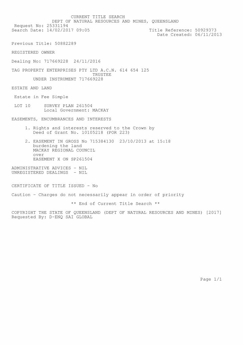
CURRENT TITLE SEARCHDEPT OF NATURAL RESOURCES AND MINES, QUEENSLAND
Request No: 25331194Search Date: 14/02/2017 09:05 Title Reference: 50929373
Date Created: 06/11/2013
Previous Title: 50882289
REGISTERED OWNER
Dealing No: 717669228 24/11/2016
TAG PROPERTY ENTERPRISES PTY LTD A.C.N. 614 654 125TRUSTEE
UNDER INSTRUMENT 717669228
ESTATE AND LAND
Estate in Fee Simple
LOT 10 SURVEY PLAN 261504Local Government: MACKAY
EASEMENTS, ENCUMBRANCES AND INTERESTS
1. Rights and interests reserved to the Crown byDeed of Grant No. 10105218 (POR 223)
2. EASEMENT IN GROSS No 715384130 23/10/2013 at 15:18burdening the landMACKAY REGIONAL COUNCILoverEASEMENT X ON SP261504
ADMINISTRATIVE ADVICES - NILUNREGISTERED DEALINGS - NIL
CERTIFICATE OF TITLE ISSUED - No
Caution - Charges do not necessarily appear in order of priority
** End of Current Title Search **
COPYRIGHT THE STATE OF QUEENSLAND (DEPT OF NATURAL RESOURCES AND MINES) [2017]Requested By: D-ENQ SAI GLOBAL
Page 1/1

Ref#: DPA-0777 35 Mar-17
Appendix C:
Plans of Proposed Development


Ref#: DPA-0777 36 Mar-17
Appendix D:
Regulated Vegetation Map

10/02/2017 11:37:14
Lot: 10 Plan: SP261504
Page 1

10/02/2017 11:37:14
Lot: 10 Plan: SP261504
Page 2

10/02/2017 11:37:14
Lot: 10 Plan: SP261504
Page 3
Vegetation Management Act 1999 - Extract from the essential habitat database
Essential habitat is required for assessment under the:
• State Development Assessment Provisions - Module 8: Native vegetation clearing which sets out the matters of interest to the state for development assessment under the Sustainable PlanningAct 2009; and
• Self-assessable vegetation clearing codes made under the Vegetation Management Act 1999
Essential habitat for one or more of the following species is found on and within 1.1 km of the identified subject lot/s or on and within 2.2 km of an identified coordinate on the accompanying essential habitatmap.
This report identifies essential habitat in Category A, B and Category C areas.
The numeric labels on the essential habitat map can be cross referenced with the database below to determine which essential habitat factors might exist for a particular species.
Essential habitat is compiled from a combination of species habitat models and buffered species records.
The Department of Natural Resources and Mines website (http://www.dnrm.qld.gov.au) has more information on how the layer is applied under the State Development Assessment Provisions - Module 8:Native vegetation clearing and the Vegetation Management Act 1999.
Regional ecosystem is a mandatory essential habitat factor, unless otherwise stated.
Essential habitat, for protected wildlife, means a category A area, a category B area or category C area shown on the regulated vegetation management map-
1) (a) that has at least 3 essential habitat factors for the protected wildlife that must include any essential habitat factors that are stated as mandatory for the protected wildlife in the essential habitatdatabase; or
2) (b) in which the protected wildlife, at any stage of its life cycle, is located.
Essential habitat identifies endangered or vulnerable native wildlife prescribed under the Nature Conservation Act 1994.
Essential habitat in Category A and B (Remnant vegetation species record) areas:1100m Species Information
(no results)
Essential habitat in Category A and B (Remnant vegetation species record) areas:1100m Regional Ecosystems Information
(no results)
Essential habitat in Category A and B (Remnant vegetation) areas:1100m Species Information
(no results)
Essential habitat in Category A and B (Remnant vegetation) areas:1100m Regional Ecosystems Information
(no results)
Essential habitat in Category C (High value regrowth vegetation) areas:1100m Species Information
(no results)
Essential habitat in Category C (High value regrowth vegetation) areas:1100m Regional Ecosystems Information
(no results)

Ref#: DPA-0777 37 Mar-17
Appendix E:
Map of Referrable Wetlands

Centred on: Lot: 10 Plan: SP261504Map requested: 10/02/2017 11:38:20
Page 1
Centred on: Lot: 10 Plan: SP261504Map requested: 10/02/2017 11:38:20
Page 2

Ref#: DPA-0777 38 Mar-17
Appendix F:
Coastal Hazard Mapping

Centred on: Lot: 10 Plan: SP261504Map requested: 10/02/2017 11:37:32
Page 1

Centred on: Lot: 10 Plan: SP261504Map requested: 10/02/2017 11:37:32
Page 2

Ref#: DPA-0777 39 Mar-17
Appendix G:
As Constructed Information


