
Interactivity. Privacy. Uncertainty. Mapping drinking water quality in Wisconsin
Roth. Severtson. Mead. Sack.
[email protected] | @RobertERoth
Annual Meeting of the AAG
Tampa, FL | 11 April 2014

source UW Extension
Land Use
Soils/Surface Deposits
Depth to Bedrock
Geology/Aquifers
Groundwater Quality 101

from Groundwater to Drinking Water in WI

this is VGI…

this is VGI…
…with a COST

this is VGI…
…with a COST
✓test kit

this is VGI…
…with a COST
✓test kit
✓tax assessment

this is VGI…
…with a COST
✓test kit
✓tax assessment
✓well replacement

this is VGI…
…with a COST
✓test kit
✓tax assessment
✓well replacement
✓death

website http://gissrv2.uwsp.edu/cnr/gwc/pw_web/


discrete (D1) vs.
continuous (D2)
smooth (D3) vs.
abrupt (D4)

after: MacEachren & DiBiase (1991)


“well samples”

“extent of
contamination”

“source of
contamination”
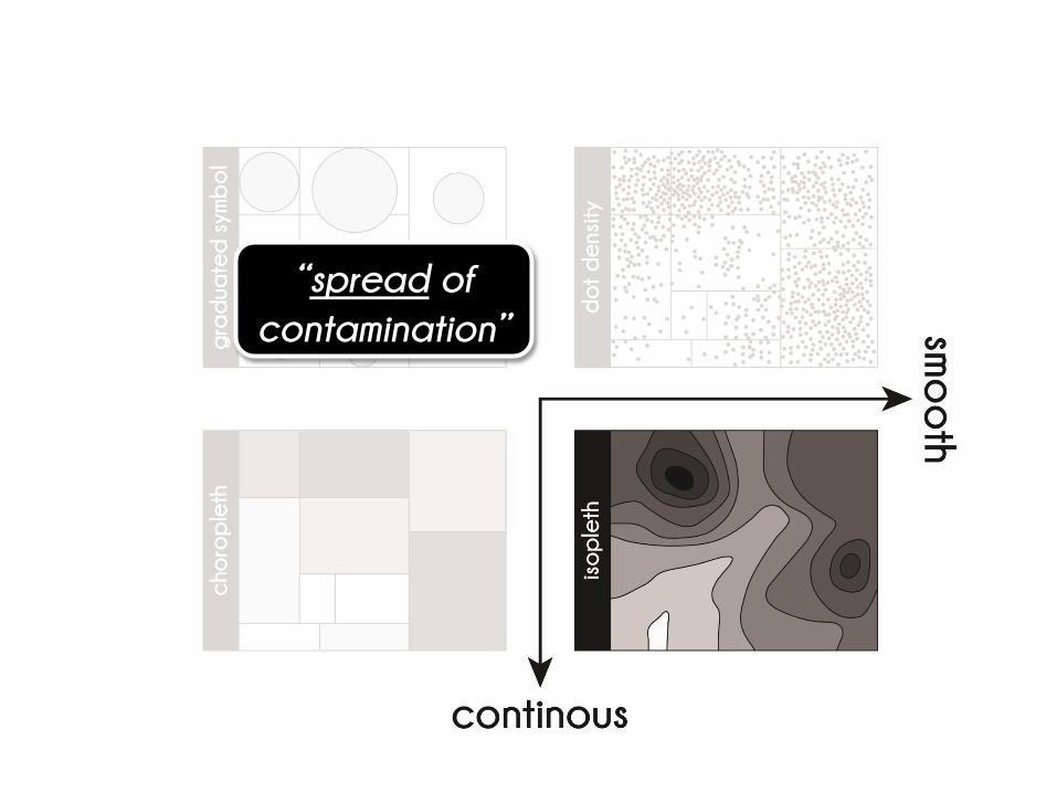
“spread of
contamination”

access (D5)
privacy (D6)
aggregation (D7)

county: n>=25

township: n>=10
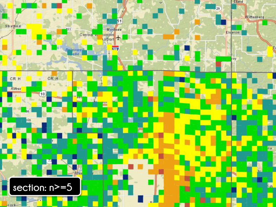
section: n>=5

accuracy (U1)
precision (U2)
trustworthiness
(U3-U9)

interrelatedness (U8)
credibility (U6)
currency (U3)

thematic map
types (R1-R4)

classification (R6)
mapped
statistic (R5)
scale (R8)

township=average

township≠maximum

section=maximum

operators (I3-I14)

retrieve (I11)
zoom (I14)

township=average

zoom-in; section=maximum

zmximum zoom-out; township=average

overlay (I6)
search (I12)


Interactivity. Privacy. Uncertainty. Maps. Maps. Maps. Maps. Maps. Maps. Maps.
Roth. Severtson. Mead. Sack.
[email protected] | @RobertERoth
Annual Meeting of the AAG
Tampa, FL | 11 April 2014


