
PAPUA NEW GUINEA REDD INITIATIVE
Mr. Goodwill AmosPNG Forest AuthorityMr. Goodwill Amos
PNG Forest Authority

PRESENTATION OVERVIEW
Background Brief on PNG Re-Organisation of Papua New Guinea Forest Authority (PNGFA) Office of climate change & development Rates and Causes of Deforestation and Forest Degradation in PNG Selection Criteria for REDD+ Pilots Five Selected Provinces for piloting REDD pilots PROVINCES FOR THE Proposed REDD COLLABORATION FOR PROGRESSING REDD PILOTS
REDD+ Pilot Sites and Initiatives REDD+ Pilot Site
What has been done for April Salumei What has been done for Central Suau
Climate Change Initiatives and Activities Constraints and Challenges Next Steps

BACKGROUND PNG Occupies the eastern half of the Island of New
Guinea, just north of Australia between 3.5 deg. and 12 deg. S
It has a rugged topography with the highest peak reaching over 4,000m
Dissected by numerous rivers with the Sepik and Fly Rivers being the largest and longest.
Climate is tropical humid with temperatures ranging from 20 – 32oC and rainfall ranging from just below 1000mm to over 8000mm pa.
Total Land Area: 46.17 million ha, 12.1% comprises the large and smaller islands (600)
Total Forest Area: 28.6 million ha or 62% Total Population: 7.1 million; Growth Rate: 2.7% pa Main Exports: Gold, Copper, Oil Gas, Timber, Agriculture
Crops (Oil Palm, Cocoa, Coffee, Tea, Copra, Vanilla) and Fisheries (Tuna)
PNG Occupies the eastern half of the Island of New Guinea, just north of Australia between 3.5 deg. and 12 deg. S
It has a rugged topography with the highest peak reaching over 4,000m
Dissected by numerous rivers with the Sepik and Fly Rivers being the largest and longest.
Climate is tropical humid with temperatures ranging from 20 – 32oC and rainfall ranging from just below 1000mm to over 8000mm pa.
Total Land Area: 46.17 million ha, 12.1% comprises the large and smaller islands (600)
Total Forest Area: 28.6 million ha or 62% Total Population: 7.1 million; Growth Rate: 2.7% pa Main Exports: Gold, Copper, Oil Gas, Timber, Agriculture
Crops (Oil Palm, Cocoa, Coffee, Tea, Copra, Vanilla) and Fisheries (Tuna)

Papua New Guinea
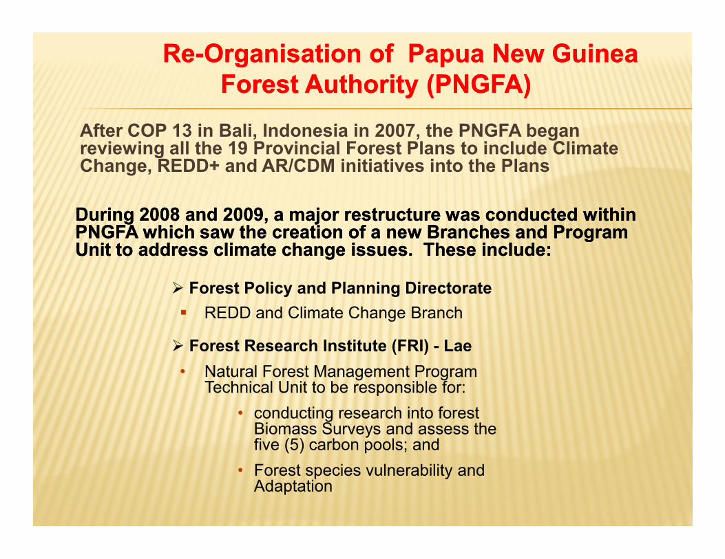
After COP 13 in Bali, Indonesia in 2007, the PNGFA began reviewing all the 19 Provincial Forest Plans to include Climate Change, REDD+ and AR/CDM initiatives into the Plans
During 2008 and 2009, a major restructure was conducted within During 2008 and 2009, a major restructure was conducted within PNGFA which saw the creation of a new Branches and Program PNGFA which saw the creation of a new Branches and Program Unit to address climate change issues. These include:Unit to address climate change issues. These include:
Forest Policy and Planning Directorate REDD and Climate Change Branch
ReRe--OrganisationOrganisation of Papua New Guinea of Papua New Guinea Forest Authority (PNGFA)Forest Authority (PNGFA)
Forest Policy and Planning Directorate REDD and Climate Change Branch
Forest Research Institute (FRI) - Lae• Natural Forest Management Program
Technical Unit to be responsible for:• conducting research into forest
Biomass Surveys and assess the five (5) carbon pools; and
• Forest species vulnerability and Adaptation

Furthermore, PNGFA has since 2009-:• Revised the National Forest Development
Guidelines and• Formulated the Forestry and Climate Change
Framework For Action 2009 – 2015
OFFICE OF CLIMATE CHANGE & DEVELOPMENT
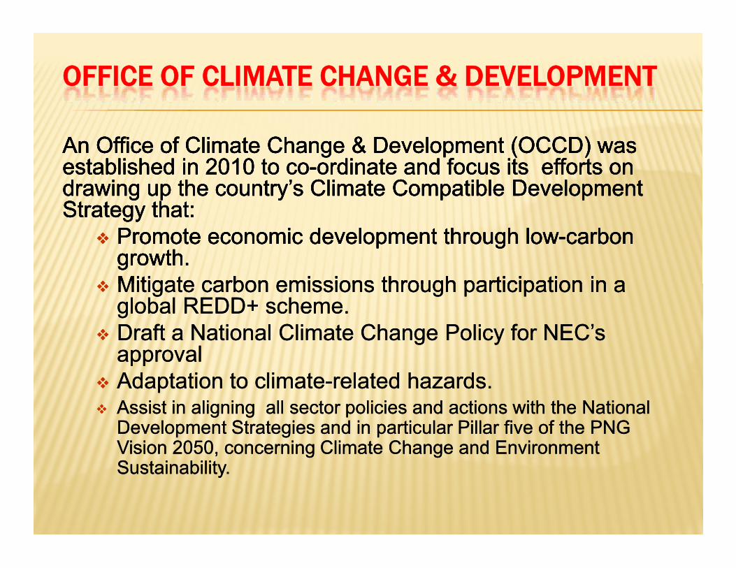
An Office of Climate Change & Development (OCCD) was An Office of Climate Change & Development (OCCD) was established in 2010 to coestablished in 2010 to co--ordinate and focus its efforts on ordinate and focus its efforts on drawing up the country’s Climate Compatible Development drawing up the country’s Climate Compatible Development Strategy that:Strategy that:
Promote economic development through lowPromote economic development through low--carbon carbon growth.growth.
Mitigate carbon emissions through participation in a Mitigate carbon emissions through participation in a global REDD+ scheme.global REDD+ scheme.
Draft a National Climate Change Policy for NEC’s Draft a National Climate Change Policy for NEC’s approvalapproval
Adaptation to climateAdaptation to climate--related hazards. related hazards. Assist in aligning all sector policies and actions with the National Assist in aligning all sector policies and actions with the National
Development Strategies and in particular Pillar five of the PNG Development Strategies and in particular Pillar five of the PNG Vision 2050, concerning Climate Change and Environment Vision 2050, concerning Climate Change and Environment SustainabilitySustainability..

RATES AND CAUSES OF DEFORESTATION AND FOREST DEGRADATION IN PNG
- 1.41% of PNG’s forest were being deforested or degraded per year.- The major causes of deforestation and forest degradation in PNG
have been logging and subsistence agriculture.
Forest and Grassland Fires, 4.4%
Commercial Agriculture, 1.0
%
Mining, Infrastructure and Urban Expansion, 0.8%
8
Timber Harvesting, 4
8.2%
Subsistence Agriculture, 4
5.6%
Forest and Grassland Fires, 4.4%
Commercial Agriculture, 1.0
%
Mining, Infrastructure and Urban Expansion, 0.8%
Shearman et al, 2008
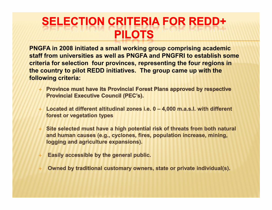
SELECTION CRITERIA FOR REDD+ SELECTION CRITERIA FOR REDD+ PILOTSPILOTS
Province must have its Provincial Forest Plans approved by respective Province must have its Provincial Forest Plans approved by respective Provincial Executive Council (PEC’s).Provincial Executive Council (PEC’s).
Located at different altitudinal zones i.e. 0 Located at different altitudinal zones i.e. 0 –– 4,000 m.a.s.l. with different 4,000 m.a.s.l. with different forest or vegetation typesforest or vegetation types
Site selected must have a high potential risk of threats from both natural Site selected must have a high potential risk of threats from both natural and human causes (e.g., cyclones, fires, population increase, mining, and human causes (e.g., cyclones, fires, population increase, mining, logging and agriculture expansions).logging and agriculture expansions).
Easily accessible by the general public.Easily accessible by the general public.
Owned by traditional customary owners, state or private individual(s).Owned by traditional customary owners, state or private individual(s).
PNGFA in 2008 initiated a small working group comprising academic staff from universities as well as PNGFA and PNGFRI to establish some criteria for selection four provinces, representing the four regions in the country to pilot REDD initiatives. The group came up with the following criteria:
Province must have its Provincial Forest Plans approved by respective Province must have its Provincial Forest Plans approved by respective Provincial Executive Council (PEC’s).Provincial Executive Council (PEC’s).
Located at different altitudinal zones i.e. 0 Located at different altitudinal zones i.e. 0 –– 4,000 m.a.s.l. with different 4,000 m.a.s.l. with different forest or vegetation typesforest or vegetation types
Site selected must have a high potential risk of threats from both natural Site selected must have a high potential risk of threats from both natural and human causes (e.g., cyclones, fires, population increase, mining, and human causes (e.g., cyclones, fires, population increase, mining, logging and agriculture expansions).logging and agriculture expansions).
Easily accessible by the general public.Easily accessible by the general public.
Owned by traditional customary owners, state or private individual(s).Owned by traditional customary owners, state or private individual(s).
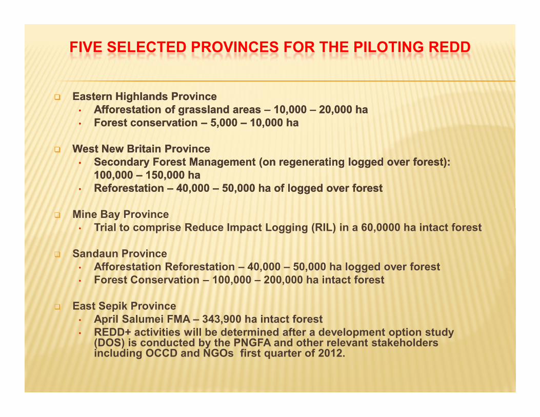
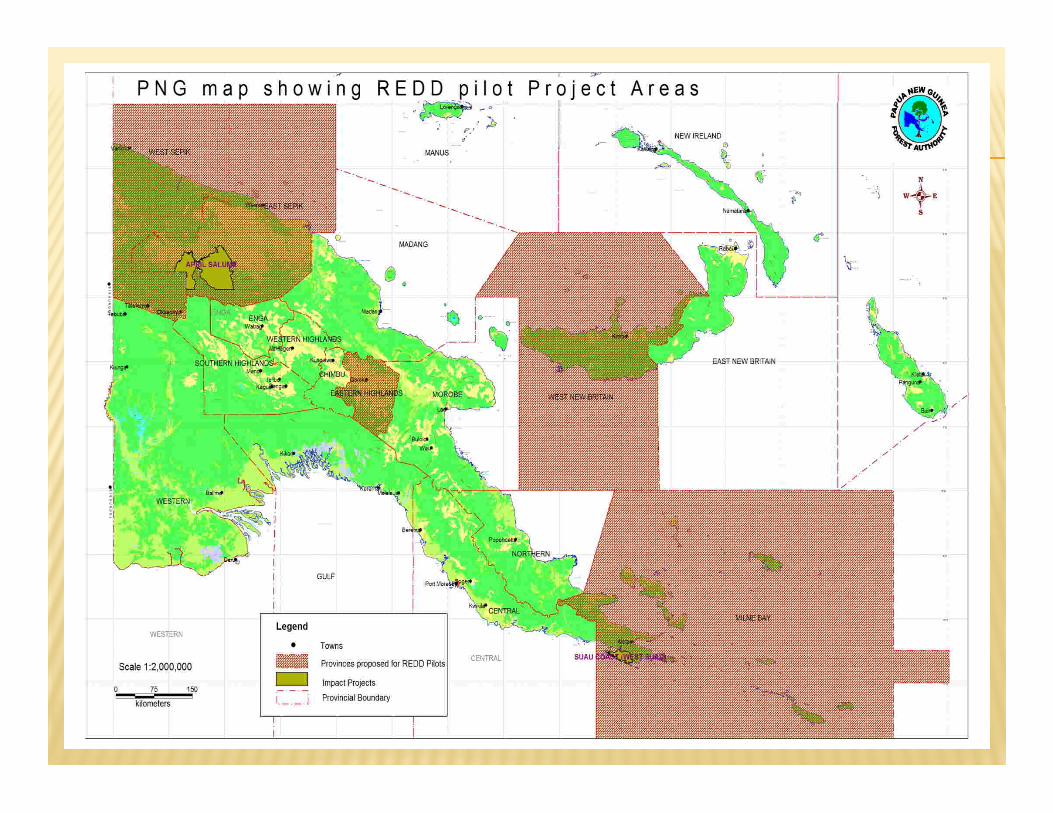
FIVE SELECTED PROVINCES FOR THE PILOTING REDD
Eastern Highlands Province• Afforestation of grassland areas – 10,000 – 20,000 ha• Forest conservation – 5,000 – 10,000 ha
West New Britain Province• Secondary Forest Management (on regenerating logged over forest):
100,000 – 150,000 ha• Reforestation – 40,000 – 50,000 ha of logged over forest
Mine Bay Province• Trial to comprise Reduce Impact Logging (RIL) in a 60,0000 ha intact forest
Sandaun Province• Afforestation Reforestation – 40,000 – 50,000 ha logged over forest• Forest Conservation – 100,000 – 200,000 ha intact forest
East Sepik Province• April Salumei FMA – 343,900 ha intact forest• REDD+ activities will be determined after a development option study
(DOS) is conducted by the PNGFA and other relevant stakeholders including OCCD and NGOs first quarter of 2012.
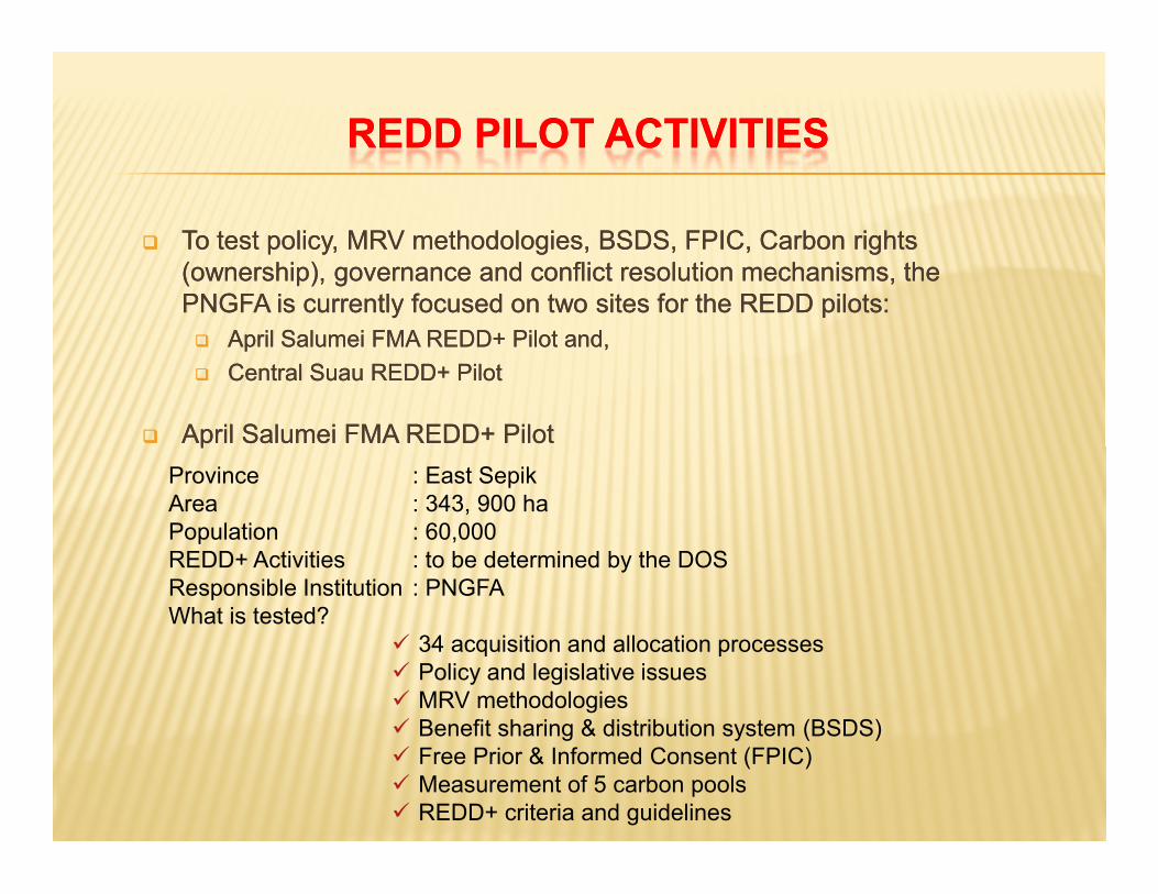
REDD PILOT ACTIVITIESREDD PILOT ACTIVITIES
To test policy, MRV methodologies, BSDS, FPIC, Carbon rights (ownership), governance and conflict resolution mechanisms, the PNGFA is currently focused on two sites for the REDD pilots: April Salumei FMA REDD+ Pilot and, Central Suau REDD+ Pilot
April Salumei FMA REDD+ Pilot
To test policy, MRV methodologies, BSDS, FPIC, Carbon rights (ownership), governance and conflict resolution mechanisms, the PNGFA is currently focused on two sites for the REDD pilots: April Salumei FMA REDD+ Pilot and, Central Suau REDD+ Pilot
April Salumei FMA REDD+ PilotProvince : East SepikArea : 343, 900 haPopulation : 60,000REDD+ Activities : to be determined by the DOSResponsible Institution : PNGFAWhat is tested?
34 acquisition and allocation processes Policy and legislative issues MRV methodologies Benefit sharing & distribution system (BSDS) Free Prior & Informed Consent (FPIC) Measurement of 5 carbon pools REDD+ criteria and guidelines
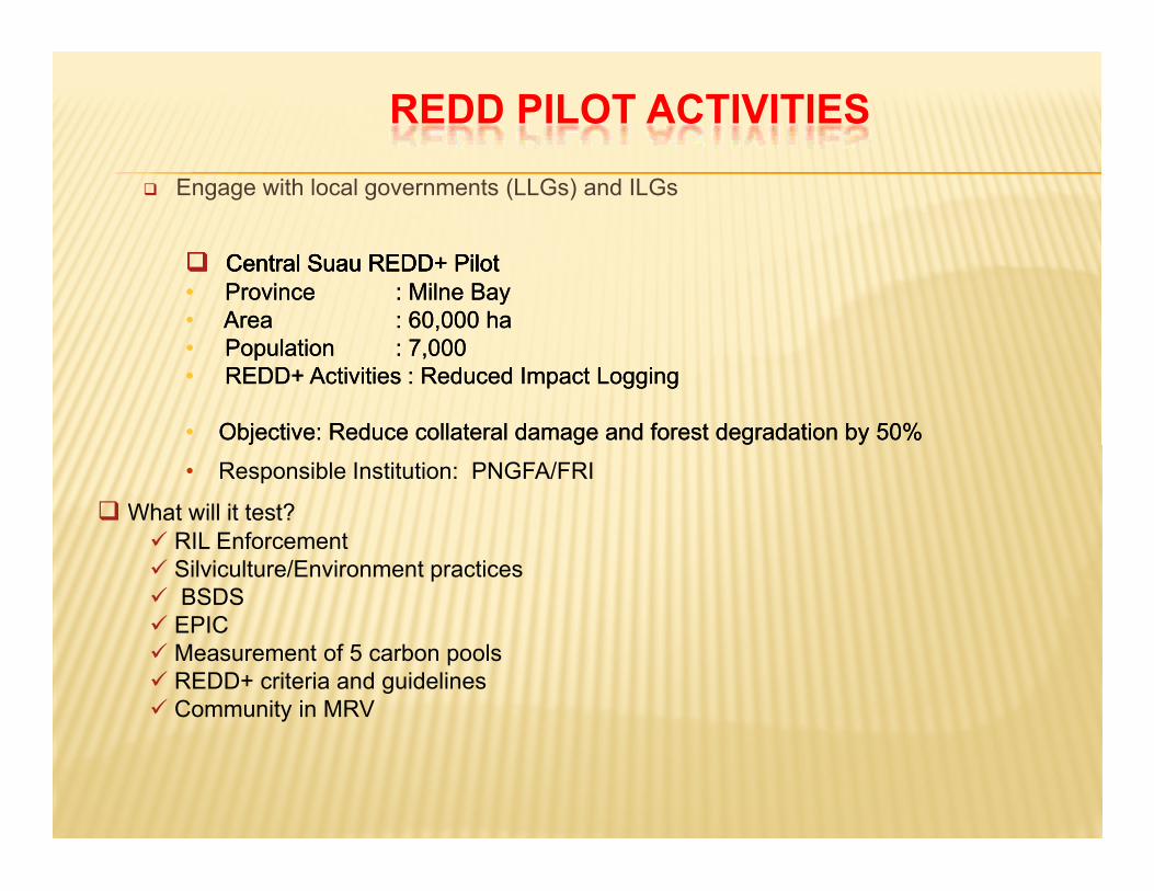
REDD PILOT ACTIVITIES
Engage with local governments (LLGs) and ILGs
Central Suau REDD+ Pilot Central Suau REDD+ Pilot • Province : Milne Bay• Area : 60,000 ha• Population : 7,000• REDD+ Activities : Reduced Impact Logging
• Objective: Reduce collateral damage and forest degradation by 50%
Central Suau REDD+ Pilot Central Suau REDD+ Pilot • Province : Milne Bay• Area : 60,000 ha• Population : 7,000• REDD+ Activities : Reduced Impact Logging
• Objective: Reduce collateral damage and forest degradation by 50%
What will it test? RIL Enforcement Silviculture/Environment practices BSDS EPIC Measurement of 5 carbon pools REDD+ criteria and guidelines Community in MRV
• Responsible Institution: PNGFA/FRI
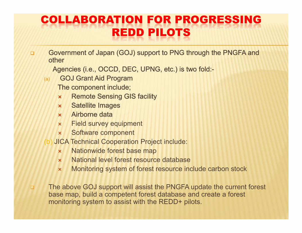
COLLABORATION FOR PROGRESSING REDD PILOTS
Government of Japan (GOJ) support to PNG through the PNGFA and other
Agencies (i.e., OCCD, DEC, UPNG, etc.) is two fold:-(a) GOJ Grant Aid Program
The component include; Remote Sensing GIS facility Satellite Images Airborne data Field survey equipment Software component
(b) JICA Technical Cooperation Project include: Nationwide forest base map National level forest resource database Monitoring system of forest resource include carbon stock
The above GOJ support will assist the PNGFA update the current forest base map, build a competent forest database and create a forest monitoring system to assist with the REDD+ pilots.
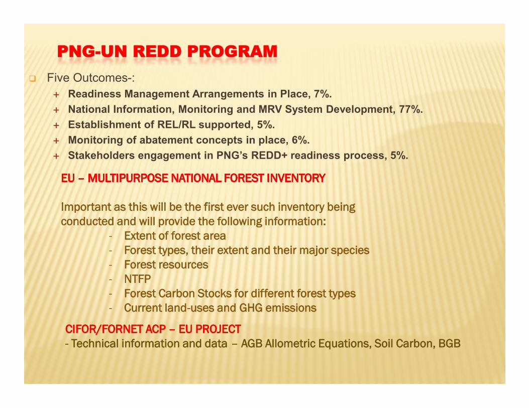
PNG-UN REDD PROGRAM Five Outcomes-:
Readiness Management Arrangements in Place, 7%. National Information, Monitoring and MRV System Development, 77%. Establishment of REL/RL supported, 5%. Monitoring of abatement concepts in place, 6%. Stakeholders engagement in PNG’s REDD+ readiness process, 5%.
EU EU –– MULTIPURPOSE NATIONAL FOREST INVENTORYMULTIPURPOSE NATIONAL FOREST INVENTORY
Important as this will be the first ever such inventory being conducted and will provide the following information:
- Extent of forest area- Forest types, their extent and their major species- Forest resources- NTFP- Forest Carbon Stocks for different forest types - Current land-uses and GHG emissions
CIFOR/FORNET ACP CIFOR/FORNET ACP –– EU PROJECTEU PROJECT- Technical information and data – AGB Allometric Equations, Soil Carbon, BGB

NEXT STEPNEXT STEP
Conduct more awareness on Climate Change, its impacts and measures for mitigating the impacts, including REDD
Establish a system that avoids or minimise any delays in progressing REDD+ processes
Reduce different interests (community vs individuals) that can cause misunderstanding between the land/forest owners
Ensuring that resources (funding and manpower) requirements are available to progress REDD processes
Establish an effective and efficient monitoring system for the pilot areas
Develop a mechanism for facilitating the benefit sharing arrangements

The development of a National LandThe development of a National Land--use Plan to avoid competing use of use Plan to avoid competing use of land and unscrupulous forest clearance and provide security for REDD+ land and unscrupulous forest clearance and provide security for REDD+ development Initiatives.development Initiatives.
The need for all stakeholders to work together to develop REDD+ The need for all stakeholders to work together to develop REDD+ initiatives.initiatives.
Registration of Integrated Land Owning Groups (ILGs)Registration of Integrated Land Owning Groups (ILGs)
FPICFPIC
Community MRVCommunity MRV
REDD+ initiatives on Climate Change compliments domestic effort and are geared towards enhancing sustainable forest management and biodiversity conservation which in turn contribute to sustainable development.
The development of a National LandThe development of a National Land--use Plan to avoid competing use of use Plan to avoid competing use of land and unscrupulous forest clearance and provide security for REDD+ land and unscrupulous forest clearance and provide security for REDD+ development Initiatives.development Initiatives.
The need for all stakeholders to work together to develop REDD+ The need for all stakeholders to work together to develop REDD+ initiatives.initiatives.
Registration of Integrated Land Owning Groups (ILGs)Registration of Integrated Land Owning Groups (ILGs)
FPICFPIC
Community MRVCommunity MRV
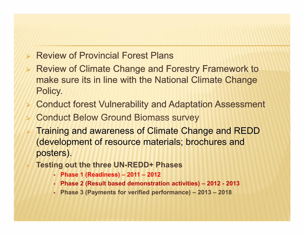
Review of Provincial Forest Plans Review of Climate Change and Forestry Framework to
make sure its in line with the National Climate Change Policy.
Conduct forest Vulnerability and Adaptation Assessment Conduct Below Ground Biomass survey Training and awareness of Climate Change and REDD
(development of resource materials; brochures and posters).
Testing out the three UN-REDD+ Phases Phase 1 (Readiness) – 2011 – 2012 Phase 2 (Result based demonstration activities) – 2012 - 2013 Phase 3 (Payments for verified performance) – 2013 – 2018

Thank youThank you


