GIS Modelling of Earthquake GIS Modelling of Earthquake Damage Zone using ALOS VNIRDamage Zone using ALOS VNIR--2, 2,
DEM and InSAR DataDEM and InSAR Data
Imperial CollegeLondon
Jian Guo Liu(1, 2), Philippa J. Mason(1), Meng-che Wu(1), Runqiu Huang(2), Tang Chuan(2)
1 Department of Earth Science and Engineering, Imperial College London, SW7 2AZ, UK, Email: [email protected]
2 State Key Laboratory of Geohazard Prevention, Chengdu University of Technology, Chengdu, Sichuan 610059, CHINA, Email:
3rd ALOS PI Symposium, Kona, Hawaii, 9~13 November 2009
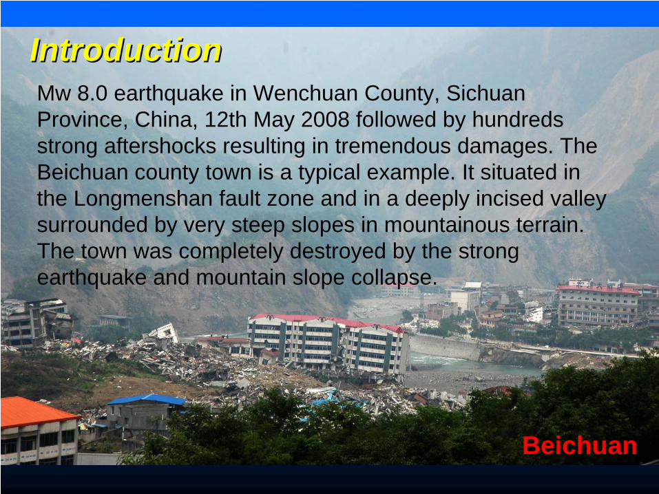
Beichuan
IntroductionIntroductionMw 8.0 earthquake in Wenchuan County, Sichuan Province, China, 12th May 2008 followed by hundreds strong aftershocks resulting in tremendous damages. The Beichuan county town is a typical example. It situated in the Longmenshan fault zone and in a deeply incised valley surrounded by very steep slopes in mountainous terrain. The town was completely destroyed by the strong earthquake and mountain slope collapse.
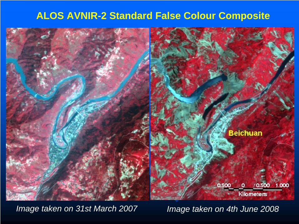
Image taken on 31st March 2007 Image taken on 4th June 2008
ALOS AVNIR-2 Standard False Colour Composite
China currently uses the 12 degree Liedu scale of seismic intensity to assess the damage level induced by an earthquake. While the region was largely categorised as 7 – 8 degrees, the actual damage in Beichuan county town is more close to 12 Liedu degree. The current rough category largely based on seismicity is obviously inadequate to characterise the local variations in damages that an earthquake may produce as the environmental factors relating to geohazards also play an important role. In this study, we investigate the GIS based modelling of earthquake damage zonation, using the Beichuan region of the Wenchuan earthquake zone as an example. The idea is to combine measurements of earthquake deformation, as derived from ALOS PALSAR DInSAR data, with a geohazard inventory and environmental factors derived from AVNIR-2 and Landsat TM multi-spectral images and ASTER DEM.
The Aim of the studyThe Aim of the study
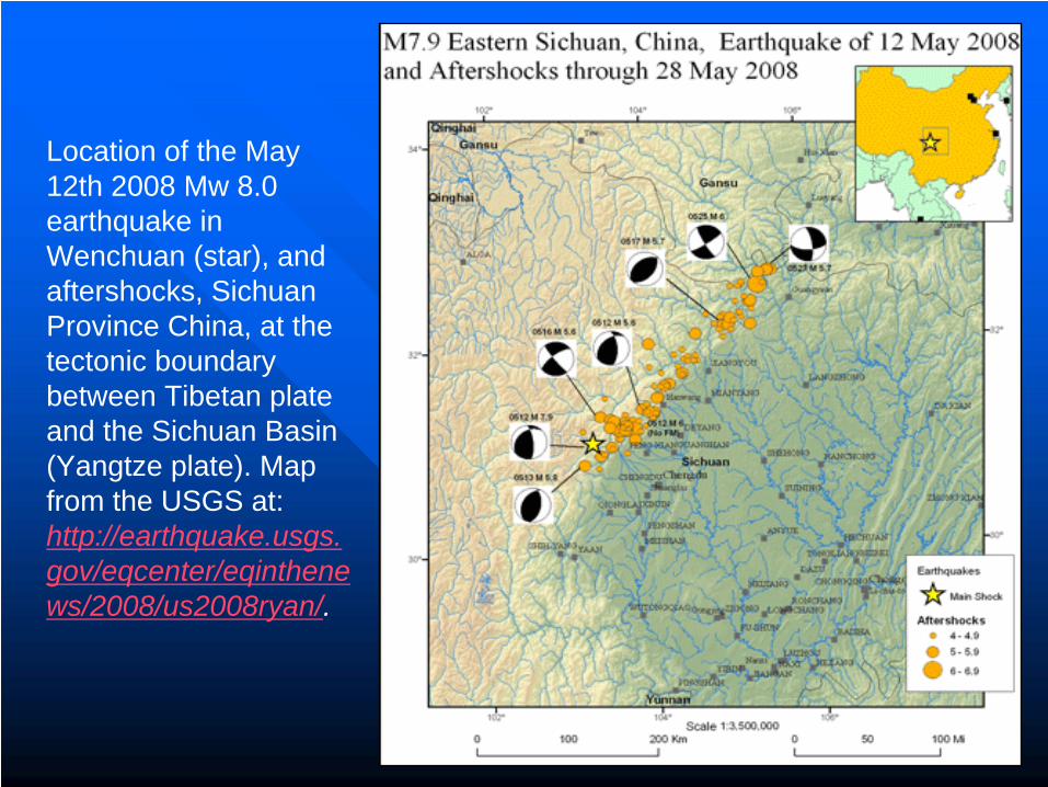
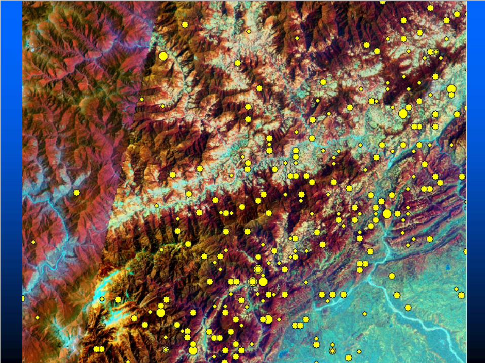
Location of the May 12th 2008 Mw 8.0 earthquake in Wenchuan (star), and aftershocks, Sichuan Province China, at the tectonic boundary between Tibetan plate and the Sichuan Basin (Yangtze plate). Map from the USGS at: http://earthquake.usgs. gov/eqcenter/eqinthene ws/2008/us2008ryan/.
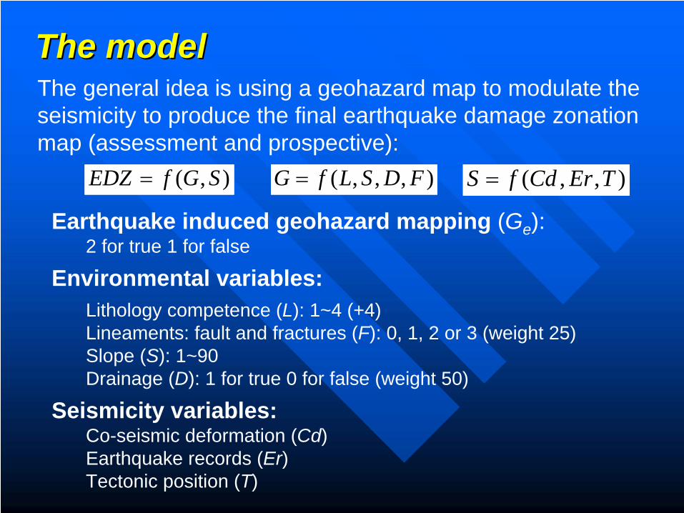
The modelThe model
Earthquake induced geohazard mapping (Ge ): 2 for true 1 for false
Environmental variables:Lithology competence (L): 1~4 (+4)Lineaments: fault and fractures (F): 0, 1, 2 or 3 (weight 25)Slope (S): 1~90Drainage (D): 1 for true 0 for false (weight 50)
Seismicity variables:Co-seismic deformation (Cd)Earthquake records (Er)Tectonic position (T)
The general idea is using a geohazard map to modulate the seismicity to produce the final earthquake damage zonation map (assessment and prospective):
),( SGfEDZ = ),,,( FDSLfG = ),,( TErCdfS =
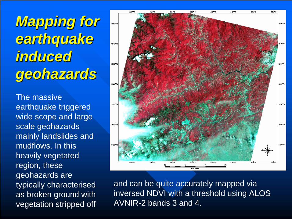
Mapping for Mapping for earthquake earthquake induced induced geohazardsgeohazardsThe massive earthquake triggered wide scope and large scale geohazards mainly landslides and mudflows. In this heavily vegetated region, these geohazards are typically characterised as broken ground with vegetation stripped off
and can be quite accurately mapped via inversed NDVI with a threshold using ALOS AVNIR-2 bands 3 and 4.
Vegetation in shade
Thick cloud
Thin cloud
Vegetation
Landslide
Cloud shadow
Urban areaBarren field
1 2 3 4
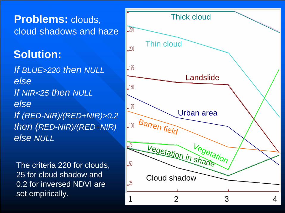
Problems: clouds, cloud shadows and haze
If BLUE>220 then NULLelseIf NIR<25 then NULLelseIf (RED-NIR)/(RED+NIR)>0.2 then (RED-NIR)/(RED+NIR) else NULL
Solution:
The criteria 220 for clouds, 25 for cloud shadow and 0.2 for inversed NDVI are set empirically.
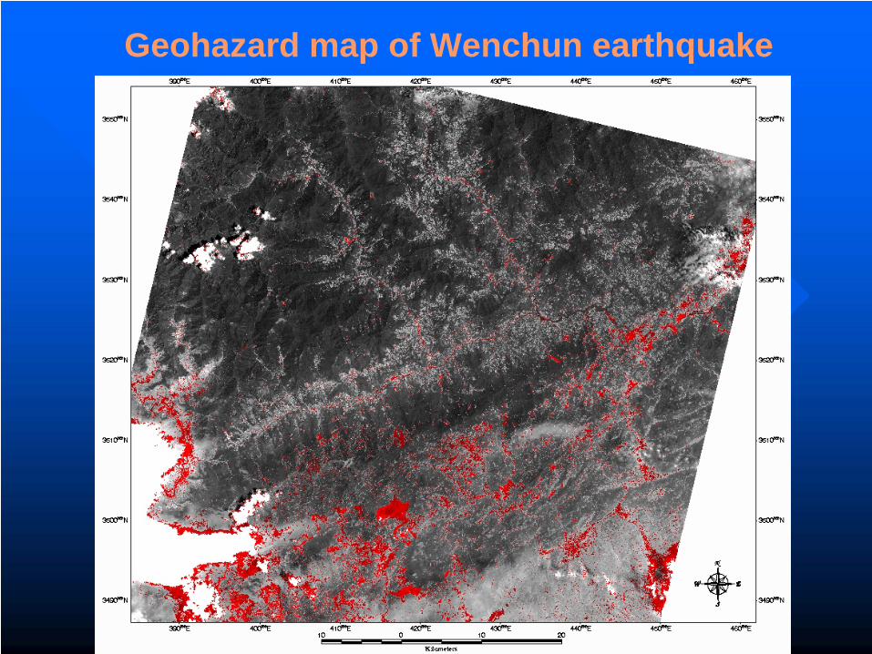
Geohazard map of Wenchun earthquake
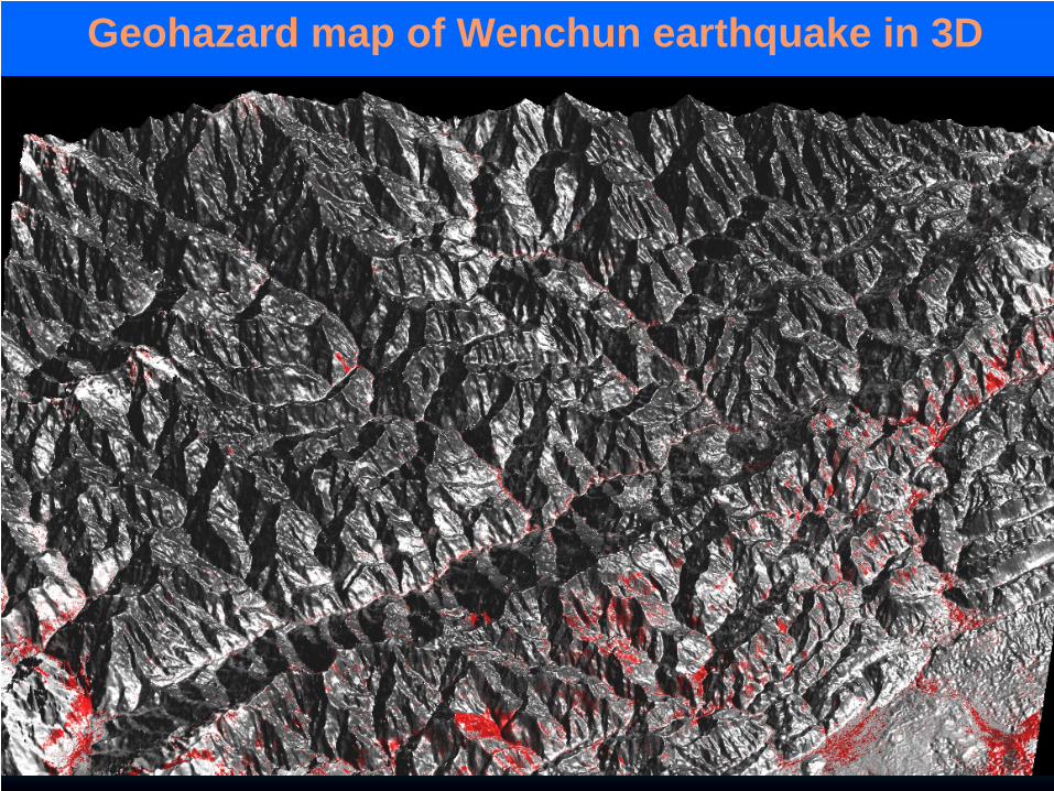
Geohazard map of Wenchun earthquake in 3D
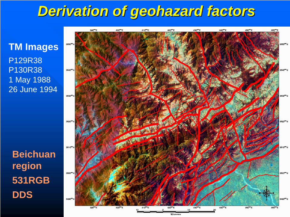
Derivation of geohazard factorsDerivation of geohazard factors
TM ImagesP129R38 P130R38 1 May 1988 26 June 1994
Beichuan region531RGBDDS
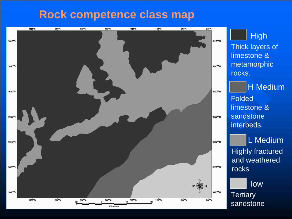
Rock competence class map
low
L Medium
HighThick layers of limestone & metamorphic rocks.
H MediumFolded limestone & sandstone interbeds.
Highly fractured and weathered rocks
Tertiary sandstone
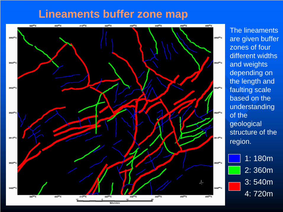
Lineaments buffer zone map
1: 180m 2: 360m3: 540m4: 720m
The lineaments are given buffer zones of four different widths and weights depending on the length and faulting scale based on the understanding of the geological structure of the region.
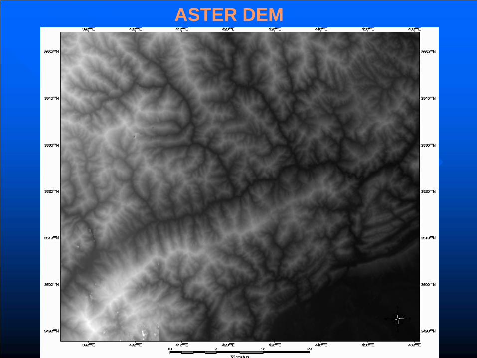
ASTER DEM
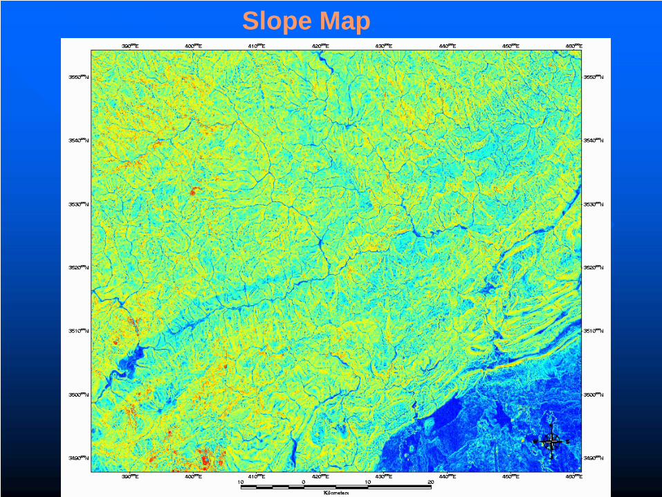
Slope Map
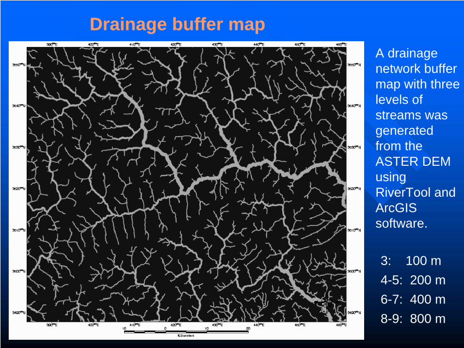
Drainage buffer mapA drainage network buffer map with three levels of streams was generated from the ASTER DEM using RiverTool and ArcGIS software.
3: 100 m4-5: 200 m6-7: 400 m8-9: 800 m
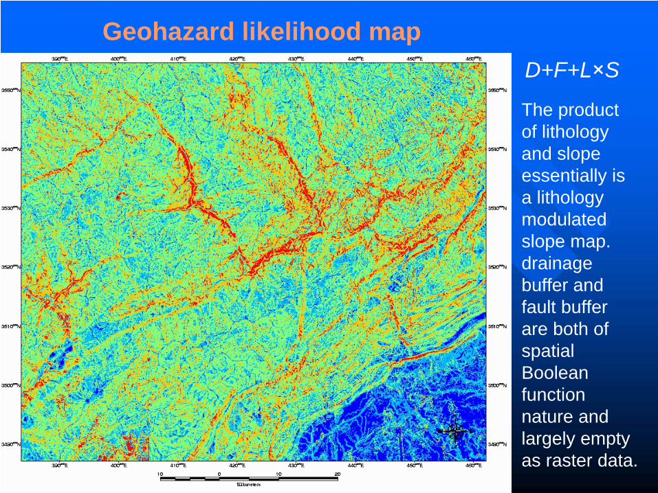
Geohazard likelihood mapD+F+L×S
The product of lithology and slope essentially is a lithology modulated slope map. drainage buffer and fault buffer are both of spatial Boolean function nature and largely empty as raster data.
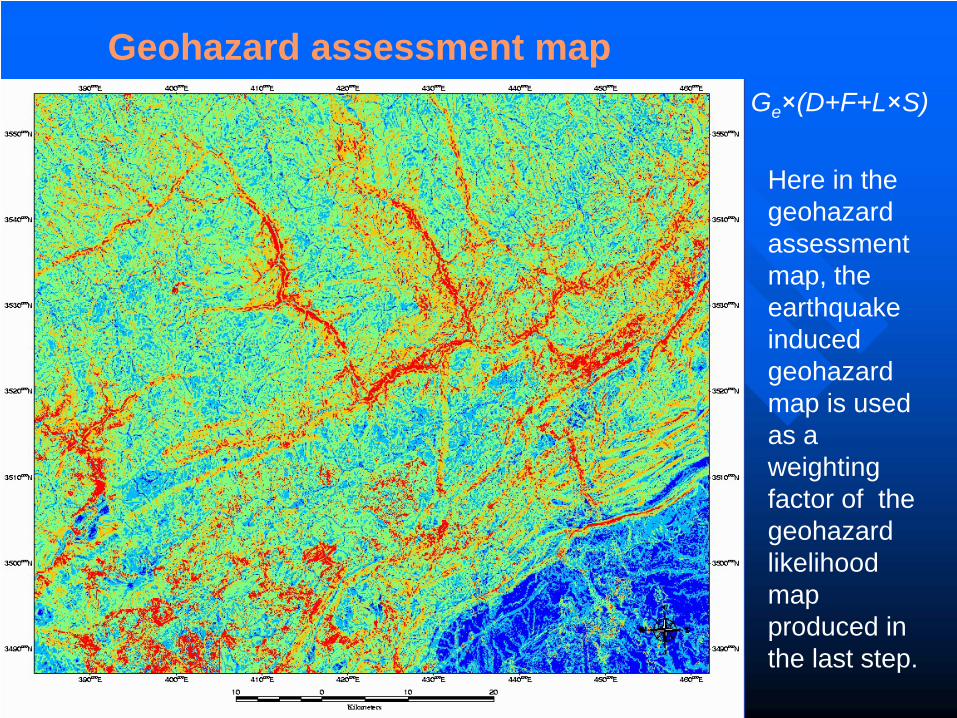
Geohazard assessment mapGe ×(D+F+L×S)
Here in the geohazard assessment map, the earthquake induced geohazard map is used as a weighting factor of the geohazard likelihood map produced in the last step.
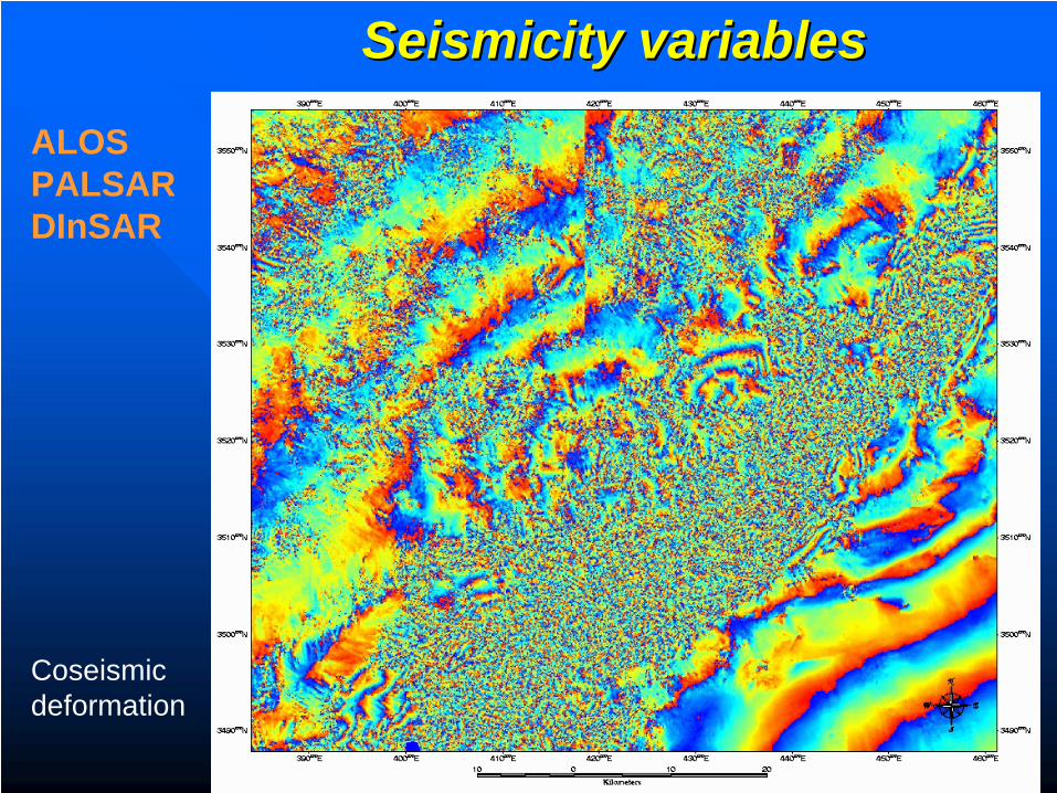
Seismicity variablesSeismicity variables
ALOS PALSARDInSAR
Coseismic deformation
-40
-35
-30
-25
-20
-15
-10
-5
0
5
10
0 20000 40000 60000 80000
Distance
Def
orm
atio
n
-40
-30
-20
-10
0
10
0 10000 20000 30000 40000 50000 60000 70000 80000
Distance
Def
orm
atio
n
-50
-40
-30
-20
-10
0
10
20
0 10000 20000 30000 40000 50000 60000 70000 80000
Distance
Def
orm
atio
n
-30
-25
-20
-15
-10
-5
0
5
10
15
20
0 10000 20000 30000 40000 50000 60000 70000 80000
Distance
Def
orm
atio
n
12
34
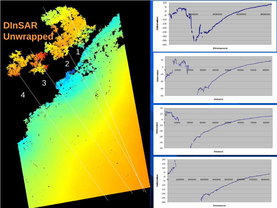
DInSARUnwrapped
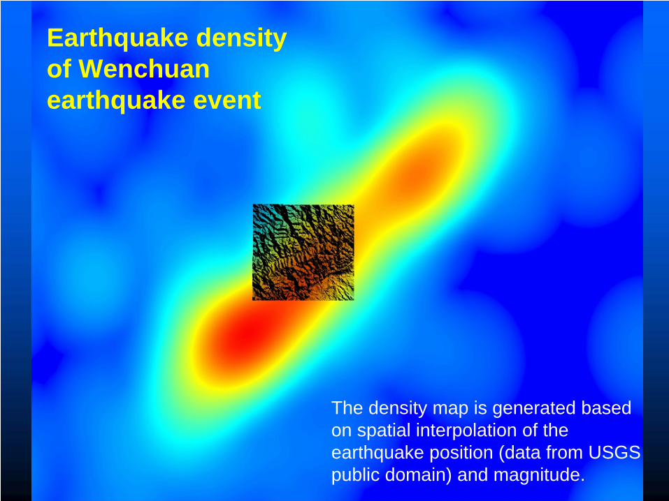
Earthquake density of Wenchuan earthquake event
The density map is generated based on spatial interpolation of the earthquake position (data from USGS public domain) and magnitude.
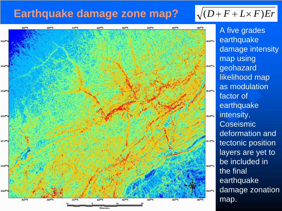
Earthquake damage zone map? ErFLFD )( ×++
A five grades earthquake damage intensity map using geohazard likelihood map as modulation factor of earthquake intensity. Coseismic deformation and tectonic position layers are yet to be included in the final earthquake damage zonation map.
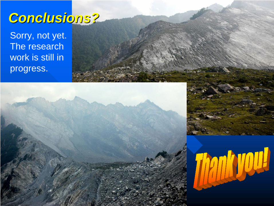
Conclusions?Conclusions?Sorry, not yet. The research work is still in progress.


