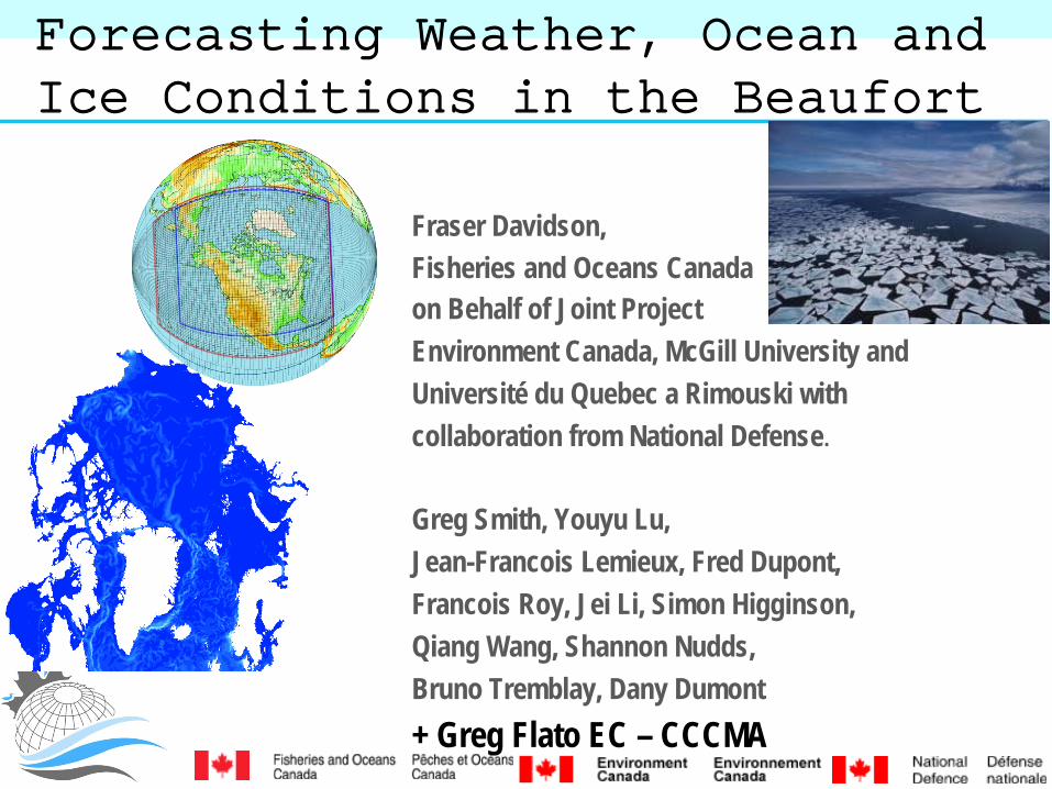
Forecasting Weather, Ocean and Ice Conditions in the Beaufort
Fraser Davidson, Fisheries and Oceans Canada on Behalf of Joint Project Environment Canada, McGill University and Université du Quebec a Rimouski with collaboration from National Defense. Greg Smith, Youyu Lu, Jean-Francois Lemieux, Fred Dupont, Francois Roy, Jei Li, Simon Higginson, Qiang Wang, Shannon Nudds, Bruno Tremblay, Dany Dumont + Greg Flato EC – CCCMA
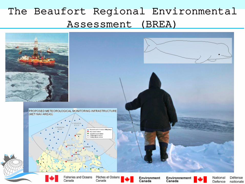
The Beaufort Regional Environmental Assessment (BREA)
Forecasting Weather, Ocean and Ice Conditions Purpose
• Enhance “vetted” descriptions of physical environment: – Strengthens environmental assessments – Beaufort Sea Ocean and Ice movement and properties – Routine accessible forecasts (web) – Operations + dissemination – Historical ocean conditions: 2002-present – Strengthens integrated management
• Describe and Communicate ocean conditions – Engage communities
BREA PRIORITY
Coupled ocean-ice-atmosphere modeling and forecasting Improved real time descriptions of Ocean, Ice circulation • Provides information for oil spill response • Permits mapping of oil spill drift scenarios • Enhances Search and Rescue operations • Provides info for design limits • Can be incorporated in geospatial tools • CanSIPS:
– define window of operation in the BeuProvide advance forecast of end of ice free operations.

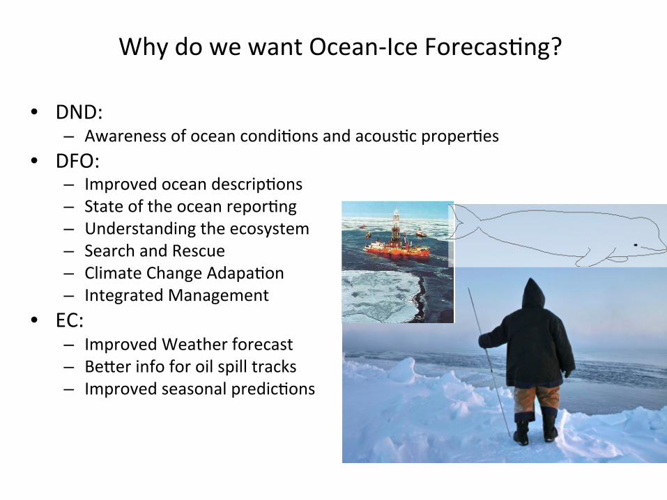
Why Ocean-Ice Forecasting?
• DND: – Awareness of ocean conditions and acoustic properties
• DFO: – Improved ocean descriptions – State of the ocean reporting – Understanding the ecosystem – Search and Rescue
• EC: – Improved Weather forecast – Better info for oil spill track
ALL: Taking in Account Climate Change
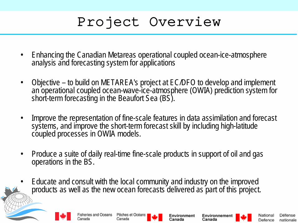
Project Overview
• Enhancing the Canadian Metareas operational coupled ocean-ice-atmosphere analysis and forecasting system for applications
• Objective – to build on METAREA's project at EC/DFO to develop and implement an operational coupled ocean-wave-ice-atmosphere (OWIA) prediction system for short-term forecasting in the Beaufort Sea (BS).
• Improve the representation of fine-scale features in data assimilation and forecast systems, and improve the short-term forecast skill by including high-latitude coupled processes in OWIA models.
• Produce a suite of daily real-time fine-scale products in support of oil and gas operations in the BS.
• Educate and consult with the local community and industry on the improved products as well as the new ocean forecasts delivered as part of this project.
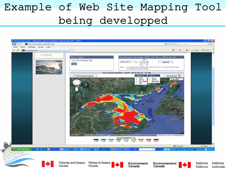
Example of Web Site Mapping Tool being developped

Example of Web Site Mapping Tool being developped
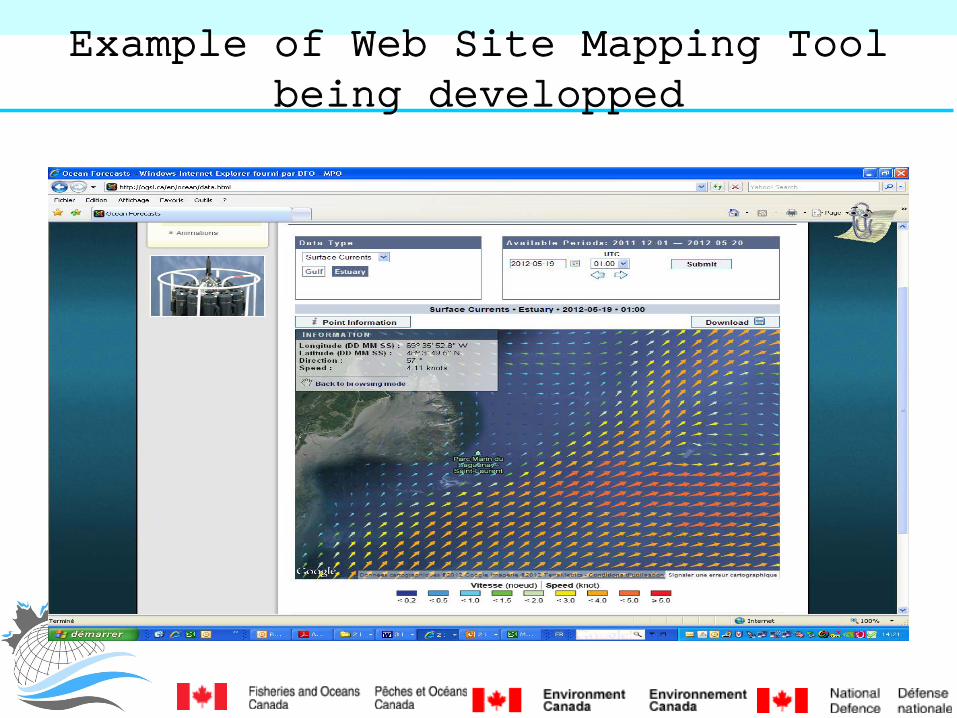
Example of Web Site Mapping Tool being developped
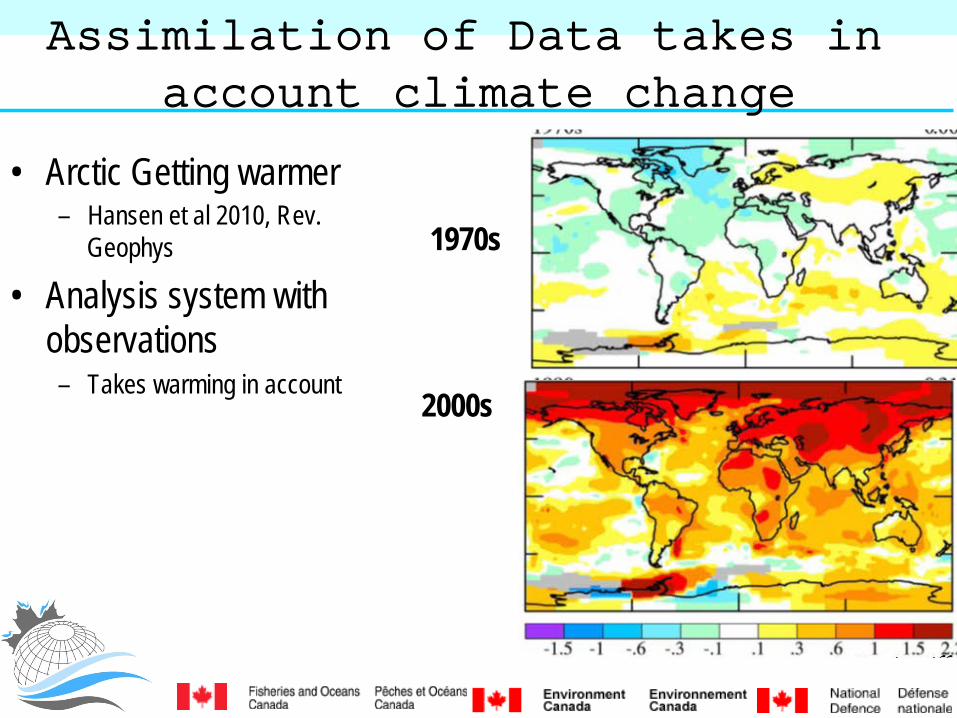
Assimilation of Data takes in account climate change
• Arctic Getting warmer – Hansen et al 2010, Rev.
Geophys
• Analysis system with observations – Takes warming in account
1970s
2000s
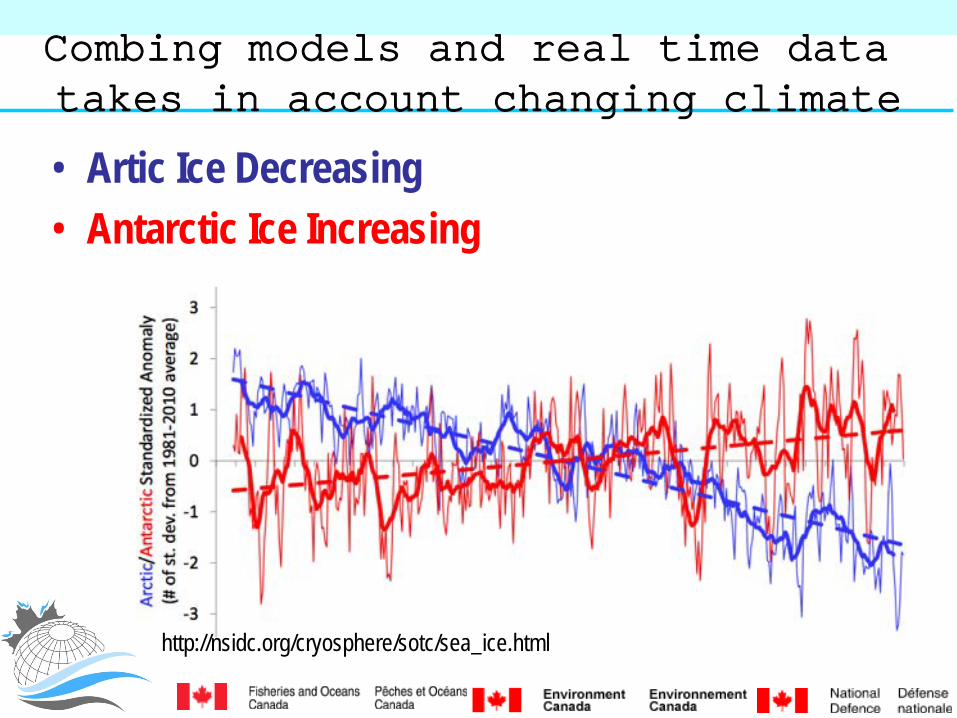
Combing models and real time data takes in account changing climate
• Artic Ice Decreasing • Antarctic Ice Increasing
http://nsidc.org/cryosphere/sotc/sea_ice.html
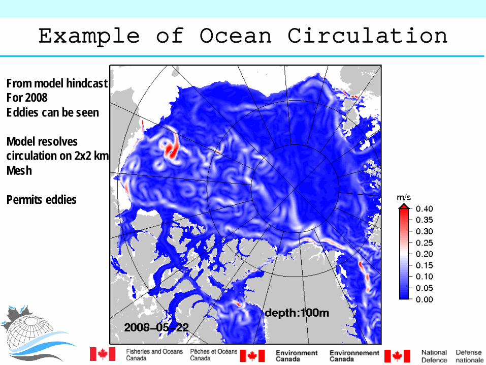
Example of Ocean Circulation
From model hindcast For 2008 Eddies can be seen Model resolves circulation on 2x2 km Mesh Permits eddies

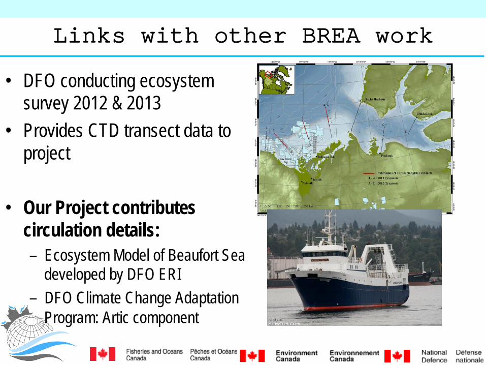
Links with other BREA work
• DFO conducting ecosystem survey 2012 & 2013
• Provides CTD transect data to project
• Our Project contributes circulation details: – Ecosystem Model of Beaufort Sea
developed by DFO ERI – DFO Climate Change Adaptation
Program: Artic component

Links with other BREA work
• Can provide best estimate of ocean conditions for any given transect 365 days a year

Why this project
• Align operational EC METAREA analysis and modelling tools with environmental assessment (EA), risk management, and policy and regulation development.
• Need environmental Information to – improve planning and operations in the Beaufort Sea
• Oil spills • transport safety and efficiency • Offloading from production platforms • Evacuation, Search and Rescue • ice management • infrastructure design, etc.) in the BS; • support EA via open access to advanced knowledge of the environment; • Reconstruct historical BS physical conditions

This project will available Ocean and Ice Observations into
• Daily maps of ocean and ice estimated properties up to 10 days into the future – Ocean: Currents, Temperature, Salinity – Ice: Ice thickness, Ice Percentage cover, width of marginal ice
zone • Enhancements to METAREA weather forecasts through
coupling of Ocean and Ice Forecasts • Operational delivery of Ocean Currents and Ice Information
Products for use by: CCG, Operations…
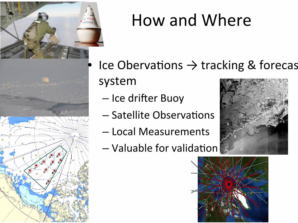
How and Where
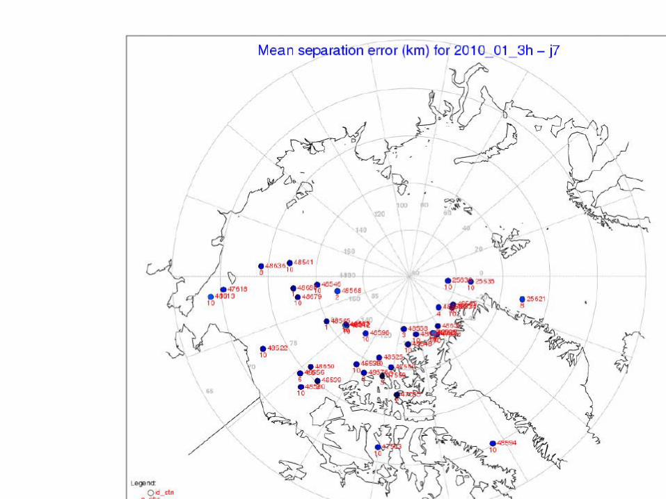
• Ice Oberva1ons → tracking & forecast system – Ice dri<er Buoy – Satellite Observa1ons – Local Measurements – Valuable for valida1on
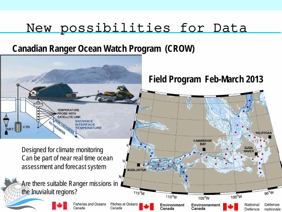
New possibilities for Data
Canadian Ranger Ocean Watch Program (CROW)
Field Program Feb-March 2013
Designed for climate monitoring Can be part of near real time ocean assessment and forecast system Are there suitable Ranger missions in the Inuvialuit regions?
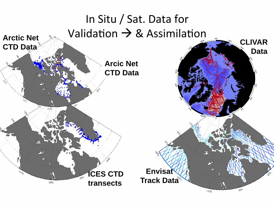
In Situ / Sat. Data for Valida1on à & Assimila1on Arctic Net
CTD Data CLIVAR Data
ICES CTD transects
Envisat Track Data
Arcic Net CTD Data

How and Where • Improved Ice Models for Forecast and Analysis system – Large computers – BeJer modelling of ice stresses
• Improving ice lead forecast predic1on in Beaufort
• Important for coupling with Atmospheric Forecasts

How and Where Ice Analysis
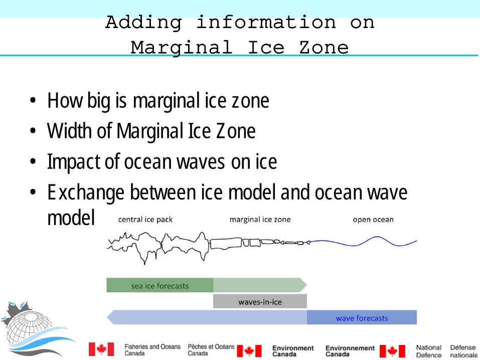
Adding information on Marginal Ice Zone
• How big is marginal ice zone • Width of Marginal Ice Zone • Impact of ocean waves on ice • Exchange between ice model and ocean wave
model

Adding informa1on on Marginal Ice Zone
• Combining wave and ice model
• Determining flow size and width of Marginal Ice Zone
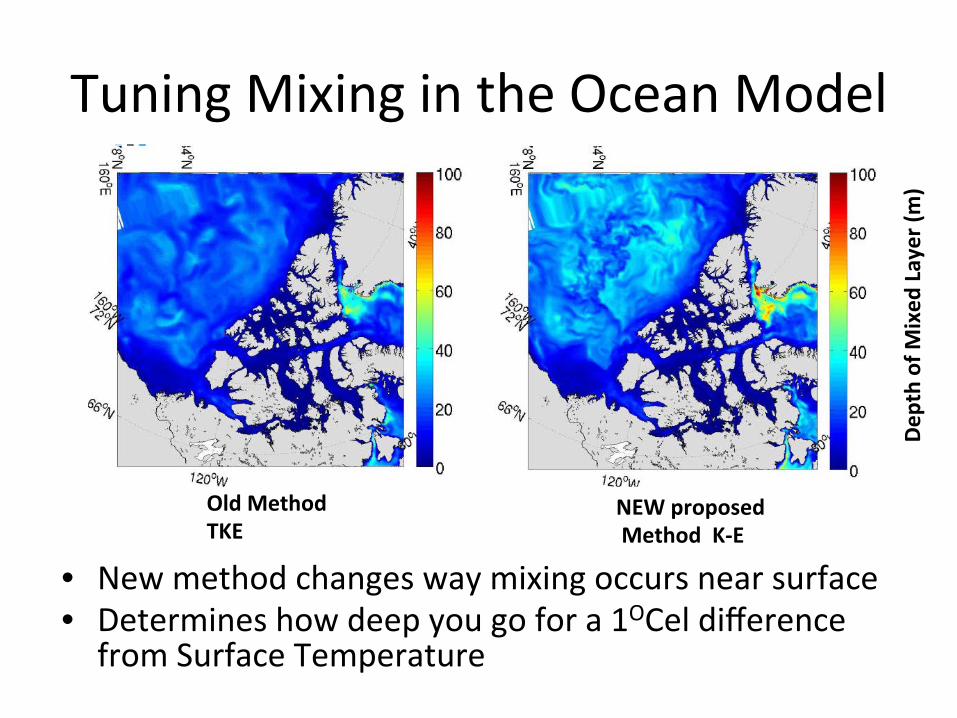
Tuning Mixing in the Ocean Model
• New method changes way mixing occurs near surface • Determines how deep you go for a 1OCel difference from Surface Temperature
Old Method TKE
NEW proposed Method K-‐E
Depth of M
ixed
Layer (m
)

Tides Implemented at High Resolu1on
• Tidal solu1ons good for Beaufort – Not so good for Hudson Bay
Low Res Hi Res
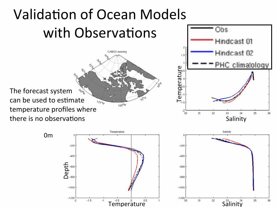
Valida1on of Ocean Models with Observa1ons
The forecast system can be used to es1mate temperature profiles where there is no observa1ons Salinity
Tempe
rature
Salinity
Depth
Temperature
0m

Working to Reduce Ice Velocity

Adjus1ng Ice Speed for Sea Ice Roughness
• Looking into adjustments to slow modelled/forecast ice down
• Link roughness to ice speed variability

How long will an ice free state last this summer? How severe will this winter’s ice cover be. CanSIPS is your tool for these questions
• Canadian Seasonal to Interannual Prediction System: multi-model, global, coupled climate prediction system • atmosphere, ocean, land surface and sea-
ice. • Developed by CCCMA operated by CMC
• Project Purpose: evaluate the ability of CanSIPS to make quantitative predictions of sea-ice extent at lead times up to 12 months.
Ocean, Ice, Weather Predictions 1- 12 months
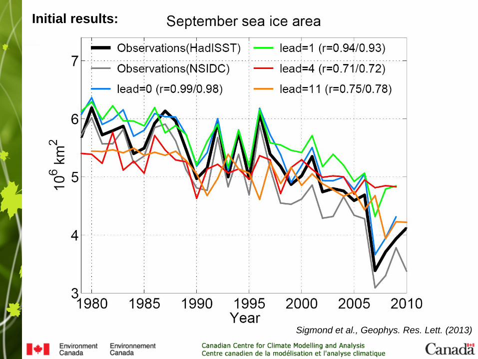
Sigmond et al., Geophys. Res. Lett. (2013)
Initial results:

Sigmond et al., Geophys. Res. Lett. (2013)
• Seasonal predictions of Arctic sea-ice area and regional concentration have “statistical” skill.
• Short term skill ( <= 1month) comes anomalies around seasonal signal don’t change that quick.
• Longer term skill (11-12 months) comes from climate change trend. • Coupled climate prediction systems provide enhancement of skill but
so far not huge.
Room for Improvement • assimilate snow amount or ice
thickness • Get operational ocean data in ice-
covered areas.
• Adding sea ice prediction to Env Canada’s long range forecasts
Ocean, Ice, Weather Predictions 1- 12 months Conclusions
Why do we want Ocean-‐Ice Forecas1ng?
• DND: – Awareness of ocean condi1ons and acous1c proper1es
• DFO: – Improved ocean descrip1ons – State of the ocean repor1ng – Understanding the ecosystem – Search and Rescue – Climate Change Adapa1on – Integrated Management
• EC: – Improved Weather forecast – BeJer info for oil spill tracks – Improved seasonal predic1ons
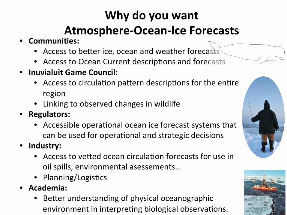
Why do you want Atmosphere-‐Ocean-‐Ice Forecasts
• CommuniGes: • Access to beJer ice, ocean and weather forecasts • Access to Ocean Current descrip1ons and forecasts
• Inuvialuit Game Council: • Access to circula1on paJern descrip1ons for the en1re region
• Linking to observed changes in wildlife • Regulators:
• Accessible opera1onal ocean ice forecast systems that can be used for opera1onal and strategic decisions
• Industry: • Access to veJed ocean circula1on forecasts for use in oil spills, environmental asessements…
• Planning/Logis1cs • Academia:
• BeJer understanding of physical oceanographic environment in interpre1ng biological observa1ons.
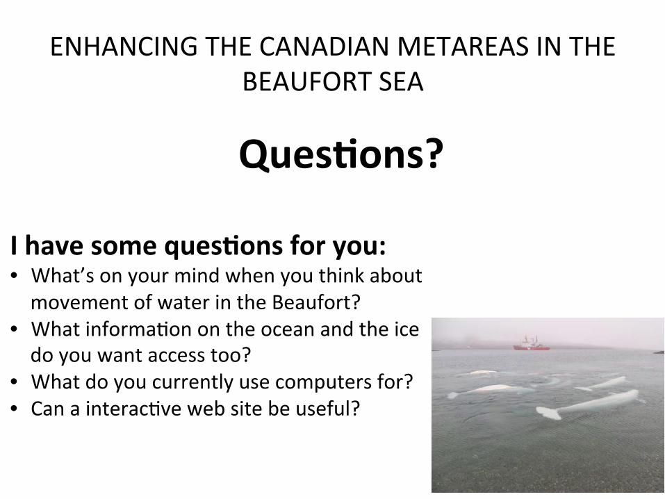
ENHANCING THE CANADIAN METAREAS IN THE BEAUFORT SEA
QuesGons?
I have some quesGons for you: • What’s on your mind when you think about movement of water in the Beaufort?
• What informa1on on the ocean and the ice do you want access too?
• What do you currently use computers for? • Can a interac1ve web site be useful?

ACRONYMS • CONCEPTS: Canadian Opera1onal Network of Coupled Environmental PredicTion Systems Collabora1on
between 3 Government Departments • DFO: Fisheries and Oceans Canada • EC: Environment Canada • CMC: Canadian Meteorological Centre • NEMO: A Community Ocean Model used widely in Europe, and implemented in Canada for development
of new coupled short term Atmosphere, Ocean and Ice predic1ons from 1-‐10 days. • CCCMA: Canadian Center for Climate Modeling and Analysis • CanSIPS: Canadian Seasonal to Interannual Predic1on System. A coupled Atmopshere, Ocean and Ice
system for fusing in observed data and making longer term predic1ons 1-‐12 months
Contacts:
Fraser Davidson Research Scien1st Fisheries and Oceans Canada Northwest Atlan1c Fisheries Centre 80 East White Hills Rd PO Box 5667 St. John's NL A1C 5X1 Tel: 709-‐772-‐2418 Fraser.Davidson@dfo-‐mpo.gc.ca
Greg Flato Manager Environment Canada Canadian Centre for Climate Modelling and Analysis 3800 Finnerty Road, SCI A203 Victoria, Bri1sh Columbia V8P 5C2 Canada Telephone : 250-‐363-‐8233 Fax : 250-‐363-‐8247 [email protected]


