Forecasting Technique: Pattern Recognition
• Associating a “weather pattern” to a “weather event”
• Significant weather events have patterns– surface features
– upper level features
– 4-panel maps useful
Pattern Recognition: Severe Weather
• Dynamics– Wind-driven
• Thermodynamics– Stability-driven
Pattern Recognition: Severe Weather
• Dynamics (winds)– Shortwaves
• jet streaks, vortmax’s
– Fronts• mech. lift
• Thermodynamics (stability)– LI’s, CAPE– Low-level moisture (Td’s)
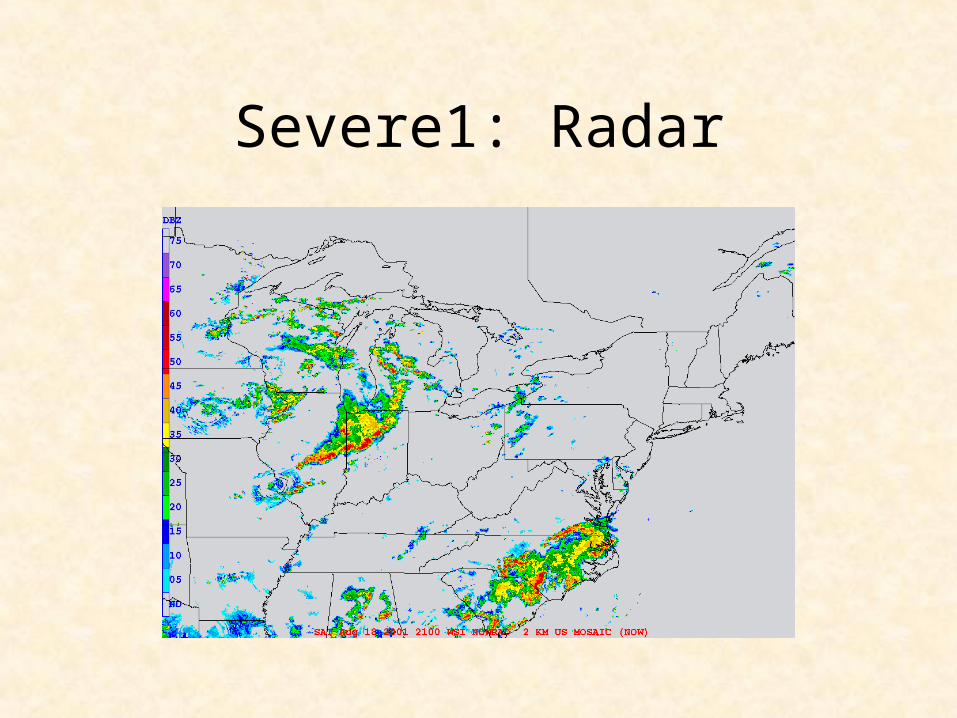
Severe1: Radar

Severe1: Severe WX Reports

Severe1: 500mb
Potentshortwaveapproaching- > 28 max-> cold air
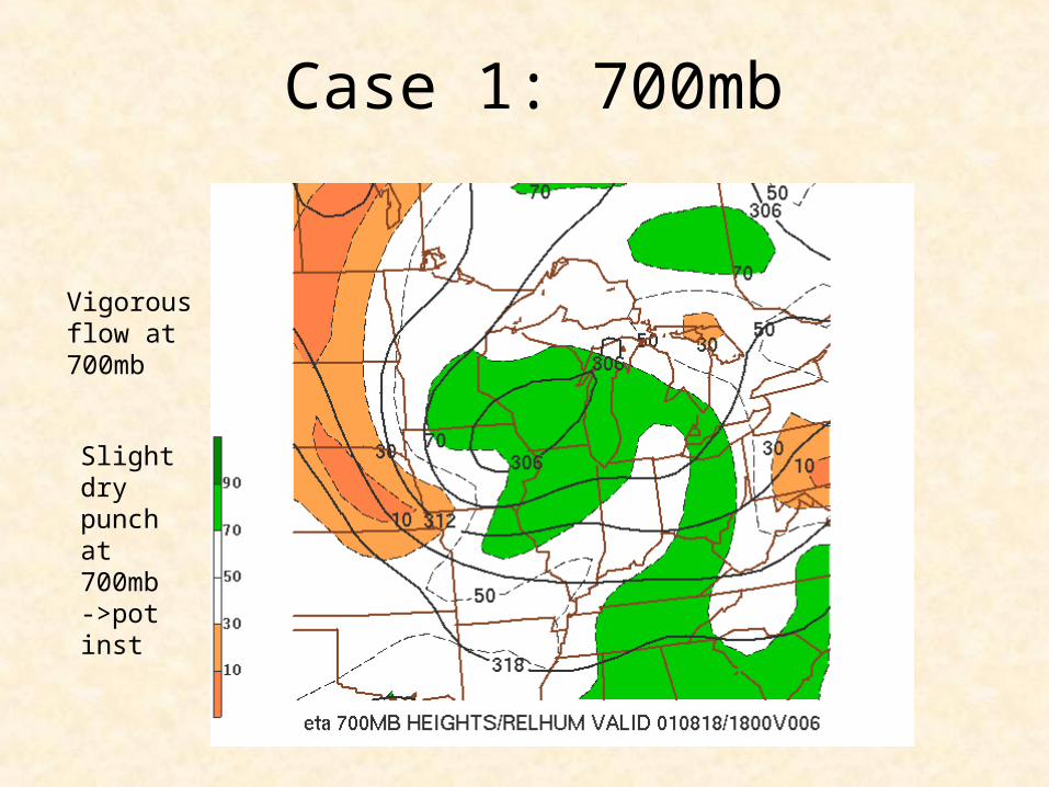
Case 1: 700mb
Slight drypunch at700mb->pot inst
Vigorousflow at700mb
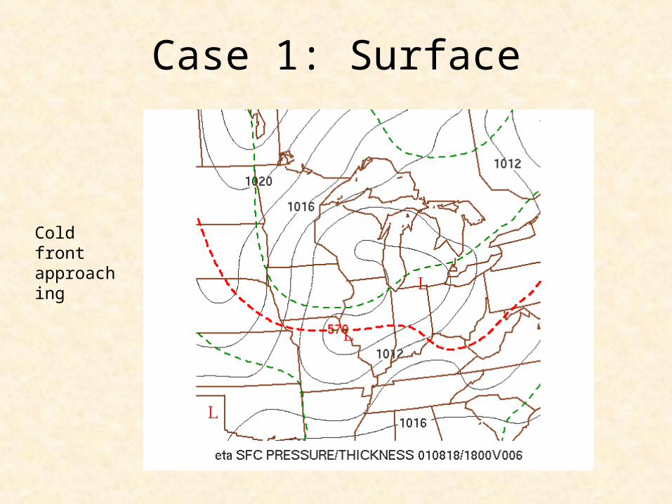
Case 1: Surface
Cold frontapproaching
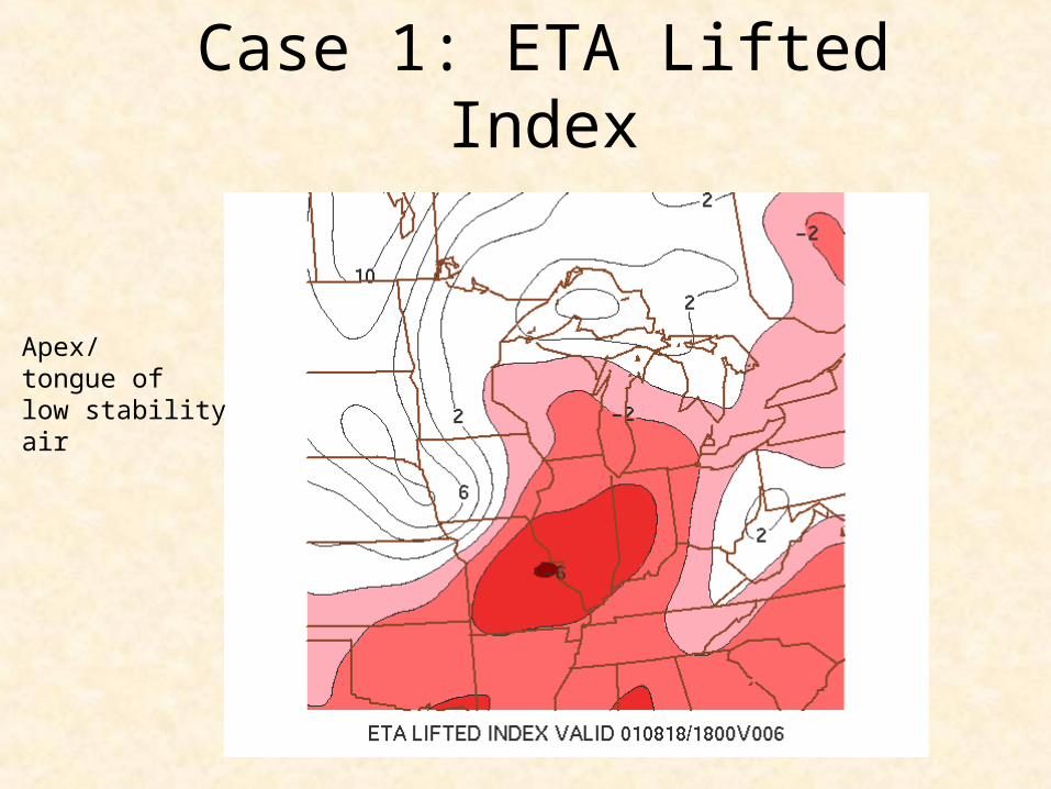
Case 1: ETA Lifted Index
Apex/tongue oflow stabilityair
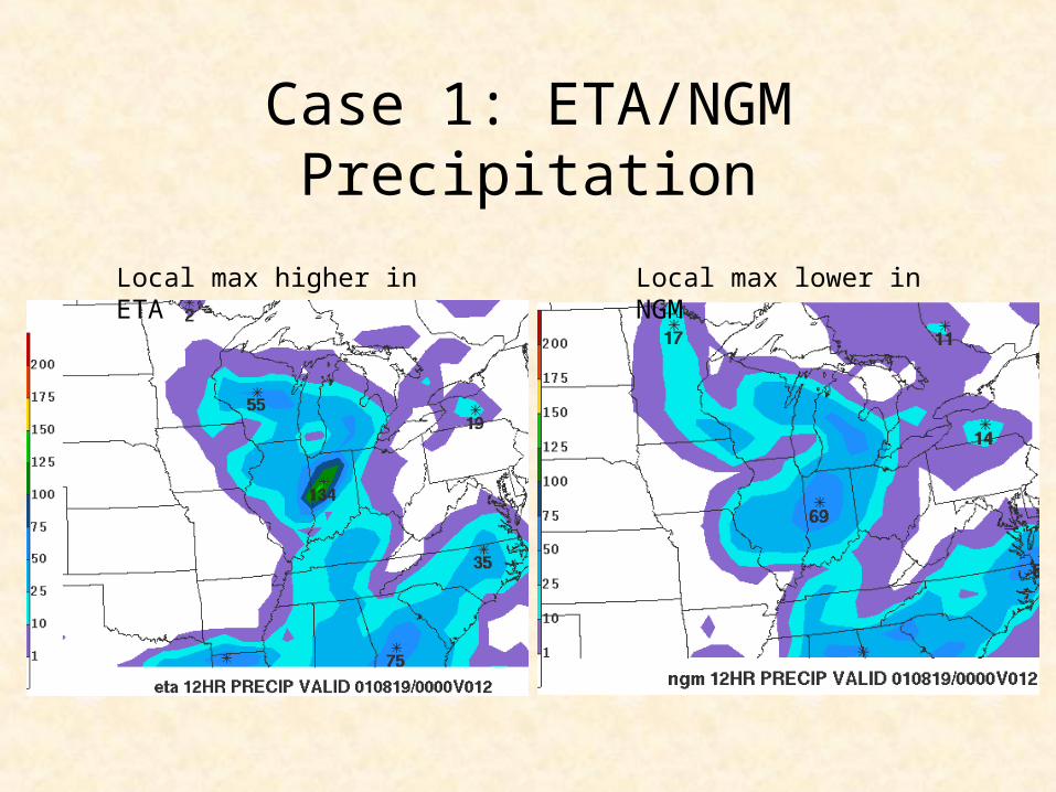
Case 1: ETA/NGM Precipitation
Local max higher in ETA Local max lower in NGM
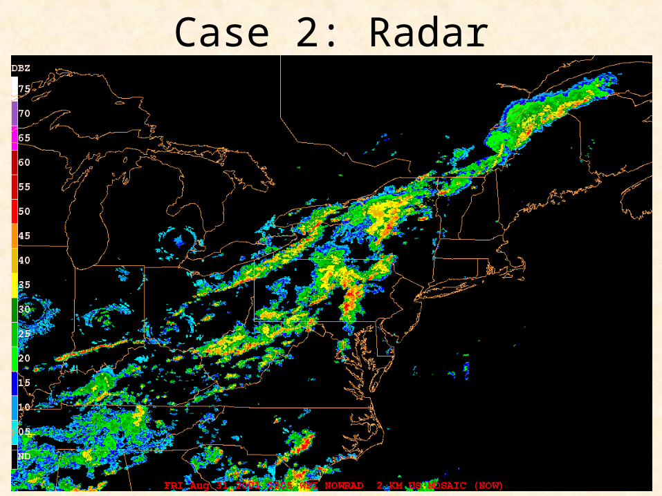
Case 2: Radar
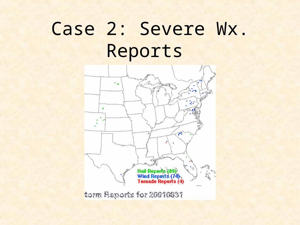
Case 2: Severe Wx. Reports
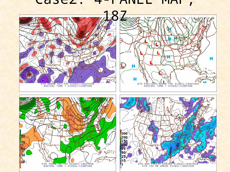
Case2: 4-PANEL MAP, 18Z
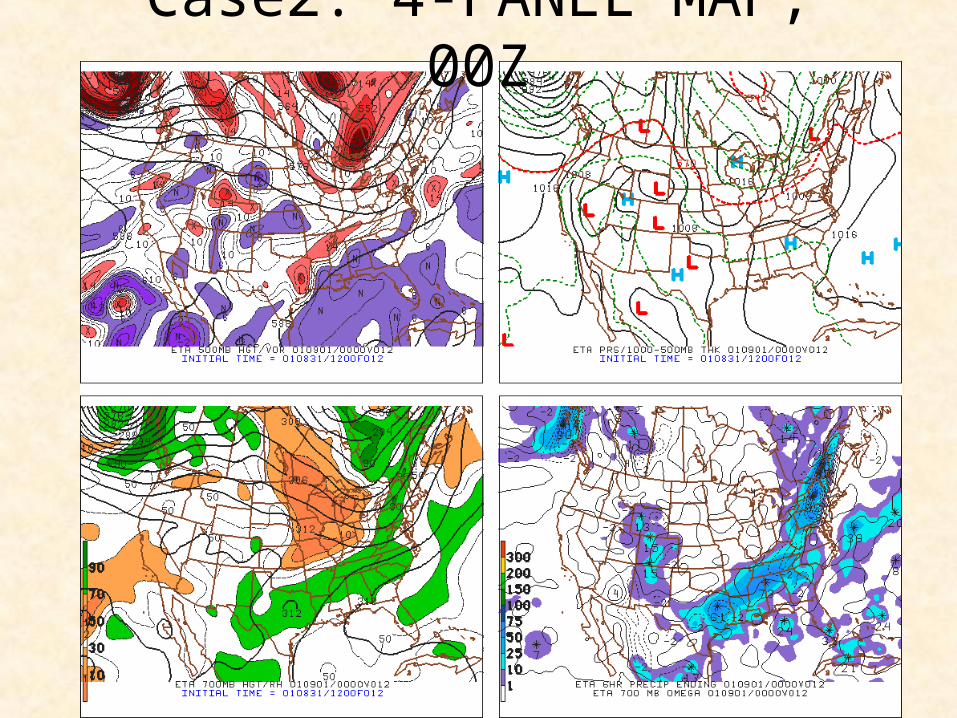
Case2: 4-PANEL MAP, 00Z
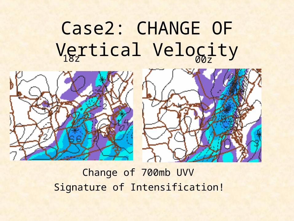
Change of 700mb UVV
Signature of Intensification!
18z 00z
Case2: CHANGE OF Vertical Velocity
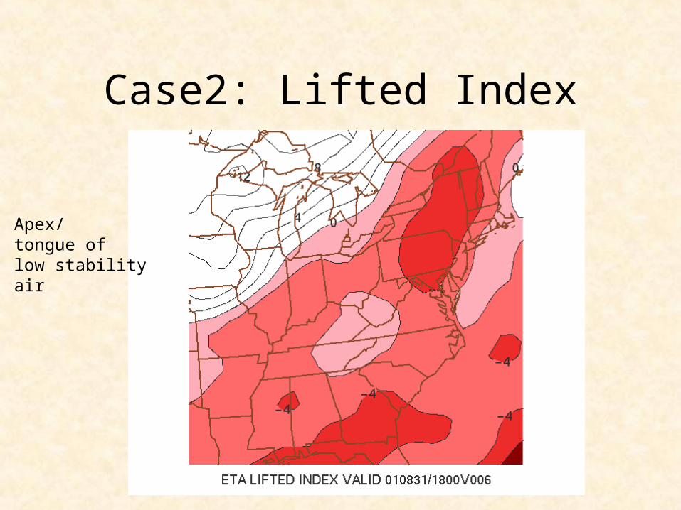
Case2: Lifted Index
Apex/tongue oflow stabilityair
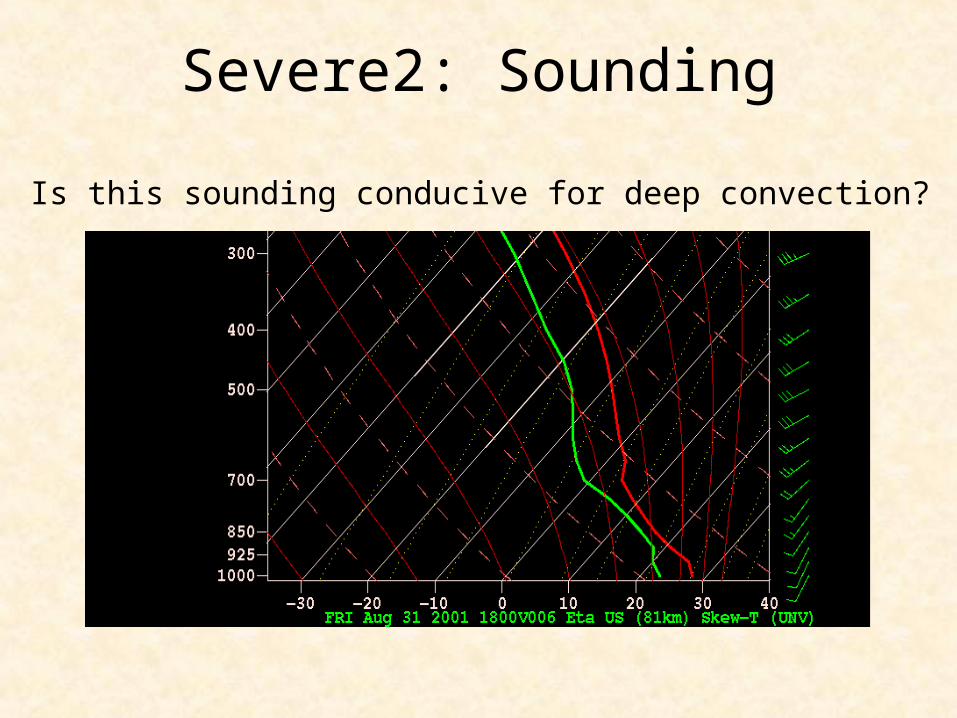
Severe2: Sounding
Is this sounding conducive for deep convection?
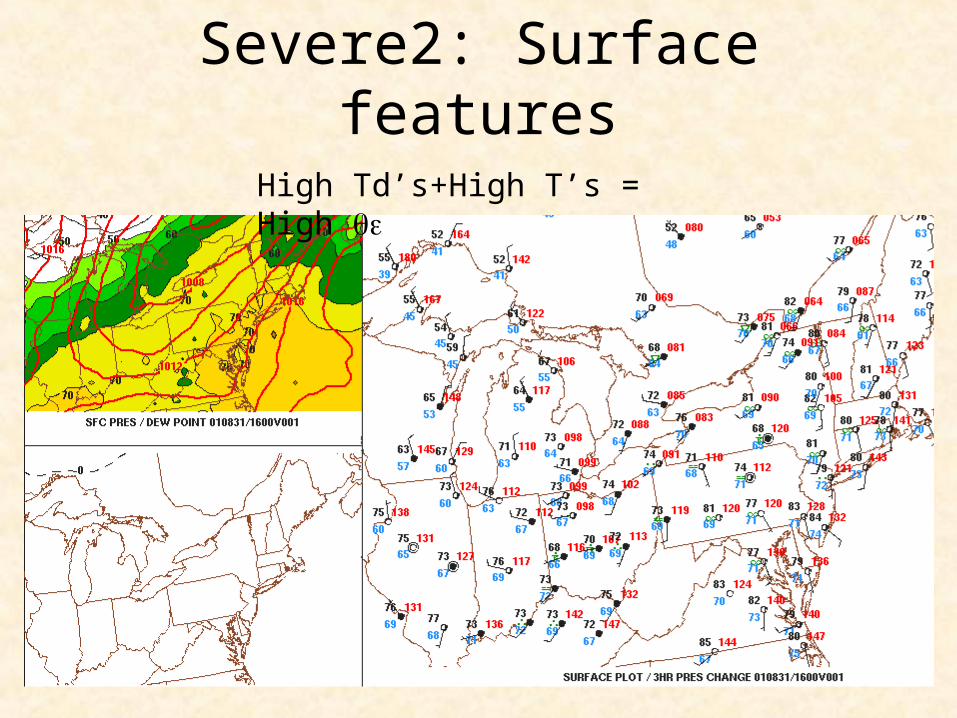
Severe2: Surface features
High Td’s+High T’s = High
Other patterns
• Strong shortwave coming from the Rockies– Adds additional lift– Brings the dryline into play– Can draw high theta-e air north from Gulf– Warming on Front Range of Rockies from
downsloping


