
EARLINET and Satellites: Partners for Aerosol Observations
Matthias WiegnerUniversität München
Meteorologisches Institut
(Satellites: spaceborne passive radiometry)

Radiative transfer equation
RTE

radiance (upward)
Radiative transfer equation

source function
Radiative transfer equation

optical depth (=0 at top at atmosphere)
zenith and azimuth angle of radiance
Radiative transfer equation

source function
Radiative transfer equation
Source Fkt.

Single scattering albedo
Radiative transfer equation
source function

phase function
Radiative transfer equation
source function

Radiative transfer equation
RTE

Solution
Radiative transfer equation
Solution

contribution from atmosphere
Radiative transfer equation
Solution

contribution from surface
Radiative transfer equation
Solution

phase function, single scattering albedo
air molecules, aerosol particles, cloud droplets
size, refractive index, shape; height dependent
and surface properties
as the vertical coordinate is the optical depth,radiance also depends on the extinction coefficient
Radiance at satellite depends on
Radiance Dependences
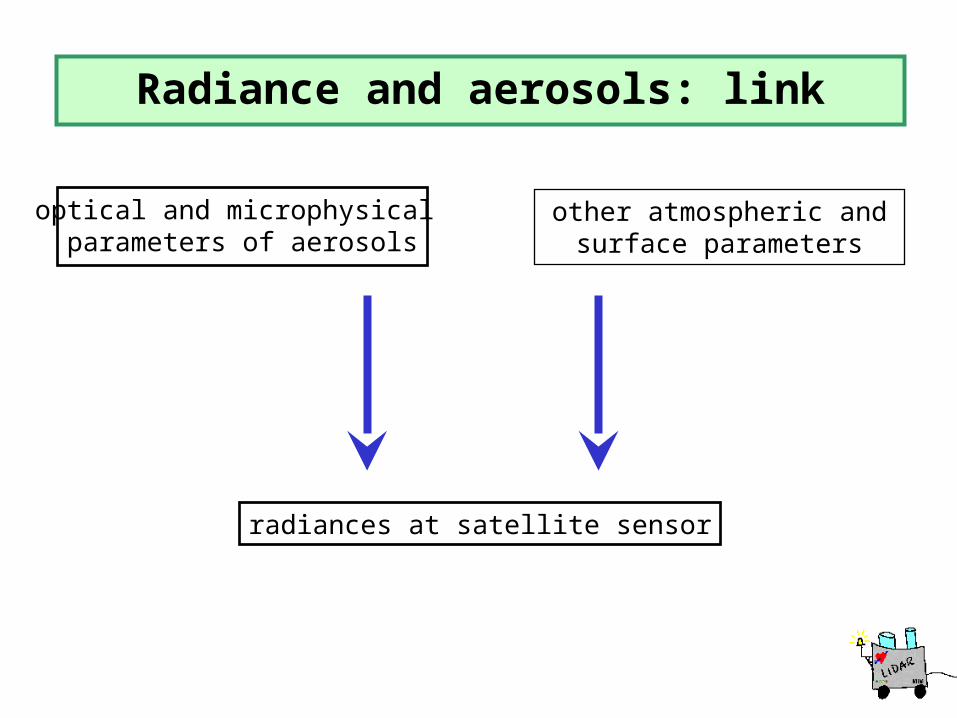
optical and microphysical parameters of aerosols
radiances at satellite sensor
other atmospheric andsurface parameters
Radiance and aerosols: link
Link
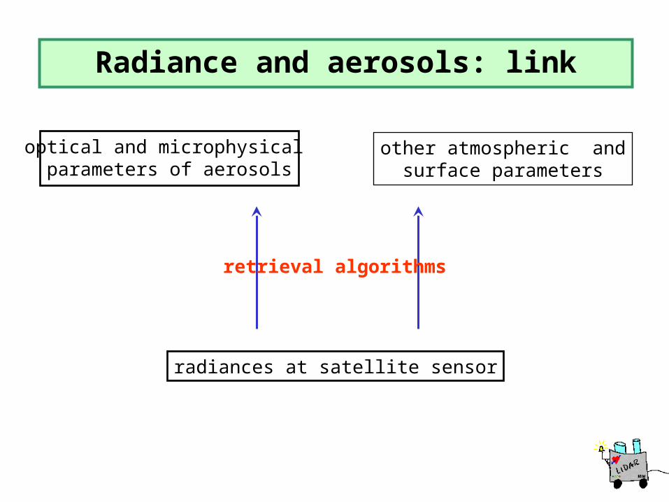
optical and microphysical parameters of aerosols
radiances at satellite sensor
other atmospheric andsurface parameters
retrieval algorithms
Radiance and aerosols: link

optical and microphysical parameters of aerosols
radiances at satellite sensor
other atmospheric andsurface parameters
EARLINET- satellite partnership
retrieval algorithms
calibrated, validated, supplemented
partnership

This was the introduction
Main topic of my talk
How can we establish an „EARLINET-Satellite partnership“?
Intro Ende

Calibration and validation of satellite data and retrieval algorithms
Supply of complementary information
Ground truthing
Consequence: Definition of the small workpackage „WP8“
Possible EARLINET contributions
Possible contrib. overview

Calibration and validation of satellite data and retrieval algorithms
Supply of complementary information
Ground truthing
Consequence: Definition of the small workpackage „WP8“
Possible EARLINET contributions

Use the EARLINET data-base
averaged data (e.g., monthly means)
„point by point“ intercomparisons (lidar measurements during an overpass)
Ground truth (cal/val)

Validation and calibration of MIPAS
Focus on ozone (balloon)No aerosols intercomparions yet
Status: waiting for overpasses
Examples of partnership
Vincenzo Rizi et al., L'Aquila
Example (1)

Validation and calibration of SAGE
Focus on stratospheric aerosolsRegular measurements began in summer 02
Status: ongoing, no final results
Examples of partnership
Thomas Trickl et al., Garmisch-Partenkirchen
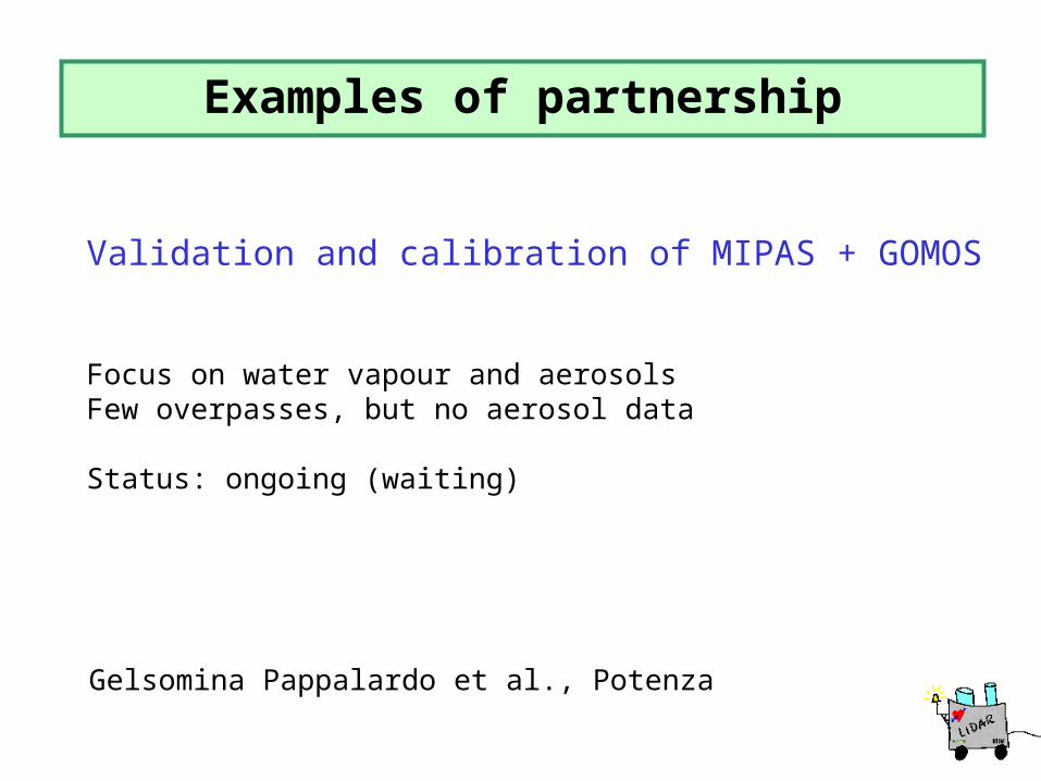
Validation and calibration of MIPAS + GOMOS
Focus on water vapour and aerosolsFew overpasses, but no aerosol data
Status: ongoing (waiting)
Examples of partnership
Gelsomina Pappalardo et al., Potenza
Examples of partnership
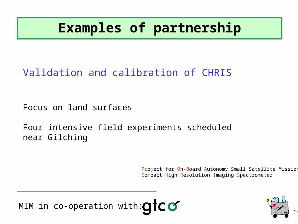
MIM in co-operation with:
Project for On-Board Autonomy Small Satellite MissionCompact High Resolution Imaging Spectrometer
GTCO
Validation and calibration of CHRIS
Focus on land surfaces
Four intensive field experiments schedulednear Gilching

Acquisition modeCHRIS: 18 km swath, 25 m resolution, 19 spectral bands (0.4-1.05 µm), along track (5 angles)
Time and placeMay to August 2002 in Gilching
GoalFull characterization of surface and atmosphere of exactlythe same scene
Requirementsco-incidence, co-location, very small satellite pixel
Examples of partnership

Results/Conclusions
Satellite PROBA encountered severe problems: no data were available in summer 2002.
A new intensive field experiment is uncertain
Examples of partnership
MIM & GTCO

Calibration and Validation of satellite data and retrieval algorithms
Supply of complementary information
Ground truthing
Consequence: Definition of the small workpackage „WP8“
Possible EARLINET contributions
Supplementary Data

Aerosol optical depth
Aerosol type
Aerosol (vertical) distribution
Surface albedo
Solar zenith angle
Fixed wavelength (532 nm)
Relevant Aerosol Parameters
Relevant (aerosol) parameters

Verticalaerosol distribution:
5 cases
(1) (2) (3) (4) (5)
A-Profiles
Model calculations

as a function ofaerosol optical depthfor different aerosol profiles
fixed aerosol type
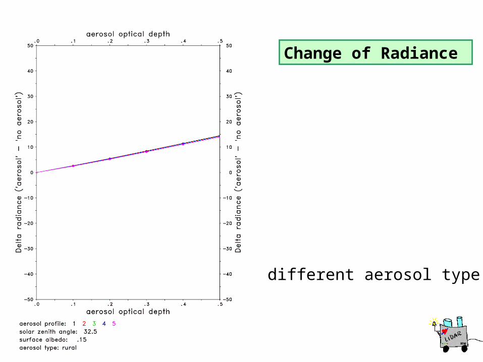
Change of Radiance
Difference of isotropic radianceat TOA, rel. to „no aerosol“-case
Sensitivity profiles
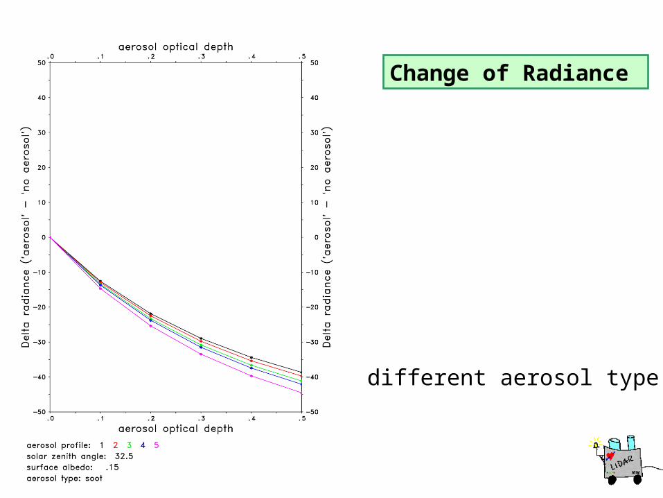
Change of Radiance
different aerosol type
Change of Radiance
different aerosol type

Change of Radiance
different aerosol type

Change of Radiance
different aerosol type

Change of Radiance
as a function ofaerosol optical depthfor different 2-layeraerosol profiles
fixed aerosol type
2-layer profiles

Change of Radiance
different aerosol type

Change of Radiance
different aerosol type

Change of Radiance
different aerosol type

Change of Radiance
different aerosol type

Change of Radiance
different layer width
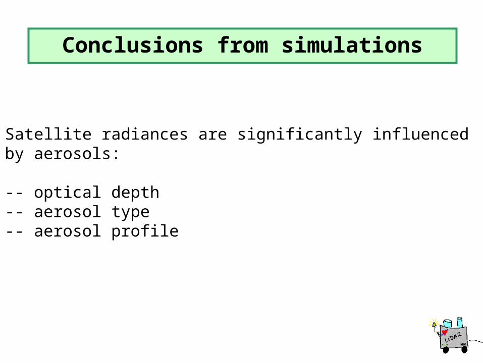
Satellite radiances are significantly influenced by aerosols:
-- optical depth-- aerosol type-- aerosol profile
Conclusions Simul.
Conclusions from simulations

Aerosol vertical distribution is hardly retrievablefrom satellites
Examples of partnership
EARLINET can provide this missing information
Vertical aerosol distribution is relevant for local energy budget, hydrological cycle, validation of CTM, ecology,....
...and satellite validation as well

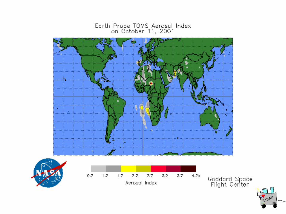
TOMS 10.10.01


TOMS 16.10.01
Results/Conclusions
Aerosol profiles from more than 20 lidar stations, twotimes a week and for three years are available. Dataand instruments have undergone QA.
Benefit of partnership
Benefit: Results
EARLINET can provide aerosol data that cannot beobtained from passive radiometry.
Validation of aerosol retrievals requires a careful selectionof time and place, and averaging over reasonable periods.First co-operations are initiated.

The (bright) future
Envisat and MSG are still at the beginning of their operation.
Benefit of partnership
Co-operation requires extra funding !!!!
Benefit: Actions
Most of the EARLINET-systems stay operational
Data archive of EARLINET is available
Spaceborne lidar is (almost) ready to launch


