Download - Community Bushfire Protection Plan

Community Bushfire
Protection Plan
This plan sets out the things you should do to survive a bushfire. Get the latest version and use it to update your personal Bushfire Survival Plan.
Most of Tasmania is bushfire-prone. Every summer you need to be bushfire-ready.
Tasmania Fire Service may not be able to protect you
during some bushfires.
Know what to do and where to go when
threatened by bushfire.
Receive bushfire updates from Tasmania Fire Service
For more information please call 1800 000 699 or visit our website www.fire.tas.gov.au
www.facebook.com/TasmaniaFireService
www.twitter.com/TasFireService (@TasFireService)
www.fire.tas.gov.au RSS feeds
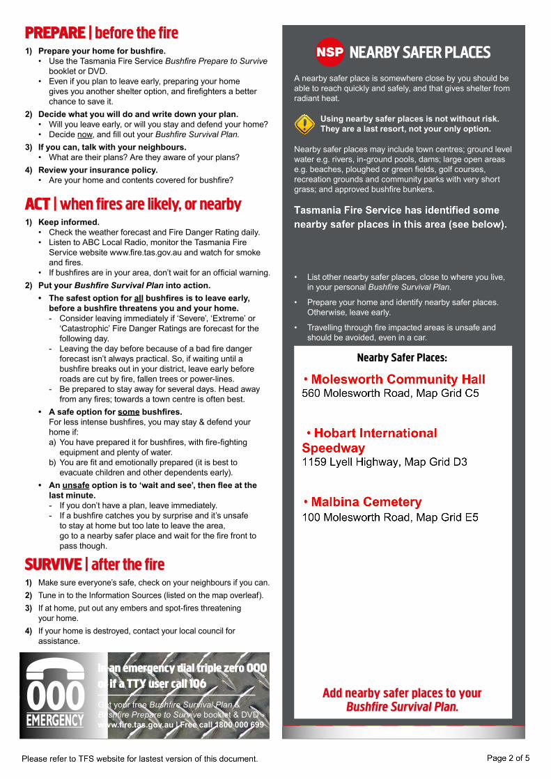
NEARBY SAFER PLACESA nearby safer place is somewhere close by you should be able to reach quickly and safely, and that gives shelter from radiant heat.
Using nearby safer places is not without risk. They are a last resort, not your only option.
Nearby safer places may include town centres; ground level water e.g. rivers, in-ground pools, dams; large open areas e.g. beaches, ploughed or green fields, golf courses, recreation grounds and community parks with very short grass; and approved bushfire bunkers.
• List other nearby safer places, close to where you live, in your personal Bushfire Survival Plan.
• Prepare your home and identify nearby safer places. Otherwise, leave early.
• Travelling through fire impacted areas is unsafe and should be avoided, even in a car.
In an emergency dial triple zero 000 or if a TTY user call 106
Get your free Bushfire Survival Plan &Bushfire Prepare to Survive booklet & DVDwww.fire.tas.gov.au | Free call 1800 000 699
NSPPREPARE | before the fire1) Prepare your home for bushfire. • Use the Tasmania Fire Service Bushfire Prepare to Survive
booklet or DVD. • Even if you plan to leave early, preparing your home
gives you another shelter option, and firefighters a better chance to save it.
2) Decide what you will do and write down your plan. • Will you leave early, or will you stay and defend your home? • Decide now, and fill out your Bushfire Survival Plan.3) If you can, talk with your neighbours. • What are their plans? Are they aware of your plans?4) Review your insurance policy. • Are your home and contents covered for bushfire?
ACT | when fires are likely, or nearby1) Keep informed. • Check the weather forecast and Fire Danger Rating daily. • Listen to ABC Local Radio, monitor the Tasmania Fire
Service website www.fire.tas.gov.au and watch for smoke and fires.
• If bushfires are in your area, don’t wait for an official warning.2) Put your Bushfire Survival Plan into action. • The safest option for all bushfires is to leave early,
before a bushfire threatens you and your home. - Consider leaving immediately if ‘Severe’, ‘Extreme’ or
‘Catastrophic’ Fire Danger Ratings are forecast for the following day.
- Leaving the day before because of a bad fire danger forecast isn’t always practical. So, if waiting until a bushfire breaks out in your district, leave early before roads are cut by fire, fallen trees or power-lines.
- Be prepared to stay away for several days. Head away from any fires; towards a town centre is often best.
• A safe option for some bushfires. For less intense bushfires, you may stay & defend your
home if: a) You have prepared it for bushfires, with fire-fighting
equipment and plenty of water. b) You are fit and emotionally prepared (it is best to
evacuate children and other dependents early). • An unsafe option is to ‘wait and see’, then flee at the
last minute. - If you don’t have a plan, leave immediately. - If a bushfire catches you by surprise and it’s unsafe
to stay at home but too late to leave the area, go to a nearby safer place and wait for the fire front to pass though.
SURVIVE | after the fire1) Make sure everyone’s safe, check on your neighbours if you can.2) Tune in to the Information Sources (listed on the map overleaf).3) If at home, put out any embers and spot-fires threatening
your home.4) If your home is destroyed, contact your local council for
assistance.
Add nearby safer places to yourBushfire Survival Plan.
Nearby Safer Places:
MOUNT FAULKNERCONSERVATION
AREA
MOLESWORTHCONSERVATIONAREA
MOUNTFAULKNER
RoseHills
BRINCKMANSRIDGE
MOLESWORTH7140
GLENLUSK7012
COLLINSVALE7012
"F"S
"H
DouglasRd
Boul
ters Rd
Wagn
er Rd
Wyre Forest Rd
McKe
nzies
Rd
MOLESWORTH RD
ToHobart
(17.2 km)
To NewNorfolk(8.9 km) !(N PS
Relats Creek
Relats Creek
Wyre Forest Creek
Kundes Creek
Sorell Creek
Sorell Creek
Sorell Creek
A
A
B
B
C
C
D
D
E
E
F
F
G
G
H
H
9 9
8 8
7 7
6 6
5 5
4 4
3 3
2 2
1 1
FOR OFFICE USE ONLY: 2 (2013)
Disclaimer: The following mapproduct has been produced by EmergencyServices GIS (ES-GIS) on behalf of theTasmania Fire Service.While all efforts have been taken to ensurethe accuracy of this product, there maybeerrors or omissions in the data presented.Users are advised to independently verify alldata for accuracy and completeness prior to use. UTM
ZONE55
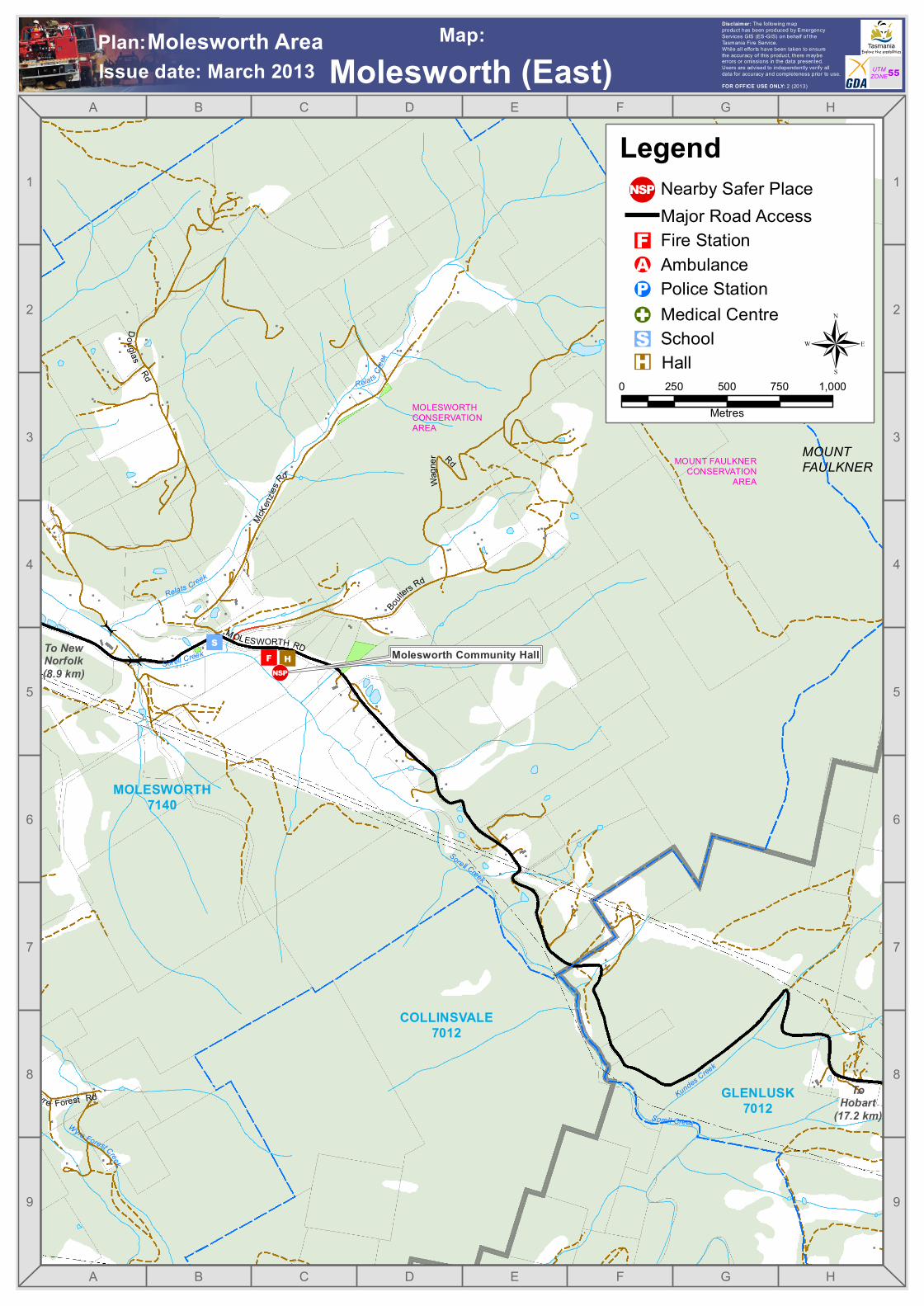
Molesworth Community Hall
Molesworth (East)Issue date: March 2013Plan:Molesworth Area Map:
0 250 500 750 1,000Metres
®
Nearby Safer Place
"S
!A"F
!G!P
Major Road Access
School
Fire Station
Police StationAmbulance
Hall
Medical Centre
Legend
"H
!(N PS
FarleysSugarloaf
BigRocky
BuddinsHill
MurdochsHill
ShingleHill
Glen Dhu
MOLESWORTH7140
MALBINA7140
MOLESWORTH7140
"S
DouglasRd
Glen Dhu Rd
Glen
DhuRd
Dawes Rd Purcells Rd
Bradsh
aw Rd
Mountain Pl
Tubb
s Rd
Wyre Forest Rd
Wyre Forest Rd
Collins CapR d
Collins Cap Rd
TanglewoodRd
McKen
ziesR
d
MOLESWORTH RD
MOLESWORTH RD
ToHobart
(21.9 km)
To NewNorfolk(5.5 km)!(N PS
Silver Falls Creek
Cou ntsCreek
Glen Dhu Rivu
let
Glen Dhu Rivulet
Wyre Forest Creek
Relats Creek
Sorell Creek
Sorell Creek
Count
s Creek
Counts Creek
Wyre Forest Creek
A
A
B
B
C
C
D
D
E
E
F
F
G
G
H
H
9 9
8 8
7 7
6 6
5 5
4 4
3 3
2 2
1 1
FOR OFFICE USE ONLY: 2 (2013)
Disclaimer: The following mapproduct has been produced by EmergencyServices GIS (ES-GIS) on behalf of theTasmania Fire Service.While all efforts have been taken to ensurethe accuracy of this product, there maybeerrors or omissions in the data presented.Users are advised to independently verify alldata for accuracy and completeness prior to use. UTM
ZONE55
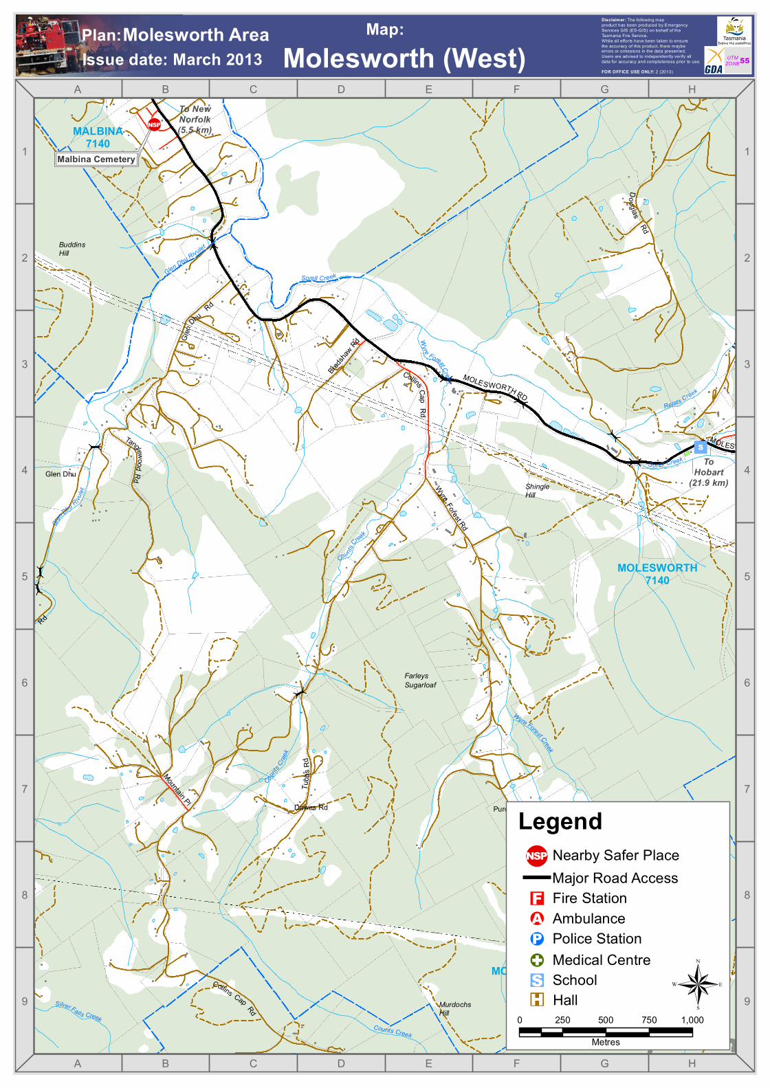
Malbina Cemetery
Molesworth (West)Issue date: March 2013Plan:Molesworth Area Map:
0 250 500 750 1,000Metres
®
Nearby Safer Place
"S
!A"F
!G!P
Major Road Access
School
Fire Station
Police StationAmbulance
Hall
Medical Centre
Legend
"H
!(N PS
McCannsPoint
BuddinsHill
IronstoneHills
SorellCreekBridge
Ralphs
Red Gum
Swepstone
DerwentCliffs
MALBINA7140
SORELLCREEK
7140
+
"S
LYELL HWY
LYELL HWY
LYELL
HWY
BOYER RD
Doug lasRd
GlenD
huRd
Sadri Crt
Bradsha
w Rd
CollinsCa pR d
Tanglew oodRd
Cock
erill sR d
MOLESWORTH RD
MOLES WORTH RD
To NewNorfolk(2.5 km)
ToHobart(23 km)
ToHobart
(27.1 km)
!(N PS
!(N PS
!(N PS
Counts Creek
Altamont Creek
Terr a
Gully
Cree
k
Wyre Forest Creek
Relats Creek
Sorell C reek
SorellCreek
Glen Dhu Rivulet
Bull Hollow C reek
Sorell Creek
³B10
³A10
A
A
B
B
C
C
D
D
E
E
F
F
G
G
H
H
I
I
8 8
7 7
6 6
5 5
4 4
3 3
2 2
1 1
FOR OFFICE USE ONLY: 2 (2013)
Disclaimer: The following mapproduct has been produced by EmergencyServices GIS (ES-GIS) on behalf of theTasmania Fire Service.While all efforts have been taken to ensurethe accuracy of this product, there maybeerrors or omissions in the data presented.Users are advised to independently verify alldata for accuracy and completeness prior to use. UTM
ZONE55
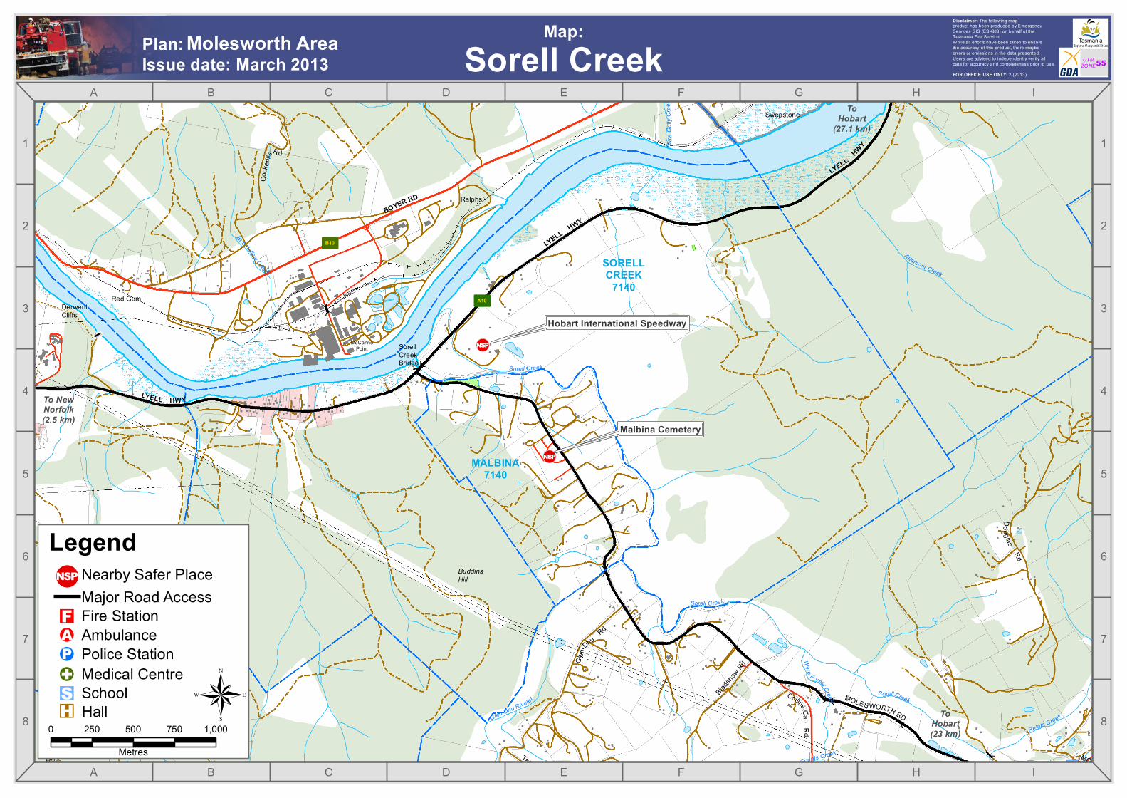
Hobart International Speedway
Molesworth AreaIssue date: March 2013 Sorell CreekPlan: Map:
0 250 500 750 1,000Metres
®
Nearby Safer Place
"S!A"F!G!P
Major Road Access
School
Fire Station
Police StationAmbulance
Hall
Medical Centre
Legend
"H
!(N PS
Malbina Cemetery


