Class 27Class 27
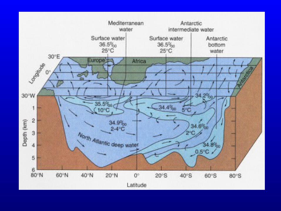
DEEP CIRCULATION AND WATER MASSESDEEP CIRCULATION AND WATER MASSES•Origin of Atlantic water masses/currentsOrigin of Atlantic water masses/currents
–Bottom waterBottom water–Deep waterDeep water–Intermediate waterIntermediate water
•Water masses and circulation in Pacific and Indian Water masses and circulation in Pacific and Indian OceansOceans
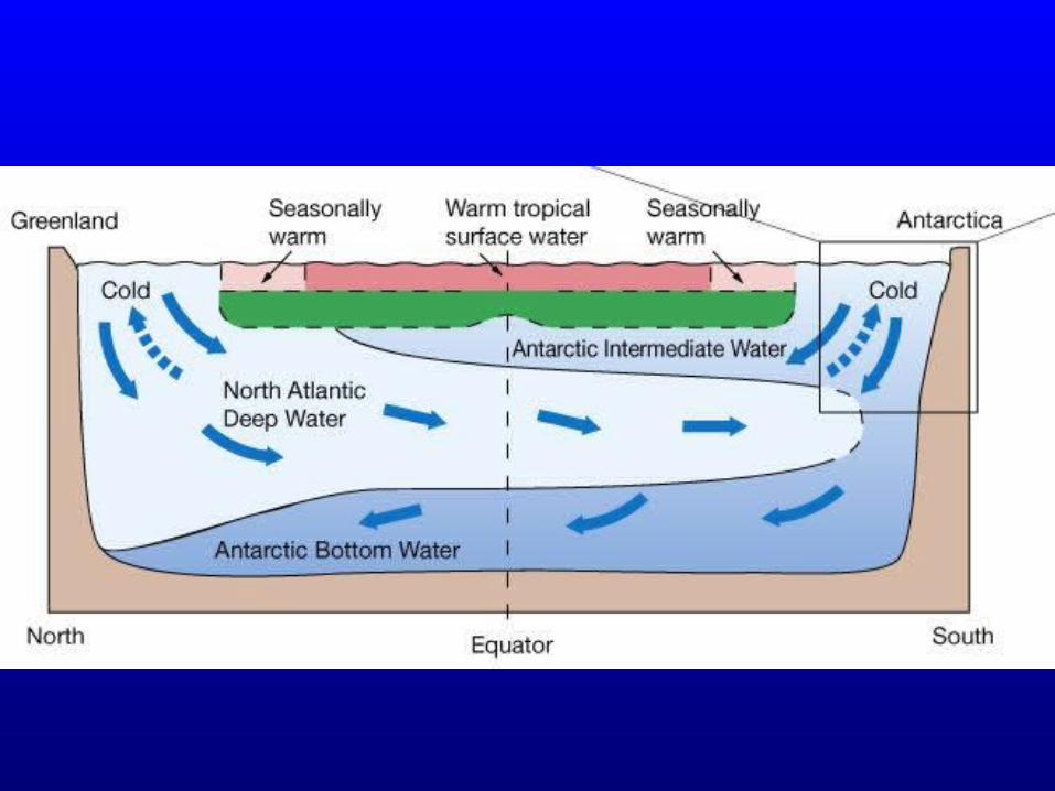
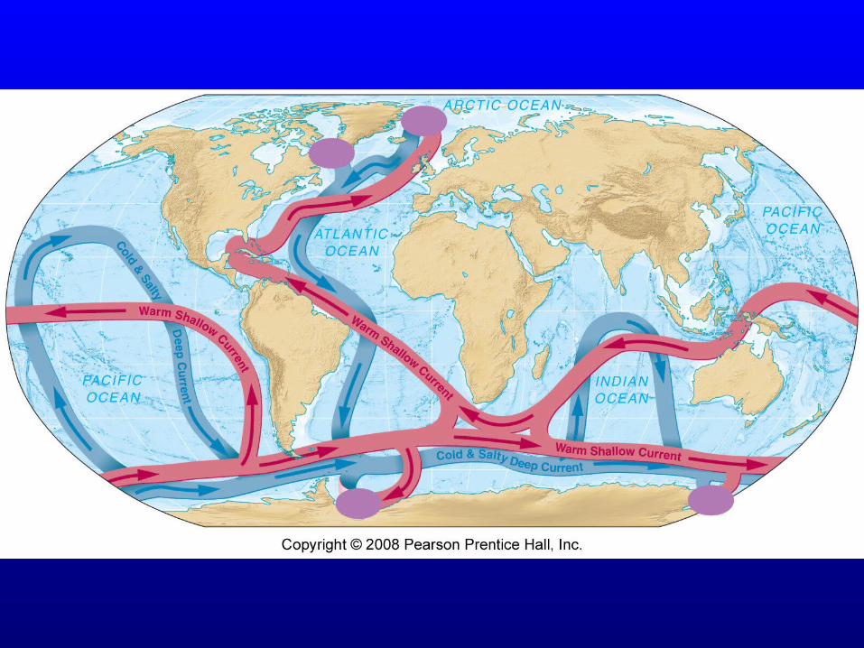
THE GLOBAL “CONVEYOR BELT”THE GLOBAL “CONVEYOR BELT”•CCoupling of deep and surface circulationoupling of deep and surface circulation
Driving force: creation of dense water masses Driving force: creation of dense water masses (cold, saline) at the surface of high-latitude (cold, saline) at the surface of high-latitude oceans (particularly the Atlantic)oceans (particularly the Atlantic)
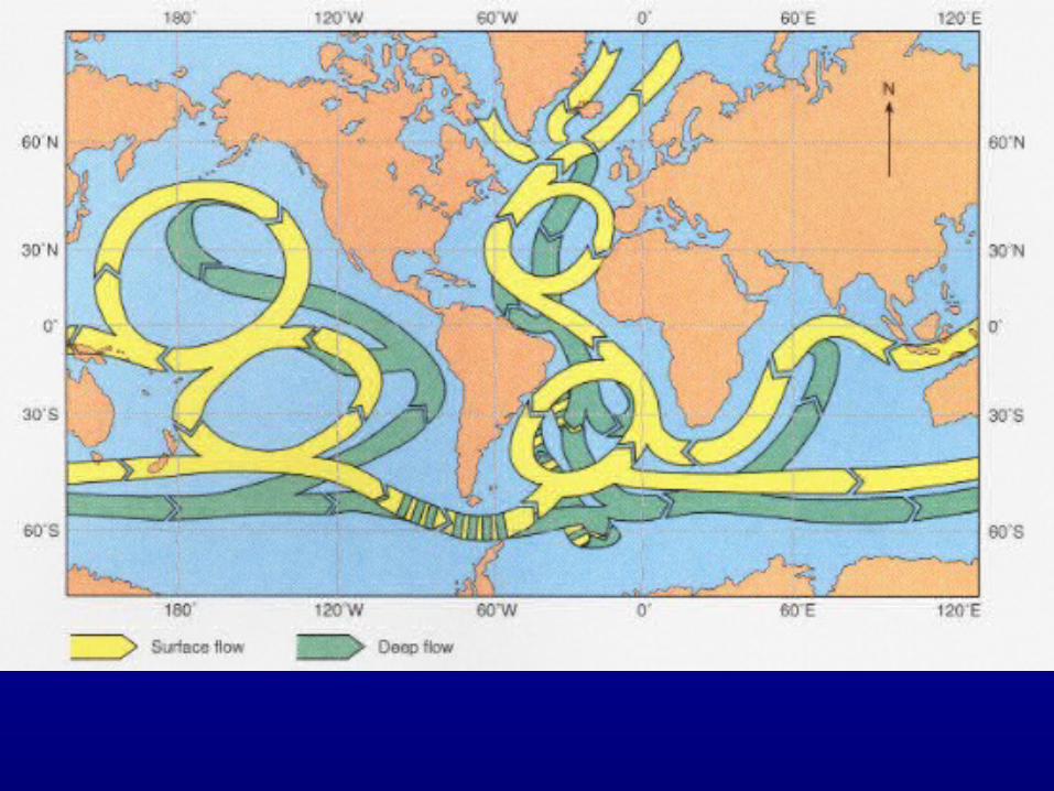
DEEP CIRCULATIONDEEP CIRCULATION
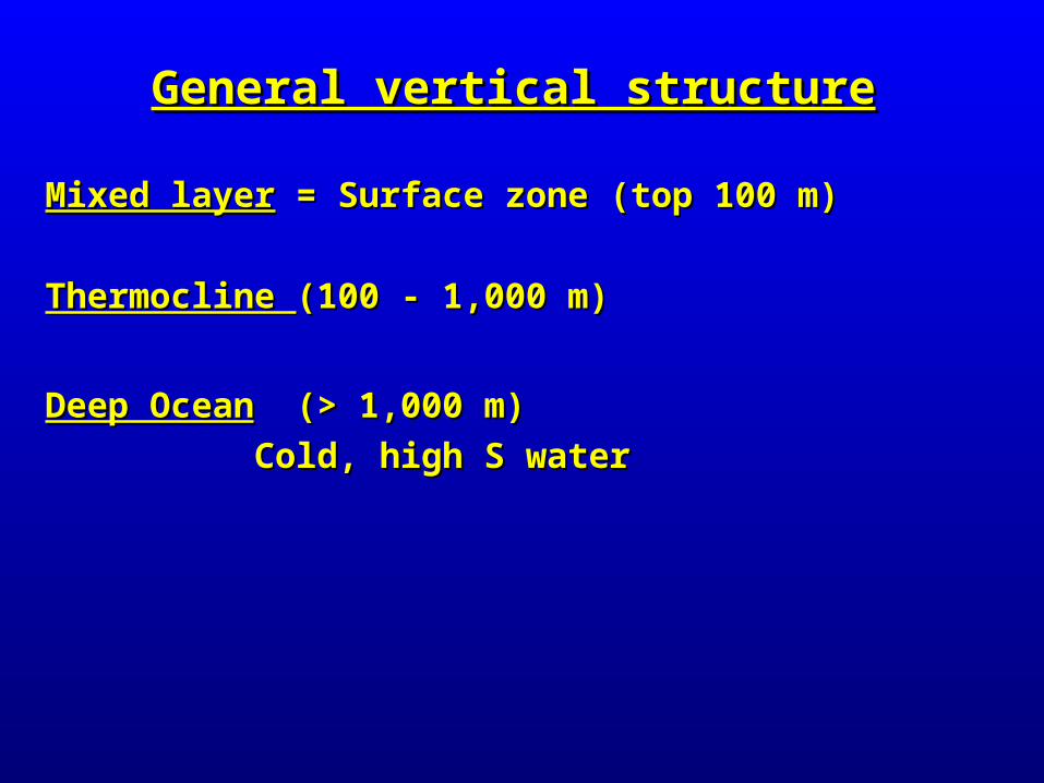
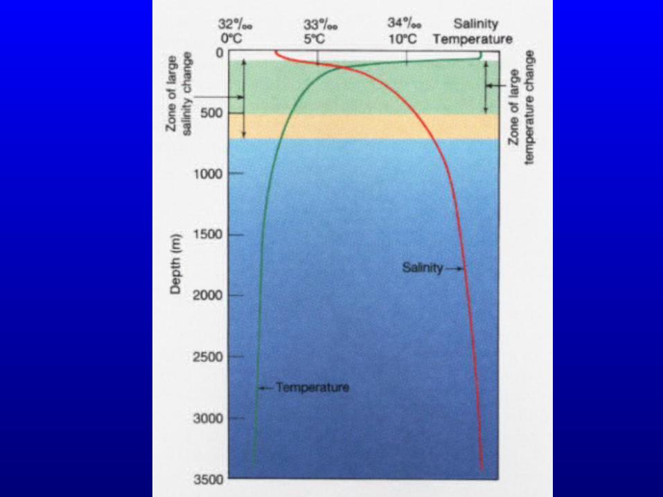
General vertical structureGeneral vertical structure
Mixed layerMixed layer = Surface zone (top 100 m) = Surface zone (top 100 m)
Thermocline Thermocline (100 - 1,000 m)(100 - 1,000 m)
Deep OceanDeep Ocean (> 1,000 m) (> 1,000 m)
Cold, high S waterCold, high S water


Intermediate, deep, and bottom water massesIntermediate, deep, and bottom water masses
•All waters in today’s oceans are always movingAll waters in today’s oceans are always moving
•Bottom Water:Bottom Water: The very densest waters at bottom The very densest waters at bottom
•Deep WaterDeep Water: Very dense water sinks and moves along : Very dense water sinks and moves along the ocean floor or not far above it.the ocean floor or not far above it.
•Intermediate Water:Intermediate Water: Moderately Dense- sinks part way Moderately Dense- sinks part way downdown
•Each water mass sinks until it reaches a depth where it Each water mass sinks until it reaches a depth where it has less dense water on top and denser water belowhas less dense water on top and denser water below

Why the Atlantic?Why the Atlantic?•Extends to highest latitudesExtends to highest latitudes•North Atlantic is relatively high salinityNorth Atlantic is relatively high salinity
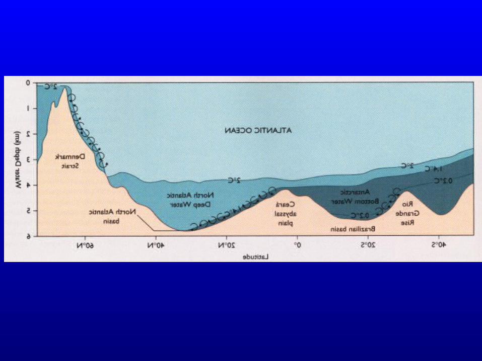
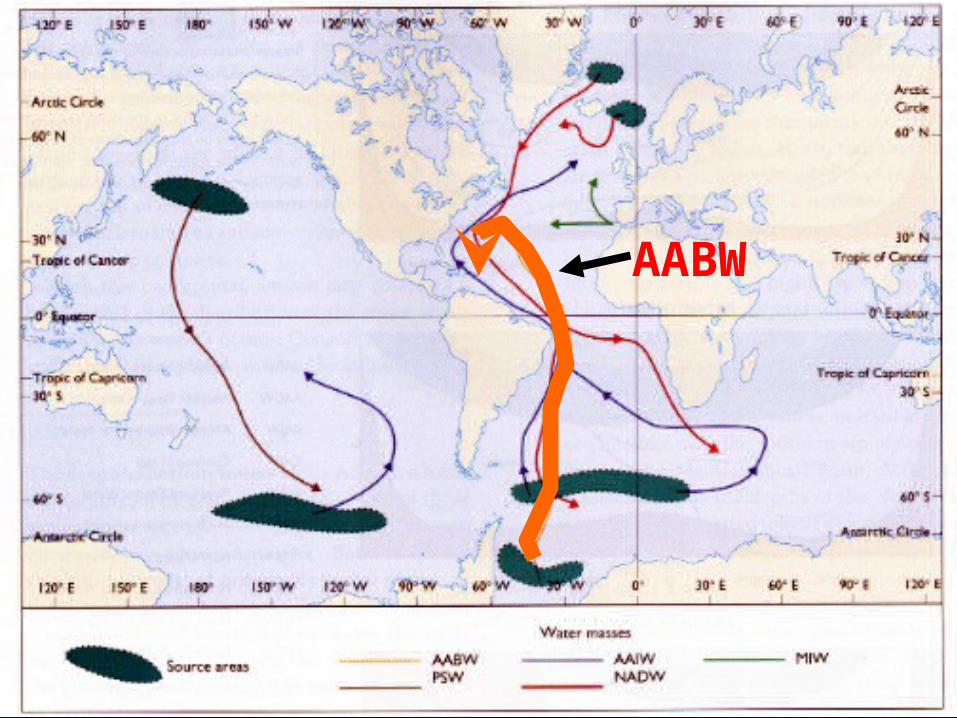
The most important deep water masses:The most important deep water masses:•North Atlantic Deep Water (NADW)North Atlantic Deep Water (NADW)•Antarctic Bottom Water (AABW)Antarctic Bottom Water (AABW)
The Most Important Deep Water Masses The Most Important Deep Water Masses Form In The AtlanticForm In The Atlantic
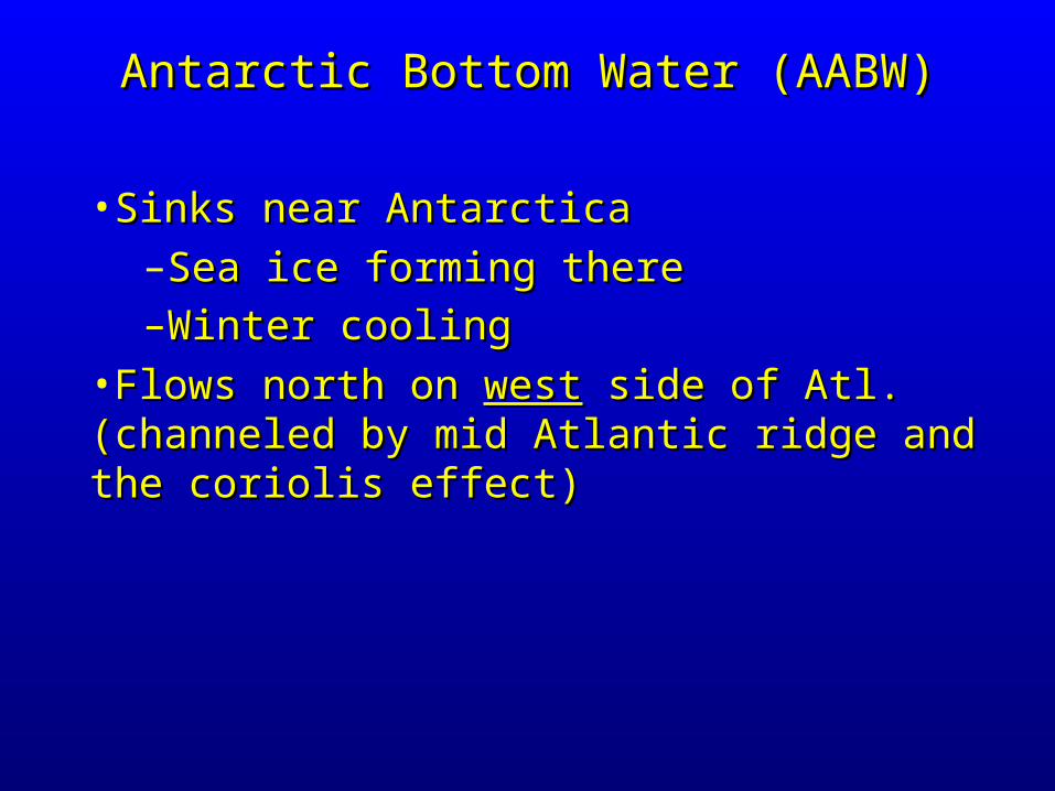
•Sinks near Antarctica Sinks near Antarctica –Sea ice forming thereSea ice forming there–Winter coolingWinter cooling
•Flows north on Flows north on westwest side of Atl. (channeled by side of Atl. (channeled by mid Atlantic ridge and the coriolis effect)mid Atlantic ridge and the coriolis effect)
Antarctic Bottom Water (AABW)Antarctic Bottom Water (AABW)
AABW

•Formed near GreenlandFormed near Greenland–N. Atl. surface water has high salinityN. Atl. surface water has high salinity– + Winter cooling, sea-ice formation+ Winter cooling, sea-ice formation
•Sinks and flows southwardSinks and flows southward•Eventually joins the denser AABWEventually joins the denser AABW
North Atlantic Deep Water (NADW)North Atlantic Deep Water (NADW)
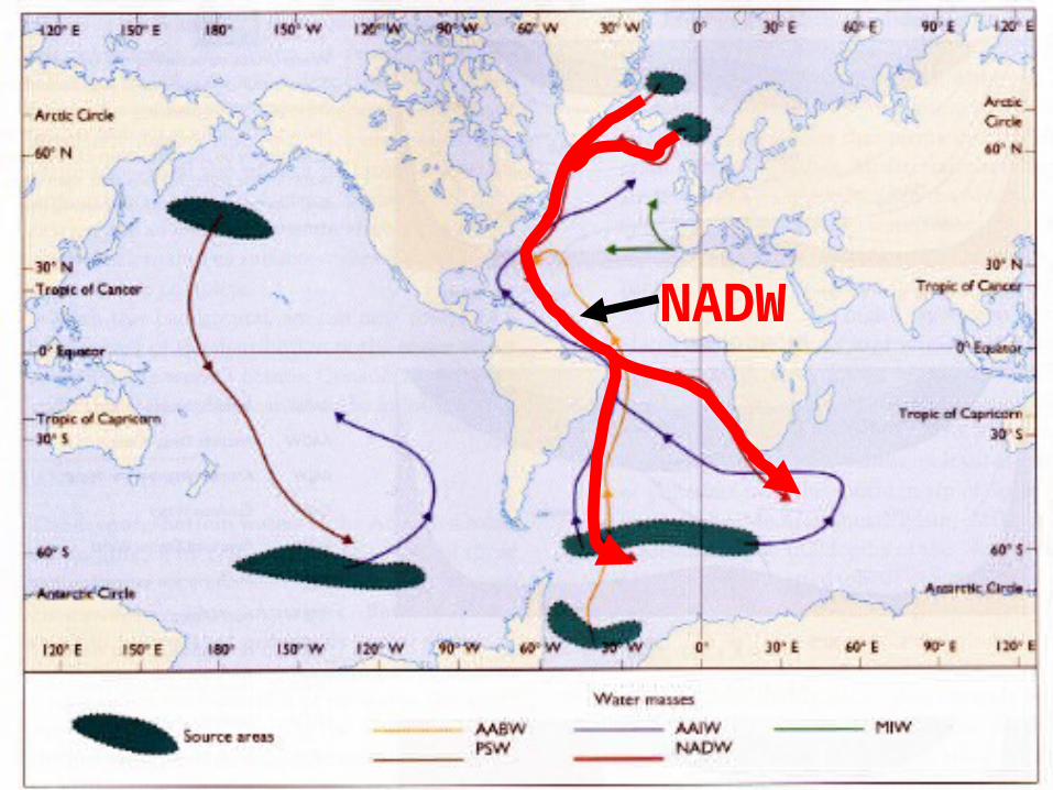
NADW
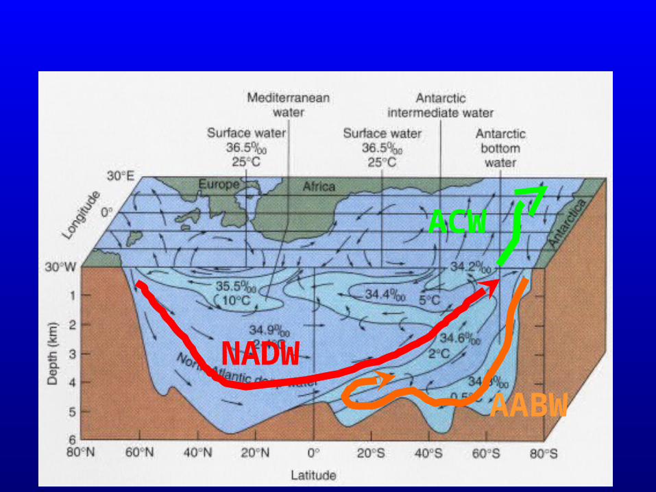
NADW
AABW
ACW
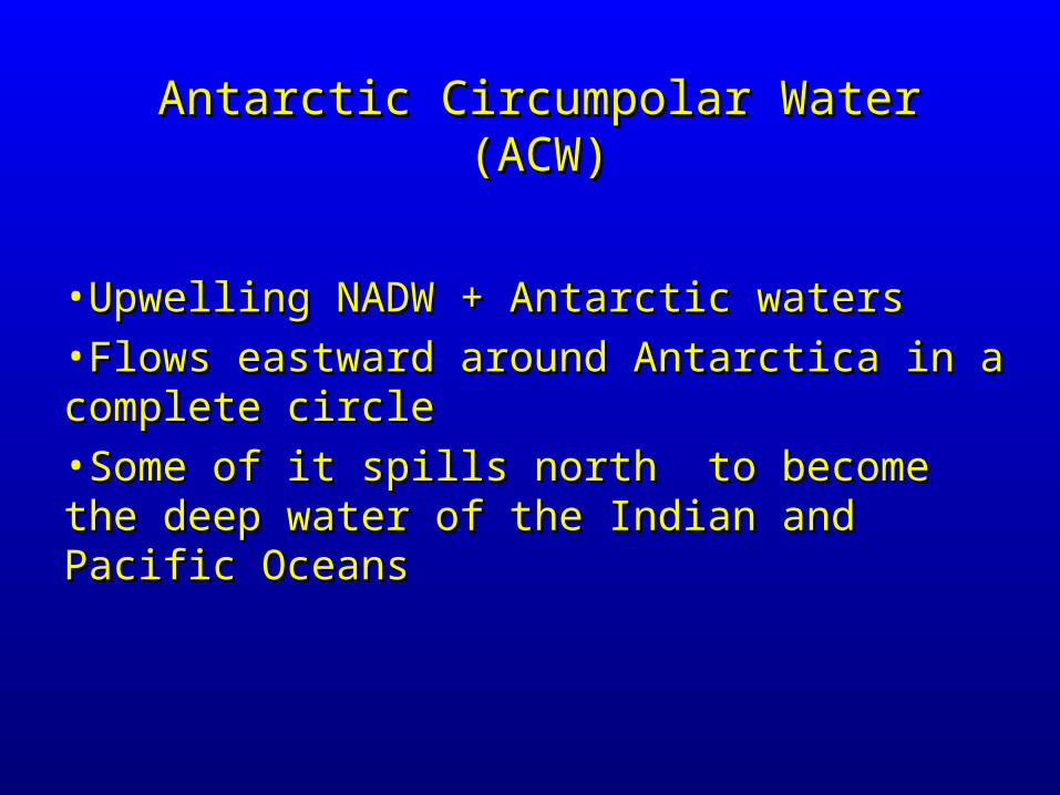
•Upwelling NADW + Antarctic watersUpwelling NADW + Antarctic waters•Flows eastward around Antarctica in a complete Flows eastward around Antarctica in a complete circlecircle•Some of it spills north to become the deep water Some of it spills north to become the deep water of the Indian and Pacific Oceansof the Indian and Pacific Oceans
Antarctic Circumpolar Water (ACW)Antarctic Circumpolar Water (ACW)
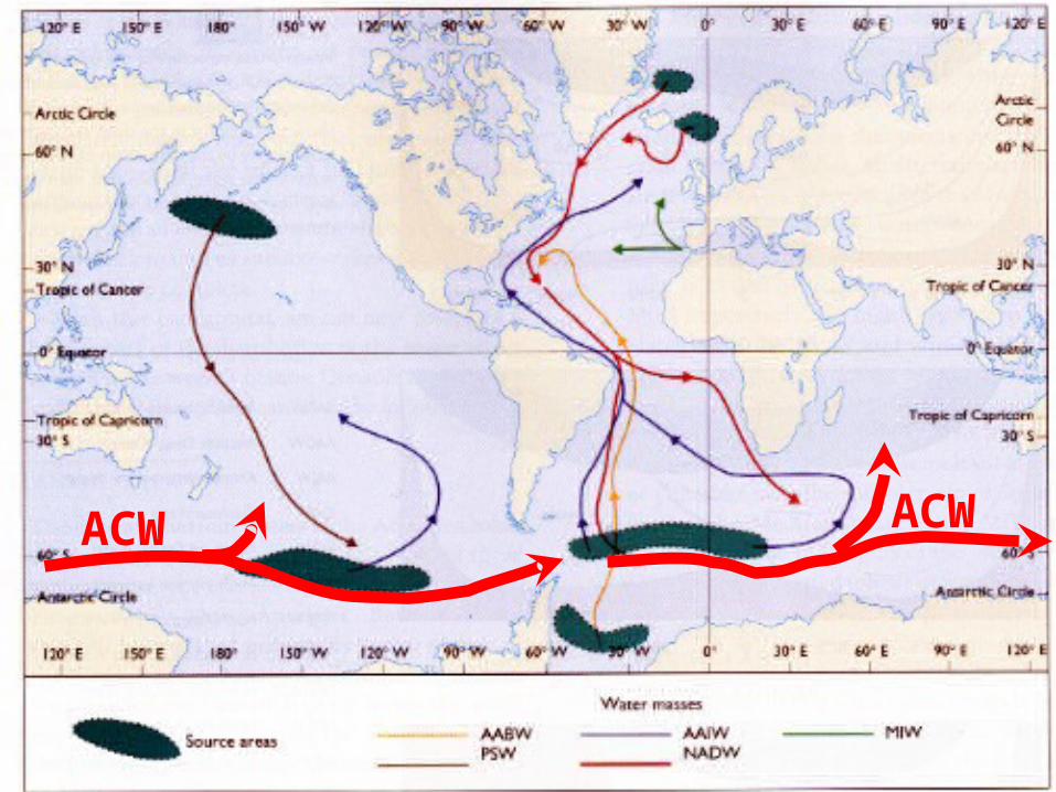
ACW ACW

NADW
AABW
ACW
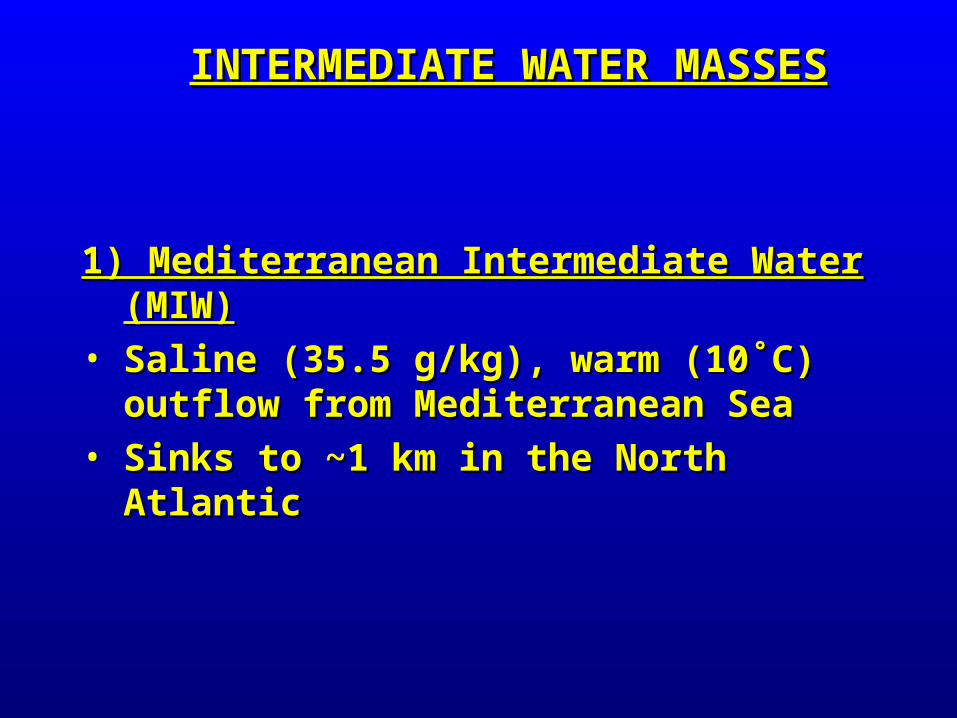
1) Mediterranean Intermediate Water (MIW)1) Mediterranean Intermediate Water (MIW)• Saline (35.5 g/kg), warm (10˚C) outflow from Saline (35.5 g/kg), warm (10˚C) outflow from
Mediterranean SeaMediterranean Sea• Sinks to ~1 km in the North AtlanticSinks to ~1 km in the North Atlantic
INTERMEDIATE WATER MASSESINTERMEDIATE WATER MASSES
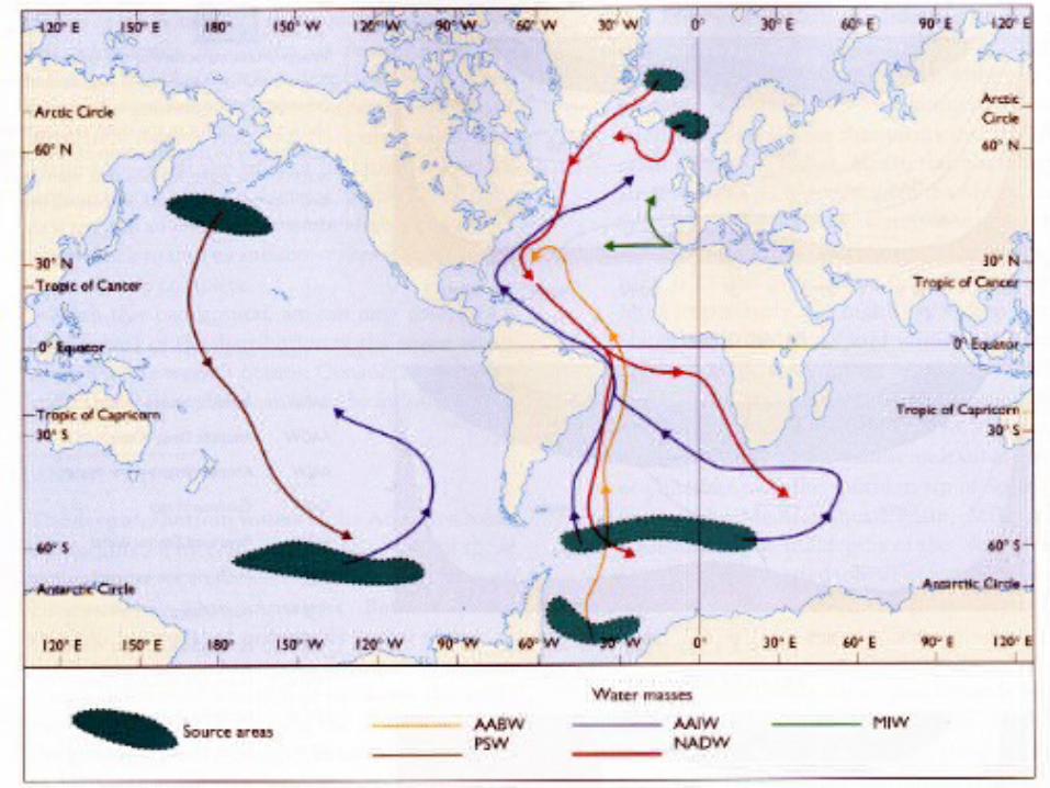
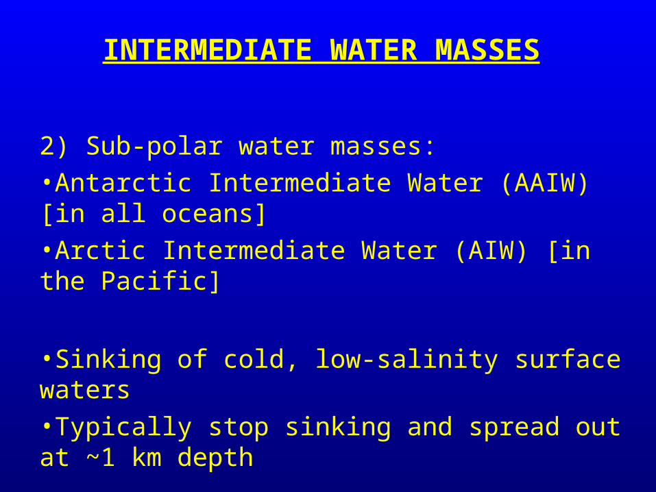
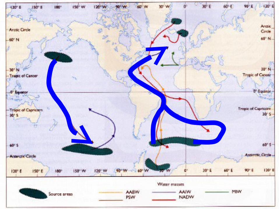
2) Sub-polar water masses: •Antarctic Intermediate Water (AAIW) [in all oceans]•Arctic Intermediate Water (AIW) [in the Pacific]
•Sinking of cold, low-salinity surface waters•Typically stop sinking and spread out at ~1 km depth
INTERMEDIATE WATER MASSES
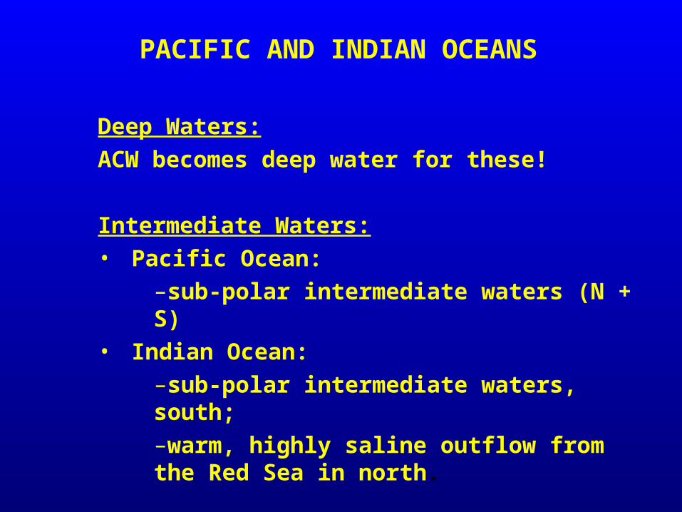
Deep Waters:
ACW becomes deep water for these!
Intermediate Waters:• Pacific Ocean:
–sub-polar intermediate waters (N + S)• Indian Ocean:
–sub-polar intermediate waters, south;–warm, highly saline outflow from the Red Sea in north.
PACIFIC AND INDIAN OCEANS
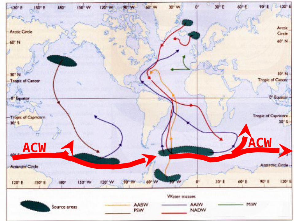
ACW ACW
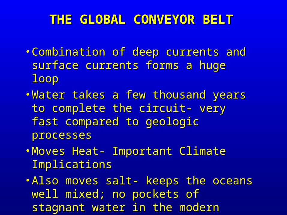
• Combination of deep currents and surface Combination of deep currents and surface currents forms a huge loopcurrents forms a huge loop
• Water takes a few thousand years to Water takes a few thousand years to complete the circuit- very fast compared to complete the circuit- very fast compared to geologic processesgeologic processes
• Moves Heat- Important Climate ImplicationsMoves Heat- Important Climate Implications• Also moves salt- keeps the oceans well Also moves salt- keeps the oceans well
mixed; no pockets of stagnant water in the mixed; no pockets of stagnant water in the modern oceansmodern oceans
THE GLOBAL CONVEYOR BELTTHE GLOBAL CONVEYOR BELT
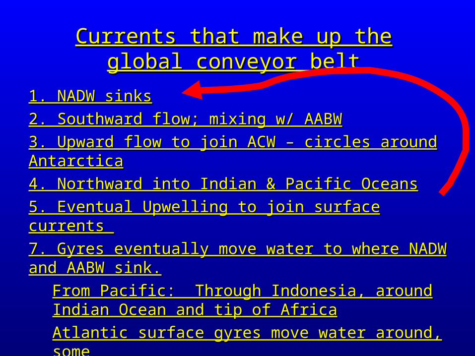
1. NADW sinks1. NADW sinks
2. Southward flow; mixing w/ AABW2. Southward flow; mixing w/ AABW
3. Upward flow to join ACW – circles around Antarctica3. Upward flow to join ACW – circles around Antarctica
4. Northward into Indian & Pacific Oceans4. Northward into Indian & Pacific Oceans
5. Eventual Upwelling to join surface currents 5. Eventual Upwelling to join surface currents
7. Gyres eventually move water to where NADW and AABW 7. Gyres eventually move water to where NADW and AABW sink.sink.
From Pacific: Through Indonesia, around Indian Ocean From Pacific: Through Indonesia, around Indian Ocean and tip of Africaand tip of Africa
Atlantic surface gyres move water around, someAtlantic surface gyres move water around, some goes to NADW/AABW formation zones goes to NADW/AABW formation zones
Currents that make up the global Currents that make up the global conveyor beltconveyor belt

Northern European Climate: Northern European Climate:
•NADW sinking draws warm water farther northwardNADW sinking draws warm water farther northward•Northern Europe receives warm air from this- westerliesNorthern Europe receives warm air from this- westerlies•If NADW flow stopped, warm water would not go as far northIf NADW flow stopped, warm water would not go as far north•Northern Europe would become coolerNorthern Europe would become cooler
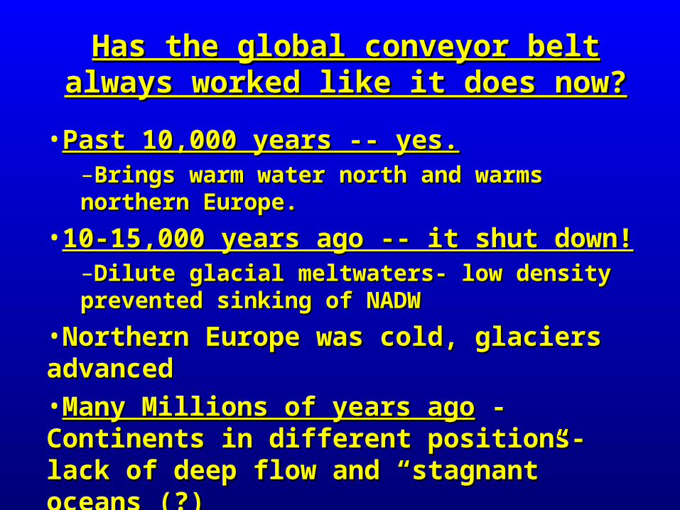
•Past 10,000 years -- yes.Past 10,000 years -- yes. –Brings warm water north and warms northern Brings warm water north and warms northern Europe.Europe.
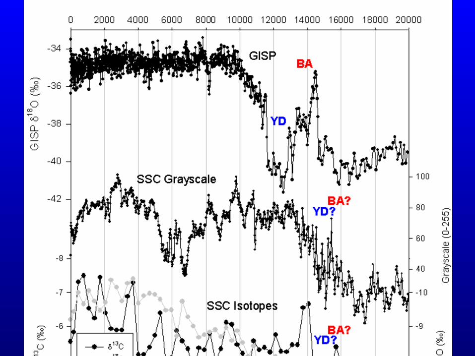
•10-15,000 years ago -- it shut down!10-15,000 years ago -- it shut down!–Dilute glacial meltwaters- low density prevented Dilute glacial meltwaters- low density prevented sinking of NADWsinking of NADW
•Northern Europe was cold, glaciers advancedNorthern Europe was cold, glaciers advanced•Many Millions of years agoMany Millions of years ago - Continents in - Continents in different positions- lack of deep flow and different positions- lack of deep flow and “stagnant” oceans (?)“stagnant” oceans (?)
Has the global conveyor belt always Has the global conveyor belt always worked like it does now?worked like it does now?