updated 10/2015
Davison Community Schools
ADVISORY CURRICULUM COUNCIL
6th Grade Social Studies
Phase I/II, 6-13-17
6th Grade CI World Geography 6th Grade Course Essential Questions (Geographic Perspective)
1. What are the natural characteristics of earth?
2. What are human characteristics of earth?
3. How do people interact with the earth?
Phase II Curriculum Unit 1: Foundations of World Geography
Essential Questions:
1. How can the five themes of geography
help us investigate our world?
2. How can maps help us understand our
world?
Essential Understanding:
1. Geographers use the 5 themes of geography to
study our world.
2. Maps can help us locate physical and human
characteristics in our world.
Curriculum Standards- DOK noted where applicable with Standards History H1.4 Historical Understanding
Use historical concepts, patterns, and themes to study the past.
6 – H1.4.3 Use historical perspective to analyze global issues faced by humans long ago and today.
Geography G1 The World in Spatial Terms: Geographical Habits of Mind
Describe and study the relationships between people, places, and environments by using information that is in a geographic (spatial)
context. Engage in mapping and analyzing the information to explain the patterns and relationships they reveal both between and among
people, their cultures, and the natural environment. Identify and access information, evaluate it using criteria based on concepts and
themes, and use geography in problem solving and decision making. Explain and use key conceptual devices (places and regions, spatial
patterns and processes) that geographers use to organize information and inform their study of the world.
G1.1 Spatial Thinking
Use maps and other geographic tools to acquire and process information from a spatial perspective
6 – G1.1.1 Describe how geographers use mapping to represent places and natural and human phenomena in the world.
6-G1.1.1 Use maps, globes and web based geography technology to investigate the world at global, interregional, regional and local scales.
6 – G1.1.2 Draw a sketch map from memory of the Western Hemisphere showing the major regions (Canada, United States, Mexico, Central
America, South America, and Caribbean).
6-G1.1.2 Draw a sketch map or add information to an outline map of the world or a world region.
G1.2 Geographical Inquiry and Analysis
Use geographic inquiry and analysis to answer important questions about relationships between people, cultures, their environment, and
relations within the larger world context.
6 – G1.2.2 Explain why maps of the same place may vary, including cultural perspectives of the Earth and new knowledge based on science and
modern technology.
6-G1.2.2 Explain why maps of the same place may vary, including the perspectives and purposes of the cartographers.
6 – G1.2.4 Use observations from air photos, photographs (print and CD), films (VCR and DVD) as the basis for answering geographic questions
about the human and physical characteristics of places and regions.
6-G1.2.4 Use images as the basis for answering geographic questions about the human and physical characteristics of places and major
world regions.
6 – G1.2.5 Use information from modern technology such as Geographic Positioning System (GPS), Geographic Information System (GIS), and
satellite remote sensing to locate information and process maps and data to analyze spatial patterns of the Western Hemisphere to answer
updated 10/2015
geographic questions.
6-G1.2.5 Locate and use information from Geographic Information Systems (GIS) and satellite remote sensing to answer geographic
questions.
G1.3 Geographical Understanding
Use geographic themes, knowledge about processes and concepts to study the Earth.
6 – G1.3.1 Use the fundamental themes of geography (location, place, human environment interaction, movement, region) to describe regions or
places on earth.
6– G1.3.1 Use the fundamental themes of geography (location, place, human environment interaction, movement, region) to describe regions
or places on earth.
6 – G1.3.2 Explain the locations and distributions of physical and human characteristics of Earth by using knowledge of spatial patterns.
6 – G1.3.2 Use maps of physical features, land-use, and transportation to generalize about the reasons for the distribution of population.
6 – G1.3.3 Explain the different ways in which places are connected and how those connections demonstrate interdependence and accessibility.
6 – G1.3.3 Explain the different ways in which places are connected and how those connections demonstrate interdependence and
accessibility.
G4.4 Forces of Cooperation and Conflict
Explain how forces of conflict and cooperation among people influence the division of the Earth’s surface and its resources.
6 – G4.4.1 Identify factors that contribute to conflict and cooperation between and among cultural groups (control/use of natural resources,
power, wealth, and cultural diversity).
6 – G4.4.1 Identify factors that contribute to conflict and cooperation between and among cultural groups (e.g., control/use of natural
resources, power, wealth, and cultural diversity).
G5.2 Physical and Human Systems
Describe how physical and human systems shape patterns on the Earth’s surface.
6– G5.2.1 Describe the effects that a change in the physical environment could have on human activities and the choices people would have to
make in adjusting to the change (e.g., drought in northern Mexico, disappearance of forest vegetation in the Amazon, natural hazards and
disasters from volcanic eruptions in Central America and the Caribbean and earthquakes in Mexico City and Colombia).
6– G5.2.1 Describe the effects that a change in the physical environment could have on human activities and the choices people would have
to make in adjusting to the change.
History H1.2 Historical Inquiry and Analysis
Use historical inquiry and analysis to study the past.
7 – H1.2.5 Describe how historians use methods of inquiry to identify cause effect relationships in history noting that many have multiple causes.
7 – H1.2.5 Describe how historians use methods of inquiry to identify cause effect relationships in history noting that many have multiple
causes.
Geography 1 The World in Spatial Terms: Geographical Habits of Mind
Describe and study the relationships between people, places, and environments by using information that is in a geographic (spatial)
context. Engage in mapping and analyzing the information to explain the patterns and relationships they reveal both between and among
people, their cultures, and the natural environment. Identify and access information, evaluate it using criteria based on concepts and
themes, and use geography in problem solving and decision making. Explain and use key conceptual devices (places and regions, spatial
patterns and processes) that geographers use to organize information and inform their study of the world.
G1.1 Spatial Thinking
Use maps and other geographic tools to acquire and process information from a spatial perspective
7 – G1.1.1 Explain and use a variety of maps, globes, and web based geography technology to study the world, including global, interregional,
regional, and local scales.
7 – G1.1.2 Draw an accurate sketch map from memory of the Eastern Hemisphere showing the major regions (Africa, Asia, Europe,
Australia/Oceania, Antarctica).
G1.2 Geographical Inquiry and Analysis
Use geographic inquiry and analysis to answer important questions about relationships between people, cultures, their environment, and
relations within the larger world context.
7 – G1.2.3 Use observations from air photos, photographs (print and CD), films (VCR and DVD) as the basis for answering geographic questions
about the human and physical characteristics of places and regions.
7 – G1.2.5 Use information from modern technology such as Geographic Positioning System (GPS), Geographic Information System (GIS), and
satellite remote sensing to locate information and process maps and data to analyze spatial patterns of the Eastern Hemisphere to answer
geographic questions.
7 – G1.2.6 Apply the skills of geographic inquiry (asking geographic questions, acquiring geographic information, organizing geographic
information, analyzing geographic information, and answering geographic questions) to analyze a problem or issue of importance to a region of
the Eastern Hemisphere.
G1.3 Geographical Understanding
Use geographic themes, knowledge about processes and concepts to study the Earth.
updated 10/2015
7 – G1.3.1 Use the fundamental themes of geography (location, place, human environment interaction, movement, region) to describe regions or
places on earth.
7 – G1.3.2 Explain the locations and distributions of physical and human characteristics of Earth by using knowledge of spatial patterns.
7 – G1.3.3 Explain the different ways in which places are connected and how those connections demonstrate interdependence and accessibility.
Knowledge/Content
I Know … Skills/Processes
I Can …
Continents are large landmasses.
The hemispheres are north, south, east and
west.
The title, legend, compass rose, Prime
Meridian and equator are used to interpret
maps.
Geography is the study of our earth and
how humans interact with it.
The five themes of geography are
movement, region, human-environment
interactions, location and place.
Human geography is the study of how
humans interact with earth.
Physical geography is natural
characteristics such as landforms, bodies
of water, vegetation and climate.
Vocabulary
5 themes of Geography (Movement,
Region, Human-Environment Interactions,
Location and Place)
human geography
physical geography
hemisphere
Draw a sketch map of the world from memory
Label continents and oceans
Name hemispheres: north, south, east and west
Identify elements of a map: title, legend,
compass rose, Prime Meridian, equator
Define geography as the study of our earth and
how humans interact with it
List the 5 themes of geography
Explain the difference between human and
physical geography and give examples of each
updated 10/2015
Phase II Curriculum Unit 2: The World in Spatial Terms
Essential Questions:
1. How do geographers study our world?
2. How do the physical (natural) features
of earth present challenges and
opportunities for human societies?
3. How can a natural disaster effect
people’s lives?
Essential Understanding:
1. Geographers divide the earth into regions, areas
with similar characteristics, to study our world.
2. The geography of an area effects the way of life
for people.
3. Natural disasters can have a negative impact
people.
Curriculum Standards- DOK noted where applicable with Standards Geography G1 The World in Spatial Terms: Geographical Habits of Mind
Describe and study the relationships between people, places, and environments by using information that is in a geographic (spatial)
context. Engage in mapping and analyzing the information to explain the patterns and relationships they reveal both between and among
people, their cultures, and the natural environment. Identify and access information, evaluate it using criteria based on concepts and
themes, and use geography in problem solving and decision making. Explain and use key conceptual devices (places and regions, spatial
patterns and processes) that geographers use to organize information and inform their study of the world.
G1.1 Spatial Thinking
Use maps and other geographic tools to acquire and process information from a spatial perspective
6 – G1.1.1 Describe how geographers use mapping to represent places and natural and human phenomena in the world.
6– G1.1.1 Use maps, globes, and web based geography technology to investigate the world at global, interregional, regional, and local scales. 6 – G1.1.2 Draw a sketch map from memory of the Western Hemisphere showing the major regions (Canada, United States, Mexico, Central
America, South America, and Caribbean).
6 – G1.1.2 Draw a sketch map or add information to an outline map of the world or a world region.
G1.2 Geographical Inquiry and Analysis
Use geographic inquiry and analysis to answer important questions about relationships between people, cultures, their environment, and
relations within the larger world context.
6 – G1.2.2 Explain why maps of the same place may vary, including cultural perspectives of the Earth and new knowledge based on science and
modern technology.
6 – G1.2.2 Explain why maps of the same place may vary, including the perspectives and purposes of the cartographers.
G1.2 Geographical Inquiry and Analysis
Use skills of geographic inquiry and analysis to answer important questions about relationships between people, their cultures, and their
environment, in their community and within the larger world context. Students use information to make reasoned judgments based on the
authenticity of the information, their skill at critically analyzing the information, and presenting the results.
6– G1.2.3 Use, interpret and create maps and graphs representing population characteristics, natural features, and land-use of the region under
study.
6 – G1.2.4 Use observations from air photos, photographs (print and CD), films (VCR and DVD) as the basis for answering geographic questions
about the human and physical characteristics of places and regions.
6– G1.2.4 Use images as the basis for answering geographic questions about the human and physical characteristics of places and major
world regions.
6 – G1.2.5 Use information from modern technology such as Geographic Positioning System (GPS), Geographic
Information System (GIS), and satellite remote sensing to locate information and process maps and data to analyze spatial patterns of the Western
Hemisphere to answer geographic questions.
6– G1.2.5 Locate and use information from Geographic Information Systems (GIS) and satellite remote sensing to answer geographic
questions.
6 – G1.2.6 Apply the skills of geographic inquiry (asking geographic questions, acquiring geographic information, organizing geographic
information, analyzing geographic information, and answering geographic questions) to analyze a problem or issue of importance to a region of
the Western Hemisphere.
G1.3 Geographical Understanding
Use geographic themes, knowledge about processes and concepts to study the Earth. The nature and uses of geography as a discipline and the
spatial perspective require that students observe, interpret, assess, and apply geographic information and skills. The uses of the subject and
content of geography are essential in the development of geographical understanding. A spatial perspective enables student to observe, describe,
updated 10/2015
and analyze the organizations of people, places, and environments at different scales and is central to geographic literacy.
6 – G1.3.1 Use the fundamental themes of geography (location, place, human environment interaction, movement, region) to describe regions
or places on earth.
6 – G1.3.2 Use maps of physical features, land-use, and transportation to generalize about the reasons for the distribution of population.
.G1.3 Geographical Understanding
Use geographic themes, knowledge about processes and concepts to study the Earth.
7 – G1.3.1 Use the fundamental themes of geography (location, place, human environment interaction, movement, region) to describe regions or
places on earth.
G2 Places and Regions
Describe the cultural groups and diversities among people that are rooted in particular places and in human constructs called regions.
Analyze the physical and human characteristics of places and regions.
G2.1 Physical Characteristics of Place Describe the physical characteristics of places.
6 – G2.1.1 Describe the landform features and the climate of the region (within the Western or Eastern Hemispheres) under study.
6 – G2.1.1 Locate and describe the landforms, ecosystems, and the climate of the region under study
6 – G2.1.2 Account for topographic and human spatial patterns (where people live) associated with tectonic plates such as volcanoes,
earthquakes, settlements (Ring of Fire, recent volcanic and seismic events, settlements in proximity to natural hazards in the Western
Hemisphere) by using information from GIS, remote sensing, and the World Wide Web.
6 – G2.1.2 Describe the basic patterns and processes of plate tectonics (e.g., plates, plate boundaries, uplift, earthquakes, volcanos and the
ring of fire).
G2.2 Human Characteristics of Place
Describe the human characteristics of places.
6 – G2.2.2 Explain that communities are affected positively or negatively by changes in technology (e.g., Canada with regard to mining, forestry,
hydroelectric power generation, agriculture, snowmobiles, cell phones, air travel).
6 – G2.2.2 Explain how communities are affected positively or negatively by changes in technology.
G3.2 Ecosystems
Describe the characteristics and spatial distribution of ecosystems on the Earth’s surface.
6 – G3.1.2 Explain the factors which cause different types of climates (e.g., latitude, elevation, marine and continental locations, and rain
shadow effect).
6 – G3.2.2 Identify ecosystems and explain why some are more attractive for humans to use than are others (e.g., mid-latitude forest in North
America, high latitude of Peru, tropical forests in Honduras, fish or marine vegetation in coastal zones).
6– G3.2.2 Identify major ecosystems of the region under study and explain why some provide greater opportunities (fertile soil, length of
growing season, precipitation) for humans and how landuse changes with technology.
G5.2 Physical and Human Systems
Describe how physical and human systems shape patterns on the Earth’s surface.
6– G5.2.1 Describe the effects that a change in the physical environment could have on human activities and the choices people would have to
make in adjusting to the change (e.g., drought in northern Mexico, disappearance of forest vegetation in the Amazon, natural hazards and
disasters from volcanic eruptions in Central America and the Caribbean and earthquakes in Mexico City and Colombia).
6– G5.2.1 Describe the effects that a change in the physical environment could have on human activities and the choices people would have
to make in adjusting to the change.
6– G5.2.2 Describe how combinations of human decisions and natural forces can lead to (or help people avoid) a natural disaster.
Civics & Government C4 Relationship of United States to Other Nations And World Affairs
Explain that nations interact with one another through trade, diplomacy, treaties and agreements, humanitarian aid, economic sanctions
and incentives, and military force, and threat of force.
C4.3 Conflict and Cooperation Between and Among Nations Explain the various ways that nations interact both positively and
negatively.
6 – C4.3.3 Give examples of how countries work together for mutual benefits through international organizations (e.g. North American Free
Trade Agreement (NAFTA), Organization of American States (OAS), United Nations (UN)).
6– C4.3.3 Analyze the impact of treaties, agreements, and international organizations on global issues.
History H1.2 Historical Inquiry and Analysis
Use historical inquiry and analysis to study the past.
7 – H1.2.3 Identify the point of view (perspective of the author) and context when reading and discussing primary and secondary sources.
G1.1 Spatial Thinking
Use maps and other geographic tools to acquire and process information from a spatial perspective
7 – G1.1.1 Explain and use a variety of maps, globes, and web based geography technology to study the world, including global, interregional,
regional, and local scales.
G1.2 Geographical Inquiry and Analysis
updated 10/2015
Use geographic inquiry and analysis to answer important questions about relationships between people, cultures, their environment, and
relations within the larger world context.
7 – G1.2.1 Locate the major landforms, rivers and climate regions of the Eastern Hemisphere.
7 – G1.2.2 Explain why maps of the same place may vary as a result of the cultural or historical background of the cartographer.
7 – G1.2.3 Use observations from air photos, photographs (print and CD), films (VCR and DVD) as the basis for answering geographic questions
about the human and physical characteristics of places and regions.
7 – G1.2.5 Use information from modern technology such as Geographic Positioning System (GPS), Geographic Information System (GIS), and
satellite remote sensing to locate information and process maps and data to analyze spatial patterns of the Eastern Hemisphere to answer
geographic questions.
7 – G1.2.6 Apply the skills of geographic inquiry (asking geographic questions, acquiring geographic information, organizing geographic
information, analyzing geographic information, and answering geographic questions) to analyze a problem or issue of importance to a region of
the Eastern Hemisphere
G1.3 Geographical Understanding
Use geographic themes, knowledge about processes and concepts to study the Earth.
7 – G1.3.1 Use the fundamental themes of geography (location, place, human environment interaction, movement, region) to describe regions or
places on earth.
7 – G1.3.2 Explain the locations and distributions of physical and human characteristics of Earth by using knowledge of spatial patterns.
G2 Places and Regions Describe the cultural groups and diversities among people that are rooted in particular places and in human
constructs called regions. Analyze the physical and human characteristics of places and regions.
G2.1 Physical Characteristics of Place
Describe the physical characteristics of places.
7 – G2.1.1 Describe the landform features and the climate of the region (within the Western or Eastern Hemispheres) under study.
G2.2 Human Characteristics of Place
Describe the human characteristics of places.
7 – G2.2.2 Explain that communities are affected positively or negatively by changes in technology (e.g., increased manufacturing resulting in
rural to urban migration in China, increased farming of fish, hydroelectric power generation at Three Gorges, pollution resulting from increased
manufacturing and automobiles).
G3.2 Ecosystems
Describe the characteristics and spatial distribution of ecosystems on the Earth’s surface.
7 – G3.2.2 Identify ecosystems of a continent and explain why some provide greater opportunities (fertile soil, precipitation) for humans to use
than do other ecosystems and how that changes with technology (e.g., China’s humid east and arid west and the effects of irrigation technology).
5.2 Physical and Human Systems
Describe how physical and human systems shape patterns on the Earth’s surface.
7 – G5.2.1 Describe the effects that a change in the physical environment could have on human activities and the choices people would have to
make in adjusting to the change (e.g., drought in Africa, pollution from volcanic eruptions in Indonesia, earthquakes in Turkey, and flooding in
Bangladesh).
Civics & Government C4 Relationship of United States to Other Nations And World Affairs
Explain that nations interact with one another through trade, diplomacy, treaties and agreements, humanitarian aid, economic sanctions
and incentives, and military force, and threat of force.
C4.3 Conflict and Cooperation Between and Among Nations
Explain the various ways that nations interact both positively and negatively.
7 – C4.3.1 Explain how governments address national issues and form policies, and how the policies may not be consistent with those of other
countries (e.g., population pressures in China compared to Sweden; international immigration quotas, international aid, energy needs for natural
gas and oil and military aid).
updated 10/2015
Knowledge/Content
I Know … Skills/Processes
I Can …
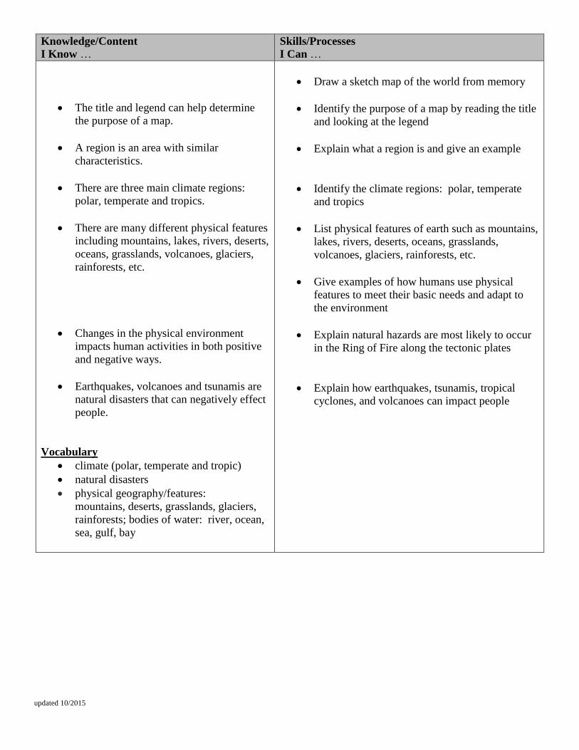
The title and legend can help determine
the purpose of a map.
A region is an area with similar
characteristics.
There are three main climate regions:
polar, temperate and tropics.
There are many different physical features
including mountains, lakes, rivers, deserts,
oceans, grasslands, volcanoes, glaciers,
rainforests, etc.
Changes in the physical environment
impacts human activities in both positive
and negative ways.
Earthquakes, volcanoes and tsunamis are
natural disasters that can negatively effect
people.
Vocabulary
climate (polar, temperate and tropic)
natural disasters
physical geography/features:
mountains, deserts, grasslands, glaciers,
rainforests; bodies of water: river, ocean,
sea, gulf, bay
Draw a sketch map of the world from memory
Identify the purpose of a map by reading the title
and looking at the legend
Explain what a region is and give an example
Identify the climate regions: polar, temperate
and tropics
List physical features of earth such as mountains,
lakes, rivers, deserts, oceans, grasslands,
volcanoes, glaciers, rainforests, etc.
Give examples of how humans use physical
features to meet their basic needs and adapt to
the environment
Explain natural hazards are most likely to occur
in the Ring of Fire along the tectonic plates
Explain how earthquakes, tsunamis, tropical
cyclones, and volcanoes can impact people
updated 10/2015
Phase II Curriculum Unit 3: Population and Migration
Essential Questions:
1. Why do people move?
2. Why are certain areas more populated
than others?
Essential Understanding:
1. People move for a variety of reasons.
2. The movement of people affects how population
grows in different areas.
Curriculum Standards- DOK noted where applicable with Standards 6th Grade
History
H1.2 Historical Inquiry and Analysis
Use historical inquiry and analysis to study the past.
6 – H1.2.1 Explain how historians use a variety of sources to explore the past (e.g., artifacts, primary and secondary sources including narratives,
technology, historical maps, visual/mathematical quantitative data, radiocarbon dating, DNA analysis).
6 – H1.2.3 Identify the point of view (perspective of the author) and context when reading and discussing primary and secondary sources.
6 – H1.2.4 Compare and evaluate competing historical perspectives about the past based on proof.
H1.4 Historical Understanding
Use historical concepts, patterns, and themes to study the past.
6 – H1.4.3 Use historical perspective to analyze global issues faced by humans long ago and today.
W1 WHG Era 1 – The Beginings of Human Society: Beginings to 4000 B.C.E./B.C.
Explain the basic features and differences between hunter-gatherer societies and pastoral nomads. Analyze and explain the geographic,
environmental, biological, and cultural processes that influenced the rise of the earliest human communities, the migration and spread of
people throughout the world, and the causes and consequences of the growth of agriculture.
W1.1 Peopling of the Earth
Describe the spread of people in the Western Hemisphere in Era 1.
6 – W1.1.1 Describe the early migrations of people among Earth’s continents (including the Berringa Land Bridge).
6 – W1.1.2 Examine the lives of hunting and gathering people during the earliest eras of human society (tools and weapons, language, fire).
Geography G1 The World in Spatial Terms: Geographical Habits of Mind
Describe and study the relationships between people, places, and environments by using information that is in a geographic (spatial)
context. Engage in mapping and analyzing the information to explain the patterns and relationships they reveal both between and among
people, their cultures, and the natural environment. Identify and access information, evaluate it using criteria based on concepts and
themes, and use geography in problem solving and decision making. Explain and use key conceptual devices (places and regions, spatial
patterns and processes) that geographers use to organize information and inform their study of the world.
G1.1 Spatial Thinking
Use maps and other geographic tools to acquire and process information from a spatial perspective
6 – G1.1.1 Describe how geographers use mapping to represent places and natural and human phenomena in the world.
6 – G1.1.1 Use maps, globes, and web based geography technology to investigate the world at global, interregional, regional, and local scales.
6 – G1.1.2 Draw a sketch map from memory of the Western Hemisphere showing the major regions (Canada, United States)
6– G1.1.2 Draw a sketch map or add information to an outline map of the world or a world region.
G1.2 Geographical Inquiry and Analysis
Use geographic inquiry and analysis to answer important questions about relationships between people, cultures, their environment, and
relations within the larger world context.
6 – G1.2.3 Use data to create thematic maps and graphs showing patterns of population, physical terrain, rainfall, and vegetation, analyze the
patterns and then propose two generalizations about the location and density of the population.
6 – G1.2.3 Use, interpret and create maps and graphs representing population characteristics, natural features, and land-use of the region
under study.
6 – G1.2.4 Use observations from air photos, photographs (print and CD), films (VCR and DVD) as the basis for answering geographic questions
about the human and physical characteristics of places and regions.
6 – G1.2.4 Use images as the basis for answering geographic questions about the human and physical characteristics of places and major
world regions.
6 – G1.2.5 Use information from modern technology such as Geographic Positioning System (GPS), Geographic
Information System (GIS), and satellite remote sensing to locate information and process maps and data to analyze spatial patterns of the Western
Hemisphere to answer geographic questions.
6 – G1.2.5 Locate and use information from Geographic Information Systems (GIS) and satellite remote sensing to answer geographic
questions.
updated 10/2015
6 – G1.2.6 Apply the skills of geographic inquiry (asking geographic questions, acquiring geographic information, organizing geographic
information, analyzing geographic information, and answering geographic questions) to analyze a problem or issue of importance to a region of
the Western Hemisphere.
6– G1.2.6 Create or interpret a map of the population distribution of a region and generalize about the factors influencing the distribution of
the population.
G1.3 Geographical Understanding
Use geographic themes, knowledge about processes and concepts to study the Earth.
6 – G1.3.1 Use the fundamental themes of geography (location, place, human environment interaction, movement, region) to
describe regions or places on earth. 6– G1.3.1 Use the fundamental themes of geography (location, place, human environment interaction, movement, region) to describe regions
or places on earth.
6 – G1.3.2 Explain the locations and distributions of physical and human characteristics of Earth by using knowledge of spatial
patterns. 6– G1.3.2 Use maps of physical features, land-use, and transportation to generalize about the reasons for the distribution of population.
6 – G1.3.3 Explain the different ways in which places are connected and how those connections demonstrate interdependence and
accessibility. 6 – G1.3.3 Explain the different ways in which places are connected and how those connections demonstrate interdependence and
accessibility.
G2.2 Human Characteristics of Place
Describe the human characteristics of places.
6 – G2.2.1 Describe the human characteristics of the region under study (including languages, religion, economic system,
governmental system, cultural traditions). 6 – G2.2.1 Describe the human characteristics of the region under study (including languages, religion, economic system, governmental
system, cultural traditions).
G3.2 Ecosystems
Describe the characteristics and spatial distribution of ecosystems on the Earth’s surface.
6 – G3.2.2 Identify ecosystems and explain why some are more attractive for humans to use than are others (e.g., mid-latitude forest in North
America, high latitude of Peru, tropical forests in Honduras, fish or marine vegetation in coastal zones).
6 – G3.2.2 Identify major ecosystems of the region under study and explain why some provide greater opportunities (fertile soil, length of
growing season, precipitation) for humans and how land use changes with technology.
G4.3 Patterns of Human Settlement
Describe patterns, processes, and functions of human settlement.
6 – G4.3.2 Describe patterns of settlement by using historical and modern maps (e.g., coastal and river cities and towns in the past and present,
locations of megacities – modern cities over 5 million, such as Mexico City, and patterns of agricultural settlements in South and North
America).
6 – G4.3.2 Describe patterns of settlement and explain why people settle where they do (e.g., coastal and river towns in the past and present,
location of megacities).
G5 Environment and Society
Explain that the physical environment is modified by human activities, which are influenced by the ways in which human societies value
and use Earth’s natural resources, and by Earth’s physical features and processes. Explain how human action modifies the physical
environment and how physical systems affect human systems.
G5.1 Humans and the Environment
Describe how human actions modify the environment.
6 – G5.1.1 Describe the environmental effects of human action on the atmosphere (air), biosphere (people, animals, and plants), lithosphere
(soil), and hydrosphere (water) (e.g., changes in the tropical forest environments in Brazil, Peru, and Costa Rica).
6 – G5.1.1 Describe examples of how humans have impacted and are continuing to impact the environment in different places as a
consequence of population size, level of consumption, and technology.
Civics & Government C4 Relationship of United States to Other Nations And World Affairs
Explain that nations interact with one another through trade, diplomacy, treaties and agreements, humanitarian aid, economic sanctions
and incentives, and military force, and threat of force.
C4.3 Conflict and Cooperation Between and Among Nations Explain the various ways that nations interact both positively and
negatively.
6 – C4.3.2 Explain the challenges to governments and the cooperation needed to address international issues in the Western Hemisphere (e.g.,
migration and human rights).
6 – C4.3.2 Explain the challenges to governments and the cooperation needed to address international issues (e.g., migration and human
rights).
6 – C4.3.3 Give examples of how countries work together for mutual benefits through international organizations (e.g. North American Free
Trade Agreement (NAFTA), Organization of American States (OAS), United Nations (UN)).
6 – C4.3.3 Analyze the impact of treaties, agreements, and international organizations on global issues.
updated 10/2015
Economics E2 The National Economy
Use economic concepts, terminology, and data to identify and describe how a national economy functions and to study the role of
government as a provider of goods and services within a national economy.
E2.3 Role of Government
Describe how national governments make decisions that affect the national economy
6 – E2.3.1 Describe the impact of governmental policy (sanctions, tariffs, treaties) on that country and on other countries that use its resources.
6 – E2.3.1 Describe the impact of governmental policy (e.g., sanctions, tariffs, treaties) on that country and on other countries that use its
resources.
History H1.2 Historical Inquiry and Analysis
Use historical inquiry and analysis to study the past.
7 – H1.2.1 Explain how historians use a variety of sources to explore the past (e.g., artifacts, primary and secondary sources including narratives,
technology, historical maps, visual/mathematical quantitative data, radiocarbon dating, DNA analysis).
7 – H1.2.3 Identify the point of view (perspective of the author) and context when reading and discussing primary and secondary sources.
7 – H1.2.4 Compare and evaluate competing historical perspectives about the past based on proof.
H1.4 Historical Understanding
Use historical concepts, patterns, and themes to study the past.
7 – H1.4.3 Use historical perspectives to analyze global issues faced by humans long ago and today.
Geography G1.1 Spatial Thinking
Use maps and other geographic tools to acquire and process information from a spatial perspective
7 – G1.1.1 Explain and use a variety of maps, globes, and web based geography technology to study the world, including global, interregional,
regional, and local scales.
G1.2 Geographical Inquiry and Analysis
Use geographic inquiry and analysis to answer important questions about relationships between people, cultures, their environment, and
relations within the larger world context.
7 – G1.2.1 Locate the major landforms, rivers and climate regions of the Eastern Hemisphere.
7 – G1.2.2 Explain why maps of the same place may vary as a result of the cultural or historical background of the cartographer.
7 – G1.2.3 Use observations from air photos, photographs (print and CD), films (VCR and DVD) as the basis for answering geographic questions
about the human and physical characteristics of places and regions.
7 – G1.2.5 Use information from modern technology such as Geographic Positioning System (GPS), Geographic Information System (GIS), and
satellite remote sensing to locate information and process maps and data to analyze spatial patterns of the Eastern Hemisphere to answer
geographic questions.
7 – G1.2.6 Apply the skills of geographic inquiry (asking geographic questions, acquiring geographic information, organizing geographic
information, analyzing geographic information, and answering geographic questions) to analyze a problem or issue of importance to a region of
the Eastern Hemisphere
G1.3 Geographical Understanding
Use geographic themes, knowledge about processes and concepts to study the Earth.
7 – G1.3.1 Use the fundamental themes of geography (location, place, human environment interaction, movement, region) to describe regions or
places on earth.
7 – G1.3.2 Explain the locations and distributions of physical and human characteristics of Earth by using knowledge of spatial patterns.
G2 Places and Regions Describe the cultural groups and diversities among people that are rooted in particular places and in human
constructs called regions. Analyze the physical and human characteristics of places and regions.
G2.1 Physical Characteristics of Place
Describe the physical characteristics of places.
7 – G2.1.1 Describe the landform features and the climate of the region (within the Western or Eastern Hemispheres) under study.
G2.2 Human Characteristics of Place
Describe the human characteristics of places.
7 – G2.2.2 Explain that communities are affected positively or negatively by changes in technology (e.g., increased manufacturing resulting in
rural to urban migration in China, increased farming of fish, hydroelectric power generation at Three Gorges, pollution resulting from increased
manufacturing and automobiles).
G3.2 Ecosystems
Describe the characteristics and spatial distribution of ecosystems on the Earth’s surface.
7 – G3.2.2 Identify ecosystems of a continent and explain why some provide greater opportunities (fertile soil, precipitation) for humans to use
than do other ecosystems and how that changes with technology (e.g., China’s humid east and arid west and the effects of irrigation technology).
5.2 Physical and Human Systems
updated 10/2015
Describe how physical and human systems shape patterns on the Earth’s surface.
7 – G5.2.1 Describe the effects that a change in the physical environment could have on human activities and the choices people would have to
make in adjusting to the change (e.g., drought in Africa, pollution from volcanic eruptions in Indonesia, earthquakes in Turkey, and flooding in
Bangladesh).
Civics & Government C4 Relationship of United States to Other Nations And World Affairs
Explain that nations interact with one another through trade, diplomacy, treaties and agreements, humanitarian aid, economic sanctions
and incentives, and military force, and threat of force.
C4.3 Conflict and Cooperation Between and Among Nations
Explain the various ways that nations interact both positively and negatively.
7 – C4.3.1 Explain how governments address national issues and form policies, and how the policies may not be consistent with those of other
countries (e.g., population pressures in China compared to Sweden; international immigration quotas, international aid, energy needs for natural
gas and oil and military aid).
Knowledge/Content
I Know … Skills/Processes
I Can …
Population maps show how people are
distributed in an area.
The geography of an area can effect the
population.
Population density is the number of
people per square mile.
Population growth depends on 3 factors:
birth rate, death rate and migration.
Migration is the movement of people from
one area to another.
Immigration is when people migrate into a
new region.
Immigration affects the size of the
population.
.
Vocabulary
immigration
migration
population density
Use a map to determine where people live
Explain how the geography of an area can
impact the number of people who live there
Define population density and discuss the
population density of the United States
List causes that influences where population is
distributed.
Define migration
Define immigration and explain how it affects
the size of the population.
Identify the cause and effect of consequences
with the increase of population.
updated 10/2015
Phase II Curriculum Unit 4: Culture
Essential Questions:
1. How and why are groups of people
culturally similar and different?
Essential Understanding:
1. People who live near one another have a similar
way of thinking and living, but people who live in
other areas or regions may have different values,
beliefs and behaviors that reflect their culture.
Curriculum Standards- DOK noted where applicable with Standards 6th Grade
History
H1.2 Historical Inquiry and Analysis
Use historical inquiry and analysis to study the past.
6 – H1.2.3 Identify the point of view (perspective of the author) and context when reading and discussing primary and secondary sources.
6 – H1.2.5 Identify the role of the individual in history and the significance of one person’s ideas.
H1.4 Historical Understanding
Use historical concepts, patterns, and themes to study the past.
6 – H1.4.1 Describe and use cultural institutions to study an era and a region (political, economic, religion/ belief, science/technology, written
language, education, family).
6 – H1.4.2 Describe and use themes of history to study patterns of change and continuity.
6 – H1.4.3 Use historical perspective to analyze global issues faced by humans long ago and today.
Geography G1.2 Geographical Inquiry and Analysis
Use geographic inquiry and analysis to answer important questions about relationships between people, cultures, their environment, and
relations within the larger world context.
6 – G1.2.4 Use observations from air photos, photographs (print and CD), films (VCR and DVD) as the basis for answering geographic questions
about the human and physical characteristics of places and regions.
6 – G1.2.4 Use images as the basis for answering geographic questions about the human and physical characteristics of places and major
world regions. 6 – G1.2.6 Apply the skills of geographic inquiry (asking geographic questions, acquiring geographic information, organizing geographic
information, analyzing geographic information, and answering geographic questions) to analyze a problem or issue of importance to a region of
the Western Hemisphere
6 – G1.2.6 Create or interpret a map of the population distribution of a region and generalize about the factors influencing the distribution of
the population.
G1.3 Geographical Understanding
Use geographic themes, knowledge about processes and concepts to study the Earth.
6 – G1.3.1 Use the fundamental themes of geography (location, place, human environment interaction, movement, region) to
describe regions or places on earth. 6 – G1.3.1 Use the fundamental themes of geography (location, place, human environment interaction, movement, region) to describe regions
or places on earth. 6 – G1.3.2 Explain the locations and distributions of physical and human characteristics of Earth by using knowledge of spatial
patterns. 6 – G1.3.2 Use maps of physical features, land-use, and transportation to generalize about the reasons for the distribution of population. 6 – G1.3.3 Explain the different ways in which places are connected and how those connections demonstrate interdependence and
accessibility. 6 – G1.3.3 Explain the different ways in which places are connected and how those connections demonstrate interdependence and
accessibility.
G2.2 Human Characteristics of Place
Describe the human characteristics of places.
6 – G2.2.1 Describe the human characteristics of the region under study (including languages, religion, economic system,
governmental system, cultural traditions). 6 – G2.2.1 Describe the human characteristics of the region under study (including languages, religion, economic system, governmental
system, cultural traditions).
G3.2 Ecosystems
Describe the characteristics and spatial distribution of ecosystems on the Earth’s surface.
6 – G3.2.2 Identify ecosystems and explain why some are more attractive for humans to use than are others (e.g., mid-latitude forest in North
America, high latitude of Peru, tropical forests in Honduras, fish or marine vegetation in coastal zones).
updated 10/2015
6 – G3.2.2 Identify major ecosystems of the region under study and explain why some provide greater opportunities (fertile soil, length of
growing season, precipitation) for humans and how land use changes with technology.
G4.3 Patterns of Human Settlement
Describe patterns, processes, and functions of human settlement.
6 – G4.3.2 Describe patterns of settlement by using historical and modern maps (e.g., coastal and river cities and towns in the past and present,
locations of megacities – modern cities over 5 million, such as Mexico City, and patterns of agricultural settlements in South and North America).
6 – G4.3.2 Describe patterns of settlement and explain why people settle where they do (e.g., coastal and river towns in the past and present,
location of megacities).
G5 Environment and Society
Explain that the physical environment is modified by human activities, which are influenced by the ways in which human societies value
and use Earth’s natural resources, and by Earth’s physical features and processes. Explain how human action modifies the physical
environment and how physical systems affect human systems.
G5.1 Humans and the Environment
Describe how human actions modify the environment.
6 – G5.1.1 Describe the environmental effects of human action on the atmosphere (air), biosphere (people, animals, and plants), lithosphere (soil),
and hydrosphere (water) (e.g., changes in the tropical forest environments in Brazil, Peru, and Costa Rica).
6 – G5.1.1 Describe examples of how humans have impacted and are continuing to impact the environment in different places as a
consequence of population size, level of consumption, and technology.
Civics & Government C4 Relationship of United States to Other Nations And World Affairs
Explain that nations interact with one another through trade, diplomacy, treaties and agreements, humanitarian aid, economic sanctions
and incentives, and military force, and threat of force.
C4.3 Conflict and Cooperation Between and Among Nations Explain the various ways that nations interact both positively and negatively.
6 – C4.3.2 Explain the challenges to governments and the cooperation needed to address international issues in the Western Hemisphere (e.g.,
migration and human rights).
6 – C4.3.2 Explain the challenges to governments and the cooperation needed to address international issues (e.g., migration and human
rights).
6 – C4.3.3 Give examples of how countries work together for mutual benefits through international organizations (e.g. North American Free Trade
Agreement (NAFTA), Organization of American States (OAS), United Nations (UN)).
6 – C4.3.3 Analyze the impact of treaties, agreements, and international organizations on global issues.
Economics E2 The National Economy
Use economic concepts, terminology, and data to identify and describe how a national economy functions and to study the role of
government as a provider of goods and services within a national economy.
E2.3 Role of Government
Describe how national governments make decisions that affect the national economy
6 – E2.3.1 Describe the impact of governmental policy (sanctions, tariffs, treaties) on that country and on other countries that use its resources.
6 – E2.3.1 Describe the impact of governmental policy (e.g., sanctions, tariffs, treaties) on that country and on other countries that use its
resources.
History H1.2 Historical Inquiry and Analysis
Use historical inquiry and analysis to study the past.
7 – H1.2.1 Explain how historians use a variety of sources to explore the past (e.g., artifacts, primary and secondary sources including narratives,
technology, historical maps, visual/mathematical quantitative data, radiocarbon dating, DNA analysis).
7 – H1.2.3 Identify the point of view (perspective of the author) and context when reading and discussing primary and secondary sources.
7 – H1.2.4 Compare and evaluate competing historical perspectives about the past based on proof.
H1.4 Historical Understanding
Use historical concepts, patterns, and themes to study the past.
7 – H1.4.3 Use historical perspectives to analyze global issues faced by humans long ago and today.
Geography G1.1 Spatial Thinking
Use maps and other geographic tools to acquire and process information from a spatial perspective
7 – G1.1.1 Explain and use a variety of maps, globes, and web based geography technology to study the world, including global, interregional,
regional, and local scales.
G1.2 Geographical Inquiry and Analysis
Use geographic inquiry and analysis to answer important questions about relationships between people, cultures, their environment, and
relations within the larger world context.
7 – G1.2.1 Locate the major landforms, rivers and climate regions of the Eastern Hemisphere.
updated 10/2015
7 – G1.2.2 Explain why maps of the same place may vary as a result of the cultural or historical background of the cartographer.
7 – G1.2.3 Use observations from air photos, photographs (print and CD), films (VCR and DVD) as the basis for answering geographic questions
about the human and physical characteristics of places and regions.
7 – G1.2.5 Use information from modern technology such as Geographic Positioning System (GPS), Geographic Information System (GIS), and
satellite remote sensing to locate information and process maps and data to analyze spatial patterns of the Eastern Hemisphere to answer
geographic questions.
7 – G1.2.6 Apply the skills of geographic inquiry (asking geographic questions, acquiring geographic information, organizing geographic
information, analyzing geographic information, and answering geographic questions) to analyze a problem or issue of importance to a region of
the Eastern Hemisphere
G1.3 Geographical Understanding
Use geographic themes, knowledge about processes and concepts to study the Earth.
7 – G1.3.1 Use the fundamental themes of geography (location, place, human environment interaction, movement, region) to describe regions or
places on earth.
7 – G1.3.2 Explain the locations and distributions of physical and human characteristics of Earth by using knowledge of spatial patterns.
G2 Places and Regions Describe the cultural groups and diversities among people that are rooted in particular places and in human
constructs called regions. Analyze the physical and human characteristics of places and regions.
G2.1 Physical Characteristics of Place
Describe the physical characteristics of places.
7 – G2.1.1 Describe the landform features and the climate of the region (within the Western or Eastern Hemispheres) under study.
G2.2 Human Characteristics of Place
Describe the human characteristics of places.
7 – G2.2.2 Explain that communities are affected positively or negatively by changes in technology (e.g., increased manufacturing resulting in
rural to urban migration in China, increased farming of fish, hydroelectric power generation at Three Gorges, pollution resulting from increased
manufacturing and automobiles).
G3.2 Ecosystems
Describe the characteristics and spatial distribution of ecosystems on the Earth’s surface.
7 – G3.2.2 Identify ecosystems of a continent and explain why some provide greater opportunities (fertile soil, precipitation) for humans to use
than do other ecosystems and how that changes with technology (e.g., China’s humid east and arid west and the effects of irrigation technology).
5.2 Physical and Human Systems
Describe how physical and human systems shape patterns on the Earth’s surface.
7 – G5.2.1 Describe the effects that a change in the physical environment could have on human activities and the choices people would have to
make in adjusting to the change (e.g., drought in Africa, pollution from volcanic eruptions in Indonesia, earthquakes in Turkey, and flooding in
Bangladesh).
Civics & Government C4 Relationship of United States to Other Nations And World Affairs
Explain that nations interact with one another through trade, diplomacy, treaties and agreements, humanitarian aid, economic sanctions
and incentives, and military force, and threat of force.
C4.3 Conflict and Cooperation Between and Among Nations
Explain the various ways that nations interact both positively and negatively.
7 – C4.3.1 Explain how governments address national issues and form policies, and how the policies may not be consistent with those of other
countries (e.g., population pressures in China compared to Sweden; international immigration quotas, international aid, energy needs for natural
gas and oil and military aid).
updated 10/2015
Phase II Curriculum
Unit 5: Human-Environment Interaction
Essential Questions:
1. In what ways do humans effect the
environment?
2. How can the environment effect people’s
lives?
Essential Understanding:
1. Humans use, modify, and/or adapt to their
environment.
2. Humans have positive and negative effects on the
environment.
3. The environment effects how people live.
Curriculum Standards- DOK noted where applicable with Standards
Knowledge/Content
I Know … Skills/Processes
I Can …
Culture is the values, beliefs and
behaviors that reflect the way of life of a
certain group of people.
Characteristics of culture: food, beliefs,
languages, behaviors, religion
government, art, etc.
The geography of an area can impact the
culture that is developed.
Cultural diffusion is the spread of ideas,
beliefs and goods from one place to
another.
Vocabulary
culture
cultural diffusion
Define culture and list the characteristics
Describe the culture of where they live
Compare another culture to their own
Give an example of how a physical characteristic
can impact a culture (for example: people who
live near a river will likely eat more fish).
Define cultural diffusion and give examples
updated 10/2015
Geography
G1.2 Geographical Inquiry and Analysis
Use geographic inquiry and analysis to answer important questions about relationships between people, cultures, their environment, and
relations within the larger world context. 6 – G1.2.4 Use observations from air photos, photographs (print and CD), films (VCR and DVD) as the basis for answering geographic questions
about the human and physical characteristics of places and regions.
6 – G1.2.4 Use images as the basis for answering geographic questions about the human and physical characteristics of places and major
world regions. 6 – G1.2.5 Use information from modern technology such as Geographic Positioning System (GPS), Geographic Information System (GIS), and
satellite remote sensing to locate information and process maps and data to analyze spatial patterns of the Western Hemisphere to answer
geographic questions.
6 – G1.2.5 Locate and use information from Geographic Information Systems (GIS) and satellite remote sensing to answer geographic
questions. 6 – G1.2.6 Apply the skills of geographic inquiry (asking geographic questions, acquiring geographic information, organizing geographic
information, analyzing geographic information, and answering geographic questions) to analyze a problem or issue of importance to a region of
the Western Hemisphere.
6 – G1.2.6 Create or interpret a map of the population distribution of a region and generalize about the factors influencing the distribution of
the population.
G1.3 Geographical Understanding
Use geographic themes, knowledge about processes and concepts to study the Earth. 6 – G1.3.1 Use the fundamental themes of geography (location, place, human environment interaction, movement, region) to describe regions or
places on earth.
6 – G1.3.1 Use the fundamental themes of geography (location, place, human environment interaction, movement, region) to describe
regions or places on earth. 6 – G1.3.3 Explain the different ways in which places are connected and how those connections demonstrate interdependence and accessibility.
6 – G1.3.3 Explain the different ways in which places are connected and how those connections demonstrate interdependence and
accessibility.
G2.2 Human Characteristics of Place
Describe the human characteristics of places. 6 – G2.2.2 Explain that communities are affected positively or negatively by changes in technology (e.g., Canada with regard to mining, forestry,
hydroelectric power generation, agriculture, snowmobiles, cell phones, air travel).
6 – G2.2.2 Explain how communities are affected positively or negatively by changes in technology.
G3.2 Ecosystems
Describe the characteristics and spatial distribution of ecosystems on the Earth’s surface. 6 – G3.2.1 Explain how and why ecosystems differ as a consequence of differences in latitude, elevation, and human activities (e.g., South
America’s location relative to the equator, effects of elevations on temperature and growing season, proximity to bodies of water and the effects
on temperature and rainfall, effects of annual flooding on vegetation along river flood plains such as the Amazon).
6 – G3.2.2 Identify major ecosystems of the region under study and explain why some provide greater opportunities (fertile soil, length of
growing season, precipitation) for humans and how land use changes with technology.
G4.4 Forces of Cooperation and Conflict
Explain how forces of conflict and cooperation among people influence the division of the Earth’s surface and its resources. 6 – G4.4.1 Identify factors that contribute to conflict and cooperation between and among cultural groups (control/use of natural resources, power,
wealth, and cultural diversity).
6 – G4.4.1 Identify factors that contribute to conflict and cooperation between and among cultural groups (e.g., control/use of natural
resources, power, wealth, and cultural diversity).
G5 Environment and Society
Explain that the physical environment is modified by human activities, which are influenced by the ways in which human societies value
and use Earth’s natural resources, and by Earth’s physical features and processes. Explain how human action modifies the physical
environment and how physical systems affect human systems.
G5.1 Humans and the Environment
Describe how human actions modify the environment.
6 – G5.1.1 Describe the environmental effects of human action on the atmosphere (air), biosphere (people, animals, and plants), lithosphere (soil),
and hydrosphere (water) (e.g., changes in the tropical forest environments in Brazil, Peru, and Costa Rica).
6 – G5.1.1 Describe examples of how humans have impacted and are continuing to impact the environment in different places as a
consequence of population size, level of consumption, and technology. 6 – G5.1.2 Describe how variations in technology affect human modifications of the landscape (e.g., clearing forests for agricultural land in South
America, fishing in the Grand Banks of the Atlantic, expansion of cities in South America, hydroelectric developments in Canada, Brazil and
Chile, and mining the Kentucky and West Virginia).
6 – G5.1.2 Explain how different technologies can have positive and negative impacts on the environment. 6 – G5.1.3 Identify the ways in which human-induced changes in the physical environment in one place can cause changes in other places (e.g.,
cutting forests in one region may result in river basin flooding elsewhere; building a dam floods land upstream and may permit irrigation in
another region).

updated 10/2015
6 – G5.1.3 Identify ways in which human-induced changes in the physical environment in one place can cause changes in other places.
G5.2 Physical and Human Systems
Describe how physical and human systems shape patterns on the Earth’s surface.
6– G5.2.1 Describe the effects that a change in the physical environment could have on human activities and the choices people would have to
make in adjusting to the change (e.g., drought in northern Mexico, disappearance of forest vegetation in the Amazon, natural hazards and disasters
from volcanic eruptions in Central America and the Caribbean and earthquakes in Mexico City and Colombia).
6– G5.2.1 Describe the effects that a change in the physical environment could have on human activities and the choices people would have to
make in adjusting to the change.
G6 Global Issues Past and Present (H1.4.3, G1.2.6)
Throughout the school year the students are introduced to topics that address global issues that integrate time and place. Included are
capstone projects that entail the investigation of historical and contemporary global issues that have significance for the student and are
clearly linked to the world outside the classroom. The topics and issues are developed as capstone projects within units and at the end of
the course. Regular experiences with those topics and issues are necessary during each grade in order to build the background students
will require to complete in-depth capstone projects.
G6.1 Global Topic Investigation and Issue Analysis (P2)
6 – G6.1.1 Contemporary Investigations – Conduct research on contemporary global topics and issues, compose persuasive essays, and develop a
plan for action. (H1.4.3, G1.2.6, See P3 and P4)
6 – G6.1.1 Contemporary Investigations - Investigate a contemporary global issue by applying the skills of geographic inquiry (asking
geographic questions, acquiring geographic information, organizing geographic information, analyzing geographic information, and
answering geographic questions) and, when practical, develop a plan for action.
Civics & Government
C4 Relationship of United States to Other Nations And World Affairs
Explain that nations interact with one another through trade, diplomacy, treaties and agreements, humanitarian aid, economic sanctions
and incentives, and military force, and threat of force.
C4.3 Conflict and Cooperation Between and Among Nations Explain the various ways that nations interact both positively and
negatively.
6 – C4.3.1 Explain the geopolitical relationships between countries (e.g., petroleum and arms purchases in Venezuela and Ecuador; foreign aid for
health care in Nicaragua).
6 – C4.3.1 Explain how governments address national and international issues and form policies and how the policies may not be consistent
with those of other countries. 6 – C4.3.2 Explain the challenges to governments and the cooperation needed to address international issues in the Western Hemisphere (e.g.,
migration and human rights).
6 – C4.3.2 Explain the challenges to governments and the cooperation needed to address international issues (e.g., migration and human
rights). 6 – C4.3.3 Give examples of how countries work together for mutual benefits through international organizations (e.g. North American Free Trade
Agreement (NAFTA), Organization of American States (OAS), United Nations (UN)).
6 – C4.3.3 Analyze the impact of treaties, agreements, and international organizations on global issues.
Economics
E3 International Economy
Analyze reasons for individuals and businesses to specialize and trade, why individuals and businesses trade across international borders,
and the comparisons of the benefits and costs of specialization and the resulting trade for consumers, producers, and governments.
E3.1 Economic Interdependence
Describe patterns and networks of economic interdependence, including trade.
6 – E3.1.2 Diagram or map the movement of a consumer product from where it is manufactured to where it is sold to demonstrate the flow of
materials, labor, and capital (e.g., global supply chain for computers, athletic shoes, and clothing).
6 – E3.1.2 Use the circular flow of economic activity to diagram or map the flow of materials, labor, and capital into a manufactured
consumer good sold in the marketplace.
Knowledge/Content I Know …(includes academic vocabulary)
Skills/Processes I Can …
People modify the environment to fit their
needs.
People adapt to their environment.
People can negatively affect their
Give examples of how people modify the
environment.
Give examples of how people adapt to the
environment.
Give examples of how people negatively affect
updated 10/2015
environment (pollution, cutting down
trees, etc.)
People can positively affect their
environment (recycling, planting trees,
creating parks, etc.)
The environment can impact how people
live.
Vocabulary
human-environment interaction
modify
adapt
their environment.
Give examples of how people positively affect
their environment.
Give examples of how the environment can
impact people.
Phase II Curriculum
Unit 6: Economics and World Trade
Essential Questions:
1. Why is trade important?
2. How can trade affect the economy?
Essential Understanding:
1. People trade items they have a surplus of to get
items they don’t have.
2. People and nations can make a profit from
trading.
Curriculum Standards- DOK noted where applicable with Standards History
H1.2 Historical Inquiry and Analysis
Use historical inquiry and analysis to study the past.
6 – H1.2.1 Explain how historians use a variety of sources to explore the past (e.g., artifacts, primary and secondary sources including narratives,
technology, historical maps, visual/mathematical quantitative data, radiocarbon dating, DNA analysis).
6 – H1.2.2 Read and comprehend a historical passage to identify basic factual knowledge and the literal meaning by indicating who was involved,
what happened, where it happened, what events led to the development, and what consequences or outcomes followed.
6 – H1.2.3 Identify the point of view (perspective of the author) and context when reading and discussing primary and secondary sources.
6 – H1.2.4 Compare and evaluate competing historical perspectives about the past based on proof.
H1.4 Historical Understanding
Use historical concepts, patterns, and themes to study the past.
6 – H1.4.1 Describe and use cultural institutions to study an era and a region (political, economic, religion/ belief, science/technology, written
language, education, family).
6 – H1.4.2 Describe and use themes of history to study patterns of change and continuity.
6 – H1.4.3 Use historical perspective to analyze global issues faced by humans long ago and today.
Geography
G1.2 Geographical Inquiry and Analysis
Use geographic inquiry and analysis to answer important questions about relationships between people, cultures, their environment, and
relations within the larger world context.
6 – G1.2.4 Use observations from air photos, photographs (print and CD), films (VCR and DVD) as the basis for answering geographic questions
about the human and physical characteristics of places and regions.
6 – G1.2.4 Use images as the basis for answering geographic questions about the human and physical characteristics of places and major
world regions. 6 – G1.2.6 Apply the skills of geographic inquiry (asking geographic questions, acquiring geographic information, organizing geographic
information, analyzing geographic information, and answering geographic questions) to analyze a problem or issue of importance to a region of
the Western Hemisphere.
6 – G1.2.6 Create or interpret a map of the population distribution of a region and generalize about the factors influencing the distribution of
the population.
updated 10/2015
G1.3 Geographical Understanding
Use geographic themes, knowledge about processes and concepts to study the Earth.
6 – G1.3.1 Use the fundamental themes of geography (location, place, human environment interaction, movement, region) to describe regions or
places on earth.
6 – G1.3.1 Use the fundamental themes of geography (location, place, human environment interaction, movement, region) to describe
regions or places on earth. 6 – G1.3.2 Explain the locations and distributions of physical and human characteristics of Earth by using knowledge of spatial patterns.
6 – G1.3.2 Use maps of physical features, land-use, and transportation to generalize about the reasons for the distribution of population. 6 – G1.3.3 Explain the different ways in which places are connected and how those connections demonstrate interdependence and accessibility.
6 – G1.3.3 Explain the different ways in which places are connected and how those connections demonstrate interdependence and
accessibility.
G2.2 Human Characteristics of Place
Describe the human characteristics of places.
6 – G2.2.1 Describe the human characteristics of the region under study (including languages, religion, economic system, governmental system,
cultural traditions).
6 – G2.2.1 Describe the human characteristics of the region under study (including languages, religion, economic system, governmental
system, cultural traditions). 6 – G2.2.2 Explain that communities are affected positively or negatively by changes in technology (e.g., Canada with regard to mining, forestry,
hydroelectric power generation, agriculture, snowmobiles, cell phones, air travel).
6 – G2.2.2 Explain how communities are affected positively or negatively by changes in technology. 6 – G2.2.3 Analyze how culture and experience influence people’s perception of places and regions (e.g., the Caribbean Region that presently
displays enduring impacts of different immigrant groups – Africans, South Asians, Europeans – and the differing contemporary points of view
about the region displayed by islanders and tourists).
6 – G2.2.3 Explain how culture and experience influence people’s perception of places and regions.
G4 Human Systems
Explain that human activities may be seen on Earth’s surface.
G4.1 Cultural Mosaic
Describe the characteristics, distribution and complexity of Earth’s cultural mosaic.
6 – G4.1.1 Identify and explain examples of cultural diffusion within the Americas (e.g., baseball, soccer, music, architecture, television,
languages, health care, Internet, consumer brands, currency, restaurants, international migration).
6 – G4.1.1 Define culture and describe examples of cultural change through diffusion, including what has diffused, why and where it has
spread, and consequences.
G4.2 Technology Patterns and Networks
Describe how technology creates patterns and networks that connect people, products, and ideas.
6 – G4.2.1 List and describe the advantages and disadvantages of different technologies used to move people, products, and ideas throughout the
world (e.g., call centers in the Eastern Hemisphere that service the Western Hemisphere; the United States and Canada as hubs for the Internet;
transport of people and perishable products; and the spread of individuals’ ideas as voice and image messages on electronic networks such as the
Internet).
6 – G4.2.1 Identify and describe the advantages, disadvantages and impact of different technologies used to move people, products, and ideas
throughout the world.
G4.4 Forces of Cooperation and Conflict
Explain how forces of conflict and cooperation among people influence the division of the Earth’s surface and its resources.
6 – G4.4.1 Identify factors that contribute to conflict and cooperation between and among cultural groups (control/use of natural resources, power,
wealth, and cultural diversity).
6 – G4.4.1 Identify factors that contribute to conflict and cooperation between and among cultural groups (e.g., control/use of natural
resources, power, wealth, and cultural diversity).
G5 Environment and Society
Explain that the physical environment is modified by human activities, which are influenced by the ways in which human societies value
and use Earth’s natural resources, and by Earth’s physical features and processes. Explain how human action modifies the physical
environment and how physical systems affect human systems.
G5.1 Humans and the Environment
Describe how human actions modify the environment.
6 – G5.1.3 Identify the ways in which human-induced changes in the physical environment in one place can cause changes in other places (e.g.,
cutting forests in one region may result in river basin flooding elsewhere; building a dam floods land upstream and may permit irrigation in
another region).
6 – G5.1.3 Identify ways in which human-induced changes in the physical environment in one place can cause changes in other places.
G6 Global Issues Past and Present (H1.4.3, G1.2.6)
Throughout the school year the students are introduced to topics that address global issues that integrate time and place. Included are
capstone projects that entail the investigation of historical and contemporary global issues that have significance for the student and are
clearly linked to the world outside the classroom. The topics and issues are developed as capstone projects within units and at the end of
the course. Regular experiences with those topics and issues are necessary during each grade in order to build the background students
updated 10/2015
will require to complete in-depth capstone projects.
G6.1 Global Topic Investigation and Issue Analysis (P2)
6 – G6.1.1 Contemporary Investigations – Conduct research on contemporary global topics and issues, compose persuasive essays, and develop a
plan for action. (H1.4.3, G1.2.6, See P3 and P4)
6 – G6.1.1 Contemporary Investigations - Investigate a contemporary global issue by applying the skills of geographic inquiry (asking
geographic questions, acquiring geographic information, organizing geographic information, analyzing geographic information, and
answering geographic questions) and, when practical, develop a plan for action.
Civics & Government
C4 Relationship of United States to Other Nations And World Affairs
Explain that nations interact with one another through trade, diplomacy, treaties and agreements, humanitarian aid, economic sanctions
and incentives, and military force, and threat of force.
C4.3 Conflict and Cooperation Between and Among Nations Explain the various ways that nations interact both positively and
negatively.
6 – C4.3.1 Explain the geopolitical relationships between countries (e.g., petroleum and arms purchases in Venezuela and Ecuador; foreign aid for
health care in Nicaragua).
6 – C4.3.1 Explain how governments address national and international issues and form policies and how the policies may not be consistent
with those of other countries. 6 – C4.3.2 Explain the challenges to governments and the cooperation needed to address international issues in the Western Hemisphere (e.g.,
migration and human rights).
6 – C4.3.2 Explain the challenges to governments and the cooperation needed to address international issues (e.g., migration and human
rights). 6 – C4.3.3 Give examples of how countries work together for mutual benefits through international organizations (e.g. North American Free Trade
Agreement (NAFTA), Organization of American States (OAS), United Nations (UN)).
6 – C4.3.3 Analyze the impact of treaties, agreements, and international organizations on global issues.
Economics
E1 The Market Economy
Describe the market economy in terms of the relevance of limited resources, how individuals and institutions make and evaluate
decisions, the role of incentives, how buyers and sellers interact to create markets, how markets allocate resources, and the economic role
of government in a market economy.
E1.1 Individual, Business, and Government Choices
Describe how individuals, businesses and government make economic decisions when confronting scarcity in the market economy.
6 – E1.1.1 Explain how incentives vary in different economic systems (e.g. acquiring money, profit, goods, wanting to avoid loss in position in
society, job placement).
6 – E1.1.1 Explain how incentives in different economic systems can change the decision-making process (e.g. acquiring money, profit, goods,
wanting to avoid loss in position in society, job placement).
E2 The National Economy
Use economic concepts, terminology, and data to identify and describe how a national economy functions and to study the role of
government as a provider of goods and services within a national economy.
E2.3 Role of Government
Describe how national governments make decisions that affect the national economy
6 – E2.3.1 Describe the impact of governmental policy (sanctions, tariffs, treaties) on that country and on other countries that use its resources.
6 – E2.3.1 Describe the impact of governmental policy (e.g., sanctions, tariffs, treaties) on that country and on other countries that use its
resources.
E3 International Economy
Analyze reasons for individuals and businesses to specialize and trade, why individuals and businesses trade across international borders,
and the comparisons of the benefits and costs of specialization and the resulting trade for consumers, producers, and governments.
E3.1 Economic Interdependence
Describe patterns and networks of economic interdependence, including trade.
6 – E3.1.1 Use charts and graphs to compare imports and exports of different countries in the Western Hemisphere and propose generalizations
about patterns of economic interdependence.
6 – E3.1.1 Use charts and graphs to compare imports and exports of different countries in the world and propose generalizations about
patterns of economic interdependence. 6 – E3.1.2 Diagram or map the movement of a consumer product from where it is manufactured to where it is sold to demonstrate the flow of
materials, labor, and capital (e.g., global supply chain for computers, athletic shoes, and clothing).
6 – E3.1.2 Use the circular flow of economic activity to diagram or map the flow of materials, labor, and capital into a manufactured
consumer good sold in the marketplace.
E3.3 Economic Systems
Describe how societies organize to allocate resources to produce and distribute goods and services.
6 – E3.3.1 Explain and compare how economic systems (traditional, command, and market) answer four basic questions: What should be
produced? How will it be produced? How will it be distributed? Who will receive the benefits of production? (e.g., compare United States and
Cuba, or Venezuela and Jamaica.)
updated 10/2015
6 – E3.3.1 Explain and compare how economic systems (traditional, command, market) answer the three basic economic questions: What
goods and services will be produced? How will they be produced? For whom will they be produced?
7th Grade
History
H1.2 Historical Inquiry and Analysis
Use historical inquiry and analysis to study the past.
7 – H1.2.1 Explain how historians use a variety of sources to explore the past (e.g., artifacts, primary and secondary sources including narratives,
technology, historical maps, visual/mathematical quantitative data, radiocarbon dating, DNA analysis).
7 – H1.2.2 Read and comprehend a historical passage to identify basic factual knowledge and the literal meaning by indicating who was involved,
what happened, where it happened, what events led to the development, and what consequences or outcomes followed.
7 – H1.2.3 Identify the point of view (perspective of the author) and context when reading and discussing primary and secondary sources.
7 – H1.2.4 Compare and evaluate competing historical perspectives about the past based on proof.
H1.4 Historical Understanding
Use historical concepts, patterns, and themes to study the past.
7 – H1.4.1 Describe and use cultural institutions to study an era and a region (political, economic, religion/ belief, science/technology, written
language, education, family).
7 – H1.4.2 Describe and use themes of history to study patterns of change and continuity.
7 – H1.4.3 Use historical perspectives to analyze global issues faced by humans long ago and today.
Geography
G1 The World in Spatial Terms: Geographical Habits of Mind
Describe and study the relationships between people, places, and environments by using information that is in a geographic (spatial)
context. Engage in mapping and analyzing the information to explain the patterns and relationships they reveal both between and among
people, their cultures, and the natural environment. Identify and access information, evaluate it using criteria based on concepts and
themes, and use geography in problem solving and decision making. Explain and use key conceptual devices (places and regions, spatial
patterns and processes) that geographers use to organize information and inform their study of the world.
G1.1 Spatial Thinking
Use maps and other geographic tools to acquire and process information from a spatial perspective.
7 – G1.1.1 Explain and use a variety of maps, globes, and web based geography technology to study the world, including global, interregional,
regional, and local scales.
G1.2 Geographical Inquiry and Analysis
Use geographic inquiry and analysis to answer important questions about relationships between people, cultures, their environment, and
relations within the larger world context.
7 – G1.2.3 Use observations from air photos, photographs (print and CD), films (VCR and DVD) as the basis for answering geographic questions
about the human and physical characteristics of places and regions.
7 – G1.2.6 Apply the skills of geographic inquiry (asking geographic questions, acquiring geographic information, organizing geographic
information, analyzing geographic information, and answering geographic questions) to analyze a problem or issue of importance to a region of
the Eastern Hemisphere.
G1.3 Geographical Understanding
Use geographic themes, knowledge about processes and concepts to study the Earth.
7 – G1.3.1 Use the fundamental themes of geography (location, place, human environment interaction, movement, region) to describe regions or
places on earth.
7 – G1.3.2 Explain the locations and distributions of physical and human characteristics of Earth by using knowledge of spatial patterns.
7 – G1.3.3 Explain the different ways in which places are connected and how those connections demonstrate interdependence and accessibility.
G2.2 Human Characteristics of Place
Describe the human characteristics of places.
7 – G2.2.1 Describe the human characteristics of the region under study (including languages, religion, economic system, governmental system,
cultural traditions).
7 – G2.2.2 Explain that communities are affected positively or negatively by changes in technology (e.g., increased manufacturing resulting in
rural to urban migration in China, increased farming of fish, hydroelectric power generation at Three Gorges, pollution resulting from increased
manufacturing and automobiles).
7 – G2.2.3 Analyze how culture and experience influence people’s perception of places and regions (e.g., that beaches are places where tourists
travel, cities have historic buildings, northern places are cold, equatorial places are very warm).
G4 Human Systems
Explain that human activities may be seen on Earth’s surface.
G4.1 Cultural Mosaic
Describe the characteristics, distribution and complexity of Earth’s cultural mosaic.
7 – G4.1.1 Identify and explain examples of cultural diffusion within the Eastern Hemisphere (e.g., the spread of sports, music, architecture,
television, Internet, Bantu languages in Africa, Islam in Western Europe).
7 – G4.1.2 Compare roles of women in traditional African societies in the past with roles of women as modern micro-entrepreneurs in current
economies.
updated 10/2015
G4.2 Technology Patterns and Networks
Describe how technology creates patterns and networks that connect people, products, and ideas.
7 – G4.2.1 List and describe the advantages and disadvantages of different technologies used to move people, products, and ideas throughout the
world (e.g., opportunities for employment, entrepreneurial and educational opportunities using the Internet; the effects of technology on reducing
the time necessary for communications and travel; the uses and effects of wireless technology in developing countries; and the spread of group and
individual’s ideas as voice and image messages on electronic networks such as the Internet).
G4.4 Forces of Cooperation and Conflict
Explain how forces of conflict and cooperation among people influence the division of the Earth’s surface and its resources.
7 – G4.4.1 Identify and explain factors that contribute to conflict and cooperation between and among cultural groups (e.g., natural resources,
power, culture, wealth).
G5 Environment and Society
Explain that the physical environment is modified by human activities, which are influenced by the ways in which human societies value
and use Earth’s natural resources, and by Earth’s physical features and processes. Explain how human action modifies the physical
environment and how physical systems affect human systems.
G5.1 Humans and the Environment Describe how human actions modify the environment.
7 – G5.1.3 Identify the ways in which human-induced changes in the physical environment in one place can cause changes in other places (e.g.,
cutting forests in one region may result in river basin flooding elsewhere as has happened historically in China; building dams floods land
upstream and permits irrigation downstream as in Southern Africa, the Aswan Dam flooded the upper Nile Valley and permitted irrigation
downstream).
Civics & Government
4 Relationship of United States to Other Nations And World Affairs
Explain that nations interact with one another through trade, diplomacy, treaties and agreements, humanitarian aid, economic sanctions
and incentives, and military force, and threat of force.
C4.3 Conflict and Cooperation Between and Among Nations
Explain the various ways that nations interact both positively and negatively.
7 – C4.3.2 Explain the challenges to governments and the cooperation needed to address international issues (e.g., migration and human rights).
Economics
E1 The Market Economy
Describe the market economy in terms of the relevance of limited resources, how individuals and institutions make and evaluate
decisions, the role of incentives, how buyers and sellers interact to create markets, how markets allocate resources, and the economic role
of government in a market economy.
E1.1 Individual, Business, and Government Choices
Describe how individuals, businesses and government make economic decisions when confronting scarcity in the market economy
7 – E1.1.2 Describe the circular flow model (that businesses get money from households in exchange for goods and services and return that money
to households by paying for the factors of production that households have to sell) and apply it to a public service (e.g., education, health care,
military protection).
E2 The National Economy
Use economic concepts, terminology, and data to identify and describe how a national economy functions and to study the role of
government as a provider of goods and services within a national economy.
E2.3 Role of Government
Describe how national governments make decisions that affect the national economy
7 – E2.3.1 Explain how national governments make decisions that impact both that country and other countries that use its resources (e.g.,
sanctions and tariffs enacted by a national government to prevent imports, most favored trade agreements, the impact China is having on the
global economy and the U.S. economy in particular).
E3 International Economy
Analyze reasons for individuals and businesses to specialize and trade, why individuals and businesses trade across international borders,
and the comparisons of the benefits and costs of specialization and the resulting trade for consumers, producers, and governments.
E3.1 Economic Interdependence
Describe patterns and networks of economic interdependence, including trade.
7 – E3.1.1 Explain the importance of trade (imports and exports) on national economies in the Eastern Hemisphere (e.g., natural gas in North
Africa, petroleum Africa, mineral resources in Asia).
7 – E3.1.2 Diagram or map the movement of a consumer product from where it is manufactured to where it is sold to demonstrate the flow of
materials, labor, and capital (e.g., global supply chain for computers, athletic shoes, and clothing).
E3.3 Economic Systems
Describe how societies organize to allocate resources to produce and distribute goods and services.
7 – E3.3.1 Explain and compare how economic systems (traditional, command, and market) answer four basic questions: What should be
produced? How will it be produced? How will it be distributed? Who will receive the benefits of production? (e.g., market economies in Africa,
Europe; command economy in North Korea; and the transition to market economies in Vietnam and China).
updated 10/2015
Knowledge/Content I Know …(includes academic vocabulary)
Skills/Processes I Can …
Trade is when people exchange items to
get something they want or need.
Surplus is having more of something.
Scarcity is not having enough.
Trade can create jobs which helps our
economy.
The geography of an area can effect what
people are able to trade.
Vocabulary
trade
surplus
scarcity
economy
Explain what trade is and give examples
Define surplus and scarcity
Give an example of how trade can create jobs
Explain how the geography of an area impacts
what people trade
Phase II Curriculum
Unit 7: Civics, Government and Global Politics
Essential Questions:
1. What is a government?
2. What are different types of
government?
Essential Understanding:
1. A government is a system of laws and rules in a
country.
2. Some governments have more power than others.
Curriculum Standards- DOK noted where applicable with Standards
6th Grade
H1.2 Historical Inquiry and Analysis
Use historical inquiry and analysis to study the past.
6 – H1.2.2 Read and comprehend a historical passage to identify basic factual knowledge and the literal meaning by indicating who was involved,
what happened, where it happened, what events led to the development, and what consequences or outcomes followed.
H1.4 Historical Understanding
Use historical concepts, patterns, and themes to study the past.
6 – H1.4.1 Describe and use cultural institutions to study an era and a region (political, economic, religion/ belief, science/technology, written
language, education, family).
6 – H1.4.3 Use historical perspective to analyze global issues faced by humans long ago and today.
Geography
G1.2 Geographical Inquiry and Analysis
Use geographic inquiry and analysis to answer important questions about relationships between people, cultures, their environment, and
relations within the larger world context.
6 – G1.2.6 Apply the skills of geographic inquiry (asking geographic questions, acquiring geographic information, organizing geographic
information, analyzing geographic information, and answering geographic questions) to analyze a problem or issue of importance to a region of
the Western Hemisphere.
6 – G1.2.6 Create or interpret a map of the population distribution of a region and generalize about the factors influencing the distribution of
the population.
updated 10/2015
G1.3 Geographical Understanding
Use geographic themes, knowledge about processes and concepts to study the Earth.
6 – G1.3.3 Explain the different ways in which places are connected and how those connections demonstrate interdependence and accessibility.
6 – G1.3.3 Explain the different ways in which places are connected and how those connections demonstrate interdependence and
accessibility.
G2.2 Human Characteristics of Place
Describe the human characteristics of places.
6 – G2.2.1 Describe the human characteristics of the region under study (including languages, religion, economic system, governmental system,
cultural traditions).
6 – G2.2.1 Describe the human characteristics of the region under study (including languages, religion, economic system, governmental
system, cultural traditions). 6 – G2.2.3 Analyze how culture and experience influence people’s perception of places and regions (e.g., the Caribbean Region that presently
displays enduring impacts of different immigrant groups – Africans, South Asians, Europeans – and the differing contemporary points of view
about the region displayed by islanders and tourists).
6 – G2.2.3 Explain how culture and experience influence people’s perception of places and regions.
G4.4 Forces of Cooperation and Conflict
Explain how forces of conflict and cooperation among people influence the division of the Earth’s surface and its resources.
6 – G4.4.1 Identify factors that contribute to conflict and cooperation between and among cultural groups (control/use of natural resources, power,
wealth, and cultural diversity).
6 – G4.4.1 Identify factors that contribute to conflict and cooperation between and among cultural groups (e.g., control/use of natural
resources, power, wealth, and cultural diversity).
Civics & Government
1 Purposes of Government
Analyze how people identify, organize, and accomplish the purposes of government.
C1.1 Nature of Civic Life, Politics, and Government Describe Civic Life, Politics, and Government and explain their relationships.
6 – C1.1.1 Analyze competing ideas about the purposes government should serve in a democracy and in a dictatorship (e.g., protecting individual
rights, promoting the common good, providing economic security, molding the character of citizens, or promoting a particular religion).
6 – C1.1.1 Compare and contrast competing ideas about the purposes of government in different countries.
C3 Structure and Functions of Government
Describe the major activities of government, including making and enforcing laws, providing services and benefits to individuals and
groups, assigning individual and collective responsibilities, generating revenue, and providing national security.
C3.6 Characteristics of Nation-States Describe the characteristics of nation-states and how they may interact.
6 – C3.6.1 Define the characteristics of a nation-state (a specific territory, clearly defined boundaries, citizens, and jurisdiction over people who
reside there, laws, and government), and how Western Hemisphere nations interact.
6 – C3.6.1 Define the characteristics of modern nation-states. 6 – C3.6.2 Compare and contrast a military dictatorship such as Cuba, a presidential system of representative democracy such as the United States,
and a parliamentary system of representative democracy such as Canada.
6 – C3.6.2 Compare and contrast various forms of government (e.g., democracy, parliamentary, dictatorships, oligarchies, theocracies)
around the world.
C4 Relationship of United States to Other Nations And World Affairs
Explain that nations interact with one another through trade, diplomacy, treaties and agreements, humanitarian aid, economic sanctions
and incentives, and military force, and threat of force.
C4.3 Conflict and Cooperation Between and Among Nations Explain the various ways that nations interact both positively and
negatively.
6 – C4.3.1 Explain the geopolitical relationships between countries (e.g., petroleum and arms purchases in Venezuela and Ecuador; foreign aid for
health care in Nicaragua).
6 – C4.3.1 Explain how governments address national and international issues and form policies and how the policies may not be consistent
with those of other countries. 6 – C4.3.2 Explain the challenges to governments and the cooperation needed to address international issues in the Western Hemisphere (e.g.,
migration and human rights).
6 – C4.3.2 Explain the challenges to governments and the cooperation needed to address international issues (e.g., migration and human
rights). 6 – C4.3.3 Give examples of how countries work together for mutual benefits through international organizations (e.g. North American Free Trade
Agreement (NAFTA), Organization of American States (OAS), United Nations (UN)).
6 – C4.3.3 Analyze the impact of treaties, agreements, and international organizations on global issues.
Discourse, Decisions, Ctzn Inv
P4.2 Citizen Involvement
Act constructively to further the public good.
6 – P4.2.1 Demonstrate knowledge of how, when, and where individuals would plan and conduct activities intended to advance views in matters
updated 10/2015
of public policy, report the results, and evaluate effectiveness.
6 – P4.2.1 Demonstrate knowledge of how, when, and where individuals would plan and conduct activities intended to advance views in
matters of public policy, report the results, and evaluate effectiveness. 6 – P4.2.2 Engage in activities intended to contribute to solving a national or international problem studied.
6 – P4.2.2 Engage in activities intended to contribute to solving a national or international problem studied.
7th Grade
History
H1.2 Historical Inquiry and Analysis
Use historical inquiry and analysis to study the past.
7 – H1.2.2 Read and comprehend a historical passage to identify basic factual knowledge and the literal meaning by indicating who was involved,
what happened, where it happened, what events led to the development, and what consequences or outcomes followed.
H1.4 Historical Understanding
Use historical concepts, patterns, and themes to study the past.
7 – H1.4.1 Describe and use cultural institutions to study an era and a region (political, economic, religion/ belief, science/technology, written
language, education, family).
7 – H1.4.3 Use historical perspectives to analyze global issues faced by humans long ago and today.
Geography
G1 The World in Spatial Terms: Geographical Habits of Mind
Describe and study the relationships between people, places, and environments by using information that is in a geographic (spatial)
context. Engage in mapping and analyzing the information to explain the patterns and relationships they reveal both between and among
people, their cultures, and the natural environment. Identify and access information, evaluate it using criteria based on concepts and
themes, and use geography in problem solving and decision making. Explain and use key conceptual devices (places and regions, spatial
patterns and processes) that geographers use to organize information and inform their study of the world.
G1.1 Spatial Thinking
Use maps and other geographic tools to acquire and process information from a spatial perspective.
7 – G1.1.1 Explain and use a variety of maps, globes, and web based geography technology to study the world, including global, interregional,
regional, and local scales.
G1.2 Geographical Inquiry and Analysis
Use geographic inquiry and analysis to answer important questions about relationships between people, cultures, their environment, and
relations within the larger world context.
7 – G1.2.6 Apply the skills of geographic inquiry (asking geographic questions, acquiring geographic information, organizing geographic
information, analyzing geographic information, and answering geographic questions) to analyze a problem or issue of importance to a region of
the Eastern Hemisphere.
G1.3 Geographical Understanding
Use geographic themes, knowledge about processes and concepts to study the Earth.
7 – G1.3.3 Explain the different ways in which places are connected and how those connections demonstrate interdependence and accessibility.
G2.2 Human Characteristics of Place
Describe the human characteristics of places.
7 – G2.2.1 Describe the human characteristics of the region under study (including languages, religion, economic system, governmental system,
cultural traditions).
7 – G2.2.3 Analyze how culture and experience influence people’s perception of places and regions (e.g., that beaches are places where tourists
travel, cities have historic buildings, northern places are cold, equatorial places are very warm).
G4.4 Forces of Cooperation and Conflict
Explain how forces of conflict and cooperation among people influence the division of the Earth’s surface and its resources.
7 – G4.4.1 Identify and explain factors that contribute to conflict and cooperation between and among cultural groups (e.g., natural resources,
power, culture, wealth).
Civics & Government
C1 Purposes of Government
Analyze how people identify, organize, and accomplish the purposes of government.
C1.1 Nature of Civic Life, Politics, and Government
Describe Civic Life, Politics, and Government and explain their relationships.
7 – C1.1.1 Explain how the purposes served by government affect relationships between the individual, government, and society as a whole and
the differences that occur in monarchies, theocracies, dictatorships, and representative governments.
C3 Structure and Functions of Government
Describe the major activities of government, including making and enforcing laws, providing services and benefits to individuals and
groups, assigning individual and collective responsibilities, generating revenue, and providing national security.
C3.6 Characteristics of Nation-States
Describe the characteristics of nation-states and how they may interact.
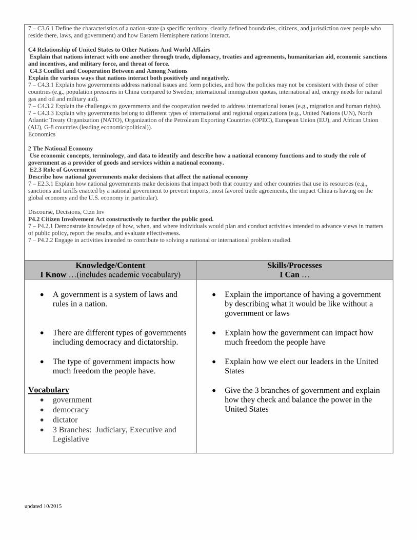
updated 10/2015
7 – C3.6.1 Define the characteristics of a nation-state (a specific territory, clearly defined boundaries, citizens, and jurisdiction over people who
reside there, laws, and government) and how Eastern Hemisphere nations interact.
C4 Relationship of United States to Other Nations And World Affairs
Explain that nations interact with one another through trade, diplomacy, treaties and agreements, humanitarian aid, economic sanctions
and incentives, and military force, and threat of force.
C4.3 Conflict and Cooperation Between and Among Nations
Explain the various ways that nations interact both positively and negatively.
7 – C4.3.1 Explain how governments address national issues and form policies, and how the policies may not be consistent with those of other
countries (e.g., population pressures in China compared to Sweden; international immigration quotas, international aid, energy needs for natural
gas and oil and military aid).
7 – C4.3.2 Explain the challenges to governments and the cooperation needed to address international issues (e.g., migration and human rights).
7 – C4.3.3 Explain why governments belong to different types of international and regional organizations (e.g., United Nations (UN), North
Atlantic Treaty Organization (NATO), Organization of the Petroleum Exporting Countries (OPEC), European Union (EU), and African Union
(AU), G-8 countries (leading economic/political)).
Economics
2 The National Economy
Use economic concepts, terminology, and data to identify and describe how a national economy functions and to study the role of
government as a provider of goods and services within a national economy.
E2.3 Role of Government
Describe how national governments make decisions that affect the national economy
7 – E2.3.1 Explain how national governments make decisions that impact both that country and other countries that use its resources (e.g.,
sanctions and tariffs enacted by a national government to prevent imports, most favored trade agreements, the impact China is having on the
global economy and the U.S. economy in particular).
Discourse, Decisions, Ctzn Inv
P4.2 Citizen Involvement Act constructively to further the public good.
7 – P4.2.1 Demonstrate knowledge of how, when, and where individuals would plan and conduct activities intended to advance views in matters
of public policy, report the results, and evaluate effectiveness.
7 – P4.2.2 Engage in activities intended to contribute to solving a national or international problem studied.
Knowledge/Content I Know …(includes academic vocabulary)
Skills/Processes I Can …
A government is a system of laws and
rules in a nation.
There are different types of governments
including democracy and dictatorship.
The type of government impacts how
much freedom the people have.
Vocabulary
government
democracy
dictator
3 Branches: Judiciary, Executive and
Legislative
Explain the importance of having a government
by describing what it would be like without a
government or laws
Explain how the government can impact how
much freedom the people have
Explain how we elect our leaders in the United
States
Give the 3 branches of government and explain
how they check and balance the power in the
United States


