digital mapping techniques 2020
TRANSCRIPT

DIGITAL MAPPING TECHNIQUES 2020
See Presentations and Proceedingsfrom the DMT Meetings (1997-2020)
http://ngmdb.usgs.gov/info/dmt/
The following was presented at DMT ‘20(June 8 - 10, 2020 - A Virtual Event)
The contents of this document are provisional
DMT 2020

Large Submarine Canyons of the Outer Continental Shelf
An aid to stewardship of federal marine oil and gas, renewable energy, and mineral resources
Paul O. Knorr, DMT ‘20

Submarine Canyon Delineation Method
o SRTM bathy data with superimposed Hudson Canyon boundaries.
o Central red line is canyon thalweg from stream order computations.
o Blue line is the Harris et al. (2014) boundary.
o Outermost Green line is 5 km buffer.
o Black line is the effect of removing the lowest 4.6% (2 Standard Deviations) of slopes from within the 5-km buffer area.

Atlantic
Detailed views of each canyon

Gulf of Mexico
3-D view of each canyon

Pacific
Useful scientific facts for analysts, fully-referenced
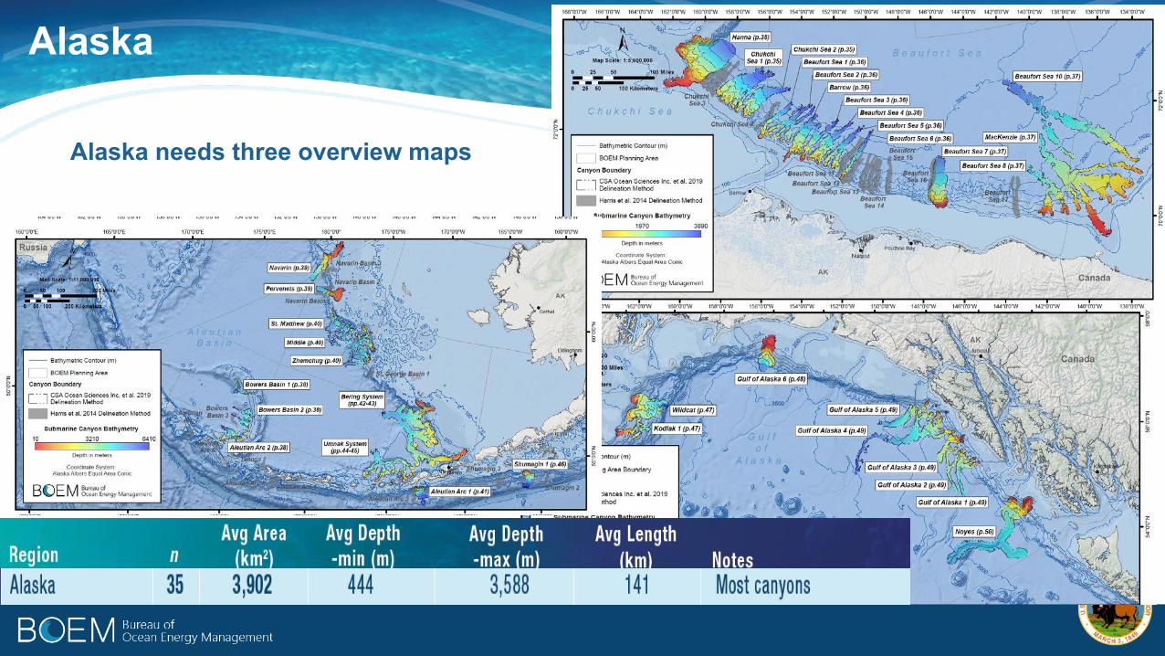
Alaska
Alaska needs three overview maps

Barrow / Alaska
Unexpected concentration of canyons along Alaska’s northern slope

Submarine Canyons - Application
• Aid to research & assessment
• 52 pages• 11x17• Printed and pdf• References• GIS files

BOEM.gov
Paul O. Knorr, PhD – [email protected] – DMT ‘20
https://espis.boem.gov/final%20reports/BOEM_2019-066.pdf