development pattern element ch
TRANSCRIPT
Sectional Map AmendmentApproved Master Plan &
BOWIEVICINITY
and
Development Pattern Element
The 2002 Prince George’s County Approved General Plan presents the key visions, goals, and policies for the master plan area. The General Plan’s development pattern element comprises three policy areas—the Developed Tier, the Developing Tier, and the Rural Tier—and designated Centers and Corridors. Two tiers, Rural and Developing, along with one Regional Center located near the intersection of US 301 and US 50, are designated in the Bowie and Vicinity Master Plan and SMA area. The master plan identifi es policies and strategies to further implement the General Plan and to address local issues. The 1991 Approved Master Plan and Adopted Sectional Map Amendment (SMA) for Bowie-Collington-Mitchellville and Vicinity, Planning Areas 71A, 71B, 74A, and 74B, provided the basic framework for the land use recommendations in this plan. The majority of the land within the 2006 Approved Master Plan for Bowie and Vicinity and Sectional Map Amendment for Planning Areas 71A, 71B, 74A, and 74Bretains the land use recommendations in the 1991 master plan. Generally, high-intensity land use activities are encouraged in the mixed-use activity centers, and land in the Rural Tier is recommended to remain rural.

6 Approved Bowie and Vicinity Master Plan and Sectional Map Amendment
Rural Tier
Vision: The vision for the Rural Tier is preservation of natural features with new development that blends into the landscape. Scenic roads, habitats, sensitive natural features, forests, and landscapes are protected during the development review process. Flexible design standards allow development that preserves rural character.
Background: The Rural Tier in the master plan area is generally located along the western shore of the Patuxent River, comprising 17 square miles. The land use character and development pattern throughout the Rural Tier is low-density residential consisting of two- to fi ve-acre home sites, farms, some existing businesses, and public open space. In the southern portion of the Rural Tier, residential development is close to US 301 and along the existing roadways. Woodlands, open areas, and farms are the dominant feature in a wide swath of land that generally parallels the Patuxent River. Land use is more diverse in the northern portion of the Rural Tier; along with residential development and agricultural uses are the former Bowie Race Track and a signifi cant amount of public land. The State of Maryland (Bowie State University and MARC), the Washington Suburban Sanitary Commission (WSSC), Prince George’s County (at the site of the former Sandy Hill Landfi ll), The Maryland-National Capital Park and Planning Commission (M-NCPPC), and the federal government
(Patuxent Research Refuge) are all landowners in the northern part of the Rural Tier.
This plan reinforces the land use policies for the Rural Tier established in the 2002 General Plan. This plan envisions that the Rural Tier will retain its rural character. Enactment of new county subdivision regulations to allow conservation subdivision design, transfer of development rights (TDR), and other fl exible design standards is a key recommendation for realizing this vision. These regulations provide for the preservation of signifi cant natural and manmade features of the rural environment and allow more compact development. They will assist in maintaining rural character and protecting the natural environment as the land use recommendation for low-density residential development is implemented.
Goals: Maintain rural character. Preserve environmentally sensitive features. Retain agricultural land. Protect scenic vistas along rural roadways. Protect property owners’ equity in their land.
Policy 1: Design new development to retain and enhance rural character.
Strategies:
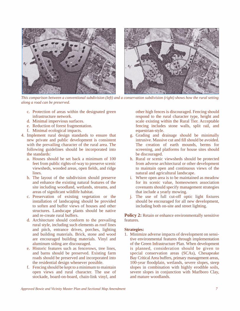
1. Enact conservation subdivision design regulations and other fl exible design standards that place a premium on conserving open areas and protecting environmental features. Through this strategy, the approved residential lotting pattern may be more compact than typically allowed, but the land that is saved from development is much greater and connectivity with other open space areas is more easily maintained.
2. Allow fl exible design standards in evaluation and network gap areas of the designated green infrastructure network.
3. Ensure that land preserved during the development review process expresses one or more of the following values: a. Agricultural preservation. b. Retention of scenic vistas.
Farms and farm buildings are important in preserving rural character.
Conservation Subdivision Design: A fl exible regulatory tool that allows for compact development to conserve scenic, historic, or environmental features. It is most frequently used
in rural areas to preserve rural character.
Approved Bowie and Vicinity Master Plan and Sectional Map Amendment 7
c. Protection of areas within the designated green infrastructure network.
d. Minimal impervious surfaces.e. Reduction of forest fragmentation.f. Minimal ecological impacts.
4. Implement rural design standards to ensure that new private and public development is consistent with the prevailing character of the rural area. The following guidelines should be incorporated into the standards: a. Houses should be set back a minimum of 100
feet from public rights-of-way to preserve scenic viewsheds, wooded areas, open fi elds, and ridge lines.
b. The layout of the subdivision should preserve and enhance the existing natural features of the site including woodland, wetlands, streams, and areas of signifi cant wildlife habitat.
c. Preservation of existing vegetation or the installation of landscaping should be provided to soften and buffer views of houses and other structures. Landscape plants should be native and re-create rural buffers.
d. Architecture should conform to the prevailing rural style, including such elements as roof lines and pitch, entrance drives, porches, lighting and building materials. Brick, stone and wood are encouraged building materials. Vinyl and aluminum siding are discouraged.
e. Historic features such as fencerows, tree lines, and barns should be preserved. Existing farm roads should be preserved and incorporated into the residential design whenever possible.
f. Fencing should be kept to a minimum to maintain open views and rural character. The use of stockade, board-on-board, chain-link vinyl, and
other high fences is discouraged. Fencing should respond to the rural character type, height and scale existing within the Rural Tier. Acceptable fencing includes stone walls, split rail, and equestrian-style.
g. Grading and drainage should be minimally intrusive. Massive cut and fi ll should be avoided. The creation of earth mounds, berms for screening, and platforms for house sites should be discouraged.
h. Rural or scenic viewsheds should be protected from adverse architectural or other development to maintain open and continuous views of the natural and agricultural landscape.
i. Where open area is to be maintained as meadow for its scenic value, homeowners association covenants should specify management strategies that include a yearly mowing.
j. The use of full cut-off optic light fi xtures should be encouraged for all new development, including both on-site and street lighting.
Policy 2: Retain or enhance environmentally sensitive features.
Strategies:1. Minimize adverse impacts of development on sensi-
tive environmental features through implementation of the Green Infrastructure Plan. When development is planned, consideration should be given to special conservation areas (SCAs), Chesapeake Bay Critical Area buffers, primary management areas, 100-year fl oodplain, wetlands, severe slopes, steep slopes in combination with highly erodible soils, severe slopes in conjunction with Marlboro Clay, and mature woodlands.
This comparison between a conventional subdivision (left) and a conservation subdivision (right) shows how the rural setting along a road can be preserved.

8 Approved Bowie and Vicinity Master Plan and Sectional Map Amendment
2. Protect forest interior dwelling species habitat, the sensitive wildlife habitat area located 300 feet inward from the edge of the forest, through the implementation of the Green Infrastructure Plan during the development review process.
3. Revise the Woodland Conservation and Tree Preservation Ordinance to require that projects in the Rural Tier meet woodland conservation requirements on site. No off-site mitigation for woodland conservation should be allowed unless the site subject to the ordinance is substantially devoid of trees prior to development. Encourage the use of native plants for all new plantings.
4. Ensure that impacts to regulated areas are limited to unavoidable impacts, such as those for road crossings and utility easements.
5. Carefully consider areas within designated evaluation areas in the green infrastructure network. Protect existing areas of connectivity of natural resources and enhance connections where they don’t exist.
6. Identify critical ecological systems supporting local and countywide SCAs during the land development review process. Ensure protection and enhancement of these systems.
7. Encourage land owners along the Patuxent River to convey the land to M-NCPPC in order to protect it from future development.
8. Multiple home subdivisions in open fi elds should include native tree reforestation in the open fi elds and it should be used to blend the development into the woodlands.
Policy 3: Protect landowners’ equity in their land.
Strategies:
1. Retain the land use density under existing zoning in the Rural Tier.
2. Encourage participation in a Transferable Develop-ment Rights (TDR) program, pursuant to county legislation. Consider increasing the TDR allocation rate in order to preserve and enhance ecologically fragile and aesthetically valuable environments in the Rural Tier, including certain streams, stream valleys, fl oodplains, wetlands, groundwater steep slopes, woodlands, scenic vistas and scenic corridors.
Policy 4: Retain agricultural land.
Strategies:1. Encourage agriculture in open areas preserved using
conservation subdivision design or other fl exible design techniques.
2. Encourage participation in a TDR program, pursuant to county legislation.
3. Adjust the Rural Tier boundary to incorporate contiguous agricultural, publicly owned, or dedicated land.
Policy 5: Scenic vistas along roads in the Rural Tier are maintained and protected.
Strategies:1. Design guidelines for areas adjacent to rural, scenic
and historic roads should be adopted and used in evaluating development proposals along roads in the Rural Tier. (See suggested guidelines in the Community Character Elements chapter, Scenic and Historic Roads.)
2. In the Rural Tier, public agencies that share re-sponsibility for preparing or reviewing plans for construction and maintenance of rural roads should:a. Design road improvements at stream crossings
to maintain desirable stream views. b. Consider the location or relocation of utilities to
preserve or enhance the scenic character of the roadway.
c. Require investigation of alternatives to any proposal to widen or realign a roadway.
d. Eliminate the use of streetlights except where warranted by safety concerns.
e. Require the use of full cut-off optic fi xtures in all instances.
Approved Bowie and Vicinity Master Plan and Sectional Map Amendment 9
Vision: The portion of the master plan area that lies within the Developing Tier is a viable, residential community that provides low- to moderate-density, suburban, and diverse residential development, renovated mixed-use activity centers, multimodal transportation, and a Regional Center connected to a major transit hub supported by the required public facilities.
Background: Most of the master plan area is located in the Developing Tier, which contains approximately 26,800 acres, or 41.9 square miles. Outside the City of Bowie, the bulk of development occurred during the 1990s and 2000s. About 25,000 acres, or 93.3 percent of the land, is developed or committed to development with approved site plans or subdivisions. The undeveloped tracts are scattered throughout the Developing Tier. The overall planning issues for the Developing Tier are:
Lack of pedestrian-oriented environments that give identity to an area or create a sense of place.
Need for more diversity of housing types. Need to protect existing neighborhood character
and quality of housing.
Need for senior housing. Achievement of high-quality development.
The main planning challenge for the Developing Tier is to balance the pace of development with demands for adequate roads, schools, and other public facilities. The plan concept for the future growth pattern steers most of the additional development toward the Bowie Regional Center and the mixed-use activity centers identifi ed in this plan. The mixed-use activity centers are Old Town Bowie, Bowie Main Street, West Bowie Village, and Pointer Ridge. Each mixed-use activity center has unique characteristics and specifi c development opportunities and constraints. This concept makes effi cient use of existing and proposed public infrastructure and investment.
Goals: Maintain low- to moderate-density land uses
(except in the Bowie Regional Center and mixed-use activity centers).
Plan for compact, high-intensity, pedestrian-oriented, mixed-use development in the Bowie Regional Center.
Sustain existing suburban residential neighborhoods. Encourage planned commercial centers as commun-
ity focal points. Encourage compact, planned employment areas. Preserve and enhance environmentally sensitive
areas. Increase transit usage. Balance the pace of development with the ability of
the public sector to provide adequate transportation and public facilities.
Encourage contiguous expansion of development where public facilities and services can be more effi ciently provided.
Promote redevelopment and revitalization in mixed-use activity centers.
Developing Tier
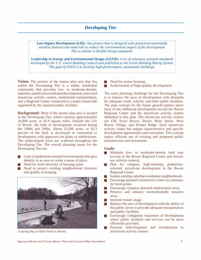
A spring day at Allen Pond in Bowie.
Low-Impact Development (LID): Any project that is designed with green/environmentally sensitive features and materials to reduce the environmental impact of the development.
This is similar to fl exible design standards.
Leadership in Energy and Environmental Design (LEED): A set of voluntary national standards developed by the U.S. Green Building Council and published as the Green Building Rating System.
The goal of LEED is to develop high-performance, sustainable buildings.

10 Approved Bowie and Vicinity Master Plan and Sectional Map Amendment
Policy 1: Encourage moderate- and high-density mixed-use development at existing and possible future activity centers.
Strategies:1. Establish boundaries, recommend possible transit
hub locations, and encourage mixed-use, transit-friendly, and transit-oriented development for the Bowie Regional Center.
2. Recommend zoning and establish planning and design guidelines for Old Town Bowie, West Bowie Village, Bowie Main Street, and Pointer Ridge mixed-use activity centers.
3. Designate a possible future Community Center in the vicinity of the Bowie State University and the MARC station to take advantage of possible future transit-oriented development opportunities. The ridership at the Bowie State University MARC station is high. It is recommended that the MARC station parking lot and its surrounding properties be redeveloped with a vertical mixed-use, pedestrian- and transit-supportive development including housing and retail uses with structured parking. To ensure that the future Community Center development is coordinated, a detailed planning study or sector plan is recommended to determine its scale, magnitude and pedestrian/bicycle linkages to the train station prior to any major development.
Policy 2: Provide high-value housing in a variety of price ranges and types.
Illustrated section and plan of what a typical residential street could look like.
The value of the housing stock in the planning area is above the county average, as reported in the 2000 census.
Strategies:1. Develop, apply and enforce development regulations
for all types of high-value housing in the Bowie Regional Center and mixed-use activity centers.
2. Enact housing regulations that incorporate features (such as one-level residences, ramps, low-maintenance yards, transit shelters) that enable people of all ages to remain in such housing as they age or develop disabilities that affect their mobility.
3. Provide housing programs that strengthen existing neighborhoods by encouraging home ownership and maintenance of affordable housing.
4. Provide housing rehabilitation programs to offer low interest loans to improve and conserve existing housing stock.
Policy 3: Protect, maintain and enhance the unique historical, cultural, and architectural identity, heritage, and character of the City of Bowie.
Strategies:1. Recognize the Levittown character of buildings,
neighborhoods, urban settings, and street fabric by designating a historic district, such as the Levitt’s model homes section on the south side of MD 450 and west of the Bowie Main Street activity center.
2. Encourage cooperation and collaboration between the City of Bowie and the county’s Department of Environmental Resources in zoning and code enforcement efforts.

Approved Bowie and Vicinity Master Plan and Sectional Map Amendment 11
3. Encourage the compatibility of infi ll residential development located outside of the Bowie Regional Center or mixed-use activity centers. Consideration should be given to similarity in density, style, size, material, and design to the surrounding residential neighborhoods.
4. Properties located at key intersections within the planning area, such as the intersection of US 301 and MD 197, are recommended for site plan review and approval.
Policy 4: Develop high-quality senior citizen housing.
Strategies:1. Active senior citizen developments should be pro-
vided according to the following design guidelines:a. Development should be located to provide easy
access to commercial and cultural centers of the Bowie and vicinity planning area.
b. Development should include linkages to shopping and services in the Bowie Regional Center or mixed-use activity centers.
c. Development should be of suffi cient size to provide amenities, such as indoor parking or garages, gardens, plazas, swimming pools, or common eating areas.
d. Development should have direct access to a collector road or greater to allow easy access for emergency medical services.
e. Development should be served by public transit or shuttle buses to shopping and services in the
Bowie Regional Center or mixed-use activity centers.
f. Prior to approval of new development, a market analysis should be conducted that evaluates and satisfactorily demonstrates the need for senior housing within one mile of a proposed site.
g. Development should occur at locations in accordance with the guidelines of the Bowie and Vicinity Master Plan and SMA and/or at locations deemed appropriate by the District Council.
h. Senior housing should be provided in locations proximate to existing residential communities.
i. All such senior adult residential development shall be subject to a detailed site plan review.
j. All such active senior adult developments may be included in mixed-use and multifamily zones.
Policy 5: Reduce traffi c congestion, improve ingress/egress, and safety along corridors throughout the planning area. Facilitate future highway improvements on US 301/MD 3 while allowing limited, low traffi c-generating development along this corridor.
Strategies:1. Reduce residential land use intensity within the
US 301/MD 3 median.2. Properties located on the west side of US 301, north
of its intersection with Mitchellville Road: The eastern portion of this property should be developed with commercial, retail, and service uses and future auto-related uses should be directed to this
established service-commercial area. The western portion of this property should be developed with single-family detached homes with a landscaped and/or natural buffer strip between the residential and commercial uses. The residential land should have two rows of single-family detached homes along a street connected to Ayrwood Lane. Development guidelines for the commercially zoned portion of the property are:
Land within the City of Bowie is 23 percent of the total land in the planning areas.
12 Approved Bowie and Vicinity Master Plan and Sectional Map Amendment
concept for the planned community at the subject location. This will offer a mix of employment and residential uses that can create a place of activity and interaction for those who live, work, or visit in the area. The residential component should develop in such a way that the residential buildings and settings complement Melford, a National Register Historic Site. Development on this site shall conform to the following:
(1) The mixed use community shall include the following uses:· Corporate offi ce;· Condominium/Professional offi ce;· Research and Development;· Hotel;· Single-family detached residential
(executive housing);· Single-family attached residential (6 to
11 dwellings per acre); a minimum of 20 percent being senior housing units and a maximum of 25 percent being senior housing units, although the District Council may vary such percentages when approving a conceptual site plan;
· Multifamily residential (at up to 30 dwellings per acre); a minimum of 20 percent being senior housing units and a maximum of 25 percent being senior
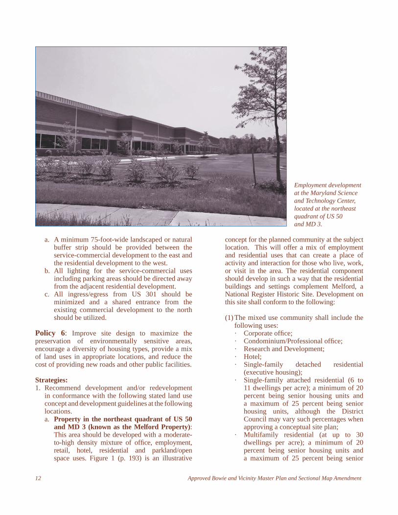
Employment development at the Maryland Science and Technology Center, located at the northeast quadrant of US 50 and MD 3.
a. A minimum 75-foot-wide landscaped or natural buffer strip should be provided between the service-commercial development to the east and the residential development to the west.
b. All lighting for the service-commercial uses including parking areas should be directed away from the adjacent residential development.
c. All ingress/egress from US 301 should be minimized and a shared entrance from the existing commercial development to the north should be utilized.
Policy 6: Improve site design to maximize the preservation of environmentally sensitive areas, encourage a diversity of housing types, provide a mix of land uses in appropriate locations, and reduce the cost of providing new roads and other public facilities.
Strategies:1. Recommend development and/or redevelopment
in conformance with the following stated land use concept and development guidelines at the following locations. a. Property in the northeast quadrant of US 50
and MD 3 (known as the Melford Property): This area should be developed with a moderate-to-high density mixture of offi ce, employment, retail, hotel, residential and parkland/open space uses. Figure 1 (p. 193) is an illustrative
Approved Bowie and Vicinity Master Plan and Sectional Map Amendment 13
housing units, although the District Council may vary such percentages when approving a concept plan.
· Live/work units (offi ce over retail; residential over retail; residential over offi ce).
Other uses may include:· Flex space and warehouse as an interim
use (See Guideline 8);· Professional training facilities
(2) The M-X-T (Mixed Use—Transportation Oriented) conceptual site plan shall show all existing development and approved development under the E-I-A (Employment and Institutional Area) zone “as approved”. The mixed-use ratio for the design plans shall be the following, based on the total gross fl oor area for residential and Employment/Offi ce/Retail/Hotel combined:
Minimum Maximum
Residential 20% 30%
Offi ce/Employment/Retail/Hotel
70% 80%
The residential component shall be no greater than 866 dwelling units.
(3) The conceptual site plan shall have an integrated network of streets, sidewalks (on all streets), and open space, public or private, and shall give priority to public space and appropriate placement of uses.
(4) The community shall be focused upon an open space network consisting of the Melford House and its historic vista, and other public spaces, which are surrounded by a combination of commercial, civic, cultural or recreational facilities. This network shall be designed with adequate amenities to function as a fully shared space for the entire community.
(5) The community shall contain additional linked open space in the form of squares, greens, parks, and trails that are accessible, safe and comfortable. The open space should provide a variety of visual and physical experiences. Some of these spaces should be bordered by buildings and be visible from streets and buildings.
(6) Retail uses shall be designed to:· Create a sense of place by, among other
techniques, creating a design focused
upon a village or main street theme; providing amenities such as plazas, parks, recreational opportunities, entertainment and cultural activities, public services and dining; and providing attractive gateways/entries and public spaces;
· Create outdoor amenities, such as brick pavers, tree grates, decorative lighting, signs, banners, high quality street furniture, and extensive landscaping, including mature trees;
· Create attractive architecture by using high-quality building materials such as stone, brick, or split-face block, and providing architectural elements such as façade articulation, dormer windows, canopies, arcades, varied roofscapes, and customized shopfronts to create a street-like rhythm;
· Provide attractive, quality facades on all commercial buildings visible from public spaces and streets; and completely screen loading, service, trash, HVAC, and other unsightly functions;
· Create a retail area where pedestrians may travel with ease, with attractive walkways and continuous street front experiences to maximize the quality of the pedestrian environment. All uses are connected by sidewalks; crosswalks run through and across the parking lots and drive aisles to connect all buildings and uses; sidewalks are wide, appealing, shaded and confi gured for safe and comfortable travel; pedestrian walkways are separated from vehicular circulation by planting beds, raised planters, seating walls, on-street parallel parking and/or structures; walking distances through parking lots are minimized and located to form logical and safe pedestrian crossings, and walkways are made more pedestrian-friendly through the use of arcades, canopies, street trees, benches, and tables and chairs;
· Screen parking from the streets and ensure that attractive buildings and signage are visible from the streets;
· Minimize the expanse of parking lots through the use of shared parking, structured parking or decks, and/or landscape islands;
· Provide a hierarchy of pedestrian-scaled, direct and indirect, high quality,
14 Approved Bowie and Vicinity Master Plan and Sectional Map Amendment
energy effi cient lighting that illuminates walkways, ensures safety, highlights buildings and landmark elements, and provides sight lines to other retail uses;
· Create a signage package for high-quality signs and sign standards and requirements for all retail and offi ce tenants and owners, which shall address size, location, square footage, materials, logos, colors, and lighting. Any revision to the existing approved signage plans shall incorporate the previously approved designs;
· Temporary signage on the site or attached to the exterior facades of a building shall not be permitted;
· Design retail pad sites to be compatible with the main retail/offi ce/hotel component. If the retail pad sites are located along the street, parking shall be located to the rear of the pad sites;
· Green areas or public plazas should be provided between pad sites;
· Restaurants should have attractive outdoor seating areas with views of the public spaces/lakes or other natural features.
(7) Residential uses shall meet the following design standards:· Single-family detached:
o There shall be a range of lot sizes, with a minimum square footage on any lot of 3,000 square feet of fi nished living space;
o At least 20 percent of the houses shall be a minimum of 4,000 square feet of fi nished living space;
o Garages should not dominate the streetscape, and all garages should either be detached, or located in the rear (accessible by alleys or driveways), attached and set back a minimum of eight feet from the façade, or attached and oriented for side entry access.
· Multifamily and single-family attached:o Building design and materials shall be
high quality, enduring and distinctive;o Use of siding should be limited;o A signifi cant number of amenities,
such as are typically provided for luxury projects, shall be provided.
(8) Any additional research and development type “fl ex space” and/or warehouses shall be limited to not more than ten percent of total non-residential space. Generally this fl ex
space is intended as an “interim use” which shall be redeveloped predominantly with offi ce use, as market conditions permit. When an area is initially developed as research/development, fl ex space and/or warehouses, that area should be the fi rst considered for redevelopment when market conditions permit new offi ce development. The long-term goal is that all of the non-residential uses would be offi ce with retail (including a “main street”) and hotel.
(9) All stream channels on the site should be depicted on all plans in their entirety, with the regulated stream buffer shown as required.
(10) All residential development proposals shall demonstrate that interior noise levels will conform to Code of Maryland Regulations (COMAR).
(11) The proposed lighting system shall include the use of full cut-off lighting systems with limited light spill over. The lighting plan and design drawings shall be included with each detailed site plan approved in the future.
(12) Development plans shall show the minimization of impervious surfaces through various phases of the project. Early phases of the project may use surface parking and later phases of development will seek to reclaim the surface parking by the use of structured parking to the maximum extent possible.
(13) Fifty percent of parking for multifamily uses shall be structured parking.
(14) The design of the stormwater management ponds shall show them as amenities with gentle natural slopes and extensive native planting.
(15) Streams shall have a 100-foot natural buffer and a 150 foot-wide building and parking setback. There shall be a 150-foot buffer on the 100-year fl oodplain. If a utility must be extended into any buffer, then an equal area of natural buffer alternative shall be retained on the community property.
(16) The following facilities shall be evaluated for transportation adequacy in all subsequent traffi c analyses for the subject property:· MD 450/MD 3 intersection;· US 301/Harbour Way-Governors Bridge
Road;· Belair Drive/northbound on-off ramp
to MD 3;· Belair Drive/southbound on-off ramp
to MD 3;

Approved Bowie and Vicinity Master Plan and Sectional Map Amendment 15
(17) At the time of submission of the detailed site plan application, the owner shall present a plan and timetable for the protection, stabilization, restoration, and planned adaptive use of the buildings and gardens of the Melford Historic Site for approval by the Historic Preservation Commission (HPC) and the Planning Board.
(18) Prior to the acceptance of building permits in the area in the immediate vicinity of Melford House labeled as POD 1, the owner shall begin the restoration of the Melford House and outbuildings. The restoration of Melford and outbuildings shall be completed prior to the release of any use and occupancy permit for POD 1.
(19) Prior to submitting a conceptual site plan, the applicant shall determine the extent of the land that should be the subject of a Phase I archeological investigation. The applicant’s fi ndings shall be submitted to the Historic Preservation staff of M-NCPPC for review and approval. Upon approval of this determination, plans may be approved and permits may be issued for any portion of the subject property excluded from the scope of the Phase I investigation. No plans may be approved and no permits shall be issued for the area subject to the Phase I investigation before satisfactory completion of the Phase I investigation, or if required Phase II and/or III.
(20) Prior to the issuance of any building permits, a written agreement/memorandum of understanding with the HPC defi nes/outlines responsibilities and timing for the maintenance/stabilization of all historic buildings within the environmental setting, to be followed by quarterly reports submitted by the property owner and/or developer, so that the HPC and staff may monitor the condition of the Melford House, grounds and cemetery.
(21) Any detailed site plan shall demonstrate that proposed buildings do not obstruct the historic vista of the Melford House.
(22) Prior to acceptance of any detailed site plan, the applicant shall demonstrate that plans for new construction within the Impact Review Area follow the guidelines on page 91 for the CDP 8601 document for the former Maryland Science and Technology Center.
(23) Two hundred eighty-eight± acres of the property are either already developed pursuant to a specifi c design plan (SDP) approved in the
E-I-A Zone or a specifi c design plan has been approved. The Zoning Ordinance at Sections 27-282 and 27-527 describes a detailed site plan and a specifi c design plan. The property owner may submit a conceptual site plan in the M-X-T Zone pursuant to Section 27-546 essentially showing the same development and plans “as in” the E-I-A Zone. All existing development and/or approved specifi c design plans shall be shown “as approved” on the conceptual site plan submitted in the M-X-T Zone. Use and occupancy permits have been issued for the following uses for structures existing on the property or to be constructed: Offi ce/Medical Practitioner Offi ce; Offi ce;
Offi ce/Manufacturing; Contractor Offi ce; Offi ce/Industrial Laboratory; Offi ce/Real Estate Subdivision Sales; Institutional/Educational/Church; Educational Institute; School/Studio for Artistic Instruction
All of these uses are also permitted in the M-X-T Zone, so the rezoning does not create nonconforming uses. The SDPs are as follows: SDP-0103; SDP-0301; SDP-0203/01; SDP-0104; SDP-0204 (sign); and SDP-0201 (building 4-E, F, G). These existing SDPs shall still regulate development of these properties.
(24) The 12.75-acre impact review area approved for the Melford Historic Site by the HPC and the Planning Board (PGCPB No. 99-28A) should be integrated into a design plan that establishes viewsheds from the Melford Historic Site to the Patuxent River. Open space should be provided adjacent to the historic site that will allow it to be seen from greater distances within the Melford property. A dedicated pedestrian link between the Melford Historic Site and the cemetery should be created. Trails should be provided that connect it to the regional trail system.
(25) Development abutting the Melford Historic Site, outbuildings, and cemetery should be compatible in scale, design, and character with the existing historical architectural character. Sensitive and innovative site design techniques, such as careful siting, variation in orientation, roof shape, building materials, screening, landscaping, berming and open space, should be incorporated into the proposal to minimize any adverse impacts to the historic site.
(26) Appropriate signage should be placed near the historic site illustrating the history of the area.
16 Approved Bowie and Vicinity Master Plan and Sectional Map Amendment
(27) Clearing for utility installation shall be minimized, especially in environmentally sensitive areas, and clearing for utilities in those areas shall be coordinated, to minimize ground or buffer disturbance. Woodland disturbed for that purpose shall be reforested in cooperation with the appropriate utility.
(28) Community recreational facilities shall take full advantage of environmental features on and adjacent to the property, and shall include extensive trail and boardwalk systems. These recreational facilities may also include educational features for the general public and public schools, such as kiosks along the trails, boardwalks at observation points, and education stations, with curriculum available to schools for use in specifi c locations.
(29) The open space system, including but not limited to environmentally sensitive areas, shall extend through the site and link the uses. Portions of the open space system shall be visible to and accessible from public streets.
b. Property located at the northeast quadrant of the US 301/Mill Branch Road intersection: This property, given its proximity to the Bowie Regional Center, should be developed with high-quality commercial retail uses, including a hotel. Future development should promote the optimum use of the transportation system and public infrastructure, preserve environmentally sensitive areas, and provide for the needs of workers and residents in the area.
The property should be rezoned to a suitable zone, such as the C-S-C (Commercial Shopping Center) Zone, to permit development of elements such as an upscale hotel, etc. The development should incorporate the following design guidelines:(1) The development should include quality
department stores but should not include discount or “big-box” commercial activities. No individual retail use, other than food or beverage stores (grocery store) shall exceed 125,000 square feet in size. Retail sales of alcoholic beverages in a food or beverage store are limited to 5,000 square feet or less.
(2) The existing 22-foot easement that provides access to the Green Branch Regional Park should be vacated and replaced by a new temporary easement, fi fty feet in width, located on this property at its easternmost property line on Mill Branch Road. The new temporary easement should be vacated when it is replaced by permanent access via a right-
of-way to be constructed at the time this property is developed. The new temporary easement on the easternmost property line should form the boundary between the Developing Tier and the Rural Tier.
(3) The development should include a pedestrian/hiker/biker system that is comprehensively designed to encourage pedestrian and biking activity within the development and with connections to the Green Branch Regional Park and Prince George’s Stadium.
2. Support rezoning to a mixed-use category that is appropriate for implementing the land use concepts for the Bowie Regional Center and the mixed-use activity centers. This zone should include design standards and guidelines and may incorporate a form-based code that implements principles of new urbanism. a. Bowie Regional Center: Develop a transit-
oriented, moderate- to high-density mixture of offi ce, retail, residential, and parkland/open space using a suitable mixed-use zone. (See Bowie Regional Center section for details.)
b. Bowie Main Street: Develop a mixture of commercial offi ce, commercial retail, service, recreation, and medium-density residential uses using a suitable mixed-use zone. (See Mixed-Use Activity Centers section for details.)
c. West Bowie Village: Develop a mixture of commercial offi ce, commercial retail, service, and recreation, parkland/open space uses for West Bowie Village using a suitable mixed use zone. (See Mixed-Use Activity Centers section for details.)
d. Pointer Ridge: Develop commercial retail, service, and recreation for the existing shopping center using a suitable mixed use zone. (See Mixed-Use Activity Centers section for details.)
3. Recommend and support future rezoning to residential Comprehensive Design Zones at selected locations.a. Property located on the north and south sides
of MD 450 extending from Race Track Road to MD 3 (owned by the Corporation of the Roman Catholic Clergymen): The portion of the property that is in the Rural Tier south of MD 450 is intended for very low-density residential land use. The portion of the property that is north of MD 450 is recommended for low-density residential development. The proposed development should provide diverse housing types, including active senior housing, which would help to mitigate
Approved Bowie and Vicinity Master Plan and Sectional Map Amendment 17
potential adverse impacts on school facilities, and the development should be as close as possible to the planned Bowie Main Street mixed-use activity center. Given the size of this undeveloped property and the availability of transportation and public facilities, phasing plans should be provided in the development application. The following development guidelines are recommended:(1) Dedicated pedestrian links between future
development and the Bowie Main Street area should be established. Trails should be provided that connect to the regional trail system and Bowie Main Street.
(2) A large area should buffer the historic site of Sacred Heart Church, White Marsh, and Cemetery. Appropriate signage should be placed near the historic site illustrating the history of the area.
(3) A treed buffer along MD 450 should be retained or planted.
(4) The property should be developed in one or more Comprehensive Design Zones or mixed-use zones. Residential uses that include diverse housing types and/or a mixed or planned retirement community are encouraged.
(5) Development in the Rural Tier, including the restoration and redevelopment of the existing commercial or other uses in the southwest quadrant of the MD 450/MD 3 intersection, should occur in an innovative and environmentally sensitive manner. The existing commercial uses may continue as nonconforming uses.
b. Property located on the north side of Leeland and Oak Grove Roads between US 301 and Church Road: This property, also known as Willowbrook, contains approximately 442 acres. The majority of this site is recommended for residential development, as opposed to employment development recommended in the prior master plan, for several reasons. The policies of the 2002 General Plan direct growth toward designated centers and corridors. This plan follows the General Plan’s policy to shift growth, including employment, to designated centers such as the Bowie Regional Center. This property is in the Developing Tier policy area designated by the 2002 General Plan and residential development at this location is consistent with the land use policies for the Developing Tier. In addition, a large volume of traffi c that would have been generated by employment development in the
Collington Corporate Center would have used A-44, formerly a master plan arterial roadway extending from US 1 to US 301. However, employment development projections have diminished with the approval of the mixed-use community of Karrington, located at the former site of the Collington Corporate Center, and the prior 1991 master plan recommendation to build A-44 was eliminated by this master plan.
This plan recommends suburban intensity residential development at this location. Zoning techniques that provide for fl exibility in lot layout, while protecting open space and environmentally sensitive areas, are encouraged. Residential development in the low range of the R-S (Residential-Suburban, Comprehensive Design) Zone is a suitable transition between adjacent neighborhoods. The intent is for development at this location to be more intense than the development to the west (Oak Creek) and less intense than the development to the south (Beech Tree). The District Council approved A-9968 simultaneously with the approval of this master plan and sectional map amendment on February 7, 2006, subject to the limitations and conditions set forth in CR-11-2006.
Approximately 13 acres of the Willowbrook site—located between the Safeway Distribution Center site that is in the northwest quadrant of US 301/Leeland Road and the residential portion of the Willowbrook site—are designated for employment land use. Employment land use is appropriate because of the physical separation of this portion of the Willowbrook site by a stream and steep topography that orients it toward the abutting, existing employment development. At this location, Prince George’s Boulevard (I-300) is to be extended from its southern terminus through this area and continue through the Safeway Distribution Center site to Leeland Road.
c. Property located at the southeast quadrant of the intersection of US 50 and US 301: This undeveloped property is surrounded by a low-density residential neighborhood, undeveloped land in the Rural Tier, and existing adjacent commercial development. This property is recommended for very low-density residential or agricultural land uses.
d. Property located at the southwest quadrant of the MD 197/US 50 intersection: This property contains approximately 13.08 acres. The property is planned for multifamily dwellings. It is located within walking distance of the Bowie Senior
18 Approved Bowie and Vicinity Master Plan and Sectional Map Amendment
Center, the Bowie Health Center, the Bowie Town Center, and other amenities and services appropriate for senior citizens. The property abuts the Bowie Regional Center, an area designated for medium- to high-density mixed-use and pedestrian-oriented development. Future development at this location should conform to the following design guidelines:(1) Site Design
(a) A minimum of 75 percent of the required parking should be in garages.
(b) Enhance pedestrian and area safety by encouraging a strong visual connection between the interiors of buildings and the sidewalk, private oversight of public space, and the provision of a uniform level of pedestrian-oriented lighting.
(2) Building Design(a) High-quality materials that are durable and
attractive should be used on the facades of all proposed buildings.
(b) Upscale and luxurious apartments with elevators are encouraged.
e. Beall Crossing Subdivision: This property consists of ten undeveloped recorded lots and a dedicated public street which would require an additional curb cut on Race Track Road near its intersection with MD 450. A new preliminary plan of subdivision and record plat should be approved. The new layout should eliminate the curb cut onto Race Track Road and reorient the dedicated public street for the subdivision to either of the existing curb cuts at Evans Funeral Home or at the northern property line of the subdivision directly across from the rear (northernmost) entrance to the Hilltop Plaza Shopping Center on Race Track Road.
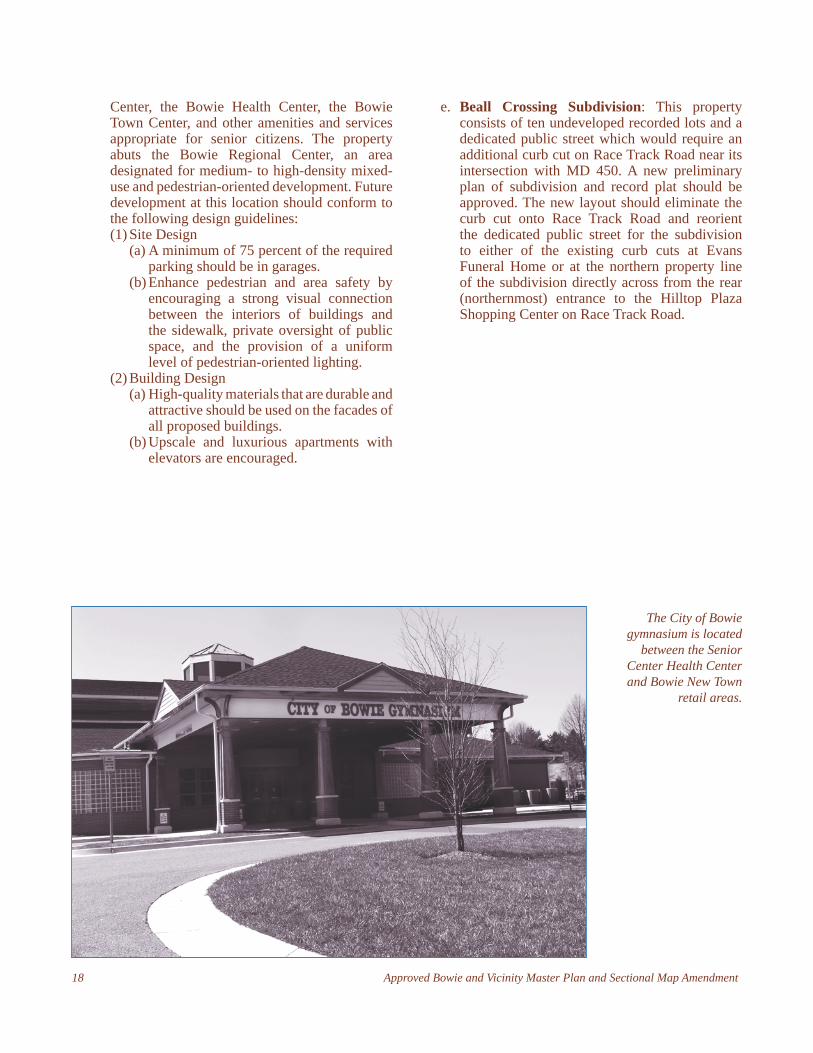
The City of Bowie gymnasium is located
between the Senior Center Health Center and Bowie New Town
retail areas.
Approved Bowie and Vicinity Master Plan and Sectional Map Amendment 19
The Bowie and Vicinity Master Plan and SMA designates four areas within the Developing Tier as mixed-use activity centers. These are specifi c locations where a pedestrian-oriented mix of residential, commercial, retail, offi ce, civic, recreational, and open space land uses should be encouraged. Each center features a unique vision, and the master plan establishes the goals, policies, and strategies to achieve these visions. The four mixed-use activity centers discussed in this chapter are Old Town Bowie, Bowie Main Street, West Bowie Village, and Pointer Ridge. They are generally located near the northern, eastern, western, and southern portions of the City of Bowie, which ensures that all citizens in the planning area have reasonable access to at least one center. Land use recommendations promote the evolution of each area into successful places where residents and citizens want to live, shop, work, and recreate. With mixed-use activity centers conveniently located within the planning area, there may be a reduction of vehicular miles traveled by area residents to obtain goods and services.
Old Town Bowie
Vision: Old Town Bowie is a revitalized village with a mix of small-scale retail shops, restaurants, museums, and residential uses carefully designed to complement
the historic character of the area, drawing visitors from throughout the area to shop, eat, and socialize in a safe, pedestrian-friendly environment.
Background: Once known as Huntington, Old Town Bowie was a former railroad junction town centered on Bowie Station. It is located at the eastern terminus of Lanham-Severn Road/9th Street and its intersection with Chestnut Avenue and 11th Street in the northwestern portion of the master plan area. Old Town Bowie consists of the historic street grid originally platted in the late 1800s and portions of the surrounding residentially and industrially zoned land. Approximately three-quarters of the Old Town mixed-use activity center is located within the City of Bowie.
Long in decline due to a shift in market trends and retail concentrations to other locations, the commercial core of Old Town Bowie currently serves a specialized retail market focused on antiques and largely run by proprietors who operate part-time establishments more as a hobby than a business. Much of the surrounding residential area remains undeveloped or is out of scale with the historic pattern of development. The industrial area located on Zug Road poses environmental and visual challenges. Though Old Town Bowie is well served by nearby parkland, connections to these valuable amenities are lacking or insuffi cient, reducing their utility.
Mixed-Use Activity Centers
Traditional Neighborhood Design (TND) Development: A mixed-use residential development that is comprehensively designed as a whole similar to the type of residential communities built in the early 20th century. In addition to the residential component, a TND includes a mixture of supporting neighborhood commercial, recreational and public uses and open spaces that are typically located in the center of the
development or at the intersection of important roadways.
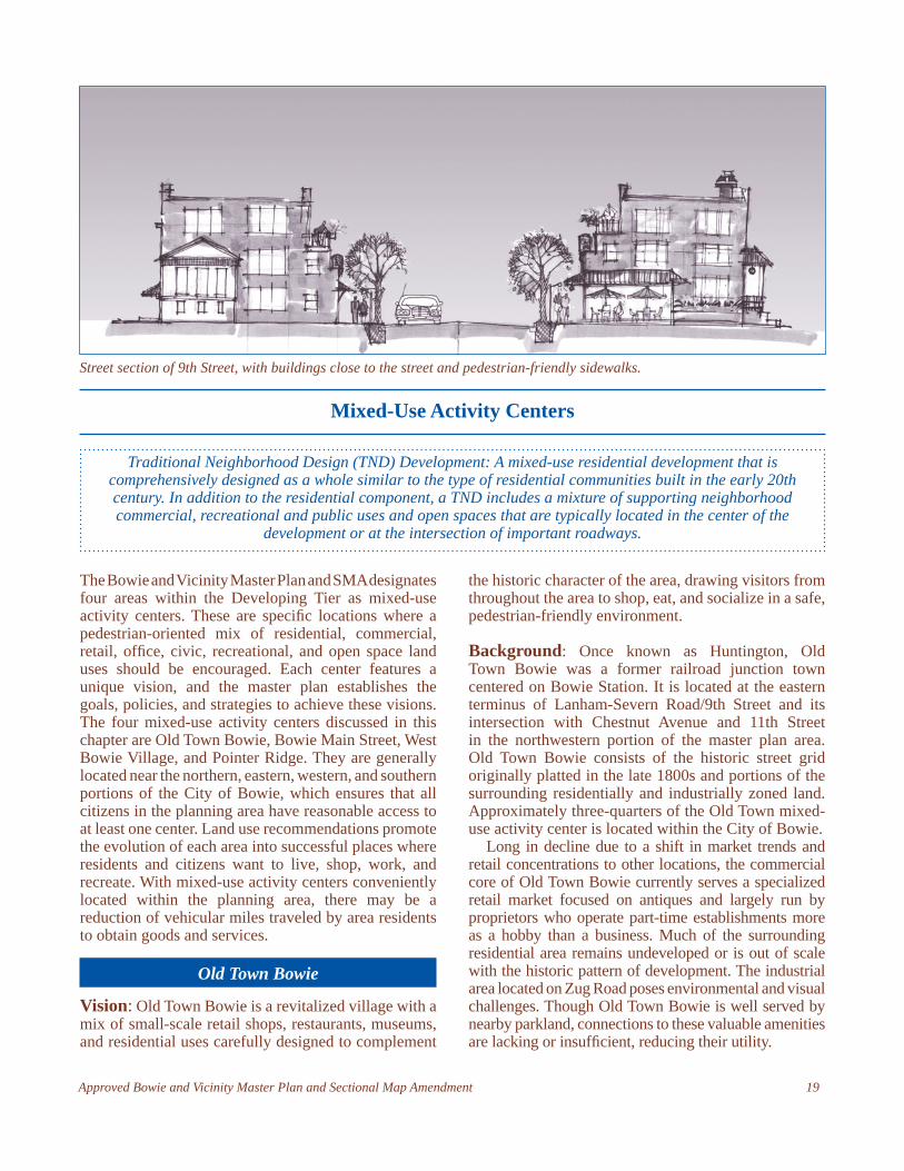
Street section of 9th Street, with buildings close to the street and pedestrian-friendly sidewalks.
20 Approved Bowie and Vicinity Master Plan and Sectional Map Amendment
d. Designate the industrial area on Zug Road for light industrial employment land use. Development in this area should be attractive and minimize noise, traffi c, and environmental impacts.
2. Promote a greater mix of uses and housing choices in Old Town and encourage a variety of housing products marketed for a broad range of income levels.
3. Coordinate with the City of Bowie, appropriate public agencies, and private developers to provide sidewalks and curb and gutter sections on all streets within the historic grid and along MD 564.
4. Pursue the use of federal, state and county tax credits and grant and fi nancing programs to foster revitalization and redevelopment efforts and assist with the rehabilitation of historic properties.
There is a signifi cant opportunity to revitalize Old Town Bowie as a mixed-use village supporting a specialty niche market (perhaps antiques, arts, or crafts businesses) built upon the historic character and unique charm of Old Town. Issues of traffi c, pedestrian safety, connectivity, compatibility, and revitalization are key concerns that must be addressed in order to ensure the future success of Old Town Bowie. (See Map 2, Appendix 8, p. 183: Old Town Bowie—Land Use.)
Goals: Promote mixed-use redevelopment and the
revitalization of the historic core. Enhance the character and feel of a small-town
village while ensuring the protection of the adjacent Rural Tier.
Mitigate traffi c concerns and improve pedestrian safety and connectivity.
Balance the need for reduced parking requirements and shared use of parking facilities with the provision of suffi cient parking to support businesses.
Provide for a modest increase in residential density to support local businesses.
Policy 1: Encourage low- to moderate-density, pedestrian-oriented, mixed-use development in the core and appropriate, compatible development in other areas.
Strategies:1. Develop zoning regulations, standards, and guidelines
to achieve the vision for Old Town Bowie and ensure compatible development.a. Approve a Development District Overlay Zone
(DDOZ) for properties within the Old Town Bowie mixed-use activity center that achieves the planning objectives and implementation rec-ommendations. (See Implementation chapter, Old Town Bowie DDOZ, for further details.)
b. Promote a pedestrian-friendly village center that allows for a horizontal and vertical mix of uses, encourages redevelopment, and provides additional opportunities for reinvestment in Old Town Bowie by rezoning its core (those properties previously classifi ed in the C-S-C [Commercial Shopping Center] Zone) to the M-U-I (Mixed-Use Infi ll) Zone.
c. Create a boundary around Old Town Bowie by clearly differentiating the land uses in Old Town and the surrounding Rural Tier. Implement this concept by retaining or rezoning residential properties outside the historic street grid in the R-R (Rural Residential), R-E (Residential-Estate), R-A (Residential-Agricultural), and O-S (Open Space) Zones.
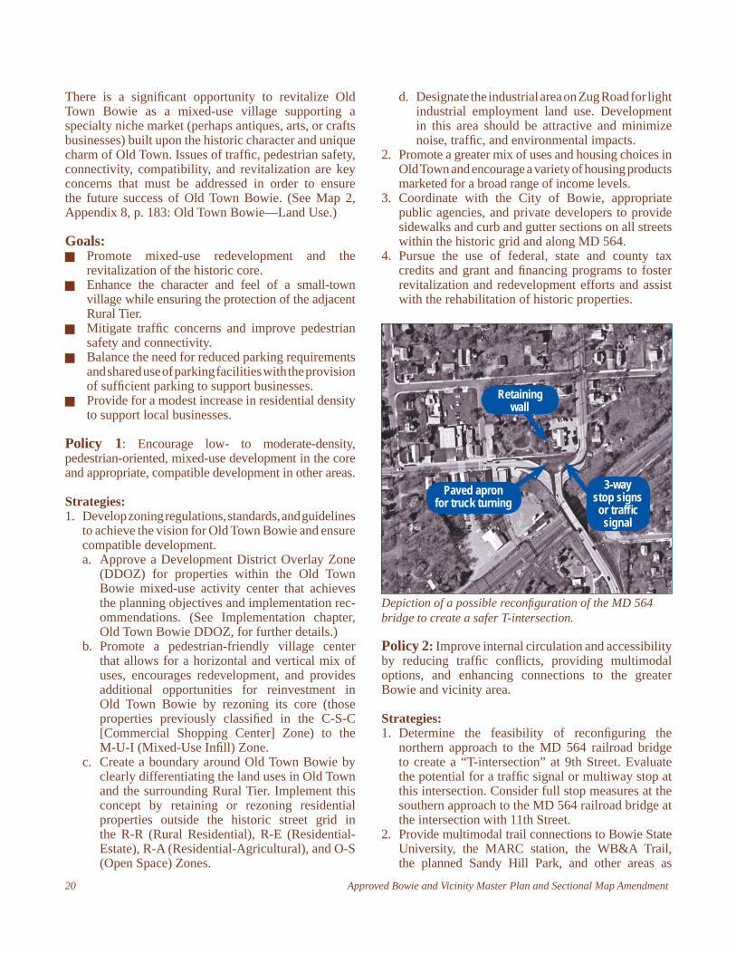
Depiction of a possible reconfi guration of the MD 564 bridge to create a safer T-intersection.
Policy 2: Improve internal circulation and accessibility by reducing traffi c confl icts, providing multimodal options, and enhancing connections to the greater Bowie and vicinity area.
Strategies:1. Determine the feasibility of reconfi guring the
northern approach to the MD 564 railroad bridge to create a “T-intersection” at 9th Street. Evaluate the potential for a traffi c signal or multiway stop at this intersection. Consider full stop measures at the southern approach to the MD 564 railroad bridge at the intersection with 11th Street.
2. Provide multimodal trail connections to Bowie State University, the MARC station, the WB&A Trail, the planned Sandy Hill Park, and other areas as
Paved apron for truck turning
Retaining wall
3-way stop signs or traffi c signal
Approved Bowie and Vicinity Master Plan and Sectional Map Amendment 21
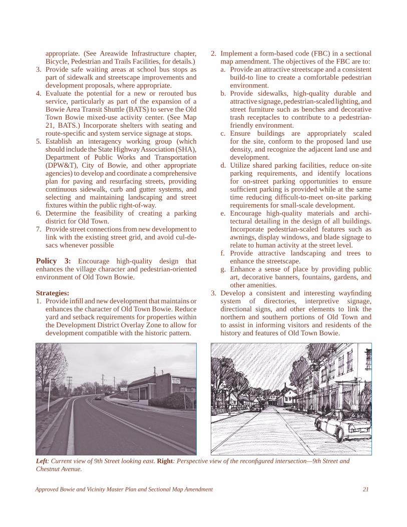
Left: Current view of 9th Street looking east. Right: Perspective view of the reconfi gured intersection—9th Street and Chestnut Avenue.
appropriate. (See Areawide Infrastructure chapter, Bicycle, Pedestrian and Trails Facilities, for details.)
3. Provide safe waiting areas at school bus stops as part of sidewalk and streetscape improvements and development proposals, where appropriate.
4. Evaluate the potential for a new or rerouted bus service, particularly as part of the expansion of a Bowie Area Transit Shuttle (BATS) to serve the Old Town Bowie mixed-use activity center. (See Map 21, BATS.) Incorporate shelters with seating and route-specifi c and system service signage at stops.
5. Establish an interagency working group (which should include the State Highway Association (SHA), Department of Public Works and Transportation (DPW&T), City of Bowie, and other appropriate agencies) to develop and coordinate a comprehensive plan for paving and resurfacing streets, providing continuous sidewalk, curb and gutter systems, and selecting and maintaining landscaping and street fi xtures within the public right-of-way.
6. Determine the feasibility of creating a parking district for Old Town.
7. Provide street connections from new development to link with the existing street grid, and avoid cul-de-sacs whenever possible
Policy 3: Encourage high-quality design that enhances the village character and pedestrian-oriented environment of Old Town Bowie.
Strategies:1. Provide infi ll and new development that maintains or
enhances the character of Old Town Bowie. Reduce yard and setback requirements for properties within the Development District Overlay Zone to allow for development compatible with the historic pattern.
2. Implement a form-based code (FBC) in a sectional map amendment. The objectives of the FBC are to:a. Provide an attractive streetscape and a consistent
build-to line to create a comfortable pedestrian environment.
b. Provide sidewalks, high-quality durable and attractive signage, pedestrian-scaled lighting, and street furniture such as benches and decorative trash receptacles to contribute to a pedestrian-friendly environment.
c. Ensure buildings are appropriately scaled for the site, conform to the proposed land use density, and recognize the adjacent land use and development.
d. Utilize shared parking facilities, reduce on-site parking requirements, and identify locations for on-street parking opportunities to ensure suffi cient parking is provided while at the same time reducing diffi cult-to-meet on-site parking requirements for small-scale development.
e. Encourage high-quality materials and archi-tectural detailing in the design of all buildings. Incorporate pedestrian-scaled features such as awnings, display windows, and blade signage to relate to human activity at the street level.
f. Provide attractive landscaping and trees to enhance the streetscape.
g. Enhance a sense of place by providing public art, decorative banners, fountains, gardens, and other amenities.
3. Develop a consistent and interesting wayfi nding system of directories, interpretive signage, directional signs, and other elements to link the northern and southern portions of Old Town and to assist in informing visitors and residents of the history and features of Old Town Bowie.
22 Approved Bowie and Vicinity Master Plan and Sectional Map Amendment
Bowie Main Street
Vision: Bowie Main Street is an active, lively place with pedestrian-friendly streetscapes designed for residents, workers, and shoppers, set amid high-quality, attractive commercial, residential, civic, institutional, and recreational uses.
Background: The Bowie Main Street mixed-use activity center is located along MD 450 between Race Track Road in the east and Bowie High School in the west. The area includes approximately 682,000 square feet of retail space concentrated primarily in three commercial centers: Free State Mall, Jemal’s Marketplace, and Hilltop Plaza. Bowie Main Street also includes several civic and open space amenities in the form of an M-NCPPC park and community center, two City of Bowie parks, the Bowie Library, Bowie Center for the Performing Arts, and the Bowie High School.
An opportunity exists for the future redevelopment of these centers with a mix of retail, offi ce, and medium-density residential uses. Civic or institutional uses could be a catalyst for such redevelopment. A pedestrian-oriented boulevard with a carefully designed streetscape
would encourage and allow for phased development. Bowie Main Street is close to a signifi cant number of long-time residents who have chosen to remain in the area. Redevelopment may include senior housing or retail catering to the “empty-nester” market.
Existing retail centers are in various states of use and redevelopment. Long-term revitalization plans for this area must allow for the phasing of development and intensifi cation. Façade treatments, renovation, redevelopment, and more intensive uses can be introduced in phases to achieve the vision for Main Street. Public commitment will be essential to the success of Bowie Main Street and could consist of streetscape improvements, grants, and other funding programs intended to assist with redevelopment over time.
Key challenges include heavy traffi c fl ow on MD 450 (which includes both through-traffi c and trips to and between the three major retail centers), lack of a coherent theme, and disconnected retail nodes. Competition from Bowie Town Center and other retail centers throughout the region has also drawn away a signifi cant portion of the population that once patronized the businesses of Main Street. Bowie Main Street must establish its own identity separate from that of the Bowie Town Center to attract new visitors from both within and beyond the surrounding area.
Planning for a pedestrian-oriented environment on Main Street and a boulevard character along MD 450 will lead to the types of commercial, residential, civic, institutional, and recreational uses essential to achieving the unique character and sense of place necessary for the area to be successful. (See Map 3, Bowie Main Street—Land Use.)
Pedestrian-Oriented Design: Development that is designed and arranged in a way that emphasizes
travel on foot rather than by car. Elements include compact, mixed-use development patterns with
facilities and design that enhance the environment for pedestrians in terms of safety, walking distances, comfort, and the visual appeal of the surroundings.
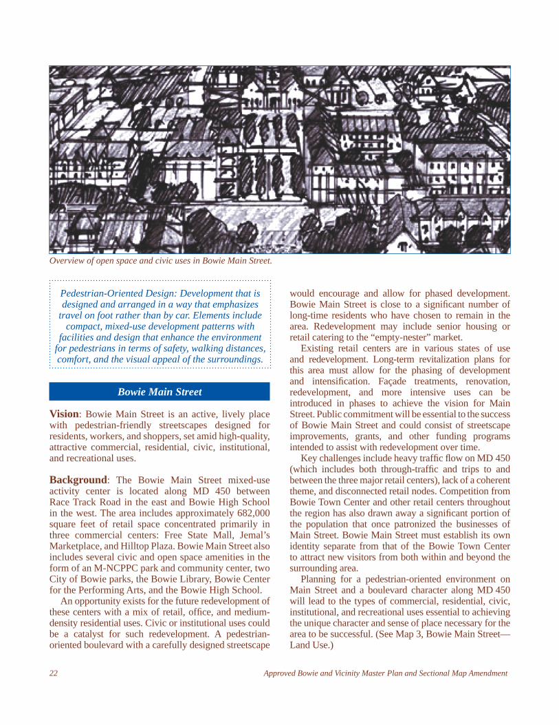
Overview of open space and civic uses in Bowie Main Street.
Approved Bowie and Vicinity Master Plan and Sectional Map Amendment 23
Goals: Provide a diverse and balanced mix of land uses at
a pedestrian-friendly scale to revitalize the area. Create attractive, active streetscapes that provide
safe pathways for pedestrians. Incorporate new civic spaces and plazas connected
by a network of streets, sidewalks, and trails. Reduce traffi c confl icts on MD 450 by providing
an internal street grid and reducing curb cuts onto MD 450.
Preserve the character of residential neighborhoods while ensuring they have access and are convenient to the Bowie Main Street mixed-use activity center.
Policy 1: Encourage pedestrian-oriented, mixed-use development to foster the creation of a true “main street” environment.
Strategies:1. Recommend and support future rezoning to
an L -A-C (local activity center) community or village comprehensive design zone or a suitable mixed-use zone at the time of development and/or redevelopment to allow for an appropriate mix of uses and intensities to achieve the desired character for Bowie Main Street (see Map 3, p. 184).
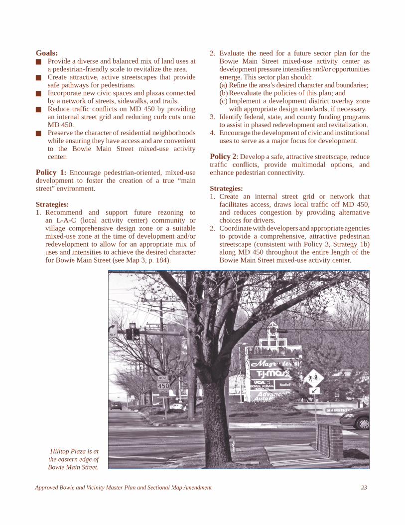
Hilltop Plaza is at the eastern edge of Bowie Main Street.
2. Evaluate the need for a future sector plan for the Bowie Main Street mixed-use activity center as development pressure intensifi es and/or opportunities emerge. This sector plan should: (a) Refi ne the area’s desired character and boundaries; (b) Reevaluate the policies of this plan; and (c) Implement a development district overlay zone
with appropriate design standards, if necessary.3. Identify federal, state, and county funding programs
to assist in phased redevelopment and revitalization. 4. Encourage the development of civic and institutional
uses to serve as a major focus for development.
Policy 2: Develop a safe, attractive streetscape, reduce traffi c confl icts, provide multimodal options, and enhance pedestrian connectivity.
Strategies:1. Create an internal street grid or network that
facilitates access, draws local traffi c off MD 450, and reduces congestion by providing alternative choices for drivers.
2. Coordinate with developers and appropriate agencies to provide a comprehensive, attractive pedestrian streetscape (consistent with Policy 3, Strategy 1b) along MD 450 throughout the entire length of the Bowie Main Street mixed-use activity center.
24 Approved Bowie and Vicinity Master Plan and Sectional Map Amendment
3. Create multimodal trail connections linking civic and public spaces, nearby parkland, and adjacent residential neighborhoods.
4. Coordinate with the appropriate agencies to establish a network of civic and public spaces such as plazas, pocket parks, and courtyards.
5. Evaluate the potential for new or rerouted bus service, particularly as part of the expansion of a Bowie Area Transit Shuttle (BATS) to serve the Bowie Main Street mixed-use activity center. Incorporate shelters with seating and route-specifi c and system service signage at stops.
6. Provide street crossings marked by special materials, count-down crossing lights, curb bump-outs, or other “safe crossing” measures at intersections.
7. Reduce the number of curb cuts onto MD 450 and ensure that parking areas are located to the rear of buildings.
Policy 3: Ensure that design proposals are high quality and conform to form-based design guidelines to create a sense of place and a unique character for Bowie Main Street.
Strategies:1. Encourage the highest quality of urban design through
the application of design recommendations that:
a. Create a consistent build-to line that frames the streets and provides a comfortable sense of
enclosure for pedestrians;b. Provide streetscape amenities such as street
trees, wide sidewalks accented with special paving materials, landscape buffer/planting strips between streets and sidewalks, pedestrian-scaled lighting fi xtures, and street furnishings such as benches, trash receptacles, and bike racks. Use mature vegetation and trees as buffers to boost the appearance of the area;
c. Ensure buildings are appropriately sized for the site, conform to the proposed land use density, and support the character envisioned for the area;
d. Use high-quality, durable and attractive materials with appropriate pedestrian-scaled architectural detailing in the design of all buildings.
e. Encourage the use of shared parking facilities and parking garages. Ensure that parking structures are suffi ciently screened from public view or designed to be visually unobtrusive. Measures to reduce the visual impact of parking structures may include incorporating ground-level retail uses on the street frontage, requiring parking structures to be internal to blocks, and requiring single-punched openings on upper stories that resemble traditional building windows rather than long horizontal slot openings.
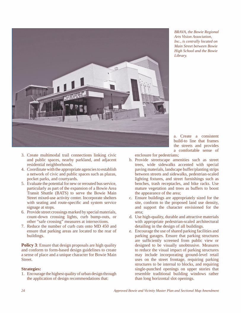
BRAVA, the Bowie Regional Arts Vision Association, Inc., is centrally located on Main Street between Bowie High School and the Bowie Library.

Approved Bowie and Vicinity Master Plan and Sectional Map Amendment 25
f. Provide high-quality signage compatible with its use and purpose. Ensure that signage placement, size and design are consistent within projects and compatible with adjacent development. Explore the feasibility of a unifi ed signage program throughout Bowie Main Street.
g. Explore the feasibility of establishing a public art program to provide fountains, statues, sculptures, sidewalk medallion insets, and other features to highlight the special nature of Main Street.
h. Locate utility lines underground where possible.i. Capitalize on every opportunity to provide a
mix of uses (residential, retail, civic, and offi ce) within existing retail centers.
j. Use the Bowie Center for the Performing Arts/Bowie High School complex to underline the unique character of the Bowie Main Street.
Policy 4: Ensure that development in Bowie Main Street does not adversely impact the character of existing residential neighborhoods.
Strategies:1. Use existing parkland adjacent to the street to buffer
existing residential areas from new development.2. Consider a transition in building density and
intensity from more intense uses located at the “core” of Bowie Main Street along MD 450 to less intense uses along the “edge” adjacent to residential neighborhoods.
West Bowie Village
Vision: West Bowie Village is a mixed-use center with commercial, residential, offi ce, and institutional uses integrated with open space in a pedestrian-friendly village setting.
Background: West Bowie Village is located west of MD 197 and south of MD 450. The area includes approximately 145,000 square feet of retail and employment uses. According to an economic analysis,
the existing businesses capture more than half (56 percent) of the residential expenditures within a half-mile radius.
Transforming this automobile-oriented shopping center into a more pedestrian-friendly, neighborhood-oriented center would sustain the existing business community and increase retail sales while minimizing the potential negative impacts caused by the relocation and expansion of MD 450. It may also enhance the competitive position of the existing businesses at West Bowie Village relative to new retail development located west along MD 450 at Highbridge Road and in the Fairwood community. An opportunity also exists for new residential development to support the businesses in West Bowie Village. Residential uses could include single-family, zero-lot-line dwellings, or townhouses. With appropriate zoning, live/work units could house home-based professional and business services such as internet-based businesses and arts-related uses, as well as traditional retail. Modest residential, retail, offi ce, and institutional uses would support the existing retail and aid in its retention.
Residential and retail uses should orient toward old MD 450. Development should be designed along a pedestrian-scaled village road with parallel parking, landscaping, a widened sidewalk, and designated bike path. (See Map 4, Appendix 8, page 185, West Bowie Village Land Use).
Goals: Retain and revitalize existing businesses. Create a pedestrian-oriented neighborhood in a
village setting. Provide new single-family, compatible multifamily,
and live/work units that help support neighborhood businesses.
Increase visibility and access and strengthen entries into West Bowie Village.
Provide an open space network linked by pedestrian and bike paths.
Policy 1: Encourage pedestrian-oriented, mixed-use development.
Rendering of the recommended design profi le of development in West Bowie Village.
26 Approved Bowie and Vicinity Master Plan and Sectional Map Amendment
Strategies:1. Create a pedestrian-friendly community environ-
ment enhanced by a mix of residential, commercial, recreational, employment, and institutional uses, closely integrated with open space.
2. Recommend and support future rezoning to an L-A-C (Local Activity Center) Village comprehensive design zone or a suitable mixed-use zone at the time of development and/or redevelopment to allow for an appropriate mix of uses and intensity to achieve the desired character for West Bowie Village.
Policy 2: Create a safe, attractive, vital village center.
Strategies:1. Provide trail connections between the central and
eastern portions of the mixed-use activity center to unify the area and enhance the character of West Bowie Village.
2. Encourage the highest quality of urban design through the application of design recommendations that:
a. Create a consistent build-to line along old MD 450 and future internal streets to frame the street and provide a pedestrian-friendly environment.
b. Provide streetscape amenities such as wide sidewalks, accent materials, pedestrian-scaled lighting fi xtures, street furnishings (benches, trash receptacles, bike racks), and attractive landscaping to encourage pedestrianism.
c. Use high-quality, durable and attractive materials and appropriate pedestrian-scaled architectural detailing in the design of all buildings.
d. Ensure buildings are appropriately sized for the site, conform to the proposed land use density, and are compatible with adjacent land uses and development.
e. Encourage the use of shared parking facilities and ensure that the design of parking areas is attractive, well-landscaped, visually screened from public streets and spaces, and safe for pedestrians. Whenever possible, parking areas should be located behind buildings and to the rear of the site.
f. Protect the quality of life in the Westview Forest residential neighborhood by limiting commercial development in that portion of West Bowie Village located in the southwestern quadrant of old MD 450 and the Pope’s Creek railroad tracks.
3. Create an open space network by linking pedestrian and bike paths to village greens, parkland, and other public spaces.
Policy 3: Revitalize and strengthen existing businesses.Strategies:1. Provide opportunities for new live/work businesses
to support the existing retail market.2. Enhance access to existing businesses by highlight-
ing entries, providing signature signage, and using a consistent wayfi nding system. Coordinate with the State of Maryland to provide special features such as unique and attractive entry signage at the inter-section of Grenville Lane and MD 450.
3. Provide residential uses in proximity to existing businesses.
New Urbanism: A movement in city planning based on the ideals of traditional, pre-World War II towns that strengthens the role people and the environment
play in city design and planning. This movement recognizes the prevalent problem of suburban sprawl
and the breakdown of the community and instead encourages convenience, walkability, aesthetics, livability, and ecological integrity in a city plan.
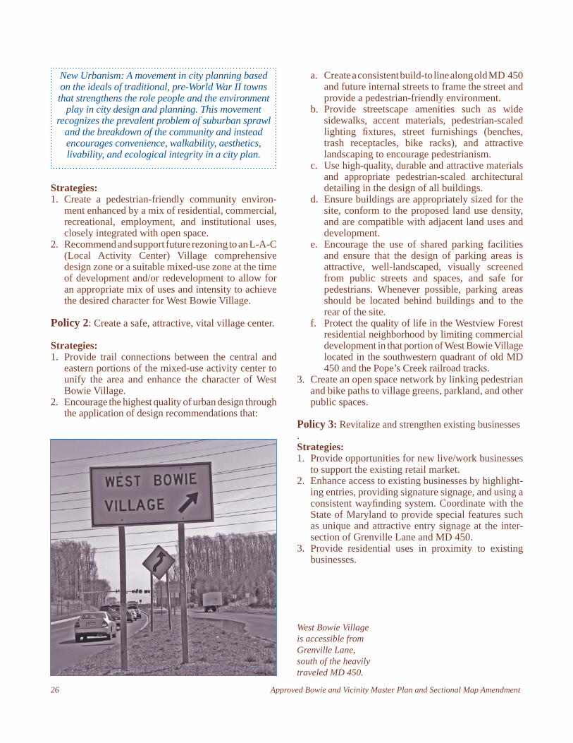
West Bowie Village is accessible from Grenville Lane, south of the heavily traveled MD 450.
Approved Bowie and Vicinity Master Plan and Sectional Map Amendment 27
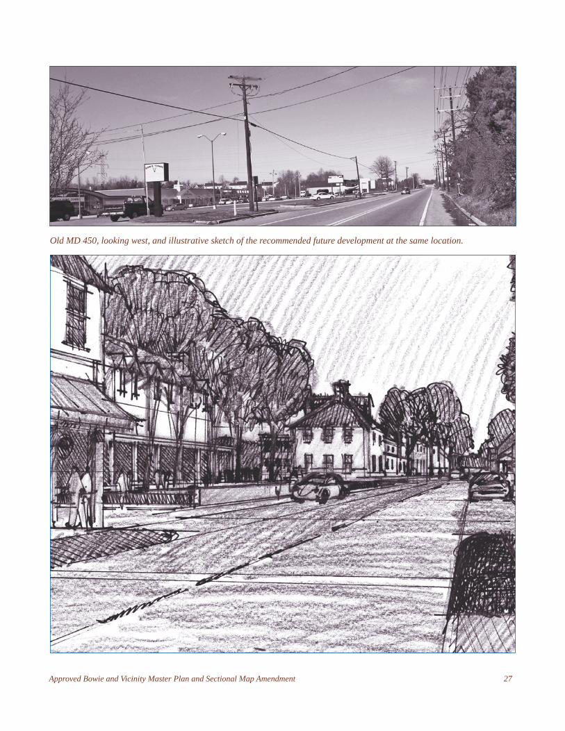
Old MD 450, looking west, and illustrative sketch of the recommended future development at the same location.
28 Approved Bowie and Vicinity Master Plan and Sectional Map Amendment
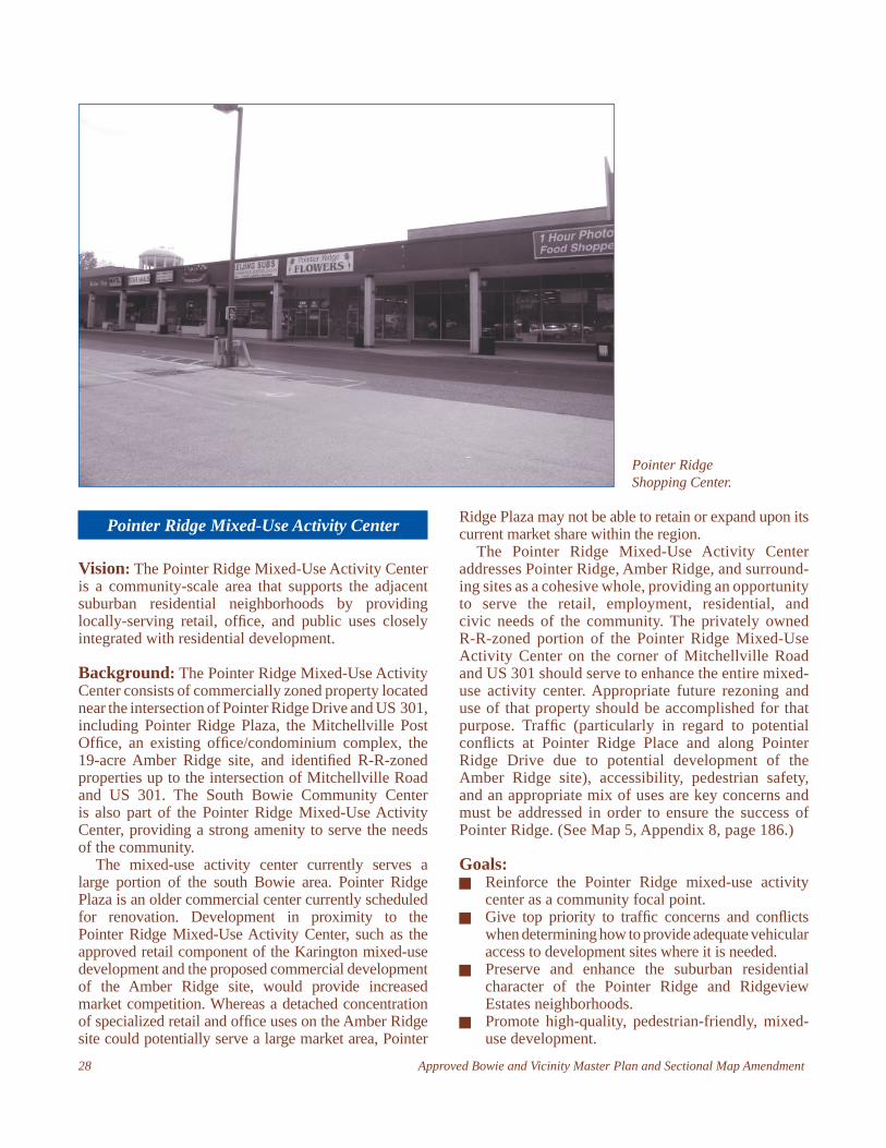
Pointer Ridge Mixed-Use Activity Center
Vision: The Pointer Ridge Mixed-Use Activity Center is a community-scale area that supports the adjacent suburban residential neighborhoods by providing locally-serving retail, offi ce, and public uses closely integrated with residential development.
Background: The Pointer Ridge Mixed-Use Activity Center consists of commercially zoned property located near the intersection of Pointer Ridge Drive and US 301, including Pointer Ridge Plaza, the Mitchellville Post Offi ce, an existing offi ce/condominium complex, the 19-acre Amber Ridge site, and identifi ed R-R-zoned properties up to the intersection of Mitchellville Road and US 301. The South Bowie Community Center is also part of the Pointer Ridge Mixed-Use Activity Center, providing a strong amenity to serve the needs of the community.
The mixed-use activity center currently serves a large portion of the south Bowie area. Pointer Ridge Plaza is an older commercial center currently scheduled for renovation. Development in proximity to the Pointer Ridge Mixed-Use Activity Center, such as the approved retail component of the Karington mixed-use development and the proposed commercial development of the Amber Ridge site, would provide increased market competition. Whereas a detached concentration of specialized retail and offi ce uses on the Amber Ridge site could potentially serve a large market area, Pointer
Ridge Plaza may not be able to retain or expand upon its current market share within the region.
The Pointer Ridge Mixed-Use Activity Center addresses Pointer Ridge, Amber Ridge, and surround-ing sites as a cohesive whole, providing an opportunity to serve the retail, employment, residential, and civic needs of the community. The privately owned R-R-zoned portion of the Pointer Ridge Mixed-Use Activity Center on the corner of Mitchellville Road and US 301 should serve to enhance the entire mixed-use activity center. Appropriate future rezoning and use of that property should be accomplished for that purpose. Traffi c (particularly in regard to potential confl icts at Pointer Ridge Place and along Pointer Ridge Drive due to potential development of the Amber Ridge site), accessibility, pedestrian safety, and an appropriate mix of uses are key concerns and must be addressed in order to ensure the success of Pointer Ridge. (See Map 5, Appendix 8, page 186.)
Goals: Reinforce the Pointer Ridge mixed-use activity
center as a community focal point. Give top priority to traffi c concerns and confl icts
when determining how to provide adequate vehicular access to development sites where it is needed.
Preserve and enhance the suburban residential character of the Pointer Ridge and Ridgeview Estates neighborhoods.
Promote high-quality, pedestrian-friendly, mixed-use development.
Pointer Ridge Shopping Center.
Approved Bowie and Vicinity Master Plan and Sectional Map Amendment 29
Policy 1: Encourage low- to moderate-density, pedestrian-oriented mixed-use development.
Strategies:1. Recommend and support future rezoning to an L-A-C
(Local Activity Center) Village Comprehensive Design Zone or a suitable mixed-use zone at the time of development and/or redevelopment to allow for an appropriate mix of uses and intensity.
2. Plan successful development and/or redevelopment of the Pointer Ridge Mixed-Use Activity Center in light of L-A-C mixed-use development at Hall Road/Central Avenue and the proposed Karington development in the southwest quadrant of Central Avenue and U.S. 301.
3. Encourage public agencies to locate public facilities to help create a civic core and provide a focal point for the Pointer Ridge Mixed-Use Activity Center.
4. Coordinate with the City of Bowie, appropriate public agencies, and private developers to provide clearly delineated pedestrian paths between civic/public uses and the adjacent residential neighborhoods.
5. Encourage the provision of public and private open space, parkland, and plazas to complement the community-oriented nature of the Pointer Ridge Mixed-Use Activity Center.
6. Explore the provision of quality senior housing within the Pointer Ridge Mixed-Use Activity Center. This senior housing should be attractive to current and future residents of nearby neighborhoods and accessible to these neighborhoods and Pointer Ridge mixed-use activity center services via pedestrian-friendly facilities. To accomplish this strategy, such senior housing is encouraged on the undeveloped Amber Ridge site.
Policy 2: Reduce traffi c confl icts, provide multimodal options, and ensure that the traffi c pattern of new development does not overwhelm local street capacity.
Strategies:1. Emphasize right-turn only ingress and egress to the
Amber Ridge site along Pointer Ridge Place from Pointer Ridge Drive to help alleviate congestion at the existing traffi c signal at the intersection of Pointer Ridge Drive and US 301.
2. Consider access to the Amber Ridge site through a portion of the South Bowie Community Center property from Pittsfi eld Lane. Work with the Department of Parks and Recreation and the City of Bowie to improve vehicular and pedestrian safety and access within the Pointer Ridge Center.
3. Evaluate the potential for new or rerouted bus service, particularly as part of the expansion of a
Bowie Area Transit Shuttle (BATS) to serve the Pointer Ridge activity center. Incorporate shelters with seating and route-specifi c, system service signage at stops.
4. Development on the Amber Ridge (C-S-C-zoned) property should not include discount or “big-box” commercial activities. No individual retail use, other than food or beverage stores (grocery store) shall exceed 75,000 square feet in size. Retail sales of alcoholic beverages in a food or beverage store are limited to 5,000 square feet or less.
Policy 3: Ensure that design is high quality and conforms to form-based design recommendations to create a sense of place and a pedestrian-oriented environment.
Strategies:1. Encourage the highest quality of urban design through
the application of design recommendations that:a. Create a consistent build-to line along all streets
(other than US 301) to frame the streets and pro-vide a pedestrian-friendly environment. Ensure that pedestrians are suffi ciently buffered from US 301 and other streets by providing a landscaped strip with trees between street and sidewalk.
b. Provide quality visual and audio screening between existing residential neighborhoods and all commercial developments.
c. Provide wide sidewalks with room for café seating (where appropriate), bike racks, and other street furniture.
d. Use high-quality paving materials and continue sidewalk materials across crosswalks to signify their presence and importance.
e. Provide buildings that are appropriately sized for the mixed-use activity center, conform to the proposed land use density, and recognize the adjacent land uses and development.
f. Provide high-quality materials and architectural detailing in the design of all buildings. Incorporate pedestrian-scaled features such as awnings, arcades, display windows, and balconies to relate to human activity at the street level.
g. Ensure that ample amenities such as plazas, public open space, public art, and civic uses are provided.
h. Provide high-quality, durable, and attractive signage, pedestrian-scaled lighting, and street furniture such as benches and decorative trash receptacles to contribute to a pedestrian-friendly environment.
i. Encourage shared parking facilities and ensure that parking structures are unobtrusive and do not dominate the visual environment.
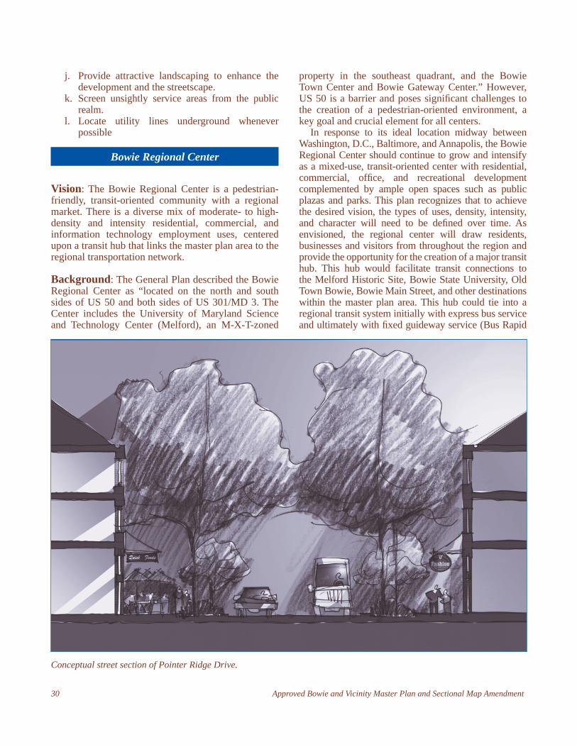
30 Approved Bowie and Vicinity Master Plan and Sectional Map Amendment
j. Provide attractive landscaping to enhance the development and the streetscape.
k. Screen unsightly service areas from the public realm.
l. Locate utility lines underground whenever possible
Bowie Regional Center
Vision: The Bowie Regional Center is a pedestrian-friendly, transit-oriented community with a regional market. There is a diverse mix of moderate- to high-density and intensity residential, commercial, and information technology employment uses, centered upon a transit hub that links the master plan area to the regional transportation network.
Background: The General Plan described the Bowie Regional Center as “located on the north and south sides of US 50 and both sides of US 301/MD 3. The Center includes the University of Maryland Science and Technology Center (Melford), an M-X-T-zoned
property in the southeast quadrant, and the Bowie Town Center and Bowie Gateway Center.” However, US 50 is a barrier and poses signifi cant challenges to the creation of a pedestrian-oriented environment, a key goal and crucial element for all centers.
In response to its ideal location midway between Washington, D.C., Baltimore, and Annapolis, the Bowie Regional Center should continue to grow and intensify as a mixed-use, transit-oriented center with residential, commercial, offi ce, and recreational development complemented by ample open spaces such as public plazas and parks. This plan recognizes that to achieve the desired vision, the types of uses, density, intensity, and character will need to be defi ned over time. As envisioned, the regional center will draw residents, businesses and visitors from throughout the region and provide the opportunity for the creation of a major transit hub. This hub would facilitate transit connections to the Melford Historic Site, Bowie State University, Old Town Bowie, Bowie Main Street, and other destinations within the master plan area. This hub could tie into a regional transit system initially with express bus service and ultimately with fi xed guideway service (Bus Rapid
Conceptual street section of Pointer Ridge Drive.
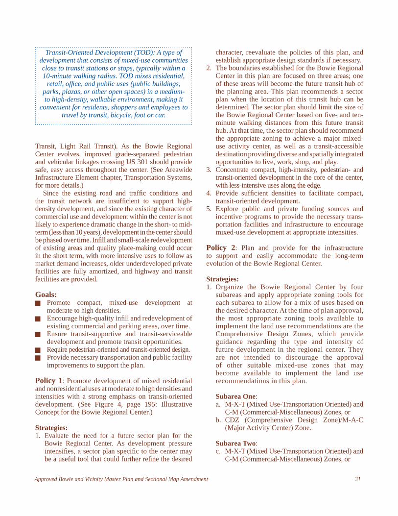
Approved Bowie and Vicinity Master Plan and Sectional Map Amendment 31
Transit, Light Rail Transit). As the Bowie Regional Center evolves, improved grade-separated pedestrian and vehicular linkages crossing US 301 should provide safe, easy access throughout the center. (See Areawide Infrastructure Element chapter, Transportation Systems, for more details.)
Since the existing road and traffi c conditions and the transit network are insuffi cient to support high-density development, and since the existing character of commercial use and development within the center is not likely to experience dramatic change in the short- to mid-term (less than 10 years), development in the center should be phased over time. Infi ll and small-scale redevelopment of existing areas and quality place-making could occur in the short term, with more intensive uses to follow as market demand increases, older underdeveloped private facilities are fully amortized, and highway and transit facilities are provided.
Goals: Promote compact, mixed-use development at
moderate to high densities. Encourage high-quality infi ll and redevelopment of
existing commercial and parking areas, over time. Ensure transit-supportive and transit-serviceable
development and promote transit opportunities. Require pedestrian-oriented and transit-oriented design. Provide necessary transportation and public facility
improvements to support the plan.
Policy 1: Promote development of mixed residential and nonresidential uses at moderate to high densities and intensities with a strong emphasis on transit-oriented development. (See Figure 4, page 195: Illustrative Concept for the Bowie Regional Center.)
Strategies:1. Evaluate the need for a future sector plan for the
Bowie Regional Center. As development pressure intensifi es, a sector plan specifi c to the center may be a useful tool that could further refi ne the desired
character, reevaluate the policies of this plan, and establish appropriate design standards if necessary.
2. The boundaries established for the Bowie Regional Center in this plan are focused on three areas; one of these areas will become the future transit hub of the planning area. This plan recommends a sector plan when the location of this transit hub can be determined. The sector plan should limit the size of the Bowie Regional Center based on fi ve- and ten-minute walking distances from this future transit hub. At that time, the sector plan should recommend the appropriate zoning to achieve a major mixed-use activity center, as well as a transit-accessible destination providing diverse and spatially integrated opportunities to live, work, shop, and play.
3. Concentrate compact, high-intensity, pedestrian- and transit-oriented development in the core of the center, with less-intensive uses along the edge.
4. Provide suffi cient densities to facilitate compact, transit-oriented development.
5. Explore public and private funding sources and incentive programs to provide the necessary trans-portation facilities and infrastructure to encourage mixed-use development at appropriate intensities.
Policy 2: Plan and provide for the infrastructure to support and easily accommodate the long-term evolution of the Bowie Regional Center.
Strategies:1. Organize the Bowie Regional Center by four
subareas and apply appropriate zoning tools for each subarea to allow for a mix of uses based on the desired character. At the time of plan approval, the most appropriate zoning tools available to implement the land use recommendations are the Comprehensive Design Zones, which provide guidance regarding the type and intensity of future development in the regional center. They are not intended to discourage the approval of other suitable mixed-use zones that may become available to implement the land use recommendations in this plan.
Subarea One: a. M-X-T (Mixed Use-Transportation Oriented) and
C-M (Commercial-Miscellaneous) Zones, or b. CDZ (Comprehensive Design Zone)/M-A-C
(Major Activity Center) Zone.
Subarea Two:c. M-X-T (Mixed Use-Transportation Oriented) and
C-M (Commercial-Miscellaneous) Zones, or
Transit-Oriented Development (TOD): A type of development that consists of mixed-use communities close to transit stations or stops, typically within a 10-minute walking radius. TOD mixes residential,
retail, offi ce, and public uses (public buildings, parks, plazas, or other open spaces) in a medium- to high-density, walkable environment, making it
convenient for residents, shoppers and employees to travel by transit, bicycle, foot or car.

32 Approved Bowie and Vicinity Master Plan and Sectional Map Amendment
d. CDZ (Comprehensive Design Zone)/L-A-C (Local Activity Center) Zone, or
e. CDZ (Comprehensive Design Zone)/V-L (Village-Low) Zone.
Subarea Three:f. C-M (Commercial-Miscellaneous) Zone, org. CDZ (Comprehensive Design Zone)/M-A-C
(Major Activity Center) Zone.
Subarea Four:h. CDZ (Comprehensive Design Zone)/M-A-C
(Major Activity Center), C-O (Commercial Offi ce), and R-R (Rural Residential) zones, or
i. CDZ (Comprehensive Design Zone)/M-A-C (Major Activity Center) Zone.
The envisioned character of each of these subareas is largely dependent upon the location of a future transit hub within the Regional Center. Three potential locations (Subareas One, Three, and Four) have been identifi ed. The subarea in which the transit hub will be built should have the highest mix and intensity of uses and density concentrated at the core of the subarea (within a quarter-mile of the transit hub), including the majority of the employment and offi ce uses to maximize usage of transit. The other two subareas under consideration should develop as transit-supportive nodes with a less intensive mix of uses and density.
Subarea Two should develop with a mix of medium- to high-density residential uses, with offi ces and small-scale ancillary commercial uses possible. All four subareas should be designed to support future transit service (for example, by providing bus stops and dedicated right-of-way for future transit lines utilizing the transit hub but making stops in the other subareas and by incorporating pedestrian-friendly architectural detailing), and to safely accommodate pedestrians.
2. Develop a phasing and public/private fi nancing plan for development and redevelopment of the Bowie Regional Center to ensure that adequate transportation and public facilities are in place or funded for construction at the time of development.
Policy 3: Provide for a multimodal, pedestrian-friendly transportation system.
Strategies:1. Identify a preferred site for a transit hub to be
phased-in over time and concentrate development intensity within the core (generally between one-quarter and one-third of a mile walking distance from the transit hub) to maximize the potential for
mass transit. Less intensive development should be directed to the edge (generally located an additional one-quarter to one-third of a mile walking distance beyond the core).
2. Provide enhanced transit service such as local circulators and intraregional and express bus.
3. Establish a Transportation Management Agency to promote the area, encourage car/van pool and transit use, improve pedestrian facilities, and facilitate parking and transportation and parking demand management.
4. Facilitate structured parking through fi nancial incentives such as the implementation of a parking district, special tax districts, and tax increment fi nancing, and through state and county private infrastructure investment.
5. Encourage use of shared parking facilities and locate complementary uses close to one another to reduce the need for car trips and to generate transit ridership.
6. Provide a multimodal network of sidewalks and trails to enhance safety and access within the Bowie Regional Center and to connect the Center to adjacent residential areas.
7. Plan for longer term fi xed guideway transit services including preservation of potential guideway.
Policy 4: Provide high-quality, pedestrian- and transit-oriented urban design in the Bowie Regional Center by ensuring that design proposals conform to form-based design recommendations.
Strategies:1. Ensure transit-oriented development with character
and quality through the application of design recommendations that:a. Concentrate density and intensity levels within the
core of the Bowie Regional Center and transition to lower levels of intensity along the edge.
b. Create a consistent build-to line that frames the streets and provides a comfortable sense of enclosure for pedestrians. Ensure that buildings do not overwhelm the street by requiring a height setback or building recession line (for example, a building or façade recession line may be established for the upper stories of all buildings that exceed four stories).
c. Recognize that the streetscape is essential to the success of pedestrian-oriented environments, and emphasize the need for the overall design and amenities within the Bowie Regional Center to create a special sense of place.
d. Provide ample streetscape amenities such as street trees, wide sidewalks accented with special paving materials, landscape buffer/planting
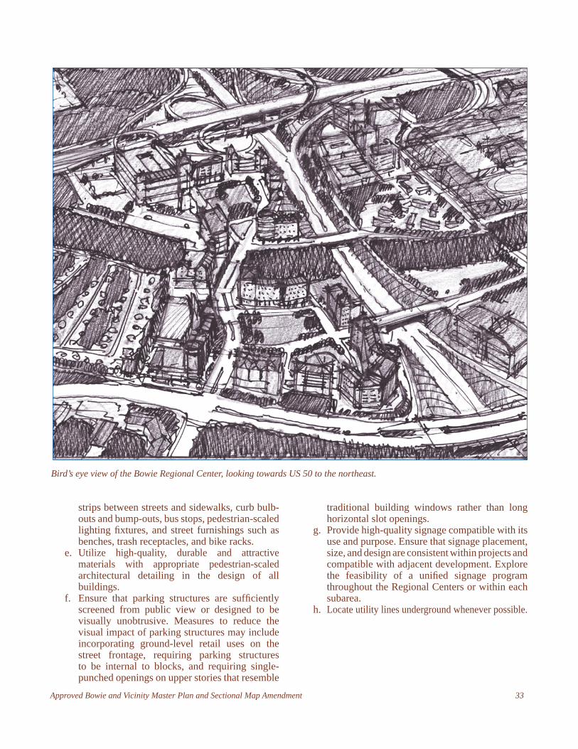
Approved Bowie and Vicinity Master Plan and Sectional Map Amendment 33
strips between streets and sidewalks, curb bulb-outs and bump-outs, bus stops, pedestrian-scaled lighting fi xtures, and street furnishings such as benches, trash receptacles, and bike racks.
e. Utilize high-quality, durable and attractive materials with appropriate pedestrian-scaled architectural detailing in the design of all buildings.
f. Ensure that parking structures are suffi ciently screened from public view or designed to be visually unobtrusive. Measures to reduce the visual impact of parking structures may include incorporating ground-level retail uses on the street frontage, requiring parking structures to be internal to blocks, and requiring single-punched openings on upper stories that resemble
traditional building windows rather than long horizontal slot openings.
g. Provide high-quality signage compatible with its use and purpose. Ensure that signage placement, size, and design are consistent within projects and compatible with adjacent development. Explore the feasibility of a unifi ed signage program throughout the Regional Centers or within each subarea.
h. Locate utility lines underground whenever possible.
Bird’s eye view of the Bowie Regional Center, looking towards US 50 to the northeast.

34 Approved Bowie and Vicinity Master Plan and Sectional Map Amendment