development engineering procedures and … - business... · development engineering procedures...
TRANSCRIPT

DEVELOPMENT ENGINEERING
PROCEDURES AND GUIDELINES

Development Engineering Procedures & Guidelines Manual Page 1
TOWN OF OAKVILLE
DEVELOPMENT ENGINEERING PROCEDURES AND GUIDELINES MANUAL
________________________________________________________________________ SECTION 1 INTRODUCTION 1.0 General 1.1 Development Engineering Department 1.2 Procedures and Guidelines Manual SECTION 2 DEVELOPMENT JURISDICTION (RESPECTIVE AGENCIES' REQUIREMENTS) 2.1 Ministry of Transportation Ontario 2.2 Halton/Credit Valley Conservation Authority 2.3 Regional Municipality of Halton 2.4 Ministry of Environment 2.5 Ministry of Natural Resources 2.6 Ministry of Government Services/ ORC 2.7 Other Applicable Agencies SECTION 3 SUBDIVISION ENGINEERING 3.1 Design Criteria and Servicing Requirements 3.2 Drawing and Drafting Requirements 3.3 Engineering Submission Procedure 3.4 Construction Administration / Timeline SECTION 4 CONSTRUCTION METHODS AND MATERIALS ( SEWER AND ROAD WORKS ) 4.1 General New Development Construction Process 4.2 Role of the Development Services Department 4.3 Working Hours 4.4 Construction Procedures and Requirements 4.5 Base Servicing for Building Permits ( 1st Stage ) 4.6 Subdivision Services Control ( House Building Stage ) 4.7 Completion of Curbs, Sidewalks, Boulevards ( 2nd Stage ) 4.8 Final Inspection of Municipal Works for Assumption Clearance 4.9 Administrative Process for the Assumption By-law 4.10 Summary

Development Engineering Procedures & Guidelines Manual Page 2
SECTION 5 SUBDIVISION ADMINISTRATION 5.1 Subdivision Agreements
5.2 Plan Registration 5.3 Assumption Procedure
SECTION 6 SITE PLAN DEVELOPMENT 6.0 General 6.1 Design Criteria 6.2 Submission Requirements 6.3 Site Development Agreements 6.4 Site Inspection and Approval 6.5 Multi-Family and Condominium Servicing 6.6 Tree Protection and Preservation Policy/Permit SECTION 7 TOWN POLICIES AND REQUIREMENTS 7.1 Building Department 7.2 Public Works Department ( Construction and Engineering ) 7.3 Parks and Open Space Department 7.4 Legal Services Department 7.5 Clerk's Department 7.6 Finance Department 7.7 Studies 7.8 Miscellaneous

Development Engineering Procedures & Guidelines Manual Page 3
SECTION 1. INTRODUCTION 1.0 General 1.1 Development Services Department (Engineering ) 1.2 Procedures and Guidelines Manual

Development Engineering Procedures & Guidelines Manual Page 4
SECTION 1. INTRODUCTION 1.0 General The Development Services Department advises the Planning and Development Council
on planning and engineering matters related to the physical development of the Town, in conjunction with associated economic, social and environmental matters
1.1 Development Services
The responsibilities for this department include the engineering issues related to: 1. Approval of Subdivision Engineering Designs (road/grading/storm) 2. Subdivision and Condominium Agreement Preparation, Plan Registration and
Assumption By-laws 3. Site Plan Review and Approval of engineering items 4. Approval of Stormwater Management Reports and Design 5. Special Studies (Environmental Assessments) 6. Approval of Grading and Drainage for all Building Permits 7. Comments for Land Severance and Committee of Adjustment 8. Comments for Draft Plan of Subdivision and/or Condominium 9. Comments for Part Lot Control Exemptions 10. Comments for Zoning and/or Official Plan Amendments 11. Approval of Development Related Studies Such as Noise, Geotechnical, Storm
Water Management, Sub-watershed, Environmental Implementation/Impact , Environmental Audit, Functional Servicing, Traffic Impact
12. Approval of Site Alteration Permits and Pool Enclosure Permits
13. Review and enforcement of Tree Protection .
14. Inspection and monitoring of subdivision construction.
Development Engineering Procedures & Guidelines Manual Page 5
The Development Services group provides engineering support and advice to the Planning Services Department, and provides liaison with the other Departments within the Town regarding development related issues.
Development engineering review process encompasses the approval of all servicing
designs for residential, commercial and industrial projects. The issues of concern include municipal road design/improvements, storm water management, noise attenuation, and general site servicing and drainage.
The following planning applications require engineering review: OP and Zoning
amendments, Watershed Studies, Plan of Subdivisions, Commercial and Industrial Site Plans, Land Division and Minor Variances, and all Building Permits.
The Section also responds to citizen concerns for grading and drainage with regard to
private property, and offers direction and advice to citizens (as requested) for remedial action.
The Construction and Permit section is comprised of field staff who perform inspections
related to the compliance of constructed private and municipal infrastructure and the impacts to existing Town assests and other private property. Permits are issued for Site Alteration, Pool Installation, and all related Tree Protection.

Development Engineering Procedures & Guidelines Manual Page 6
1.2 Procedure and Guidelines Manual This Procedure and Guidelines Manual is prepared by the Development Services
Department with the assistance of the Engineering and Construction Department and the Parks and Open Space Department, for reference and direction to consulting engineers, planners, developers, architects and others involved in land development related projects within the Town of Oakville.
The intent of the manual is to assist the development industry in the preparation and
processing of engineering drawing/reports and agreement submissions. It is expected that all consultants and others who design or construct services or build will
adhere to these procedures and the Town of Oakville standards. This manual will identify: a) The various Town Departments and outside agencies involved with the
engineering approval process b) The general requirements for subdivision development engineering including
design criteria, engineering submission requirements, subdivision agreements, subdivision construction, subdivision assumption process
c) The site plan general requirements including design criteria, submission
requirements, site development agreements and site inspection approval d) Miscellaneous Town policies, approvals and permits e) The requirements for major studies such as Environmental Assessments,
Watershed and Sub-watershed Studies, Noise Attenuation Studies, Traffic/Transportation Studies
f) Additional issues such as sales pavilions, model homes, construction trailers, etc. g) General information pertaining to the Town's Development Charges By-law h) Applicable subdivision and site plan standard forms and letters i) Construction procedures and methodologies j) Parks and Open Space Department requirements and procedures related to Town
Parks development

Development Engineering Procedures & Guidelines Manual Page 7
SECTION 2. DEVELOPMENT JURISDICTION (AGENCIES' REQUIREMENTS)
2.1 Ministry of Transportation Ontario 2.2 Credit Valley Conservation / Conservation Halton 2.3 Regional Municipality of Halton 2.4 Ministry of the Environment 2.5 Ministry of Natural Resources / DFO 2.6 Other Applicable Agencies

Development Engineering Procedures & Guidelines Manual Page 8
SECTION 2. DEVELOPMENT JURISDICTION 2.1 Ministry of Transportation Ontario - M.T.O. The Development Engineering Section provides guidance and information regarding
Ministry requirements. Ministry of Transportation Access Permit A permit is required for modification of an access from a highway, use of an existing
entrance for a different purpose or change of ownership. It is the owner's/consultant's responsibility to obtain this permit.
Encroachment Permit An encroachment permit is required for work upon, under, or within the limits of a
provincial highway right-of-way. It is the owner's/consultant's responsibility to obtain this permit.
Sign Permit Erection of a sign within 400m of any provincial highway may require a permit. It is the
owner's/consultant's responsibility to obtain this permit. Building and Fill Permits/ Storm Drainage Criteria Placement of fill, constructing a building or any structure requires a permit. Check with
MTO per their SWM criteria for sites draining towards their corridors. * All M.T.O. requirements should be confirmed directly with the M.T.O. 2.2 Credit Valley Conservation - C.V.C. Conservation Halton - CH Approval is required from the H.R.C.A. & C.V.C.A. for, but not limited to, the following Stormwater Management Studies and Ground Water Impacts ( MNR ) Erosion and Sedimentation Control Plans and Reports Stormwater Ponds / Outfall Structures / Alteration to a Water Course Top of Bank Protection / Lot Grading adjacent to Regulated Creeks Water Taking Permits/ Watercourse crossings / Site Alteration within Regional floodplain Note that the conservation authorities review all projects with respect to Section 35 of the
Fisheries Act on behalf of the Department of Fisheries and Oceans (DFO) It is the owner's/consultant's responsibility to obtain the approvals (or permits).

Development Engineering Procedures & Guidelines Manual Page 9
2.3 Regional Municipality of Halton Information and approvals are required for, but not limited to, the following: a) Sanitary / Wastewater Sewers The location of connections and an impact study of trunk and semi-trunk mains,
approval of proposed subdivision sanitary services. The effect on and possible relocation of existing installations It is the owner's/consultant's responsibility to obtain Region approvals. b) Watermains The location of existing watermains and an impact study of proposed
development on existing installations, approval of proposed subdivision works. Changes to existing installations The effect on pressure levels and impact on existing fire protection c) Ground Water and Well Water Required impact assessments and hydro geological studies. d) Storm Sewers The approval of storm systems on regional roads only. e) Regional Road Works All proposed work within the r.o.w. Halton Region, Development Coordinator,
shall approve limits of a Regional Road. Note that the Town of Oakville maintains the sidewalk on these roads.
Regional Roads include the following in whole or part ( check with the Region ) : Bronte Road, Dundas Street, Upper Middle Road, Trafalgar Road, Ford Drive,
Burloak Drive, Dorval Drive and Burnamthorpe and Neyagawa Blvd.

Development Engineering Procedures & Guidelines Manual Page 10
2.4 Ministry of Environment , M.O.E. Approvals are required for, but not limited to, the following: Stormwater Quality/Quantity Studies / Permits to Take Water Municipal and Private Water & Sewage Works Noise Impact Assessment Studies It is the owner's/consultant's responsibility to obtain the approvals. 2.5 Ministry of Natural Resources, M.N.R./ DFO Approvals are required for, but not limited to the following: Alteration to a Water Course / Lakes and Rivers Permit Stormwater Management Studies (Watershed and Subwatershed Level) It is the owner's/consultant's responsibility to obtain the approvals. 2.6 Other Agencies Approvals may be required from: Agriculture and Food - Ministry Bell Canada Canada Post Canadian Pacific Railway/ Canadian National Railway Culture and Communications GO Transit Halton Public Board of Education Pipeline Authorities – National Energy Board ( IPL/TCPL/Union/Enbridge ) Municipal Affairs/ORC - Parkway Belt Niagara Escarpment Commission
Development Engineering Procedures & Guidelines Manual Page 11
Non-Profit Housing - Halton Oakville Hydro Ontario Hydroelectric Power Commission Police - Halton Public Health - Halton Roman Catholic School Board - Halton Royal Commission of the Future of the Toronto Waterfront Social Services - Halton TransCanada Pipeline Union Gas - Canada It is the owner's/consultant's responsibility to obtain approvals from these agencies, when
necessary.

Development Engineering Procedures & Guidelines Manual Page 12
SECTION 3. SUBDIVISION ENGINEERING 3.1. Design Criteria and Servicing Requirements 3.1.1. Introduction 3.1.2. Sanitary and Water Supply 3.1.3. Storm Drainage Criteria 3.1.3.01. Storm Water Management Policy/ Watershed Based Planning 3.1.3.02. Regulated Watercourses 3.1.3.03. Sedimentation Control (Topsoil/Fill By-Laws) 3.1.3.04. Storm Water Quantity Control 3.1.3.05. Storm Water Quality Control 3.1.3.06. Storm Water Management Report Requirements 3.1.3.07. Storm Sewer Design Criteria 3.1.3.08. Storm Sewer Pipe Specifications 3.1.3.09. Catch basin Specifications 3.1.3.10. Manhole Specifications 3.1.3.11. Individual Service Connections 3.1.3.12. Roof Leader Criteria 3.1.3.13. Foundation Drain Criteria 3.1.3.14. Overland Flow Routes (Major) 3.1.3.15. Inlet/Outlet Structures
3.1.3.16. Culverts and Bridges 3.1.3.17. SWM Pond Design Guidelines 3.1.3.18. SWM Pond Monitoring and Maintenance ( Assumption )
3.1.4. Lot Grading and Drainage Criteria 3.1.4.1. Information Required on Lot Grading Plan 3.1.4.2. Drainage Criteria 3.1.4.3. Grading Constraints / Topsoil Criteria 3.1.4.4. Retaining Walls 3.1.4.5. Driveway Settlement and Lot Grading Repairs 3.1.4.6. Exterior Stairs and Landings 3.1.4.7. Lot Grading Certificates 3.1.4.8. Foundation Wall Certification 3.1.4.9 Site Alteration By-Law 2003-021

Development Engineering Procedures & Guidelines Manual Page 13
3.1.5. Municipal Road Criteria 3.1.5.1. Right-of-Way and Pavement Widths 3.1.5.2. Geometric Design 3.1.5.3. Pavement Design - Roadways 3.1.5.4. Construction Accesses 3.1.5.5. Driveway Entrances 3.1.5.6. Curbs 3.1.5.7. Sidewalks 3.1.5.8. Traffic Signs 3.1.5.9. Street Lighting 3.1.5.10. Hydro 3.1.5.11. Bicycle Pathways 3.1.5.12. Canada Post 3.1.5.13. Pipelines 3.1.5.14. Street Names 3.1.5.15. Noise Fences
Development Engineering Procedures & Guidelines Manual Page 14
3.1. Design Criteria and Servicing Requirements 3.1.1. Introduction This section outlines the engineering design criteria and servicing requirements for
guidance to the land development industry with projects in the Town of Oakville. The criteria is to be used as a guide and is general in nature. It is not meant to relieve the
developer of the responsibility of submitting a finished product of competent engineering design and construction. For any form of consideration made to diverge from minimum Town standards of requirements, the applicant prior to the respective submission for Town approval shall specifically refer to a proposal.
3.1.2. Sanitary Sewers and Water Supply Information regarding the design criteria and standard for sanitary and water servicing
must be obtained from the Region of Halton Public Works Department.

Development Engineering Procedures & Guidelines Manual Page 15
3.1.3 STORM DRAINAGE CRITERIA 3.1.3.01 Storm Water Management Policy 3.1.3.02 Regulated Watercourses 3.1.3.03 Sedimentation Control (Topsoil/Fill By-Laws) 3.1.3.04 Storm Water Quantity Control 3.1.3.05 Storm Water Quality Control 3.1.3.06 Storm Water Management Report Requirements 3.1.3.07 Storm System Design Criteria 3.1.3.08 Storm Sewer Pipe Specifications 3.1.3.09 Catch basin Specifications 3.1.3.10 Manhole Specifications 3.1.3.11 Individual Service Connections 3.1.3.12 Roof Leader Criteria 3.1.3.13 Foundation Drain Criteria 3.1.3.14 Overland Flow Routes (Major) 3.1.3.15 Inlet/Outlet Structures 3.1.3.16 Culverts and Bridges
3.1.3.17 SWM Pond Design Guidelines 3.1.3.18 SWM Pond Monitoring and Maintenance ( Assumption )

Development Engineering Procedures & Guidelines Manual Page 16
3.1.3 Storm Drainage Criteria 3.1.3.01 Storm Water Management Policy / Watershed Based Planning The Town of Oakville adheres to the recommendations of the Province regarding the
implementation of watershed management planning and the promotion of a comprehensive ecosystem approach. All new development proposals shall conform to the recommendations of the applicable Watershed/sub-watershed and/or Environmental Implementation study.
The preservation and enhancement of watercourses, valleys and natural heritage features
shall be consistent with watershed and sub-watershed impact management studies. New development shall be designed to mitigate impacts to the watercourse, valley feature and fish habitat including erosion, flooding, water quality and other detrimental impacts.
The majority of Creeks, within the boundaries of Oakville and south of Dundas Street,
have been assessed via Sub-watershed Studies. These Study Reports are deposited with the Town and Conservation Halton and shall be referred to when analyzing drainage impacts within the delineated sub-watershed boundary. The Town and CH shall be consulted when determining which study applies and whether further assessment and updates are required.
The North Oakville Secondary Plan has a separate comprehensive watershed plan known
as the ‘North Oakville Creeks Subwatershed Study’ or NOCSS. This study report applies to the lands north of Dundas Street up to the MTO 407 corridor and between Tremaine Road and Ninth Line.
The NOCSS provides the terms of reference for the Environmental Implementation
Report (EIR) which shall be prepared for the watershed sub-area impacted by a development plan ( subdivision ). All Draft Plans of Subdivision require an approved EIR and Functional Servicing Study ( FSS ).
The EIR/FSS is prepared to ensure that the requirements of the Subwatershed Strategy
and Secondary Plan are met and to address site characteristics in sufficient detail to allow for the development of Draft Plan conditions. The NOCSS outlines the terms of reference for the EIR. The EIR provides a more detailed review of the following issues ( not a finite list ) :
• Preservation of the natural heritage system ( NHS ) • Protection and rehabilitation of stream corridors and linkages • SWM, hydrogeology/water balance, water quality, erosion, • Refinement of floodline mapping and hydrologic features
The SWM plan shall be formulated through a combination of Best Management Practices (BMP), Low Impact Development (LID), and SWM Ponds.

Development Engineering Procedures & Guidelines Manual Page 17
3.1.3.02 Regulated Watercourses Conservation Halton shall be consulted when determining the regulated limits of creeks. Flood Line Mapping can be obtained from CH and is some cases from the Town. Storm sewer outfalls, creek crossings, erosion protection and all other regulated creek
alterations require a permit from CH and may have restricted work periods based on the fishery designation of the creek.
The proposed disturbance of the watercourse may also require an "environmental impact
assessment" to identify the preferred infrastructure location with the least negative impacts.
3.1.3.03 Sedimentation Control/Site Alteration By-Law 2003-021/2008-124 A major detrimental impact on natural watercourses is the introduction of suspended soil
particles in the water system. Suspended soil in the watercourse is hazardous to fish and fish habitat both where it is suspended and when it is finally deposited.
The Ministry of Natural Resources, DFO and Conservation Authorities have stressed the
importance of controlling activities, which lead to the contamination of watercourses and fish habitat.
The Town of Oakville has implemented a by-law, through the co-operation of the Conservation Authorities, for the purpose of controlling construction and other earth moving activities, which may contribute, to the contamination of the creek systems.
The Site Alteration By-Law regulates the placement, removal and any type of disturbance of soil on all sites in the Town of Oakville as associated with all types of building or construction activity. This by-law states that no person or corporation shall engage in earth moving activities within the Town of Oakville without first having obtained a Site Alteration Permit from the Development Services Department.
The permit will be issued once the Town is satisfied that all precautions have been taken
to protect a watercourse and/or storm system from contamination. This permit will also ensure the protection of trees, detail site restoration, and secure for any damage to municipal infrastructure and general cleanup.
For complete requirements of the By-law, contact the Manager of Permits and
Construction, Development Services Department.

Development Engineering Procedures & Guidelines Manual Page 18
3.1.3.04 Storm Water Quantity Control Storm water quantity control is required where increased storm runoff, due to
development, will cause detrimental impacts via flooding and erosion. Controls are to be implemented based on all applicable Watershed/Subwatershed and/or Environmental Impact studies and will require a site-specific storm water impact management assessment to identify the detailed swm methods required to comply with the watershed target levels and Town policies.
Subdivisions typically incorporate extended wet detention ponds to provide the required
quality and quantity attenuation. These ponds are located within or adjacent to open space areas where they can provide natural habitat enhancement as well as a public amenity feature. Ponds provide a centralized efficient facility which is fully owned and operated by the Town. Town operation of these facilities ensures that the pond function will continue to comply with all of the required swm attenuation targets.
The Town’s requirements for the design of SWM Ponds can be found in a section of this
manual under ‘ Municipal SWM Pond Design Guidelines ‘ Site specific controls are required where peak runoff exceeds the receiving storm sewer
and/or watercourse capacity, or existing flooding or erosion problems have been identified. In the absence of a Subwatershed Study the minimum control is to maintain post-development peak runoff at pre-development levels for all events up to the 100-year level. This applies where the capacity or impacts to the receiving system is unknown or too difficult to accurately determine.
Typical site storage methods include SWM Ponds, flat rooftops, bio-swales, remote
parking surfaces where permitted, and oversizing of pipes or buried tanks. 3.1.3.05 Storm Water Quality Control Water Quality controls are to be implemented on all developments in accordance with the
applicable approved Subwatershed Plan/ EIR or the established criteria for the receiving body. Conservation Halton has established the sensitivity of most creek systems based on MNR and DFO studies and surveys.
The Ministry of the Environment has published a SWM Planning and Design Manual
which shall be referenced for the appropriate method of quality control to achieve the targeted levels per the given receiving system.
At source controls are encouraged where soil conditions allow for infiltration and
biological treatment. Subdivision level development will generally incorporate a centralized SWM pond which
will provide quality and quantity control functions. These ponds are incorporated adjacent to the existing natural features and park facilities. The Town will establish the

Development Engineering Procedures & Guidelines Manual Page 19
safety, aesthetic, and maintenance criteria based on each specific development. The Town’s requirements for the design of SWM Ponds can be found in a section of this
manual under ‘ Municipal SWM Pond Design Guidelines ‘ Developers are required to maintain and monitor the operation of quality/detention ponds
and shall ensure the facility meets with the current MOEE criteria prior to the Town assuming the facility.
Small sites per general commercial and industrial development are suitable for the
application of at source controls such as oil/grit separators and bio-swales. Specific manufactures shall provide certification of the performance of these devices. The private site owner shall be responsible for the long term operation and maintenance of this type of device.
The quality of discharged storm water shall also comply with the Town’s Storm Sewer
Use By-law as outlined in By-law 2009-031. 3.1.3.06 Storm Water Management Implementation Report Requirements General Site Plan Submission On-site storm water quantity controls are required where drainage restrictions are
established or post-to-pre runoff control is warranted. The modified Rational Method or equivalent may be used for the analysis of simple sites.
OTTHYMO/INTERHYMO modeling may be required where warranted or another Model may be dictated by the Watershed Study.
Control devices shall be installed on the upstream side of control manholes located on the
street line; preferred method is a two-piece adjustable diamond orifice. Orifice openings must have a diameter of no less than 75 mm in order to prevent clogging of the opening.
Storm connections from the building roof and foundation drains must be made
downstream of the manhole and/or catchbasin inlet controls. Roof drains should be selected to provide the required flows per unit to obtain the designed detention storage.
Pond limits and available storage are to be depicted on the site servicing/grading drawings. Maximum ponding depth in parking areas is not to exceed 250mm, and no ponding shall be located in a fire route. No five-year ponding (nuisance) on pavement: use landscaped areas, roofs or underground structures. Sites are to be designed to contain all runoff with major overland spills diverted to approved channels or municipal right-of-ways. External flows shall be accepted without upstream impacts.
An overland flow route shall be clearly marked on drawings. The grading of landscaped
areas and parking lots shall provide a safe path for the overland flow route to the surrounding municipal right of way during storms exceeding the design storm event.

Development Engineering Procedures & Guidelines Manual Page 20
Details and concepts are to conform to the Urban Drainage Design Guidelines, set out by
the Ministry of Environment and Energy. Where applicable, approval will be required from the local Conservation Authority.
A Professional Engineer must approve and stamp, the on-site storm water management
report and site servicing drawings. The Design Engineer shall provide an "as-built certification" of the SWM system prior to the final release from the Town.
Storm Water Management for a Subdivision Plan A SWM Implementation Report shall be prepared and include the following : 1. A map of existing contours and pre-development catchments including external
contributing areas. Identify flood plain limits of all watercourses. 2. A plan with post-development catchments including area and runoff coefficients. 3. A plan of sewer system, SWM facilities and overland flow routes. 4. A description of methodology and existing watershed criteria 5. A summary of the Town's applicable criteria to be met. 6. Detail input parameters to OTTSWMM Model. 7. Submit complete computer output/input printouts (computer files). 8. Summarize computer output results in a simplified tabular format. 9. Compare sewer sized by Rational Method to OTTSWMM output; identify revised
pipes and proposed catchbasin inlet controls. 10. Verify that major overland flow routes do not impact properties and that road
gutter flows are within Town parameters. 11. 1:100 year hydraulic grade lines to be calculated for all pipes and basement
elevations evaluated for surcharge potential 12. Provide summary of how all Town and Watershed SWM criteria has been
satisfied. 13. Outline the maintenance and monitoring program for the SWM features.

Development Engineering Procedures & Guidelines Manual Page 21
3.1.3.07 Storm Water Conveyance Design Criteria Major and Minor systems In general, the Town supports the concept of urban drainage with two separate and
distinct components being the minor drainage system and the major drainage system. The minor drainage system may incorporate swales, street gutters, catchbasins, and storm
sewers. Components of the minor system accommodate the runoff from the more frequent storms up to the design frequency of the system (e.g. once in two years up to once in ten years). Properly designed and maintained, it reduces the incidence of inconvenience to both pedestrians and motorists.
The major drainage system comprises the natural streams and valleys and the man-made
channels and ponds, and shall accommodate the runoff from even the least frequent storms such as once in a hundred years and the Regional storm. In practice, the street also acts as components of the major system during severe floods since they transport the runoff in excess of the storm sewer capacity. Properly designed and constructed, the major system shall minimize the risk of loss of life and property damage due to flooding.
Hydraulic Design Levels The system of street gutters; catchbasins and storm sewers shall be designed for the 1:5
year storm, with the following exceptions: (a) Consideration will be given to using a 1:2 year storm for low to medium density
residential areas if this is necessary for achievement of the specified degree of quantity control for the community.
(b) Consideration will be given to using a 1:10 year storm for high value commercial
development and for downtown business areas. In such cases, the Town may require some internal control in the form of storage on flat roofs, temporary ponding on parking areas furthest away from the building or underground storage. In either case, the Town may require the developer to provide a manhole located at the street line to control discharges into the storm sewer system.
It is absolutely vital that the interception capacity of the system of catchbasins be
completely compatible with the design capacity of the storm sewers. While the storm sewers will be designed for free-flow conditions for the storm noted above, the actual flows captured by the catchbasins during the 1:100 year design storm shall be determined using OTTSWMM. The hydraulic grade lines produced by the captured 1:100 year design storm flows shall be determined using OTTSWMM or SWMM EXTRAN and shall be plotted on the detailed design drawings. OTTSWMM calculates the pipe size assuming a free-flow; if surcharge conditions are preferred, EXTRAN shall be used.
Development Engineering Procedures & Guidelines Manual Page 22
The spacing of catchbasins may be varied and approved orifice devices may be fitted into
the catchbasin leads to control the amount of water entering the storm sewers during less frequent storms.
No basement shall be constructed below the 1:100 year storm hydraulic gradeline of the
section of sewer, which services the structure. The underside of house footings shall be designed at an elevation of 0.5m above the calculated 100 year hydraulic gradeline (HGL) to allow for a margin of error.
Rational Method The Rational Method, while simple and popular, has its major limitations in the crude
representation of physical runoff parameters and its inability to simulate the actual runoff distribution in time. However, it can be used for the preliminary sizing of the convenience/minor sewer in the final design stage.
Storm sewers shall be designed to drain all lands as calculated by the Rational Method.
The Rational Method calculations must be checked using the OTTSWMM model where the drainage area is greater than 5 hectares. The larger of the flows is to be used in the design of the sewer system.
Q = 0.0028 C I A where: Q = Flow in cubic metres per second A = Area in hectares C = Run-off coefficient I = Intensity in mm/hr Intensity of Rainfall The intensity of rainfall is to be determined from the most recent Town of Oakville
standard INTENSITY - DURATION - FREQUENCY RAINFALL CURVES. The FIVE-YEAR EVENT FREQUENCY SHALL BE USED FOR THE MINOR SYSTEM DESIGN.
Time of Concentration The minimum initial time of concentration (tc) is to be 10 minutes. Pre-development: To calculate the initial time of concentration for upstream,
undeveloped lands, the following formulae may be used: Bransby Williams, HYMO/OTTHYMO, SCS Upland Method, etc. The most appropriate method will be determined at the discretion of the Town of Oakville.

Development Engineering Procedures & Guidelines Manual Page 23
Post-Development: To calculate the initial external time of concentration (tc) for external lands that are scheduled for future development, a straight line is to be drawn from the furthest point within the watershed to the proposed inlet. The top 50 metres shall have an intial time of concentration of 10 minutes and the remainder shall have a tc as if the velocity in the sewer is 2ms
-1. The summation of the two tc's will give the future external time of concentration. If the
upstream area has adequate storm sewers, channels, or culverts, the velocity of the flow through these sewers, channels, or culverts shall supersede the 2ms-1 calculations.
Run-off Coefficient Pre-development values shall be based on the soil characteristics and the slope of the
land. Post-development values shall be a minimum of 0.60 for single residential, 0.70 for
medium density ( townhouses ), and 0.80 for high density ( condo/highrise ) . Future industrial/commercial shall use a minimum of 0.9 unless a significant landscape
area is included, then the C value shall be calculated to reduce, if desired. Meteorology / Hydrology All models derive flows from storms of a given frequency. The frequency of the flow is,
in general, not identical to the frequency of the storm. The Rational Method uses rainfall intensity-duration-frequency curves. All other models use design storm or, in special cases, real storm distribution.
Since there are no satisfactory meteorological data for Oakville, the data available from
the Toronto Bloor Street station, which has continuous rainfall data for the last 50 years, shall be used in Oakville. Table 3.1 gives the rainfall intensity-duration-frequency (IDF) values that shall be used for all frequencies from 1:2 years to 1:100 years.
The 24 hour Keifer and Chu ( Chicago ) design storm should be used to develop
hydrographs for urban and rural basins and for determining the required detention storage.
A time step of ten ( 10 ) minutes with a ratio of time of maximum intensity to storm
duration of 0.33 should be used to discretize the design storm.

Development Engineering Procedures & Guidelines Manual Page 24
Table 3.1 INTENSITY-DURATION-FREQUENCY VALUES
Duration 2 Year 5 Year 10 Year 25 Year 50 Year 100 Year (minutes) <<<<<<<< Rainfall Intensity (mm / hr ) >>>>>>>> >>>>>>>>
5 117 164 194 233 262 29110 80 108 126 149 166 18315 65 90 107 129 145 16030 41 58 69 83 93 10360 25 35 41 48 54 60
120 15 20 23 27 30 33360 6.1 8.1 9.4 11 12 13720 3.6 4.6 5.3 6.2 6.8 7.5
1,440 2 2.5 2.9 3.4 3.7 4.1
* Values as recorded at " AES Toronto (Bloor Street) Gauge ". Formulations for Rainfall Intensity (Based on above IDF Table values)
I 2 year = 725 / (tc + 4.8) 0.808
I 5 year = 1170 / (tc + 5.8) 0.843
I 10 year = 1400 / (tc + 5.8) 0.848
I 25 year = 1680 / (tc + 5.6) 0.851
I 50 year = 1960 / (tc + 5.8) 0.861
I 100 year = 2150 / (tc + 5.7) 0.861

Development Engineering Procedures & Guidelines Manual Page 25
3.1.3.08 Storm Sewer Pipe Design Parameters Depth of Storm Sewers Storm sewers shall be placed at a depth so as to be a minimum of 1 metre below
basement floor elevations and to allow for the installation of foundation and weeping tile connections. Note that the 100-year hydraulic grade line must be calculated and shown on the drawings. This is to avoid potential surcharging of foundation drains.
The minimum cover of storm sewers from centre line of road to the obvert of the pipe shall be 2.5 m to allow for the connection of foundation drains.
Unless the engineer is sure of the types of buildings to be incorporated along a street, it is
suggested that storm sewers be placed with 3.0 metres of cover below the centre line of the road.
NOTES: a) Where weeping tiles cannot drain into storm sewers by gravity, sump pumps may be
installed to pump foundation drain water into storm sewers. Three pipe systems may be used, as approved by the Director of Planning Services, where gravity drainage is to be provided separate from the surface drainage system.
b) A minimum clearance of 500mm between the barrel of the sanitary sewer and the
barrel of the storm sewer must be provided if the sanitary sewer connections are required to go under the storm sewer.
Location of Storm Sewer Storm sewer mains shall be offset by 1.5 metres from the centre line of the road. The
sanitary sewer main shall be placed at the same 1.5 m centre line offset on the opposite side of the storm sewer location.
Pipes may be located closer to the road centerline if a common trench is to be used. Note
that the pipes shall have a minimum offset of 1.0m from their barrels. Size of manholes shall dictate the pipe offset.
Pipe Material i) Concrete pipe with rubber gasket joints Nonreinforced per CSA Standard A257.1 Reinforced per CSA Standard A257.2 Pipe strength to be determined via table, using depth, trench width, and bedding type as
parameters.

Development Engineering Procedures & Guidelines Manual Page 26
ii) Polyvinyl Chloride (PVC) Pipe Manning's 'n' that will be used for the sizing of PVC pipes shall be 0.013. The Manning's
'n' that will be determine velocity and time of concentration is 0.009. Maximum allowable deflection of main line sewer is 5%. Deformation gauge (PIG)
test may be required prior to acceptance. Pipe shall meet the Canadian Standard Association requirement as noted within OPSS
1841. The basic material used in manufacturing this pipe shall have a cell classification of 12454-B or 12454-C or ASTM Standard D-3034 and OPSS 1841.Pipe Manufacturer must be approved by the Planning Services Department.
Maximum PVC pipe size that will be allowed to be installed for the Town of Oakville
shall be 600mm diameter. The compaction of all bedding and cover material shall be 95% Standard Proctor or
better. Maximum cover shall be in accordance with OPSD 806.04 and 806.06. Special care must be given to contouring the bedding material to conform with the pipe bottom and projecting bells, along with proper compaction of the haunches in order to provide even support throughout the pipe. Backfill of manufacturer's specifications and all flexible pipes shall be in accordance with the Town standards and OPSS 514.07.08.
Changes in Pipe Sizes No decrease of pipe size from a larger upstream to a smaller size downstream will be
allowed regardless of the increase in grade. Standard Easement Requirements The minimum width of easements for storm sewers shall be in accordance with the
following guidelines: Size of pipe Depth of Invert Minimum Width of Easement 250 to 375 mm 3.0 m maximum 3.0 m 450 to 675 mm 3.0 m maximum 4.5 m 750 to 1500 mm 3.0 m maximum 6.0 m 1650mm and up 4.0 m maximum 4.0 plus 3 times O.D. of Pipe Regardless of the above, all situations will be reviewed and judged on individual cases at
the discretion of the Planning Services Department.

Development Engineering Procedures & Guidelines Manual Page 27
Pipe Classification and Bedding The type and classification of storm sewer pipe and the sewer bedding shall be clearly
indicated on all profile drawings for each sewer length. All storm sewer pipes shall conform to the requirements of the Canadian Standards
Association. The class of pipe and the type of bedding shall be selected to suit loading and proposed
construction conditions. In general, Type "B" bedding (crushed stone base with granular over the sewer) shall be used for storm sewers in new developments, and the class of pipe will be selected to suit this bedding detail.
The width of trench at the top of the pipe must be carefully controlled to ensure that the
maximum trench width is not exceeded unless additional bedding or higher strength pipe is used.
Radius Pipes Radius pipe shall be allowed for storm sewers 1050mm in diameter and larger provided
that a manhole is located at the beginning or at the end of the radial section. The minimum centre line radius allowable shall be in accordance with the minimum radii table as provided by the manufacturers.
Limits of Construction Sewers shall be terminated with a manhole at the subdivision limits when external
drainage areas are considered in the design. The design of the terminal manholes must allow for the future extension of the sewer.
When external areas are not included on the sewer design, the sewer shall extend at least
half way across the frontage and /or flankage of any lot or block in the subdivision. Sewer Alignment Storm sewers shall be laid in straight line between manholes unless radius pipe has been
designed. Joint burial (common trenching) with sanitary sewers will be considered when supported by the recommendations of a soils report prepared by a qualified Geotechnical Engineering Company.
Development Engineering Procedures & Guidelines Manual Page 28
Pipe Capacities Manning's formula shall be used in determining the capacity of all storm sewers. The
capacity of the sewer shall be determined on the basis of the pipe flowing full. The value of the roughness coefficient 'n' used in the Manning's formula shall be as
follows: - Concrete Pipe 0.013 - Concrete box culverts 0.013 - Corrugated Metal 68 * 13mm corrugations 0.024 - Corrugated Metal 25% paved invert 0.021 - PVC Pipe (conservative value) 0.013 Design flow calculations must be completed on Town of Oakville design sheets. Flow Velocities (flowing full) For circular concrete pipes the minimum acceptable velocity is 0.75 ms-1 and the
maximum acceptable velocity is 4.0 ms-1. Minimum Sizes The minimum size for: on street storm sewer shall be 300mm. : foundation drain collector (fdc) shall be 200mm 3.1.3.09 CATCHBASIN CRITERIA Catchbasins shall be selected, located and spaced in accordance with the conditions of
design. The design of the catchbasin location and type shall take into consideration the lot areas, the lot grades, pavement widths, road grades, and intersection locations.
The maximum area to be served by any catchbasin shall be 2000m2 of paved area or
4000m2 of sodded area. Catchbasins shall be generally located upstream of sidewalk crossings at intersections
and upstream of all pedestrian crossings. Catchbasins shall not be located in driveway curb depressions, if possible to avoid.
Double catchbasins are to be installed at the low point of any road. Maximum catchbasin spacing: Pavement width: 8.5m or less -100 metres Pavement width: 9m to 12m -80 metres Pavement width: 12.5 or greater -60 metres Road catchbasins: sump unit, "square opening" grate per OPSD 400.11. Rear Yard Catchbasins : sumpless unit, beehive grate.

Development Engineering Procedures & Guidelines Manual Page 29
Catchbasins and pipes on private residential property shall be maintained by the Town via a 3.0 metre easement. ( 2.4m easement allowed on narrow sideyards )
Catchbasin Connections: Single Catchbasin =250mm pipe at 1% Double Catchbasin =300mm pipe at 1% Catchbasin inlet controls shall be the plug type.( not plates ) 3.1.3.10 Manhole Criteria Manholes are to be provided at pipe junctions, change in pipe alignment (vertical and
horizontal), change in pipe size or material, and where maximum pipe run is attained. Maximum Manhole Spacing 100m for pipes 450mm or smaller 130m for pipes 525mm to 1050mm 150m for pipes 1200mm or larger Manhole size based on pipe size and number of pipes at junction, per OPSD.
Manholes larger than 3.0m diameter to be designed and detailed. Pipe Angle at Manhole Acute interior angle of flows not allowed (less than 90°)Pipes 1050 and larger shall not
exceed a maximum change in direction of 45°. General Requirements Manholes may be either precast or poured in place. Safety gratings shall be provided in all manholes when the depth of the manhole exceeds
five (5) metres. The obverts on the upstream side of manholes shall not be lower than the obvert of the
outlet pipe. Where the difference in elevation between the obvert of the inlet and outlet pipes exceed 1.2 m, a drop pipe shall be placed on the inlet pipe.
Provide benching to the obvert of the outlet pipe. Three pipe systems, where a separate foundation drainpipe is in a common trench with
the sanitary sewer, shall be designed with individual manholes. Head Losses and Drops Suitable drops shall be provided across manholes to compensate for the loss in energy
due to the change in flow velocity and for the difference in the depth of flow in the sewer. Restrict the change on velocity between the inlet and outlet pipes to 0.6 ms-1.

Development Engineering Procedures & Guidelines Manual Page 30
The minimum drops across manholes shall be as follows: Change of Direction Minimum Drop (mm) 0° 20 1° to 45° 50 46° to 90° 80 3.1.3.11 Service Connections To Main Sewer The location of service laterals at lot frontages is detailed within the public works
standard drawing manual. Note the storm/sanitary alignment and the angle into the lot. Service Lateral Sizing Single family and semi-detached and multiple residential areas (foundation drain only) -minimum size 150mm diameter PVC SRD 28. Commercial and Industrial Areas (sized for surface drainage) -minimum size 300mm diameter concrete or PVC up to 600mm. NOTE: Service lateral depth at streetline shall be 2.0 m minimum and 3.0 m maximum. Double connections are acceptable in residential areas where all other utilities can be
accommodated and where the difference in the two connecting basement elevations does not exceed 500mm. See the Region of Halton for double sanitary service requirements.
Main Line Connections Manufacture of service tees at the main sewer shall be as follows: -For storm main sewer pipe sizes 600 mm or smaller, pre-fabricated tees from the plant
shall be utilized. -For storm main sewer pipe sizes 675 mm to 900 mm, tees shall be manufactured in the
field on top of the trench with the proper saddles and shall be inspected by the Consulting Engineer prior to installation.
-For storm pipe sizes 975 mm and larger, tees shall be manufactured in the trench with
proper saddles. In both above cases, the storm sewer shall be drilled or scribed at the plant rather than
breaking through the pipe wall on site.

Development Engineering Procedures & Guidelines Manual Page 31
Identification of Buried Service Stub 100mm X 50mm wooden markers placed from the invert of the storm service to 1.0 m
above ground level shall be placed at the ends of each residential connection (street line). The top 0.5 m of the markers are to be painted white. 3.1.3.12 Roof Leader Criteria In general roof drainage shall discharge to landscaped areas to encourage infiltration. Commercial, industrial, and high-density residential building sites may not have the
ability to discharge to landscaped areas, therefore, the storm water roof drainage may be discharged directly into a storm sewer system given that flow control shall be applied where deemed necessary.
Within new subdivisions storm sewers are sized based on sodded lots ,therefore roof
leaders are not be connected directly to the storm sewer system so as to encourage infiltration.
The following conditions apply to residential lot roof discharge: 1) Roof leaders discharge into sideyard swales via concrete splash pads. Roof
leaders are not permitted to discharge onto driveways or walkways. 2) Houses located on corner lots have roof leader(s) at the corners of the house,
closest to the street lines. 3) The following clauses shall be in the Servicing Agreement,
a) The Consultant is to certify, as part of the preliminary lot-grading certificate that the roof leader(s) are not connected directly to the storm sewer and are located in accordance with Town Standards.
b) The Consultant is to certify as part of the final lot-grading certificate, that the
roof leader(s) have been installed in accordance with the preliminary lot-grading certificate.
4) A warning clause is to be placed in the Development Agreement for the affected
lots indicating that the roof leader cannot be connected to the storm sewer system. 5) Roof leader down spout locations are to be indicated on site grading plans.

Development Engineering Procedures & Guidelines Manual Page 32
3.1.3.13 Foundation Drain Criteria It is the Town of Oakville's requirements to connect foundation drains by gravity to a
storm sewer provided that the elevation of the basement floor is at least 1.0 metre above the elevations of the storm sewer obvert at that point in the system. Where deemed critical, the 100-year hydraulic gradeline is to be modeled.
Multi-unit Blocks: Freehold developments shall be provided with individual unit service
connections to the foundation drainage system. Condominium Shared Ownership developments shall be provided with a minimum of two (2) connections per block.
Where the above provisions for gravity connection of foundation drains cannot be met, a
sump pump system must be installed with a discharge location satisfactory to the Town. Foundation Drain Collector (FDC) "Third Pipe" Three pipe systems, where the foundation drainage system is a separate sewer, are
acceptable in the Town of Oakville, but must be justified to the satisfaction of the Director of Development Services.
3.1.3.14 Overland Flow Routes Major flows in excess of the minor system capacity shall be safely routed to the receiving
watercourse. An overland flow route must be established through all areas and shall be contained within either the road right-of-way or by other lands in the Town's ownership.
The depths of overland flows permitted on streets and at intersections during the 1:100
year storm are as follows:
-No building shall be inundated at the ground line, unless the building has been flood proofed.( no buildings within regulated flood plain )
-For all classes of roads, the product of depth of water (m) at the gutter times the
velocity of flow (ms-1) shall not exceed 0.65 m2/s.
-For arterial roads, the depth of water at the crown shall not exceed 0.15 m.
-Flow across road intersections shall not be permitted for minor storms (generally 1:10 year). To meet criteria for major storm run-off, low points in roads must have adequate provision for the safe overland flow.
-Where possible, low maintenance concrete walkways shall serve as the overland
discharge route through residential blocks.

Development Engineering Procedures & Guidelines Manual Page 33
3.1.3.15 Inlet/Outlet Structures Inlet/outlet structures shall be fully detailed on the engineering drawings. The details
provided shall include the existing topography/vegetation, proposed grading and works necessary to protect against erosion of the channel/slopes and structure foundations.
Gabions, armour stone, rip-rap, concrete, or other erosion protection shall be provided at
all inlets to prevent erosion of the watercourse and to the area adjacent to the headwall. The extent of the erosion protection shall be indicated on the engineering drawings and shall be dependent upon the velocity of the flow at the storm outlet/inlet, the soil conditions, the flow in the existing watercourse and slope conditions.
The openings to inlets and outlets must be protected to prevent unauthorized access and
blockage of the system. Safety grates are required where pipes exceed 300mm diameter. Large culverts may not require grates where the system is open at both ends and the
length is determined to be acceptable. Safety fencing is required on structures where a vertical face exists greater than 1.0 m in height.
The obvert outlet pipes shall be above the 25 year flood elevation of the receiving body. Complete slope restoration shall be provided where slopes are disturbed. Natural
stabilization methods are encouraged, including plant replacement/enhancement and bioengineering techniques.
All outlets to a regulated watercourse require a permit from the HRCA/CVCA. 3.1.3.16 Culverts and Bridges Road crossings of watercourses shall be designed per flood frequencies. The following
minimum capacities shall be provided with allowance for overtopping of roads. Road Classification Design Flood Frequency Arterial 1:100 Year to Regional Collector 1:100 Year Urban Local 1:50 Year Rural Local 1:25 Year Temporary Detour 1:10 Year Driveway 1:10 Year Bridges and other major drainage structures shall require special designs as determined
by the Development Services Department. Hydraulic calculations will be required to identify the capacities required. Road crossings shall not result in an increase in upstream Regional Storm flood levels, therefore, sizing may exceed these minimum requirements.
All crossings of a regulated watercourse require a Permit from HRCA/CVC and possibly MNR and DFO.

Development Engineering Procedures & Guidelines Manual Page 34
3.1.3.17 Municipal SWM Pond Design Guidelines
Storm Water Management Ponds are generally designed as multi-functional storm water control facilities. Ponds can detain volumes and limit outflow velocities so as to control the impacts of increased volumes and runoff rates associated with impervious surfaces within developments. The main goals are to prevent negative impacts to downstream water courses and flood plains by preventing increases in erosion and flood levels. In most cases these ponds will also provide a level of quality treatment by removing particulates which are transported by storm water as surface flows wash chemicals and debris from roads and building sites. This type of pond will incorporate a permanent pool of water which acts as a settling basin and given a certain detention time will allow the target particle sizes to settle to the pond bottom. This type of pond is currently the standard and is referred to as an “extended detention wet pond”. To enhance the quality treatment, appropriate water plants are to be incorporated into the permanent pool. All ponds will be somewhat unique given the parameters established by a Sub/Watershed Study and will be of a shape and size based on the topography and natural features associated with the approved location. Generally the Town prefers centralized facilities which serve a minimum drainage area of 25 hectares. The goal is to minimize the number of facilities and structures, thereby, reducing the long term maintenance costs. These ponds will be owned and operated by the municipality to ensure the long term control and operation of the SWM functions. Conservation Halton (CH) has jurisdiction on the level of control, the determination of the flood lines, erosion prevention, the location of outfalls and the approval of construction within natural areas. The Town will assume the facilities no sooner than two (2) years after the assumption of the final plan within the drainage area. The Town shall be satisfied that the pond is functioning per the approved design, therefore, monitoring and sampling shall be performed during the two (2) year period. See later section on Pond Monitoring and Assumption. SWM Ponds form a part of the overall open space/natural area associated with regulated water courses/creeks, therefore, they are used by the public as passive recreational features with pathways connecting the ponds with the adjacent park and open spaces. The ponds are not to be fenced and shall allow for water edge access based on safe pond slopes around the entire perimeter. All ponds will be unique but all will incorporate the basic requirements of the Town of Oakville, the EIR and the MOE SWM Design Manual to ensure proper hydraulic function, water quality treatment, safe public access, enhancement to the existing natural features, and minimize the long term maintenance costs. The following is a list of guidelines to be incorporated into a SWM Pond design: ( see next page )…………………………………….

Development Engineering Procedures & Guidelines Manual Page 35
SWM Pond Guidelines – ‘ Extended Wet Detention Pond ‘
Shape / Size Pond Depth Bottom Lining Side Slopes Pond Block Size Inlet Structures Outlet Structures Flow Control Devices
Incorporate two cells – forebay and mainbay(submerged berm) Length – based on partical size and settling rate(MOE calc) Shape - vary shoreline per landscape design; min 3:1 length:width Permanent pool: min. forebay of 1.5m, min. mainbay of 1.2m Active volume: Max.depth of 2.0m (100yr ) is the design goal. Detention of Regional volumes limited to total pond depth of 5.0m. Shale / Clay excavation is satisfactory; if not water tight use clay lining Min. 7 to 1 within 3m horizontal zone above and below the NWL Min 5 to 1 to upper limit of extended detention zone Min 4 to 1 below the “7 to 1” zone ; to the pond bottom Min 3 to 1 in all other transition zones above extended detention level The required pond block size shall be determined at the Draft Plan stage of the planning approval process. ( may be refined prior to registration ) 1: Determine the pond storage area based on total flood volume and required side slopes. ( 3:1 length to width may also apply ) 2: Add perimeter buffer of 7.5m beyond HWL (100yr/Regional; highest design elev) : allows for pathway, maintenance, upland planting and a buffer zone from private property. This 7.5m buffer zone shall not exceed an average slope of 10%. Pipe invert to be at permanent pool level or max 0.3m above; armour stone splash pad 5m into forebay; Endwall to be poured in place concrete with armour stone wingwalls and 1.2m chain link safety fence Primary outlet control pipes shall be bottom draw with perforated end plus protective stone jacket ; min. cover of 0.5m below NWL. Provide anti-seepage collars or impervious bedding/cover to pipe Secondary control per cutouts in structure plus grates Overflow (emergency/uncontrolled ) per pond berm spillway; avoid submerged grates;if grates are required, stone steps to be provided for safe egress out of pond Control of low flows(frequent) – stainless steel orifice plate housed within min 1.5m concrete manhole; provide guides and plate to plug flow when desired; valve may be an option Control of high flows(infrequent) – secondary orifice or weir opening in manhole structure designed for staged storage of all event targets ; grated openings not to be 100% submerged/provide safe egress
Development Engineering Procedures & Guidelines Manual Page 36
Maintenance Drain Access Roads Public Pathways Pond Landscaping Perimeter Fencing Public Information Signage
Provide secondary outlet pipe with knive valve; 300 mm min. Valve to be housed in manhole. Allow for pond to drain to bottom where an appropriate outlet elevation can be provided. Access roads shall be provided to all structures and to pond bottom. Above water level – roads to be 3.0m wide, 300mm granular base; provide turnaround at dead ends. Below water/down slopes – 4.0m wide and hard surface( turfstone ) Maximum slope of 10% ( turfstone where > 6% ) Access roads are combined with pathways where practical. Pathways within the pond block shall be approved by the Parks and Open Space Dept. and shall be incorporated within the Approved Pond Landscape Plan. Pedestrian pathways are typically 2.4m wide and may be combined with maintenance access roads where practical. All public pathways shall be located above the High Water Level. A landscape plan shall be prepared to the satisfaction of the Town and Conservation Halton. The type, density and location of the plant material shall satisfy the aesthetic, habitat, and pond quality treatment functions of the pond. Ground cover shall be established per CH approved seed mix and shall include an average consolidated topsoil depth of 0.3m on all areas above the NWL, and the extent of the 7:1 submergent zone below the NWL. No topsoil in pond bottom. Residential SWM Ponds are public open space areas and therefore access is permitted from all other adjoining public lands such as roads, parks, creeks, woodlots and walkways. As per the Towns open space policy, private properties are delineated from public lands by installing a 1.2m chain link fence along the common property lines. This fence is Town owned and private gates are prohibited. All ponds shall include public signage to identify the general operation of the pond and list the public restrictions for recreational use. These signs have been prepared by the Town. The developer shall acquire the signs from Town staff who will dictate the number of signs required and their specific locations for placement.

Development Engineering Procedures & Guidelines Manual Page 37
TYPICAL EXTENDED DETENTION POND LAYOUT

Development Engineering Procedures & Guidelines Manual Page 38

Development Engineering Procedures & Guidelines Manual Page 39
CONTROL CHAMBER: ACCESS / OVERFLOW LID AND CUTOUT WEIR

Development Engineering Procedures & Guidelines Manual Page 40
TYPICAL HEADWALL AT OUTFALL TO POND

Development Engineering Procedures & Guidelines Manual Page 41
TYPICAL ORIFICE CONTROL PLATE DETAIL

Development Engineering Procedures & Guidelines Manual Page 42
ALTERNATE ORIFICE PLUG/FLANGE DETAIL

Development Engineering Procedures & Guidelines Manual Page 43
TYPICAL PERFORATED OUTLET PIPE DETAIL

Development Engineering Procedures & Guidelines Manual Page 44
TYPICAL POND OUTLET CONTROL STRUCTURE

Development Engineering Procedures & Guidelines Manual Page 45
TYPICAL POND MAINTENANCE DRAIN STRUCTURE

Development Engineering Procedures & Guidelines Manual Page 46
SWM Pond Landscape Design Guidelines
The following is a list of Landscape Guidelines to be incorporated into a SWM Pond design:
• Landscape plans to be prepared by a Landscape Architect in good standing with the OALA.
• Landscape Plans to be reviewed and approved by the consulting Engineer to ensure
conformance with approved subdivision grading plans.
• Landscape Plans to be submitted to the Development Engineering for review and comment.
• Landscape Plans to be submitted to Conservation Halton for review and comment. • Landscape Plans to be submitted to Parks and Open Space for review and approval. The
engineering design of the SWM Pond Block must receive preliminary approval from the Parks and Open Space Dept. and Development Engineering prior to draft approval. The intent of the preliminary design approval is to demonstrate the SWM Pond block will be large enough to accommodate the required functions.
• Grading Design shall be in accordance with Development Engineering standards. See
previous section for Town of Oakville Safe Side Slope requirements.
• Topsoil requirements shall conform to Town of Oakville standards, 300mm minimum throughout and 750 mm minimum for designated shrub or tree planting beds.
• Maintenance access routes to sediment fore-bays and outlet structures shall be in
accordance with Development Engineering standards. A standard gate shall be installed along the access route outside of the permanent pool that is integrated with the fringe vegetation surrounding the SWM pond.
• Recreational trails and related amenities shall be in accordance with Parks & Open Space
standards . • Where required, pedestrian bridges / crossings shall be subject to approval of Parks &
Open Space, Development Engineering and Conservation Halton (as necessary). Pedestrian bridge structures shall be in accordance with Parks and Open Space Standards.
• A 1200 mm high black vinyl chain-link fence separating public from private property,
will be required. This fence will be in accordance with Parks and Open Space standards. • Retaining walls, when required, shall be constructed of armour stone. Retaining walls
shall be subject to approval of Parks & Open Space, Development Engineering and Engineering and Construction.
Comment [TE1]: Current standard is 3. 0 m wide with 300 mm granular base.

Development Engineering Procedures & Guidelines Manual Page 47
• Secondary fencing or other such barriers may be utilized to deter the public from accessing the waters edge, steep slopes, and other areas which may be hazardous.
• Planting design shall generally conform to Conservation Halton “Landscape and Tree
Preservation Guidelines” • The Conservation Halton guidelines shall be modified as follows:
o Tree planting stock shall be 60% caliper, ball & burlap or wire basket material,
and 40% whip and or saplings. o Shrub stock shall be potted. o No bare root planting without written permission from the Town of Oakville
Parks & Open Space Dept. o No seedlings and/ or plug planting without written permission from the Town of
Oakville Parks & Open Space Dept.. o Target tree planting density is 7-10 trees /100m2. o When determining tree planting density 3, 50 mm caliper trees shall be deemed
equal to 10, 10 mm caliper whips. o Regardless of planting density targets some filtered views from residential
properties through to the SWM Pond surface shall be maintained. The intent being to provide some visual access for safety and security reasons.
o As per MOE guidelines plant selection and massing will be utilized to provide a
continuous barrier to deter the public from accessing the waters edge, steep slopes, and other areas which may be hazardous.
o All slopes steeper than 5:1 require dense shrub planting. o Topsoil requirements shall conform to Town of Oakville standards, 300mm
minimum throughout and 750 mm minimum for designated shrub or tree planting beds.
o All seeding shall be “terra-seeding”. Hydro seeding is not acceptable.
Development Engineering Procedures & Guidelines Manual Page 48
3.1.3.18 SWM Pond Monitoring / Maintenance / Assumption
Performance Monitoring SWM ponds shall be monitored to establish the performance compliance with the approved design parameters. Monitoring shall be initiated at completion of base servicing of the subdivision plan. Initial operational monitoring during house construction activity shall consist of hydraulic operational functions such as level recording, time to drain, and outflow ( l/sec ). Other routine inspections shall include the documenting of sedimentation accumulation, erosion sites and structural integrity of all features. Water quality samples shall be taken once the pond has established with vegetative cover and general silt control has been established on the site. A sampling routine shall be established to ensure that samples are taken during each of the four seasons for each year up to the final acceptance of the facility. The quality sampling and monitoring shall continue for a period of 2 years after the assumption of the last plan within the drainage area of the facility. Note that the pond shall be cleaned/dredged of all construction sediment prior to the assumption of the final plan contributing to the pond. At the end of the final 2 year monitoring program a report shall be prepared to outline the results of monitoring and the level of compliance to the current provincial water quality guidelines. The Town shall determine if acceptance is warranted or whether corrective or improvement works are required to rectify deficiencies of the facility. Note that this is the minimal level of monitoring and that the approved EIR may outline more specific monitoring procedures. Operation Manual and Maintenance Schedule A SWM Facility Operational Manual shall be provided prior to acceptance of the facility. The manual shall provide all as-constructed pond data, the approved design criteria for the required SWM functions, identification of all control structures with a description of their purpose and operational instructions, and recommended maintenance schedule. The developer shall provide the money required for the operation and maintenance of the facility for the next ten years of operation by the Town. A cost estimate shall include all items as recommended in the MOE SWM Manual and shall include the removal of sedimentation at the 10 year interval. The Town shall review and approve the cost estimate and shall request the funds at present day value.
Development Engineering Procedures & Guidelines Manual Page 49
Storm Water Management Pond Assumption Procedure SWM Ponds are generally designed as sedimentation basins as well as flood storage/flow control facilities. Most ponds act as construction sediment basins during the house building period of the plans within the contributing drainage area. This period of several years is only the first phase of the pond with the second phase being the long term SWM treatment of the developed drainage area. The Town of Oakville will not assume maintenance responsibility for these ponds until they are fully functional and have been certified to provide the treatment level as per the approved SWM design. To be fully functional the ponds shall be cleaned by removing all of the accumulated sediment from the construction phase of the development and restored/repaired so as to be stable and 100% operational including all of the required landscaping and access roads. When the Town is satisfied that the pond has been cleaned and is safe and operational, the final two year monitoring period shall commence. The developer shall monitor the pond operation per the required parameters and provide a final operational manual. See Section 3.1.3.18 for the monitoring and maintenance specifications.
Clean-out and Certification of SWM Ponds ( Procedure Check List )
1. The engineer shall request that the swm pond is at the stage of clean-out and shall justify this stage of the development by documenting the build out of the drainage area and the end of the construction period. This request shall be made no later than May 1st. .
2. A site meeting shall be arranged with Town staff, the developer’s engineer and the contractor. The pond shall be inspected per the current condition and clean-out issues shall be reviewed. Items to discuss include : type of machinery to be used, points of access, storage areas/drying of pond material, proposed haul routes to disposal site, extent of disturbed zones versus established water plant growth. An approved work plan shall be established prior to June 30th
3. The work period shall be limited from June thru to September : ( this is the dry season and will allow for ground cover to establish in the disturbed areas prior to the end of fall ) If the silt removal work proceeds into October and plant restoration cannot be completed, the final two year monitoring period shall not commence until the following spring when restoration can be completed. The Town has the authority to stop work if progress is unsatisfactory and shall order the restoration of the site including establishment of temporary ground cover. The developer will be required to apply for the completion of the remaining work the following spring.
4. Off-site sediment disposal : the engineer shall provide an estimate of the amount of sediment to be removed and the proposed disposal site. If the receiving site is not a licensed land fill the engineer shall provide soil quality sampling and the certification that the material is suitable for the land use of the receiving lands. A Site Alteration Permit is required where soil/earth is to be placed within the Town of Oakville limits.

Development Engineering Procedures & Guidelines Manual Page 50
5. Pond draining : the engineer shall request that the pond be drained via the opening of the
maintenance valve or by pumping. The Town will authorize the draining when satisfied that all clean-out issues have been resolved. The water shall be released no faster than over a 48 hr period.
6. A second site meeting shall be arranged once the pond is drained and the Town shall decide when the clean-out operation can commence.
7. During the clean-out process, the engineer shall provide weekly status reports identifying the amount of material removed, the status of silt controls and the condition of the adjacent roads. The completion date shall be updated as work progresses.
8. On completion of sediment removal, the engineer shall perform a grade survey and determine the actual pond volume and certify per the design volumes. All structures shall be inspected and cleaned. Remove and replace outlet pipe stone jackets with clean stone. Inspect perforated outlet pipes for structural condition and ensure anchoring to bottom.
9. Prior to allowing the pond to fill, another site meeting shall be arranged to inspect the pond condition : side slopes, control structures, access roads, extent of areas to be restored. When clean-out is acceptable, the restoration of all areas shall be performed including the final topsoil placement on the pond slopes, placement of ground cover and the final planting of water edge plants. The pond can now be allowed to fill with water again.
10. A final inspection shall be performed once all restored areas have established and an ‘As-constructed pond survey ‘ is submitted with the engineer’s certification of the pond operation. When all documentation is submitted and the pond block has been restored to the satisfaction of the Town, the final two year monitoring period of the pond can commence. Final Pond Assumption At the completion of a minimum two year monitoring period the engineer shall apply for the assumption of the swm pond. Specific EIR’s may outline a longer period and additional monitoring parameters. The monitoring results shall be presented with support for the compliance to the design objectives and justification or action plan if compliance was not obtained. A maintenance manual shall be prepared and submitted with all final as-built data. See the previous pages of Section 3.1.3.18 for details of this final documentation.

Development Engineering Procedures & Guidelines Manual Page 51
3.1.4 Lot Grading and Drainage The following provides for detailed procedural policy for any form of lot grading within
the Town, based on a lot specific basis.
* A detailed Lot Grading Plan must accompany all building permit applications. Building permits will not be issued until the Development Services Department is satisfied with the lot-grading plan.
3.1.4.1 Information Required on Lot Grading Plan(s) Plot plans shall be submitted as one lot per sheet at a scale of 200:1. Sheet size of " 8.5 by 14 " or "11 by 17 " is preferred.
A key plan with north arrow is required in the upper right hand corner of the sheet. Provide a title block with the name of builder/developer/subdivision, registered plan
number, architect/designer company, scale of drawing and date of preparation. Provide the as-built location and elevation of storm, sanitary and water services -elevation of culverts, drainage ditches, sidewalks. -location of approved erosion and sedimentation controls. -location of sump pump, discharge point and any dry wells. Provide the existing elevations as per topographic survey indicating existing buildings,
drainage patterns and finished first floor elevations for all buildings on adjacent lands. Indicate the surface run-off for all adjacent and proposed lots using arrows to show the
direction of flow and swale locations, length and slope percentage. Indicate the house type and elevations of the finished first floor, top of foundation wall,
basement floor, underside of the footings and service lateral invert at property line. Indicate the elevations at the lot corners, landings, garage slab and all entrances
(indicating the number of risers), the existing roads and catchbasins. Refer all elevations to a geodetic Town of Oakville benchmark. Indicate the location, length and percent slope of proposed driveways Provide complete details of proposed retaining walls and noise/privacy fencing.
NOTE: Lots submitted within unassumed subdivisions must be approved by the developer's engineer as for conformance to the overall subdivision design, prior to review by the Town.
Development Engineering Procedures & Guidelines Manual Page 52
3.1.4.2 Drainage Criteria The following criteria applies to overall residential subdivision drainage control and
lot/site specific drainage design. Note that lot specific elevations shall conform with the approved subdivision control plan.
All swales shall have a minimum depth of 150mm and a minimum slope of 2.0% for a
maximum length of 60 m before outfall to sewer, creek or municipal road/block. In general, where an upper lot drains onto a lower lot, an interceptor swale shall be
located on the lower lot, adjacent to the rear property line in such a manner as to divert the drainage to the side yard swales of the lower lot.
Window wells, where required, shall be indirectly connected to the weeping tile system
using 100mm drainpipe filled with 19mm clear stone. All downspouts shall discharge onto approved sodded areas using splash pads for erosion
control. Direct connection of the downspouts to the storm system must have prior approval from the Town of Oakville ( high density ). The location of the discharge is not to interfere with access or pose a safety hazard.
Where Sump pumps are required, pumps must discharge directly to a storm sewer or a
municipal drainage ditch. Discharge of a pump to a sideyard is not acceptable. 3.1.4.3 Lot Grading Criteria Yard Slopes All yard surfaces front and rear shall have a minimum slope of 2.0%. Rear yards are to have a maximum grade of 5.0% for a minimum apron length of 5
metres distance from the rear face of the dwelling. The maximum slope allowed on any yard surface side, front and rear shall be 3:1 (3 parts
horizontal to 1 part vertical). Driveway slopes shall be a minimum of 1.0% and a maximum of 7.0%. There shall be a 0.6m wide path at a 2.0% slope away from the foundation around one
side of the building, except where side yard setbacks from lot lines do not permit. This flat area allows for a walkway to access the rear of the house.

Development Engineering Procedures & Guidelines Manual Page 53
Lot Sodding All residential lots and Town r.o.w. boulevards shall be sodded per the following soil
criteria so as to minimize weeds and reduce the need for pesticides: Topsoil Specification
• min. 200mm of unconsolidated native topsoil is to be placed over the entire lot where sod is to be placed and a lawn is to be established
• min. 750mm of topsoil on road boulevards where Town trees are planted • native topsoil is to be screened thru a 25mm sieve to remove all large subsoil
fragments, stones, roots, and remnant construction material • soil to be fertile, with no less than 5% organic matter for clay loams, and no less
than 2% organic matter for sandy loams • soil acidity range shall be within 6.0 – 7.5 ph and free of agricultural residue
( measure NPK / Mg levels ) • the following ratio of soil elements shall be provided ( micrograms/gram ) :
* Nitrogen at 20-40, Phosphorous at 10-20, Potassium at 70-120 * • where imported topsoil is required, the same parameters shall be used to approve
the source of the topsoil
Topsoil Testing Procedure
• Developer’s engineer shall test topsoil from local stockpile by randomly acquiring 0.5kg grab samples and forwarding to a testing lab as approved by the Town: all samples shall be identified as to location and current land use
• The samples shall be shipped in accordance with Provincial testing regulations • Testing shall identify all hazardous elements and qualify the level as per
Provincial acceptance limits : typical known harmful elements include but not limited to :atrazene, sodium/salts, herbicides, growth inhibitors or sterilants, heavy metals and hydrocarbons
• Should the testing reveal levels of any element which exceeds residential soil quality guidelines, further testing shall be performed to isolate the source and limit of the contaminated soil, and a program of removal or enhancement shall be recommended ( nutrient enrichment may be required in some cases )
• The Town reserves the right to reject any topsoil supply that does not meet the Town’s topsoil guidelines.
Final Responsibility for Topsoil Quality
• The Subdivision Developer, as identified in the subdivision agreement, shall be wholly responsible for the placement of topsoil and sod and shall ensure that all lots are sodded and comply with the Town’s topsoil policy and lot grading criteria until such time as the Town assumes the plan of subdivision.

Development Engineering Procedures & Guidelines Manual Page 54
3.1.4.4 Retaining Walls All retaining walls are to be constructed of a minimum material being pressure treated
wood conforming to CAN/CSA-080.1-M89. Retaining walls may also be constructed of poured in place concrete, pre-cast concrete or stone. Site Alteration Permit is required.
Retaining walls exceeding 1.0m in height are required to have plans submitted to the
Development Services Section stamped by a professional engineer and showing the proposed retaining wall construction. Fences or rails will be required on all retaining walls that exceed 0.6m in height. The fence must be a minimum height of 1.2m and conform to the swimming pool enclosure By-Law 1991-20.
All retaining walls are to have the face of the wall placed on the property line in such a
manner that any tiebacks etc. are located entirely within the upper lot. 3.1.4.5 Driveway Settlements and Lot Grading and Repairs Settlements in asphalt driveways are to be repaired by saw cutting around the settled area,
removing the material and replacing with compacted granular material to provide a constant approach to the garage. Notwithstanding any agreement signed by the homeowner, the procedure outlined previously will be the minimum that is accepted by the Town of Oakville.
Prior to the commencement of repair work to driveways or settled areas, the homeowner
will be circulated a waiver form outlining the type and method of repair that is to be done. This form will enable the homeowner to agree to or waive commencement of the work. The form will contain all the information as outlined in Schedule "A".
(See Appendix 1). NOTE: Under the conditions of a Subdivision Agreement, it is the developer's
responsibility to pave driveway aprons within the road right of way. 3.1.4.6 Exterior Stairs and Landings All exterior stairs and landings are to conform to Section 9.8 of the Ontario Building
Code. Decks and landings that are less than 1.0m in height shall have the area directly under them covered with a 100mm layer of 19.0mm clear stone.
3.1.4.7 Reverse Grade Driveways The Town of Oakville actively discourages the use of reverse driveways. If their use is
proposed, the proponent must ensure that a suitable degree of protection is provided. Reverse drainage facilities may not be connected by gravity to the storm system unless it can be proven that surcharging by the sewer system during a 1:100 year storm will not cause water to surcharge into a dwelling. Also the grade at the street line shall be verified so as to prohibit overland flow from the municipal road from spilling down the driveway and flooding the structure. See the Reverse Driveway policy document in the Appendix.
Development Engineering Procedures & Guidelines Manual Page 55
3.1.4.8 Lot Grading Certificates Lot grading certificates signed by a registered professional engineer must be submitted to
the Town of Oakville upon completion of the grading and prior to assumption. The certificate must be submitted in the format outlined in Schedule "B" of Appendix 1.
Development Engineering staff will perform a final inspection of lots once the engineer
submits the grading certificate. Any grading deficiencies, which develop prior to the assumption of the plan, will require rectification. The developer in accordance with the Town’s current lot grading criteria shall address property owner concerns.
3.1.4.9 Approved Plot Plans The Development Engineering Section will sign and stamp approved plot plans with one
copy kept on file and one for the builder's record. Approved plans may have red-lined revisions attached to the approval, therefore, it is
imperative that builders obtain their approved copy of the plot plan prior to construction. The builder's copy of approved plot plans can be obtained from the Development
Services Department, Permits and Construction Section. 3.1.4.10 Site Alteration By-Law 2003-021
No person shall alter the grade of land in the Town of Oakville until they have complied with By-Law 2003-021. "A By-Law to regulate site alterations in Oakville".
A permit is required if the proposed site alterations are not exempt from the regulations
of the By-Law. The By-Law schedules outline the associated fee and security requirements. See the Permits and Construction Section, Development Services Dept.
A Site Alteration Permit application shall identify the area of land to be disturbed, the
impacts of the altered drainage pattern, the erosion and siltation control method, the extent of soil to be imported or exported and from or to where, any Town or private tree impacts, and the method of surface restoration.
Note that a Tree Permit may also be required under this process if any Town owned trees
may be impacted by the excavation/fill or construction traffic. Private tree protection will also be reviewed with the goal of maximizing tree preservation or providing compensation for loss of trees on the property.

Development Engineering Procedures & Guidelines Manual Page 56
3.1.5. Municipal Roads 3.1.5.1.Road Right-of-Way and Pavement Widths R-O-W PAVEMENT (m) (m) 16 7.5 (Minor-Local, sidewalk one side) 18 7.5 (Local, sidewalk both sides) 20 8.5 (Minor- Collector, sidewalk both sides) 24-26 12.5-14.5 (Collector, “ “ “ ) 30 14.5-19.5 (Arterial, “ “ “ ) All roads within the Town shall be constructed to urban standards: concrete sidewalk,
asphalt pavement, concrete curb and gutter, storm sewers and street lighting.
* See the Town of Oakville Standard Drawings for complete details of all road sections, including the 2009 North Oakville road standards.
3.1.5.2.Geometric Design This geometric design will be in accordance with the Town of Oakville Design Std. 8.4.
(radii, daylights, pavement widths, slopes) All geometric design criteria with respect to horizontal and vertical control elements must
also conform generally with the standards as set out in the latest edition of "Geometric Design Standards for Canadian Roads and Streets", issued by R.T.A.C./MTO.
3.1.5.3.Pavement Design Refer to Town Standard 7-2 for material type and thickness. The Town standard is only a
minimum guideline. The developer shall engage a soils consultant to design a flexible pavement based on
results of local soils evaluation and in accordance with the "Equivalent Thickness Method of Flexible Pavement Design" from the Asphalt Institute.
All field tests must be conducted by a recognized Soils Laboratory, and certified by a
professional engineer. Copies of such tests must be submitted to the Development Services Department.

Development Engineering Procedures & Guidelines Manual Page 57
3.1.5.4.Construction Accesses All proposals for construction accesses onto public road allowances must be submitted to
the Town for prior approval. Permits and security deposits will be based on each application. * M.T.O. and Region require separate application.
3.1.5.5.Driveway Entrances Driveway entrances and curb cuts on existing roads shall be in accordance with Town
standards. Special designs will be required for commercial and industrial driveways, depending on intended use. See Standard 10-2 for details of By-law 1988-220.
All proposals for entrances must be completed on the application form obtained from the
Public Works Dept. and submitted to the Town for prior approval. Permits and security deposits will be based on each application and submitted to the Public Works Dept. for approval. Driveways within a new Subdivision Plan do not require a permit.
3.1.5.6.Curbs All new Town streets are to be constructed with either curbs or curbs and gutters. A
driveway entrance is required for each lot. Curb depressions are required at each intersection on pedestrian road crossings.
Two-stage curb construction shall be used except where site-specific conditions warrant
otherwise. See Standard Drawing 6-1. For sub-drains see Std. 6-2. 3.1.5.7.Sidewalks The Town has revised the Sidewalk Policy for 1996 based on input from the development
industry and with support from the Province's Alternative Development Guidelines. SIDEWALK LOCATION CRITERIA Road Type Sidewalk Location Exceptions to Rule Cul-de-sac Not Required one side if walkway link Local (<100 units) One side only Local (>100 units) Both sides of street Collector/Arterial Both sides of street Industrial Local Not Required one side if walkway link Industrial/Collector One side only Industrial Arterial One side only both side if ROW > or = 30m * Requests for Policy exemption shall be submitted to the Engineering and Construction Dept.

Development Engineering Procedures & Guidelines Manual Page 58
3.1.5.8 Traffic Signs, Street Name, and Pavement Markings A separate Traffic Management Plan ( TMP ) shall be submitted showing the proposed
location of all traffic signs and pavement markings to be installed within the subdivision. The TMP shall be submitted to the Traffic Operations Section of Roads and Works, in parallel with the second engineering submission.
The Town shall be satisfied with a Conditional Approved TMP prior to the release of
building permits. The developer’s engineer shall contact the Traffic Operations Section a minimum of 90 days prior to the registration of the plan to allow for review and ordering of materials.
Temporary signage shall be installed prior to the first house occupancy of the plan. The
Town’s Subdivision Inspector shall monitor this installation and if delinquent the Town may contract the work to be completed and charge the all costs to the subdivision security.
Permanent traffic control signage shall be installed prior to the placement of top course
asphalt and the start of the final one year road maintenance period leading up to the assumption of the plan. Final sign placement may be modified based on as-built field conditions, therefore a final TMP shall be approved based on the as-built condition.
Traffic and street name sign fabrication, mounting materials and placement shall be as
specified in Town Standards. All pavement markings and traffic signs are to be paid for by the developer.
3.1.5.9 Street lighting The developer is responsible for arranging for the installation of street lighting on all
streets in accordance with the standards of the Town and Oakville Hydro. The work must be paid for by the developer and securities approved by Oakville Hydro, and deposited under the Town's Agreement.
Note that the Town has two light pole/head standards; one for local streets and another
for collector and arterial roads. Oakville Hydro can be approached where specialized lighting is requested for a neighbourhood.

Development Engineering Procedures & Guidelines Manual Page 59
3.1.5.10 Hydro The developer is responsible for arranging for the installation of all hydro work within
the plan of subdivision. This is a separate agreement between the developer and Oakville Hydro. The developer shall engage a qualified consultant to design the electrical system to the satisfaction of Oakville Hydro or they may provide the design.
The developer shall pay for the electrical facilities, including streetlights and shall
provide a security deposit of 100% of the value of the approved electrical system. Building permits will not be available until Oakville Hydro is satisfied that the work is
completed and fully energized. 3.1.5.11 Bicycle Pathways See the Parks and Open Space Department requirements. 3.1.5.12 Canada Post Facilities Mail delivery is a Federal jurisdiction, and therefore, Canada Post must approve the
number of units and their location. An agreement between Canada Post and the Town detailing location requirements is summarized in the Appendix.
The approved final locations of mail facilities shall be clearly shown on the approved
engineering drawings and on the site posted land use signs prior to the Town issuing building permits. Note that warning clauses are required in the builder's purchase sale agreement for lots adjacent to the facilities.
The developer shall provide the concrete pads and ramps at the locations approved for
the installation of Mail Boxes. 3.1.5.13. Pipeline Authorities All crossings of pipelines require the Authorities' approval and the execution of an
agreement between the Town and the Authority. 3.1.5.14. Municipal Street Names The Public Works Department shall approve all new street names. Contact the
Engineering and Construction Department to review potential names.

Development Engineering Procedures & Guidelines Manual Page 60
3.1.5.15. Noise Fences To comply with the M.O.E.E. noise attenuation requirements, the need for noise fences
may be imposed on new developments. A Qualified Professional Acoustical Engineer shall prepare a report and provide the noise attenuation recommendations per the current MOEE requirements. This report shall be submitted in support of Draft Plan Approval of a Plan of Subdivision.
When a noise fence is required, it shall be installed entirely on Town owned property
where practical. The Town shall assume responsibility for the maintenance of these fences. Warning clauses shall be placed on title of these lands to clarify any encumbrances or liabilities.
The type of fence material shall be site specific although the preferred material is cedar
wood per the approved Town Detail Drawing (see Appendix). Maximum allowed fence height is 2.4 metres. (Greater heights can be achieved with a combination of retaining wall/berm or special structural approval by the Town)
The Acoustical Engineer shall certify the final as-built condition based on the final lot
grading, prior to the assumption of a Plan of Subdivision. Noise Studies which are assessing the traffic noise impact from Halton Region roads
shall be submitted to and approved by Halton Region. 3.1.5.16 Transit Facilities Plan Transit facilities shall be provided per the Town’s Transit First policy. A Transit Facilities Plan ( TFP ) specifies the required transit corridors, facilities and
amenities and their specific design and location. The TFP shall also specify the required streets to be built in the initial subdivision
phase for the formation of the transit link. A schedule of house construction shall be determined so as to compliment the completion of this transit link.
Oakville Transit approval of the TFP is required prior to final engineering approval.
Development Engineering Procedures & Guidelines Manual Page 61
3.2 DRAWING and DRAFTING REQUIREMENTS 3.2.1 Specification for Engineering Drawing Sheets 3.2.2 General Drawing Requirements 3.2.3 General Plan / Legal Plan 3.2.4 Composite Above Ground Plan / Utility Plan 3.2.5 Storm Drainage Plans 3.2.6 Grading Plans 3.2.7 "Plan and Profile" Drawings 3.2.8 General Notes Sheet 3.2.9 Erosion and Sedimentation Control Plan 3.2.10 As-Built Drawings

Development Engineering Procedures & Guidelines Manual Page 62
3.2 Drawing and Drafting Requirements 3.2.1.Specification for Engineering Drawing Sheets Size: - All drawings must measure 594mm x 841mm (A1 metric) Format: - Town of Oakville standard sheet format Sheet Material - Plotting Velum for construction: Mylar for as-builts 3.2.2 General Drawing Requirements
(a) Computer Aided Design (CAD) shall be used to generate all engineering drawings. Vector format “DXF” files shall be supplied to the Town’s IT Department for incorporation into the GIS System. This data shall be supplied firstly when the engineering is approved and secondly when ‘as-builts’ are submitted for assumption. The required ‘map layers’ are outlined in the appendices.
(b) All drawings shall be signed, sealed, and dated by a registered engineer.
(c) All elevations are to relate to a Town of Oakville geodetic datum and the bench mark shall be described on the drawings. A book describing these benchmarks is available in the Survey Section of the Roads and Works Department. Plans must show a relation to the Province’s horizontal control network “COSINE” and provide coordinates of the control monuments used.
(d) All “real world” coordinates are to be based on a 6 degree Universal Transverse Mercator Projection, North American Datum 1983. The boundaries of the overall site shall be obtained from the Town’s IT Department. All mapping supplied to the Town must snap to the adjacent property boundaries.
(e) All drawings must include a "key plan" to identify the subject area. (f) A complete engineering set of drawings shall include : 1. Cover Sheet 2. General Notes 3. General Plan / Legal Plan 4. Composite Above Ground / Utility Plan 5. Phasing Plan 6. External Storm Plan 7. Storm drainage Plan 8. Erosion and Sedimentation Control Plan 9. Grading Plans 10. Plan and Profile Drawings 11. Details Sheets 12. Standard drawings (Town/OPSD)

Development Engineering Procedures & Guidelines Manual Page 63
3.2.3.General / Legal Plan General plan(s) to be drawn to a scale of 1 to 1000 or larger and shall show land uses,
road layout, street names, lot numbers and legal description of adjoining lands. 3.2.4.Composite Above Ground / Utility Plan Above-ground plan(s) showing all above ground services are to be drawn to a scale of 1
to 1000 or larger, and are to indicate all street furniture and surface features. Canada Post, Halton Region and all of the Utility Agencies shall approve this plan prior to building permits being issued. Coordination with the utilities is the Engineer’s responsibility.
This plan shall also indicate the required traffic controls/signs/pavement markings. 3.2.5.Storm Drainage Plans Storm drainage plans are to be drawn to a scale of 1 to 1000 or larger (a scale 1 to 5000
will be accepted for large external drainage areas) and are to indicate the total area to be drained by the proposed storm sewers. The storm drainage plan is to be compatible with the grading plan and the Town's latest contour mapping and is to indicate the following:
a) existing contours (0.5m intervals) b) drainage patterns of adjacent lands c) runoff coefficients and number of hectares of tributary areas outside the
development for each section of the storm sewers within the development. d) direction of runoff (overland flow) e) street names f) manhole numbers g) sewer sizes h) directions of flow in the sewers i) any catchbasins or swales, on the lots or blocks, required to pickup the runoff j) complete major and minor storm systems * 1:2000 base OBM mapping in digitized format is available from the Drafting
Section of the Public Works Department.

Development Engineering Procedures & Guidelines Manual Page 64
3.2.6. Grading Plans Grading plans for all lots and blocks are to be drawn to a scale of 1 to 500 showing
existing contours (0.5m intervals), established from elevations taken in the field and/or from the Town's base mapping.
Existing Elevations At: a) the corners of each lot and block b) external elevations extending to a minimum 30m perimeter external to the Plan Proposed Elevations At: a) intervals along the centre line of all proposed roads (maximum 30m spacing);
note slope of each road section b) all high points (split drainage, rear and side yards) c) the corners of each lot and block d) intervals along cut-off swales and ditches e) the exterior grade at the front and rear of each structure f) any other points necessary to give a proper picture of the proposed drainage
scheme including tops of catchbasins and bottoms of swales and associated easements
g) critical transition points adjacent to walkways or existing lots (provide section
details where useful) Other Required Information a) street furniture including road structures (CB's and MH's) b) direction of gutter flow at catchbasins c) direction of overland flow routes including points of outlet and ponding limits for
the 100 year event d) label all lots with a drainage type and refer to a detail on the detail drawings
e) indicate existing trees and proposed tree saving limits; provide elevations at base of trees where proposed grading may conflict
f) detail retaining walls where required

Development Engineering Procedures & Guidelines Manual Page 65
g) show all fencing, easements and noise attenuation structures h) indicate the regulatory flood limits of watercourses i) provide percent grade where swales are at minimum slope or are otherwise critical j) specify run vs. rise ratio where slopes are created with a slope greater than 10%
(note: maximum slope = 3:1) 3.2.7. "Plan and Profile" Drawings i) General Requirements a) All plan and profile drawings are to be drawn to a horizontal scale of 1:
500 and a vertical scale of 1:50. b) Two short streets may be shown on one plan and profile drawing, if space
permits. c) Where two or more sheets are required for one street, match lines must be
used and there are to be no overlaps or duplication of information. d) Where intersecting streets are shown on a plan and profile drawing, only
the diameter of the pipe and direction of flow of the intersecting sewers are to be shown. This also applies to easements for which a separate plan and profile drawing has been drawn.
e) Pavement designs for the particular roadway are to be indicated on the
first plan and profile drawing. f) The detail information from all the borehole logs is to be plotted on the
profile and located on the plan. If this interferes with some other detail such as a manhole, the exact location may be altered sufficiently for clarity. Borehole information should contain a borehole plot plus a brief description of soils and the water level.
ii) Plan View a) The following information and details are to be included:
Key plan, legend, street names, block/lot number and frontage dimension, block/lot type (single, semi, multiple), servicing locations for storm, sanitary and water, all sewers and watermains, manholes, catchbasins, valve chambers, hydrants, sidewalk, centerline chainage (every 30m), north (true and construction), road allowance and pavement dimensions, curb radii, easements, reserves, road sections where clarification is

Development Engineering Procedures & Guidelines Manual Page 66
required, detail gutter grades on large radius bends and cul-de-sacs (minimum 0.5%)
b) Only the type and diameter of the sewers is to be indicated on the Plan view. iii) Profile View a) The type of sewer (sanitary or storm), the diameter, length, grade and class of
pipe are to be shown on the profile portion of the drawings only. b) Where possibility of a conflict with other services exists, connections are to be
plotted on the profile (i.e. watermain). c) Indicate the road profile, existing and proposed. Any fill areas are to be hatched
in. d) Provide centerline chainage and elevations. Indicate the elevation at grade
changes and provide the slope and length of each section. e) Provide all vertical curve data on the top of the profile view. f) Provide manhole details including size, Town or OPSD std, pipe inverts at entry
and exit, drop structure details. Indicate safety platforms and elevations where required.
g) Plot the 100-year hydraulic grade line or verify that no sewer surcharging will
occur. 3.2.8. General Notes Sheet This sheet shall list the following notes: 1. General Town of Oakville design criteria, which apply to all sheets. The pertinent
notes for the project can be extracted from the design criteria chapter (i.e. lot service, pipe sizes, curb type, CB grate type, etc.).
2. Special warnings from utility companies and government agencies, i.e. existing
structures and buried services 3. General Town policies and by-laws, which apply to the construction activity (i.e.
hours of work, mud tracking, fire permits, construction access, etc.)

Development Engineering Procedures & Guidelines Manual Page 67
3.2.9. Erosion and Sedimentation Control Plan Provide a phasing and construction schedule that shows the works required to mitigate
sediment contamination of the affected creek, adjacent lands, and storm sewer systems and how they are to be staged.
Detail controls for catchbasins and show sediment basins with design calculations and instructions for maintenance.
These plans shall show the existing contours and proposed grades at various
stages/phases of construction. The scale of these drawings shall be 1 to 1000 or larger. The drawing is to conform to
the design details and requirements of the detailed report of Section 3.1.1. NOTE: No person shall alter the grade of land in the Town of Oakville until they have complied with By-Law 2003-021,"A By-Law to regulate site alterations in Oakville". 3.2.10. As-Built Drawings "As-built" drawings constitute the original engineering drawings, which have been
revised to include "as-built" conditions. The "as-built" drawings shall be submitted to the Development Engineering Section for the Town's permanent records upon completion of construction and prior to the request for the Town to initiate the assumption process.
The "as-built" revisions shall be based upon an "as-built" survey of all the subdivision
services and shall include as a minimum, a field check of the following items: 1. "As-built" Field Survey 1.1 Location of manholes and utilities 1.2 Location of catchbasins 1.3 Location of curbs 1.4 Location of sidewalks 1.5 Location of hydrants 1.6 Location and ties to valve chambers and valve boxes 1.7 Road centre line profile 1.8 Manhole/Storm Pipe inverts 1.9 Pipe sizes

Development Engineering Procedures & Guidelines Manual Page 68
1.10 Distance between manholes 1.11 Special manhole details 1.12 Bench mark to be checked The "as-built" drawings for all the public services shall incorporate all revisions found in
completing the "as-built" field survey and include a check of the following items and incorporation of the necessary revisions.
2. "As-Built" Drawings 2.1 Length and percent grade - sewers 2.2 Road centerline and percent grade - roads 2.3 House connections - location and invert at the property line 2.4 Pipe classes and bedding 2.5 "As-built" drawing (shown in revision column with date) 2.6 Drawing number (Town of Oakville file reference) 2.7 All construction notes shall be removed 2.8 The registered plan number must be shown on the plan view of each drawing as
well as the General Plan 2.9 Lot and block numbers shall be in conformity with the Reg. Plan 2.10 Street names shall be in conformity with the Registered Plan 2.11 All easements to be verified and provide Reference Plan Nos. 3. Tolerances 3.1 A maximum of 50mm tolerance will be accepted for all engineering information
shown in the profile of each drawing. 3.2 A maximum of 300mm tolerance will be accepted for all engineering information
shown on the plan view of each drawing and the sewer lengths are to be dimensional within the nearest 100mm.
3.3 All road and sewer grades are to be recalculated according to "as-built"
information.

Development Engineering Procedures & Guidelines Manual Page 69
3.4 The amendments should be incorporated into all plans. 4. Digital Data / G.I.S. Compatibility As-built drawings shall also be submitted in a 'DXF' Digital Format and are to be
compatible with the Town's Geographic Information System. 5. Acceptance of "As-Built" Drawings "As-built" drawings are to be submitted to the Development Engineering Section,
Planning Services Department, when the field survey is completed, no later than 3 months after base servicing is completed. (Prints are acceptable at this stage)
The Town of Oakville's Development Engineering Section will spot check each
submitted drawing, including field checks. Drawings shall be revised if discrepancies are found or insufficient details are provided.
Prior to assumption of the plan a complete set of mylars shall be submitted along
with the digital files (see drawing requirements for digital format). The Development Engineering Section will forward the drawings to the Engineering and Construction Section of Roads and Works Department when satisfied with the information provided.

Development Engineering Procedures & Guidelines Manual Page 70
3.3 Engineering Submission Requirements 3.3.1 First Submission of Engineering Design 3.3.2 Second Submission 3.3.3 Interim Submission
3.3.4 Final Submission 3.3.5 Engineering Drawing Approval
3.3.6 Revisions to Approved Engineering

Development Engineering Procedures & Guidelines Manual Page 71
3.3 Engineering Submission Requirements The following requirements are those of the Development Engineering Section. The
specific requirements of other Agencies and Departments are the responsibility of the developer and his agents.
3.3.1 First Submission of Engineering Design The following shall be submitted as one package: a) Two (2) complete sets of drawings as outlined in Section 3.2. b) Storm Sewer Design Sheets (2 copies) c) Geotechnical Report/Phase 1 Environmental Audit Report (1 copy) d) Acoustical Report (2 copies) e) Traffic Impact / Transit Facilities Report (2 copies) f) Storm Water Management Report (1st draft) (2 copies) g) Erosion and Sedimentation Control Report and Plans * Completed permit application and appropriate fee. h) A Letter of Retention to the Town from the consulting engineer stating that he has
been engaged for the design and complete general construction supervision of all municipal services.
i) A Letter of Retention from the geotechnical consultant stating that he has been
retained to supervise, in total, the installation of bedding and the backfilling of all trenches within road allowances and easements, and to certify to the owner and the Town that he has supervised the backfilling operations, carried out sufficient tests to obtain a representative report as to the compaction of the backfill and that he finds the backfill installation and all engineering fill to be in compliance with the Town's specifications.
j) One copy of the Landscape Design prepared for the Parks and Recreation
Department, including the engineer's statement of conformity with the proposed lot grading and municipal services.
NOTE: This submission will not be reviewed until a complete package is received. A
redlined, marked set of drawings shall be returned to the consultant with the Town's comments. A letter summarizing the Town's comments will be provided and a meeting can be arranged if clarification is required. Oakville Town Council will not review submissions prior to Draft Plan approval.

Development Engineering Procedures & Guidelines Manual Page 72
3.3.2 Second Submission Submit the following: a) Two (2) complete sets of all drawings b) The red-line/marked up 1st submission drawing package, including a checklist of
i) comments addressed/revised; ii) items still outstanding; iii) items revised contrary to Town's comments, with reasons; iv) new details added or revised (not based on Town comments)
c) Revised Storm Water Management Report This report shall include the final storm modeling with the input used and output
generated (OTTSWMM). The storm sewer design sheets shall be revised based on the findings of the modeling. Also, the drawings shall be revised accordingly to show CB flow controls where required, and plot the 100-year hydraulic gradeline of the sewer system.
d) Two (2) copies of the draft M-Plans and all applicable reference plans. e) Two (2) sets of the Ministry of Environment application forms for approval of
water and sewage works. These shall be completed, filled out and signed by the developer and consulting engineer. The Town will fill in the storm sewer approval section and pass the forms to the Region of Halton. The Region shall also be supplied with the Storm Sewer Design Sheets and all applicable drawings.
NOTE: This application will not be forwarded to the Region of Halton
until the Town and Conservation Halton is satisfied with the storm sewer design.
f) Two (2) copies of the draft cost estimate or contract prices g) Copies of applications for approval to all ministries, authorities and agencies, as
pertain to the particular development. h) Certification of compliance with EA Schedule "C” for private projects. i) Submission of street names to be approved by Engineering and Construction.

Development Engineering Procedures & Guidelines Manual Page 73
3.3.3 Interim Submissions Interim submissions shall include two (2) copies of all drawings and documents revised,
as well as the previous submissions redlined drawings with an explanation of changes or additions.
Each interim submission shall require a minimum two to three week response time from
the Town, therefore, all revisions should be complete and correct to avoid delays in the approval process.
The Town suggests that the owner's engineer arrange meetings with Town staff to clarify
all comments and requirements prior to submitting revisions. It is the responsibility of the owner's engineer to ensure that all Town Departments and agencies are contacted with respect to revisions pertaining to their jurisdictions.
3.3.4 Final Submission Submit the following as one package: a) Two (2) complete print sets of final drawings b) The original velum/mylar sheets for signature c) Two (2) final cost estimates - including breakdown for agreement: i) roads, earth and site works ii) storm sewers iii) SWM facilities, Creek Re-hab, sediment/erosion controls (A priced contract shall be provided once awarded .) d) One (1) set of landscape drawings as approved by Parks Dept.
e) Final Composite Utility plan (Canada Post Boxes ), Traffic Management plan and Transit Facilities plan
f) All required approvals from M.T.O., M.N.R., M.O.E.E., Conservation Authority,
School Boards, Pipelines (IPL, TCPL) g) Plan of approved phasing/staging of subdivision servicing. h) Final versions of all engineering reports (noise, SWM, Traffic/Transit)
i) Preliminary copies of all schedules required for the subdivision agreement; reference plans, costs, DCA breakdown
Development Engineering Procedures & Guidelines Manual Page 74
3.3.5 Engineering Drawing Approval Drawings will be signed per the Development Services Department approval once all revisions have been made and clearances from all agencies have been received. Distribution of signed sets of prints:
• 2 sets for the Development Services Department • 3 sets for the Manager of Permits and Construction • CD of digital drawing files to Engineering and Construction/Drafting
Prior to the release of Building Permits, the digital drawing files shall be submitted to the Town’s GIS Co-ordinator in the format as described in the subdivision agreement.
3.3.6 Revisions to Approved Engineering All proposed field revisions shall be authorized by the Development Services Department. Drawings shall be updated with the revision details and the revisions block shall note the type of revision and the date of Town authorization. All replotted computer generated drawing sheets shall have the Town signing block documented per the original Town approval date. For any revisions to the drawings, a complete set of prints shall be printed and submitted to the Development Services Department.
Development Engineering Procedures & Guidelines Manual Page 75
3.4 CONSTRUCTION ADMINISTRATION / TIMELINE 3.4.1 Development Services Department Jurisdiction 3.4.2 Requirements Prior to Construction 3.4.3 Clearance of Agreement Conditions for Building Permits 3.4.4 Security Reductions 3.4.5 Maintenance Period

Development Engineering Procedures & Guidelines Manual Page 76
3.4.1 Development Services Department Jurisdiction The Development Services Department has the responsibility of approving subdivision
engineering designs, implementation and monitoring of erosion and sediment controls, grading and drainage, construction of municipal infrastructure (roads and storm sewers ) preparation and administration of the subdivision agreement, the approval of security reductions and the final release for assumption. Development Services Inspectors will inspect works pertaining to private lands, erosion and sediment controls, and general storm water management control features.
As for the monitoring of construction, the Development Services Construction Inspectors
perform all inspections of municipal infrastructure within the limits of public road allowances and other Town lands such as valleys and creek blocks. The Construction Inspectors enforce the approved design in conformance with Town policies and standards. See Section 4 for specific Subdivision Construction Procedures and Specifications.
The developer's engineer has full responsibility for the actions of all contractors and the
quality of their work. Therefore, the engineer shall provide full time inspection services. The Town staff shall only perform a part-time monitoring of construction activities to ensure general conformance to the agreement and Town policies and standards.
All revisions to the approved design during construction shall be reviewed and approved
by the Development Services Department for design consistency. It is the consultant's responsibility to obtain this approval by submitting all field revisions to the Development Services Department.
The Parks and Open Space Department shall approve and inspect all landscaping
associated with the development of Town open space and parks.

Development Engineering Procedures & Guidelines Manual Page 77
3.4.2 Requirements Prior to Construction Ideally construction starts when the engineering drawings are signed, the subdivision
agreement is executed, all securities are deposited and the subdivision plan is registered. The following are the minimum requirements prior to any construction activity on
development sites. a) Topsoil Stripping/Earthworks The following is required prior to any earth moving activity. - Sediment/erosion plan approved by Town and the Conservation Authority - Approval from the Town Arborist w.r.t tree removal/preservation
- Site Alteration Permit issued by the Permits and Construction Section - A pre-construction meeting arranged ( schedule of work and limits ) - Phase 1 Audit Submitted (no environmental issues identified) - Archeological investigation completed and clearance from the ministry.
- Sediment/erosion controls and tree hoarding must be in place and inspected by the Conservation Authority/Town, prior to any work on site!
b) Pre-servicing (Prior to Registration of the Plan ) Any work started before 1) the drawings are signed, 2) the subdivision agreement
is executed, and 3) the plan is registered, is done at the owner's risk. Prior to pre-servicing, the Town requires:
1. An application by the owner in the form of a "Pre-servicing Letter of Agreement" stating his recognition of risk, and the submission of financial security in the amount equal to 100% of the value of the municipal works.
2. The Town shall sign the engineering drawings and all reference plans, M-Plans and agreement schedules to be submitted in draft form.
3. All planning issues pertaining to the Draft Plan shall be resolved; no pending revisions by Council or appeals to the OMB.
4. All permits and approvals in place per Conservation Halton, MOEE, Halton Region, MTO, and all pertinent Town departments.
5. Insurance Certificates with the Town and its agents specifically mentioned as co-insured by the policy, minimum coverage to be $ 5,000,000.00.
6. The Regional Municipality of Halton servicing agreement executed. 7. The Conservation Authority to approve SWM concept and issue permits.
8. No external servicing or connections to existing services will be permitted prior to the preparation of the Subdivision Agreement.
9. Approval from the M.O.E.E. under their "Application for Approval of Water and Sewage Works".
10. Completion of a Phase 1 Environmental Audit to the Town's satisfaction. This audit is required prior to any lands being conveyed to the Town.
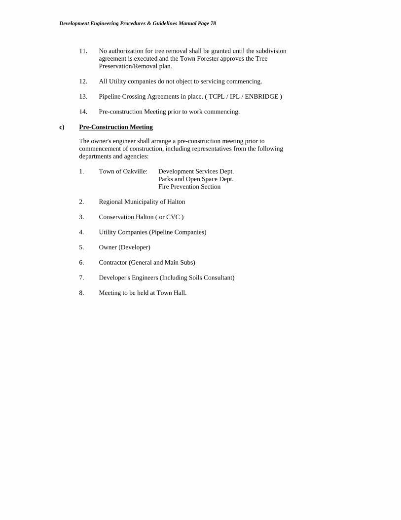
Development Engineering Procedures & Guidelines Manual Page 78
11. No authorization for tree removal shall be granted until the subdivision
agreement is executed and the Town Forester approves the Tree Preservation/Removal plan.
12. All Utility companies do not object to servicing commencing.
13. Pipeline Crossing Agreements in place. ( TCPL / IPL / ENBRIDGE )
14. Pre-construction Meeting prior to work commencing. c) Pre-Construction Meeting The owner's engineer shall arrange a pre-construction meeting prior to
commencement of construction, including representatives from the following departments and agencies:
1. Town of Oakville: Development Services Dept. Parks and Open Space Dept. Fire Prevention Section 2. Regional Municipality of Halton 3. Conservation Halton ( or CVC ) 4. Utility Companies (Pipeline Companies) 5. Owner (Developer) 6. Contractor (General and Main Subs) 7. Developer's Engineers (Including Soils Consultant) 8. Meeting to be held at Town Hall.

Development Engineering Procedures & Guidelines Manual Page 79
3.4.3 Clearance of Agreement Conditions for Building Permits The Development Services Department will provide the Building Services Department
with building permit clearance when all items pertaining to this Department’s jurisdiction have been satisfied. Each plan will have specific conditions as summarized in a schedule of the development agreement.
The following is a list of standard conditions: - Completion of base servicing and works certified by the developer’s engineer - 100 % completion of primary utilities - Engineer’s certification of storm water management facilities(stabilized ground cover) - 100 % of financial securities and fees deposited with the Town - Registration of the subdivision plan and the subdivision agreement
- Site posting of land use signs (identifies land uses and facilities) - Meeting with all builders, utilities, Town Departments, and agencies - Submission of each builder's purchase/sale agreement warning clauses
- Confirmation that all silt/erosion controls are functioning - All Parks Dept. fencing and walkways installed
- Noise Attenuation features constructed per approved report - Final Composite Above-ground Utility Plan approved - Site to be clean of garbage and roads safe for access - Canada Post to approve of temporary box site and order required units - Traffic Control Plan / Transit Facilities Plan shall be approved by Traffic Operations and Transit - Digital Engineering drawings to be submitted to the Town’s GIS Department per the GIS layer requirements
* Note that partial plan clearances may be granted based on the number of builders involved and the need for specific Site Plan approvals.
3.4.4 Grading Plan Review for Building Permits Each building permit application requires the submission of a plot plan detailing the lot
grading and drainage for each drawing. The review of this Plan is a Development Services function, and is coordinated via the Building Services Department.
The owner's/developer's engineer must certify that each of the builder's plans are in
conformance to the overall subdivision grading plans and schedules, and that erosion and sediment controls are in place prior to submission for this Section's approval. This certification must be stamped, dated and signed. See Section 3.1 for detailed criteria.

Development Engineering Procedures & Guidelines Manual Page 80
3.4.5 Security Reductions Security reductions may be requested at any time after registration, throughout the
construction of the subdivision. Completed works may be reduced by 85%, but the total value of securities shall never be less than 25% of all works after application of top asphalt. Each reduction request must be made in writing to the Development Coordinator and include the following documentation:
1. The owner's statutory declaration of payment of accounts and the engineer's
statement of work completed (see Appendix) 2. A security reduction chart as per the Town's format (see Appendix)
3. A copy of payment certificate certified by the consultant
4. Summary of work completed versus work outstanding ( tender form )
5. A copy of the current insurance policy. 3.4.6 Maintenance Period Once all of the subdivision works are completed as per the agreement, the construction
staff will confirm the acceptance of the work and a one (1) year maintenance period will commence. This period can begin when top asphalt has been completed and house construction is substantially complete.
NOTE: The developer is responsible for all works within the road allowance and shall
not pass on the cost, or obligation of performing these works, to individual property owners or builders.
At the completion of the final maintenance phase, the Town shall review all lots for compliance to the individual and overall drainage concept. All settlements shall be rectified prior to the Town assuming the plan. See the Assumption section of the Manual for complete details pertaining to the Assumption process.

Development Engineering Procedures & Guidelines Manual Page 81
SECTION 4 CONSTRUCTION METHODS AND MATERIALS
(MUNICIPAL SEWER AND ROAD WORKS)
4.1 General - New Development Construction Process 4.2. Role of the Development Services Department
4.3. Working Hours
4.4. Construction Procedures/Requirements
4.4.1 Pre-construction 4.4.2 Construction Start Up 4.4.3 Site Meetings 4.4.4 Excavation 4.4.5 Backfilling and Compaction 4.4.6 Quality Control 4.4.7 Materials 4.4.8 Construction Season Cut-Off Dates
4.5. Base Servicing for Building Permits ( 1st Stage ) 4.5.1 Level of Road Completion 4.5.2 Traffic Control Signage/Street Names 4.5.3 Utility Installation 4.5.4 Storm Water Management Status
4.6. Subdivision Services Control ( House Building Stage )
4.7. Completion of Top Curb, Sidewalks, Boulevards ( 2nd Stage )
4.8. Final Inspection of Municipal Works for Assumption Clearance
4.9. Administrative Process for the Assumption By-law
4.10. Summary

Development Engineering Procedures & Guidelines Manual Page 82
4.1 General New Development Construction Process The Town of Oakville has a Corporate Goal to provide quality infrastructure within the community. Maintaining functional infrastructure is heavily dependent on our ability to inherit quality road and sewer infrastructure built by Developers.
This section shall outline the construction phase of subdivision development. Note that the construction stage cannot commence until the Town has approved the engineering design drawings and the subdivision agreement with the Town has been executed. See Sections 3 and 5 for the engineering design and subdivision administration process. The Development Services Department is responsible for the design, construction and assumption of municipal infrastructure associate with the land development process. In general the Engineering and Construction Department has adopted Ontario Provincial Standard Drawings and Specifications for road and sewer construction. There is a Town Engineering Standards Book, which overrides several of the Ontario Provincial Standard Drawings. Contact the Engineering and Construction Department for the most recently revised standards book. Developers, consultants and contractors engaged in subdivision projects in Oakville should carry both Ontario Provincial Standard Drawings & Specifications and the overriding Town of Oakville Standards Book as reference for subdivision construction in addition to this Procedural Manual. The Developer shall retain a qualified Civil Engineer ( Consulting Firm ) for the purposes of design, contract administration and construction certification of the municipal infrastructure required by the land development. It will be the responsibility of the developer’s consultant to ensure that the Town’s specifications and standards are adhered to. Development Services Staff will liaise with the developer’s consultant and will provide periodic inspections to ensure the Town’s standards and specifications are adhered to, and also, to ensure that the developer’s consultant is providing full time supervision to the contractor during all stages of construction. .
The Developer shall ensure that their Engineer provides full time construction administration and inspection. The contract for services shall be clear on this requirement, including the final inspections and repairs required for final assumption of the plan and the preparation of as-constructed drawing records for deposit with the Town.

Development Engineering Procedures & Guidelines Manual Page 83
4.2 Role of the Development Services Department
The Development Services Department is involved in the Planning Process from the initial application to final Council approval. Once approved by Council, the Developer approaches Development Services to proceed with the construction of the municipal infrastructure required to provide the services to allow for the construction of residential/commercial/industrial buildings. Development Services approves the engineering design, prepares and administers the subdivision agreement, inspects the road and sewer works, and approves all lot grading. The department is responsible for this process to ensure that the roads and sewers are constructed to the current Town and Provincial standards and that the quality of the infrastructure is acceptable for the Town to assume and maintain. All development engineering related design and construction enquiries shall be directed to the Manager of Development Engineering or the Manger of Permits and Construction.
4.3 Working Hours
Normal working hours for inspection and quality control staff are 8:00 a.m. to 4:30 p.m., Monday to Friday. Depending on workload, staff may be authorized to work prior to 8:00 a.m. and/or after 4:30 p.m. In addition, staff may be authorized to work on Saturdays. Town of Oakville By-law 1963-29, prohibits noise pollution between the hours of 6:00 p.m. and 7:00 a.m., Monday through Saturday. Absolutely no work is allowed on Sundays! The Town recognizes the following dates as holidays, and thus, any work is prohibited on these dates: New Years Day Civic Holiday Good Friday Labour Day Easter Monday Thanksgiving Victoria Day Christmas Day Canada Day Boxing Day

Development Engineering Procedures & Guidelines Manual Page 84
4.4 Construction Procedures/Requirements
4.4.1 Pre-Construction Meeting The developer’s consultant is to co-ordinate a pre-construction meeting with the developer, contractor, consultant, utilities, Region and all applicable Town of Oakville Development Services staff. 4.4.2 Construction Start Up
Prior to the start of construction, the following must be in place: a) Subdivision Agreement executed by all parties (Developer, Region and Town) or Pre-Servicing Agreement. b) Approved construction drawings signed by the Director of Development Services (Town) and Commissioner of Engineering (Region) c) All required securities submitted by developer. A site trailer, with heat and hydro, (air conditioning in the summer) is to be suitably located within the subdivision site and accessible by all parties. An adequate parking area (graded with granular material) is to be provided adjacent to the trailer for all necessary staff/visitors for meetings, etc. Please note that parking on existing adjacent Town roadways for the purpose of accessing the trailer is not acceptable. The trailer is to be equipped with a desk for both Town and Region Construction Inspection staff. In addition, table and chairs sufficient for all site meetings is to be provided. Also, clean drinking water and toilet facilities as per the occupational Health and Safety Act, Part II, General Construction Hygiene, Sections 28 and 29, are to be supplied.
4.4.3 Site Meetings
At the discretion of the developer’s consultant, site meetings shall be scheduled at frequent intervals, depending on construction progress. However, during normal construction periods, frequency of meetings of once(1) a week or bi weekly are appropriate. The Development Services Dept. shall be notified of each meeting.
4.4.4 Excavation
Excavations shall be to widths and depths necessary to provide adequate space for the wall or fitting formwork, and if required, over-excavation of unsuitable material. Generally, excavation shall be such that it leaves a firm and even surface of undisturbed soil, true to the required subgrade elevations. Where the subgrade is of poor quality, the consultant will direct the contractor to over-excavate and place a layer of 19mm base gravel to the required elevation.

Development Engineering Procedures & Guidelines Manual Page 85
Prior to placing concrete or loose gravel, the excavated subgrade shall be compacted to achieve an average density, within the upper 500mm of the subgrade, equivalent to 98 percent by using vibratory compaction equipment. * All excavations must comply with the Occupational Health and Safety Act and Regulations for Construction Projects.
4.4.5 Backfilling and Compaction
The contractor’s attention is drawn to the backfilling requirements which must be carried out in strict accordance with the specifications. A Geotechnical Engineer shall provide an analysis of the existing soil conditions and provide a methodology for the excavation, storage, mixing, moisture control and the placement procedure for use as backfill.
The Town requires that all trenches within the proposed road allowance be backfilled using Granular “B” unless the use of select native material is approved by the Director of Development Services. The following procedures are to be followed where native material ( specifically shale ) is to be used for backfill to sewer trenches: a) The excavation of the trench is to be done with a rock bucket equipped with “tiger teeth” on a hydraulic backhoe. The trench is to be ripped by the teeth of the bucket across the entire horizontal surface. This ripping breaks the shale layers into fragments less than 150mm across, which then can be stockpiled for re-use as backfill. Any fragments larger than 150mm are to be segregated and disposed of on abutting lots. Excavation of the center of the trench and knocking down the sides to widen it produces fragments larger than 150mm. This is not an accepted procedure and will result in the Town rejecting the material as suitable backfill under the roadway. In the event that this procedure is not effective, the contractor will be directed to use a ‘V’ shaped rock bucket. As such, the contractor should have access to a ‘V’ bucket if it is deemed necessary. b) The shale fragments and clay overburden are to be mixed and pushed into the trench with a bulldozer. The mix must be to the satisfaction of the Soils Consultant and/or Development staff. This blends the material in a more thorough manner than dumping with a front end loader. A small dozer is then to be used in the trench to distribute the backfill in 200mm maximum lifts. Each lift is to be compacted to a minimum of 95% Standard Proctor Density using a self-propelled vibratory sheep’s foot roller. The owner is responsible to take soils tests, particularly adjacent to the trench walls and manholes to determine if the density has been reached. If 95% cannot be achieved as established by the test strip method, the problem should be traced to the cause of failure.

Development Engineering Procedures & Guidelines Manual Page 86
c) The length of trench section left open will be kept to a minimum to reduce the drying (freezing in the winter) of the excavated material. The native material, as excavated, is usually drier than optimum and with additional air drying, more compactive effort is required to obtain the desired results. Water will be imported, during hot dry periods (to be added to the pile) to the native material to bring it to optimum moisture content to achieve the required compaction where necessary. The application of water shall be via the use of water cannon trucks. It is desirable to keep the moisture level of the backfill material in the lower reaches of the trench to slightly above optimum. In the higher reaches (i.e. – nearer to subgrade level) it is desirable to keep the moisture level slightly below optimum. Therefore, the contractor is required to carefully apply water to the piles and, if necessary, into the trench to achieve the above. d) Under winter conditions, frozen material will not be permitted as backfill. e) If the trench width is inadequate to allow the equipment to operate as required, Granular “B” will be used and the surplus excavated material will be disposed of, as directed. Bull dozers are not permitted to widen trenches. A hydraulic backhoe is required for this operation. f) At the start of the project, a trial section 70m to 150m will be required to verify the techniques, and familiarize the contractor with the procedure. This section will be observed by the Town, the subdivider’s engineer and the Soils Consultant. g) Sewer laterals may be handled in two ways. If the sewer laterals are installed after the installation of the sewer main granular “B” is required from the sewer main to 1m beyond the curb line. If the laterals are installed with the sewer main, native material may be used, provided the same procedure is used as on the mainline sewer and the corner formed by the lateral trench wall and main line trench wall is stepped back using a hydraulic backhoe to allow compaction equipment to operate. Catchbasin laterals are to be treated in the same fashion as sewer laterals. Ramps into the trench for backfill purposes are to be done with hydraulic backhoe. h) The granular backfill around manholes and catchbasins must extend at least 0.6m from the manhole or catchbasin or to where the native material can be compacted to the required specification. The granular backfill must be installed in lifts before the native material is brought up. To achieve proper compaction, the drum of the compactive equipment must be able to travel from the native material to the granular material. Experience has indicated that careful attention to both excavation and backfill techniques are required to achieve the desired results. Any failure by the contractor to follow both procedures will result in the Town changing the backfill requirements back to Granular “B” at the contractor’s expense

Development Engineering Procedures & Guidelines Manual Page 87
4.4.6 Quality Control
It is the developer’s responsibility to provide for quality control testing for all phases of construction. Apart from utilizing the services of a Consulting Engineer to design and administer the subdivision project, the developer should engage a reputable Soils Consultant for trench backfill compaction as well as granular, asphalt and concrete testing. The Town may contract its own soils consultant during trench backfilling and compaction operations when weather conditions or difficult soils are encountered and a third party verification is deemed appropriate to ensure quality results. The backfilling and compaction of trenches is a critical operation in subdivision construction and consequently requires extensive testing in this area to ensure strict adherence to specifications. All testing results by the Soils Consultant shall be copied to the Manager of Permits and Construction, Development Services Dept., on a monthly basis. Daily results are to be forwarded to the Subdivision Inspector by the next day.

Development Engineering Procedures & Guidelines Manual Page 88
4.4.7 Materials
The following are the approved list of materials for use in road building and storm sewer servicing installation operations: i) Sewer Bedding - Rigid Pipe: HL8 conforming to OPSD 802.03 - Flexible Pipe HL8 conforming to OPSD 802.04 ii) Storm Sewers and Appurtenances - Rigid Pipe: concrete conforming to CSA A257.1/A257.2 - Flexible Pipe: PVC SDR 35, conforming to CSA B182.2 (max PVC pipe size allowed is 600mm for mainline storm sewer ) - Manholes: Precast or cast in place concrete conforming to Ontario Provincial Standards and Town Standards 2-1 and 2-2. - Catchbasins & Ditch Inlets:conforming to Ontario Provincial Standards and Town Standards 5-1 and 5-2. ( rear yard CB’s shall be ‘sumpless’ ) - Adjustment Units and Caps: Conforming to Ontario Provincial Standards. - Frames and Covers: conforming to Ontario Provincial Standards and Town Standards 3-1, 3-2, 3-3 and 3-4. ( road CB grate to be OPSD 400.11 ) - Inlet Control Devices: “Scepter” Plug Type. - Catchbasin leads to rear yard drains (beyond street line) are to be concrete. If flexible pipe is used, a concrete slab shall be poured above the pipe cover from pipeline to structure. This is to prevent fence posts damaging the pipe. iii) Sewer Cover - Granular “B”/HL8 granular conforming to OPSD 802.03 and/or 802.04. iv) Trench Backfill - Select native material or Granular “B” where trench is too narrow for equipment to operate. - Granular “B” backfill material under all existing pavements. *** Soil Compaction Criteria = 95 % SPD *** ( upper 0.5m layer of road subgrade to be compacted to 98 % )

Development Engineering Procedures & Guidelines Manual Page 89
v) Road Base Granulars - Granular “B” : May 1 – September 30. Granular “B” must be placed on sub- grade by end dumping and pushing with a dozer at the full make-up thickness to eliminate alterations to sub-grade profile. - Granular “A”: May 1 – September 30 - 50mm Crushed Limestone: October 1 – April 30 * wet weather specification * - 19mm Limestone: October 1 – April 30 “ “ *** Granular base Compaction Criteria = 100 % SPD *** vi) Sub Drains - 100mm Perforated Corrugated Polyethylene pipe with geotextile fabric conforming to OPSS 405, 1860 and Town Standard 6-2. vii) Curb and Gutter - 30 MPa concrete at 28 days (min. 355 kg/m3 Type 10 Portland Cement) conforming to OPSS 1350 and Town Standard 6-1. viii) Sidewalks and Walkways - 30 Mpa concrete at 28 days (min. 355 kg/m3 Type 10 Portland Cement) conforming to OPSS 1350 and Town Standards 6-3 and 6-4. ix) Asphalt - Base asphalt: HL8 conforming to OPSS - Top asphalt: HL3 conforming to OPSS
• see appropriate road standard for asphalt pavement depths. - Driveway apron asphalt: **75mm HL3A conforming to OPSS
( 150mm of 19mm crush limestone to be full width of driveway in the apron area) *** Asphalt Compaction Criteria = 98 % ***

Development Engineering Procedures & Guidelines Manual Page 90
* All utility road crossings must be installed prior to placement of base asphalt. In the event that a utility must revise its plant design after base asphalt has been placed, the road crossing trench will be entirely backfilled with unshrinkable backfill. In addition, the cut in the base asphalt shall be stepped 40mm deep by 300mm wide around the entire circumference of the cut where base asphalt thickness is 80mm or greater. The step will only be 25mm deep where base asphalt thickness is less than 80mm. ** It is preferable to have all driveways constructed with 50mm of HL8(OPSS) and 25mm of HL3A (OPSS) in two separate lifts to allow for settlement during the maintenance period of the roads.
4.4.8 Construction Season Cut-off Dates Subdivision construction may proceed during all seasons subject to the following conditions:
a) Top Asphalt Works: June 1 to October 31
b) Top Stage Concrete Curb: March 21 to October 31 c) Concrete Sidewalk & Walkways: March 21 to October 31 d) Base Asphalt Works: March 21 to December 15
e) Base Stage Concrete Curb: March 21 to December 15 Underground servicing may proceed year round provided that the backfill material is free from frozen components.

Development Engineering Procedures & Guidelines Manual Page 91
4.5 Base Servicing for Building Permits ( 1st Stage )
4.5.1 Level of Road Completion for Permits
1. All roads within the phase shall be complete to a base asphalt and base curb 2. Lots are clear of debris and set at pre-grade condition. 3. Storm sewers and outfall completed and all storm water management facilities
(ponds) constructed and certified as operating per the design. 4. Geodetic bench marks submitted to the Town Surveyor. 5. All required street signs ( temporary format ) installed to satisfaction of the
Manager of Traffic Operations. 6. All walkways and public paths shall be roughed in per Parks and Open Space,
including the required fencing (between lots leading to Parks and top of valley path systems)
7. Primary utilities installed within boulevards and Oakville Hydro satisfied with hydro installation including street lights.
8. Halton Region satisfied with water and sanitary sewer testing. 9. Erosion and sediment controls in place and functioning. 10. Noise Attenuation Fences shall be constructed or at minimum posts
in place where conflicts with house construction exist 11. Road barricades installed where construction traffic is prohibed and interim
construction access roads built where required by the Town 12. Arrange a Builder’s meeting to review the list of conditions.
Requests for building permit issuance are to be formally made to the Manager of Development Services. In general clearances will be provided for complete plans. Partial plan clearances may be considered based on warranted conditons. A letter from the developer’s consultant is required certifying that all works have been completed to base asphalt level and in accordance with Town Standards. The Developer shall contact the Development Coordinator to review all other administrative conditions per the subdivision agreement. See Section 3 of the manual.

Development Engineering Procedures & Guidelines Manual Page 92
4.5.2 Transit Facilities Plan ( Transit First Policy )
Oakville Transit shall ensure that the building permit release schedule complies with the approved Transit Facilities Plan and the Town’s Transit First planning principles. Contact the Manager of Transit Planning to arrange a meeting to review the building permit schedule.
4.5.3 Utility Installation
A Composite Utility Plan shall be approved by all the utilities including Canada Post. All primary utilities shall be in the ground and the boulevard restored to grade. Canada Post to be satisfied with temporary centralized pad for the initial installation of post boxes. Inform CP of the timing of first occupancy.

Development Engineering Procedures & Guidelines Manual Page 93
4.5.4 Storm Water Management Status
Storm Water ponds shall be certified as complete and fully functional. Ponds shall have all exposed slopes stabilized with ground cover or erosion control devices when the time of year prohibits establishment of natural cover. All outfalls to creek systems shall be complete and stabilized to the satisfaction of Conservation Halton and DFO. The Engineer shall verify that all safety features have been installed ( fences and grates ) and that all side slopes have been graded to the required safe public access criteria. Submit all SWM and sewer design reports in final form including a schedule for the monitoring of all SWM features and siltation/erosion control works.

Development Engineering Procedures & Guidelines Manual Page 94
4.6 Subdivision Services Control ( House Building Stage)
Once the subdivision is complete to base asphalt and base curb level, it is the developer’s responsibility to: 1. Maintain roadway pavement widths for safe vehicular traffic during the construction of homes, buildings, etc. Use of the road allowance for the stockpiling of materials by trades is not permitted. 2. Maintain clean (mud and dust free) roadways within the subdivision and adjacent Town roadway. This will necessitate frequent sweeping and flushing at the developer’s expense. Also, garbage/waste is to be contained within garbage bins. 3. Maintain free flowing sediment controlled catchbasins, ditch-inlets, sewers, outfalls and channels during the construction of homes, buildings., etc. 4. Maintain all traffic signs (stop sign, street names signs, etc.) as well as the subdivision information signboard.
5. Monitor the interim road barriers (two-stage chain ) and inform the Town when roads
can be opened based on the state of construction versus the level of occupancy.
The Subdivision Services Inspector will inspect the subdivision for adherence of the above on a regular basis. The Inspector will provide direction to either the developer or the consultant for rectification of any infractions. The Town may, at its own discretion, arrange to resolve infractions with its own forces, or hire contract forces the cost of which (including 100% administration) will be charged to the developer.

Development Engineering Procedures & Guidelines Manual Page 95
4.7 Completion of Top Curb, Sidewalks, Boulevards ( 2nd Stage )
The completion of the finished road works will generally be performed at different stages during the house building phase of the development and shall be timed to coincide with the occupancy of units. Sidewalks and top stage curb are required to set the grade control for lot grading of the individual lots to allow for the lot grading to be completed prior to the occupancy of the newly constructed homes.
The subdivision agreement requires that home owners shall have their lots sodded within 30 days of occupancy ( weather/season permitting ). The timing and scheduling of the sidewalk and curb work is critical to ensure that lot sodding is not unduly delayed.
It is recommended that the developer’s consultant arrange for a meeting (several times a year) with the Manager of Development Services to discuss/co-ordinate the necessary sidewalk, curb and boulevard installations to be scheduled based on building activity.
Prior to the installation of top stage curb, sidewalks, boulevards, aprons and top asphalt,
the developer’s consultant is to contact the Subdivision Inspector in advance for the scheduling of inspections. Prior to any of this work proceeding, the consultant and Town staff shall review the existing base asphalt and base curb, etc. for any evident deficiencies which are to be repaired prior to the progression of additional works.
The Developer’s Engineer shall administer and monitor all works within the municipal
right-of-way during this house building stage and shall ensure that the appropriate quality control testing is being performed by the Geotechnical / Quality Control consultant.
Top Asphalt ( Final Surface Course ) Top asphalt may be placed once the subdivision has experienced at least two(2) winter
seasons after the completion of servicing to base asphalt and base curb level.
In addition, top asphalt placement may not proceed until the completion of all:
1. lot grading and sodding. 2. sodding of boulevards. 3. driveway aprons installed (asphalt/concrete/interlock) min. base course 4. base asphalt, curb and sidewalk repairs to the satisfaction of the Town.
5. permanent traffic and street name signs installed Special circumstances may allow for the placement of top asphalt where some lots are incomplete or minor road repairs are outstanding. Specific requests for these circumstances shall be submitted to the Manager of Development Services for approval.

Development Engineering Procedures & Guidelines Manual Page 96
4.8 Final Inspection for the Assumption of Municipal Works
The developer’s consultant may make a request for assumption once all of the municipal works have been completed in the subdivision and once the top asphalt has experienced at least one winter season. The consultant shall formally request for an assumption inspection by June 1 by providing written notice to the Manager of Development Services as per the requirements of Section 3 of this manual. The final inspection will include an entire walkover of all curbs, sidewalks, boulevards, aprons, walkways and roadways within the subdivision. The inspection will also include a review of all manhole and catchbasin structures, storm sewers as well as all box culverts, headwalls, railings and all traffic signs, etc. Note that prior to the final inspection by Town, the developer is to arrange for all storm sewers to be flushed. It is the consultant’s responsibility to record all deficiencies noted (with locations) during this inspection. The compiled list will be forwarded to the Construction Co-ordinator and the Subdivision Inspector as soon as possible prior to any repair work proceeding. It will be the consultant’s responsibility to contract a road sweeper and flusher, at the developer’s expense, to sweep and flush the entire roadway network within thirty(30) minutes prior to the inspection. The purpose for this is to review the drainage of the pavement areas within the subdivision. The consultant is required to contact the Subdivision Inspector prior to the commencement of deficiency repairs in order that the inspection may be scheduled. Once all noted deficiency repairs have been completed (subject to annual cut-off dates), the developer’s consultant is to contact the Subdivision Inspector to arrange for one final walkover of the subdivision to ensure that all the repairs are satisfactory. It is at this time that final lot grading inspections shall also be performed with the Town’s inspector.

Development Engineering Procedures & Guidelines Manual Page 97
4.9 Administrative Process for the Assumption By-law
Once all of the works have been completed as described above, the Manager of Development Services shall be notified to initiate the preparation of the Assumption By-law report as required to be submitted to Town Council for adoption. The consultant shall submit the following to the Manager of Development Services:
A certificate from an Ontario Land Surveyor stating that monument and lot markings are in place and are in accordance with the registered plan(s). A copy of the registered plans should be submitted indicating which monuments and lot markings were in place or were replaced.
Final Engineers certification of all municipal works to date. Developer’s Statutory Declaration of Payment to Contractors “As-constructed” engineering drawing package (both Mylar and digital file) Public Works cash reimbursement for traffic signage and pavement markings Letter of credit/cash-in-lieu settlements for future works, if authorized
4.10 Summary See Section 5 for the complete assumption administrative process.

Development Engineering Procedures & Guidelines Manual Page 98
SECTION 5 SUBDIVISION ADMINISTRATION 5.1 SUBDIVISION AGREEMENTS 5.1.1 General Functions of the Agreement 5.1.2 Agreement Preparation 5.1.3 Financial Requirements 5.1.4 Agreement Administration 5.2 PLAN REGISTRATION
5.2.1 Plan Registration 5.2.2 Street Names 5.3 SUBDIVISION ASSUMPTION

Development Engineering Procedures & Guidelines Manual Page 99
5.1 Subdivision Agreements The developer shall enter into a subdivision agreement with the Town of Oakville for the
purposes of controlling the design and construction of municipal services and ensuring the completion of works to the satisfaction of all Town Departments.
5.1.1 General Functions of the Agreement 1. To satisfy draft plan approval conditions for the registration of the Plans; several
draft conditions cannot be fulfilled at the time of registration and are, therefore, transferred into the subdivision agreement to satisfy the registration process.
2. To refer to the approved engineering design which is to be adhered to and to
detail the responsibilities of the owner's engineer; 3. To refer to appropriate Town policies and procedures; 4. To secure monies for the completion of works to the Town's satisfaction; 5. To amalgamate the requirements of all Town Departments and related agencies; 6. To define and obtain all public lands and Town easements as required; 7. To provide time frames for the construction of municipal services; 8. To detail the services which are to be paid for by the Town via the Development
Charges By-law; 9. To establish conditions/warning clauses which are to be placed on individual lots
via the builder's purchase/sale agreement; 10. To provide a process for the acceptance and assumption of the subdivision and the
subsequent release of obligations by the developer;
11. To obtain the Town's fees required for the processing of the engineering approval and the monitoring of construction;
12. To define all works required outside of the Plan of Subdivision on existing Town
roads and land.
13. To establish the conditions to be fulfilled prior to the issuance of Building Permits.

Development Engineering Procedures & Guidelines Manual Page 100
5.1.2 Agreement Preparation The following items shall be submitted as one package to the Development Services
Department, Development Coordinator, for the preparation of the agreement. a) Four (4) draft copies of all M-Plans b) Four (4) draft copies of all reference plans (storm and hydro easements) c) Two (2) sets of signed drawings (signed by the Town and the Region) d) Four (4) copies of the lot frontage and area schedules e) Final cost estimate or tendered prices, (all items detailed) f) Legal description of lands - Schedule "A" g) Summary of security items i) Roads and site work - Schedule "B" ii) Storm Sewers - Schedule “C” iii) Environmental Works ( swm/esc ) Schedule “G” h) Electrical distribution and street lighting - Schedule "F" - Cost estimate as approved by Oakville Hydro i) Landscaping cost estimate (Parks and Open Space Dept.) - Schedule "H" j) Detailed listing of all lots, parts and blocks for- Schedule "I” - Easements, reserves and dedications. k) Financial summary - Schedule "J" - Listing of all securities, cash-in-lieu costs and the fee calculation for
engineering approval and monitoring of construction by the Town. l) Works to be constructed on behalf of Town - Schedule "K” - Estimate of the costs of works to be paid for by the Town and recovered
via the Development Charges By-law. m) Building Permit Requirements Summary Schedule “L” n) Five million ($ 5,000,000.00) dollar liability insurance with the Town of Oakville
to be named as the co-insured.

Development Engineering Procedures & Guidelines Manual Page 101
5.1.3 Financial Requirements a) Agreement Preparation Fee - a non-refundable fee is required to initiate the agreement b) Town Subdivision Administration Fee -Calculated as a percentage of the value of 100 % of all municipal
works, excluding Hydro, Regional, and D.C.A. items c) Securities for Works to be constructed
- estimate based on 100% of the construction costs of municipal roads, sidewalks, storm sewers, SWM facilities (ponds) and landscaping (letter of credit to be provided per approved list of financial firms)
d) Additional Securities (Cash or Letter of Credit) - Garbage - Street cleaning - Park/valley rehabilitation - Electrical distribution (Oakville Hydro) - Street trees - Cash In-lieu of Parkland dedication e) Securities for Works to be constructed on Behalf of the Town - 100% of the cost of works to be paid for by the Town as approved per the
Development Charges By-law * See By-Law 2009-148 for complete details of the Subdivision Agreement and
Administration financial fee schedule. 5.1.4 Agreement Administration a) The Development Coordinator ensures that all legal drawings, financial schedules
and special conditions are in order for the agreement document preparation. The complete information package is then passed to the Legal Services Department for the preparation of the draft Subdivision Agreement.
b) The draft agreement document is then circulated by the Development Coordinator
for comment to all appropriate Town Departments, the Conservation Authority, Halton Region, Oakville Hydro and all other pertinent agencies.

Development Engineering Procedures & Guidelines Manual Page 102
c) Once all sections of the agreement are finalized, a report is prepared by the
Development Coordinator to be presented to the Planning and Development Council for final approval.
d) After Council approval the agreement is executed by the Town and the
Developer. The agreement will be registered on the lands once the plan is registered.
e) All securities and cash must be in place prior to the registration of the plan(s). Development Engineering forwards the request for subdivision clearance to the
appropriate Town departments for the final plan registration. f) During the life of the project, the Development Services Dept. monitors and
enforces the conditions of the agreement, including all security reductions, various timing items, mud and dust controls, safety issues, etc. (See Section 3.5).
g) When the maintenance period is over, the Development Sevices Dept. will accept
the request for assumption and will process it. (See Section 3.6). 5.2.1 Plan Registration The Town will authorize the registration of a plan when the Development Coordinator for the Town of Oakville is satisfied that all conditions of the Subdivision Draft Plan approval have been fulfilled. The Development Coordinator for the Town of Oakville is responsible for ensuring that all Town conditions and the conditions of all other agencies are satisfactorily addressed. All monies and securities shall be deposited with the Town prior to registration. Once a plan is registered with the Land Registry Office the Town requires ten (10) copies of the printed plan for Town distribution. A reproducible copy shall be deposited at the Public Works Department, Drafting Section. The Building Department will not issue building permits prior to the registration of a plan. The Zoning Section requires 3 copies of the lot area and frontage schedules as certified by the Land Surveyor ( OLS ). It is the Developer's responsibility to correspond with all agencies who have applied conditions to the approval of the plan of subdivision. A Developer shall inform the Development Coordinator of their intention to register a plan and arrange for a meeting to clarify the process.

Development Engineering Procedures & Guidelines Manual Page 103
The following is a list of the chronological steps to follow when registering a plan: SUBDIVISION REGISTRATION PROCESS
1. Town Subdivision Agreement approved by Town of Oakville Council. 2. Confirmation that all agency clearances and conditions of draft approval satisfied. The
Town’s Development Coordinator to be contacted for instructions. 3. Final version of M-Plan ( endorsed by Registry Office ) received by Town. 4. M-Plan circulated to Legal, Planning, Halton Region and Oakville Hydro for review. 5. Region’s conveyance requirements sent to Town and incorporated in Town’s Document
Registration Agreement ( DRA ). 6. Town’s Document Registration Agreement ( DRA ) signed by Town Solicitor and
circulated to Solicitor for Developer, Region and Oakville Hydro for signature. 7. Fully executed DRA returned to Town Legal Department. 8. Developer’s Solicitor prepares Town, Region and Hydro conveyance documents as set
out in DRA ( except Notice of Inhibiting Order, Notice of Subdivision Agreement and Application to Delete Inhibiting Order which is prepared by Oakville Legal Department). Documents electronically messaged to other parties for review.
9. Legal Department receives inhibiting order ( executed by Regional Clerk ) from Planning Dept., attaches schedule of Town conveyance requirements, circulates inhibiting order to Oakville Hydro’s solicitor for execution by Oakville Hydro and to Clerk’s Dept. for execution by Town Clerk, and completes Inhibiting Order by inserting names of persons signing inhibiting order.
10. Legal Department notifies developer’s solicitor and Planning Department that Legal Dept. requirements have been completed. Town’s Director of Planning signs M-Plan.
11. Developer or his Surveyor receives plan from Planning Dept. and delivers plan to Land Registry Office.
12. Developer’s Solicitor registers plan of subdivision, obtains M-Plan number and registers Notice of Inhibiting Order.
13. Developer’s Solicitor registers reference plans and Regions conveyance documents. 14. Oakville Hydro’s Solicitor registers Hydro conveyance documents and notifies Legal
Dept. that inhibiting order may be lifted. 5.2.2 Street Names The naming of municipal streets shall be to the satisfaction of the Town Surveyor. A draft legal plan shall be submitted to the Roads and Works Department as early as possible after draft plan approval. Suggested names can be provided, but the Town has final authority.

Development Engineering Procedures & Guidelines Manual Page 104
5.3 Assumption Following completion of all construction, the subdivider may request assumption of the
subdivision. A letter from the subdivider's engineer, along with the executed "Certificate Recommending the Assumption of the Subdivision by the Town", is submitted to the Development Coordinator. A circulation for clearance is distributed to the following agencies and Town Departments, as required:
Parks and Open Space Department Roads and Works Department / Traffic Operations Engineering and Construction Department / Survey Legal Services Department Finance Department Building Services Department Transit Department Halton Region Conservation Authority Credit Valley Conservation Authority Oakville Hydroelectric Commission Regional Municipality of Halton The above agencies and Town Departments provide subdivision deficiency forms to the
Development Services Dept. The onus is on the owner/subdivider to ensure that each agency or department has all of the required information, and that all deficiencies are addressed.
The Development Services Dept. assesses the deficiency items for assumption. Once all
Departments/Agencies are satisfied, a Council Report is prepared with an applicable assumption by-law number. When assumption is approved by Council, the Development Services Coordinator then advises the owner's subdivider of the respective approval and any special conditions which may be attached.
Any remaining securities shall be released once Town Council approves the Assumption
By-Law. Some securities may be withheld if all building lots have not yet been completed. Note that the request to initiate the assumption process requires the submission of the
associated financial fee. * See By-Law 2009-148 for complete details of the Subdivision Agreement and
Administration financial fee schedule.

Development Engineering Procedures & Guidelines Manual Page 105
Key Requirements for Assumption ° Submit the Statutory Declaration Form, to be supplied by the owner, verifying the
payment of all accounts pertaining to the construction of the subdivision. ° Owner's engineer to certify that all subdivision works have been constructed in general
conformity to the approved plans and specifications including as-built records of roads and sewers.
° Lot Grading Certificates to be provided by the developer's engineer and final grading
inspection and approval by the Development Engineering Section. All housing construction shall be complete prior to the assumption of the plan. Special consideration may be given where vacant lots still remain. The Director of Planning Services shall determine the conditions and securities required.
° Certification by a registered O.L.S. that all control S.I.B.'s, all easement I.B.'s, and all
Town dedicated land I.B.'s have been confirmed or re-established ° Certification by the Acoustical Engineer that all noise attenuation features have been
constructed or installed as per the approved Acoustical Report. ° Certification by the Engineer that the Storm Water Management facilites are operating
per design. Submission of final as-built SWM models and facility operational and monitoring manuals.
° Confirmation from the Town Solicitor that the Developer's Solicitor has submitted all
records of the transference of easements, reserves, and municipal lands. ° Release from Development Services on the acceptance of all road works and storm
sewers. Traffic Operations Section to confirm traffic signs and pavement markings. (Traffic Signals)
° Clearance from the Parks and Open Space Department. ° Clearance from Transit per “ Transit First “ planning policy. ° Acceptance of all works under the jurisdiction of other agencies such as Oakville Hydro,
Region of Halton, MTO, Conservation Halton. ° Payment of all Development Charge fees. ( Generally due at building permit stage ) ° As-built drawings approved by the Development Services Dept. .
(Digital files submitted per Town’s GIS criteria) NOTE: Assumption requests must be received prior to June 1 to ensure the
completion of the process within that year.

Development Engineering Procedures & Guidelines Manual Page 106
SECTION 6. SITE PLAN DEVELOPMENT 6.0 General 6.1 Design Criteria 6.2 Submission Requirements 6.2.1 Engineering Drawing Requirements 6.2.2 Survey Plan Requirements
6.2.3 Subdivider's Approvals 6.2.4 Storm Drainage Criteria 6.2.5 Permits and Other Approvals
6.3 Site Development Agreements 6.4 Site Inspection and Approval 6.5 Multi-Family and Condominium Servicing 6.5.1 General Requirements 6.5.2 Private Residential Roadways 6.5.3 Utility Services
6.5.4 Lot Grading and Amenity Area 6.6 Tree Protection and Preservation Policy/Permit

Development Engineering Procedures & Guidelines Manual Page 107
SECTION 6. SITE PLAN DEVELOPMENT 6.0 General Site plan approval by the Development Services Department is one of the general
prerequisites to the issuance of a Building Permit. All applications to the Planning Department are circulated to Development Services for review.
For the general procedures in a site plan application, please refer to the requirements as
specified in the site plan application brochure provided by the Planning Services Department. It is the responsibility of the applicant to ensure that all application criteria for submission to Development Services is complete and in accordance with the following requirements. Incomplete submissions will be refused.
6.1 Design Criteria Section 3.1 of this document specifically outlines the design criteria for subdivision
development. The criteria as specified is to be reflected in the site plan design. Prior to an engineering submission, the applicant is to contact the following external
authorities for specific design criteria should the subject properties abut or contain: ° A watercourse/valley/creek block regulated by the Halton Region or Credit Valley
Conservation Authority (site plan, grading, drainage/servicing and landscape plans to be submitted)
° Ontario Hydro property (grading, drainage and servicing plans and landscaping) ° CNR or CPR (grading, drainage & servicing plans) ° Pipelines or pipeline easements (grading, drainage & servicing plans) ° If a driveway is proposed on a municipal road within 180m of an intersection with
a Provincial Highway (QEW, 403, 407) ° Frontage or access to Regional Roads (Region of Halton or Peel) ° Land adjacent to Lake Ontario (Ministry of Natural Resources and H.R.C.A.)

Development Engineering Procedures & Guidelines Manual Page 108
6.2 Submission Requirements 6.2.1 Engineering Drawing Requirements All site servicing and grading plan drawings must include: ° Erosion and sediment controls (Site Alteration permit required). ° Town of Oakville bench mark description and elevation ° All abutting streets, right-of-ways, easements ° All utilities on existing roads including storm, sanitary, water, Bell, hydro and gas ° All proposed services to the building (note that all services including Bell and
hydro must be provided underground from the existing source to the building) ° Tree inventory and removal/preservation plan. ° Existing grades of abutting roads and proposed grades through new entrances,
elevations on a grid throughout the site including lot corners, and a minimum 15 metres external to the site so that drainage patterns may be evaluated
° All surface drainage routes including swales, ditches, watercourses and their
invert elevations and flow direction ( flood plain limits ) ° The overall surface drainage pattern on the site is to be shown by flow arrows ° Location of on-site storm sewers, manholes and catchbasins including size and
class of pipe and grades ° Ground floor elevations of the building and ground elevation at all building
corners, entrances, catchbasins, tops and bottoms at slopes and other locations as required to establish the surface drainage system
° Location of roof downspouts and details of roof hoppers (flow controls) ° Location and size of driveways and culverts ° A legend detailing all symbols used (i.e. catchbasins, retaining walls, road,
property line, building line, existing and proposed elevations)

Development Engineering Procedures & Guidelines Manual Page 109
6.2.2 Survey Plan Requirements An up-to-date survey must be prepared, stamped and signed by an Ontario Land
Surveyor, or as an alternative, an O.L.S. stamp and signature on a site plan prepared by an architect or engineer indicating:
-the lot number and registered plan, or concession / lot of Town grid, and address - the lot area in metric measure - location of proposed building(s) - i.e. to verify setbacks - all existing structures, topographical features (i.e. swales, ditches, top of bank) 6.2.3 Subdivider's Approvals Applicants are referred to the subdivider to determine if the subdivider's approval of a
proposal is also required where a plan is not assumed. Any revisions to approved plans such as those required by the subdivider's engineer and architect, or otherwise, will require further review and approval by the Town of Oakville.
6.2.4 Storm Drainage Criteria
• Storm runoff shall be controlled to local constraints of receiving systems; established watershed study, MTO guidelines, existing sewer capacity, pre to post where capacity unknown or history of flooding or erosion.
• Where practical sites shall be designed with a sewer network capable of capturing the 5 Year Event. If sewers are not possible, surface drainage reaches shall be limited to 50m.
• Sites shall be self contained unless part of a previous master drainage scheme. Major overland flow relief to a Town r.o.w. shall be reviewed for impacts.
• Storm water can be detained by the following storage methods; landscape ponds, oversized pipes, underground tanks, roof tops, and some hard surface areas ( conditions ).
• Frequent events up to the 5 Year level shall not be stored on paved surfaces; this nuisance ponding interferes with operation of site access; loading docks/storage areas may be used
• Quality treatment of storm water is required. The level of treatment is to be determined per the receiving system ( see Halton Conservation ). Wet Ponds, Oil Grit Separators and Landscape Filter Strips are acceptable methods. Oil grit separators are to be certified by the installer/manufacture as per installation, operation and final cleaning for acceptance.
• All storm sewer structures are to comply with OPSD specifications and adhere to the requirements of the Ontario Building Code; Building Department to approve code issues.
• Quality and Quantity control devices shall be located at the property line for municipal access; if not possible, easements may be required. ( these private facilities shall be operated and maintained by the property owner )
• Existing external drainage shall be accommodated without impacts to upstream lands.

Development Engineering Procedures & Guidelines Manual Page 110
6.2.5 Permits and Other Approvals The following permits or approvals may be required:
• Road Corridor Access Permit : any work within a Town r.o.w. shall be reviewed by Public Works and a permit may be required, ie; new driveways, road cuts for service installations, road widenings
• Site Alteration Permit : any alteration to a property where excavation or alteration of the existing grade is proposed, requires Town approval and issuance of a Site Alteration Permit per the By-law . This permit secures for damage to Town r.o.w.’s, tree protection, adjacent lands and to control sedimentation and erosion of the site
• Conservation Halton Permits: see the authority for permit requirements per the alteration of water courses and storm water mangement.
• Encroachment Agreements: any occupation of Town land in conjunction with the building activity for a site, requires an agreement with the Town : this includes site hoarding, construction access, and equipment / material storage.
• Plumbing Permits : site servicing / plumbing shall be reviewed and inspected by the Town’ Building Department : inspection fees apply
6.3 Site Development Agreements
The applicant may be required to enter into a form of Development Agreement with the Town to allow for construction works external to the Plan. Such works may include roadway widening , sewer reconstruction, watercourse improvements, stormwater management works, etc. It is highly recommended that the applicant contact the Development Engineering Department prior to formal application to discuss these requirements.
6.4 Site Inspection and Approval Once an applicant has completed all of the works that were conditions of Site Plan
approval, an applicant may request a reduction of the posted securities. The applicant shall submit a written request to the Planning Services Department, giving the property address and the site plan number.
Upon receipt of the request and the required fees, Planning staff will circulate a request to
the Development Engineering Dept for confirmation that all engineering and construction requirements have been satisfied.
It is highly recommended that the applicant ensure that the requirements for the
respective development are fulfilled prior to application for inspection. If deficiencies are found, a deficiency form is submitted to the Site Planner. Depending on the extent of deficiencies, a specified security holdback will be requested of the applicant's security.

Development Engineering Procedures & Guidelines Manual Page 111
6.5 Multi-Family and Condominium Servicing
This section pertains to the engineering development design criteria for private condominium and multi-family type developments.
Generally, the form of application is through the Town's Site Plan Control process. The Town’s Development Coordinator shall be contacted for the requirements of a Condominium Agreement and the Registration process.
6.5.1 General Servicing Requirements
Engineering drawings shall be prepared to show location (horizontal and vertical) of all underground services including sanitary, storm, watermains, hydro, Bell communication, gas, etc., together with cross section drawings of all roadways, sidewalks, and boulevards, certified and each drawing is to be stamped, signed and dated by a registered professional engineer of the Province of Ontario. Three copies must be submitted to the Development Engineering Section within 60 days of completion of the project stamped "as constructed." The "as constructed" drawings shall show all of the underground services on one drawing. Drawings shall be submitted to a scale of 1:500 horizontal and 1:50 vertical.
Multi-family developments shall be signed so as to easily identify the location of all
blocks. The Director of Planning Services shall approve such signs. Proper garbage collection areas must be provided at the municipal frontage to the
development so that the municipal refuse collectors can collect refuse efficiently and safely ( site access/egress in forward motion ). Such arrangements shall be in accordance with standards as set down by the Public Works Department of the Town of Oakville.
6.5.2 Private Residential Roadways Roadways shall not be considered to form any part of the required parking. Parking lots shall be structurally designed to the residential road standards. Designated fire access routes shall be provided throughout the development to the
standards of the Fire Department and in accordance with good engineering practice. Emergency access routes may be required. The consulting engineer must contact the Fire
Department for actual requirements and approval (structural design to accommodate eighteen (18) ton vehicles).
Internal private roadways shall be designed in accordance with the current design criteria for a minor residential street (including curbs, curb and gutters and sidewalks) with the following modifications:

Development Engineering Procedures & Guidelines Manual Page 112
a) Minimum width of roadway shall be 7.5m between curb faces. b) Minimum centre line turning radius shall be 12.5m (fire truck) for any
development which has no buildings over three storeys. For high-rise developments (four storeys or greater), the minimum centre line turning radius shall be 14m (aerial ladder trucks).
c) Minimum overhead clearance shall be 4.5m. d) The minimum road pavement design shall be as follows: 300 mm Granular "B" 150 mm Granular "A" 50 mm H.L.8 Asphalt 40 mm H.L.3 Asphalt e) An internal 1.5 m wide sidewalk on one side only of all internal roadways. 6.5.3 Utility Services The developer/builder is responsible for ensuring that all utility services are designed and
constructed in accordance with the relevant agencies. A certified statement signed and stamped by a registered professional engineer of the
Province of Ontario stating that all services have been designed and constructed in accordance with Town requirements is required prior to registration of the development.
Storm sewer design and construction must adhere to the requirements outlined in the Storm Drainage Policies and Criteria Manual and the Plumbing Code. Contact Halton Region for waste water and municipal water service capacity and connections to mains and trunk sewers.
6.5.4 Lot Grading and Amenity Area
Multiple Family Lots shall generally adhere to the requirements of Section 3.1.4 "Lot Grading/Drainage". These typically smaller lots require additional attention due to many constraints. Note that while smaller than single lots, amenity areas are still required and their size shall be determined via the Site Plan process. Minimum 2% and maximum 5% slopes apply to the amenity areas. Free hold amenity areas shall conform to general lot grading policy; no cross lot drainage except at rear swales and all side yards to have directional swales to acceptable receiving systems.

Development Engineering Procedures & Guidelines Manual Page 113
6.6 Tree Protection and Preservation Policy/Permit
The Town of Oakville has placed the protection and preservation of the ‘urban forest’ as a priority and ensures that land developers, businesses and individuals maintain and preserve native tree species’ through the development process. A Tree Protection and Preservation Policy and Procedures Manual has been created to assist in outlining the Town’s objectives for preserving and enhancing the urban forest as per the direction of the Town’s Official Plan. This manual can be obtained from the Urban Forestry Coordinator, Development Services Department. The Town Forester has full control of all Town trees which are owned and maintained by the Town as they reside on Town land. These trees are protected from land development activities via a Tree Protection Agreement which regulates the construction activity adjacent to these trees by implementing the appropriate protection measures as approved by the Town. The Tree Protection Agreement is issued in conjunction with the Site Alteration Permit which regulates and controls all development / building / servicing projects. For further details on the protection of municipal trees, refer to the Street Tree By-Law 2009-025 and the Site Alteration By-Law 2003-021. The Town has enacted a Private Tree Protection By-Law 2008-156 / amended by 2009-145, a by-law to regulate or prohibit the injury or destruction of trees on private property within the Town of Oakville. The implementation of the by-law when related to a development application is processed through the Development Services, Permits and Construction Section. All other non-development related tree issues are enforced by the Forestry Section of Parks and Open Space. It is recommended that applicants refer to the noted procedures manual for the methodology of inventorying and assessing the existing tree resources and the design elements required to develop an appropriate site development plan. The by-law can be referenced through the Town website under the Forestry Section.

Development Engineering Procedures & Guidelines Manual Page 114
SECTION 7. TOWN POLICIES AND REQUIREMENTS 7.1 Building Department 7.2 Roads and Works Department ( Construction and Engineering ) 7.3 Parks and Open Space Department 7.4 Legal Services Department 7.5 Clerk's Department 7.6 Finance Department 7.7 Engineering Studies 7.8 Development Related By-Laws 7.9 Miscellaneous

Development Engineering Procedures & Guidelines Manual Page 115
SECTION 7. TOWN POLICIES AND REQUIREMENTS 7.1 Building Services Department The Building Department informs the Development Services Department when a
building permit is applied for and ensures that a lot grading/drainage/servicing site plan is provided for review. Development Engineering will sign-off for permit release when all engineering and subdivision agreement issues are satisfactorily addressed.
7.2 Engineering and Construction Department
The Engineering and Construction Department creates and maintains all of the Town’s engineering standards as they pertain to road and storm sewer infrastructure.
Driveway and Road Cut Permit A permit is required for any proposed construction within the limits of an existing Town
right-of-way. This applies to driveway widenings and utility installations. 7.3 Parks and Open Space Department Approval is required from the Parks and Recreation Department for: ° any works on lands dedicated for park, open space, park walkways, valley lands
and green space. ° tree preservation plan approvals ° streetscape approvals including tree planting, fencing, landscape screening,
boulevard and traffic island improvements. ° bicycle paths 7.4 Legal Services Department Agreements are drafted by the Legal Services Department and commented on by
Development Engineering for any changes or additional provisions that are required. Development Engineering then forwards the agreement to the Clerks Department for
approval by Council. 7.5 Clerk's Department Council through the Clerk’s Department approves agreements. Recommendation for
approval of the agreement is forwarded to the Region for approval through the Clerk's Department. By-law for approval of assumption is provided by the Clerk's Department

Development Engineering Procedures & Guidelines Manual Page 116
and approved by Council. The Clerk's Department provides Development Engineering with the assumption by-law and associated documentation.
7.6 Finance Department The Finance Department is responsible for the collection and administration of
development charges relating to all site plan and subdivision developments. These securities are placed in the form of letters of credit, cash deposits and cash-in-lieu.
The Town has formulated a development charge structure through a by-law which
imposes growth-related net capital costs against land as is allowed for under the Development Charges Act of 1989. New property owners are required to finance the growth-related net capital cost to the level of service currently enjoyed by the existing Oakville residents. The current by-law amends all the previous by-laws. This by-law will be frequently reviewed and revised to reflect the required fee structure.
Levies are to be paid to the Finance Department at the time of Building Permit issuance.
The amount owing would be the rate at the time of permit issuance. 7.7 Engineering Studies The following studies may be required through a subdivision or site plan agreement: ° Ministry of the Environment Related Studies ° Ministry of Natural Resources Related Studies ° Erosion and Sedimentation Control Studies ° Stormwater Management Studies ° Traffic Impact Studies ° Transportation Studies ° Watershed/Subwatershed Management Impact Studies ° Noise Impact Assessment Studies

Development Engineering Procedures & Guidelines Manual Page 117
7.8 Town of Oakville By-Laws There are various by-laws, which are applicable to subdivision and site plan construction
within the Town of Oakville. REGULATION BY-LAW NUMBER 1. Noise Restrictions - Noise & Hours of Work 1963-29 Section 6 (H) - Any noise arising between the hours of six o'clock in the
afternoon of any day and seven o'clock in the forenoon of the next following day from any excavation or construction work whatever, including the erection, demolition, alteration or repair of any building authorized by the Corporation except in case of urgent necessity and then under a permit from the Building Inspector.
2. Fouling of Highways 1972-108 Section 2 - The fouling of any highway, by tracking on to it with a vehicle, soil,
stone, debris, or any combination thereof is hereby prohibited. 3. Dumping of Garbage 1991-27 Section 21 (a) (b) (c) (d) - No person shall: (a) cause or permit collectible material or non-collectible waste to accumulate
upon his or her property so that it is unsightly, emits foul or offensive odours or is likely to attract rats, other vermin or insects;
(b) convey along any street within the limits of the Town any collectible
material or non-collectible waste except in properly covered containers or in a vehicle totally covered with a tarpaulin so secured around the edges a to prevent any of the contents from insects and so as to control as far as possible the escape of offensive odours;
(c) sweep, dump, throw, lay or deposit any collectible material or non-
collectible waste on any Town street or other Town property; (d) sweep, dump, throw, lay or deposit any collectible material or non-
collectible waste on any public property not being the property of the Town or on any private property except with the consent of the owner thereof;

Development Engineering Procedures & Guidelines Manual Page 118
4. Signs on Private Property 1994-142 Section 3 - (1) No person shall erect, display, alter or repair or cause or allow to
be erected, displayed, altered or repaired, any sign contrary to the provisions of this by-law.
5. Signs on Public Property 1993-152 Section 2 (a) (b) (c) - No person shall nail, tape, staple or otherwise erect,
display, attach or affix, or cause to be nailed, taped, stapled or otherwise erected, displayed, attached or affixed any sign or notice:
(a) upon or overhanging on any public property including a road allowance
within the Town of Oakville; (b) to or upon any pole, bench or waste receptacle managed and controlled by
the Corporation of the Town of Oakville; or (c) to or upon any pole managed and controlled by the Oakville Hydro-
Electric Commission and located upon a highway. Section 5 - Notwithstanding Section 2, the following signs may be erected or
displayed on or overhanging public property including a road allowance, provided a permit has been obtained from the Director of Public Works of the Corporation of the Town of Oakville.
(a) (i) the sign is of a maximum face size of 1.22 metres by 1.22 metres
(4 ft. by 4 ft.) (ii) no more than three signs relate to one plan of subdivision; and (iii) the sign is erected or displayed for a maximum period of one year. (b) Every person who contravenes any provision of this by-law is guilty of an
offense and is liable, upon conviction, to a penalty of not greater than two thousand dollars ($2,000) exclusive of costs.
6. Depositing Snow on Public Highways 1973-18 1. No person shall throw, place or deposit snow, ice or slush from private
property onto any public highway or lane in Town. 7. Use of Roads for Construction Purposes 1990-23 Sections (2) & (3)

Development Engineering Procedures & Guidelines Manual Page 119
2. No person shall occupy any portion of a road by placing thereon any
fence, hoarding, sidewalk, barricade or covered way, piling or shoring, plant or material of any kind, unless otherwise authorized by by-law to do so or unless he or she obtains permission so to do from the Director of Public Works or unless such occupation is in the ordinary course of public traffic on the road.
3. No person shall break, excavate, dig up, tear up, or remove, or cause or
permit the breaking, excavating, digging up, tearing up or removing of the soil of any road, or any planking, sidewalk, curbing, pavement or road structure of any sort, forming the surface of any road, or construct any retaining or toe walls or make any excavation in or under any road or sidewalk, unless otherwise authorized by by-law to do so or unless he or she obtains permission so to do from the Director of Public Works.
7.9 Miscellaneous The Development Services Department provides technical assistance to the Planning
Services Department regarding engineering matters as they relate to various types of land development applications.
Types of Land Use Applications Committee of Adjustment Part Lot Control Exemptions Zoning Amendments Official Plan Amendments/ Secondary Plans Plan of Subdivision Site Plan ( commercial and industrial ) Land Division - controlled by Halton Region Areas of Engineering Concern Lot grading and drainage, availability of services, road restoration and improvements, required road widenings, site access safety, local traffic impacts, volume and quality of storm water runoff, and tree protection.