developed by: people’s science institute, dehra dun gis laboratory a web-gis based system for...
TRANSCRIPT
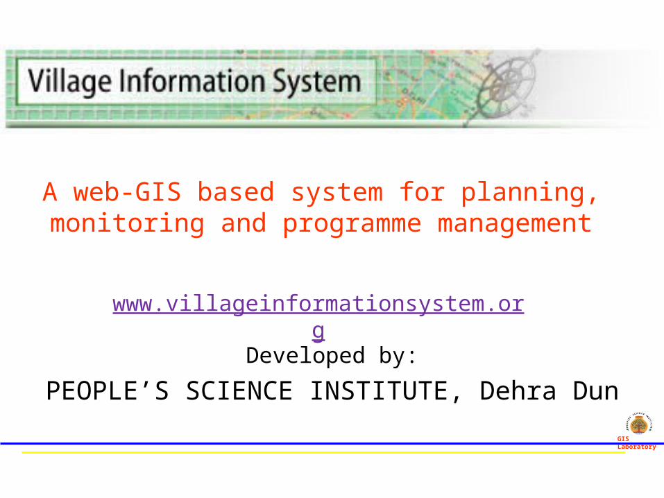
Developed by:
PEOPLE’S SCIENCE INSTITUTE, Dehra Dun
www.villageinformationsystem.org
GIS Laboratory
A web-GIS based system for planning, monitoring and programme management
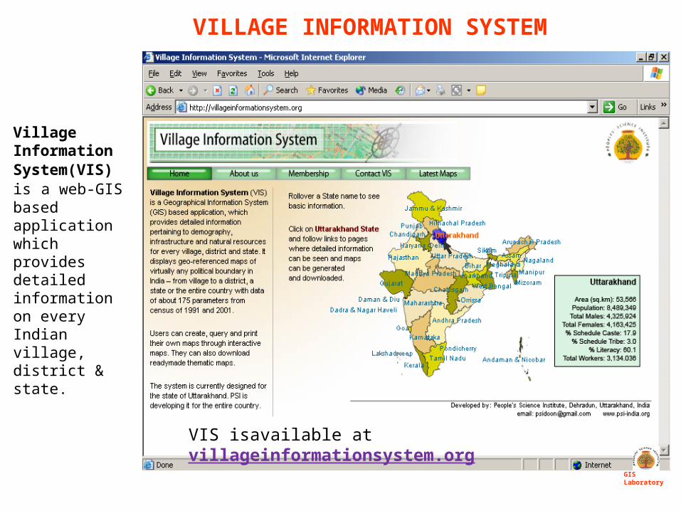
Village Information System(VIS) is a web-GIS based application which provides detailed information on every Indian village, district & state.
GIS Laboratory
VILLAGE INFORMATION SYSTEM
VIS isavailable at villageinformationsystem.org
FEATURES
GIS Laboratory
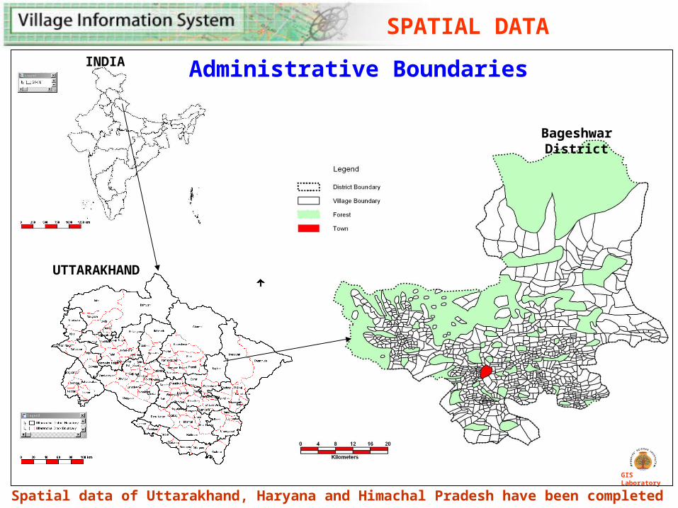
SPATIAL DATA
Administrative Boundaries
GIS Laboratory
Bageshwar District
INDIA
Spatial data of Uttarakhand, Haryana and Himachal Pradesh have been completed
UTTARAKHAND
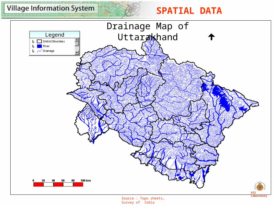
Drainage Map of UttarakhandLegend
Source : Topo sheets, Survey of India
GIS Laboratory
SPATIAL DATA
Legend
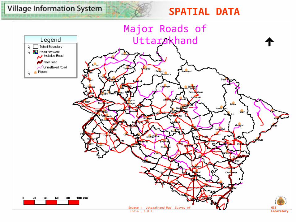
Major Roads of Uttarakhand
Source : Uttarakhand Map ,Survey of India , G.O.I. GIS Laboratory
SPATIAL DATA
GIS Laboratory
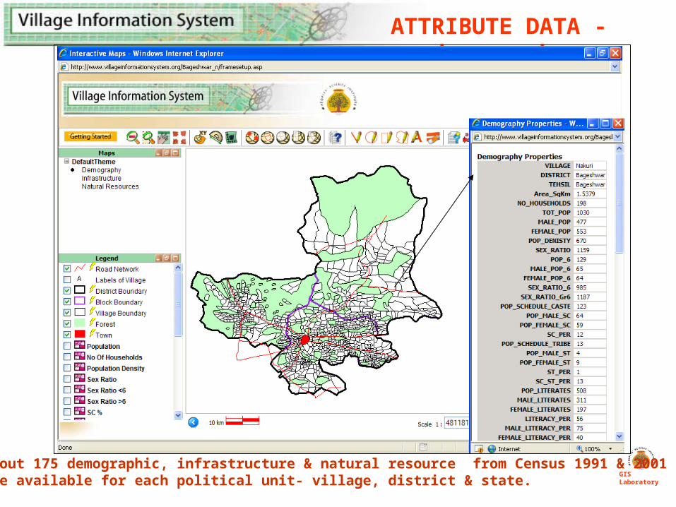
ATTRIBUTE DATA -demography
* About 175 demographic, infrastructure & natural resource from Census 1991 & 2001 are available for each political unit- village, district & state.
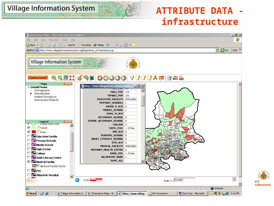
ATTRIBUTE DATA -infrastructure
GIS Laboratory
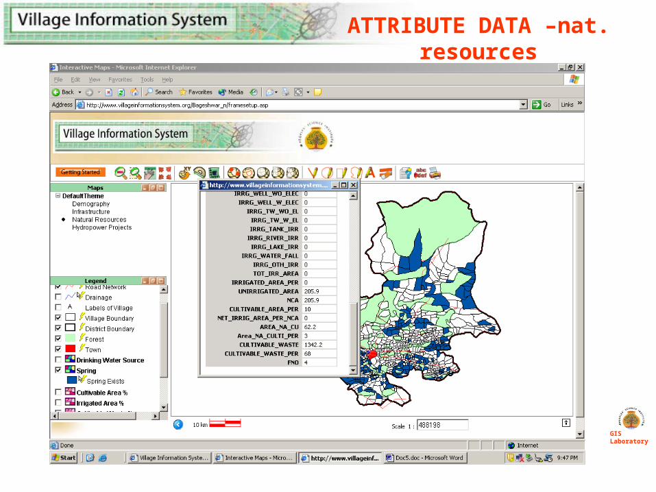
ATTRIBUTE DATA –nat. resources
GIS Laboratory
GIS Laboratory
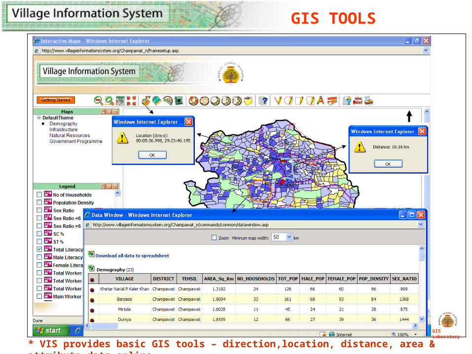
* VIS provides basic GIS tools – direction,location, distance, area & attribute data online
GIS TOOLS
FACILITIES
GIS Laboratory
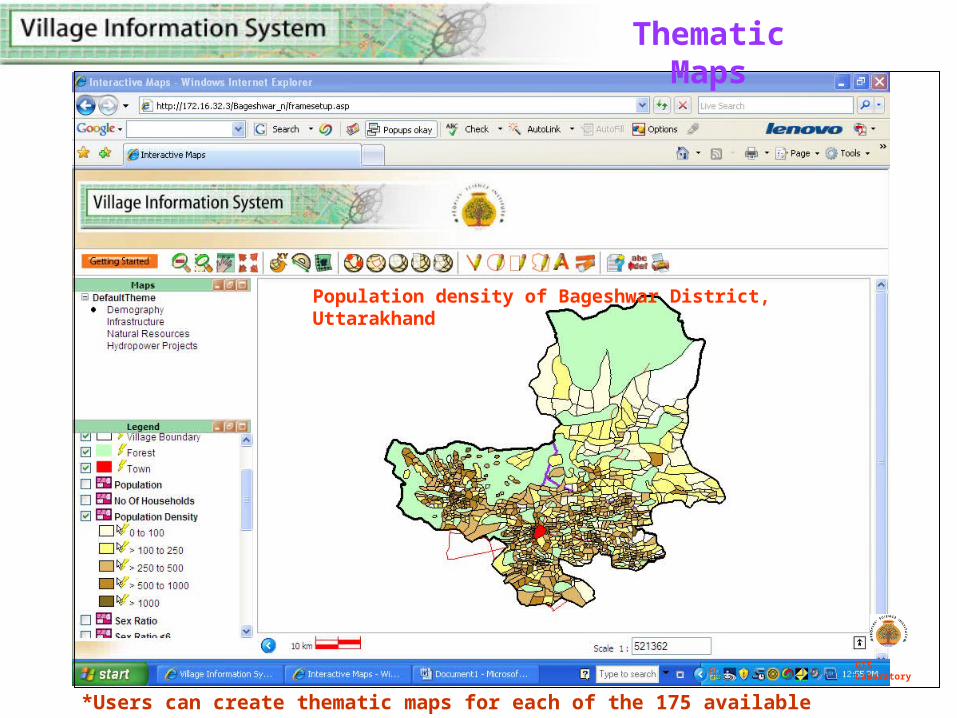
*Users can create thematic maps for each of the 175 available parameters
GIS Laboratory
Thematic Maps
Population density of Bageshwar District, Uttarakhand
GIS Laboratory
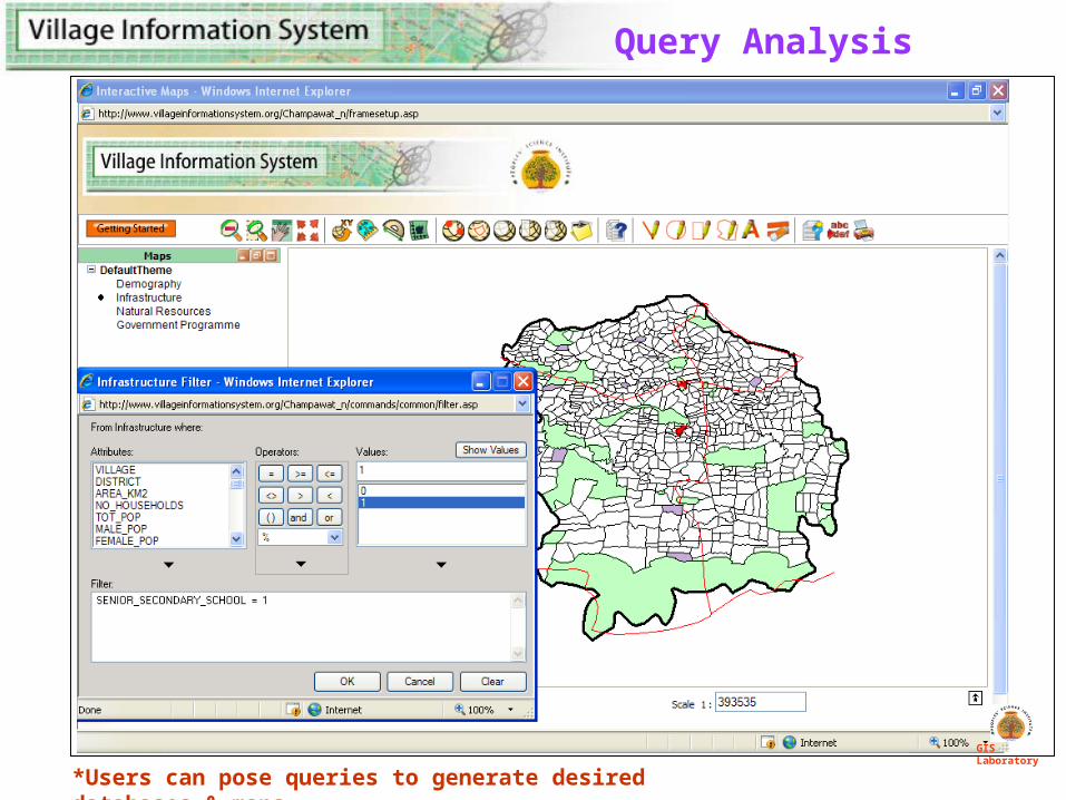
Query Analysis
*Users can pose queries to generate desired databases & maps
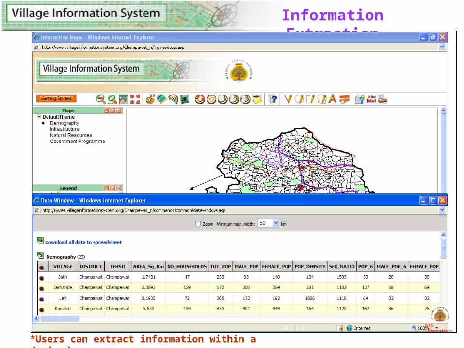
Information Extraction
*Users can extract information within a desired area
GIS Laboratory
GIS Laboratory
APPLICATIONS
GIS Laboratory
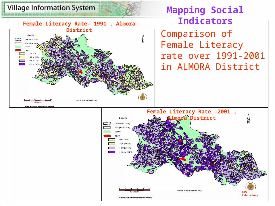
Comparison of Female Literacy rate over 1991-2001 in ALMORA District
Female Literacy Rate -2001 , Almora District
Female Literacy Rate- 1991 , Almora District
GIS Laboratory
Mapping Social Indicators
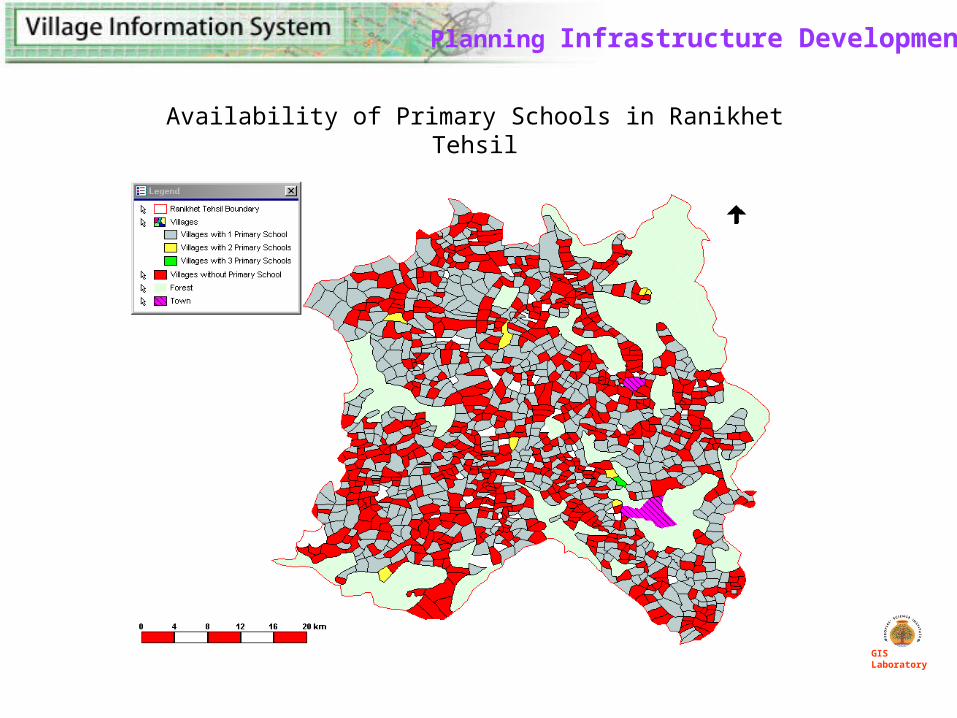
Planning Infrastructure Development
Availability of Primary Schools in Ranikhet Tehsil
GIS Laboratory
Legend
Source : Census of India 2001
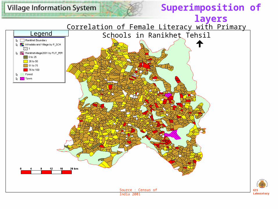
Superimposition of layers
Correlation of Female Literacy with Primary Schools in Ranikhet Tehsil
GIS Laboratory
GIS Laboratory
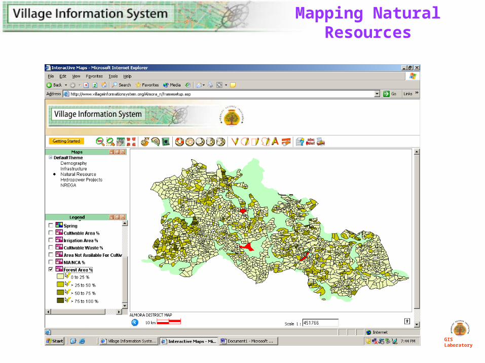
Mapping Natural Resources
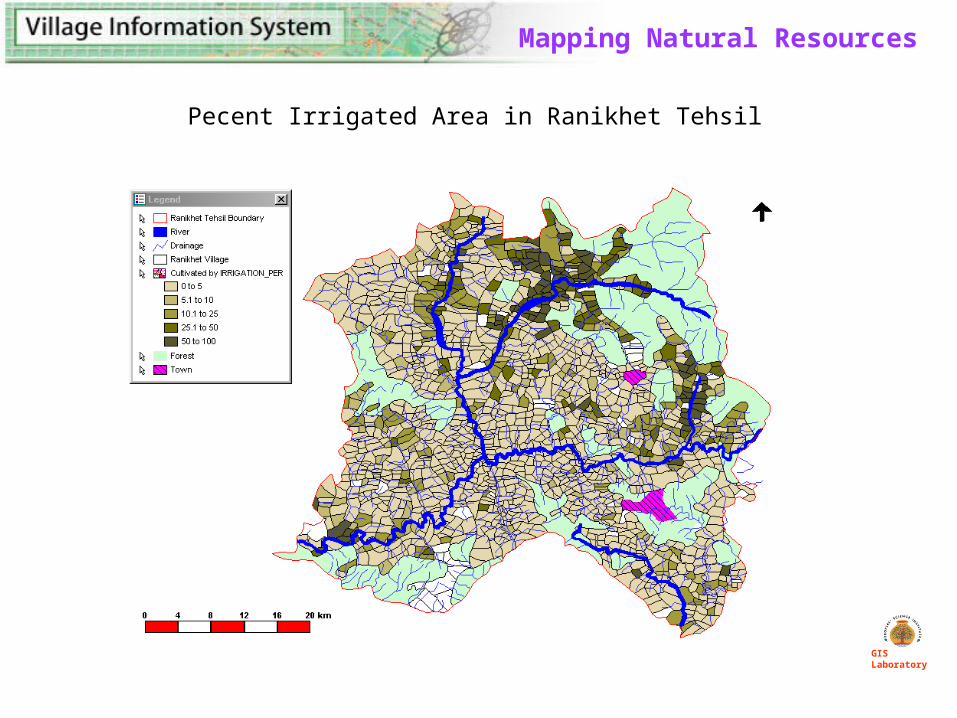
Mapping Natural Resources
Pecent Irrigated Area in Ranikhet Tehsil
GIS Laboratory
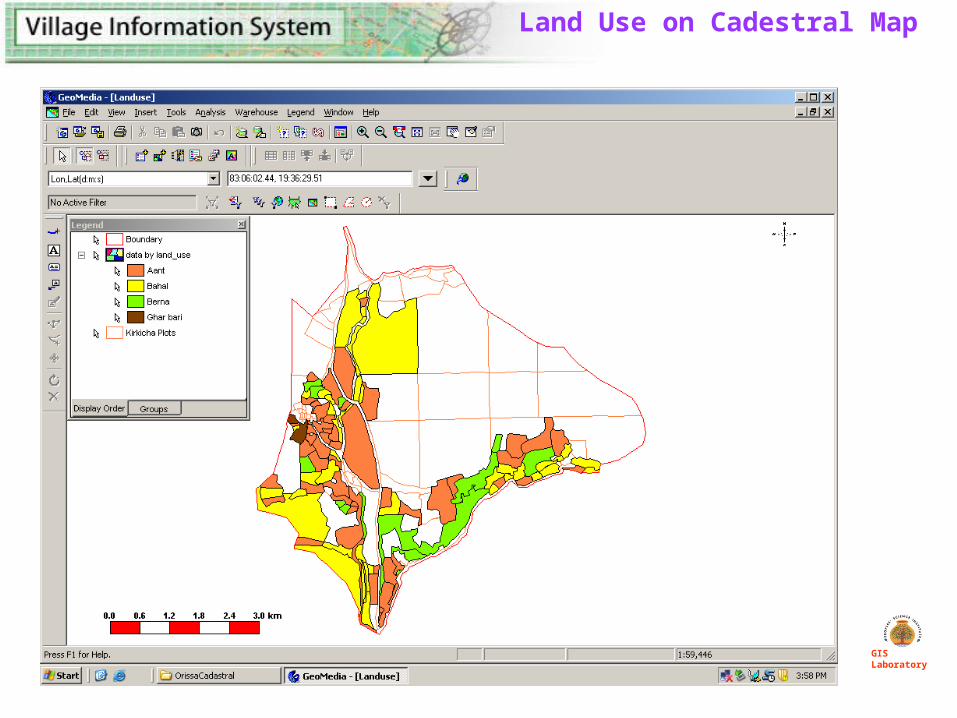
Land Use on Cadestral Map
GIS Laboratory
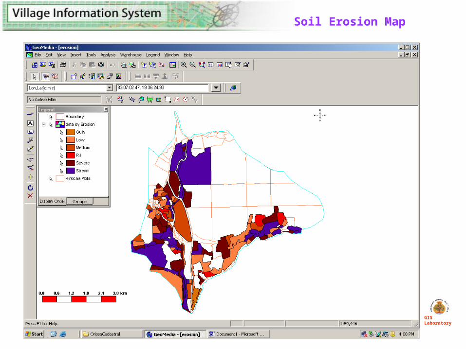
Soil Erosion Map
GIS Laboratory
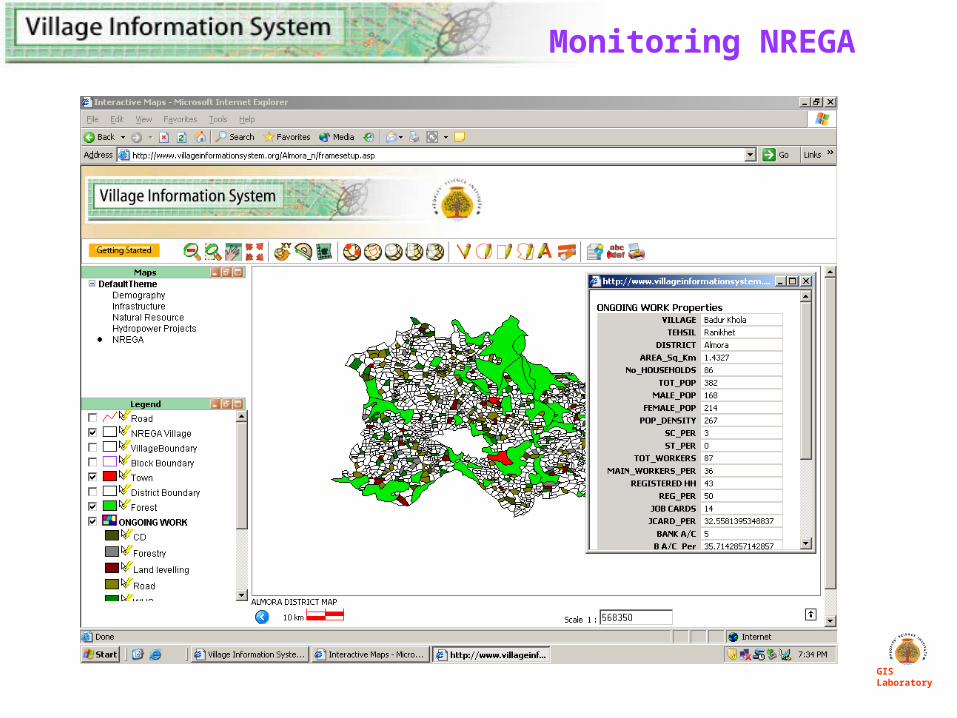
Monitoring NREGA
GIS Laboratory
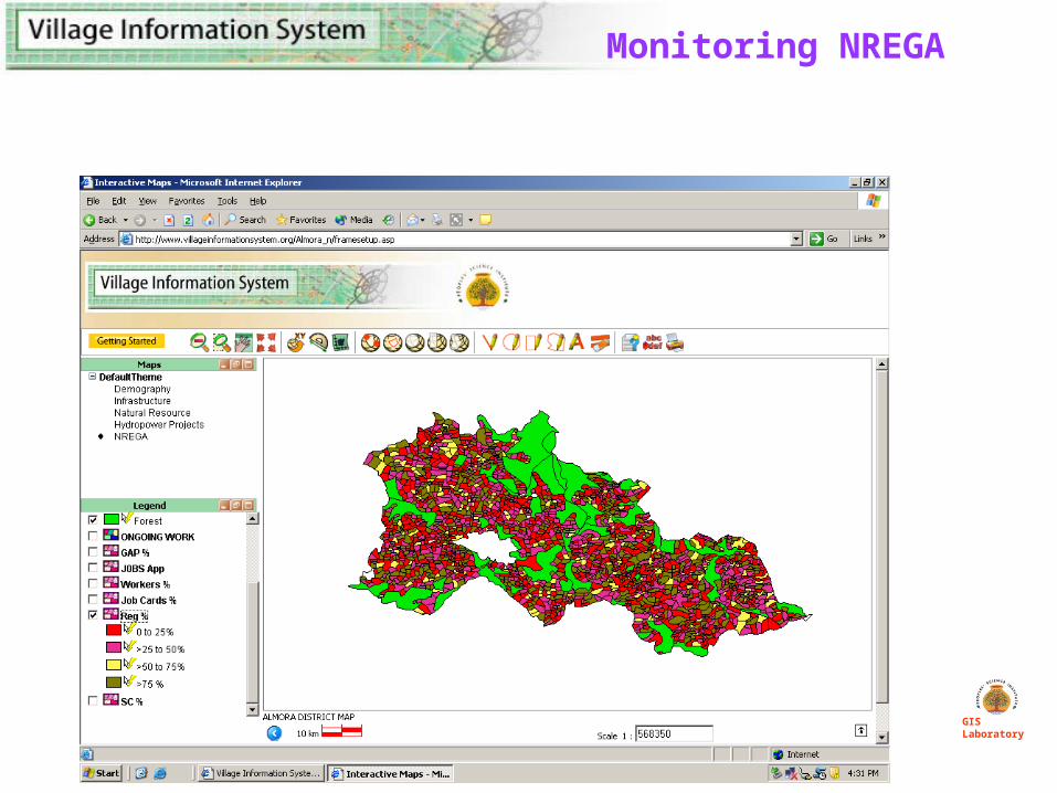
Monitoring NREGA
GIS Laboratory
GIS Laboratory
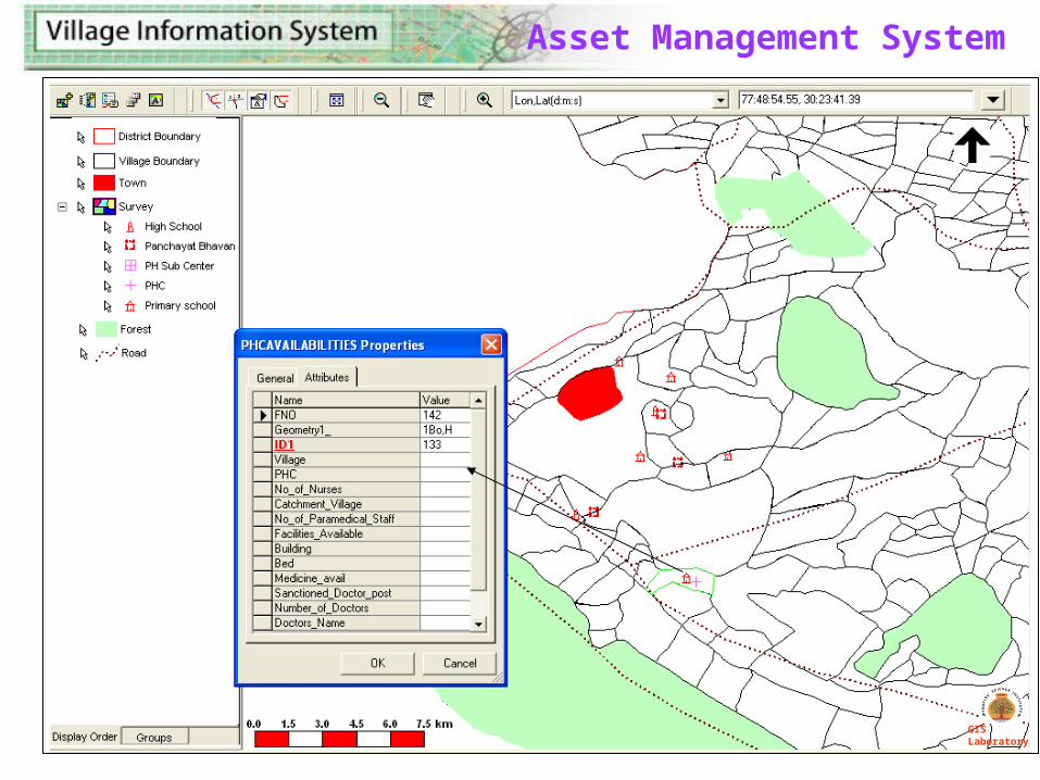
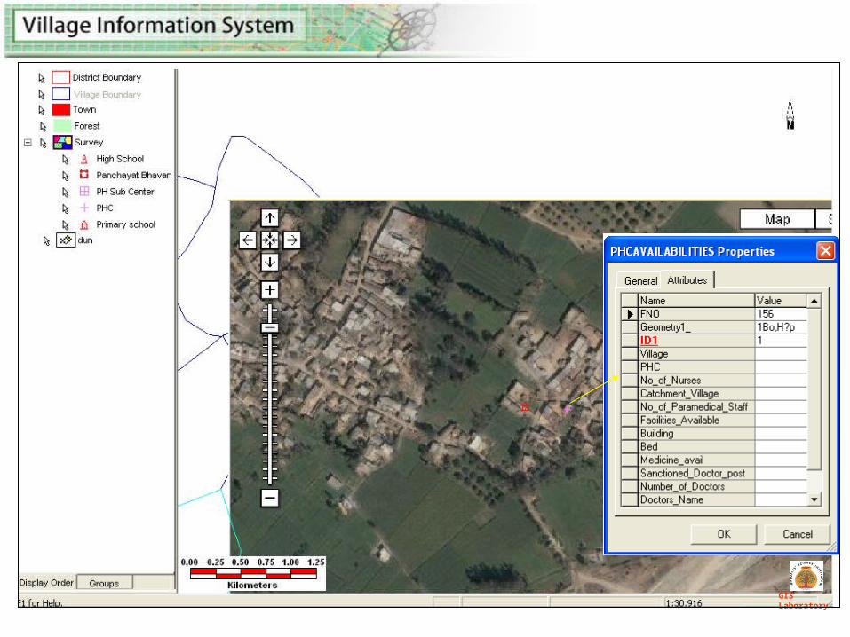
Asset Management System
GIS Laboratory
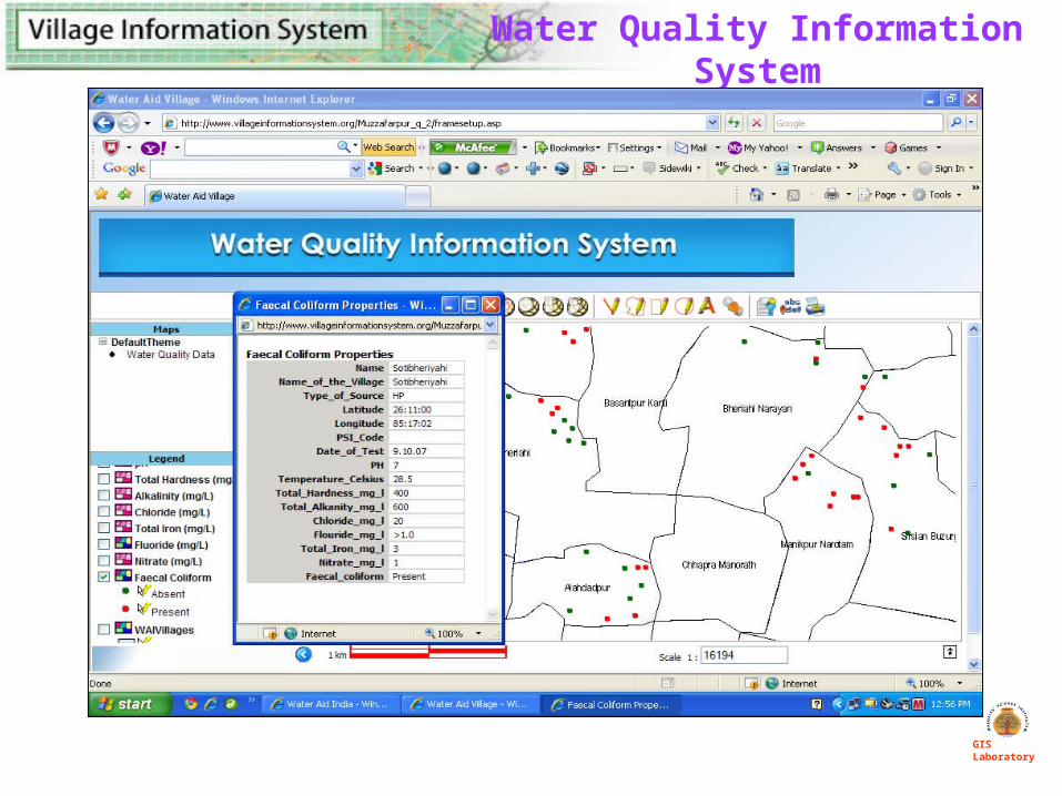
Water Quality Information System
GIS Laboratory
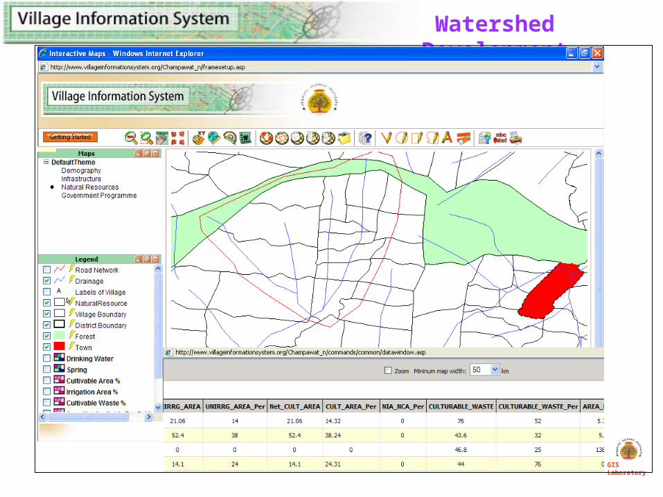
Watershed Development
GIS Laboratory
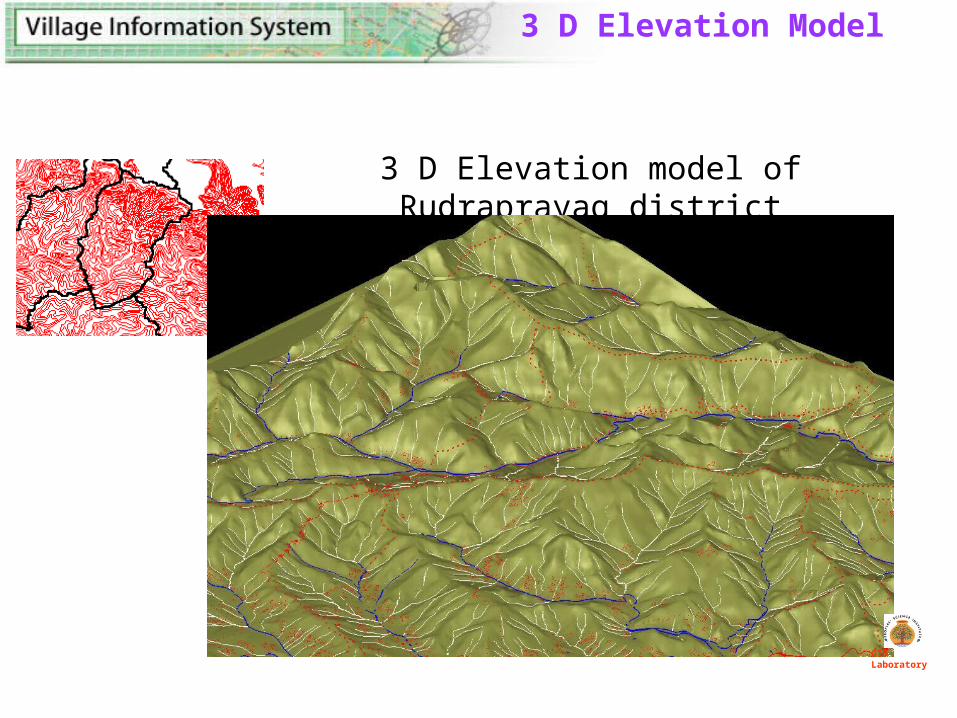
3 D Elevation model of Rudraprayag district
3 D Elevation Model
GIS Laboratory
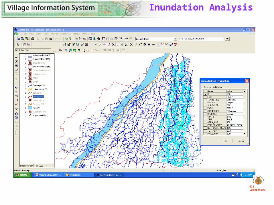
Inundation Analysis
GIS Laboratory
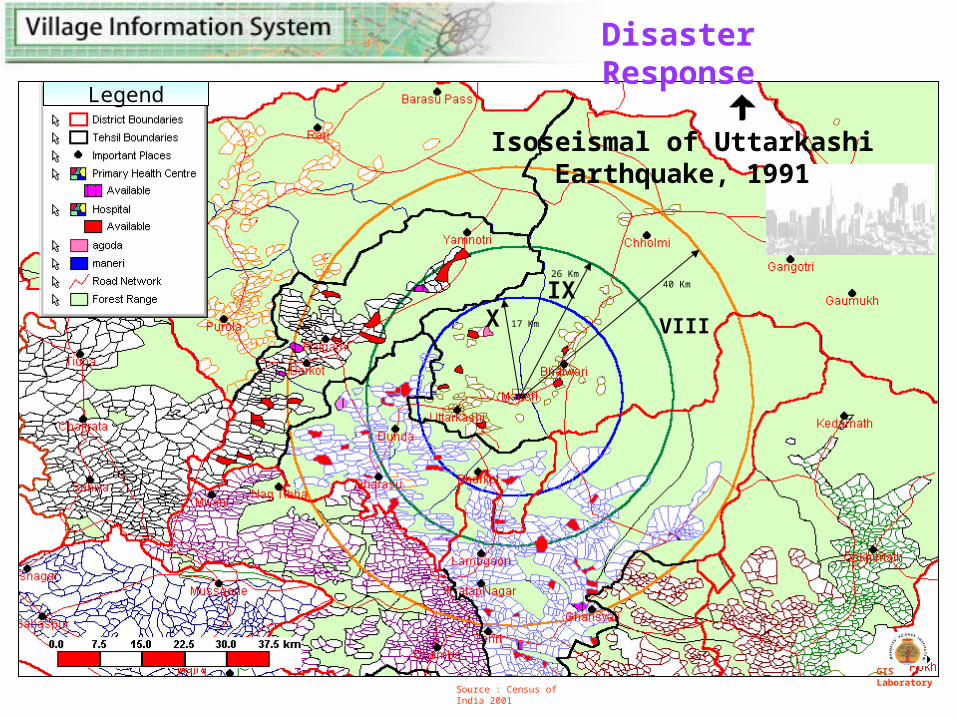
Source : Census of India 2001
17 Km
26 Km40 Km
XIX VIII
Legend
GIS Laboratory
Disaster Response
Isoseismal of Uttarkashi Earthquake, 1991
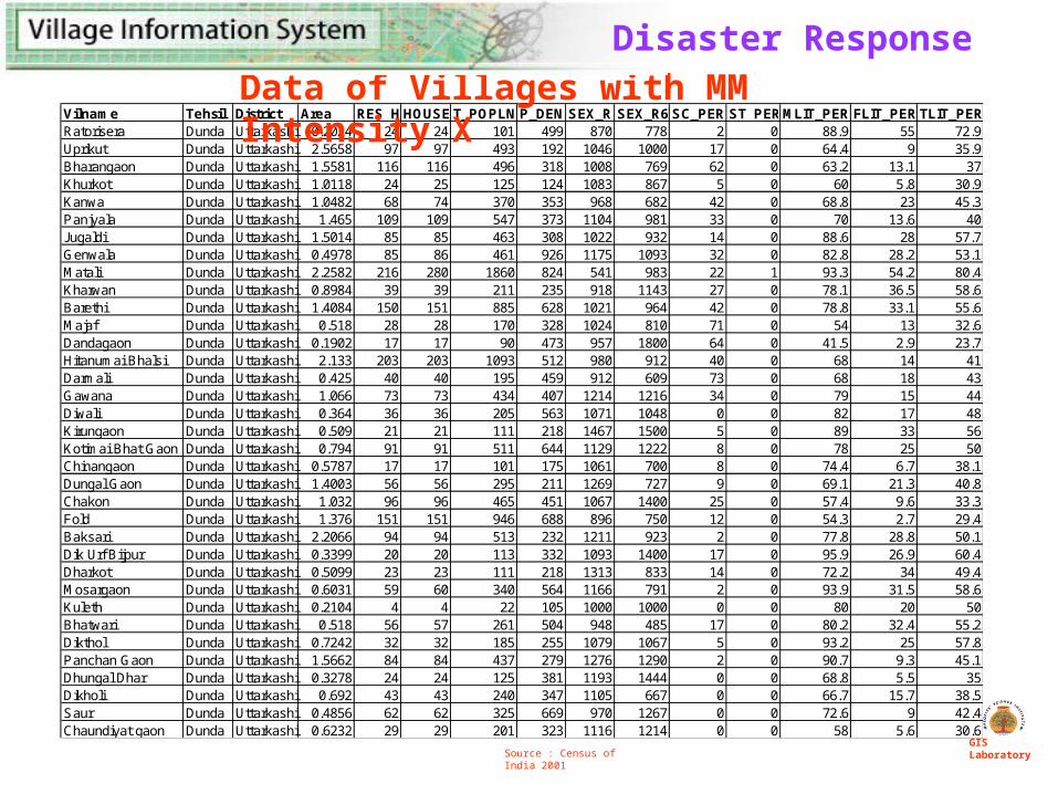
Vilname Tehsil District Area RES_HOUSEHOUSEHOLDST_POPLN P_DEN SEX_R SEX_R6 SC_PER ST_PERMLIT_PER FLIT_PER TLIT_PERRatorisera Dunda Uttarkashi 0.2024 24 24 101 499 870 778 2 0 88.9 55 72.9Uprikut Dunda Uttarkashi 2.5658 97 97 493 192 1046 1000 17 0 64.4 9 35.9Bharangaon Dunda Uttarkashi 1.5581 116 116 496 318 1008 769 62 0 63.2 13.1 37Khurkot Dunda Uttarkashi 1.0118 24 25 125 124 1083 867 5 0 60 5.8 30.9Kanwa Dunda Uttarkashi 1.0482 68 74 370 353 968 682 42 0 68.8 23 45.3Panjyala Dunda Uttarkashi 1.465 109 109 547 373 1104 981 33 0 70 13.6 40Jugaldi Dunda Uttarkashi 1.5014 85 85 463 308 1022 932 14 0 88.6 28 57.7Genwala Dunda Uttarkashi 0.4978 85 86 461 926 1175 1093 32 0 82.8 28.2 53.1Matali Dunda Uttarkashi 2.2582 216 280 1860 824 541 983 22 1 93.3 54.2 80.4Kharwan Dunda Uttarkashi 0.8984 39 39 211 235 918 1143 27 0 78.1 36.5 58.6Barethi Dunda Uttarkashi 1.4084 150 151 885 628 1021 964 42 0 78.8 33.1 55.6Majaf Dunda Uttarkashi 0.518 28 28 170 328 1024 810 71 0 54 13 32.6Dandagaon Dunda Uttarkashi 0.1902 17 17 90 473 957 1800 64 0 41.5 2.9 23.7Hitanumai Bhalsi Dunda Uttarkashi 2.133 203 203 1093 512 980 912 40 0 68 14 41Darmali Dunda Uttarkashi 0.425 40 40 195 459 912 609 73 0 68 18 43Gawana Dunda Uttarkashi 1.066 73 73 434 407 1214 1216 34 0 79 15 44Diwali Dunda Uttarkashi 0.364 36 36 205 563 1071 1048 0 0 82 17 48Kirungaon Dunda Uttarkashi 0.509 21 21 111 218 1467 1500 5 0 89 33 56Kotimai Bhat Gaon Dunda Uttarkashi 0.794 91 91 511 644 1129 1222 8 0 78 25 50Chinangaon Dunda Uttarkashi 0.5787 17 17 101 175 1061 700 8 0 74.4 6.7 38.1Dungal Gaon Dunda Uttarkashi 1.4003 56 56 295 211 1269 727 9 0 69.1 21.3 40.8Chakon Dunda Uttarkashi 1.032 96 96 465 451 1067 1400 25 0 57.4 9.6 33.3Fold Dunda Uttarkashi 1.376 151 151 946 688 896 750 12 0 54.3 2.7 29.4Baksari Dunda Uttarkashi 2.2066 94 94 513 232 1211 923 2 0 77.8 28.8 50.1Dik Urf Bijpur Dunda Uttarkashi 0.3399 20 20 113 332 1093 1400 17 0 95.9 26.9 60.4Dharkot Dunda Uttarkashi 0.5099 23 23 111 218 1313 833 14 0 72.2 34 49.4Mosargaon Dunda Uttarkashi 0.6031 59 60 340 564 1166 791 2 0 93.9 31.5 58.6Kuleth Dunda Uttarkashi 0.2104 4 4 22 105 1000 1000 0 0 80 20 50Bhatwari Dunda Uttarkashi 0.518 56 57 261 504 948 485 17 0 80.2 32.4 55.2Dikthol Dunda Uttarkashi 0.7242 32 32 185 255 1079 1067 5 0 93.2 25 57.8Panchan Gaon Dunda Uttarkashi 1.5662 84 84 437 279 1276 1290 2 0 90.7 9.3 45.1Dhungal Dhar Dunda Uttarkashi 0.3278 24 24 125 381 1193 1444 0 0 68.8 5.5 35Dikholi Dunda Uttarkashi 0.692 43 43 240 347 1105 667 0 0 66.7 15.7 38.5Saur Dunda Uttarkashi 0.4856 62 62 325 669 970 1267 0 0 72.6 9 42.4Chaundiyat gaon Dunda Uttarkashi 0.6232 29 29 201 323 1116 1214 0 0 58 5.6 30.6
Data of Villages with MM Intensity X
Source : Census of India 2001GIS Laboratory
Disaster Response
GIS Laboratory
PLANNERS AND POLICY MAKERS
•Informed policy decision making.
•Planning development programmes.
•Asset management systems
•Disaster response.
• Project impact assessment.
ADMINISTRATORS
•Planning and monitoring development programmes.
•Status of health, education and drinking water infrastructure.
•Immediate response to disasters.
RESEARCHERS AND ACADEMECIANS
• Study comparative changes and trends (1991, 2001).
•Study impact of development programmes .
VIS is Useful
• Need to create one integrated system for rural development planning and monitoring
• Standardize formats and systems for collection, collation and updation of data
• The system should be created in a layered manner from block, district, state and nation
• Planning and monitoring at village and panchayat level should be done through MLP and the focus should be on community management system – Gram Swaraj Abhiyan
STEPS FORWARD
GIS Laboratory

GIS Laboratory
People’s Science Institute252, Vasant Vihar – I, Dehra Dun, Uttarakhand
Email : [email protected]: peoplesscienceinstitute.com
Please visit : www.villageinformationsystem.org
Thank You