designing sdi4apps poi base€¦ · designing sdi4apps poi base otakar Čerba*, tomáš mildorf*,...
TRANSCRIPT
Designing SDI4Apps POI Base
Otakar Čerba*, Tomáš Mildorf*, Raitis Bērziņš**
*University of West Bohemia, Czech Republic*Baltic Open Solutions Centre, Latvia
Joint International Workshop on Semantic Sensor Networks and Terra CognitaBethlehem PA, October 11, 2015

Objectives
● SPOI introduction● Data model● SPOI vs. OpenPOIs● SPOI publication● Future steps & Conclusions
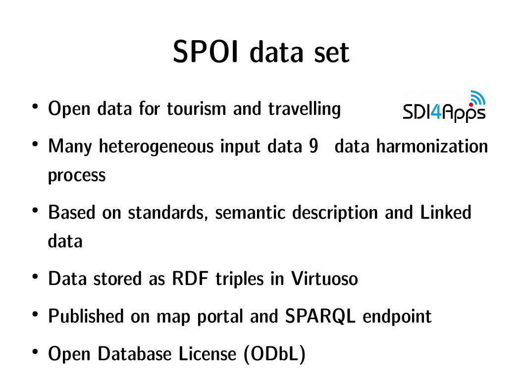
SPOI data set● Open data for tourism and travelling● Many heterogeneous input data → data harmonization
process● Based on standards, semantic description and Linked
data● Data stored as RDF triples in Virtuoso● Published on map portal and SPARQL endpoint● Open Database License (ODbL)

SPOI data set – Why?● Request of project partners and subjects participating
in tourism● Needs of
– Enrichment of existing data and applications– Promotion of particular places and territories
● Support of all types of participants of tourism
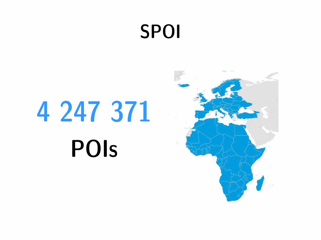
SPOI
4 247 371 POIs

Source data
● OpenStreetMap● GeoNames.org (dumps)● Local data – documents from Posumavi region, Sicily
and travel agency● Semantic data – experimental ontologies (OWL) of
UWB (ski resort, sight in Rome)

410942597%
OSMGeoNamesOther
Statistics
78%
22%
EuropeAfrica

Data modelSPOI
+ rdfs:label : xsd:string [1..*]+ rdfs:comment : xsd:string [0..*]
+ geos:asWKT : WKTLiteral
+ poi:category : xsd:string [0..1]+ poi:categoryOSM : xsd:string [0..1]
+ poi:address : xsd:string [0..1]+ foaf:mbox : xsd:string [0..*]+ poi:fax : xsd:string [0..*]+ foaf:phone : xsd:string [0..*]+ foaf:homepage : xsd:anyURI [0..*]
+ poi:iata : xsd:string [0..1]+ poi:openingHours : xsd:string [0..*]+ poi:access : xsd:string [0..*]+ poi:internetAccess : xsd:string [0..1]+ poi:cuisine : xsd:string [0..1]
+ poi:photo : xsd:anyURI [0..*]+ poi:wikidata : xsd:anyURI [0..1]+ rdfs:seeAlso : xsd:anyURI [0..*]+ skos:exactMatch : xsd:anyURI [0..*]+ owl:sameAs : xsd:anyURI [0..*]+ geos:sfWithin : xsd:anyURI [1..*]
WazeClassification
+ skos:prefLabel : xsd:string
poi:categoryWaze
1
1
Links
Contact information
Labels & descriptionsGeometry
Classification
Tourist information

Identifier● URI● Combination
– ISO 3166-1 alpha-2 country code– Acronym of category of POI according Waze navigation
data– Coordinates (long_lat)
<rdf:Description rdf:about="http://www.sdi4apps.eu/poi/ML_NAT_0.8712_14.9746">

Links
● Classification – vocabulary to re-use● Photos and pictures● Same features
– Web pages (Wikipedia, Wolfram|Alpha)– Linked data resources (DBpedia, GeoNames.org)
● Topological relation – to countries (GeoSPARQL)

SPOI & 5-star rating system
* Accessibility: SPARQL endpoint & Open Database License (OdbL)
** Structured data: JSON, XML, CSV or RDF
*** Non-proprietary format: RDF and other exports
**** URIs: Identifiers of each POI
***** Links: see the previous slide

Data harmonization● Transcription to structured data (table, text → XML) ● Preparation of common vocabularies (Waze) and
mappings (OSM, GeoNames.org → Waze)● Filtering● Adding information (links to countries)● Transformation to common data model● Export to common data format (RDF)

Data harmonization – technology
● XSLT 2.0 templates – Transformation language based on XML– Process XML based files and non-structured files
● Saxon processor– Java-based– XSLT + input data

SPOI vs. OpenPOIs

SPOI vs. OpenPOIs

SPARQL endpoint
http://ha.isaf2014.info:8890/sparql

Map client● HS layers● Specific tiles for
cycling and biking● OpenCycleMap,
MTB map, OSM...● Panoramio,
OpenWeatherMap

Map client
http://ng.hslayers.org/examples/geosparql/

Web page
sdi4apps.eu/
spoi
gis.zcu.cz/sp
oi

Future steps● Extension of information resources (imported data,
links, APIs)● Optimization of data model, data storage, data
harmonization & data refining● Cartographic challenges (clustering)● Context-based application (user will get only
information related to concrete needs)● Analyses & itineraries & routing

Conclusions
● Common data model● Re-using existing standards● Linked data● SPARQL endpoint
