david donohue, hydrosolutions inc tom henderson, montana …...1934 –tony boyle injured working as...
TRANSCRIPT
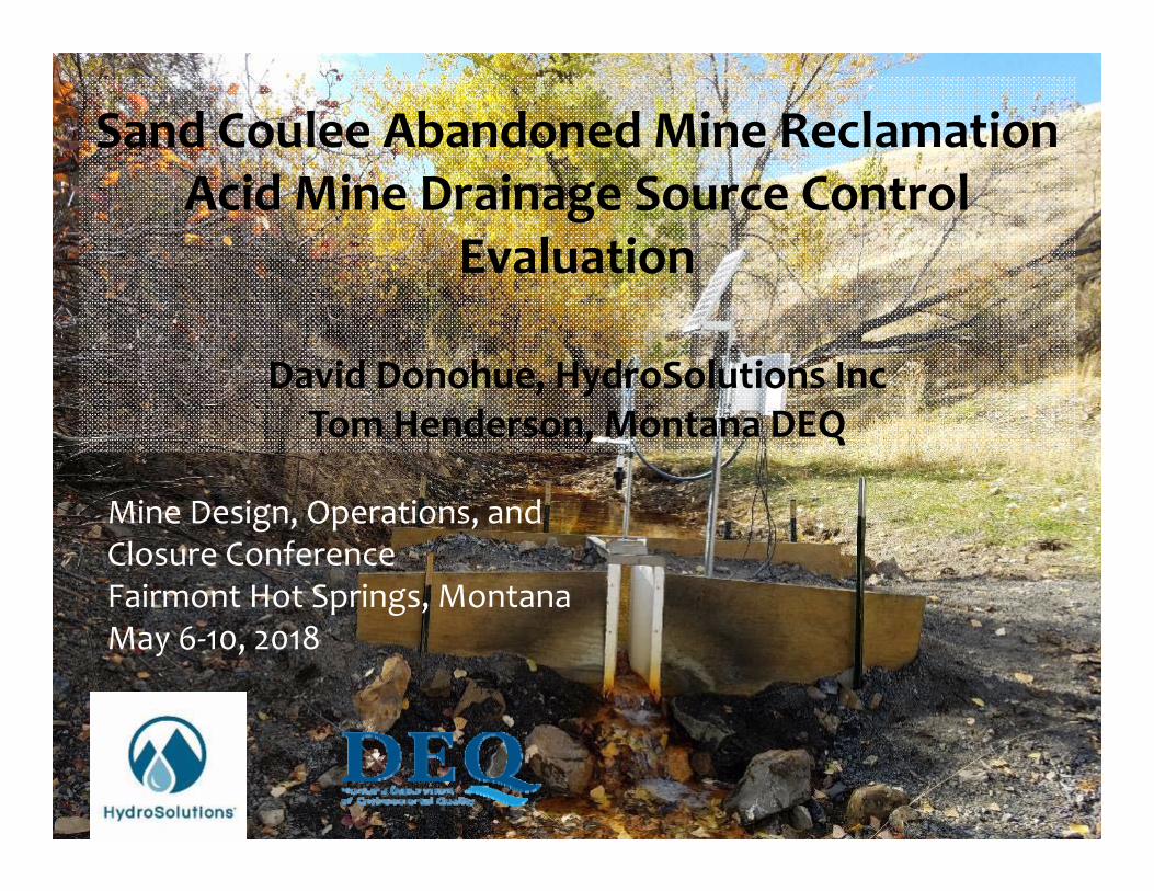
Sand Coulee Abandoned Mine Reclamation Acid Mine Drainage Source Control
Evaluation
David Donohue, HydroSolutions IncTom Henderson, Montana DEQ
Mine Design, Operations, and Closure ConferenceFairmont Hot Springs, MontanaMay 6‐10, 2018

Montana Department of Natural Resources and Conservation (DNRC)
Montana Department of Environmental Quality(DEQ)
U.S. Office of Surface Mining Reclamation and Enforcement (OSMRE)
Project Sponsors

Sand Coulee Mining History Previous Investigations Source Control and Feasibility Evaluation Recent Investigations Adit Flow, Monitoring Wells, and Bedrock Aquifer Drainage Well Practicability
Next Steps
Presentation Outline

4
Great Falls Coal FieldSand Coulee, Stockett, Belt
5
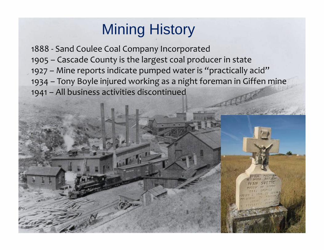
Mining History1888 ‐ Sand Coulee Coal Company Incorporated1905 – Cascade County is the largest coal producer in state1927 – Mine reports indicate pumped water is “practically acid”1934 – Tony Boyle injured working as a night foreman in Giffen mine1941 – All business activities discontinued
6
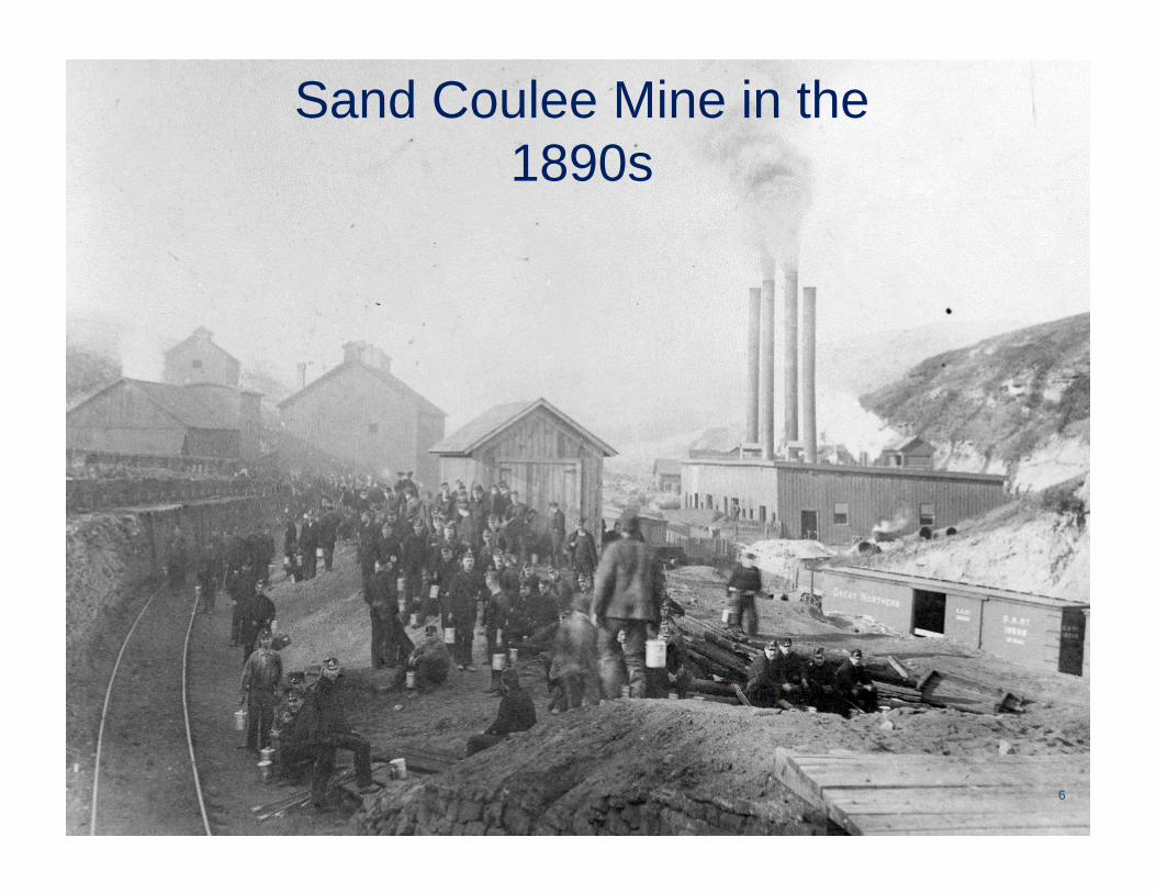
Sand Coulee Mine in the 1890s

7
80 Years Later -1970

8
Abandoned Mine Land ReclamationSurface Mining Reclamation Control Act

Kate’s Coulee
pH 3.81,400 mg/L Acidity 157 mg/L Aluminum201 mg/L Iron2,330 mg/L Sulfate30 GPM

Mining Coulee
pH 2.67,500 mg/L Acidity 764 mg/L Aluminum756 mg/L Iron9,570 mg/L Sulfate7 GPM
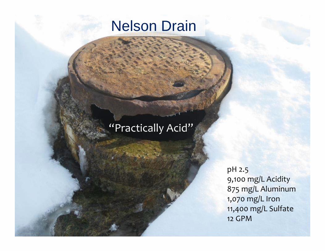
Nelson Drain
“Practically Acid”
pH 2.59,100 mg/L Acidity 875 mg/L Aluminum1,070 mg/L Iron11,400 mg/L Sulfate12 GPM
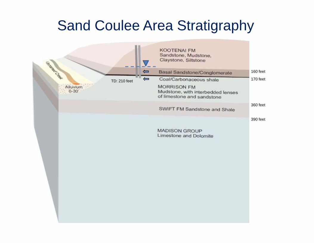
160 feet
170 feet
360 feet
390 feet
TD: 210 feet
Sand Coulee Area Stratigraphy

13
Basal Kootenai Sandstone
Morrison Formation Coal
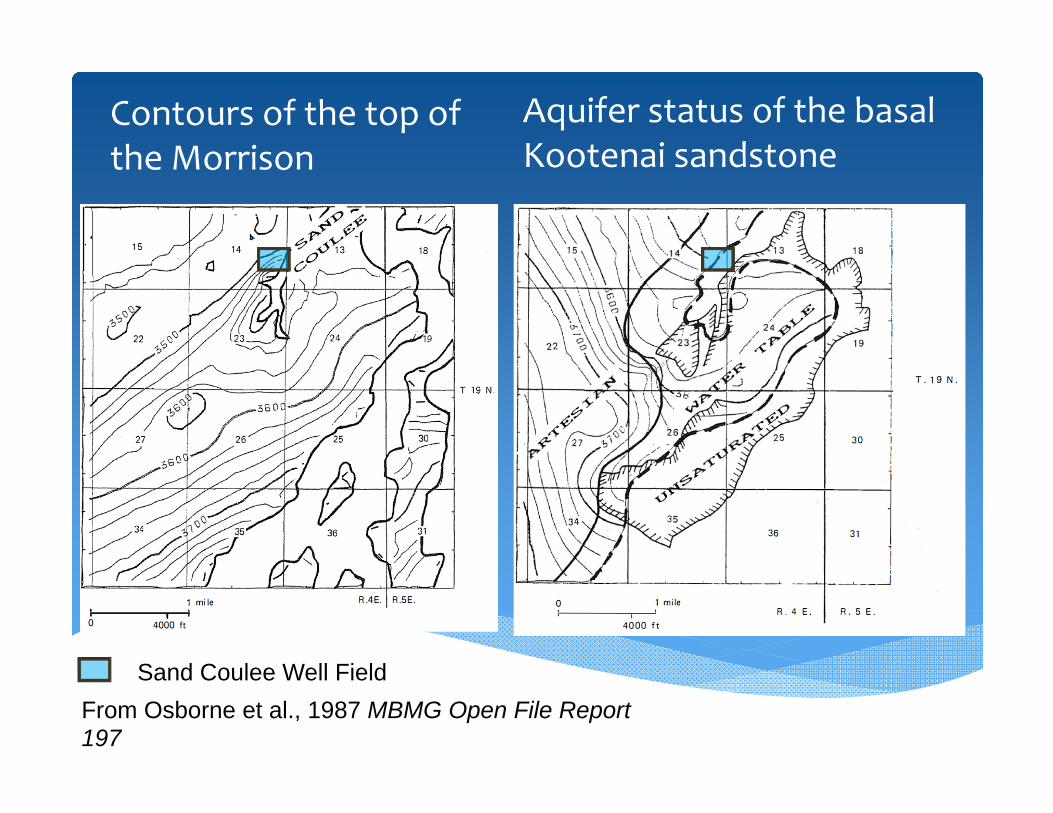
Contours of the top of the Morrison
Aquifer status of the basal Kootenai sandstone
Sand Coulee Well FieldFrom Osborne et al., 1987 MBMG Open File Report 197

Photo taken July 2015
GW flow in the Kootenai Sandstone
Sand Coulee Well Field
Mine Discharge
16
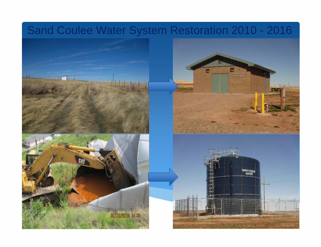
Sand Coulee Water System Restoration 2010 - 2016
Photo taken July 2015

DNRC Planning Grant to assess feasibility of groundwater interception (2013‐2014)
DNRC RDG Grant to conduct Hydrogeological Investigation and install pilot interception wells (2016‐2019)
Source Control Investigations
from Gammons et al., 2010 Chemical Geology 269 100–112

Intercept uncontaminated groundwater up‐gradient of the historic mine workings using gravity‐driven drainage wells completed in the basal Kootenai sandstone.
Thereby reduce leakage into and AMD emanating from the old mine workings.
Source Control With Groundwater Interception Objectives

Two well designs were considered, a horizontal or low angle well, and a vertical drainage well.
Horizontal well installed using directional drilling technology.
The vertical drainage well would be installed by a conventional water well contractor.
Conceptual Well Design


Potential effectiveness of both horizontal and vertical drainage wells were analyzed as part of the 2013‐2014 DNRC planning grant.
The evaluation focused on estimating the yield of drainage wells and potential reduction in the amount of water discharging from the abandoned mine workings using drainage wells.
Source Control Feasibility Evaluation
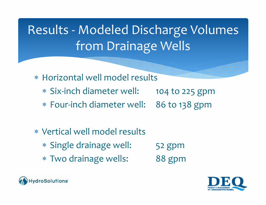
Horizontal well model results Six‐inch diameter well: 104 to 225 gpm Four‐inch diameter well: 86 to 138 gpm
Vertical well model results Single drainage well: 52 gpm Two drainage wells: 88 gpm
Results ‐Modeled Discharge Volumes from Drainage Wells

Need accurate adit discharge measurements. Adit discharge rates affected by factors including precipitation events and seasonal and long‐term climatic patterns.
Site conditions (freezing winter conditions and the extremely low turbidity of the discharged water favored a design employing non‐contact water stage measurement.
Adit Discharge


Four adit discharge sites – previous average flow rates of 6.6 to 30 gpm.
Two molded fiberglass polyester 0.6’ HS‐flumes One 3‐inch Parshall flume One 0.5’ H‐flume Senix ToughSonic Chem 10 Ultrasonic level sensor and Campbell Scientific CR300 data logger.
Adit Discharge Equipment
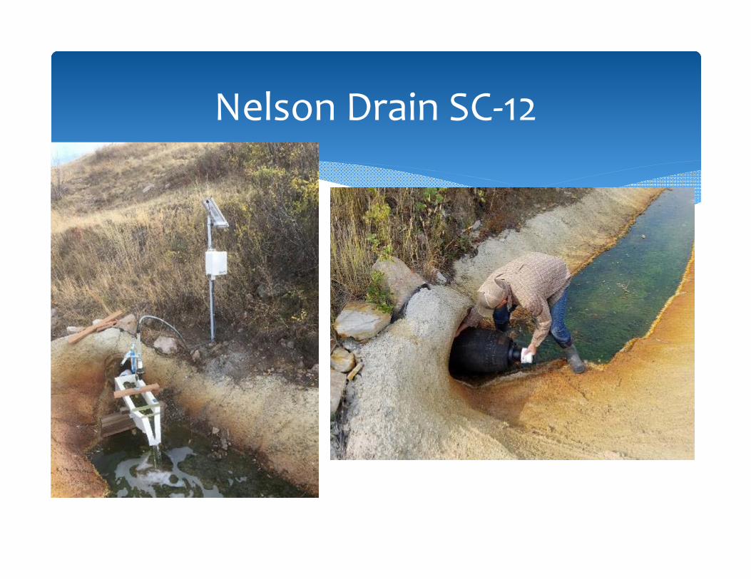
Nelson Drain SC‐12
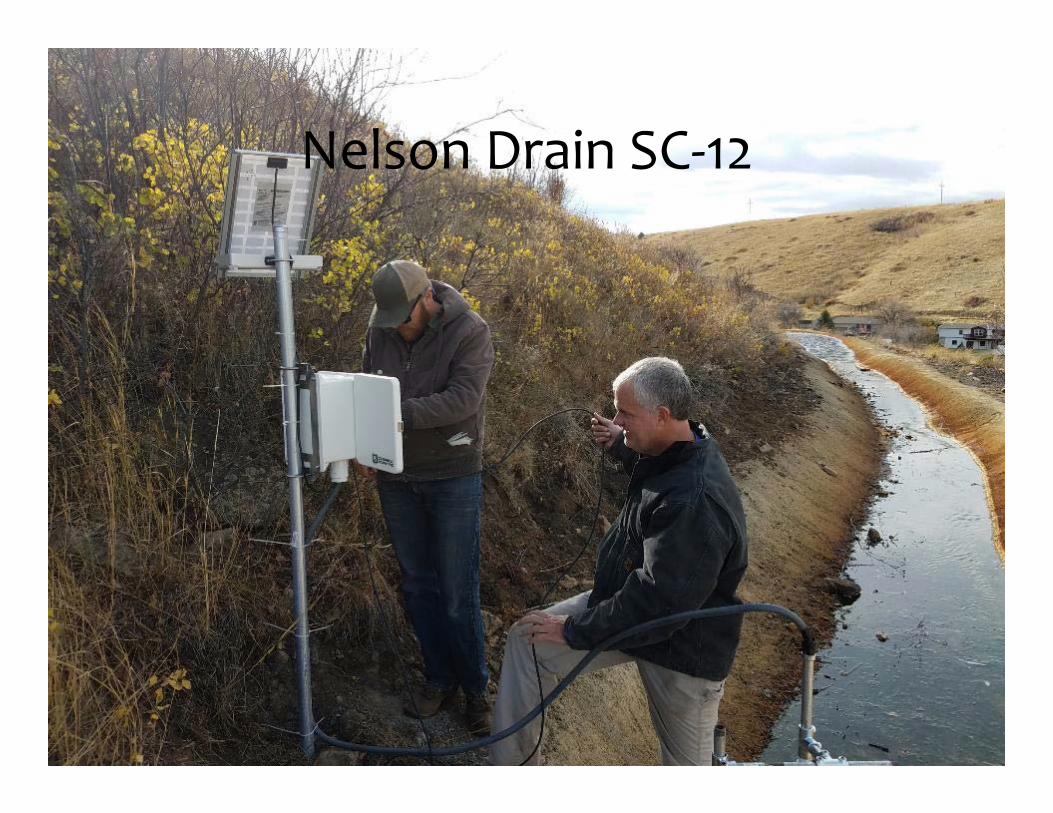
Nelson Drain SC‐12

Kate’s Coulee SC‐8

SC‐3A

Miner’s Coulee SC‐1

Non‐contact Stage Measurement
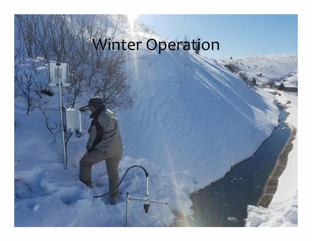
Winter Operation

0
5
10
15
20
25
1‐Nov
21‐N
ov
11‐Dec
31‐Dec
20‐Jan
9‐Fe
b
1‐Mar
21‐M
ar
10‐Apr
30‐Apr
GPM
Miner's Coulee SC‐1 Discharge
Adit Discharge Measurements

Private Well Inventory
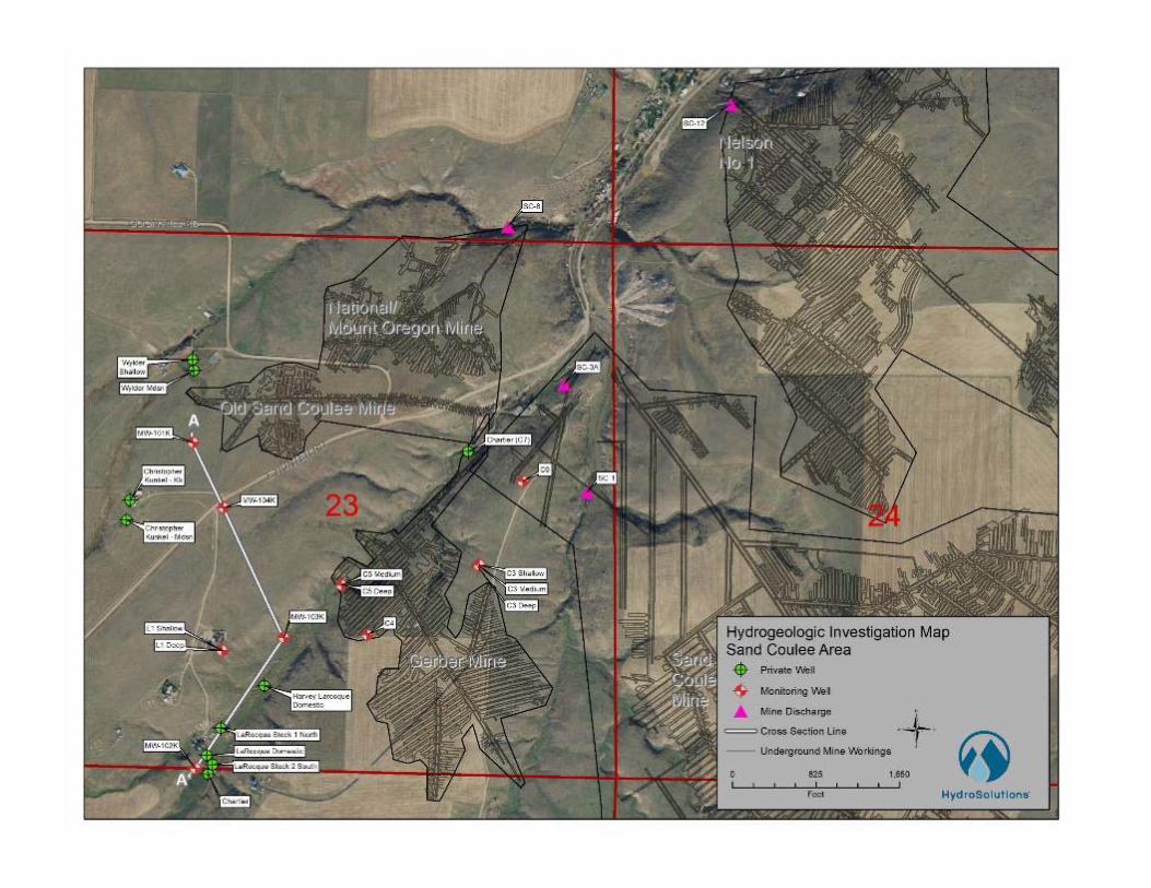

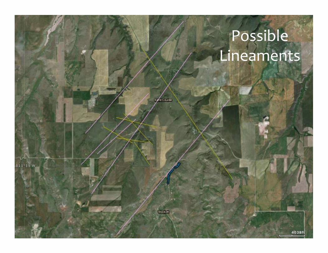
Possible Lineaments

Smith 2008. MGWAA

Horizontal Well Locations
Preliminary hydrogeologic evaluation (well and survey data) led to identifying six feasible well locations
H‐3, H‐5, H‐6

Gravity‐driven vertical drainage wells provide additional installation opportunities when compared with gravity‐driven horizontal wells
Compared with the horizontal wells, a vertical drainage well is not dependent on elevations providing natural drainage at the spud location.
A vertical drainage well connecting the Kk1 aquifer directly to the Madison aquifer would be less expensive than a horizontal well.
Pilot Vertical Interception Well
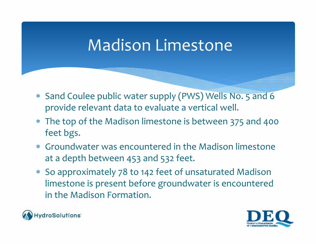
Sand Coulee public water supply (PWS) Wells No. 5 and 6 provide relevant data to evaluate a vertical well.
The top of the Madison limestone is between 375 and 400 feet bgs.
Groundwater was encountered in the Madison limestone at a depth between 453 and 532 feet.
So approximately 78 to 142 feet of unsaturated Madison limestone is present before groundwater is encountered in the Madison Formation.
Madison Limestone

Given the surface elevations found within the drainages and the head encountered in Kk1, more opportunities to locate pilot vertical interception wells exist up‐gradient of all mines.
Recommended locations include Within Sand Coulee near MW‐102K, The vicinity of MW‐103K which is just up‐gradient of the Gerber
Mine workings, and On the bench above Sand Coulee near MW‐101K, upgradient of
Mount Oregon Mine
Vertical Drainage Well Locations

Moving forward with planning for one horizontal drainage well up to about 2,000 feet long , and
One to three vertical drainage wells. Horizontal wells are more technically challenging, and are more expensive but a single installation could have a larger effect on AMD prevention than any single vertical drainage well.
More potential opportunities exist for vertical drainage wells which could be added incrementally to achieve a desired level of AMD control.
Conclusions And Recommendations

Continue maintenance and calibration of adit discharge monitoring equipment
Coordination with landowners Follow up with regulatory agencies on permitting needs Solicit interest and abilities from drilling companies Prepare drill bids Drill pilot wells ‐ late summer
Current Schedule
