cumbria landscape character guidance and toolkit part 1 · cumbria landscape character guidance and...
TRANSCRIPT

Cumbria Landscape Character Guidance and ToolkitPART ONE Landscape Character Guidance
Supporting Cumbria’s Local Development Frameworks

This document has been prepared jointly for:
Cumbria County Council
Allerdale Borough Council
Barrow Borough Council
Carlisle City Council
Copeland Borough Council
Eden District Council
South Lakeland District Council
It provides evidence to support policy formulation and site allocations in the Local Development
Frameworks being developed by each of the above local authorities.
Acknowledgments
This document has been prepared by Jenny Wain, Principal Planning Officer, Cumbria County Council.
Also from Cumbria County Council:
Mark Brennand and Richard Newman provided historic input.
Matthew Armstrong provided support reviewing the original landscape character assessment and
strategy, reviewing surveys and running workshops.
Alison Mofatt and Lucinda Weymouth, Landscape Architects at Capita Symonds provided expert
input on Part Two of this document.
The document has been produced with the support and encouragement of the
Cumbria Landscape Character Steering Group:
Chris Greenwood – Lake District National Park Authority
Richard Pearse – Friends of the Lake District
Stuart Pasley – Natural England
Leanne Beverley – Cumbria County Council
Photographs are courtesy of Cumbria County Council, Brian Irving HELM Images and Lucy Drummond.
For further information contact
Jenny Wain on 01539 713427 or [email protected]
© Cumbria County Council, March 2011
ii
Cumbria Landscape Character Guidance
1. Introduction 1
2. Changes in the landscape 4
3. Cumbria Landscape Character Assessment and Guidance 16
Maps 18
Type 1: Bay and Estuary 26 Sub type 1a: Intertidal Flats 27 Sub type 1b: Coastal Marsh 31
Type 2: Coastal Margins 34 Sub type 2a: Dunes and Beaches 35 Sub type 2b: Coastal Mosses 39 Sub type 2c: Coastal Plain 42 Sub type 2d: Coastal Urban Fringe 46
Type 3: Coastal Limestone 50 Sub type 3a: Open Farmland and Pavements 51 Sub type 3b: Wooded Hills and Pavements 55 Sub type 3c: Disturbed Areas 59
Type 4: Coastal Sandstone 62
Type 5: Lowland 66 Sub type 5a: Ridge and Valley 67 Sub type 5b: Low Farmland 71 Sub type 5c: Rolling Lowland 75 Sub type 5d: Urban Fringe 79 Sub type 5e: Drained Mosses 82
Type 6: Intermediate Farmland 84
Type 7: Drumlins 90 Sub type 7a: Low Drumlins 91 Sub type 7b: Drumlin Field 94 Sub type 7c: Sandy Knolls and Ridges 98
Type 8: Main Valleys 100 Sub Type 8a: Gorges 101 Sub type 8b: Broad Valleys 104 Sub type 8c: Valley Corridors 108 Sub type 8d: Dales 111
iii
Cumbria Landscape Character Guidance
Contents
Type 9: Intermediate Moorland and Plateau 116 Sub type 9a: Open Moorlands 117 Sub type 9b: Rolling Farmland and Heath 120 Sub type 9c: Forests 123 Sub type 9d: Ridges 126
Type 10: Sandstone Ridge 130
Type 11: Upland Fringes 134 Sub type 11a: Foothills 135 Sub type 11b: Low Fells 139
Type 12: Higher Limestone 142 Sub type 12a: Limestone Farmland 143 Sub type 12b: Rolling Fringe 147 Sub type 12c: Limestone Foothills 150 Sub type 12d: Moorland and Commons 153
Type 13: Fells and Scarp 156 Sub type 13a: Scarps 157 Sub type 13b: Moorland, High Plateau 160 Sub type 13c: Fells 163
iv
Cumbria Landscape Character Guidance
Background
1.1 In 2009 Cumbria County Council, in partnership with the Cumbrian Local Planning Authorities began the review of the Cumbria Landscape Classification and Cumbria Landscape Strategy. These were produced in the 1990s and together provided a county wide landscape character assessment and strategy for landscapes outside the Lake District and Yorkshire Dales National Parks.
Purpose of the review
1.2 The original assessment and strategy were over 10 years old. Although the landscape character assessment was revised in 20021, the revised document had never been formally adopted or published by the council. Further revision would enable it to be better aligned with the more recently published landscape character assessment for the Lake District National Park. The landscape strategy needed revising to reflect new influences that have been shaping our landscapes over the last decade and into the future. Both needed revising to reflect the principles of the European Landscape Convention which were adopted by the UK in 2007.
1.3 In line with good practice it was agreed to review both documents and combine them into this single Landscape Character Assessment Guidance and Toolkit.
• The landscape character assessment seeks to describe and map the elements and features that make up distinctively different types of landscape throughout the county.
• The vision, landscape changes and guidelines provide a framework to help protect, manage, enhance and restore landscapes in the future and keep their distinctiveness.
1.4 The landscape character assessment and toolkit will provide a base line of information that can be used
by land owners, managers, developers, communities and planning authorities when making decisions on future land use and management. Importantly it will support the local development frameworks and be used to influence where future development takes place and what it might look like. It addresses the aims of the European Landscape Convention by identifying and assessing landscape types and by providing a strategic framework that includes visions and objectives for future landscapes and guidelines to help protect, manage and plan changes to maintain and enhance landscape distinctiveness.
Methodology and approach
1.5 A county wide review of the existing Cumbria Landscape Classification, Technical Paper 5 and Cumbria Landscape Strategy took place in 2009. This was undertaken by staff at Cumbria County Council with the support of officers from local planning authorities. It has involved a review of existing information, consideration of the findings of surveys and workshops and field assessments. The work followed national guidance2 and recent approaches taken by other local authorities. Further information on the detailed methodology adopted when carrying out a landscape character assessment is contained in Part Two.
1.6 In carrying out the review consideration has been given to the information contained in the Lake District National Park Landscape Character Assessment and Guidelines, Yorkshire Dales National Park Landscape Character Assessment and Natural England’s National Park boundary review landscape character assessment, particularly for areas adjacent to the national parks. It has also considered Natural England’s NW Landscape Character Framework.
1.7 The assessment identifies, maps, classifies and describes the elements and features that make up a landscape’s character. It has taken into account
1
Cumbria Landscape Character Guidance
1. Introduction
1. Technical Paper 5 – Landscape Character Assessment (Cumbria and Lake District Joint Structure Plan 2001 – 2016)2. Landscape Character Assessment – Guidance for England and Scotland (Countryside Agency /Scottish National Heritage, 2002.)
both the physical components of a landscape and the relationships between people, place and nature. It acknowledges that landscapes are dynamic and have and will be shaped by natural and man made forces and actions. It recognises the historic and cultural associations, wildlife and habitats and how the landscape might be regarded by people. These are generally defined as:
• Visible physical components such as landform, vegetation, buildings and structures.
• Visible spatial components such as scale, pattern, colour and texture.
• Non visible components such as sense of tranquillity, wildness and cultural associations.
1.8 Generic landscape types were originally developed in the Cumbria Landscape Classification. These are defined units of landscape that occur across the county and that have the same distinct and recognisable pattern of elements. There were 13 broad landscape types and 37 sub types in the original landscape assessment. These have all been reviewed.
1.9 The review confirmed that the landscape types are still largely appropriate for Cumbria. However some boundary changes have been made to better reflect the character now and to better align with the Lake District National Park Landscape Character Assessment. No new types are proposed. Type 1 Estuary and Marsh has been renamed to Bay and Estuary to better reflect coastal characteristics, and Type 6 Intermediate Land has been renamed to Intermediate Farmland to better reflect its farming characteristics. Main urban areas have not been included in the assessment due to resource limitations. Further work is necessary to characterise Cumbria’s urban areas.
1.10 This assessment only identifies landscape character types. It does not identify landscape character areas. This area of work was not carried out as part of the review due to the scale of the work and resource restrictions. It is anticipated that landscape character areas will be defined through any district scale landscape character assessments. These will reflect the character areas that have already been defined for the National Parks and the Areas of Outstanding Natural Beauty.
1.11 Once the landscape character is understood judgements can be made on how sensitive landscapes are to change, the landscape’s condition and issues that might influence change. This helps determine what guidelines might be appropriate to help manage landscape change in the future. This information was contained in the original Cumbria Landscape Classification and the Cumbria Landscape Strategy. When reconsidering these issues we recognised that landscapes are dynamic and always have and will change. Our activities along with natural forces and processes are major influences on our environment and landscapes. The review concluded that many of the original guidelines were still appropriate but new issues, such as changes in agricultural policy and approaches to climate change adaptation and mitigation, needed to be better reflected.
1.12 In 2009 a range of organisations and individuals with an interest in landscapes were involved in the review work. A survey was carried out in spring 2009 and workshops were held in summer 2009 with a range of interest groups and technical staff. The feedback from these has helped shape the landscape character assessment and guidelines. Following this a working draft of this document was published for consultation in summer 2010.
The role of landscape character assessments
1.13 Landscape character assessment is the process of systematically characterising, describing and mapping the distinct and recognisable pattern of elements that occur consistently in a particular type of landscape. Landscape character assessment embraces themes of the physical, social, cultural, perceptual and natural environment, covers all landscapes and involves all people. They can be an aid to decision-making – a tool to help understand what the landscape is like today, how it came to be like that, and how it may change in the future. They support a judgement making stage that can help protect, plan and manage landscapes into the future. Landscape Character Assessment is also the name given to a study’s end product.
2
Cumbria Landscape Character Guidance

1.14 Landscape quality, or landscape condition, differs from landscape character. It is determined by looking at the physical state of the landscape and deciding how intact it is. When doing this visual, functional, historical and ecological characteristics are taken into account, along with the state of repair of individual features and elements which contribute to the landscape’s character, such as walls and buildings.
1.15 Landscape value is concerned with the relative value that is placed on different landscapes. All landscapes are valued by someone and this often goes beyond them just forming a view. They can be valued for their scenic beauty, tranquillity, wildness, sense of history, cultural associations, quiet enjoyment and recreational opportunities, sense of place, sense of freedom and escapism or as places for inspiration or places for nature. Landscape value is commonly associated with national or other landscape designations that aim to protect and enhance landscape character. A clear and robust process has been set out by Natural England to determine the extent to which the natural beauty and recreational opportunities support consideration for a national landscape designation.
1.16 Landscape character assessments can help to identify landscape quality/condition and provide a vehicle for exploring landscape value. The following landscape character assessment has looked at landscape condition to help influence the guidelines for managing change in the future. It does not seek to attach any landscape value to the types and sub types it characterises. Instead it is expected to be used to support the ‘All Landscapes Matter’ approach set out in Part Two.
Relationships with other landscape character assessments
1.17 A number of different landscape character assessments have been produced for Cumbria, at a national, regional, county and nationally protected landscape level, as set out below.
• National Character Areas (2009/10) • North West Regional Landscape Character
Framework (2009)
• Cumbria Landscape Character Assessment (2010) • Lake District National Park Landscape
Character Assessment (2008) • Yorkshire Dales National Park Landscape
Character Assessment (2001) • Arnside and Silverdale AONB Landscape
Character Assessment (2011) • Solway Coast AONB Landscape Character
Assessment (2011) • North Pennines AONB Landscape Character
Assessment (2011)
Some parish and town councils are also embarking on producing local assessments. Although the Cumbria Landscape Character Assessment is the only assessment that is published as part of this Guidance and Toolkit, the other landscape character assessments are all linked to the toolkit and together form Cumbria’s evidence base for landscape character. They should be used by decision-makers, land owners and managers, environmental organisations and communities in Cumbria. All landscape character assessments provide important information and evidence, but the more localised the landscape character assessment, the more specific it becomes and the more relevant it might be to local decision making.
1.18 National park assessments provide similar scaled landscape character types to those included in this landscape character assessment. Collectively they provide a comprehensive landscape typology for Cumbria. To help with understanding this assessment cross-refers to the landscape character types that cross the county/national park boundaries. These national park assessments also identify unique landscape character areas and provide guidelines for managing change. The guidelines contained in this document have been revised to reflect guidelines in the national parks.
1.19 The landscape character assessments for the Areas of Outstanding Natural Beauty provide more local level detail on landscape character types within and adjacent to the AONB boundaries. They also identify unique landscape character areas and provide guidelines for managing change. These guidelines have been developed to build on the county level guidelines and provide more local level detail.
3
Cumbria Landscape Character Guidance

Introduction
2.1 Cumbria has been and always will be a dynamic and changing landscape. Changes over time have contributed to the character we have today and have added to the variations and interest in the landscapes across the county. The Cumbrian landscape will inevitably continue to evolve over time through both natural and human influences.
2.2 This section summarises some of the past physical, historic and socio-economic influences shaping the landscape, and highlights some of the key issues that are likely to influence change in the future. It incorporates and builds upon information previously included in the Cumbria Landscape Character Strategy. A range of sources have been drawn upon to gather new information, ranging from the Countryside Quality Counts website, a landscape survey and a series of workshops held around Cumbria to bring together professionals and the wider community in identifying what should be included in the updated landscape character assessment. In addition to this, emerging policy and strategies have been reviewed in order to assess what may be the key drivers for change in the future.
Physical influences
2.3 Cumbria has a rich and varied geology which contributes immensely to its variety of landforms and landscapes.
2.4 The High Fells and uplands of the Lake District dominate the county and comprise Ordovician marine sediments and outpourings of lava and ash from volcanoes. Large masses of igneous rock were intruded into these rocks during the early Devonian Period. This geology is mainly found in the Lake District National Park.
2.5 Surrounding the central core of the Lake District is a ring of rocks spanning the Carboniferous
Period. These include the distinctive Carboniferous Limestone, which forms the limestone scenery of the Kent Estuary area and the Cumbrian part of the Yorkshire Dales area around Kirkby Lonsdale.
2.6 The overlying Upper Carboniferous sandstones and shales of the Millstone Grit and the mudstones, shales and sandstones of the Coal Measures form a broad band of outcrop from the coast north of Whitehaven to the north of the Lake District. The lower land around the Solway Firth in north Cumbria, the Carlisle Plain and Vale of Eden are floored by mudstones and sandstones of Permian and Triassic age. These outcrop on the coast in the St Bees area, where they form the well-known red sandstone cliffs.
2.7 The landscape of Cumbria, and, in particular, the much loved mountains and valleys of the Lake District, were shaped by the enormous erosive forces of the glaciers and ice sheets of the Ice Ages of the past 500,000 years. Huge amounts of material were deposited by the ice sheets over the landscape leading to the formation of drumlins and the undulating and hummocky lower-lying ground around and between the Lakeland Fells and the North Pennines. This has resulted in very limited outcrops of the underlying rocks in these areas.
Ordovician
2.8 Rocks of Ordovician age (495-443 million years ago) form the characteristic mountains, radiating ridges, steep scarps and glaciated valleys of the High Fells of the Lake District. Two main groupings of Ordovician rocks are present. In the northern part of the Lakes, the rounded bulk of the hills of the Skiddaw area are formed by the mudstones and siltstones of the Skiddaw Slates. These were deposited in a deep water basin and yield the fossils of a group of extinct, planktonic, colonial animals known as graptolites, which are very useful for dating the rocks.
4
Cumbria Landscape Character Guidance
2. Changes in the landscape
3. Reproduced from Natural England’s County Geology website page.
3

2.9 The second and overlying group, of Ordovician age is the Borrowdale Volcanic Group, which form the central core to the Lake District and the rugged mountains of Helvellyn and the Scafell range. The Borrowdale Volcanic Group comprises a thick sequence of lavas and tuffs (ash falls), which were the product of an extended period of violent volcanic eruptions. The volcanoes would have rapidly built up their cones well above sea-level, so that most of the debris, which included ash falls and lavas, fell on land whilst the fine-grained tuffs were probably deposited in water.
2.10 Following the extrusion of the rocks of the Borrowdale Volcanic Group, there was a period of considerable earth movement and erosion, before the return of marine conditions and the deposition of the limestones and associated sandstones, tuffs and lavas of the Windermere Super Group. The shallow water limestones of the Windermere Super Group yield fossil brachiopods and trilobites and outcrop in a narrow band at the southern end of the Borrowdale Volcanic Group outcrop and as isolated areas at Cross Fell and to the west of Ulverston.
Silurian
2.11 Marine conditions continued into the Silurian (443-417 million years ago) and deposition carried on without a break from the Ordovician. A series of mudstones, sandstones and silts were deposited, which contain fossil graptolites, brachiopods and trilobites. These rocks now form the gentler landscapes of the southern Lakes, outcropping from Ambleside southwards to a line running approximately between Ulverston and Kirkby Lonsdale.
2.12 The sequence of Silurian rocks exposed in the Windermere area and across the Southern Lakes show that the marine basin in which they were deposited gradually filled with sediment over time, so there is a change from deeper water muds in the Lower Silurian through to shallow water sandstones and the onset of more continental conditions in the Upper Silurian and the beginning of the Devonian Period.
Devonian
2.13 The Devonian (417-354 million years ago) was a period when much of Britain, apart from south-west England, formed part of a large continental landmass. In Cumbria there are no continental deposits of this age, however, the Devonian was marked by a great phase of mountain-building (the Variscan Orogeny). This compression of the crust resulted in uplift of the land and buckling of the earlier rocks, which is still discernible, despite later periods of folding.
2.14 Associated with these earth movements was the intrusion of large amounts of igneous rock. After repeated phases of deposition and erosion, the previously deeply buried igneous masses are now exposed at the surface. These include the granite masses of Shap, Skiddaw and Eskdale (the largest granite body in the Lake District), as well as igneous masses around Ennerdale, Buttermere, Wastwater and Carrock Fell.
Carboniferous
2.15 The end of the Variscan mountain-building phase resulted in the formation of a new land surface, on which the deposition of sediments began again in the late Devonian or early Carboniferous (354-290 million years ago) following the encroachment of the early Carboniferous sea. In Northern England and southern Scotland, the land over which the sea transgressed comprised a series of blocks and troughs or basins. Greater thicknesses of sediment were deposited in the troughs than over the blocks which tended to remain as relatively stable, shallower, areas throughout the Carboniferous. Much of Cumbria lay over what was then one of these block areas and this influenced deposition during this period.
2.16 Apart from the south-west Cumbrian coast, rocks of Carboniferous age form a broad swathe of outcrop around the older core of the Lake District. The oldest rocks of the area belong to the Carboniferous Limestone Series. These rocks are composed of limestones, sandstones and shales deposited in a shallow marine-estuarine environment, and outcrop in south Cumbria
5
Cumbria Landscape Character Guidance
in the Ulverston-Furness area, in a broad lobe between the Kent Estuary, Kirkby Lonsdale and up to Kendal and then in a broad band following the eastern and northern rim of the Lake District from Ravenstonedale, north-westwards to Penrith and then around the north of the Lakes to Cockermouth.
2.17 The Carboniferous Limestone is overlain by the Millstone Grit Series. In this area of England, the differences between the Millstone Grit and the older Carboniferous Limestone are less marked than further south, with sandstone common in the Carboniferous Limestone and limestone present in the Millstone Grit. In Cumbria, the Millstone Grit series consists of a series of limestones, marine shales and sandstones, and the ‘Millstone Grit’ itself, thick coarse-grained sandstones, siltstones and mudstones. These rocks were deposited in the late Carboniferous (approximately 300 million years ago) in a coastal environment where large river deltas were building out into the shallow marine waters. Continuing deposition over the millennia led to the further building out of the deltas and the formation of an extensive low-lying, swampy land area in which the succeeding Coal Measures were deposited.
2.18 The Lower and Middle Coal Measures outcrop in north-west Cumbria from the coast at Whitehaven to Maryport and then easterly to south-east of Wigton. The rocks of the Coal Measures show a repeated coal, sandstone and mudstone cycle which reflects relative changes in land and sea level. The coals represent the fossilised remains of swamp vegetation which grew as luxuriant forests on the deltas, while the mudstones were deposited under shallow marine conditions. The Lower and Middle Coal Measures contain the workable coals of the West Cumbria Coalfield.
Permian and Triassic 2.19 The Permian (290-248 million years ago) and
Triassic (248-205 million years old) Periods in Cumbria are represented by red mudstones and sandstones that outcrop in a broken ring around the Lake District, from the south-west coast (south of Whitehaven) to the Solway Firth, Carlisle and
the Vale of Eden. However, although these rocks have a relatively extensive area of outcrop, apart from at the coast, the solid rock geology rarely emerges from beneath a thick covering of glacial and post glacial deposits.
2.20 The Permian-Triassic rocks of Britain were deposited under arid conditions over a large desert plain with numerous basins and mountain ranges. In South Cumbria breccias and overlying marine or brackish water mudstones and limestones are probably of Permian age and represent deposits on the edge of the so-called Bakevellia Sea, a shallow sea that filled much of the present day Irish Sea basin. Thick sandstones formed by desert dunes are also present, particularly in the Vale of Eden.
2.21 Lower Triassic sandstones, such as those exposed at St. Bees on the west coast represent the deposits of large braided rivers that crossed the desert plain. These are overlain by the Mercia Mudstone Group, which comprise mudstones, sandstones and thin horizons of gypsum and rock salt. These rocks form the solid geology to north Cumbria along the shore of the Solway Firth to the River Eden estuary.
Quaternary
2.22 Over the last two million years the climate of Britain has varied tremendously with periods of temperate climate interrupted by repeated advances and retreats of glaciers and ice sheets. Collectively these periods have become known as the Ice Age (we are still in one of the temperate phases) and the actions of the ice sheets have been instrumental in forming the landscape we see today.
2.23 Apart from the peaks and fells of the Lake District, much of the bedrock geology of Cumbria is mantled by sediments deposited during the Ice Age by ice sheets moving over the area or from glaciers originating in the area. Perhaps, nowhere else in England is evidence for the tremendous landscape-shaping forces of the Ice Age more evident than in the glacier-scoured U-shaped valleys of the Lake District and the upland corries and craggy outcrops.
6
Cumbria Landscape Character Guidance

2.24 These valleys were carved out during the last main glacial period, the Devensian, some 12,000-50,000 years ago and are now occupied by the famous lakes such as Windermere and Coniston Water. There is a vast array of glacial deposits, mainly of till (boulder clay) lying over the surface of the County, deposited from beneath ice sheets and glaciers. The composition of the till varies depending on where the main ice flow was from, so that till over parts of northern Cumbria contains material derived from Scotland, while the Carlisle Plain received ice and its debris from the north, south and probably east.
2.25 During the melting of the last ice sheets and glaciers, over some 15,000 years, large amounts of material were released and transported by the meltwaters to form large spreads of fluvio-glacial sand and gravel deposits. Arctic, tundra-like conditions would have prevailed for the first few thousands years and during this time earlier glacial deposits would have been subject to repeated freezing and thawing leading to the formation of deposits of shattered bedrock (known as head) and large scree deposits.
2.26 The presence of large amounts of glacial material also led to modifications in the course of streams and rivers. Such an example is seen at Lake Windermere, where glacial deposits held back the rising waters of the lake during the melting of the glaciers, so that the lake now drains out through an overflow channel to the west rather than directly to the south.
Human historic influences
2.27 As well as millennia of geological and geomorphological changes to the landscape, the environment has been shaped by successive periods of human settlement and cultivation over at least the last 10,000 years.
2.28 The post-glacial landscape would have included extensive tracts of low-lying land, now submerged, as sea water locked up in the ice melted, and sea levels rose. A succession of trees re-colonised the former glaciated land, until mixed woodland
covered much of the drier ground, with alder-rich fen on lower lying areas. Charcoal, alongside changes in the pollen record, suggest small-scale clearances were made into this woodland, possibly by the Mesolithic hunter-gatherers, but that these regenerated relatively quickly.
2.29 The Neolithic period (4000-2500 BC) witnessed an increasing reliance on domesticated animals and crops by human groups, although this adaptation was drawn out over many centuries. Small-scale woodland clearances are evident but usually regenerate, and there is significant tree cover throughout this period, with no evidence of formally demarcated permanent plots or fields.
2.30 There is some evidence of increased tree clearance throughout the Bronze Age, and this may be linked with climatic deterioration and less productivity in the uplands. Many of the upland cairn fields and linear stone banks may date from this period, suggesting that for the first time people were physically marking boundaries with permanent structures involving significant labour. This expression of tenure may also be related to more scarce land resources, and a more sedentary population. Although present, cereals are still rare in the pollen record, however, and a significant degree of pastoralism is likely.
2.31 Pollen evidence shows that there was a notable increase in the areas of woodland cleared during the later Iron Age, and many archaeologists believe that by the time the Roman army pushed northwards into modern-day Cumbria, they were already aware that there was an agricultural system in place that could provide for many of their needs, through taxing the native population. A significant increase in the level of tree clearance and the presence of cereals at this time, and increasing into the Roman period, suggest that this was indeed the case. The landscape the Roman army encountered is likely to have been occupied by small arable fields, extensive tracts of pasture, interspersed by small farmsteads.
2.32 The Roman military constructed a road system across the county to facilitate the movement of troops and supplies between their forts and
7
Cumbria Landscape Character Guidance
stations, and in turn civilian settlements grew up around the forts to service them, these are known as vici. Some of these settlements were as large as medieval towns and probably had urban functions. Carlisle, the civic capital of the Carvetti was perhaps the only settlement that could be classed as a significant urban centre in Roman Cumbria and certainly is the only Roman centre to have significantly influenced later urban landscape development. It is unclear how much direct control the Roman military took over agricultural production, but it is likely to have intensified at this time, to meet the demands of a larger population. The larger enclosed farmsteads in the county suggest that similarly some large nucleated farms or estates evolved at this time.
2.33 Pollen evidence suggests that there was some regeneration of woodland and scrub in the early medieval period, but this is unlikely to represent a wide-scale de-population following the end of the Roman economy. Clearly, even in the north there was at least a high subsistence arable element to the agricultural economy, alongside both cattle and sheep pastoralism, which will have dominated the uplands. Recent research suggests that the largely dispersed pattern of settlement established in the Iron Age continued on through the Roman period into the early medieval period. There is some evidence to suggest an intensification of settlement in the upland valleys, probably in part associated with incoming Norse settlers. This led to the creation of new dispersed farmsteads in the 10th and 11th centuries, and the proliferation of seasonal settlements usually known as scales in Cumbria but shielings in the North East. The collapse of the Roman economy seems to have caused the demise of the vici with evidence coming only from Carlisle and Birdoswald for significant post-Roman settlement within the vici and/or Roman forts. Carlisle may have formed the only significant settlement nucleation in Cumbria between the 5th and 12th centuries.
2.34 A major re-planning of the landscape and settlement pattern appears to have occurred in the 12th century following the Norman occupation of Cumbria. To a large extent this established the rural settlement pattern still visible today in many areas. Throughout the Eden valley, the
Solway Plain and much of the western coastal plain and Low Furness, planned regular villages and hamlets were laid out surrounded by common fields. These settlements and landscapes are very similar to those established at the same time over much of north-eastern England and are a variant of the type of planned medieval settlement considered so typical of the English Midlands. In much of the uplands the dispersed settlement pattern established by the 10th and 11th centuries continued, with a new wave of permanent colonisation occurring in the 15th-16th centuries, especially in the Pennines. Elsewhere the wooded districts that formed part of the extensive royal forests in the northern parts of Cumbria experienced the establishment of new isolated farmsteads originating as assarts in the 12th and 13th. These and other processes gave Cumbria a mixed and complex settlement pattern by the later Middle Ages with regular planned villages dominating in some areas, hamlets in others and isolated farmsteads elsewhere.
2.35 Despite a continuous history of settlement and farming over more than 6,000 years by the 18th century Cumbria was still dominated by large stretches of uncultivated, unenclosed land consisting of low fells, former wooded areas and mosslands as well as mountains. Cumbria’s farming landscape could justifiably be described as islands of cultivation within an ocean of unenclosed waste. Enclosure of the mosslands and lower lying open wastes accelerated hugely from the later 18th century, with enclosure brought about by Parliamentary acts. The process took about a century to complete, broadly resulting in the largely enclosed landscape of today. The fields formed as part of this process tended to have ruler straight boundaries and formed a rectilinear pattern. Those areas which had open common arable and meadow fields in the Middle Ages, also experienced enclosure which often resulted in the preservation of some of the layout of the medieval field system through enclosed strip fields with distinctive reversed ‘s’ curves to the longer field boundaries.
2.36 From the later 17th century Cumbria began to experience an intensification of urban and
8
Cumbria Landscape Character Guidance

industrial development. New ports and planned towns were established at Whitehaven and Maryport to facilitate the exploitation of the West Cumberland coalfield. Coal and iron mining and iron manufacture especially grew throughout the later 18th and 19th centuries resulting in further urban expansion. The port and town of Barrow was established in the later 19th century to serve the iron industry and the associated engineering and shipbuilding industries that grew there. At the time along with Middlesborough it was considered to be the fastest growing town in England.
2.37 The increasing pace of industrial development from the later 18th century was regretted by some. Industrial and urban impact on a landscape that in the 18th century had come to be seen as sublime and picturesque encouraged the growth of a counter-balancing desire to conserve ‘natural’ beauty. William Wordsworth for example resisted the extension of the railways into the heart of the Lake District and walked across the Cumbrian landscapes for pleasure. Lake District resident, Canon Rawnsley, was pivotal in founding the National Trust at the end of the 19th century. Changes to traditional farming systems were also opposed in the early 20th century and Beatrix Potter acquired farms in order to preserve a traditional way of life and the traditional Lakeland sheep, the Herdwick. Protection of the Cumbrian landscape from industrialisation, urbanisation and agricultural change and to enable greater public access was a cornerstone of the development of the conservation and access movement in England where the demand of urban populations for access to the countryside and to nature for quiet appreciation became a political movement. By the middle of the 20th century this movement had led to the drafting of 1949 National Parks and Access to the Countryside Act and the designation of the Lake District National Park in 1951 and the Yorkshire Dales National Park in 1954. Subsequently other parts of Cumbria were recognised as having value for their landscape beauty and three Areas of Outstanding Natural Beauty were created that lie wholly or partly within Cumbria; along the Solway coast, in the North Pennines and in the area of Arnside and Silverdale. In 2009 a review of the Yorkshire
Dales and Lake District Park boundaries resulted in consultation for extensions. This could result in more landscape in Cumbria being recognised nationally for its character and quality. The Countryside and Rights of Way Act, 2000 designated large areas of Cumbria’s mountain, moor and heath as open access land. This will be extended to coastal landscapes by the Marine and Coastal Access Act, 2009.
Socio-economic and environmental influences
2.38 Development changes from construction projects and changes in land management relating to agriculture have traditionally been the main forces for change in the Cumbrian countryside. Significant changes continued in the latter half of the 20th century, often as a direct or indirect result of government policy, and in particular agricultural and forestry policy and grant regimes. The expansion of cities, towns and villages and improvements in infrastructure for transport, energy and telecommunications and an increased national demand for minerals, stone, water and other resources have all influenced the landscapes we see today in Cumbria.
2.39 The types of changes taking place within Cumbria have varied dramatically in both the rate at which they’ve occurred and their make-up. Major changes have taken places which have had an immediate effect on the landscape, such as large scale forestry. Or, over a period of time, many smaller changes occur which have a cumulative or incremental effect on the character and appearance of the countryside, such as an increase in modern agricultural barns.
2.40 These influences will continue into the 21st century. However, the need to respond to climate change and develop mitigation and adaptation responses will be the major influence of change. The following sections set out some of the key issues that landscapes are likely to be facing in the future.
9
Cumbria Landscape Character Guidance
Climate Change Adaptation and Mitigation
2.41 Climate Change is considered by Government as the biggest environmental challenge facing the world today4. The effects of climate change will be widespread and will impact upon the entire UK. The effects most likely to impact on Cumbrian landscapes are, rising sea levels, warmer wetter winters and hotter, dryer summers, an increase in extreme weather events, an increase in flooding and increase in rainfall intensity. Some of this has already been experienced in parts of Cumbria, in particular the increase in extreme weather events and flooding. Mitigation and adaptation measures will be needed for flood risk management, coastal flood defences, water resources, habitat and species distribution, farming practices, and energy sources.
2.42 Climate Change will affect a wide and diverse array of landscapes and the species and habitats associated with them. The most significant changes are likely in the montane habitats of the Lakeland, Yorkshire Dales and North Pennines Fells. There will be an increased importance for biodiversity refuges as species migrate north, inland or higher up the hills and fells. It is likely that some species will become extinct in Cumbria, and new non native species will appear. There could be an increase in peat, bracken and forest fires. Soils and peat could be susceptible to drying out and there will be a need to improve the condition of raised mires to reduce this risk and ensure optimum carbon capture. Raised mires and peat lock carbon if they are wet and active. If they dry out they release additional carbon into the atmosphere. There could be a change in grasslands as farming practices change and a change in woodland habitat as species and management regimes change to support a wood fuel economy.
2.43 Climate change brings an increased importance for the role of our landscapes and natural habitats and species to support people in the UK. There will be an increased need to help make habitats robust to climate change at a landscape scale, for example looking at water catchment areas to help woodland and wetlands to hold water and reduce water run off into river systems.
2.44 One response to help mitigate climate change is to change how we produce energy in the future. The 2008 Climate Change Act set legally binding ‘carbon budgets’ for Britain which aim to reduce UK carbon emissions by 34% by 2020 and, in line with European guidelines, at least 80% by 2050. In order to achieve this, money will be invested into low carbon and renewable energy technologies such as nuclear power stations, large scale wind turbines, tidal and hydro technologies, solar and wood fuel systems. All of the above technologies are either being deployed or considered in Cumbria and will need to be integrated effectively into the landscape. The need to support low carbon and renewable energy sources could result in a change in character of parts of the county. For example tidal energy schemes could change the character of coastal and marine habitats and landscapes, developments to assist with carbon capture and storage could change the character of farming landscapes and the future potential for additional nuclear power stations and associated grid upgrades could affect the character of a wide range of landscapes across the county.
2.45 Cumbria is host to Britain’s Energy Coast which is working towards increasing both low carbon nuclear and renewable energy provision in the county. As Cumbria is one area of the UK that has a relatively high wind resource and a relatively low population density developers have favoured siting large scale wind energy schemes here. It is likely that developers will continue to be interested in developing more turbines in Cumbria, due to the national and international imperative to deliver more renewable energy in the future. Large scale wind turbines are highly visible and can affect the landscape character. Accommodating them on the scale needed to meet national targets would probably result in wind turbines being a significant landscape feature in parts of Cumbria. The Cumbria Wind Energy Supplementary Planning Document was produced in 2008 to help guide the siting and design of wind turbines and to indicate different landscape’s capacity to accommodate them.
2.46 As set out in the woodland and forestry section, large-scale biomass planting will also be a
10
Cumbria Landscape Character Guidance
4. Defra –Climate Change and Energy, 2007.

renewable energy source that will influence the character of our landscapes over time, particularly if large plantation blocks of coniferous or short rotation forestry were planned.
2.47 In addition to renewable energy, there are currently proposals for nuclear power stations along the Cumbrian coast. If more than one was developed it could create both a localised and west coast wide change to our coastal landscape character, and in particular change views significantly from key Lakeland peaks.
2.48 To support existing and future energy needs the current electricity grid needs upgrading around Cumbria. The technology to support an offshore underwater grid that could link to new nuclear energy and offshore renewable energy alike is unlikely to come forward in the next 20 years or so. Although sections could be buried underground this is costly and it is likely that much of the upgraded grid would continue to be on pylons above ground. This could affect the character of many landscape types as the grid upgrades are likely to span the whole of Cumbria.
2.49 The sections below all have a role to play in delivering climate change adaptation and mitigation and shaping our future landscapes.
Green Infrastructure and Ecosystems Services
2.50 Green infrastructure is a strategic network of multi functional green space (including water bodies). It includes new and existing and rural, peri-urban and urban infrastructure which supports natural and ecological processes and is integral to the health and quality of life in sustainable communities. It delivers a broad range of functions and provides vital socio-economic and cultural benefits which underpin individual and community health and well being. These functions include:
• Conserving and enhancing the natural environment
• Providing wildlife corridors • Reducing noise and air pollution • Helping communities to adapt to a changing
climate through water and carbon management
2.51 Within and around settlements, functions include providing routes such as footpaths and cycleways, which link areas of open space within settlements and to the wider countryside, providing sustainable drainage, flood storage, urban cooling, and providing opportunities for children’s play, sport, recreation, relaxation.
2.52 As the landscape is an important part of the natural environment and the landscape of settlements contribute to overall landscape character, it is likely that characteristics could be reinforced through this approach, greater value could be placed on landscapes or new landscapes may need to be designed to help deliver the approach. A clear understanding of landscape character of rural, urban and fringe areas will help support good decisions relating to Green Infrastructure.
2.53 Ecosystem services have a part to play in delivering Green Infrastructure. Put simply ecosystem services are life support services provided by the natural environment to support people. They include the provision of food, fibre and fuel, spaces for recreation, sports and nature appreciation, regulation of climate, purification of water and air, flood protection, soil formation and nutrient recycling. The role our landscapes have in supporting these life support systems is immense and will underpin future land use decisions. As highlighted in the following sections, the need to maintain a healthy environment and respond to changes in climate will shape our landscapes in the next few decades.
Agriculture
2.54 Much of rural Cumbria is characterised by pastoral landscapes reflecting agricultural practices largely dominated by livestock farming. The significant differences between the upland and lowland areas have an identifiable impact on the type of farming practised and, therefore, its effect on landscape. Farming within Cumbria is a vital industry but, unlike most businesses, it is subject to unforeseen changes and often requires quick decisions and potentially diversification to counter these changes and continue functioning. Farming, especially
11
Cumbria Landscape Character Guidance

traditional upland farming, has sustained the rural appearance of much of Cumbria that the local community, visitors and tourists alike value.
2.55 In the past changes in agricultural policy and subsidies affected farming in Cumbria, leading to an intensification of farming practices and the increase in field size in some places. More recently the 2001 Foot and Mouth epidemic created an opportunity for enhancement and changes in farming approaches. There has also been a reduction in the numbers of agricultural workers staying in the profession, with many leaving to find better paid employment. This has led to a loss of many traditional skills and an aging work force. The low wages and increasing costs associated with housing in Cumbria have further compounded this with fewer new workers being attracted to farming.
2.56 Changes to farm payments, and particularly the move away from headage payments to farm hectarage payments could support less intensive farming and a reduction in grazing levels. Defra’s Environmental Stewardship scheme currently provides financial incentives to support more environmentally friendly farming practices and the restoration and management of traditional boundaries, field margins, wildlife habitats, historic farm buildings and increased public access. This programme has aided the enhancement of traditional landscape features and is set to continue in the short term. Although schemes such as these can help assist in the restoration and enhancement of the features that make Cumbria’s landscapes distinctive there are other issues that our landscapes need to respond to which are likely to shape them in the future. One of these is Natural England’s vision for the English Uplands for 2060. This calls for a need to change farming and land management practices to help stabilise soils, support diverse upland habitats, grazing to support greater diversity of livestock or greater diversity of nature and more and better managed woodland.
2.57 Recent flood events have focussed attention on the role of the countryside in mitigating against some of the worse effects of future high rain/flood events. The farmed landscapes in some of the major catchment areas may need to change to
respond to this. Woodland could become more prevalent to slow water run off and the amount of active floodplain could increase. Future farm landscapes will have a greater role in supporting the provision of ecosystem services (or life support systems) such as wildlife habitats to help with crop fertilisation and woodlands to help capture carbon. The Environment Agency is encouraging catchment sensitive farming initiatives that will help reduce agricultural run off, improve the edges of water courses to help improve water quality and assist with flood risk management. This could also assist in the restoration of traditional and the creation of new landscape features.
2.58 Farming practices are also likely to change to reflect changes in temperature and rainfall and the need to supply food more locally and sustainably. This is inextricably linked to the need to reduce carbon emissions and the transportation of goods. There is also likely to be an increase in energy crops such as miscanthus and short rotation coppicing and forestry to help provide a sustainable and renewable source of fuel.
2.59 Natural and political forces are likely to continue to shape our farmed landscapes and farming and agricultural practices will inevitably need to adapt to meet demand, climate change, maximise their profitability and deliver ecosystem services. There will continue to be opportunities for farm diversification to support farming incomes. This is likely to include tourist and recreation facilities, farm shops to support the demand for locally produced food and the provision of land for renewable energy sources such as wind turbines.
Woodlands and Forestry
2.60 The presence of woodland and trees in the landscape has a profound effect on the way the landscape is perceived and appreciated. Past influences on the woodlands are extensive. Natural forests once enveloped much of the county, outside the most mountainous areas, but from prehistoric times these were cleared for farming. Ancient woods are highly valued in landscape and wildlife terms but, today, many are neglected, heavily grazed by stock or under
12
Cumbria Landscape Character Guidance
managed. Stock management appropriate to a wood pasture system has been declining since the 18th century. Woodland management, through regular coppicing, has largely been abandoned since World War II. This resulted from the decline in traditional woodland crafts such as charcoal burning and besom, swill basket and hurdle making. In addition, wood-made items such as bobbins were replaced with plastics and other materials. From the late 18th century, but especially in the later 19th century, many large and smaller scale plantations were established typically in the Lake District, along the Borders, and in the Eden Valley. Many of these were decorative plantings as settings for country houses and features of landscape parks but others were established as shelter belts. Such plantations often featured large numbers of conifers such as larch, though exotic deciduous species alien to Cumbria at that time, such as beech and sycamore, were also planted. More recently large block planting of conifers for commercial purposes become features of less agriculturally-valuable areas and some upland landscapes.
2.61 In 1998 around 7.5% of the county was wooded. By 2005 it had increased to around 9.25% (64,582ha)5. Around 66% of this is privately owned. Many of the woodlands currently provide suitable habitat for a diverse and rich range of wildlife reflecting differences in soils, geology and climate. Even the less biodiverse coniferous plantations have provided habitat that aids the survival of the red squirrel.
2.62 The government and the Forestry Commission are committed to increasing woodland cover by 2050. The Forestry Commission in the North West is aiming to double existing woodland cover during this period. Where the planting takes place will vary according to the nature, existing use and value of the landscape. Practical reasons will limit woodland expansion in urban environments, desirability will limit it within the most protected landscapes and competition with food and energy crops could limit it in the most highly valued agricultural land. Elsewhere within areas of lower value agricultural land a much higher degree of woodland expansion may be accommodated. In
addition to this Natural England’s Upland Vision envisages a 25% national increase in woodland within the uplands by 2060.
2.63 With a growing need to respond to climate change concerns through carbon capture and sustainable and renewable sources of fuel, forestry is increasingly being looked upon as a potential solution. Living trees store carbon and provide a carbon-neutral fuel source provided that the harvested wood is replaced. Short rotation coppicing using species such as Willow can produce sustainable biomass yields on a 5 year cycle. In addition to this trials are currently being carried out for short rotation forestry utilising fast growing exotic species such as Eucalyptus. Grants that support new deciduous and coniferous woodland planting and better woodland management can also support the wood fuel agenda and the Forestry Commission’s Woodfuel Strategy for England (2007).
2.64 In Cumbria, new approaches could see significant woodland and forestry increase in lower value agricultural land outside the protected landscapes, such as in the borders and the low fells around the Lake District and Yorkshire Dales National Parks. These would historically be the most appropriate areas for new woodland development as they are the areas that were much more heavily wooded in the Middle Ages. The northern edge of the Lake District for example was once part of the Forest of Inglewood which contained extensive woodland tracts 800 years ago. In these areas a significant increase in woodland and a change in the type of woodland are likely to result in changes to landscape character at a local level and possibly more widely. Change will need to be managed to ensure that its scale is appropriate for any given environment. Woodland should be encouraged in only the most suitable places and existing landscape values such as biodiversity and historic environment interests should be protected. Any increase in woodland should ensure that it produces multi-functional benefits, for example woodland planted primarily as a carbon store may also be expected to produce biodiversity, aesthetic and recreational benefits. In upland areas, there would need to be a careful selection of sites to
13
Cumbria Landscape Character Guidance
5. NW Regional Forestry Framework
prevent a significant alteration to the appearance of Cumbria’s most valued landscapes.
2.65 In future it may also be necessary to encourage the phased and partial re-planting of ancient woodland with suitable native species that help conserve or enhance the biodiversity value of those woodlands. Their long term active management will also need to be encouraged, perhaps through an emphasis on revived woodland crafts. Where coniferous block plantations occur, their edges can be softened with, irregular plantings of deciduous species.
Coastal Change
2.66 Our coast has always been shaped and moulded by the sea. Waves, currents, tides and other natural processes cause cliffs and beach material to be broken down and carried out to sea or moved to be deposited on a different part of the coast. It is this dynamic quality of the coast that has created the variety of coastal environments that we know and cherish today.
2.67 This changing coastline and its estuaries and bays have created opportunities for both people and the natural environment. As such, the coast is embedded in our lifestyles as we, like our ancestors, take advantage of the opportunities that it brings. Coastal communities have grown up as a result of opportunities for trade, industry, national defence and, in the more recent past, for relaxation, recreation and tourism. The coastal railway connects communities, allows the appreciation of coastal landscapes and opens up areas for economic development and recreational uses. Viaducts form interesting features across some of our estuaries. In the future, coastal and marine resources could be harnessed for greater energy generation.
2.68 As well as creating opportunities, coastal change can pose a threat to coastal communities, infrastructure and environments. This threat sits alongside others associated with the sea such as coastal flooding. The latest tendency shows that the risks of flooding and coastal erosion will be exacerbated by climate change.
2.69 Managing something as dynamic as the changing coast requires an equally dynamic approach from both government and coastal communities. The Government is committed to effective management of flood and coastal erosion risk, both inland and on the coast. In the future coastlines will be defended where it is sustainable and affordable to do so. However, there will be some locations where it is not sustainable to either build new defence structures or maintain existing ones. Where this is the case, there could be a change to landscape character and a process of adapting to both the physical effects of coastal change and the social and economic impacts that can accompany this.
Development, Land Use and Recreation
2.70 Cumbria is predominantly a rural landscape with development pressures typically occurring around the peripheries of cities, towns and villages or along transport and communication routes. Over the last decade approximately 14,900 houses have been built, a rate that is consistent with house building trends over the last three decades. The vast majority of development has taken place in the countryside on the edge of, or near to existing settlements on land perhaps highly valued by local residents. Increasingly development is also taking place on disused sites within settlements too. The need for affordable housing to meet local need is a critical issue in Cumbria and more housing is needed to meet both local needs and population expansion.
2.71 In line with past building rates, the Regional Spatial Strategy (2008) sought around 31,000 new housing units to be provided during 2003-2021. These targets will be reviewed and future growth rates are likely to be planned more locally. However, during the next decade there will be a continued need to expand Carlisle, Barrow, Workington, Kendal, Ulverston, Whitehaven and Penrith to support affordable housing, population expansion and economic growth. Other towns and villages are also likely to experience some expansion to support the rural hinterland and maintain viable communities. Development patterns and designs will be influenced by the need to reduce carbon
14
Cumbria Landscape Character Guidance
emissions and the need to have regard to the role that open spaces, edges of settlements and the wider countryside has in delivering Green Infrastructure and Ecosystem Services across Cumbria.
2.72 The Regional Spatial Strategy (2008) also set targets for 50% of development to take place on ‘brownfield’ or previously developed land as opposed to ‘greenfield’ sites for the majority of Cumbria, rising to 80% in Barrow. These targets may change with the demise of the Regional Spatial Strategy, but settlements could still continue to see changes to open spaces, or to redundant sites or buildings to meet housing and economic needs. In the countryside this could influence a greater reuse of redundant farm buildings and previously used land and buildings for other uses.
2.73 Development will continue to be needed to reflect changes in agriculture and to support a diversifying local economy and business development. This could include further conversions of former agricultural buildings, the introduction of larger agricultural barns and the development of facilities to support growing tourism and recreation, such as holiday accommodation, golf courses, horse riding and mountain biking centres.
2.74 Significant areas of development are also likely to be linked to climate change adaptation and mitigation and the need for greater energy security. This could include the reworking of coal sites, an increase in low carbon and renewable energy infrastructure, new pylons and improvements to the national grid, changes to shoreline and flood risk management which may see greater coastal realignment and managed retreat in parts of the county. There could be a significant increase in woodland and forestry cover to capture CO
2 emissions and provide renewable energy, and a growth in energy crops. More details are set out on this later in this section.
2.75 Transport infrastructure could change in parts of the county, particularly if nuclear energy sites come forward. The M6 corridor could be subject to increase signage to reflect changes in technology, and rural roads could be improved to address road
safety concerns. The West Coast Mainline route could also be subject to upgrading.
2.76 Recreation and tourism development is likely to continue due to the attraction to Cumbria arising from its intrinsic beauty, its varied coastline, countryside, nationally and internationally protected landscapes and wildlife habitats. Over the last 50 years recreation has increased with people often arriving by car for activities or partaking in scenic drives through the countryside. Such activities can put pressure on locations for car parking and reduce tranquility in certain landscapes. In contrast there are currently 7,441km of public rights of way across Cumbria which provides a sustainable transport network that incorporates historic tracks, trails and paths used by walkers, horse riders and cyclists. They also provide the opportunity to reach viewpoints from which to appreciate our landscape’s natural and historic beauty and access some of Cumbria’s remote and most spectacular landscapes. In the next decade open coastal access will be rolled out in support of the Government’s intention to provide a continuous route along England’s coast. Cumbria’s landscapes and access to them will continue to be important to the Cumbrian economy. As temperatures rise, and costs of flights abroad increase to reflect rising fuel prices, there could also be an increase in visitor numbers from within the UK.
15
Cumbria Landscape Character Guidance

3.1 Whether in town or countryside, it is important that new development and changes to land management and use are compatible with the distinctive characteristics of the landscape or townscape. This is particularly important in areas where the landscape, wildlife and historic character are important assets in marketing Cumbria as a high quality location for business and tourism. Development itself is not harmful if it is carefully designed, preserves amenity and is well integrated with the surrounding countryside or townscape character. For example, the sensitive adaptation of existing redundant farm and other rural buildings for employment purposes can help in regenerating the rural economy and improve the appearance of neglected areas. In addition to these developments, there is a clear challenge to ensure that new infrastructure is provided where it is needed and designed and sited in a way which minimises negative effects on the quality of the landscape. In some cases it might be necessary to design new landscapes that are robust to climate change adaptation or that support climate change mitigation measures. Where this is the case a clear understanding of what makes the landscape distinctive now can help develop a sensitive response.
3.2 The landscape character assessment in this section of the guidance sets out what makes a landscape distinctive now. It considers the sensitive elements of the landscape, sets out a vision covering around a 20 year period. This is based on its current characteristics, condition and the need to respond to a changing climate and provide a healthy natural environment. It also includes a series of guidelines to help encourage and plan action that will protect, manage, enhance, restore and create landscapes that will be able to adapt to change over time but still retain the characteristics that make them distinctive.
3.3 Cumbria Landscape Character Assessment defines, describes and maps 13 landscape types and 34 sub types. For each sub type changes to the landscape are set out and a vision and guidelines provided to help manage landscape change in the future.
3.4 It does not cover the areas of Cumbria in the Lake District and Yorkshire Dales National Parks. These areas have their own landscape character assessments. It does not cover the main urban areas of the County.
3.5 The vision and guidelines will help manage change.
16
Cumbria Landscape Character Guidance
3. Cumbria Landscape Character Asessment and Guidance

17
Cumbria Landscape Character Guidance
Summary of landscape types, sub-types and locations:
1 Bay and Estuary
1a Intertidal Flats: Solway Firth, Morecambe Bay, Kent, Duddon and Leven Estuaries, St Bees to Drigg, Workington to Maryport, Walney Island
1b Coastal Marsh: Solway Coast; Duddon, Kent and Leven Estuaries, Walney Channel
2 Coastal Margins
2a Dunes and Beaches: Sandscale Haws, Walney Island, Haverigg, Drigg, Solway Coast.
2b Coastal Mosses: Solway Coast, Duddon Estuary
2c Coastal Plain: Leven and Duddon Estuaries, Holme, Walney, Solway Coast.
2d Coastal Urban Fringe: Silloth, Workington, Millom, Askam, Walney, Sowerby, Rampside, Ulverston, Flookburgh
3 Coastal Limestone
3a Open Farmland and Pavements: Great Urswick, Farleton Knott, Grange over Sands
3b Wooded Hill and Pavements: Arnside/Silverdale AONB
3c Disturbed Areas: North of Dalton in Furness
4 Coastal Sandstone
South of Whitehaven
5 Lowland
5a Ridge and Valley: Carlisle to Whitehaven
5b Low Farmland: Wigton and Solway Coast, east of Carlisle and West Cumbria
5c Rolling Lowland: Warwick Bridge, Winscales, Barrow in Furness
5d Urban Fringe: West Cumbria and Carlisle
5e Drained Mosses: Bolton Moss
6 Intermediate Farmland
South and east of Carlisle, the Eden Valley
7 Drumlins
7a Low Drumlins: Rampside, Milnthorpe/Holme
7b Drumlin Field: East of Barrow, north and south of Kendal
7c Sandy Knolls and Ridges: Carlisle
8 Main Valleys
8a Gorges: Eden Valley
8b Broad Valleys: Eden Valley, Lune Valley, Derwent Valley, Black and White Lyne, Irthing Valley
8c Valley Corridors: Lune Valley
8d Dales: Mallerstang and Fell End Valley, South Tyne and Nent Valleys
9 Intermediate Moorland and Plateau
9a Open Moorlands: Pica, Bewcastle
9b Rolling Farmland and Heath: Hoff, Killington
9c Forests: Kershope and Spadeadam
9d Ridges: Arlecdon, Kirkby in Furness
10 Sandstone Ridge
Cotehill, Eden Valley
11 Upland Fringes
11a Foothills: North Pennines fringe, Lake District fringe
11b Low Fells: Benson Knott and Lambrigg
12 Higher Limestone
12a Limestone Farmland: Shap, Orton, Little Asby
12b Rolling Fringe: Sleagill, Bothel
12c Limestone Foothills: Berrier to Calbeck
12d Moorland and Commons: Orton
13 Fells and Scarps
13a Scarps: North Pennines AONB, Mallerstang
13b Moorland, High Plateau: North Pennines AONB
13c Fells: Howgills, Shap Fells, Wild Boar Fell, Barbon Middleton and Leck Fells, Whin Fell

18
Cumbria Landscape Character Guidance
�������������� ��������
�������������� ��������
�������������� ���
������������ ����� ���
������� ����� ���
������������� ����� ���
��������������� ���
����������
��� ��
Cumbria Landscape Character TypesKey to maps

25
Cumbria Landscape Character Guidance

26
These dynamic maritime seascapes lie at the interface of land and sea, comprising wide and expansive mudflats, sea, marshes and beaches. The coastal edges tend to be soft and low lying with only a narrow strip of more exposed coast with high cliffs south of St Bees.
The estuaries stretch well inland and strongly interact with other landscapes. The sheltered waters of the upper estuaries are fringed by salt marshes.Long expansive views across open sea mix with shorter views across tidally inundated sand and mudflats within the estuaries, Solway Firth and Morecambe Bay. Movement is provided by water and the flocks of waders and seabirds who use the environment as feeding grounds. The character changes with the tide, seasons and the weather.
This was formerly called Estuary and Marsh in the Cumbria Landscape Classification, 1995 and the Cumbria Wind Energy Supplementary Planning Document, 2007.
Sub types:
1a Intertidal Flats
1b Coastal Marsh
Bay and Estuary
Type 1
Kendal
Penrith
Carlisle
Workington
Whitehaven
Barrow-in-Furness
YORKSHIRE DALESNATIONAL PARK
LAKE DISTRICTNATIONAL PARK

27
Sub type 1a
Intertidal flats
Location These seascapes are found in Morecambe Bay, the Duddon Estuary and the Solway Firth.
Key Characteristics
• Dynamic landscape changing rapidly with daily tides and through cycles of erosion and deposition
• Mudflats, sands, shingle and pebble beaches contrast with open water
• Predominantly flat and open topography• Vast uncluttered skies and horizons• Significant ecological interest – large intertidal habitat
for invertebrates forms internationally important roosting and feeding grounds for wading birds and wildfowl
• Cultural artifacts and historical routes or ‘waths’ across the sands enrich this landscape and strengthen a sense of the past
• Cockle fishing, Haaf netting and other fishing activities provide a human presence
Physical character
This sub type comprises of wide beaches and expanses of mudflats within the estuaries and bays that are exposed at low tide. At high tide they are covered in sea water.
The areas are underlain by Triassic and Permian mudstone with fine sands and silts and pebbles forming the intertidal flats. These are dynamic high energy seascapes, changing with the daily tides but also through the centuries by processes of erosion and deposition. Mudflats have greatly increased over the centuries following progressive siltation. Inflowing rivers carry little suspended sediment load. Sediments derive mainly from the Irish Sea. River channels are constantly shifting thus affecting the extent of the salt marshes and channels in
Morecambe Bay. On the open coast the processes of long shore drift operate.
Small islands and low lying coastal edges frame the mud and sandflats.
Land cover and land use
At low tide mudflats predominate. The wide estuaries and bays are dissected by river channels that are constantly changing position. This is particularly the case in Morecambe Bay. Sometimes patches of strewn boulders (scaurs) or pebbles and exposed bedrock occur.
As the tide rises water channels fill and sand banks are revealed until they too are covered in sea water. A simple and expansive water body then fills the seascape to the seaward horizon until the tide begins to fall. The beaches comprise mud, sand, shingle and pebbles, the latter tending to form the upper foreshore where they are associated with increased gradient. These often support cockle and mussel beds, some of which are harvested commercially. These support feeding grounds for vast numbers of birds.
Man made features are virtually absent limited to small viaducts, causeways and piers projecting into the seascape. Undeveloped coastline, sea defences and towns and villages fringe the area and are associated with adjacent sea and landscapes. In places large offshore wind turbines form a prominent feature to the setting across the Irish Sea.
Ecology
The intertidal sand and mudflats of the Cumbrian coast are some of the most important wildlife habitats in the UK. The flats support huge numbers of invertebrates such as cockles, lugworms, sandhoppers, small pink
27
Section

baltic tellin and mud snails. They also provide the main feeding grounds for internationally important numbers of wintering and passage waders and wildfowl. These include shelduck, pintail, oystercatcher, grey plover, dunlin, bar-tailed godwit, curlew and redshank. The flocks of wading birds are particularly noticeable on the coming tide when the beach area becomes progressively restricted.
Between Maryport and Silloth and along the outer shore of Walney boulder scars support mussel beds and reefs formed by colonies of the polychaete worm Sabellaria alveolata, the former providing feeding areas for eider duck, oystercatcher, turnstone and purple sandpiper.
Historic and cultural character
Throughout the county there is evidence relating to shipping and trade. Within the intertidal zone of Morecambe Bay there are a number of wrecks dating throughout history. The water logged conditions ensure excellent organic preservation, particularly of wood, leading to the survival of artefacts ranging from preserved prehistoric forests to fish traps.
The route across “Kent Sands”, latterly “Morecambe Bay”, was described by numerous writers including Ann Radcliffe, Elizabeth Gaskell in “The Sextons Hero”, Edwin Waugh in “Over Sands to the Lakes”, Melvyn Bragg in “The Maid of Buttermere” and in “The Lonsdale Magazine. It is too an area well documented through the work of artists including J.N.W Turner, David Cox, Thomas Sunderland. Poets such as Sir Walter Scott, William Wordsworth and Norman Nicholson have all been inspired by these landscapes.
Perceptual character
The unique attraction of this landscape centres on its dynamic nature with shifting patterns of texture, colour and play of light across its surfaces. The scene rhythmically changes with the tide from shimmering water to golden sands or shining silt. It has big skies and a mix of open panoramic uninterrupted seaward horizons and mountainous landward horizons to Scottish, Lakeland and Bowland fells.
The weather and tides often dictate the mood both at different times of day and through different seasons. A calm day may be tranquil and restful with gliding tides over smooth sands, a stormy day invigorating and dangerous with surging tides and dark expansive skies. Clouds cast shadow patterns adding to the dynamics of the landscape and windblown salt spray can fill the air. The shifting nature or the weather, tidal conditions and sands ensure people venture here with care. Tranquillity is enhanced by the expansive vistas, lack of people and the strong presence of birds and wildlife.
The majestic scale and openness of these landscapes can inspire a sense of freedom, remoteness and wildness, especially when looking out to uninterrupted views across the open sea. In other areas shorter views are gained across the Solway Firth, Duddon Estuary and Morecambe Bay providing a more intimate experience. The lack of development on the horizons reinforces these experiences.
Sensitive characteristics or features
The largely undeveloped horizons, naturalness and tranquillity of the wide open seas and mudflats contribute to its sensitivity. Daily inundation provides a feeling of wildness and remoteness which is sensitive to man made development. Nature conservation and birds reinforce the naturalness of area and is sensitive to significant changes in management and use. The large and expansive backdrop of the Lakeland and Scottish fells add to the drama of the area.
Vision
The open unspoilt qualities of these estuaries, bays and beaches and the rich variety of wildlife associated with them will be conserved. Statutory designations are currently in place protecting the vast array of important wildlife in these intertidal areas, and within estuaries for example, developments must be of high quality and meet strict tests laid down in the planning system. Major energy or other infrastructure will be carefully controlled and undergrounded where acceptable. A balance will be met between the protection and management of environmental interests and the sustainable growth of
28
Cumbria Landscape Character Guidance – Sub type 1a: Intertidal Flats

fisheries, rural economies and settlements. There will be a response to the potential threat of flooding and coastal erosion reducing the landscape and ecological impacts of climate change and the environmental impacts of coastal and flood defence schemes will be balanced against the economic and social benefits to local communities and will recognise the dynamic characteristics of the areas.
Changes in the Landscape
Over the next 10 – 20 years this landscape could be subject to the following changes or issues:
Climate Change and Coastal Processes• Natural processes in these highly dynamic areas will
continue to shape and change their character.• The threat of increased storminess and possibly
sea level rise may change the natural processes of erosion and deposition. There could be the potential to damage dunes, highways and natterjack habitats (erosion), particularly in the Solway area.
• The introduction of new shoreline and flood risk management techniques to combat climate change could have major impacts on the coastline and adjacent farmland.
• Increases in rainfall and temperature could change habitats and species. More extreme run off events could possibly increase siltation levels.
Management Practices• Pollution occurs in the form of marine rubbish and
sewage which spoils beaches. Cockle or mussel fishing can directly affect birdlife on the mudflats through disturbance and indirectly by reducing the quality of their feeding areas.
Development• Coastal protection and flood defence works should
be considered in terms of their aesthetics and environmental sustainability. Managed retreat may be an option in places. In others the west coast rail line, roads and sea dykes may continue to form hard edged coastal protection.
• Development pressures include major infrastructure and energy infrastructure proposals, which can be highly intrusive particularly as the waters-edge naturally attracts attention and is a focal point. The need to develop renewable energy sources to help mitigate
climate change could include tidal energy schemes and on and off shore large scale wind energy developments. These could have significant effects on natural coastal processes, habitats and the open seascape character.
• Extraction of sand and shingle along the foreshore and waste tipping has also affected natural processes.
• Natural dynamic processes of erosion and deposition are sensitive to the introduction of man-made coastal flood defences, which can increase erosion effects on adjacent soft unprotected coast.
• Litter and old industrial waste and spoil can be spread along the coast and have an unsightly effect on the beaches.
Access and Recreation• The planned implementation, over the next decade,
of enhanced access to the whole of the English coast could result in some disturbance to wildlife in sensitive locations at certain times of the year.
Guidelines
Climate Change and Coastal Processes• Avoid the use of ‘hard’ defences against erosion
along the outer soft coast favouring ‘soft’ accretion solutions. Within the estuaries flood defences such as sea dykes need to be carefully planned to minimise environmental damage and selectively protect the most ecologically valuable areas.
• Coordinate coastal protection approaches around the Cumbrian coast through the development of Shoreline Management Plans.
• Consider the scope for managed retreat of flood and coastal defences allowing reversion of farmland to marsh, mudflat or beach.
Coastal Features• Actively manage the intertidal zone including the
careful removal of marine rubbish along beaches avoiding damage to strandline vegetation.
• Provision of information and interpretation of wildlife and related interest.
• Ensure adequate regulation of commercial fishing for cockles and mussels to minimise disturbance to birdlife and damage to their feeding areas.
• Conserve and enhance historic sites through avoiding disturbance and removal of structures, levelling, excavation and tipping.
29
Cumbria Landscape Character Guidance – Sub type 1a: Intertidal Flats

Development • Avoid developments that damage features of
ecological, archaeological or landscape interest or require long term protection through new coastal defences.
• Protect the more intimate character of inner estuaries from inappropriate development, particularly with regard to sites in adjacent landscapes.
• Retain open views across the intertidal flats, and to sensitive horizons, through the careful control, siting and design of infrastructure or energy developments.
• Ensure that the design and siting of all development is of a high standard which enhances its surroundings and habitats are carefully restored after construction.
• Ensure the development decisions respect long distance views to adjacent landscapes in the Lake District, Forest of Bowland and Dumfries and Galloway fells and within the Hadrian’s Wall buffer zone.
• Encourage the deep burial of cables to reduce the need for vertical structures both in this and adjacent seascapes that form the backdrop to this type, especially the Solway Coast and Arnside and Silverdale AONBs, and the Hadrian’s Wall buffer zone.
Access and Recreation • In areas where coastal access will introduce new
routes, appropriate access management may be needed in sensitive locations, at certain times of the year, to minimise disturbance to wildlife.
30
Cumbria Landscape Character Guidance – Sub type 1a: Intertidal Flats
Location
This sub type is found around Morecambe Bay, Walney Channel, Duddon Estuary and the Solway Firth.
Key Characteristics
• Salt marshes in sheltered parts of estuaries and bays• Hedge topped sea dykes• Closely grazed fine sward• Creeks and channels form a dendritic pattern• Higher marshes dissected by streams• Sporadic scrub and remnant field hedges
Physical character
The geology is a mixture of Triassic mudstone, Carboniferous limestone, with some Silurian slates/siltstones around the Duddon. Extensive areas of saltmarsh occur around the sheltered waters of the County’s estuaries and bays. This is a dynamic seascape with the saltmarshes constantly changing size and location. There is accretion by sediment at high tides.
The seaward edge is characterised by a system of dendritic creeks and erosion cliffs up to 3m high. A series of terraces within the marshes can be related to isostatic uplift and creek migrations. Sections of creeks can be cut off leaving isolated sections of water known as pans or fleshes. River channels constantly cut new courses. The area of marsh can be considerably reduced or enlarged by the changing course of a river or inundation of the sea.
Land cover and land use
The marshes lie above the average daily tides. The higher the marsh, the less frequent is tidal inundation. This results in a transitional seascape character.
On the seaward edge, lower saltmarshes are characterised by a closely grazed fine sward etched by an intricate maze of creeks and channels in a dendritic pattern. This gives way to higher, older saltmarshes dissected by streams meandering towards the sea and frequently colonised by gorse scrub. The tide and streams have etched out an intricate and changing pattern of channels across a plain of seawashed turf. In the Solway Firth turf cut grooves add a linear regular pattern across the saltmarshes.
The marshes are essentially open except for patches of scrub and remnant field hedges on the higher marshes. The marshes are usually enclosed by man made sea dykes. These provide a strong enclosure that contrasts with the open character of the marshes, particularly where they are topped by hedges which are left to grow taller to act as windbreaks.
Common grazing rights occur on some of the marshes where sheep and cattle wandering freely across them have been an essential feature for centuries. Other than the sea dykes, manmade elements are noticeably absent.
Ecological character
All the coastal marsh in Cumbria is of international ecological importance. The saltmarshes support a range of plants including glasswort, sea lavenders, sea aster, sea purslane and thrift. They provide feeding grounds for wildfowl and roosts for waders, including pink-footed geese, Bewick’s swan, whooper swan, wigeon, teal, barnacle geese, curlew, knot, bar-tailed godwit, redshank, lapwing and golden plover. Peregrine falcon and merlin hunt over coastal grazing marsh during the winter months. Other birds breed on saltmarshes, including redshank, lapwing, black-headed gull and terns. Saltmarshes support a number of uncommon and rare invertebrates, whilst upper saltmarshes are important for natterjack toads and great-crested newts. The prolific birdlife on the marshes is an integral part of their character.
31
Section
Sub type 1b
Coastal Marsh
Historic and cultural character
The highly dynamic nature of the environment has resulted in the remains of former settlements being lost to the sea, as well as former marine features, such as quays, becoming land locked. The coastal marshes also contain the remains of salt pans.
William Wordsworth, amongst other local poets, took inspiration from the Duddon estuary. In 1307 Edward the first anticipated the invasion of Scotland. His strategy was to invade via the Solway Mosses. He died before the invasion took place at Burgh-by-Sands where today there stands a monument in his memory. In May 1568 Mary Queen of Scots fled the rebellion in Scotland and escaped by boat down the Solway Firth.
Perceptual character
The intrinsic beauty of this seascape type lies in its unspoilt simplicity, wildness and remoteness. The remote qualities are reinforced by birdlife and the presence of grazing stock complements the peaceful scene. This landscape makes a valuable contribution to the wider seascape and has striking relationships with neighbouring landscape types. The open marshes and expansive mudflats and long horizons create a strong sense of space and freedom. The inner estuaries become more intimate with the protecting enclosure of land and fells. Here the simple flatness of the marshes contrasts dramatically with the verticality and complexity of the fells. The green colour of the marshes is a distinctive characteristic which contrasts with the grey and sandy colours of the estuary. Gorse scrub provides colourful contrasts on the landward edges of the marshes. The changing weather that can sweep across the adjacent estuaries and bays can switch from a calm and tranquil to an exposed and elemental experience.
Sensitive characteristics or features
The sheltered salt flats and intricate pattern of creeks lie adjacent to open flats/sea. The open and undeveloped nature makes them sensitive to development and significant changes to the largely undeveloped horizon. There is a high degree of naturalness and tranquillity and a feeling of wildness and remoteness that is also
sensitive to development. The large number of birds reinforce the naturalness of the area and the habitats are sensitive to changes in sea dynamics, marsh management and fishery activities. The organic form and line along the coastal edge could be sensitive to hard realignment and changes in sea level and coastal dynamics. The large and expansive backdrop of the seas and Lakeland and Scottish fells could be sensitive to significant infrastructure development.
Vision
Conservation will be the main priority in this landscape of distinctive high landscape and ecological value. The restoration of drained agricultural land to saltmarsh will be encouraged, with some enhancement of coastal margins as changes in coastal flood defences come forward. The visitor experience within these landscapes will be enhanced and managed to reduce any impacts.
Changes in the Landscape
Over the next 10 – 20 years this landscape could be subject to the following changes or issues:
Climate Change and Coastal Processes• The saltmarshes are in a constant cycle of erosion and
deposition. They are added to by sediment following high tides and the same forces are continuously eroding them. The dramatic change in the extent and position of the saltmarshes over time is well illustrated in historical maps.
• Predictions of increased storminess and possibly sea level rise could have serious implications for the extent of low-lying saltmarshes, especially if hard sea defences prevent an inland retreat.
• Coordinate coastal protection approaches around the Cumbrian coast through the development of Shoreline Management Plans.
• Consider the scope for managed retreat of flood and coastal defences allowing reversion of farmland to marsh, mudflat or beach.
• The raising of sea dykes as part of the shoreline management process could destroy hedges and marsh habitat.
32
Cumbria Landscape Character Guidance – Sub type 1b: Coastal Marsh

Development • Energy infrastructure including tidal, large scale wind
and pylons could be considered in the adjacent estuary and bay areas. These could have significant effects on natural coastal processes, habitats and the open seascape character.
• Major and medium scale development in adjacent landscapes including coastal defences, energy infrastructure, communication masts and caravan site extensions could compromise the remote qualities of these areas.
Management Practices• The balance of saltmarsh grazing, by which sheep
modify the vegetation to a close cropped turf, could be upset by changes in the grazing regimes. Turf cutting is a traditional management practice but if excessive can scar and erode the marshes.
Access and Recreation• Without proper management recreation (and
sea fisheries activities) can lead to localised visual intrusion of parked cars, erosion of the turf by vehicles particularly on the narrower more accessible saltmarshes and disturbance to birdlife and livestock from vehicles.
• The planned implementation, over the next decade, of enhanced access to the whole of the English coast could result in some disturbance to wildlife in sensitive locations at certain times of the year.
Guidelines
Climate change and Coastal Processes• Any improvement of sea dykes needs to be carefully
planned to minimise environmental damage whilst selectively protecting the most valuable farmland and residential areas.
• Economic and social benefits need to be carefully weighed against the likely environmental impacts of flood defence schemes including loss of dyke hedgerows and marshy habitats.
• Consider the re-creation of saltmarsh on land, which in the past has been reclaimed to agriculture, in instances where managed retreat of coastal defences is inevitable.
Coastal Features• Conserve and enhance the marsh through the
continuation of traditional grazing to maintain the open peaceful landscape qualities and maximise botanical and birdlife interest.
• Develop management programmes to provide optimum conditions for birds and to improve the variety of salt tolerant grasses and herbs.
• Resist commercial scale turf cutting or access by vehicles to prevent damage to the saltmarsh.
Development• Protect the periphery of saltmarshes from the
intrusion of large and medium scale development within neighbouring landscape types.
• Ensure large scale development does not cause significant harm to natural coastal processes and habitats.
• Resist the clutter and obstruction of views by minor development such as signs and fencing.
• Ensure that the design and siting of all development is of a high standard which enhances its surroundings and any saltmarsh habitat disturbed by construction is carefully restored.
Access and Recreation • Improve information for visitors to encourage
the protection of sensitive saltmarsh habitats and minimise wildlife disturbance.
• Ensure car parks and lay-bys are sensitively sited and well designed being appropriate in size and form.
• Where appropriate provide well-designed vehicle barriers around car parking areas to prevent erosion of the saltmarsh.
• Ensure that planning decisions support increased recreation provision that is compatible with the remote and wild qualities of these landscapes.
• Support improved coastal access through waymarking, gates, gaps, bridges and appropriate surfacing and encourage wardening around areas of wildlife sensitivity.
• In areas where coastal access will introduce new routes, appropriate access management may be needed in sensitive locations at certain times of the year, to minimise disturbance to wildlife.
33
Cumbria Landscape Character Guidance – Sub type 1b: Coastal Marsh
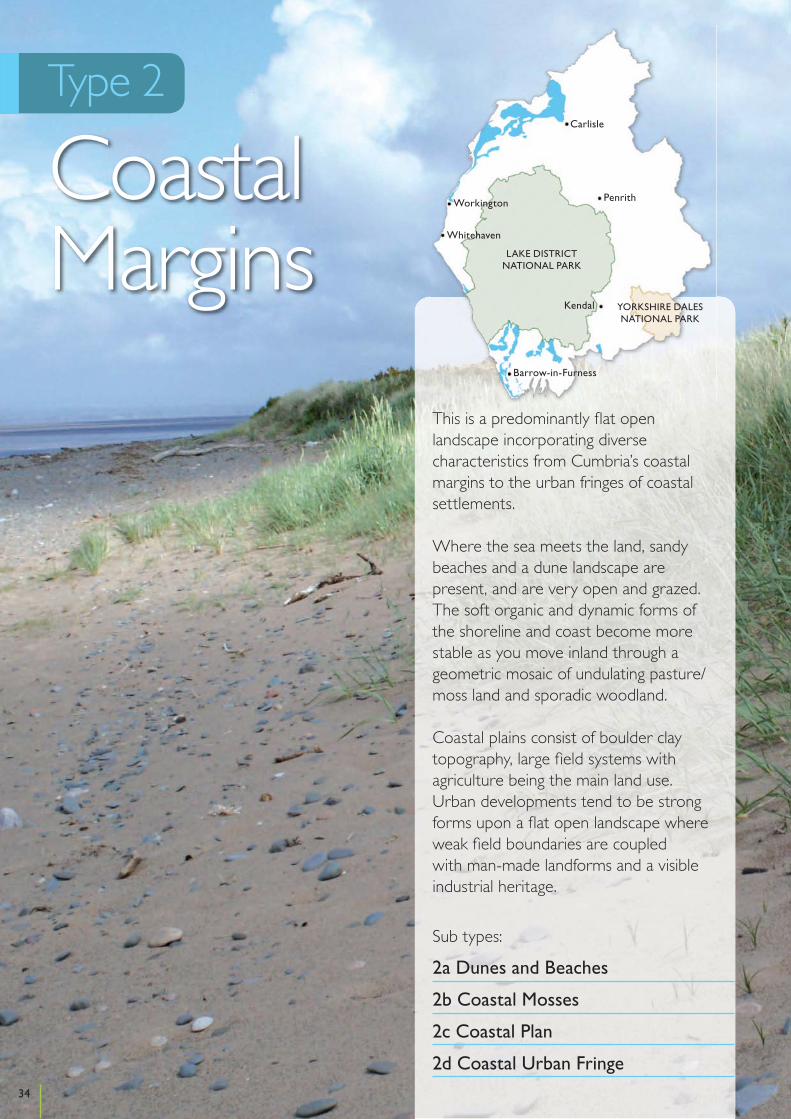
Cumbria Landscape Character Assessment
Type 2
CoastalMargins
This is a predominantly flat open landscape incorporating diverse characteristics from Cumbria’s coastal margins to the urban fringes of coastal settlements.
Where the sea meets the land, sandy beaches and a dune landscape are present, and are very open and grazed. The soft organic and dynamic forms of the shoreline and coast become more stable as you move inland through a geometric mosaic of undulating pasture/moss land and sporadic woodland.
Coastal plains consist of boulder clay topography, large field systems with agriculture being the main land use. Urban developments tend to be strong forms upon a flat open landscape where weak field boundaries are coupled with man-made landforms and a visible industrial heritage.
Sub types:
2a Dunes and Beaches
2b Coastal Mosses
2c Coastal Plan
2d Coastal Urban Fringe34
Kendal
Penrith
Carlisle
Workington
Whitehaven
Barrow-in-Furness
YORKSHIRE DALESNATIONAL PARK
LAKE DISTRICTNATIONAL PARK
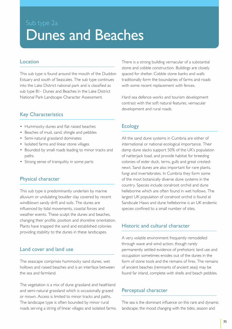
Location
This sub type is found around the mouth of the Duddon Estuary and south of Seascales. The sub type continues into the Lake District national park and is classified as sub type B1– Dunes and Beaches in the Lake District National Park Landscape Character Assessment.
Key Characteristics
• Hummocky dunes and flat raised beaches• Beaches of mud, sand, shingle and pebbles• Semi-natural grassland dominates• Isolated farms and linear stone villages • Bounded by small roads leading to minor tracks and
paths• Strong sense of tranquility in some parts
Physical character
This sub type is predominantly underlain by marine alluvium or undulating boulder clay covered by recent windblown sandy drift and soils. The dunes are influenced by tidal movements, coastal forces and weather events. These sculpt the dunes and beaches, changing their profile, position and shoreline orientation. Plants have trapped the sand and established colonies providing stability to the dunes in these landscapes.
Land cover and land use
The seascape comprises hummocky sand dunes, wet hollows and raised beaches and is an interface between the sea and farmland.
The vegetation is a mix of dune grassland and heathland and semi-natural grassland which is occasionally grazed or mown. Access is limited to minor tracks and paths. The landscape type is often bounded by minor rural roads serving a string of linear villages and isolated farms.
There is a strong building vernacular of a substantial stone and cobble construction. Buildings are closely spaced for shelter. Cobble stone banks and walls traditionally form the boundaries of farms and roads with some recent replacement with fences.
Hard sea defence works and tourism development contrast with the soft natural features, vernacular development and rural roads.
Ecology
All the sand dune systems in Cumbria are either of international or national ecological importance. Their damp dune slacks support 50% of the UK’s population of natterjack toad, and provide habitat for breeding colonies of eider duck, terns, gulls and great crested-newt. Sand dunes are also important for rare plants, fungi and invertebrates. In Cumbria they form some of the most botanically diverse dune systems in the country. Species include coralroot orchid and dune helleborine which are often found in wet hollows. The largest UK population of coralroot orchid is found at Sandscale Haws and dune helleborine is an UK endemic species confined to a small number of sites.
Historic and cultural character
A very volatile environment frequently remodelled through wave and wind action, though rarely permanently settled evidence of prehistoric land use and occupation sometimes erodes out of the dunes in the form of stone tools and the remains of fires. The remains of ancient beaches (remnants of ancient seas) may be found far inland, complete with shells and beach pebbles.
Perceptual character
The sea is the dominant influence on this rare and dynamic landscape, the mood changing with the tides, season and
35
Section
Sub type 2a
Dunes and Beaches

weather. The beaches have wide uninterrupted views across open sea, marsh and mudflats or landwards to mountains and fells. These open and exposed seascapes offer wide attractive views. The big skies and natural forces can be exhilarating and evocative with focal points such as Piel Island and Criffell in Scotland adding interest. In contrast the dunes offer shelter and a feeling of intimacy with plants and providing a rich variety of interest. Most enjoy a sense of tranquillity and remoteness. In contrast beaches on the fringes of settlements are more energetic and are often full of human activity.
Sensitive characteristics or features
The wildness and high ecological value of the sand dunes and dune grassland are likely to be sensitive to coastal dynamics, shoreline management responses and changes in management regimes. The small scale traditional coastal villages and farms are sensitive to medium to large scale expansion of modern housing and industry. The open and expansive views to a largely undeveloped horizon both inland and offshore are sensitive to large scale wind energy development. The feeling of tranquillity arising from ‘naturalness’ of the landscapes is sensitive to unsympathetic development and noisy land uses. The organic form and line along the coastal edge could be sensitive to hard realignment and changes in sea level and coastal dynamics.
Vision
The conservation and enhancement of the wild qualities and ecological value of the dunes and grassland will be a priority, while at the same time the public’s freedom to roam will be retained. There will be co-ordinated management for the dynamic dune system and its ecosystem. There will be more interpretation to foster greater respect of the dune system. Important habitats such as those for Natterjack toads will be maintained and any opportunities to increase the extent of or enhance the unique features of the dune system will be taken. Impacts linked to coastal erosion will be monitored and managed. New development will be sensitively sited and designed to reflect the tranquility of the dunes and beaches. Recreational uses will be monitored and managed to minimise negative impacts.
Changes in the Landscape
Over the next 10 – 20 years this landscape could be subject to the following changes or issues:
Climate Change and Coastal Processes• As this is a dynamic and changing seascape natural
processes will continue to change the character of the area. The threat of sea level rise and increased storminess as a consequence of global warming is likely to increase pressure for more coastal defences in some areas. In some places the dunes are eroding, in others they are accreting. Evidence suggests that erosion may be related to the loss of sediment supply due to the extraction of sand and gravel or the introduction of hard coastal defences in adjacent stretches of coast. However, erosion could increase due to climatic changes and become severe in some areas resulting in direct biodiversity loss.
Management Practices• Practices such as tipping, heavy grazing and intensive
mowing have tended to tame the wild qualities of the dune grasslands and their ecological interest.
• Scrub can establish quickly in areas that are not appropriately managed by mowing or grazing.
Development• Energy infrastructure including tidal, large scale wind
and pylons could be considered in the adjacent estuary and bay areas. These could have significant effects on natural coastal processes, habitats and the open seascape character.
• Major and medium scale development in adjacent landscapes including coastal defences, energy infrastructure, communication masts and caravan site extensions could compromise the remote qualities of these areas.
• Minor detractions include engineered urban detailing to features such as streams, fences and walls along with neglect of traditional features such as cobblestone banks.
• Development in nearby settlements could influence the need for changes to shoreline management that could influence the character of the area.
Access and Recreation• Damage due to recreational pressures including wear
and erosion by vehicular access, spoiling by litter, fly
36
Cumbria Landscape Character Guidance – Sub type 2a: Dunes and Beaches
tipping, unauthorised camping, fires and disturbance to wildlife.
• Damage to the dune system from the misuse of four wheel drive vehicles, quads, mussel fishers and unrestricted parking is very evident here, leaving the shingle shore and vegetation in an unmanaged state. Plover, tern, oystercatcher and other protected birds are also vulnerable.
• The planned implementation, over the next decade, of enhanced access to the whole of the English coast could result in some disturbance to wildlife in sensitive locations at certain times of the year.
• Coastal access will be improved to support the coastal open access programme. Space will be needed to allow the route to shift in this dynamic area and in response to any future coastal erosion.
• Some poorly designed facilities such as informal car parks can visually detract.
• Large scale tourism developments could detract from the open qualities of the area.
Guidelines
Climate Change and Coastal Processes• Support the reinforcement of the dune system as a
coastal defence and favour ‘soft’ accretion solutions for coastal protection in favour of less compatible ‘hard’ coastal defences.
• Ensure coastal defence schemes are carefully planned and based on knowledge of local erosion and deposition processes along the seacoast. They should also minimise visual intrusion, avoid indirect damage to adjacent coast and selectively protect the most valuable wildlife and historic sites.
Management Practices• Manage dune grassland for low key recreation by
reducing grazing levels in areas that are overgrazed, and maintaining a suitable grazing regime, to maximise species diversity and prevent scrub encroachment.
• Encourage the reclamation of improved pasture to dune grassland with restriction of fertiliser and herbicide applications.
• Encourage improvement of species diversity on golf courses and extent of ‘rough’ grassland by controlled grazing, relaxing mowing regimes, reducing the use of fertilisers and herbicides.
• Conserve and manage traditional features such as
cobblestone banks to strengthen a sense of place. Minimise the intrusion of incongruous features such as fences, tracks, hard coastal defences, engineered drains and channels that compromise the remote and wild qualities of the dunes.
Development• Ensure large scale development does not cause
significant harm to natural coastal processes and habitats.
• Protect the periphery of dunes from the intrusion of large scale development within neighboring landscape types.
• Development should be sited and designed to maintain an open and undeveloped shoreline character.
• Ensure that new facilities are carefully sited and designed to minimise their landscape and visual effects on this undeveloped and natural seascape.
• Provide and replace vehicle restraints to a robust and consistent design sympathetic to the dune character.
• In the Solway Coast Area of Outstanding Natural Beauty, ensure that housing development and associated stone walls utilise traditional materials from locally sustainable sources. Cobble removal from the shoreline should be managed to prevent a negative change in character and changes in function as a natural sea defence.
• Prohibit extraction of sand and gravel from the foreshore.
Access and Recreation• Coastal access footpaths, areas and facilities should
be improved and developed to be compatible with the undeveloped and natural character of this sub type. In line with the Marine and Coastal Access Act consideration should be given to routing coastal access footpaths along appropriate sea defence structures.
• In areas where coastal access will introduce new routes, appropriate access management may be needed in sensitive locations at certain times of the year, to minimise disturbance to wildlife.
• Information should be provided to encourage responsible enjoyment of these undeveloped and natural seascapes, and the importance of not damaging the dune system with unauthorised vehicles.
• Develop coordinated programmes of recreation management including repair and maintenance of
37
Cumbria Landscape Character Guidance – Sub type 2a: Dunes and Beaches

facilities, regulating public access, repairing grassland damaged by vehicles and pedestrians, removal of rubbish, interpretation of wildlife interest.
• Consider relocation of existing car parks away from dune grassland, particularly where these are exacerbating erosion problems and are poorly screened.
• Improve the appearance of facilities such as car parks, picnic areas, toilet blocks, signs, footpath links and boundary treatments. Unify designs in an appropriate coastal vernacular avoiding urban municipal characteristics and using high quality durable materials.
38
Cumbria Landscape Character Guidance – Sub type 2a: Dunes and Beaches
Location
This sub type is found around the head of the Duddon Estuary and to the north and west of Carlisle. The sub type also occurs in the Lake District national park and is classified as sub type B2 – Coastal Mosses in the Lake District National Park Landscape Character Assessment.
Key Characteristics
• Lowland raised mosses• A mosaic of heath, Willow Carr, Birch scrub
woodland and pasture • High ecological value• Field shapes vary, bounded by hedges and fences• Some woodland around the Duddon Estuary• Picturesque backdrop of the Lakeland Fells/open flat
panoramic views • Distinct raised edges• Sense of remoteness and tranquility
Physical character
Lowland raised mosses (peat bogs or raised mires) have formed by peat accumulation in poor draining alluvial or boulder clay basins. The mosses rise up to three metres above surrounding levels. These are often associated with post glacial drumlins that form local features in the adjacent landscapes. They are usually found close to the coastal edge or in areas of drained land.
Land cover and land use
These comprise a mosaic of moss, willow carr or birch scrub woodland and pasture. The woodland scrub often forms distinctive edges, particularly in the Solway. Enclosure may be by trimmed hedges or overgrown gapped hedges and fences. Woodland is limited to the upper mosses around the Duddon Estuary.
Field shapes range from the small and irregular in undulating areas to large rectangular fields on flat open mosses.
Settlement is sparse, though some vernacular farm buildings lie on the fringes of the mosses. Large scale peat extraction can be found in places around the Solway. The distinctiveness of the mosses is being weakened and fragmented by encroaching pasture and peat extraction.
Ecology
This is a landscape of great ecological importance, dominated by lowland raised bogs of international and national significance. Most of the remaining raised mire in England lies in Cumbria. Whilst many of the mires have been subjected to peat extraction and drainage there are still extensive areas of relatively intact raised mire and these support communities dominated by Sphagnum mosses and cotton-grasses, whilst drier areas of mire are often dominated by heather or birch and Scot’s pine woodland. The drained margins of these mires can support large areas of rush and purple moor-grass pasture. Lowland raised mire supports a range of uncommon and rare species, including the large heath butterfly, variable dragonfly, reed bunting, skylark and redshank.
Historic and cultural character
The mosses have a rich cultural heritage and contain evidence of reclamation, particularly in areas north of the county in the areas held by Holme Abbey. Within the field systems is the preserved evidence of former peat rooms in long narrow enclosures. In general there is good boundary preservation and evidence of both traditional field patterns consisting of small irregular enclosures and later larger more regular enclosures.
39
Section
Sub type 2b
Coastal Mosses

Where the mosses are not degraded they have the potential to preserve waterlogged organic archaeological deposits including wood. Consequently, they may contain evidence of prehistoric trackways or other features that do not survive in normal terrestrial environments. They are also important for preserving pollen which allows the past environment and climate to be interpreted and they have previously produced skeletal evidence of past fauna both wild and domesticated.
Perceptual character
This is a rare landscape in both national and Cumbrian terms. The open remnant patches of moss provide a rich note of interest in surrounding agricultural landscapes. The variety of moss plants is colourful and rough textured, contrasting with the smoother improved pasture fields. Despite some peat extraction the mosses are generally peaceful backwaters. The small, yet open and undeveloped nature of the mosses contributes to broader seascape views across the Solway Firth and along the Duddon Estuary. The Duddon Mosses have the benefit of the backdrop of the Lakeland Fells and uninterrupted views along the Duddon Estuary. In the Solway views tend to be limited and discrete, and the remaining uninterrupted views to the sea are important to the sense of remoteness associated with these landscapes. The experience of these landscapes is influenced by the seasons and weather with a calm and tranquil feeling sometimes giving way to a wilder feeling when winds rise and skies darken.
Sensitive characteristics or features
Changes in drainage around the moss land could affect the simple balance of the mosaic landscapes and habitat. The sense of remoteness and naturalness, the rich habitats and presence of birds, and the flat dark and open areas that contrast with green farmland, large skies and seaward views could be sensitive to significant changes in land management and large scale infrastructure development.
Vision
The mosses will be conserved and restored creating a landscape enriched with ecological diversity. Detailed management and restoration projects will extend the mosses and allow their visual and wildlife interest to flourish creating much more diverse landscape and habitat. The small-scale pattern of carr woodland will be retained and proposals for the extraction of peat and extensive commercial woodland planting will face strong opposition ensuring the protection of the hydrology of the peat body and retaining a sense of tranquility.
Changes in the Landscape
Over the next 10 – 20 years this landscape could be subject to the following changes or issues:
Climate Change and Coastal Processes• Increased rainfall could provide opportunities to
improve the condition of existing areas and reinstate areas of moss. Active mosses can help with carbon sequestration and mitigate against climate change.
• Those that are found close to the coastline could be susceptible to periodic inundation from sea water if sea levels rise significantly.
Management Practices• Agricultural reclamation and improvement has
traditionally been the main pressure on this rare landscape. Even where the moss is not directly removed, adjacent drainage works can cause the edges to dry out encouraging scrub development with a consequent risk of fire. Dessication can also cause land shrinkage, drops in height and road deformation.
• Large-scale peat cutting and coniferous planting also weaken the character of this landscape by obscuring or destroying mosses. A number of Cumbria’s lowland mosses are still subject to commercial peat extraction, especially around the Solway.
• Unmanaged burning can damage the surface vegetation and the overall hydrological integrity of the bog.
40
Cumbria Landscape Character Guidance – Sub type 2b: Coastal Mosses
Development • The introduction of energy infrastructure and
associated tall and vertical structures such as pylons and large scale wind turbines can impact greatly on the character of these expansive open areas. The introduction of pylons with regard to the grid upgrade could act as an incentive to developers looking to site tall structures which could obscure important views.
Access and Recreation• The planned implementation, over the next decade,
of enhanced access to the whole of the English coast could result in some disturbance to wildlife in sensitive locations at certain times of the year.
• Coastal access will be improved to support the coastal open access programme. Space will be needed to allow the route to shift in this dynamic area and in response to any future coastal erosion.
Guidelines
Climate Change and Coastal Processes• Strategic projects should be developed to ensure
the carbon sequestration potential of the raise mires is enhanced. Development, in and around the landscape, that could significantly reduce this potential should be avoided.
• Adopt environmentally sensitive management of the mosses including maintenance of a high water table, phased cutting and burning of heather, preventing damage to moss growth by overgrazing and poaching, control of scrub encroachment, restricting liming, fertilizer, and herbicide and pesticide treatments.
• Allow drained and managed mossland to revert back to semi-natural wetland. This may include ‘blocking’ of adjacent drainage systems, restricting grazing, appropriate wetland planting or seeding, removal of hedgerows and scrub.
• Resist improvement or introduction of drainage systems that might threaten the dampness of the mosses.
Management Practices• Protect the mosses from further commercial peat
cutting and agree schemes to ensure worked areas are restored to wetland.
• Resist burning as a management measure as this can damage the integrity of the peat body.
• Manage existing birch and alder carr woodland by a mixture of natural regeneration and coppicing, excluding stock, and thinning to prevent shading of water areas.
• Restrict new planting, particularly conifer woodlands to maintain an open semi-natural character.
• Remove tree and shrub growth where appropriate to support the restoration of the mosses.
Cultural Features• Manage hedgerows in a traditional way involving a
cycle of hand laying and trimming.• Restore fenced boundaries to hedgerows involving
replanting and renovation of gappy overgrown hedges. Discourage introduction of fences to replace or ‘gap up’ hedgerows.
Development• Protect the small-scale open character of the mosses
from inappropriate development, specifically large vertical developments such as large scale wind turbines and pylons.
• Avoid fragmentation of the natural patterns of the mosses and wildlife links by infrastructure development.
Access and Recreation• In areas where coastal access will introduce new
routes, appropriate access management may be needed in sensitive locations at certain times of the year to minimise disturbance to wildlife.
• Support the roll out of coastal access and encourage sensitively sited coastal access and recreational infrastructure. Coastal access footpaths, areas and facilities should be improved and developed to be compatible with the undeveloped and natural character of this sub type. In line with the Marine and Coastal Access Act consideration should be given to routing coastal access footpaths along appropriate sea defence structures.
41
Cumbria Landscape Character Guidance – Sub type 2b: Coastal Mosses
Location
This sub type is found extensively around the Solway Firth, and to a lesser extent around the Duddon Estuary, Walney Island and Cartmel Sands. The sub type continues into the Lake District national park and is classified as sub type B3 – Coastal Plain in the Lake District National Park Landscape Character Assessment.
Key Characteristics
• Flat and slightly undulating coastal plain• Long and narrow fields in undulating areas with larger
fields in flat areas• Intersected by shallow rivers and watercourses• Hedges form main field boundaries• Scarce tree cover• Predominantly pasture with some arable in drier
areas • Frontiers of the Roman Empire - Hadrian’s Wall
World Heritage Site is a significant archaeological feature in the Solway
• Historic field pattern strongly linked to settlements
Physical character
The flat coastal plain is largely based on fluvial drift, marine alluvium and undulating boulder clay on Triassic mudstones and sandstones. The land is up to 15m AOD. This coastal landscape is subject to coastal erosion and flooding.
Land cover and land use
Improved pasture predominates in this agricultural landscape. In flatter areas the coastal plain is divided into large square fields surrounded by a linear matrix of drainage ditches. In undulating areas fields are often long and narrow and around historic settlements are derived
from the pattern of medieval common field farming in strips. In drier areas, particularly on boulder clay, arable crops are grown producing a patchwork of colour and texture. Rougher and marshy pasture with rushes or gorse scrub occur around the moss, saltmarsh fringes and along watercourses.
Proximity to the sea is a major influence on land cover. Field division is primarily by hedges with or without cobblestone banks (kests), but replaced with fences, particularly on more marginal farmland. On the exposed coasts hedges tend to be sparse, sometimes with gorse, and tree cover is often sparse. Thicker hedges and wind sculpted hedgerow trees are scattered in more sheltered areas. Further inland small copses or shelterbelts, associated with farms or churches are prominent features along with the thicker hedges. Birch woodland occurs on the edges of the mosses providing shelter and enclosure. Around the head of the Solway and Levens estuaries small coniferous and deciduous plantations are found, associated with large estates.
Coastal villages tend to be vernacular in character and nucleated and closely knit with stone walls for shelter. They are usually the most prominent feature on the skyline. Inland, buildings are more spread out and softened by hedges. Roads and railway lines, both operational and disused, form strong linear features that cut across the plains. These features are reinforced by scrub and woodland growing alongside.
Telecommunications masts and pylons provide prominent and contrasting vertical features in some of the areas. In parts of the Solway, the coastal plain adjacent to the mosses are characterised by 20th century military sites that include airfields, radar and radio installations. These are isolated developments and do not dominate the overall agricultural character of the landscapes.
42
Cumbria Landscape Character Assessment
Sub type 2c
Coastal Plain

Ecology
As this is some of the most agriculturally improved land in Cumbria, ecological interest is largely confined to small areas of remnant lowland raised mires and coastal and floodplain grazing marsh habitats. The former are mostly wooded with birch or Scot’s pine, with only small areas of open mire vegetation. These woods are often important for red squirrel. The coastal and floodplain grazing marsh habitats support large flocks of wintering barnacle geese, pink-footed geese and whooper swan, particularly around the Solway. This agricultural landscape is also important for farmland birds, particularly barn owl and corn bunting, with most of the few remaining Cumbrian populations of the latter species occurring in this landscape type. The grazing marsh supports a range of plants including creeping bent and marsh foxtail. In wetter field margins greater reedmace, reed canary grass, water plantain and sedges are supported. The lower reaches of both the River Esk and River Eden flow through this landscape and both are important for otter and Atlantic salmon. The banks of these rivers also provide nest sites for sand martins.
Historic and cultural character
The coastal plain has a highly nucleated settlement pattern with evidence of the late enclosure of former common arable outfields. The settlements are characterised by vernacular buildings constructed of local stone with red sandstone, a feature of the north of the county. Many of these buildings date to the seventeenth and eighteenth centuries. In general the character of this landscape type has strong and discernable links to its past development. On the Solway Plain salt pans can be found. Clay built buildings are a characteristic feature too. Amongst the characteristic archaeological remains are former sea defences but the most significant archaeological feature is Hadrian’s Wall, which, west of Carlisle, runs through the Solway Plain. Some present villages such as Burgh-by-Sands occupy the sites of former Roman forts along the Wall. Other cultural features include a monument to Edward I.
Perceptual character
The impression varies according to distance from the open sea and the local topography. Open, flat, larger scale landscapes with big expansive skies and long views of the sea and Lakeland and Scottish Fells contrast with undulating enclosed and intimate landscapes. Land cover patterns tend to be simple with farms and copses standing out as prominent features. Marginal farmland on the fringes can appear neglected. Outer coastal plains are strongly influenced by the sea with wind sculpted hedges and trees providing a sense of exposure to natural processes. Here experiences are influenced by the seasons and the weather and can leave you feeling tranquil and calm when the weather is good to vulnerable and exposed in stormy and poor weather. All areas have the appearance of peaceful backwaters relatively unspoilt by 20th century development.
Sensitive characteristics or features
The medieval field patterns and traditional scale vernacular villages are sensitive to village expansion and changes in land management. The open character of the exposed coastal farmland is sensitive to development. The open views across adjacent marshes and flats out to sea and inland to the Lakeland Fells are sensitive to large scale infrastructure development. Wind sculpted hedges and trees and traditional kest hedges are sensitive to changes in land management.
Vision
This working landscape is well maintained and supports a diverse range of wildlife habitats. The impacts of agricultural intensification will be minimised and traditional farming practices will be supported resulting in the restoration and management of key features such as hedgerows, hay meadows, semi-natural and native woodland and historic field patterns. Any opportunities to restore semi-natural wetland will be exploited enriching wildlife and visual diversity. The contrasting open fields enclosed by bold masses of woodlands will be strengthened while the scattered pattern of isolated mature trees and clumps will be reinforced and conserved. Some diversification of farmland to new crops and recreational uses will
43
Cumbria Landscape Character Guidance – Sub type 2c: Coastal Plain

be accommodated and encouraged where it will benefit local character. Hadrian’s Wall is a key feature within this type and will be conserved and maintained. Some infrastructure and energy developments will be accommodated in the landscape should they be designed carefully and sited appropriately.
Changes in the Landscape
Over the next 10 – 20 years this landscape could be subject to the following changes or issues:
Climate Change and Coastal Processes• Areas close to the sea could be affected by rises in
sea level, increased storminess, coastal erosion and the proposals of shoreline management plans.
Management Practices• The switch from hay making to more intensive silage
production changes the nature and biodiversity of the landscape.
• The drainage and improvement of wetland, remnant mires, grazing marshland and floodplain reduces the varied land cover and biodiversity. It can also reduce the remnant mire potential for carbon sequestration.
• The removal and neglect of hedges and move away from traditional maintenance practices erodes the distinctive character.
• Loss of farmland wildlife could be due to more intensive farming practices.
• Loss of woodland can reduce the biodiversity and interest of the landscape.
Development • Proposals linked to tidal energy could lead to new
infrastructure in the coastal plain which could affect the open and distinctive character of the landscape.
• This area could be affected by an upgrade to the national grid resulting in new pylons. These are needed to support future energy infrastructure and provide a stable and secure energy supply in Cumbria. New, larger pylons could affect the open character of the landscape.
• Developments such as new industrial scale farm buildings could impact on this type if they are introduced in large numbers or, if they lead the way for proposals for similar developments.
• Farm diversification could lead to an increase in the use of farm land for horse grazing and equestrian uses could result in changes to field patterns and boundaries. An introduction of stables and ménages could cause incremental change the character of the farmed areas.
Access and Recreation• Over the next decade the planned implementation
of enhanced access to the whole of the English coast could result in some disturbance to wildlife in sensitive locations, at certain times of the year.
• Coastal access will be improved to support the coastal open access programme. Space will be needed to allow the route to shift in this dynamic area and in response to any future coastal erosion.
• Visitor numbers could increase in these areas linked to the roll out of coastal access, and attractiveness of adjacent National Park areas. This could lead to the need for better management of sensitive parts of the landscape.
Guidelines
Climate Change and Coastal Processes• Restrain development in areas susceptible to flooding
to allow the land to possibly be grazed, drained or returned to wetland should areas of this landscape become liable to flooding due to climate change.
• Encourage Shoreline Management Plan responses to be sensitive to undeveloped nature of parts of the seascape.
Natural Features• Allow suitable marginal land, which in the past has
been reclaimed to agriculture to revert to mossland, saltmarsh or wet grassland.
• Reduce further drainage works that would result in the loss of wetland, hedges or trees and encourage sensitive ditch management to support wetland enhancement.
• Maximise opportunities to improve floral diversity along verges, dykes or ditches through reprofiling banks, extending clearance cycles, working short stretches to allow recolonisation and restricting herbicide use.
44
Cumbria Landscape Character Guidance – Sub type 2c: Coastal Plain

• Reinforce existing woods by appropriate management, natural regeneration, and exclusion of stock and restocking of plantations.
• Plant new woodland belts to ameliorate existing conifer plantations, enhance significant views and reduce the visual dominance of transmission lines.
• Consider the planting of willow coppice or other energy crops on farmland that avoids grazing marshland habitats and raised mires.
• Plant new hedgerow trees to replace maturing stock using indigenous species, or tagging selected saplings avoiding obstruction of attractive open vistas.
• Undertake small scale native woodland planting concentrated around villages and farmhouses to form visual islands on the coastal plain and soften the forms of new farm buildings.
• Encourage small scale woodland planting along field margins to develop ecological corridors and link with hedgerows.
Cultural Features• Restore fenced boundaries to traditional hedgerows
involving replanting and renovation of gappy overgrown hedges.
• Discourage the introduction of fences to replace or gap-up hedgerows.
• Manage hedgerows in a traditional way involving a cycle of hand laying and trimming.
• Restore and maintain locally distinctive boundary treatments such as cobblestone and turf hedge banks.
Development• Minimise the impact of major developments such
as large scale wind energy, roads, pylons, masts and infrastructure linked to offshore developments by careful siting to maximise screening from public view and high standards of design and landscape treatment. Open and exposed sites and those that affect key views should be avoided, especially where development would become the dominant feature.
• Reduce the impact of new farm buildings by careful siting, breaking down mass, choice of sympathetic colours and non-reflective finishes and screen planting.
• Encourage horse grazing and equestrian uses to respect field boundaries and field patterns. Stables and other facilities should be sited sensitively with appropriate landscape mitigation to prevent the erosion of the pastoral farmland character.
Access and Recreation• Support the roll out of coastal access and encourage
sensitively sited coastal access and recreational infrastructure. Coastal access footpaths, areas and facilities should be improved and developed to be compatible with the undeveloped and natural character of this sub type.
• In areas where coastal access will introduce new routes appropriate access management may be needed in sensitive locations at certain times of the year to minimise disturbance to wildlife.
45
Cumbria Landscape Character Guidance – Sub type 2c: Coastal Plain

Location
This sub type is found around Flookburgh, Ulverston, Walney and Millom in the south of the county and around Silloth and the coastal edge between Workington and Maryport in the north and west.
Key Characteristics
• Low lying flat land• Urban influences linked to tourism development,
derelict buildings and major transport routes• Strong man-made landforms on coastal edges• Mixed land cover of mown grass, pasture, scrub and
semi natural grassland• Weak field patterns.
Physical character
These are generally flat or gently undulating land largely based on fluvial drift, marine alluvium and undulating boulder clay on Triassic mudstones and sandstones. The land is up to 15m AOD.
Land cover and land use
The areas characterised by urban, industrial and leisure related development, derelict and unused buildings and transportation routes. In parts of the Duddon Estuary and Morecambe Bay the fringe areas are adjacent to coastal beaches and mudflats. These along with agricultural land, playing fields and recent man made landforms such as slag banks associated with former industrial sites provide an open character to the seascape.
Land cover is typically mixed; predominantly pasture, but sometimes mown grass or semi-natural grassland and scrub. Fields are small and patterns are weak. Field
division is often by hedges or fences. Hedges are sparse and gappy where they occur.
The areas along the coastal edges are usually hard and man-made characterised by roads, promenades, sea dykes and sea defences. Roads, railways, large scale wind turbines and pylons cut across the seascape around settlements. Holiday parks and redundant buildings and sites are frequently found, as are unmaintained fences and hedges. The urban characteristics of adjacent areas are increasing in this seascape with extension to business parks and leisure facilities, particularly around Carlisle and Barrow.
Ecology
This landscape supports a surprising wealth of wildlife, often, but not exclusively, associated with former industrial sites. Areas of iron slag are often colonised by herb-rich grasslands, which can support uncommon plants and wildlife. Previously developed land around Workington and Maryport support a significant population of small blue butterfly and purple broomrape. Great crested newts and natterjack toads are frequent in damp ground and pools within this landscape; and where it adjoins areas of saltmarsh and intertidal sand and mudflat areas can be used as a high tide roost by wintering and passage waders and wildfowl such as whooper swans, pink footed goose and barnacle goose. Hodbarrow Lagoon is of importance for breeding and wintering birds and scarce aquatic plants such as spiral tasselweed. Previously developed land also supports mosaic habitats of pen land, grassland, scrub, pools and heathland.
Historic and cultural character
There are rich Haematite deposits in Low Furness (Lindal), Millom (Hodbarrow), Egremont (Florence Mine) and west Cumbria. Monks of Furness Abbey first
46
Cumbria Landscape Character Assessment
Sub type 2d
Coastal Urban Fringe

exploited Furness Iron “industrially” in the 12th/13th century. There are rich coal deposits in west Cumbria. Further afield it was heavily involved in the slave trade between west Africa and the West Indies and American Colonies. From these it gained rum, sugar, cotton and tobacco. Cumberland rum butter, Kendal mint cake and Kendal snuff have all derived from this trade routed primarily through Whitehaven and Lancaster.
Whitehaven is important as the first classically planned new town in England, dating from the late 17th century, but there were others that came later along the west Cumbria coast in response to maritime trade and industry. These include Maryport, Harrington, Silloth, Askam, Barrow and Millom. Barrow-in-Furness is a Victorian model town, planned on grid pattern, utilising the natural harbour and local Haematite deposits for building steel ships. Iron-master, John Wilkinson built the first iron ship on the River Severn, having first experimented with a small version on Witherslack Mosses. He was a leading light of 18th century industrial revolution and was involved with Backbarrow Iron Furnace. Other features of John Wilkinson’s iron legacy can be found around Lindale and Castle Head House, which he built.
The cultural heritage of this zone is rich and highly variable from area to area. Near Silloth 20th century military remains are a significant feature in the landscape. Around Barrow the landscape is marked by former industrial manufacturing and mining sites. On Walney Island there is much below-ground evidence of prehistoric habitation and land use.
Perceptual character
This landscape is busy with many uses and a variety of land cover. It can have an air of neglect where buildings and land have become run down. It has a strong association both with the urban character of nearby villages, towns and cities and the open and undeveloped adjacent landscapes. Roads, railways, buildings and derelict sites detract from the unique attraction of sea views, beaches and water. Open and less developed parts provide an important link to interesting sea views and expansive skies. In these parts the time of day, seasons and weather can influence the character and experience of the landscape, especially when looking out to sea.
Sensitive characteristics or features
The high ecological value of some former industrial sites is sensitive to changes in land management and development. The views across adjacent landscapes to open sea and expansive skies are sensitive to development that would enclose or interrupt these views.
Vision
The qualities of this landscape and seascape will be enhanced, restored and improved as important settings for recreation. In order to foster strong local ownership and distinctiveness, improvements will be made regarding community involvement. The rural and natural qualities of these areas will be reinforced and there will be the development of a bold landscape structure to unify disparate uses. This will be achieved through the conservation of rural green areas and a reduction in the impact of development in prominent locations. Where possible, derelict and old industrial sites will be restored through positive development and management schemes, reflecting any historic or biodiversity value and landscape works will soften coastal edges, protect significant views and improve recreation facilities. In the farmed hinterlands hedgerows will be restored, natural grassland and scrub fringes will be conserved and extended and woodland will be created in more sheltered locations.
Changes in the Landscape
Over the next 10 – 20 years this landscape could be subject to the following changes or issues:
Climate Change and Coastal Processes• Sea level rise and increased storminess may lead
to pressure for further hard sea defence works to mitigate against flooding and other consequences.
Management Practices• The farmed hinterland can sometimes suffer by
neglect of agricultural management that may be a reaction to fragmentation of holdings or public access pressures.
47
Cumbria Landscape Character Guidance – Sub type 2d: Coastal Urban Fringe

• Mown grassland and large areas of concrete and tarmac weaken the natural distinctiveness provided by scrub woodland and grassland.
Development• Fragmented and sporadic development has a negative
influence on the character of this landscape. New housing and business development could reinforce a sporadic characteristic.
• The development of brownfield land could erode important habitats that have developed, particularly on sites that have been left vacant and neglected for some years.
• Farm diversification could lead to an increase in the use of farm land for horse grazing and equestrian uses could result in changes to field patterns and boundaries. An introduction of stables and ménages could cause incremental change the character of the farmed areas.
• The coastal edge is attractive to visitors and interest for recreational and tourism development is likely to continue in these areas.
• Energy infrastructure could be introduced and the national grid could be upgraded resulting in new, larger pylons and substations. This could affect the character of some of the less developed parts of the coastal urban fringe.
Access and Recreation• Over the next decade the planned implementation
of enhanced access to the whole of the English coast could result in some disturbance to wildlife in sensitive locations at certain times of the year.
• Coastal access will be improved to support the coastal open access programme. Space will be needed to allow the route to shift in this dynamic area and in response to any future coastal erosion.
• These areas provide good opportunities for large numbers of people to appreciate the surrounding landscapes and seascapes, particularly from promenades coastal roads. Interest in such activities is likely to continue to be popular.
• Recreation pressure on the coastal edge has led to an extension of mown grass areas or hard urban edges.
Guidelines
Climate Change and Coastal Processes• Encourage Shoreline Management Plan responses
to be sensitive to undeveloped nature of parts of the seascape and encourage coordinated policies for coastal protection that helps avoid piecemeal actions.
• Ensure that areas under threat from climate change have adequate defensive measures in place whether through managed retreat, soft ‘accretion’ solutions, re-wetting of the areas or hard defences if absolutely necessary.
Natural Features• Conservation and management of coastal grassland
by for example relaxing mowing regimes, managing public access, implementing restoration programmes and controlling scrub encroachment.
• Restore and reclaim derelict airfields, industrial sites and mining areas to remove eyesores, enhance open mosaic and semi-natural habitats and to make a positive contribution to the landscape.
• Encourage the protection and enhancement of habitat for the small blue butterfly along the coast between Workington and Maryport.
Cultural Features• Retain and manage hedgerows in a traditional way
encouraging restoration and maintenance of locally distinctive and historic boundary treatments such as cobblestone and turf hedge banks.
• Discourage introduction of fences to replace or ‘gap-up’ hedges and restore fenced boundaries to traditional hedgerows.
• Where a dilapidated pattern of fields may no longer function as part of a productive farm unit and their value in serving present day needs is questionable consideration should be given to removing some field boundaries to create open ‘commons’, and creating new woodlands that reflect topographic variation and help define public and private spaces.
Development• Protect ‘green’ areas from sporadic and peripheral
development. Support the retention and development of ‘green gaps’, green infrastructure and ecosystem services approaches in Local Development Frameworks where they would help maintain distinctive, undeveloped characteristics.
48
Cumbria Landscape Character Guidance – Sub type 2d: Coastal Urban Fringe
• Encourage new development on brownfield and vacant sites to protect and enhance habitats, such as those found in Workington and Maryport that support the small blue butterfly.
• Minimise the impact of new development by careful siting, design and high standards of landscape treatment particularly where public views are affected.
• Minimise the impact of major developments such as large scale wind energy, roads, pylons, masts and offshore infrastructure by careful siting in less sensitive areas, maximising screening from public view and following high standards of design and landscape treatment. Open and exposed sites and those that affect key views should be avoided, especially where development would become the dominant feature.
• Encourage horse grazing and equestrian uses to respect field boundaries and field patterns. Stables and other facilities should be sited sensitively with appropriate landscape mitigation to prevent the erosion of the pastoral farmland character.
• Establish new woodland belts or thick hedgerows along the edges of developments to soften their impact, provide a backcloth, define limits of urban expansion and integrate isolated development.
• Manage and restock existing woodland and hedgerow screens.
Access and Recreation• Support the roll out of coastal access and encourage
sensitively sited coastal access and recreational infrastructure. Coastal access footpaths, areas and facilities should be improved and developed to be compatible with the undeveloped and natural character of this sub type.
• In line with the Marine and Coastal Access Act consideration should be given to routing coastal access footpaths along appropriate sea defence structures.
• In areas where coastal access will introduce new routes appropriate access management may be needed in sensitive locations at certain times of the year to minimise disturbance to wildlife.
• Seek to improve the network and enjoyment of rights of way and other paths particularly circular and linking routes while protecting neighbouring land and sensitive habitats.
• Establish new planting to provide shelter, enclosure, interest and direct views.
• Unify detailing such as street furniture, lighting and signing respecting any local distinctiveness and historic identity.
• Unify boundary treatments favouring locally distinctive elements such as cobblestone walls or stone and turf banked hedges.
• Upgrade existing rights of way and other paths with appropriate surfacing, waymarking, gates, gaps, bridges, planting, removal of eyesores and enhancement of views.
49
Cumbria Landscape Character Guidance – Sub type 2d: Coastal Urban Fringe

Cumbria Landscape Character Assessment
50
Type 3
Coastal Limestone
These form part of the Morecambe Bay Limestones which are unique to Cumbria and Lancashire. A landscape rich in history derived from prehistoric features and medieval enclosure patterns and rich in biodiversity due to the mosaic of semi-natural habitats, including limestone pavements, scrub, semi-natural coppice woodland, herb-rich grasslands, peaty fenlands and mosses.
The conspicuous limestone hills, scarps and pavements rise above low lying pasture and wetland. The limestone farmland creates neat, ordered, rolling landscapes, larger in scale and more open than the wooded hill and pavement areas.
Late 19th century iron mine workings in the Barrow area of this character type have left a landscape which contrasts with other areas in this type, man-made irregular landforms and spoil heaps generally create a visually complex landscape.
Sub types:
3a Open Farmland and Pavements
3b Wooded Hills and Pavements
3c Disturbed Areas
Kendal
Penrith
Carlisle
Workington
Whitehaven
Barrow-in-Furness
YORKSHIRE DALESNATIONAL PARK
LAKE DISTRICTNATIONAL PARK

Location
This sub type is found along the coast of Morecambe Bay south of Ulverston and west of Grange. Inland they are found around Farleton Knott and between Kendal and Levens. The sub type continues into the national park around Grange and Kendal and is classified as Type C – Coastal Limestone in the Lake District National Park Landscape Character Assessment. There is no sub type in the national park.
Key Characteristics
• Steep scarp limestone slopes, limestone pavement or other rocky outcrops
• Grazed land with stone wall field boundaries• Rough pasture as open common or fell in higher
areas • Sporadic scrub and woodland on steep scarp slopes • Stately homes and parklands in lower areas• Extensive open and uninterrupted views from high
ground
Physical character
This sub type is found on Lower Carboniferous limestone with calcareous brown soils. The landscape has steep scarp slopes, exposed limestone pavement or other rough rocky outcrops. It has similar characteristics to other limestone landscape types, but its coastal associations provide additional distinctiveness. Around the coast these are open, rolling limestone hills rising to between 130m and 230m. Inland the coastal limestone form distinctive scarp and rocky skyline features and rise to around 280m. The sub type contrasts sharply with adjacent lower lying coastal areas.
Land cover and land use
Both along the coast and inland most of the land is improved and semi improved grazing. There is a distinctive and sometimes historic pattern of fields which are strongly defined by a matrix of limestone walls and hedges at lower levels.
There are pockets of scrub, including juniper scrub, and deciduous woodlands associate with both pasture fields and limestone pavement. There are extensive plantations on Hutton Roof as well as extensive areas of bare rock with scrub developing around the edges. Some attractive semi-natural woodland and pavements form distinctive features around Hampsfield Fell, Eggerslack Wood and Curwen near Clawthorpe.
Settlements are generally small and dispersed, with the main settlement being the Victorian seaside town of Grange over Sands. Holme Park Quarry is a significant man made feature in this sub type and can be prominent in views, mainly from the west. Pylons provide some limited vertical features in the landscape.
Ecology
The ecological habitats of this landscape are almost entirely determined by the underlying limestone geology. Where the rock outcrops open limestone pavements support a range of characteristic and rare species, including dark red helleborine, limestone fern, rigid buckler-fern, angular Solomon’s seal and lily-of-the-valley.
Pavements also support a number of rare invertebrates, such as the narrow-mouthed whorl-snail. Thin soils over limestone support limestone grassland, including the nationally scarce blue moor-grass grassland type. This grassland supports a range of uncommon plants, including spiked speedwell and is important for a variety of uncommon and rare butterflies, including northern brown crops, high-brown fritillary, pearl-bordered
51
Cumbria Landscape Character AssessmentCumbria Landscape Character Assessment
Sub type 3a
Open Farmland and Pavements

fritillary, Duke of Burgundy fritillary and small blue. The woods of this landscape are of the upland mixed ash wood type and support a rich flora and fauna including dormouse, mezereon and yew. Juniper scrub is also characteristic of this landscape.
Historic and cultural character
Areas within this sub-type are rich in Neolithic remains, many artefacts such as bracelets and axe heads have been found. Several sacred sites are present. A stone circle exists at Birkrigg Common.
The settlement pattern is nucleated, but mainly became so in the 19th century. The field pattern is mixed but characterised by dry-stone walls with features including bee boles. Many of the farm buildings are traditional and limestone built. There is much evidence of quarrying and numerous lime kilns. Stately homes with parklands are a characteristic. Archaeological remains include evidence of past iron working. Iron Age and Romano-British settlement sites are characterised by well preserved extant earthworks. Medieval stone buildings occur sporadically. The remains of former quarrying occur throughout.
Perceptual character
A larger scale more open landscape than other coastal limestone landscapes. The farmed areas have a managed feel due to the improved pasture and neat stone walls displaying the underlying geology. These contrast with the rougher semi improved pasture. The dramatic limestone pavements provide shelter to many plants and species but have a wilder unmanaged feel to them. This is a rare and unusual landscape which is varied and interesting due to the range of limestone features and the strong sense of history derived from pre-historic features and medieval enclosure patterns. There are large expansive views from higher parts of the landscape. The undeveloped nature and uninterrupted views to the Lakeland Fells, Yorkshire Dales and across the coastal plain and mosses to Morecambe Bay provide a feeling of openness and exposure to the elements and seasons and the dramatic skyline above and seascape below.
Sensitive characteristics or features
The high ecological value of wooded pavements, outcrops and limestone grassland are sensitive to changes in land management practices. The small dispersed settlement pattern could be sensitive to unsympathetic village expansion. Prehistoric features, medieval enclosure patterns, the strong matrix of limestone walls and hedges and limekilns are sensitive to changes in land management practices. The openness in higher parts and long uninterrupted views to the Lakeland Fells and across Morecambe Bay are sensitive to large scale and infrastructure development.
Vision
The high scenic quality of these limestone hills will be conserved and enhanced. Development proposals will respect the open unspoilt tops and commons and will avoid causing disruption in the lower-scale patterns of farmland, woods and villages. There will be support for the maintenance of key components such as the historic pattern of small fields, stone walls and hedges in the lower areas. Limestone pavements, calcareous grasslands and ancient semi-natural woodlands are important components and will be conserved and enhanced through positive measures and management practices will improve in relation to grazing levels and recreation.
Changes in the Landscape
Over the next 10 – 20 years this landscape could be subject to the following changes or issues:
Management Practices• Agricultural improvements including fertiliser
application and reduction in grazing have reduced species diversity in limestone grasslands and led to the invasion of scrub.
• Pressure to extend quarries could further influence distinctive characteristics. In the past the removal of limestone pavement badly damaged an irreplaceable landscape feature and wildlife habitat. However, this now enjoys protection through Limestone Pavement Orders.
52
Cumbria Landscape Character Guidance – Sub type 3a: Open Farmland and Pavements

• Changes to the sheep farming economy could result in changes in management practices leading to either intensification or abandonment.
Development• As part of the Government’s response to Climate
Change there could be interest in the development of large scale wind turbines in the higher and more exposed parts. These could erode the open character of the area and affect the settings of national landscape designations.
• The attractiveness and proximity to major towns has resulted in pressures to expand the historic villages; this may continue in order to support housing and economic growth.
• Planned and incremental expansion of villages and towns could result in a loss of vernacular character, the small dispersed settlement pattern, and a proliferation of settlement fringe development. This could erode the distinctive character of the area.
Access and Recreation• Over the next decade, the planned implementation
of enhanced access to the whole of the English coast could result in some disturbance to wildlife in sensitive locations at certain times of the year.
• Coastal access will be improved to support the coastal open access programme. Space will be needed to allow the route to shift in this dynamic area and in response to any future coastal erosion.
• An increase in visitor numbers and the roll out of coastal access could result in additional recreational pressures. If this is the case, it may need to be better managed to maintain paths in a good condition and enhance local landscape features.
Guidelines
Natural Features• Manage limestone pavement and species rich
grassland to improve their biological diversity including controlled light grazing, appropriate control of scrub and bracken and discouragement of fertiliser use and control of poor woodland management on the limestone pavements to reduce damage. Established stands of dwarf shrubs such as juniper should be protected and natural regeneration encouraged.
• Manage public access to limit disturbance to wildlife and sensitive habitats and improve awareness of natural features.
• Reinforce existing woods by appropriate management including traditional coppice working, natural regeneration, restocking and exclusion of stock.
• Conserve and manage scrub where it relates to characteristic vegetation patterns and provides valuable wildlife habitats. This may include rotational cutting to encourage a diverse structure or development to restore relic ancient semi-natural woodland.
Cultural Features• Discourage field enlargement and introduction of
fences to replace or gap-up walls and hedgerows.• Restore and manage limestone walls and hedgerows
using traditional methods.• Protect selected features including remnant medieval
‘strip fields’ around villages.
Development• Preserve the distinct historic forms of settlements
and intimate relationship to the scale and form of the landscape.
• Protect uncluttered skylines and key views to and from the area from large-scale energy infrastructure developments such as large scale wind turbines, pylons or telecommunications masts.
• Resist expansion of quarries where these will produce prominent scars or destroy irreplaceable features and habitats.
• Ensure quarries have high quality restoration schemes that support the expansion of semi-natural habitats.
• Ensure new developments respect the scale, traditional form and materials of villages and do not infill important open spaces such as orchards and gardens integral to their character.
• Enhance settlements through sensitive environmental improvements to village greens, ponds, lakes and other features.
Access and Recreation• Support the roll out of coastal access and encourage
sensitively sited coastal access and recreational infrastructure. Coastal access footpaths, areas and facilities should be improved and developed to be compatible with the undeveloped and natural character of this sub type.
53
Cumbria Landscape Character Guidance – Sub type 3a: Open Farmland and Pavements

• In line with the Marine and Coastal Access Act consideration should be given to routing coastal access footpaths along appropriate sea defence structures.
• In areas where coastal access will introduce new routes, appropriate access management may be needed in sensitive locations at certain times of the year to minimise disturbance to wildlife.
• Manage public footpaths through better waymarking, improved gates and gaps and appropriate surfaces and better interpretation, whilst retaining the open and comparatively wild character of the landscape.
• Preserve the distinct historic forms of settlements and intimate relationship to the scale and form of the landscape.
54
Cumbria Landscape Character Guidance – Sub type 3a: Open Farmland and Pavements

Location
This sub type is found in Arnside and Silverdale Area of Outstanding Natural Beauty only.
Key Characteristics
• Low rolling wooded hills• Open pasture of mainly drained mossland• Coastal features include cliffs salt marshes and shingle
beaches• Extensive limestone pavement• Views out across Morecambe Bay and up to the
Lakeland Fells exist
Physical character
This sub type is found on Lower Carboniferous limestone with calcareous brown soils. The landscape has steep scarp slopes, exposed limestone pavement or other rough rocky outcrops. It has similar characteristics to other limestone landscape types, but its coastal associations provide additional distinctiveness.
Limestone pavement is an important feature of the area. Most of the pavement is within woodland blocks which are often visible in open clearings.
This landscape of low, rolling hills terminates in a varied coast including estuarine features such as cliffs, salt marsh and shingle beach.
Land cover and land use
This landscape is a complex mosaic of improved pasture, grassland, mosses, limestone outcrops and woodland and woodland pasture. The pasture is divided into small to medium sized fields bound by a strong matrix of limestone walls and high hedges. Woodland cover is
extensive and includes former coppice pavement, hazel, ash and natural yew woods. Pavement is often visible in open clearings within the woodlands. Large coniferous plantations are being restored back to locally native woodland. Small orchards are scattered throughout the area.
Nineteenth and 20th century settlements are generally nucleated and include Victorian coastal towns. More traditional vernacular farmsteads and settlements are dispersed inland. Medieval and historic field patterns are often visible close to the settlements and provide open spaces within them. Pele towers notable historic features in the area. The settlements, woods and fields are connected together by a complex network of narrow winding lanes enclosed by stone walls and high hedges which thread through the area.
Ecology
A landscape characterised by large expanses of upland mixed ash wood and wooded limestone pavement, limestone grassland and species-rich hedgerows. The woods support high-brown fritillary and mezereon, whilst the grassland is important for butterflies such as northern brown argus, high-brown fritillary, pearl-bordered fritillary. Duke of Burgundy fritillary and small blue and rare plants such as fingered sedge. Where the rock outcrops open limestone pavements support a range of characteristic and rare species, including dark red helleborine, limestone fern, rigid buckler-fern, angular Solomon’s seal and lily-of-the-valley. Pavements also support a number of rare invertebrates, such as the narrow-mouthed whorl-snail.
Historic and cultural character
The historic landscape is mainly a mixture of ancient enclosure, parkland and woodland. Much of the woodland is ancient coppice wood and contains
55
Cumbria Landscape Character AssessmentCumbria Landscape Character Assessment
Sub type 3b
Wooded Hills and Pavements

evidence of former woodland management and industries. There are former quarries: limekilns and occasional iron mines scattered throughout. The limestone kilns are a common feature and many date from the late 18th to mid 19th century when farmers burned limestone to create quick lime, which was then added to the land to improve its fertility. Caves contain evidence of prehistoric occupation from the Ice Age through to the Romans. Deer parks and designed landscapes are still evident.
Perceptual character
This is an unusual or rare landscape and its scenic beauty is recognised in the national landscape designation. In places it is a complex, intimate landscape which can easily lose a new visitor not familiar with its matrix of roads and footpaths and woodlands. Towards the coast and around Arnside Knott it is more open and the contrast between the expanses of sand and limestone cliffs and headlands provide additional drama. In higher parts there are dramatic views across the sky, sands and mudflats of Morecambe Bay out to sea and across to Grange over Sands and the Lake District fells. Here the changing weather, seasons, skies and tides influence the open views which can sometimes be tranquil and calm and at other times be wilder and more elemental. Local views, which are generally limited by rolling topography or woodland and are sometimes dominated by large features such as Arnside Knott and Middlebarrow Hill.
Sensitive characteristics or features
The complex mosaic of grassland, mosses, limestone features and woodland are sensitive to changes in land management practices. The matrix of limestone walls and high hedges is sensitive to changes in land management and farming diversification. Pele towers and their open locations are sensitive focal points in the landscape. The enclosed narrow and winding rural lanes are sensitive to road improvements and new access to development. The special character of the Arnside and Silverdale Area of Outstanding Natural Beauty is sensitive to unmanaged changes to land management, village expansion and tourism development. There are some valued views from open parts of wooded pavements across Morecambe Bay and the Lakeland
Fells that could be sensitive to changes in woodland management and poorly sited development.
Vision
This landscape will be conserved and enhanced in accordance with the Arnside and Silverdale Area of Outstanding Natural Beauty Management Plan. Development and the intensity of vehicular traffic will be subject to strict controls. The co-ordination between recreation and countryside management will continue enhancing facilities for quiet enjoyment and understanding. Pasture, mossland, woodland and pavements will be managed to enhance biodiversity. Farmers and landowners will be encouraged to adopt detailed management and restoration projects to support mosaic habitats, traditional farming patterns, semi-natural woodlands, unimproved and limestone grasslands, mosslands and features of historic or cultural significance including parkland.
Changes in the Landscape
Over the next 10 – 20 years this landscape could be subject to the following changes or issues:
Management Practices• Intensification of agriculture and larger farm holdings
could affect distinctive features such as species rich grassland, traditional field boundaries and woodland.
• Afforestation using non-native species now ceased.• The former destruction of limestone pavement for
garden rockery has been stemmed as a result of protection afforded by Limestone Pavement Orders.
• A decline in the distinctive character of historic parklands, and in the fabric of historic features such as lime kilns and fortified farmhouses
Development• Development of residential, holiday homes, caravan
sites (and extensions), minor road improvements and recreational facilities have led to some ‘suburbanisation’ of rural character.
• Planned and incremental expansions of settlement such as Arnside could result in a loss of historic boundaries and a weakening of vernacular or traditional characteristics.
56
Cumbria Landscape Character Guidance – Sub type 3b: Wooded Hill and Pavements

• Extension of limestone quarrying and small-scale local industry can erode the woodland and intimate character.
• Energy infrastructure or other large scale development could be sited in adjacent landscapes which could affect open views.
Access and Recreation• Over the next decade, the planned implementation
of enhanced access to the whole of the English coast could result in some disturbance to wildlife in sensitive locations at certain times of the year.
• Coastal access will be improved to support the coastal open access programme. Space will be needed to allow the route to shift in this dynamic area and in response to any future coastal erosion.
• Parts of the landscape are likely to continue to be attractive for recreation and tourism purposes. This could lead to traffic congestion, issues with parking and heavy use of some footpaths. Footpaths and facilities may be improved linked to the coastal access roll out.
• There is likely to be continued interest in development linked to tourism and recreational activities including the expansion of some of the large caravan sites. This could lead to loss of open farmland, woodland. Incremental suburban features could also erode the character of the area.
Guidelines
Natural Features• Conserve and restore the broad scale pattern
of ancient semi-natural woodland cover through appropriate management for amenity and nature conservation benefits.
• Encourage appropriate species and structural diversity of woodlands to maximise ecological interest and attractive combinations of colour and texture.
• Retain the character and structure of yew dominant woodland.
• Retain and appropriately manage areas of historic 18th and 19th century designed landscapes and parkland.
• Continue to enhance the appearance and biodiversity value of existing commercial and coniferous plantations and support the removal of planted woodland from pavement areas.
• Conserve and enhance through appropriate management, the biological diversity of the characteristic open mosaic of bare rock outcrops, species rich calcareous grassland, heath and scrub vegetation.
• Encourage natural diversity through the reversion of drained and intensively managed mossland and pasture back to semi-natural wetland and meadows.
• Reverse the effects of agricultural improvements and scrub/woodland encroachment on remaining wetland mosses through the adoption of environmentally sensitive management measures.
• Encourage the reversion of drained and managed mossland back to semi-natural wetland.
Cultural Features• Conserve and restore through appropriate
management the dry stone walls and hedges which enclose the historic pattern of small-scale fields and lanes.
• Discourage field enlargement and introduction of fencing to subdivide fields, or to replace or gap-up walls and hedgerows.
• Conserve and enhance disused quarries and historic structures such as medieval farmhouses, wells, lime kilns and associated quarries.
Development• Manage any further expansion of villages to respect
their natural and historic boundaries and features and to avoid sprawl and encroachment into surrounding countryside and important village settings.
• Protect village fringes from unsympathetic peripheral development. Ensure any new developments are visually contained and respect the scale, traditional form and character of the settlement and building materials.
• Resist infill development of important open or historic spaces within villages.
• Enhance villages through sensitive environmental improvements to entrances, village greens, estuary frontages etc.
• Retain the character of the rural road network and encourage new highways signage to reflect the rural character of the area.
• Manage other development, such as new or extensions to caravan sites, to prevent unsympathetic development, additional suburban characteristics and to ensure they are visually contained and are of an
57
Cumbria Landscape Character Guidance – Sub type 3b: Wooded Hill and Pavements
appropriate scale. • Manage the siting of large scale development,
and particularly energy infrastructure, in adjacent landscapes where it could adversely affect key coastal and inland views.
Access and Recreation• Support the roll out of coastal access and encourage
sensitively sited coastal access and recreational infrastructure. Coastal access footpaths, areas and facilities should be improved and developed to be compatible with the undeveloped and natural character of this sub type.
• In line with the Marine and Coastal Access Act consideration should be given to routing coastal access footpaths along appropriate sea defence structures.
• In areas where coastal access will introduce new routes appropriate access management may be needed in sensitive locations at certain times of the year to minimise disturbance to wildlife.
• Protect sensitive natural habitats through careful routing of paths and provision of vehicle restraints.
• Resist the expansion or further development of tourism or recreation facilities, which would prejudice the quiet scenic qualities of this area.
• Develop traffic management schemes to address the problems of congestion and parking whilst avoiding measures to increase capacity for cars.
• Minimise the visual intrusion and ecological damage created by existing facilities such as car parks, lay-bys, waymarking, signage and footpaths through sensitive siting and design, and use of high quality durable materials.
58
Cumbria Landscape Character Guidance – Sub type 3b: Wooded Hill and Pavements
Location
This sub type is found in three small areas north of Dalton-in-Furness.
Key Characteristics
• Undulating glacial till• Restored mine working landscape• Patchy woodland cover, small areas of marsh, ponds
and reed beds• Abandoned mine buildings, old limestone quarries
and reclaimed agricultural land
Physical character
Glacial till and mineral veins on Carboniferous limestone underpin this sub type. The hummocky land rises up to 130m AOD. It has been created by iron mine workings superimposed on undulating land. Mining has left an irregular landform strewn with spoil heaps and steep sided depressions containing ponds.
Land cover and land use
This disturbed hummocky land is fast becoming naturalised and taking on a bosky appearance, although the new man made landforms still dominate the character of the sub type. The sides of the spoil heaps and depressions are commonly covered by a mixed native scrub of willow, alder, hawthorn, gorse, elder, bramble and rose. Several pits have been filled in with refuse and reclaimed for agriculture. Grazed pasture can be found between these semi natural habitats. Small patches of marsh occur in the lower areas along with ponds and reed beds.
Woodland cover is patchy. Ash and birch are colonizing land around Burlington Pits and ash and sycamore can be found around Lineal Moor.
Views tend to be intermittent and limited by the hummocky terrain. The hilltops offer long views across the coast.
Ecology
A rich diversity of semi-natural habitats forms a valuable wildlife refuge bounded by pasture or built up areas. Habitats include open water, scrub. woodland, carr and roadside verges. Ponds are steep sided and deep with little emergent vegetation. Shallow ponds have been created to improve the habitat for fish. Between the ponds there is willow/alder carr, hawthorn scrub and patches of unimproved, herb rich grassland which was formerly found in surrounding fields. Birds using the ponds include mallard, moorhen, common and black-headed gull. Insects such as butterflies, dragonflies and damselflies also occur.
Former mine workings and quarries and steep banks support stands of limestone grassland, together with areas of gorse and hawthorn scrub. Damp hollows hold stands of rush pasture, reed bed and wet woodland in the form of willow carr.
Historic and cultural character
These areas have a heavy industrial mining heritage. This is celebrated through Norman Nicholson s poetry of Millom. Percy Kelly, a local artist painted around Hodbarrow iron mines and also the works at Millom.This is an industrial landscape with evidence of former iron mining and limestone quarrying. Little evidence of pre 19th century field patterns.
59
Cumbria Landscape Character Assessment
Sub type 3c
Disturbed Areas

Perceptual character
The unity and identity of this landscape is derived from the disturbance by mining which has produced a distinctive landform and land cover. The industrial scars are softened by the colonizing vegetation. They give a strong sense of both the pre and post industrial character associated with nearby quarries and towns.
Sensitive characteristics or features
Emerging semi natural habitats and recently colonised land support rich biodiversity that is sensitive to changes in land management.
Vision
These areas will be conserved and enhanced to retain their industrial legacy and wildlife interest. Recreational demands such as fishing will be carefully managed. Other areas which are predominantly working landscapes will be enhanced and restored through the improved management of key features and the integration of high quality development respecting traditional character. In order to achieve this, field patterns and woodland cover will be strengthened, field enlargement will be resisted and the intrusion of modern farm buildings will be reduced. There will be little capacity to accommodate further development; therefore, harsh development edges will be softened and peripheral development will be integrated within a stronger landscape framework.
Changes in the Landscape
Over the next 10 – 20 years this landscape could be subject to the following changes or issues:
Management Practices• Activities such as tipping and agricultural reclamation
can damage character of these areas.
Development • Some areas are subject to development pressures,
often linked to village expansion. There is some loss of hedges and replacement with intrusive fences.
Access and Recreation• Given their proximity to urban centres these
landscapes can provide opportunities for quiet enjoyment and other recreational activities. However the areas are susceptible to damage from inappropriate activities, such as motorbike scrambling,
Guidelines
Natural Features• Conserve and enhance the diversity of natural
habitats including scrub woodland, open water, marsh and herb-rich grassland. This may include exclusion of livestock, avoidance of agricultural improvements such as liming, herbicide and fertiliser applications, maintenance of a high water table and controlling access and recreation use.
• Resist land filling or tipping within pits and quarries of historical, ecological or geological importance.
• Ensure where possible that ‘linked networks’ of vegetation are created using native trees and shrubs to enhance their nature conservation value and their use as ‘ecological corridors’.
• Improve and manage facilities for recreation such as existing car parks in appropriate rural vernacular and using high quality durable materials.
Cultural Features• Encourage retention, restoration and traditional
maintenance of hedgerows.• Increase planting of native broadleaf trees as features
within hedgerows.• Encourage retention and restoration of stone walls,
traditional gate posts and features on a whole farm basis.
Development• Encourage retention of existing traditional stone
buildings, gate posts, planting on garths, around buildings, along farm access roads and main entrances.
• Reduce the impact of any large scale new farm buildings by sensitive siting, breaking down mass, choice of sympathetic colours and non-reflective finishes and landscaping using traditional hedgerows and woodland screen planting.
• Resist proposals to reclaim former mining areas for development.
60
Cumbria Landscape Character Guidance – Sub type 3c: Disturbed Areas

Access and Recreation• Improve the network of public rights of ways and
encourage the quiet enjoyment of these areas by sensitively upgrading routes with appropriate surfacing, better waymarking, improved gates and gaps (that can restrict unauthorised vehicular activities), better interpretation and enhancement of viewpoints.
61
Cumbria Landscape Character Guidance – Sub type 3c: Disturbed Areas
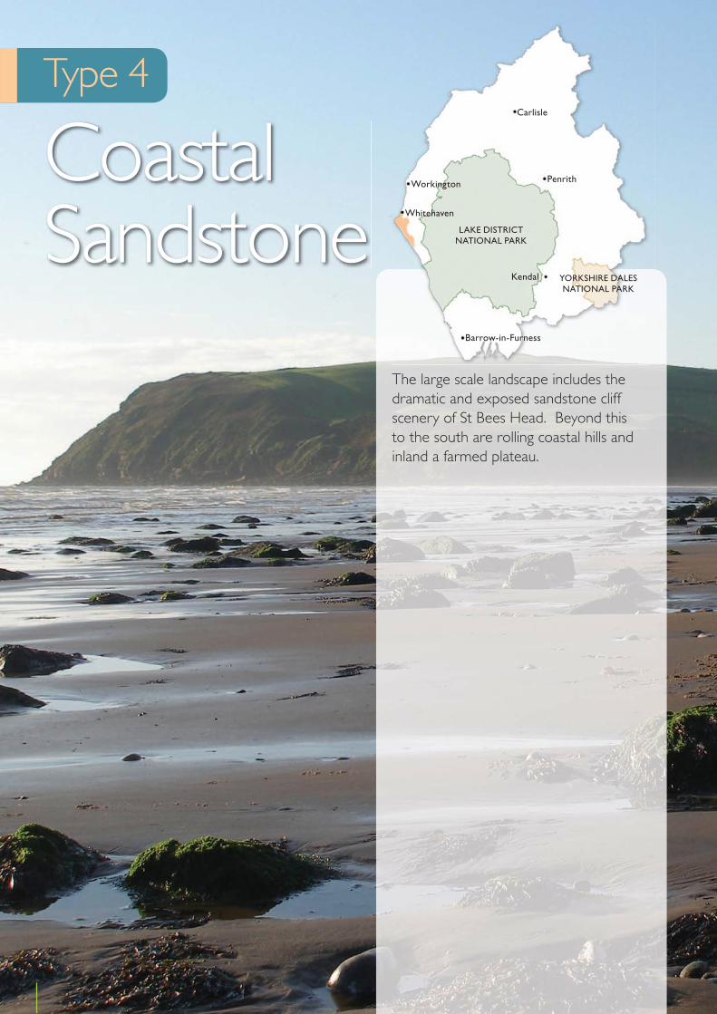
Cumbria Landscape Character Assessment
Type 4
Coastal Sandstone
The large scale landscape includes the dramatic and exposed sandstone cliff scenery of St Bees Head. Beyond this to the south are rolling coastal hills and inland a farmed plateau.
62
Kendal
Penrith
Carlisle
Workington
Whitehaven
Barrow-in-Furness
YORKSHIRE DALESNATIONAL PARK
LAKE DISTRICTNATIONAL PARK

Location
This sub type is found along the coastal edge extending from Whitehaven to St Bees Head and south to Sellafield. This type continues into the Lake District national park and is classified as Type E – Coastal Sandstone in the Lake District National Park Landscape Character Assessment.
Key Characteristics
• Coastal sandstone cliffs• Sandstone rolling hills and plateaus• Large open fields• Prominent hedge banks bound pastoral fields• Small woodland blocks along valley sides• Exposed coastal edge moving to intimate and
enclosed farmland inland
Physical character
Permo Triassic red sandstones overlain by fluvial-glacial drift and brown sandy soils extend between Whitehaven and Sellafield. The tall sandstone cliffs at St Bees Head are a prominent feature and form the best exposure of the sandstone in the area and along the coast of Cumbria. The land becomes progressively lower and the cliff edge softens as you move towards Sellafield. A plateau like area is found around St Bees, intersected by Pow Beck towards the edge of Whitehaven.
Land cover and land use
The area comprises the distinctive sandstone cliff scenery around St Bees, undulating plateau and the rolling coastal hills that move inland and south towards Sellafield. The open plateau north of St Bees is covered in a patchwork of large open regular pastoral fields. These are largely divided by hawthorn hedges. Between St Bees and Sellafield the patchwork of fields continues and gently rolling pastoral fields with prominent hedge (kest) banks of gorse, hawthorn and sometimes bracken. Small blocks of mixed woodland and scrub occur on the valley sides and inland throughout this type.The valley of Pow Beck which cuts through the higher ground is often open and bare, but higher up is more wooded with well maintained hedges.
The area is lightly settled with small scale farmsteads and hamlets scattered away from the cliffs to the north of St Bees. The lighthouse is the most prominent built feature. Further south nucleated caravan sites and villages are dotted closer to the coast, but often sited in dips and undulations in the rolling hills. The traditional buildings are built in the distinctive rich red sandstone. Modern buildings are often rendered with sandstone dressings. The railway follows the shoreline and low contours and is generally hidden and discrete feature in the landscape. The most significant man made development is the sandstone quarry in the coastal cliffs near Whitehaven.
Ecology
The cliffs of St Bees Head support colonies of breeding seabirds, including razorbill, guillemot puffin and kittiwake. The cliffs also support large areas of coastal heath and species-rich grassland including sea campion, bloody crane’s bill, kidney vetch, thrift, common scurvy grass and red fescue. Inland the landscape is largely agricultural, but along the valley of Pow Beck there is areas of rush pasture, reed bed and swamp vegetation. Small, deeply incised tributaries to Pow Beck hold small semi natural woodlands.
Historic and cultural character
The St Bees area is characterised by remnants of the former monastic landscape created by the 12th century Priory. The settlements are nucleated and discrete surrounded by the fossilised strips of former medieval field systems. Many of the discrete settlements emerged with parliamentary enclosures in the late 18th century. Many of the buildings are in the local vernacular tradition and built of sandstone. The field pattern is a mix of former common arable field, ancient enclosures and planned enclosure.
Perceptual character
The open character of the landscape along the coast offers wide and uninterrupted views across to sea horizons and along the coast. There is a feeling of remoteness and wildness along the coastal edge with the exposure to the cliff edge, changing weather and sea. In
63
Cumbria Landscape Character Guidance – Type 4: Coastal Sandstone

particular the high cliffs and cliff top landscape at St Bees Head is vast in scale and has an exposed, invigorating, remote and beautiful feel. Inland there is a more intimate feel due to the simple farmed character and the more enclosed rolling land and small valleys.
Sensitive characteristics or features
The dramatic cliffs of St Bees Heritage Coast, their colonies of breeding sea birds that provide a strong link with the open sea and sense of ‘naturalness’, and the discrete siting of the railway line along the lower coastal edge are all sensitive to the dynamic forces of the sea. The networks of native hedges are sensitive to changes in land management and farm diversification. Discrete settlements, the distinctive sandstone of traditional buildings and fossilised medieval strip fields are sensitive to village expansion.
Vision
The objective is to manage, enhance and restore the landscape. This includes the conservation and enhancement of the distinctive sandstone cliff scenery of the Heritage Coast and enhancement of the coastal strip below St Bees. This should include the restoration of locally distinctive features such as hedge banks and the restoration of maritime heath along the cliff top. A Management Plan should be prepared for the Heritage Coast. Coastal access improvements will encourage visitors and recreation development will be sensitively sited and designed. There is an opportunity to create more woodland on the good soils behind the immediate coast.
Changes in the Landscape
Over the next 10 – 20 years this landscape could be subject to the following changes or issues:
Climate Change• The coastal edge may be affected by higher levels of
erosion due to increased storminess and significant tidal events.
Management practices• This high quality landscape - rare within Cumbria -
is affected by agricultural change including neglect or loss of field boundary hedges and the loss of landscape features.
Development• There is likely to be continued interest in urban and
industrial development in areas around Whitehaven which could erode the undeveloped and rural character of the northern part of this landscape type if not carried out sensitively.
• New buildings are often rendered and opportunities to reinforce the rich red sandstone vernacular are not always taken, despite access to locally quarried stone.
• Large scale wind energy development could take place here due to the exposed coastal location where wind speeds could be high.
Access and Recreation• Over the next decade, the planned implementation
of enhanced access to the whole of the English coast could result in some disturbance to wildlife in sensitive locations at certain times of the year.
• Coastal access will be improved through the roll out of open access along the coast. Space will be needed to allow the route to shift in this dynamic area and in response to any future coastal erosion.
Guidelines
Natural Features• In areas less affected by sea winds encourage a
programme of mixed planting over a phased period; to include establishment of wind breaks, followed by further planting of tree groups, woodlands and feature trees.
• Establish native tree planting along the main water courses at Pow Beck and River Ehen to further emphasise their legibility in the landscape and increase their potential for nature conservation.
• Maintain, enhance and restore important features including maritime cliff grassland, maritime heath, the seabird colony and geological features through appropriate management.
64
Cumbria Landscape Character Guidance – Type 4: Coastal Sandstone
Cultural Features• Restore and maintain existing hedgerows and hedge
banks in a traditional manner.• Undertake supplementary planting of scanty
hedgerows and hedge banks.• Where climatic conditions allow, increase planting of
deciduous trees within hedgerows to strengthen the pattern in the landscape and increase their value as a wildlife habitat.
• Discourage the sole use of fences as field boundaries and encourage planting and traditional management of hedgerows.
Development• Strengthen definition between town and country by
using extensive buffer planting to screen the built up areas and reduce the impact of industry.
• Improve visual containment of caravan parks close to the coast with landscape works and discourage further large scale developments, such as wind energy, in prominent coastal locations.
• Conserve and enhance the traditional farm buildings and features within their own setting.
• Reduce the impact of any new buildings by careful siting and design.
• Support small scale quarrying at the existing site to provide local stone for new developments and repairs to buildings.
Access and Recreation• Support the roll out of coastal access and encourage
sensitively sited coastal access and recreational infrastructure. Coastal access footpaths, areas and facilities should be improved and developed to be compatible with the undeveloped and natural character of this sub type.
• In line with the Marine and Coastal Access Act consideration should be given to routing coastal access footpaths along appropriate sea defence structures.
• In areas where coastal access will introduce new routes appropriate access management may be needed in sensitive locations at certain times of the year to minimise disturbance to wildlife.
• Introduce planting associated with wind-break barriers to improve the appearance and shelter along promenades.
• Undertake sea frontage improvements linked to the existing and potential recreational capacity.
• Improve the design and maintenance of public facilities.
65
Cumbria Landscape Character Guidance – Type 4: Coastal Sandstone

Cumbria Landscape Character Assessment
66
Type 5
Lowland
This landscape type includes extensive areas of lowland agricultural pasture. It has five sub types that reflect topographical and other changes.
These cover the ridges and dissecting valleys, lowland and undulating rolling farmland, drained mosses and agricultural land influenced by urban fringe development. In parts of the sub types traditional development and lowland pasture have been influenced by more recent 20th century development and past mineral workings. It is generally a large scale open landscape with simple farmed uses. However they are sensitive to both incremental and planned development and agricultural change.
Sub types:
5a Ridge and Valley
5b Low Farmland
5c Rolling Lowland
5d Urban Fringe
5e Drained Mosses
Kendal
Penrith
Carlisle
Workington
Whitehaven
Barrow-in-Furness
YORKSHIRE DALESNATIONAL PARK
LAKE DISTRICTNATIONAL PARK
Location
This sub type runs in an unbroken band from Carlisle to Workington alongside the Limestone Fringe landscape. It becomes broken up around Workington and continues in this way to Cleator Moor.
Key Characteristics
• A series of ridges and valleys that rises gently toward the limestone fringes of the Lakeland Fells
• Well managed regular shaped medium to large pasture fields
• Hedge bound pasture fields dominate, interspersed with native woodland, tree clumps and plantations.
• Scattered farms and linear villages found along ridges• Large scale structures generally scarce
Physical character
This landscape is found mainly on carboniferous rocks overlain by extensive glacial till and riverine sand and gravels deposited in the glacial outwash plain. The glacial till formed some low subtle drumlins and the sand and gravel formed some long low eskers. These have helped shape the ridges and valley landscape. In some places, kettle holes occupy hollows in the surface of the glacial deposits and in places peat mires have formed. Coal seams can be found throughout the area. The ridges and valleys vary in height between 50-130m AOD.
Land cover and land use
The landscape rises gently to high wide ridges with long views or falls to small, narrow valleys. The Ellen Valley forms a distinctive feature.
The landscape is dominated by improved farmed pasture. Fields are typically regular in shape and are medium to
large in size. Arable fields provide an occasional contrast with the pasture. Field patterns tend to be oblong with straight boundaries enclosed by hedges, hedge banks or fences. These still reflect the planned enclosure of open common pastures in the 19th century.
The patchwork field pattern is interspersed with both native broadleaved and planted coniferous woodlands and some unimproved and features include dense high hedges, woodland, especially along narrow valleys, shelterbelts, remnant parkland and tree clumps. Some hedges are fragmented. Small areas of forestry plantation punctuate the landscape.
Scattered farm buildings are dispersed throughout the area and are often concealed by undulations in the land and woodlands. Villages are linear or nucleated in form, having developed this character largely in the later 19th and 20th centuries, and mainly sited along ridge tops.
Roads that connect the villages along the ridge tops are generally straight. Roads in the valleys tend to wind along contours and are flanked by high hedges or banks.
Industrial activities have influenced the landscape, with areas of reclaimed open cast land introducing modern field patterns, woodland and plantation features. Wind energy schemes are a reoccurring feature, and along with other vertical elements such as pylons, are often sited along ridge tops. They interrupt the skyline and form prominent features in the landscape.
Ecology
Much of the ecological interest of this agriculturally improved landscape lies in species-rich hedgerows and hedge banks, particularly where they are allowed to grow tall. Most woods are plantations, both of native broadleaves and of conifers, but native oak woodland is found along the more deeply incised river and stream valleys. Plantations are often found on Ancient
67
Cumbria Landscape Character Assessment
Sub type 5a
Ridge and Valley

Woodland sites. The larger conifer plantations are important for red squirrels. Less common habitats include species-rich rush pasture and purple moor-grass wet grasslands and, in a few rare cases, hay meadows. Small patches of species-rich pasture are occasionally present along steep banks. West of Carlisle several small remnant lowland raised bogs are present, now largely covered by woodland. Several important river systems flow through these valleys, including the River Ellen and tributaries of the River Derwent, which are important for Atlantic salmon, otter and freshwater pearl-mussel.
Historic and cultural character
This sub type is culturally very varied. Fields are often planned enclosure of former arable common fields and common grazing land. In general nucleated villages developed late in a historically dispersed settlement pattern. It features ancient market centres such as Aspatria, Wigton and Dalston. Settlements are often surrounded by traditional field systems with some fossilised strips. On the outskirts of many settlements are the remains of former industries including iron mining and working, coal mining, quarrying and lime burning. Evidence of Roman occupation is prolific in places and includes Roman roads and settlements like Papcastle. More recent military sites are a feature as at Great Broughton and Great Orton.
Perceptual character
These are medium scale landscapes generally enclosed in valleys and around woodlands with a more open feel along the ridge tops. Here the experience of the landscape can be influenced by changes in the seasons and weather and there can be a more elemental experience on exposed ridge tops. There are strong associations both with the nearby limestone fringe and coast due to the long views from the ridge tops. In particular there are attractive views over the Solway Firth and to the Lakeland Fells. Despite the concentration of large scale wind energy schemes that dominate the landscape around Workington, many parts remain intact and retain the sense of a pleasant, peaceful working farmed landscape.
Sensitive characteristics or features
The peaceful pastoral atmosphere away from busier parts is sensitive to large scale development. Native broadleaved woodlands, shelterbelts and remnant parklands, species rich hedges and hedge banks, and the interest they provide to the farmed landscape, are sensitive to changes in land management. Discrete and dispersed farmsteads are sensitive to unsympathetic expansion. Ridge top locations of settlements are sensitive to village expansion. Undeveloped areas of ridge tops and valley rims are sensitive to large scale ridge line development where significant contrast could arise between small scale settlements and large scale features such as large scale wind turbines and pylons. Open and uninterrupted views from ridge tops to the Solway Firth and Lakeland Fells are sensitive to large scale infrastructure development.
Vision
This pleasant working farmed landscape will be enhanced and restored. This landscape will accommodate further agricultural intensification and limited field enlargement and removal of hedges but this will be balanced with the improved management of retained hedgerows and woodlands and traditional field patterns. Bold new woodland planting will provide visual contrast. In addition, harsh development edges will be softened and existing and new, peripheral development will be integrated within a stronger landscape framework. Ridge top clutter will be restricted to strengthen the rural environment and minimise the effects of urban influences.
Changes in the Landscape
Over the next 10 – 20 years this landscape could be subject to the following changes or issues:
Climate Change• An increase in short rotation coppice, biomass or
other woodland planting could help mitigate against climate change and support renewable energy production.
• An increase in rainfall and extreme weather events could result in an increase in flash flooding. Flood
68
Cumbria Landscape Character Guidance – Sub type 5a: Ridge and Valley

risk management may result in man made mitigation measures such as strengthened river defences, re-engineered bridges and access routes.
Management Practices• Changes in agricultural practices could lead to the loss
of traditional boundaries and field enlargement. • Implementation of the Water Framework Directive
could result in changes to water abstraction, pollution control, and changes in flood risk and river basin management. This could provide opportunities for enhancement and restoration of streamside features and river catchment areas.
Development• There could be a trend towards the development of
urban fringe characteristics where the sub type abuts towns and villages.
• Farm diversification could lead to an increase in the use of farm land for horse grazing and equestrian uses could result in changes to field patterns and boundaries. An introduction of stables and ménages could cause incremental change the character of the farmed areas.
• The continued need to support renewable energy schemes is likely to result in an increase in large scale wind energy schemes, energy crops and biomass planting. Large scale wind energy schemes have already changed the character of the sub type, particularly around Workington. Without careful control parts of this sub type could become defined by wind energy development. This could have knock on effects on the character of adjacent landscape types due to the far reaching visual effects of such development.
• Upgrades to the national grid to provide energy security and support new power generation could result in larger pylons and sub stations.
• There could be pressure to accommodate other large scale infrastructure development including, industrial buildings, roads, masts, and opencast coal mining. The latter could take place as markets for coal change. The exposed and open character of the ridgelines makes them sensitive to such development.
• Existing mineral sites could extend in the future which, if well planned, could provide opportunities for ecological enhancement during restoration.
Access and Recreation• Public rights of way provide a network of routes
that enable quiet appreciation and enjoyment of the countryside. Ongoing maintenance is needed to support this network in the future.
• Current farm stewardship grants provide the opportunity to develop more public access in the countryside. Future grant or other programmes may continue to support this.
Guidelines
Climate Change• Encourage energy crops along valleys and away from
ridge tops. These should avoid areas of sensitive habitat and seek to enhance hedge boundaries around fields. Planting should respect the scale of the local landscape features. The edges of short rotation forestry should be soft and follow the grain of the topography.
• Encourage appropriate woodland or other planting in landscapes higher up the river catchment areas to help provide natural alleviation to extreme weather events and reduce the amount of hard engineered solutions needed alongside rivers and close to settlements.
Natural Features• Maintain and enhance the aquatic interest of rivers
and floodplain environments.• Use appropriate large scale new planting to integrate
settlements and associated industrial development with the surrounding countryside and provide landscape frameworks for development expansion.
• Manage existing Plantation and Ancient Woodland sites to allow regeneration of broadleaved woodland.
• Undertake environmental improvement within villages and built up areas to complement planting proposals within the surrounding farmland areas: to include roadside tree planting and within public open spaces to create a more established appearance and a stronger identity to individual settlements.
Cultural Features• Discourage the further nucleation of the settlement
pattern.• Manage and restock maturing hedgerow trees and
woodlands.
69
Cumbria Landscape Character Guidance – Sub type 5a: Ridge and Valley

• Reintroduce locally native hedges to enhance the strong matrix of field boundaries.
• Enrich depleted hedgerows following the pattern of the strong and dense hedgerows in certain areas while linking to woodland planting where possible.
• Enhance/restore hedgerows and encourage traditional management and maintenance.
• Discourage the permanent introduction of fences to replace or ‘gap up’ hedgerows.
Development• Discourage the further nucleation of the settlement
pattern.• Improve visual awareness of the individual settlement,
land uses, and cultural landmarks along each road and provide locations for stopping, viewing and picnicking.
• Introduce appropriate roadside planting to frame long distance views of fells and estuary and relieve bland farmland views and reduce the detrimental impact of straight major roads on ridge tops through the open countryside.
• Undertake environmental improvements within the settlements including traffic calming, crossing points, roadside tree planting and strong definition of the gateway entrance and exit from the individual settlement.
• Ensure that the capacity for tall and vertical development such as pylons and turbines is agreed and not exceeded to maintain views, particularly in area surrounding Workington.
• Ensure new development makes a contribution to the character of the area by respecting the form of villages e.g. linear along ridge lines, creates new focal spaces and takes advantage of attractive long views.
• Carry out village enhancement schemes including townscape environmental improvements, tree planting and establishment of attractive green spaces.
• Reduce the impact of large scale new buildings by careful location away from ridge tops and subservient to traditional farm and landscape proposals, and using a choice of sympathetic colours and non-reflective finishes.
• Conserve and enhance the traditional farm buildings and features within their own setting.
• Encourage horse grazing and equestrian uses to respect field boundaries and field patterns. Stables and other facilities should be sited sensitively with appropriate landscape mitigation to prevent the erosion of the pastoral farmland character.
• Large scale wind energy schemes should follow the guidance and capacity assessments of the Cumbria Wind Energy Supplementary Planning Document. Wind turbines and other energy infrastructure should be carefully sited and designed to prevent this sub type becoming an energy landscape.
• Encourage mineral sites to develop restoration schemes that reinforce the landscape features and provide ecological enhancement.
Access and Recreation• Public rights of way should be well maintained and
quiet recreational areas and facilities should be improved and developed to be compatible with the pastoral character of this sub type.
• Seek opportunities to enhance access to farmland through farm stewardship or other schemes.
• Disused railway lines could provide opportunities for discrete recreational routes and the enhancement of landscape features and ecological corridors.
70
Cumbria Landscape Character Guidance – Sub type 5a: Ridge and Valley

Location
This sub type can be found in several parts of the county – north, east and west of Carlisle, south of Whitehaven and north of Barrow. The sub type continues into the Lake District national park east of Seascale and is classified as Type D1 – Low Farmland in the Lake District National Park Landscape Character Assessment.
Key Characteristics
• Undulating and rolling topography• Intensely farmed agricultural pasture dominates• Patchy areas of woodland provide contrast to the
pasture • Woodland is uncommon west towards the coast• Fields are large and rectangular• Hedges, hedgerow trees and fences bound fields and
criss cross up and over the rolling landscape
Physical character
Permo Triassic bedrock is overlain by thick glacial drift deposits forming sand and gravel eskers, low drumlins and a variety of undulations and topographical variations in the landscape. The rolling topography is dissected by small and larger meandering river valleys, with the latter being found through the lower plain around Carlisle. The land is low lying, usually below 100m AOD.
Land cover and land use
Much of this type is intensively farmed agricultural land. The predominant land cover is pasture. This is interspersed with arable land. Fields tend to be fairly large and bounded by hedges with hedgerow trees, or replacement fences. The hedges form an interlocking matrix across the undulating land.
Tree clumps, riverside and hedgerow trees are notable features. Woodland is uncommon particularly close to the coast in the west. It increases as you move inland but is often found as patchy woodland. The valley of the River Lyne runs from Kirklinton north eastwards forming an important linear feature east of Carlisle. It includes hanging and ancient semi-natural woodlands. Areas of wet pasture are found in low lying areas and near watercourses.
The settlement pattern is varied, with large and small nucleated traditional settlements intermixed with many discrete farms dispersed across the landscape. Buildings are often rendered with rich red sandstone buildings dominant along the west coast, and lighter sandstone buildings around Carlisle. Straight roads are common.
Pylons and telegraph poles are generally subtle elements, but pylons can sometimes dominate, especially where there is more than one line of them.
Ecology
This is an intensely, agricultural landscape where semi-natural vegetation is scarce. There are areas of grazing marsh and floodplain habitat north west of Wigton and north east of Carlisle. This supports a range of plants including creeping bent and marsh foxtail. In wetter field margins greater reedmace, reed canary grass, water plantain and sedges are supported. Hedgerows are common, but often species-poor and woodland is scarce west of Carlisle. Significant woodland cover is however present along the River Lyne, supporting a range of upland oak and wet woodland communities. Small and medium sized rivers are a common feature of the landscape, supporting small ribbons of woodland and otters. Several small remnant lowland raised bogs are present around the Carlisle area and these support areas of birch and pine woodland, rush pasture and purple moor-grass and small areas of raised mire vegetation. One has a colony of the uncommon white-
71
Cumbria Landscape Character Assessment
Sub type 5b
Low Farmland
faced darter dragonfly. This landscape is important for farmland birds, including yellowhammer, linnet and tree sparrow. This landscape is also important for barn owl to the north and east.
Historic and cultural character
In the north of the county this landscape type is greatly influenced by the presence of the Anglo Scottish border and contains a number of medieval fortified sites including tower houses. Cropmark sites of prehistoric and Romano-British settlements are found. Other archaeological and historical interest in the landscape includes Hadrian’s Wall and sites as diverse as Egremont Castle, the former Royal Ordnance Factory at Gretna and stretched across the Scottish border, Britain’s earliest operational nuclear power station at Calder Hall. The settlement pattern is varied. To the west of Carlisle areas of medieval influenced nucleated settlements around former common arable fields and more dispersed farmsteads developed around the time of planned field enclosure. To the north and east of Carlisle and around Millom field patterns are dominated by planned enclosures and ancient enclosures. South of Whitehaven more traditional settlements are dominated by modern settlements and development associated with Sellafield In general the field pattern is very regular with the area to the north of Carlisle characterised by late enclosure.
The Charles Dickens and Wilkie Collins collaboration ‘The Lazy Tour of Idle Apprentices” describes a journey from Corrode Fell to Allonby.
Perceptual character
This is a traditional working farmed landscape, interspersed with large scale industrial developments in the countryside. It is generally large scale and open. Views can be wide and long distance to the Fells and sea and have an expansive feeling, or small and contained giving a more intimate feel. Wind sculpted trees and hedges give a feeling of exposure and connections with the windswept coastline. Here the experience of the landscape can be more readily influenced by changes in the seasons and weather and there can be a more elemental experience close to the coastline. Woodlands,
and traditional scale farms and associated tree clumps provide distinctive punctuation and interest in the landscape.
Sensitive characteristics or features
The matrix of interlocking hedges, woodlands, trees along rivers and fields and wind sculpted trees in hedges in coastal areas are sensitive to changes in land management. The ecological value associated with grazing marsh, wetlands and floodplains are also sensitive to changes in land management. Frontiers of the Roman Empire: Hadrian’s Wall and associated Romano British settlements are sensitive to infrastructure and other development. The traditional feel of villages and farms can provide a sense of stepping back in time in places and is sensitive to unsympathetic village expansion. The open and uninterrupted views to the Solway Firth and Lakeland Fells are sensitive to tall infrastructure development.
Vision
The key features of this well maintained working landscape will be conserved and enhanced. Further agricultural change and development will be absorbed and combined with measures to conserve and enhance landscape, wildlife features and minimise urban intrusions. Limited field enlargement and the removal of hedges will take place but the management of retained hedges will be a key priority to maintain traditional boundary features. Trees and woodland will be managed, restored and enhanced and will be used to integrate urban intrusions into the landscape.
Changes in the Landscape
Over the next 10 – 20 years this landscape could be subject to the following changes or issues:
Climate Change• An increase in short rotation coppice, biomass or
other woodland planting could help mitigate against climate change and support renewable energy production.
72
Cumbria Landscape Character Guidance – Sub type 5b: Low Farmland

• An increase in rainfall and extreme weather events could result in an increase in flash flooding. Flood risk management may result in man made mitigation measures such as strengthened river defences, re-engineered bridges and access routes.
Management Practices• Further intensification could result in a depletion
of traditional field boundary patterns and the replacement of hedges with wire fences.
• Loss and neglect of features such as hedgerow trees, copses and wetland.
• There could be damage to lowland raised bogs and wetlands due to agricultural pollution, and changes to drainage that cause drying out.
• There has been an increase in the number of invasive species along watercourses, including Himalayan Balsam and Japanese Knotweed.
Development• Green infrastructure provides an opportunity to
seek enhancements to the landscape, biodiversity and cultural heritages adjacent to urban areas and to create green corridors between settlements.
• Creeping urbanisation includes airport, warehouse, garden centre and large car park development which can degrade the traditional landscape characteristics.
• Large scale farm development sited away from the traditional farmstead can erode the pastoral character.
• Farm diversification could lead to an increase in the use of farm land for horse grazing and equestrian uses could result in changes to field patterns and boundaries. An introduction of stables and ménages could cause incremental change the character of the farmed areas.
• New nuclear power generation adjacent to Sellafield could come forward towards the end of the decade along with associated infrastructure which could change the character of the landscape.
• Upgrades to the national grid to provide energy security and support new power generation could result in larger pylons and sub stations.
• The continued need to support renewable energy schemes could likely result in an increase in large scale wind energy schemes. Wind energy schemes have already changed the character of the adjacent Ridge and Valley sub type and without careful control this could be replicated here.
• New large scale energy Infrastructure and the impact of the transportation of the infrastructure for potential large scale wind turbines could affect small country roads which may not have the capacity for such large loads.
• Coal extraction and the re-working of previous coal sites could become prevalent in these areas, specifically in areas around Flimby and Workington, which could impact upon local character.
Access and Recreation• New recreation facilities close to towns and cities,
such as golf courses could lead to pressures in these landscapes.
• Public rights of way provide a network of routes that enable quiet appreciation and enjoyment of the countryside. Ongoing maintenance is needed to support this network in the future.
• Current farm stewardship grants provide the opportunity to develop more public access in the countryside. Future grant or other programmes may continue to support this.
Guidelines
Climate Change • Encourage biomass, short rotation coppice and
energy crops that avoid areas of sensitive habitat, such as grazing marsh habitat and that seek to enhance hedge boundaries around fields. Planting should respect the scale of the local landscape features. The edges of short rotation forestry should be soft and follow the grain of the topography.
• Encourage appropriate woodland or other planting in landscapes higher up the river catchment areas to help provide natural alleviation to extreme weather events and reduce the amount of hard engineered solutions needed alongside rivers and close to settlements.
Natural Features• Manage and restock hedgerow trees, parkland trees
and copses round farms and villages.• Increase planting of mixed woodland and tree groups
of varying sizes to create more panoramic diversity and colour
• Manage and enhance areas of semi natural and ancient woodland.
73
Cumbria Landscape Character Guidance – Sub type 5b: Low Farmland

• Create ‘linked networks’ of vegetation using native trees and shrubs to form ‘ecological corridors’ as well as emphasise valleys.
• Use woodland to contain and soften those areas that have been degraded by development or require an improved setting in the landscape.
• Use woodland planting particularly along the M6 corridor, east of Carlisle, where strong landscape features are needed to compete with this divisive element.
• Manage raised bogs, wetlands and grazing marsh to improve wildlife diversity and provide contrasts in texture and colour to improved farmland.
• Restore wetland or unimproved grassland in particular around existing areas of moss. This may include ‘blocking’ of drainage systems, restricting grazing, appropriate wetland planting or seeding, removal of hedgerows, scrub and woodland.
Cultural Features• Restore and maintain remaining hedgerows to
strengthen field patterns and convey an impression of good health.
• Renovate gappy overgrown hedges through management and replanting.
• Discourage introduction of fences to replace or gap up hedgerows
• Manage hedgerows in a traditional way.• Restore and maintain traditional kests (hedge banks)
and small scale field patterns.• In all areas strengthen and develop field patterns to
provide an improved setting for towns and villages.
Development• Energy infrastructure including nuclear and large
scale wind energy generation, pylons and substations should be carefully sited and designed to prevent this sub type becoming an energy landscape. Prominent locations should be avoided and appropriate mitigation should be included to minimise adverse affects.
• When new development takes place consider opportunities to enhance and strengthen green infrastructure to provide a link between urban areas and the wider countryside. Reinforcing woodland belts, enhancing water and soil quality and the provision of green corridors from and between settlements could all help reinforce landscape and biodiversity features.
• Plant deciduous tree groups and lines on garths, around farm buildings, along farm access roads and main entrances.
• Reduce the impact of large-scale new farm buildings by locating them in a non-prominent position subservient to traditional farm buildings, broken down in mass, softened by landscape proposals using a choice of sympathetic colours and non-reflective finishes.
• Encourage retention of traditional stone gateposts and features.
• Encourage horse grazing and equestrian uses to respect field boundaries and field patterns. Stables and other facilities should be sited sensitively with appropriate landscape mitigation to prevent the erosion of the pastoral farmland character.
• Ensure new development respects the historic form and scale of villages creating new focal spaces and using materials that are sympathetic to local vernacular styles. Further ribbon development or fragmented development should be supported where it is compatible with the wider landscape character.
• Improve visual awareness of the individual settlement, land uses and cultural landmarks along each road and provide locations for stopping, viewing and picnicking.
• Encourage environmental improvements along roadside settlements to include traffic calming, planting and stronger definition of gateway entrances and exits. Introduce roadside planting of deciduous and mixed species to enrich views from the road.
Access and Recreation• Integrate new recreation development, such as
golf courses, into the countryside by careful siting, appropriate ground modelling and planting and exploit opportunities these developments provide to improve visual and wildlife diversity.
• Small scale sensitive farm based tourism/recreational businesses should be well sited close to or within existing farm buildings and appropriate landscaping should be included to integrate new facilities into the landscape.
• Public rights of way should be well maintained and quiet recreational areas and facilities should be improved and developed to be compatible with the pastoral character of this sub type.
• Seek opportunities to enhance public access to farmland through farm stewardship or other schemes.
74
Cumbria Landscape Character Guidance – Sub type 5b: Low Farmland
Location
This sub type is found in 3 parts of the county - east of Wetheral, west of Cockermouth and north east of Barrow. The sub type continues into the Lake District national park east of Seascale and is classified as Type D2– Rolling Lowland in the Lake District National Park Landscape Character Assessment.
Key Characteristics
• Open undulating and rolling topography • Lowland agricultural landscape dominated by pasture• Hedges and hedgerows trees are common on lower
ground and sparse on higher ground• Some scrub woodland
Physical character
The geology of these areas varies. Carboniferous rock is found around Workington and Barrow, with Triassic mudstones or sandstones found east of Carlisle. Both are overlain by fluvial glacial drift. The topography is generally rolling with some low summits and dissected in some parts by steep sided valleys. Land rises from 25 – 125m AOD.
Land cover and land use
This is a lowland agricultural landscape dominated by pasture with some woodland, scrub and other marginal land. Field patterns are variable relating to topography and are generally regular at lower levels, but irregular around Barrow. In lower lying areas the landscape is generally undulating and fields bounded by a strong matrix of hedgerows and hedgerows trees are dominant. On higher ground land is more rolling and open and the topography is the distinctive characteristic. Hedges and other vegetation are sparse.
Parkland can be found around Greysouthen and along the River Eden. Plantations, scattered woodland and shelterbelts punctuate the pastoral fields and are found along the valley sides, such as the River Marron and Goldmire Beck. These often form linear features.
Villages are generally nucleated and some retain a strong vernacular character and are built in local stone. The traditional character of some is weakened by an increase in modern 20th century development. Farms are dispersed and large modern farm buildings near to the traditional farmsteads are common. Rural roads criss cross between villages and farmsteads. In parts quarrying, sand extraction and waste landfill sites inject a developed and industrial character.
Ecology
This is largely an agricultural landscape with only isolated areas of semi-natural vegetation. Hedgerows and small semi natural woodlands are the most widespread features of ecological interest; however a feature of note in this landscape is the presence of a number of basin mires to the south-east of Carlisle. These support a range of mire and fen communities, together with a rich invertebrate fauna and breeding sites for birds such as reed bunting, reed warbler and sedge warbler. The Rivers Eden and Cocker flow through sections of this landscape and are important for otter and aquatic plants such as water crowfoots.
Historic and cultural character
The settlement pattern is predominantly dispersed but there are some nucleations surrounded by traditional field systems including some fossilised strips. The domination of red sandstone as the main building material gives a distinctive local character to the villages. The fields are defined by the often ancient hedgerows.
75
Cumbria Landscape Character Assessment
Sub type 5c
Rolling Lowland

There are some stately homes with surrounding parklands as at Corby Castle. Formal parkland boundaries are surrounded by stone built walls of 19th century date which form the park pale.
Eaglesfield was the birthplace of John Dalton, 1766-1844, who established the Atomic Theory in 1803 with paper on the relative weights of the ultimate particles of bodies’. In 1794, he published the first description of colour blindness. George Graham born 1673 at Kirklinton was apprenticed to Thomas Tempion, and made various clocks and scientific instruments for the Royal Observatory at Greenwich.
Perceptual character
This is a typical working farmed landscape punctuated by quarrying activities. Views are limited by undulating topography.
Sensitive characteristics or features
The matrix of hedges and hedgerow trees that form and shape strong field pattern are sensitive to changes in land management. Rolling, open and undeveloped higher ground is sensitive to tall infrastructure or large scale development. Parkland and woodland in the farmland and alongside rivers are sensitive to changes in farming practices. Tranquility is greatest along rivers and is sensitive to development or farming intensification. The strong red sandstone vernacular of small nucleated villages is sensitive to changes from unsympathetic village expansion.
Vision
This working landscape will be enhanced and restored through the improved management of key features and the integration of development. A prosperous farming economy will be created and programmes will lead to the strengthening of traditional field patterns, hedgerows, trees and woodland cover. However, limited field enlargements and hedge removal could be supported and any modern farm buildings will be sited unobtrusively. Unsympathetic development edges will be softened and peripheral
development will be integrated within a stronger woodland landscape framework while the identity of existing buildings and villages will also be enhanced.
Changes in the Landscape
Over the next 10 – 20 years this landscape could be subject to the following changes or issues:
Climate Change• An increase in short rotation coppice, biomass or
other woodland planting could help mitigate against climate change and support renewable energy production.
• An increase in short rotation coppice or other woodland planting could help mitigate against climate change and support renewable energy production.
• An increase in rainfall and extreme weather events could result in an increase in flash flooding. Flood risk management may result in man made mitigation measures such as strengthened river defences, re-engineered bridges and access routes.
Management Practices• These areas have been subjected to agricultural
intensification and there has been a neglect of traditional boundary features and particularly the loss of hedgerow trees from modern hedge pruning and flailing techniques.
Development • These areas are subject to pressures for urban
development due to their proximity to key towns and cities in Cumbria. Without careful management planned and incremental expansion could erode the landscape character. The Green Infrastructure approach provides an opportunity to seek landscape and biodiversity enhancements as new development is planned on the edges of settlement. Green infrastructure and the development of green corridors can help connect the settlements with the wider countryside and other settlements.
• Upgrades to the national grid to provide energy security and support new power generation could result in larger pylons and sub stations.
• The continued need to support renewable energy schemes could likely result in an increase in large scale wind energy schemes. Wind energy schemes have
76
Cumbria Landscape Character Guidance – Sub type 5c: Rolling Lowland
already changed the character of the adjacent Ridge and Valley sub type and without careful control this could be replicated here.
• Farm diversification could lead to an increase in the use of farm land for horse grazing and equestrian uses could result in changes to field patterns and boundaries. An introduction of stables and ménages could cause incremental change the character of the farmed areas.
• New roads, housing, recreational facilities and quarrying have led to loss of landscape features.
Access and Recreation• Public rights of way provide a network of routes
that enable quiet appreciation and enjoyment of the countryside. Ongoing maintenance is needed to support this network in the future.
• Current farm stewardship grants provide the opportunity to develop more public access in the countryside. Future grant or other programmes may continue to support this.
Guidelines
Climate Change • Encourage biomass, short rotation coppice and
energy crops that avoid areas of sensitive habitat, such as grazing marsh habitat and that seek to enhance hedge boundaries around fields. Planting should respect the scale of the local landscape features. The edges of short rotation forestry should be soft and follow the grain of the topography.
• Encourage appropriate woodland or other planting in landscapes higher up the river catchment areas to help provide natural alleviation to extreme weather events and reduce the amount of hard engineered solutions needed alongside rivers and close to settlements.
Natural Features• Planting of mixed shelterbelts in the more exposed
areas with tree groups, woodlands and feature trees throughout the landscape and particularly along watercourses.
• Plant small mixed woodlands to enrich landscape pattern and to visually contain village expansion, existing quarries and recreational facilities.
• Improve the management, maintenance of existing
mature woodlands and carry out supplementary planting of woodlands, tree groups and copses within this area.
• Encourage management and enhancement of parklands to include programmes of amenity management and replacement planting in sympathy with the historic significance.
Cultural Features• Encourage retention, restoration and traditional
management of hedgerows.• Increase planting of deciduous trees as feature trees,
within hedgerows.• Ensure where possible that ‘linked networks’ of
vegetation are created using native trees and shrubs to enhance their nature conservation value and their use as ‘ecological corridors’.
• Encourage retention and restoration of stone walls, traditional gate posts and features on a whole farm basis.
Development• When new development takes place consider
opportunities to enhance and strengthen green infrastructure to provide a link between urban areas and the wider countryside. Reinforcing woodland belts, enhancing water and soil quality and the provision of green corridors from and between settlements could all help reinforce landscape and biodiversity features.
• Energy infrastructure including large scale wind energy generation, pylons and substations should be carefully sited and designed to prevent this sub type becoming a wind energy landscape. Prominent locations should be avoided and appropriate mitigation should be included to minimise adverse affects.
• Encourage retention of existing traditional stone buildings, gate posts, planting on garths, around buildings, along farm access roads and main entrances.
• Reduce the impact of any large scale new farm buildings by sensitive siting, breaking down mass, choice of sympathetic colours and non-reflective finishes and landscaping using traditional hedgerows and woodland screen planting.
• Encourage horse grazing and equestrian uses to respect field boundaries and field patterns. Stables and other facilities should be sited sensitively with appropriate landscape mitigation to prevent the
77
Cumbria Landscape Character Guidance – Sub type 5c: Rolling Lowland

erosion of the pastoral farmland character.• Encourage environmental improvements within
settlements including traffic calming measures that reflect the character of the rural roads. Use planting to strengthen the definition of ‘gateways’ and enhance the identity.
• Soften the impact of unsympathetic development edges and integrate peripheral development within a stronger landscape framework.
• Integrate new recreation development such as golf courses into the countryside by careful siting, appropriate ground modelling and planting and exploit opportunities these developments provide to improve visual and wildlife diversity.
• Ensure mineral extraction is carried out in a manner that does minimal damage to distinctive landscape features.
Access and Recreation• Public rights of way should be well maintained and
quiet recreational areas and facilities should be improved and developed to be compatible with the pastoral character of this sub type.
• Seek opportunities to enhance access to farmland through farm stewardship or other schemes.
78
Cumbria Landscape Character Guidance – Sub type 5c: Rolling Lowland

Location
This landscape sub type is found around the edges of Carlisle, Workington and Whitehaven.
Key Characteristics
• Long term urban influences on agricultural land• Recreation, large scale buildings and industrial estates
are common• Mining and opencast coal workings are found around
Keekle and Moor Row• Wooded valleys, restored woodland and some semi-
urbanised woodland provide interest
Physical character
The geology of these areas varies. Carboniferous rock is found around Workington and Barrow, with Triassic mudstones or sandstones found east of Carlisle. Both are overlain by fluvial glacial drift.
Land cover and land use
These agricultural landscapes have been subjected to urban and industrial influences for a long time and in many parts maintain a rural character. Field patterns remain distinct in the largely pastoral areas, often bounded by strong hedges and hedgerow trees. The urban influences vary.
In West Cumbria small settlements associated with former mining and associated activities spread over a ridge and valley landscape. While deep mining of iron ore has largely gone, agricultural areas on restored opencast coal sites introduce modern 20th century field patterns amongst more regular field patterns associated with parliamentary enclosure. Woodland, wetland and scrub has been reintroduced through
restoration schemes. Derelict land is dotted throughout the landscape. Despite the scars of former industries, much of the countryside character is still intact with wooded valleys retained along valleys that cut across the landscape.
In Carlisle there is a ring of semi-urbanised low farmland around the city. Large development such as large industrial estates, the racecourse and golf courses sit alongside small modern settlements linked to traditional farmsteads. Large modern agricultural buildings are also common.
Ecology
Largely an urban influenced landscape with mainly species-poor hedgerows and occasional small areas of woodland. There are isolated areas of coastal grazing marsh around Carlisle and hay meadows in West Cumbria. In addition to this, derelict former industrial or other previously developed sites have the potential to support a range of habitats and species which may have colonised the site since the previous uses ended.
Historic and cultural character
On the outskirts of Carlisle there is buried evidence of prehistoric settlement including burnt mounds, Neolithic activity and one of the largest Mesolithic sites found in North West England. Whitehaven was, briefly in the 18th century, the second Atlantic coast port (after Bristol) trading with Ireland, and exporting coal, so in West Cumbria the urban fringes contain much evidence of former coal and iron mining. The settlement pattern is generally dispersed and of fairly recent origin. Traditional fields are regular and indicative of late enclosure.
79
Cumbria Landscape Character Assessment
Sub type 5d
Urban Fringe

Perceptual character
This is a busy area where modern development dominates the pastoral character. The towns can be seen as progressively encroaching and areas have an air of neglect. The more agricultural areas and parts where woodland and open green spaces remain are important green lungs close to the towns and cities which provide respite from the busy areas and a connection to the wider countryside.
Sensitive characteristics or features
Wooded valleys, restored woodland, some semi urbanised woodland, and the intact field patterns of farmland reinforced by hedges and hedgerow trees are sensitive to changes in land management and settlement expansion. Open green spaces and fields close to settlement edges are sensitive to unsympathetic development.
Vision
This changing landscape will be enhanced through restoration. Management practices will create a stronger definition between town and country areas integrating adjacent discordant land uses into the landscape. Woodland areas and traditional field boundaries will be managed and enhanced. New woodland planting will be used strategically to create a bold landscape structure unifying disparate uses in developing areas while the reinforcement of rural ‘green’ qualities will help maintain rural character and provide visual relief. Access through the public rights of way network from towns and cities into the countryside will be enhanced.
Changes in the Landscape
Over the next 10 – 20 years this landscape could be subject to the following changes or issues:
Climate Change• An increase in rainfall and extreme weather events
could result in an increase in flash flooding. Flood risk management may result in man made mitigation
measures such as strengthened river defences, re-engineered bridges and access routes.
Management Practices• Urban encroachment and changes in land use can
lead to declining patterns of field boundaries.• Areas of despoiled and unused derelict land can
detract from the local character.
Development• The tendencies for urban development to further
encroach on the countryside and for agriculture to suffer from vandalism and pressures for access.
• Housing development on sensitive ridges can often lack the soft landscaping needed to help integrate it into the wider landscape.
• Expansion of villages can lead to a lack of identity and poor definition between town and country.
• Green infrastructure provides an opportunity to seek enhancements to the landscape, biodiversity and cultural heritages adjacent to urban areas and to create green corridors between settlements.
• Farm diversification could lead to an increase in the use of farm land for horse grazing and equestrian uses could result in changes to field patterns and boundaries. An introduction of stables and ménages could cause incremental change the character of the farmed areas.
Access and Recreation• Public rights of way provide a network of routes from
towns and cities that enable quiet appreciation and enjoyment of the countryside. Ongoing maintenance is needed to support this network in the future.
• Current farm stewardship grants provide the opportunity to develop more public access in the countryside. Future grant or other programmes may continue to support this.
Guidelines
Climate Change• Encourage appropriate woodland or other planting
in landscapes higher up the river catchment areas to help provide natural alleviation to extreme weather events and reduce the amount of hard engineered solutions needed alongside rivers and close to settlements.
80
Cumbria Landscape Character Guidance – Sub type 5d: Urban Fringe

Natural Features• Establish new woodlands or tree groups on
prominent skylines in order to soften their windswept appearance and provide screening where climatic conditions allow.
• Manage and restore existing semi-natural woodlands.• Carry out schemes of structural planting to contain
settlements, punctuate and reinforce the identity of each settlement and contain urban edges.
• Use planting and general environmental improvements to frame views and define open spaces and recreational links along river valleys.
• Schemes for the management of riverbanks should be carried out sympathetically.
• Unimproved grassland or wetlands should be restored where possible.
• Seek opportunities to restore piped watercourses to enhance ecological corridors.
Cultural Features• Restore and develop the pattern of hedgerows with
additional planting and supplementary planting of scanty hedgerows.
• Increase planting of deciduous trees as feature trees, within hedgerows, along watercourses and in tree groups to enrich the general landscape.
• Ensure, where possible, that linked networks of vegetation are created using native trees and shrubs to enhance their nature conservation value and their use as ‘ecological corridors’.
• Discourage the replacement or sole use of fences and encourage planting and traditional management of hedgerows.
• Develop whole farm environmental schemes.
Development• When new development takes place consider
opportunities to enhance and strengthen green infrastructure to provide a link between urban areas and the wider countryside. Reinforcing woodland belts, enhancing water and soil quality and the provision of green corridors from and between settlements could all help reinforce landscape and biodiversity features.
• Protect ‘green’ areas from sporadic and peripheral development. Support the retention and development of ‘green gaps’, green infrastructure and ecosystem services approaches in Local Development Frameworks where they would help maintain
distinctive, undeveloped characteristics.• Protect countryside areas from sporadic and
peripheral development through the local plans. • Careful siting of any new development in non-
prominent locations.• Strengthen undeveloped areas of land with mixed
woodland and hedgerow planting and restoration of natural landscape features.
• Encourage horse grazing and equestrian uses to respect field boundaries and field patterns. Stables and other facilities should be sited sensitively with appropriate landscape mitigation to prevent the erosion of the pastoral farmland character.
• Along major roads, develop schemes to improve visual awareness of the individual settlements, land uses and cultural landmarks.
• Conserve and maintain traditional farm buildings within their own setting.
• Reduce the impact of large scale new farm buildings by careful location so as not to dominate the traditional farm buildings on a plot adequate to accommodate circulation, storage and landscape proposals using a choice of sympathetic colours and non-reflective finishes.
Access and Recreation• Public rights of way should be well maintained and
quiet recreational areas and facilities should be improved and developed to be compatible and reinforce the remaining pastoral characteristics of this sub type.
• Seek opportunities to enhance access to farmland through farm stewardship or other schemes.
81
Cumbria Landscape Character Guidance – Sub type 5d: Urban Fringe
Location
This sub type is found around Bolton Fell to the east of Carlisle.
Key Characteristics
• Mainly flat open landscape• Extensive areas of lowland raised bog • Distinctive geometric field patterns• Low ridges with linear woodland planting • Mossy fields, sparse hedges and relict woodlands• Areas of peat extraction
Physical character
Triassic sandstone is overlain by fluvio-glacial deposits. Peat has accumulated in low lying areas developing a raised dome. It is similar to the coastal mosses, but found further inland.
Land cover and land use
This is a mainly flat, open landscape of drained mossy fields bounded by sparse hedges and relict woodlands. There are significant areas of lowland raised bog and fen with some active peat extraction.
Between the areas of raised bog a series of low ridges have been planted with avenues and shelterbelts that bound large scale pasture fields and create an unusual grid pattern in the landscape. Drainage ditches and roads tend to be straight.
The area is sparsely populated with few settlements, dispersed farmsteads and hamlets. This is an unusual, if simple landscape with some incongruous features linked to industrial yards, buildings, pylons and the peat extraction.
Ecology
This landscape is dominated by two extensive raised mires. Whilst Bolton Fell has been subject to extensive peat extraction the centre of the mire still retains characteristic raised mire vegetation with abundant Sphagnum mosses and species like bog rosemary and cranberry. Walton Moss supports areas of raised mire vegetation, together with areas of wet heath and birch woodland. There are extensive areas of rush and purple moor-grass on drained mossland around both mires.
Historic and cultural character
The drained mosses may have some potential for studying past landscapes through analysis of plant remains in preserved peat. However, it is likely that survival or remains would be variable across the mosses. They also contain evidence of former peat extraction. There are surviving areas of unenclosed low fell and moss.
Perceptual character
This is a large scale, mainly open landscape. The changes in land cover from raised bog, to pasture and woodland provide variety and support wildlife interest. There are open views, particularly southwards from the low ridges. This is a peaceful landscape with a feeling of remoteness due to the lack of settlement. The feeling of remoteness can increase with seasonal and weather change.
Sensitive characteristics or features
The distinctive geometric field patterns reinforced by woodland planting are sensitive to changes in land management. The relict woodlands, raised mire, bog and fen areas are sensitive ecological areas that could be affected by changes to drainage and other land
82
Cumbria Landscape Character Assessment
Sub type 5e
Drained Mosses

management. The lack of settlements and openness of the mosses provides a sense of remoteness and tranquility that is sensitive to land management changes and medium to large scale development.
Vision
The raised bog will be managed and drained and worked mossland will be restored. The potential to recreate a more natural landscape and increase wildlife interest will be encouraged through the restoration of the worked mosses. An active programme will be embarked upon to plant and improve maintain the distinctive field patterns and the management of hedges, woodland and tree belts. Unsympathetic buildings and structures found around the periphery will be screened to enhance this landscape.
Changes in the Landscape
Over the next 10 – 20 years this landscape could be subject to the following changes or issues:
Climate Change• Raised bog has a high carbon sequestration potential.
Good condition bog can help mitigate against adverse effects of climate change. Management practices might need to change to improve the condition of bog and enhance its carbon sequestration potential.
Management Practices• Continued peat extraction can threaten the
landscape and nature conservation interest and carbon capture potential of the area.
• Agricultural improvements can lead to the neglect of existing landscape features.
Development• Pylons can be found in the area, and there is interest
in large scale wind energy development in the area. This could lead to dominant man made features and create visual clutter in the simple landscape.
Guidelines
Climate Change• Restore drained mossland back to wetland. This may
include ‘blocking’ of drainage systems, restricting grazing, and removal of invasive scrub and woodland.
• Manage and enhance raised bog through appropriate management including lowering stocking levels, ditch blocking and reviewing any burning practices.
Natural Features • Plant woodland clumps in association with groups of
farm buildings.• Plant additional small scale mixed woodlands to
create all year interest.• Undertake improved management and
supplementary planting of tree clumps and belts.• Encourage schemes for the sensitive management
of the mosses and surrounding agricultural land including maintenance of a high water table, phased cutting of heather, preventing damage to moss growth by overgrazing and poaching, control of scrub encroachment, restricting liming, fertiliser herbicide and pesticide treatments.
• Consider the potential for interpretation, controlled access and additional facilities in consultation with Natural England.
Cultural Features• Undertake additional planting of hedgerows along
ditches, road sides and accesses to farms, to create new features in the landscape on a whole farm basis.
• Undertake supplementary planting and management of neglected hedgerows and traditional maintenance of all hedgerows.
• Maintain tree lines as key features.• Plant a variety of indigenous species and sizes of
trees within the hedgerows to create an enriched environment of natural appearance.
Development• Protect the mosses from further commercial peat
cutting and agree schemes to ensure worked areas revert to a natural condition.
• Ensure that any proposals within existing peat working areas are carefully sited and designed to retain the unspoilt open character of this landscape.
• Resist any infrastructure development that undermines the remote and peaceful character or significantly changes views to the Lakeland fells.
83
Cumbria Landscape Character Guidance – Sub type 5e: Drained Mosses

Cumbria Landscape Character Assessment
Type 6
Intermediate Farmland
This is a large-scale open landscape of intermediate farmland that occurs between lowland and rolling upland areas. The land use is predominately grazing land bound by hedgerows and stone walls. Although there are no sub types there are characteristic changes within the type reflecting local geology and vernacular.
This was formerly called Intermediate Land in the Cumbria Landscape Classification, 1995 and in the Cumbria Wind Energy Supplementary Planning Document, 2007.
84
Kendal
Penrith
Carlisle
Workington
Whitehaven
Barrow-in-Furness
YORKSHIRE DALESNATIONAL PARK
LAKE DISTRICTNATIONAL PARK

Location
This landscape type runs in three tongues around Penrith and in the Eden Valley. It is found from Wreay and Sedbergham south to Kings Meaburn, from Kirkoswald to Appleby and from Lazonby towards Penrtih. It is also found further north running from Catlowdy south to the line of Hadrian’s’ Wall near Brampton.
Key Characteristics
• Transitional farmland between the lowland and upland landscapes
• Extensive areas of improved pasture with some arable farming
• Planned villages with greens displaying topographical and archaeological evidence of their medieval origins
• In parts the landscape is dissected by the deeply incised or open river valleys
• Wooded valleys and ghylls• Sandstone and limestone vernacular
Physical character
Carboniferous rocks overlain by glacial drift predominate areas to the north of Carlisle and to the north west and south of Penrith. To the north east of Penrith the geology is Permo Triassic sandstone overlain by glacial drift.
Land cover and land use
This type comprises of predominantly grazing land between 100-200m AOD. It is intermediate between the lowland and more rolling upland types. The higher parts are open and rolling with wide views, stone walls and few hedges. At lower levels land becomes more undulating and enclosed with a regular pattern of hedges or hedgerow trees.
In Carlisle the area is dissected by the deeply incised valleys of the Black and White Lyne which are well wooded. Settlements are dispersed and small. Field patterns vary between being large and irregular in shape, to being more medium and rectilinear in shape. These are mainly bounded by hedges and trees.In Eden very broad valleys and narrow ghylls
intersect the fields and woodland. Pasture dominates, interspersed with arable fields. Fields are large scale with mainly regular and rectilinear patterns. However there are some areas of older enclosures that provide variety to the landscape through more irregular field patterns. Field walls form a strong matrix and are built in rich red sandstone along the North Pennine edge. Elsewhere hedges are the predominant field boundary. Blocks of woodland reinforce the regular field patterns and are complemented by wooded ghylls and stream and river banks. Most of this landscape type is fairly simple in character with some strong features such as the parkland around Unthank.
Throughout this type some parts are lightly settled with small nucleated villages. Farms are dispersed with some large scale modern agricultural buildings forming new features in the landscape. Many of the settlements retain a traditional centre with rich red sandstone vernacular where the type is found in the eastern parts of the Eden Valley, with other traditional buildings being built in a lighter sandstone or limestone elsewhere. The M6 motorway and railway line provide modern linear features running through Eden and the telecommunications masts at Skelton form a distinctive vertical feature and modern landmark.
Ecology
This is a landscape of improved pastures with species-rich hedgerows and, in the Eden Valley small woodlands. Along the White and Black Lyne rivers there are more extensive river valley woodlands with a range of upland oak and wet woodland communities. Plantations are often sited on ancient woodland sites. Areas of rush pasture and purple moor-grass are occasional, with one area supporting the rare marsh fritillary butterfly. A couple of small basin mires are to be found near Penrith. Species-rich roadside verges are occasional to the north and south of Penrith. Tributaries of the River Eden, as well as the Black and White Lyne and River Petterill support otter and to the north of Brampton.
Historic and cultural character
Within this landscape type there is considerable cultural diversity. The Eden area is characterised by nucleated
85
Cumbria Landscape Character Guidance – Type 6: Intermediate Farmland

villages, with some medieval planning, either as row settlements or as settlements around a village green, probably originating from the 12th century. They often possess large churches and consist of largely sandstone buildings. The villages are characterised by the large number of traditional farm buildings within them and are surrounded by large former open common field areas. Inglewood Forest is distinct from much of the rest of the intermediate land as it is late enclosed and characterised by post-medieval squatter settlements. Archaeological survivals include well preserved earthworks of late prehistoric and medieval settlements and a variety of Roman remains including roads, marching camps and forts. In Carlisle the area once formed part of the Debatable Lands. Settlements are dispersed and individual farms have become nucleated settlements and vice versa over time. Planned enclosure is mixed with ancient enclosures which can be seen in the current field patterns. Ancient woodland is concentrated in ghyll woodland alongside the Black and White Lyne Rivers.
Perceptual character
This is a large scale mainly open working farmed landscape. The woodland, valleys, farmland and strong but varied vernacular give interest to the general rural character. Hedges, trees and the undulating nature of the land can limit views and provide a more intimate feel to the landscape. Where land rises and opens out, there are extensive views to the Lakeland Fells and North Pennines, giving a more open and exposed feel linked to the dramatic backdrop. This experience can be influenced by changes in the weather bringing a more elemental character, particularly when the Fells and Pennines can be obscured by cloud or be snow capped. In parts of Eden, the M6 motorway and Skelton Masts are constant reminders of the working nature of the landscape but do not dominate the wide landscape.
Sensitive characteristics or features
Traditional villages with greens and vernacular stone architecture are sensitive to unsympathetic village expansion. Wooded valleys and ghylls, isolated parkland and hedge bounded fields are sensitive to changes in land management. The intersecting open valleys and deeply incised rivers are sensitive to valley side development.
Vision
This landscape will be restored and enhanced. Neglected field boundaries will be restored, along with woodland and other features of landscape and wildlife interest. Neglected farmland will be restored and there prominent modern developments will be better integrated into the landscape. Traditional farmsteads and villages will be conserved in their setting. Development will be sited to respect local character, settlement patterns and will be designed to have an appropriate scale and to use vernacular materials.
Changes in the Landscape
Over the next 10 – 20 years this landscape could be subject to the following changes or issues:
Climate Change• There could be increased interest in the planting
of energy crops to support renewable energy generation. Energy crops could include miscanthus, short rotation coppice (usually willow) or short rotation forestry of fast growing tree species to provide biomass for electricity production and heat. Large scale planting or planting in sensitive locations could change the character of this landscape. Opportunities could also arise to bring woodland into better management to support the biomass and wood fuel markets.
• Farming practices could change if temperatures rise and it is more effective to grow arable crops.
Management Practices• Agricultural improvements have been leading to the
loss of hedgerows, wetland habitats and the neglect of field boundaries.
• There could be future pressures for arable intensification to help with food security and an increase in popularity for community farming and allotment schemes.
Development• In the last decade there has been an increase in the
number of large-scale farm buildings sometimes sited in prominent locations.
• The introduction of newer, larger slurry tanks within these types could impact upon character. In addition,
86
Cumbria Landscape Character Guidance – Type 6: Intermediate Farmland

the potential for anaerobic digestion on farms could result in changes to farm buildings in the future and may affect traditional characteristics.
• The use of modern building materials has weakened the strong local vernacular character particularly around Penrith, Appleby and the outskirts of Carlisle.
• The M6 corridor as an element in the landscape could have the potential to attract new large scale commercial development. Improvements to surfacing, lighting and information systems along the motorway could affect its appearance and people’s awareness of it in the landscape.
• The potential expansion of Carlisle Airport could influence the character of this type in the north of the county.
• There is an increased interest large scale wind energy development in parts of the county where this landscape type occurs. The development of energy infrastructure such as large scale wind turbines could result in an increase in vertical features. These could change the character of the landscape as vertical elements are currently mainly associated with the radio masts around Skelton.
• Farm diversification could lead to an increase in the use of farm land for horse grazing and equestrian uses could result in changes to field patterns and boundaries. An introduction of stables and ménages could cause incremental change the character of the farmed areas.
Access and Recreation• Public rights of way provide a network of routes
that enable quiet appreciation and enjoyment of the countryside. Ongoing maintenance is needed to support this network in the future.
• Current farm stewardship grants provide the opportunity to develop more public access in the countryside. Future grant or other programmes may continue to support this.
Guidelines
Climate Change• Encourage biomass planting of a scale that respects
the local characteristics. Edges to forestry or coppicing should respect existing field boundaries and be designed to reflect the general grain of the land.
Natural Features• Strengthen and expand existing farm woodlands
and shelterbelts to frame open views and soften the impact of prominent urban development.
• Manage existing broadleaved woodland by natural regeneration, restocking with local native deciduous species and through maintaining clearings and coppiced areas.
• Manage existing plantations on ancient woodland sites to allow regeneration of broadleaved woodland.
• Plant small to medium scale broadleaved woodlands on valley sides and within the motorway corridor and around the edges of plantations to help soften the cycles of clear felling of commercial woodlands. However, care should be taken to ensure new planting doesn’t reinforce the linear corridor of the M6 motorway.
• Conserve important riverside trees.• Maintain and enhance the landscape and ecological
value of rivers and riparian floodplain habitats referring to local Biodiversity Action Plans (BAP) to guide habitat creation.
• Promote the conservation of existing semi-improved pastures and meadows and extend species rich grassland to provide visual contrast, botanical interest and consequent habitat for wildlife referring to the local BAP to guide habitat creation.
• Manage and enhance diverse swards in marginal farmland and roadside verges and conserve or create semi natural grassland habitats.
Cultural Features• Maintain and enhance the pattern of hedgerows
with additional / supplementary planting of scanty hedgerows and traditional management.
• Plant new hedgerow trees to replace maturing stock using indigenous species or tagging selected saplings.
• Establish ecological corridors using local native trees and shrubs.
• Encourage retention and traditional management of dry stone walls.
Development• Conserve and enhance the stone built farm buildings
and features within their landscape settings.• Ensure new development respects the variable scale
and character of the landscape, creates focal spaces and is also well related to distinctive built forms. This should help protect and enhance historic stone built
87
Cumbria Landscape Character Guidance – Type 6: Intermediate Farmland

villages with distinctive nuclear or linear forms.• Reduce the impact of large scale new buildings by
careful siting and design and by the use of appropriate materials.
• Introduce appropriate roadside planting to frame long distance views of fells and estuary and improve visual awareness of the individual settlements, land uses, and cultural landmarks along each road and provide locations for stopping, viewing and picnicking.
• Avoid siting large scale wind energy, other vertical structures such as telecommunications masts, pylons and overhead transmission lines in open and prominent areas where it could degrade the rural character of the area.
• Retain the rural character of the M6 corridor by resisting large scale commercial development and ensuring new motorway infrastructure such as information signs and necessary lighting is sited to minimise adverse effects on open parts of the landscape. Noise pollution should be mitigated against through careful selection of surface materials.
• Ensure additional vertical features such as masts, large scale wind turbines and telegraph poles don’t create a cluttered landscape or result in significant adverse changes to local character.
• Conserve parkland and sensitive development around the Penrith area in keeping with local character.
• Encourage farm diversification where it will benefit the landscape and economy.
• Encourage horse grazing and equestrian uses to respect field boundaries and field patterns. Stables and other facilities should be sited sensitively with appropriate landscape mitigation to prevent the erosion of the pastoral farmland character.
Access and Recreation • Public rights of way should be well maintained and
quiet recreational areas and facilities should be improved and developed to be compatible with the pastoral character of this sub type.
• Seek opportunities to enhance access to farmland through farm stewardship or other schemes.
88
Cumbria Landscape Character Guidance – Type 6: Intermediate Farmland

89

Cumbria Landscape Character Assessment
Type 7
Drumlins
This is a working landscape defined by its pronounced patterns of drumlins and regular field patterns. The subtle differences in landform scale have contributed to defining these sub-types.
Frameworks of hedges and occasional woodland support this bare rolling landscape. The predominant land cover is pasture and improved grassland. Many of the villages and hamlets in this area retain a strong historic structure and grain responding to the shape of the landscape.
Sub types:
7a Low Drumlins
7b Drumlin Field
7c Sandy Knolls and Ridges 90
Kendal
Penrith
Carlisle
Workington
Whitehaven
Barrow-in-Furness
YORKSHIRE DALESNATIONAL PARK
LAKE DISTRICTNATIONAL PARK

Location
This sub type is found in two small areas; south from Barrow to Rampside and between Milnthorpe and Farleton Knott.
Key Characteristics
• Tracts of low drumlins• Broad rounded tops, often with steep sides• Strong agricultural pattern of medium to large
improved pasture fields• Strong matrix of hedges with minimal tree cover• Intersected by small streams and watercourses• Scattered farmhouses with modern outbuildings• Expanding historic stone villages, with peripheral
modern housing, scattered farmhouses
Physical character
The drumlins lie on Carboniferous rocks and were formed in the Quaternary period. The tracts of low drumlins form oval whaleback hills formed by glacial till. These are usually around 10m - 25m high and are often steep sided with broad rounded tops. They have a parallel alignment which gives a distinctive grain to the land. The drumlin features are often isolated and are less distinct and contained than the adjacent Drumlin Fields sub type.
Land cover and land use
The drumlins are farmed and have a strong agricultural pattern. Fields are usually medium to large sized and regular in shape. They are predominantly improved pasture, but there are occasional arable fields.
The fields are usually bounded by managed low cut thorn hedges, but stone walls can also be found. Field boundaries reinforce the distinctive shape of the
drumlins as they rise up and down the sides and skirt along the edges. Tree and shrub cover is notably absent with only occasional hedgerow trees particularly in sheltered valleys, copses around buildings and streamside trees.
Streams intersect the landscape and areas of wetland can be found in the hollows and dips between the drumlins.
Around Barrow, fields are more irregular in shape and boundary hedgerows are often planted on small stone banks. Scattered farmhouses are reached by a network of winding lanes and tracks.
Around Milnthorpe the agricultural drumlins are intersected by expanding villages with historic stone built centres surrounded by modern housing. Other modern developments include isolated industrial buildings, overhead power lines, main roads, motorway and a railway lines and weaken the agricultural rural character. The hilly topography and hedges contain some of this development and screen long distance views.
Ecology
This is a landscape of improved pasture with species-rich hedgerows and occasional small woodlands. The Lancaster Canal runs through Holme and supports a range of aquatic plants, whilst otters are present in the small rivers.
Historic and cultural character
The settlement pattern is mixed with traditional nucleated and discrete settlements. The field pattern is variable reflecting former common arable and ancient enclosures. There are a number of traditional market centres such as Burton-in-Kendal and Milnthorpe. The evidence of the former iron industry is distinctive around
91
Cumbria Landscape Character Assessment
Sub type 7a
Low Drumlins

Barrow and south of Kendal one of the most significant features is the northern end of the Lancaster Canal.
Perceptual character
This a pleasant working landscape distinguished by its pronounced pattern of drumlins and regular field pattern. Pasture fields produce a dynamic pattern of colour and texture changing with the seasons and are contained within a strong patchwork framework of hedges. The noise of main roads, the motorway and railway sometimes fragments the pastoral scene. The glimpsed views of neighbouring limestone hills and the coast provide an important connection to adjacent landscapes and contrast with the intimate and enclosed feel of the landscape.
Sensitive characteristics or features
The hedges and walls that form a patchwork over the low drumlins are sensitive to changes in land management. The strongly orientated, small scale and distinctive drumlin forms are sensitive to development that would affect their overall form and appearance in the landscape. Rural lanes that wind along the lower reaches of the drumlins are sensitive to highway improvements for safety or to support new development.
Vision
This is a well composed landscape which will be conserved and enhanced. The distinctive field pattern will be maintained along with the conservation and restoration of natural features such as hedges and streams. The unique topography within this type will be maintained through strict controls regarding development and any other potentially detrimental activities. The intrusion of new farm buildings and other development will be minimised through careful siting that complements the grain and form of the drumlins, is of an appropriate scale and high quality design. The pattern of small woods and hedgerow trees that complement the scale, relief and field patterning of the drumlins will be conserved and extended where possible. Recreation routes will also be strengthened and better maintained.
Changes in the Landscape
Over the next 10 – 20 years this landscape could be subject to the following changes or issues:
Climate Change• There could be increased interest in the planting of energy crops to support renewable energy generation. Energy crops could include miscanthus, short rotation coppice (usually willow) or short rotation forestry of fast growing tree species to provide biomass for electricity production and heat. As arable and woodland planting is very limited in the landscape sub type this could change the character significantly.
Management Practices• Agricultural change towards intensively managed
grassland and silage production. • The introduction of newer, larger farm buildings could
impact upon character. Increased interest in the potential for anaerobic digestion on farms could result in further changes to farm buildings in the future which may affect traditional characteristics.
• There are localised examples of neglect of hedges and walls which need better management as they are a key landscape feature.
Development• There is the continued need for additional housing,
commercial and recreational development related to towns and larger villages which could affect the rural qualities.
• Village expansion, barn conversions, and sporadic development that don’t reflect the local vernacular or traditional siting of development at the foot of the drumlins could weaken local identity.
• There could be an increased interest in large scale onshore wind energy development in parts of the county where these landscape sub types occur. Upgrading the electricity grid will take place in the next decade and its effect on landscape character needs to be considered.
• Other Infrastructure developments including roads, motorway and railway improvements cutting across the grain of landscape and introducing vertical structures that dominate the drumlin characteristics.
• Development sited away from settlements could introduce buildings that are inappropriate in location, siting, and scale.
92
Cumbria Landscape Character Guidance – Sub type 7a: Low Drumlins
Access and Recreation• Public rights of way provide a network of routes
that enable quiet appreciation and enjoyment of the countryside. Ongoing maintenance is needed to support this network in the future.
• Current farm stewardship grants provide the opportunity to develop more public access in the countryside. Future grant or other programmes may continue to support this.
• Farm diversification to support recreational and tourism businesses could weaken the distinctive character of the landscape if not carried out sensitively.
Guidelines
Climate Change• Encourage biomass planting in hollows and between
the lower more open drumlins to help retain the distinctive form and pasture land cover of the drumlins.
Natural Features• Plant small pockets of indigenous woodland within
hollows and woodland belts between the lower more open drumlin swarms.
• Establish new hedgerow trees using indigenous species or tagging selected saplings to replace maturing stock.
• Discourage large scale planting that would obscure or swamp the pattern of drumlins.
• Protect and enhance tarns and wetlands through carefully controlling drainage schemes to safeguard water quality and levels and regenerating water margin vegetation by preventing overgrazing and poaching by stock and controlling scrub encroachment.
• Create new ponds, tarns and wetlands in hollows and by streams.
• Maximise floral diversity along road verges by adopting sensitive cutting cycles and restricting use of herbicides.
Cultural Features• Conserve and maintain hedgerows in a traditional
way where possible with hand laying and trimming.• Discourage boundary removal and field enlargement.• Maintain dry stone walls in the traditional manner.• Restore dry stone walls and neglected hedgerows;
the latter involving replanting of gaps and coppicing of overgrown plants.
• Conserve and enhance features such as remnant medieval ‘town fields’ and disused iron ore mines in Furness by positive management and discouraging damaging agricultural and other reclamation schemes.
• Conserve and enhance historic routes such as the Lancaster Canal and encourage public use by management of trees and scrub, carrying out structural repairs to bridges, walls etc. (with archaeological advice) and protection from stock.
Development• Ensure that all developments are of high quality and
well related to the distinctive grain and scale of this landscape. Avoid siting development on prominent hill tops or cutting across slopes, particularly with reference to tall structures such as pylons and large scale wind turbines, and take advantage of natural containment by landform and trees.
• Avoid siting large scale wind energy, other vertical structures such as telecommunications masts, pylons and overhead transmission lines in open and prominent areas where it could degrade the rural character of the area.
• Reduce the impact of new farm buildings by careful siting, breaking down mass, choice of sympathetic colours and non-reflective finishes and screen planting. Ensure any diversification from farming use does not disrupt the strong held pattern.
• Conserve and protect historic villages by ensuring new housing development respects their scale, traditional form and vernacular styles and does not overcrowd narrow lanes or infill open spaces such as orchards and gardens integral to the character. Encourage sensitive environmental improvements to village greens, ponds, tree plantings etc.
Access and Recreation• Public rights of way should be well maintained and
quiet recreational areas and facilities should be improved and developed to be compatible with the pastoral character of this sub type.
• Seek opportunities to enhance access to farmland through farm stewardship or other schemes.
93
Cumbria Landscape Character Guidance – Sub type 7a: Low Drumlins
Location
This sub type is found in a band running from Cowan Head south east past Kendal to near Kirkby Lonsdale, and in a band running from Lindal in Furness south to the coast around Roosebeck.
Key Characteristics
• Tracts of high drumlins• Rounded tops with steep sides • Distinct landform grain• Hedges and stone walls form strong boundaries• Streams and wet hollows are found in the valleys and
dips between the drumlins• Farms and development often nestle in intersecting
valleys• Narrow lanes with tall hedges and steep banks criss
cross through the drumlins • Drumlins are cut through by the M6 motorway,
railways and power lines
Physical character
The drumlins lie on Carboniferous rocks and were formed in the Quaternary period. The tracts of rolling high drumlins form oval whaleback hills moulded from boulder clay by glacial processes. They range from 50 - 125m high, have broad rounded tops and are frequently steep-sided.
The drumlins provide evidence of glaciation. During the Pleistocene period these areas were glaciated several times and till (boulder clay) was deposited. The present topography resulted from the last glaciation when the ice sheet deposited the ‘Lake District Drift’ and moulded it into a striking drumlin pattern. The parallel alignment of these hills gives the landform a distinctive, uniform grain. The orientation of the drumlins is NW/SW around Kendal and NNW/SSE in Furness.
Land cover and land use
The drumlins are mainly covered in pastoral fields, usually divided by thick well managed hedges. Limestone walls can be found bounding fields in higher parts and around villages. The strong patchwork of fields forms a distinctive pattern that crosses up and down the drumlins.
Small broadleaved woods, orchards and hedgerow trees are abundant around Kendal but, perhaps due to exposure, these rarely occur in Furness where tree cover is restricted to sheltered valleys of farms and villages. Brooks and streams wind through the hills and occasional tarns occur in the hollows between them.
Many of the villages retain a strong historic structure responding to the shape of the landform either strongly linear along the side of hills or nucleated within hollows with houses grouped around greens or tarns. Modern housing expansion has weakened this intimate relationship and the vernacular identity of the villages.
The drumlin fields are crossed by power lines, main roads, railways and the M6 motorway. The Lancaster Canal, south of Kendal, is partly infilled but still retains its towpaths, bridges, tunnels and planting in many parts.
There are some urban fringe characteristics in the parts of the landscape closest to Barrow and Kendal which have weakened the distinctive pastoral drumlin and village scene.
Ecology
This is a landscape of improved pasture with species-rich hedgerows and occasional small woods. Small areas of rush pasture are occasionally present in hollows. The northern section of the Lancaster Canal supports a range of aquatic plants, whilst otters are present in small rivers.
94
Cumbria Landscape Character Assessment
Sub type 7b
Drumlin Field

Historic and cultural character
The landscape consisting of nestling farms within the drumlins is interesting and often painted by artists such as; William Collingwood, Arthur Tucker and Hubert Coutts. Particular features are kettle tarns, which were formed in basins by the melting ice age.
The settlement pattern is largely dispersed and the field pattern regular with a mix of field sizes reflecting former common arable and ancient enclosures. However, these are distinguished by the recent removal of many hedged boundaries. The traditional buildings are constructed of limestone. The most distinctive archaeological feature is the evidence from industrial activity such as paper making and gunpowder manufacture.
Perceptual character
This is a comfortable working landscape dominated by sleek, well managed pasture fields. Seasonal farming practices bring a dynamic nature to the area with summer mowing creating a bright patchwork of greens and yellows. The combination of drumlin landforms overlain by a geometric net of fields gives this landscape a strong identity. The hedgerows often seem to march over the drumlins, their curvature accentuating the relief of the hills. The landscape is punctuated by hedgerow trees, farms, woods, tarns and villages. The lack of tree cover in Furness creates a bare rolling landscape. A journey through it reveals a series of contrasts from enclosed sheltered hollows to exposed open hilltops affording long views. In some cases the views open across valleys where farmland and towns, such as Kendal, are framed in the landscape. A sense of intrigue and surprise can be created by the hilly winding lanes.
Sensitive characteristics or features
The distinctive grain and interlocking appearance of the drumlin forms are sensitive to development that would change their appearance in the landscape. The strong matrix of hedges and walls that criss cross and ‘rollercoaster’ up and down the drumlins are sensitive to changes in land management. The rivers and watercourses that intersect the drumlins reinforce a sense of tranquility and are sensitive to
farm intensification and changes to land management. Rural lanes that wind along the lower reaches of the drumlins are sensitive to highway improvements for safety or to support new development. The traditional vernacular village forms reflect the distinctive shape of the drumlins and are sensitive to village expansion. Open and expansive views to Morecambe Bay, the Lakeland Fells and Yorkshire Dales are sensitive to large scale infrastructure development.
Vision
This well composed landscape will be conserved and enhanced to retain its distinctive characteristics. Its unique topography will be maintained and enhanced as a striking asset. The intrusion of new farm buildings will be minimised, field patterns maintained and strengthened and natural features restored through careful conservation. Conservation and restoration of the small woods and hedgerow trees will complement the scale, relief and field patterning of the drumlins. Any small-scale development will be sited and aligned to complement the grain and form of the drumlins and a good network of paths and recreational routes will exist.
Changes in the Landscape
Over the next 10 – 20 years this landscape could be subject to the following changes or issues:
Climate Change• There could be increased interest in the planting
of energy crops to support renewable energy generation. Energy crops could include miscanthus, short rotation coppice (usually willow) or short rotation forestry of fast growing tree species to provide biomass for electricity production and heat. As arable and woodland planting is very limited in the landscape sub type this could change the character significantly.
• There could be an increase in localised flooding linked to increased rainfall and storm events which may need to be managed in the future.
95
Cumbria Landscape Character Guidance – Sub type 7b: Drumlin Field

Management Practices• Agricultural change towards intensively managed
grassland could reduce biodiversity and support more silage production.
• There continue to be localised examples of neglected hedges and walls.
Development• Interest in residential, commercial and recreation
development is likely to continue close to major towns and villages.
• Village expansion, barn conversions, and sporadic development that don’t reflect the local vernacular or traditional siting of development at the foot of the drumlins could weaken local identity.
• Infrastructure developments including large scale wind energy developments, pylons, roads, motorway and railway improvements could cut across the grain of landscape and introduce vertical structures that dominate the drumlin characteristics.
• Development sited away from settlements could introduce buildings that are inappropriate in location, siting, and scale.
• Farm diversification could result in more recreational uses such as golf courses.
• The M6 corridor as an element in the landscape could have the potential to attract new large scale commercial development. Improvements to surfacing, lighting and information systems along the motorway could affects its appearance and people’s awareness of it in the landscape.
Access and Recreation• Public rights of way provide a network of routes
that enable quiet appreciation and enjoyment of the countryside. Ongoing maintenance is needed to support this network in the future.
• Current farm stewardship grants provide the opportunity to develop more public access in the countryside. Future grant or other programmes may continue to support this.
• Visitor numbers could increase in areas adjacent to the Lake District and Yorkshire Dales National Parks and from programmes encouraging people to access the countryside around where they live.
Guidelines
Climate Change• Encourage biomass planting in hollows and between
the lower more open drumlins to help retain the distinctive form and pasture land cover of the drumlins.
• Encourage appropriate flood risk management measures to reflect the local character.
Natural Features• Plant small pockets of indigenous woodland within
hollows or on prominent hilltops and woodland belts between the lower more open drumlins.
• Manage existing woods by selective felling, natural regeneration, restocking and exclusion of stock.
• Establish new hedgerow trees using indigenous species or tagging selected saplings to replace maturing stock.
• Resist large scale planting that would obscure or swamp the pattern of drumlins.
• Protect and enhance tarns and wetlands through carefully controlling drainage schemes to safeguard water quality and levels and regenerating water margin vegetation by preventing overgrazing and poaching by stock and controlling scrub encroachment.
• Create new ponds, tarns and wetlands in hollows and by streams.
• Maximise floral diversity along road verges by adopting sensitive cutting cycles and restricting use of herbicides.
Cultural Features• Conserve and maintain hedgerows in a traditional
way where possible with hand laying and trimming.• Discourage boundary removal and field enlargement.• Maintain dry stone walls in the traditional manner.• Restore dry stone walls and neglected hedgerows;
the latter involving replanting of gaps and coppicing of overgrown plants.
• Conserve and enhance features such as remnant medieval ‘town fields’ and disused iron ore mines in Furness by positive management and discouraging damaging agricultural and other reclamation schemes.
• Conserve and enhance historic routes such as the Lancaster Canal and encourage public use by management of trees and scrub, carrying out structural repairs to bridges, walls etc. (with archaeological advice) and protection from stock.
96
Cumbria Landscape Character Guidance – Sub type 7b: Drumlin Field

Development• Ensure that all developments are of high quality and
well related to the distinctive grain and scale of this landscape. Avoid prominent hill tops or cutting across slopes, particularly with reference to tall structures such as pylons and large scale wind turbines and, take advantage of natural containment by landform and trees.
• Reduce the impact of new farm buildings by careful siting, breaking down mass, choice of sympathetic colours and non-reflective finishes and screen planting. Ensure any diversification from farming use does not disrupt the strong held pattern.
• Conserve and protect historic villages by ensuring new housing development respects their scale, traditional form and vernacular styles and does not overcrowd narrow lanes or infill open spaces such as orchards and gardens integral to the character. Encourage sensitive environmental improvements to village greens, ponds, tree plantings etc.
• Avoid siting large scale wind energy, other vertical structures such as telecommunications masts, pylons and overhead transmission lines in open and prominent areas where they could degrade the rural character of the area.
• Retain the rural character of the M6 corridor by resisting large scale commercial development and ensuring new motorway infrastructure such as information signs and necessary lighting is sited to minimise adverse effects on open parts of the landscape. Noise pollution should be mitigated against through careful selection of surface materials.
Access and Recreation• Public rights of way should be well maintained and
quiet recreational areas and facilities should be improved and developed to be compatible with the pastoral character of this sub type.
• Promote and enhance existing recreation routes by improving waymarking, appropriate surfacing, gates and gaps and interpretation.
• Encourage the development of footpath, bridleway and cycleway networks where appropriate combined with additional hedgerow and tree planting to provide interest.
• Seek opportunities to enhance access to farmland through farm stewardship or other schemes.
97
Cumbria Landscape Character Guidance – Sub type 7b: Drumlin Field

Location
This sub type is found in a small swathe running south from Brampton towards Castle Carrock.
Key Characteristics
• Regular knolls and ridges • The land cover is generally pasture • Field patterns are irregular• Significant amounts of woodland cover in the form
of hanging woods, coniferous plantations and semi natural woods
Physical character
The prominent ridges and knolls are formed from glacial alluvium and overlie Permo Triassic sandstone rocks. A distinctive feature in this sub type is a ‘kame’ ridge formed of gravel from glacial meltwater which stretches for 4 km to the east of Brampton. The landscape is similar to Rolling Lowlands (sub-type 5c) but has greater variation in topography due to the knoll and ridge features.
Land cover and land use
The predominant land cover is pasture with irregular field patterns. Fields are usually bounded by hedges, with hedgerow trees. There is significant woodland cover throughout the landscape which varies from coniferous plantations, semi-natural woodlands, parkland, such as that at Naworth, and dramatic hanging woods along the River Gelt.
Buildings are generally in a vernacular tradition and limestone built outside of the Georgian town of Brampton.
Pylons, the A69 and the railway line cut across the area. These are sometimes discrete features hidden by changes in topography and woodland cover.
Ecology
This is a landscape of improved pasture with species-rich hedgerows and frequent upland oak woodland, particularly along the River Gelt. Otters are present along the River Gelt and other rivers.
Historic and cultural character
The area has been a popular location for a variety of artists such as Ben Nicholson, Winifred Nicholson, George Howard, Christopher Wood and Donald Wilkinson.
The settlement pattern consists of small nucleations surrounded by recently modified traditional field systems containing some fossilised strips. There is some planned enclosure south of Brampton. The medieval castle of Naworth lies close to Brampton and dates back to the early 14th century, although there is evidence of an earlier fortification in 1270. There is some parkland associated with major estate centres such as Naworth Castle. The principal archaeological features are the route of the Roman road known as the Stanegate, a variety of medieval castles and The Mote (Brampton) and Written Rack of Celt, Torte (Naworth).
Perceptual character
This is a pleasant farmed landscape. It is a generally small to medium scale, enclosed landscape which opens out on the edges. The combination of knolls and ridges with mature woodland and pasture creates an enclosed parkland like appearance. Most views are framed by woodland or topography. There are some longer vistas northwards from the ridges near Brampton.
98
Cumbria Landscape Character Assessment
Sub type 7c
Sandy Knolls and Ridges
Sensitive characteristics or features
Semi natural woodlands, hanging woodlands and parkland are sensitive to changes in land management. Traditional vernacular villages are sensitive to unsympathetic expansion.
Vision
This varied well-composed landscape will be conserved and enhanced. Hedges and other boundary features, small and medium scale woodlands and individual trees will be managed and restored with the help of farmers and landowners. Large-scale changes in agricultural management or major increases in woodland will be discouraged. Small-scale development will be carefully sited and landscaped to exploit the natural potential for visual containment. Residential development, mineral extraction and recreation development will be carefully controlled.
Changes in the Landscape
Over the next 10 – 20 years this landscape could be subject to the following changes or issues:
Management Practices• Symptoms of agricultural change include neglect or
removal of some hedges.• Continued quarrying is likely in this area.
Development• Residential development and barn conversions within
existing villages.
Recreation• Visitor numbers could increase due to its proximity
to the North Pennines and programmes encouraging people to access the countryside around where they live. Some of the woodland areas are currently managed for conservation with public access but otherwise there are few facilities for recreation.
Guidelines
Natural Features• Manage existing woods by appropriate cutting, natural
regeneration, restocking and exclusion of stock.
• Institute programmes of replacement planting of hedgerow trees using indigenous species or tagging selected saplings.
• Encourage the creation of small to medium size new native woodlands.
• Ensure the natural topography of the ridges and knolls is maintained and not degraded.
Cultural Features• Encourage traditional management of hedgerows
and maintenance of the existing pattern of field boundaries.
• Encourage the restoration of gappy hedgerows and the replacement of fences with hedges.
• Encourage the restoration and conservation of dry stone walls and other boundary features.
• Conserve historic features in their landscape setting and encourage interpretation/visitor management.
• Consider the potential for interpretation, controlled access and additional facilities in consultation with English Heritage.
Development• Conserve and protect historic villages and hamlets
and ensure all new development reflects the scale and character of the existing settlement.
• Encourage additional planting to soften and screen existing large scale or eyesore developments.
• Ensure mineral extraction is carried out in a manner that does minimal damage to distinctive landscape features.
Access and Recreation• Public rights of way provide a network of routes
that enable quiet appreciation and enjoyment of the countryside. Ongoing maintenance is needed to support this network in the future.
• Current farm stewardship grants provide the opportunity to develop more public access in the countryside. Future grant or other programmes may continue to support this.
• Manage interest for both formal and informal recreation by encouraging access to areas able to sustain the impact without detriment.
• Encourage the development of footpath, bridleway and cycleway networks where appropriate combined with additional hedgerow and tree planting to provide interest.
99
Cumbria Landscape Character Guidance – Sub type 7c: Sandy Knolls and Ridges

Type 8
Main Valleys
The characteristics of this landscape type combine linear valley landscape features with significant changes in topography and rural elements. There are 4 sub types found throughout the county reflecting these changes. They do not include every river valley in the county as many are included as elements of other landscape types.
Such landscapes are common within the county. Height and location determine many of the features, although streams, rivers, hanging woodlands, pasture, scrub and woodland are common throughout.
The orientation, scale and links to settlements vary and can affect
perceptions and the experience gained.
Sub types:
8a Gorges
8b Broad Valleys
8c Valley Corridors
8d Dales
100
Kendal
Penrith
Carlisle
Workington
Whitehaven
Barrow-in-Furness
YORKSHIRE DALESNATIONAL PARK
LAKE DISTRICTNATIONAL PARK
Location
This short section of the River Eden extends from near the ‘Nunnery’ north of Lazonby to Wetheral.
Key Characteristics
• A deep linear sandstone gorge• Fast flowing river with waterfalls• Outcrops of steep rocky cliffs• Hanging woodlands cling to the gorge sides• Large concentrations of ancient semi-natural birch
woodland and occasional coniferous• Impressive views into the gorge from adjacent high
ground
Physical character
The dramatic gorge has formed in an area of Permo Triassic sandstone and cuts through the Sandstone Ridge (type 10) and Rolling Lowland (sub type 5c). The gorge drops from around 100 – 25m AOD in a northerly direction.
Land cover and land use
The gorge has a strongly distinctive character with rocky sides and cliffs that drop steeply down to the River Eden. The gorge is lined in many parts with swathes of hanging oak and birch woodlands and remnant ancient and semi natural woodlands. These tend to give way to coniferous plantations as you move up the gorge side before joining rolling farmland. Occasional improved or semi improved fields sit between the woodlands. Above the gorge sides pasture fields slope gently upwards and are bounded by sandstone walls and wire fences. A short section near Armathwaite includes a dramatic waterfall due to changes in geology. The gorge then opens up and has a flat floodplain valley floor and pasture fields extend down to the river.
There are traditional scaled nucleated settlements around bridging points and isolated traditional farmsteads and some modern dwellings sited along the river. Buildings are often constructed in the distinctive rich red local sandstone. A railway line skirts discretely along the western edge of the gorge and does not detract from the overall character.
The Lune Gorge is not included in this sub type due to significantly different man made characteristics. It is included in sub -type 8c.
Ecology
A landscape of high ecological interest, much of which lies in the upland oak woodland which lines the steep banks and cliffs of the Eden gorge. These woods are important for birds such as pied flycatcher, redstart, wood warbler and goosander. The damp cliffs support a diverse assemblage of mosses, liverworts, ferns and species such as the river jelly lichen. The river itself is of international importance and supports otter, Atlantic salmon and lampreys.
Historic and cultural character
The Settle to Carlisle railway runs through this landscape sub-type and is regarded as the most scenic railway in England. A section of the route runs adjacent to the valley of the river Eden. Skilled engineering was required to overcome the complex landform of this area. Striking railway viaducts are a feature of this landscape.
The settlement pattern is concentrated into a few large villages which had an industrial past associated with water power. Buildings are sandstone constructed, largely dating to the eighteenth and nineteenth centuries. There are elements of ornamental designed landscapes on the river banks as at Armathwaite.
101
Cumbria Landscape Character Assessment
Sub type 8a
Gorges

Perceptual character
The landscape is picturesque and can feel wild, natural and invigorating with its steep sides, heavily lined by swathes of woodland, looming over the fast flowing river in the gorge bottom. Changes in seasons can change the character of woodland, and weather changes can influence the flow, noise and energy of the river. Where fields interrupt the woodland they provide contrast with the dramatic hanging woodlands and provide more open views to farmland beyond. Views along the gorge are enclosed and snake along the rivers course. The lack of settlement and energy of the river give a feeling of remoteness.
Sensitive characteristics or features
Hanging woodlands in steep sided gorges and dramatic changes in geology are sensitive to changes in water management and natural forces. The distinctive sandstone vernacular and traditional scale villages are sensitive to unsympathetic expansion. Viaducts and the discretely sited Settle to Carlisle rail line could be sensitive to changes in the upkeep of the rail line. Enclosed views along a wild and remote undeveloped gorge are sensitive to valley rim development.
Vision
The picturesque qualities and ecological richness of the gorge will be conserved and enhanced. The contrasts between the hanging woodlands and cliff faces will be retained. The character of the former ancient and semi-natural woodland cover will be restored through various management practices. Development and the management of recreation will be strictly controlled.
Changes in the Landscape
Over the next 10 – 20 years this landscape could be subject to the following changes or issues:
Climate Change• There could be increases in flash flooding in upland
areas linked to higher rainfall and extreme weather events. This could affect river courses and vegetation.
Management Practices• The replanting of some of the ancient valley
woods with further large scale coniferous planting I unlikely to happen in the future. However, sensitive management of maturing plantations is needed.
• Intensive bank side grazing, use of fertiliser and diffuse pollution could cause changes to the nature conservation value of the River Eden SSSI.
Development• Planned or incremental village expansion and
increased recreational use and ancillary tourism developments such as caravan parks could change the generally undeveloped and vernacular character of the landscape.
• There could be an increase in interest for small scale hydro electric schemes to help generate renewable energy.
Access and Recreation• Public rights of way provide a network of routes
that enable quiet appreciation and enjoyment of the countryside. Ongoing maintenance is needed to support this network in the future.
Guidelines
Climate Change• Encourage flood risk management to maximise the
use of natural approaches such as additional tree planting rather than the introduction of man made flood management approaches.
• Ensure the management of floodplain areas resisting development while conserving and enhancing floodplain habitats.
Natural Features• Improve management of the established broadleaf
woodlands primarily for landscape and nature conservation.
• Where appropriate, extend broadleaf woodland cover along the River Eden and tributaries linking into the adjacent pattern of hedgerows to further emphasise their legibility in landscape and increase potential for nature conservation.
• Ameliorate existing coniferous plantations through sensitive management including softening of geometric outlines, phased felling appropriate to small
102
Cumbria Landscape Character Guidance – Sub type 8a: Gorges

scale linear landscape patterns, introduction of open spaces and restocking with appropriate broadleaf species.
• Retain and maintain existing stone walls, gate posts and other built features. Encourage new walls where wire fences have replaced them in the past.
• Ensure the conservation and enhancement of semi-natural habitats.
Development• Ensure new development on the edges of settlements
is sited and designed to reflect the traditional village form and character and maintains a rural setting. Maintain key views from villages to the River Eden.
• Ensure new development elsewhere, such as caravan parks, respects the scale and traditional form of other development. Ensure that new buildings are integrated into the landscape through careful siting, design and the use of appropriate materials.
• Ensure any small scale hydro electric schemes are sensitively sited and do not erode the generally undeveloped character of the landscape, or harm any nature conservation interests.
Access and Recreation• Encourage new access proposals and improvements
in areas that would not harm the nature conservation value of the river and woodlands.
103
Cumbria Landscape Character Guidance – Sub type 8a: Gorges
Location
These broad valleys include parts of the rivers Liddel, Irthing, Eden, Derwent, Lune, Lyth, Kent and Winster. The sub type continues into the Lake District national park and is classified as sub types H2 Valley Floor with River Floodplain in the Lake District National Park Landscape Character Assessment. Parts of this type around the River Lune meet the criteria for National Park designation and are being considered for designation in 2010/11.
Key Characteristics
• Wide and deep valleys with open floodplains• Rural farmland comprising significant areas of
improved pasture• Pockets of scrub, woodland and coniferous plantations• Hedges and stone walls form a matrix of field boundaries• Roads and railway lines often follow the linear valley
contours
Physical character
These broad valleys are found on a range of rocks, but are usually overlain by fluvio glacial drift and river alluvium. The valley bottoms are often less than 50m AOD with either gentle or steep valley sides that reach to around 175m AOD. While generally broad and large in scale, the topography can vary as valleys cut through a range of landscape types including drumlin fields, limestone escarpments, and fells. Throughout this sub type the rivers have formed both open and wide floodplains and broad and deep valleys where the rivers gently meander along the valley bottoms. Occasionally narrow and faster flowing sections of river are found reflecting local geological variations.
Land cover and land use
Land cover is mixed. Fields of improved pasture dominate, but there are occasional arable fields, particularly in the Eden Valley. The farmland is broken up by pockets of scrub, deciduous woodland and small blocks of coniferous plantation.
Fields are both irregular and regular in shape and bounded by hedges or stone walls and provide a strong pattern of boundaries. Hedges tend to be thicker in southern valleys. In places fences have replaced traditional boundaries. Hedgerow trees and riverside trees are common. These contribute to the wooded character of the valleys.
The more open sections of river usually have a flat floodplain with the river meandering gently along the valley bottom. Valley sides can be incised by small streams and tributaries. Improved pasture is dominant, particularly on the floodplain and lower valley sides. Blocks of plantations and broadleaved and coppice woodland can be found in more open areas and towards the top of the valley sides. These are often associated with estate parkland and areas that were historically deer park. Damson orchards are a distinctive feature of the Lyth Valley. Drained mosses can often be found towards the mouths of the Kent, Lyth and Winster in the south.
In the narrower deeper more gorge like valley sections the rivers are more twisting and can have short fast flowing sections with water falls. Valley sides are steeper and are often covered with wooded banks and hanging woodlands.
Small scale historic bridges cross the rivers in many places and have determined the location of many of the traditional villages. Small villages that retain a strong vernacular character are common, with buildings built mainly of local sandstone and limestone. Villages are often linear close to the river or more nucleated along
104
Cumbria Landscape Character Assessment
Sub type 8b
Broad Valleys

the valley top. Towns such as Kirkby Lonsdale and Sedbergh retain a traditional core but have modern characteristics where they have expanded. Farms are isolated and dispersed usually along valley sides.
Small rural roads and railway lines often follow the contours of the river valleys and are generally discrete features. More modern larger roads often cut across the valleys in a more discordant way.
Ecology
The rivers are often ecologically rich, supporting species such as otters, Atlantic salmon, bullhead, lampreys and white-clawed crayfish. Several are internationally important. The river banks are often wooded with upland oak, remnant ancient and semi natural woodland and wet woodland communities. Patches of rush pasture can also be present. Along the Lyth Valley small wooded remnants of once more extensive lowland raised bogs are present. Species-rich hedgerows frequently bound the fields of improved pasture, and these, together with the river habitats provide important habitat for bats. Species-rich roadside verges are a feature of the Lune valley east of Tebay. Earth cliffs along the river bank provide nesting sites for sand martins whilst riverside woods support nesting goosander. Some valleys also support wintering sites for whooper swans.
Historic and cultural character
The broad valleys of the area have been popular locations for artists. The Lune Valley and the upper Lune Valley in Ravenstonedale were painted by J.M W. Turner, Norman Adams, and David Morris. The Eden Valley is the location for one of Andy Goldsworthy’s sheepfold sculpture walks.
The settlement pattern is dispersed except in the Eden and Irthing valleys and part of the Lune Valley which are more nucleated. Fields are often associated with ancient enclosure and former common arable land. Planned enclosure is dominant in the Lyth Valley and along the edges of the Eden, and Black and White Lyne valleys. There are varying building styles with sandstone the primary building material in the north and limestone in the south. There are a number of historic weirs and
bridges associated with the rivers. The most frequent archaeological sites relate to water powered industries; paper, gunpowder and iron manufacturing on the River Kent and corn mills on all the river systems. Marble quarrying once took place along the banks of the River Kent south of Kendal.
There are Roman sites such as Kirkby Thore in the Eden and Lune valleys. In Irthing Valley Hadrian’s Wall and forts such as Birdoswold form the most significant archaeological components. The Wall and associated earthworks follow a prominent ridge running along the northern rim. There are a number of ornamental and parkland landscapes, particularly in the Kent and southern Lune Valley.
Perceptual character
These landscapes are generally medium in scale with a lot of variety along the length of the valleys. The narrow enclosed wooded sections can feel remote and wild due to the lack of development and speed and character of the river and hanging woodlands. The character of the river can change with the seasons and weather, sometimes increasing the sense of wildness. In more open parts there is a sense of calm within a working farmland. Close to large towns and roads there is a busier feeling but the rural qualities still dominate. Low level views are often intimate, contained by the valley sides and woodland. More expansive views are possible from the top of some valley sides towards the Scottish hills, Lakeland fells and the North Pennines.
Sensitive characteristics or features
Woodlands, orchards and the matrix of hedges and hedgerow trees and open meandering undeveloped river plains are sensitive to changes in land management. The planned nature of estate parkland and historic deer parks is sensitive to changes in estate management and the expansion of estate buildings. The limestone and sandstone vernacular, traditional scale of villages and their siting that follows the grain of the valleys are sensitive to unsympathetic expansion. Traditional stone bridges and roads that follow the grain of the valleys could be sensitive to flooding events and highway improvements. Undeveloped valley rims and their
105
Cumbria Landscape Character Guidance – Sub type 8b: Broad Valleys

relationship with adjacent landscapes are sensitive to rim edge development. The remoteness and wildness associated with the rivers, and the sense of calm associated with the more open farmland, are sensitive to changes in land management.
Vision
These landscapes will be conserved and enhanced. Hedgerows and walls will be strengthened adding striking edges to field boundaries and will help define the river valleys and the farmed valley bottoms. Settlement patterns and habitats associated with the rivers will also be conserved and enhanced while tree cover will be maintained and strengthened. Development will be sited to complement traditional settlement patterns and use vernacular materials. The historic features and continuity will be conserved and enhanced.
Changes in the Landscape
Over the next 10 – 20 years this landscape could be subject to the following changes or issues:
Climate Change• Changes in approaches to flood risk management
could provide an opportunity for some floodplain areas to become wetter in future.
Management Practices• Changing agricultural practices have led to the neglect
of landscape features and the loss or replacement of hedgerows by fences.
• There could be a tendency for coniferous forests and designed landscapes to introduce non-native trees which may bring disease.
• Lack of management to estate or other woodlands and hedgerow and riverside trees can erode the character of the area.
• Water abstraction, pollution and enrichment can affect riverside features.
Development• Large scale farm buildings can be found in some parts
and are introducing uncharacteristic development into the farmed landscape.
• There is likely to be continued pressure for expansion of villages and towns along the Derwent, Eden, Kent and Lune.
• The need to provide more renewable energy sources could result in an interest for large scale wind energy development and small scale hydro electric schemes.
• Road and rail improvements and energy infrastructure such as, large scale wind turbines could erode the rural character and affect adjacent landscapes.
Access and Recreation• Visitor numbers could increase in areas adjacent
to the Lake District and Yorkshire Dales National Parks and north pennines and from programmes encouraging people to access the countryside around where they live.
• Public rights of way provide a network of routes that enable quiet appreciation and enjoyment of the countryside. Ongoing maintenance is needed to support this network in the future.
• Current farm stewardship grants provide the opportunity to develop more public access in the countryside. Future grant or other programmes may continue to support this.
• Additional recreation facilities such as fishing lodges, holiday accommodation and golf courses could be sought in these areas.
Guidelines
Climate Change• Opportunities should be taken to create new areas
of wetland in response to changes in flood risk management, such as is planned in the Lyth Valley.
Natural Features• Encourage the restoration of the floodplain and
catchment centered farming to protect river edges and vulnerable habitats in association with Biodiversity Action Plans (BAP).
• Conserve and enhance marginal wetland features and support the re-wetting of areas such as the Lyth Valley to provide wildlife and landscape diversity.
• Protect, enhance or restore marshes, wet meadows and pasture, off-stream ponds, reed beds, willow and alder, carr and bank side trees. This may involve for example, sensitively timed light grazing, maintenance
106
Cumbria Landscape Character Guidance – Sub type 8b: Broad Valleys

of water levels, protection from livestock or control of invasive vegetation.
• Ameliorate incongruous river engineering and canalisation works by softening geometric forms and creating a variety of habitats and natural features within and alongside rivers.
• Reinforce established broad-leaved and mixed woodlands through improved management and supplementary planting ensuring a balance is maintained between coniferous and deciduous plantations.
• Extend tree cover into adjacent areas by additional planting of tree groups, lines, hedgerow trees and roadside planting, encouraging use of indigenous species.
• Plant trees to enhance vistas whilst emphasising contrasts between wooded valley sides and open flood plain.
• Encourage the use of deciduous species along the river valley sides to give definition to the watercourse and encourage the development of riverside habitats.
• Introduce open areas within woodland and manage water and wetlands to increase landscape and nature conservation value.
• Ensure that the planting of designed landscapes using non-native trees does not bring disease into the surrounding landscape.
• Maintain and enhance other semi-natural habitats such as ancient woodlands and unimproved grasslands.
• Create ecological corridors to enhance nature conservation value.
Cultural Features• Improve the management of existing hedgerows to
create stronger patterns in the landscape.• Encourage the replanting and renovation of gappy
overgrown hedges.• Renovate parkland respecting historic designed
layouts and planting schemes.• Conserve historic buildings and structures, which
may include removal of trees and scrub to keep them open and viewable.
• Conserve historic earthworks through avoidance of damaging agricultural activities such as infilling or leveling, tree planting, poaching by cattle, ploughing or tipping.
Development• Minimise the visual impact of recreational
developments such as caravan sites. Careful siting, restrictions on scale and a high standard of design and landscaping may achieve this.
• Minimise the impact of infrastructure and housing development by careful siting, avoiding open valley floors, obstruction of corridor views and relating them to existing development. Set high standards of landscape treatment.
• Maximise opportunities to create/enhance semi-natural elements such as woodland and wetland in association with recreation developments such as golf courses.
• Minimise developments impact on local character through ensuring design and scale respects the local vernacular and character particularly regarding the introduction of modern large-scale farm buildings.
• Large scale wind energy schemes should avoid small enclosed valleys and valley tops where they could appear dominant.
• Hydro electric schemes should be sited and designed to be discrete elements in the landscape and not harm nature conservation interests.
• Conserve and enhance traditional farm buildings and features particularly within a historic setting.
• Encourage retention and restoration of stone gate posts, historical artefacts and features forming part of the cultural heritage.
• Reduce the impact of large scale new buildings by careful location, siting and design.
• Conserve and protect the character of historic stone built villages in their landscape settings.
• Discourage fringe development in non-traditional materials that will affect the setting of the village particularly in its relationship with the River Eden
Access and Recreation• Public rights of way should be well maintained and
quiet recreational areas and facilities should be improved and developed to be compatible with the pastoral character of this sub type.
• Seek opportunities to enhance access to farmland through farm stewardship or other schemes.
• Promote and enhance existing recreation routes by improving waymarking, providing appropriate surfacing, gates and gaps and interpretation.
107
Cumbria Landscape Character Guidance – Sub type 8b: Broad Valleys

Location
This sub type is found in a high section of the Lune Valley running south from Tebay to Lowgill.
Key Characteristics
• Narrow gorge between high fells• Steep sides with pasture and woodland • Meandering river along valley bottom• M6 motorway, railway and pylons dominate the valley
Physical character
The underlying rocks are Silurian mudstones and sandstones overlain by till and gravel fluvial glacial deposits. The river runs through a steep deep gorge that is strongly enclosed by the Shap and Whinash Fells to the west and Howgill Fells to the east. The valley height varies from 175 - 200m AOD
Land cover and land use
The valley has a managed pastoral character that is dominated by transport infrastructure. Sloping pastures along the lower valley sides and floodplain from a patchwork of fields bounded by stone walls and hedges. These are interspersed with woodlands and copses and isolated trees. The woodland is often found along the edge of the river course. This provides contrast with the unenclosed rough grazing, bracken and rocky outcrops found on the valley sides and the enclosing fells.
At the northern end of the Lune Gorge there is the former railway village of Tebay. Otherwise settlement is sparse and limited to dispersed farmsteads that shelter in the valley bottom.
As the gorge forms a gap between the fells is has been a vital transport route over the centuries. A Roman road runs along the eastern side, and a dismantled railway and associated features can still be found. More recently a modern railway line and M6 motorway were built along the western side. Earthworks associated with this have resulted in a number of artificial cliff features of which have a high geological interest. The motorway is the dominant feature running through the gorge despite it curving along the valley contours carefully. This is largely due to its scale and the noise and movement associated with it. The railway line adds to the noise and movement in the landscape.
Ecology
The river valley supports areas of upland oak and wet woodland, scrub, rush pasture and floodplain grazing marsh and provide habitat for bats, otter, sand martin and Atlantic salmon.
Historic and cultural character
The Lune gorge is especially characterised by the route-ways going through it from a Roman road with an associated fort, through to a 19th century railway and the M6 motorway. Farmland is predominantly ancient enclosure with some former common arable land and unenclosed moorland.
Perceptual character
The Lune Gorge at Tebay is a large scale, dramatically enclosed landscape with discordance between its rough and wild texture and the presence of heavy motorway traffic. The noise of traffic detracts from the quiet enjoyment of the valley and nearby fells. Nevertheless this landscape is considered to be both invigorating and beautiful and is arguably the most dramatic section of
108
Cumbria Landscape Character Assessment
Sub type 8c
Valley Corridors

motorway in the country. The weather influences the experience of the area as poor weather can obscure the containing fells.
Sensitive characteristics or features
The strong undeveloped enclosures of the Tebay, Howgill Grayrigg, Lambrigg Fells and Commons are sensitive to changes in land management. The unenclosed moorland that contrasts with lower level farms and fields is sensitive to changes in land management. The strong linear transport links that curve along the lower valley sides are sensitive to unsympathetic expansion.
Vision
This valley will be enhanced where possible and development intruding on the traditional characteristics will be resisted. Enhancement will come in the form of strengthened natural features and landscape structure, contrasting wooded valley sides and open pastoral flood plains. Farmland structures will be restored and cultural or historic features will be carefully conserved and enhanced. The valley will remain a predominantly rural corridor with contained and managed road and rail infrastructure. The tourism resource in the Lune Valley for activities such as kayaking and walking will be managed and strengthened.
Changes in the Landscape
Over the next 10 – 20 years this landscape could be subject to the following changes or issues:
Climate Change• Changes in approaches to flood risk management
could provide an opportunity for some floodplain areas to become wetter in future.
Management Practices• Hedges and walls could be damaged by increased
run off from the enclosing fells due to an increase in rainfall and extreme weather events.
• Intensive farming practices could affect the condition and extent of wetter areas associated with the
floodplain and lower valley sides. • Older hedges and hedgerow trees could be
susceptible to disease as they age.
Development• The M6 corridor as an element in the landscape
could have the potential to attract new large scale commercial development, particularly around Tebay. Improvements to surfacing, lighting and information systems along the motorway could affects its appearance and people’s awareness of it in the landscape.
• The need to provide more renewable energy sources could result in an interest for large scale wind energy development and small scale hydro electric schemes.
• Rail, road and other infrastructure improvements, including pipelines and pylons could be routed along the valley.
• Extensions to farmsteads with modern farm buildings could affect the pastoral character of the valley.
Access and Recreation• Visitor numbers could increase in areas adjacent to
the Lake District and Yorkshire Dales National Parks and from programmes encouraging people to access the countryside around where they live.
• Public rights of way provide a network of routes that enable quiet appreciation and enjoyment of the countryside. Ongoing maintenance is needed to support this network in the future.
• Current farm stewardship grants provide the opportunity to develop more public access in the countryside. Future grant or other programmes may continue to support this.
Guidelines
Climate Change• Opportunities should be taken to create new areas
of wetland in response to changes in flood risk management.
Management Practices• Encourage catchment sensitive farming and
reductions in diffuse pollution from fertilisers and other agricultural treatments.
109
Cumbria Landscape Character Guidance – Sub type 8c: Valley Corridors

Natural Features• Reinforce and extend existing broad-leaved and
mixed woods on valley sides by appropriate management and new planting.
• Conserve important riverside trees.• Protect and enhance marshes, wet meadows and
pasture, off-stream ponds, reed beds, willow and alder, carr and bank side trees. This may involve for example, sensitively timed light grazing, maintenance of water levels, protection from livestock or control of invasive vegetation.
Cultural Features• Restore hedgerows involving replanting and
renovation of gappy overgrown hedges.• Manage hedgerows in a traditional way involving a
cycle of hand laying and trimming.• Plant new hedgerow trees to replace maturing stock
using indigenous species, or tagging selected saplings.• Conserve historic earthworks through avoidance of
damaging agricultural activities such as disturbance and removal of stones, leveling and excavation, tree planting, poaching by cattle, ploughing and tipping.
• Repair and maintain historic buildings which may include removal of trees and scrub to keep views of them open from the riverside.
Development• Minimise the impact of infrastructure development
by careful siting avoiding open valley floors, obstruction of corridor views and relating them to existing structures. Seek high standards of landscape treatment including restoration of semi-natural components.
• Large scale wind energy schemes should avoid enclosed valleys where they could appear dominant.
• Hydro electric schemes should be sited and designed to be discrete elements in the landscape and not harm nature conservation interests.
• Retain the rural character of the M6 corridor by resisting large scale commercial development and ensuring new motorway infrastructure such as information signs and necessary lighting is sited to minimise adverse effects on open parts of the landscape. Noise pollution should be mitigated against through careful selection of surface materials.
• Reduce the impact of new farm buildings by careful siting, breaking down mass, choice of sympathetic colours and non reflective finishes, and appropriate planting.
Access and Recreation• Public rights of way should be well maintained and
quiet recreational areas and facilities should be improved and developed to be compatible with the character of this sub type.
• Seek opportunities to enhance access to farmland through farm stewardship or other schemes.
• Promote and enhance existing recreation routes and riverside footpaths and bridleways by improving waymarking, providing appropriate surfacing, gates and gaps and interpretation.
• Protect neighbouring farmland and sensitive habitats by careful routing and maintenance of boundaries.
110
Cumbria Landscape Character Guidance – Sub type 8c: Valley Corridors
Location
The dales sub type is found around Alston in the North Pennines Area of Outstanding Natural Beauty and at Mallerstang and Low Dovengill near the Yorkshire Dales National Park. This type meets the criteria for National Park designation at Mallerstang and Low Dovengill and is being considered for designation in 2010/11.
Key Characteristics
• Distinctive, wide V-form upland valley• Angular limestone scarps and steep slopes• Dominated by rough pasture bounded by stone walls• Steeper slopes are covered in bracken and scrub• Woodlands are found along river banks• Dispersed farms, small traditional villages and rural
roads are the main built features
Physical character
The geology of these areas is varied. At Alston Moor a stepped profile has formed along the valley sides from alternating bands of mudstone, sandstone and limestone of the Yoredale series with drumlin features along the valley bottoms. Elsewhere Carboniferous Limestone is overlain by glacial till. These river dales are located in fells and scarps landscapes ranging from 225m up to 400m high.
The upland valleys generally have a distinctive wide V-form, defined by steep slopes from adjacent fells. These culminate in open skylines. In some places there are angular limestone scarps, narrow gorge features and small terraces forming a stepped profile along the slope sides. In other places the valleys widen and open out. The main rivers or becks are fed by numerous side ghylls which are often deeply incised.
International and regionally important geological sites are found around Nenthead.
Land cover and land use
Land cover is dominated by rough pasture, with many of the steeper slopes being covered with bracken and scrub. Tree cover is mainly confined to small woodlands along riverbanks, stream sides and ghylls. However there are some small copses and small plantations elsewhere. Large-scale afforestation is limited to the higher valley sides near Alston.
The grazing land covering the valley bottom is usually divided into small square fields by stone walls. In places the fields are more elongated and divided by a long series of walls separating the lower fields from the higher rougher grazing commons. Hay meadows are common in the lower areas. The fields often increase in size up the valley sides with some isolated ‘intakes’ found even higher still. Stone field barns are dotted about the valley. Old trees stand alone, follow walls or are clustered near buildings.
Settlements are generally only found in the dales at Alston Moor, where they are sited close to bridging points along the rivers. These are mostly associated with early mines or mining and small tips and mine buildings are distinctive features that have modified the dales valleys. Dispersed farmsteads in limestone vernacular are found along the valley bottoms, with isolated barns (often derelict) dotted about the fields.
Roads are rural in character and tend to hug the valley bottom or lower sides. In Mallerstang the Settle to Carlisle railway forms an unexpected but discrete feature.
Ecology
These high river valleys support narrow bands of upland oak woodland and occasional areas of wet woodland, together with rush pastures, hay meadows and calamarian grassland linked to the lead mines. The
111
Cumbria Landscape Character Assessment
Sub type 8d
Dales

roadside verges provide an important wildlife habitat in these dales, supporting broad swathes of species-rich grassland and tall herb vegetation, characterised by meadowsweet, wood crane’s-bill and around Alston, melancholy thistle. The rivers support otter, dipper and in the Alston area are noted for the flora and invertebrate fauna of their shingle banks which include rare helleborines and water voles. This mosaic of habitats in the Tyne and Nent valleys provides the main black grouse stronghold in Cumbria. Statutory designations include Alston Shingle Banks SSSI.
Historic and cultural character
The dales are generally characterised by a dispersed settlement pattern with irregular fields featuring surviving ring garths and evidence of intacks as well as isolated field barns. The fields are generally enclosed with dry stone walls and the buildings are limestone built. Alston has medieval origins and there are many traditional buildings of seventeenth and 18th century date. Outside of Alston bastles are a characteristic feature of the rural buildings. Archaeological features include medieval defensible structures such as Pendragon Castle, evidence of quarrying, lime burning and coal and lead mining including surviving binsteads. The increased industrialisation linked with the exploitation of minerals and the traditional farming heritage has led to farmer/miner landscapes. Culturally the landscape was developed as small holdings with mining being carried out as a part-time activity.
Nenthead is rich in mining heritage, regarded as the most important single site associated with the lead mining in the north Pennines. The mining dates back from Roman times where lead was smelted to extract silver content. The Quaker London Lead Company built the village of Nenthead in the 1830’s.
Perceptual character
In higher parts there is a large landscape feel with wide expansive views over the adjacent moorland. In the lower parts a smaller scale valley landscape prevails. This landscape can provide a feeling of enclosure, openness or remoteness depending on height and location. At higher levels changes in the seasons and weather can
accentuate the remote feeling. The lower parts of the valley are tranquil due to a lack of modern development and a sense of naturalness from the hay meadows, birdlife and river. Relics of former mining activity provide a link to history and expose the geology of the area. Stone walls provide a strong unifying element. Seasonal changes bring colourful additions to the low lying pasture and hay meadows and the higher bracken covered slopes.
Sensitive characteristics or features
Open and expansive uninterrupted views along the valley bottoms and rims are sensitive to unsympathetically sited and scaled development. Undeveloped skylines are sensitive to large scale infrastructure development. The deciduous ghyll woodlands, the tight matrix of stone walls that contain lower level pasture and the contrasting open moor are sensitive to changes in land management. The small scale vernacular towns, villages, farms and field barns are sensitive to expansion and redevelopment to non agricultural uses. The open moorlands and more enclosed valley bottoms are sensitive to additional large scale plantations. Discrete rural roads curve along valley sides and over moorland tops and are sensitive to urban style highway improvements and safety measures. The rich mining heritage and archaeological features are sensitive to changes in land management.
Vision
Conservation and restoration will be the priority in these dales which are designated and/or highly valued landscapes. The well managed and traditional landscape pattern will be fostered and features such as stone walls, barns, trees, woods and hay meadows will be retained and kept in good condition. Farming support schemes will be targeted towards these aims and some forms of farm diversification will be accepted to aid in maintaining this traditional landscape pattern; in addition, small-scale farm based tourism developments supplementing farm incomes will be encouraged. However, new farm buildings will be strictly controlled, carefully and sited and sympathetically designed to avoid intrusion into the landscape. Small-scale broadleaved or mixed plantation will be introduced to make a positive
112
Cumbria Landscape Character Guidance – Sub type 8d: Dales
contribution to the landscape and in the northern Pennines a strategy will be developed for the conservation of landscapes modified by early mining remains.
Changes in the Landscape
Over the next 10 – 20 years this landscape could be subject to the following changes or issues:
Climate Change• Changes in approaches to flood risk management
could provide an opportunity for some floodplain areas to become wetter in future.
Management Practices• Agricultural intensification including grassland
improvement, loss of traditional hay meadows and new farm sheds.
• Symptoms of neglect including derelict walls and field barns, replacement of walls and hedges by fences, old woodlands and trees.
• The need to provide more renewable energy sources could result in an interest for large scale wind energy development and small scale hydro electric schemes.
• Diversification to tourism and forestry. • Environmentally sensitive farming initiatives (Pennine
Dales ESA) are beginning to have an effect in these areas.
• Small scale potential for further mineral working in the Pennine dales.
Access and Recreation• Public rights of way provide a network of routes
that enable quiet appreciation and enjoyment of the countryside. Ongoing maintenance is needed to support this network in the future.
• Current farm stewardship grants provide the opportunity to develop more public access in the countryside. Future grant or other programmes may continue to support this.
Guidelines
Climate Change• Opportunities should be taken to create new areas
of wetland in response to changes in flood risk management.
Natural Features• Manage, conserve or recreate species rich hay
meadows. This may involve sensitively timed light grazing and late cutting to allow seeding, prevention of ploughing, cultivation, herbicide and fertiliser applications and re-seeding with an appropriate diverse mixture.
• Conserve the pattern of small woods and scattered trees by appropriate management, natural regeneration, restocking and exclusion of stock.
• Plant new field boundary trees to replace maturing stock using indigenous species.
• Protect gill sides from livestock to encourage development of diverse ground flora and beck-side trees by natural regeneration or restocking.
• Avoid new tree planting in areas of hay meadow. • Conserve and enhance semi-natural habitats in
relation to Biodiversity Action Plans (BAP).• Protect and enhance marshes, wet meadows and
pasture, off-stream ponds, reedbeds, willow and alder, carr and bank side trees. This may involve for example, sensitively timed light grazing, maintenance of water levels, protection from livestock or control of invasive vegetation.
Cultural Features• Conserve and maintain the historic field pattern
which is a key element in the dales.• Encourage the restoration of gappy hedgerows using
traditional methods.• Restore stone walls and replace wire fences where
possible.• Conserve and maintain historic structures such as
field barns, farmhouses, mining structures and lime kilns. This may include protection from stock, removal of trees or scrub and carrying out structural repairs with archaeological advice.
• Conserve important spoil heaps and other earthworks.
Development• Ameliorate existing daleside coniferous plantations
including softening geometric outlines, introduction of open spaces and greater diversity of species.
• Ensure that new farm buildings and all other developments are carefully integrated into the landscape.
• Resist the proliferation of minor intrusions such as fences, enlarged vehicular access points and
113
Cumbria Landscape Character Guidance – Sub type 8d: Dales

tracks. Where these are absolutely necessary encourage locally distinctive constructions and use of materials that harmonise with the local landscape characteristics.
• Large scale wind energy schemes will be strongly resisted in national landscape designations as they would cause significant harm to the landscape character and the purposes of designation.
• Hydro electric schemes should be sited and designed to be discrete elements in the landscape and not harm nature conservation interests.
• Minimise surface scarring, clutter and dereliction of existing mineral workings.
Access and Recreation• Public rights of way should be well maintained and
quiet recreational areas and facilities should be improved and developed to be compatible with the rural character of this sub type.
• Seek opportunities to enhance access to farmland through farm stewardship or other schemes.
114
Cumbria Landscape Character Guidance – Sub type 8d: Dales

115
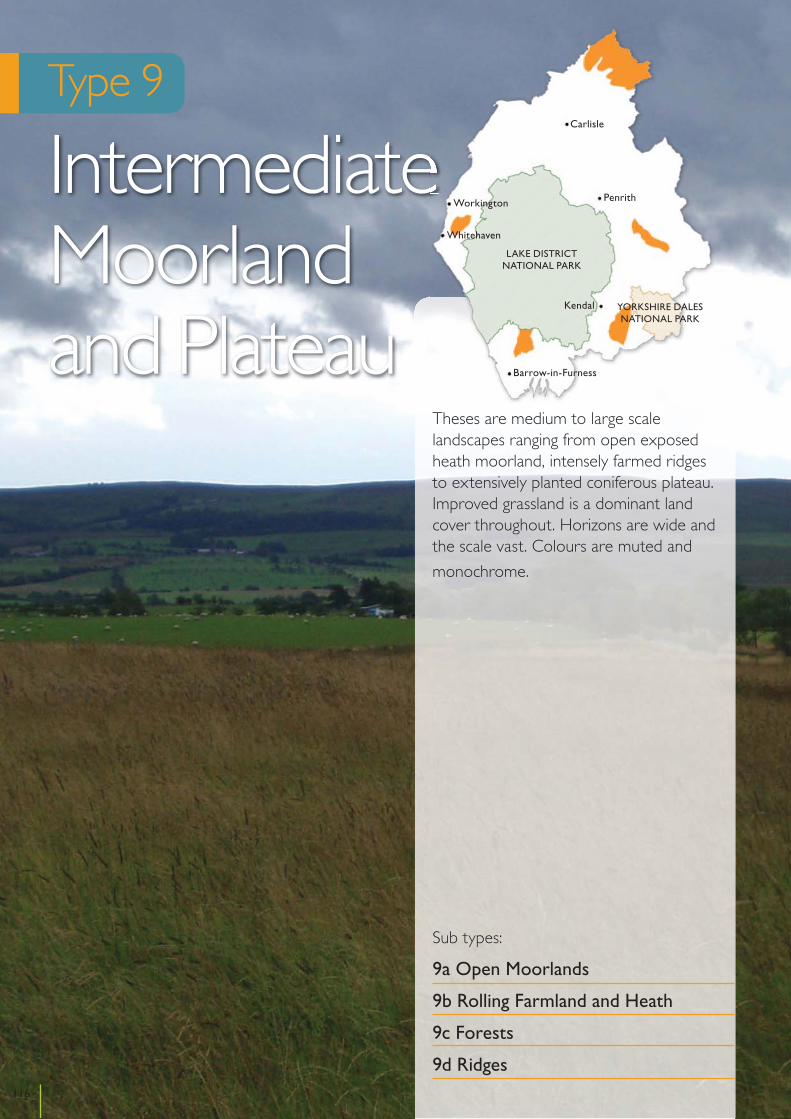
Cumbria Landscape Character Assessment
Type 9
Intermediate Moorland and Plateau
Theses are medium to large scale landscapes ranging from open exposed heath moorland, intensely farmed ridges to extensively planted coniferous plateau. Improved grassland is a dominant land cover throughout. Horizons are wide and the scale vast. Colours are muted and
monochrome.
Sub types:
9a Open Moorlands
9b Rolling Farmland and Heath
9c Forests
9d Ridges116
Kendal
Penrith
Carlisle
Workington
Whitehaven
Barrow-in-Furness
YORKSHIRE DALESNATIONAL PARK
LAKE DISTRICTNATIONAL PARK
Location
This sub type is found between Kershope Forest and Spadeadam Forest near Bewcastle in the north, and to the east of Distington and Frizington on the west coast.
Key Characteristics
• High mostly open landscapes • Undulating semi-improved and unimproved pasture• Open rough moorland• Areas of deciduous woodland• Areas of peat and raised mire
Physical character
There is a mixture of Carboniferous gritstone and mudstone overlain by large areas of peat in the north and coal measures and Permian sandstone with pockets of peat in the west. In the north undulating land is found at between 150-250m AOD with parts rising steeply to 500m. It is intersected by becks, streams and rivers. In the west the topography is less undulating and rises to around 200m adjacent to a moorland ridge and the River Keekle cuts through the landscape and helps define the boundary with the moorland ridge.
Land cover and land use
This is a high, generally open landscape. The predominant land cover is a mixture of semi-improved pasture in large rectangular ‘lots’ and extensive areas of unimproved and unfenced moorland. In some places the open moorland has been semi improved for farmland and has a more managed character. This is typically found in the west. Fields are mainly bounded by species rich hedges with hedgerow trees or wire fences. Areas of wet mossland intersperse the pasture and moorland and retain a wilder and more unmanaged character.
Deciduous and semi natural woodland can be found in small pockets, shelterbelts and along streams and becks in the more sheltered valleys. These often have straight, crisp edges. In the north the distinct lack of conifer plantations contrasts with the adjacent landscapes and helps define its boundaries.
The lower parts of the landscape are lightly settled, either with small settlements or dispersed, isolated properties. Roads are rural in character and skirt around the lower parts. Pylons run through the west and form prominent vertical features in the open farm and moorland. In the west there is evidence of past mining activities but much of the land has been restored to pasture and moorland.
Ecology
This is a landscape of rough pasture with extensive areas of rush pasture and purple moor-grass and areas of acid grassland. Upland oak woodland is present in steep river valleys and one of the largest areas of alder wet woodland in Cumbria is found south of Bewcastle. Areas of upland heathland are occasional to rare in this landscape, whilst blanket bog is extensive south-east and north-east of Bewcastle. Species-rich springs and flushes are locally frequent, particularly where there is a calcareous influence to the irrigating waters. In the west this landscape provides over wintering habitat for internationally important numbers of Hen Harriers.
Historic and cultural character
The settlement pattern is generally dispersed with some clusters of 19th century industrial workers housing. The fields are often large and formed by late moorland enclosure. There is good preservation of earthworks including prehistoric settlements and medieval shielings. The landscape type features remains associated with the
117
Cumbria Landscape Character Assessment
Sub type 9a
Open Moorlands
border, including fortified sites, Roman roads and forts and evidence of coal mining around Moresby.
Perceptual character
In the north the large open landscapes give a feeling of remoteness and the darker, rougher moorland contrasts with the greener, smoother improved pasture. The changes in colour and texture and feeling of remoteness can be accentuated by changes in the seasons and weather. Views stretch to the Scottish Hills and are uncluttered and framed by forest. In the west the landscape still feels large and open but less remote due to its more managed look and past uses. However sudden changes to poor weather can lead to a feeling of remoteness in higher areas. Despite the row of pylons it retains large expansive views of the Lakeland Fells which provide a dramatic backdrop to the landscape.
Sensitive characteristics or features
The open character and expansive views across moorland and higher farmed areas are sensitive to large scale infrastructure development that could obscure or significantly interrupt the views. The small wooded valleys and shelterbelts that intersperse the open moorland and farmland are sensitive to changes in land management. The species rich hedgerows and wet mossland and flushes that provide biodiversity interest away from moorland and the archaeological remains and earthworks that provide cultural interest are sensitive to changes in land management. Contrast of rough moorland with improved pasture provides interest and is sensitive to changes in land management.
Vision
This landscape will be enhanced through restoration and enrichment creating a harmonious balance between the moorlands and woodlands and mining and agricultural features. Semi-natural grassland will be conserved and enhanced, fragmented patterns of rough moorland will be repaired, areas of blanket bog will be restored and semi-derelict pastoral fields will be allowed to revert back to moorland. Degraded areas and neglected
sections of landscape will be restored back to their former beauty through the creation of new landscape features including woodland, wetland and strengthened hedgerow patterns.
Changes in the Landscape
Over the next 10 – 20 years this landscape could be subject to the following changes or issues:
Climate Change• Climate change mitigation and the Government’s
commitment to an increase in renewable energy could see increased interest in large scale wind energy schemes and short rotation coppicing and forestry.
• Areas of active blanket bog and peat provide the best carbon sinks after woodland and can assist with carbon sequestration.
Management Practices• Agricultural intensification and inappropriate
management such as overgrazing, burning and drainage could result in the loss of moorland, semi natural grassland, woodland, wetland and stream features.
• Future agri-environment schemes may support beneficial changes in the landscape.
• Planned and incremental expansion of villages could result in the loss of landscape features and field patterns.
Development • Large scale wind energy infrastructure developments
and other vertical structures such as, communication masts, pylons or overhead transmission lines could erode the open and remote character of the landscape and reduce the nature conservation interest.
• As energy markets change there could be new interest in open cast coal mining which could arise in temporary landscape change.
Access and Recreation• Informal recreation is likely to continue along public
rights of way and across the extensive areas of open access land.
118
Cumbria Landscape Character Guidance – Sub type 9a: Open Moorlands
Guidelines
Climate Change• Forestry and coppice planting should reflect any field
patterns and the grain of the landscape. They should be sited and designed so that they integrate well with the landscape, retain the open moorland character and do not sit as large unbroken blocks of planting.
• Projects should be encouraged that seek to improve the condition of areas of peat to optimise their carbon capture potential.
Natural Features• Investigate presence of remnant heather and
regenerate through management programmes.• Manage semi-natural grassland to enhance biological
diversity including controlled light grazing, control of bracken and rushes.
• Restrict further agricultural improvement of moorland and unimproved pasture including ploughing, reseeding application of fertiliser, liming or herbicide treatment.
• Enhance and/or recreate wetland including flushes, small tarns and marshy hollows. This may include preventing drainage improvements and blocking existing drains to maintain a high water level, preventing overgrazing and poaching by stock and controlling scrub encroachment.
• Protect gills and becks from stock to encourage development of diverse ground flora.
• Manage areas of blanket bog appropriately and sensitively including the reduction of stocking levels, blocking ditches, removal of conifers and avoidance of burning.
• Ensure habitat connectivity is a priority and the introduction of eco-corridors or ‘islands’ to create habitats in association with Biodiversity Action Plans (BAP).
• Create a mosaic of irregular shaped areas of mixed woodland sensitive to land form particularly on former areas of coal working and on marginal land and valleys.
• Create woodland belts as sheltered areas suitable as wildlife habitats and for establishment of native woodland.
Cultural Features• Maintain and enhance the pattern of hedgerows with
additional planting and supplementary planting of
scanty hedgerows.• Consider the removal of derelict hedgerows on the
more exposed parts to allow reversion to open moorland.
• Planting of deciduous trees as feature trees, within hedgerows, along water courses and in tree groups to create more interest in the landscape and to act as a foil to the coniferous woodland in the background.
• Create ecological corridors to enhance landscape and nature conservation value.
• Encourage planting and traditional management of hedgerows and replace fences where possible with hedgerows.
Development• Avoid siting development on prominent edges of the
plateau taking advantage of the natural containment offered by intermediate ridges and horizons.
• Minimise the impact of development by careful siting and design and seek environmental gains such as heather moorland restoration.
• Carefully manage the expansion of major developments such as quarrying, mining, opencast coal (due to the location of the resource).
• Avoid siting large scale wind energy, and other vertical structures such as telecommunications masts, pylons and overhead transmission lines in open and prominent areas where it could degrade the open and expansive character. They should be sited to prevent visual clutter with existing pylons.
• Minimise adverse effects of tall and vertical structures such as pylons and turbines through careful siting and managing the numbers of turbines to prevent them becoming a dominant feature in the landscape.
• Ensure new development respects the local landscape character and vernacular.
Access and Recreation• Public rights of way and access to open access land
should be well maintained to allow quiet enjoyment and appreciation of the areas.
• Opportunities should be developed to promote and enhance existing recreation routes by improving waymarking, providing appropriate surfacing, gates and gaps and interpretation.
119
Cumbria Landscape Character Guidance – Sub type 9a: Open Moorlands
Location
This sub type can be found in the east of the county south of Appleby running alongside the Eden Valley, and in the south of the county to the east of the M6 motorway near Kendal and Kirkby Lonsdale. A small part of this type adjacent to the Lune Valley meets the criteria for National Park designation and is being considered for designation in 2010/11.
Key Characteristics
• Shallow relief plateau with ridges and hollows• Rolling farmland• Occasional rocky outcrops • Rough pasture with wet flushes and semi heathland• Coniferous plantations• Narrow wooded valleys with wetland features
Physical character
The geology is a mixture of Carboniferous limestone and Silurian slates and gritstones. The land is relatively high, rising between 150-250m AOD. The underlying limestone geology gives rise to a rolling appearance in the east and a plateau landscape where the Silurian rocks occur between the Kent and Lune Valleys. The plateau has a shallow relief of ridges and hollows and occasional rocky outcrops and a knobbly outline to the ridges.
Land cover and land use
There is a varied land cover pattern with improved pasture dominant in lower parts. Medium sized fields are enclosed by hedges, some with significant hedgerow trees, and to a lesser extent, stone walls. In higher parts and along ridge tops rough and poorly drained pasture is dominant, often interspersed with patches of heather,
bracken or rushes. The land is intersected by streams, tarns and marshy hollows.
The landscape is punctuated by small and medium sized coniferous plantations particularly on the higher ground. Small deciduous woodland is evident but sparse, and gorse and willow scrub can often be found.
Small villages, scattered hamlets and farms are connected by a network of rural roads that cut across the landscape. Masts and pylons have begun to change the character in some areas in the south. The Settle to Carlisle railway forms a liner feature crossing the landscape in the east, and Killington Reservoir is an important manmade feature in the south.
Ecology
This is a landscape of rough and improved pasture containing areas of rush pasture and purple moor-grass, upland heathland and acid grassland. Of note in the area south of Killington Reservoir is the presence of a series of small raised bogs, whilst conifer plantations in this area provide nest sites for long-eared owl. Species-rich roadside verges are a feature of this landscape south of Appleby and above the Lune valley.
Historic and cultural character
In the south there is a dispersed settlement pattern with limestone built farmsteads often featuring date stones on both houses and farm buildings. In general buildings date from the late 17th century onwards. The field system is a mixture of ancient, former common arable and parliamentary enclosure. In the east, however, the settlement pattern is based on nucleated villages with a field pattern of early enclosures often containing fossilised strips.
120
Cumbria Landscape Character Assessment
Sub type 9b
Rolling Farmland and Heath

Perceptual character
The landscape is medium to large scale and open. On higher land there are some wide views of surrounding fell and dale tops, adjacent valleys and, in the south, across to Morecambe Bay. Despite the introduction of some large scale vertical discordant features, the limited nature of these enables the landscape to retain the feeling of a peaceful, working farmland. Seasonal changes bring contrasts in colours between rough and improved pasture, heather and bracken and changes in weather can provide a feeling of containment when long views are obscured.
Sensitive characteristics or features
Open ridges along plateau edges and expansive views to the Yorkshire Dales, Lakeland Fells and Morecambe Bay are sensitive to poorly sited and scaled development, including large scale infrastructure development. The matrix of hedges and walls that reinforce the field pattern and contrast with more open and rough pasture found in higher parts are sensitive to changes in land management. The peaceful countryside character is sensitive to agricultural intensification and changes in land use.
Vision
This landscape will be enhanced and the core of rough heath and grassland will be retained. The visual contrast between the open rolling farmland and the heath will be strengthened. The existing rough grassland and features, such as marshy hollows, will be maintained. Remnant heath will be conserved and enhanced and adjacent improved land will be allowed to revert back to heath where fragmentation has occurred. Woodland areas will be expanded as an alternative to agriculture as this will make a positive contribution to the landscape. Only development which is of high quality and can be contained by the natural rolling topography will be accepted and the uncluttered natural character of the rolling farmland and heath will be conserved.
Changes in the Landscape
Over the next 10 – 20 years this landscape could be subject to the following changes or issues:
Climate Change• Climate change mitigation could see increased interest
in short rotation coppicing and forestry.
Management Practices• Agricultural improvements on marginal land, and
pressure to convert semi-natural areas to improved pasture.
• Localised symptoms of neglect including dilapidated walls, replacement of hedge and walls by fences, and grazed farm woodlands.
Development• The Government’s commitment to an increase in
renewable energy could see growing pressure for energy infrastructure developments such as large scale wind turbines.
• Upgrades to the national grid and new pylons, communication masts and caravan parks could also erode the character of the area.
• The M6 corridor as an element in the landscape could have the potential to attract new large scale commercial development. Improvements to surfacing, lighting and information systems along the motorway could affects its appearance and people’s awareness of it in the landscape.
Access and Recreation• Public rights of way provide a network of routes
that enable quiet appreciation and enjoyment of the countryside. Ongoing maintenance is needed to support this network in the future.
• Current farm stewardship grants provide the opportunity to develop more public access in the countryside. Future grant or other programmes may continue to support this.
Guidelines
Climate Change• Forestry and coppice planting should reflect any field
patterns and the grain of the landscape. They should be sited and designed so that they integrate well with
121
Cumbria Landscape Character Guidance – Sub type 9b: Rolling Farmland and Heath

the landscape, retain the open moorland character and do not sit as large unbroken blocks of planting.
Natural Features• Regenerate suppressed heather through management
programmes including reduction of stocking levels, control of bracken, phased cutting and burning.
• Manage semi-natural acidic grassland to enhance biological diversity including controlled light grazing.
• Cease further agricultural improvement including ploughing, reseeding, application of fertiliser, liming or herbicide treatment.
• Recreate heath or rough grassland on land which has been ‘improved’ to pasture to strengthen the continuity of semi-natural land cover. This may involve cultivation to expose peat soils, spreading heather cuttings with ripe seed from nearby moorland and initially excluding stock.
• Re-create and enhance wetland including flushes, small tarns and marshy hollows. This may include preventing drainage improvements and blocking existing drains to maintain high water levels, preventing overgrazing and poaching by stock, controlling scrub encroachment.
• Protect gills and becks from stock to encourage development of diverse ground flora, scattered trees and woodland.
• Protect rocky outcrops by preventing removal or disturbance and controlling scrub encroachment.
• Restore the matrices of hedgerows closer to plantations.
• Conserve and reinforce ancient woodland in valleys and field boundary trees at lower levels.
• Restore and reinforce existing grazed broadleaf and mixed woodlands by exclusion of livestock, natural regeneration, restocking of plantations.
• Ameliorate existing coniferous plantations including softening geometric outlines, introduction of open spaces and species diversification.
• Establish new medium scale mixed and broad-leaved plantations aligned to respect and enhance the topographic pattern of interlocking ridges and reduce the visual dominance of transmission lines and masts. Avoid planting on heath, species rich grassland and wetland.
• Plant new field boundary trees to replace maturing stock using indigenous species.
Cultural Features• Restore and maintain dry stone walls and hedges
enclosing improved farmland where they are a key feature.
• Strongly discourage the removal of hedges and stone walls and introduction of fences.
Development• Avoid siting development on prominent edges of the
plateau taking advantage of the natural containment offered by intermediate ridges and horizons.
• Resist cluttering of further communication masts or large scale wind turbines, particularly on valley rims.
• Ensure new development respects the local landscape character and vernacular.
• Reduce the impact of new farm buildings by careful siting and design, including choice of finishes and appropriate planting.
• Encourage the appropriate management of new farm development such as slurry and silage tanks to minimise their impact on local character.
• Avoid siting large scale wind energy, other vertical structures such as telecommunications masts, pylons and overhead transmission lines in open and prominent areas where it could degrade the rural character of the area and affect sensitive views.
• Retain the rural character of the M6 corridor by resisting large scale commercial development, and ensuring new motorway infrastructure such as information signs and necessary lighting is sited to minimise adverse effects on open parts of the landscape. Noise pollution should be mitigated against through careful selection of surface materials.
Access and Recreation• Public rights of way should be well maintained and
quiet recreational areas and facilities should be improved and developed to be compatible with the pastoral character of this sub type.
• Seek opportunities to enhance access to farmland through farm stewardship or other schemes.
• Promote and enhance existing recreation routes by improving waymarking, providing appropriate surfacing, gates and gaps and interpretation.
122
Cumbria Landscape Character Guidance – Sub type 9b: Rolling Farmland and Heath
Location
This sub type is found in the north of the county at Kershope and Spadeadam Forests.
Key Characteristics
• Areas of high rolling or undulating moorland and plateau
• Large areas of coniferous planting • Some open attractive areas on forest edge • Extensive views towards distant hills and craggy scarps
Physical character
The geology is mainly Carboniferous sandstone and gritstone overlain by peat. The land is high rolling or undulating moorland and plateau. It rises from around 150m to 520m AOD.
Land cover and land use
The landscape is extensively planted with coniferous forest. Its character changes with the management cycles of clear felling and replanting. The forests are made up of large and extensive planting blocks with firebreaks and access roads. There is little variation in tree species and sitka spruce dominates. Within the forests open space is sparse and often limited to remnants of simple moorland that are found around the periphery of the forests.
Around the edge of the forest there are areas of farmland with a mixture of improved, semi improved and marshy pasture. Fields are large and regular in shape. Where the fields are bound by hedges there is a strong matrix field pattern. Some hedges have been replaced by wire fences. The field pattern and hedges tend to weaken closer to the plantations.
Settlement is sparse. Isolated farmsteads and dwellings are found at the edges of the forests. Part of Spadeadam Forest is used for military purposes and its associated roads, security fences, buildings and overhead power lines influence the landscape character.
Ecology
Extensive coniferous plantation dominates this landscape and provides nest sites for goshawk and a reserve for red squirrels. Within and around the edges of these plantations there are large areas of blanket bog, rush pasture, purple moor-grass and small raised bogs. These are particularly extensive in Spadeadam Forest. Isolated areas of hay meadow and wet woodland are present in the upper reaches of the River Irthing. Species-rich springs and flushes are present where there is a calcareous influence to the irrigating waters and support species such as small white orchid.
Historic and cultural character
The landscape remains largely unenclosed and the settlement pattern is largely dispersed and post-medieval in origin. A number of the farms originated as bastles in the late sixteenth and early seventeenth centuries. Prehistoric sites including burial cairns are relatively common. Other important potential heritage sites include 20th century military sites such as the Blue Streak missile testing range at Spadeadam. In the 1950’s Spadeadam was the test location for the “Blue Streak” missile project, the equivalent to the American Atlas missile. It was suddenly cancelled in 1960. Britain attempted to salvage the project by utilising the “Blue Streak” technology to enter the Space Race and form the first stage of a satellite launcher.
123
Cumbria Landscape Character Assessment
Sub type 9c
Forests

Perceptual character
The forests have a feeling of remoteness, wildness, tranquility and space at the moorland edges. Changes in the weather can accentuate these feelings. At the forest edges horizons are wide and the scale vast with extensive views towards distant hills and craggy scarps. Within the forests views are limited but the continuous tree cover provides a feeling of remoteness.
Sensitive characteristics or features
The peripheral areas of blanket bog, heathland and moorland provide contrast to the large scale and uniform plantations and are sensitive to changes in land management and additional forestry plantations. The simple dispersed settlement pattern is sensitive to expansion. The expansive views and sense of openness from forest edges to distant hills is sensitive to enclosure or interruption from significant infrastructure development. The remote feeling in forests and along edges arising from a lack of development is sensitive to intensification of land use.
Vision
The forest landscape, adjacent moorland and farming areas will be enhanced. Recreation within these areas will be increased where opportunities present themselves and, there will be an increase in nature conservation interest of upland mire habitats both inside and outside the forests. The detrimental visual impact of remaining military areas will be reduced through careful restoration or redevelopment. The visual containment of the forests will provide limited opportunity for some wind energy development which will be combined with moorland reinstatement and complementary forest management. Natural features, field boundary patterns and traditional farm buildings will all be enhanced to further improve the characteristics of the farming landscape.
Changes in the Landscape
Over the next 10 – 20 years this landscape could be subject to the following changes or issues:
Climate Change• Climate change mitigation could see a shift to short
rotation forestry. • Areas of active blanket bog and peat provide the
best carbon sinks after woodland and can assist with carbon sequestration.
Management Practices• Within publicly owned forest, Forest Design Plans
are reducing the impact of cycles of clear felling, creating open spaces and restoration of raised mires and seeking to introduce native species, particularly on Plantations with Ancient Woodlands (PAWS). Improvements are taking place within privately owned woods as management plans are developed.
• There could be a possible threat to upland mires through forestry expansion or agricultural improvement.
• Hedges are being replaced by wire fences as farming practices change.
Development• There is interest in wind energy development in the
area due to its exposure and relative remoteness.• The future use of military areas at Spadeadam may
need careful consideration to limit adverse effects on landscape character.
Access and Recreation• Public rights of way and areas of open access land
provide a network of routes that enable quiet appreciation and enjoyment of the countryside. Ongoing maintenance is needed to support this network in the future.
Guidelines
Climate Change• Forestry planting should reflect any field patterns
and the grain of the landscape. They should be sited and designed so that they integrate well with the landscape and retain the open moorland character.
• Projects should be encouraged that seek to improve the condition of areas of peat to optimise their carbon capture potential.
124
Cumbria Landscape Character Guidance – Sub type 9c: Forests

Natural Features• Increase planting of deciduous trees as feature trees,
within hedgerows, along water courses and in tree groups to act as a foil to the dominant coniferous woodland in the background.
• Create linked networks of vegetation to enhance nature conservation value and their use as ecological corridors and links with the adjacent forest area.
• Adopt sensitive felling cycles to reduce the impact of clear felling and re-shape forests to enhance topographic variations of scarps, plateaus and lower foothills and vistas of crags and tors.
• Protect and enhance natural areas and mires peripheral to the forested areas and natural crags or tors from masking by forests.
• Remove conifers from areas of high nature conservation interest such as blanket mire.
• Extend the forestry management policies to encourage recreation.
• Relieve the overwhelming green of the predominantly sitka spruce stands with more open areas, change in species, colour contrast, inclusion of deciduous species in appropriate locations and introduction of focal points and features of interest including suitable trees for long term retention.
• Use of broadleaf species along the river valley sides to give definition to the water course rather than disguise it and encourage the development of riverside habitats.
Cultural Features• In fields adjacent to forests and woodland, enhance
the pattern of hedgerows with additional planting and supplementary planting of poor hedgerows.
• Forestry activities should avoid damage to upstanding archaeological remains, and clear tree growth away from them when opportunities arise.
Development• Wind energy infrastructure should be sited and
designed to reduce any adverse landscape and visual effects, particularly to the dispersed population.
• Create landscape buffer zones between the military areas and the surrounding forest landscape.
• Encourage partnership arrangements between Forest Enterprise, MOD, Local Authorities and conservation bodies to develop and monitor long term landscape and nature conservation plans.
Access and Recreation• Public rights of way and access to open access land
should be well maintained to allow quiet enjoyment and appreciation of the areas.
• Establish points of orientation for recreation purposes and enhance the networks of footpath, bridleway and cycleway links.
• Seek opportunities to enhance access to farmland through farm stewardship or other schemes.
125
Cumbria Landscape Character Guidance – Sub type 9c: Forests
Location
This sub type is found in two parts of the county. In the west it is found at Dean Moor and High Park, north of Cleator Moor. In the south it is found to the north west of Ulverston and north east of Askam in Furness.
Key Characteristics
• Distinct ridges • Extensive areas of true heathland moorland• Improved pasture with distinctive stone walls• Woodland and small belts of trees form prominent
features
Physical character
In the west the geology is a mixture of coal measure and sandstone, and in the south there is a mixture of Silurian and Igneous rocks. Distinct ridges rise to around 300m AOD at the highest point. The ridges are steep sided and include a number of rounded hill summits that vary in height. The ridges have a strong topographical and geological link with adjacent higher low fell and fringe areas.
Land cover and land use
The landscape is a mixture of true heather moorland and a more managed farmed landscape. Unmanaged heather cover or bracken on higher ground gives way to pasture on the lower slopes. The improved pasture can be found in distinct rectangular fields bounded by strong stone walls. These form a prominent local feature against the open and unimproved moorland.
Tree cover is sparse and limited to a few remnants of old woodland and small belts of trees. These form strong local features in the open moorland. Streams, becks and tarns form wetland features.
Settlement is scarce. Isolated farmsteads and hamlets are scattered along the sides of the ridges. The landscape has been shaped by man in several ways and features linked to including open cast mining (now restored), quarrying, reservoirs and energy infrastructure intersperse the open moorland and farmed pasture. These introduce a significant man made character to parts of the landscape. In particular the large scale wind turbines and pylons form prominent vertical features.
Ecology
Areas of moorland are present on the higher sections of these ridges, with upland heathland dominant on Kirkby Moor and rush pasture and purple moor-grass dominant on High Park. The lower slopes support rush pastures and swamp, together with improved grassland. These support a range of invertebrates and birds including Curlew, Skylark, Plover and Lapwing. Steeply incised valleys support small upland oak woodlands. Kirkby Moor provides a southwest outpost for red grouse in Cumbria.
Historic and cultural character
Settlement is sparse but in the lower areas is generally nucleated whereas higher up it is dispersed and later in origin. Lower down the fields are irregular and often small, but on higher land they are generally regular and a product of late enclosure. Unenclosed moorland is still evident in the south. The landscape is strongly affected by large-scale quarrying with the quarries at Bannishead being a particularly distinctive feature. Other characteristic archaeological remains are prehistoric settlements and burial cairns.
126
Cumbria Landscape Character Assessment
Sub type 9d
Ridges

Perceptual character
These are generally open, large scale landscapes. The unenclosed moorland gives a feeling of wildness. Views are often wide and expansive and uninterrupted and striking views of the Lakeland Fells and Duddon Estuary and Morecambe Bay provide drama and reinforce the sense of wildness. Changes in weather conditions can accentuate the sense of wildness.
Sensitive characteristics or features
The open and distinct ridges and heather moorland and wide and expansive uninterrupted views to sea and the Lakeland Fells provide a sense of wildness that are sensitive to changes in land management and significant infrastructure development.
Vision
This landscape will be conserved and enhanced. Development will be carefully controlled in order to ensure ridges aren’t cluttered or dominated by new development. The fragmenting pattern of rough moorland will be repaired, significantly enriching the wildlife and visual interest of these areas. The remnant heather and rough pasture will be improved and extended. Existing features will be enhanced and new features will be created such as tarns, wetlands and small woods creating dramatic focal features in a predominantly open landscape. The pattern of stone walls, hedges and woodlands on lower slopes will be conserved and maintained.
Changes in the Landscape
Over the next 10 – 20 years this landscape could be subject to the following changes or issues:
Management Practices• Surface scarring could occur from quarrying and any
move back towards open cast coal mining. • Much of the original moorland has been lost and
remnant patches of heather continue to decline under agricultural pressures of overgrazing and conversion to pasture.
• Marginal land could be abandoned by farmers giving the potential for uplands to revert back to moorland.
• There has been a continued replacement of hedges by fences in the areas that are more intensively farmed.
• Changes to drainage methods and an increase in fertiliser can affect wetland areas.
• Overgrazing and under grazing can reduce and fragment areas of unimproved grassland, heathland and wetlands.
Development• The Government’s commitment to an increase in
renewable energy could see increased interest in large scale wind energy schemes. The cumulative effects of schemes could have a significant adverse effect on the character of the area.
• As energy markets change there could be new interest in open cast coal mining.
Access and Recreation• Public rights of way provide a network of routes
that enable quiet appreciation and enjoyment of the countryside. Ongoing maintenance is needed to support this network in the future.
• Current farm stewardship grants provide the opportunity to develop more public access in the countryside. Future grant or other programmes may continue to support this.
Guidelines
Natural Features• Regenerate suppressed heather on moorland
tops through management programmes including reduction in stocking levels, control of bracken, phased cutting and burning.
• Regenerate rough pasture on land which has been ‘improved’ through controlled light grazing and control of bracken and rushes.
• Restrict further agricultural improvement including ploughing, re-seeding, application of fertiliser, liming or herbicide treatment.
• Recreate heather moorland on land which has been ‘improved’ to pasture to provide continuity of heather cover. This may involve cultivation to expose peat soils, spreading heather cuttings with ripe seed from a local source and excluding stock until heather establishes.
127
Cumbria Landscape Character Guidance – Sub type 9d: Ridges
• Enhance and/or recreate wetland including flushes, small tarns and bog pools. This may include preventing drainage improvements and blocking existing drains to maintain high water levels preventing overgrazing and poaching by stock.
• Protect gills and becks from stock to encourage development of diverse ground flora, scattered trees and woodland.
• Enhance existing reservoirs to soften hard engineering details and integrate with adjacent moorland.
• Restore and reinforce semi-natural moorland top and gill woodlands by exclusion of livestock, natural regeneration, restocking and appropriate management.
• Undertake small scale planting concentrated around farmhouses.
Cultural Features• Manage stonewalls and hedges in a traditional way.• Strongly discourage the introduction of fences as
replacement boundaries or to sub-divide large fields. Remove fences to restore large-scale allotment rough pastures
Development• Minimise the impact of development by careful siting
and design and seek environmental gains such as heather and moorland restoration.
• Avoid siting large scale wind energy, other vertical structures such as telecommunications masts, pylons and overhead transmission lines in open and prominent areas where it could degrade the open and expansive character.
• Carefully manage the expansion of major developments such as quarrying, mining, communication masts, large scale wind energy development and energy transmission lines.
• Minimise the impact of surface scarring from quarrying and opencast mining where possible through careful screening or siting.
• Ensure any re-establishment of opencast coal sites is managed and maintained in relation to local character.
Access and Recreation• Public rights of way should be well maintained and
quiet recreational areas and facilities should be improved and developed to be compatible with the pastoral character of this sub type.
• Seek opportunities to enhance access to farmland through farm stewardship or other schemes.
• Promote and enhance existing recreation routes by improving waymarking, providing appropriate surfacing, gates and gaps and interpretation.
128
Cumbria Landscape Character Guidance – Sub type 9d: Ridges

129

Cumbria Landscape Character Assessment
Type 10
Sandstone Ridge
This landscape consists of a sandstone ridge running north from Penrith breaking off into a series of hills north of Lazonby.
This open, large-scale landscape has a varied character including improved farmland, conifer plantation and unimproved heathland. Open expansive views are present both toward and away from the Lake District National Park.
130
Kendal
Penrith
Carlisle
Workington
Whitehaven
Barrow-in-Furness
YORKSHIRE DALESNATIONAL PARK
LAKE DISTRICTNATIONAL PARK
Location
This landscape consists of a sandstone ridge running from Cotehill to Whinfell, south of Penrith.
Key Characteristics
• Prominent north south ridge • Improved pasture with a mosaic field pattern• Conifer plantation blocks and mixed woodland
punctuate farm and heathland• Significant areas of improved heathland • Open, expansive long distance views
Physical character
The ridge of Permo Triassic sandstone is overlain by fluvial glacial deposits and has some scientifically important sandstone exposures. The ridge forms a distinctive landform with a number of hill and fell summits. These vary in height from 100-300m AOD. The southern part of the ridge including Beacon Hill and Lazonby Fell is most pronounced and Whinfell forms an outlier to the south of Penrith. North of Lazonby Fell it breaks into a series of isolated hills. Here the ridge is partly intersected by the Eden Gorge which forms a dramatic feature on the east side.
Land cover and land use
Land cover is dominated by improved farmland along the lower parts of the ridge with large blocks of conifer plantations and mixed deciduous woodlands on the middle and upper parts of the ridge. These are interspersed along the length of the ridge hill and fell summits by significant areas of unimproved heathland.
The pasture fields are generally regular in shape and medium to large in scale. They are often bounded by hedges, particularly in the northern part of the ridge, or stone walls which are more common in the southern part of the ridge. The strong field boundaries form a geometric mosaic around the large scale plantations or areas of open heathland. The type generally lacks clear ‘historic’ field patterns and in recent years farming out
by ‘open range’ methods has resulted in a neglect of some field boundaries.
The deciduous woodlands provide contrast and sometimes soften the edges of the more angular, large scale coniferous plantations. Woodland shelterbelts can form linear features across the ridges which reinforce the geometric patterning of the fields.
Roads run along and across the ridge between the summits. These are straight and wide and are often enclosed by tree belts of hawthorn, rowan and birch and species rich hedges. These connect isolated farmsteads and dwellings which usually nestle in dips and hollows away from the ridge tops. Some farmsteads have new uncharacteristic farm entrances and large-scale modern farm buildings. Otherwise settlement is limited.
Other development includes a small number of telecommunications masts located in prominent ridge top locations, with pylons running more discretely across the ridge along dips between the summits.
Ecology
This ridge supports the main areas of lowland heathland in Cumbria on Wanfell and Lazonby Fell. Whilst most of the conifer plantations are of limited ecological interest, those found to the south of Penrith support a range of uncommon plants associated with native Scot’s pine woodland, including northern bilberry, creeping lady’s tresses and common wintergreen. These also provide a resource for red squirrels. A basin mire supporting a range of uncommon and rare mire species, including lesser tussock sedge is also present on the southern end of the ridge. Rush pasture is occasionally present. At the northern end of the ridge a series of ponds and wetlands formed by mineral extraction support a range of swamp and fen communities.
Historic and cultural character
Settlement is sparse but mainly nucleated. Buildings are of sandstone. The field pattern is regular and of 19th century origin. The area was historically sparsely populated and was formerly used as medieval hunting preserves, either as forest or deer park. However
131
Cumbria Landscape Character Guidance – Type 10: Sandstone Ridge

most of these characteristics have been lost to modern plantations and field enclosures.
Perceptual character
This is a large scale, open landscape with a mixture of open and rough areas with colourful patches of heather and smoother managed pastoral fields. Tree lined roads provide a feeling of enclosure in places. Seasonal changes can accentuate the colour and contrasts between the heathland, woodland and managed fields. There are large and expansive uninterrupted long distance views over the Petteril valley to the Lake District and the Eden Valley towards the North Pennines. The ridge is particularly prominent from the M6 corridor to the west from where it provides a mainly afforested skyline.
Sensitive characteristics or features
The summit and ridge top areas of heathland and geometric mosiac of fields and boundaries and woodland shelterbelts are sensitive to changes in land management and large scale infrastructure development. The strong road enclosure from woodlands and hedges is sensitive to improvements to highway safety and access to new development. Discretely sited small scale vernacular settlements are sensitive to unsympathetic expansion.
Vision
The important features of this landscape will be enhanced and restored. Forests will be managed in this visually prominent landscape to create a more natural character, softening the edges of coniferous plantation with deciduous species. The remaining areas of open ridge will be conserved and cluttering with vertical structures will be resisted. Stone walls and hedgerows within farmland, remnant sandstone heath and semi-natural acidic grassland will be conserved, expanded and restored. Wetlands will be conserved and re-created along with other natural features enriching the visual and wildlife diversity.
Changes in the Landscape
Over the next 10 – 20 years this landscape could be subject to the following changes or issues:
Climate Change• There could be increased interest in the planting
of energy crops to support renewable energy generation. Energy crops could include miscanthus, short rotation coppice (usually willow) or short rotation forestry of fast growing tree species to provide biomass for electricity production and heat. Large scale planting or planting in sensitive locations could change the character of this landscape. Opportunities could also arise to bring woodland into better management to support the biomass and wood fuel markets.
• Farming practices could change if temperatures rise and it is more effective to grow arable crops.
Management Practices• Agricultural improvements have led to an increase in
the number of native cattle, but the loss or neglect of hedgerows and walls and wetland habitats.
• There could be future pressures for arable intensification to help with food security and an increase in popularity for community farming and allotment schemes.
• There has been a loss of considerable areas of dry heathland to afforestation in the past.
Development• Telecommunications masts have been erected on
some prominent ridge tops without harming the overall character of the landscape. However, as the higher parts of the landscape is open and is likely to have good wind speeds, interest in wind energy is likely to increase in response to changes in technology and the Government’s commitment to renewable energy provision.
• The nearby M6 corridor could have the potential to attract new large scale commercial development. Improvements to surfacing, lighting and information systems along the motorway could affects its appearance and people’s awareness of it in adjacent landscapes such as this.
• Pressure for sand extraction could lead to loss of boundaries and affect the character of the landscape.
132
Cumbria Landscape Character Guidance – Type 10: Sandstone Ridge
Access and Recreation• Public rights of way and areas of open access land
provide a network of routes that enable quiet appreciation and enjoyment of the countryside. Ongoing maintenance is needed to support this network in the future.
• The Oasis holiday complex at Whinfell, though generally inconspicuous, could possibly create localised recreational pressures, particularly if expanded.
Guidelines
Climate Change• Encourage biomass planting of a scale that respects
the local characteristics. Edges to forestry or coppicing should respect existing field boundaries and be designed to reflect the general grain of the land.
Natural Features• Recreate and enhance wetland including flushes,
small tarns and marshy hollows. This may include preventing drainage improvements and blocking existing drains to maintain high water levels, preventing overgrazing and poaching by stock, controlling scrub encroachment.
• Encourage regeneration of suppressed heather through management programmes including reduction of stocking levels, control of bracken, phased cutting and burning.
• Encourage management of semi-natural acidic grassland to enhance biological diversity including controlled light grazing, control of bracken and rushes.
• Strongly discourage further agricultural improvement including ploughing, reseeding, application of fertiliser, liming or herbicide treatment.
• Encourage the re-creation of heath or rough grassland on land which has been ‘improved’ to pasture to pasture to strengthen the continuity of semi-natural land cover. This may involve cultivation to expose peat soils, spreading heather cuttings with ripe seed from nearby moorland and initially excluding stock.
• Encourage opportunities to return areas of commercial forestry land back to heathland and moorland.
• Integrate single species coniferous plantations into the landscape by softening geometric outlines, introducing open spaces, diversifying species and identifying suitable broadleaved species for long term retention.
Cultural Features• Discourage introduction of fences to replace or ‘gap
up’ hedges.• Restore fenced boundaries to traditional hedgerows.• Encourage retention and traditional management of
hedgerows.• Encourage retention and restoration of traditional
stone walls.• Encourage the appropriate use of local sandstone to
help maintain local distinctiveness.
Development• Avoid developments in exposed skyline locations and
ensure developments respect the ridgeline. This is particularly important regarding the introduction of tall and vertical structures such as pylons, large scale wind turbines or additional telecommunication masts.
• Retain the rural character of the M6 corridor by resisting large scale commercial development and ensuring new motorway infrastructure such as information signs and necessary lighting is sited to minimise adverse effects on open parts of the landscape. Noise pollution should be mitigated against through careful selection of surface materials.
• Ensure that farming related or other development is discretely located and designed to complement the landscape character.
Access and Recreation• Public rights of way should be well maintained and
quiet recreational areas and facilities should be improved and developed to be compatible with the pastoral character of this sub type.
• Seek opportunities to enhance access to farmland through farm stewardship or other schemes.
• Promote and enhance existing recreation routes by improving waymarking, providing appropriate surfacing, gates and gaps and interpretation.
• Support measures to improve the availability of public access to woodlands and forests and that incorporate discrete facilities such as car parking.
• Support better management of routes and rights of way in close proximity to the Oasis complex at Whinfell to limit any adverse changes to landscape character.
133
Cumbria Landscape Character Guidance – Type 10: Sandstone Ridge

Cumbria Landscape Character Assessment
Type 11
Upland Fringes
These landscapes are characterised by rolling low fells, hilly plateau farmland and moorland. Patches of heather and features such as rocky outcrops, streams, stone walls and sparse woodland creates diversity. Despite the proximity to the M6 motorway and main roads, the landscapes are generally peaceful and lightly settled.
Sub types:
11a Foothills
11b Low Fells134
Kendal
Penrith
Carlisle
Workington
Whitehaven
Barrow-in-Furness
YORKSHIRE DALESNATIONAL PARK
LAKE DISTRICTNATIONAL PARK

Location
This sub type is found along the North Pennines scarps, to the south, east and west of the Lake District fells. A small part of this type west of Tebay meets the criteria for National Park designation and is being considered for designation in 2010/11.
Key Characteristics
• Rolling, hilly or plateau farmland and moorland• Occasional rocky outcrops• Hills are dissected by numerous streams and minor
river valleys• Areas of improved grassland, unimproved heathland
and extensive conifer plantations• Semi natural woodland in the small valleys• Large areas of farmland are bounded by stone walls
and hedges
Physical character
The geology is predominantly Carboniferous limestone. However it varies throughout this type as it forms a transition between coastal plain, farmland and the high fells of the Lake District and North Pennines.
In Carlisle and Eden the type is characterised by rolling, hilly or plateau farmland and moorland generally 150-250m AOD adjoining the North Pennines AONB.
In west Cumbria this is a broad type transitional in character between the general countryside and the distinctive open moorland and fell found mainly in the Lake District between 100 - 250m AOD.
In South Lakeland this type comprises slightly lower rolling hills between 50 - 200m AOD.
Land cover and land use
At lower levels in all these areas land use is predominantly improved pasture and meadows and there is a strong pattern of stone walls giving way to hedges at lower levels. At higher levels improved and semi improved pasture give way to open moorland. Small woodlands are common on steeper slopes and alongside streams and rivers. Numerous field boundary trees and tree clumps occur around farms. Small coniferous shelterbelts contrast with large scale plantations. Occasional marshy hollows and small tarns with willow scrub add interest.
Settlements are generally dispersed and sparse. Farmsteads are isolated, and sometimes large in scale. Villages, hamlets and farms are often discrete features, concealed by the rolling topography sited along the base of slopes following the grain of the land. In the main, minor roads criss cross through the landscapes serving the scattered farms and hamlets. These are often tree lined and follow the line of the slopes. Lines of pylons, the A66 and the M6, large scale modern agricultural buildings, quarrying, spoil heaps and coniferous plantations form large scale man made features in some parts of the landscape. These can detract from the overall character of the landscapes.
Along the North Pennines land cover ranges from improved grazing land with some arable to unimproved heathland or moorland with extensive conifer plantations. Most farmland has a pattern of large fields tending to be square with stone walls or hedges in generally poor condition. Many of the areas offer good views towards the Pennine scarp.
In the west the farmland varies between pastoral landscapes with small fields to rolling higher topography with fine long distance views.
In the south, numerous streams and minor river valleys dissect the hills. These are sometimes steep sided with
135
Cumbria Landscape Character Assessment
Sub type 11a
Foothills

woodlands and occasional rocky outcrops. The M6 motorway and west coast mainline form a strong linear feature running adjacent to the landscape type around Tebay.
Ecology
Largely an agricultural landscape, but includes many small pockets of ecological interest. In the north and east there are areas of upland heathland and acid grassland, whilst rush pasture is frequent on poorly drained ground throughout, as are species-rich hedgerows, though these tend to be confined to lower ground. There are many small river valleys and these often support small upland oak woodlands. These woodlands are particularly notable along the upper River Belah east of Brough, where they are accompanied by stands of species-rich grassland. Occasionally there are outcrops of limestone and these support areas of limestone grassland and upland ash woodland. Species-rich springs and flushes are present where there is a calcareous influence to the irrigating waters. The numerous rivers and becks provide habitat for species such as otter, dipper and, along the River Eden, freshwater pearl-mussel.
Historic and cultural character
The settlement pattern is dispersed and the field systems mainly a product of late enclosure. In the east around Kendal settlements are more nucleated and both here, and around Furness, field patterns are linked to ancient enclosure. Some of the farms originated as late sixteenth or early 17th century bastles. Traditional farm buildings are limestone built and the field boundaries generally consist of dry stone walls. Ring garths and intacks are identifiable. Upstanding archaeological remains are widespread and include prehistoric stone circles and cairns, medieval shielings and droveways, remnants of late medieval deer parks and the prolific remains of past industries. These include quarrying and lead mining in the Pennines. Some areas, like Warcop Common, are especially rich in archaeological remains.
Perceptual character
These are mostly small to medium scale enclosed landscapes with open moorland in higher parts. The landscape is transitional and is often seen against a backdrop of the larger fells and pikes of the Lake District and North Pennines. At lower levels the feeling is more intimate due to the topography and woodland cover containing views in some places. On higher land open views to the surrounding fells and sea give an expansive feeling to the area. In some cases the views open across valleys where farmland and towns, such as Kendal and Appleby, are framed in the landscape. The landscapes are diverse varying from pasture to woodland to moorland and give a different feel with each season. The rich green of improved fields often contrasts strongly with the mottled and subdued hues of surrounding fells. Although easy to access the countryside is attractive and peaceful and is highly valued locally and is often as a rural backwater.
Sensitive characteristics or features
The strong matrix of stone walls and hedges provide a framework to the improved and semi improved pasture. Wooded ghylls, woodland and hedgerow trees provide interest and support biodiversity. These are sensitive to changes in land management. Farmsteads and villages are discrete and dispersed and follow the grain of the rolling topography and are sensitive to unsympathetic expansion and redevelopment. Rural roads connect farmsteads and settlements following the flow of the topography and are sensitive to highway safety improvements or access to new developments. The remote, peaceful and rural farmland is sensitive to additional large scale coniferous plantations. The contrast in scale with Pennine Scarps and Lakeland Fells and more intimate farms and woodland are sensitive to large scale infrastructure development.
Vision
This landscape will be conserved and enhanced. Field boundaries, woodland, other natural features, cultural and historic features will be conserved and enhanced to reinforce the distinctiveness of the areas. Farm-scale woodlands will be supported in relation to
136
Cumbria Landscape Character Guidance – Sub type 11a: Foothills

agricultural change and to reinforce existing woodland patterns. Unimproved heathland will be managed and conserved. New large-scale forestry will be resisted and the boundaries of existing plantations will be softened and a diversity of tree species will be supported. Existing settlements and built features will be conserved and new development will respect the grain and scale of the landscape. Informal and small-scale recreational activities will be managed to support nature conservation interests and local distinctiveness.
Changes in the Landscape
Over the next 10 – 20 years this landscape could be subject to the following changes or issues:
Climate Change• Changes in agricultural practices to help mitigate
against climate change, such as short rotation forestry, could affect landscape features and local character.
• There could be an increase in alien species along river and streams in response to climate change and temperature rises.
Management Practices• Agricultural intensification and changes in agricultural
policy and practices, along with the erection of new large scale farm buildings could affect landscape features and local character.
• Over grazing along streams can reduce woodland regeneration and a lack of variation in vegetation.
• Continued neglect and removal of field boundaries including walls and hedges could further erode these features in the landscape.
• Afforestation pressures have decreased in recent years but could be replaced by short rotation forestry as a response to the need to provide more renewable energy sources in rural areas.
• Agri-environment schemes could provide opportunities for habitat creation and boundary enhancements.
Development• Planned and incremental expansion of settlements
and farmsteads and the use of non vernacular materials could erode local character.
• Upgrading the national grid and the development of more large scale wind energy schemes could erode
the open and generally undeveloped character, particularly close to national landscape designations.
• There could be a short term return to open cast coal mining in areas along the west coast.
• Other development pressures include quarrying extensions and communications masts.
Access and Recreation• Public rights of way and areas of open access land
provide a network of routes that enable quiet appreciation and enjoyment of the countryside. Ongoing maintenance is needed to support this network in the future.
• Recreation which, although often low key in these landscapes, could increase as more people utilise these areas to access higher peaks, particularly along the edge of the national parks and North Pennines.
• Increased road traffic associated with recreation could change the character of the local road network.
Guidelines
Natural Features• Encourage sustainable management of moorland,
woodland, ghyll woodland and wetland areas and habitats.
• Reduce the artificial appearance of straight edged plantations by feathering in broad leaved species and by leaving open areas along edges and water courses to help them assimilate into the landscape.
• Support better management of ancient and semi natural woodlands.
• Refrain from additional large-scale plantations and encourage small farm-scale plantations that enhance the landscape characteristics.
• Encourage planting of a mosaic of new, well-designed woodland incorporating open areas and recreational provision.
• Support the development of a mosaic of habitats through woodland, wetland, species rich grassland and heathland to improve nature conservation value and robustness to climate change.
• Encourage appropriate planting of locally native woodland alongside rivers, stream and ghylls.
• Ensure that ‘linked patterns’ of vegetation are created to enhance landscape and nature conservation value.
137
Cumbria Landscape Character Guidance – Sub type 11a: Foothills

Cultural Features• Retain and restore dry stone walls, traditional
gateposts and features on a whole farm basis where appropriate.
• Retain and restore hedgerows to enrich the more prominent farmland particularly in Carlisle/Eden.
• Restrict the replacement of walls and hedges by post and wire fences and encourage planting and traditional management of hedgerows.
Development• Protect village fringes from unsympathetic
development.• Resist development of important open spaces such as
small pastures or woods within villages.• Ensure that new farm buildings are integrated into the
landscape by careful siting and design and redundant modern buildings are removed.
• Protect uncluttered skylines and key views to and from the area from large-scale energy infrastructure developments such as large scale wind turbines, pylons and expansive areas of biomass planting that may erode the character of the area.
• Conserve the rural character of the existing small road network.
Access and Recreation• Public rights of way and access to open access land
should be well maintained to allow quiet enjoyment and appreciation of the areas.
138
Cumbria Landscape Character Guidance – Sub type 11a: Foothills

Location
This sub type is found to the east of Kendal around Hay Fell and Lambrigg Fell.
Key Characteristics
• Rolling low fells with rocky outcrops• Open improved pasture • Some areas of bracken, moorland and heather• Small woodlands and scrub on the steeper slopes and
by farms• Distant views along Kent and Lune valley
Physical character
This sub type is mainly Silurian gritstones forming low fells between 200m-300m AOD. The have a distinctive northeast to southwest grain. The relatively soft sedimentary rocks have eroded to fairly rounded forms with only occasional rocky outcrops and a knobbly outline in places.
Land cover and land use
The vegetation is generally open grassland with varying intensity of management. Sometimes there is a strong contrast between rich green improved pasture enclosed by stone walls and open moorland of rough grass, bracken and remnant heather.
The open landscape is relatively featureless with only occasional stone wall field boundaries. Trees can be found along small streams, and willow scrub is often found in rushy hollows. Small woods or scrub can be found on steeper slopes. Tree clumps are often associated with farm buildings. Occasional farmsteads coincide with the improved land served by peripheral lanes.
The M6 motorway and to a lesser extent the A684 are discordant features. Fell tops afford distant views down the Kent and Lune valleys.
Ecology
These low fells support areas of upland heathland and acid grassland, with areas of rush pasture and purple moor-grass and stands of gorse scrub. Small upland oak woodlands are present along stream valleys and small stands of wet woodland are present in damp hollows.
Historic and cultural character
There are few settlements and most are isolated farmsteads. The field system is a product of late enclosure and defined by dry stone walls. There is evidence of some medieval deer parks and widespread evidence of quarrying.
Perceptual character
Due to the transitional location and relationship to higher fells, these are relatively undramatic low fells. They have a simple, open character. Colourful patches of heather, streams and wooded steep slopes and the mosaic of stone walls provide interest which can be accentuated with seasonal change. Despite the movement and noise where the M6 motorway carves through the Westmorland fells, the area is still generally seen as an open place to enjoy the countryside, with wide and largely unspoiled panoramic views. A sense of isolation can occur at times of poor weather as views become enclosed by cloud or rain.
139
Cumbria Landscape Character Assessment
Sub type 11b
Low Fells

Sensitive characteristics or features
The distinctive landscape grain and mosaic of walls are sensitive to unsympathetically sited and scaled development and changes in land management. The small woodlands and contrasting wide open moorlands are sensitive to changes in land management. The wide and expansive views of Lakeland Fells and the Howgills are sensitive to significant and large scale infrastructure development.
Vision
This landscape will be conserved and enhanced. Agricultural change will be managed to conserve and re-create key components such as species rich grassland, heather moorland and other natural features. Where complementary diversification is a real prospect in this marginal farming area it will be encouraged. Low key recreational uses and extensive woodland planting will be introduced in carefully sited areas to enrich the character and support the management of existing features and moorland. New housing development will be sensitive to the surrounding landscape and reinforce local vernacular.
Changes in the Landscape
Over the next 10 – 20 years this landscape could be subject to the following changes or issues:
Climate Change• Changes species and habitats could arise as
temperatures rise and species migrate higher up hillsides.
Management Practices• Increased grazing, scrub and heather clearance could
continue to change the character of the moorland.• The loss of remaining moorland through drainage,
reseeding, fertilisation and enclosure by fences.• Symptoms of neglect, including grazed woods,
over mature farm copses, unmanaged heather and dilapidated walls and barns.
Development• Planned and incremental expansion of settlements
and farmsteads and the use of non vernacular
materials could erode local character.• The M6 corridor as an element in the landscape
could have the potential to attract new large scale commercial development. Improvements to surfacing, lighting and information systems along the motorway could affects its appearance and people’s awareness of it in the landscape.
• The development of more large scale wind energy schemes could erode the open and generally undeveloped character, particularly close to national landscape designations.
• Other development pressures include quarrying extensions and communications masts.
Access and Recreation• Despite open access land and the Dalesway passing
through this landscape recreation is low key and compatible with the landscape.
• Public rights of way provide a network of routes that enable quiet appreciation and enjoyment of the countryside. Ongoing maintenance is needed to support this network in the future.
• Current farm stewardship grants provide the opportunity to develop more public access in the countryside. Future grant or other programmes may continue to support this.
Guidelines
Natural Features• Enhance and/or recreate fell wetland habitats
including flushes, small tarns and bog pools. This may include preventing drainage improvements and blocking existing drains to maintain high water levels, preventing overgrazing and poaching by stock, excluding supplementary feeding areas and controlling scrub encroachment.
• Protect gills from encroachment by stock to encourage the development of more diverse ground flora, scattered trees and woodland.
• Protect rocky outcrops as features by preventing removal or disturbance and controlling scrub encroachment.
• Consider recreating heather moorland on suitable land.
• Regenerate suppressed heather through management programmes including reduction of stocking levels, control of bracken, phased cutting and burning.
140
Cumbria Landscape Character Guidance – Sub type 11b: Low Fells

• Regenerate rough pasture through controlled light grazing, control of bracken and rushes.
• Restrict further agricultural improvement including ploughing, re-seeding, application of fertiliser, liming or herbicide treatment.
• Conserve and reinforce the scattered pattern of isolated mature trees and clumps concentrated around farms and tarns.
• Bring remnant and grazed woodland back into appropriate management by exclusion of livestock, natural regeneration and restocking.
• Ameliorate existing coniferous plantations including softening geometric outlines, introduction of open spaces and identifying suitable species for diversification and long term retention.
• Plant lower sheltered slopes with a mosaic of mixed and broad-leaved woodland avoiding moorland, wetland and rocky outcrops.
Cultural Features• Restore fenced boundaries to traditional stone walls.• Restrict removal of stone walls and replacement by
fences.• Manage and repair derelict stone walls.• Avoid the use of ‘barrier’ fencing.
Development• Ensure that developments take advantage of the
natural containment offered by intermediate ridges and horizons, avoiding sites on prominent edges of the plateau.
• Avoid siting large scale wind energy, other vertical structures such as telecommunications masts, pylons and overhead transmission lines in open and prominent areas where it could degrade the rural character of the area.
• Retain the rural character of the M6 corridor by resisting large scale commercial development and ensuring new motorway infrastructure such as information signs and necessary lighting is sited to minimise adverse effects on open parts of the landscape. Noise pollution should be mitigated against through careful selection of surface materials.
• Ensure that all developments are carefully designed so as not threaten the open, unspoiled character; this is particularly the case with tall and vertical structures such as large wind turbines and pylons.
Access and Recreation• Public rights of way should be well maintained and
quiet recreational areas and facilities should be improved and developed to be compatible with the pastoral character of this sub type.
• Seek opportunities to enhance access to farmland through farm stewardship or other schemes.
• Promote and enhance existing recreation routes by improving waymarking, providing appropriate surfacing, gates and gaps and interpretation.
141
Cumbria Landscape Character Guidance – Sub type 11b: Low Fells
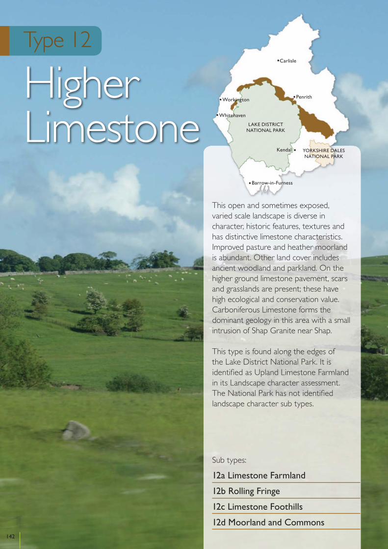
Cumbria Landscape Character Assessment
Type 12
Higher Limestone
This open and sometimes exposed, varied scale landscape is diverse in character, historic features, textures and has distinctive limestone characteristics. Improved pasture and heather moorland is abundant. Other land cover includes ancient woodland and parkland. On the higher ground limestone pavement, scars and grasslands are present; these have high ecological and conservation value. Carboniferous Limestone forms the dominant geology in this area with a small intrusion of Shap Granite near Shap.
This type is found along the edges of the Lake District National Park. It is identified as Upland Limestone Farmland in its Landscape character assessment. The National Park has not identified landscape character sub types.
Sub types:
12a Limestone Farmland
12b Rolling Fringe
12c Limestone Foothills
12d Moorland and Commons
142
Kendal
Penrith
Carlisle
Workington
Whitehaven
Barrow-in-Furness
YORKSHIRE DALESNATIONAL PARK
LAKE DISTRICTNATIONAL PARK

Location
This subtype is found to the east of the Lake District National Park between Shap and Kirkby Stephen. The sub type continues into the national park and is classified as Type I – Upland Limestone Farmland in the Lake District National Park Landscape Character Assessment. Most of this type meets the criteria for National Park designation and is being considered for designation in 2010/11.
Key Characteristics
• Rolling upland farmed landscape • Distinctive limestone characteristics in the form of
strong field patterns with high stone walls• Land cover is dominated by improved or semi-
improved pasture• Small broad leaved, coniferous or mixed plantations
provide variety and interest • Historic features are often obvious and evoke a
strong sensory response
Physical character
This sub type is dominated by Carboniferous limestone overlain by glacial till. In places outcrops provide high geological interest. Other areas of interest are associated with the till and fluvial glacial deposits exposed along Scandal Beck. This provides key evidence for interpreting late Quaternary stratigraphy.
This is a rolling upland farmed landscape found between 250-300m AOD. The area is intersected by small streams and rivers and has distinctive limestone characteristics. The area forms a transitional area with the higher Lakeland and Howgill Fells.
Land cover and land use
The underlying limestone geology is present through the strong pattern of fields bounded by high stone walls and other built stone features, such as lime kilns and traditional farm buildings. The matrix of walls emphasise the rolling landform.
Land cover is dominated by improved or semi-improved pasture. Tree clumps and small broadleaved, coniferous or mixed plantations often near farmhouses are typical features. In the Orton-Raisbeck area the scale of fields is larger with a pattern dominated by large allotments and more open moorland. Around some of the villages and hamlets there is smaller scale pasture with some long, narrow fields. At lower levels the patchwork of walls give way to hedges with some field boundary trees.
The local building vernacular is dominated by limestone with a mixture of discrete nucleated villages and dispersed farms. These are mainly connected by small roads that often follow the grain of the landscape.
In the western parts the M6 motorway, rail line, pylons and large quarries contrast with the pastoral characteristics and introduce discordant man made features in the landscape.
Ecology
This landscape supports some of the most species-rich hay meadows in Cumbria and is also notable for broad species-rich roadside verges. Where the limestone outcrop areas of limestone grassland are present and in places there are extensive species-rich springs and flushes with alpine bartsia and black bog-rush. Stands of upland ash woodland are present along gills and river valleys. The many small rivers that dissect this landscape support both otter and white-clawed crayfish.
143
Cumbria Landscape Character Assessment
Sub type 12a
Limestone farmland
Historic and cultural character
A landscape of nucleated villages with a variety of early and late enclosed fields all bounded by dry stone walls containing features such as hog holes and bee boles. The villages often have traditional village greens and traditional limestone built farm buildings within them. Isolated field barns also feature. The landscape has a variety of well preserved earthwork remains including ridge and furrow and lynchets. The boundaries of former late medieval deer parks are preserved within the modern field pattern. Archaeological remains include prehistoric stone circles and cairns, early medieval settlement remains and the remains of abandoned quarries and limekilns. The historic legacy is rich and discernable.
Perceptual character
This is a farmed landscape with a pastoral character. The bright greens of improved fields contrast with darker unimproved and more open land. At lower levels there is a sense of enclosure, which changes to a more open and expansive, feeling on more exposed areas. There are long, open views and mainly uncluttered views of the Lakeland Fells, the Howgills and the Northern Pennines. There is a strong sense of history derived from a wealth of historic features and a sense of remoteness in many parts. Changes in the weather can give an elemental feeling and accentuate feelings of exposure and remoteness.
Sensitive characteristics or features
The limestone vernacular from field walls, lime kilns and traditional farm and village buildings is sensitive to changes in land management and new development patterns and materials. Species rich hay meadows and roadside verges, and the matrix of walls that reinforce the rolling landscape grain and varied historic field patterns are sensitive to changes in land management. Small, traditional villages, with a rural character and village greens are sensitive to village expansion. Discrete rural roads winding along contours are sensitive to highway improvements. Archaeological remains and historic farm buildings and features are sensitive to changes in landscape management and village/farmstead
expansion. Long open views to the Fells, Pennines and Howgills are sensitive to large scale and prominent development that could significantly interrupt views.
Vision
This landscape will be conserved and enhanced. This well managed landscape will be fostered while the historic field and settlement pattern will be conserved and maintained retaining the open character of this landscape. Historic earthworks and other archaeological and features of historic interest will be conserved. Wildlife interest will be increased to help enhance this landscape. This will be achieved through conserving, restoring and extending small woods, flower-rich grassland and field boundary trees, increasing habitat diversity and enriching the less diverse areas. Farm buildings, roads and quarry extensions will be carefully controlled and designed. Development will be of high quality and complement the local vernacular in this sensitive landscape.
Changes in the Landscape
Over the next 10 – 20 years this landscape could be subject to the following changes or issues:
Management Practices• Farming practices are the primary influence on the
character of this distinctive landscape and changes in policy or grant funding regimes could effect the future management of landscape features both positively and negatively.
• Over the past few decades the tendency towards intensively managed grassland and silage production has produced ‘clean’ well-managed fields.
• A lack of grant money available to farmers and the terrain may influence their capability to diversify and, therefore, farm incomes could suffer significantly.
• Current grant regimes can help prevent the loss and neglect of stone walls, decline in botanical interest, neglect of woods and field boundary trees.
• Intensive grazing regimes and field improvements have reduced biodiversity and caused harm to historic features in the past.
144
Cumbria Landscape Character Guidance – Sub type 12a: Limestone Farmland

Development• These ‘transitional’ landscapes are traditionally
fragile in nature and new development may further exaggerate this trend eroding distinctive characteristics.
• The Government’s commitment to renewable energy could see an interest in large scale wind energy schemes in this open area which could change key open views and the feeling of remoteness felt in parts of this area.
• The need to upgrade the national grid during the next decade could see changes in character where pylons already exist along the M6 corridor.
• The M6 corridor as an element in the landscape could have the potential to attract new large scale commercial development. Improvements to surfacing, lighting and information systems along the motorway could affects its appearance and people’s awareness of it in the landscape.
• As agricultural practices shift they has been a more towards the erection of large scale farm buildings which – depending on their design - can be particularly intrusive in the higher open parts of this landscape.
• Planned and incremental expansions to villages may be needed to support the rural economy and agricultural diversification. This needs to be sensitive to the historic form, local topography and vernacular to prevent erosion of the landscape character.
Access and Recreation• Public rights of way provide a network of routes
that enable quiet appreciation and enjoyment of the countryside. Ongoing maintenance is needed to support this network in the future.
• Current farm stewardship grants provide the opportunity to develop more public access in the countryside. Future grant or other programmes may continue to support this.
Guidelines
Natural Features• Restrict further agricultural improvement of existing
semi-improved pastures and meadows, including ploughing, fertilising, herbicide spraying, reseeding and liming. Restore areas lost to improvements where possible.
• Maintain and enhance existing species rich grassland, meadow and flush.
• Support improvements to the condition of Sites of Special Scientific Interest that will enhance and support a more diverse landscape.
• Plant new field boundary trees or tagging selected saplings to replace maturing stock using indigenous or locally established species.
• Reinforce existing woods by appropriate management, natural regeneration, restocking and exclusion of stock.
• Establish new small to medium scale native broad-leaved, mixed plantations woods on improved farmland and along beck sides.
• Avoid new planting on species rich grassland, wetland and higher open landscapes or where it might obscure distinctive field patterns.
Cultural Features• Discourage field enlargement and ‘ranching’ that
result in the loss of traditional field patterns and boundaries.
• Manage and restore walls and hedgerows in a traditional way
• Restrict introduction of fences to replace or ‘gap-up’ walls and hedgerows.
• Restore fenced boundaries to traditional walls and hedgerows
• Conserve historic artifacts including burial mounds, cairns, settlement earthworks, standing stones, through avoidance of damaging agricultural activities such as disturbance and removal of stones, levelling and excavation, planting trees, poaching, ploughing and tipping.
• Conserve and enhance historic structures such as limekilns and stone barns. This may include protection from stock, removal of trees or scrub or carrying out structural repairs with archaeological advice.
• Protect features such as long fields behind villages and funnel shaped intakes.
Development• Avoid development in the transitional, fragile and
exposed areas that will degrade their character, specifically tall or vertical energy infrastructure developments such as large scale wind turbines and pylons.
• Avoid siting large scale wind energy, other vertical structures such as telecommunications masts,
145
Cumbria Landscape Character Guidance – Sub type 12a: Limestone Farmland

pylons and overhead transmission lines in open and prominent areas where it could degrade the rural character of the area.
• Retain the rural character of the M6 corridor by resisting large scale commercial development and ensuring new motorway infrastructure such as information signs and necessary lighting is sited to minimise adverse effects on open parts of the landscape. Noise pollution should be mitigated against through careful selection of surface materials.
• Protect settlement fringes from unsympathetic development.
• Ensure new development respects scale, form and distinctive character of villages.
• Enhance through sensitive environmental improvements to entrances, village greens and planting etc.
• Conserve and maintain traditional farm buildings.• New farm buildings, structures, tracks and access
ways should be sympathetic to their surroundings. This can be achieved by careful siting; integration with existing buildings, breaking down mass, choice of sympathetic colours and non-reflective finishes and appropriates planting.
Access and Recreation• Public rights of way should be well maintained and
quiet recreational areas and facilities should be improved and developed to be compatible with the pastoral character of this sub type.
• Seek opportunities to enhance access to farmland through farm stewardship or other schemes.
• Promote and enhance existing recreation routes by improving waymarking, providing appropriate surfacing, gates and gaps and interpretation.
146
Cumbria Landscape Character Guidance – Sub type 12a: Limestone Farmland
Location
This subtype is found around the fringe of the Lake District National Park, near Ullock in the west, from Tallentire to Caldbeck in the north and from Stainton to Drybeck in the east. The sub type continues into the national park and is classified as Type I – Upland Limestone Farmland in the Lake District National Park Landscape Character Assessment.
Key Characteristics
• Large-scale undulating topography• Large fields of improved pasture • Stone walls mainly in the east, occasional hedges and
fence boundaries• Very sparse tree cover• Some large scale conifer plantations • Small streams and rivers cut through the rolling
topography
Physical character
This sub type is dominated by Carboniferous limestone overlain by glacial till. In the east this type is transitional between the true limestone landscape and the glacial and valley types. In the north it forms the fringe of the northern Lake District fells. It mainly comprises large scale, rolling or undulating topography at altitudes of 150-300m AOD with some high points reaching around 380m AOD. Small streams and rivers provide variation in topography.
Land cover and land use
Although a limestone landscape limestone features are mostly absent, with limestone crags be found in just a few places.
Land cover consists of large, often rectangular, fields of improved pasture divided by stone walls, fences or occasional hedges. Walls are a strong feature in the east, but sparse in the north. Here hedges criss cross the landscape and form a strong feature. Areas of rough pasture with moorland and moss can be found at higher elevations and add interest to the area.
Tree cover is generally sparse apart from extensive, but isolated coniferous plantations in the north, and occasional woodland clumps in lower areas and on knolls.
Settlements are generally nucleated with dispersed farms throughout the landscape. Roads often cut across the topography, and are often enclosed by strong hedge and wall boundaries.
Included in the sub-type is an area further to the south at a slightly lower elevation (100-200m AOD). The northern part of this has some natural limestone features, which are absent elsewhere. This is a fairly simple landscape, with clear views to the Lakeland Fells.
Ecology
This is a landscape of improved grassland with only occasional hedgerows. Areas of semi-natural vegetation are scarce, but include occasional areas of limestone grassland, particularly around the Orton Fells, and small upland ash woods. A few species-rich roadside verges are also present. The main feature of ecological interest in this landscape is a disused quarry which hosts a large great crested newt population of international importance.
Historic and cultural character
Features of historical interest abound. In the east the landscape features nucleated villages surrounded by early enclosed field systems featuring fossilised strips. There is
147
Cumbria Landscape Character Assessment
Sub type 12b
Rolling Fringe

a variety of well preserved earthwork remains including ridge and furrow and lynchets. In the north it is still a discrete village landscape but with fewer fossilised strips in the surrounding field pattern. Here late enclosed outfields are a feature of the field system. Archaeological remains include Viking Age artefacts in Allerdale and in all areas there is widespread evidence of quarrying, lime kilns and lime burning.
Perceptual character
This is largely a simple, open landscape, with a more intimate feel in the valleys, and a contrasting feel of wildness in the moorland areas. This can be accentuated in poor and stormy weather. Views are often expansive across to the Lakeland Fells, but on the eastern side are dominated by television transmission masts. Otherwise the landscape has a pastoral feel with some tranquillity and a sense of peacefulness.
Sensitive characteristics or features
Walls and hedge mosaics to improved pasture are sensitive to changes in land management. Nucleated and discrete vernacular villages reinforce the farmland character and are sensitive to village expansion. Scarce limestone outcrops, features and grassland provide important interest and biodiversity and are sensitive to changes in land management. Open, uninterrupted views across moorland to a backdrop of hills are sensitive to large prominent infrastructure or other development.
Vision
This landscape will be enhanced through restoring and creating new features. Hard edges of conifer plantations will be softened to reflect the topography. New planting with a diversity of tree species will take place. Field boundaries will be strengthened while retaining the open and unfenced character of this landscape. Historic and ecological features will be restored and enhanced. In order to avoid intrusion into this landscape, development will be strictly controlled particularly where it could affect key views into the Lake District National Park.
Changes in the Landscape
Over the next 10 – 20 years this landscape could be subject to the following changes or issues:
Management Practices• The loss of tree cover and similar features.• The neglect of hedgerows leading to the loss of
traditional characteristics.• Farming practices are the primary influence on the
character of this distinctive landscape and changes in policy or grant funding regimes could effect the future management of landscape features both positively and negatively.
• A lack of grant money available to farmers and the terrain may influence their capability to diversify and, therefore, farm incomes could suffer significantly.
• Current grant regimes can help prevent the loss and neglect of stone walls, decline in botanical interest, and neglect of hedges.
• Intensive grazing regimes and field improvements have reduced biodiversity and need to be better managed in the future.
Development• These ‘transitional’ landscapes are traditionally
fragile in nature and new development may further exaggerate this trend eroding distinctive characteristics.
• The Government’s commitment to renewable energy could see an interest in large scale wind energy schemes in this open area which could change key open views and the feeling of wildness felt in parts of this area.
• The M6 corridor as an element in the landscape could have the potential to attract new large scale commercial development. Improvements to surfacing, lighting and information systems along the motorway could affect its appearance and people’s awareness of it in the landscape.
• The need to upgrade the national grid during the next decade could see changes in character where pylons already exist along the M6 corridor.
• As agricultural practices shift they has been a more towards the erection of large scale farm buildings which – depending on their design - can be particularly intrusive in the higher open parts of this landscape.
• Planned and incremental expansions to villages may be needed to support the rural economy and
148
Cumbria Landscape Character Guidance – Sub type 12b: Rolling Fringe
agricultural diversification. This needs to be sensitive to the historic form, local topography and vernacular to prevent erosion of the landscape character.
Access and Recreation• Public rights of way and open access land provide a
network of routes that enable quiet appreciation and enjoyment of the countryside. Ongoing maintenance is needed to support this network in the future.
• Current farm stewardship grants provide the opportunity to develop more public access in the countryside. Future grant or other programmes may continue to support this.
Guidelines
Natural Features• Ameliorative measures to help integrate conifer
plantations into the landscape and aid in the re-wooding of areas that have lost tree cover.
• Planting of mixed woods on improved agricultural land, avoiding areas of mossland and moor.
• Introduce more small woodlands, tree groups and feature trees using typical limestone species e.g. Ash while maintaining essential openness.
• Reinforce existing woods by appropriate management and additional planting.
• Create focal points within woodland and encourage informal recreation.
Cultural Features• Encourage the restoration of fenced boundaries to
traditional walls or hedgerows.• Encourage the planting of new hedgerows in more
sheltered locations and traditional management. • Encourage the management and restoration of stone
walls and other field boundary features.• Discourage the expansion of well preserved traditional
settlements. Where development is necessary to support viable communities expansion should be discrete and respect the preserved character.
Development• Avoid development in the transitional, fragile and
exposed areas that will degrade their character, specifically tall or vertical energy infrastructure developments such as large scale wind turbines and pylons.
• Avoid siting large scale wind energy, other vertical structures such as telecommunications masts, pylons and overhead transmission lines in open and prominent areas where they could degrade the rural character of the area.
• Retain the rural character of the M6 corridor by resisting large scale commercial development and ensuring new motorway infrastructure such as information signs and necessary lighting is sited to minimise adverse effects on open parts of the landscape. Noise pollution should be mitigated against through careful selection of surface materials.
• Protect settlement fringes from unsympathetic development.
• Ensure new development respects scale, form and distinctive character of villages.
• Enhance through sensitive environmental improvements to entrances, village greens and planting etc.
• Conserve and maintain traditional farm buildings.• New farm buildings, structures, tracks and access
ways should be sympathetic to their surroundings. This can be achieved by careful siting; integration with existing buildings, breaking down mass, choice of sympathetic colours and non-reflective finishes and appropriates planting.
Access and Recreation • Public rights of way and access to open access land
should be well maintained and quiet recreational areas and facilities should be improved and developed to be compatible with the pastoral character of this sub type.
• Seek opportunities to enhance access to farmland through farm stewardship or other schemes.
• Promote and enhance existing recreation routes by improving waymarking, providing appropriate surfacing, gates and gaps and interpretation.
149
Cumbria Landscape Character Guidance – Sub type 12b: Rolling Fringe

Location
This sub type is found around Greystoke and the Lake District National Park. The sub type continues into the Mungrisedale Valley in the national park and is classified as Type I – Upland Limestone Farmland in the Lake District National Park Landscape Character Assessment.
Key Characteristics
• Rolling undulating topography with occasional plateaus• Limestone pavements, crags and other rock outcrops
are rare• Areas of unimproved and improved pasture• Stone walls and hedges reinforce the pastoral features • In the south, small pasture fields with the presence of
both disused and active quarries• Ancient woodland and parkland• Large forestry plantations
Physical character
This sub type is dominated by Carboniferous limestone overlain by glacial till. Some rocky outcrops form notable local features. The land rises to the adjacent Lakeland fells at an elevation of 220-360m AOD. The rolling undulating topography is occasionally steep and sometimes appears plateau-like.
Land cover and land use
The sub type is dominated by large forestry plantations around Greystoke and Johnby. The large blocks of forest and other woodland are the main features in this type. Elsewhere the land cover is largely characterised by unimproved pasture, areas of ancient woodland and parkland. Deciduous shelterbelts often edge coniferous plantations and help integrate them better with the rolling topography.
Field sizes are a mixture of large allotments and smaller fields. These are mainly bounded by stone walls or hedgerows. These can be tall and strong alongside roads. Pavements, crags and other rock outcrops are rare.
In the southern part of this sub type, the dominant characteristics come from small pasture fields, bounded by stone walls. The fields are interspersed with the pock marks of old and active quarries. This contrasts with the large scale features found elsewhere.
Settlements are generally dispersed with a mixture of limestone and sandstone vernacular.
Ecology
One of the most notable features of this landscape are the broad roadside verges which support species-rich stands of tall herbs, neutral grassland, limestone grassland and rush pasture. Small areas of limestone grassland are also found around small outcrops of limestone and species-rich springs and flushes are also occasionally present. Small areas of upland ash woodland are sometimes present, but one of the main woodland features is the wood pasture and veteran trees of Greystoke Park. The landscape also supports barn owls and red squirrels.
Historic and cultural character
The settlement pattern features nucleated villages with limestone built traditional buildings. The field systems are mainly planned enclosure on former medieval wastes and feature dry stone walls and fossilised strips. Evidence of deer parks as at Greystoke Castle, are preserved within existing boundaries. Earthwork remains relating to medieval habitation and farming are associated with the villages but many have been removed in recent years.
150
Cumbria Landscape Character Assessment
Sub type 12c
Limestone Foothills

Perceptual character
This is a large scale, open landscape which becomes smaller and more intimate in the wooded areas and in the southern part. This landscape is tranquil and peaceful, and has a strong relationship with the Lake District fells and national park. The changes in characteristics provide interest and the Parkland (eg Greystoke Park) is considered beautiful by many. In the more open parts of the west and north there are clear views of the Lake District fells which reinforce a sense of remoteness. Changes to the weather can accentuate the feeling of remoteness, especially when windswept and wet, or the feeling of tranquility on dry and still days.
Sensitive characteristics or features
Ancient woodland and parkland landscapes are sensitive to large scale development or significant plantation expansion. The matrix of walls and hedges reinforcing farmland and enclosing rural roads are sensitive to changes in land management. Ecologically sensitive roadside verges are vulnerable to road improvements and access to development. Small scale vernacular villages of limestone and sandstone and medieval earthworks and remains around settlements are sensitive to settlement expansion and new building design and materials’ use. The sense of remoteness that is reinforced by the proximity to Lakeland Fells is sensitive to large scale agricultural, tourism or wind energy development.
Vision
The high quality elements of this landscape will be conserved and enhanced. Key components such as the strong pattern of limestone walls and hedgerows will be conserved and enhanced. Rare components such as species rich meadows, hay meadows and historic features such as lime kilns especially where associated with limestone pavement will be conserved, enhanced or extended. The extensive blankets of coniferous forest will be improved so that they relate more closely to the rolling topography while scattered patterns of woodland copses associated will hill tops and farm buildings will be developed to enrich the landscape and provide a diverse array of habitats. Intrusive development will be mitigated
where possible while inappropriate development and residential extensions to villages will be strictly controlled.
Changes in the Landscape
Over the next 10 – 20 years this landscape could be subject to the following changes or issues:
Climate Change• Climate Change could result in agricultural practices
moving towards mixed farming and ploughing up pasture in order to plant crops e.g. vegetables to biofuels. Climate Change could also lead to increased storm events and summer droughts impacting on trees and woodland.
Management Practices• Farming and forestry practices are the primary
influence on the character of this distinctive landscape and changes in policy or grant funding regimes could effect the future management of landscape features both positively and negatively.
• A lack of grant money available to farmers and the terrain may influence their capability to diversify and, therefore, farm incomes could suffer significantly.
• The loss of native and ancient tree cover and similar features through changes in farming practices.
• Current grant regimes can help prevent the loss and neglect of stone walls and the decline in botanical interest. The replacement of walls with wire fences has begun to erode the distinctive character of the area.
Development• These ‘transitional’ landscapes are traditionally
fragile in nature and new development may further exaggerate this trend eroding distinctive characteristics.
• The Government’s commitment to renewable energy could see an interest in large scale wind energy schemes in this open area which could change key open views and the feeling of remoteness felt in parts of this area.
• As agricultural practices shift there has been a move towards the erection of large scale farm buildings which – depending on their design - can be particularly intrusive in the higher open parts of this landscape.
151
Cumbria Landscape Character Guidance – Sub type 12c: Limestone Foothills

• Planned and incremental expansions to villages may be needed to support the rural economy and agricultural diversification. This needs to be sensitive to the historic form, local topography and vernacular to prevent erosion of the landscape character.
• Mineral or other industrial development could take place where there are mineral resources in the southern part, and closer to large settlements.
Access and Recreation• Public rights of way and open access land provide a
network of routes that enable quiet appreciation and enjoyment of the countryside. Ongoing maintenance is needed to support this network in the future.
• Current farm stewardship grants provide the opportunity to develop more public access in the countryside. Future grant or other programmes may continue to support this.
Guidelines
Natural features• Manage and enhance species rich grassland in
marginal farmland and roadside verges through appropriate management including restricting the use of fertilisers.
• Areas of limestone pavement should be subject to sympathetic grazing management and the surrounding grassland should be targeted for restoration or enhancement.
• Ameliorate existing coniferous stands taking account of the impact of forestry practices from surrounding viewpoints.
• Adopt rotational cropping of forested areas in coupe sizes and shapes that generate a pattern of cleared areas, open spaces and newly planted areas and identify suitable species for long term retention, thereby creating a more natural appearance harmonious with the landform.
• Use of broadleaf native species to enhance ecological and landscape value.
• Establish woodland copses in association with hill tops or new farm and residential developments to soften their impact and remain in character with traditional buildings.
Cultural features• Restrict field enlargement or major change to the
existing pattern of field boundaries.• Conserve and restore existing walls and hedgerows.• Restrict introduction of fences to replace or ‘gap-up’
walls and hedgerows.• Reinstate roadside walls to strengthen the traditional
interdependent pattern of roads and field boundaries. • Plant new field boundary and feature trees to replace
maturing stock using indigenous stock typically Ash.
Development• Avoid development in the transitional, fragile and
exposed areas that will degrade their character, specifically tall or vertical energy infrastructure developments such as large scale wind turbines and pylons.
• Ensure new development associated with villages and farmsteads respects scale, form and distinctive character of villages.
• Enhance through sensitive environmental improvements to entrances, village greens and planting etc.
• Conserve and maintain traditional farm buildings.• New farm buildings, structures, tracks and access
ways should be sympathetic to their surroundings. This can be achieved by careful siting; integration with existing buildings, breaking down mass, choice of sympathetic colours and non-reflective finishes and appropriate planting.
• Minimise the impact of minerals or other development by careful siting, design and high standard of landscape treatment, particularly where public views are affected.
• Use traditional materials to define site boundaries, roads and access points.
Access and Recreation• Public rights of way and access to open access land
should be well maintained to allow quiet enjoyment and appreciation of the areas.
• Seek opportunities to enhance access to farmland through farm stewardship or other schemes.
• Promote and enhance existing recreation routes by improving waymarking, providing appropriate surfacing, gates and gaps and interpretation.
• Ensure any recreational developments are contained within a robust landscape structure to ensure the character of the existing landscape is not harmed.
152
Cumbria Landscape Character Guidance – Sub type 12c: Limestone Foothills
Location
This sub type runs in a north west to south east direction from Shap to the south of Kirkby Stephen. The sub type continues into the national park and is classified as Type I – Upland Limestone Farmland in the Lake District National Park Landscape Character Assessment. All of this type meet the criteria for National Park designation and is being considered for designation in 2010/11.
Key Characteristics
• Broad, open grazing common with heather moorland• Limestone pavement, scars and screes• Western intrusion of granite• Some large coniferous plantations• Wide views of the Lake District and Howgill Fells
Physical character
This sub type is mainly Carboniferous limestone, but the western fringe is underlain by Shap granite. Glacial erosion and weathering has exposed limestone pavements, scars and screes. Limestone pavements and scars are dominant in many areas particularly on Orton and Ashy Scars.
Land cover and land use
Land cover is dominated by open common grassland or remnant heather moorland with some coniferous woodland and occasional tree clumps. Although streams and rivers are limited, sink holes and springs can be found throughout.
The edges of the open commons and lower fields are bounded by strong limestone walls. These, along with the exposed rocks, pavements and scars form distinctive features in the area. The walls and outcrops often form rectilinear and linear patterns across the landscape. The
stone walls which form the boundary of the commons are of historic interest. The area is an important limestone habitat and a number of the scars, pavements and grasslands have been designated.
The extreme western and eastern parts of the area are affected by industrial and urban influences, including the M6 motorway and highway depot, A685, and mineral extraction and processing. Despite this the majority of the rest of the landscape retain an open and undeveloped character.
Ecology
This landscape is dominated by internationally and nationally important and protected limestone pavements, upland heathland and acid grassland moorland. Associated with these are species-rich springs and flushes, roadside verges, purple moor-grass and limestone grassland. The distinctive clints and grykes of the pavements support interesting flora. The limestone grasslands and flushes support a range of rare and uncommon species, including Geyer’s whorl snail, bird’s-foot sedge, bird’s-eye primrose and slender green feather-moss. Birds of interest include Lapwing, Reed Bunting, Curlew and Skylarks.
Historic and cultural character
There is little settlement and much unenclosed common land. What enclosure exists is late. The few settlements that date from the first half of the 19th century are situated in either planned enclosure or the edge of assarts. Small areas of plantation woodland exist in an area of medieval deer park around Ravenstondale. These areas are especially important for prehistoric remains which include boundary walls, settlements and cairns. In addition they contain features peculiar to upland farming such as bields and widespread evidence of quarrying and lime burning.
153
Cumbria Landscape Character Assessment
Sub type 12d
Moorland and Commons

Perceptual character
The landscape is largely open and exposed with expansive panoramic views to the Lakeland and Howgill Fells and the North Pennines. There is tangible sense of remoteness because of the lack of settlements and development. Its open character has a strong relationship with the adjacent higher fells whose uncluttered skyline contributes to a sense of tranquillity and relative wildness. This can be accentuated by changes in the weather. Pockets of heathland and limestone outcrops provide added interest to the open moorland and seasonal contrasts. The sense of tranquillity is largely intact despite the busier developed edges around Shap and Kirkby Stephen.
Sensitive characteristics or features
Extensive areas of unenclosed commons bounded by limestone walls, the linear grain of walls and rock exposures and prehistoric remains and distinctive historic land use patterns could be sensitive to agricultural or other development. Open uncluttered skylines and rough untamed commons provide a sense of remoteness and wildness and are sensitive to large scale energy and infrastructure development. Limestone pavements, screes and scars expose the underlying geology and, along with a mosaic of limestone grassland and heathland, are sensitive habitats that could be vulnerable to unsympathetic changes in land management.
Vision
The open rough, unspoilt limestone pavement and moorland character and its ecological and historic interest will be conserved and enhanced. The heather and species rich grassland of the commons, limestone and other natural features will be conserved and enhanced to reinforce landscape distinctiveness and improve ecological interest. The commons boundary walls will be maintained to maintain the distinction between common and enclosed land. Historical features will be protected and managed. New infrastructure or other development will only be supported if it does not erode the intrinsic character of the area. Large conifer plantations will be better integrated in the landscape through the introduction of
more diverse tree species and through a softening of straight edges. Large extensions will be resisted if they are likely to detract from local characteristics.
Changes in the Landscape
Over the next 10 – 20 years this landscape could be subject to the following changes or issues:
Management Practices• Farming practices are the primary influence on the
character of this distinctive landscape and changes in policy or grant funding regimes could effect the future management of landscape features both positively and negatively.
• A lack of grant money available to farmers and the terrain may influence their capability to diversify and, therefore, farm incomes could suffer significantly.
• The erosion of distinctive character in some areas due to losses of heather moorland and species rich grassland.
• Blocks of conifer planting have interrupted the openness and rough uniformity of the commons.
• An increase in improved and semi-improved pasture has changed the character of some fringe areas.
• Overgrazing can effect limestone pavement, grassland and wet flushes, and under grazing can result in scrub encroachment and the reduction in ecological interest.
Development• The M6 corridor as an element in the landscape could
have the potential to attract new large scale minerals, industrial, infrastructure or other commercial development, particularly on the western fringes around Shap due to the relationship of the M6 and several quarries. Improvements to surfacing, lighting and information systems along the motorway could affects its appearance and people’s awareness of it in the landscape.
• Energy infrastructure developments and associated vertical structures such as, communication masts, pylons or large scale wind turbines could erode the open and remote character of the landscape.
Access and Recreation• Public rights of way and areas of open access land
provide a network of routes that enable quiet
154
Cumbria Landscape Character Guidance – Sub type 12d: Moorland and Commons

appreciation and enjoyment of the countryside. Ongoing maintenance is needed to support this network in the future.
Guidelines
Natural Features• Regenerate heather through management
programmes including reduction of stocking levels, control of bracken, phased cutting and burning.
• Manage limestone grassland to improve the variety of flowering plants through appropriate stocking levels and control of scrub, bracken and rushes.
• Restrict localised agricultural improvement particularly of isolated fields within the moorland including application of organic manure or fertiliser, liming or herbicide treatment.
• Avoid planting of coniferous blocks on the open moorland and consider restoration of moorland on clearance and felling of existing blocks.
• Help retain the open and unspoiled qualities of this landscape by reducing existing blocks of coniferous plantations and discouraging additional plantation blocks.
• Protect and enhance tarns and wetlands through carefully controlling drainage schemes to safeguard water quality and levels, through regenerating water margin vegetation by preventing overgrazing or poaching by stock, and by controlling scrub encroachment.
• Protect and enhance limestone pavements and scars and associated features such as glacial erratics (e.g. around Shap) by preventing removal or disturbance and setting suitable grazing levels. This may involve the local exclusion of sheep outside areas of commons.
• Reinforce existing tree clumps on the fringes of the commons in field corners and next to farmsteads and tarns by appropriate management, natural regeneration, restocking with indigenous species and exclusion of stock.
• Support steps to move SSSIs into favourable condition, including the use of temporary fencing in open areas, as this will enhance the landscape character and ecological interest in the long term.
Cultural Features• Discourage introduction of permanent fences on the
Commons; temporary fencing may be acceptable in
order to assist heather regeneration and to improve the condition of SSSIs.
• Manage common and allotment boundary walls in a traditional way.
• Conserve historic sites such as burial mounds, cairns and settlement earthworks avoiding damaging agricultural or other activities.
• Conserve the geological, historic or ecological importance of disused quarries.
Development• Avoid development in remote, undeveloped,
prominent and exposed areas that would degrade the landscape character. Particular developments that could cause harm include telecommunications masts, pylons, large scale wind turbines, and overhead transmission lines and telephone lines. Small scale wind turbines may be accommodated if visually and functionally related to and in proportion with existing used buildings.
• Resist the construction of new access tracks and roads that compromise the relative wildness of the landscape.
• Resist expansion of major developments such as quarrying and industry. Where this is unavoidable minimise the impact by careful siting, design and high standards of landscape treatment.
• Retain the rural character of the M6 corridor by resisting large scale commercial development and ensuring new motorway infrastructure such as information signs and necessary lighting is sited to minimise adverse effects on open parts of the landscape. Noise pollution should be mitigated against through careful selection of surface materials.
Access and Recreation• Public rights of way and access to open access land
should be well maintained to allow quiet enjoyment and appreciation of the areas.
• Seek opportunities to enhance access to farmland through farm stewardship or other schemes.
• Promote and enhance existing recreation routes by improving waymarking, providing appropriate surfacing, gates and gaps and interpretation.
155
Cumbria Landscape Character Guidance – Sub type 12d: Moorland and Commons

Cumbria Landscape Character Assessment
Type 13
Fells and Scarp
This is an open extensive landscape between 500-900m AOD comprising moorland, plateaus, fells and scarps. This broad type incorporates areas of the North Pennines, Howgill, Shap and Middleton fells. There are few settlements. Upland raised bog and open moorland are distinctive. Woodland vegetation is minimal creating very open environments, which tend to be heavily grazed. The contours of the land are smooth and domed, and although steep sided, are sometimes
interrupted by stone walls or fences.
Landscape sub types:
13a Scarps
13b Moorland, High Plateau
13c Fells156
Kendal
Penrith
Carlisle
Workington
Whitehaven
Barrow-in-Furness
YORKSHIRE DALESNATIONAL PARK
LAKE DISTRICTNATIONAL PARK
Location
This landscape sub type runs along the western edge of the North Pennines and adjacent to the Yorkshire Dales National Park. A very small area of this type adjacent the Yorkshire Dales National Park meets the criteria for National Park designation and is being considered for designation in 2010/11.
Key Characteristics
• Horizontal outcrops of limestone and volcanic rock form distinct features
• Unimproved grassland dominates• Steep slopes often filled with bracken and scrub• Ghylls and gullies intersect the scar and moorland• Improved pasture on lower slopes• Small fields bounded by stone walls
Physical character
This landscape is found predominantly on Carboniferous limestone with exposures of horizontal limestone outcrops. The limestone scarp is found in a small area between Cumrew to Newbiggin in the north and more extensively from Melmerby to Helbeck in the south. Around Dufton and Knock the Cross Fell Inlier forms distinctive conical pike features against the scarp. These are unique to this part of Cumbria.
Land cover and land use
North of Cumrew the scarp slopes rise gently from the limestone foothills. Most of the slopes are covered with unimproved grassland and wet and dry heath. In parts there is a matrix of small fields enclosed by stone walls. Outside the enclosures, slopes are sometimes heath-like with scrub and bracken. The slopes are sharply incised by streams and rivers and gully or ghyll features
frequently break the scar and run down from the moorland top.
Woodland is generally scarce, but there are some areas of upland ash woodland around Brough. Small clumps of trees can also be found sheltering in ghylls or at the bottom of the slopes. There are some small areas of conifer plantations.
Rocky features are common including limestone pavements and scars and Whin Sill cliffs (eg High Cup Nick). At the southern extremity on some of the more inaccessible slopes there are remnants of ancient woodland.
There is virtually no settlement. A small area of the slopes above Warcop is part of an army training area, but the landscape still retains the open and undeveloped character of the rest of the sub type.
Ecology
The western scarp slopes of the Pennines are covered by large areas of limestone grassland, acid grassland, wet and dry heathland and bracken. Along the scarp edge there are exposures of both limestone and volcanic rock and screes and these, together with the associated areas of limestone grassland, support rare species such as alpine saxifrage and Teesdale violet. Species-rich springs and flushes are locally frequent on these steep slopes, as are areas of rush pasture. Small areas of peat bog are found in the northern areas.
Historic and cultural character
There is little modern settlement but there are some abandoned post-medieval farmsteads. The field system features intacks and parliamentary enclosure. There is evidence of coal and lead mining with surviving bell pits indicative of early coal mining on Stainmore.
157
Cumbria Landscape Character Assessment
Sub type 13a
Scarps

Archaeological interest also includes relict prehistoric field systems and settlements.
Perceptual character
This landscape has an open, expansive and undeveloped character that gives a sense of remoteness. The open moorland and vast, uninterrupted skies add a sense of wildness. Changes to stormy and unsettled weather can bring a feeling of exposure and a greater sense of wildness and remoteness. Still, dry days can bring a feeling of tranquility in these undeveloped and natural feeling landscapes. Pockets of heather moorland and seasonal colour changes provide interest to the broad open moorland areas.
Sensitive characteristics or features
Steep limestone grassland slopes intersected by streams and ghylls and ghyll woodland and low lying wooded areas, and extensive areas of exposed geology are sensitive ecological areas that could be vulnerable to development. The tranquil character arising from the distinct lack of settlement and farms could be undermined by isolated developments. The open and expansive slopes are remote with a sense of wildness and character that is vulnerable to any forms of development.
Vision
The remote and diverse qualities of these upland landscapes will be conserved and enhanced. The heath and species rich grassland will be enhanced and sympathetic moorland management will be re-established. The remaining areas of semi-natural woodland will be conserved and enhanced, with ghyll side planting increased. Further coniferous planting on open moorland and slopes will be discouraged. Wetland areas will be conserved and enhanced. Traditional features such as patterns of stone walls, meadows and former ‘miner-farmer’ landscapes will be conserved. With regard to recreation and tourism, improved facilities for low key activities in selected locations will be provided offering good accessibility, protection of sensitive habitats and minimal intrusion
on the landscape. The open, unspoilt, uncluttered and wild qualities and characteristics of these landscapes will be maintained through resisting inappropriate and intrusive development; this could include vertical energy developments such as large wind turbines or pylons.
Changes in the Landscape
Over the next 10 – 20 years this landscape could be subject to the following changes or issues:
Managements Practices• A fragile farming system subject to changing markets • Over intensive grazing and agricultural improvement
leading to loss of moorland vegetation to the detriment of wildlife.
• There could be further interest in afforestation if farming becomes more marginal and incentives are provided to support short rotation forestry.
Development• Energy infrastructure developments and associated
vertical structures such as, communication masts, pylons or large scale wind turbines could erode the open and remote character of the landscape.
• The further intensification of training at the Warcop Training Area could introduce incongruous features and threaten the remote, unspoilt character
• Small scale mining or quarrying has continued in a few places. Any further development could have major implications on landscape character particular if scarp slopes are affected.
Access and Recreation• Public rights of way and areas of open access land
provide a network of routes that enable quiet appreciation and enjoyment of the countryside. Ongoing maintenance is needed to support this network in the future.
Guidelines
Natural Features• Encourage regeneration of suppressed heather
through the active management of grouse moors including a reduction in stocking levels, control of bracken, phased cutting and controlled burning in
158
Cumbria Landscape Character Guidance – Sub type 13a: Scarps
accordance with Natural England’s Heather and Grass Burning Code.
• Maintain and enhance blanket bog through appropriate management including lowering stocking levels, ditch blocking and reviewing any moorland burning practices in accordance with Natural England and the Moorland Association’s management plan template to prevent damage to underlying bog.
• Maintain and enhance areas of semi-natural grasslands and heath to enhance biological diversity including reduction in stocking levels.
• Restore allotment grasslands by ditch blocking, reducing grazing levels etc.
• Strongly discourage further agricultural improvement including ploughing, reseeding, application of fertiliser, liming or herbicide treatment.
• Maintain and enhance fell wetland including flushes, small tarns and bog pools. This may involve discouraging drainage schemes, preventing overgrazing or poaching by stock and controlling invasion by scrub.
• Protect ghylls or other deep valleys from stock to encourage the retention and expansion of tree cover and a diverse ground flora.
• Restore and reinforce remnant semi-natural woodland on scarp slopes.
• Improve the appearance of existing coniferous plantations including softening of geometric outlines, introduction of open space and increasing species diversity.
• Remove intrusive conifer blocks from open fell land as opportunities arise and resist new or significant extensions to coniferous plantations, especially in the moorland zone and on valley sides and scarps.
• Prevent infilling of minor gullies or sinkholes.• Protect rocky outcrops, limestone pavement,
scree and other rocky areas as open features by discouraging damage or removal and encouraging management of invading scrub.
Cultural Features• Encourage joint measures for the sustainable
management of common land.• Encourage the conservation and repair of boundary
walls to fields or large allotments where significant in historic or landscape terms (This applies mainly in 13A).
• The erection of fencing on open moorland is normally to be avoided.
• Manage and create species rich hay meadows. This may involve sensitively timed light grazing and late cutting to allow seeding, prevention of ploughing, cultivation, herbicide and fertiliser applications and re-seeding with an appropriate diverse mixture.
• Conserve and maintain historic structures such as field barns, farmhouses, mining structures and lime kilns. This may include protection from stock, removal of trees or scrub and carrying out structural repairs with archaeological advice.
• Conserve important spoil heaps and other earthworks.
Development• Avoid development in remote, undeveloped,
prominent and exposed areas that would degrade the landscape character. Particular developments that could cause harm include telecommunications masts, pylons, large scale wind turbines, and overhead transmission lines and telephone lines. Small scale wind turbines may be accommodated if visually and functionally related to and in proportion with existing used buildings.
• Resist major developments such as minerals or those involving permanent built structures including roads, embankments or dams that would erode the remote, undeveloped character.
Access and Recreation• Improvements to the Pennine Way and other
footpath or bridleway networks should be encouraged, including the laying of flags where necessary, better waymarking, improved gates and gaps and improved interpretation. All such work should use natural materials that harmonise with the landscape.
• Provision of sensitively designed small scale parking facilities for cars and buses in appropriate locations.
• Provide safety advice to those wishing to walk in remote areas, explore caves or old mines.
• Interpret the landscape, history and wildlife of the area to help promote its care and conservation.
159
Cumbria Landscape Character Guidance – Sub type 13a: Scarps

Location
This landscape sub type is found along the western side of the North Pennines and to the east of Kendal. A small area of this type to the east of Kendal meets the criteria for National Park designation and is being considered for designation in 2010/11.
Key Characteristics
• Fells, summits and moorland plateau• Incised by deep valleys and ghylls• Extensive areas of blanket bog• Acid grassland and dwarf heath shrub provide
contrast to bog• Valley slopes have varied land cover
Physical character
This area is predominantly Carboniferous limestone which forms an extensive area of upland moorlands. Much of the moorland is plateau-like with numerous deep valleys and ghylls. There are several high fells and summits that are generally over 5OOm, rising to around 900m at places like Cross Fell. The summits in the west central section are the highest in the Pennine chain and dominate the adjacent scarp.
Land cover and land use
The majority of the area is covered in blanket bog and is interspersed with a mosaic of other vegetation. To the north dry dwarf shrub heath dominates, in the centre fen, marsh and swamp features abound. On the lower valley slopes limestone and acid grassland can be found. Where heather survives, managed grouse moors are a rare feature; otherwise the majority of the area is used for extensive sheep grazing with some ponies and hill cattle. The area is largely devoid of tree cover.
A major civil aircraft radar installation at Great Dunn Fell is the only intrusive man made feature which is visible from a wide area.
Ecology
These high Pennine moorlands are of international importance for their extensive blanket bogs and the breeding populations of moorland birds they support, including species such as golden plover, dunlin and hen harrier. These moors also support areas of upland heathland and acid grassland, together with limestone grasslands, species-rich springs and flushes with rare species such as marsh saxifrage, spring gentian and alpine forget-me-not. Several of the summits support montane heath communities and a range of rock and scree vegetation is present. On former lead mines, the spoil often supports a unique lead tolerant flora including alpine penny-wort and spring sandwort. Along the moorland edge there are large areas of rough pasture, including expanses of rush pasture. These moorland edges provide important habitat for black grouse. Further north, Geltsdale and Glendue SSSI is noted for its upland bird communities and moorland vegetation.
Historic and cultural character
This remains an unenclosed area, with no settlements or field systems and little of archaeological interest. Nineteenth century grouse pits occasionally feature in some areas. The southern part of the landscape contains extensive areas of common land including Ousby, Dutton and Murton fells, Stainmore, Winton and Kaber fells. Large parts of these commons are included within Sites of Special Scientific Interest.
160
Cumbria Landscape Character Assessment
Sub type 13b
Moorland, High Plateau

Perceptual character
This landscape has a strong feeling of remoteness due to the lack of settlement and development. Its sweeping topography provides wide expansive views and uninterrupted skylines providing a sense of wildness. Changes in weather can reinforce the feeling of wildness, especially on stormy and unsettled days. In contrast on still, dry days there can be a feeling of tranquility.
Sensitive features or characteristics
Extensive areas of blanket bog interspersed by heather, fen, marsh and swamp are ecologically sensitive to some changes in land management. Grouse moors are a rare feature also sensitive to changes in land management. Wide, expansive views within the Pennines and almost total lack of man made structures and uninterrupted skylines are sensitive to vertical structures and other large scale development.
Vision
The remote and diverse qualities of these upland landscapes will be conserved and enhanced. The heath and species rich acidic grassland, natural features and habitats are all key features within this landscape and will be conserved and enhanced to improve landscape interest and ecological diversity. Sympathetic management of moorland areas will be re-established, grips will be blocked and natural processes will be left to develop where possible to retain the remote wild qualities. The remaining areas of semi-natural woodland will be conserved and enhanced while further coniferous planting on open moorland and slopes will be discouraged. With regard to recreation and tourism, improved facilities for low key activities in selected locations will be provided offering good accessibility, protection of sensitive habitats and minimal intrusion on the landscape. The open, unspoilt, uncluttered and wild qualities and characteristics of these landscapes will be conserved through resisting intrusive development which may impinge on these unique features; this could include vertical energy developments such as large scale wind turbines or pylons.
Changes in the Landscape
Over the next 10 – 20 years this landscape could be subject to the following changes or issues:
Climate Change• Blanket bog has a high carbon sequestration potential.
Good condition bog can help mitigate against adverse effects of climate change. Management practices might need to change to improve the condition of blanket bog and enhance its carbon sequestration potential.
• This area is heavily influenced by natural erosion processes. These could intensify with increased rainfall and extreme weather events. Land cover and management practices could be changed to make the landscape more robust to effects of climate change.
Management Practices• A fragile farming system subject to changing markets. • Over intensive grazing and agricultural improvement
leading to loss of moorland and heathland vegetation and limestone grassland to the detriment of wildlife.
• There could be further interest in afforestation if farming becomes more marginal and incentives are provided for short rotation forestry in the future.
• An increase in moorland tracks for shooting activities has been seen in the North Pennines. These can sometimes create visually intrusive features and affect peatland conservation.
• Sound grouse management can contribute to the landscape character. Well managed peat burning can form part of the management regime. However some burning practices could damage the hydrological integrity of the peat and its vegetative cover.
Development• Energy infrastructure developments and associated
vertical structures such as, communication masts, pylons, large scale wind turbines or overhead transmission or telephone lines, and associated transport infrastructure could harm the open, undeveloped and wild character of the landscape.
• The further intensification of training at the Warcop Training Area could introduce incongruous features and threaten the remote, unspoiled character
• Small scale mining or quarrying has continued in a few places. Any further development could have major implications on landscape character particularly if scarp slopes are affected
161
Cumbria Landscape Character Guidance – Sub type 13b: Moorland, High Plateau

Access and Recreation• Public rights of way and areas of open access land
provide a network of routes that enable quiet appreciation and enjoyment of the countryside. Ongoing maintenance is needed to support this network in the future.
Guidelines
Natural Features• Regenerate suppressed heather through detailed
management programmes including reduction of stocking levels, control of bracken, phased cutting and burning in accordance with Natural England’s Heather and Grass Burning Code.
• Encourage joint measures for the sustainable management of common land.
• Maintain and enhance areas of semi-natural acidic grassland and heath to enhance biological diversity including reduction in stocking levels.
• Maintain limestone grassland through appropriate grazing regimes.
• Restore allotment grasslands by ditch blocking, reducing grazing levels etc.
• Strongly discourage further agricultural improvement including ploughing, reseeding, application of fertiliser, liming or herbicide treatment.
• Maintain and enhance blanket bog through appropriate management including lowering stocking levels, ditch blocking and reviewing any burning practices.
• Maintain other fell wetland including flushes, small tarns and bog pools by discouraging inappropriate drainage schemes, preventing over/under grazing or poaching by stock and by controlling scrub encroachment.
Cultural Features• Manage and create species rich hay meadows. This
may involve sensitively timed light grazing and late cutting to allow seeding, prevention of ploughing, cultivation, herbicide and fertiliser applications and re-seeding with an appropriate diverse mixture.
• Conserve and maintain historic structures such as field barns, farmhouses, mining structures and lime kilns. This may include protection from stock, removal of trees or scrub and carrying out structural repairs with archaeological advice.
• Encourage the removal of eyesores and derelict sites of no historic interest. Conserve important spoil heaps and other earthworks.
• Encourage the conservation and repair of boundary walls to fields or large allotments where significant in historic or landscape terms (This applies mainly in 13A).
• The erection of fencing on open moorland is normally to be avoided.
Development• Avoid development in remote, open, prominent and
exposed areas that would degrade the landscape character. Particular developments that could cause harm include telecommunications masts, pylons, large scale wind turbines, and overhead transmission lines and telephone lines. Domestic scale wind turbines may be accommodated if visually and functionally related to and in proportion with existing used buildings.
• Resist major developments such as minerals or those involving permanent built structures including roads, embankments or dams.
Access and Recreation• Improvements to the Pennine Way and other
footpath or bridleway networks should be encouraged, including the laying of flags where necessary, better waymarking, improved gates and gaps and improved interpretation. All such work should use natural materials that harmonise with the landscape.
• Provision of sensitively designed small scale parking facilities for cars and buses in appropriate locations.
• Interpret the landscape, history and wildlife of the area and thus promote its care and conservation. Provide safety advice to those wishing to walk in remote areas, explore caves or old mines.
162
Cumbria Landscape Character Guidance – Sub type 13b: Moorland, High Plateau
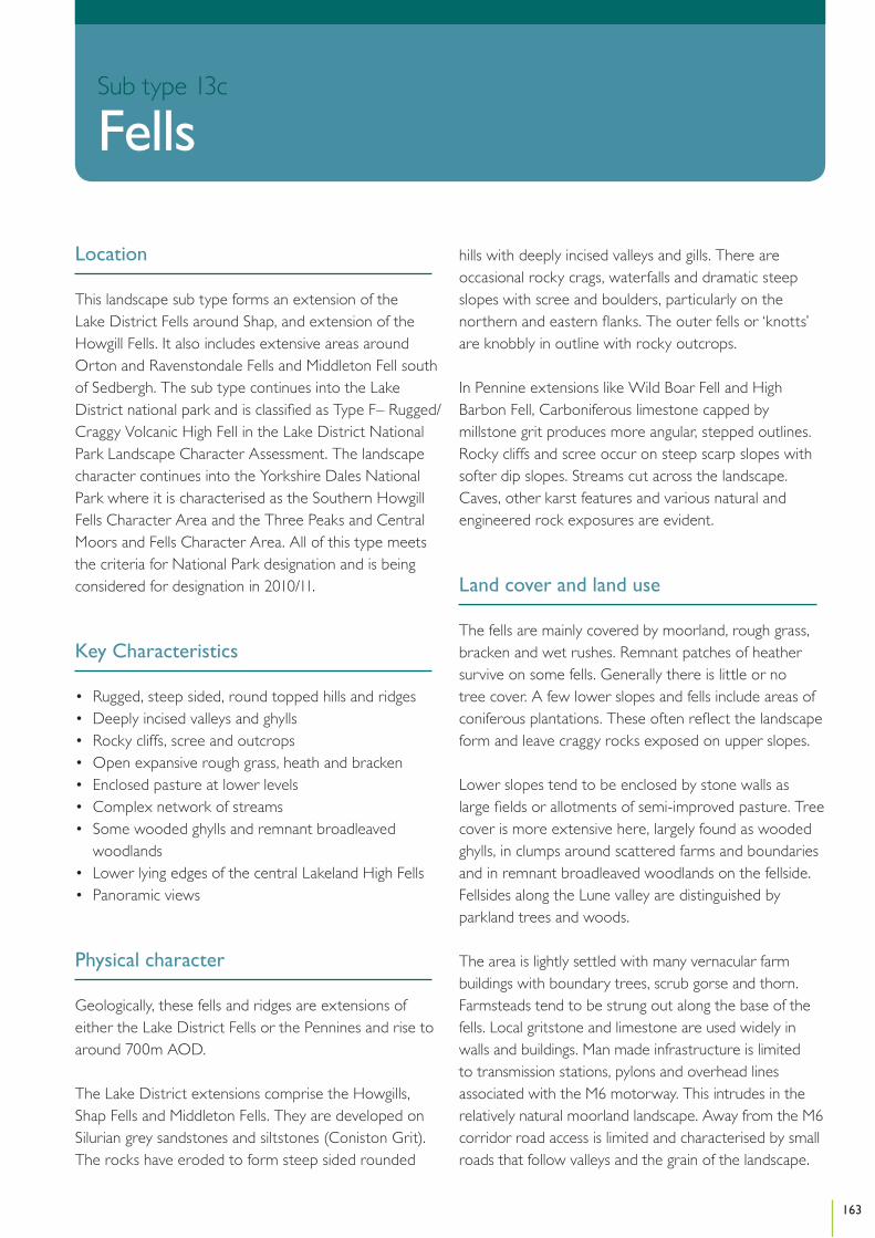
Location
This landscape sub type forms an extension of the Lake District Fells around Shap, and extension of the Howgill Fells. It also includes extensive areas around Orton and Ravenstondale Fells and Middleton Fell south of Sedbergh. The sub type continues into the Lake District national park and is classified as Type F– Rugged/Craggy Volcanic High Fell in the Lake District National Park Landscape Character Assessment. The landscape character continues into the Yorkshire Dales National Park where it is characterised as the Southern Howgill Fells Character Area and the Three Peaks and Central Moors and Fells Character Area. All of this type meets the criteria for National Park designation and is being considered for designation in 2010/11.
Key Characteristics
• Rugged, steep sided, round topped hills and ridges• Deeply incised valleys and ghylls • Rocky cliffs, scree and outcrops • Open expansive rough grass, heath and bracken• Enclosed pasture at lower levels• Complex network of streams• Some wooded ghylls and remnant broadleaved
woodlands• Lower lying edges of the central Lakeland High Fells• Panoramic views
Physical character
Geologically, these fells and ridges are extensions of either the Lake District Fells or the Pennines and rise to around 700m AOD.
The Lake District extensions comprise the Howgills, Shap Fells and Middleton Fells. They are developed on Silurian grey sandstones and siltstones (Coniston Grit). The rocks have eroded to form steep sided rounded
hills with deeply incised valleys and gills. There are occasional rocky crags, waterfalls and dramatic steep slopes with scree and boulders, particularly on the northern and eastern flanks. The outer fells or ‘knotts’ are knobbly in outline with rocky outcrops.
In Pennine extensions like Wild Boar Fell and High Barbon Fell, Carboniferous limestone capped by millstone grit produces more angular, stepped outlines. Rocky cliffs and scree occur on steep scarp slopes with softer dip slopes. Streams cut across the landscape. Caves, other karst features and various natural and engineered rock exposures are evident.
Land cover and land use
The fells are mainly covered by moorland, rough grass, bracken and wet rushes. Remnant patches of heather survive on some fells. Generally there is little or no tree cover. A few lower slopes and fells include areas of coniferous plantations. These often reflect the landscape form and leave craggy rocks exposed on upper slopes.
Lower slopes tend to be enclosed by stone walls as large fields or allotments of semi-improved pasture. Tree cover is more extensive here, largely found as wooded ghylls, in clumps around scattered farms and boundaries and in remnant broadleaved woodlands on the fellside. Fellsides along the Lune valley are distinguished by parkland trees and woods.
The area is lightly settled with many vernacular farm buildings with boundary trees, scrub gorse and thorn. Farmsteads tend to be strung out along the base of the fells. Local gritstone and limestone are used widely in walls and buildings. Man made infrastructure is limited to transmission stations, pylons and overhead lines associated with the M6 motorway. This intrudes in the relatively natural moorland landscape. Away from the M6 corridor road access is limited and characterised by small roads that follow valleys and the grain of the landscape.
163
Section
Sub type 13c
Fells

Ecology
Much of this moorland is covered by acid grassland, particularly the Howgill Fells; however parts of Birkbeck Fells and Middleton Fell are covered by extensive areas of upland heathland and blanket bog. Rush pasture is frequent along the unenclosed valley bottoms. On lower ground there are species-rich hay meadows along some of the remote valleys. Limestone is present under some parts of this landscape and in places, notably The Clouds, it outcrops forming areas of limestone pavement with associated areas of limestone grassland. Species-rich springs and flushes are present locally. Upland oak woodland is present along some ghylls and valley sides on lower ground.
The Shap Fells are extensively designated for ecological interest. This includes heather dominated blanket bog on deep peat with widespread flush communities, areas of raised mire, a range of acidic grasslands and small broadleaved woodlands. There are diverse upland breeding bird populations and a sizeable herd of red deer. The Middleton Fells have extensive heather cover which supports herds of red deer. The wildlife of the fells includes buzzards, kestrels, foxes and hares.
Historic and cultural character
The area is dominated by unenclosed uplands. There are some ancient fields and intakes. The occasional isolated farmsteads are often on ancient sites and in the valleys some of the farms are located on medieval vaccary sites. Only the lower slopes are enclosed by often large, though not always regular, fields bounded by dry stone walls with hog holes. The landscape retains many historic features including droveways, pennings and bields. Archaeological earthworks and other remains are generally well preserved and shielings are particularly common in areas like the Howgills.
Perceptual character
These are generally unpretentious fells and lonely valleys which are dwarfed by the higher fells elsewhere in the County. The higher slopes and summits afford extensive and panoramic views. The fells are tranquil and have a sense of remoteness due to the lack of development
and abundance of natural features. Changes in weather conditions can accentuate the sense of remoteness as views are enclosed and experiences become more elemental. In contrast to the Lakeland Fells these areas are little visited. The Howgills form a distinct cluster of soaring sweeping fells and have a higher profile and identity. AW Wainwright recognised their distinctive form, describing them in his walking guide as ‘Sleek and smooth, looking from a distance, like velvet curtains in sunlight, like steep sided but gently domed……Their soaring and sweeping lines are not interrupted by walls or fences………a remarkable concentration of summits, often likened to a huddle of squatting elephants…..’.
Sensitive features or characteristics
Areas of open, uninterrupted upland, sometimes with dramatic sweeping and soaring fell sides, with a lack of roads and development provide a sense of tranquility and isolation that is sensitive to development.
Vision
The high quality elements present within this landscape will be conserved and enhanced. The moorland will be sympathetically managed. The grassland and grazing levels will be managed to enhance land cover and species diversity. At lower levels the landscape will benefit from strong patterns of limestone walls and hedgerows which will be conserved and enhanced over time. Rare features, such as species rich hay meadows, will be expanded and conserved. The areas of coniferous forest will be improved and will relate more closely to the rolling landform, while patterns of woodland copses associated with hill tops and farm buildings will enrich the landscape where they exist and provide diversity of habitats. The open, unspoilt, uncluttered and wild qualities and characteristics of these landscapes will be conserved through resisting intrusive development which may impinge on these unique features; this could include vertical energy developments such as large scale wind turbines or pylons.
164
Cumbria Landscape Character Guidance – Sub type 13c: Fells

Changes in the Landscape
Over the next 10 – 20 years this landscape could be subject to the following changes or issues:
Climate Change• This area is heavily influenced by natural erosion
processes. These could intensify with increased rainfall and extreme weather events. Land cover and management practices could be changed to make the landscape more robust to effects of climate change.
• An increase in invasive species however, could affect key landscape characteristics.
• Blanket bog has become degraded. This effects its carbon sequestration potential. Good condition bog can help mitigate against adverse effects of climate change.
Management Practices• Grazing pressures continue to degrade heather cover,
limestone and other grassland and wildlife diversity.• As farm incomes reduce, the loss of farm labour could
be contributing to localised neglect of traditional features including occasional derelict walls and buildings, under-grazed woodlands and over mature farm copses.
• Coniferous afforestation pressures have abated in recent years however interest could increase if incentives are provided to support short rotation forestry.
Development• Energy infrastructure developments and other
vertical structures such as, communication masts, pylons, transmission lines, telephone lines and transport infrastructure could erode the open, undeveloped and wild character of the landscape. Such development could also have a negative effect on the settings of the National Parks.
• The M6 corridor, as an element in the landscape, could have the potential to attract new large scale commercial development. Improvements to surfacing, lighting and information systems along the motorway could affects its appearance and people’s awareness of it in the landscape.
Access and Recreation• Public rights of way and areas of open access land
provide a network of routes that enable quiet appreciation and enjoyment of the countryside.
Ongoing maintenance is needed to support this network in the future.
Guidelines
Natural Features• Regenerate suppressed heather through detailed
management programmes including reduction of stocking levels, control of bracken, phased cutting and burning in accordance with Natural England’s Heather and Grass Burning Code.
• Manage semi-natural acidic grassland to enhance biological diversity including reduction in stocking levels, control of bracken and rushes.
• Manage limestone grassland through appropriate grazing and scrub clearance regimes.
• Restrict further agricultural improvement including ploughing, re-seeding, application of fertiliser, liming or herbicide treatment.
• Protect and enhance fell wetland including flushes, small tarns, and bog pools. This may include preventing drainage improvements and blocking existing drains to maintain high water levels, preventing overgrazing and poaching by stock, excluding supplementary feeding areas and controlling scrub encroachment.
• Protect gills and becks from stock to encourage development of diverse ground flora, scattered trees and woodland.
• Protect rocky outcrops, screes, potholes and caves by preventing removal, infilling or disturbance and controlling scrub encroachment.
• Reinforce existing tree clumps that accentuate farmsteads as visual islands at the base of fells.
• Restore and reinforce remnant grazed broad-leaved woodland by exclusion of livestock, natural regeneration restocking and appropriate management.
• Develop small to medium scale deciduous and locally native planting on suitable sites, and in particular on the lower slopes, valleys and ghylls.
• Ameliorate existing coniferous plantations including softening geometric outlines, introduction of open spaces and species diversification.
Cultural Features• Manage the existing pattern of stone walls and repair
derelict walls in a traditional way.
165
Cumbria Landscape Character Guidance – Sub type 13c: Fells
• Maintain and repair traditional farm buildings where they are significant landscape features.
Development• Avoid development in remote, open, prominent and
exposed areas that would degrade the landscape character. Development that could cause harm includes telecommunications masts, pylons, large scale wind turbines, and overhead transmission lines and telephone lines.
• Retain the rural character of the M6 corridor by resisting large scale commercial development and ensuring new motorway infrastructure such as information signs and necessary lighting is sited to minimise adverse effects on open parts of the landscape. Noise pollution should be mitigated against through careful selection of surface materials.
Access and Recreation• Any parking facilities should be sensitively sited
and well designed to minimise the impact on the landscape.
• Manage public access so as to avoid landscape damage and disturbance to sensitive habitats including sensitively designed waymarking, improved gates and gaps, bridges, boundary maintenance, appropriate surfaces and better interpretation.
166
Cumbria Landscape Character Guidance – Sub type 13c: Fells

167

If you require this document in another format (eg CD, audio cassette, Braille or large type) or in another language, please telephone 01228 606060.
© Cumbria County Council, March 2011