cottonwood cove developed area hals...
TRANSCRIPT
COTTONWOOD COVE DEVELOPED AREA HALS NV-1 (Searchlight Ferry) NV-1 Lake Mead National Recreation Area Cottonwood Cove Road Cottonwood Cove Clark Nevada
PHOTOGRAPHS
PAPER COPIES OF COLOR TRANSPARENCIES
WRITTEN HISTORICAL AND DESCRIPTIVE DATA
HISTORIC AMERICAN LANDSCAPES SURVEY PACIFIC WEST REGIONAL OFFICE
National Park Service U.S. Department of the Interior 1111 Jackson Street, Suite 700
Oakland, CA 94607
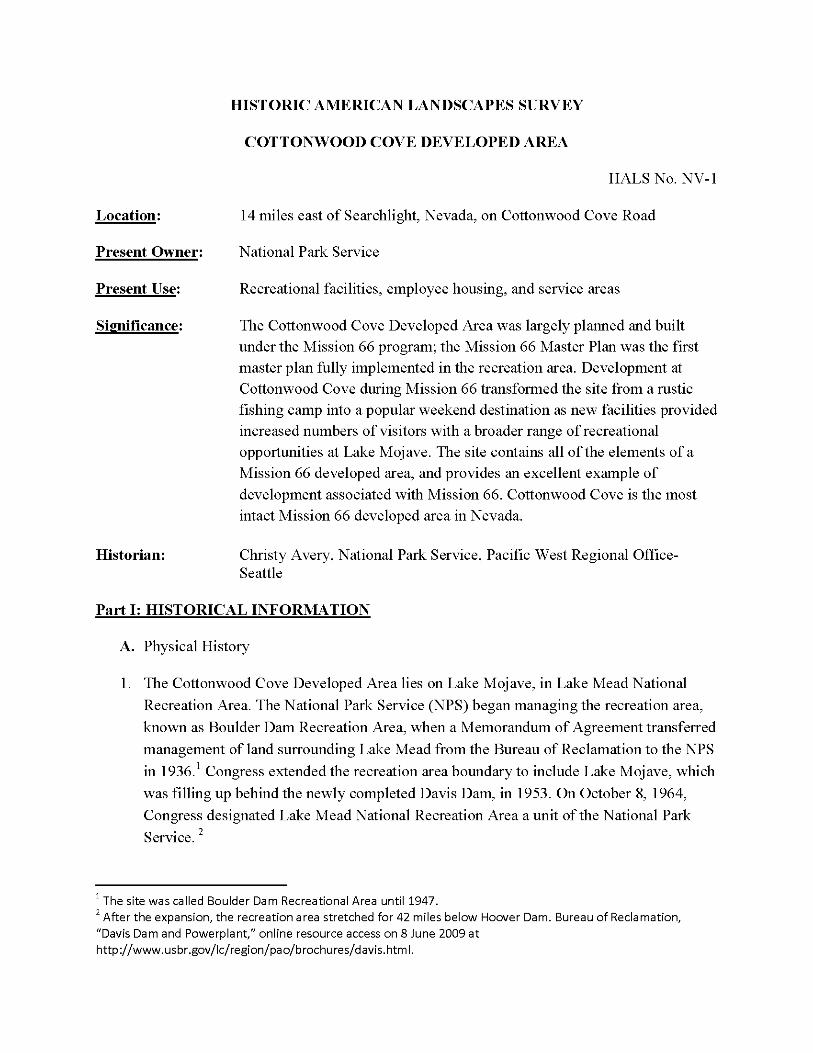
HISTORIC AMERICAN LANDSCAPES SURVEY
COTTONWOOD COVE DEVELOPED AREA
HALS No. NV-1
Location:
Present Owner:
Present Use:
Significance:
Historian:
14 miles east of Searchlight, Nevada, on Cottonwood Cove Road
National Park Service
Recreational facilities, employee housing, and service areas
The Cottonwood Cove Developed Area was largely planned and built under the Mission 66 program; the Mission 66 Master Plan was the first master plan fully implemented in the recreation area. Development at Cottonwood Cove during Mission 66 transformed the site from a rustic fishing camp into a popular weekend destination as new facilities provided increased numbers of visitors with a broader range of recreational opportunities at Lake Mojave. The site contains all of the elements of a Mission 66 developed area, and provides an excellent example of development associated with Mission 66. Cottonwood Cove is the most intact Mission 66 developed area in Nevada.
Christy Avery, National Park Service, Pacific West Regional Office- Seattle
Part I: HISTORICAL INFORMATION
A. Physical History
1. The Cottonwood Cove Developed Area lies on Lake Mojave, in Lake Mead National Recreation Area. The National Park Service (NPS) began managing the recreation area, known as Boulder Dam Recreation Area, when a Memorandum of Agreement transferred management of land surrounding Lake Mead from the Bureau of Reclamation to the NPS in 1936. Congress extended the recreation area boundary to include Lake Mojave, which was filling up behind the newly completed Davis Dam, in 1953. On October 8, 1964, Congress designated Lake Mead National Recreation Area a unit of the National Park Service.
The site was called Boulder Dam Recreational Area until 1947. After the expansion, the recreation area stretched for 42 miles below Hoover Dam. Bureau of Reclamation,
"Davis Dam and Powerplant," online resource access on 8 June 2009 at http://www.usbr.gov/lc/region/pao/brochures/davis.html.
Cottonwood Cove Developed Area HALS No. NV-1
Page 2
During the 1930s and 1940s, Lake Mead NRA had little infrastructure or tourist facilities. Since the NPS considered recreation areas inferior to national parks, development at Lake Mead NRA remained a low priority. Concessionaires ran small fishing camps at points around the two reservoirs. At the Cottonwood Cove site, then known as Searchlight Ferry, concessionaire Murl Emery began operating a fishing camp on the broad, level wash in 1948. Emery had previously worked ferrying supplies to the Hoover Dam site while it was under construction and operating a tour boat service; he also started a fishing camp at Nelson's Landing (in Eldorado Canyon) on the Colorado River south of Hoover Dam in 1940. The camp at Searchlight Ferry contained six tent cabins (four rental cabins and two employee cabins), a dock, a boat ramp, pit toilets, a small electric plant, an unpaved airstrip (on the other side of the lake, accessible by boat taxi) and a small store. Emery also rented boats and provided guide services to fishermen. Visitors accessed the site by a gravel road from the town of Searchlight, about fourteen miles to the west. Park staff estimated that as the lake level rose behind the newly created Davis Dam, however, the camp site would become inundated by the early 1950s. Surveyors investigated central Lake Mojave for an alternate site to locate tourist facilities, but they concluded that moving facilities to higher ground in the same location would prove best.
Visitation at Lake Mead NRA skyrocketed after World War II, as it did at national parks across the nation, due to a combination of increased leisure time, rising automobile ownership, and a rapidly growing population. In 1951, 2,051,000 million people visited the recreation area, more than triple the amount that visited eleven years earlier. By 1958, the number had increased to 4,597,000. In southern Nevada, transportation improvements and thousands of new residents boosted tourism. Las Vegas experienced huge population increases during the war due to the defense industries that attracted large numbers of workers; only 8,422 people lived in Las Vegas in 1940, but ten years later, that number had grown to 48,283. By 1960, 127,016 lived in the metropolitan area, which sprawled east toward the lake. The city of Phoenix also grew tremendously after the war, and Lake Mojave was only about 250 miles from the growing metropolis. The largest numbers of visitors to Lake Mojave and Cottonwood Cove came from southern California, since the reservoir was an easy weekend drive distance via Highway 68 from Los Angeles. These
Hal Rothman, Balancing the Mandates: Administrative History of Lake Mead National Recreation Area (draft), 56- 58. 4 "Murl Emery," The Nevadan, 26 May 1985 5 Harvey Cornell to Regional Director, 5 April 1949, Administrative History Notes File, LAME Archives; Master Plan Development Outline, Lake Mead National Recreation Area, Developed Areas, (National Park Service, 1953), 21.
Cottonwood Cove Developed Area HALS No. NV-1
Page 3
urban residents thought of Lake Mead and Lake Mojave as desert oases, and they flocked to the reservoirs.
The recreation area's newfound popularity was also the result of changing recreation patterns. Americans increasingly sought recreational opportunities in their national parks after World War II, and Lake Mead represented a new kind of park service unit, one that placed primary importance on outdoor recreation and that catered to recreational users. The popularity of water sports rose rapidly after the war, and Americans who could not afford to live on lakes or other bodies of water headed to government administered reservoirs such as Lake Mohave and Lake Mead. Most visitors to Lake Mojave and Lake Mead spent their time boating, fishing or swimming.
As visitation grew, the NPS urged concessionaires to expand their facilities. In 1953, the NPS identified the Cottonwood Cove site as "attractive and easily developed," with some of the best fishing in Lake Mojave. Park managers stipulated, in the concession contract, that Cottonwood Cove concessionaire Murl Emery make improvements and expand facilities. In particular, the NPS wanted Emery to build a new dock, store, cafe, gas station, trailer court, cabins or a motel, a small power plant, and improve water and sewer lines. However, Emery did not have the means to undertake a project of this size, and in 1954, the NPS terminated his contract. In 1954, the NPS awarded a concession contract to Cottonwood Cove Corporation. The company immediately began construction on a trailer park (by 1955, rental trailers were available for overnight accommodation) as well as a restaurant and dock. However, the concessionaire did not make other improvements the NPS hoped for. The NPS similarly had difficulty convincing concessionaires at other Lake Mead NRA sites to construct new tourist facilities, and development at Cottonwood Cove and other sites in the recreation area only occurred after the NPS began a systemwide program called Mission 66.
Rothman, 83. Ethan Carr, Mission 66: Modernism and the National Park Dilemma, Amherst: University of Massachusetts Press,
2007, 29; Rothman, 56-58; 68. s Rothman, 115.
National Park Service, Region Three, Master Plan Development Outline, Lake Mead National Recreation Area, 1953; Master Plan for Development of Lake Mojave, 1953, 5. 10 NARA, RG 79, Box 871, M.R. Tillotsen, Regional Director, to Murl Emery, 3 April 1953, Administrative Files. There are no extent resources from this original development. 11 NARA, RG 79, Box 740, Administrative Files, "Cottonwood Cove, 1954-1964." A 1960 photo shows three loops of the trailer park in place.
Cottonwood Cove Developed Area HALS No. NV-1
Page 4
Mission 66, proposed in 1955 by NPS director Conrad Wirth, was a development program that sought to modernize and enlarge park facilities (and the park system itself) by the NPS's fiftieth birthday in 1966. National park budgets had been cut drastically during World War II, and they remained low throughout the rest of the 1940s and early 1950s due to the Korean War and the emphasis on Cold War defense spending. Furthermore, the federal government abolished New Deal programs that had provided the National Park Service with labor for maintenance and construction projects (such as the Civilian Conservation Corps and the Public Works Administration) in 1942. However, as soon as World War II, and the associated rationing and travel restrictions, ended, park visitation boomed. Ever-increasing numbers of Americans flocked to national parks due to a rise in population, high auto ownership, better roads and highways and an increased amount of leisure time. Visitation rose from 17 million in 1940 to 56 million in 1955
1 o
nationwide.
However, park budgets remained at prewar levels, and visitors found poorly maintained and inadequate visitor's facilities. Parks had too few campgrounds, accommodations, restrooms, parking lots and other facilities, as well as low numbers of staff and traffic- clogged roads. Existing facilities were often in poor repair, since many structures had been closed during the war. To meet the needs of the 80 million visitors that were expected to visit the parks in 1966, the Park Service embarked on a campaign to upgrade and construct roads, trails, visitors centers, campgrounds and other park facilities, as well as to increase staffing and acquire new parcels of land. The name Mission 66 evoked a sense of wartime urgency, rather than a return to New Deal social programs. President Eisenhower proved enthusiastic about the plan, partially due to his support of public works projects that could stimulate the economy, and partially due to the negative press that the national parks were receiving. In the spring of 1956 Congress approved huge budget increases for the National Park Service so that the agency could begin the $700 million program. Congress would allot additional budget increases over the next ten years. The program marked the second era of park development and modernization—the first began in the 1920s, when Congress appropriated increased amounts of funding to develop visitors' facilities and roads in parks.
Mission 66 architecture represented a departure from earlier styles in the national parks. During the previous major era of development in the 1920s and 1930s, architects designed rustic structures modeled after older hotels in the parks or inspired by the Arts
12 Carr, 3-7. 13 Ibid., 3-10
Cottonwood Cove Developed Area HALS No. NV-1
Page 5
and Crafts movement. By the time the Mission 66 program began, modernist architecture had emerged as the dominant style. This style was characterized by prefab elements, concrete, steel, and unusual fenestration. Park service architects designed buildings that reflected this trend while also designing buildings that met the needs of national park visitors and staff. This resulted in a distinctive building type known as Park Service Modern. Wirth felt that park service structures should embody "up-to-date" design standards, but he also believed that "structures should be designed to reflect the character of the area" and be "subordinate" to their surroundings. NPS planners created "developed areas" to centralize services for visitors and employees, and these developed areas became a hallmark of Mission 66 planning and design. A developed area typically contained three or four separate areas, including visitor accommodations, employee housing, maintenance, and visitor services.
By 1966, the NPS had spent $1 billion on land acquisitions, staffing and new or improved facilities, and seventy new units had been added to the system. The park service constructed or improved thousands of miles of roads, hundreds of miles of trails, and hundreds of new structures for visitor use and park administration under Mission 66. The Mission 66 era was the most recent period of significant park expansion and improvement. It was also the last era in which "profoundly new ideas found expression in a systemwide program of national park development." The plan reinvented the national park system, and the program significantly shaped park landscapes in ways that are still
1 Q
clearly visible to twenty-first century visitors.
The Cottonwood Cove Developed Area was one of seven sites at Lake Mead NRA largely planned and developed during the Mission 66 era. The Mission 66 master plan represented the first master plan implemented at the recreation area. Park planners sought to facilitate the enjoyment of water and desert recreation at the park through development of roads, campgrounds, boating facilities, hotels, and other services, and the resulting landscape reflects the principles of Mission 66 design and planning. Some of the resources built at Lake Mead NRA during this period, including the Cottonwood Cove Developed Area, are still extant, and retain a high level of integrity.
14 bid., 137-139. Ethan Carr, Elaine Jackson-Retondo and Len Warner, "Multiple Property Documentation Form, National Park
Service Mission 66 Resources," Draft, Pacific West Regional Office-Seattle, 2005. Carr et al., 23. Jackson-Retondo, 26.
13 Ibid., 1-6. 19 laster Plan Development Outline, Lake Mead National Recreation Area, 1953, 6.
Cottonwood Cove Developed Area HALS No. NV-1
Page 6
Under the Mission 66 program, the park transformed the small fishing camp of Searchlight Ferry into the Cottonwood Cove Developed Area. The site had a good harbor that was well protected by the surrounding hills, and a broad, level place for development. Park planners considered the site "an excellent setting" for a variety of tourist facilities. Park managers had hoped for large scale development for the Cottonwood Cove site since the early 1950s, but only after the park received Mission 66 funds did significant development occur. Mission 66 era development expanded upon the 1953 Lake Mojave Master Plan, which had called for the removal of all existing facilities, and construction of a trailer village, motel, dock, marine store, boat ramp, office, comfort station, and overnight cabins by a concessionaire, and construction of a ranger station, dock, picnic area, swimming beach and campground by the NPS. The NPS brought commercial electric lines to the site, and installed a new water and sewer system, in 1958; the sewage system was upgraded in 1961. By 1961, however, little of the Lake Mohave Master Plan had been implemented, and visitors overwhelmed Cottonwood's facilities.
In 1961, a Mission 66 Master Plan for Lake Mead NRA called for, at Cottonwood Cove, an expanded road system, an enlarged boat ramp and parking area, an improved campground and swimming beach, a service station and store, a concession motel and
91 restaurant, and a ranger station. The NPS hoped the concessionaire would build a motel, restaurant, and additional trailer spaces.
Most of the development at Cottonwood Cove occurred between 1960 and 1966. Since park housing was often inadequate and the Mission 66 program heightened numbers of park staff, the NPS considered the construction of new employee housing particularly important. At Cottonwood Cove, the NPS constructed three employee residences in 1960. Mission 66 plans called for two additional residences, including seasonal quarters, but another single family home and a duplex were not built until much later. In 1964, the NPS built a ranger station that was designed to serve as an information center for visitors entering the park. Two years later, the park constructed a 200' x 300' boat ramp, with
99 15,000 square feet of parking.
The Mission 66 program allowed the NPS to build or expand campgrounds in most parks, including Lake Mead NRA. The two campgrounds at Cottonwood Cove, built in 1965, were designed by the Landscape Architecture branch of the Western Office of Design and Construction. Like other Mission 66 era campgrounds, the campgrounds at
20
21
22
Cottonwood trees were quickly colonizing the site, and park managers changed the site's name. Master Plan Development Outline, 1953, 21; Rothman, 92. NARA-Laguna Niguel, CA, RG 79, Chief of Park Maintenance to Superintendant, 23 March 1966,.
Cottonwood Cove Developed Area HALS No. NV-1
Page 7
Cottonwood Cove included one-way loop roads and campsites along spurs, a design which minimized the impact on the surrounding environment. Park designers oriented campsites so that they would enjoy views of the lake, and they planted trees and other vegetation to provide privacy and shade. The upper campground plan originally called for eight loops with 219 spaces, though only three loops and 100 campsites were built. The lower campground contained forty-two individual and two group sites. By 1966, the trailer village contained three loops and twenty-three spaces, as well as a comfort station that included showers and laundry. However, the village road was not paved, which caused dust and drainage problems. The park constructed a utility building near the residential area in 1966.
Concessionaires were an important part of the NPS's Mission 66 plans, and in 1967, the NPS agreed to a twenty year contract with the Cottonwood Cove Corporation. The agreement stipulated that the company build 100 additional trailer spaces, a store, a comfort station, a new fuel dock, a gas station, an office, twenty overnight units, and expand boating facilities, by December of 1968. Most of these additions, however, were constructed in the 1970s. Four times as many campers with recreational vehicles camped at Lake Mead NRA than did tent campers, so expanding trailer facilities was a priority. Between 1966 and December of 1971, the concessionaire added 233 spaces to the trailer village. By 1977, there were 301 spaces in the trailer village, including 226 "long term" spaces and 15 spaces for short-term camping. By 1972 the concessioner had built a store and tackle shop, fueling dock, boat rental dock, and four other boat docks with 206 slips. Other concessionaire facilities, by 1977, included a fuel pump, 100 dry boat storage spaces (east of the NPS housing area) and a general store and a coffee shop along the lakeshore. Concession employees lived in trailers just southwest of the trailer village. This housing area was unpaved and not landscaped, and blowing dust and sand plagued residents.
Elaine Jackson-Retondo, "Design Guidelines for the Rehabilitation of National Register Eligible Mission 66 Campgrounds at Lake Mead National Recreation Area," Draft, July 2004, Pacific West Regional Office-Seattle.
Western Office of Design and Construction, Preliminary Site Plan, Upper Campground, Cottonwood Cove, 1965, Denver Service Center, Technical Information Center (ETic); San Francisco Planning and Service Center, As Constructed Drawing, Upper Campground, 1968, ETic.
Cottonwood Cove Corporation, Trailer Village and Service Buildings, 1965, etic. National Park Service, Western Region, Cottonwood Cove Developed Area Plan, 1977, 6; National Park Service,
"Trailer Park Paving," 22 February 1980, ETic. 27 NARA-College Park, RG 79, Box 871, Administrative Files, Contract between the N PS and Cottonwood Cove Corporation, 27 March 1967. 2E laster Plan for Preservation and Use of Lake Mead National Recreation Area, Cottonwood Cove Design Analysis, (National Park Service, 1961), 1-6. 29 National Park Service, Cottonwood Cove Trailer Village Addition, 1973, ETic; National Park Service, Cottonwood Cove Water System, 1977, ETic.
Cottonwood Cove Developed Area HALS No. NV-1
Page 8
In 1975, more than twenty years after the proposal first appeared the Lake Mojave Master Plan, the Cottonwood Cove Corporation built a 24 unit motel along the waterfront. The NPS hoped that the company would build additional motel buildings, or even a luxury hotel on the bluff overlooking the lake, but no other overnight accommodations were constructed. The company added a new store and restaurant in 1977. Forever Resorts became the concessionaire at an unknown date, and remains so in 2009.
Two additional park residences were built decades after they first appeared in Mission 66 plans. The NPS built a duplex in 1994, next to one of the single family houses in the residential area. In 2002, the agency constructed a two bedroom ranch style home in the area encircled by the residential loop road. Mission 66 era plans show two other residences inside this circle, but they were not built. Many planned projects, including some that first appeared during the Mission 66 era, were never built. The NPS continued to hope for a motel expansion, permanent concession housing, permanent restrooms near the boat launch, and additional paved parking. They hoped that the concessionaire would operate a shuttle system that would shuttle visitors to the waterfront from a proposed parking lot near the ranger station. However, these additions were not made.
Cottonwood Cove remains a popular spot in Lake Mead NRA. Visitors flock to the site for boating, fishing and other water-based recreation. In 2009, services include overnight accommodations, camping, boat and houseboat rentals, boat repair, and food service.
Part II: PHYSICAL INFORMATION
A. Landscape Character and Description Summary
The Cottonwood Cove Developed Area is an excellent example of a National Park Service Mission 66 development, and it contains all of the components of a Mission 66 developed area. The site's buildings and structures have facilitated the growth of tourism and recreation at Lake Mead NRA.
Cottonwood Cove Developed Area is accessed via Highway 164 from Searchlight, Nevada. The highway turns into Cottonwood Cove Road, and it bisects the developed area as it travels downhill toward the lake, with buildings, sites and structures lying just north or south of the road within about a mile of Lake Mojave. A ranger station, about five miles east of the park boundary on Cottonwood Cove Road, defines the entrance to the developed area. The NPS support services area, which contains a cluster of five NPS residential units, as well as three NPS maintenance and utility structures, occupies the
30 Cottonwood Cove Developed Area Plan, 5-7.
31
Cottonwood Cove Developed Area HALS No. NV-1
Page 9
area just north of the ranger station, on the north side of Cottonwood Cove Road. The three loops and 100 sites of the Upper Campground are placed south of the road, and just east of the ranger station. Across from the eastern end of the campground, a road leads north to the boat storage and concession maintenance area. Cottonwood Cove Road travels in northeasterly direction, and the 301-space trailer village is set south of the road, to the east of the Upper Campground. A concessionaire employee housing area, with six trailers, lies just southeast of the trailer village.
Concession buildings and structures occupy the mouth of a broad wash, where it meets the waterfront. A one-story, 24-unit motel, laid out north to south, occupies a lakefront spot on the southern portion of the wash. A swimming beach fronts the motel on the shore. A cafe and a store occupy the waterfront just north of the motel. A marina with four docks is accessed by a single dock leading from the shore in between the motel and the store. A separate concession services dock, with a fuel pump, lies just north of the marina. Continuing north, a comfort station and fish cleaning station are sited along the shore near the fuel dock, and a boat ramp is set just beyond. A large parking lot is set adjacent to the ramp. A covered picnic area occupies the north end of the harbor. At the north end of the parking lot, a road leads into the forty-four site Lower Campground. This campground occupies a wash that curves in a northwesterly direction.
B. Character Defining Features
1. Topography
The developed area was constructed in a wide wash, which runs west to east before terminating at Lake Mojave. The entire site slopes downhill to the lake. The northern and southern edges of the area are bounded by a steep, low bluff, while Lake Mojave lies to the east. The Lower Campground occupies a smaller, narrower wash to the north, which also slopes down to the lake. Hills surround and shelter the harbor. The soil is course alluvium and the climate is arid. The landscape outside of the developed area is mostly barren, and creosote bush is the predominant native plant.
2. Vegetation
Mexican fan palms and oleander are the dominant introduced plants at the site. Palms have been planted around the motel, parking lots, and they exist in smaller numbers scattered throughout the residential area, trailer village, and both campgrounds. A large lawn is placed between the motel and the parking lot. Oleanders provide shade and
Jackson-Retondo, 8.
Cottonwood Cove Developed Area HALS No. NV-1
Page 10
screening in large numbers in both campgrounds, and also serve as a hedge between the trailer village and Cottonwood Cove Road. Small numbers of various other trees are also scattered around the developed area. Eucalyptus provide shade in the Lower Campground. Native vegetation, predominantly creosote, remains along the edges of the site.
3. Water
Cottonwood Cove Developed Area occupies the western shore of Lake Mojave. Cottonwood Cove is a small harbor, which is sheltered by the surrounding hills. The Cottonwood Cove Developed Area lies on the arid west shore of Lake Mojave, in Lake Mead National Recreation Area. Lake Mojave extends for 67 miles from Davis Dam to the foot of Hoover Dam.
C. Land Patterns
1. Circulation
Cottonwood Cove Road leads into the developed area. A ranger station, about five miles east of the park boundary, is the first NPS structure set along the road, on the south side. A small parking area, with one way vehicular access, is set in front of the ranger station. Heading east, a road to the upper campground leads to the south just past the ranger station. The campground road leads to three one-way campground loops, which area laid out east to west, just east of the ranger station. Vehicles exit via the same road from which they entered. About 20 feet east of the campground road, a loop road intersects Cottonwood Cove Road on the north, and leads to the NPS support services area. This short one-way residential loop road provides vehicular access to six NPS employee housing units and to the maintenance area. The ranger station parking lot and the intersections of Cottonwood Cove Road and the employee housing access road and the upper campground road are all located along a 200' stretch of the road. A half-mile to the east, Cottonwood Cove Road intersects the vehicular entrance to the concessionaire operated trailer village on the south (right), and a concessionaire operated maintenance and housing access road to the north (left). About 200 yards east lies another entrance to the trailer village, on the south side of the road. Continuing along the road, which heads in a northeasterly direction, there is a service station entrance just after the second trailer village driveway. Shortly thereafter there is an entrance to a boat launch and concession facilities on the lake. The road then curves north along the lakeshore, and leads directly

32
33
Cottonwood Cove Developed Area HALS No. NV-1
Page 11
into the lower campground loop road. Cottonwood Cove Road, between the ranger station and the lake, is about one mile long.
The circulation system was designed and built under the Mission 66 program. Cottonwood Cove road, the residential, campground and trailer village access roads, and the boat launch area remain largely the same as when they were constructed. The concession maintenance access road and the first trailer village entrance were built in the late 1970s or early 1980, and as such were not part of Mission 66 development, but these additions did not alter the vehicular circulation of the Mission 66 plan.
D. Views
The developed area is built on a slope that leads east to the waterfront, so many of the sites and structures have views of Lake Mojave and the Black Mountains. Many buildings, such as the ranger station, the motel and three of the NPS housing units, are oriented to take advantage of the view.
E. Buildings and Structures
1. Ranger Station:
The ranger station is a one-story, rectangular 807 square foot building, located about a mile from Lake Mojave along Cottonwood Cove Road. Park planners sited the ranger station at the entrance to the developed area in order to intercept visitors as they arrived; in this way, the ranger station fulfills some of the same functions as a Mission 66 visitor center. The building, constructed with reddish 4" x 8" x 16"concrete masonry units (CMUs) was completed in 1964. It contains five rooms—a lobby, an office, a storage room, and a men's and women's restroom. The lobby serves as a visitor information center and has floor to ceiling windows on the front and rear sides. The sweeping view toward Lake Mojave is visible through the rear window wall. There is a concrete plaza with a radial pattern and wood dividers between the parking lot and the building. There are also four planted areas, with palms, cactus and other vegetation, adjacent to the ranger station. Interpretive signs identify some of the trees and plants. An island of lava rock and vegetation separates the parking area from the road.
The character defining features of this building include the spatial layout, the exposed structure, the tinted concrete masonry units, the small plaza in a geometric pattern with
Jackson-Retondo, 9-10. Jackson-Retondo, 9-10.
34
35
Cottonwood Cove Developed Area HALS No. NV-1
Page 12
wood dividers, the pedestrian pathways, the parking area, the planting beds and the island of vegetation in the parking lot. All of these features are hallmarks of Mission 66 design.
The ranger station, which was constructed in 1966, has been little altered. There have been minor changes on the rear (east) side, such as the replacement of some lighting fixtures and the removal of a water fountain. On the interior, the utility room was partitioned to create an office. None of these alterations alter the spatial relations or the visitor experience of the building.
2. Upper Campground
The upper campground, which was constructed in 1965, contains 100 individual campsites in three loops. Loop A contains 28 sites, Loop B contains 35 sites, and Loop C has 29 sites. There are eight additional sites along the access road. The parking pads are paved, and each site contains a picnic table and metal fire pit with a grill top. The site pull-ins are set at an angle to the access road. Oleander grows thickly along the campground road and provides shade and privacy between campsites; a few palm and eucalyptus trees are also scattered around the sites. The campground contains three 385 square foot comfort stations which contains features typical of a Mission 66 era comfort station, such as a low profile form with a shallow projecting roof and easy vehicular access. There is an informational kiosk, with a pullout, and a trailer dump station near the campground entrance.
Character defining features include the loop roads, the comfort stations, the individual campsites, and the vegetation (planted during the Mission 66 era), which provides shade and privacy. The campground loops remain unaltered since construction. One of the comfort stations has been painted white, and the vehicular pullout areas in front of the comfort stations have been altered to provide handicapped accessibility. Despite these changes, the campground retains the historic feel of the Mission 66 era.
3. Lower Campground
Built in 1965, the campground is located in a narrow wash at the end of Cottonwood Cove Road. It has a single elongated loop with 42 sites and two group sites. The sites are shaded and screened from each other with vegetation, such as oleander, palms and eucalyptus, planted during the Mission 66 period. Two comfort stations serve the campground. One represents standard Mission 66 comfort station design, and is
Jackson-Retondo, 11. Jackson-Retondo, 12.
36
37
Cottonwood Cove Developed Area HALS No. NV-1
Page 13
constructed with the same reddish 4" x 8" x 16" concrete masonry units (CMUs) laid in a running bond pattern as other park buildings. The other comfort station, located near the campground entrance, uses the same CMUs, but otherwise conveys a much different character. It is constructed with flat, exposed metal beams and planks. Short raised wood in-fill panels on the rear wall allow for air flow, and the small exposed I-beams supporting the shed roof have circular perforations that add a decorative character to an otherwise functional element. The windows are fixed pane with wood frames and mullion. 8" x 8" x 8" concrete masonry units, laid in a stacked bond pattern to create a lattice type screen, serve as exterior privacy panels. The roof has a 6' overhang on the front of the structure. It is the only extant comfort stations in this style at LAME (the comfort station in this style at Katherine Landing has been removed).
The character defining features of the campground—the vehicular circulation, the individual campsites and their furnishings, the vegetation, and the comfort stations—are all largely unaltered. The pullout areas in front of the comfort stations have been enlarged to meet handicapped accessibility standards, and some of the campground furnishings have been replaced, but these changes have little impact on the overall scene.
4. Boat Ramp and Parking Lot
An asphalt boat ramp was built in 1964. In 2001, the asphalt was replaced with concrete and the ramp was lengthened. Eight rows of parking, set on a diagonal and running southwest to northeast, lay just west of the boat ramp, and are mainly occupied by vehicles with boat trailers. A dock protrudes from the north end of the ramp and provides temporary moorage. The boat ramp and parking areas retain their original configuration.
5. NPS Support Services Area
The NPS support services, which includes a maintenance area and residential area, was built in stages, and plans for the configuration changed over time. Under the Mission 66 program, the NPS constructed three residences on a loop road north of Cottonwood Cove Road in 1960; a duplex and another single family home were added later. The maintenance area, which was built in 1966, is west and uphill from the residential area, and it is accessible via the loop road. It includes a Mission 66 era utility building as well as a metal building (built later) that serves as the fire station and a small metal carport near the fire station. The fire station and the carport are located south and southeast of the
Jackson-Retondo, 13. Jackson-Retondo, 13.
3E
39
Cottonwood Cove Developed Area HALS No. NV-1
Page 14
utility building. The residences and the utility building exhibit the hallmarks of Mission 66 design at LAME, with light red concrete masonry unit construction, low profile horizontal forms with flat or slightly gabled roofs, curvilinear vehicular pathways and large or continuous fenestration patterns.
The residential area contains one duplex and four single family homes along a loop road, just north of the ranger station across Cottonwood Cove Road. Cottonwoods, oleander, and a few palms serve as landscaping. The first three units are located along the outside of the loop, and these were designed and built during Mission 66. The fourth unit was planned during Mission 66, but built in 2002, and is located just past the three older units. The residential area remains largely unaltered, and though the two buildings constructed after the Mission 66 period are sited according to the master plan, they lack the historic character of the other buildings.
6. Residence number 201
Constructed in 1960, residence 201 is an H-shaped building, a style that is unique to Lake Mead NRA within the Pacific West Region (this housing type was also built at Echo Bay and Boulder Beach). In the hot desert climate, shade and ventilation were primary concerns, and the H-shape allowed for better natural ventilation. While 1959 plans called for all three Mission 66 residences to be built in this style, this was the only one built at Cottonwood Cove.
The 1263 square foot building has a flat roof and three bedrooms. Concrete masonry units serve as walls on the "legs" of the H, while wood siding covers the longest exterior walls and the connecting hyphen. An concrete walkway leads from the carport and driveway to the front door, which is sited on the hyphen. The exterior front and sides of the building remain unaltered but in the rear, the sliding glass door has been replaced with French doors.
7. Residences number 202 and 203
The NPS originally planned to construct two additional H-shaped homes, but for unknown reasons, residences 202 and 203 were built as ranch style houses. The 1,424 square foot homes, built in 1960, are low-profile buildings based on standardized design. They each have a flat roof, 3 bedrooms and are composed of wood frame with stucco on a concrete slab. Planners oriented the houses so that they would be shielded from as much
Jackson-Retondo, 13-14. Jackson-Retondo, 14-15.
40
41
Cottonwood Cove Developed Area HALS No. NV-1
Page 15
sun as possible. The homes are also oriented for views toward Lake Mojave and the Black Mountains. The entry is via the carport.
Renovations in the early 1990s altered building 202. Park staff replaced the original aluminum frame windows with vinyl windows and installed faux stucco window frames. They also applied a dash coat stucco finish and planted new vegetation. Building 203 did not undergo these changes, and remains as constructed, with the exception of the French doors that have replaced the sliding glass doors on the rear of the building.
8. Residences No. 204 and 205 (Duplex)
The building is a low-profile, one-story ranch style with a slightly gabled roof. It lies just to the north of residence 203. Each duplex unit contains two bedrooms, two bathrooms and 1112 square feet. The building was constructed with a wood frame and stucco walls. The low-profile, horizontal form of the buildings, and the fact that they were planned during the Mission 66 era, diminish their impact on the historic scene.
9. Residence No. 206
This building lies within the area encircled by the residential road, west of the other residences. Like the duplex, this building also has a low-profile, horizontal form, wood frame and stucco construction, and a slightly gabled roof. The building contains two bedrooms and two baths. The NPS planned to build this house during the Mission 66 era, though it was not built until 2002.
10. Utility building
Completed in 1966, this building contains 1,736 square feet and is constructed of concrete masonry unit and steel frame construction. Cruciform CMU piers occupy the corners of the building. The utility building is shaped like a dumbbell, with equipment service and storage space at one end, and a shop, storage area and restroom on the other end. The CMUs are of the same reddish color as other LAME Mission 66 buildings. The structure is topped with a mansard-like roof and contains a row of windows beneath the roof. The building has not been altered since it was constructed.
11. Fire Station and Carport
Jackson-Retondo, 15-16. Jackson-Retondo, 16.
42
43
Cottonwood Cove Developed Area HALS No. NV-1
Page 16
The fire station is located just south of the utility building. The structure is a low-profile, 900 square foot metal building with a slightly gabled roof. A single vehicle metal carport is located nearby. These buildings were constructed after the Mission 66 period.
12. Concessionaire Public Use Area
A group of concession buildings and facilities lies south of the road in the widest part of the wash. This includes a trailer village, a motel, a cafe, a small store and a service station. These facilities were planned during the Mission 66 era, but structures were not built until after the program ended. The concessioner also operates the marina that lies just offshore. The overall configuration of this area has not changed since the Mission 66 era, and the facilities are used as intended in the Mission 66 plan. There is also a concessionaire service area on the north side of Cottonwood Cove Road. The area was not part of the Mission 66 master plan, and is obscured from view by the topography.
13. Motel
The one-story, Spanish style 24-room motel occupies the south end of the waterfront, and is constructed with earth-toned concrete masonry units. A Spanish-style red tile roof, with overhangs on both sides, caps the structure. The motel is oriented to the lake and guest rooms are afforded lake views. On the shore side, each room includes a concrete patio that is accessed through a sliding glass door. The patios give way to lawn. A paved walkway parallels the motel and separates the lawn from the beach; round concrete picnic tables are set alongside the walkway. Decorative arches run the length of the shore (east) side of the building; the pier of each arch is set into a planter box constructed of concrete masonry units. The office entrance is on the west side of the motel, and a gabled overhang protrudes from the motel and serves as a covered temporary parking area for a single vehicle. A large lawn with paved walkways lies between the motel and the parking lot to the west. Palms are the dominant tree around the motel, and they are scattered throughout the grounds.
14. Marina
The marina is accessed by a single floating walkway that leaves the shore between the motel and the store. There are eight docks, four on each side of the walkway. One of the
Jackson-Retondo, 15-16. Jackson-Retondo, 18.
Cottonwood Cove Developed Area HALS No. NV-1
Page 17
docks is covered. There is a fueling and guest dock with a gas pump just north of the marina.
15. Trailer Village
The trailer village contains 301 sites. There are two comfort stations, each containing showers and laundry. The rows of sites are laid out in various directions; four rows run southwest to northeast; seven rows lay east to west, and eight rows are laid out from southeast to northwest. The fifteen short term sites run north to south and lay at the east end of the village. Eight sites on the village's northern boundary, and three on the southern boundary, are designated view lots. Trees and shrubs such as oleander provide some screening between sites, and a trimmed oleander hedge separates the trailer village from Cottonwood Cove Road. The circulation system is unpaved. A small community center, with earth toned CMU construction, a red tile roof and a large covered patio to the east (facing the lake), sits just east of the trailer village.
16. Cafe
The cafe, a wooden structure measuring 80' x 72', occupies the shore north of the motel and the store. There is a covered patio on the south side of the structure.
17. Store
The store, which sells camping, fishing and boating supplies, sits north of the motel and south of the cafe along the lake shore. A fence, with wood posts and rope, runs the length of the store and cafe along the shore.
18. Concession Employee Housing Area This area consists of six single-wide trailers, set atop a slope just southeast of the trailer village. The area has expansive views of the lake and Black Mountains to the east.
19. Concession Support Services Area
The concession support services area includes a boat repair shop, boat storage office, employee housing, boat and RV storage, and warehouses. The entrance to this area lies opposite the west end of the trailer village across Cottonwood Cove Road. An unpaved road leads uphill and north toward the area, which contains two adjacent unpaved areas fenced with chain link topped with barbed wire. The unpaved road then curves to the
44 Cottonwood Cove Corporation, Cottonwood Cove Store and Restaurant, 1979, etic.
Cottonwood Cove Developed Area HALS No. NV-1
Page 18
west and dead ends into a large boat storage area. There are four corrugated metal warehouses inside of the southernmost fenced areas, while the employee housing and RV storage lies inside the fenced area just north.
20. Small Scale Elements
A number of small scale elements occupy the north part of the cove. A comfort station, with a Spanish style red tile room and concrete masonry unit construction, is set near the entrance to the fuel dock. A three panel information kiosk and fish cleaning station, both with red tile roofs that match the comfort station, occupy the area just east. A picnic shelter, with twelve tables and eight pedestal grills, lies on the north end of the shore. A small comfort station services the picnic area.
Part HI: Sources of Information
A. Drawings/Plans
Cottonwood Cove Corporation, Trailer Village and Service Buildings, 1965. National Park Service, Denver Service Center, Electronic Technical Information Center (Etic).
Gledhill, Harold. Cottonwood Cove Motel, 1975. National Park Service, Denver Service Center, Electronic Technical Information Center (Etic).
U.S. Department of the Interior, National Park Service, Western Office of Design and Construction, Cottonwood Cove, Part of the Master Plan, 1953. National Park Service, Denver Service Center, Electronic Technical Information Center (Etic).
U.S. Department of the Interior, National Park Service, Western Office of Design and Construction, Cottonwood Cove, Residence and Utility Area, 1958. National Park Service, Denver Service Center, Electronic Technical Information Center (Etic).
U.S. Department of the Interior, National Park Service, Western Office of Design and Construction, Cottonwood Cove, Part of the Master Plan, 1961. National Park Service, Denver Service Center, Electronic Technical Information Center (Etic).
U.S. Department of the Interior, National Park Service, Western Office of Design and Construction, Campground Roads, 1965. National Park Service, Denver Service Center, Electronic Technical Information Center.
U.S. Department of the Interior, National Park Service, Utility Building, Cottonwood Cove, 1966. National Park Service, Denver Service Center, Electronic Technical Information Center.

Cottonwood Cove Developed Area HALS No. NV-1
Page 19
U.S. Department of the Interior, National Park Service, Cottonwood Cove, Part of the Master Plan, 1973. National Park Service, Denver Service Center, Electronic Technical Information Center (Etic).
U.S. Department of the Interior, National Park Service, Trailer Court, Cottonwood Cove, 1973. National Park Service, Denver Service Center, Electronic Technical Information Center.
U.S. Department of the Interior, National Park Service, Cottonwood Cove Trailer Village Addition, 1973. National Park Service, Denver Service Center, Electronic Technical Information Center.
U.S. Department of the Interior, National Park Service, Cottonwood Cove Water System, 1977. National Park Service, Denver Service Center, Electronic Technical Information Center.
U.S. Department of the Interior, National Park Service, Western Office of Design and Construction, Site Plan, Ranger Information Center, 1963. National Park Service, Denver Service Center, Electronic Technical Information Center.
Pinkney Construction, Cottonwood Cove Marina Addition, 1979. National Park Service, Denver Service Center, Electronic Technical Information Center.
U.S. Department of the Interior, National Park Service, Cottonwood Cove Master Plan, 1981. National Park Service, Denver Service Center, Electronic Technical Information Center (Etic).
B. Historic Photographs
Cottonwood Cove, 1960, Lake Mead National Recreation Area Files, Boulder City, Nevada.
C. Bibliography
1. Primary Sources
National Archives and Records Administration, College Park, MD, Record Group 79, Records of the National Park Service, Lake Mead National Recreation Area.
2. Secondary Sources
Carr, Ethan. Mission 66: Modernism and the National Park Dilemma, Amherst: University of Massachusetts Press, 2007.
Cottonwood Cove Developed Area HALS No. NV-1
Page 20
Carr, Ethan, Elaine Jackson-Retondo and Len Warner, "Multiple Property Documentation Form, National Park Service Mission 66 Resources." Pacific West Regional Office-Seattle.
Jacks on-Retondo, Elaine. Determination of Eligibility, Cottonwood Cove Developed Area, Lake Mead National Recreation Area. September 21, 2005.
National Park Service. The National Parks: Shaping the System, (Harpers Ferry, WV: National Park Service, 1991).
National Park Service. Master Plan Development Outline, Lake Mead National Recreation Area, 1953. Denver Service Center, Electronic Technical Information Center.
National Park Service. Master Plan for Development ofLake Mojave, 1953. Denver Service Center, Electronic Technical Information Center.
Rothman. Hal. Balancing the Mandates: Administrative History of Lake Mead National Recreation Area (draft), 2005.
Sellars, Richard. Preserving Nature in the National Parks: A History. New Haven: Yale University Press, 1999.
Part IV: Project Information
The Mission 66 resources of Cottonwood Cove Developed Area have been determined eligible for the National Register of Historic Places by the Nevada SHPO. This report was done to fulfill part of Lake Mead National Recreation Area's Section 110 responsibilities.
Cottonwood Cove Developed Area HALS No. NV-1
Page 21
Cottonwood Cove in 1960, before most of the Mission 66 development occurred. (Courtesy of Lake Mead National Recreation Area).
Cottonwood Cove Developed Area HALS No. NV-1
Page 22
Lake Mead Hmnrml Rm&mmSa€s Ana NaftoaalPWkSwvica U.S. Department oS Sie Internet
Ot* Puts Hgpiifc OstNf M
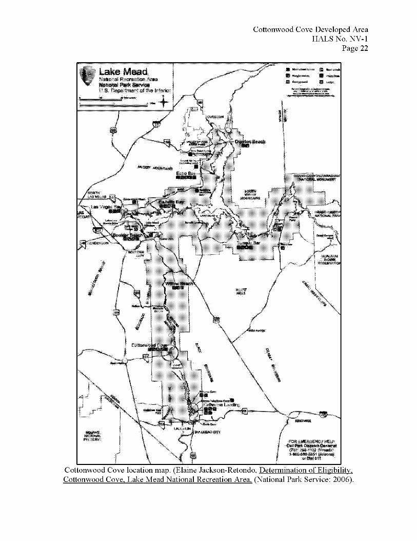
Cottonwood Cove location map. (Elaine Jacks on-Ret ondo, Determination of Eligibility. Cottonwood Cove. Lake Mead National Recreation Area. (National Park Service: 2006).
Cottonwood Cove Developed Area HALS No. NV-1
Page 23
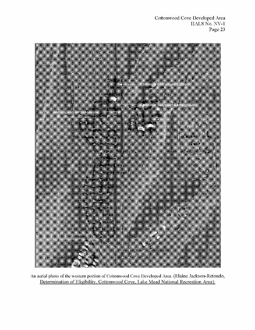
An aerial photo of the western portion of Cottonwood Cove Developed Area. (Elaine Jacks on- Ret ondo, Determination of Eligibility. Cottonwood Cove. Lake Mead National Recreation Area).
Cottonwood Cove Developed Area HALS No. NV-1
Page 24
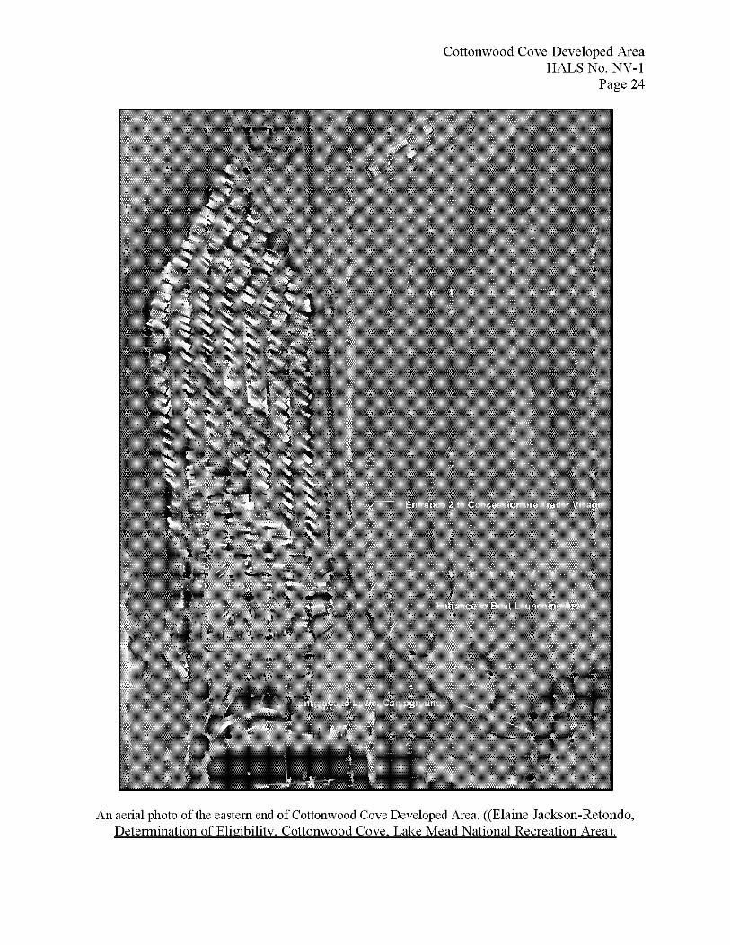
An aerial photo of the eastern end of Cottonwood Cove Developed Area. ((Elaine Jacks on-Retondo, Determination of Eligibility. Cottonwood Cove. Lake Mead National Recreation Area).
Cottonwood Cove Developed Area HALS No. NV-1
Page 25
The lower campground at Cottonwood Cove Developed Area. (Elaine Jacks on-Retondo, Determination of Eligibility. Cottonwood Cove. Lake Mead National Recreation Area).
Cottonwood Cove Developed Area HALS No. NV-1
Page 26
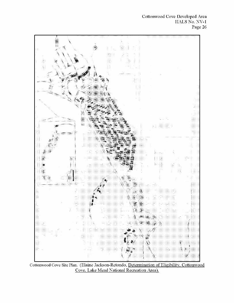
Cottonwood Cove Site Plan. (Elaine Jacks on-Retondo, Determination of Eligibility. Cottonwood Cove, Lake Mead National Recreation Area).