cost effective gis implementation for municipalities “wisconsin land information association...
TRANSCRIPT
Cost Effective GIS Implementation for Municipalities“Wisconsin Land Information Association Annual Conference – Applications Track” February 13, 2003

Presentation Outline
Discussion – Typical GIS Uses for Municipalities– Implementation Strategies– Challenges– Software/Innovations– Cost Saving Measures
Implementation Examples– City of Chetek– Village of Albany – City of Barron

Typical GIS Uses
Mapping– Parcel– Utilities (water, sanitary, storm, electric)– Buildings– Facilities– Environmental Areas– Assets (vehicular, personnel, aerial,etc.)
Facilities management– All mapping elements– Inventory control– Asset management
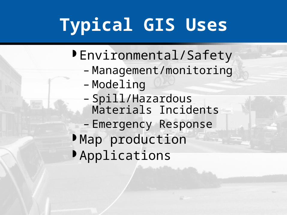
Typical GIS Uses
Environmental/Safety– Management/monitoring– Modeling – Spill/Hazardous Materials Incidents– Emergency Response
Map production Applications

Process for GIS Implementation
Needs assessment Implementation plan Acquire technology Pilot project Mapping Final GIS system Documentation – user and system manuals Continually maintaining, updating, and adding

Implementation Questions?
How much budget do you have?
What tasks can you complete?
What data exists?Who owns the data?
?? How do I acquire it?
What software is needed?
Can your system handle it?
Data accuracy and coordinate system?

Implementation Strategies
Phased CompleteInternalExternalIntegrated – Multiple DepartmentsCooperative – Multiple Agencies
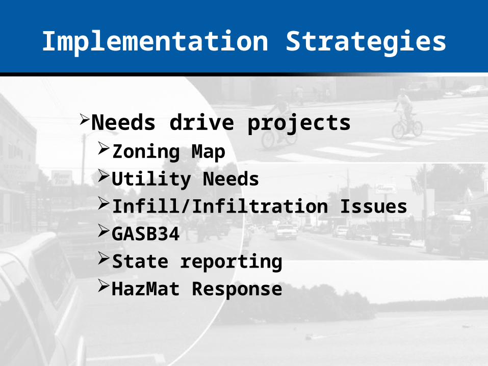
Implementation Strategies
Needs drive projectsZoning MapUtility NeedsInfill/Infiltration IssuesGASB34State reportingHazMat Response

Challenges of Implementation

Other Typical Challenges...
Identification of barriers – technical and institutional
An implementation plan should bea living document
Funding Systems administration, IT systems, training
and data architecture

Cooperation is KEY

Software/Applications Bring It All Together
SoilsParks/HistoricalZoningWatershedsUtilitiesD O Q / PhotoSchool DistrictsVillage BoundaryLand UseWetlands/NWIRoadsBase Map
Geodetic Reference

Several Options Exists For GIS Software and Use
ArcExplorerDataViewArcViewArc EditorArcInfoOther GIS Software PackagesInternet/Intranet Applications

Future of GIS
Simple/easy to access information
Palm computers
Cellular
Handheld GPS
Geodatabases
SDE

Internet/Intranet GIS

Case Studies
City of Chetek
Village of Albany
City of Barron

Case Studies
City of Chetek

Chetek Project Objective
Develop a GIS (Geographic Information System) for managing the City of Chetek
Introduce the City of Chetek to software that links information so individuals can:– Locate parcels for notification– Locate utility items easily– Map additional items– Easily incorporate information from other studies– Buffer Hazardous Spills– Emergency Management
Budget Constraints - $5,000.00

Project DevelopmentSteps in Completing Project
Planning/Needs Analysis Meeting
Review of existing data Acquisition of data layers
from other entities Convert system layers to
Baron County Coordinate System.
Create Other Layers Develop a database
(attribute tables) pertinent to the system’s characteristics in Microsoft Access
Convert utility cad information to shapefile format
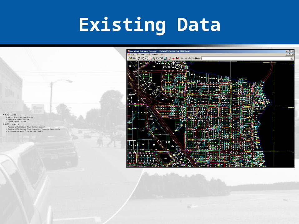
Existing Data
CAD Data– Water Distribution System– Sanitary Sewer System– Storm Sewer System
GIS Layers– Parcel information from Barron County– Zoning information from Regional Planning Commission– Orthophotography from Barron County

Nomenclature
The City of Chetek had no systematic numbering system for features within their water distribution system or sanitary sewer system.
The city divided their boundaries into quarters for numbering and locational purposes.
City staff redlined large plots with numbering/naming schemes for each data layer.

Data Layers
Parcels Lots Subdivisions (boundaries and text) Right-of-Ways Hydrologic Features Water Distribution System Sanitary Sewer System Storm Sewer System Zoning

Water Data Layer Attributes

Storm and Sanitary Sewer Data Layer Attributes

Parcel Data Layer Attributes

Locating New Features
The city plans to purchase the ESRI/Trimble GeoXT/ArcPad bundle for locating new features and creating new data layers
City staff want to do a large part of the work for new data layer creation

Software
Database Software GIS Software
Microsoft AccessEase of useEasy to learnCompatibility with ESRI productsInterface with water billing softwareAllows for custom reporting
DataView®
Easy to ImplementEasy to learn/No Formal Training NeedsESRI product (Map Objects) Connectivity to Microsoft Access

SoftwareDataView®

Attribute Tables
Each layer contains an attribute table (dbf file associated with shapefiles)
Each layer also contains a table in Microsoft Access for storing additional information

Future Plans
Chetek completed a Downtown Transportation Study– Sidewalk Locations– Parking Locations– Accidents– Traffic
Water system flow information Additional Layer Creation

Continuing The Implementation
The Needs Assessment identified more data layers The City has performed a prioritization and budgeting
schedule for a multi-year implementation The City intends to purchase ArcView to expand their
GIS capabilities. The City staff have already been working within the
application daily in the Public Works, Building Inspection, City Clerk, Police and Fire Departments, with the intent on increasing this until staff are using the system several times daily.

Case Studies
Village of Albany
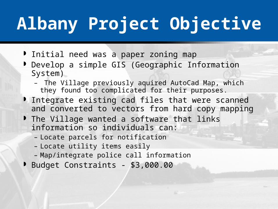
Albany Project Objective
Initial need was a paper zoning map Develop a simple GIS (Geographic Information System)
– The Village previously aquired AutoCad Map, which they found too complicated for their purposes.
Integrate existing cad files that were scanned and converted to vectors from hard copy mapping
The Village wanted a software that links information so individuals can:– Locate parcels for notification– Locate utility items easily– Map/integrate police call information
Budget Constraints - $3,000.00

Project DevelopmentSteps in Completing Project
Review of existing data Acquisition of data layers
from other entities Convert system layers to
Green County Coordinate System
Link county assessment data to the parcel map
Develop a database in Microsoft Access for attribute information
Allow for editing/input of zoning codes into the database easily
Convert utility cad information to shapefile format

Existing Data
GIS Layers– Green County Parcel Information – Green County Orthophotography
CAD Data– Water Distribution System– Sanitary Sewer System
Nomenclature
The Village had a systematic numbering system for features within their water distribution system and sanitary sewer system.
The Village had divided their boundary in half (based on the river location that splits the village) for numbering and locational purposes previously.

Data Layers
Parcels Hydrologic Features Water System Sanitary Sewer System Zoning

Water Data Layer Attributes

Sanitary Sewer Data Layer Attributes

Parcel Data Layer Attributes
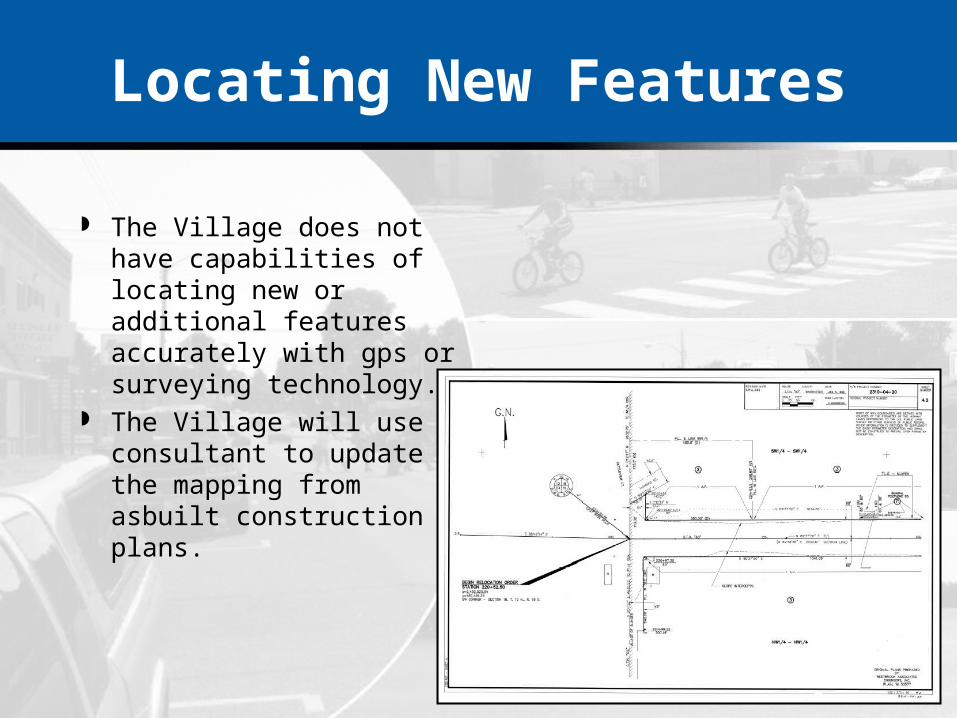
Locating New Features
The Village does not have capabilities of locating new or additional features accurately with gps or surveying technology.
The Village will use a consultant to update the mapping from asbuilt construction plans.

Software
Database Software GIS Software
Microsoft AccessEase of useEasy to learnCompatibility with ESRI productsInterface with County tax assessment listingAllows for custom reporting
DataView®
Easy to ImplementEasy to learn/No Formal Training NeedsUses ESRI shape file formatConnectivity to Microsoft Access

SoftwareDataView®

Attribute Tables
Each layer contained an attribute table (dbf file associated with shapefiles)
Each layer also contains a table in Microsoft Access for storing additional information

Future Plans
DataView is meeting the Village’s needs. The Village is planning to add an updated zoning
layer.

Case Studies
City of Barron

Barron Project Objective
Locate and view utility information readily Develop a GIS (Geographic Information System) for managing
the City of Barron
Introduce the City of Barron to software that links information so individuals can:– Locate parcels for notification– Locate utility items easily– Map additional items– Easily incorporate information from other studies– Complete locates in the field easily
Budget Constraints - $25,000.00

Project DevelopmentSteps in Completing Project
Planning/Needs Analysis Meeting - Informal
Review of existing data Acquisition of data layers
from other entities Locate manholes, hydrants
and valves using GPS
Convert system layers to Baron County Coordinate System
Develop a database (attribute tables) in Microsoft Access
Convert utility information from wall maps to digital format
Existing Data
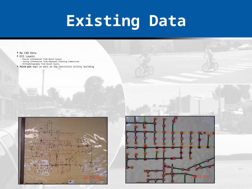
No CAD Data GIS Layers
– Parcel information from Baron County– Zoning information from Regional Planning Commission– Orthophotography from Baron County
Stick-pin maps on wall at the electrical utility building

Nomenclature
The City of Barron had a systematic numbering system for features within their water distribution, sanitary sewer and electrical distribution systems.
City staff redlined large plots with numbering/naming schemes for each data layer where new/unnamed items were located.

Data Layers
Parcels Hydrologic Features Water System Sanitary Sewer System Electrical Distribution System Zoning

Locating New Features
The City doesn’t have the capability of locating new or additional features with gps or survey.
The City will use a consultant to update the mapping using construction asbuilts.
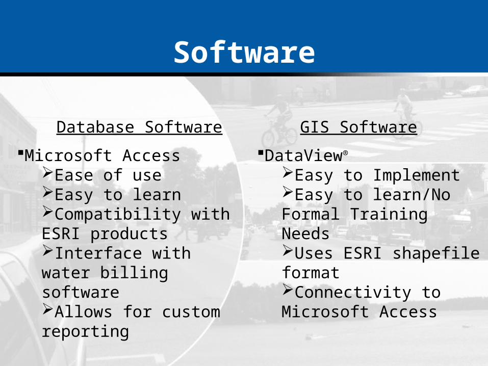
Software
Database Software GIS Software
Microsoft AccessEase of useEasy to learnCompatibility with ESRI productsInterface with water billing softwareAllows for custom reporting
DataView®
Easy to ImplementEasy to learn/No Formal Training NeedsUses ESRI shapefile formatConnectivity to Microsoft Access

Attribute Tables
Each layer contained an attribute table (dbf file associated with shapefiles)
Each layer also contains a table in Microsoft Access for storing additional information
Future Plans
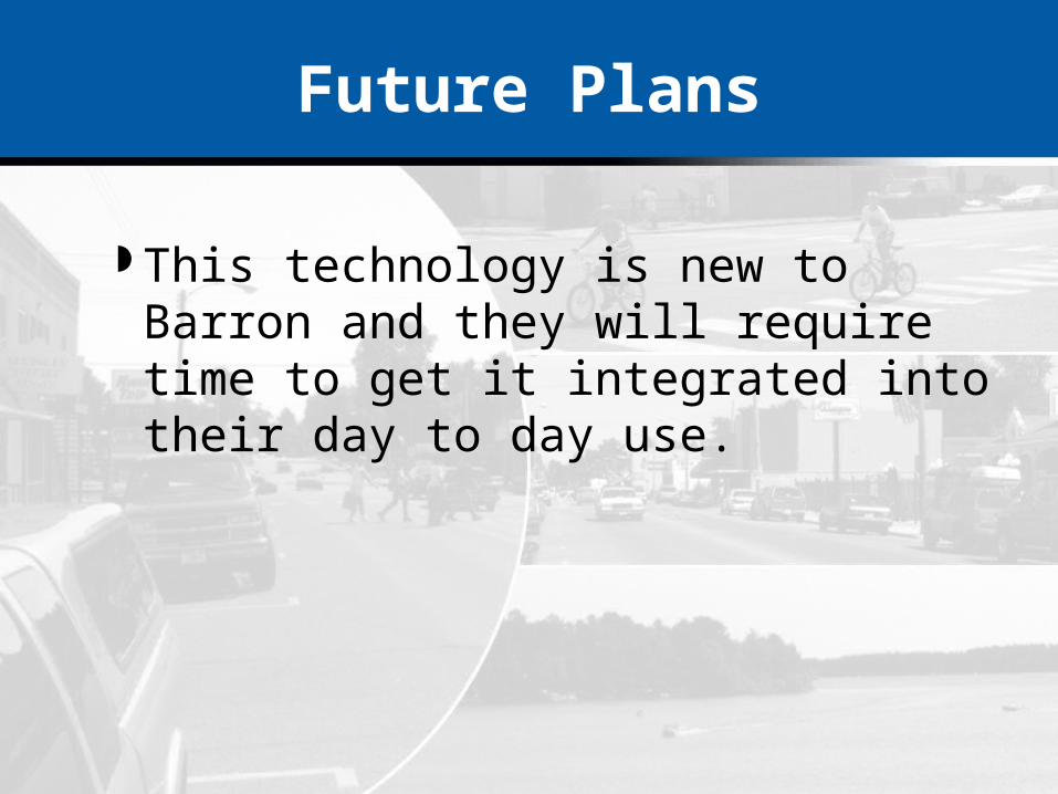
This technology is new to Barron and they will require time to get it integrated into their day to day use.

Summary
A GIS implementation is more than a software purchase
A GIS should be designed to fit your needs You don’t need to do it all at once An effective approach to GIS implementation will
reduce the project’s cost You can implement a GIS on your budget

Cost Effective GIS Implementation for MunicipalitiesFor more information contact:
Jon Schwichtenberg or Glen Ausse 608.274.2020 or 800.732.4362
email: [email protected] or [email protected]