corridor study for the pacific coast highway - executive ... · pdf filehigh travel time and...
TRANSCRIPT


BACKGROUND
1
133
73
55
5
405
SB
SEAL BEACHSUBAREA 1
HB
HUNTINGTON BEACHSUBAREA 2
NB
NEWPORT BEACHSUBAREA 3 NC
NEWPORT COASTSUBAREA 4
LB
LAGUNA BEACHSUBAREA 5
DP
DANA POINTSUBAREA 6 SC
SAN CLEMENTESUBAREA 7
SEAL BEACH
NEWPORT BEACH
NEWPORT COAST
LAGUNABEACH
DANAPOINT
SAN CLEMENTE
HUNTINGTON BEACH
2
Pacific Coast Highway (PCH) is one of Orange County’s most iconic highways. Directly adjacent to the Pacific Ocean, it traverses beautiful downtowns, open space, as well as, urban centers. PCH is also the corridor that links Orange County’s six coastal cities—Seal Beach, Huntington Beach, Newport Beach, Laguna Beach, Dana Point, and San Clemente.
Corridor residents and visitors frequently use multiple modes (vehicles, transit, walking, and bicycling) to travel to and from their activities in and around the corridor. Non-motorized modes such as walking and bicycling serve greater numbers of travelers in this corridor than in most other areas of Orange County. However, all of these diverse travel interactions occurring in an extremely tight right-of-way (ROW), put daily strain on this aging 37-mile long corridor.
As a result, the six Orange County coastal cities, requested that the Orange County Transportation Authority (OCTA) and the California Department of Transportation (Caltrans) conduct a PCH Corridor Study extending from the Los Angeles County line (in Seal Beach) to Avenida Pico

High travel time and delay due to traffic congestion and heavy volumes of pedestrians crossing the highway
Inconsistent aesthetic treatment of improvements compared to the scenic character of the corridor
Safety conflicts between vehicles, bicycles, and pedestrians
High volumes of visitors and recreational users leading to unique travel patterns and peaking characteristics
Constrained ROW resulting in limited improvement opportunities
1.
4.
2.
5.
3.
6. Frequent interruption and closures due to events and incidents resulting in limited parallel options
3
(in San Clemente). The goal of the study was to identify, evaluate, and recommend long-term multi-modal improvement recommendations both on a corridor-wide and subarea-wide (primarily jurisdictional) basis. The Study followed the typical Corridor-Study methodology, which consisted of problem definition (development of a Purpose and Need Statement), identification of alternatives, evaluation of alternatives, modification of alternatives (based upon stakeholder and technical input), and recommendations. The following sections provide an overview of corridor-wide and subarea-wide needs, improvement objectives, the three final alternatives (Transportation System Management, Low Capital and High Capital), and improvement recommendations.
Corridor-wide NeedsThe PCH Corridor Study identified corridor-wide and subarea issues, opportunities, and constraints based on existing and future conditions analysis and input from agency representatives. This formulated the specific Needs and Objectives for the corridor, as well as, for each subarea to be used as the basis for identifying and recommending potential improvements.

CW CORRIDOR-WIDE
Corridor-wide Purpose (Objectives)• Improvesafetybyreducingpotentialfor
conflicts between modes;
• Improvemobilitybyreducingtrafficcongestion and traveler delay, improving the continuity of traffic flow, and making it more convenient for people to travel without needing an automobile;
• Creatingamorepleasantcorridorexperience by encouraging aesthetic enhancements as part of corridor improvement projects;
• Betteraccommodatingtheuniquetravelcharacteristics associated with the corridor’s coastal location;
• Developcost-effectiveandfeasibleimprovement options.
4

Recommended Alternatives
Transportation System Management/Transportation Demand Management Alternative
• DevelopaconsistentsignageprogramtodemarcateClassIIIbikeroutesandtoguiderecreationalbikestoparallelbikefacilities.LocationsofbikefacilitieswouldbeincludedineducationalTrafficManagementPrograms.
$
• DevelopaPCHEducationalBicycleandPedestrianprogram
$
• AdoptContextSensitiveDesignimprovementsinthecorridor.Appropriatetechniquesorcomponentstoprovidecomfortableandsafeaccommodationsofvehicles,pedestrians,transit,andbicycles.
Cost to be determined once projects are defined.
• RecommendimprovementsthatavoidsignificantROWacquisition.
$
• TrafficManagementProgram-BeachTravelAPPtoprovideupdatesonevents,alternateroutes,parking/transitoptions,andschedules.Tailoredtohaveinformationforallmodes(vehicles,bicyclepedestrian,transit).
$$
• Pursuejointagencyprojectsandsubmitmulti-agencygrantapplications.
$
Low Capital Alternative
• Busturnoutsforlayoverareasatheavyboarding/alightingstopstoremovebusesfromtravellanesatlocationswithlongerdwelltimes.
$$$
•Modernizetrafficsignalsystems:
-Synchronizationandoptimization
-Upgradeequipmentandprovidefiberinterconnect
- InstallCCTV-ConnecttoCaltransandCityTrafficManagementCenters
-Developcorridoremergencyresponseandre-routestrategies
$$$
• DevelopContextSensitiveSolutionstobuidlingouttheMPAH.
Cost to be determined once projects are defined.
• BuildonBasicTransportationManagementProgram,includingsharingcommunicationsystems,incorporateparkingmanagement,andsigns.
$$
• Incorporateaestheticenhancementsinfuturecorridorprojectsandprograms.
Aesthetic costs are part of project cost.
High Capital Alternative
•WorkwithCoastalCommissiononparkingreplacementtoaccommodateacorridor-wideClassIIbikeprogramorsidewalks.
$$$
• Developtransithubsandsignalprioritypotential.
$$$
• UsingaSharedFiberOpticsystem,incorporateConnectedVehiclesandothertechnicalfeaturestohelpoverallsafetyofthecorridor.
$$
CW
5
CostofImprovementupto$250,000
CostofImprovement$250,000-$5,000,000
CostofImprovementgreaterthan$5,000,000

SB SEAL BEACHSUBAREA 1
Subarea NeedsNeeds were determined based on the existing and future conditions analysis of the Seal Beach subarea.
• Recurringpeakhourtrafficcongestiondelays–limited mobility
• Conflictsbetweenbicyclists/pedestriansandhigh-speed moving vehicles in areas with no designated bicyclefacilities/sidewalks
• Conflictsbetweenbicyclistsandparkedcars/busstops and moving vehicles
• Conflictsforbicyclistsbetweenfast-movingcarsand right-turn movements
Subarea ObjectivesObjectives for the subarea were then defined to be used as the basis for identifying and recommending potential future improvements.
• Reducerecurringcongestionanddelays
• Reducepotentialforconflictbetweenbicyclesandmoving vehicles
• Reducepotentialforconflictbetweenbicyclesandparked vehicles
• Improvecontinuityoftrafficflow
Seal Beach encompasses the northernmost portion of the corridor and serves as a gateway between Los Angeles and Orange counties. Located between the cities of Long Beach and Huntington Beach, Seal Beach consists of smaller residential neighborhoods amongst popular surfing destinations and commercial areas in the southern portion. This portion of the PCH corridor is primarily a 4-lane travel-through corridor with existing and future recurring congestion, as well as limited designated bicycle facilities.
6

7
OR
AN
GE
CO
UN
TY
MA
IN S
T
SE
AL B
EA
CH
BLV
D
AN
DE
RS
ON
ST
LOS
AN
GE
LES
CO
UN
TY
SA
N G
AB
RIE
L RIV
ER
AN
AH
EIM
BA
Y
PCH / MAIN ST
Providewayfindingsignstoguidebicycliststoparallelbikefacility(proposedClassIIbikelanesandexistingmulti‐usepathinmedian)onElectricAvenuebetweenMainStreet
andOceanAvenue.
RemoveSBright‐onlylaneonPCHatSealBeachBoulevardandreplacewithbikelane.
Provideon‐streetpaintedbufferbetweenbikelaneandtrafficlaneonPCHbetweenSealBeachBoulevardandAndersonStreet(whereroadwayandlanewidthpermit).
RemoveNBright‐turnonlylaneatdrivewaynorthofPCH/MarinerDr.andreplacewithbikelanes.
RemoveSBright‐turnonlylaneatPCH/PhillipsStreetandreplacewithbikelanes.
Addsidewalksindevelopedareaswheretheyarecurrentlymissing(about1,000ftontheinlandsideofPCH,andabout2,000ft.onthe
oceansideofPCH).
Eliminateorrelocatepolesandotherfixedobjectsatgradeneardrivewaysinsections
northofPiedmontCircle.
Reduceorcombineaccesspointswherefeasible,especiallyinareasnorthofPiedmontCircle,aspartofredevelopment.
Provideatwo‐wayClassIVCycle‐TrackwithbufferonthesouthwestsideofPCHandsupplementwithanorthbound
bikelane(OCLoopGapLproposedalignment)
MinorstreetwideningandtravellanewidthreductiontoaccommodateClassIIbikelanesbetweenon‐streetparking
andtravellanesonPCH.
Providenorthboundoff‐streetbikeway(withinCaltransROW)inadvanceofintersectiontotransitionbicyclistsoffroadwayandguidethemtotravelsoutherlyalongSealBeachBoulevard
ClassIbikeway.
IntersectionimprovementsatPCH/MainStreet(RestripeWB(MainStreet/BolsaAvenue)toprovidedualrightturns(RT,
Thru/RT,LT).
Remove/relocateon-streetparkingandinstallbikelanes.
Widenintersectionapproach(ornarrow/removemedian)andprovideathroughbikelaneonPCH
(betweenthethroughandright‐turnvehiclelanes)ontheinlandside.
IntersectionimprovementsatPCH/SealBeachBoulevard(AddSBdualleftturnfromPCH(awayfromthecoast).
Map illustration not to scale
Implemented through future development
City Lim
it
Subarea Alternatives• HighCapitalAlternative • LowCapitalAlternative• TransportationSystemManagement/ Transportation Demand Management Alternative
CostofImprovementgreaterthan$5,000,000 CostofImprovement$250,000-$5,000,000 CostofImprovementupto$250,000
SB
SEAL BEACH BLVD TO ANDERSON ST
SEAL BEACH BLVD TO ANDERSON ST
MAIN ST TO SEAL BEACH BLVD
PCH / SEAL BEACH BLVD
HB HUNTINGTON BEACHSUBAREA 2
Subarea NeedsNeeds were determined based on the existing and future conditions analysis of the Huntington Beach subarea.
• Vehicleconflictpointsformovingtrafficduetonon-standard design of local streets and parking
• Recurringpeakhourtrafficcongestiondelays–limited mobility
• Conflictsbetweenbicyclistsandhigh-speedmoving vehicles in areas with no designated bicycle facilities
• Trafficback-upduetofullcityparkinglots–conflicthazard for moving traffic
• Conflictsbetweenbicyclistsandparkedcarsandmoving vehicles
• PedestriancrossingsofPCHat6thSt.reducetraffic capacity and limit mobility
• Heavypedestriancrossingvolumesreducecapacityand limit mobility
• Midblockpedestriancrossingvolumesposeconflictwith traffic
• Signaltimingisnotoptimizedforcontinuoustrafficflow
Subarea ObjectivesObjectives for the subarea were then defined to be used as the basis for identifying and recommending potential future improvements.
• Reducepotentialforconflictbetweenbicyclesandmoving vehicles
• Reducepotentialforconflictbetweenbicyclesandparked vehicles
• Reducepotentialforconflictbetweenvehiclesandpedestrians crossing PCH
• Reducerecurringcongestionanddelays
• Improvecontinuityoftrafficflow
• ReducelikelihoodoftrafficbackupsontoPCHfromcity parking lots
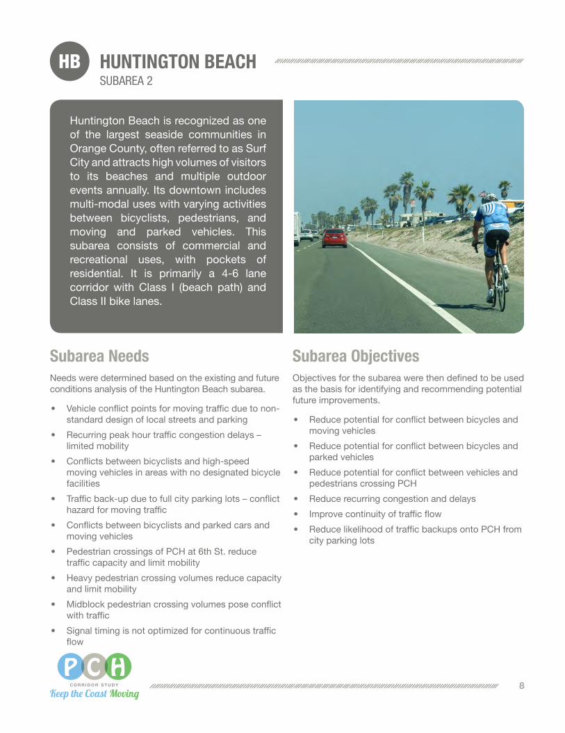
Huntington Beach is recognized as one of the largest seaside communities in Orange County, often referred to as Surf City and attracts high volumes of visitors to its beaches and multiple outdoor eventsannually.Itsdowntownincludesmulti-modal uses with varying activities between bicyclists, pedestrians, and moving and parked vehicles. This subarea consists of commercial and recreational uses, with pockets of residential. It is primarily a 4-6 lanecorridorwithClass I (beach path) andClassIIbikelanes.
8

9
WA
RN
ER
AV
E
6T
H S
T
BE
AC
H B
LVD
GO
LDE
NW
ES
T S
T
SE
AP
OIN
T S
T
HU
NT
ING
TO
N S
T
AN
DE
RS
ON
ST
SA
NTA
AN
A R
IVE
R
Map illustration not to scale
PCH / WARNER AVE
SUNSET BEACH
PCH / 6TH ST
PCH / BEACH BLVD
BEACH BLVD TO SANTA ANA RIVER
Providetreatmentstoreducebike/vehicularconflictsat
intersection(e.g.twostageleftturnboxes,turnboxprotectedbyphysicalbufferorparking
laneetc,)forbicyclistsonPCHatWarnerAvenue.
Redesignminorroadaccesses,roadgeometrics,remove
on‐streetparkingtoimprovevisibilityandsightanglesasredevelopmentoccurs.
Widenexitdrivewayfrombeachsideparkinglottoallowforseparateturnmovements(may
entailrelocationofparking).
InstallthroughbikelanesonPCHatWarnerbynarrowing
median.
StripeClassIIIsharrowsonAndersonStreetbetweenPCH
andPacificAvenue.
EliminateonepedestriancrosswalkatPCH/6thStreetandprohibitpedestriancrossingacrossthatlegofintersectioninordertoeliminateauto/pedestrian
conflictsononelegoftheintersectionandincreaseavailable
greentimeforturningvehicles(improvementwillincludetrafficsignalmodification,signing/striping,removalofcrosswalketc.).
IntersectioncapacityimprovementatPCH/WarnerAvenuewithdesign
toavoidimpactonadjacentsensitivearea.
WARNER AVE TO GOLDENWEST ST
InstallClassIIbikelanes(onbothsidesofPCH)andadda2‐footbufferonPCHthroughBolsaChica–adjustvehicularlanewidths/
medianasneeded.
Stripethroughbikelanesatright‐turnpocketsandinstallgreenconflict
stripinginmergeareaspriortoandatbeachaccessdriveways(ifbikelanesaredevelopedonthissegmentofPCH).
Landscapeexistingmedianorconstructaraisedcentermediantovisuallynarrowandprovideaesthetic
enhancements.
PCH / BROOKHURST ST
IntersectionimprovementatPCH/BrookhurstStreetinordertocarrybikelanesthroughthe
intersection.
GOLDENWEST ST TO 6TH ST
InstallsharrowsonPCHintrafficlanenexttoon-streetparkingwherenoon‐streetbikelaneis
provided.
DevelopparallelClassIIIbikeroutealongWalnutAvenueorOliveAvenuebetweenGoldenwest
Streetand1stStreet.
6TH ST TO BEACH BLVD
StripeClassIIbicyclelanesonPCHfrom1stStreettoBeachBoulevardbetweenparkingandadjacenttravellane,whereClassIIbikelanesaremissingandwhere
roadwayandlanewidthpermit.
RestripePacificViewAvenuetoprovideonetravellaneandoneClassIIbikelaneeachway
between1stStreetandBeachBoulevard.
Addmedianbarrierorfence(HuntingtonStreettoBeach
Boulevard).
Remove/relocateparkingandinstallClassIIbikelanes.
Paintsharedlanemarkings(sharrows)inlaneadjacenttoparkingandincorporatespeedreductionmechanism.
DevelopClassIIIbikerouteonPacificViewAveandClassIIonAtlantaAve.
ProvideenhancedsignagehighlightingforbicycliststheavailabilityoflowstressroutealongPacificAvenuefromAndersonStreettoWarner
Avenue.
Providetreatmentstoreducebike/vehicularconflictsatintersection(e.g.,twostageleftturnboxes,turnboxprotectedbyphysicalbufferorparkinglaneetc,)for
bicyclistsatPCH/BeachBoulevard.
Providetreatmentstoreducebike/vehicularconflictsatintersections(e.g.,twostageleftturnboxes,turnboxprotectedbyphysicalbufferorparkinglaneetc,)for
bicyclistsatBeachBoulevard,NewlandStreet,MagnoliaStreet,andBrookhurstStreet.
ConvertexistingshouldertoClassIIbikelaneswitha2footbuffer(betweenBeachBoulevardandtheSantaAnaRiver).Thisimprovementmayalsoincludereductionoflane‐widthtoaccommodateClassIIbikelaneswithin
existingpavement.
AddsidewalksonbothsidesofPCH(BeachtoNewland).
SEAPOINT ST TO GOLDENWEST ST
Installintelligentparking
managementsystemtodirectvisitorsawayfromfulllotstoavailableparking.
Modifyaccesstodrivewaysandcirculationwithinparkinglotstoprovidemultipleentry(accessredesign).
City Lim
it
HBC
ity Limit
BR
OO
KH
UR
ST
ST
Subarea Alternatives• HighCapitalAlternative • LowCapitalAlternative• TransportationSystemManagement/ Transportation Demand Management Alternative
CostofImprovementgreaterthan$5,000,000 CostofImprovement$250,000-$5,000,000 CostofImprovementupto$250,000

NB NEWPORT BEACHSUBAREA 3
Subarea NeedsNeeds were determined based on the existing and future conditions analysis of the Newport Beach subarea.
• ConflictsbetweenbicyclistsusingnorthboundPCHand parked cars and moving vehicles
• Heavyvolumesofpedestrians,bicycles,andtrafficaggravate conflict potential in west Newport
• Recurringpeakhourtrafficcongestiondelays–limited mobility
• Heavytrafficvolumesandhighpedestriancrossingactivity delays through Mariners Mile area
• Conflictsbetweenbicyclistsandparkedcarsandmoving vehicles
• HeavyvolumesofpedestriancrossingsinMarinersMile conflicts with traffic
• LimitedmobilitythroughCoronadelMarareadueto significant traffic volumes, constrained capacity, substantial pedestrian activity, substantial bicycle activity, and on-street parking friction
• Heavypedestriancrossingvolumesposeconflictwith traffic
• Conflictsforbicycliststravelinginsharedtrafficlaneadjacent to parked cars
• SignaltimingisnotoptimizedfromSantaAnaRiverto Jamboree Rd.
Subarea ObjectivesObjectives for the subarea were then defined to be used as the basis for identifying and recommending potential future improvements.
• Reducepotentialforconflictbetweenbicyclesandmoving vehicles
• Reducepotentialforconflictbetweenbicyclesandparked vehicles
• Reducepotentialforconflictbetweenvehiclesandpedestrians crossing PCH
• Reducerecurringcongestionanddelays
• Improvecontinuityoftrafficflow
• Improveaesthetics
• Reduceoreliminateconflictsbetweenbicyclesandright-turning vehicles
Located in the coastal center of Orange County, the City of Newport Beach includes residential “villages,” growing commercial areas, and various aquatic sport activities along the beach and bay area.Itconsistsofvaryinglandscapeandactivity between bicyclists, pedestrians, and moving and parked vehicles. Heavy traffic travels along the 4-8 lane corridors, withsomeClassI,II,andIIIbikelanes.
10

11
OR
AN
GE
ST
PR
OS
PE
CT
ST
SU
PE
RIO
R A
VE
RIV
ER
SID
E A
VE
NE
WP
OR
T B
LVD
BA
YS
IDE
DR
JAM
BO
RE
E R
D
PE
LICA
N P
OIN
T D
R
SE
AW
AR
D R
D
SA
NTA
AN
A R
IVE
R
LOW
ER
NE
WP
OR
T B
AY
MACARTHUR BLVD TO SEAWARD RD
MACARTHUR BLVD TO PELICAN POINT DR
SANTA ANA RIVER TO SUPERIOR AVE SR-55 TO DOVER DRSR-55 TO DOVER DR, PCH/RIVERSIDE
AVE, PCH / DOVER DR
DOVER DR TO BAYSIDE DR
ExtendsharrowsonPCHsouthofPoppyAve.
StripeclassIIbikelanealongnorthboundPCHbetweenHighlandStreetand61stStreet,wherever
roadandlanewidthpermit.
Improvebicycle/pedestrianaccesstobeachfromRiversideAvenueusingsidewalkonoceansideofCoastHighwaytoaccessBalboaPeninsula(SR‐55toDover).
ParkandridelotbetweenSR‐55andOldNewportBoulevard(vacantpavedlotonthenorthwestquadrantoftheintersectionofOld
NewportBoulevardandPCH).
ImproveNBPCHthroughinterchangewithSR-55byincludingadditionalthrough
lane,turningpocket,andClassIIbikelane.
Implementaccessmanagementstrategies
includingconsolidatingaccesspointsandradiusdriveways.
Widen/restripeandaddClassIIbikelanesby
removingon-streetparking.
AddsecondsouthboundleftturnlaneonPCHatRiverside.
Eliminate/relocatetrafficsignalatTustinAve.
ConstructnewClassIbiketrailatendofAvonStreetlinkingtoOldNewportBoulevardanddirectingbicycliststotheloopleadingtosouthboundNewport
BoulevardtoaccessBalboaPeninsula.
StripeClassIIbikelanesacrosstheBackBayBridgebetweenDoverandBayside.
WidenoraddtobridgeoverBackBaytoprovideClassI
bikewaybetweenBaysideDriveandDoverDrive.
Provideintersectiontreatmentstoreducebike/vehicularconflictsat
intersections.
Reduceconflictpointsthroughaccessmanagementstrategiesincluding
consolidatingaccesspointsandradiusdriveways,asredevelopmentoccurs.
Relocation/reductionofon‐streetparkingonPCHbetweenSantaAnaRiverandSuperiorAvenuetobenefitoperationsandreduce
disruptionoftrafficflow.
Remove/relocateonstreetparkingandinstallClassIIbikelanes.
ProvidenewClassItrailnearSunsetRidgeParklinkingtofutureBanningRanchdevelopmentforparallelroutingbetween
SuperiorandSantaAnaRiverTrail.
ExtendeastbankClassIbikewayonSantaAnaRiverTrailunderCoastHighwayandlink
toSeashoreDrive.
ImplementtwobikeboulevardsinCronaDelMar;northerly(FifthtoOrchid),andsoutherly(AvocadotoSecondtoGoldenrodto
SeaviewtoPoppyorBaysidetoMargueritetoPoppy).
ImplementstrategiestoencouragedriverstouseNewportCoastDrive,toremovetrafficfrom
PCHinCoronadelMar.
Remove/relocatestreetparkingandstripeClassIIbike
lanes.
Installcurbextension(onlyonparkinglanes)toshortenpedestriancrossingtimes(MacArthurBoulevard
toSeawardRoad).
ImplementtwobikeboulevardsinCoronaDelMarNorthernandSouthernarea.
PCH / ORANGE ST / PROSPECT ST / SUPERIOR AVE
PCH / SUPERIOR AVE
DevelopmobilityhubwithParkandRideparkingspaces,transitcenter,bikeandpedestrianamenitiesnearPCH/Superior(atthenortheastcornerofCoastHighway
atSuperior)integratedwithITSandparkingmanagementsigns.
Widen/restripetoprovidethreetravellanesineachdirectionwithacentertwowayleftturnmedianandClassIIbikelaneswithremovalofon-streetparking
betweenNewportBoulevardandDoverDrive.
Gradeseparatedpedestrianandbicyclecrossingbridgeandremoveat‐grade
pedestriancrosswalksandre‐timesignalaccordingly.
Providebicycle/pedestriantraillinkingtoSantaAnaRiverTraileastbanktoprovide
accesstocommunityofhomesandbusinessesnorthofCoastHighway.
WidenintersectionofPCH/SuperiorAvenuetoreducepeakperiodcongestionanddelay,
possiblybyaddingasecondturnlaneonthewestbound(Coast
Highway)approach.
MA
CA
RT
HU
R B
LVD
DO
VE
R D
R
NB
SR-55 TO DOVER DR, PCH/RIVERSIDE AVE
Enhancesigning/striping/lightingtobetteralertmotoriststopedestriancrossingatintersections(SR‐55toDover).
DeveloppedestrianovercrossingincoreareaofMarinersMile(nearRiversideAveorTustinAve).
Installmedianrefugeislandtoshortencrossingdistanceandpedestriansignaltiming.
SANTA ANA RIVER TO NEWPORT BLVD
PCHbetweenSantaAnaRiverandNewportBoulevard:maintainexistingsouthboundClassIIbikelanesandrestripesectionswithshouldertoprovideClassIIbike
laneswitha2footbuffer,whereROWpermits.
Implemented through future development
TBD
Implemented through
future development
Implemented through future development
City Lim
it
Subarea Alternatives• HighCapitalAlternative • LowCapitalAlternative• TransportationSystemManagement/ Transportation Demand Management Alternative
CostofImprovementgreaterthan$5,000,000 CostofImprovement$250,000-$5,000,000 CostofImprovementupto$250,000
NC NEWPORT COASTSUBAREA 4
Subarea NeedsNeeds were determined based on the existing and future conditions analysis of the Newport Coast subarea.
• Conflictbetweenbicyclesandtrafficusingrightturnlanes on Newport Coast Drive
Subarea ObjectivesObjectives for the subarea were then defined to be used as the basis for identifying and recommending potential future improvements.
• Reducepotentialforconflictbetweenbicyclesandmoving vehicles
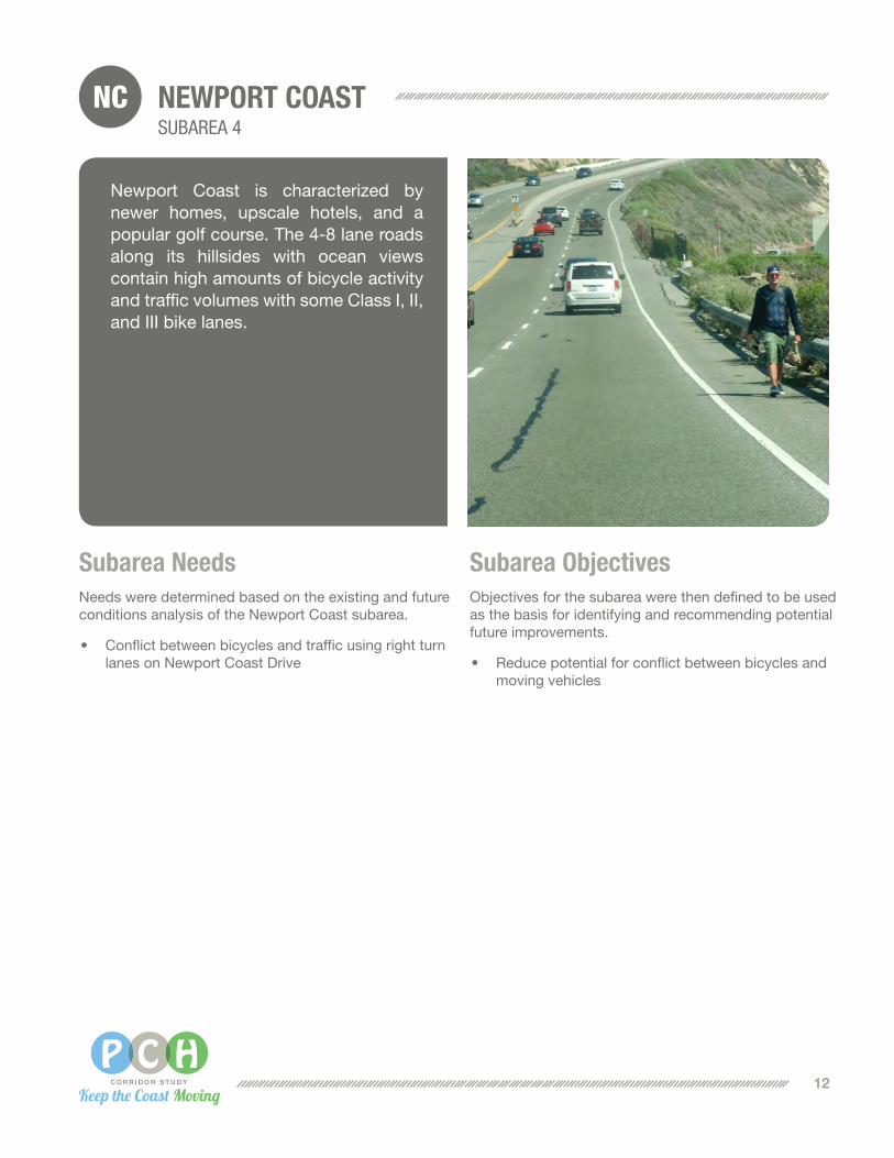
Newport Coast is characterized by newer homes, upscale hotels, and a popular golf course. The 4-8 lane roads along its hillsides with ocean views contain high amounts of bicycle activity andtrafficvolumeswithsomeClassI,II,andIIIbikelanes.
12

13
PE
LICA
N P
OIN
T D
R
PCH/NEWPORT COAST DR
PCH/CRYSTAL HEIGHT DR AREA
PELICAN POINT DRIVE TO NORTH LAGUNA BEACH CITY LIMIT
SignandrestripeintersectiontoprovideClassIIbikelanethroughintersection
ConstructaraisedmedianattheshoppingcenterentrancenearCrystalHeightsDrivetoprecludeillegalturnsacrossthestripedmedian
PCH(SeawardRoad–NewportBeachCityLimit):maintainexistingClassIIbikelanesandrestripesectionswith8footshouldertoprovideClassIIlaneswitha2footbufferAdd/designateon‐streetClassIIbikelaneswheregapsinsystemwithin
identifiedlimits.
ExtendClassIbikewaythroughCrystalCoveParktoElMoroStateParksignal
DevelopClassIpathorClassIVcycletracktoprovidealowstressbikefacilityforbicyclistsfromNewportCoasttoLagunaBeach
Map illustration not to scale
NCC
ity Limit
CR
YS
TAL H
EIG
HT
S D
R
NE
WP
OR
T C
OA
ST
DR
Subarea Alternatives• HighCapitalAlternative • LowCapitalAlternative• TransportationSystemManagement/ Transportation Demand Management Alternative
CostofImprovementgreaterthan$5,000,000 CostofImprovement$250,000-$5,000,000 CostofImprovementupto$250,000

LB LAGUNA BEACHSUBAREA 5
Subarea NeedsNeeds were determined based on the existing and future conditions analysis of the Laguna Beach subarea.
• Limitedmobilityduetosignificanttrafficvolumes,constrained capacity, pedestrian activity, and on-street parking friction
• Heavypedestriancrossingvolumesposeconflictwith traffic
• Bicycliststravelingincloseproximitytomovingandparked cars due to constrained width of PCH and presence of on-street parking
• Narrowormissingsidewalks
Subarea ObjectivesObjectives for the subarea were then defined to be used as the basis for identifying and recommending potential future improvements.
• Reducerecurringcongestionanddelays
• Reducepotentialforconflictbetweenbicyclesandmoving vehicles
• Reducepotentialforconflictbetweenbicyclesandparked vehicles
• Reducepotentialforconflictbetweenvehiclesandpedestrians crossing PCH
• Reducepotentialforconflictbetweenvehiclesandpedestrians walking along PCH
The City of Laguna Beach is another popular recreational destination for residents and visitors alike, with a close-knit beach community, characterized by upscale homes and shops. Downtown Laguna Beach along Pacific Coast Highway specifically has high pedestrian and bicycle activity and a narrow roadway. The subarea consists of a mostly 4-lane corridor with on-street parking, narrow sidewalks, and no marked/designatedbikelanes.
14

15
LED
RO
IT S
T
BO
AT
CA
NY
ON
DR
LEDROIT ST TO BOAT CANYON DR
MOUNTAIN RD TO DANA POINT CITY LIMIT
NORTH LAGUNA BEACH CITY LIMIT TO DANA POINT CITY LIMIT
BROADWAY ST TO MOUNTAIN RD SOUTH LAGUNA BEACH
UpgradesidewalkandpedestrianfacilitiestoADAstandards
Removecentertwo‐wayleftturnlanewhereappropriate,manage/consolidateturningmovementstoaccommodateClassII
bikelanesonPCH(RubytoNyes).
StripingandADAimprovementsnearMountainRd
OnPCHfrom7thAvenuetoMossStreetupdateexistingADAcurbramps,widensectionsofexistingsidewalktomeetminimumclearwidthstandardsandaddAPS
systems.
Implementpedestrian“scramble”crossingatlocationsidentifiedthroughcoordination
withCityCouncilandcommunity.
Installpaintedsharedlanemarkings(sharrows)alongwithcorresponding“BicyclesMayUseFullLane”signs.
Stripethroughbikelanesatrightturnpocketsandinstallgreenconflictstripinginmergeareaspriortoandataccessdriveways.
Addsidewalkswherethereissufficientroomtoaccommodate‐includesacquisitionofROW.
ReconfigureGlenneyre(CaliopetoMermaid)from4to2travellanestoaccommodateClassIIbikelaneswithwayfindingsigns.
Installilluminatedpedestriancrossingswithadvancedwarningsystemsatadditionallocations.Locationsforthisstrategycanbe
obtainedthroughdetailedpedestrianactivitystudy
Remove/relocateon-streetparkingandstripeClassIIbikelane.
BR
OA
DW
AY
ST
MO
SS
ST
RU
ST
Y S
T
NY
ES
PL
MO
UN
TAIN
RD
7T
H
Map illustration not to scale
LB
City Lim
it
City Lim
it
Subarea Alternatives• HighCapitalAlternative • LowCapitalAlternative• TransportationSystemManagement/ Transportation Demand Management Alternative
CostofImprovementgreaterthan$5,000,000 CostofImprovement$250,000-$5,000,000 CostofImprovementupto$250,000

DP DANA POINTSUBAREA 6
Subarea NeedsNeeds were determined based on the existing and future conditions analysis of the Dana Point subarea.
• Recurringdelaysandlimitedmobilityduetoanticipated increases in pedestrian activity and concentration of higher traffic volumes
• Conflictsforbicycliststravelingadjacenttomovingvehicles
• Conflictsforbicycliststravelinginasharedlanewith moving and parked vehicles
• Recurringpeakhourtrafficcongestiondelays
• Lackofpedestrianfacilities
• NonorthboundbicyclerouteonCoastHighwayfrom Doheny Park Rd. to Del Obispo St.
• HeightofCoastHighway/ParkLanternbridgeinadequate to withstand flood waters
• Limitedtravelmodestoconnecttodestinationswithin the community core areas
• Inconsistentaesthetictreatments
• Conflictsbetweenbicyclistsandmovingvehicles
Subarea ObjectivesObjectives for the subarea were then defined to be used as the basis for identifying and recommending potential future improvements.
• Reducerecurringcongestionanddelays
• Reducepotentialforconflictbetweenbicyclesandmoving/parkedvehicles
• Reducepotentialforconflictbetweenvehiclesandpedestrianswalkingalong/crossingPCH
• Maintainoperationduringinterruptionsandclosures
• Increaseopportunitiesforothermodesoftransport
• Improvenighttimelighting
• Accommodateandencouragetransportationenhancements
Halfway between San Diego and Los Angeles, Dana Point is known for its coastal bluffs, beaches, and rolling hills along the coast. With increasing pedestrian activity along its corridor, there is a need for the accommodation and encouragement of multimodal uses throughout the subarea. Roads consist ofacombinationof2-6lanes,includingClassIIandIIIbikelanes,withastretchofClassIfacilitybetweenDohenyParkRoad and Camino Capistrano.
16

SA
N JU
AN
CR
EE
K
17
CROWN VALLEY PKWY TO BLUE LANTERN ST
BLUE LANTERN ST TO COPPER LANTERN STCOPPER LANTERN ST TO
DEL OBISPO STLAGUNA BEACH BORDER TO BLUE
LANTERN ST AND COPPER LANTERN ST TO DEL OBISPO ST
PCH / GOLDEN LANTERN ST
DOHENY PARK AREA
PCH / COPPER LANTERN ST / DEL PRADO AVE
AdditionofbusturnoutsfromBlueLanterntoCopperLantern,asredevelopmentoccurs.
Widensidewalksforpedestrians.
Reviewandincludeconsistentlightingforbicyclesandpedestrians
duringprojectupgrades.
Stripethroughbikelanesatrightturnpocketsandinstallgreenconflictstripingatmergeareaspriortoandat
accessdriveways.
AddsidewalksonbothsidesbetweenLagunaBeachborderandSelvaSt
whereright-of-waypermits.
AddretainingwallsoninlandsidebetweenNiguelSttoSelvaStandconstruct5ftsidewalk(min).
InstallonewayClassIBike/PedTrailonbothsidesofPCHbetweenLagunaBeachCityLimitandBlueLantern.
ProvideClassIbiketrailontheoceansideofPCH(LagunaBeachtoBlue
Lantern).
OvercrossingonPCHatGoldenLanternforpedestrianscrossingPCH,withprohibitionof
atgradecrossings.
ImprovePCH/CopperLantern/DelPradoIntersectiontoenhancetrafficflow(possiblywitharoundabout).
PCH / DEL OBISPO ST
WidenintersectionofPCH/DelObispotoprovidecongestionrelief
throughtheintersection.
Map illustration not to scale
CR
OW
N VA
LLEY
PK
WY
NIG
UE
L RD
DE
L OB
ISP
O S
T
DO
HE
NY
PA
RK
GO
LDE
N LA
NT
ER
N S
T
CO
PP
ER
LAN
TE
RN
ST
WidenexistingsidewalkunderrailroadtoImprovebicycle/pedestriancrossingunderLOSSANRailroadtracksnearCoastHighway/DohenyParkRoad.
Installcycletracktoencouragebicyclingandwalkingunderrailroad.
Constructnewwider/tallerbridgeandincorporatestressfreebicyclingandwalkingfacilityfornorth/southactivetransportationtraveloverSanJuanCreek
‐includeswideningofbridgesidewalk.
ConstructClassIbikeandpedestriantrailbetweenDohenyParkRoadandDelObispothroughDohenyStatePark,usingParkLantern.
Providebike/vehicleconflictzonetreatmentleadingtointersections(CoastHighwayatParkLantern).
DP
CRYSTAL LANTERN TO DEL OBISPO ST
WidenPCHandaddClassIIbikelanes
betweenCrystalLanternandDelObispo.
Aesthetics part of project cost
Aesthetics part of project cost
BLU
E LA
NT
ER
N S
T
City Lim
it SE
LVA R
D
Subarea Alternatives• HighCapitalAlternative • LowCapitalAlternative• TransportationSystemManagement/ Transportation Demand Management Alternative
CostofImprovementgreaterthan$5,000,000 CostofImprovement$250,000-$5,000,000 CostofImprovementupto$250,000
CopperLanterntoDelObispo–Landscapebeautificationandsafetyenhancement(aspartofmajorcapitalimprovement,as
redevelopmentoccurs).
PCH(NiguelRd.toDanaPointnortherncitylimit,BlueLanterntoCopperLantern)landscapebeautificationandsafetyimprovements(aspartof
majorcapitalimprovements).

SC SAN CLEMENTE (INCLUDES SOUTH DANA POINT)SUBAREA 7
Subarea NeedsNeeds were determined based on the existing and future conditions analysis of the San Clemente subarea.
• Conflictsbetweenbicyclistsandparkedcarsandmoving vehicles.
• Missingpedestrianfacilities
• Conflictsbetweenbicyclistsandpedestriansduetoconstrained width of the separated path
• Conflictsbetweennorthboundbicyclistsandvehicles when crossing form the bike lane south of Camino Capistrano
• Conflictsbetweenpedestriansandbicyclistsatseveral intersections
Subarea ObjectivesObjectives for the subarea were then defined to be used as the basis for identifying and recommending potential future improvements.
• Reducepotentialforconflictbetweenbicyclesandmoving vehicles
• Reducepotentialforconflictbetweenbicyclesandparked vehicles
• Reducepotentialforconflictbetweenbicyclesandpedestrians using the separated path
• Reducethepotentialforconflictsbetweenbicycles,pedestrians, and vehicles at intersections
The City of San Clemente encompasses the southernmost portion of the PCH Corridor study area, just north of San Diego County. Recognized as a resort beach town with Spanish-influenced architecture, its commercial downtown and beaches are popular destinations for residentsandvisitors.Itsroadsconsistmostly of 2-4 lanes widths. Although someClass II andClass IV bike lanesare present, facilities for bicyclists and pedestrians are generally inadequate.
18

19
DANA POINT HARBOR TO PALISADES DR
DOHENY PARK TO PALESADES DR
PALESADES DR TO CAMINO CAPISTRANO
PCH / CAMINO CAPISTRANO CAMINO CAPISTRANO TO AVENIDA ESTACION
Rebuildpedestrianbridgeacrossrailroadtracks
Launcheducationalcampaignforuserstoslowdownandsharethepath
WidenprotectedClassIbikefacility
NewClassIIIbikeroutealongCoastHighwaybetweenDohenyParkRoadandPalsadesDrive,
onbothsidesofCoastHighway.
Restripethestreetsegmenttoprovidefor2vehicularlanes(oneineachdirection)andClassIIbicyclelanesandmaintain2northboundthroughlanesatintersectionatDohenyParkandCoastHighway.ImprovementwouldrequireMPAHamendment.
Widenexistingsidewalkandcreatemulti‐usepathontheoceanside(providetwo‐wayClassIbike/pedfacility(DohenyParktoPalisadesDrive).
Remove/relocateon-streetparkingandinstallClassIIbikelanes
Remove/relocateon-streetparkingandinstallClassIVbiketrackwithbufferbetweenvehiclesandpedestrians/bicycles
Completesidewalkoninlandsideofstreet
Providetreatmentstoreducebike/vehicularconflictsatintersection(e.g.twostageleftturnboxes,turnboxprotectedbyphysicalbufferorparkinglaneetc,)forsouth‐boundandwestboundbicyclesatCoastHighway/CaminoCapistranointersectionoraddleft‐turnbicyclesignaltoprovidefor
transitionfrombikelanestobikepath.
Evaluateandimplementfeasibleintersectionimprovements(optionsmay
includeroundabout,iffeasible)atfollowingintersectionstoreducethepotentialfor
conflictsbetweenbicycles,pedestrians,andvehicles:
CoastHighway@CaminoSanClemente
CoastHighway@AvenidaEstacion
Evaluateandimplementfeasibleintesectionimprovements(optionsmayincluderoundabout,iffeasible)atintesections
toreducethepotentialforconflictsbetweenbicycles,pedestrians,andvehicles.Map illustration
not to scale
PA
LISA
DE
S D
R
AV
EN
IDA
PIC
O
AV
EN
IDA
ES
TAC
ION
CA
MIN
O C
AP
IST
RA
NO
DO
HE
NY
PA
RK
SC
City Lim
it
Subarea Alternatives• HighCapitalAlternative • LowCapitalAlternative• TransportationSystemManagement/ Transportation Demand Management Alternative
CostofImprovementgreaterthan$5,000,000 CostofImprovement$250,000-$5,000,000 CostofImprovementupto$250,000

IMPLEMENTATION & NEXT STEPS
Roles and ResponsibilitiesThe three recommended alternatives include plausible improvement strategies to help address corridor needs, whether corridor-wide, or in particular subareas: Transportation System Management/Transportation Demand Management Alternative, Low Capital Alternative, High Capital Alternative. The array of recommended improvements intend to provide choices for implementing agencies for actions they can take to address specific needs, as they see fit, and as funding becomes available. Responsibility for making physical improvements, operating and maintaining PCH belongs to the jurisdiction in possession of the ROW.
• Corridor-wide programs, as well as, crossjurisdictional improvements would require multi-agency cooperation efforts.
• Stateownedsegmentswouldrequirealocalagency to enter into a Co-op Agreement with Caltrans, and require the local agency to adhere to Caltrans’ specified design standards and project development processes.
• Forcity-ownedsegmentsofPCH, the localagency would be responsible for the entire project development process and providing ongoing operations and maintenance once the improvements are in place and complete.
Key Issues Affecting Implementation • Context Sensitive Design: The PCH corridor
ROW is highly constrained along many parts of the corridor and acquisition of additional ROW for major improvements affect adjacent businesses, homes, or coastal recreation areas. Many of the study’s recommended improvements could be implemented with little or no ROW acquisition, with exceptions to Caltrans’ full-standard design criteria. Local agencies can work with Caltrans during project development processes to review and approve design exception proposals. Community goals and user needs as stated in Caltrans’ policy document “Main Street, California” should also be considered during this process.
• Coastal Access and On-Street Parking: The California Coastal Commission (CCC) has determined the removal of on-street public parking in the coastal zone constitutes a reduction of public access to the coast. Because the study recommends developing bike lanes in place of existing on-street parking, the CCC would require the replacement of public parking nearby. Since adjacent areas are either fully developed or public beaches, collaboration between the coastal cities, Caltrans, OCTA, and the CCC is needed to develop innovative approaches for on-street parking relocation that result in improved overall coastal access for users of all modes.
20

Project Types
Elig
ibili
ty
Arte
rials
Bicy
cle
Faci
litie
s
Brid
ges
ITS
Park
ing
Faci
litie
s
Pede
stria
n Fa
cilit
ies
Prog
ram
s (S
afet
y/En
cour
agem
ent)
Tran
sit C
apita
l
Fed
eral
Recreational Trails Program (RTP) N,R • • • •
TIGER Discretionary Grant N,R • • • • • •
Highway Safety Improvement Program (HSIP) N,R • • • • •
Sta
te
Active Transportation Program N • • • • •
Cap and Trade: Affordable Housing & Sustainable Communities Program N • • • • •
Cap and Trade: Low Carbon Transit Operations Program N • • • • •
Regional Improvement Program (STIP) N • • • •
State Highway Operations Protection Program (SHOPP) R • •
Reg
iona
l & L
oca
l
Bicycle Improvement Program Call for Projects (Source CMAQ) N • • • • •
Measure M2 - Local Fair Share Program N,R • • • • • •
Measure M2 - Regional Capacity Program (Project O) N • • • • •
Measure M2 - Community Based Transit/Circulators (Project V) N • • • •
Measure M2 - Signal Synchronization (Project P) N,R • • • • • • • •
Parking Revenue District N • • • • • • •
Development Impact Fees N,R • • • • •
Local Gas Tax Subvention N • • • • • • •
Enhanced Infrastructure Financing District • • • • • •
City General or Other Discretionary Funds N,R • • • • • • • •
N=newfacilitiesR=reconstructionofexistingfacilities
* Please note that this list is not exhaustive and each funding source has its own unique set of requirements and/or approvals in order for projects to qualify and potentially compete for funding. Furthermore, final FAST Act distributions have yet to be determined.
FundingThe following matrix presents potential sources of funding for the various project improvements identified through the corridor study. Given the noted eligibility conditions, project sponsors are encouraged to take an integrated, holistic approach to defining the projects, to incorporate multiple improvements and qualify for the broadest possible range of funding programs.
21

Next StepsNext steps for the PCH corridor improvement process will involvefurtherdevelopmentof individualprojectsand/orprojectcomponents identified in the three final alternatives for the corridor and subareas. Agencies are encouraged to initiate these next stepsintheprojectdevelopmentprocesswhichinclude–projectselection, environmental review, design, and implementation as priorities and funding allow.
IMPLEMENTATION & NEXT STEPS
22

23

March 9, 2016
Art direction and illustration by IBI Group
Photos of PCH and technical work by HDR, Engineering Inc.