correction to da of october 16, 2017 - ml … to da of october 16, 2017 - ml 53495 - metalliferous...
TRANSCRIPT

CORRECTION TO DA OF OCTOBER 16, 2017 - ML 53495 - METALLIFEROUSMINERALS
Coal & MineralStatus:11/06/2017 Approved by David Ure Department:DA Date:
Hale, AlyDrafted By: 658ID:
CONTRACT DETAILSLessee: VALYRIAN RESOURCES CORP.
Address: CORPORATION TRUST CENTER1209 ORANGE STREETWILMINGTON, DE 19801
Administrator: Mansfield, Jerry County: Beaver Total acres: 817.08
Start Date: 11/01/2017 Beneficiary: School
Expiration Date: 10/31/2027
LAND PARCELS (GIS Review of Description: 09/27/2017)T28S, R11W, SLB&M Section 27 E2NE4 80.00 acres
T28S, R12W, SLB&M Section 2 LOTS 1(24.31), 2(24.28), 3(24.26), 4(24.23), 5(40.00), 6(40.00), 7(40.00),8(40.00), S2N2, S2 [ALL]
737.08 acres
SUMMARYOn the Director's Actions of October 16, 2017 (item #556), this contract was listed for approval with a rental of $500.00 whichshould have been $818.00.
TYPE OF RECORD: APPROVAL
State of Utah School and Institutional Trust Lands Administration Page 1 of 1Form 1

ASSIGNMENT APPROVAL - ML 40058 - OIL GAS & HYDROCARBONOil & GasStatus:11/06/2017 Approved by David Ure Department:DA Date:
Hale, AlyDrafted By: 691ID:
CONTRACT DETAILSAdministrator: Adams, Wes County: Duchesne Total acres: 160.00
Start Date: 06/01/1982 Beneficiary: School
Expiration Date: 12/31/2999
Royalty Rate: 16.666667%
FINANCIAL/REVENUEAssignment fee of $50.00, check #00029335, has been submitted by Crescent Point Energy U.S. Corp.
SUMMARYA record title assignment is approved for 100% interest in the above-numbered lease to Crescent Point Energy U.S. Corp, 55517th Street, Suite 1800, Denver, CO 80202, by III Exploration II LP. No override reserved, but subject to previously reservedoverriding royalties of record. Effective June 1, 2004, the School and Institutional Trust Lands Administration assumes noresponsibility in reviewing, collecting, or distributing overriding royalty.
TYPE OF RECORD: APPROVAL
State of Utah School and Institutional Trust Lands Administration Page 1 of 1Form 2

ASSIGNMENT APPROVALS - ML 52861 - OIL GAS & ASSOCIATED HYDROCARBONSOil & GasStatus:11/06/2017 Approved by David Ure Department:DA Date:
Hale, AlyDrafted By: 693ID:
CONTRACT DETAILSAdministrator: Garrison, LaVonne J. County: Uintah Total acres: 418.07
Start Date: 06/01/2014 Beneficiary: School
Expiration Date: 12/31/2999
Royalty Rate: 17%
FINANCIAL/REVENUEAssignment fee of $400.00, eight (8) assignments at $50.00 each), check #3101261622, has been submitted by Whiting Oil &Gas Corp.
SUMMARYEight (8) separate record title assignments are approved for the interests listed below in this lease to Whiting Oil and GasCorporation, 1700 Broadway, Suite 2300, Denver, CO 80290, by assignors who reserve overriding royalties as listed below. Nopreviously reserved overriding royalties. Effective June 1, 2004, the School and Institutional Trust Lands Administrationassumes no responsibility in reviewing, collecting, or distributing overriding royalty.
Assignor Assigned Interest Overriding Royalty Reserved T-K Production Company 63.000000% 2.520000% Remuda Energy Development LLC 4.875000% 0.195000% AME Production Company 1.500000% 0.060000% B & E Pinkerton, LLC 1.500000% 0.060000% DAHD, Inc. 1.500000% 0.060000% Snake Oil Sales, LLC 1.500000% 0.060000% Triple J Production, Inc. 0.750000% 0.030000% SAKA, LLC 0.375000% 0.015000%
TYPE OF RECORD: APPROVAL
State of Utah School and Institutional Trust Lands Administration Page 1 of 1Form 2

BOND / INSURANCE STATEWIDE - ACCEPTANCEOil & GasStatus:11/06/2017 Approved by David Ure Department:DA Date:
Alldredge, DavidDrafted By: 692ID:
BOND / INSURANCE DETAILSPrincipal Name: WAPITI OPERATING, LLC Bond Type: Surety Bond
Amount: $15,000.00Reference Number: B011057
Issued By: U.S. SPECIALTY INSURANCE COMPANY
SUMMARYWapiti Operating, LLC, 800 Gessner, Suite 1100, Houston, TX 77024, submitted a statewide bond of lessee, Bond No.B011057, in the amount of $15,000.00 to cover their oil and gas exploration and production operations on trust lands. Surety isU.S. Specialty Insurance Company, 13403 Northwest Freeway, Houston TX 77040. U.S. Specialty Insurance Company is ratedA++(superior) by A.M. Best Company.
TYPE OF RECORD: APPROVAL
State of Utah School and Institutional Trust Lands Administration Page 1 of 1Form 9
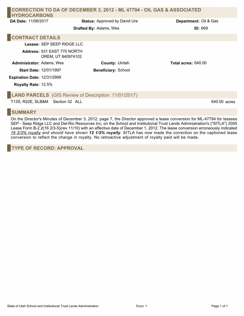
CORRECTION TO DA OF DECEMBER 3, 2012 - ML 47794 - OIL GAS & ASSOCIATEDHYDROCARBONS
Oil & GasStatus:11/06/2017 Approved by David Ure Department:DA Date:
Adams, WesDrafted By: 669ID:
CONTRACT DETAILSLessee: SEP SEEP RIDGE LLC
Address: 531 EAST 770 NORTHOREM, UT 840974102
Administrator: Adams, Wes County: Uintah Total acres: 640.00
Start Date: 12/01/1997 Beneficiary: School
Expiration Date: 12/31/2999
Royalty Rate: 12.5%
LAND PARCELS (GIS Review of Description: 11/01/2017)T13S, R22E, SLB&M Section 32 ALL 640.00 acres
SUMMARYOn the Director's Minutes of December 3, 2012, page 7, the Director approved a lease conversion for ML-47794 for lesseesSEP - Seep Ridge LLC and Del-Rio Resources Inc, on the School and Institutional Trust Lands Administration's ("SITLA") 2005Lease Form B-2.2(16 2/3-5)(rev 11/10) with an effective date of December 1, 2012. The lease conversion erroneously indicated16 2/3% royalty and should have shown 12 1/2% royalty. SITLA has now made the correction on the captioned leaseconversion to reflect the change in royalty. No retroactive adjustment of royalty paid will be made.
TYPE OF RECORD: APPROVAL
State of Utah School and Institutional Trust Lands Administration Page 1 of 1Form 1

APPROVAL LEASE CONVERSION OF ML 47393 - OIL GAS & HYDROCARBONOil & GasStatus:11/06/2017 Approved by David Ure Department:DA Date:
Adams, WesDrafted By: 672ID:
CONTRACT DETAILSLessee: PHILCO EXPLORATION LLC
Address: PO BOX 459VERNAL, UT 84078
Administrator: Adams, Wes County: Uintah Total acres: 640.00
Start Date: 12/01/1996 Beneficiary: School
Expiration Date: 12/31/2999
Royalty Rate: 12.5%
LAND PARCELS (GIS Review of Description: 11/01/2017)T13S, R22E, SLB&M Section 36 ALL 640.00 acres
SUMMARYPhilco Exploration LLC is the current lessee of ML-47393. By letter dated October 6, 2017, Del-Rio Resources, Inc. hasrequested a lease conversion from its original lease form to the current lease form B-2.1(12 1/2)(rev04/17). Del-Rio Resources,Inc. is the Manager for Philco Exploration LLC and has the authority to act on behalf of both parties in this request. The Schooland Institutional Trust Lands Administration deems the lease conversion request appropriate and in the best interest of itsbeneficiaries. The lease conversion will be effective as of December 1, 2017. However, the original anniversary date will remainthe same.
TYPE OF RECORD: APPROVAL
State of Utah School and Institutional Trust Lands Administration Page 1 of 1Form 1

PARTIAL RELINQUISHMENT - ML 48065 - OIL GAS & HYDROCARBONOil & GasStatus:11/06/2017 Approved by David Ure Department:DA Date:
Adams, WesDrafted By: 662ID:
CONTRACT DETAILSLessee: ALKER, HENRY A
Address: 5360 VINE HILL ROADSEBASTOPOL, CA 95472
Administrator: Adams, Wes County: Carbon Total acres: 640.00
Start Date: 09/01/1998 Beneficiary: School
Expiration Date: 12/31/2999
Royalty Rate: 12.5%
LAND PARCELS (GIS Review of Description: 11/02/2017)T15S, R12E, SLB&M Section 16 ALL 640.00 acres
SUMMARYHenry A. Alker, the record title interest owner of lease ML 48065, has requested a partial relinquishment of Section 2 of T15S-R12E, being 640.60 acres, more or less. The lands will be released from the lease effective September 1, 2017. The BusinessSystem has been updated to reflect that the lease now includes only Section 16 of T15S-R12E, being 640 acres, more or less. All operating rights interest owners in the lease, being Ed Gray (25%) and Savoy Energy Inc. (75%), have accepted the requestfrom Henry A. Alker.
TYPE OF RECORD: APPROVAL
State of Utah School and Institutional Trust Lands Administration Page 1 of 1Form 1

AMENDMENT - ESMT 1803 - EASEMENT AND FEE WAIVERSurfaceStatus:11/06/2017 Approved by David Ure Department:DA Date:
Bartlett, ScottDrafted By: 679ID:
CONTRACT DETAILSLessee: SAWTOOTH NGL CAVERNS LLC
Address: SUITE 2706965 UNION PARK CENTERMIDVALE, UT 84047
Administrator: Bartlett, Scott County: Millard Total acres: 20.98
Start Date: 06/01/2013 Beneficiary: School
Expiration Date: 05/31/2043
LAND PARCELS (GIS Review of Description: 04/17/2013)T15S, R6W, SLB&M Section 20 W2SW4 (WITHIN) (SEE METES & BOUNDS) 5.59 acres
T15S, R6W, SLB&M Section 20 N2S2, SW4NW4 (WITHIN) 13.90 acres
T15S, R6W, SLB&M Section 29 NW4NW4 (WITHIN) (SEE METES & BOUNDS) 1.49 acres
BACKGROUNDThis easement was issued effective August 1, 2013, expiring May 31, 2043, for a rail loop, rail spurs and associated facilities.The grantee holds ML 51573A-OBA on adjacent trust lands. This easement was issued for the rail loop as it was to beconstructed outside of lease boundaries.
On November 6, 2015, the easement was amended to include cut and fill slopes for a portion of the rail spur within leaseboundaries, but whose cut and fill slopes would fall outside lease boundaries.
The original rail spur portion of the easement, as issued in 2013, will not be constructed. As that portion of the easement is notrequired, it will be removed from the easement.
NARRATIVEThe portion of the easement to be deleted contains approximately 13.899 acres. The portion of the easement that will remaineffective contains approximately 7.079 acres. The expiration date remains May 31, 2043.
FINANCIAL/REVENUEBecause this is a Trust-initiated action, the $400.00 amendment fee should be waived.
SUMMARYThe original rail spur portion of the easement that will not be constructed, containing approximately 13.899 acres, is to bedeleted by amendment. The portion of the easement for cut and fill slopes, containing approximately 7.079 acres, will remain.The amendment fee is waived as this is a Trust-initiated action.
TYPE OF RECORD: APPROVAL
State of Utah School and Institutional Trust Lands Administration Page 1 of 1Form 1
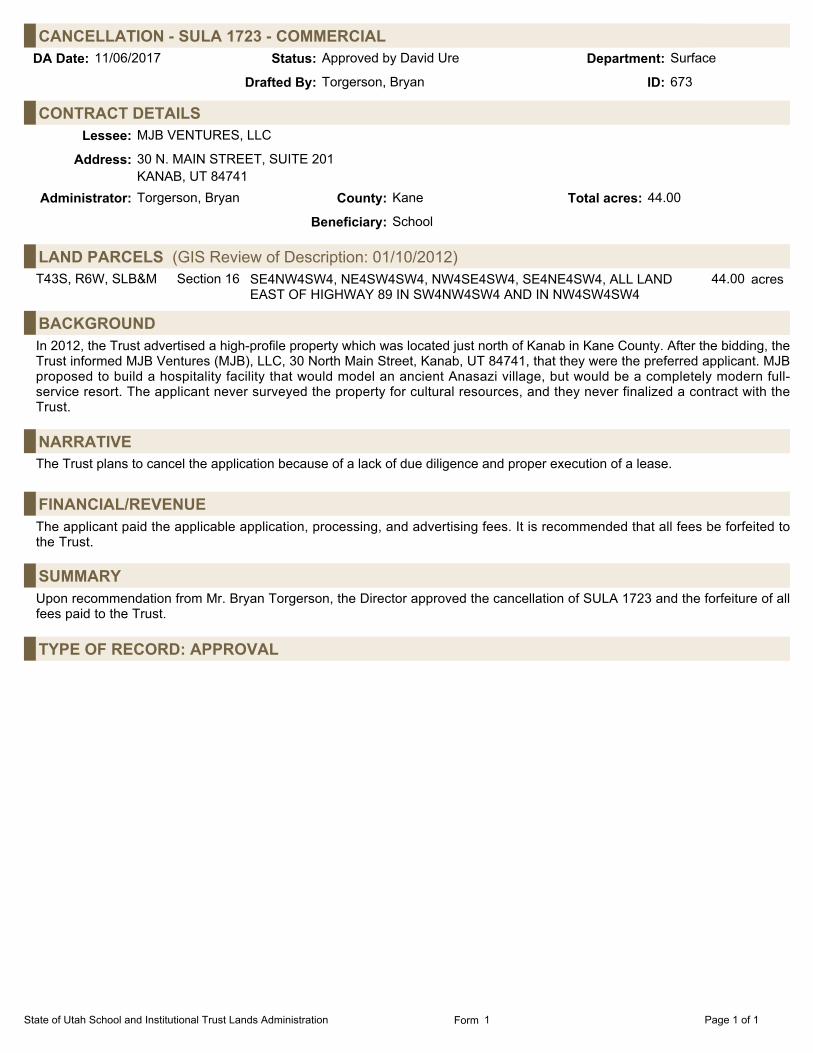
CANCELLATION - SULA 1723 - COMMERCIALSurfaceStatus:11/06/2017 Approved by David Ure Department:DA Date:
Torgerson, BryanDrafted By: 673ID:
CONTRACT DETAILSLessee: MJB VENTURES, LLC
Address: 30 N. MAIN STREET, SUITE 201KANAB, UT 84741
Administrator: Torgerson, Bryan County: Kane Total acres: 44.00
Beneficiary: School
LAND PARCELS (GIS Review of Description: 01/10/2012)T43S, R6W, SLB&M Section 16 SE4NW4SW4, NE4SW4SW4, NW4SE4SW4, SE4NE4SW4, ALL LAND
EAST OF HIGHWAY 89 IN SW4NW4SW4 AND IN NW4SW4SW444.00 acres
BACKGROUNDIn 2012, the Trust advertised a high-profile property which was located just north of Kanab in Kane County. After the bidding, theTrust informed MJB Ventures (MJB), LLC, 30 North Main Street, Kanab, UT 84741, that they were the preferred applicant. MJBproposed to build a hospitality facility that would model an ancient Anasazi village, but would be a completely modern full-service resort. The applicant never surveyed the property for cultural resources, and they never finalized a contract with theTrust.
NARRATIVEThe Trust plans to cancel the application because of a lack of due diligence and proper execution of a lease.
FINANCIAL/REVENUEThe applicant paid the applicable application, processing, and advertising fees. It is recommended that all fees be forfeited tothe Trust.
SUMMARYUpon recommendation from Mr. Bryan Torgerson, the Director approved the cancellation of SULA 1723 and the forfeiture of allfees paid to the Trust.
TYPE OF RECORD: APPROVAL
State of Utah School and Institutional Trust Lands Administration Page 1 of 1Form 1
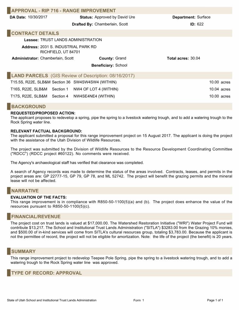
APPROVAL - RIP 716 - RANGE IMPROVEMENTSurfaceStatus:10/30/2017 Approved by David Ure Department:DA Date:
Chamberlain, ScottDrafted By: 622ID:
CONTRACT DETAILSLessee: TRUST LANDS ADMINISTRATION
Address: 2031 S. INDUSTRIAL PARK RDRICHFIELD, UT 84701
Administrator: Chamberlain, Scott County: Grand Total acres: 30.04
Beneficiary: School
LAND PARCELS (GIS Review of Description: 08/16/2017)T15.5S, R22E, SLB&M Section 36 SW4SW4SW4 (WITHIN) 10.00 acres
T16S, R22E, SLB&M Section 1 NW4 OF LOT 4 (WITHIN) 10.04 acres
T17S, R22E, SLB&M Section 4 NW4SE4NE4 (WITHIN) 10.00 acres
BACKGROUNDREQUESTED/PROPOSED ACTION:The applicant proposes to redevelop a spring, pipe the spring to a livestock watering trough, and to add a watering trough to theRock Spring water line. RELEVANT FACTUAL BACKGROUND:The applicant submitted a proposal for this range improvement project on 15 August 2017. The applicant is doing the projectwith the assistance of the Utah Division of Wildlife Resources. The project was submitted by the Division of Wildlife Resources to the Resource Development Coordinating Committee("RDCC") (RDCC project #60122). No comments were received. The Agency's archaeological staff has verified that clearance was completed. A search of Agency records was made to determine the status of the areas involved. Contracts, leases, and permits in theproject areas are: GP 22777-15, GP 79, GP 78, and ML 52742. The project will benefit the grazing permits and the minerallease will not be affected.
NARRATIVEEVALUATION OF THE FACTS:This range improvement is in compliance with R850-50-1100(5)(a) and (b). The project does enhance the value of theresources pursuant to R850-50-1100(5)(c).
FINANCIAL/REVENUEThe project cost on trust lands is valued at $17,000.00. The Watershed Restoration Initiative ("WRI") Water Project Fund willcontribute $13,217. The School and Institutional Trust Lands Administration ("SITLA") $3283.00 from the Grazing 10% monies,and $500.00 of in-kind services will come from SITLA's cultural resources group, totaling $3,783.00. Because the applicant isnot the permittee of record, the project will not be eligible for amortization. Note: the life of the project (the benefit) is 20 years.
SUMMARYThis range improvement project to redevelop Teepee Pole Spring, pipe the spring to a livestock watering trough, and to add awatering trough to the Rock Spring water line was approved.
TYPE OF RECORD: APPROVAL
State of Utah School and Institutional Trust Lands Administration Page 1 of 1Form 1
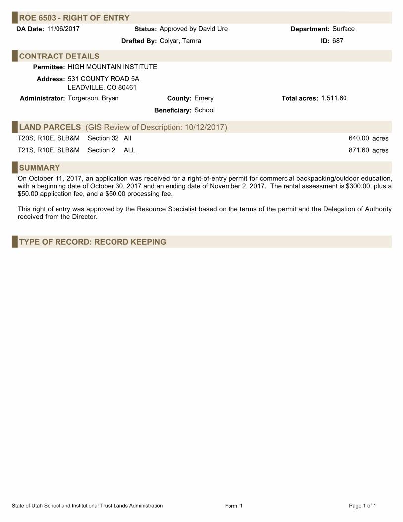
ROE 6503 - RIGHT OF ENTRYSurfaceStatus:11/06/2017 Approved by David Ure Department:DA Date:
Colyar, TamraDrafted By: 687ID:
CONTRACT DETAILSPermittee: HIGH MOUNTAIN INSTITUTE
Address: 531 COUNTY ROAD 5ALEADVILLE, CO 80461
Administrator: Torgerson, Bryan County: Emery Total acres: 1,511.60
Beneficiary: School
LAND PARCELS (GIS Review of Description: 10/12/2017)T20S, R10E, SLB&M Section 32 All 640.00 acres
T21S, R10E, SLB&M Section 2 ALL 871.60 acres
SUMMARYOn October 11, 2017, an application was received for a right-of-entry permit for commercial backpacking/outdoor education,with a beginning date of October 30, 2017 and an ending date of November 2, 2017. The rental assessment is $300.00, plus a$50.00 application fee, and a $50.00 processing fee.
This right of entry was approved by the Resource Specialist based on the terms of the permit and the Delegation of Authorityreceived from the Director.
TYPE OF RECORD: RECORD KEEPING
State of Utah School and Institutional Trust Lands Administration Page 1 of 1Form 1

ROE 6502 - RIGHT OF ENTRYSurfaceStatus:11/06/2017 Approved by David Ure Department:DA Date:
Colyar, TamraDrafted By: 686ID:
CONTRACT DETAILSPermittee: PAIGE DORIAN PRODUCTIONS
Address: 4425 W. RIVERSIDE DR., SUITE 101BURBANK, CA 91505
Administrator: Torgerson, Bryan County: San Juan Total acres: 1.00
Beneficiary: School
LAND PARCELS (GIS Review of Description: 10/12/2017)T27S, R20E, SLB&M Section 16 WITHIN 1.00 acres
SUMMARYOn October 11, 2017, an application was received for a right-of-entry permit for commercial photography, with a beginning dateof October 19, 2017 and an ending date of October 20, 2017. The rental assessment is $600.00, plus a $50.00 application feeand a $50.00 processing fee.
This right of entry was approved by the Resource Specialist based on the terms of the permit and the Delegation of Authorityreceived from the Director.
TYPE OF RECORD: RECORD KEEPING
State of Utah School and Institutional Trust Lands Administration Page 1 of 1Form 1

ROE 6497 - RIGHT OF ENTRYSurfaceStatus:11/06/2017 Approved by David Ure Department:DA Date:
Colyar, TamraDrafted By: 685ID:
CONTRACT DETAILSPermittee: YOUNGBLOOD, KENT
Address: 1818 S QUEBEC WAY #15 2DENVER, CO 80231
Administrator: Torgerson, Bryan County: Grand Total acres: 1,896.66
Beneficiary: School
LAND PARCELS (GIS Review of Description: 10/31/2017)T20S, R24E, SLB&M Section 32 ALL (LESS 23.34 ACRES CONVEYED VIA ROW 1085-D) 616.66 acres
T21S, R20E, SLB&M Section 32 All 640.00 acres
T21S, R23E, SLB&M Section 35 ALL 640.00 acres
SUMMARYOn September 26, 2017, an application was received for a right-of-entry permit for commercial filming, with a beginning date ofOctober 13, 2017 and an ending date of October 15, 2017. The rental assessment is $1,350.00, plus a $50.00 application feeand a $50.00 processing fee.
This right of entry was approved by the Resource Specialist based on the terms of the permit and the Delegation of Authorityreceived from the Director.
TYPE OF RECORD: RECORD KEEPING
State of Utah School and Institutional Trust Lands Administration Page 1 of 1Form 1

ROE 6495 - RIGHT OF ENTRYSurfaceStatus:11/06/2017 Approved by David Ure Department:DA Date:
Colyar, TamraDrafted By: 684ID:
CONTRACT DETAILSPermittee: JEEP JAMBOREE USA
Address: 2776 SOURDOUGH FLATGEORGETOWN, CA 95634
Administrator: Torgerson, Bryan County: Grand Total acres: 53,788.09
Beneficiary: School 50,714.77 ac (94.29%);Utah State University 3,073.32 ac (5.71%)
LAND PARCELS (GIS Review of Description: 09/25/2017)T26S, R21E, SLB&M Section 33 DEFAULT PARCEL FOR GRAND AND SAN JUAN JEEP SAFARI
ROUTES50,714. acres
T26S, R25E, SLB&M Section 2 DEFAULT PARCEL FOR JEEP SAFARI ROUTES 3,073.3 acres
SUMMARYOn September 25, 2017, an application was received for a right-of-entry permit for annual Jeep Jamboree event, with abeginning date of October 26, 2017 and an ending date of October 28, 2017. The rental assessment is $300.00, plus a $50.00application fee and a $50.00 processing fee. The permittee shall also pay 3% of their gross receipts, or $5.00 perparticipant/per day, whichever is greater, within 30 days of the permit expiration date. Participants will stay on designated roadsand trails.
This right of entry was approved by the Resource Specialist based on the terms of the permit and the Delegation of Authorityreceived from the Director.
TYPE OF RECORD: RECORD KEEPING
State of Utah School and Institutional Trust Lands Administration Page 1 of 1Form 1

ROE 6487 - RIGHT OF ENTRYSurfaceStatus:11/06/2017 Approved by David Ure Department:DA Date:
Colyar, TamraDrafted By: 683ID:
CONTRACT DETAILSPermittee: SKYDIVE MOAB
Address: 114 W. AVATION WAYPO BOX 995MOAB, UT 84532
Administrator: Torgerson, Bryan County: Grand Total acres: 156.17
Beneficiary: School
LAND PARCELS (GIS Review of Description: 10/31/2017)T24S, R20E, SLB&M Section 6 LOT 6 (36.17) [SE4SW4]; W2SE4, SE4SE4 156.17 acres
SUMMARYOn September 13, 2017, an application was received for a right-of-entry permit for event camping near the airport, with abeginning date of September 20, 2017 and an ending date of September 25, 2017. The rental assessment is $300.00, plus a$50.00 application fee and a $50.00 processing fee.
This right of entry was approved by the Resource Specialist based on the terms of the permit and the Delegation of Authorityreceived from the Director.
TYPE OF RECORD: RECORD KEEPING
State of Utah School and Institutional Trust Lands Administration Page 1 of 1Form 1

FIVE-YEAR REVIEW - SULA 400 - INDUSTRIALSurfaceStatus:11/06/2017 Approved by David Ure Department:DA Date:
Davis, JimDrafted By: 678ID:
CONTRACT DETAILSLessee: US MAGNESIUM LLC
Address: 238 NORTH 2200 WESTSALT LAKE CITY, UT 84116
Administrator: Davis, Jim County: Tooele Total acres: 12.00
Start Date: 11/01/1977 Beneficiary: School
Expiration Date: 10/31/2026
LAND PARCELS (GIS Review of Description: 11/01/2017)T1S, R6W, SLB&M Section 5 North line 6.00 acres
T1S, R6W, SLB&M Section 6 North line 6.00 acres
BACKGROUNDThe authorized use of the subject parcel is building, maintaining and using a run-off control dike. The review date is November1, 2017.
NARRATIVEDUE DILIGENCE AND PROPER USE:The development allowed by the lease has occurred. It is recommended that the lease be kept in force. PROPER USE:The leased premises are being used in accordance with the lease agreement. ADEQUATE INSURANCE AND BOND COVERAGE:This lease was generated by the School and Institutional Trust Lands Administration's ("SITLA") predecessor agency, theDivision of State Lands. The lease has no provisions that require a bond or proof of insurance.
WATER RIGHTS AND WELLS:There are no Trust-owned water rights associated with this lease. ENVIRONMENTAL COMPLIANCE:The property was inspected and reviewed for environmental compliance on October 2, 2017. The lease inspection indicated itwould be rated as low risk. There is no evidence of underground petroleum storage tanks stored on the lease property. Thereare no oil and gas containers on the leased premises. The complete environmental report is in the lease file.
LAND OWNERSHIP AND LEGAL DESCRIPTION:In reviewing this lease, GIS identified a problem with the legal description of the leased property. The legal description includesa piece of land that is not administered by SITLA. When the lease was created in 1977, the Division of State Lands was theadministrator of all the property included in the lease. When SITLA was formed this lease transferred to SITLA, but not all theland in the lease was under SITLA's management. The lessee has been notified of the need to amend the legal description ofthe leased property, but that issue has not yet come to resolution. The amendment of the lease will be documented in a futureDirector's Agenda.
FINANCIAL/REVENUEThe lease agreement provides for periodic increases in the annual base rental amount. Pursuant to the lease agreement, it isrecommended that the annual base rental be increased from $1,130.00 per year to $1,190.00 per year, effective November 1,2017.
A certified notice was sent informing the lessee of this action. No response has been received.
After a preliminary analysis pursuant to Board policy, the value of comparable, unimproved properties in the area has beenestimated to be approximately $100.00 per acre. Based on this analysis, it has been determined that an appraisal is not
State of Utah School and Institutional Trust Lands Administration Page 1 of 2Form 1

FIVE-YEAR REVIEW - SULA 400 - INDUSTRIAL (Continued)warranted, and that any rental increase should be tied to published federal rental schedules. The existing lease is currentlyconsidered the highest and best use of a parcel of this type of land.
Annual Base Rental: $1,190.00Rental per acre: $99.16
SUMMARYThe legal description for this lease needs to be amended to remove those lands that are not administered by SITLA. Theannual rental has been increased from $1,130.00 to $1,190.00, effective November 1, 2017. The next five-year review will becompleted by November 1, 2022.
TYPE OF RECORD: APPROVAL
State of Utah School and Institutional Trust Lands Administration Page 2 of 2Form 1

FIVE-YEAR REVIEW - SULA 1744 - INDUSTRIALSurfaceStatus:11/06/2017 Approved by David Ure Department:DA Date:
Davis, JimDrafted By: 667ID:
CONTRACT DETAILSLessee: GREAT SALT LAKE BRINE SHRIMP COOPERATIVE
Address: 1750 WEST 2450 SOUTHOGDEN, UT 84401
Administrator: Davis, Jim County: Box Elder Total acres: 76.36
Start Date: 11/01/2012 Beneficiary: Reservoirs
Expiration Date: 10/31/2042
LAND PARCELS (GIS Review of Description: 06/06/2012)T11N, R9W, SLB&M Section 10 LOTS 1, 2, 3 & 4 76.36 acres
BACKGROUNDThe authorized use of the subject parcel is to provide access to the shoreline of the Great Salt Lake for harvesting brine shrimp.The review date is November 1, 2017.
NARRATIVEDUE DILIGENCE AND PROPER USE:The development allowed by the lease has occurred. It is recommended that the lease be kept in force. PROPER USE:The leased premises are being used in accordance with the lease agreement. ADEQUATE INSURANCE AND BOND COVERAGE:The lessee has provided proof of adequate insurance coverage. As the lease only grants temporary, seasonal access acrossthe property, no bond has been required.
WATER RIGHTS AND WELLS:There are no Trust-owned water rights associated with this lease. ENVIRONMENTAL COMPLIANCE:The property was inspected and reviewed for environmental compliance on October 17, 2017. The property was not being usedat the time of the inspection. No concerns or potential hazards were identified. The complete environmental report is in thelease file.
FINANCIAL/REVENUEThe lease agreement provides for periodic increases in the annual base rental amount. Pursuant to the lease agreement, it isrecommended that the annual base rental be increased from $3,500.00 per year to $3,600.00 per year, effective November 1,2017.
A certified notice was sent informing the lessee of this action. No response has been received.
After a preliminary analysis pursuant to Board policy, the value of comparable, unimproved properties in the area has beenestimated to be approximately $700.00 per acre. Based on this analysis, it has been determined that an appraisal is notwarranted, and that any rental increase should be tied to CPI increases. The existing lease is currently considered the highestand best use of a parcel of this type of land.
Annual Base Rental: $3,600.00Rental per acre: $47.00
SUMMARYThe annual rental has been increased from $3,500.00 to $3,600.00, effective November 1, 2017. The next five-year review willbe completed by November 1, 2022.
State of Utah School and Institutional Trust Lands Administration Page 1 of 2Form 1
FIVE-YEAR REVIEW - SULA 1744 - INDUSTRIAL (Continued)
TYPE OF RECORD: APPROVAL
State of Utah School and Institutional Trust Lands Administration Page 2 of 2Form 1

THREE-YEAR REVIEW - SULA 1708 - INDUSTRIALSurfaceStatus:11/06/2017 Approved by David Ure Department:DA Date:
Davis, JimDrafted By: 666ID:
CONTRACT DETAILSLessee: GENWAL RESOURCES, INC.
Address: PO BOX 910EAST CARBON, UT 84520
Administrator: Davis, Jim County: Emery Total acres: 7.32
Start Date: 11/01/2011 Beneficiary: School
Expiration Date: 10/31/2041
LAND PARCELS (GIS Review of Description: 10/05/2011)T17S, R8E, SLB&M Section 5 LOT 6 (WITHIN) 7.32 acres
BACKGROUNDThe authorized use of the subject parcel is to allow for the construction and operation of two (2) mine discharge waterevaporation basins. These basins or ponds are used to treat water that is being discharged from the Crandall Canyon Mine. Todate, only one pond has been constructed. The review date is November 1, 2017.
NARRATIVEDUE DILIGENCE AND PROPER USE:The development allowed by the lease has occurred. It is recommended that the lease be kept in force. PROPER USE:The leased premises are being used in accordance with the lease agreement. ADEQUATE INSURANCE AND BOND COVERAGE:The lessee has provided proof of adequate insurance coverage. The lease allows for a bond to be required or increased at anytime during the lease at the discretion of the Trust. This facility is included as part of the permit area for the Crandall CanyonMine administered by the Division of Oil, Gas and Mining. Bonding for the site is covered under the Crandall Canyon Minereclamation plan.
WATER RIGHTS AND WELLS:There are no Trust-owned water rights associated with this lease. ENVIRONMENTAL COMPLIANCE:The property was inspected and reviewed for environmental compliance on October 18, 2017. The lease inspection indicated itwould be rated as medium risk. There is no evidence of underground petroleum storage tanks stored on the lease property. Thesite is fully fenced and the pond liner appears to be in good working order. No stained soils, leaks or other hazards wereobserved during the inspection. The complete environmental report is in the lease file.
FINANCIAL/REVENUEThe lease agreement provides for periodic increases in the annual base rental amount. Pursuant to the lease agreement, it isrecommended that the annual base rental be increased from $3,150.00 per year to $3,240.00 per year, effective November 1,2017.
A certified notice was sent informing the lessee of this action. No response has been received.
After a preliminary analysis pursuant to Board policy, the value of comparable, unimproved properties in the area has beenestimated to be approximately $700.00 per acre. Based on this analysis, it has been determined that an appraisal is notwarranted, and that any rental increase should be tied to CPI increases. The existing lease is currently considered the highestand best use of a parcel of this type of land. Annual Base Rental: $3,240.00Rental per acre: $442.60
State of Utah School and Institutional Trust Lands Administration Page 1 of 2Form 1
THREE-YEAR REVIEW - SULA 1708 - INDUSTRIAL (Continued)
SUMMARYThe annual rental has been increased from $3,150.00 to $3,2400.00, effective November 1, 2017. The next three-year reviewwill be completed by November 1, 2020.
TYPE OF RECORD: APPROVAL
State of Utah School and Institutional Trust Lands Administration Page 2 of 2Form 1

THREE-YEAR REVIEW - SULA 1613 - INDUSTRIALSurfaceStatus:11/06/2017 Approved by David Ure Department:DA Date:
Davis, JimDrafted By: 665ID:
CONTRACT DETAILSLessee: KERR-MCGEE OIL & GAS ONSHORE LP
Address: PO BOX 173779DENVER, CO 802173779
Administrator: Davis, Jim County: Uintah Total acres: 1.25
Start Date: 11/01/2008 Beneficiary: School
Expiration Date: 10/31/2038
LAND PARCELS (GIS Review of Description: 10/23/2008)T9S, R21E, SLB&M Section 33 SE4NW4 (WITHIN) 1.25 acres
BACKGROUNDThe authorized use of the subject parcel is to construct, operate, and maintain a down-hole salt water injection well, NBU #921-33F SWD. The review date is November 1, 2017.
NARRATIVEDUE DILIGENCE AND PROPER USE:The development allowed by the lease has occurred. It is recommended that the lease be kept in force. PROPER USE:The leased premises are being used in accordance with the lease agreement. ADEQUATE INSURANCE AND BOND COVERAGE:The lessee has provided proof of adequate insurance coverage. The lease allows the Agency to require a bond at any time, orto require additional bonding as may be in the best interest of the beneficiary. A performance and reclamation bond in theamount of $5,000.00 is currently in place, and upon consultation with the Agency’s environmental compliance manager, it hasbeen determined that amount is adequate for the current risks associated with the lessee’s current uses.
WATER RIGHTS AND WELLS:There are no Trust-owned water rights associated with this lease. ENVIRONMENTAL COMPLIANCE:The property was inspected and reviewed for environmental compliance on October 25, 2017. The lease inspection indicated itwould be rated as medium risk. There is no evidence of underground petroleum storage tanks stored on the lease property. Alloil and gas containers are being properly stored. The complete environmental report is in the lease file.
FINANCIAL/REVENUEThe lease agreement provides for periodic increases in the annual base rental amount. Pursuant to the lease agreement, it isrecommended that the annual base rental be increased from $1,050.00 per year to $1,800.00 per year, effective November 1,2017.
A certified notice was sent informing the lessee of this action. No response has been received.
Water Disposal Fee:The lease agreement provides for payment of a water disposal fee in the amount of $0.15 per barrel of non-compliant waterdisposed of in the facility. An evaluation of comparable leases for water disposal facilities was conducted which indicated thatthe current water disposal fee represents fair-market value for non-commercial water disposal facilities. It is thereforerecommended that the water disposal fee remain at $0.15 per barrel.
After a preliminary analysis pursuant to Board policy, the value of comparable, unimproved properties in the area has beenestimated to be approximately $400.00 per acre. Based on this analysis, it has been determined that an appraisal is notwarranted, and that any rental increase should be tied to a change in the CPI. The existing lease is currently considered thehighest and best use of a parcel of this type of land.
State of Utah School and Institutional Trust Lands Administration Page 1 of 2Form 1
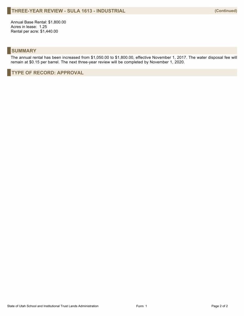
THREE-YEAR REVIEW - SULA 1613 - INDUSTRIAL (Continued) Annual Base Rental: $1,800.00Acres in lease: 1.25Rental per acre: $1,440.00
SUMMARYThe annual rental has been increased from $1,050.00 to $1,800.00, effective November 1, 2017. The water disposal fee willremain at $0.15 per barrel. The next three-year review will be completed by November 1, 2020.
TYPE OF RECORD: APPROVAL
State of Utah School and Institutional Trust Lands Administration Page 2 of 2Form 1

THREE-YEAR REVIEW - SULA 1612 - INDUSTRIALSurfaceStatus:11/06/2017 Approved by David Ure Department:DA Date:
Davis, JimDrafted By: 664ID:
CONTRACT DETAILSLessee: KERR-MCGEE OIL & GAS ONSHORE LP
Address: PO BOX 173779DENVER, CO 802173779
Administrator: Davis, Jim County: Uintah Total acres: 1.49
Start Date: 11/01/2008 Beneficiary: School
Expiration Date: 10/31/2038
LAND PARCELS (GIS Review of Description: 10/15/2008)T9S, R21E, SLB&M Section 34 SE4NE4 (WITHIN) 1.49 acres
BACKGROUNDThe authorized use of the subject parcel is to construct, operate, and maintain a down-hole salt water injection well, NBU #921-34H SWD. The review date is November 1, 2017.
NARRATIVEDUE DILIGENCE AND PROPER USE:The development allowed by the lease has occurred. It is recommended that the lease be kept in force. PROPER USE:The leased premises are being used in accordance with the lease agreement. ADEQUATE INSURANCE AND BOND COVERAGE:The lessee has provided proof of adequate insurance coverage. The lease allows the Trust to require a bond at any time, or torequire additional bonding as may be in the best interest of the beneficiary. A performance and reclamation bond in the amountof $5,000.00 is currently in place, and upon consultation with the Trust’s environmental compliance manager, it has beendetermined that amount is adequate for the current risks associated with the lessee’s current uses.
WATER RIGHTS AND WELLS:There are no Trust-owned water rights associated with this lease. ENVIRONMENTAL COMPLIANCE:The property was inspected and reviewed for environmental compliance on October 25, 2017. The lease inspection indicated itwould be rated as medium risk. There is no evidence of underground petroleum storage tanks stored on the lease property. Alloil and gas containers are being properly stored. The complete environmental report is in the lease file.
FINANCIAL/REVENUEThe lease agreement provides for periodic increases in the annual base rental amount. Pursuant to the lease agreement, it isrecommended that the annual base rental be increased from $1,050.00 per year to $1,800.00 per year, effective November 1,2017.
A certified notice was sent informing the lessee of this action. No response has been received.
Water Disposal Fee:The lease agreement provides for payment of a water disposal fee in the amount of $0.15 per barrel of non-compliant waterdisposed of in the facility. An evaluation of comparable leases for water disposal facilities was conducted which indicated thatthe current water disposal fee represents fair market value for non-commercial water disposal facilities. It is thereforerecommended that the water disposal fee remain at $0.15 per barrel.
After a preliminary analysis pursuant to Board policy, the value of comparable, unimproved properties in the area has beenestimated to be approximately $400.00 per acre. Based on this analysis, it has been determined that an appraisal is notwarranted, and that any rental increase should be tied to a change in CPI. The existing lease is currently considered the highestand best use of a parcel of this type of land.
State of Utah School and Institutional Trust Lands Administration Page 1 of 2Form 1

THREE-YEAR REVIEW - SULA 1612 - INDUSTRIAL (Continued) Annual Base Rental: $1,800.00Rental per acre: $1,208.00
SUMMARYThe annual rental has been increased from $1,050.00 to $1,800.00, effective November 1, 2017. The water disposal fee willremain at $0.15 per barrel. The next three-year review will be completed by November 1, 2020.
TYPE OF RECORD: APPROVAL
State of Utah School and Institutional Trust Lands Administration Page 2 of 2Form 1

THREE-YEAR REVIEW - SULA 1611 - INDUSTRIALSurfaceStatus:11/06/2017 Approved by David Ure Department:DA Date:
Davis, JimDrafted By: 663ID:
CONTRACT DETAILSLessee: KERR-MCGEE OIL & GAS ONSHORE LP
Address: PO BOX 173779DENVER, CO 802173779
Administrator: Davis, Jim County: Uintah Total acres: 1.32
Start Date: 11/01/2008 Beneficiary: School
Expiration Date: 10/31/2038
LAND PARCELS (GIS Review of Description: 10/15/2008)T9S, R21E, SLB&M Section 34 NW4SW4 (WITHIN) 1.32 acres
BACKGROUNDThe authorized use of the subject parcel is to construct, operate, and maintain a down-hole salt water injection well, NBU #921-34L SWD. The review date is November 1, 2017.
NARRATIVEDUE DILIGENCE AND PROPER USE:The development allowed by the lease has occurred. It is recommended that the lease be kept in force. PROPER USE:The leased premises are being used in accordance with the lease agreement. ADEQUATE INSURANCE AND BOND COVERAGE:The lessee has provided proof of adequate insurance coverage. The lease allows the Trust to require a bond at any time, or torequire additional bonding as may be in the best interest of the beneficiary. A performance and reclamation bond in the amountof $5,000.00 is currently in place, and upon consultation with the Trust’s environmental compliance manager, it has beendetermined that amount is adequate for the current risks associated with the lessee’s current uses.
WATER RIGHTS AND WELLS:There are no Trust-owned water rights associated with this lease. ENVIRONMENTAL COMPLIANCE:The property was inspected and reviewed for environmental compliance on October 25, 2017. The lease inspection indicated itwould be rated as medium risk. There is no evidence of underground petroleum storage tanks stored on the lease property. Alloil and gas containers are being properly stored. The complete environmental report is in the lease file.
FINANCIAL/REVENUEThe lease agreement provides for periodic increases in the annual base rental amount. Pursuant to the lease agreement, it isrecommended that the annual base rental be increased from $1,050.00 per year to $1,800.00 per year, effective November 1,2017.
A certified notice was sent informing the lessee of this action. No response has been received.
Water Disposal Fee:The lease agreement provides for payment of a water disposal fee in the amount of $0.15 per barrel of non-compliant waterdisposed of in the facility. An evaluation of comparable leases for water disposal facilities was conducted which indicated thatthe current water disposal fee represents fair-market value for non-commercial water disposal facilities. It is thereforerecommended that the water disposal fee remain at $0.15 per barrel.
After a preliminary analysis pursuant to Board policy, the value of comparable, unimproved properties in the area has beenestimated to be approximately $400.00 per acre. Based on this analysis, it has been determined that an appraisal is notwarranted, and that any rental increase should be tied to a change in CPI. The existing lease is currently considered the highestand best use of a parcel of this type of land.
State of Utah School and Institutional Trust Lands Administration Page 1 of 2Form 1
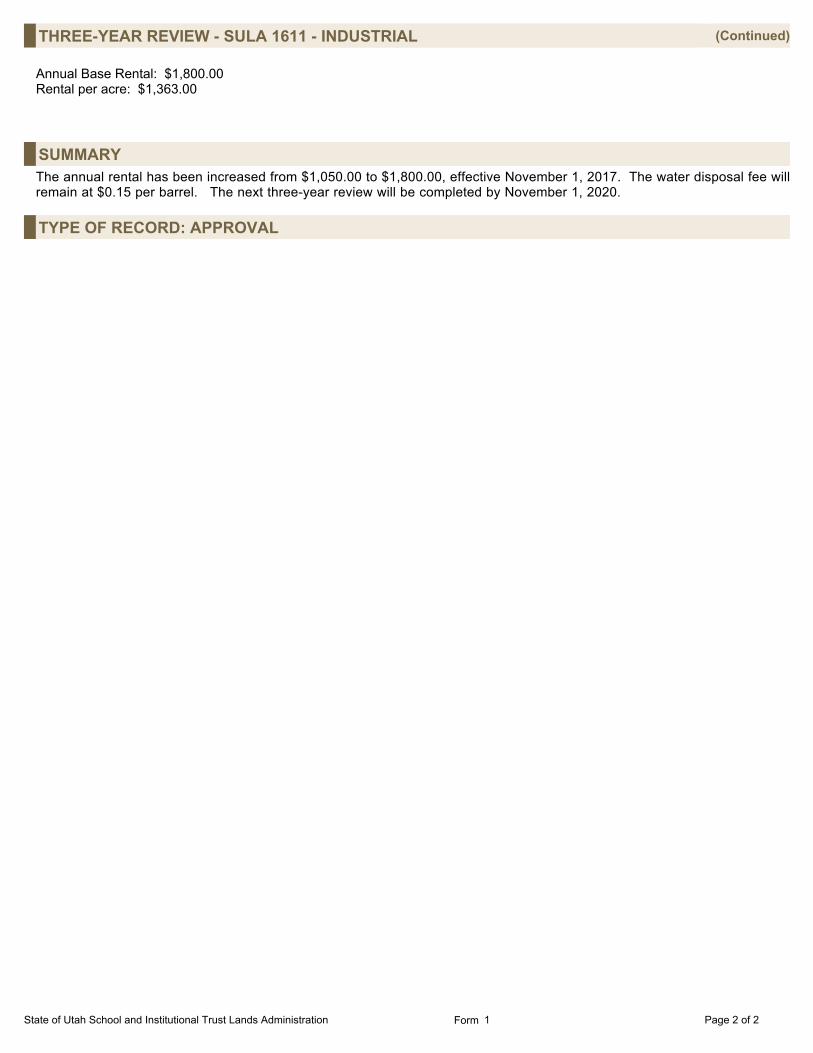
THREE-YEAR REVIEW - SULA 1611 - INDUSTRIAL (Continued) Annual Base Rental: $1,800.00Rental per acre: $1,363.00
SUMMARYThe annual rental has been increased from $1,050.00 to $1,800.00, effective November 1, 2017. The water disposal fee willremain at $0.15 per barrel. The next three-year review will be completed by November 1, 2020.
TYPE OF RECORD: APPROVAL
State of Utah School and Institutional Trust Lands Administration Page 2 of 2Form 1
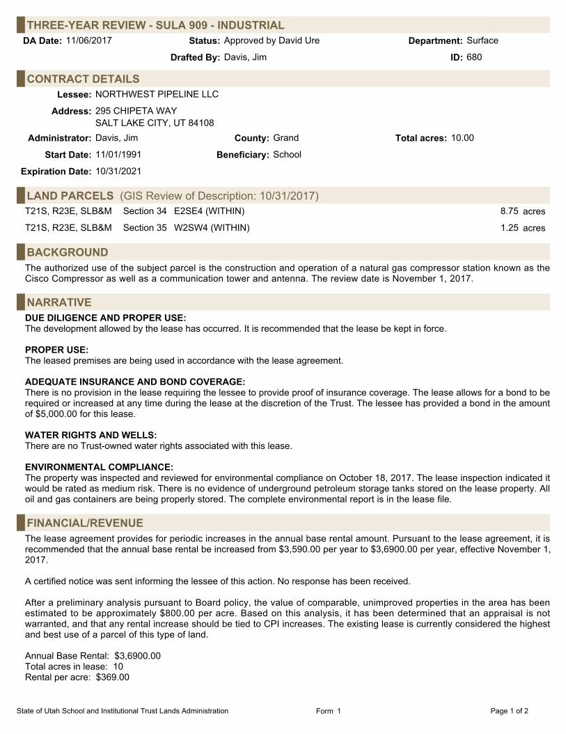
THREE-YEAR REVIEW - SULA 909 - INDUSTRIALSurfaceStatus:11/06/2017 Approved by David Ure Department:DA Date:
Davis, JimDrafted By: 680ID:
CONTRACT DETAILSLessee: NORTHWEST PIPELINE LLC
Address: 295 CHIPETA WAYSALT LAKE CITY, UT 84108
Administrator: Davis, Jim County: Grand Total acres: 10.00
Start Date: 11/01/1991 Beneficiary: School
Expiration Date: 10/31/2021
LAND PARCELS (GIS Review of Description: 10/31/2017)T21S, R23E, SLB&M Section 34 E2SE4 (WITHIN) 8.75 acres
T21S, R23E, SLB&M Section 35 W2SW4 (WITHIN) 1.25 acres
BACKGROUNDThe authorized use of the subject parcel is the construction and operation of a natural gas compressor station known as theCisco Compressor as well as a communication tower and antenna. The review date is November 1, 2017.
NARRATIVEDUE DILIGENCE AND PROPER USE:The development allowed by the lease has occurred. It is recommended that the lease be kept in force. PROPER USE:The leased premises are being used in accordance with the lease agreement. ADEQUATE INSURANCE AND BOND COVERAGE:There is no provision in the lease requiring the lessee to provide proof of insurance coverage. The lease allows for a bond to berequired or increased at any time during the lease at the discretion of the Trust. The lessee has provided a bond in the amountof $5,000.00 for this lease.
WATER RIGHTS AND WELLS:There are no Trust-owned water rights associated with this lease. ENVIRONMENTAL COMPLIANCE:The property was inspected and reviewed for environmental compliance on October 18, 2017. The lease inspection indicated itwould be rated as medium risk. There is no evidence of underground petroleum storage tanks stored on the lease property. Alloil and gas containers are being properly stored. The complete environmental report is in the lease file.
FINANCIAL/REVENUEThe lease agreement provides for periodic increases in the annual base rental amount. Pursuant to the lease agreement, it isrecommended that the annual base rental be increased from $3,590.00 per year to $3,6900.00 per year, effective November 1,2017.
A certified notice was sent informing the lessee of this action. No response has been received.
After a preliminary analysis pursuant to Board policy, the value of comparable, unimproved properties in the area has beenestimated to be approximately $800.00 per acre. Based on this analysis, it has been determined that an appraisal is notwarranted, and that any rental increase should be tied to CPI increases. The existing lease is currently considered the highestand best use of a parcel of this type of land.
Annual Base Rental: $3,6900.00Total acres in lease: 10Rental per acre: $369.00
State of Utah School and Institutional Trust Lands Administration Page 1 of 2Form 1

THREE-YEAR REVIEW - SULA 909 - INDUSTRIAL (Continued)
SUMMARYThe annual rental has been increased from $3,590.00 to $3,690.00, effective November 1, 2017. The next three-year review willbe completed by November 1, 2020.
TYPE OF RECORD: APPROVAL
State of Utah School and Institutional Trust Lands Administration Page 2 of 2Form 1
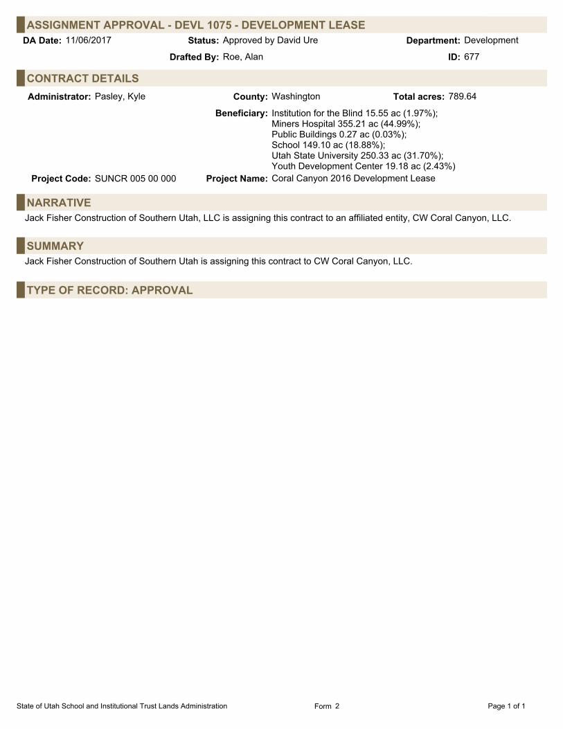
ASSIGNMENT APPROVAL - DEVL 1075 - DEVELOPMENT LEASEDevelopmentStatus:11/06/2017 Approved by David Ure Department:DA Date:
Roe, AlanDrafted By: 677ID:
CONTRACT DETAILSAdministrator: Pasley, Kyle County: Washington Total acres: 789.64
Beneficiary: Institution for the Blind 15.55 ac (1.97%);Miners Hospital 355.21 ac (44.99%);Public Buildings 0.27 ac (0.03%);School 149.10 ac (18.88%);Utah State University 250.33 ac (31.70%);Youth Development Center 19.18 ac (2.43%)
Project Code: SUNCR 005 00 000 Project Name: Coral Canyon 2016 Development Lease
NARRATIVEJack Fisher Construction of Southern Utah, LLC is assigning this contract to an affiliated entity, CW Coral Canyon, LLC.
SUMMARYJack Fisher Construction of Southern Utah is assigning this contract to CW Coral Canyon, LLC.
TYPE OF RECORD: APPROVAL
State of Utah School and Institutional Trust Lands Administration Page 1 of 1Form 2
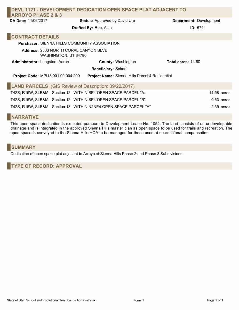
DEVL 1121 - DEVELOPMENT DEDICATION OPEN SPACE PLAT ADJACENT TOARROYO PHASE 2 & 3
DevelopmentStatus:11/06/2017 Approved by David Ure Department:DA Date:
Roe, AlanDrafted By: 674ID:
CONTRACT DETAILSPurchaser: SIENNA HILLS COMMUNITY ASSOCIATION
Address: 2303 NORTH CORAL CANYON BLVDWASHINGTON, UT 84780
Administrator: Langston, Aaron County: Washington Total acres: 14.60
Beneficiary: School
Project Code: MPI13 001 00 004 200 Project Name: Sienna Hills Parcel 4 Residential
LAND PARCELS (GIS Review of Description: 09/22/2017)T42S, R15W, SLB&M Section 12 WITHIN SE4 OPEN SPACE PARCEL "A: 11.58 acres
T42S, R15W, SLB&M Section 12 WITHIN SE4 OPEN SPACE PARCEL "B" 0.63 acres
T42S, R15W, SLB&M Section 13 WITHIN N2NE4 OPEN SPACE PARCEL "A" 2.39 acres
NARRATIVEThis open space dedication is executed pursuant to Development Lease No. 1052. The land consists of an undevelopabledrainage and is integrated in the approved Sienna Hills master plan as open space to be used for trails and recreation. Theopen space is conveyed to the Sienna Hills HOA to be managed for these uses at no additional compensation.
SUMMARYDedication of open space plat adjacent to Arroyo at Sienna Hills Phase 2 and Phase 3 Subdivisions.
TYPE OF RECORD: APPROVAL
State of Utah School and Institutional Trust Lands Administration Page 1 of 1Form 1

C 26758 - DEVELOPMENT SALE-SUN RIVER VILLAS PHASE 5DevelopmentStatus:11/06/2017 Approved by David Ure Department:DA Date:
Roe, AlanDrafted By: 675ID:
CONTRACT DETAILSLessee: SUN RIVER VILLAS DEVELOPMENT LLC
Address: 1404 WEST SUN RIVER PARKWAYSUITE 200ST. GEORGE, UT 84790
Administrator: Pasley, Kyle County: Washington Total acres: 4.23
Start Date: 10/27/2017 Beneficiary: School
Patent Number: P-20544 Patent Date: 10/03/2017
Project Code: SOBLK 003 00 000 000 Project Name: South Block / SunRiver / DEVL 729
LAND PARCELS (GIS Review of Description: 09/27/2017)T43S, R16W, SLB&M Section 23 WITHIN NW4SE4 4.23 acres
NARRATIVEThis parcel is sold pursuant to Development Lease No. 729 between the School and Institutional Trust Lands Administration andSun River St. George Development. The development lease allows Sun River to purchase parcels of land in phases asdevelopment progresses. The purchase price for the parcel is $157,066.25.00. This is $37,131.50 per acre of developable land(4.23 acres). The base price was set at $35,000.00 in 2013. This is increased every year by 3%, starting on July 1, 2016. Thiswas agreed to in the fourth amendment to the development lease dated December 23, 2014. When development has beencompleted, Sun River will make a reconciliation payment to bring the value up to 3% of the price of the finished home. Agencystaff has judged $35,000.00 per acre to be a fair price because of the risk Sun River took to cover grading, drainage, and theuncertainty of the sub-surface soil conditions at the time of this lease amendment.
FINANCIAL/REVENUEThe buyer has paid the $157,066.25 purchase price
SUMMARYThis sale is pursuant to DEVL 729.
TYPE OF RECORD: APPROVAL
State of Utah School and Institutional Trust Lands Administration Page 1 of 1Form 1

CANCELED FOR NON-PAYMENTAccountingStatus:11/06/2017 Approved by David Ure Department:DA Date:
Babinsky, MichaelDrafted By: 690ID:
CONTRACT NAME BENE TYPECOUNTYML 52731 MGE UTAH UTAH LLC SCH SANJ O&G
FINANCIAL/REVENUEThis lease is cancelled due to non-payment.
SUMMARYThis oil & gas lease was not paid on or before the cancellation date of May 15, 2017.
TYPE OF RECORD: APPROVAL
State of Utah School and Institutional Trust Lands Administration Page 1 of 1Form 3

ML 52577 - TRANSFER OF PAYMENT FROM ML 52214 AND REINSTATEMENTAccountingStatus:11/06/2017 Approved by David Ure Department:DA Date:
Babinsky, MichaelDrafted By: 670ID:
BACKGROUNDThe lessee made a $80.00 rental payment for ML 52577 but was credited to ML 52214. When a refund was generated on theDirector's Actions dated September 5, 2017 (ID #451), the lessee informed us that the payment should have been credited toML 52577.
SUMMARYJournal Entry 11305 was completed to move the $80.00 rental payment from ML 52214 to ML 52577. Contract ML 52577 wasalso restored to an active contract.
TYPE OF RECORD: APPROVAL
State of Utah School and Institutional Trust Lands Administration Page 1 of 1Form 7

INTEREST RATEAccountingStatus:11/06/2017 Approved by David Ure Department:DA Date:
Babinsky, MichaelDrafted By: 694ID:
FINANCIAL/REVENUEFollowing are the current and past year prime rates:
CURRENT YEAR: 4.25% ONE YEAR AGO: 3.50%
Separately, a late penalty of 6% or $30.00, whichever is greater, shall be charged after failure to pay any financial obligation,excluding royalties as provided in R850-5-300(2), within the time limit under which such payment is due.
Interest on delinquent royalties shall be based on the prime rate of interest at the beginning of each month, plus 4%.
TYPE OF RECORD: APPROVAL
State of Utah School and Institutional Trust Lands Administration Page 1 of 1Form 7
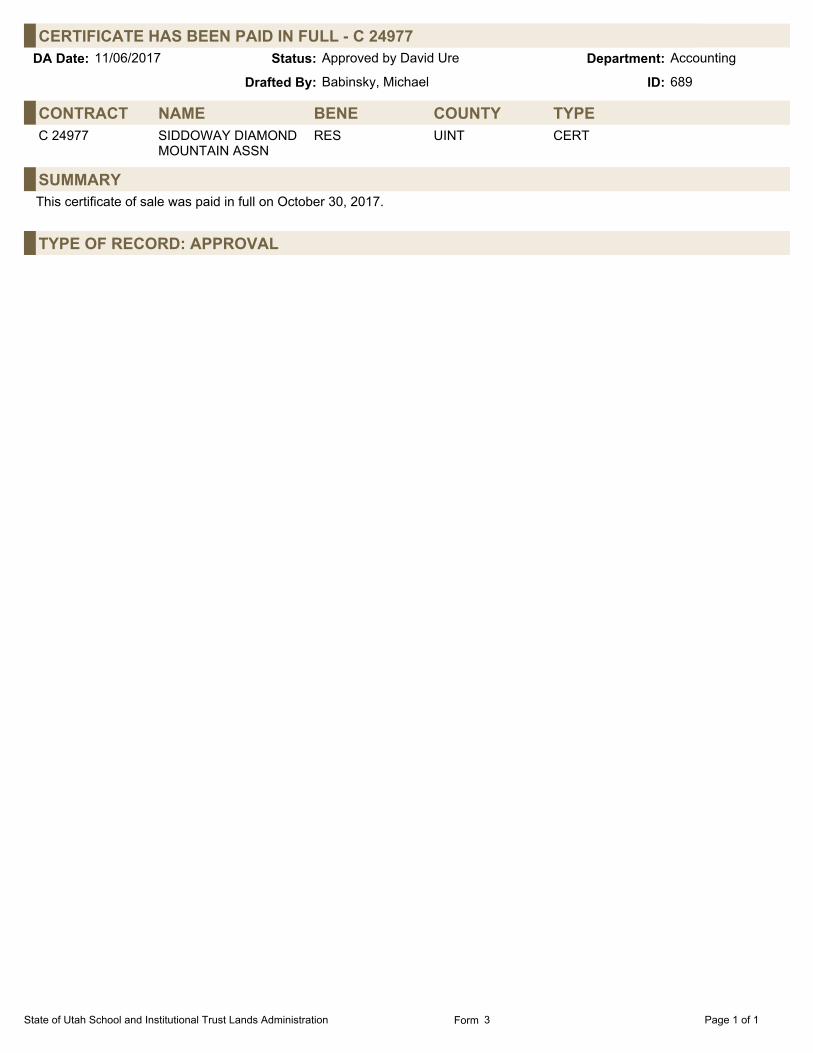
CERTIFICATE HAS BEEN PAID IN FULL - C 24977AccountingStatus:11/06/2017 Approved by David Ure Department:DA Date:
Babinsky, MichaelDrafted By: 689ID:
CONTRACT NAME BENE TYPECOUNTYC 24977 SIDDOWAY DIAMOND
MOUNTAIN ASSNRES UINT CERT
SUMMARYThis certificate of sale was paid in full on October 30, 2017.
TYPE OF RECORD: APPROVAL
State of Utah School and Institutional Trust Lands Administration Page 1 of 1Form 3

CERTIFICATE HAS BEEN PAID IN FULL - C 24976AccountingStatus:11/06/2017 Approved by David Ure Department:DA Date:
Babinsky, MichaelDrafted By: 688ID:
CONTRACT NAME BENE TYPECOUNTYC 24976 SIDDOWAY DIAMOND
MOUNTAIN ASSNRES UINT CERT
SUMMARYThis certificate of sale was paid in full on October 30, 2017.
TYPE OF RECORD: APPROVAL
State of Utah School and Institutional Trust Lands Administration Page 1 of 1Form 3