context form construction research
TRANSCRIPT
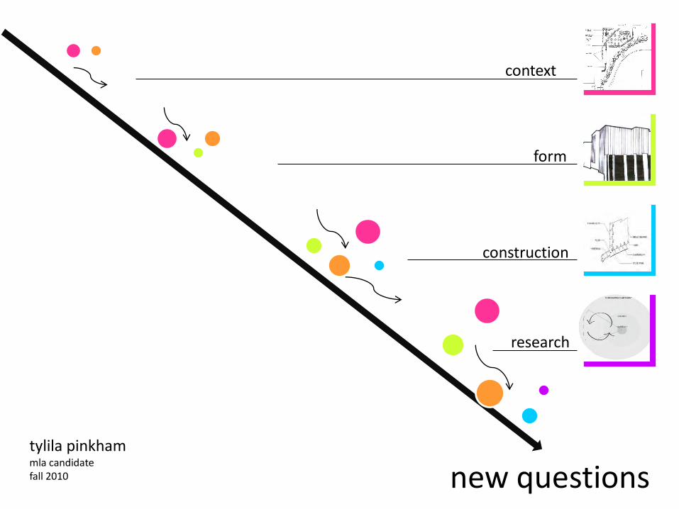
context
form
construction
tylila pinkhammla candidatefall 2010 new questions
research
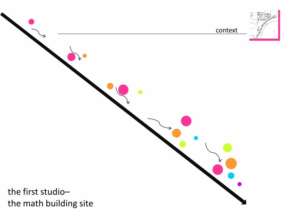
context
the first studio–the math building site

Design Goals:1. Create an outdoor gathering space for students2. Provide access to coffee shop across street3. Provide a bus stop
the site
Systems EngineeringBuilding
Planned Coffee Shop
Physics BuildingSite
Wolfline Bus Route

the design
Seating area
Graffiti wall
Bus stop
Crosswalk
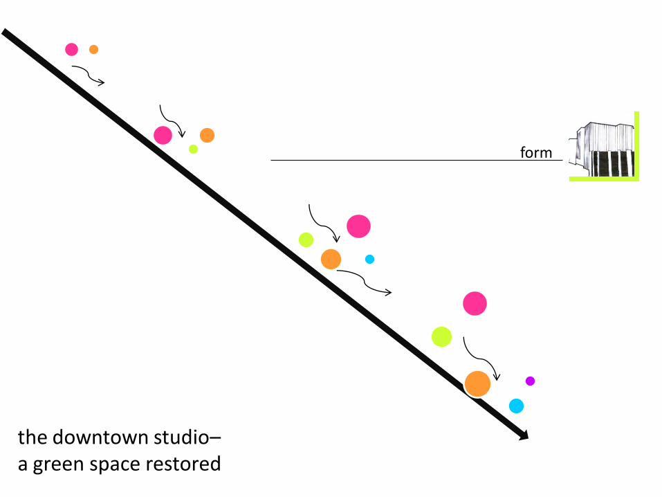
form
the downtown studio–a green space restored
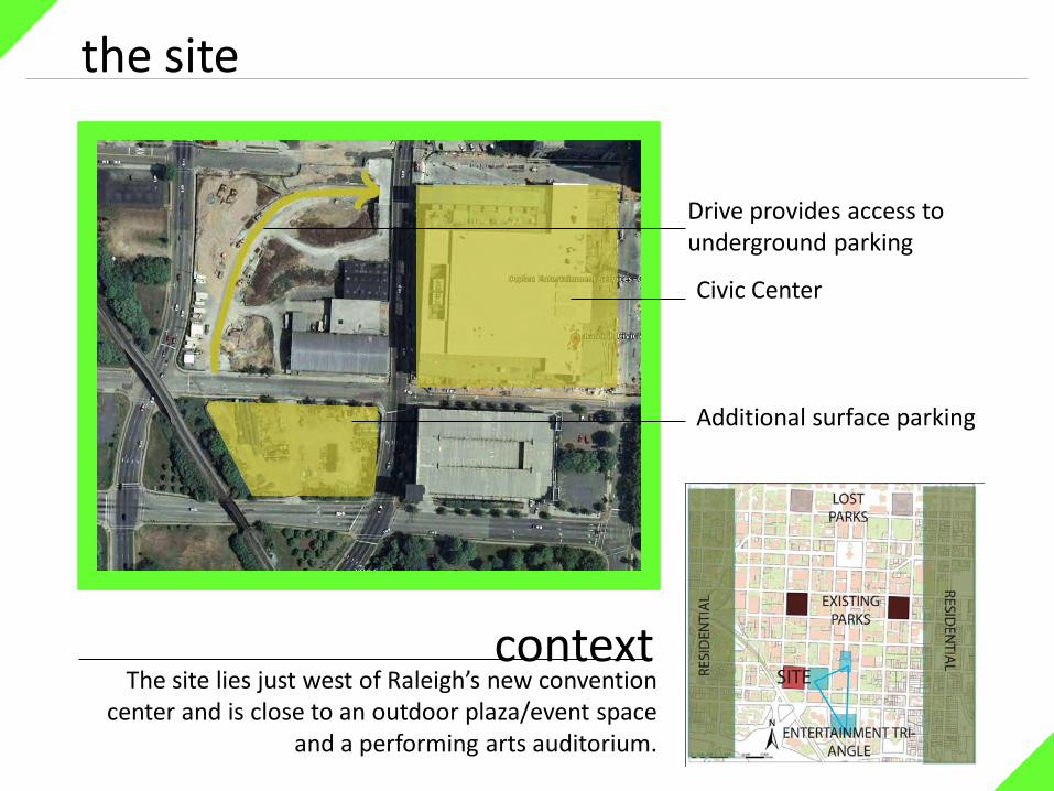
the site
Drive provides access to underground parking
Civic Center
Additional surface parking
The site lies just west of Raleigh’s new convention center and is close to an outdoor plaza/event space
and a performing arts auditorium.
context
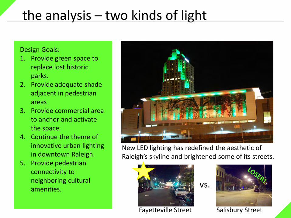
the analysis – two kinds of light
vs.
Fayetteville Street Salisbury Street
New LED lighting has redefined the aesthetic of Raleigh’s skyline and brightened some of its streets.
Design Goals:1. Provide green space to
replace lost historic parks.
2. Provide adequate shade adjacent in pedestrian areas
3. Provide commercial area to anchor and activate the space.
4. Continue the theme of innovative urban lighting in downtown Raleigh.
5. Provide pedestrian connectivity to neighboring cultural amenities.

the analysis – precedent studies
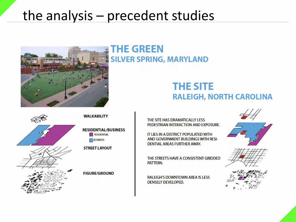
the analysis – precedent studies

Process – paper diagrams
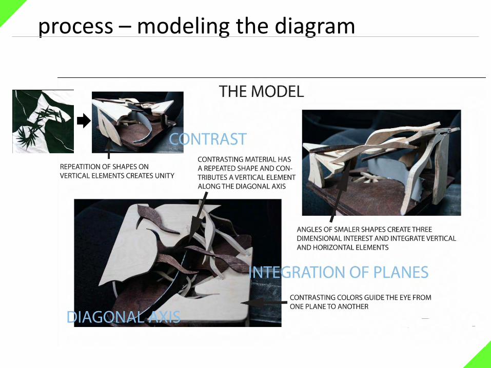
process – modeling the diagram
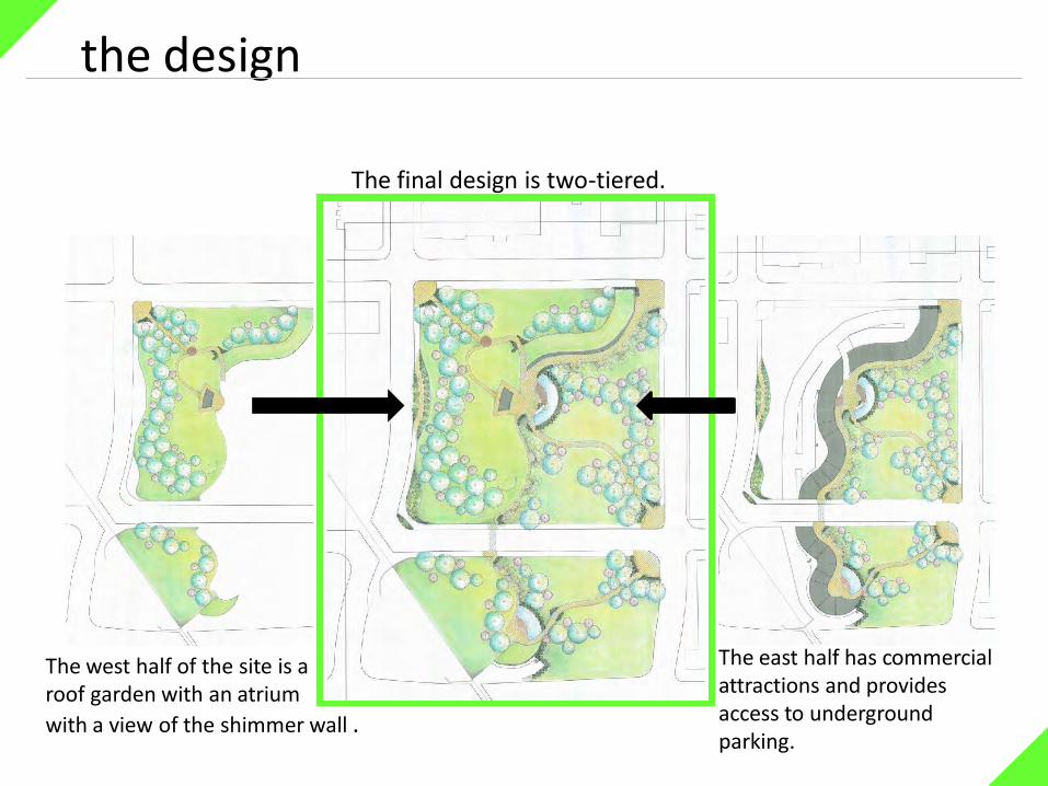
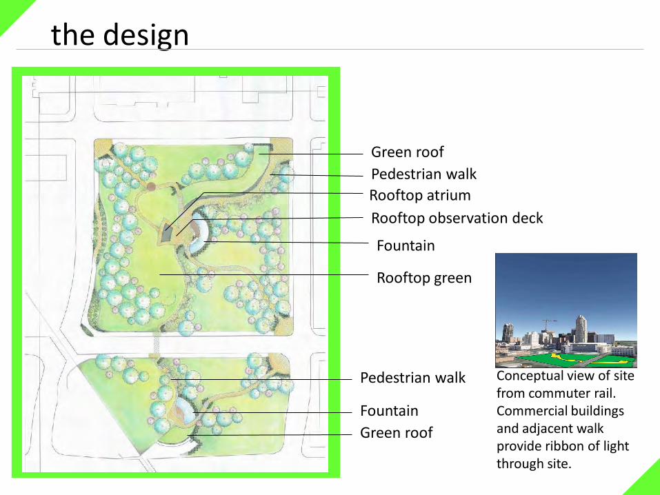
the design
The final design is two-tiered.
The west half of the site is a roof garden with an atrium
with a view of the shimmer wall .
The east half has commercial attractions and provides access to underground parking.
the design
Fountain
Fountain
Rooftop atrium
Rooftop observation deck
Rooftop green
Green roof
Green roof
Pedestrian walk
Pedestrian walk Conceptual view of site from commuter rail. Commercial buildings and adjacent walk provide ribbon of light through site.

the design
Fountain wall and adjacent plaza
Rooftop observation deck
Atrium
Parking and deliveries tunnel
Mural wall

construction
the construction studio–shade fountain and the wetland bowl
the site
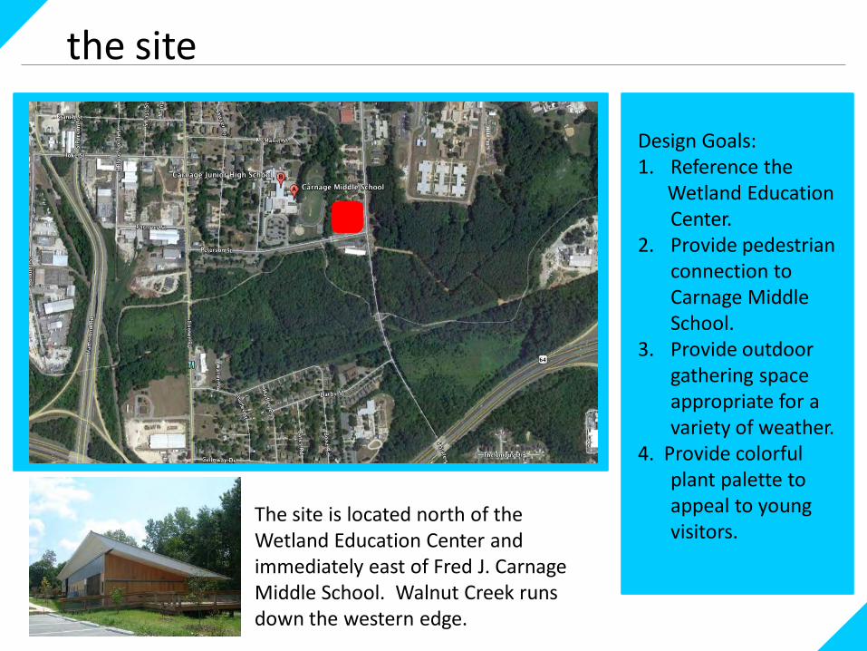
The site is located north of the Wetland Education Center and immediately east of Fred J. Carnage Middle School. Walnut Creek runs down the western edge.
Design Goals:1. Reference the
Wetland Education Center.
2. Provide pedestrian connection to Carnage Middle School.
3. Provide outdoor gathering space appropriate for a variety of weather.
4. Provide colorful plant palette to appeal to young visitors.
the design – grading
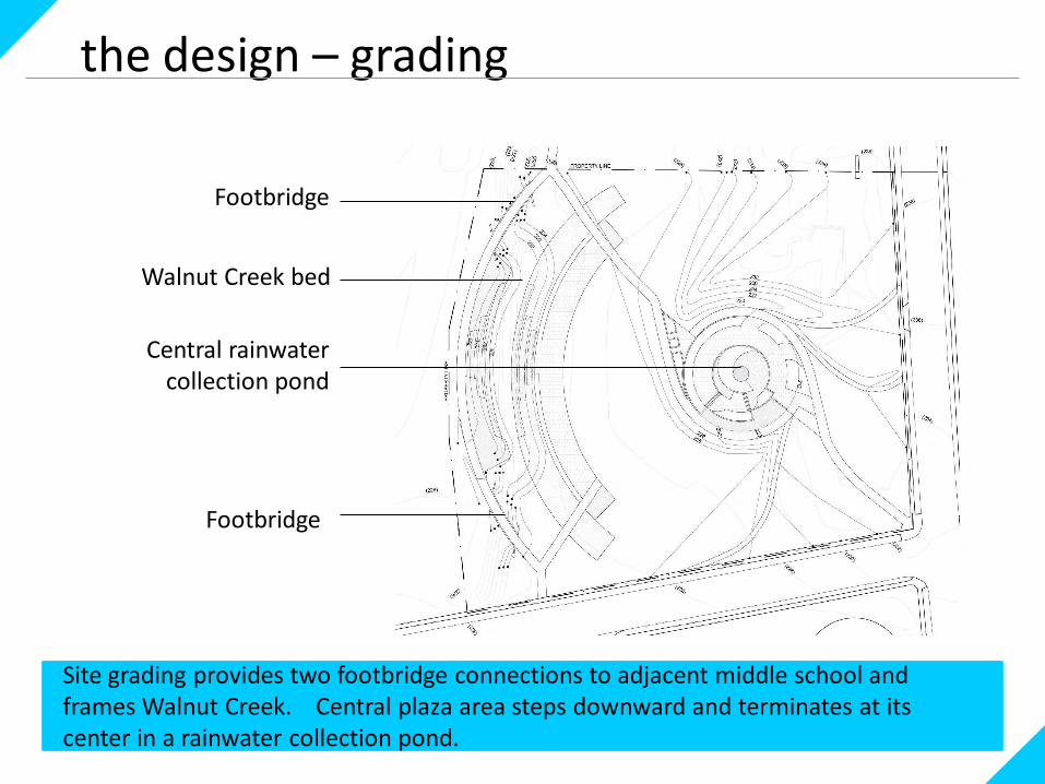
Walnut Creek bed
Central rainwater collection pond
Site grading provides two footbridge connections to adjacent middle school and frames Walnut Creek. Central plaza area steps downward and terminates at its center in a rainwater collection pond.
Footbridge
Footbridge

the design - planting
Plants in the design include colorful, flowering species and seed mixes appropriate to the moisture content of the area where they are planted.
modeling the concept
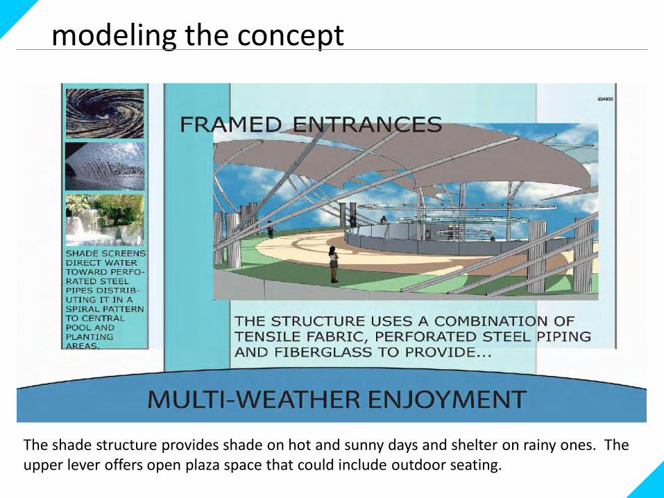
The shade structure provides shade on hot and sunny days and shelter on rainy ones. The upper lever offers open plaza space that could include outdoor seating.
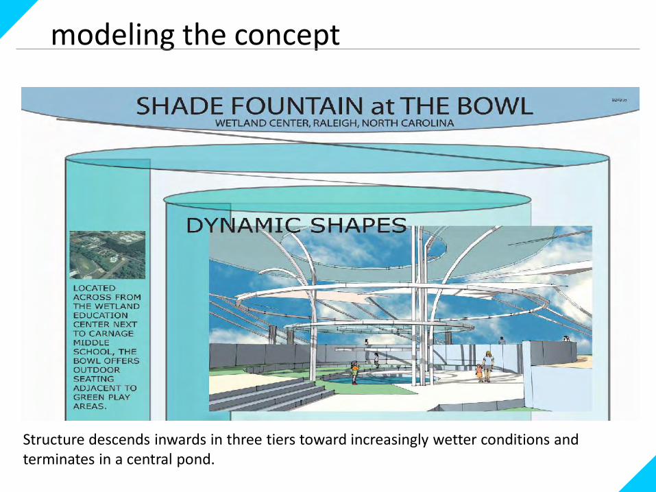
modeling the concept
Structure descends inwards in three tiers toward increasingly wetter conditions and terminates in a central pond.
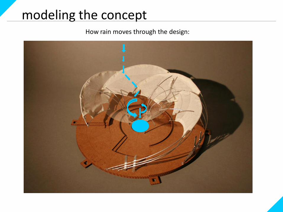
modeling the conceptHow rain moves through the design:
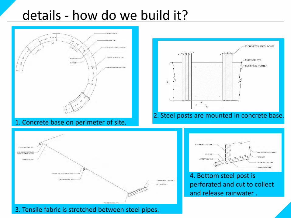
details - how do we build it?
1. Concrete base on perimeter of site.
3. Tensile fabric is stretched between steel pipes.
2. Steel posts are mounted in concrete base.
4. Bottom steel post is perforated and cut to collect and release rainwater .
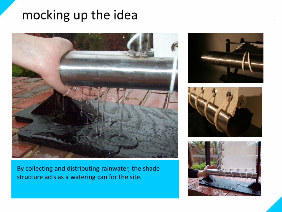
mocking up the idea
By collecting and distributing rainwater, the shade structure acts as a watering can for the site.
research
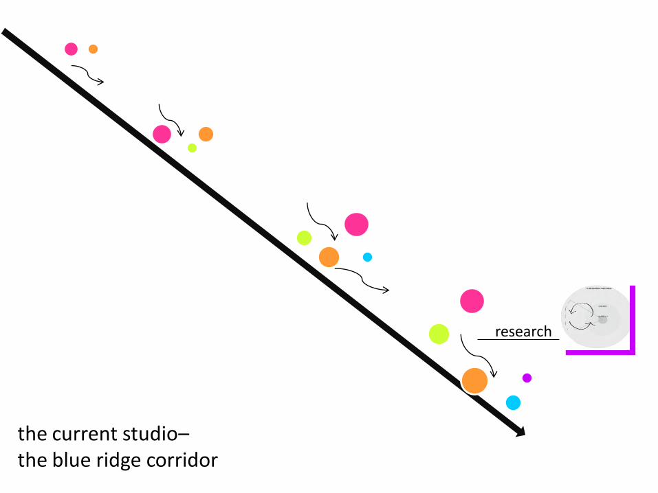
the current studio–the blue ridge corridor

the site
Design Goals:1. Address parking arrangement and surface
materials.2. Provide new mixed use areas.3. Activate the fairgrounds property and
create connection with surrounding area.4. Address storm water runoff onsite
wherever possible.5. Activate area adjacent to RBC Center and
Carter-Finley Stadium.6. Pursue these goals to the fullest extent
possible from the standpoint of human
and environmental health.
The Corridor The Focus Area

analysis – land use and organization
Residential
State/Commercial
Parking
Green space
Bus route
Railroad
Streets

analysis - problems
Wow! The site currently offers approximately 60 acres of parking (conservatively 6,300 spaces) to support just three locations: the fairgrounds, Carter-Finley Stadium and the RBC Center.
While Youth Camp Road does offer a bike line, many streets in the area do not, and even fewer have sidewalks.
The fairgrounds site is currently fenced off along a large portion of its perimeter immediately adjacent to streets.
Parking: Streets: Fairgrounds:
th
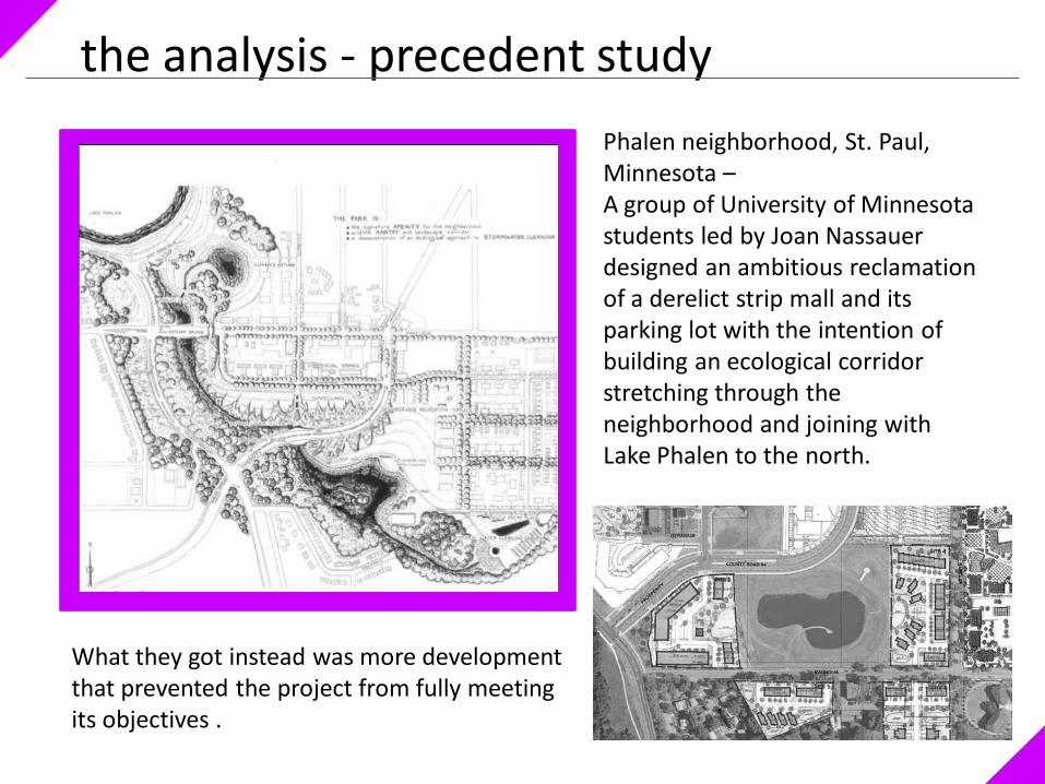
the analysis - precedent study
Phalen neighborhood, St. Paul, Minnesota –A group of University of Minnesota students led by Joan Nassauerdesigned an ambitious reclamation of a derelict strip mall and its parking lot with the intention of building an ecological corridor stretching through the neighborhood and joining with Lake Phalen to the north.
What they got instead was more development that prevented the project from fully meeting its objectives .
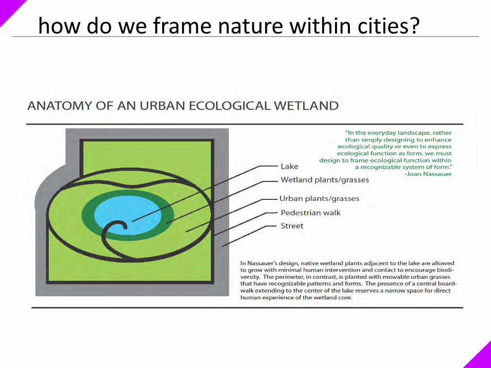
how do we frame nature within cities?

how can cities contribute to ecology?
Ways in which cities can support ecological health:
1. Community-wide composting2. Rain gardens 3. Urban forestry4. Limit use of vehicles with street
design and public transportation

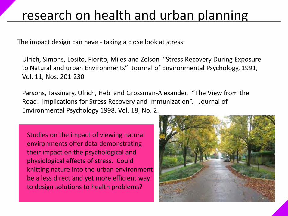
research on health and urban planning
Ewing, Schmid, Killingsworth, Zlot, Raudenbush, “Relationship Between Urban Sprawl and PhysicalActivity, Obesity, and Morbidity” The Science of Health Promotion.September/October 2003, Vol. 18, No. 1.
CORRELATION = CAUSATION
Frank, Martin, Andresen, Thomas, Schmidt “Obesity Relationships with Community Design, Physical Activity and Time Spent in Cars” The American Journal of Preventative Medicine. 2004, vo. 4, No. 11.
Saelens, Sallis, Frank, “ Environmental Correlates of Walking and Cycling: Findings From the Transportation, Urban Design, and Planning Literatures” Annals of Behavioral Medicine. 2003, vol. 25, No. 2.
research on health and urban planning
Ulrich, Simons, Losito, Fiorito, Miles and Zelson “Stress Recovery During Exposure to Natural and urban Environments” Journal of Environmental Psychology, 1991, Vol. 11, Nos. 201-230
Parsons, Tassinary, Ulrich, Hebl and Grossman-Alexander. “The View from the Road: Implications for Stress Recovery and Immunization”. Journal of Environmental Psychology 1998, Vol. 18, No. 2.
The impact design can have - taking a close look at stress:
Studies on the impact of viewing natural environments offer data demonstrating their impact on the psychological and physiological effects of stress. Could knitting nature into the urban environment be a less direct and yet more efficient way to design solutions to health problems?

a final thought…
Human interaction with the landscape is multi-faceted and complex. Successful long-term revisions to land planning and urban organization will demand multi-disciplinary cooperation.

tylila pinkhammla candidatefall 2010 thank you!