concurrent eruptions of mt.kliuchevskoi and mt.sheveluch
TRANSCRIPT

- Case study 2 -
Concurrent Eruptions of Mt.KLIUCHEVSKOI and Mt.SHEVELUCH
in Kamchatkan Peninsula
SECOND VAAC Best Practices Seminar
Montreal, 12 to 13 June 2012
Toshiyuki Sakurai Tokyo VAAC / JMA

Contents Overview (Eruption details)
Review (Tokyo VAAC's reaction)
Discussions
Visible / Discernable Ash
Collaboration
Confidence Level(Prediction methodology)
Summary

Overview (Eruption details)

Location and Eruption time
Eruptions of Mt.KLIUCHEVSKOI and Mt.SHEVELUCH
in the part of North of Kamchatkan Peninsula
between October 27th and 29th in 2010

Record of the eruptions KLIUCHEVSKOI
Oct 27,2010 1059Z Detection of ash cloud on the satellite imagery at KLIUCHEVSKOI 1059Z FL210 by MTSAT imagery 2010Z FL230 by the report from KEMSD(Received 2024Z)
Oct 28,2010 0359Z-0459Z Ash cloud is indistinguishable from it of SHEVELUCH Ceasing emissions from crater 0619Z Final VAA for KLIUCHEVSKOI(Handover to SHEVELUCH)
SHEVELUCH Oct 27,2010
2231Z Eruption at SHEVELUCH 2231Z FL230 by the report from KEMSD(Received 2327Z) FL300-FL330 by the report from KVERT,PAWU and AVO(Received 22-23UTC)
Oct 28,2010 0359-0459Z Detection of ash cloud on the satellite imagery at SHEVELUCH Ash cloud is indistinguishable from it of KLIUCHEVSKOI 0459Z FL250 by MTSAT imagery 0615Z VAA for Ash clouds including it from KLIUCHEVSKOI

Overview of satellite imagery The two volcanoes erupted at the same time.
The ash clouds was observed over a large region.
Movies: 27/0532Z – 30/2359Z

Review (Tokyo VAAC's reaction)

Review of initial reaction KLIUCHEVSKOI(KLIU),SHEVELUCH(SHEV)
(KLIU) VAA191 27/1358Z(Img 1259Z) FL210 <- Satellite(IR1&GPV)
(KLIU) VAA192 27/1755Z(Img 1659Z) FL220 <- Satellite(IR1&GPV)
(KLIU) VAA193 27/2051Z(Img 1959Z) FL230 <- Report(Video)
(KLIU) VAA194 27/2350Z(Img 2259Z) FL230 <- Report(Video)
(SHEV) VAA097 27/2336Z(Text only) FL230 <- Report(Seismic)
(SHEV) VAA098 28/0007Z(Text only) FL300 <- Report(Unknown)

Indistinguishable ash clouds KLIUCHEVSKOI(KLIU),SHEVELUCH(SHEV)
(SHEV) VAA099 28/0615Z(Img 0459Z) FL250 <- SATELLITE(IR1&GPV)
(KLIU) VAA195 28/0619Z(Text only) Final VAA
It was difficult to distinguish the ash clouds between KLIUCHEVSKOI and SHEVELUCH.
Tokyo VAAC continued issuing the VAA for SHEVELUCH, because SHEVELUCH was more active than KLIUCHEVSKOI.
We need to discuss how to deal with eruptions at the same time.

Discussions
-Visible/Discernable Ash
-Collaboration
-Confidence Level(Prediction methodology)

Visible/Discernable Ash

Collaboration with Volcano Observatory
KLIUCHEVSKOI 27/1059Z FL210 by MTSAT imagery(IR1 & GPV)
27/2010Z FL230 by the e-mail(Video) from KEMSD(27/2024Z)
SHEVELUCH 27/XXXXZ FL330 by e-mail(Unknown) from KVERT(27/2202Z)
27/2231Z FL230 by e-mail(Seismic) from KEMSD(27/2327Z)
272338/28053842 FL300 by SIGMET from PAWU(27/2342Z)
272338/28053842 FL300 by e-mail(About SIGMET) from AVO(27/0002Z)
0359-0459Z Ash cloud is detected on satellite imagery Ash cloud is indistinguishable from it of KLIUCHEVSKOI
Volcanological observatories in the area of Tokyo VAAC KVERT (Kamchatkan Volcanic Eruption Response Team) SVERT (Sakhalin Volcanic Eruption Response Team) KEMSD (Kamchatkan Experimental & Methodical Seismological Deparatment) PHIVOLCS (Philippine Institute of Volcanology and Seismology)

Record of handover Record of VAA for SHEVELUCH
Tokyo:(SHEV) VAA099 28/0615Z(Img 0459Z) FL250
Anchorage:(SHEV) VAA001 28/0815Z(Text only) RMK:PLEASE SEE FVFE01 RJTD 28/0615 ISSUED BY TOKYO VAAC THAT DESCRIBES CONDITIONS NEAR THE ANCHORAGE VAAC AREA OF RESPONSIBILITY
Tokyo:(SHEV) VAA100 28/1149Z(Img 1059Z) FL250 Tokyo VAAC sent FAX Sheets to ask the request of handover to Anchorage VAAC.
Anchorage:(SHEV) VAA002 28/1310Z(Img 1310Z) FL250 Anchorage VAAC issued VAA for the ash cloud in their responsibility area.
Tokyo:(SHEV) VAA101 28/1817Z(Img 1659Z) FL250 Tokyo VAAC issued VAA for the ash cloud in our responsibility area.
Tokyo:VAA100 Anchorage:VAA002

Necessity of handover Limit of the area MTSAT imagery using Tokyo VAAC
(65N-35S,70E-170W)
Limit of the area of dispersion model using Tokyo VAAC
(75N-75S,70E-140W)
Tokyo VAAC plan to develop new global dispersion model.
Limit of the field of view of MTSAT (70N-70S,70E-140W)
We can’t track ash clouds out of the field of view of geostationaly satellite.

HRS(Handover Request Sheet) Tokyo VAAC uses the form fax-
sheets in Japanese and English for handover requests.
Tokyo VAAC sends HRS with VAA, VAG, VAGI and other information.
VAGI(Not ICAO Product) shows latest aea of ash clouds.

OBS VA CLD(Initial ash polygon)
Excerpt from BP/1 Tokyo VAACs approach

Dispersion and trajectory model
In the case of Crater height >= 3000m Bottom of ash column = Crater height In the case of Crater height < 3000m and Estimated height >= 10000m Bottom of ash column = 5000m In the Case of Crater height < 3000m and Estimated height <10000m Bottom of ash column =1000m
Top of ash column = Estimated height
Bottom of ash column
How to determine ash particles for dispersion and trajectory model in Tokyo VAAC ? Initial ash particles are observed ash boundary. A ash column is inverted pyramid shape.
Inverted pyramid shape.

Prediction result
Yellow – FCST VA CLD +6 HR (Forecast polygon)
Blue – Observed ash cloud by satellite.

Observation and Prediction
Yellow – FCST VA CLD +6 HR (Forecast polygon)
Black – Observed ash cloud by satellite
In this case, the estimated height may be low, so we updated the height to FL250 in next advisory.

OBS VA CLD for Confidence levels
Yellow – FCST VA CLD +6 HR (Forecast polygon)
Thin black – Observed ash cloud by satellite
Thick black – Prediction & Observation
When there are a lot of meteorological clouds, we need to consider parts covered with them.

OBS VA CLD(T=0) for Confidence levels
Confidence Level Criteria for T=0
High (meets all 3) •More than 2/3 of polygon contains identified/discernible ash cloud , and •Ash cloud edges( with respect to polygon) mostly (2/3) discernable, and •plume height and/or ash cloud top reported or measured (objectively) (e.g., Radar, Lidar, satellite, etc)
Medium (meets 2) •Between 1/3 and 2/3 of polygon contains identifiable/discernible ash cloud. •Between one third and two thirds of ash cloud’s edges discernable •Plume height and/or ash cloud top estimated from recent data (<12 hours)
Low •Less than1/3 of polygon contains identiable/discernable ash cloud. • Ash cloud edges uncertain. •Plume height and/or ash cloud top unconfirmed
Excerpt from BPS/1
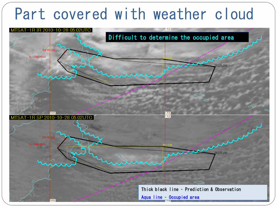
Part covered with weather cloud
Thick black line – Prediction & Observation
Aqua line – Occupied area
Difficult to determine the occupied area

Confidence Levels
More than 2/3 of polygon contains identified ash cloud ->High
Between one third and two thirds of ash cloud's edges discernable ->Mid
Ash cloud top reported or measured objectively ->High
In this case, Confidence Level defines as Mid.
Thick black line – Prediction & Observation
Aqua line – Occupied area

Confidence Levels
In this case, Confidence Level define as Mid.

Black line – High confidence
Blue line – Med confidence
Red line – Low conficence
Approach of Darwin VAAC for Confidence Levels
The confidence level of a polygon edge

Approach of Darwin VAAC for Confidence Levels
Black line – High confidence
Blue line – Med confidence
Red line – Low confidcence

Summary
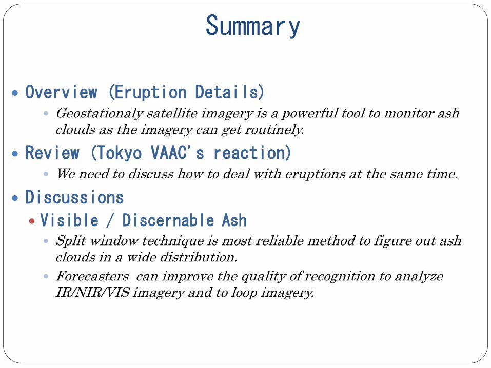
Summary
Overview (Eruption Details) Geostationaly satellite imagery is a powerful tool to monitor ash
clouds as the imagery can get routinely. Review (Tokyo VAAC's reaction)
We need to discuss how to deal with eruptions at the same time. Discussions
Visible / Discernable Ash Split window technique is most reliable method to figure out ash
clouds in a wide distribution. Forecasters can improve the quality of recognition to analyze
IR/NIR/VIS imagery and to loop imagery.

Summary
Discussions
Collaboration Tokyo VAAC receives email about eruptions from overseas
volcanological authorities. Unfortunately, some volcanological authorities are not on duty during the night.
We mainly use formed fax-sheet in Japanese and English for communication between the adjacent VAACs.
Confidence Level(Prediction methodology) When there are a lot of meteorological clouds, we need to consider
parts covered with them. In operation of areal confidence, We might be difficult to fit the criteria of occupied area.