comprehensive plan 2038 - middletown, virginia€¦ · that the town is successfully moving toward...
TRANSCRIPT

Comprehensive
Plan 2038
Town of Middletown, Virginia
Gateway to Cedar Creek and Belle Grove National Historical Park
Middletown, VA
Embody Charm

2
CONTENTS
INTRODUCTION ________________________________________________ 5
Legal Authority ___________________________________________________________ 5
Basis and Adoption _______________________________________________________ 5
Planning Commission _____________________________________________________ 6
Scope and Purpose of the Plan ______________________________________________ 6
Implementation___________________________________________________________ 7
Role of Local Government __________________________________________________ 7
Respect for the Rights of Individual Property Owners Versus Public Responsibility _____ 8
VISION: 2038 ___________________________________________________ 9
CORE MISSION: 2038 __________________________________________ 10
Core 1 _________________________________________________________________ 10
Core 2 _________________________________________________________________ 10
Core 3 _________________________________________________________________ 10
Core 4 _________________________________________________________________ 10
Core 5 _________________________________________________________________ 10
Purpose of these Missions _________________________________________________ 10
REGIONAL SETTING AND HISTORY ______________________________ 11
Regional Setting _________________________________________________________ 11
History ________________________________________________________________ 12
POPULATION AND HOUSING STATISTICS _________________________ 18
Historic Rates of Growth __________________________________________________ 18
Population Projections ____________________________________________________ 18
Age and Distribution 2010 _________________________________________________ 19
Household Projections ____________________________________________________ 20
ECONOMY, BUSINESS, AND EMPLOYMENT _______________________ 21
DOWNTOWN PLAN ____________________________________________ 23
What is a Downtown Plan? ________________________________________________ 23
TRANSPORTATION ____________________________________________ 25
INVENTORY ___________________________________________________________ 25
Roadways ____________________________________________________________ 25
Functional Classification_________________________________________________ 25

3
Traffic volumes ________________________________________________________ 26
Sidewalks ____________________________________________________________ 26
PLANNING ASSUMPTIONS _______________________________________________ 26
EXISTING AND FUTURE NEEDS AND RECOMMENDATIONS ___________________ 27
Roadway Improvements _________________________________________________ 27
Parking ______________________________________________________________ 28
Pedestrian and Bicycle Accommodations ___________________________________ 28
Transportation Demand Management ______________________________________ 28
Maintenance __________________________________________________________ 29
PLANNING-LEVEL COST ESTIMATES FOR RECOMMENDED IMPROVEMENTS ___ 29
COMMUNITY FACILITIES AND SERVICES _________________________ 30
Community Facilities in Middletown __________________________________________ 30
Parks _________________________________________________________________ 30
Municipal Buildings ______________________________________________________ 30
Wastewater Management _________________________________________________ 30
Storm Water Management _________________________________________________ 31
Water Dependence ______________________________________________________ 31
Water Distribution System _________________________________________________ 32
Chesapeake Bay Preservation Act __________________________________________ 32
ACTION PLAN _________________________________________________ 33
OVERVIEW ____________________________________________________________ 33
ECONOMIC DEVELOPMENT ______________________________________________ 33
STREETS, STREET LIGHTING AND SIDEWALKS _____________________________ 34
PARKS AND RECREATION FACILITES _____________________________________ 34
STORM WATER MANAGEMENT ___________________________________________ 35
PROPERTY MAINTENANCE ______________________________________________ 35
ZONING ADMINISTRATION AND ENFORCEMENT ____________________________ 36
HISTORIC DISTRICT ____________________________________________________ 36
WATER INDEPENDENCE ________________________________________________ 38
MAPS ________________________________________________________ 39
Zoning ________________________________________________________________ 40
Existing Sidewalks _______________________________________________________ 41
Transportation Plan ______________________________________________________ 42

4
APPENDICES _________________________________________________ 43
Appendix A: Reliance Road Area Land Use Plan _______________________________ 43
RELIANCE ROAD AREA LAND USE PLAN _________________________________ 43
LAND USE ___________________________________________________________ 44
TRANSPORTATION ___________________________________________________ 44
WATER AND SEWER __________________________________________________ 46
Appendix B: Implementation Tools __________________________________________ 48
Legal Implementation ___________________________________________________ 48
Financial Implementation ________________________________________________ 49
Administrative Implementation ____________________________________________ 50
Summary ____________________________________________________________ 52
5
INTRODUCTION
Legal Authority
All states have enabling legislation addressing comprehensive plans, but in Virginia, state law
actually requires comprehensive plans with prescribed content. Section 15.2-2223 of the
Code of Virginia requires that every local planning commission shall prepare a
comprehensive plan for the physical development of the territory within its jurisdiction and the
governing body shall adopt a comprehensive plan. The Planning Commission shall review the
plan at least once every five years to determine if amendments are advisable.
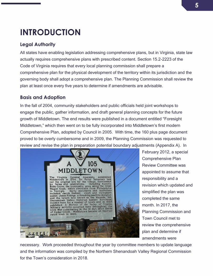
Basis and Adoption
In the fall of 2004, community stakeholders and public officials held joint workshops to
engage the public, gather information, and draft general planning concepts for the future
growth of Middletown. The end results were published in a document entitled “Foresight
Middletown,” which then went on to be fully incorporated into Middletown’s first modern
Comprehensive Plan, adopted by Council in 2005. With time, the 160 plus page document
proved to be overly cumbersome and in 2009, the Planning Commission was requested to
review and revise the plan in preparation potential boundary adjustments (Appendix A). In
February 2012, a special
Comprehensive Plan
Review Committee was
appointed to assume that
responsibility and a
revision which updated and
simplified the plan was
completed the same
month. In 2017, the
Planning Commission and
Town Council met to
review the comprehensive
plan and determine if
amendments were
necessary. Work proceeded throughout the year by committee members to update language
and the information was compiled by the Northern Shenandoah Valley Regional Commission
for the Town’s consideration in 2018.
6
Planning Commission
The Middletown Planning Commission consists of five (5) members appointed by the Town
Council, all of whom shall be residents of the Town qualified by knowledge and experience to
make decisions on community growth and development. In addition to the five members, a
member of the Council serves as a non-voting liaison.
Scope and Purpose of the Plan
In accordance with state code, the comprehensive plan shall be made with the purpose of
guiding and accomplishing a coordinated, adjusted and harmonious development of the
territory which will, in accordance with present and probable future needs and resources, best
promote the health, safety, morals, order, convenience, prosperity and general welfare of the
inhabitants, including the elderly and persons with disabilities. The plan shall be general in
nature and shall designate the general or approximate location, character, and extent of each
feature, including any transportation improvements shown on the plan. The plan shall
indicate where existing lands or facilities are proposed to be extended, widened, removed,
relocated, vacated, narrowed, abandoned, or changed in use as the case may be.
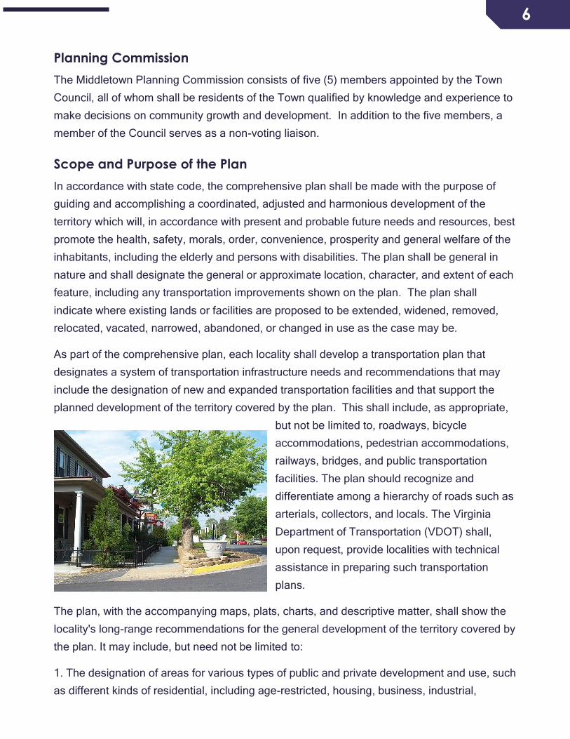
As part of the comprehensive plan, each locality shall develop a transportation plan that
designates a system of transportation infrastructure needs and recommendations that may
include the designation of new and expanded transportation facilities and that support the
planned development of the territory covered by the plan. This shall include, as appropriate,
but not be limited to, roadways, bicycle
accommodations, pedestrian accommodations,
railways, bridges, and public transportation
facilities. The plan should recognize and
differentiate among a hierarchy of roads such as
arterials, collectors, and locals. The Virginia
Department of Transportation (VDOT) shall,
upon request, provide localities with technical
assistance in preparing such transportation
plans.
The plan, with the accompanying maps, plats, charts, and descriptive matter, shall show the
locality's long-range recommendations for the general development of the territory covered by
the plan. It may include, but need not be limited to:
1. The designation of areas for various types of public and private development and use, such
as different kinds of residential, including age-restricted, housing, business, industrial,
7
agricultural, mineral resources, conservation, active and passive recreation, public service,
flood plain and drainage, and other areas;
2. The designation of a system of community service facilities such as parks, sports playing
fields, forests, schools, playgrounds, public buildings and institutions, hospitals, nursing
homes, assisted living facilities, community centers, waterworks, sewage disposal or waste
disposal areas, and the like;
3. The designation of historical areas and areas for urban renewal or other treatment;
4. The designation of areas for the implementation of reasonable ground water protection
measures;
5. A capital improvements program, a subdivision ordinance, a zoning ordinance and zoning
district maps;
6. The location of existing or proposed recycling centers;
7. The plan shall include: the designation of areas and implementation of measures for the
construction, rehabilitation and maintenance of affordable housing, which is sufficient to meet
the current and future needs of residents of all levels of income in the locality while
considering the current and future needs of the planning district within which the locality is
situated.
8. The plan shall include: a map that shall show road improvements and transportation
improvements, including the cost estimates of such road and transportation improvements as
available from the Virginia Department of Transportation, taking into account the current and
future needs of residents in the locality while considering the current and future needs of the
planning district within which the locality is situated
Implementation
The Comprehensive Plan provides a long-term perspective of community change, typically
spanning a 20-year period. It is one of the most essential documents produced by the
Planning Commission. Implementation of the plan occurs through town ordinances, including
zoning ordinances, which contain regulations for the use and development of both public and
private property within the town.
Role of Local Government
Comprehensive planning should be a continuous cycle of activity. It begins with preparations
and adoption of the plan, followed by implementation, and finally periodic review of and

8
updates to the plan to ensure it remains a current document. Preparation of the plan usually
starts with collecting and analyzing data about the town, which is then used to identify a
preferred vision for the town at some point in the future. Projections are also made regarding
the future of the town, such as the size of the population and the levels of certain public
services that will be required to accommodate this population. The plan then includes goals
and specific means for implementation that are designed to help the town achieve its vision
for the future.
Once the comprehensive plan is adopted, the next phase of the planning process is
implementation. The plan shall serve as the framework for town decision-making to ensure
that the town is successfully moving toward its desired future. The comprehensive plan is
implemented through the daily decisions of town officials, including the adoption and
enforcement of regulations, establishment of new or expanded public services and programs,
annual budgeting, and capital improvement planning. The effort and foresight that are put
into the comprehensive plan during establishment or review are effective only to the level that
the plan is implemented by town officials.
The final part of the comprehensive planning process is the periodic review and updating of
the plan. This should be an on-going activity that periodically evaluates the data in the plan,
identifies current items that need to be addressed, and examines the plan’s objectives and
implementation strategies to determine if they are adequately addressing town issues.
During a review period, the town should gauge whether or not it indeed is making progress
towards its desired future. Thorough and accurate plan review and updating is critical to
ensure that the plan continues to provide accurate guidance to town officials.
Respect for the Rights of Individual Property Owners Versus Public
Responsibility
The government of Middletown has to balance its responsibilities to the community as a
whole with that of individual property owners by encouraging direct community involvement in
planning, in an open two-way communication process. Respect for the individual rights of
Middletown residents to use their properties without excessive governmental mandates
makes Middletown a special place.
9
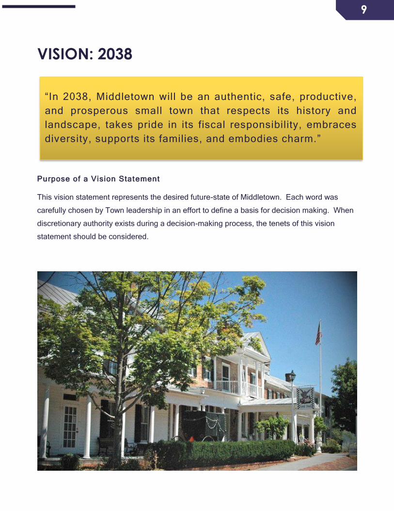
VISION: 2038
Purpose of a Vision Statement
This vision statement represents the desired future-state of Middletown. Each word was
carefully chosen by Town leadership in an effort to define a basis for decision making. When
discretionary authority exists during a decision-making process, the tenets of this vision
statement should be considered.
“In 2038, Middletown will be an authentic, safe, productive,
and prosperous small town that respects its history and
landscape, takes pride in its fiscal responsibility, embraces
diversity, supports its families, and embodies charm.”

10
CORE MISSION: 2038
Core 1
Establish framework for a new revised organization which will be responsible for the short and
long-term revitalization goals for the Town of Middletown.
Core 2
Increase the community relations between our youth and the Town of Middletown.
Core 3
Continue to promote business and economic development, while preserving historical
structures and landmarks and maintaining a quaint small town feel in the Town of Middletown
and continue working relations with Frederick County government officials.
Core 4
Continue to provide high quality services to the Town of Middletown.
Core 5
Continue to promote long-term Small Business Development along Main Street also known
as the main artery of our community and continue to fill empty commercial structures in the
town limits.
Purpose of these Missions
These 5 items have been identified as core missions, vitally important to achieving the
desired vision of the Town.

11
REGIONAL SETTING AND HISTORY
Regional Setting
Middletown is located in Southern Frederick County within the Shenandoah Valley of Virginia.
Two factors in the Town’s regional setting have greatly influenced its existence and growth.
The first factor was the Town’s location along the transportation corridor which began as a
path for migratory animals, then a Warrior’s Trail, The Great Wagon Road, The Valley
Turnpike and finally State Route-11. This early route, with its westward extension, known as
the Wilderness Road, was the most important frontier highway in Colonial America. The road
opened Western Virginia to settlement and also provided a means to market area produce
and products.
The second regional factor
affecting Middletown has been
its location near large urban
areas and regional
employment centers,
enhanced by the modern
interstate system whose north-
south axis parallels Route-11.
The nearness of the Town to
the Virginia Inland Port and to
such cities as Washington
D.C., Baltimore, and
Richmond make it possible for
local industry to easily
transport products to major
markets and to develop
regional employment. Local workers have the option to commute to urban areas or to work
locally. The junction, of I-81 and I-66, located one mile south of Town, makes Middletown and
its surrounding area a central transportation point for the entire Central Shenandoah Valley.

12
History
Middletown started as
one of a series of
settlements which
sprang up along the
Valley Pike, within the
boundaries of the 17th
Century Fairfax Grant.
This was a political
payoff to allies of the
King during the civil
war in England in the
mid-1600’s. Land here
was under control of
Thomas Lord Fairfax
and was surveyed initially by a 16-year-old George Washington.
Some of the first documentation of early Middletown dates back to the late 18th century when
“Senseney Town” was laid out by Dr. Peter Senseney and his wife Magdelen. The chief factor
in establishing the town was the construction of the Macadamized (crushed stone pavement)
Valley Turnpike. The doctor was an astute land speculator who realized that a horse
changing station was planned for the mid-way point between New Town (Stephens City) and
Strasburg. When Middletown was established as a town, by an act of the General Assembly
in 1796 and in anticipation of the paved turnpike, the 50-acre community was already laid out
in a grid street pattern with 126 lots. Senseney also purposely laid out Main Street in town at
a much wider width than normal, to allow traffic to easily pass within the town. Unfortunately,
Peter Senseney did not live long enough to see much beyond the early establishment of the
town, having passed in 1804. He is buried at Mt. Hebron Cemetery in Winchester.
The first census conducted for the town in 1800 listed its population as 144 free citizens and
12 slaves. It should be noted that many of the formerly enslaved families remained in
Middletown following emancipation and one family worked at the Wayside Inn from the
horrific days of slavery until recent years.

13
Major Isaac Hite, Jr., who served in Muhlenberg’s regiment during the Revolutionary War,
and his wife, Nelly Conway Madison (sister of President James Madison), built a large
limestone mansion one mile southwest of Middletown. Belle Grove, as the house and 7500-
acre plantation became known, had the assistance of Thomas Jefferson in its design and was
completed in 1797. The mansion was restored in the late 1960’s and is under the care of the
National Trust for Historic Preservation.
Early industry in Middletown was centered on the horse changing station connected to
Wilkerson’s Tavern (Wayside Inn-one of the oldest continuously operating Inns in the
country). A wheelwright, blacksmith, harness maker and dry goods shops were all located
near the inn. Several other taverns opened in the town, probably giving Middletown a rough
stage stop reputation. Civilization came to town when citizens organized the Methodist
Episcopal Church on Senseney Street in 1818 and the Episcopal Church in 1835.
Middletown had gained prominence in the manufacture of quality precision instruments
(clocks, watches and surveying equipment) as early as 1786 by Jacob Danner, a veteran of
the American Revolution, and his partner Anthony Kline. A thriving milling industry also
developed on the streams a short distance west of town, because the town run was
inadequate for such purposes.

14
The advent of the American Civil War brought much destruction to the town and the region as
armies pursued each other up the Valley toward Harrisonburg and down the Valley toward
Winchester. There were a number of camps near town during the war and several fights in
and around town. Two major actions occurred in the town.
The first occurred on May 24, 1862 when Stonewall Jackson ‘s Confederates raced to the
Valley Pike, after soundly defeating the Union garrison at Front Royal, in an effort cut-off
Bank’s Federal Army from Winchester. The Federal camps were in Strasburg and along
Cedar Creek. Part of Jackson’s Column led by Turner Ashby’s cavalry arrived by the
Cedarville Road at what is 1st Street and overtook part of Bank’s wagon train. They
skirmished with the Federals to Stephens City (then called Newtown). Meanwhile the
Louisiana Battalion took Buckton Ford Road (Formerly 6th Street-Now Veteran’s Way) and
cut off Bank’s rearguard, which was able to escape back to Strasburg and retreat over the
Mountain and eventually to Winchester. This was the start of Jackson’s famous 1862 Valley
Campaign.
The next major event to impact Middletown was the 1864 Shenandoah Valley Campaign.
After defeating the Confederates at Winchester, Kernstown, Toms Brook and Fisher’s Hill,
Gen. Philip Sheridan’s Union Troops followed Early’s Confederates to about Harrisonburg
and began a retro move back to Cedar Creek, burning farms, crops, mills, barns and
anything of use to the Confederate war effort. The Burning, as it is known locally, permanently
wrecked the grain industry in the much of the Valley.
Camping the behind the protection of
Cedar Creek and assuming little
danger from Early’s army, Sheridan
left Gen. Wright in charge and went
to meet with President Lincoln.
Confederate General. John B.
Gordon and mapmaker Capt.
Jedediah Hotchkiss scouted Union
positions and designed a surprise
attack on the Union camps. On
October 19, 1864, just before dawn
and following an all-night march, the
15
attack opened on the Union 8th Corps camps south of Middletown. Under the cover of a
thick fog, and close to the trenches the battle began with a Rebel Yell and a volley from the
darkness as Early’s army charged the Union trenches. The surprise was complete and the
8th Corps soon abandoned their trenches, rallying briefly on Buckton Ford Rd (Veteran’s
Way) and giving way through town. Firing roused the Union 19th and 6th Corps. Custer’s
Cavalry ordered boots and saddles and rode into the fight and tried briefly to stem the
Confederate tide with their carbines and flying artillery near Buckton Ford Rd, but soon
returned to camp to await orders. The 19th Corps was confused with some units responding
and others not. The 6th Corps immediately beat the long roll and readied for the fight. As
the battle progressed, the Union troops of the 8th and parts of the 19th Corps were driven
back through town and along streams to the west. Minnie Balls and artillery rounds flew
thick in the streets. Part of the Union 6th Corps held the cemetery and delayed the
Confederate assault long enough for the army to regroup about a mile north of town as
Confederates began to ransack the Federal camps for food and supplies. By about noon,
Confederate lines were established at the North end of town.
General Sheridan had returned to Winchester the prior evening and after hearing cannon fire
on the morning of the 19th, began his famous ride to rally the Union Army. Upon his arrival,
he rode the battle line to encourage his soldiers and wanting to be sure of what forces the
Confederates had on the field, ordered a cavalry charge to take prisoners. Two attempts were
made before this was accomplished. Two hundred horses fell near where Lord Fairfax
Community College now stands. Around 4pm, Sheridan ordered his troops forward with the
heaviest fighting occurring West of the Valley Pike where Confederate General Ramseur was
mortally wounded. Custer’s Cavalry flanked the Confederate lines and their morning
victory turned into a rout as they scrambled South through and around Middletown, losing
their baggage train and nearly all of their artillery. The battle ended at dark as Union artillery
shelled the fleeing Confederates from Hupp’s Hill in Strasburg.
As the battle flowed north in the morning and back South in the evening, the town suffered
tremendous damage from rifle and artillery fire caused by the fighting in the streets and as a
result of overshot rounds from both armies. It is thought that most citizens took refuge in
their cellars, where the noise of battle was terrifying. According to James Taylor, a reporter
and artist with Frank Leslie’s Illustrated Newspaper, “on my route out Church Street, I am
greeted on each hand with the evidence of the fierce fighting in the struggle back and forth

16
during the morning and evening of the 19th, in the buildings and fences, which were peppered
like sieves.” Taylor also tells a story of a curious citizen who crawled outside for a time to
watch the battle as bullets zipped over his head. Today, many old homes in town lay claim to
stories of bullets and cannonballs passing through their walls that day. A couple of homes still
have blood stained floors.
The wounded of both armies sought shelter in town and surgeries were established at the
Methodist Church, with the primary surgery at St. Thomas Church. The St. Thomas field
hospital was established by Confederate surgeons in the morning and then the struggle to
save lives was joined by Union surgeons in the evening. Confederate doctors remained on
duty there and worked side by side with Federal surgeons. St. Thomas Church was struck
at least twice by artillery fire with a round passing through the bell tower and another lodging
in the tower. The rounds were likely fired by DuPont’s Battery posted just north of present
day Lord Fairfax Community College.
According to historian Dr. Jonathan Noyalis, “the Union army, which entered the battle with an
overall strength of 31,610 men, suffered 5,764 casualties, 569 of whom were killed. The
Confederate army which consisted of 14,091 men at the battle’s outset suffered
approximately 3,060 casualties, 1,860 of whom were either reported killed or wounded.”
In an ongoing effort to protect both Belle Grove and the battleground, Cedar Creek and Belle
Grove National Historical Park became the 388th unit of the National Park Service on
December 19, 2002.
The Post-Civil War era brought a change in agriculture from wheat to orchards, but as a
whole the local economy remained poor for years to come. Small communities like
Middletown gradually rebuilt from war damages with towns people often bartering with
neighbors for goods and services and sometimes receiving damage reparations from the

17
Federal Government. It took the Methodists until the 1890’s to replace their badly damaged
brick building with what we in town now know as Grace United Methodist.
Around 1889, Middletown was tarnished by one of the many land promotion schemes then
common. “New Middletown” was to be developed just west of the town boundaries to include
the Hotel Belleview (cost $25,000.00) and “portable houses.” Encompassing nearly 1,000
acres of land, it even offered free sites for manufacturing purposes to attract mills, a tin can
factory, and others. Sadly, the boom failed with many people losing money and land.
The history of the Town has been one generally of providing business, educational, religious,
and social opportunities to the surrounding countryside as well as serving the needs of private
and commercial travelers in the valley.
18
POPULATION AND HOUSING STATISTICS
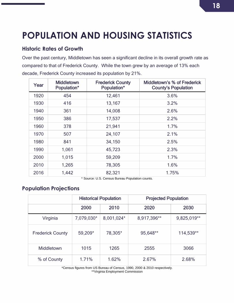
Historic Rates of Growth
Over the past century, Middletown has seen a significant decline in its overall growth rate as
compared to that of Frederick County. While the town grew by an average of 13% each
decade, Frederick County increased its population by 21%.
Year Middletown Population*
Frederick County Population*
Middletown’s % of Frederick County’s Population
1920 454 12,461 3.6%
1930 416 13,167 3.2%
1940 361 14,008 2.6%
1950 386 17,537 2.2%
1960 378 21,941 1.7%
1970 507 24,107 2.1%
1980 841 34,150 2.5%
1990 1,061 45,723 2.3%
2000 1,015 59,209 1.7%
2010 1,265 78,305 1.6%
2016 1,442 82,321 1.75% * Source: U.S. Census Bureau Population counts.
Population Projections
Historical Population Projected Population
2000 2010 2020 2030
Virginia 7,079,030* 8,001,024* 8,917,396** 9,825,019**
Frederick County 59,209* 78,305* 95,648** 114,539**
Middletown 1015 1265 2555 3066
% of County 1.71% 1.62% 2.67% 2.68%
*Census figures from US Bureau of Census, 1990, 2000 & 2010 respectively. **Virginia Employment Commission

19
Age and Distribution 2010
Statistically, Middletown shows little or no difference when compared with Frederick County
and the Commonwealth of Virginia. Roughly one quarter of the population is under the age of
18, 62% are of working age, and 10% of retirement age. The aging of the Baby Boom
population after 2010 will have a dramatic impact on the growth of the elderly population. By
the year 2025, the survivors of the Baby Boom will be between the ages of 61 and 79. During
the period 2010 to 2025 all states show a rapid acceleration in the growth of the elderly
population.
Age and Distribution 2016 - ACS 5yr Estimates
Middletown Frederick County Virginia
Under 5 years 88 (6.1%) 4,857 (5.9%) 490,308 (5.8%)
5 to 9 years 91 (6.3%) 5,762 (7%) 581,721 (11.9%)
10 to 14 years 89 (6.2%) 5,433 (6.6%) 548,480 (5.2%)
15 to 19 years 95 (6.6%) 5,186 (6.3%) 523,549 (7.1%)
20 to 24 years 102 (7.1%) 4,857 (5.9%) 490,308 (10.7%)
25 to 29 years 101 (7%) 4,775 (5.8%) 481,997 (6.7%)
30 to 34 years 99 (6.9%) 4,939 (6%) 498,618 (7.6%)
35 to 39 years 94 (6.5%) 4,939 (6%) 498,618 (7.8%)
40 to 44 years 97 (6.7%) 5,680 (6.9%) 573,411 (4.6%)
45 to 49 years 101 (7%) 6,339 (7.7%) 639,893 (5.3%)
50 to 54 years 105 (7.3%) 6,421 (7.8%) 648,203 (5.7%)
55 to 59 years 97 (6.7%) 6,174 (7.5%) 623,273 (4.7%)
60 to 64 years 85 (5.9%) 4,528 (5.5%) 457,067 (5.5%)
65 to 69 years 69 (4.8%) 4,281 (5.2%) 432,136 (5.3%)
70 to 74 years 49 (3.4%) 3,046 (3.7%) 307,481 (1.7%)
75 to 79 years 33 (2.3%) 2,305 (2.8%) 232,688 (1.6%)
80 to 84 years 23 (1.6%) 1,564 (1.9%) 157,896 (1.8%)
85 years and over 25 (1.7%) 1,265 (1.5%) 124,655 (1%)
Total Population 1,142 82,321 8,310,301
Source: U.S. Census Bureau Population counts.
20
Household Projections
2000 2010 2016
Estimate 2020 2030
Population 1,015 1,265 1,442 2,555 3,066
Persons Per Household 2.48 2.48 2.82 2.48 2.48
Number of Households 409 508 512 1030 1236
Significant population growth is expected within the Town due to growth pressures from
Northern Virginia, as well as new housing opportunities expected to come on line within the
projection period.
21
ECONOMY, BUSINESS, AND EMPLOYMENT
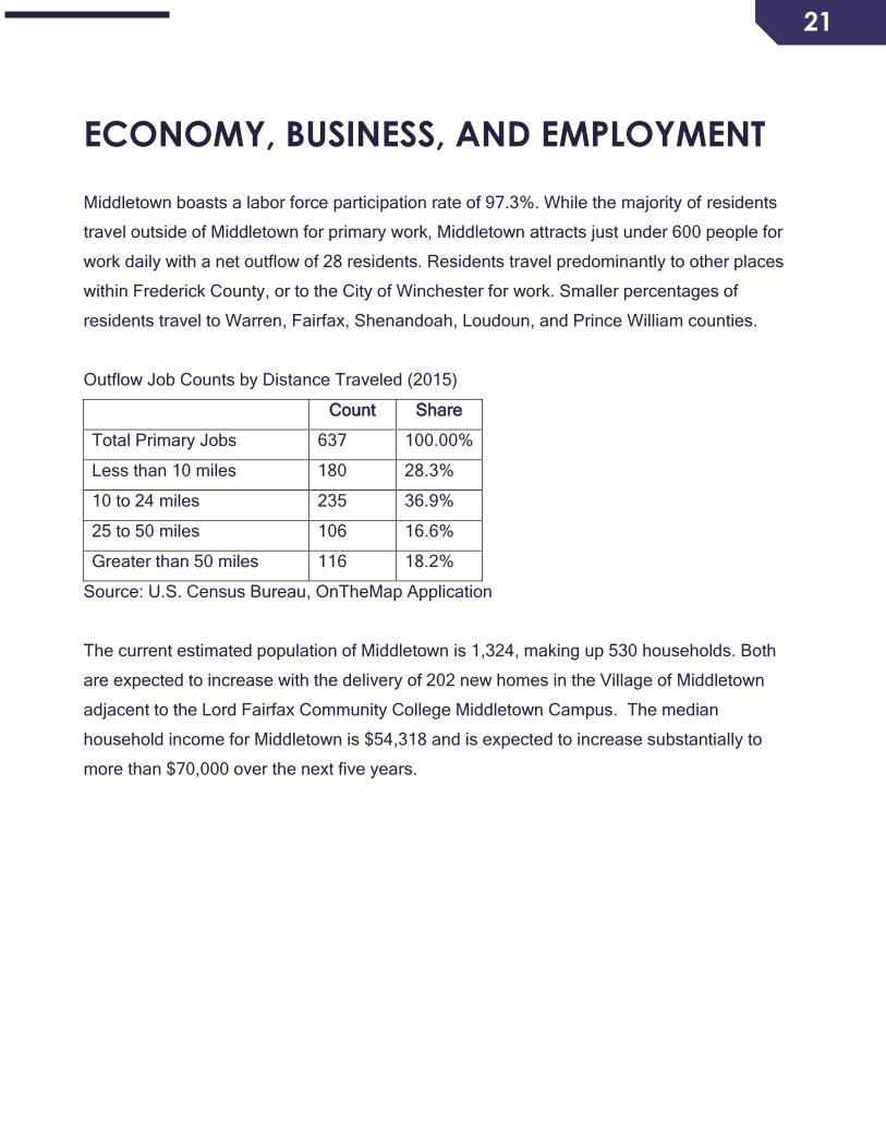
Middletown boasts a labor force participation rate of 97.3%. While the majority of residents
travel outside of Middletown for primary work, Middletown attracts just under 600 people for
work daily with a net outflow of 28 residents. Residents travel predominantly to other places
within Frederick County, or to the City of Winchester for work. Smaller percentages of
residents travel to Warren, Fairfax, Shenandoah, Loudoun, and Prince William counties.
Outflow Job Counts by Distance Traveled (2015)
Count Share
Total Primary Jobs 637 100.00%
Less than 10 miles 180 28.3%
10 to 24 miles 235 36.9%
25 to 50 miles 106 16.6%
Greater than 50 miles 116 18.2%
Source: U.S. Census Bureau, OnTheMap Application
The current estimated population of Middletown is 1,324, making up 530 households. Both
are expected to increase with the delivery of 202 new homes in the Village of Middletown
adjacent to the Lord Fairfax Community College Middletown Campus. The median
household income for Middletown is $54,318 and is expected to increase substantially to
more than $70,000 over the next five years.
22
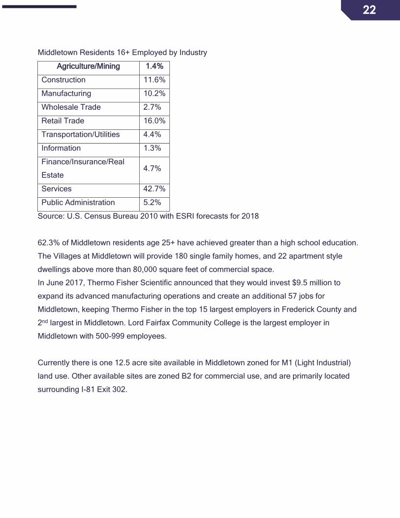
Middletown Residents 16+ Employed by Industry
Agriculture/Mining 1.4%
Construction 11.6%
Manufacturing 10.2%
Wholesale Trade 2.7%
Retail Trade 16.0%
Transportation/Utilities 4.4%
Information 1.3%
Finance/Insurance/Real
Estate 4.7%
Services 42.7%
Public Administration 5.2%
Source: U.S. Census Bureau 2010 with ESRI forecasts for 2018
62.3% of Middletown residents age 25+ have achieved greater than a high school education.
The Villages at Middletown will provide 180 single family homes, and 22 apartment style
dwellings above more than 80,000 square feet of commercial space.
In June 2017, Thermo Fisher Scientific announced that they would invest $9.5 million to
expand its advanced manufacturing operations and create an additional 57 jobs for
Middletown, keeping Thermo Fisher in the top 15 largest employers in Frederick County and
2nd largest in Middletown. Lord Fairfax Community College is the largest employer in
Middletown with 500-999 employees.
Currently there is one 12.5 acre site available in Middletown zoned for M1 (Light Industrial)
land use. Other available sites are zoned B2 for commercial use, and are primarily located
surrounding I-81 Exit 302.

23
DOWNTOWN PLAN
What is a Downtown Plan?
In accordance with the State of Virginia Code, Comprehensive Plans, including Downtown
Plans (or Small Area Plans) shall be made with the purpose of guiding and accomplishing a
coordinated, adjusted and harmonious development of the town which will, in accordance
with present and probable future needs and resources, best promote the health, safety, and
the general welfare of the town residents.
The Downtown Plan provides a short and long-term perspective of community change.
Implementation of the plan occurs through Town Ordinances, including Zoning Ordinances,
which contain regulations for the use and development of both public and private property
within the downtown.

24
Downtown planning should be a continuum of activity that does not end after the plan is
drafted. The planning process begins with preparation of the physical document and adoption
of the plan by the Town Council. The next steps include the implementation of the plan’s
elements and review of and amendments to the plan to ensure that it remains a current,
“living” document. Preparation of this plan involves the collection and analysis of current data
about the downtown core. These existing conditions were utilized to identify a vision for the
Town in the future. The plan includes goals and strategies for implementation that are
designed to help the Town achieve its collective vision for downtown. Once the Downtown
Plan is adopted, it will serve as the framework for decision-making to ensure the plan is
implemented. The Downtown Plan is implemented through the policy decisions of the Town
Council and Planning Commission, including the adoption and enforcement of regulations.
The final phase of the planning process is the periodic review and updates to the plan. This
should be an on-going activity that regularly evaluates the data in the plan, identifies current
items that need to be addressed, and examines the plan’s objectives and implementation
strategies to determine if they are adequately addressing Town issues. Accurate and on-
going plan review is critical to ensure that the plan continues to provide appropriate guidance
in the Town’s decision making. This should be conducted at least annually.

25
TRANSPORTATION
INVENTORY
Roadways. There are currently 6.5 miles of roads in Middletown. Of these, 6.4 miles are
state maintained while the Town maintains approximately 0.1 mile (one block of Sixth Street,
between Main and Church Streets;
and Fourth Street east from Church
Street). VDOT defines Primary
Roads as being two to six lanes and
connect cities and towns with
interstates, while Secondary Roads
are state maintained and generally
numbered 600 and above. About
one (0.89) mile of the streets in
Middletown are considered primary
(U.S. 11) and the remaining 5.6
miles as secondary roads.
Functional Classification
• Freeways (including Interstates) and arterial
roads carry larger volumes of traffic over
long distances at relatively high speeds.
Middletown is served by Interstate 81 via
Exit 302 at Reliance Road.
• Collector roads are those that “collect” traffic
from smaller roads and feed it into the
arterial system. U.S. 11 and Virginia
Secondary Route 627 are classified as
major collectors.
• The remainder of the streets in Town are considered local roads which serve to provide
access to landowners and carry traffic to collector roads.

26
Traffic volumes
The following roads have the highest volume of traffic within the corporate limits based on
AADT (Annual Average Daily Traffic – The estimate of typical daily traffic on a road segment
for all days of the week, Sunday through Saturday, over the period of a year):
• Main St. (Route 11), from the South Corporate Limit to the North Corporate Limit: 4,400
vehicles*, of which 95 % are autos, vans, pickup trucks and motorcycles, and 4% are
buses and 2-axle/3-axle/semi-trailer trucks.
• Reliance Rd. (Route 627), from the East Corporate Limit to Main St. (Route 11): 2,200
vehicles*.
• Carolyn Avenue, from Massanutten Dr. to Reliance Rd. (Route 627): 1300 vehicles*.
• First St. (Route 627), from Main St. (Route 11) to the West Corporate Limit: 320 vehicles*.
• Carolyn Ave., from Pleasant View Dr. to Massanutten Dr.: 740 vehicles*.
• Carolyn Ave., from First St. to Pleasant View Dr.: 670 vehicles*.
• First St., from Carolyn Ave. to Church St.: 710 vehicles*.
• Church St., from Fifth St. to First St.: 610 vehicles*.
• Fifth St. (Route 625), from Church St. to Main St. (Route 11): 230 vehicles*.
• Fifth St. (Route 625), from Main St. (Route 11) to the West Corporate Limit: 530 vehicles*.
*Source: Daily Traffic Volume Estimates, Special Locality Report 260, Town of Middletown, 2017
Sidewalks
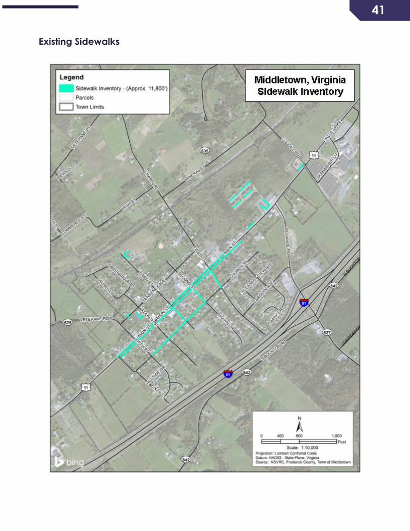
There are approximately 11,800 linear feet of sidewalk in the town. Main Street (Route 11) is
lined with sidewalks on both sides from Sixth Street to approximately one block north of First
Street. Sidewalks are also found along one side of Church Street from Second to Fifth
streets, and along First, Second and Third streets between Main and Church streets. See
page 40 for a map of existing sidewalks.
PLANNING ASSUMPTIONS
• Middletown’s population is expected to exceed 3,000 by 2030, more than double the 2016
estimated population. Similarly, the number of households will more than double,
surpassing 1,200.
• Enrollment at Lord Fairfax Community College is expected to grow from its current 3,000
full-time equivalent student population. The campus master plan, completed in 2013,
anticipates the need for four additional academic buildings over its 20-year plan horizon.
27
• Interstate-oriented commercial uses are likely to develop in the 44 acres surrounding the
Exit 302 interchange.
• A technology park is envisioned east of the interchange, covering approximately 259
acres, bisected by Reliance Road (Route 627). The current alignment of Buckton Road,
proximate to the interchange, is an impediment to development.
EXISTING AND FUTURE NEEDS AND RECOMMENDATIONS
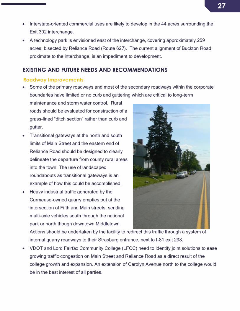
Roadway Improvements
• Some of the primary roadways and most of the secondary roadways within the corporate
boundaries have limited or no curb and guttering which are critical to long-term
maintenance and storm water control. Rural
roads should be evaluated for construction of a
grass-lined “ditch section” rather than curb and
gutter.
• Transitional gateways at the north and south
limits of Main Street and the eastern end of
Reliance Road should be designed to clearly
delineate the departure from county rural areas
into the town. The use of landscaped
roundabouts as transitional gateways is an
example of how this could be accomplished.
• Heavy industrial traffic generated by the
Carmeuse-owned quarry empties out at the
intersection of Fifth and Main streets, sending
multi-axle vehicles south through the national
park or north though downtown Middletown.
Actions should be undertaken by the facility to redirect this traffic through a system of
internal quarry roadways to their Strasburg entrance, next to I-81 exit 298.
• VDOT and Lord Fairfax Community College (LFCC) need to identify joint solutions to ease
growing traffic congestion on Main Street and Reliance Road as a direct result of the
college growth and expansion. An extension of Carolyn Avenue north to the college would
be in the best interest of all parties.
28
• It is recommended that coordination be undertaken
with CSX Railroad to upgrade their existing at-grade
crossing on the western end of First Street to include
crossing gates and pedestrian/bicycle paths.
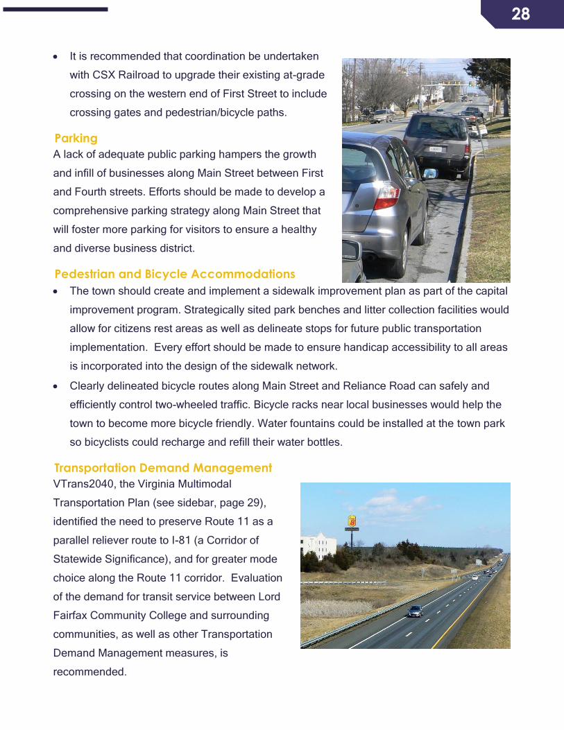
Parking
A lack of adequate public parking hampers the growth
and infill of businesses along Main Street between First
and Fourth streets. Efforts should be made to develop a
comprehensive parking strategy along Main Street that
will foster more parking for visitors to ensure a healthy
and diverse business district.
Pedestrian and Bicycle Accommodations
• The town should create and implement a sidewalk improvement plan as part of the capital
improvement program. Strategically sited park benches and litter collection facilities would
allow for citizens rest areas as well as delineate stops for future public transportation
implementation. Every effort should be made to ensure handicap accessibility to all areas
is incorporated into the design of the sidewalk network.
• Clearly delineated bicycle routes along Main Street and Reliance Road can safely and
efficiently control two-wheeled traffic. Bicycle racks near local businesses would help the
town to become more bicycle friendly. Water fountains could be installed at the town park
so bicyclists could recharge and refill their water bottles.
Transportation Demand Management
VTrans2040, the Virginia Multimodal
Transportation Plan (see sidebar, page 29),
identified the need to preserve Route 11 as a
parallel reliever route to I-81 (a Corridor of
Statewide Significance), and for greater mode
choice along the Route 11 corridor. Evaluation
of the demand for transit service between Lord
Fairfax Community College and surrounding
communities, as well as other Transportation
Demand Management measures, is
recommended.
29
Maintenance
Middletown is committed to a uniform system of
roadways and will require all new roadways be built to
VDOT specifications with an understanding upon
completion they will be accepted into the VDOT
roadway system. Existing roadways that are not
conforming will be listed in our capital improvement
plans to upgrade the roadways, so they can be
accepted into the state system, or if no longer
necessary and no longer serving a public purpose,
abandoned to remove the burden from Town
maintenance.
PLANNING-LEVEL COST ESTIMATES FOR
RECOMMENDED IMPROVEMENTS
A map of recommended transportation improvements
is presented on page 41. Planning-level cost
estimates for the recommended improvements are
presented below:
• Single Lane Roundabout on US 11 at the northern
entrance to Lord Fairfax Community College:
$2,800,000
• Single Lane Roundabout on US 11 at the southern
Town Limits: $2,300,000
• Single Lane Roundabout on Reliance Road at the
intersection with Carolyn Avenue: $3,000,000
• Extension of Carolyn Avenue to connect to the
southern entrance to Lord Fairfax Community
College (2-lane roadway with curb and gutter and
sidewalk, approximately 0.38 mile): $3,600,000
State and federal transportation
dollars are now allocated through
VDOT in part based on how well
projects support the goals and
objectives of VTrans2040,
Virginia’s statewide long-range,
multimodal transportation plan.
Led by the Commonwealth’s
Office of Intermodal Planning and
Investment, VTrans2040 is a
policy document that focuses on
the needs of the Commonwealth’s
Corridors of Statewide
Significance, the multimodal
regional networks that support
travel within metropolitan regions,
and improvements to promote
Urban Development Areas
(UDAs). VTrans2040 establishes
goals in the areas of safety and
security; system maintenance and
preservation; mobility,
connectivity and accessibility;
environmental stewardship;
economic vitality; transportation
and land use coordination, and
program delivery. Through this
document, the state has
significantly shifted mobility
priorities from being primarily
single-occupancy vehicle oriented
to a multimodal model.
30
COMMUNITY FACILITIES AND SERVICES
Community Facilities in Middletown
The term “community facilities” describes those buildings or services publicly owned or
operated which are necessary for the health, safety and welfare of the people. Community
facilities within the corporate limits of Middletown include municipal buildings, a public park, a
Veterans’ memorial, a water distribution system, a wastewater treatment plant, and a fire and
rescue station.
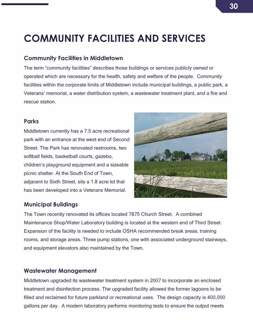
Parks
Middletown currently has a 7.5 acre recreational
park with an entrance at the west end of Second
Street. The Park has renovated restrooms, two
softball fields, basketball courts, gazebo,
children’s playground equipment and a sizeable
picnic shelter. At the South End of Town,
adjacent to Sixth Street, sits a 1.8 acre lot that
has been developed into a Veterans Memorial.
Municipal Buildings
The Town recently renovated its offices located 7875 Church Street. A combined
Maintenance Shop/Water Laboratory building is located at the western end of Third Street.
Expansion of the facility is needed to include OSHA recommended break areas, training
rooms, and storage areas. Three pump stations, one with associated underground stairways,
and equipment elevators also maintained by the Town.
Wastewater Management
Middletown upgraded its wastewater treatment system in 2007 to incorporate an enclosed
treatment and disinfection process. The upgraded facility allowed the former lagoons to be
filled and reclaimed for future parkland or recreational uses. The design capacity is 400,000
gallons per day. A modern laboratory performs monitoring tests to ensure the output meets

31
state standards. The facility currently operates at
50% capacity. The treatment system plans to
start upgrading to an air filtration system by the
year 2018 to better support the planned growth of
the community.
Storm Water Management
Middletown has an antiquated and inadequate
storm water management system with little to no
capabilities to even manage minimal run off.
Geographically built atop a north-south oriented
ridge that stretches the length of Church Street,
water is drained/channeled into either open
roadside ditches to the east or into five storm water culverts running under Main Street which
extends into another series of open ditches to the west. An extensive integrated storm water
management system with containment ponds and or rain gardens needs to be studied,
funded, engineered and constructed to ensure Middletown continues to meet the strict
standard set by the Chesapeake Bay Watershed Implementation Program.
Water Dependence
All drinking water is purchased from a sole source, the City of Winchester, which draws the
water from the Shenandoah River just south of Middletown. Due to the need to replace its
own aging infrastructure, the cost of water continues to rise dramatically. An older Town well
can no longer be used; as it was capped in the early 1950’s and no longer meets Virginia
Department of Health Standards. The need for identifying additional water supplies is
apparent throughout the Shenandoah Valley as demand is placing stress on the existing
sources of supply. As of this writing the Town is dedicated to 249,710, gallons per day (gpd)
from its current Winchester allotment for property development. Any additional commercial
expansion would be predicated on obtaining additional water.
32
Water Distribution System
Middletown’s water distribution infrastructure is dated and in poor repair. Although each of the
water metering devices is current, most of the mains and laterals date back into the early
1950’s. As of this writing over $500,000 would need to be allocated to replace and upgrade
the aging lines.
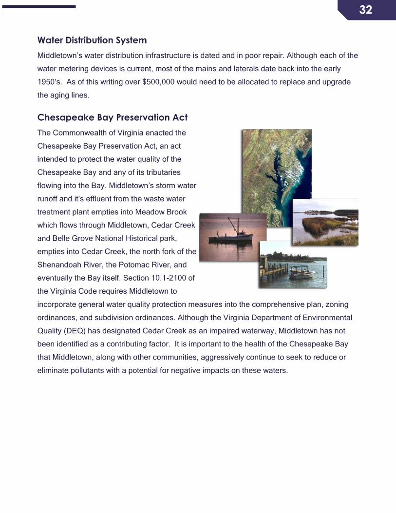
Chesapeake Bay Preservation Act
The Commonwealth of Virginia enacted the
Chesapeake Bay Preservation Act, an act
intended to protect the water quality of the
Chesapeake Bay and any of its tributaries
flowing into the Bay. Middletown’s storm water
runoff and it’s effluent from the waste water
treatment plant empties into Meadow Brook
which flows through Middletown, Cedar Creek
and Belle Grove National Historical park,
empties into Cedar Creek, the north fork of the
Shenandoah River, the Potomac River, and
eventually the Bay itself. Section 10.1-2100 of
the Virginia Code requires Middletown to
incorporate general water quality protection measures into the comprehensive plan, zoning
ordinances, and subdivision ordinances. Although the Virginia Department of Environmental
Quality (DEQ) has designated Cedar Creek as an impaired waterway, Middletown has not
been identified as a contributing factor. It is important to the health of the Chesapeake Bay
that Middletown, along with other communities, aggressively continue to seek to reduce or
eliminate pollutants with a potential for negative impacts on these waters.
33
ACTION PLAN
OVERVIEW
One of the most important parts of a comprehensive plan is the preparation of policy
statements called goals and strategies. Goals state the general manner and direction in which
residents would like to see the town develop. Strategies are more detailed statements
showing how to help achieve the goals.
There are two overall policies that impact the future of Middletown: Middletown should expect
moderate residential, commercial and industrial growth while maintaining its rich small-town
character. Most if not all industrial growth should occur outside of the historic district; and,
elected and appointed officials should, through the planning process; as implemented through
this Comprehensive Plan, a Capital Improvement Plan and related ordinances, maintain an
adequate level of community facilities and services for the health, safety and general well-
being of the residents of the town and surrounding area.
ECONOMIC DEVELOPMENT
Goal: The town will attract and maintain a desired mix of business establishments, and
ensure that the business types, their scale, and their locations are in compliance with the
planning policies.
Strategy A: For each area of town targeted for business development (for example,
downtown core, 1-81 Interchange areas), create a comprehensive list of business types
generally regarded as desirable and in compliance with the planning policies.
Strategy B: Define and implement steps to encourage business development, including
marketing and advertising, financial incentives, grant/loan acquisition and working with other
organizations in the northern Shenandoah Valley.
Strategy C: Develop a process to encourage adaptive reuse of under-utilized or unused
structures within the existing town. In conjunction with Strategies A and B, this may entail
working with a property owner to attract a specific business to a specific location.

34
Strategy D: Establish a planning/economic development position within the Town
government.
Strategy E: Create a Middletown Chamber of Commerce to support the current businesses in
town and help facilitate others to come in the area.
STREETS, STREET LIGHTING AND SIDEWALKS
Goal: Middletown will construct sidewalks and add street lighting throughout the community
to enhance pedestrian safety and develop a sense of “connectivity.” Traffic control devices
will be installed where appropriate.
Strategy A: Provide, through systematic planning and prioritization, a system of sidewalks
throughout the town. Evaluate pedestrian traffic flow to determine where sidewalks are most
needed; to include sidewalks along Main Street to both the north and south corporate
boundaries.
Strategy B: Create a uniform street lighting throughout the town that enhances the historical
feel of the area and serves as a “path” at the beginning and end of Middletown.
Strategy C: In partnership with Lord Fairfax Community College, provide a walking path to
the college from the town boundary to provide pedestrian safety and access to recreation.
Strategy D: Incorporate a sidewalk map and priority list into the Capital Improvement Plan
and relevant ordinances.
PARKS AND RECREATION FACILITES
Goal: Parks will have to be expanded to meet population growth.
Strategy A: Additional parkland is needed on the East side of Main Street to serve residents
and avoid crossing Main Street. Neither major equipment nor buildings are necessary. At
least one playground for public use should be incorporated into newly developed areas.
Strategy B: Install tree screening as needed on the West side of the existing park to screen
the expanded wastewater treatment plant.

35
Strategy C: Include requirements for parkland, open space and equipment in revised and
updated zoning, subdivision and other relevant ordinances.
STORM WATER MANAGEMENT
Goal: Comprehensive storm water management initiatives will be in place to mitigate
flooding and potential damage to property, structures and public facilities within the limitation
of the Town’s natural topography.
Strategy A: Develop a map of existing and needed storm water management routes and
structures.
Strategy B: To prevent water from collecting on streets, provide drainage at driveways that
presently have none through partnering with adjoining property owners and VDOT where
appropriate.
Strategy C: Coordinate with VDOT to address existing problems on Main Street as well as
streets and driveways intersecting with Main Street.
Strategy D: Incorporate a storm water management map and priority list into the Capital
Improvement Plan and relevant ordinances.
Strategy E: Enact or otherwise implement best practices for the design and engineering of
storm water management facilities, independently or in cooperation with Frederick County.
PROPERTY MAINTENANCE
Goal: Properties will be properly maintained to protect public health, safety and promote the
general well-being of residents.
Strategy A: Enforce the existing code and enact additional ordinances as required.
36
ZONING ADMINISTRATION AND ENFORCEMENT
Goal: Zoning code provisions, site plan agreements and special use permit terms will be
consistently enforced in order to protect public health, safety and ensure compliance.
Strategy A: The zoning administrator, together with appropriate town officials and staff
should review all business use, at least annually, to determine whether the use and
conditions are in compliance with the relevant approvals.
Strategy B: Maintain an appropriate record keeping system.
HISTORIC DISTRICT
Goal: Historic district assets will continue to be viable components of the Town’s identity.
Strategy A: Foster programs that encourage maintenance, renovation and re-use of historic
structures.
Concepts:
• Establish an event unique to Middletown such as a “Founders Day Celebration” to
enhance civic pride and celebrate the town’s rich history. As part of the celebration,
sell historic plaques to owners of contributing properties inside the National Historic
Register Boundary and encourage owners to research their homes and previous
occupants. If any revenue is generated it could be held in trust or donated to already
preserve sites like St. Thomas Trust to demonstrate the need for preservation and the
continued need of funding.
• Implement a basic, non-intrusive historic district or heritage area ordinance, which
acknowledges the boundaries set by the National Historic Register. The ordinance
should establish clear guidelines for both demolition and construction within the
boundaries, including penalties for Demolition by Neglect, which will enhance the
streetscape by reducing unsightly properties. It should offer basic guidelines for
outward appearances of new construction within the district. It should encourage tax
incentives for maintenance and restoration of contributing properties as a benefit of the
plan. It should only encourage correct looking repairs and renovations without any
restrictions regarding color, materials etc. including roofs.
37
• Revise the B-2 Residential/Commercial Ordinance as applied to Main Street and other
appropriate zoning ordinances to prevent further construction of unsightly box stores,
warehouses and factories on all streets of the old town within the National Register
Boundaries. Re-adopt the acceptable building types from the earlier Vision Middletown
document.
Strategy B: Foster ongoing dialog among residents, town officials, property owners and
experts to understand the need to retain historic assets. There has been fierce opposition to
any Historic District or Heritage Area Ordinance. Failure to protect our historic resources and
treasures is clearly out of step with neighboring towns in our region. The town should sponsor
a series of informational presentations by battlefield, architectural, structural and natural
resource preservationists to demonstrate the value of preserving our small-town appearance,
foster pride in our historic homes and educate the public about preservation issues. Under
each of the past three administrations, at least three contributing sites to the National
Register Historic District have been demolished. These should be stricken from the map and
the district description should be amended to reflect this. Middletown has much to lose by
allowing continued demolition of contributing structures which destroy the streetscape and the
character of the town. Few towns had battles fought through them and fewer have had the
same battle rage through the streets twice. The town has a number of homes which were
here prior to and during the war. Many were damaged as a result of fighting in our streets and
are worthy of preserving. These points should foster dialog between town officials,
homeowners within the district boundaries and the general public.
Strategy C: Encourage the Middletown Heritage Committee and other similar organizations
to continue and expand its programs such as the Walking Tour. The Heritage Association is a
tool whereby citizens can gain knowledge of the town’s history, but lacks a driving force
beyond informational events. A stronger citizen led organization with a non-profit status is
needed to buy and renovate valuable historic resources or work with owners to preserve
them. For example, a partnership could be established to with a local church to preserve the
circa 1818 Methodist Church and later African American Church. This is likely one of the few
standing log churches remaining in the region and is in great need of proper preservation. It
should be considered the most endangered historic property in the town. The town should
encourage the establishment of a town museum by taking the following actions: assist in
providing initial funding, assist in providing space in which to display items loaned or donated

38
by citizens, become a central collection point for such items. An informative display is needed
to present and interpret relics discovered during the archaeological survey conducted prior to
construction of the Veteran’s Memorial as well as those recovered within the town. The town
should increase contact with the National Park Service who conduct tours of our streets and
town officials should take these tours to enhance their awareness of historic resources in
town. The town’s liaison to the Park Service should encourage the National Park Service to
draw town citizens to their tours and should provide an annual report to the council and
citizens. The town should also encourage commercial tours as well which may have themes
such as Ghost Walks or where Civil War generals and other notables conducted their
business, early settlers and other thematic tours.
WATER INDEPENDENCE
Goal: The Town will produce its own drinking water and sell excess to outside accounts.
Strategy A: Implement a program to bring on line sufficient fresh water wells and treatment
facilities to meet current and future demands.
Strategy B: Include upgrades to the water treatment facilities in the CIP in order to meet the
growing needs of the town population.

39
MAPS

40
Zoning
41
Existing Sidewalks

42
Transportation Plan

43
APPENDICES
Appendix A: Reliance Road Area Land Use Plan
RELIANCE ROAD AREA LAND USE PLAN
In spring 2010, the Town of Middletown expressed interest in expanding its boundaries to
incorporate approximately 250 acres of land on the east side of 1-81, Exit 302, following
Reliance Road. Shortly thereafter, the Reliance Road Steering Committee (RRSC) was
convened. The RRSC was composed of representatives from the Town Council and the
Board of Supervisors.
The RRSC met various times over the ensuing months. The Town representatives also held
a community meeting and met with individual property owners within the study area to gain an
understanding of the interest of the property owners in terms of the Town’s desired boundary
line adjustment with the County, as well as future land use opportunities. These meetings
were summarized and presented to the RRSC by Town representatives. It was noted that
while approximately 37 acres of B2 Business General Zoning exists within the study area,
only one site has been developed and benefits from the Town’s water and sewer system: the
2.7 acre site occupied by an existing Exxon service station.
The RRSC also evaluated the existing transportation network in addition to water and sewer
availability. The RRSC considered the Foresight Middletown plan (adopted into the Town’s
Comprehensive Plan in 2005), which promoted the implementation of a technology park east
of the interstate. The results of these findings led to the crafting of the Reliance Road Area
Land Use Plan as a means to illustrate the potential land uses, and the supporting
transportation and public water and sewer for the area, to foster further discussions.
The land use plan is envisioned to guide land use decisions for an area of approximately 311
acres over the next 20 to 30 years. Recognizing the Town’s current water availability,
development within the study area will initially be limited until all additional water supply is
more readily available. Additionally, policy enabling the Town to provide water and sewer
service to the County properties would require Board approval.
44
LAND USE
The proximity of the study area to I-81, Exit 302, enhances the opportunities for land uses that
benefit from the interstate. As such, commercial and technology uses would be most
beneficial at this location.
The plan calls for the establishment of approximately 44 acres or commercial uses that serve
the traveling public, such as hotels, gasoline service stations and restaurants. The
commercial opportunities would be located immediately east of the interstate interchange on
the north and south sides of Reliance Road. This is also the area where public water and
sewer presently serve the existing Exxon service station. These land uses could be
implemented through the B2 Business General Zoning District.
Technology uses are envisioned both north and south of Reliance Road, covering
approximately 259 acres. Based on the targeted businesses identified by the Winchester-
Frederick County Economic Development Commission, the technology uses would include
economic sectors such as: Advanced Security, Assembly, Business Services, and Life
Sciences. These land uses would be implemented through the OM Office Manufacturing
Zoning District.
In recognition of the continuation of the agricultural and large lot residential land uses
adjacent to the study area, efforts should be implemented through the rezoning and
development process that mitigate and lessen the adverse impacts that the commercial and
technological uses may introduce. Mitigation techniques such as 100-foot distance buffers
and landscape screening would be expected.
TRANSPORTATION
While the existence of 1--81, Exit 302, is a strong asset to the area’s transportation network,
the actual configuration of the interchange and its close proximity to Buckton Road is not
conducive to accommodating future traffic demands. In order for the interchange to operate
efficiently and effectively in the future, it is essential to migrate the existing intersection of
Reliance and Buckton Roads further east, creating a greater separation distance from the
I~81 northbound on/off ramps. Increasing this separation distance will avoid significant
degradation of the interchange, similar to what has occurred at Exit 307 in Stephens City.
45
In rapidly qrowing areas, as noted in the Foresight Middletown plan; controlling and
coordinating the number, design and location of new access points to major roadways is
critical to maintaining the safety and capacity of the road system as traffic volumes increase.
Accordingly, access to Reliance Road should be managed and limited. The plan calls for
limiting Reliance Road access to three points: a managed access entrance point in the
vicinity of Confidence Lane, and two appropriately spaced roundabout or signalized
intersections.
The initial access point onto Reliance Road would be established with the relocation of
Buckton Road. A second access point onto Reliance Road would be established with the
relocation of Huttle Road, to create a single intersection on Reliance Road for relocating
Huttle Road and a new road servicing the southern land area.
These three Reliance Road access points would facilitate traffic movement to/from Reliance
Road to the various future land uses to the north and south. It may also be appropriate to
utilize a roundabout at the relocated Buckton Road intersection with Reliance Road as a
means to define where the developed portion of Reliance Road ends and the rural land uses
of the County begin. A similar technique was suggested by the Foresight Middletown plan as
a means to create an entrance to the developed area.
Finally, the Foresight Middletown plan calls for Reliance Road within the Town limits to be a
boulevard with a landscaped median: the Reliance Road Area Land Use Plan carries this
design concept forward east of the interstate.
Consistent application of Comprehensive Plan Goals to achieve an acceptable level of
service on area roads and overall transportation network, level of service C or better, should
be promoted. Further, efforts should be made to ensure that additional degradation of the
transportation beyond an acceptable level of service shall be avoided. Consideration of future
development applications within the study area should only occur when an acceptable level of
service has been achieved and key elements and connections identified in this plan have
been provided.

46
WATER AND SEWER
The Town completed an upgrade to its wastewater treatment facility in 2010 which enables it
to treat upwards of 400,000 gpd. The treatment system plans to start upgrading to an air
filtration system in the near future to better support the planned growth of the community.
Existing limitations in water availability and the conveyance lines under the interstate may
hinder development in the near future. As the Town secures additional water availability,
upgrades to the conveyance system could easily be undertaken.
Reflective of current water availability, the Town is positioned to dedicate up to 18,000 gpd of
water to development on the east side of I-81. This available water resource could facilitate
an initial expansion of the commercial land uses to include a hotel, expanded gasoline
service station/ convenience center, and a restaurant. Any additional commercial uses would
certainly warrant additional water resources.
Development of the technology park land uses will be limited until additional water resources
are identified and available. Technology uses that require limited water resources would
certainly be more desirable initially, until the expanded water supply has been secured and
accessible.
-------------
Adopted and included as an amendment to the Frederick County, Virginia, Comprehensive
Plan on December 14, 2011

47

48
Appendix B: Implementation Tools
The preparation of a Comprehensive Plan for Middletown is only the beginning of the
planning process. The recommendations and goals in the report can only be achieved
through a program of implementation.
This appendix describes the legal, financial, and administrative tools, which can be used to
carry out the proposals presented.
While cooperation between government and the private sector is essential to accomplish the
recommendations of this report, the following paragraphs will stress Town government’s
important role in the implementation process.
Legal Implementation
Subdivision Regulations
These are locally adopted laws, which control the conversion of open-space land into building
sites. New development is prohibited until the Town Council approves a plat of the proposed
changes. Approval is based upon compliance with all standards set forth in the subdivision
regulations. The standards provide for platting procedure, lot sizes, street standards, utility
easements and setback related regulations for the orderly development of subdivision areas.
These regulations serve many purposes. To the developer they become a protection against
substandard competitors, which may destroy the value of surrounding areas. It affords a
convenient step in securing adequate land title record for tax officials. The consumers are
assured they will receive a buildable lot with adequate facilities. For everyone, the regulations
protect against undesirable development that could be financially burdensome due to
improvements and/or services that the town may be compelled to provide. Middletown
adopted a subdivision ordinance in 1977. This ordinance should be reviewed and revised as
needed.
Zoning Ordinance
Zoning is the legal method of imposing conditions on the development of land and
establishing controls on land use, building use, building size, building height, area, lot sizes,
bulk and location of structures. The purpose of zoning is to control the development of vacant
land. It has no direct effect upon existing land use and structures, however, as buildings are
removed, modified or have a change of use, properties that do not conform then to the
49
ordinance can gradually be brought into conformance with current policy. This characteristic
enables zoning to be one of the most important tools available for implementing the land use
portion of the Middletown Comprehensive Plan.
Middletown adopted a zoning ordinance in 1967. It represents what the town thought was the
best use of its land. The zoning ordinance should be updated regularly to keep abreast of
changing laws. It is the responsibility of the Middletown Planning Commission to review
existing planning policy and recommend appropriate changes. It is important for the zoning
map and land use plans to conform. This will help achieve the goals of the Comprehensive
Plan, since the plan has no direct power to control development.
Other Legal Devices
There are a number of other legal controls available. A few of these are: sanitary codes,
nuisance ordinances and housing codes. Controls such as these will help Middletown attain
the goals of the plan and they should be enacted as the need arises.
Financial Implementation
State-Federal Aid
Some state and federal aid (primarily in the form of loans and technical assistance) is
available to municipalities for community improvements. The following publication should be
consulted for information on possible aid programs: Catalogue of Federal Assistance
Programs, office of Management and Budget (Washington, D.C., U.S. Government Printing
Office). Also, additional state and foundation publications can be accessed on the Internet.
Current programs of importance to Middletown include but are not limited to:
Cops Program
This program is used to fund salaries for additional police personnel.
Virginia Community Development Block Grants
This program, which was formerly administered by the Federal Department of Housing and
Urban Developments, has as its goal the improvement of the economic and physical
environment in Virginia communities and neighborhoods for the primary benefit of low and
moderate-income citizens. The program’s three major objectives are to assist local
governments in:
• Increasing business and employment opportunities.
• Conserving and improving housing conditions
• Improving the availability and adequacy of community facilities.

50
Division of Motor Vehicle Grants
Funds are available through the Virginia Division of Motor Vehicles to fund salaries for
additional police personnel and for the purchase of traffic control devices and alcohol
detection devices such as radar and breathalyzers.
Fire Administration Grants
This grant is used to upgrade equipment within fire departments such as breathing
apparatuses, protective equipment for firemen and training.
Authorities
An authority is a public corporation organized by a municipality under state enabling
legislation to carry on a specific function outside the regular structure of government. There
are various kinds of authorities including, but not limited to, those for schools, water, sewers,
parking and airports.
Authorities are formed by communities because of the high cost of needed projects and
limited resources available. Too often, public improvements are necessary but the
municipality does not have the current revenue to finance such improvements. With
authorities, the borrowing power of the county, city or town is not used; it is rather the
estimated cost of, and revenues from, the proposed projects that form the base for the bond
Issue.
Bonds
Middletown is permitted by State law to issue bonds for borrowing money. The money, with
interest, is repaid from future revenues. Because population growth has increased demands
for community facilities, the expanded use of bonds for major projects should be considered.
While it is cheaper to pay for major improvements out of current revenue, it is unlikely that the
Town will be able to build up enough reserves to establish a “pay as you go” capital
improvements program. Additionally, a bond will assure that future residents who will be using
the facility will bear some of the cost.
Administrative Implementation
Continuing Comprehensive Planning
The Comprehensive Plan serves a number of purposes:
• It presents a framework of desirable short, medium and long-range development for
Middletown and provides a systematic guide for the Town Council to review projects.

51
• It enables the Town Council and residents to consider and develop definite policies, which
would lead to a specific pattern of future physical development.
• It is an inventory of existing community facilities and a source of information concerning
economic and social conditions.
• It assists those involved in the planning process in relation to the social and economic
issues involved in problems of physical development.
• It serves as a guide for the zoning ordinance and should assist local officials in making
future zoning changes.
To be successful, a Comprehensive Plan must be implemented as well as adopted. The
residents of Middletown should understand and support their plan. The plan should reflect the
general goals of the people as well as the economic and social forces shaping the physical
land uses in the Town. The town should review and revise this plan as the need arises.
Capital Improvement Program
The orderly determination and scheduling of major public improvements for a period, usually
five years into the future, is called a Capital Improvement Plan (CIP). Towns often find it
necessary to spend large sums of money to provide the facilities needed to serve its
residents. Major public improvements such as water and sewer systems are called capital
improvements.
Few jurisdictions have enough money at any one time to meet all demands for new or
enlarged improvements. Therefore, it’s important that all public projects be prioritized and
developed as part of a long-range program. Cost estimates for each proposal as well as
estimates for future expenses and revenues including grant money should be prepared.
Projects are selected after the need and cost of individual proposals are determined. A
schedule is then made for the beginning and completion of the chosen improvements. A
capital budget should be prepared annually detailing those projects to be undertaken during
the first year of the five-year capital program. This budget serves as the annual
implementation of the ClP. The CIP is a major tool for guiding public improvements along
desirable channels and for insuring that they proceed in an orderly manner.
It requires operating departments and elected officials to plan for the future and to anticipate
capital expenditures, thus establishing a sound basis for budget decisions. Substantial
52
savings may occur by providing more efficient use of equipment through long-range
scheduling.
Most importantly, capital improvement planning provides an opportunity to spread the cost of
improvements over a period of years, avoiding the great tax increases that are often caused
by postponing community responsibilities.
Reference: Code of Virginia, 15.2-2239
Summary
Reference to the Middletown Comprehensive Plan and implementation of its provisions is part
of an on-going process. Review and modification of ordinances and codes may also be
necessary to bring about the recommendations of this plan. Assistance from many levels of
both governmental and non-governmental groups will be important in implementation. The
goals of this plan cannot be fully attained unless local officials and citizens work together to
understand and solve issues, and to guide development in accordance with the
Comprehensive Plan, which aspires for the common good.