comprehensive mining software solutions · n stack up sections in 2d, or place in 3d for...
TRANSCRIPT
...The Mining Solution
®
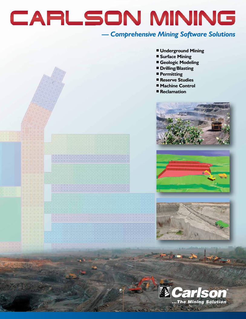
� Underground Mining� Surface Mining� Geologic Modeling� Drilling/Blasting� Permitting� Reserve Studies� Machine Control� Reclamation
— Comprehensive Mining Software Solutions
Colors: Cyan, Magenta, Yellow, Black. Files not trapped or preflighted.Prepress company, please Preflight and Trap this art as needed.
Carlson Mining Brochure 2012 4-6-12Dimensions: 11 in x 17 in + bleed (folds to 8.5 in x ll in)

...The Mining Solution
®
2 3
TABLE OF CONTENTS
Intro to Carlson Mining 2 - 3
Carlson Geology 4 - 7
Underground Mining 8 - 9
Carlson Surface Mining 10 - 11
Basic Mining / SDPS 12
Mining Financials 13
Natural Regrade 14 - 15
Data Collection 16
Survey / Civil / Hydrology / GIS 17
Carlson Machine Control 18 - 19
Carlson Mining Users List / Contact Info Back Page
Mining Software Solutions
In use throughout the world, Carlson mining solutions, including machine control, have expanded beyond coal into the phosphate, trona, limestone, aggregates, granite, clay, and even the hard rock markets. Whether the application is underground mining, surface mining, permitting, geologic mapping, or reserves studies, or reclamation. Carlson provides uniquely powerful automation combined with our trademark ease-of-use.
Carlson Software listens to its customers and builds its software to meet users’ needs. We consider there’s a direct correlation between being the dominant software in this
market – 90 percent of the U.S. coal industry utilizes Carlson Mining software – and our commitment to both advanced technology and customer service.
Enhancements to the software continue on an ongoing basis. In recent years, improvements have included expanding 3D abilities within bench pit design, augmentation of the haul truck cycle analysis routines, new spoil placement timing, adding options for color settings for enhanced visual feedback in the underground timing sequencing, the ability to produce customized, more professional reports and much more as we move into the future.
Planning, Engineering or Automating a Mine – Look to Carlson
Top attributes of Carlson Mining software solutions include:n Easy to learnn Affordablen Fast-paced client-driven
developmentn Runs inside AutoCAD®; comes
with IntelliCAD® built-inn Reads existing geologic datan Drawings can be linked to
databasesn Real-time survey guidancen Real-time remote data exchangen On-site & remote supportn Access to a production & support
team with combined 100+ years of mining software experience
Carlson Mining: Designed to Work for You
The Carlson Mining Division receives direct attention from Carlson Software Founder and President Bruce Carlson (foreground) and is led by Steve Richards (center) and Grant Wenker (right).
“From the very beginning of the company, Carlson Software has focused on mining applications. Our location within a five-hour drive of virtually all mines in the U.S. Appalachian and Illinois coal basin dictated that and helped us realize the real need for automation of processes. Our goal is to ensure greater mining productivity utilizing best practices as they apply throughout the world.. Together with our software engineers, our experienced sales staff, and our valued customers, we look forward to meeting your needs.”
— R. Bruce Carlson President & Founder,
Carlson Software

...The Mining Solution
®
4 5
Carlson GeoloGy The Complete Geologic Modeling Package – Stratigraphic Modeling
The Carlson Geology Module uses drillhole and sample data to create accurate and easy-to-use subsurface geologic models. It uses industry standard modeling algorithms to create both stratigraphic surface models and hardrock ore block models. Highlights include:n Import any drillhole format and
store data in CAD or external database such as SQLite
n Utilize fast macros to reproduce the model with new drilling, samples and surveys
n Fault automatically at any dip-angle and displacement to offset the geology
n Create geologic cross-sections and fence diagrams instantly from polylines, picking points or saved alignments
n Generate mine reserves and reserve classification for Measured, Indicated and Inferred analysis with flexible reporting directly into Excel
Stratigraphic ModelingDrillholesn Import from any format using
custom settings, storing in CAD or linked to SQLite database
n Draw geologic columns in section or in 3D for correlation and checking
n Validate holes with queries and reports to highlight data errors
n Use tools such as Ferm and Horizon Codes combined with Drillhole equations for high level model building
Cross-Sections & Fence Diagramsn Instantly view sections from
polylines or realtime with dynamic section line movement
n Hatch sections by attributes and grade with drillholes posted for model correlation
n Stack up sections in 2D, or place in 3D for visualization with mine designs and topo
n Create the initial sections for dragline range diagrams using the real geology and surfaces
Faultsn Place fault lines at the topography
with variable dip-angles and displacements to create normal or strike-slip faults
n Draw the fault plane for viewing in 3D
n Have the program find the displacement shift by analyzing the surrounding drillholes
n Apply faults to existing model with new data
Mine Reservesn Use the Pre-calculated model for
reserves with weight-averaged quality attributes
n Create strip ratio grids to determine mineable reserves regions
n Format the reports with equations and attribute options while exporting directly into Excel
n Analyze deposits with Reserve Classification to report and hatch the measured, indicated, inferred and hypothetical results
n Fine tune the reserves with automatic options such as minimum thickness of ore and waste, dilution above and below, recovery, density and weathered depth
n Breakout the reserves by vertical quantities, overall highwall slopes, or detailed bench-by-bench designs and surface history files
Modelingn Use industry-standard geological
modeling algorithms and calculate residuals to see which method is recommended
n Create macros and utilities to reproduce the model with new data
n Check the models with inspector tools and color-hatched isopachs
n Enhance the model with limit lines, strata polylines, pit and channel samples combined with the drilling
n Add grids or TINs to the Pre-calculated model for reserves and sections
Block Diagram
Mine Reserves
Drillholes
Hatched 3D Isopachs
3D Fence Diagram
Create geologic models with surfaces or block models and display in cross-section and 3D for analysis and reserve estimation
Faulted Seam Modeling

...The Mining Solution
®
6 7
Carlson GeoloGy The Complete Geologic Modeling Package – Block Modeling
Block ModelingKriging and Variogramsn Make block models by 3D
Inverse Distance or Krigingn Use the Variogram Generator
to determine the nugget, sill and range
n Choose from Variogram types such as Semivariogram, Covariance and Correlogram
Grade Parametersn Enter grade ranges to
determine different classes of material for volumes and reporting
n Combine up to 50 attributes to determine just one grade
n Add cost per grade for value block model and Lerch-Grossman optimized pit design
n Set colors and intervals for smooth hatching and legend viewing
Block Viewingn View partial or entire block
model with inclusion/exclusion perimeters
n Turn blocks of similar grades on or off like layers to peel away and see inside the model
n Inspect the block model by depth or elevation with instant feedback on grades
n Add drillholes, surface topography and mine designs on top of blocks for full visualization
Fence Diagrams & Hatchingn Hatch and color by grade
parameters for easy grade viewing in section or 3D
n Display drillholes in section or 3D and color by grade parameters
n Color elevation or bench grids by the block model and grade parameters
n Color hatch pits by block model
Mine Reservesn Breakout quantities by grade
attributes to report tons and volume in the various grade breakdowns
n Calculate overburden for surface mines to get to specific ore blocks
Pit with Benches & Rampsn Define grades with a specific
cost amountn Create a value block model
where each block is a profit or loss calculation
n Create output grid of the optimal pit shell of profitable mining blocks
n If costs change, re-run with few changes to view the revised pit shell
Block Viewing
Block Model Viewing
Kriging and Variograms

...The Mining Solution
®
8 9
Carlson UnderGroUnd MininG For Precise Designing, Scheduling, and Mapping
Quickly generate volumes, generate tonnage reports, define any pattern of pillar cut, determine attributes, thickness and grades, and produce accurate individualized reports.
All of this is accomplished with Carlson Software’s renowned ease-of-use, enabling most aplications to be completed in minutes vs. hours, thereby increasing efficiency and savings.
Underground Mine Mapping n Process survey data and
generate the mine map seamlessly with the mine mapping features in Carlson’s Basic Mining or Underground Mine Modules
n Calculate end-of-month tonnage on each section in one of three ways with Quantities either by: Average, Grid, or Centerline
n Use the full array of mining symbols from the Mine Symbol Library, or build your own library of mining symbols, pillaring plans, point symbols, or map symbols
n Automatically connect the survey data using Auto-Connect Pillars
n Layout your room and pillar mine automatically using Advanced Panel Layout features
n Draw and then view the underground in 3D
Underground Mine ReservesDetermine these complete with quality attributes, thickness and grades calculated and displayed using user-defined parameters, such as:n tonnagen overburdenn area minedn qualitiesn periodsn equipmentn cost
Underground SchedulingKnowing precedence is critical in underground mining, Carlson’s timing routines provide valuable information to assign equipment to reduce idle time and increase production rates by avoiding delaying or illogical layout elements and precedence.
Added options for color settings enhance visual feedback in the underground timing sequencing. Retreat mining can also be included in the scheduling, splitting the panels by advance and retreat.n Schedule timing and quality
forecast, tying into the geologic model
n Individually schedule mining sections based on both productivity and operating schedules
n Forecast difficult mining areas using Difficulty Factors in several different ways, for example as a function of time, location, or thickness
n Place drawing events in the mine to accumulate specific tasks such as belt moves, belt heads, stopping points, longwall moves, etc.
n Update your mine and re-forecast quickly using one of two methods
n All reports export directly to XML Reports, ASCII text files, and more
n Automatically calculate extraction ratios when pillars are drawn, or input the ratio using simple closed polylines on the PERIM layer representing the panel
n Much of the panel data can be input by just keying in text on specifically named layers such as Difficulty, Extract, Ret_Extract, and more
n Accumulate timing results by property owners
Mine Symbol Library example
Longwall Mining
Underground Timing
Choose your report format
3D Room and Pillar, multi-bench underground mining
Auto-detection of Pillar Corners
Any pattern of Pillars can be defined
Get the power to draft the mine and draw it automatically
3D Underground Room and Pillar Simulator

...The Mining Solution
®
10 11
The Carlson Surface Mining module enables users to find the most efficient mine design by testing layouts in plan, section and 3D view. Use Carlson to:n Integrate geologic and
surface modeling with plan view, 3D view, and section view mine layout routines
n Get accurate calculations of overburden, ore quantities, strip ratios, rehandle, and ultimately, cost
n Easily convert any road or ditch centerline, dam, building pad, pit or other defined object into a final terrain
Carlson’s color-coding highlights production timing and statistics and its calendars explore “what if?” scenarios and monitor equipment usage. Also get the ability to base timing on calendar periods, tonnages, or on volumes of overburden.
Multiple slope groups are now easy to define for all pit blocks globally with symbols for different slope and bench templates on different sides. You can now cut through the benches whether working from the top down or the bottom up with automatic ramp building.
3D Pits & Spoil Designn Try varied bench parameters
on different sides of the pits by tagging Slope groups
n Alter the slope, width, and height of the benches in pit through different material or depth
n Place ramps strategically by testing in design, just select slope and starting location to have ramps automatically carved into the pit even with switchbacks
n Base benches on strata, elevation, or quality for both pits and spoil
Pit, Property & Spoil Layoutsn Use several pit layout
algorithms to represent actual mine pits or simply to subdivide reserves into smaller production blocks for reserves or scheduling
n Choose any shape for your layout from simple to extremely complex using commands such as Pit Matrix Layout and Layout by Advance
n Further subdivide and identify pits by ownership automatically for instant lease and royalty-calculations-by-owner using the property lines
n Create spoil location polygons for spoil timing
n Name property boundaries for use in reserves and scheduling
Surface Mine Reservesn Calculate reserves from
drillholes on the fly, or from pre-calculated grid or block models
n Choose between vertical quantities, overall highwall slopes, or detailed bench layback designs
n Store quantities or grids into the pits for scheduling
n Create full reports of volume, tons, quality, area and strip ratios
n Analyze deposits with Reserve Classification for measured, indicated and inferred results
Haul Cycle Analysisn Define truck fleet productivity
(pick from 24 pre-defined trucks plus add own)
n Create haul road networks for possible routes based on color-coded 3D polylines with length and slope
n Calculate and report cycle time, overall productivity or truck fleet size required
Dragline Range Diagramsn Test interactive range diagram
options for detailing dragline sequences and associated volumes
n Analyze dragline height, reach, and digging depth limits based on design
n Combine dozer push analysis with cast blasting, shovel, and dragline analysis to obtain the optimal combination of equipment and mining sequencing
n Process the section design to 3D creating pits and the spoiled surface
Scheduling & Timingn Base surface mining rates on
overburden removal or ore tonnage
n Apply equipment calendars/usage to individual or collective fleets
n Create multiple calendars to explore “what if?” scenarios
n Get color-coded view to highlight the production timing and statistics
n Base timing on calendar periods or tonnages or on volumes of overburden
n Set production requirements per user-defined time periods
n Attach precedence requirements to any timing blocks
n 3D Pick for short range sequencing with multiple select and colored benches
n Automatically create 3D surfaces of each period scheduled to simulate the mine progression and play it back for review
n Combine dozer push analyses with cast blasting, shovel and dragline analysis to obtain the optimal combination of equipment and mining sequencing
n Sequence placement of spoil given cuts and haul fleets and combine that with the mining advance to play back the entire mine progression
Carlson sUrfaCe MininG
3D Dragline
3D Benches
3D Surface Pit
Range Diagram
For complex surface mining design and techniques with precise scheduling and timing
Mine Reserves
Pit with Benches & Ramps
3D Pit Timing

...The Mining Solution
®
12 13
BasiC MininG/sdPs MininG finanCials Software to Improve Mine Efficiency and Lower Costs
Carlson Basic Mining ModuleAffordable and Upgradable
Here’s the software you need to get started or for mining basics at a low cost. It’s the perfect AutoCAD/IntelliCAD mining add-on to Carlson Civil and is geared to those who need a low cost tool for simple mining practices. It can be upgraded to any of the other Carlson Mining modules at any time.
Features include:n Basic drillhole entryn Reserves and fence diagrams
(on-the-fly only)n Underground mine mappingn Layoutn Quantities
SDPSSubsidence Deformation Prediction System
Generate isopachs and subsidence based on depth of mining, geological characteristics, and mine design parameters.
This high-end program predicts and represents the settlement of the surface topography due to underground mining. SDPS is a niche program developed through the Virginia Poly-Technical University and Carlson Software is the world’s only distributor.
Get the total picture — incorporate 4D and 5D (time & cost) computing Into your mineCarlson Mine Financials is a full financial analysis program that takes its output from the underground and surface mine scheduling routines found in Carlson Mining.n Schedule and track all mining
resources and activities, including work crews, in-use and non-assigned equipment, supplies, fuel, labor and miscellaneous costs
n Compute how fast a project can be accomplished, including how many and exactly which pieces of equipment will be needed based on a hard-stop deadline
n Determine potential costs based on mine plan, mine characteristics (difficulty factors), and additional factors that control the production
n Define specific, customized budgeting and reporting periods
Carlson Mine Financials
Carlson Mining
Financial Reports
Carlson Mine FinancialsMining Equipment, Production Timing, Quantities and Event Reports
Library reports, Schedule reports, Operating cost reports, Income statement, DCF report and Balance sheetOther Input Data
Equipment, Labor, Supply & Material, Events, Other Costs and Unit Rates

...The Mining Solution
®
14 15
natUral reGrade with GeoFluv™
Coordinating MINE DESIGN with MINE OPERATIONS and MINE CLOSURE = EFFICIENCY
Do it right the first time with Natural Regrade for mine reclamation — working with nature brings real savings
The Natural Regrade reclamation design will:n Help meet and exceed
environmental standardsn Provide maintenance-free
stability against erosion and true sustainability
n Provide reclaimed land run-off water quality comparable to surrounding undisturbed lands.
n Encourage wildlife and plant diversity in the reclaimed land
n Enhance the local view shed by returning the natural beauty of the land
Uniform slopes & artificial water conveyances of traditional methods of land reclamation are no match for the forces of nature
GeoFluv™ dialog box leads the user through the process
GeoFluv™ integrated 3D channel network using local empirically-determined drainage density
Plan view and cross-sectional channel geometry based on bankfull discharge has additional floodprone area
GeoFluv™ creates complex slope profiles with convex-to-concave inflection point determined locally
Natural Regrade makes a design for a stable landform that satisfies local empirically determined user inputs
Powerful 3D viewer aids final design editing of the draft landform
Natural Regrade automatically sets channel confluences to grade — change one and the others adjust
Natural Regrade is ideal for integrating with Global Positioning System and machine control, for example Carlson Grade, to simplify and speed construction and reduce costs. The need to survey and stake the designs in the field is eliminated using these technologies
Named a “TIPS Core Software” in 2007 for mine reclamation design and review use by the U.S. Dept. of the Interior’s Office of Surface Mining, Reclamation and Enforcement.
Rather than fight the natural forces that shape the land, Natural Regrade with GeoFluv creates a landscape that harmonizes with those forces and does not require expensive long-term maintenance and repair
“Before even breaking ground, savvy operators consider material placement that is needed for a reclamation plan that meets all requirements. Mining and reclamation plans that are designed to work together will minimize material handling and can make big savings.”
— Nicholas Bugosh, GeoFluv Developer

...The Mining Solution
®
16 17
data ColleCtion sUrVey/CiVil solUtions SURVEY, CIVIL, HYDROLOGY, GIS
SurvCE, SurvPC, GIS360, Field, MINI, Surveyor / Surveyor+, Supervisor / Supervisor+GPS
Software choices:Carlson SurvCE – A complete data collection system for Real Time (RTK) GPS and Total Stations with in-field coordinate geometry. Enhanced functionality and links seamlessly to Carlson Geology and Mining.
Carlson SurvPC – A full-screen version of SurvCE allows users to get the world’s most flexible and powerful data collection software on a PC platform. Provides more graphic power, more processing power, contouring with CAD, and interface with Google Earth and Esri.®
Carlson GIS360 – A new solution utilizing both GIS and surveying technology in the field to collect data. GIS360 can seamlessly collect data for both AutoCAD® and ArcGIS® products and is also compatible with Google Earth. GIS360 provides the first use of 3D GIS in the field delivered in such a way that anyone on site can use it with minimal training.
Carlson Field – Data collection software designed for GIS work; real-time kinematic GPS and total station data collection directly in CAD. Allows users to see points and linework as data is collected with the ability to place text on the drawing and contour in the filed to verify that enough points have been taken.
Hardware choices:CarlsonMINI – rugged, compact and lightweight field computer offering lightning-quick processing with a touch screen and high-contrast color display.
Carlson Surveyor/Surveyor+ – fast, incredibly durable, and powerful data collectors yet light and easy to grip. Use with Carlson SurvCE for surveying, stakeout, construction layout and more.
Carlson Surveyor+ GPS – a dual-frequency RTK GNSS receiver and field controller fully scalable from the Surveyor+, it includes drivers for most total stations and robotics.
Carlson Survey. A completely intuitive survey solution provides versatile and intuitive raw data editing and processing, Network Least Squares, the easiest and most powerful Field-to-Finish, legal description and deed writing and reading, and a full compliment of COGO tools for every survey application.
Carlson Civil. For all your terrain detail — roads, ramps, pits, ditches, reclamation — use your creativity to the fullest with Carlson Civil. The fully dynamic (but only when you want it to be) environment allows defining your project folder to suit your organization and your own annotation style, exploring of “what if?” scenarios with a simple drag and drop, and editing or changing the design and all surfaces and volumes automatically in real time.
Carlson Hydrology. Get complete automation with full 3D design to compute runoff coefficients from layers, run rainfall events through your fully designed system, analyze the watershed for any storm event and then build the structures to detain and reroute the runoff, build ponds and spillways with channels, weirs, pipes and culverts, and also connect with HydroCAD® to determine stormwater chamber specifications and run rainfall events.
Carlson GIS. New linkage with Esri® allows you to immediately perform preliminary engineering and hydrological studies and planning analysis. Also get the ability to link objects in the drawing to the external database for queries in addition to linking ownership boundaries, leases, mine plans, and properties to the database in order to easily query and retrieve quantities, tonnage, and ore quality.
Carlson Supervisor & Carlson Supervisor+ GPS Tablet – a powerful, rugged PC tablet developed by Carlson Software to complement its comprehensive line of land development and mining software and allow users to bring the office to the site and vice versa.
Both feature:n Microsoft Windows 7.0 Ultimate
operating systemn Intel ultra-low-power yet super-
fast 1.6GHz processorn A massive 64GB solid-state
hard driven A 7-inch widescreen, 1024x600
resolution, sunlight-readable, resistive touchscreen
n Works on more total stations, robots and GPS systems than any other solution
The Carlson Supervisor and the Super G can both be used with Carlson SurvPC and with Carlson Grade Supervisor, an easy-to-use software made for construction grade management.
Look to Carlson for comprehensive data collection software with supporting hardware
Carlson office design software for designing or upgrading your mine site
CarlsonMINI
Carlson Surveyor
Carlson Supervisor
Carlson Surveyor+
Carlson Surveyor+ GPS
Runoff Tracking
Haul Road Design
GIS Soil Map

...The Mining Solution
®
18 19
Carlson MaChine Control MininG systeMs
CARLSON Mining Grade — Connect to GNSS SystemsMaximize your Mining Operations with Carlson Software’s consistent user interface across all machines, field assets, and supervisors.
Carlson’s Grade solutions are made to work with all equipment in need of grade control.n DOZERSn LOADERSn EXCAVATORSn COMPACTORSn GRADERSn DRILLSn SCRAPERSn BUCKETWHEELSn SHOVELSn FOREMAN TRUCKS
Utilizing a ruggedized cab-mounted computer, heavy equipment operators can accurately and quickly perform cut/fill, achieving the proper grade with the first pass, with the result less maintenance and lower costs.
CARLSON TruckPROHaul Truck Management
Reduce idle time and increase productivity with accurate, real-time tracking of all truck-related activity. This includes road speed analysis, status (loaded-unloaded) and ore quality reporting, and all loading and dumping information.
CARLSON Fleet Manager OfficeRemote Site Management
Allows all data to be at the fingertips of those in the field/mine and those in the office (any office). Efficiency and productivity can then be maximized with in-depth analysis and evaluation.
Featuresn Configurable on-board displayn 3D avoidance zones and
surfacesn Proximity warnings between
machines and assetsn Real time cut/fill/on-grade to
multiple design surfacesn In-cab, on-demand training
moviesn User-definable tasks and delaysn Flexible user interface as
simple or as advanced as the user needs
n Support for most GPS/GNSS receivers
n Collect/stakeout/as-built pointsn Direct import: .dwg, .dxf, TN3,
GC3, LN3, TIN, GRDn NTRIP-compatible with most
networksn Build pads; flat, single/dual/
multi-slopen Handle large surface files up to
50MBn XP/Win7 compatible
Overall Benefitsn Increase productivity through
accurate push strategiesn Analyze single or multiple
vehiclesn Easily mine to the designn Get correct floor elevationn Accurately track materialsn Reduce idle timen Enable “best-practice”
evaluationsn Keep personnel out of harm’s
way with watch and warning zones
n Reduce survey costsn Get 24/7 survey assistancen Determine accurate overhaul
costsn Finish reclamation areas
Carlson Grade Solutions: Powerful Software For All Your Needs
Carlson Commander MC Control Box
Supervisors: You’ll always know what’s going on with real-time position and height inspection capabilities.
Heavy equipment operators: You’ll know your grade and location without the need for stakes, in low or no light circumstances, and in severe weather conditions.

AustraliaACOR Appleyard ConsultantsAnglo American CapCoalCentennial Coal CompanyEchelon MiningGijimaAstKlipstone Pty LtdMineRPPeabody EnergyRoss Seedsman Pty LtdXstrata Coal Qld
BelgiumCarmeuse Group
CanadaAgriumBGC EngineeringBridge View EnterprisesCarmeuse LimeGeorgia Pacific CanadaGIS MatrixGoldcorpGrande Cache CoalKarson AggregatesLafargeLedcor Industries Inc.Quinsam CoalWalter Energy Western COA
ChinaAsian-American Coal Inc.Peabody Energy
ColumbiaDrummond LtdGeologia y Geotecnia S.A.S.MINERÍA Inter American S.A.S.
El SalvadorMSC Ingernieros
GhanaGolden Star Wassa Limited
GreeceIPI GroupPublic Power Corporation S.A.
IndiaBLA Industries Pvt LtdLawrence & Mayo I PVT LTDMin Mec Consultancy Pvt LtdShotam Instruments Pvt Ltd
JamaicaSt. Ann Jamaica Bauxite
Partners
MexicoMICARE
MongoliaNorwestPeabody EnergySapphire geo
PanamaTopoequipos S.A.
RussiaAlrosaBAIN-Zuhre Coal Co.BererezovskyBKOBorodinskyGMK TimirGornaia Co.GT MORSTROJIngGeo
Kaliningradskie Kar’eryKanskyLUTEKMagunskyNazarovskyNerungrinskyNIP InformaticaSeveralmazSibNIIUgle Siberian CoalSUEK KrasnoyarskTajvolaTugnuiUpravlenie gornyh rabotVAMIVostsibugolYakutugol
SlovakiaCarmeuse Lime
South AfricaCronimet Chrome Mining
Pty Ltd
United KingdomJ P Ketelaar
United StatesA & G CoalAbbott Engineering WVAbingdon Spatial TechnologiesACME Brick CompanyAdams EngineeringAdvanced Land Services Inc.Agapito Associates LLCAgate Foundations and Piering Aggregates USA LLCAgriumAK SteelAlabama Surface Mining
CommissionAlaska Division of Mining, Land
and WaterAlden Resources LLCAllegheny Resources Inc.Alliance Coal LLCAlliance Consulting Inc.Alpha CoalAlpha Engineering ServicesAlpha Natural Resources LLCAlpine Consulting and
EngineeringAlton Coal Development LLCAmbre EnergyAME Technologies LtdAMEC Environment &
Infrastructure Inc.American Colloid CompanyAmerican Gypsum CompanyAnderson MiningAnn’s Run LLCAPACAppalachian Coal & Land
Services PLLCAppalachian Land Co.Appalachian Mining &
EngineeringAppalachian TechnicalAqua Terra Consultants Inc.ARCELOR Mittal Midvol CobraArch CoalArch MaterialsArgus EnergyArkansas Department of
Environmental QualityArkansas Lime Co.Armstrong Coal Company Inc.Asian American Coal Inc.Associated Engineers Inc.
Atlantic Development and Capital LLC
B & N Coal Inc.B & W CoalBadger MiningBailey EngineeringBarr EngineeringBarrett Paving MaterialsBays Inc.Begley LumberBentonite Performance
MineralsBerwind Land CompanyBHPBlack Diamond Mining Co.Black Mountain Resources LLCBlack Panther Mining LLCBlaschak Coal Corp.Bledsoe Coal CompanyBlethen Mining Associates PCBlue Diamond Coal CompanyBlue Mountain EnergyBlue Mountain EngineeringBNI Coal Limited Center MineBocook Engineering Inc.Booth EnergyBorder EnergyBowen Engineering Co./WVBowie Resources LLCBoxley MaterialsBridger Coal CompanyBronco EnergyBrook Trout Coal Co.Brown & CaldwellBuckeye Industrial Mining Co.Buckingham Coal CompanyBureau of Indian AffairsBureau of Land Management Buzzi Unicem USACAM Ohio LLCCapitol Cement Corp.Carbontronics Fuels
ManagementCarmeuse LimeCBC Engineers & Assoc.CDR Minerals Inc.C-E MineralsCentennial CollaborativeCentral App Consulting LLCCentral Ohio Coal CompanyCentre Crown Mining LLCCivil & Environmental
ConsultantsCKC Design Group LLCCLIFFS Mining ServicesClintwood Elkhorn MiningCloud Peak Energy LLCCME Engineering Inc.Coal Contractors (1991) Inc.Coal Productions EngineeringCoal Resources Inc.Coal River EnergyCoal SourceColas Inc.Colorado Division of Minerals
& GeologyConsol EnergyCumberland Mine Service Inc.Cumberland River Coal Co.Cumberland Valley EngineeringDean Word CompanyDecota Consulting CompanyDelta CompaniesDelta Engineering & AssociatesDiamond Engineering & Assoc.Dodd & Dodd ConsultingDolet Hills Lignite CompanyDoss Engineering
Drummond CompanyDuke EngineeringDutra MaterialsDynatec Mining CorporationEarthres Group Inc.EarthTech Inc.East Fairfield CoalECSI LLCEdward C. LevyEEC-Natural ResourcesEkenco Inc.Elk Horn Coal Company LLCEmerald Coal Resources LPEmpire ConsultingEnergy Plus ServicesEngineering Services Inc.Environmental Design
ConsultantsEnvironmental Permitting Svs.Environmental Resource
ManagementEnvirotech Engineering
ConsultantsEpp & AssociatesEsmer & Associates Inc.Essroc Cement Corp.Evergreen Consulting GroupFairmount Minerals LtdFarrell-Cooper Mining Co.Five Star Mining Company Inc.Floyd EngineeringFMCFossil Rock LLCFred Weber Inc.Freelance Technical AssociatesFreeman United Coal Mining Freeport McMoRanG Force Engineering Services Gaddy Engineering CompanyGalyen Geologic Consulting Geary AssociatesGeneral Shale Brick Inc.Geo/Environmental AssociatesGEOSERVGeosurvGeotechnical ConsultantsGila Geological ConsultantsGlamorgan Coal Resources Glenn F. Phillips EngineeringGlobal Resource Engineering Golden Eagle MineralsGolder AssociatesGPS-TechGraymont Inc.Green River Collieries LLCGreen Tree Consulting Inc.Greenbrier MineralsGreer IndustriesGress EngineeringH2H AssociatesHalliburtonHampden Coal Company Inc.Hanson – HeidelbergHargroveHawkeye Contracting LLCHeidtman MiningHighland GeocomputingHillsboro Energy – Patton
MiningHollberg Professional GroupHolston River Quarries Inc.Homesteader Inc.Howard Engineering &
GeologyHydro Logic SolutionsIllinois Dept. of Natural
ResourcesIndiana Dept. of Natural
Resources
Indiana Limestone CompanyIntegrated Technical SupportIntercon EngineeringIntrepid Potash NMIowa Dept. of Agriculture &
Land StewardsIRTECJ.B. Energy LLCJ.E. Stover & Associates Inc.JAD Coal CompanyJames Caudill EngineeringJames River Coal Service Co.JE Black Earth SciencesJewell Smokeless Coal Corp.Jigsaw Ent. LLCJMP Holdings LLCJohn T. Boyd CompanyJohnson Engineering Inc.Jones & Jordan Engineering Inc.Justice CompaniesKanawha Eagle LLCKansas Dept. of Health &
EnvironmentKaufman EngineeringKentucky Cumberland Coal Co.Kentucky Fuels CorporationKentucky River Properties LLCKnight Hawk Coal CompanyKnight Technologies Inc.Kopper Glo FuelsKY-TN Clay CompanyL & W Enterprises Inc.L. AlgeoLA Gates CompanyLafargeLand Management Associates Laurel Sand & Gravel Inc.LCT Energy LPLeeco Inc.Lewicki & AssociatesLexington Coal CompanyLhoist North AmericaLinn EngineeringLinwood Mining & MineralsLisbon Valley Mining CompanyLuminantM. ColmenaresM.I. SwacoMacoupin Energy LLCMadison Coal & Supply Co.Magnetation Inc.Manalapan MiningMarshall Miller & AssociatesMartin MariettaMcCoy Elkhorn Coal Corp.McGehee Engineering Corp.MDE-WMAMechel Bluestone IndustriesMEPCO LLCMichael Baker Jr. Inc.Midwest Reclamation
ResourcesMiller Brothers Coal LLCMine Engineers Inc.Mine Management ConsultantsMingo Logan Coal CompanyMississippi Lime Co.Missouri Dept. of Natural
ResourcesMitsubishi Cement Corp.Monsanto CompanyMorgan Worldwide
ConsultantsMorning Star Mining LLCMosaic Fertilizer LLCMosaic Potash CompanyMountain Coal Company LLCMountain State Company
MSHAMulzer Crushed StoneMusser Engineering Inc.MWHNA DegerstomNagengast Brothers LPNational Coal CorporationNatural Resource PartnersNavajo Abandoned MinesNelson Brothers Mining ServiceNew Mexico Land & RanchesNew Mexico Land OfficeNew Millenium Tech ServiceNew River Engineering Inc.North American CoalNorth American Reserve LLCNorth Dakota State Public
Service Comm.Northern AggregatesNorwest CorporationOffice of Surface Mining &
ReclamationOhio AML & DNROklahoma Abandoned Mine
LandsOlliver & AssociatesOricaOxbow MiningOxford Mining Co. LLCP & A EngineeringPacifiCorpPacRim Coal Co.Pardee ResourcesParkwood Resources Inc.Patrick Processing LLCPatriot Coal CompanyPBS CoalsPCS PhosphatePeabody EnergyPenn Virginia ResourcesPenn-Ohio Coal Co.Pennsylvania DEPPennsylvania Services Corp.Perc EngineeringPerry Supply Co.Phoenix Coal CorporationPike Letcher Land CompanyPike Technical Services Inc.Pincock, Allen & HoltPine Branch Coal SalesPounding Mill Quarry Corp.Prairie State Generating Co.Preferred SandsPremier Elkhorn Coal Co.Prime Coal LLCPublic Service of New MexicoQuad Three Group Inc.R.M. Johnson EngineeringRapoca Energy CompanyRed River – Dolet Hills MiningReed EnergyReed MineralsResource AssociatesResource Enterprises Inc.RESPECRevelation EnergyRhino Energy LLCRifle Coal CompanyRiver View Coal LLCRobindale Energy Services Inc.Robinson Nevada Mining Co.Rocas y MineralesRosebud Mining CompanyS & ME Inc.S & S Ltd.Salt River Materials GroupSammons Law Offices PLLC
Sands Hill Coal Company Inc.Sequoia Energy LLCSignal Peak EnergySimplotSkelly & Loy Inc.Solar SourcesSouthern ServicesSpectrum EngineeringSpringfield CoalStagg Resource Consultants Inc.Staker & ParsonStantec ConsultingSterling MaterialsSugar Camp Energy LLCSummit Engineering Inc.Sunrise Coal LLCSvonavec Inc.Sweeney & Bullman, Eng.Synergy Engineering Services Taggart Global LLCTASK EngineeringTaTa General ChemicalTECO Coal CorporationTee Engineering Co. Inc.Templeton Coal CompanyTerra Tech EngineeringTexas Railroad CommissionThe Lily GroupThe Ohio Valley Coal CompanyThe Rogers Group Inc.The Shelly CompanyThunder Peak EnterprisesTJS Mining Inc.TransAlta CentraliaTrapper Mining Inc.Triad Engineering ConsultantsTriad MiningU.S. Environmental Protection
AgencyUnited Minerals Co. LLCUnited States Gypsum Co.URS Washington DivisionU.S. Coal CorporationUSDA-NRCSUsibelli Coal MiningVapco EngineeringVigo CoalVulcan Materials CompanyW.B.I. Holding Inc.Walter Energy Inc.Walter Minerals Inc.Walturn EngineeringWashington Tru SolutionsWeeminuche ConstructionWeir International Mining ConsWellford Management SVCS West Virginia Dept. EnviromentWestern FuelsWestern Mesquite Mines Inc.Western Pocahontas PropertiesWestern Water Consultants Westlake Inc.Westmoreland Coal CompanyWhite Oak ResourcesWiley Consulting LLCWilliamson Development LLCWilson Creek Energy LLCWolf Run Mining Company LLCWolfe & AssociatesWWMV LLCWyo-Ben Inc.Wyodak Resources Dev. Corp.Wyoming Dept. of
Environmental QualityXinergy CorporationYatesville Coal Holdings Inc.
CARLSON MINING USER LIST (listed by country)
For more information call or visit: 800-989-5028 • 606-564-5028; www.carlsonsw.com • [email protected]
© Copyright 2012 Carlson Software, Inc. All rights reserved. Carlson Software is a registered trademark of Carlson Software, Inc. Trademarks provided under license from Esri. All other product names or trademarks belong to their respective holders.