commons country walk 2 dots print - the chilterns aonb€¦ · keep dogs on leads near livestock fr...
TRANSCRIPT
Visitor informationThis is one of a series of walks through the Chilterns Area of Outstanding Natural Beauty. It mainly follows rights of way most of which are waymarked as follows:
Please be considerate in the countryside
©Photographs kindly provided by Clive Ormonde
Chilterns Country
an Area of Outstanding Natural Beauty
There are many other wonderful walks in the Chilterns:Visit or call 01844 355500 for other
Chilterns Country walks.Visit or call 01494 771250 for
information on the Chiltern Society's walk programme, to obtain Chiltern Society footpath maps or to join the Society.
•
•
www.chilternsaonb.org
www.chilternsociety.org.uk
Take a break with a picnic on the commons and/or refreshments at a pub along the route. In Nettlebed, there is village shop with a café and the White Hart Hotel (01491 641245) is also a pub. En route you will pass?The Red Lion at Peppard Common (01491 628329)?The Unicorn near Kingwood Common (01491 628674)?King William at Hailey near Ipsden (01491 681845)
The route will also take you close to ?Greys Court at Rotherfield Greys, a National Trust
property with a tea room and shop (01494 755564)?Stoke Row, with a village shop and pubs – The Cherry
Tree (01491 680430) and The Crooked Billet (01491 681048)
?Nuffield Place at Huntercombe, a National Trust property with a tea room and shop (01491 641224)
For details of places to stay, visitor attractions and other walks, contact the Visitor Information Office in the Town Hall in Henley-on-Thames (01491 578034) or visit www.visitchilterns.co.uk
Points of interest
Greys Green Like commons, village greens were all 'waste of the manor', areas not agriculturally viable for the Lord of the Manor which were used by local people. Village greens have been used for lawful sports and pastimes for hundreds of years and the picturesque cricket pitch continues the tradition here.
Peppard Common Peppard Common lies in Rotherfield Peppard parish. 'Rotherfield' originated from the Anglo-Saxon for 'open land for cattle' reflecting the historical use for grazing. Across the common, older trees show the evidence of coppicing and pollarding (management techniques which produced a sustainable supply of timber), and old quarry pits indicate where clay, flints and sand were extracted.
Kingwood Common During the Second World War, part of the common was used as a military camp and later for wounded German prisoners of war. Today, Kingwood Common is one of the largest areas of heathland in Oxfordshire and a haven for wildlife.
Maharajah's Well, Stoke Row This unique Victorian well, with its gilded dome and elephant, was a gift from the Maharajah of Benares. Mr Edward Reade, the local squire, had worked with the Maharajah in the 19th century and during his time in India he sank a well for a local community. When Mr Reade finally left the area in 1860, he asked the Maharajah to ensure that the well was maintained. A few years later, remembering Mr Reade's stories of the scarcity of water in this area, the Maharajah made an endowment. It took a year to dig the well by hand.
A
G
Learn more about Chilterns commons at
This leaflet has been produced by the Chilterns Conservation Board as part of the Chilterns Commons Project. The Project benefits from funding by the Heritage Lottery Fund and help from volunteers.
www.chilternsaonb.org/commons
•
•
Keep to public rights of way, and leave farm gates as you find them
Keep dogs on leads near livestock
The following points of interest can be found on the walks. See map for locations.
Nettlebed Situated on the top of the Chilterns escarpment on Reading Clay, Nettlebed was the major centre for brick, tile and pottery manufacture in Oxfordshire from medieval times, and possibly even earlier, up until the 20th century. Evidence of the past industry can be seen around the village and on the commons. The origin of the name Nettlebed is unknown but nettles grow in abundance in the area. A thread can be produced from nettles which can be made into a linen cloth, historically made into sheets and table cloths.
Greys Court Once home to the Brunner family, this 16th century house and its walled gardens are now owned by the National Trust. Other buildings include the 12th century Great Tower and a rare Tudor donkey wheel, in use until the early 20th century.
I
These circular walks start and finish at the bus shelter in the centre of Nettlebed. To plan a journey by public transport from anywhere in the country to the starting point, call 0871 200 2233 or visit
There is a no cycle rack in the village.
The nearest station is Henley-on-Thames. Call National Rail Enquiries 0845 600 5165 or visit
Thames Travel bus 139 stops in the centre of Nettlebed. Call 01865 785400 or visit
Free parking is available on the edge of Nettlebed common near the bus shelter.
www.traveline.info
www.firstgreatwestern.co.uk
www.thames-travel.co.uk
By bicycle:
By train:
By bus:
By car:
How to get to the start
C
D
B
E
F
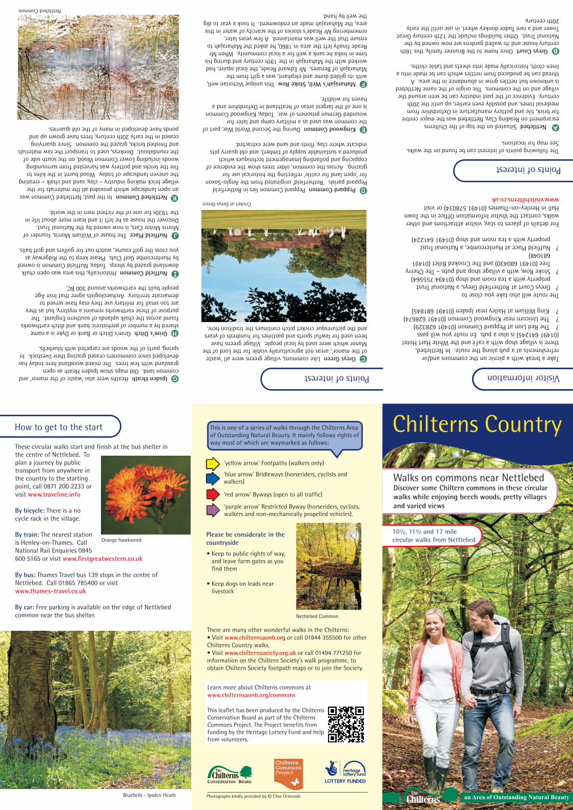
Nettlebed Common
'yellow arrow' Footpaths (walkers only)
'blue arrow' Bridleways (horseriders, cyclists and walkers)
‘red arrow' Byways (open to all traffic)
‘purple arrow’ Restricted Byway (horseriders, cyclists, walkers and non-mechanically propelled vehicles).
Walks on commons near NettlebedDiscover some Chiltern commons in these circular walks while enjoying beech woods, pretty villages and varied views
Points of interest
Ipsden Heath Heaths were also 'waste of the manor' and common land. Old maps show Ipsden Heath as open grassland with few trees. The mixed woodland here today has developed since commoners ceased grazing their livestock. In spring, parts of the woods are carpeted with bluebells.
Grim's Ditch Grim's Ditch or Bank or Dyke is a name shared by a number of prehistoric bank and ditch earthworks found across the chalk uplands of southern England. The purpose of these earthworks remains a mystery, but as they are too small for military use they may have served to demarcate territory. Archaeologists agree that Iron Age people built the earthworks around 300 BC.
Nuffield Common Historically, this area was open chalk downland grazed by sheep. Today, Nuffield Common is owned by Huntercombe Golf Club. Please keep to the Ridgeway as you cross the golf course, watch out for golfers and golf balls.
Nuffield Place The house of William Morris, founder of Morris Motor Cars, is now owned by the National Trust. Discover the house as he left it and learn more about life in the 1930s for one of the richest men in the world.
Nettlebed Common In the past, Nettlebed Common was an open landscape which provided all the materials for the village brick making industry – clay, sand and chalk – creating the uneven landscape of today. Wood burnt in the kilns to fire the bricks and pottery was harvested from surrounding woods including Lower Common Wood, on the south side of the roundabout. Donkeys, used to transport the raw materials and finished bricks, grazed the common. Since quarrying ceased in the early 20th century, trees have grown up and ponds have developed in many of the old quarries.
Bluebells - Ipsden Heath
Orange hawkweed10½, 11½ and 17 mile circular walks from Nettlebed
J
KCricket at Greys Green
H
Nettlebed Common

Description of route:The route follows paths and bridleways through commons and woods, and across fields. Some paths are steep and can be muddy in places. There are some stiles. Take care, wear suitable footwear and allow time to rest and enjoy the varied views. Map: OS Explorer 171
Starting with your back to the four-sided bus shelter in the centre of Nettlebed, walk to your right, cross the main road and follow the access road in front of the houses
to the gates. Turn left and, keeping the brick wall on your right, follow the path, over the drive, until it reaches the B481.
Cross the road and follow the bridleway through Lower Common Wood. This track was the old road to Bix.
Keep following the track after it has emerged from the woods then take the second bridleway on the right up a short slope. Follow the track to Bromsden Farm.
At the farm, take the path to the left and walk in front of the house. Go through a field gate and bear right through a second field gate into Tartary Wood, carpeted in bluebells each spring.
At the bottom of the slope go straight ahead where the footpath crosses a bridleway and continue into Pissen Wood, part of the National Trust's Greys Court Estate. Go through a kissing gate on your left and follow the permissive path to another kissing gate. Detour – follow the path on the left to reach Greys Court house and gardens.
Bear left onto Rocky Lane and join the Chiltern Way on the right, over a stile, across a field to another stile. Walk to the right around the cricket pitch to the main road. Turn right and walk along the road.
Approx 100m after the T junction, leave the Chiltern Way and take the permissive bridleway on the left running parallel with the road. The path bears to the left and continues through an area of plantation woods on Greys Green golf course, emerging at Peppard Common. Take care crossing the road. The Red Lion is on the right.
1
2
3
4
Follow the lane to Peppard Hill. The road has no pavement but is quiet. Turn right in front of The Unicorn and follow Colmore Lane beside Kingwood Common.
Approx 250m after 'Great David's' on your left, pass through the field gate on the left and take the footpath on the right. The footpath takes you through Burnt Platt to Bear Wood. Go straight across the road and continue along the footpath in Bush Wood.
The footpath brings you to a bend with a lane at the back of Stoke Row. Our route goes back into the wood to the right and bears left down the hill to Newnham Hill Bottom. Detour - follow the lane to the left to the centre of Stoke Row for the Maharajah's Well, The Cherry Tree and a village shop. Along the lane to the right is The Crooked Billet.
Turn left and follow the lane to the end, continuing straight ahead onto the bridleway to English Farm where observant walkers might spot an elephant!
If you are walking the shorter southern circular walk, now return to Nettlebed by following these directions.
Turn right on to the footpath around the back of the traditional barns and go down the slope. At the bottom, go over a stile on the left and follow the path across a large field to another stile.
Once over the stile, bear right and follow the main track until you reach Howberrywood house.
After the house, follow the tarmac track until you reach Nettlebed church.
Turn right and walk up the High Street back to the bus shelter in the centre of Nettlebed.
If you are walking the shorter western circular walk, follow these directions to join the longer walk at point
Starting with your back to the four-sided bus shelter in the centre of Nettlebed, walk to your right, cross the B481 Watlington Road and walk up the High Street to the church.
Immediately after the church yard, turn left onto a track. Follow the tarmac track to Howberrywood house.
Bear right at the house and follow the track until you reach a junction with six paths. Cross the stile on the left and follow the footpath across a large field to another stile.
Turn right and follow the footpath up the slope and around the back of traditional barns to English Farm where observant walkers might spot an elephant!
Take the footpath on the left immediately after the converted barn. After crossing a cattle grid and passing a pond on the left, turn right between a hedge and tennis court. Cross the stile and walk diagonally across the field to another stile. Cross a quiet lane to a third stile. Walk diagonally across the horse field to the corner of the garden and enter the wood ahead by another stile.
Follow the path across Ipsden Heath, cross the road and take the lane sign-posted to Homer Farm, to the King William.
After the pub, take the first track on the right. Continue across fields and through a wood to Woodhouse Farm.
Turn right and follow the bridleway around the wood, up a slope across fields, towards Mongewell Woods. Just before the wood, take the permissive path on the left along the edge of the wood and across the field to a stile.
Over the stile, turn right. Our route now follows the Ridgeway along a spectacular section of Grim's Ditch. Follow the Ridgeway (identified with an acorn symbol), turning left opposite Nuffield Church, across Nuffield Common (now Huntercombe golf course) and across the A4130. Detour – turn right to reach Nuffield Place, approx 300m on the left.
Go down through a wood and on the other side of the large field, leave the Ridgeway to follow the Chiltern Way on the right though Hazel Wood.
Leaving the Chiltern Way, turn right on the footpath to Digberry Lane. At the junction with a lane by some double bends, go straight ahead and continue straight until you reach the B481.
Turn right and walk approx 50m along the B481 to a footpath on the left. Follow the path straight ahead along the boundary bank on the edge of Nettlebed Common. Bear right at the first fork in the path, cross the first track; at the second track, turn right. Bear left onto a footpath, marked with white arrows on trees, up Windmill Hill. At the top of the hill, the footpath joins a track which leads into Mill Road, which joins the B481 near the centre of the village. Turn left at the T junction to return to the bus shelter.
7
5
6
8
10
9
11
13
14
12
15
16
17
18
19
12
© Crown copyright and database rights 2013 Ordnance Survey Licence no. 100044050
1Start/FinishA
2
3
4
5
6
7
8
9
11
10
12
13
14
15
16
17
18
19
C
D
E
F
G
H
I
KNettlebedCommon
PeppardCommon
KingwoodCommon
IpsdenHeath
NuffieldCommon
B
J
W4
W3
W2S4
S3
S2
S1
W1
0.5 1kilometre
half mile north
Southern circular walk 10½ milesStart and Finish: NettlebedReturning via to
1S4S1
Western circular walk 11½ milesStart and Finish: Nettlebed to then to
W1W4W1 12 19
W4
W3
W2
S4
S3
S2
S1
W1
LowerCommon Wood
Nettlebed