colorado historic highway inventory - historical summary ... · colorado historic highway inventory...
TRANSCRIPT
Colorado Historic Highway Inventory - Historical Summary and Evaluation of Significance
Highway Name: State Highway (SH) 22
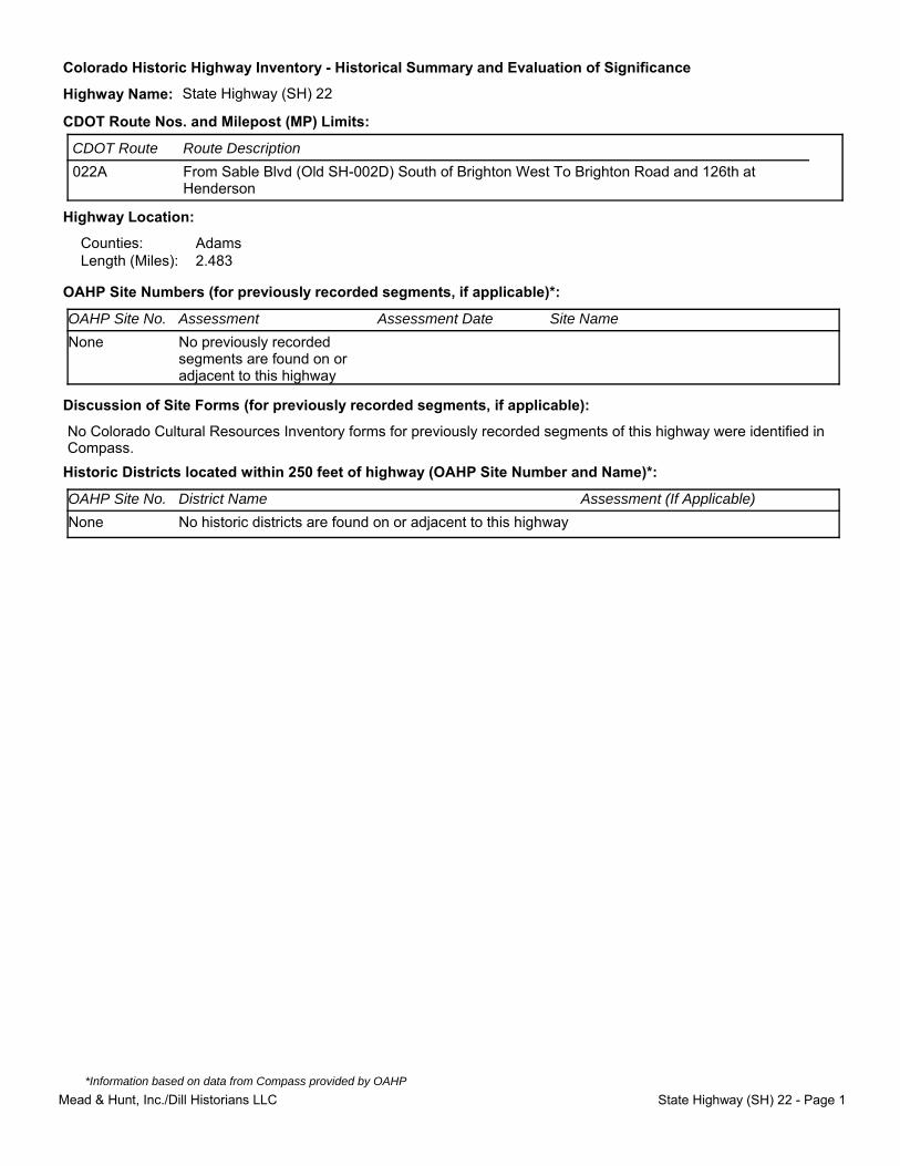
Highway Location:
Counties: AdamsLength (Miles): 2.483
OAHP Site Numbers (for previously recorded segments, if applicable)*:
Discussion of Site Forms (for previously recorded segments, if applicable):
No Colorado Cultural Resources Inventory forms for previously recorded segments of this highway were identified in Compass.
Historic Districts located within 250 feet of highway (OAHP Site Number and Name)*:
CDOT Route Nos. and Milepost (MP) Limits:
CDOT Route Route Description
022A From Sable Blvd (Old SH-002D) South of Brighton West To Brighton Road and 126th at Henderson
Site NameAssessment DateAssessmentOAHP Site No.
None No previously recorded segments are found on or adjacent to this highway
Assessment (If Applicable)District NameOAHP Site No.
None No historic districts are found on or adjacent to this highway
Mead & Hunt, Inc./Dill Historians LLC State Highway (SH) 22 - Page 1
*Information based on data from Compass provided by OAHP
Colorado Historic Highway Inventory - Historical Summary and Evaluation of Significance
Highway Name: State Highway (SH) 22
Historical Data:
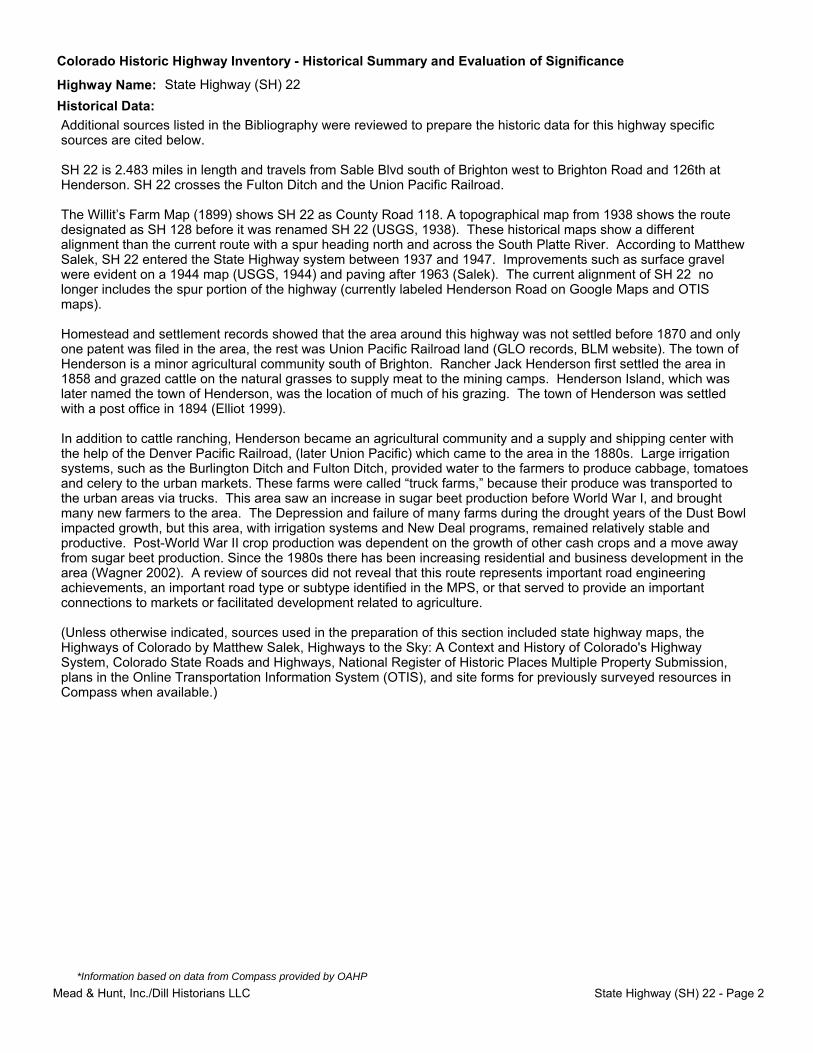
Additional sources listed in the Bibliography were reviewed to prepare the historic data for this highway specific sources are cited below.
SH 22 is 2.483 miles in length and travels from Sable Blvd south of Brighton west to Brighton Road and 126th at Henderson. SH 22 crosses the Fulton Ditch and the Union Pacific Railroad.
The Willit’s Farm Map (1899) shows SH 22 as County Road 118. A topographical map from 1938 shows the route designated as SH 128 before it was renamed SH 22 (USGS, 1938). These historical maps show a different alignment than the current route with a spur heading north and across the South Platte River. According to Matthew Salek, SH 22 entered the State Highway system between 1937 and 1947. Improvements such as surface gravel were evident on a 1944 map (USGS, 1944) and paving after 1963 (Salek). The current alignment of SH 22 no longer includes the spur portion of the highway (currently labeled Henderson Road on Google Maps and OTIS maps).
Homestead and settlement records showed that the area around this highway was not settled before 1870 and only one patent was filed in the area, the rest was Union Pacific Railroad land (GLO records, BLM website). The town of Henderson is a minor agricultural community south of Brighton. Rancher Jack Henderson first settled the area in 1858 and grazed cattle on the natural grasses to supply meat to the mining camps. Henderson Island, which was later named the town of Henderson, was the location of much of his grazing. The town of Henderson was settled with a post office in 1894 (Elliot 1999).
In addition to cattle ranching, Henderson became an agricultural community and a supply and shipping center with the help of the Denver Pacific Railroad, (later Union Pacific) which came to the area in the 1880s. Large irrigation systems, such as the Burlington Ditch and Fulton Ditch, provided water to the farmers to produce cabbage, tomatoes and celery to the urban markets. These farms were called “truck farms,” because their produce was transported to the urban areas via trucks. This area saw an increase in sugar beet production before World War I, and brought many new farmers to the area. The Depression and failure of many farms during the drought years of the Dust Bowl impacted growth, but this area, with irrigation systems and New Deal programs, remained relatively stable and productive. Post-World War II crop production was dependent on the growth of other cash crops and a move away from sugar beet production. Since the 1980s there has been increasing residential and business development in the area (Wagner 2002). A review of sources did not reveal that this route represents important road engineering achievements, an important road type or subtype identified in the MPS, or that served to provide an important connections to markets or facilitated development related to agriculture.
(Unless otherwise indicated, sources used in the preparation of this section included state highway maps, the Highways of Colorado by Matthew Salek, Highways to the Sky: A Context and History of Colorado's Highway System, Colorado State Roads and Highways, National Register of Historic Places Multiple Property Submission, plans in the Online Transportation Information System (OTIS), and site forms for previously surveyed resources in Compass when available.)
Mead & Hunt, Inc./Dill Historians LLC State Highway (SH) 22 - Page 2
*Information based on data from Compass provided by OAHP
Colorado Historic Highway Inventory - Historical Summary and Evaluation of Significance
Highway Name: State Highway (SH) 22
Property Type and Areas of Significance:
Criterion A specific requirements
Criterion C specific requirements
Subtypes
Criterion A specific requirements
Criterion C specific requirements
Criterion A specific requirements
Criterion C specific requirements
Cultural:
Early and/or prominent project of the Colorado Highway Department (Transportation)
Representative example (Transportation)
Association with a significant event (If applicable, the Area of Significance is indicated in the statement of significance below)
Association with federal work relief programs (Politics/Government)
Farm-to-Market Road
Limited Access, Multiple-Lane, Divided Highway/Freeway
Highway Bypass
Early and/or prominent project of the Colorado Highway Department (Transportation)
Association with a significant event (If applicable, the Area of Significance is indicated in the statement of significance below)
Association with federal work relief programs (Politics/Government)
Representative example (Transportation)
Engineering achievement (Engineering)
Engineering:
Aesthetic:
Early and/or prominent project of the Colorado Highway Department (Transportation)
Association with a significant event (If applicable, the Area of Significance is indicated in the statement of significance below)
Association with federal work relief programs (Politics/Government)
Representative example (Transportation)
Engineering achievement (Engineering)
Landscape architecture (Landscape Architecture)
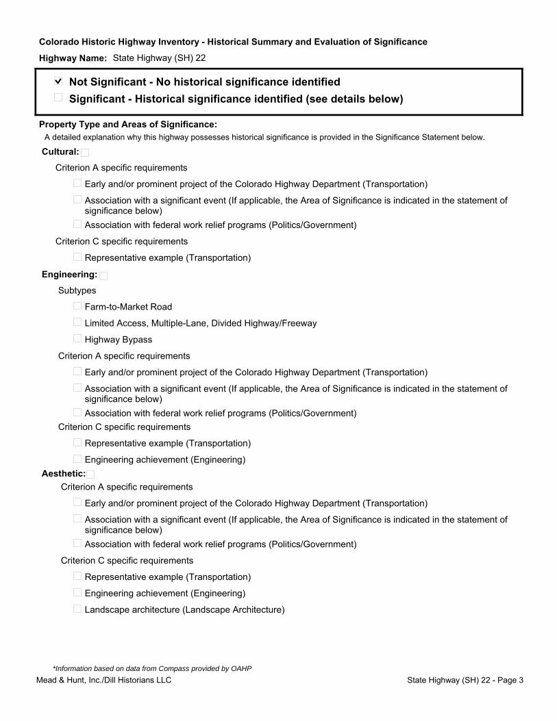
Not Significant - No historical significance identified
Significant - Historical significance identified (see details below)
A detailed explanation why this highway possesses historical significance is provided in the Significance Statement below.
Mead & Hunt, Inc./Dill Historians LLC State Highway (SH) 22 - Page 3
*Information based on data from Compass provided by OAHP
Colorado Historic Highway Inventory - Historical Summary and Evaluation of Significance
Highway Name: State Highway (SH) 22
Historic periods of highway construction:
Level of Significance:
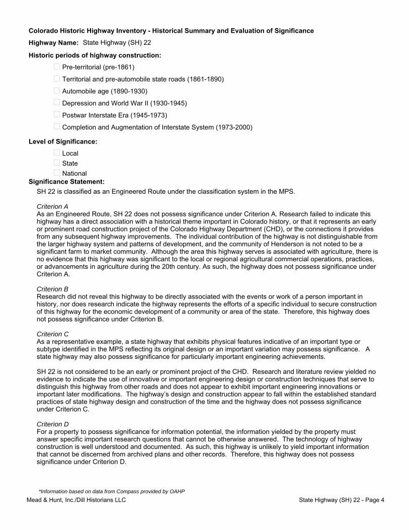
SH 22 is classified as an Engineered Route under the classification system in the MPS.
Criterion AAs an Engineered Route, SH 22 does not possess significance under Criterion A. Research failed to indicate this highway has a direct association with a historical theme important in Colorado history, or that it represents an early or prominent road construction project of the Colorado Highway Department (CHD), or the connections it provides from any subsequent highway improvements. The individual contribution of the highway is not distinguishable from the larger highway system and patterns of development, and the community of Henderson is not noted to be a significant farm to market community. Although the area this highway serves is associated with agriculture, there is no evidence that this highway was significant to the local or regional agricultural commercial operations, practices, or advancements in agriculture during the 20th century. As such, the highway does not possess significance under Criterion A.
Criterion B Research did not reveal this highway to be directly associated with the events or work of a person important in history, nor does research indicate the highway represents the efforts of a specific individual to secure construction of this highway for the economic development of a community or area of the state. Therefore, this highway does not possess significance under Criterion B.
Criterion CAs a representative example, a state highway that exhibits physical features indicative of an important type or subtype identified in the MPS reflecting its original design or an important variation may possess significance. A state highway may also possess significance for particularly important engineering achievements.
SH 22 is not considered to be an early or prominent project of the CHD. Research and literature review yielded no evidence to indicate the use of innovative or important engineering design or construction techniques that serve to distinguish this highway from other roads and does not appear to exhibit important engineering innovations or important later modifications. The highway’s design and construction appear to fall within the established standard practices of state highway design and construction of the time and the highway does not possess significance under Criterion C.
Criterion D For a property to possess significance for information potential, the information yielded by the property must answer specific important research questions that cannot be otherwise answered. The technology of highway construction is well understood and documented. As such, this highway is unlikely to yield important information that cannot be discerned from archived plans and other records. Therefore, this highway does not possess significance under Criterion D.
Pre-territorial (pre-1861)
Territorial and pre-automobile state roads (1861-1890)
Automobile age (1890-1930)
Depression and World War II (1930-1945)
Postwar Interstate Era (1945-1973)
Completion and Augmentation of Interstate System (1973-2000)
Significance Statement:
Local
State
National
Mead & Hunt, Inc./Dill Historians LLC State Highway (SH) 22 - Page 4
*Information based on data from Compass provided by OAHP

Colorado Historic Highway Inventory - Historical Summary and Evaluation of Significance
Highway Name: State Highway (SH) 22
022.jpg
Mead & Hunt, Inc./Dill Historians LLC State Highway (SH) 22 - Page 5
*Information based on data from Compass provided by OAHP