city plan 2030: executive summary - altamonte.org
TRANSCRIPT

CITY OF ALTAMONTE SPRINGS EXECUTIVE SUMMARY
CITY PLAN 2030: EXECUTIVE SUMMARY City Plan 2030 Vision... the City of Altamonte Springs envisions our city to be a unique, quality and sustainable community achieved through diverse and compact land use with modern amenities (parks, lakes, urban plazas, walkways, and landscaping) and multi-modal transportation that meet the needs of both residents and businesses.
INTRODUCTION
All local governments in Florida are mandated by Florida law to prepare long-range comprehensive plans by the “Local Government Comprehensive Plan and Land Development Regulation Act” that requires their preparation, adoption, and enforcement. Chapter 163, Florida Statutes (F.S.), is part of the State’s growth management laws that govern comprehensive plans. In addition, comprehensive plans must be prepared according to minimum standards set forth within the Florida Administrative Code (F.A.C). The City’s Comprehensive Plan meets the requirements of Chapter 163, F.S., and Rule 9J-5, F.A.C.
City Plan 2030 is a comprehensive plan that addresses subjects – called elements – involving land use, transportation, housing, infrastructure, conservation, recreation and open space, intergovernmental coordination, capital improvement, and public school facilities. Although the Comprehensive Plan is organized into individual chapters, each element is interrelated and consistent.
City Plan 2030 (or the Comprehensive Plan) establishes a means to accomplish the Vision through the planning horizon 2030. The means is formed into a plan that describes actions that will be taken by the City to guide the built environment toward an urban form consistent with the These actions and strategies are defined and organized into goals, measurable objectives, and specific policies (GOP’s) within each element of the Comprehensive Plan.
ORGANIZATION OF CITY PLAN 2030
City Plan 2030 contains two sections which includes all elements. The first section provides goals, objectives and policies (GOPs) that rely upon specific information and statistics relevant to the City of Altamonte Springs and its surrounding area. An inventory of data and an explanation of the analysis that support the GOPs are located in the second section, which is titled Data, Inventory, and Analysis (DIA).
Each of the nine elements appearing in the Comprehensive Plan is assigned a chapter number. The same chapter number applied to an element found in the GOP section also applies to the same element within the DIA section. For example, the Housing Element appears as Chapter 3 in both the GOP and DIA sections. Figures (as required) are placed at the end of the respective element. Figures are numbered with the corresponding section number appearing first (e.g., Figure I-4.1 is located in the GOP section, Chapter 4). A table of contents is provided for both the GOP and DIA sections.
Enumeration, or codification, of GOPs occurs in the following order: element #, goal #, objective #, and policy #. The diagram below illustrates this enumeration format:
1 CITY PLAN 2030
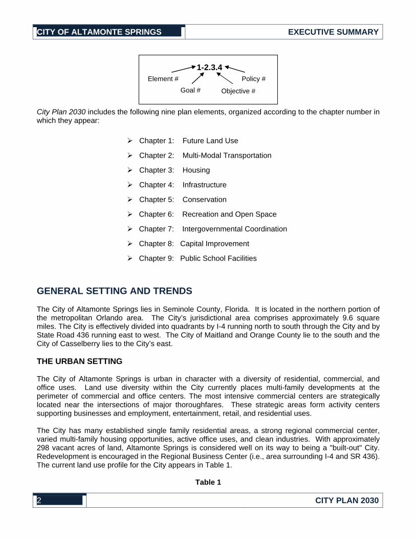
1-2.3.4 Element # Policy #
Goal # Objective #
CITY OF ALTAMONTE SPRINGS EXECUTIVE SUMMARY
City Plan 2030 includes the following nine plan elements, organized according to the chapter number in which they appear:
Chapter 1: Future Land Use
Chapter 2: Multi-Modal Transportation
Chapter 3: Housing
Chapter 4: Infrastructure
Chapter 5: Conservation
Chapter 6: Recreation and Open Space
Chapter 7: Intergovernmental Coordination
Chapter 8: Capital Improvement
Chapter 9: Public School Facilities
GENERAL SETTING AND TRENDS
The City of Altamonte Springs lies in Seminole County, Florida. It is located in the northern portion of the metropolitan Orlando area. The City’s jurisdictional area comprises approximately 9.6 square miles. The City is effectively divided into quadrants by I-4 running north to south through the City and by State Road 436 running east to west. The City of Maitland and Orange County lie to the south and the City of Casselberry lies to the City’s east.
THE URBAN SETTING
The City of Altamonte Springs is urban in character with a diversity of residential, commercial, and office uses. Land use diversity within the City currently places multi-family developments at the perimeter of commercial and office centers. The most intensive commercial centers are strategically located near the intersections of major thoroughfares. These strategic areas form activity centers supporting businesses and employment, entertainment, retail, and residential uses.
The City has many established single family residential areas, a strong regional commercial center, varied multi-family housing opportunities, active office uses, and clean industries. With approximately 298 vacant acres of land, Altamonte Springs is considered well on its way to being a "built-out" City. Redevelopment is encouraged in the Regional Business Center (i.e., area surrounding I-4 and SR 436). The current land use profile for the City appears in Table 1.
Table 1
2 CITY PLAN 2030

CITY OF ALTAMONTE SPRINGS EXECUTIVE SUMMARY
Existing Land Use Acreage Distribution
Land Use Acres Percent of Developed Land
Total Residential 2,787.6 60%
Commercial/Office 1,251.0 27%
Industrial 139.8 3%
Institutional 269.2 6%
Recreation 198.9 4%
Total Developed Land 4,646.5 100%
Conservation 74.7
Vacant 297.5
Right-of-Way 1,150.8
Total Undeveloped Lands 1,523.0
Total Land Area 6,169.5
URBAN PATTERNS
Over the past two decades, Altamonte Springs has been experiencing a transition from a suburban community to a diverse urban and economic center. Development patterns in Altamonte Springs show higher intensity commercial retail and office uses congregating at or near the intersection of major transportation corridors. Two major commercial nodes, or Activity Centers, have formed in areas surrounding the intersection of State Road (SR) 436 and Interstate 4 (I-4) and in the vicinity of the SR 436 and SR 434 intersection. Another Activity Center occurs along SR 436 on the east side of the City. Property at the northeast corner of Maitland Boulevard and SR 434 is also expected to generate heightened market demands for intensive office and commercial uses. This demand emerges from the area’s strategic location along major transportation corridors and its proximity to intensive office parks and multiple story office buildings located to the east on Maitland Boulevard in Orange County. Current trends experienced in the City’s four Activity Centers are expected to continue. All four Activity Centers are accessible to major transportation corridors and current transit routes. The City is focused on integrating land use and transportation in these areas.
RESIDENTIAL NEIGHBORHOODS
Residential uses predominantly occur in areas away from the major roadways. Most single family homes were constructed prior to 1990 with a large portion of the housing stock constructed in the 70’s and 80’s. Vacant land or lots available for single family homes is minimal. With limited land available to accommodate single family homes, future housing construction is anticipated to be predominantly multi-family residential. Nearly all existing multi-family developments and most single family neighborhoods are typically located less than a half-mile walk to commercial retail and employment areas as well as major transportation corridors.
PARKS AND OPEN SPACE
3 CITY PLAN 2030

CITY OF ALTAMONTE SPRINGS EXECUTIVE SUMMARY
The City’s park system is comprised of recreational lands and facilities. The City currently owns 224.5 acres of recreation land designated for community parks, neighborhood parks, and open space. The City also offers a variety of recreational programs at its parks that are designed to meet the needs of all age groups and skill levels.
NATURAL RESOURCES
The Little Wekiva River traverses through 4.5 miles of the City. Though wetlands are located adjacent to lakes in the northeast and southwest areas of the City, the City does not have extensive wetland systems. Several natural lakes occur at locations throughout the City.
POPULATION AND HOUSING
According to the University of Florida Bureau of Economic and Business Research (BEBR), the City’s population in 2008 was 43,244 (as of April 1, 2009). By 2030, the City anticipates the population growing to 45,481. As an inland City removed from the tourist attractions dominating the south side of Orlando, Altamonte Springs does not have a significant seasonal population. Seasonal population primarily seeks lodging at local hotels and motels.
More residents currently live in multi-family dwelling units than do single family units. More than 60 percent of the City’s 21,027 housing units are multi-family buildings. Multi- family housing will represent at least this same proportional share of the housing stock through 2030. While residential development is anticipated to occur within the approximately 298 vacant acres, the majority of vacant land is expected to be developed as office and commercial. To accommodate future demand for housing, redevelopment of existing non-residential buildings and sites in the future will need opportunities to provide multi-family residential development.
TRANSPORTATION SYSTEMS
The City is served by several bus routes operated by LYNX (aka Central Florida Regional Transportation Authority). Numerous transit stops are located along these routes, including two transfer stops. Major highways or roads that traverse the City include SR 436, SR 434 and I-4. A CSX rail line, serving regional freight and Amtrak trains, crosses north-south through the City’s eastern side. No passenger rail stations are located within or adjacent to the City, however a commuter rail station as a part of SunRail is proposed in Altamonte Springs in the East Town Center.
INFRASTRUCTURE AND PUBLIC SERVICES
The City of Altamonte Springs owns and operates potable water, sanitary sewer, and reclaimed water facilities. All development is connected to central water system and nearly all development is served by central sewer. Septic tanks only remain within a few isolated pockets within the City. Service areas for central water and sewer systems extend beyond the City’s jurisdictional boundaries. Garbage collection service is also provided by the City to single family residential customers. Other land uses are served by private contractors. Seminole County provides disposal services at its landfill facility and through the solid waste transfer facility located within the City.
4 CITY PLAN 2030

CITY OF ALTAMONTE SPRINGS EXECUTIVE SUMMARY
CITY PLAN 2030: GENERAL PLANNING APPROACHES
The City of Altamonte Springs has limited vacant land remaining for new development. More City residents will reside in multi-family housing than will reside in single family homes. Nearly all developments and most single family neighborhoods are located less than a half-mile walk to commercial retail and employment areas as well as major transportation corridors. Transition from a suburban community to a diverse urban and economic center generates current and forthcoming demand for enhanced bus transit and pedestrian systems capable of meeting mobility needs for City residents, business, and visitors.
The Comprehensive Plan focuses on land use planning, site design, and development densities compatible with efficient transit operation and service over the long term. The approach involves concentrating higher intensity development at or near intersections of major transportation corridors, thus making transit more accessible to population and employment concentrations. Activity Centers are placed at these strategic transportation corridor crossroads to effectively function as urban nodes for high intensity employment, commerce and residential activities. The Activity Centers support internal multi-modal transportation options and are also linked together by local transit systems, which in turn is connected to regional transit systems serving the Orlando metropolitan area along the I-4 corridor.
The Comprehensive Plan also supports pedestrian and bicycle-oriented planning and development to support walking or bicycling for short trips. The walking and bicycling environments are also supported by the diversity of land uses directed within close proximity to each other and by establishing site design principles that create more efficient and convenient connections between buildings and public sidewalk systems. The Comprehensive Plan fully integrates land use and multi-modal transportation.
INTEGRATION OF LAND USE AND TRANSPORTATION
Facts and findings presented within the DIA section of the Comprehensive Plan indicate that the City will need to diversify its transportation system to maintain mobility within the City. Vehicle traffic on roadways will continue to increase, requiring the City to focus more on multi-modal mobility. Therefore, the Comprehensive Plan is centered on walking and bicycling, bus systems, and local passenger rail.
While the Comprehensive Plan recognizes that the automobile will continue to be the primary transportation mode at least in the short term, emphasis is placed on expanding opportunities for multi-modal transportation to provide transportation system with multiple options for the City’s residents. Development within the City must occur in a manner that creates land use patterns and development that is effectively integrated with the multi-modal transportation system.
City Plan 2030 establishes a policy framework for the City to guide future development towards urban design and land use patterns that supports the multi-modal transportation system and expands travel choices. Land use and transportation planning are integrated in City Plan 2030 through the following planning actions:
1. Activity Centers. The highest development intensities are directed to strategic locations at or near the intersections of major transportation corridors. By doing so, higher concentrations of population and employment occur within short walking distances to existing and future transit corridors. Four Activity Centers are designated as land uses in the Future Land Use Element: the Regional Business Center (including the Core West and Core East), West Town Center, East Town Center and Gateway Center. Figure I-1.2 of the Future Land Use Map Series identifies the official boundaries for each Activity Center.
5 CITY PLAN 2030

CITY OF ALTAMONTE SPRINGS EXECUTIVE SUMMARY
2. Development Densities Supporting Transit and Pedestrian Activity. Efficient transit (bus and passenger rail) service relies upon ridership. Higher ridership allows for more convenient and cost efficient service, i.e., less wait at transit stops for buses to arrive. The Comprehensive Plan requires development intensities that support transit and directs such development to Activity Centers and other locations along major transportation corridors. Minimum density and intensity standards discourage development that is not conducive to creating high employment and population concentrations.
3. Site Design Supporting Transit and Pedestrian Activity. Site design must accommodate pedestrian, bicycle, and transit use. Examples of a few urban design techniques that accomplish this planning approach include building locations closer to streets, building entrances linked to public sidewalk systems and transit stops, and buildings placed closer to each other to encourage walking.
4. Residential Proximity to Retail and Employment. Residential areas are located within walking distance to commercial retail and to offices. Nearly all multi-family development is directed to locations in or near Activity Centers or within walking distances to major transportation corridors where transit service is available. Activity Centers allow for diverse land uses including multi-family residential. Higher density residential development is required to locate near existing or proposed transit routes.
5. Transit Hub and Station Locations. Activity Centers are designated sites for major transit hubs or intermodal transportation stations – places where people can transfer between buses or between different transportation modes, such as bus to car or rail to bus transit. Bus and rail transit systems are directed to hubs located in Activity Centers where land use intensities are highest.
6. Land Use Diversity. Within designated areas of the City, residential land uses are allowed in the same area with office and commercial uses. This approach allows people to live within walking distance to shopping and jobs.
7. Promotion of Transit- and Pedestrian-oriented Development through Incentives. City Plan 2030 promotes transit- and pedestrian-oriented development through incentives for higher intensities and residential densities if site design requirements comply with the land use/transportation integration approach supported by the Comprehensive Plan. Development may be able to obtain more residential units or more commercial or office floor area when site design supports transit and pedestrian systems. These development bonuses also apply when the developer commits to capital or service improvements to pedestrian or transit systems. Development bonuses are only provided within the Activity Center.
PROTECTION OF ESTABLISHED RESIDENTIAL NEIGHBORHOODS
Established single family residential neighborhoods are present throughout the City of Altamonte Springs. Typically, these neighborhoods are located away from the major roadways. Development patterns experienced along major corridors have commercial, office, or multi-family development placed between the major thoroughfares and residential neighborhoods.
City Plan 2030 promotes the protection of these established residential neighborhoods through the following activities:
6 CITY PLAN 2030

CITY OF ALTAMONTE SPRINGS EXECUTIVE SUMMARY
1. Future Land Use Map Designations. The future land use designation assigned to these residential neighborhoods protects their residential character by assuring future development occurs compatible with residential character and density.
2. Mitigate Transportation Impacts. The Comprehensive Plan discourages cut-through traffic in residential neighborhoods by limiting roadway widening improvements or major roadway projects within residential areas. The Plan promotes a multi-modal transportation system to alleviate future traffic congestion on major roadways, thus preventing drivers from seeking alternative routes off of the major roadway system.
3. Buffers from Non-Residential Areas. Landscape buffers and screening will occur at the perimeter of commercial and non-residential uses abutting residential neighborhoods.
EFFICIENT AND EFFECTIVE PROVISION OF INFRASTRUCTURE AND PUBLIC SERVICES
City Plan 2030 evaluates existing and future demand for potable water, sanitary sewer, drainage, solid waste, recreation and transportation services, and analyzes infrastructure needs for future population growth and development. To assure that infrastructure is provided to meet these demands, City Plan 2030 establishes level of service (LOS) standards for each service.
New development and redevelopment are evaluated at the time a development application is submitted to the City to determine whether sufficient capacity is available for each facility according to the adopted LOS standards. The process for evaluating impacts that development will place on LOS facilities is called the concurrency management program. City Plan 2030 formulates a framework for the initial implementation of a concurrency management program and special provisions for transportation to establish a multi-modal transportation system which enhances mobility.
7 CITY PLAN 2030

CITY OF ALTAMONTE SPRINGS EXECUTIVE SUMMARY
CITY PLAN 2030: SUMMARY OF PLAN ELEMENTS
The GOP section of City Plan 2030 is supported by an inventory of data (DIAs) that identifies current characteristics and trends within the City and supported by an analysis of the data inventory to estimate demands and needs anticipated through year 2030. Below is a summary of each of the nine elements within the Comprehensive Plan. The summary identifies key policy decisions related to the planning approaches described above.
1. FUTURE LAND USE ELEMENT
The Future Land Use Element addresses the distribution, location and extent of land uses within the City of Altamonte Springs. A map, titled the Future Land Use Map (Figure I-1.1 in the GOP section), illustrates the distribution pattern of land use designations established by the City.
The extent of uses allowed within each land use designation is measured by residential density and non-residential intensity. The Future Land Use Element establishes standards for development density and intensity at a minimum and maximum level. The maximum density and intensity will vary based upon the land use designation. Residential density is measured according to a number of units per acre. Non-residential intensity is measured by floor area ratio (FAR), the ratio of building gross floor area to the land area. For example, a building with 10,000 square feet on a one acre lot (43,560 square feet) has an FAR of 0.23. For every 0.23 square feet of floor area there would be one square foot of land.
Key Findings from Data Inventory and Analysis
a. Population and Housing. The population of residents living year-round in the City will increase from 43,244 in 2008 to 45,481 by year 2030. According to BEBR, the City has 7,680 single family homes and 13,347 multi-family homes to accommodate existing population.
b. Summary of Future Land Use Needs. Based on the data and analysis presented in the Comprehensive Plan, land within the current jurisdictional boundaries will need to accommodate more than 2,000 new residents, office, commercial space, and industrial space. Analysis of vacant lands performed in the Future Land Use Element demonstrates that development will continue to be predominantly redevelopment of existing sites and structures. With less than 300 acres of vacant land as of 2010, insufficient vacant land is available to accommodate future demands for future land use, particularly for commercial and office uses. The Comprehensive Plan places more emphasis on directing higher density development to Activity Centers.
City Plan 2030 and the Future Land Use Map create adequate space to accommodate future growth and development through land use policy that allows higher density development to concentrate near current and proposed transportation corridors and away from established residential neighborhoods.
Data, inventory, and analysis presented in the Multi-Modal Transportation Element indicates that the major road system will not be able to meet the volume of automobile traffic generated within and outside the City. Land use and transportation must be prudently planned to concentrate new development, particularly multi-family residential and commercial uses, in strategic locations along major transportation corridors where existing and future transit and pedestrian systems can efficiently serve residents and workers.
8 CITY PLAN 2030

4)
5)
CITY OF ALTAMONTE SPRINGS EXECUTIVE SUMMARY
1) Residential Land Use Needs. The City is projecting a need for an addition of approximately 2,000 residential units between 2000 and 2030. Land needs for residential will concentrate on multi-family development. Available land for new single family homes within low density residential subdivisions is limited to available vacant lots. Current vacant lands are not anticipated to be used for low density single family. New multi-family development occurring at medium and high density levels is anticipated to occur within vacant lands located in or adjacent to Activity Centers.
2) Commercial and Office Needs. The City has over 9.5 million square feet of commercial and office space. While vacant land is anticipated to accommodate up to half of the additional space needs, the other half is anticipated to occur at sites currently developed. The Comprehensive Plan directs commercial and office development and redeveloped to the four Activity Centers.
3) Recreation. The Recreation and Open Space Element has determined that additional recreation lands are not necessary to meet LOS standards. However, to maintain an LOS standard consistent to that currently offered by the City, new residential development will be required to provide recreation space and facilities for new residents.
Institutional Land Needs. The Comprehensive Plan does not anticipate a need for additional space to accommodate Institutional land uses. Most institutional land uses can occur within land use designations other than the Institutional designation provided on the Future Land Use Map.
Industrial Land Needs. The Comprehensive Plan anticipates the need for additional industrial buildings to add to the City’s employment base.
6) Activity Centers. Multi-family residential, commercial and office development will be concentrated in Activity Centers strategically located along major transportation corridors, creating efficient accessibility to transit routes. Activity Centers will need to allow diverse land uses within close proximity to each other to promote walking between activities. Multi-family residential will be able to locate internal to or near commercial and office development.
Summary of Future Land Use GOPs
Based on land use issues and needs identified within the DIA section of the Comprehensive Plan, the GOPs, together with the Future Land Use Map, establish a land use program to manage the distribution and extent of development within the City. The Future Land Use Element establishes the following growth management framework:
a. Integrate Intensive Land Uses and Multi-Modal Transportation within Activity Centers. Higher intensity development is directed to Activity Centers designed to accommodate land use diversity and support multi-modal transportation. Four Activity Centers are established in City Plan 2030: Regional Business Center (including Core West and Core East), West Town Center, East Town Center, and the Gateway Center. The most intensive development allowed in the City occurs within the Core Districts of the Regional Business Center. Boundaries for each Activity Center and the Core District are denoted in the Future Land Use Map Series (Figure I-1.2). Land use and multi-modal transportation are further integrated as a coordinated planning effort through the following activities set forth within the Future Land Use Element:
9 CITY PLAN 2030

CITY OF ALTAMONTE SPRINGS EXECUTIVE SUMMARY
1) Minimum Land Use Densities. For higher density residential land use and higher intensity office and commercial uses, development must occur above an established minimum density or intensity. The purpose of a minimum land use density/intensity is to assure development occurs with population and employment concentrations that support transit and pedestrian systems.
2) Transit-Oriented Development. For higher density residential land use and higher intensity office and commercial uses, transit-oriented site design will be required. Incentives are also provided to encourage such site design. Transit-oriented development accommodates specific site design needs of transit patrons and pedestrian to efficiently connect buildings entrances to transit and off-site pedestrian systems. It places less emphasis on site design oriented toward the needs of supporting automobile transportation.
b. Protection of Residential Neighborhoods. The Future Land Use Element establishes objectives and polices to protect established residential neighborhoods from encroachment by commercial, industrial, office, and other land uses not supporting a residential character. The following activities are supported by the Future Land Use Element:
1) Residential Neighborhoods and the Future Land Use Map. Established single family residential neighborhoods are designated on the Future Land Use Map as Low Density Residential or as Medium Density Residential. Only residential uses are allowed in these low and medium density residential designations on the Future Land Use Map.
2) Buffer and Screening. Where residential neighborhoods abut commercial, office, or industrial areas, landscape buffers and screening is required to mitigate impacts that may affect the preservation of residential character. The Future Land Use Element also discourages non-neighborhood traffic from accessing residential areas from commercial sites.
c. Opportunities for Innovative Design and Land Use Planning. The Future Land Use Element recognizes that all market conditions cannot be anticipated and that flexibility in land planning may be necessary to promote innovate development that creates reduced demand on public services and infrastructure, provides economic benefits to the community, or presents better opportunities to preserve natural resources and open space
d. Protection of Natural and Historic Resources. Only a few relatively small wetland areas occur within the City. Several lakes occur throughout the City. An inventory of historic sites indicates that only two existing structures currently may have historical significance.
Where environmentally fragile lands have been identified within the Conservation Element, the Future Land Use Element establishes land use policies to minimize development encroachment into such areas. The intent of the Conservation designation in the Future Land Use Element is to identify natural resources that merit preservation.
In addition to a specific designation for the Future Land Use Map, the Future Land Use Element includes the following activities to promote conservation of natural resources:
1) Protect Natural Resources. Policies direct the City to promote reclaimed water, endangered and threatened species, trees, floodplains and wellfield areas.
10 CITY PLAN 2030

CITY OF ALTAMONTE SPRINGS EXECUTIVE SUMMARY
2) Historic and Archeological Sites. The Land Development Code is required to include procedures and standards to address preservation of designated historic sites and, if discovered during construction activities, the evaluation of archeological findings.
3) Aquifer Recharge Areas. Groundwater recharge areas are identified and policies address mitigation of impacts that may affect natural rates of recharge to the aquifer.
e. School Planning. The Future Land Use Element identifies locations suitable for elementary, middle, and high school facilities. Although no new public school facilities are currently planned inside the City limits, State growth management laws in Chapter 163, F.S., require local governments to identify land use designations where public school facilities are acceptable.
f. Future Land Use Map Series. The Future Land Use Map illustrates specific locations within the City where residential, commercial, office, industrial, institutional, conservation and other land use types can occur and according to minimum, if applicable, and maximum development densities or intensities. Appendix A describes the type of uses and development extent allowed within each Future Land Use Designation.
The Future Land Use Map is one component of a Future Land Use Map Series. In addition to policies regarding future land use designations appearing on the Future Land Use Map, other policies within the Future Land Use Element and its other elements direct and guide the distribution and extent of development within Altamonte Springs. The Future Land Use Map Series is comprised of the following:
• Figure I-1.1: Future Land Use Map • Figure I-1.2: Regional Business Center & Activity Centers • Figure I-1.3: Park & Recreation System • Figure I-1.4: Historic & Archeological Sites • Figure I-1.5: Vacant Land • Figure I-1.6: Waterwells & Cones of Influence • Figure I-1.7: Aquifer Recharge Areas • Figure I-1.8: Wetlands • Figure I-1.9: 100-year floodplains • Figure I-1.10: Soil Associations • Figure 1-1.11: Wekiva Study Area • Figure 1-1.12: Most Effective Recharge Areas • Figure 1-1.13: Karst Features • Figure 1-1.14: Sensitive National Habitats • Figure 1-1.15: Transportation Concurrency Exception Area
11 CITY PLAN 2030

CITY OF ALTAMONTE SPRINGS EXECUTIVE SUMMARY
2. MULTI-MODAL TRANSPORTATION ELEMENT
The types, locations, and extent of existing and proposed transportation systems are inventoried and evaluated within the Multi-Modal Transportation Element to identify current and long-range infrastructure and service needs based on demands generated by anticipated population growth and development. A multi-modal transportation system offers several modes of transportation. City Plan 2030 addresses the City’s transportation needs for bicycle and pedestrian facilities, transit (bus, rapid bus transit, and regional rail transit), and automobile.
The Multi-Modal Element inventories current transportation systems and their service capabilities. For automobile transportation, current and estimated traffic volumes are measured against an LOS standard to identify where and when additional transportation services will be needed. The evaluation also identifies the transportation modes for which service will be expanded to provide future mobility options for the City of Altamonte Springs.
Key Findings from Data Inventory and Analysis
Growth and development within the City of Altamonte Springs as well as the Orlando metropolitan area over the next two decades will generate greater demand for trips by motorized vehicles than the current roadway system can support. Expansion of the existing major roadway system within the City, particularly state roads, is severely limited due to right-of-way constraints. Most state roads and other major roads have been expanded or are currently being expanded to the greatest extent possible without requiring the demolition and removal of existing commercial and residential buildings. Removal of substantial commercial properties could also have an economic impact on the City’s property tax base. The existing roadway system and traffic conditions are illustrated on Figure II-2.1, Current Transportation Conditions (2010), section of the Comprehensive Plan.
The data and analysis presented within the Multi-Modal Transportation Element identifies current and estimated future traffic conditions on the City’s roadway system. The LOS standard is based on PM peak hour, peak direction traffic conditions (PHPD).
Summary of Multi-Modal Transportation Element GOPs
To meet the transportation demands generated by anticipated population and employment growth, City Plan 2030 emphasizes multi-modal transportation – transit service and pedestrian and bicycle facilities – for the 20-year planning period. Managing demand for transportation will also play a greater role in transportation planning during this planning period. Transportation demand management programs, such as car/van pooling, flexible work schedules, and work-at-home programs, will need to be organized and administered both at a local or regional level. For such programs to be successful, involvement and support from the private sector, employers and businesses, will be necessary. This transportation system becomes financially feasible and offers effective service when land use patterns and development densities support adequate concentrations of people. Land use planning is integrated with transportation planning to assure that land use pattern, population densities, and site design can support transportation alternatives such as transit. Similarly, transportation programs and facilities are planned in a manner that assures an LOS that enhances transportation options.
Land use planning is integrated with multi-modal transportation systems in City Plan 2030 by furthering the purpose of Activity Centers to function as urban nodes that provide development intensities necessary to support efficient transit service. Activity Centers are also designated as transit hubs, making them centers
12 CITY PLAN 2030
CITY OF ALTAMONTE SPRINGS EXECUTIVE SUMMARY
for diverse land use activity and access points for regional transit services.
The following actions and directives are established in the form of GOPs to address transportation demand and needs identified within the DIA section of the Multi-Modal Transportation Element:
a. Offer Multi-Modal Travel Options. The City will promote and implement a transportation system that efficiently accommodates pedestrian and bicycle, automobile, freight, and transit modes. A long-range transportation plan for 2030 is illustrated in the map series located in the GOP section of the Comprehensive Plan.
1) Bicycle and Pedestrian System Improvements. A pedestrian and bicycle plan identifies the location of existing and needed bicycle paths and sidewalks, potential pedestrian overpass facilities, and bicycle/pedestrian system connections to Activity Centers and future transit hubs located therein, regional trail facilities, and schools. Central Parkway is designated as a “pedestrian corridor” linking residential areas west of I-4 with the Regional Business Center. The City will coordinate with FDOT to improve access across SR 436 and SR 434.
2) Augment Bicycle and Pedestrian System. New development and redevelopment will be required to install bicycle parking facilities. Site design standards will promote better linkages between public sidewalk systems and building entrances.
3) Eliminate Impediments and Gaps in Existing Pedestrian System. A sidewalk program will be continued to earmark funding on an annual or regular basis for the connection of incomplete sidewalks systems and to maintain existing sidewalks. The sidewalk program and requirements on new development will help to eliminate impediments to pedestrian activity.
4) Augment Transit System. Each Activity Center will accommodate transit hubs based on the type of transit anticipated to serve it. The City will continue support of bicycle carrying racks on LYNX buses. Design standards shall improve pedestrian linkages between transit stops and adjacent land uses.
5) Rail Alignment and Transit Hub Designations. The Regional Business Center and West Town Center are designated as transit hub sites for bus/rapid bus transit, pedestrian and bicycle systems, car/van pool programs, and regional rail transit. The East Town Center will service as a hub from car/van pool programs and bus transit. The Gateway Center will serve sites for hubs connecting pedestrian/trail systems, car pool/van pool programs, and bus/bus rapid transit systems.
b. Integrate Transportation Planning and Land Use Planning. Many policies within the Multi-Modal Transportation Element overlap with similar policies within the Future Land Use Element because transportation and land use issues are integrated. The following actions in the Multi-Modal Transportation Element support the integration of transportation and land use planning:
1) Land Use and Transportation Mode Compatibility. Development densities and intensities, land use distributions and concentrations, and site design are to be compatible with the type of transportation modes serving areas surrounding major transportation corridors.
2) Transit- and Pedestrian- Friendly Design and Standards. The Land Development Code will be amended to incorporate site design that promotes walking and use of bicycles and transit, bicycle parking standards, design standards for multi-level parking garages, and on-site pedestrian
13 CITY PLAN 2030

CITY OF ALTAMONTE SPRINGS EXECUTIVE SUMMARY
systems, building orientation and setbacks, and right-of-way provisions for transit.
3) Access Management. The City will continue to implement its access management program.
c. Transportation Planning to Promote Protection of Residential Neighborhoods. Roadway system improvements will be designed to direct traffic away from residential neighborhoods. Other policies also address roadway system planning and design to protect residential character of established neighborhoods.
3. HOUSING ELEMENT
The purpose of the Housing Element is to assess the housing needs for various income groups to the year 2030 and to develop public policy guidance that emphasizes the importance of the private sector in addressing these needs. The Housing Element creates an inventory of current housing conditions and evaluates availability and affordability among household income groups. An emphasis is placed on the availability of affordable housing for moderate to very low-income households. Future housing demands are estimated to analyze future housing needs for each household income group.
Key Findings from DIA
A summary of findings from the DIA section of the Comprehensive Plan are provided below:
a. The City has no public housing units, designated historical residential structures, or substandard dwelling units.
b. Affordable housing represents housing units that cost 30 percent or less, of the annual median household income for Seminole County, $49,326 in 2000.
c. In 2010, over 90% of the City's housing stock was more than 10 years old. d. In 2000, the median monthly cost of a dwelling unit in the City was $1,021. e. The City has no residential structures designated as historic sites and no residential neighborhoods
designated as historic places.
Summary of Housing Element GOPs
The Housing Element establishes policy framework to assure that adequate housing sites are available to meet future population growth, housing units are available for very-low, low and moderate income households, and that locations are available for housing population with special needs. It also establishes mechanisms to discourage blight within residential areas.
a. Provision of Housing Resources for all Citizens. With approximately 298 acres available in the City to accommodate new development, land use designations will need to allow a diversity of land uses. Multi-family residential uses will be allowed within and adjacent to Activity Centers.
b. Incentives to Encourage Private Sector Investment in Affordable Housing. An incentive program will be established to promote affordable housing and such program incorporated into the Land Development Code, and economic solutions will be evaluated as a means to improve the supply of affordable housing units.
c. Available Sites for Housing for Lower Income Groups and Those with Special Needs. Higher density housing is encouraged to be located near transportation corridors where transit service is
14 CITY PLAN 2030

CITY OF ALTAMONTE SPRINGS EXECUTIVE SUMMARY
available or planned. With over 60 percent of the housing units representing multi-family units, the City will only need to monitor housing trends to assure that affordable housing remains available for lower income groups as the City grows through 2030. The City shall assure that the Future Land Use Map has available sites for nursing homes, adult living facilities and similar housing for persons with special needs. Coordination will occur with Seminole County and other agencies regarding affordable housing and special housing needs for lower income households.
d. Preserve Residential Neighborhoods and Discourage Blight. The City shall discourage cut-through traffic in residential areas by maintaining adequate levels of service and reduce congestion on major roadway. The City will continue code enforcement programs to assure that residential buildings do not become substandard. Commercial development will not be allowed to encroach into established neighborhoods. The development review process will create an expedited review process for affordable housing developments.
4. INFRASTRUCTURE ELEMENT
The Infrastructure Element is organized into five sub-elements: Sanitary Sewer, Solid Waste, Potable Water, Aquifer Recharge and Drainage. The purpose of the Infrastructure Element is to provide an inventory of the current conditions of these public facilities or resources and to determine future infrastructure and service improvements necessary to serve existing and future population and development. Infrastructure will be planned and provided according to minimum LOS standards for all five sub-elements except for aquifer recharge.
Key Findings from Infrastructure Element
Key findings are organized below according to the sub-element order in which they appear in the Infrastructure Element.
a. Sanitary Sewer.
1) Existing System Capacity. The City owns and operates a wastewater system with a design capacity of 12.50 million gallons per day (mgd). City and wholesale customers use approximately 5.74 mgd with 0.63 mgd being used by wholesale customers. Available capacity increases to 6.63 mgd as new wastewater flow replace capacity used to augment the wastewater flow. The system needs to receive a minimum to operate effectively.
2) Service Area. Wholesale customers served by the wastewater system are located outside the City. The service area extends beyond the City’s boundaries.
3) Future System Capacity. Based on population growth and development anticipated in City Plan 2030, the system will have an available capacity of 4.68 mgd in year 2030.
b. Solid Waste The City of Altamonte Springs collects garbage and single family and duplex residential customers within the City, which also includes collection of recyclable materials. Other land uses receive collection service from private contractors. Disposal occurs at Seminole County’s Central Transfer Station and at its Osceola landfill. No collection or disposal capacity problems have been identified and none are anticipated through 2030.
c. Potable Water
15 CITY PLAN 2030

CITY OF ALTAMONTE SPRINGS EXECUTIVE SUMMARY
The City owns and operates a potable water treatment system with a treatment capacity of 11.29 mgd. The projected annual water flow demand in 2010 is approximately 6.7 mgd. A reclaimed water facility, also owned and operated by the City, provides water for irrigation systems, reducing potable water demands. The system has sufficient capacity to service population growth and development anticipated by the Comprehensive Plan. In 2030, the system is estimated to have a surplus capacity of 4.93 mgd. The City’s 10-year water supply plan is provided as an exhibit to the Infrastructure Element.
d. Groundwater Aquifer Recharge The Floridan Aquifer is the primary source of potable water in the City of Altamonte Springs. Figure I-1.7 identifies topographical areas according to their potential for aquifer recharge.
e. Drainage The drainage system contains both publicly and privately owned facilities. The City drainage system includes 186 stormwater ponds, of which the City maintains 73 as well as other drainage facilities such as roadside drainage systems, control structures, pump stations and other similar drainage facilities. While most development occurs outside the 100-year floodplain, a few flood prone areas have structures affected by such storm events. No significant stormwater or flooding problems have been identified with exception to the small isolated incidences where development is located in the 100-year floodplain. These structures existed prior to the Federal Emergency Management Agency identifying the 100-year flood zones. Based on development and growth within the City, the current stormwater master plan will need to be updated within the next few years.
Summary of Infrastructure Element GOPs
a. Sanitary Sewer The Goals, Objectives, and Policies focus on the cost-effective provision of wastewater treatment and disposal, emphasize maximizing existing facilities, and establish LOS standards. Policies provide the following direction toward the provision of sanitary sewer facilities and services:
1) Force Main Replacement. Priority is given to replacing lines located within Activity Centers.
2) Package Plants, Septic Tanks, and Project APRICOT. New development will not use package plants or septic tanks for sewer service. All new development must connect to the central sewer system and to the reclaimed water system (Project APRICOT).
3) Service to Annexed Areas. Properties annexing into the City must connect to the sewer system or execute an agreement to do so according to a timeframe set by the City.
4) Maintain LOS. Though capacity is available through 2030, the City will annually access the available capacity and estimate future demand to determine when capacity improvement may be warranted.
5) LOS Application outside the City. The City will provide capacity to wholesale customers outside the City consistent with interlocal agreements. Each local government receiving sewer capacity is responsible for monitoring and enforcing its own LOS standard.
6) Capacity Priorities. Prior to entering into interlocal agreements or contracts to provide capacity to areas outside the City, the City will assure that sufficient capacity is available to serve existing and future demands generated from within the City’s boundaries. The City will
16 CITY PLAN 2030

CITY OF ALTAMONTE SPRINGS EXECUTIVE SUMMARY
give priority to extending sewer service to infill areas.
b. Solid Waste Goals, objectives and policies emphasize efficient provision of solid waste collection services. The following policies substantially affect the provision of solid waste service within the City:
1) Collection Service. The City will ensure that single family residential customers receive garbage pick-up twice weekly and that residents in multi-family developments and commercial and industrial customers served by private haulers will receive service at least once weekly.
2) Recycling Programs. The City will continue implementation of recycling programs, including yard waste materials and hazardous waste. When purchasing materials, City will promote use of recycle products and materials by considering purchasing products made from recyclable materials.
c. Potable Water GOPs direct the provision of potable water services to meeting existing and future needs, to conserve resources and to reduce potable water demand through reclamation. The following policies substantially affect the provision of potable water services:
1) LOS for Fire Safety. The water system will be designed to meet a minimum water pressure for fire safety purposes.
2) Alternative Water Supplies. The City shall continue to coordinate with the St. John’s River Water Management District (SJRWMD) and public and private water suppliers in the research, analysis and possible implementation of viable alternative water supply and conservation projects.
3) Water Conservation. Conservation programs, including continuation of reclaimed water distribution, will be initiated by the City. All new development is required to connect to the Project APRICOT system. If system lines are not accessible to the property, the property owner will enter into an agreement with the City to connect within one year.
4) Service Connections Outside City. Property owners of property outside the City who request connection to the water system must annex the property into the City or pay a City surcharge for such service.
5) Annexation. Prior to annexing property into the City, a property owner must enter into an agreement regarding a schedule for the extension and connection of water and reclaimed water facilities to the property.
6) Expansion of Facilities Outside City. Prior to expanding service to areas outside the City, the City shall assure the system capacity is available to meet existing and future demands generated within the City boundaries.
d. Drainage GOPs direct the City to protect and enhance stormwater capacity. The following policies substantially affect the provision of drainage service within the City:
1) Stormwater Improvements. The City will implement stormwater improvements consistent with its Capital Improvement Plan.
17 CITY PLAN 2030

CITY OF ALTAMONTE SPRINGS EXECUTIVE SUMMARY
2) Stormwater Utility Fee. Funds collected from stormwater utility fee will only be used for stormwater improvements.
3) Stormwater Impacts from Outside the City. The City will not accept stormwater flows from development outside the City except for certain circumstances.
4) Natural Drainage Features. The City will continue to protect its natural drainage features.
e. Aquifer Recharge The City will augment aquifer recharge and protect wellfield cones of influence. The following policies substantially affect City actions to protect groundwater quality:
1) Open Space. The City will require all new development to have at least 25% open space (except where City Plan 2030 otherwise allows off-site transfer of open space).
2) Reuse Practices. Private irrigation wells for landscape irrigation will be prohibited once property is connected to the City’s reclaimed water system. The use of reclaimed water shall not be required if the reclaimed water supply becomes unavailable, is inadequate, or another source is authorized by the SJRWMD.
3) Wellfield Protection Zones. Areas around wellfields shall be protected from activities that may be detrimental to water quality.
4) Septic Tanks Prohibitions. No new septic tanks are allowed within designation groundwater recharge areas.
5. CONSERVATION ELEMENT
Natural resources occurring within Altamonte Springs are to be protected according to activities and direction provided by the GOPs of the Conservation Element. An inventory of natural resources and current conservation activities is presented in the DIA section.
Key Findings from Data Inventory and Analysis
Natural resources within the City of Altamonte Springs include the Little Wekiva River, lakes, and wetlands. The Little Wekiva River extends approximately 4.5 miles through City. Approximately 16 natural lakes occur either wholly or partially within the City. Though not extensive in area, wetland pockets occur in the northeast and southwest area of the City and generally are located adjacent to or near lakes. The DIA section of the Conservation Element includes the following significant findings:
• Project APRICOT is operating at capacity, and discharge into the river has decreased by 90 percent.
• The City of Altamonte Springs has implemented a Stormwater Utility Fee to fund the construction of drainage structures to improve water quality within the lakes in the City.
• Results of air quality monitoring continue to indicate no significant health risks. • The City of Altamonte Springs recognizes FEMA’s floodplain elevations for use in planning
and permitting development. • There are presently soil erosion problems on the banks of the Little Wekiva River within the
City limits. The City has partnered with the St. Johns River Water Management District
18 CITY PLAN 2030

CITY OF ALTAMONTE SPRINGS EXECUTIVE SUMMARY
(SJRWMD), Seminole County, and Orange County on the construction of components identified in the District’s Little Wekiva River Watershed Management Plan.
• The City of Altamonte Springs has implemented a water quality monitoring program for City lakes by participating in Florida LAKEWATCH Program as developed by the University of Florida.
• As required by federal regulations found in 40 CFR 122.26 and state code Chapter 62-624, F.A.C., a National Pollutant Discharge Eliminate System (NPDES) Permit has been issued to the City of Altamonte Springs to govern the operation and management of the municipal storm sewer system.
Summary of Conservation Element GOPs
The City is to conserve the remaining natural areas, improve surface water quality conditions, and augment its water resources (lakes, Little Wekiva River and wetlands). The objectives and policies of the Conservation Element emphasize the following activities or directives:
a. Improve Surface Water Quality. Water quality in lakes and rivers is to be improved through programs that monitoring water quality, assure that stormwater facilities meting standards, reduce pollutant longs on the Little Wekiva River, and restoration of aquatic vegetation in selected lakes.
b. Minimize Groundwater Withdrawals. Groundwater withdrawals will be minimized by continuing reclaimed water mandatory connections, promoting conservation education, and through coordination with the SJRWMD regarding water conservation plans and rules.
c. Prevent Soil Erosion. Activities to be implemented by the City to prevent soil erosion include coordinated basin improvements for the Little Wekiva River with Orange County, Seminole County and the SJRWMD; continue implementation of the Little Wekiva River Watershed Master Plan; and enforcement of its Land Development Code.
d. Wetland Protection. The City will follow the following activities to protect wetlands – designate wetlands along Lake Lotus and floodways of the Little Wekiva River as Conservation on the Future Land Use Map; require development to evaluate impacts to wetlands greater than five acres; direct development away from floodplains and protect floodplains; and use “transfer of development rights” to protect Conservation areas or wetlands if such program is applicable; protect wetland transition zones; apply conservation easements to protected wetlands.
e. Upland Habitat Protection. The City will protect trees and require development to place minimum impact of habitats for endangered and threatened species.
f. Air Quality. The City will continue to prohibit open burning and encourage multi-modal transportation to reduce green house gas emissions.
6. RECREATION AND OPEN SPACE ELEMENT
Park facilities, recreational lands, and open space lands are inventoried within the Recreation and Open Space Element. LOS standards are established for park land and recreational facilities. These standards are compared with anticipated future population levels to determine future recreation land and facility needs.
Key Findings from DIA
19 CITY PLAN 2030

CITY OF ALTAMONTE SPRINGS EXECUTIVE SUMMARY
Two hundred and twenty-four acres of community park space is owned by the City of Altamonte Springs. Undeveloped upland park lands account for approximately one acre. Other attributes of the City’s recreation system include:
• The City offers a variety of recreational programs and activities that are designed to meet the needs of all age groups, including the elderly and handicapped.
• The City has three larger community parks with on-site supervision. These parks also provide barrier-free access and handicapped parking spaces.
• Besides park land, there are three Conservation Open Space Areas in the City: (1) the 110 acres of wetlands within Lake Lotus Park; (2) the 4.8 acres Florida Audubon Society wetland east of Lake Florida; and (3) the Little Wekiva River floodway.
• The City emphasizes creation or preservation of useable open space in the form of nature preserves for public and private developments.
• The Seminole Wekiva Trail, a multi-purpose recreational use trail owned and maintained by Seminole County, was completed in 2000 along the abandoned railroad right-of-way west of I-4 and north of SR 436. It provides a pedestrian/bicycle link to four parks or recreation facilities; (1) the City's Westmonte Park; (2) the City's San Sebastian Trail Head facility; and (3) Seminole County's Sanlando Park; and (4) the Seminole Softball Complex. Besides walking and bicycle activity, the Trail is also used by roller bladders, joggers and by non-motorized scooters.
a. LOS Standard. The recreation LOS standard is 3.37 acres per 1,000 population.
b. Future Recreation Land and Facility Needs. There are no existing deficiencies in parkland. The City has a surplus of parkland available to accommodate the number of Altamonte Springs residents projected through 2030.
Summary of Recreation Element GOPs
The City will provide and maintain adequate parks, recreational facilities and open space to meet the desired recreation demands of its residents. The GOPs of the Recreation and Open Space Element emphasize the following activities and preferences:
a. Provide Recreation Land and Facilities. Land and facilities for parks will be maintained consistent with LOS standards. The City will annually evaluate recreation LOS in conjunction with the annual budget. The City will continue its impact fee program to assist funding park improvements or land purchases. Consideration shall be given to recreation space and facility needs for groups with special needs, such as handicapped or elderly persons.
b. Open Space Standard. All private and public development will provide a minimum of 25 percent open space within the project boundaries. For development within Activity Centers, a portion of the required open space may be transferred to areas outside the Activity Center’s designated boundaries. The City will continue the program to beautify roadway medians with landscaping as a form of promoting open space.
c. Public Access. Parks shall be accessible to the public, including water-front areas. Park facilities shall be accessible to handicapped persons. Parks shall be accessible to pedestrian and bicycles. Public access shall be maintained to the Lake Orienta boat ramp.
20 CITY PLAN 2030

CITY OF ALTAMONTE SPRINGS EXECUTIVE SUMMARY
d. Coordination of Recreation Activities. The City will coordinate with the Seminole County School Board regarding use of recreation and athletic facilities to continue public access to such facilities. Coordination will occur with Seminole County regarding maintenance and extension of the Seminole Wekiva Trail.
e. Multiple Family Developments. Recreation facilities and space shall be available at, and constructed with, multi-family developments.
f. Density Bonuses. The City will office density bonuses as an incentive to development in Activity Centers to provide increased landscaping and open space, streetscape improvements, and pedestrian and bicycle facilities.
g. Grant Funds. Annually, the City shall review available grant assistance programs from state and federal agencies to augment its recreation and open space system.
7. INTERGOVERNMENTAL COORDINATION ELEMENT
The purpose of this Element is to improve coordination and cooperation among various levels of government and in some cases with the private sector. Coordination of comprehensive plans with other government plans will improve effective implementation of the GOPs in City Plan 2030 by identifying and seeking solutions to interference from, or conflicts with, comprehensive plans and policies of adjacent local governments as wells as with State agency policy plans. Overall, the intent of intergovernmental coordination is to create more effective comprehensive plans, eliminate duplication of public services, and to establish more cost-effective public infrastructure planning.
Key Findings from the DIA
The City has a number of intergovernmental agreements covering such matters as development notifications and cooperative purchasing arrangements. All agreements are functioning satisfactorily. The DIAs section includes a detailed matrix identifying all coordination mechanisms between the City and other government agencies regarding issues related to or affecting City Plan 2030. The City should pursue improved intergovernmental coordination for the following issues:
• Greater cooperation regarding the resolution of potential flooding and soil erosion problems in the Little Wekiva Basin is needed.
• The City and Seminole County have entered into a Joint Planning Agreement addressing: compatibility of adjacent land uses at the City’s fringe; compatibility between the City and County Land Development Codes; annexations of enclaves; intergovernmental coordination; and conflict resolution.
• All local governments in Seminole County need to coordinate efforts to develop solutions to the affordable housing problems.
• The City relies on the County to protect the cones of influence around the proposed Charlotte Street wellfield from incompatible land uses. An interlocal agreement is necessary to ensure this continues in the future.
• Greater coordination is desired between the City and adjacent municipalities and counties, LYNX, and FDOT regarding implementation of expanded transit and multi-modal transportation alternatives.
Summary of Intergovernmental Element GOPs
21 CITY PLAN 2030

CITY OF ALTAMONTE SPRINGS EXECUTIVE SUMMARY
The objectives and policies of the Intergovernmental Coordination Element emphasize the following activities and preferences:
a. Coordination with the School Board. The City will coordinate with the School Board regarding land development coordination, joint facility use, and school impacts on public facilities.
b. Coordination with Seminole County. Coordination with the County will address growth management issues, conflict resolution processes, solid waste, recycling, special transportation funding district, and concurrency management.
c. Coordinate Surface and Groundwater Protection. Coordination will occur with Seminole County regarding wellfield protection at the Charlotte Street facility. Issues pertaining to a comprehensive water management plan for the Little Wekiva River Basin will be coordinated with SJRWMD.
d. Coordinate with State and Regional Policy Plans. Coordination with the State will address issues pertaining to any future amendment of City Plan 2030, regional trail systems, land development regulation consistency with State laws and procedures, and transportation. Such State agencies include the Florida Department of Community Affairs, FDOT, LYNX, and MetroPlan Orlando.
e. Intergovernmental Coordination Activities. Areas where improved intergovernmental coordination is sought include: traffic and transportation systems; potable water distribution, and wastewater expansion.
f. Coordinate Transportation Issues. Transportation issues that require additional coordination include access management on State roads and enhanced funding for transportation improvements.
g. Land Use Coordination. Land uses and development issues that cross jurisdictional boundaries are addressed through coordination mechanisms with the adjacent government, East Central Florida Regional Planning Council, SJRWMD and State agencies.
8. CAPITAL IMPROVEMENT ELEMENT
The purpose of the Capital Improvement Element is to assure that City Plan 2030 is a cost-feasible plan. Improvements and services recommended in City Plan 2030 are inventoried within the Capital Improvement Element. A source of funding dedicated to that improvement or service is identified. The capital improvement program prepared with the City’s annual budget must be consistent with the Five-Year Schedule of Capital Improvements within the Capital Improvement Element of the Comprehensive Plan. The Five-Year Schedule of Capital Improvements is located in the GOP section of Chapter 8, City Plan 2030.
9. PUBLIC SCHOOL FACILITIES ELEMENT
The City of Altamonte Springs along with the other six municipalities within Seminole County recognizes the benefits of providing adequate public school facilities to their citizens and students in a timely manner. Because of the importance of the school system to the future of Seminole County, coordinated school planning among the County, the School District, and the seven municipalities continues to be understood as critical to ensure that public school capacity needs are met.
22 CITY PLAN 2030

CITY OF ALTAMONTE SPRINGS EXECUTIVE SUMMARY
Key Findings from the DIA
Amendments to Section 163.3180, F.S., enacted by the 2005 Florida Legislature with the passage of Senate Bill 360 mandated a comprehensive focus on school planning by requiring local governments and school boards to adopt district-wide school concurrency systems. School concurrency ensures coordination between local governments and school boards in planning and permitting residential developments that affect school capacity and utilization rates. The legislation also required inclusion of a Public School Facilities Element in all Florida jurisdiction Comprehensive Plans. The City of Altamonte Springs adopted the new element into its Plan on February 2, 2008, by Ordinance No. 1582-07.
The most significant problems for the Seminole County School Board in planning for both existing schools and future schools is funding availability and the increased scarcity of vacant, developable land. These issues limit the ability of the School Board to locate sites for new schools that comply with the standards of the Florida Department of Education (FDOE). The scarcity of vacant land also limits the ability to expand most existing schools on their current sites and make it difficult to co-locate public schools with other public facilities.
a. LOS Standard. The Public School LOS standards are as follows:
School Type 2008 - 2012 Beginning 2013
Elementary and Middle CSA
100% of Permanent FISH Capacity
100% of Permanent FISH Capacity
High School CSA
110% of Permanent FISH Capacity
100% of Permanent FISH Capacity
b. Future Public School Facility Needs. With the use of a tiered school level of service, the public school LOS standards are met. The School Board has capacity creating capital improvements in its Five-Year Capital Facilities Plan at two elementary schools within the City to help meet student demand.
Summary of Public School Facilities Element GOPs
The objectives and policies of the Public School Facilities Element emphasize the following activities and preferences:
a. LOS Standards and Service Boundaries. The City will coordinate with the School Board to correct existing school deficiencies and address future needs through adopted LOS standards within established school Concurrency Service Areas (CSAs).
b. Annual Update of the Capital Improvement Element. The City shall include in its annual update to the Capital Improvement Element the financially feasible capital improvement projects adopted by the School Board necessary to meet the adopted LOS Standards.
c. Co-location of Public Facilities. The City will encourage to the extent feasible, the co-location of new schools with compatible City facilities.
23 CITY PLAN 2030

CITY OF ALTAMONTE SPRINGS EXECUTIVE SUMMARY
d. Coordination with the School Board and Local Governments. The City will coordinate with the School Board and local governments regarding land development coordination and emergency preparedness issues.
24 CITY PLAN 2030

CITY OF ALTAMONTE SPRINGS EXECUTIVE SUMMARY
APPENDIX A: SUMMARY OF LAND USE DESIGNATIONS AND INTENSITIES
Future Land Use Designations and Intensity/Density
Future Land Use Designation Residential (units/acre)
Non-Residential (FAR) Uses
Min Max DB Min Max DB
Residential
Low Density -- 5.0 -- -- -- -- Single family residential. Passive recreation facilities and conservation-related facilities.
Medium Density 5.1 10.0 -- -- -- --
Multi-family residential. Public and semi-public services including governmental administration; public schools and not-for-profit educational institutions; hospital facilities and
supportive health care units; arts and cultural or civic facilities; utilities, and other similar activities. Passive recreation facilities and conservation-related facilities.
Commercial/Office -- -- -- -- 0.35 --
Government, professional, medical, and business office uses; and hospitals, nursing homes, treatment facilities,
and dental/medical clinics, retail stores, restaurants, financial institutions, child care centers, personal service uses, convenience stores, automobile service stations, offices and treatment rehabilitative facilities. Public and
semi-public services including governmental administration; public schools and not-for-profit
educational institutions; hospital facilities and supportive health care units; arts and cultural or civic facilities;
utilities, and other similar activities.
Industrial -- -- -- -- 0.30 --Light manufacturing, warehousing distribution, assembly
and similar uses not requiring outdoor storage; also government uses and public facilities.
Institutional -- -- -- -- 0.35 --
Public and semi-public services including governmental administration; public schools and not-for-profit
educational institutions; hospital facilities and supportive health care units; arts and cultural or civic facilities;
utilities, and other similar activities.
25 CITY PLAN 2030

CITY OF ALTAMONTE SPRINGS EXECUTIVE SUMMARY
Future Land Use Designation Residential (units/acre)
Non-Residential (FAR) Uses
Min Max DB Min Max DB
Conservation -- -- -- -- -- -- Passive recreation facilities and conservation-related facilities.
Office/Residential 5.1 18 -- -- 0.3 --
Multi-family residential buildings. Hotel/motel, public/private sports facilities, office uses, retail uses,
restaurants, personal service uses, professional services, business services, financial institutions, institutional uses, transit facilities, and parking structures. Public and semi-
public services including governmental administration; public schools and not-for-profit educational institutions;
hospital facilities and supportive health care units; arts and cultural or civic facilities; utilities, and other similar
activities.
Activity Centers
Regional Business Center 10 25 35 0.25 0.5 1.0 Multi-family buildings and retail commercial on first floor. Retail stores and shops, offices, financial institutions,
hotel/motel complexes, cinemas, restaurants, institutional governmental and public recreation areas. Public and
semi-public services including governmental administration; public schools and not-for-profit
educational institutions; hospital facilities and supportive health care units; arts and cultural or civic facilities;
utilities, and other similar activities. Passive recreation facilities and conservation-related facilities.
RBC – Core West 10 25 35 0.4 1.0 3.5
RBC – Core East 25 35 80 0.4 1.0 3.5
West Town Center 10 18 25 0.15 0.35 0.5
East Town Center 10 18 25 0.15 0.35 0.5
Gateway Center 10 18 25 0.25 0.5 0.75 Min – Minimum Max – Maximum DB – Development Bonus
26 CITY PLAN 2030

CITY OF ALTAMONTE SPRINGS EXECUTIVE SUMMARY
APPENDIX B: LOS STANDARDS WATER
The City's potable water system will use the following recommended LOS standards: City Service LOS Standard
Potable Water 135 gallons per capita per day Land Uses Average Daily Flow Peak Daily Flow
Commercial 175 GPD per 1,000 sq. ft. 260 GPD per 1,000 sq. ft. Office 150 GPD per 1,000 sq. ft. 255 GPD per 1,000 sq. ft. Industrial 25 GPD per 1,000 sq. ft. 40 GPD per 1,000 sq. ft. Hotel/Motel 175 GPD per room 300 GPD per room Single Family Residential 300 GPD per unit 560 GPD per unit Multifamily Residential 135 GPD per unit 225 GPD per unit Public Education Facilities(1) 15 GPD per student 25 gals/day/student
WASTEWATER
The City's wastewater treatment system shall provide capacity according to the following LOS standard for each of the following land use types:
City Service LOS Standard
Sanitary Sewer 105 gallons per capita per day
Land Use Service Category LOS Standard
Single Family Residential 300 gallons per day per unit
Multi-family Residential 135 gallons per day per unit
Commercial 175 gallons per day per 1,000 SF
Hotel and Motel 175 gallons per day per unit
Office 150 gallons per day per 100 SF
Industrial and Warehouse 25 gallons per day per 1,000 SF
SOLID WASTE
The solid waste LOS standards are as follows:
Planning Period LOS Standard (PCD)
Seminole County Landfill At Central Transfer Osceola Road Station
thru 2030 4.2 4.3
PCD – pound per capita per day.
27 CITY PLAN 2030

CITY OF ALTAMONTE SPRINGS EXECUTIVE SUMMARY
STORMWATER MANAGEMENT
The City hereby establishes the following LOS standards for stormwater quantity and quality and such LOS standards shall apply to all development and redevelopment:
(a) The lowest floor elevation of a habitable structure must be at least one foot above the 100-year, Base Flood Elevation (BFE) flood plain as set by the Federal Emergency Management Agency (FEMA). In areas designated as flood hazard areas but where a BFE has not been established by FEMA, a flood study by a Florida-registered Professional Engineer and accepted by the City is required to determine the 100-year flood plan. No portion of any structure which reduces the storage capacity of the flood hazard area may be constructed within the limits of the flood hazard area unless equal replacement storage volume is provided by acceptable stormwater construction techniques. No construction shall result in a rise in floodways established by FEMA.
(b) Sites shall conform to the following design standards:
Development Type Standard Landlocked drainage basin-primary system design standard:
New Development Retain the difference in pre-development versus post-development run-off volume during the 100-year, 24-hour storm event and the SJRWMD criteria for water quality treatment, independent of project size.
Redevelopment Retain the difference in pre-development versus post-development run-off volume during the 100-year, 24-hour storm event and the SJRWMD criteria for water quality treatment, independent of project size.
Infill Development Retain the difference in pre-development versus post-development run-off volume during the 25-year, 6-hour storm event and the SJRWMD criteria for water quality treatment, independent of project size.
Positive Outfall (Riverine) drainage basis-primary system design standard:
New Development Detain the difference in pre-development versus post-development run-off volume and rate of the 10-year, 3-hour storm event and the SJRWMD criteria for water quantity and quality, independent of project size.
Redevelopment Detain the difference in pre-development versus post-development run-off volume and rate of the 10-year, 3-hour storm event and the SJRWMD criteria for water quantity and quality, independent of project size.
Infill Development Detain the difference in pre-development versus post-development run-off volume and rate of the 10-year, 3-hour storm event and the SJRWMD criteria for water quantity and quality, independent of project size.
For secondary system such as roads and storm sewer systems, the design storm shall be the 10-year storm event, using the "Rational method."
(c) Flooding of major arterial roadways shall be limited to one-half of the outer travel lane width using peak intensity for the 10-year storm.
(d) Flooding of local streets shall be limited from exceeding one-inch above the crown of the road.
(e) Local streets shall not flood to such an extent that they become impassable to emergency vehicles.
28 CITY PLAN 2030

CITY OF ALTAMONTE SPRINGS EXECUTIVE SUMMARY
(f) Any existing structure with a first floor elevation below the 100-year floor elevation will be treated as a nonconforming use.
(g) Any new development will be built in such a manner that the development will not exceed the downstream capacity for rate and volume of runoff for the storm events listed above.
(h) Discharge to natural water bodies shall be consistent with state standards as stated in 62.302.560, F.A.C., and the National Pollution Discharge Elimination System (NPDES) Stormwater Standards.
RECREATION AND OPEN SPACE
The LOS standard for Parks and Recreation Facilities is recreational land at 3.37 acres per 1,000 persons.
TRANSPORTATION
The following system for roadway LOS is as shown below. Roadway functional classifications listed below are delineated on Figure I-2.9. Any road not listed as a collector or an arterial is considered to be a local road. All roadway LOS standards are based on peak hour, peak direction (PHPD) traffic volumes. LOS categories (i.e. “C”, “D”, “E”, and “F”) are defined by the most recent edition of the Highway Capacity Manual (HCM), published by the Transportation Research Board. The analytical methodology described in the HCM and the associated professionally acceptable software can be used to further LOS evaluation. This includes the most recent Florida Department of Transportation Quality/Level of Service (Q/LOS) Handbook (with the consideration of items described in Sub-Section “C” below) which is based on the most recent HCM. The City’s Land Development Code will provide procedures and methodology for evaluating LOS standards as part of the City’s mobility management system.
A. Collector Roadways. The following LOS standards apply to collector roads except for those assigned a special designation.
1. City Major Collectors. All City collectors shall operate at LOS “E” or better on a PHPD basis.
2. County Collectors. All County-classified major collectors shall operate at LOS "F" or better on a PHPD basis.
B. Arterial Roads. The following LOS standards apply to arterial roads and freeways except for those assigned a special designation.
1. City Arterial Roads. No City roadways are designated as arterials. An amendment to the Comprehensive Plan must occur prior to designating a City road as an arterial facility. LOS standards for City arterials shall be established at such time.
2. County Minor Arterial. All County classified minor arterials that are within the County's proposed Urban Center Boundary shall operate at LOS "F" or better on a PHPD basis.
3. State Minor Arterials. All State classified minor arterials shall operate at LOS "F" or better on a PHPD basis.
4. State Principals Arterials. All State principal arterials shall operate at LOS “F” or better on a PHPD basis.
5. Freeways. I-4, a state-classified principal arterial, which currently operates with only
29 CITY PLAN 2030

CITY OF ALTAMONTE SPRINGS EXECUTIVE SUMMARY
general use lanes; however, plans include improving I-4 to include general use and special use lanes. I-4 shall operate at LOS “F” or better for its general use lanes and LOS “E” or better for its special use lanes, when operational.
C. Special Provisions.
In recognition that the City is in the process of transitioning from a largely single occupant vehicle mode to a multi-modal system, the following special provisions will be considered in quantifying the acceptable service volumes at the associated LOS on roadways within the City:
1. Service Volumes at LOS “F”. LOS “F” represents conditions based on speeds (for signalized arterials) and density (for freeways). Technically, the traffic volumes served actually decrease under LOS “F” operating conditions. Per the FDOT Q/LOS Handbook, the maximum capacity of a roadway is considered the maximum service volume at LOS “E”. Therefore, service volumes at LOS “F” will be established as the service volume for LOS “E” (the maximum number of vehicles which can be processed) for a two hour period compared to the volume served over a two hour period. Generalized PHPD Service Volumes identified in the most recent FDOT Q/LOS Handbook shall provide the initial service volumes. If determined appropriate by the City, more specific service volumes can be calculated using acceptable software. When identifying existing conditions, Seminole County travel time runs are an acceptable method for identifying actual LOS.
2. Minimum/Maximum Acceptable Key Input Values (K, D, g/C). The minimum/maximum acceptable key input values for K, D and g/C (as defined in the most recent FDOT Q/LOS Handbook) for determining service volumes shall be the most recently measured values at the location being evaluated. Values for future conditions shall be determined by City Growth Management staff.
PUBLIC SCHOOLS
To ensure that the capacity of public schools is sufficient to support student growth, Seminole County, the cities within the County and the Seminole County School Board agree that the desired LOS standard shall be 100% of the aggregate permanent FISH capacity for each school type within each CSA. To financially achieve the desired LOS standard, the following tiered LOS standard is established as follows:
School Type 2008 - 2012 Beginning 2013
Elementary and Middle CSA
100% of Permanent FISH Capacity
100% of Permanent FISH Capacity
High School CSA
110% of Permanent FISH Capacity
100% of Permanent FISH Capacity
30 CITY PLAN 2030

CITY OF ALTAMONTE SPRINGS EXECUTIVE SUMMARY
APPENDIX C: POLICY COMMITMENTS
SUMMARY OF POLICY COMMITMENTS IN CITY PLAN 2030
This report identifies those proposed objectives and policies within City Plan 2030 that place a commitment on the City to perform an activity by a specific date and that require an amendment to the City’s Land Development Code. In addition to the policy commitments, the Five-Year Schedule of Capital Improvements in the Capital Improvements Element lists improvements and projects that are scheduled to be implemented within the next five fiscal years.
1. FUTURE LAND USE ELEMENT
Policy 1-1.2.5: Development Bonus and Incentive Program within Land Development Code.
Policy 1-1.2.16: East Town Center Station Area Plan. Policy 1-1.2.20: West Town Center Development Standards. Policy 1-1.3.3: Performance Criteria within the Land Development Code. Policy 1-1.4.1: Update Development Bonuses and Incentives. Policy 1-1.5.1: Streamline Development Review Process for Redevelopment. Policy 1-1.5.2: Expedite Applications for Special Development Categories. Policy 1-1.5.5: Eliminate of Non-Conforming Lots and Promote Land Assembly. Policy 1-1.9.1: Development Supporting Transit- and Pedestrian-Oriented Design. Policy 1-1.9.2: Land Use Activities Supporting Multi-Modal Transportation. Policy 1-1.19.4: Evaluation and Appraisal Reports.
2. MULTI-MODAL TRANSPORTATION ELEMENT
Policy 2-1.6.9: Bicycle Parking. Policy 2-1.6.11: Automobile Parking - Strategy. Policy 2-1.8.3: Access Management Program and Implementation. Policy 2-2.3.12: Transit Funding District. Policy 2-2.8.1: Multi-Modal Achievement Indicators.
3. HOUSING ELEMENT
Policy 3-1.2.1: Monitor Housing Needs and Trends. Policy 3-1.2.2: Eliminate Barriers to Affordable Housing. Policy 3-1.5.1: Affordable Housing Incentive Program. Policy 3-1.5.3: Amend Land Development Code. Policy 3-1.6.4: Special Needs Housing Locations. Policy 3-1.11.2: Affordable Housing Incentives. Policy 3-1.11.6: Economic Solutions to Improve Access to Affordable Housing.
4. INFRASTRUCTURE ELEMENT
Policy 4-1.2.2: System Improvements to Maintain LOS Standards. Policy 4-2.1.4: Intergovernmental Task Force on Solid Waste. Policy 4-3.1.5: 10-Year Water Facilities Work Plan. Policy 4-3.1.6: Alternative Water Supplies.
31 CITY PLAN 2030

CITY OF ALTAMONTE SPRINGS EXECUTIVE SUMMARY
Policy 4-3.3.2: Promote Low Water Use Landscaping and Plants. Policy 4-4.1.4: Capital Improvement Element Update. Policy 4-4.3.7: Land Development Regulations. Policy 4-5.1.6: Protect Cones of Influence.
6. RECREATION AND OPEN SPACE ELEMENT
Policy 6-2.2.9: Landscaping Best Management Practices.
7. INTERGOVERNMENTAL COORDINATION
Policy 7-1.6.5: Efficient Coordination of Land and Water Management.
8. CAPITAL IMPROVEMENT ELEMENT
Policy 8-1.2.1: Five-Year Capital Improvement Program (CIP). Policy 8-1.7.1: Annual Capital Improvement Element Evaluation.
9. PUBLIC SCHOOL FACILITIES ELEMENT
Policy 9-1.5.1: Annual Update of Capital Improvements Element. Policy 9-1.7.3: Bicycle Access and Pedestrian Connection. Policy 9-1.7.4: Coordination to Ensure Necessary Off-site Improvements. Policy 9-1.7.5: Inclusion of Provisions for School Buses.
32 CITY PLAN 2030