citizens land use and zoning toolkit - clark county, · pdf filecitizens land use and zoning...
TRANSCRIPT
Citizens Land Use and
Zoning Toolkit ...an everyday guide to the
land use process...

Introduction
Planning is founded on the belief that the community has the right to decide how their town should be developed. Zoning helps protect and enforce those decisions. This guide is designed to offer an overview of the land use planning and zoning procedures within Clark County and ways to communicate with the decision makers throughout those processes. Town Advisory Boards (TAB) and Citizen’s Advisory Councils (CAC), the Planning Commission (PC), and the Board of County Commissioners (BCC) all need current and accurate information to make decisions on land use issues. Although there is no guarantee that appointed and/or elected officials will always agree with your point of view, it is important to be sure they understand your position on an issue, and you understand the process to best organize and present your input. If you have a question or concern not addressed in this toolkit, call the Clark County Comprehensive Planning Department at (702) 455-4314 for more information.
1

Table of Contents What is The Land Use Plan? ………………………………………... Page 3 What is Zoning? ………………………………………………………. Page 3 How Zoning Affects You Today………………………………..…….. Page 4 The Zoning Process – Step by Step..……………………...……….. Page 5
• Exceptions to the Land Use Plan or Title 30……..……….... • Conforming Zone Change Flow Chart………………...……. • Non-Conforming Zone Change Flow Chart………………… • Other Land Use Application Flow Chart ……………...…….
Page 6 Page 8 Page 9 Page 10
Voicing your opinions or objections…………………………………. Page 11 • How Do I Express My Opinion……………………...……….. • List of Steps to Prepare for a Meeting…………...…………. • Town Advisory Board or Citizens Advisory Board Meeting • Planning or Board of County Commissioners Meeting……. • Presentation Tips…………………………………..………….. • FAQs……………………………………………….…………...
Page 12 Page 12 Page 14 Page 15 Page 16 Page 17
Contacts……………………………………………………….……….. Page 18 Definitions to Increase Your Planning/Zoning Vocabulary……….. Page 20 Forms and Examples…………………………………………..……… Page 24
• Filing An Appeal………………………………………….......... Page 25 • Notice of Public Hearing card………………………..…......... Page 26 • Elevations………………………………………..……………... Page 27 • Landscaping Plans……………………………..……………… Page 28
Application Nuts and Bolts……………………………..……………… Page 29 • Meeting Information of Applicants………………..………….. Page 30 • Required Exhibits…………………………………..………….. Page 31 • Reports……………………………………..…………………… Page 35
2

The Land Use Plan
A land use plan (sometimes referred to as a master plan) is a policy document intended to help guide growth and development decisions in Clark County. The plan is an expression of the community’s expectations and identifies future land use by the citizens. A land use plan is not a rigid or static set of rules. The goals and policies are intended to allow flexibility in light of new information or opportunities. The plan is an attempt to record the basic, core community development values and principles that citizens of Clark County share and to use them as guideposts in the future decisions concerning growth, development, and improvement in the community. It guides deliberations involving land development and land use regulations. A land use plan’s timeframe is both the near and distant future. A land use plan has no expiration date, but it should be revisited on a regular basis to evaluate it against changes in market conditions, community values, and development practices and to keep the vision current. Clark County typically evaluates the plan for possible update every 5 years. Clark County has jurisdiction over the land use planning for the unincorporated areas of the county. Clark County is also separated into eleven sub-planning districts. You can view the various Land Use Plans at the Clark County Government Center or on-line at http://www.clarkcountynv.gov/depts/comprehensive_planning/land_use/Pages/default.aspx . What Is Zoning? Zoning regulates where residential, business, and industry can be located in communities, creating their look and feel. Zoning also dictates density (i.e. how many houses per acre), land use intensity (commercial, manufacturing, industrial uses) and aesthetics (how dwellings or structures are placed on a lot, what the structures look like and whether trails, parks or open space requirements are appropriate). Today, zoning ordinances or laws in Clark County are designed to ensure that development will:
preserve air quality conserve open space and natural resources provide for recreational needs provide protection from flood, landslides and other natural disasters provide for harmonious development compatible with the surrounding area and more as listed in the Clark County Unified Development Code (Title 30).
3
How Zoning Affects You Today Before buying property, it is always beneficial to understand that property’s current zoning, and zoning and land use plans for the surrounding area. Zoning regulations control the dimensional characteristics and use of buildings. Zoning answers questions such as:
• What may I use my property for? • How much of my property may I cover with a building? • How far back must my building be from my property lines and the street? • How big may I make my building? • How tall can it be? • What type of businesses can I conduct from my home?
All land in Unincorporated Clark County has a zoning designation attached. Whether property is residential, commercial, industrial, or resort, the density and/or type of use is assigned. Zoning is necessary to protect the health, safety, and general welfare of the citizens of Clark County. It is also used to ensure that incompatible uses are not placed next to each other or that measures are taken to mitigate impacts caused by incompatible development. The current zoning on a property may or may not be the same as the proposed land use. If you want to change your zoning, the land use plan suggests what appropriate uses could be approved. All Clark County zoning requirements are identified in a document entitled: Clark County Unified Development Code (Title 30). It is accessible online at: http://www.clarkcountynv.gov/Depts/comprehensive_planning/zoning/Pages/Title30.aspx Zoning has been proven and upheld by the courts – it is part of the police power of the state.
4

THE ZONING PROCESS... Step by Step
5

Exceptions to the Land Use Plan or Title 30
What happens when someone wants to do something on their land that is not compatible with current zoning, is not conforming to the adopted land use plan for that area, or does not comply with Title 30 requirements? Landowners or developers can apply for exceptions to the code by filing a Land Use application. The applications are heard at public meetings, where you will have an opportunity to comment on them. Your local Town Advisory Board (TAB) or Citizens Advisory Council (CAC) will hear the application first and make a recommendation. The type of request determines if the Planning Commission (PC) and/or Board of County Commissioners (BCC) will hear the item next and who will take final action on it. Listed below are some of the common land use applications that deal with exceptions to the code.
• Special use permit • Text amendment • Waiver of condition • Waiver of development standards • Zone Change (Zone boundary amendment)
There are two different types of zone boundary amendment (zone change) applications: conforming and non-conforming. Conforming zone change – when an applicant decides the current zoning will not support his development plans for that parcel(s) of land, he can request a zone change. It is considered “conforming” if it complies with the requirements of the current land use plan. The requirements can pertain to residential density (how many houses per acre) or non-residential intensities (what sort of non-residential use is allowed on the parcel). (The BCC hears this item after your TAB or CAC and takes final action.) See page 8 for the steps involved in a conforming zone change. Non-conforming zone change - an application is submitted to change the zoning on a parcel that does NOT conform to the current land use plan. It is the burden of the applicant to demonstrate how approval of a non-conforming zone change benefits the existing community. The applicant is required to hold a neighborhood meeting prior to their presentation to the TAB/CAC. The PC hears this item after the TAB/CAC and will make a recommendation to the BCC. The BCC will then hear the item and take final action. See page 9 for the steps involved in a non-conforming zone change.
Once a Land Use Plan is updated and approved by the Board of County Commissioners, non-conforming zone change applications will not be accepted for the following two years.
6

Any action where the Planning Commission decision is final can be appealed to the Board of County Commissioners. An appeal form (pg. 25) must be submitted to the Comprehensive Planning Department within 5 business days of the Planning Commission’s decision. If an item is appealed, then the Planning Commission’s decision is forwarded to the Board of County Commissioners as a recommendation. A Board of County Commissioners decision can only be reconsidered at the request of a Commissioner on the prevailing side of the vote. Reconsideration requests are made directly to the Commissioner and must be made within 5 workings days. Clark County Comprehensive Planning assigns the dates for each meeting upon receipt of application. To obtain a meeting date for an application, you can call the Comprehensive Planning Department at (702) 455-4314. An application number is the easiest way for staff to locate the meeting dates. If not known, you will need to provide a street address, a parcel number, or the nearest cross streets.
7

Zone Boundary Amendment (Zone Change) Conforming
When an applicant decides the current zoning will not support his development plans for that parcel(s) of land, a zone change application can be submitted. It is considered “conforming” if it
complies with the current land use plan for things such as how many houses per acre for residential development or non-residential intensities (types of uses allowed on the parcel).
Applicant files application with Current Planning
Current Planning assigns dates for TAB & BCC meetings
County notifies property owners within 1000' radius or 100 unique
property owners which ever is greater
TAB/CAC Meeting* Applicant explains request and is instructed by county staff to provide the information required by code.* This is the public’s opportunity to provide support for application, suggest conditions, or oppose the application.* TAB/CAC forwards their recommendation to the BCC.
Board of County Commissioners Meeting* Staff announce agenda item and TAB/CAC recommendations.* Applicant explains request* BCC takes comments from the audience* BCC makes final decision on item
8

Zone Boundary Amendment (Zone Change) Non-Conforming
When an application is submitted for a zone change on a parcel that does NOT comply with the requirements of the current land use plan, it is called a non-conforming zone change (NZC). It is the burden of the applicant to demonstrate how approval of a non-conforming zone change benefits the
existing community
Applicant files NZC application with Current Planning
Pre-application meeting with County staff
Applicant is required to hold a separate Neighborhood Meeting to explain the plans and take input from the neighbors. This is the time for
neighbors to express their opinion and request added conditions for approval. Applicant must notify neighbors within 1500' radius or as large a radius as necessary to capture 100 unique property owners.
Applicant files NZC application form with
recap of neighborhood meeting
Dates assigned by Current Planning for TAB/CAC, PC, & BCC
meetings
Notification by Current Planning of property owners within 1500' radius or as large to capture 100 unique
property owners
TAB/CAC MeetingProject presented by applicant. This is an
opportunity for citizen input.
The TAB/CAC forwards their recommendations to the PC and the BCC
PC MeetingConsideration is taken
of citizen input.PC recommendation is
forwarded to BCC.
BCC MeetingLast opportunity for citizen input. BCC’s
decision is final for the item.
9

Other Types of Land Use ApplicationsSee definitions for more complete description of each type of application.
Design Review, Special Use Permit, Vacation and Abandonment, Waiver of Development Standards, Waiver of Conditions (of a previous land use application)
Application is filed with Current Planning
Dates assigned for TAB/CAC and PC/BCC meetings
Applicant must attend TAB/CAC meeting. This is the first opportunity for citizen input.
The TAB/CAC makes recommendations to the PC or BCC. These recommendations can include approval, approval with additional
conditions, and denial.
Applicant must attend PC or BCC meeting (depending on type of application). This is another opportunity for citizen input. Unless the PC action is appealed, this is the final decision on the item. The BCC
decision is final action.
10

Voicing Your Opinions or Objections
11
How Do I Express My Opinion to a Neighbor’s or Developer’s Proposed Land Use Application?
The applicant may be proposing something you support, definitely do not support, or possibly could support with some changes or conditions. Zoning and Land Use disputes can be emotionally charged and can be dramatic local news. To support your opinion, your best bet is to do some homework and gather factual data. In preparing for the public hearing, the following are a few items to consider:
o Does the proposed change meet the desires in the neighborhood? o Will the change in use adversely impact the character of the neighborhood or
community? o Is the scale of the project extensive? o Does the change pose a threat to the health and safety of the neighborhood (i.e.
increased traffic, overcrowded schools)? o Does the project conform to the Land Use Plan? o Is it a compatible use? o What other developments have been approved near the proposed project? Is this
project similar?
The following are items to help you prepare for the meeting.
• Know what the area is currently zoned and “master planned”. • Simply stating “I just don’t like it!” is not a compelling reason to deny an application. • Visit the site of the zoning issue. • Visit other projects by this developer. • Hold your own neighborhood meeting to understand all the neighbors’ concerns. You
could invite the developer to this or a subsequent meeting. • Identify and prioritize important points to cover. • Meet with members of your TAB or CAC, Planning Commission and Board of County
Commissioners. • Select one spokesperson. • Get signatures from those who cannot attend meeting. • Take pictures; create maps to support your position. • Learn the key terms of zoning and planning language. • Research other zoning actions in the area. • Use GIS Info Mapper. This is a tool used to identify current zoning and property layout
for the project and surrounding area. It is located on the county website at http://gisgate.co.clark.nv.us/openweb/ .
• Know if Clark County staff is recommending approval or denial.
12

Conditions
Certain conditions can be placed on a project. To make any condition a required part of the project, the condition must be included in the motion to approve an application. Conditions that could be associated with a project include, but are not limited to: • Traffic pattern – entrances into subdivision/commercial property • Sidewalk, bike path and other trails • Landscaping • Visual look to adjacent neighbors • One story/two story structures • Specific fencing types • Clustering homes and leaving a portion of the subdivision undeveloped for open space
preservation • Buffering (lower density and similar to adjacent established homes, near edges of
proposed development) and landscape buffering • Architectural standards (building design, color, height, elevations) • Homes on the exterior of the development face toward the existing street to provide
seamless integration into existing neighborhood • Low level lighting • Commercial – restricted hours of operation • Less density than being requested • Time limits to complete construction • Signage (crosswalks to schools, traffic lights) • Adequacy of existing roads to support the new development? • If the project design changes, have the Design Review come back before the TAB or
CAC.
13

TOWN ADVISORY BOARD (TAB) / CITIZENS ADVISORY COUNCIL (CAC)
The application is first heard at your local TAB or CAC meetings which meet in the evenings. Remember, it is VERY IMPORTANT to be concise and to the point! Talking about unrelated issues, hearsay, or rambling could cause to you “lose” your target audience – the Board members! Consider meeting with TAB/CAC members individually prior to meeting.
Here is a list of things to watch for and do at your TAB or CAC meeting: Locate the item you are interested in on the agenda. Agendas are posted prior to
the meeting at a minimum of four locations in your community (e.g. Post Office and Community Center) and online at: http://www.clarkcountynv.gov/depts/admin_services/tlservices/Pages/default.aspx
The draft staff report and recommendation is posted online at: http://www.clarkcountynv.gov/Depts/comprehensive_planning/zoning/Pages/TH_Disclaimer.aspx
Listen for the item summary to be read into the official record by the chairperson Applicant will present the proposed project to TAB members Chair will ask if anyone on the Board would like to speak on the project, then invite
members of the audience to speak Go forward to the microphone, clearly state your name and address, then the reason
for your support or opposition of the item. Bring copies of pertinent material for each Board member, secretary and staff Visual aids (maps, pictures) are very effective tools to help Board members to
understand your position. If your visuals are small, make enough copies for each Board member
Address the chair and the Board, not the applicant or audience TAB/CAC makes a recommendation to the PC or BCC. If you have a strong opinion
of the project, do not assume your presence at the TAB is enough. You should also plan on attending the PC meeting and the BCC meeting.
Please note: Each applicant is given a document called “Meeting Information for Applicants,” which includes a checklist of items to bring to the TAB or CAC meeting. See page 30 for an example of this document.
14

PLANNING COMMISSION MEETING AND BOARD OF COUNTY COMMISSIONERS MEETING
The application will next be heard at one or both of the above meetings. The Planning Commission (PC) meets on the assigned Tuesday evening (7 p.m.) The Board of County Commission (BCC) hears zoning related items on the assigned Wednesday during the day (beginning at 9 a.m.) Agendas are posted on Internet at: http://www.clarkcountynv.gov/Depts/public_communications/Pages/Agendas.aspx
Pick up an agenda from the table in front of the main doors of chamber and find the item you are interested in. Note the item number assigned.
For the Planning Commission, sign in on the “sign-in” sheet located to the right of the podium and for the Board of County Commissioners, sign in outside of Chambers. Be sure to list the agenda item number(s) you will be speaking on where indicated.
Notice toward the top of the agenda, the item numbers are shown that are considered routine action. Routine action items or “consent agenda” are applications that are usually non-controversial and standard. However, sometimes the item you are interested in will be in this part of the agenda. If your item is in this area, ask for it to be removed from this portion of the agenda when directed by the meeting chair. Below is an example taken from a BCC agenda:
“ROUTINE ACTION ITEMS (3-34) The following items may be considered in one hearing and in one motion. Any person representing an application who does not agree with the conditions recommended by staff and all applicable standard conditions for the application type, should request that the item be removed from this portion of the agenda and be heard separately when directed by the Board of County Commissioners. All remaining items are subject to the conditions listed on each agenda item and all applicable standard conditions for the application type.”
Listen carefully to the information read into the official record for:
o Any items that will be held – they might be held until later in the same meeting or until a later date.
o Change in the order the items are heard. When your item is announced, the applicant will present the proposal. The chair will
then ask if anyone would like to comment on the proposal. This is your cue to approach the microphone and speak.
Clearly state your name and address for the record. Bring copies of pertinent material for each board member and staff. Visual aides (such as maps or pictures) can be placed in the center of the podium.
The camera overhead will project the material on the two large TV screens in the commission chambers and on small screens in front of each commissioner. Visual aides are very effective tools to help board members to understand your position.
Address the chair and board, not the audience or applicant.
15

Meeting Presentation Tips
General Presentation Do’s:
• Arrive early • Obtain a copy of agenda and follow along throughout the hearing • Listen carefully to Chair’s instructions • Speak when recognized • Keep the microphone next to your mouth • Direct comments/questions to the Chair or other Members • Be precise and address specific points or issues • Coordinate with other speakers or neighbors interested in the item • Know how to use camera or other AV equipment in advance • Be respectful • Thank Board members for their time and consideration
General Presentation Don’ts:
• Be argumentative • Raise your voice • Get emotional • Direct questions to applicant or members of the audience • Interrupt other speakers • Clap or boo during presentation • Misrepresent facts • Imply Board has already made the decision • Accuse Board of being insensitive or uninformed • Attack particular groups or individuals • Speak after the public hearing is closed
16

Frequently asked Questions How do I find out what district I live in and which county commissioner represents me? Online, access the County’s OpenWeb InfoMapper at: http://gisgate.co.clark.nv.us/openweb/ , then follow these steps: 1. Click “Accept” 2. Use Search Tools (left side of page) to locate your parcel. You may find your parcel with
your name, your address, or your parcel number. Type in required information and then enter. Once your parcel is accessed (it will be outlined in pink), double click your parcel. This will open a new window that will include your district and commissioner.
When/Where do the Planning Commission and the Board of County Commissioners meet? Both Commissions meet in the Commission Chambers at the Clark County Government Center, 500 S. Grand Central Parkway, Las Vegas, NV 89155. The Planning Commission meets at 7:00 p.m. on the designated Tuesday. The Board of County Commissioners holds meetings during the day, beginning at 9:00 a.m., on the designated Wednesday. How long are the PC and BCC meetings? Meetings can be long, depending on the number of the applications and speakers supporting/opposing those applications. You can prepare by taking reading material, planning “shifts” to monitor the meeting and take breaks. The Government Center’s cafeteria is open daily from 6am to 5pm. What if a developer doesn’t bring elevations, pictures or drawings of a project to the TAB meeting? Clark County Current Planning gives every applicant a checklist of items to bring to the TAB meeting. The list includes any drawings, elevations, and pictures of the project. Please note: The Applicant is not required to show plans when a conforming zone change is requested; however, a subsequent design review of the project may be required before development can begin. If the applicant doesn’t have the items on the checklist at the TAB meeting, you can ask the TAB to make a recommendation that the applicant be sent back to the TAB with the appropriate materials in order for them to make an informed recommendation. Please find an example of the form given to applicants titled “Meeting Information for Applicants” on page 30. Where can I find Title 30, the development code? Online at: http://www.clarkcountynv.gov/Depts/comprehensive_planning/zoning/Pages/Title30.aspx .
17

CONTACTS
18
Who can help me further understand the process?
Who will listen to my information and concerns?
• Clark County Current Planning - Land Use and Zoning Administration
Government Center office, general number: (702) 455-4314.
• Town Advisory Board (TAB) or Citizens Advisory Council (CAC) members Attend your TAB meeting to hear information on zoning and community issues or to present your side of an issue.
TAB/CAC Members: o are volunteers and are appointed by your County Commissioner o meet once to twice per month in your town o make recommendations to the Planning Commission and the Board of County
Commissioners Recommendations are advisory to PC and BCC A list of TAB members can be located on the Internet at: http://www.clarkcountynv.gov/depts/admin_services/tlservices/Pages/default.aspx
• Planning Commission (PC) Attend the meeting to hear information on land-use issues or present your side of an issue PC Members:
o are appointed by your County Commissioners and receive a small stipend. o meet two times each month at the Clark County Government Center o make decisions on land-use applications by voting o make recommendations that are forwarded to BCC for final action.)
Your comments or concerns can be forwarded to the Planning Commission by contacting the Current Planning Office.
• Board of County Commissioners (BCC) Attend the meeting to hear information on land-use issues or present your side of an issue Commissioners:
o are elected by the citizens in their districts o meet two times per month at the Clark County Government Center on land
use and zoning items o take final actions on land-use applications o hear appealed items
19

Definitions to Increase Your Planning/Zoning Vocabulary
20

Definitions Accessory Building- A non-habitable subordinate building clearly incidental to, and located upon, the same lot occupied by the main building and which does not have interior access to the main building. Appeal – The process by which the Board of County Commissioners may consider reversing and/or clarifying a Planning Commission decision (Appeal Form on pg. 25). Community Districts – Areas throughout Clark County with a similar level of intensity of development, character, and the availability of urban services. Some of the uses specific to Community District 5 are: increased number of permitted agricultural animals, animal care projects, accessory structure size and allowance of greenhouses. (See Title 30, Table 30.44-1 for additional information.) Conditions – A premise upon which the fulfillment of an agreement depends or a prerequisite to development. (See page 13.) Conforming zone change – Zone change request that are in conformance with the Land Use Plan (planned use). (BCC – Final Action) Design Review – The design of a project includes, but is not limited to outside elevation, architectural elements; color scheme, signage, lighting, and landscaping. A Design Review can be considered with a zone change or be a separate application. Note, that if the Design Review is considered with the zone change, design changes will not be heard again by the Town Board unless they are “significantly” different from the originally approved plans. Easement – A limited right of use or interest of a property granted to a person, government entity or public utility by the property owner for specific purpose, or a prescriptive right as determined by a court of law. Elevations – View of buildings or structures from any 1 of 4 sides showing features such as construction materials, design, height, dimensions, windows, doors, other architectural features and the relationship of grade to floor level. (See pg. 27 for elevation examples.) Improvements-onsite/offsite – Public improvements that may include but are not limited to fire hydrants, sidewalks, curbs, gutters, pavement, gravel, aggregate base, streetlights, street name signs, traffic signals and signs, pavement markings, other applicable traffic control devices, survey monuments, sewers, utilities, flood control and drainage facilities, overpasses and underpasses for vehicular and pedestrian use. Legal non-conforming use – A structure or land use that doesn’t meet the current requirements of the code but was legally in place before the current code was adopted. Major project – A project larger than 300 acres anywhere in the County. NDOT – Nevada Department of Transportation Non-Conforming zone changes – Zone change requests that do not conform with the Land Use Plan (planned use). (BCC – Final Action) Non-Urban design standards- Public works offsite improvement requirements that are less intensive than those in urban areas (does not require curb, gutter, or street lighting in some situations). Public Facilities Needs Assessment – An analysis which identifies existing public facilities and services within a project, including but not limited to fire and police protection, flood control and drainage, parks and open space, schools, water and sewer services, and evaluates the need for and phasing of additional facilities and services.
21

Public Hearing – A meeting announced and advertised in advance that is open to the public, in which members of the public have an opportunity to participate. Advertising may include a postcard, mailed to property owners within a certain radius of the proposed development. Public Meeting – A meeting of any recommending or legislative body in conformance with the Open Meeting Law. PUD – Planned Unit Development. Reconsideration – A formal request by a member of the Board who voted on the prevailing side of a land use application action to bring the action back before the Board to reexamine the action and determine whether a subsequent public hearing shall be heard. (The request is voted on by the BCC.) Right-Of-Way – Public property acquired by dedication, easement, prescription or condemnation and intended to be occupied by a street, sidewalk, trail, water line, sanitary sewer and/or other public utility or facility. Resolution of Intent (ROI) – Board approval of certain zone boundary amendments, which is conditional upon completion of the project, together with compliance with the action taken. If the project is not completed within the specified period of time, the property might revert to its original zoning. Site plan – A plan showing the uses of the parcel of land, existing and proposed structures, setbacks, yards and open space, lot layout, the size and number of parking spaces, routes of vehicular access, the location of signs, the location of landscaping, trash enclosures, loading spaces, sight zones, and any other information that is necessary for the Zoning Administrator to evaluate the request. Special Use Permit – A land use application to allow certain types of uses be allowed, e.g. allowing a wedding chapel in commercial zone. (PC usually takes final action; however, BCC hears applications on gaming, explosives, and hazardous materials, projects of regional significance and requests that accompany other applications that require BCC approval.) Subdivision – The division of any land into two or more parcels for the purpose of sale or lease. Text amendment- To alter the wording of the development code (BCC - final action) Vacation and abandonment- To request that the County give back land that had been dedicated or planned for a public road, improvement, public easement of interest to Clark County, or other uses. (PC usually takes final action.) Waiver of Development Standards – A request filed to modify a required development standard, e.g. setbacks, height, parking, or the elimination of certain requirements. A waiver of off-site improvements sometimes constitutes a temporary postponement only and is usually approved subject to signing deed restrictions for future improvements. (PC usually takes final action.) Waiver of Condition – A request filed to modify an imposed condition. (Final action rests with the PC or BCC depending on who imposed the condition) Zone boundary amendment- A request filed with the Zoning Administrator to amend the Official Zoning Map of Clark County by reclassifying property from one zoning district to another.
22

Common residential zoning designations: R-U (Rural Open Land District) - Low-density residential use and other appropriate uses of the vast areas of rural land. Allows 1 dwelling unit per 2 acres. R-E (Rural Estates) – Low density residential uses, raising of crops and a limited number of animals for non-commercial purposes. Allows 1 dwelling unit per ½ acre. R-A (Residential Agricultural District) – areas particularly suited for suited for agricultural uses, including residential uses in conjunction with raising crops, animals and other agricultural activities. Allows 1 dwelling unit per acre. R-T (Manufactured Home Residential) – Single-family residential uses, including manufactured home parks. Allows 5 dwelling units per acre. R-1 (Single Family Residential) – Single family residential uses. Allows 5 dwelling units per acre. R-2 (Medium Density Residential) – Compact single-family and two-family residential uses. Allows 8 dwelling units per acre. RUD (Residential Urban Density District) – Compact single-family residential uses. Allows 14 dwelling units per acre. R-3 (Multiple-Family Residential District) – Medium density residential uses. Allows 18 dwelling units per acre. R-4 (Multiple-Family Residential – High) – High density residential uses. Allows 25 dwelling units per acre. R-5 (Apartment Residential District) – High density apartment residential uses. Allows 50 units per acre. Common non-residential zoning designations: CRT (Commercial Residential Transition District) – Promotes uses and sites that are compatible with adjacent residential development. C-P (Office and Professional District) – Office and professional uses that provide a buffer through the establishment of low intensity uses between more intensive commercial uses and residential districts. C-1 (Local Business District) – Retail business and personal services that provide convenience to neighborhoods and local markets. C-2 (General Commercial District) – Accommodates a full range of commercial uses, or mixed commercial and residential uses that can serve the needs of the entire community. M-D (Designed Manufacturing District) – Provides area suitable for the development of light manufacturing establishments with limited outside uses. M-1 (Light Manufacturing District) – Provides area suitable for the development of more intense light manufacturing establishments. M-2 (Industrial District) – Provides area suitable for the location and operation of the most intense manufacturing and industrial activities. H-1 (Limited Resort and Apartment District) – Provides for the development of gaming enterprises, compatible commercial, and mixed commercial and residential uses. U-V (Urban Village District) – Provides for a mixture of residential, commercial/employment, and recreation uses. P-F (Public Facility) – Provides for the location and development of sites suitable for necessary public buildings, structures, and uses.
23

Forms and Examples
24

Department of Comprehensive Planning
FILING AN APPEAL
Please note the following requirements for filing an appeal:
1. Any interested party may file an appeal to an action of the Planning Commission. Such an appeal must be received in the Current Planning Division office not later than 5 P. M. five (5) judicial (business) days following the Planning Commission meeting.
2. Fill out the following information. An additional sheet may be attached if desired. Please include a daytime telephone number. This form can also be faxed (702-455-3271) or mailed to the Current Planning Division,(P.O. Box 551744, Las Vegas, NV 89155-1744) within the deadline noted above.
3. All appeals must be set for hearing before the Board of County Commissioners within forty (40) days after filing the appeal. 4. Appellant should be aware the County Commission may restrict debate to issues raised by the appeal, or may elect to review
all actions and /or conditions imposed by the Planning Commission. 5. The decision of the Board of County Commissioners shall become final and effective after five (5) judicial (business) days of
the day the decision is made. NO permits or licenses shall be issued concerning the property in question until the decision becomes final.
PLEASE PRINT
Name: _____________________________________________________________________________
APPLICANT NEIGHBOR INTERESTED PARTY
Address____________________________________City__________________________Zip________ Telephone: AM____________________________PM_______________________FAX____________ Application Number: ________________________________________________________________ Planning Commission Meeting Date: ____________________________________________________ Reason for Appeal: ___________________________________________________________________ ____________________________________________________________________________________ ____________________________________________________________________________________ ____________________________________________________________________________________ SIGNATURE__________________________________________________Date__________________
DO NOT WRITE BELOW THIS LINE. FOR OFFICE USE ONLY. DATE AND TIME APPEAL RECEIVED: ___________________________________________________________ BOARD OF COUNTY COMMISSIONER’S HEARING DATE AND TIME: _______________________________________________________________________________ NOTIFICATION MADE TO APPLICANT/CORRESPONDENT (NAME): ________________________________________________________________________________________ DATE/TIME: _____________________________________________PROCESSED BY: __________________
25

26

Elevation Examples
27

Landscaping Plan Example for Screening
Landscaping Plan Example for Parking Lots
28

Land Use Application
“Nuts and Bolts” When a Land Use application is submitted, the applicants are required to provide many things. In the pages that follow, find:
• A “Meeting Information for Applicants” form • List of required exhibits that must accompany application when submitted. Please note:
not every kind of exhibit is required for every kind of land use application. • List of reports required for non-conforming zone changes and/or a project of regional
significance.
29
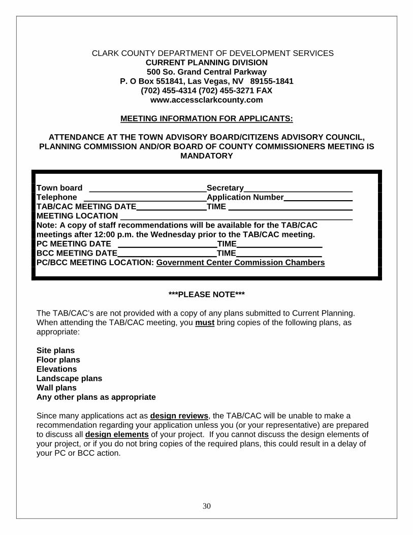
CLARK COUNTY DEPARTMENT OF DEVELOPMENT SERVICES CURRENT PLANNING DIVISION 500 So. Grand Central Parkway
P. O Box 551841, Las Vegas, NV 89155-1841 (702) 455-4314 (702) 455-3271 FAX
www.accessclarkcounty.com
MEETING INFORMATION FOR APPLICANTS:
ATTENDANCE AT THE TOWN ADVISORY BOARD/CITIZENS ADVISORY COUNCIL, PLANNING COMMISSION AND/OR BOARD OF COUNTY COMMISSIONERS MEETING IS
MANDATORY
Town board Secretary Telephone Application Number__________ TAB/CAC MEETING DATE TIME _______________________ MEETING LOCATION Note: A copy of staff recommendations will be available for the TAB/CAC meetings after 12:00 p.m. the Wednesday prior to the TAB/CAC meeting. PC MEETING DATE ______________________TIME___________________ BCC MEETING DATE______________________TIME___________________ PC/BCC MEETING LOCATION: Government Center Commission Chambers
***PLEASE NOTE***
The TAB/CAC’s are not provided with a copy of any plans submitted to Current Planning. When attending the TAB/CAC meeting, you must bring copies of the following plans, as appropriate: Site plans Floor plans Elevations Landscape plans Wall plans Any other plans as appropriate Since many applications act as design reviews, the TAB/CAC will be unable to make a recommendation regarding your application unless you (or your representative) are prepared to discuss all design elements of your project. If you cannot discuss the design elements of your project, or if you do not bring copies of the required plans, this could result in a delay of your PC or BCC action.
30

CLARK COUNTY DEPARTMENT OF DEVELOPMENT SERVICES
CURRENT PLANNING DIVISION REQUIRED EXHIBITS
LAND USE APPLICATION SUBMITTAL
REQUIREMENTS
All documents accompanying applications must be legible and suitable for microfilm and imaging reproduction, and include the information described below. All documents submitted are available to the public for inspection and copying. All plans must be accurate drawn to a standard scale not smaller than one (1) inch equals sixty (60) feet, or one-eighth (1/8) inch equals one (1) foot, dimensioned, and folded so they can be placed into a legal size (11x14”) file. The required documentation must be provided for the application to be accepted.
1. Application.
A signed application, notarized when required by the Zoning Administrator, detailing the nature and justification for the request. For corporate signatories or non-legible signature, corporate declaration of authority must accompany the application. Ownership/Applicant Disclosure Form completely filled out and signed by an approved authority.
2. Site Plans.
A. Site development plans showing the uses of the parcel of land, existing and proposed structures, setbacks, yards and open space, maximum slope of property (if in excess of twelve (12%) percent, see Chapter 30.56 for hillside development), lot layout (including legend showing setbacks), the size and number of required and provided parking spaces, routes of vehicular access, the location of signs, the location of landscaping, trash enclosures, group mail delivery boxes, loading spaces, sight zones, and any other information that is necessary for the Zoning Administrator to evaluate the request. Proposed development shall be shown on the entire parcel or parcels included within the application. Plans accompanying applications for zone boundary amendment and accompanying applications may be conceptual, however, if so, a Design Review may be required at the discretion of the Commission or Board, for any site development changes.
B. For an annexation request, reconveyance, and vacation and abandonment, the plan
shall show the property proposed to be annexed, reconveyed or vacated, the adjacent parcels, and the political jurisdiction to which the adjacent parcels belong.
3. Floor Plans.
Floor plans indicating the size of existing and proposed buildings, the use of space and total square footage of buildings. Plans accompanying applications for zone boundary amendment may be conceptual, however, if so, a Design Review may be required.
4. Elevation.
31

Elevations indicating the architectural appearance, the types of building materials proposed for the exterior, and the height of the existing and proposed buildings. At the discretion of the Zoning Administrator, photographs of existing structures may be substituted for required elevations. Plans accompanying applications for zone boundary amendment may be conceptual, however, if so, a Design Review may be required.
5. Landscape Plan (or shown on site plan).
Plans accompanying applications for zone boundary amendment may be conceptual, however if so, a Design Review may be required. Plans showing:
A. Landscaped areas in relation to property lines, pavement, streets, and buildings. B. The common name, botanical name, size, number and location of existing and
proposed plant materials and non-living ground cover. C. Water features, fences and retaining walls. D. Total landscape area in square feet, with amount of turf separately listed.
E. Grading to show retention of precipitation when possible.
F. Notes to address maintenance and installation materials.
6. Locator Map.
A map that shows the location of residential developments, structures for religious services, and public or private schools within two thousand five hundred (2,500) feet of the property upon which the establishment is to be located.
7. Assessor’s Map(s).
The most recent official Assessor’s plat map or maps, to scale, full-size (11x17”) indicating the subject parcels, together with a list of all of the parcel numbers included within the proposal if more than one (1) parcel is involved. For street naming, street name or numbering change, and vacation and abandonment applications, Assessor’s maps for the entire alignment affected by the application shall be required.
8. Zone Boundary Map/Legal Description.
When multiple zoning districts are requested with a single application, the legal description for the area of each zone boundary shall be typed on a clean sheet of paper, together with maps showing the proposed district boundaries.
9. Deed.
The most recent recorded deed is required. For any extension of time, the deed is required only if ownership of the property has changed since the original application’s approval.
10. Legal Description.
32

The legal description of the property shall be typed on a clean sheet of paper. The legal description of an easement and/or right-of-way to be vacated or property to be reconveyed must be typed on the “Exhibit A” form.
11. Parking Analysis.
An analysis of required parking for all existing and/or proposed uses at the location shall demonstrate adequate parking based on Chapter 30.60. The analysis may be included on the site plan in a legend.
12. Annexation Letter. 13. Justification Letter.
A letter stating justifications for the approval of a land use application, including how the proposal will produce an environment of stable and desirable character consistent with the objectives of this Title and the Comprehensive Plan, an analysis of outstanding issues, the intended uses, the impact on adjacent properties, the need for any public utility or public services, actions to be taken to minimize any detrimental impacts of the proposal, an analysis of how the proposal is consistent with the standards of approval listed for the various applications and, if applicable, the time period for which the permit is sought.
14. Letter from Fire Alarm Office.
A letter from the Fire Alarm Office that specifies that the proposed street name is in accordance with the guidelines shown in Las Vegas Valley Street Naming and Address Assignment Policy, as adopted by the Board on August 3, 1988.
15. Reports.
See 30.16.240(a)(15) {or Reports Handout} for list and description of reports. Required for non-conforming Zone Boundary Amendments, High Impact Projects, or text amendments to modify the Mixed Use Overlay District.
16. Ownership/Applicant Disclosure. A disclosure form provided by Clark County that requires applicants to list the names of individuals holding more than 5% ownership or financial interest in the business entity, or in the case of a Medical Marijuana Establishment, all individuals, appearing before the Board of County Commissioners. Except as described in 30.16.240(a)(16).
17. Fire Permit Survey Form.
18. Project Description.
19. Easements/Right-of-Way Documents.
20. Vicinity Map.
33

21. FAA Submittal.
22. Pedestrian Circulation Plan.
23. Development Agreement.
24. Residential Impact Statement. If the Zoning Administrator determines that any of the listed documents is not necessary for a particular application, he/she may waive the requirement for the submission of the document. If the nature of a particular application necessitates the submittal of additional documentation, such documentation may be required by the Zoning Administrator, Commission or Board.
34

REPORTS Each applicant applying for a non-conforming zone change and/or a project of regional significance is required to submit the following reports to the Current Planning Division with the application: NOTE: The report forms may be accessed on the County’s web site at: http://www.clarkcountynv.gov/depts/comprehensive_planning/zoning/Pages/Forms.aspx 1. Water Supply Report
2. Wastewater Treatment Report
3. Transportation Report (including Traffic, Right-of-way, and Mass Transit information)
4. Geotechnical Report
5. Flood Control and Drainage Report
6. Fire Protection and Emergency Services Report
7. Police Services Report
8. Educational Services Report
9. Neighborhood Impact Report
10. Economic and Employment Impact Report
11. Parks/Trails/Federal Lands
12. Air Quality and Environmental Review
13. Water Quality
14. Stormwater
15. Analysis Summary
16. Additional Reports (as determined by the Zoning Administrator, Commission, or Board) Incomplete reports and/or inaccurate information will delay application submittal and processing. The Comprehensive Planning Department will distribute the completed reports to the reviewing agencies. NOTE: Per Chapter 30.16.240 of the Clark County Code, all submitted documents are available to the public for inspection and copying and must be legible and suitable for microfilm and imaging reproduction. All plans must be accurate, drawing to a standard scale not smaller than one (1) inch equals sixty (60) feet, or one-eighth (1/8) inch equals one (1) foot, dimensioned, and folded so they can be placed into a legal size file.
35