circulation - city of irvine
TRANSCRIPT

Circulation

City of Irvine B-1 Circulation Element
General Plan
ELEMENT B
CIRCULATION
GOAL: Provide a balanced transportation system.
Description of Circulation Element
The overall Citywide circulation system can influence the pace of urban development and
facilitate interaction among the planning areas. Irvine’s circulation system has been
designed to:
Create a hierarchy of roadways.
Reinforce boundaries of planning areas.
Respond to conservation, noise, air pollution, and wildlife preservation policies.
Satisfy City General Plan and Strategic Business Plan objectives.
Four different types of systems compose Irvine’s circulation system: air, road, public
transit, and trails. This element describes the nature and extent of the existing circulation
network, and identifies trends, issues, and public policies relating to the development of a
balanced, multi-modal circulation system for Irvine.
Existing Conditions
Air System. The air system is comprised
of general aviation and commercial flights
from John Wayne Airport. Most of the air
transportation needs of Orange County are
met by John Wayne Airport. The flight
schedules of local airlines are regulated by
the county to minimize air and noise
pollution impacts
Road System. The City’s arterial
roadway system is shown on Figure B-1
and B-2. Figure B-1 illustrates the arterial
highway designation for roadways. Both
the County of Orange and City of Irvine
roadway designations are identified
below for reference.
City of Irvine B-2 Circulation Element
General Plan
Arterial Highways (Figure B-1)
Figure B-1 designates the type of roadway
facility, which is defined primarily by the
number of lanes within the roadway. The
facility classifications contained in Figure
B-1 are defined as follows:
Freeway: A divided state highway
with access restricted to grade
separated interchanges. Freeways
provide for movement of high
volumes of intercity traffic.
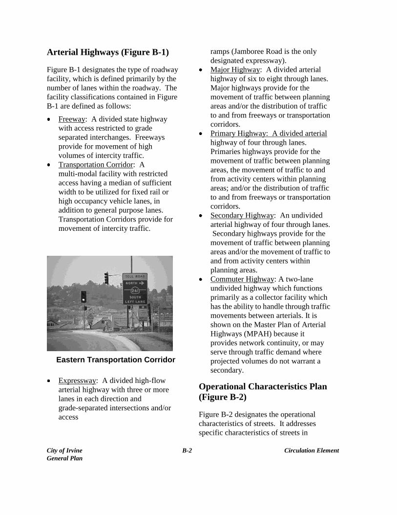
Transportation Corridor: A
multi-modal facility with restricted
access having a median of sufficient
width to be utilized for fixed rail or
high occupancy vehicle lanes, in
addition to general purpose lanes.
Transportation Corridors provide for
movement of intercity traffic.
Eastern Transportation Corridor
Expressway: A divided high-flow
arterial highway with three or more
lanes in each direction and
grade-separated intersections and/or
access
ramps (Jamboree Road is the only
designated expressway).
Major Highway: A divided arterial
highway of six to eight through lanes.
Major highways provide for the
movement of traffic between planning
areas and/or the distribution of traffic
to and from freeways or transportation
corridors.
Primary Highway: A divided arterial
highway of four through lanes.
Primaries highways provide for the
movement of traffic between planning
areas, the movement of traffic to and
from activity centers within planning
areas; and/or the distribution of traffic
to and from freeways or transportation
corridors.
Secondary Highway: An undivided
arterial highway of four through lanes.
Secondary highways provide for the
movement of traffic between planning
areas and/or the movement of traffic to
and from activity centers within
planning areas.
Commuter Highway: A two-lane
undivided highway which functions
primarily as a collector facility which
has the ability to handle through traffic
movements between arterials. It is
shown on the Master Plan of Arterial
Highways (MPAH) because it
provides network continuity, or may
serve through traffic demand where
projected volumes do not warrant a
secondary.
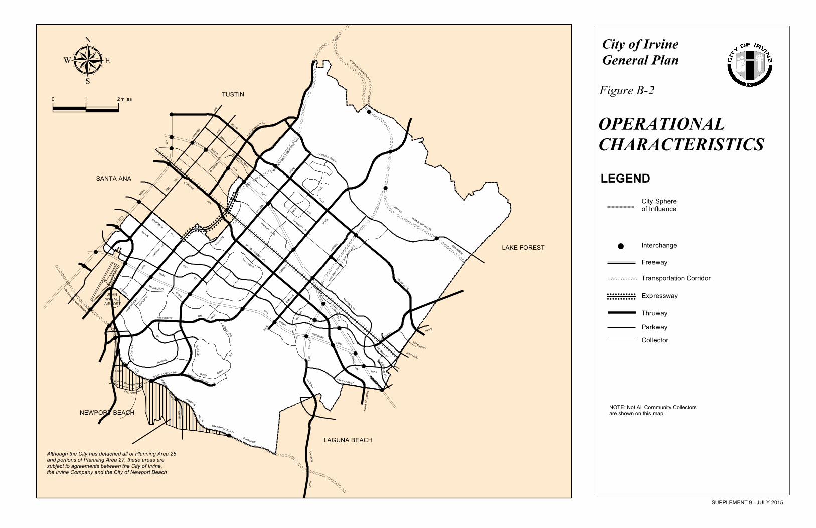
Operational Characteristics Plan
(Figure B-2)
Figure B-2 designates the operational
characteristics of streets. It addresses
specific characteristics of streets in
City of Irvine B-3 Circulation Element
General Plan
Irvine, including restricted access, parking
prohibitions, and the types of traffic
utilizing the street. The functional
operational classifications contained in
Figure B-2 are defined as follows:
Freeway: See County of Orange
definition.
Transportation Corridor: See County
of Orange definition.
Thruway: A relatively high speed
arterial highway with restricted access
supplementing the freeway system and
carrying intermediate range trips to or
between major nonresidential land
uses. A thruway has emergency
parking only, and minimal pedestrian
interference with traffic.
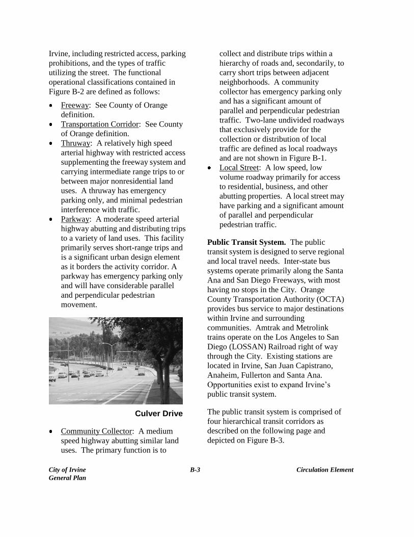
Parkway: A moderate speed arterial
highway abutting and distributing trips
to a variety of land uses. This facility
primarily serves short-range trips and
is a significant urban design element
as it borders the activity corridor. A
parkway has emergency parking only
and will have considerable parallel
and perpendicular pedestrian
movement.
Culver Drive
Community Collector: A medium
speed highway abutting similar land
uses. The primary function is to
collect and distribute trips within a
hierarchy of roads and, secondarily, to
carry short trips between adjacent
neighborhoods. A community
collector has emergency parking only
and has a significant amount of
parallel and perpendicular pedestrian
traffic. Two-lane undivided roadways
that exclusively provide for the
collection or distribution of local
traffic are defined as local roadways
and are not shown in Figure B-1.
Local Street: A low speed, low
volume roadway primarily for access
to residential, business, and other
abutting properties. A local street may
have parking and a significant amount
of parallel and perpendicular
pedestrian traffic.
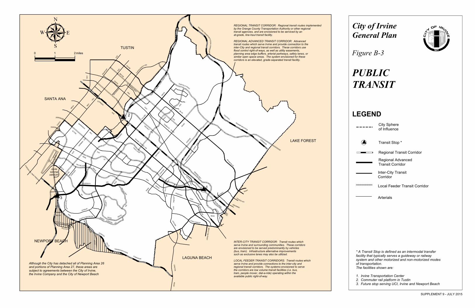
Public Transit System. The public
transit system is designed to serve regional
and local travel needs. Inter-state bus
systems operate primarily along the Santa
Ana and San Diego Freeways, with most
having no stops in the City. Orange
County Transportation Authority (OCTA)
provides bus service to major destinations
within Irvine and surrounding
communities. Amtrak and Metrolink
trains operate on the Los Angeles to San
Diego (LOSSAN) Railroad right of way
through the City. Existing stations are
located in Irvine, San Juan Capistrano,
Anaheim, Fullerton and Santa Ana.
Opportunities exist to expand Irvine’s
public transit system.
The public transit system is comprised of
four hierarchical transit corridors as
described on the following page and
depicted on Figure B-3.
City of Irvine B-4 Circulation Element
General Plan
Regional Transit Corridors: Transit
corridors are implemented by the
Orange County Transportation
Authority or other regional transit
agencies, and are envisioned to be
serviced by an at-grade, line-haul
transit facility.
Intercity Public Transit Corridors:
Secondary transit corridors provide
connections between Irvine and other
destinations serving both inter- and
intracity traffic. The corridors are
envisioned to be served predominantly
by rubber-tired vehicles (i.e., bus,
tram). Alternative improvements such
as exclusive lanes for high occupancy
vehicles (HOV lanes) may also be
utilized.
Intracity Public Transit Corridors:
Local public transit corridors serve
planning areas, providing a feeder
system to the intercity and regional
transit corridors. The systems
envisioned to serve the corridors are
low volume transit facilities (i.e., bus,
tram, people mover, dial-a-ride)
operating within the available public
right of way.
Intra-City Advanced Transit Corridor:
Corridors connect to the regional
transit corridors to serve both inter-
and intracity travel needs. The
corridors entail the maximum usage of
overlapping or multipurpose right of
ways, including primarily the flood
control right of ways, as well as utility
easements, planning area edge buffers,
arterial parkways, safety lanes, or
similar open space areas, as
appropriate to preserve the
opportunity for implementing a future
advanced transit system. This system
is envisioned to be served by an
elevated, grade-separated transit
facility.
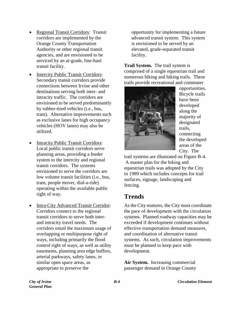
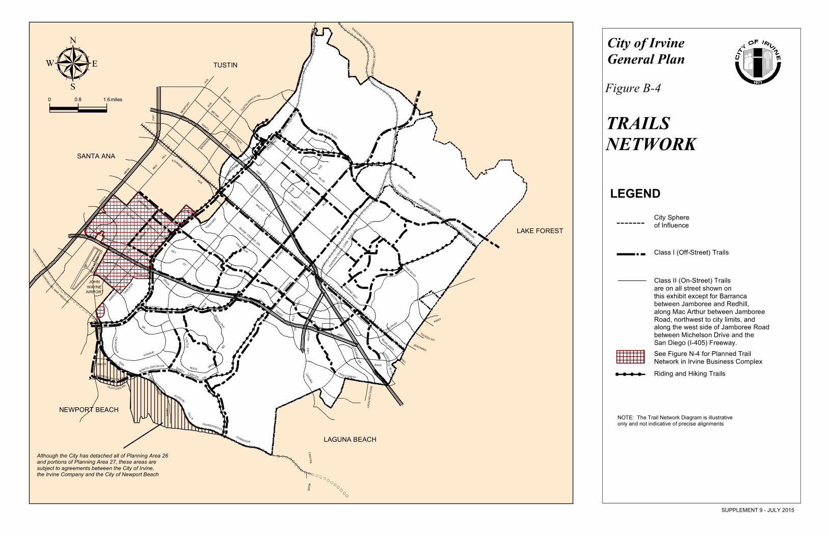
Trail System. The trail system is
comprised of a single equestrian trail and
numerous biking and hiking trails. These
trails provide recreational and commuter
opportunities.
Bicycle trails
have been
developed
along the
majority of
designated
trails,
connecting
the developed
areas of the
City. The
trail systems are illustrated on Figure B-4.
A master plan for the hiking and
equestrian trails was adopted by the City
in 1989 which includes concepts for trail
surfaces, signage, landscaping and
fencing.
Trends
As the City matures, the City must coordinate
the pace of development with the circulation
systems. Planned roadway capacities may be
exceeded if development continues without
effective transportation demand measures,
and coordination of alternative transit
systems. As such, circulation improvements
must be planned to keep pace with
development.
Air System. Increasing commercial
passenger demand in Orange County
City of Irvine B-5 Circulation Element
General Plan
will probably not be totally
accommodated at John Wayne Airport
due to numerous environmental and
political constraints. The number of daily
departures from John Wayne Airport is
limited by a settlement agreement
negotiated between the County of Orange,
the City of Newport Beach (which lies
under the flight path of aircraft taking off
from the airport), the Airport Working
Group, and Stop Polluting Our Newport.
This agreement caps the annual number of
passengers at 8.4 million, until its
expiration in 2005. It is expected that upon
expiration of the agreement there will be
opposition to more intensive use of John
Wayne Airport. However, due to increases
in population, passenger demand is
expected to increase in Orange County.
MCAS-El Toro and MCAS Tustin were
both closed in 1999. As a result, reuse
plans for both bases are currently being
developed. Although Irvine is not the lead
agency, the City is reviewing these plans.
Objective B-7, Air Transportation System,
and its related policies are intended to
protect the City as demand for air
transportation increases and new land use
plans for the closing military bases are
adopted.
Road System. The City must plan for a
doubling of its residential population and
tripling of its employment population.
As such, jobs-to-housing relationships
will play an important part in
understanding circulation impacts from
development. Due to the large capital
outlay already spent and future outlay
anticipated, it can be assumed that the
automobile will continue to be an
important transportation mode.
Recognizing the role of the automobile,
the City, correlates the circulation
network (Figure B-1) with General Plan
land use through its planning efforts,
(Table A-1). The City utilizes a
computer traffic model to assist in
analyzing proposed land use changes. In
order to ensure the proper use of the
model, the City reviews and updates the
land use assumptions, traffic generation
rates and other factors utilized in the
computer model. Transportation demand
management measures (i.e., ride sharing,
flexible work hours, telecommuting, etc.)
are significant tools to reduce vehicular
demand rather than increasing system
capacity and are closely coordinated with
the City’s computer model.
Public Transit. Public transit should
become an increasingly viable
transportation mode as operating costs
for private autos increase, roadway
congestion increases, and lack of
accessibility to private autos for certain
groups (i.e., elderly, handicapped, low
income) increases. While public transit
may never supplant the automobile as the
primary mode of transportation, its
implementation and use will help
alleviate street congestion, as well as
provide a more economical means of
transportation.

City of Irvine B-6 Circulation Element
General Plan
Irvine Transportation Center
Trail System. It is expected that
bicycle/pedestrian trails will continue to
be developed concurrent with adjacent
development. The hiking and equestrian
trails will also be developed as the City
grows.
Identification of Issues
1. How can the City plan for a
vehicular circulation system which
accommodates both local and
regional land use and circulation
needs?
2. How can the City reduce,
eliminate, or mitigate negative
environmental impacts of the
circulation system?
3. How can the City encourage the
use of a more balanced
multi-modal circulation system?
4. How can the City preserve
opportunities for future advanced
rapid transit systems?
5. How can the City maximize the
positive attributes of the existing
air facilities within and adjacent to
the City, while minimizing the
negative or potentially negative
impacts?
6. To provide adequate circulation
capacity, the City should maintain
a functional mix of land uses and
an adequate relationship between
housing and employment
opportunities. How can the City
provide an adequate
jobs-to-housing balance?
7. How can the City enhance
alternative transit modes?

City of Irvine B-7 Circulation Element General Plan Supplement 9, July 2015
Response to Issues
The following objectives, and policies have been formulated as policy to respond to circulation issues.
OBJECTIVE B-1: ROADWAY DEVELOPMENT
Plan, provide and maintain an integrated vehicular circulation system to accommodate projected local and regional needs.
The following policies support Objective B-1:
Policy (a): Use the Circulation, Land Use and Growth Management Elements to determine roadway sizing and phasing.
Policy (b): Use Figure B-1, Master Plan of Arterial Highways, for the purpose of detailed planning of the circulation network.
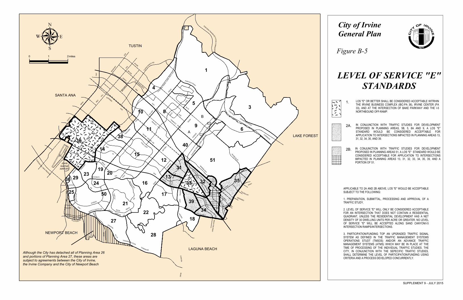
Policy (c): Develop, on an incremental basis, a vehicular circulation system responding to local and regional access requirements. The following Level of Service (LOS) Standards shall be the goal applied to arterial highways, as shown in Figure B-1 and Figure B-5, which are in the City of Irvine or its sphere of
influence, and which are under the City’s jurisdiction.
1. LOS “E” or better shall be considered acceptable within the Irvine Business Complex (IBC-PA 36), Irvine Center (PA 33), and at the intersection of Bake Parkway and the I-5 northbound off-ramp.
2a. In conjunction with traffic studies for development proposed in Planning Areas 5B, 6, 8A and 9, a LOS “E” standard would be considered acceptable for application to intersections impacted in Planning Areas 13, 31, 32, 34, 35 and 39.
2b. In conjunction with traffic studies for development proposed in Planning Area 51, a LOS “E” standard would be considered acceptable for application to intersections impacted in Planning Areas 13, 31, 32, 34, 35 and 39 and a portion of 51.
Applicable to 2a and 2b above. LOS “E” would be acceptable subject to the following:
1. Preparation, submittal, processing and approval of a traffic study for the specific subdivision map.
2. Level of Service “E” will only be considered acceptable for an intersection that does not contain a residential quadrant unless the
City of Irvine B-8 Circulation Element General Plan Supplement 9, July 2015
3. residential development has a net density great of 30 dwelling units to the acre or greater. No Level of Service “E” will be accepted along Sand Canyon except at the Sand Canyon/I-5 Interchange ramps/intersections.
4. Participation/funding to an upgraded traffic signal system as defined in the Traffic Management Systems Operations Study (TMSOS) and/or an Advance Traffic Management System (ATMS), which may be in place at the time of processing of the individual traffic study. The City, in conjunction with the specific traffic study, shall determine the level of participation/funding using criteria and a process developed concurrently.
LOS “D” or better shall be considered acceptable within all other areas.
Policy (d): Evaluate the incremental additions to the roadway system through use of the City transportation model.
Policy (e): Cooperate with state, county, and local governments to assure orderly development.
Policy (f): Work with the county, landowners, and other agencies in developing compatible land use and circulation plans for the area northerly of the sphere of influence, recognizing that new development in this area can have a significant impact on the existing City circulation system.
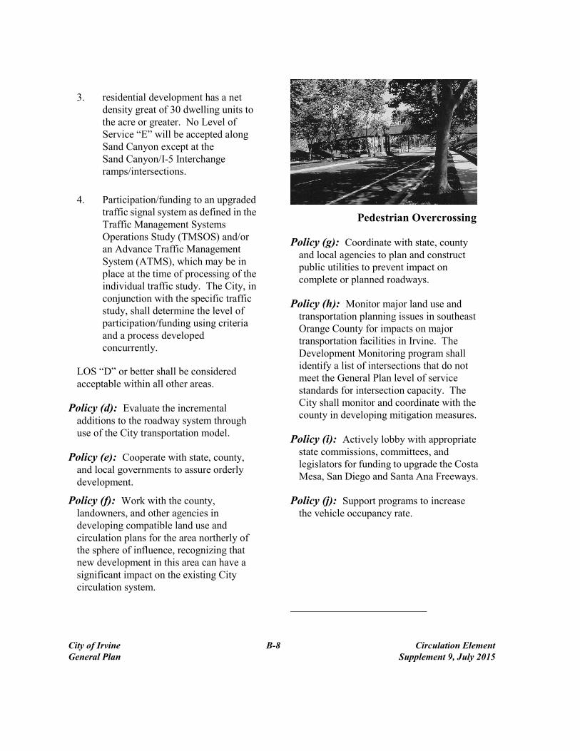
Pedestrian Overcrossing
Policy (g): Coordinate with state, county and local agencies to plan and construct public utilities to prevent impact on complete or planned roadways.
Policy (h): Monitor major land use and transportation planning issues in southeast Orange County for impacts on major transportation facilities in Irvine. The Development Monitoring program shall identify a list of intersections that do not meet the General Plan level of service standards for intersection capacity. The City shall monitor and coordinate with the county in developing mitigation measures.
Policy (i): Actively lobby with appropriate state commissions, committees, and legislators for funding to upgrade the Costa Mesa, San Diego and Santa Ana Freeways.
Policy (j): Support programs to increase the vehicle occupancy rate.
City of Irvine B-9 Circulation Element
General Plan
Policy (k): Study arterial links listed in
this policy to determine that the
proposed augmentations, if necessary,
are adequate to accommodate traffic
demand at build out of the General
Plan. As part of any evaluation of an
arterial augmentation proposal, travel
demand reduction measures shall also
be analyzed to determine if they can be
implemented in lieu of augmentation.
Arterial augmentations include
improvements to signal timing or
coordination, additional intersection
through or turn lanes, auxiliary lanes,
intersection grade separations, and
eight lane major highways.1
Augmentation proposals, other than those
that are operational in nature (e.g. signal
timing, signal coordination and minor
restriping), shall be evaluated and
approved by the Transportation and
Infrastructure and Planning
Commissions. Augmentation proposals
related to a development case may be
reviewed in connection with the
processing of the development case.
1ARTERIAL CAPACITY AUGMENTATIONS
Improvement Capacity Augmentation*
Signal timing/coordination Up to 10%
Additional right or left turn lanes 10% to 33%
Additional through lanes at intersection 20% to 35%
Auxiliary lanes 20% to 35%
Eight lane major 33%
Intersection grade separation (flyover) 100%
*Effective operational capacity augmentation may be significantly less
due to variations in intersection traffic flow patterns.
The following list was identified for
further study as a result of the
Conservation/Open Space General Plan
Amendment (GPA-16).
Alton Parkway from Jeffrey Road to
approximately 2,500 feet east of Jeffrey
Alton Parkway from unnamed PA 12
north-south road to Sand Canyon
Ford Road from the San Joaquin Hills
Transportation Corridor to MacArthur
Boulevard
Laguna Canyon Road from State
Route-133 to Bake Parkway
Irvine Boulevard from unnamed arterial
to the west leg of the Eastern
Transportation Corridor
Culver Drive from Main Street to
Michelson Drive
Sand Canyon Road from Alton
Parkway to Interstate-405
Bison from California to MacArthur
Boulevard
Barranca Parkway from Technology to
Irvine Center Drive
Alton Parkway from Technology to
Interstate
Bake Parkway from Rockfield to
Interstate-5
Irvine Center Drive from Alton
Parkway to Bake Parkway
Other arterial links not listed herein may
be augmented as necessary in accordance
with this implementing action. 2
2Augmented capacity methodology is detailed in the City of Irvine
Conservation/Open Space Traffic Study prepared by Austin-Foust
Associates, Inc. (See Appendix A, EIR 82-GA-0016).

City of Irvine B-10 Circulation Element
General Plan
Policy (l): Implement a transportation
management program for the Irvine
Business Complex (PA 36) with a goal
to reduce p.m. peak hour vehicle trips
by 15 percent.
Policy (m): Work with the University of
California at Irvine, consistent with the
City of Irvine and UCI Culver Drive
Memorandum of Understanding, to
realign Culver Drive west along the
University’s property, in order to
minimize environmental impacts to
residential developments in Planning
Area 21, adjacent to Culver Drive.
Policy (n): Design roadways which
ensure safe and efficient traffic flow
while also providing adequate and
convenient access to retail sites.
Policy (o): Monitor and update ITAM
Trip Generation Rates as required to
maintain consistency with changes in
development, as well as with changes
in any pertinent regional traffic model.
Any changes to trip generation rates
shall be analyzed to determine any
effects on the Level of Service (LOS)
Standards and intersection capacity
standards. Such changes shall be
reviewed by the Transportation and
Infrastructure Commission and
Planning Commission, and approved
by the City Council.
Policy (p): Secure public support for the
development of a balanced circulation
system through a well-organized public
relations program.
Policy (q): Ensure development within
other planning areas within the City of
Irvine will not be responsible for
funding and construction of IBC
area-wide circulation improvements, if
consistent with the land use
assumptions in the IBC Program
Environmental Impact Report (PEIR).
Policy (r): Pursue local and outside
funding for the implementation of the
roadway system from sources.
OBJECTIVE B-2:
ROADWAY DESIGN
Develop a vehicular circulation
system consistent with high
standards of transportation
engineering safety and with
sensitivity to adjoining land uses.
The following policies support Objective B-2:
Policy (a): Align roadways in
relationship to adjoining land uses to
minimize noise and visual impacts.
Policy (b): Design roadways to mitigate
vehicle noise through:
Physical barriers, such as berms
which would permit residential
units to be effectively screened
from excessive noise.
Semi-depressed roadways, in
conjunction with berms and belts of
trees, where feasible.
Policy (c): Design roadways to follow
the natural terrain and the least
City of Irvine B-11 Circulation Element
General Plan
environmentally damaging routes,
particularly in hillside areas.
Policy (d): Ensure that existing
roadways are designed to complement
other circulation networks without the
need for major reconstruction.
Policy (e): Design roadways which:
Discourage through traffic in
residential neighborhoods.
Prohibit parking on all thruways,
parkways, and community collectors.
Limit the routes, speeds, and
operation types of trucks and buses.
Policy (f): Visually enhance the
appearance of roadways and parking
areas through design techniques and
landscaping. Particular attention should
be paid to streetscape design and the
creation of new, and preservation of
existing, view corridors.
Policy (g): Include mitigation measures
in the approval of all proposed
developments to minimize negative
impacts of the automobile.
Policy (h): Properly space and
interconnect traffic signals in order to
minimize the number of traffic signals,
and the acceleration/deceleration that
produces significantly higher vehicular
emissions and noise levels.
Policy (i): Utilize traffic control device
systems that are understandable,
attractive, simple, uniform, and visible.
Policy (j): Implement Transportation
Management Plans developed for
Irvine Industrial Complex (Spectrum)
and Irvine Business Complex.
City of Irvine B-12 Circulation Element
General Plan
Level of Service Standards
Level of Service (LOS) Standards are
defined for intersections and roadway
links (Figure B-1) as follows:
Level of Service “A”: The
volume/capacity ratio ranges from .0 to
.60. At this LOS, traffic volumes are low
and speed is not restricted by other
vehicles. All signal cycles clear with no
vehicles waiting through more than one
original cycle. For roadway links, this
LOS indicates no physical restriction on
operating speeds.
Level of Service “B”: The
volume/capacity ratio ranges from .61 to
.70. At this LOS, traffic volumes begin
to be affected by other traffic. Between
1 and 10 percent of the signal cycles have
one or more vehicles which wait through
more than one signal/cycle during peak
traffic periods. For roadway links, this
LOS indicates flow with few restrictions
on operating speeds.
Level of Service “C”: The
volume/capacity ratio ranges from .71 to
.80. At this LOS, operating speeds and
maneuverability are closely controlled by
other traffic. Between 11 and 30 percent
of the signal cycles have one or more
vehicles which wait through more than
one signal cycle during peak traffic
periods. For roadway links, this LOS
indicates stable flow, higher volume, and
more restrictions on speed and lane
changing.
Level of Service “D”: The
volume/capacity ratio ranges from .81 to
90. At this LOS, traffic will operate at
tolerable operating speeds, although
with restricted maneuverability.
More than 30 percent of the signal
cycles have one or more vehicles which
wait through more than one signal cycle
during peak traffic hours. For roadway
links, this LOS indicates tolerable
conditions, approaching unstable flow,
and little freedom to maneuver.
Level of Service “E”: The
volume/capacity ratio ranges from .91 to
1.0. Traffic will experience restricted
speeds, vehicles will frequently have to
wait through two or more cycles at
signalized intersections, and any
additional traffic will result in
breakdown of the traffic carrying ability
of the system. For roadway links, this
LOS indicates unstable flow; lower
operating speeds than LOS D and some
momentary stoppages.
Level of Service “F”: Long queues of
traffic, unstable flow, stoppages of long
duration where traffic volumes and traffic
speed can drop to zero. Traffic volumes
will be less than the volume which occurs
at Level of Service “E.” For roadway
links, this LOS indicates forced flow
operation at low speeds where the
roadway acts as a storage area and there
are many stoppages.

City of Irvine B-13 Circulation Element
General Plan
Policy (k): Continue to monitor and develop
solutions to the Irvine Business Complex
(IBC) traffic. This is a mutual effort of the
affected agencies (e.g. Caltrans, Orange
County Transportation Commission, etc.)
Policy (l): Periodically review the impact of
increases in the San Diego and Santa Ana
Freeway traffic on utilization of parkways
in the east-west activity corridor.
Policy (m): Require, at the time Campus
Drive, University North and California
Avenue are proposed to be improved to
their General Plan designation,
environmental studies that consider
alternative roadway designs to at-grade
level designs, to ensure that the
ecologically significant adverse biotic
impacts are avoided, or mitigated to a level
of insignificance.
Policy (n): List Yale Avenue between
University Drive on the south and Yale
Loop on the north on the General Plan
Operational Characteristics diagram as a
“collector” and as a “commuter” (two-lane
roadway) on the Arterial Highway
Designation diagram. The cross section of
Yale Avenue across the San Diego
Freeway shall provide for two travel lanes
(one in each direction), bicycle lanes and
sidewalks. The roadway may widen to
meet the existing cross section of Yale
Avenue at the Michelson and University
intersections. The existing roadway
between Yale, Michelson and University
may be narrowed, or a median installed, to
limit the roadway to two lanes, plus turning
lanes.3
3Implementing actions n, p, q, r and s have been completed. However, due to a
voter initiative, Measure B, they are required to remain in the General Plan.
Policy (o): List Yale Avenue between
Deerfield Avenue on the south and
Edgemere Avenue on the north on the
General Plan Operational Characteristics
diagram as a “collector” and as a
“commuter” (two-lane roadway) on the
Arterial Highway Designation diagram.
The cross section of Yale Avenue across
the AT&SF railroad shall provide for two
travel lanes (one in each direction), bicycle
lanes and sidewalks. The roadway may
widen to meet the existing cross section of
Yale Avenue at the Deerfield and Winvale
intersections.3
Policy (p): Construct noise walls (where
needed) on Yale Avenue between
University and Yale Loop so that no
residences along Yale Avenue between
Yale Loop and University are exposed to
noise levels in excess of City standards.3
Policy (q): Construct noise walls (where
needed) on Yale Avenue between
Deerfield and Winvale so that no
residences along Yale Avenue between
Irvine Center Drive and Walnut Avenue
are exposed to noise levels in excess of
City standards. 3
Policy (r): Landscape Yale Avenue between
Deerfield and Winvale such that off site
views of the project are mitigated to City
standards. 3
City of Irvine B-14 Circulation Element
General Plan
Policy (s): Install traffic signals at the
intersection of Yale and Deerfield prior to
opening Yale Avenue between Deerfield
and Winvale. 3
OBJECTIVE B-3:
PEDESTRIAN CIRCULATION
Establish a pedestrian circulation
system to support and encourage
walking as a mode of transportation.
The following policies support Objective B-3:
Policy (a): Link residences with schools,
shopping centers, and other public
facilities, both within a planning area and
to adjacent planning areas, through an
internal system of trails.
Policy (b): Require development to provide
safe, convenient, and direct pedestrian
access to surrounding land uses and transit
stops. Issues such as anticipated
interaction between pedestrians and
vehicles, proposed infrastructure
improvements and design standards shall
be considered.
Policy (c): Design and locate land uses to
encourage access to them by
nonautomotive means.
Irvine Ballot Measure “B”
On June 5, 1990, the residents of the City
approved Ballot Measure “B” which amended the
General Plan for vehicular overcrossings of Yale
Avenue at the AT&SF railroad and the San Diego
Freeway (I-405). To date, the vehicular
overcrossing at the AT&SF railroad has been
constructed according to the following provisions
of Measure “B”:
Between Deerfield and Edgemere, Yale is
shown as a collector on the MPAH and as a
commuter on the Operational Characteristics
diagram. The section at the AT&SF crossing
provides for one vehicle lane in each
direction, bicycle lanes and sidewalks.
Yale between Winvale and Deerfield must
contain noise walls so that no residences
along Yale are exposed to noise in excess of
City standards.
Yale between Deerfield and Winvale must be
landscaped so that off-site views of the
project are mitigated to City standards.
Policies n, p, q, r and s must remain in the General
Plan unless repealed by a Citywide vote.
City of Irvine B-15 Circulation Element
General Plan
OBJECTIVE B-4:
BICYCLE CIRCULATION
Plan, provide and maintain a
comprehensive bicycle trail network
that together with the regional trail
system, encourages increased use of
bicycle trails for commuters and
recreational purposes.
The following policies support Objective B-4:
Policy (a): Use the Trails Network diagram
(Figure B-4) as a basis for detailed planning
of the bicycle trail system. Detailed planning
shall occur through the development
processes outlined in the City’s Zoning and
Subdivision Ordinances.
Policy (b): Require a system of bicycle trails,
both on- and off-street, in each planning area.
Such trails shall be linked to the system
shown in Figure B-4. The on-street trails
shall be designed for the safety of the cyclist.
Policy (c): The trail system shall be designed
to accommodate cyclists of all levels of
experience and shall provide for both
recreation and transportation.
Policy (d): Require bicycle trail linkages
between residential areas, employment areas,
schools, parks, community facilities,
commercial centers, and transit facilities.
Policy (e): Require pedestrian and bicycle
circulation plans detailing access to the
subject property and adjacent properties in
conjunction with new development.
Policy (f): Require that bicycle trip
destinations, including community facilities,
commercial centers, and transit facilities be
equipped with appropriate bicycle facilities
including, but not limited to, the provision of
showers and bike racks.
Policy (g): Require traffic control devices and
traffic signal phasing for bicycle crossing,
turning, and through movements.
Policy (h): Require grade-separated crossings
for Class I bikeways at major intersections,
wherever feasible, to increase safety and
efficiency. Policy (i): Provide off-street bicycle trails in
areas with minimal cross traffic, such as open
space spine, flood control and utility
easements, where possible.
Policy (j): Support programs to increase
public awareness of bicycle safety and
bicycling as an alternative mode of
transportation.
Policy (k): Incorporate, where appropriate,
school and park locations within the design
of the bikeway system.
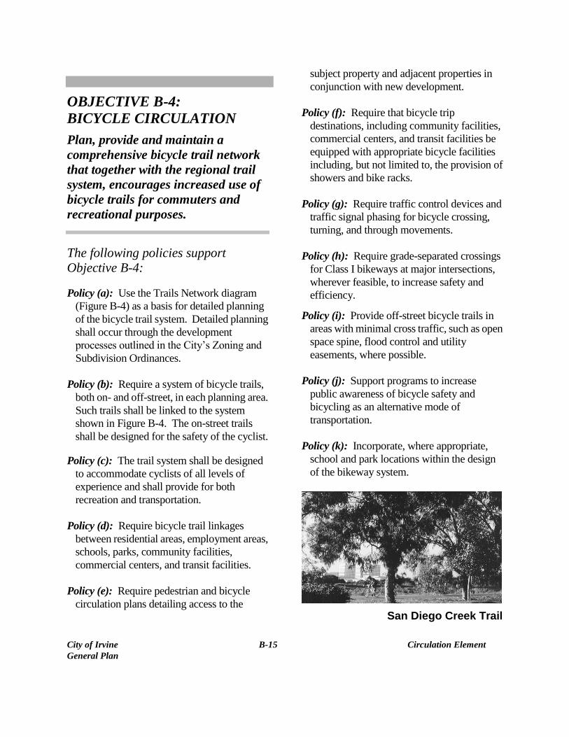
San Diego Creek Trail

City of Irvine B-16 Circulation Element
General Plan
OBJECTIVE B-5:
RIDING AND HIKING TRAIL
NETWORKS
Plan, develop and maintain a riding
and hiking trail network and support
facilities to satisfy the needs of riders
and hikers.
The following policies support
Objective B-5:
Policy (a): Phase expansion of the riding and
hiking trail network consistent with the
City’s growth.
Policy (b): Locate and maintain riding and
hiking trails as illustrated on Figure B-5,
Trails Network, and in areas identified as
permanent open space, scenic highway
corridors, agricultural edges, public utility
rights of way and easements, flood control
channels, and areas designated for rural and
estate density.
Policy (c): Encourage the development of trail
facilities that minimize impacts on existing
or planned development and wildlife
preservation areas.
Policy (d): Provide and maintain equestrian
staging areas, rest stops and boarding centers
at locations which provide easy access to the
trail system and are away from high-density
urban areas.
Policy (e): The Master Plan for Riding and
Hiking Trails shall include a precise plan for
riding and hiking trails to:
Pedestrian Trail
Identify trail alignments, standards,
priorities for development, and
recommended support facility locations
Depict the exact locations where riding,
hiking and bicycle trails shall share a
common surface
Provide a mechanism whereby City trails
can be submitted for inclusion in Orange
County’s Master Plan of Riding and
Hiking Trails.
Policy (f): Require developer dedication and
final improvement of the trail alignments as
shown in the master plan.
Policy (g): Monitor and seek funds for trail
system development and maintenance from
all available sources.
City of Irvine B-17 Circulation Element
General Plan
Policy (h): Ensure in Planning Area 4 that an
east/west trail connection to Hicks Canyon
Trail (i.e. County of Orange Foothill Trail) is
provided, per the City’s Master Plan of
Riding and Hiking Trails.
OBJECTIVE B-6:
PUBLIC TRANSIT PROGRAM
Work with Orange County
Transportation Authority to
implement a public transit system for
trips within the City and adjacent
areas.
The following policies support Objective B-6:
Policy (a): Plan residential, commercial, and
industrial areas to enable effective use of
public transit.
Policy (b): Consider emergency parking lanes
on arterial highways potential public transit
corridors.
Policy (c): Coordinate with OCTA to:
Implement a bus service network in and to
the City as a feasible alternative to the use
of the automobile.
Provide bus service to existing land uses to
maximize patronage.
Pursue additional transit service to the
City.
Policy (d): Undertake detailed planning of an
advanced transit network (including local
and activity center systems) encompassing
the City and its sphere of influence as
illustrated in Figure B-3.
Policy (e): Adopt a master plan of potential
advanced intracity transit routes which
includes a detailed study of transit
technologies.
Policy (f): Coordinate the development of
intracounty and regional transit stops with
Irvine’s intracity transit system.
Policy (g): Overlay transit routes on planning
area edges, parkways, safety lanes, flood
control channels, and other open space where
feasible. Exclusive transit rights of way may
be required where no such overlay is
feasible.
Policy (h): Encourage the short-term use of
rights of way reserved for the various
circulation systems for other uses, such as
recreational open space.
Policy (i): Require the applicants of new
developments, at the time of tentative tract
map submittal to indicate the precise location
of transit routes.
Policy (j): Reserve railroad rights of way for
regional transit corridors.
Policy (k): Nothing in this Circulation
Element should be construed as a
commitment by the City to establish a
separate transportation authority or a
City-funded bus system separate from
systems run by OCTA or other public and
private entities.
City of Irvine B-18 Circulation Element
General Plan
OBJECTIVE B-7:
AIR TRANSPORTATION
PROGRAM
Promote improved air transportation
for Orange County while minimizing
noise and air pollution.
The following policies support Objective B-7:
Policy (a): Coordinate public and local transit
with planning for air transportation.
Policy (b): Support expansion of service at
John Wayne Airport as long as all
environmental impacts such as noise, air
pollution, and traffic congestion can be
mitigated
Policy (c): Oppose commercial use of former
MCAS El Toro and continue liaison with
surrounding communities in organizing and
supporting opposition to such use.
Policy (d): Encourage use of Los Angeles and
Ontario International Airports for continental
and international flights. Explore
commercial airport potential of existing and
closing military facilities within Los
Angeles, San Bernardino, Riverside and San
Diego counties, as well as existing
commercial airport and general aviation
airports which have expansion potential in
order to meet the growing passenger demand
on a regional basis. Discourage the
development or expansion of airfields which
are not now operating as commercial
airports, or the expansion of existing
commercial airports which would adversely
impact existing urban communities.
Policy (e): Develop, in cooperation with the
City of Newport Beach, an activity center
transportation system to alleviate the ground
access congestion related to John Wayne
Airport.
Policy (f): Encourage the development of
high-speed ground transportation systems to
supplement the air system for meeting
regional travel needs.
OBJECTIVE B-8:
TELECOMMUNICATIONS
PROGRAM
Promote the use of
telecommunications by Irvine
residents, employers, employees and
students as a means to reduce air and
noise pollution generated by
automobile traffic.
The following policies support Objective B-8:
Policy (a): Encourage the private sector to
participate in, and to be the primary provider
of, telecommunications infrastructure and
services for the community.
Policy (b): Ensure that leading edge
telecommunication services are available to
all businesses and residents within the
community, and are considered in the
planning of future development and
infrastructure improvements.
City of Irvine B-19 Circulation Element
General Plan
Policy (c): Assume the role of a facilitator to
encourage productive communications
between public and private sector agencies
with regard to telecommunications issues
and services.
Policy (d): Protect the public’s assets (i.e.,
streets, parks) against unmitigated impacts of
telecommunications infrastructure
development.
Policy (e): Retain and ensure the
community’s high standards for aesthetics,
now and in the future.
Policy (f): Ensure that adequate and secure
bandwidth for Public Safety and other City
communications are continuously
considered.
“Everything in life is somewhere else, and
you get there in a car.”
E.B. White
RELATED OBJECTIVE NUMBERS
The following objectives are related to the
Circulation Element:
Land Use Element - A-3, A-4, A-6, A-7
Housing Element - C-1, C-2, C-7
Noise Element - F-1
Public Facilities Element - G-1
Energy Element – I-1
Safety Element - J-2
Parks and Recreation Element - K-3
Conservation and Open Space Element - L-5,
L-8, L-12
Growth Management Element - M-1 through
M-5, M-7, M-8

TUSTIN
SANTA ANA
LAGUNA BEACH
LAKE FOREST
NEWPORT BEACH
ROAD
NEWPORT
AVE
AVE
ALTON
MAIN ST
AVE.
H ARVARD
DRIVEROCK
TURTLE
RIDG ELINEDR
MOULTON PKWY
LAGUNA
BAKE BLVD
PKWY
ROAD
TRABUCO ROAD
FWY
EDINGER
AVEBLVD
TOLEDO WYJERONIMO
PKY
PKYAV
E.
BARRANCA
CAMPUS
MIC HELSON
DRIVE
CARLSON
DR.
CAN YO N
CANYON
AVENUE
AVE
TUSTIN RANCH RDIRVINE
BRYAN
SANTA
ANA
FWY
DRIVE
PORTOLA PKWY
MESA
CULVER
WALNUT AVE.
IRVINE CENTER DR.
KARMAN AVE.
VON
COSTA
YALE LOOP
JEFFREY
SAN
YALEUNIVERSITY
CORONA DEL MAR FREEWAY
DIEGO
FREEWAY(405)
DR
CALIFORN IA
AVENUE
BISO N
MUIRLANDS
LA KE FOREST
JAMBOREE RD
PKY
TECHNOLOGY
YALE
SAND
EASTERN TRANSPORTAT ION CORRIDOR EA ST LEG
NEWPORTCOAST
DRIVE
SAN
RESEA RCH DR.
EL CAMINO REALBROWNING
FOOTHILL
TRANSPORTATION
CORRIDOR
JOAQUIN HILLS TRANSPORTATION CORRIDOR
OLD FO R D RD.
BONITA CANYO N DRIVE
EASTERN TRAN
S. CORR. W
EST L
EG
EASTE
RN TRANS.
CORR. EAST
LEG
IRVINE BLVD
ALTON PKWY
BONITA CNYON DR SHADY CANYON D R
MARINE WAY
RED
HILL
LAG UNAFW
Y
LAGUNACYN
R D
ROCKFIE LD
MACA
RTHU
R0 1 2miles
SUPPLEMENT 9 - JULY 2015
Although the City has detached all of Planning Area 26and portions of Planning Area 27, these areas aresubject to agreements between the City of Irvine,the Irvine Company and the City of Newport Beach
City of IrvineGeneral PlanFigure B-1
MASTER PLANOF ARTERIALHIGHWAYSLEGEND
City Sphereof Influence
Interchange
Freeway
Transportation Corridor
Expressway
Major Highway 6-LanesPrimary HighwaySecondary Highway
NOTE: Not all commuter highways are shown on the map
Major Highway 8-Lanes
Commuter Highway
NOTES:1. Additional interchange locations for transportation corridors to be determined2. Arterial designations may change at city boundaries. Please consult adjacent jurisdictions.3. Harvard Avenue between Michelson Drive and University Drive is limited to two lanes and will not be constructed to four lanes due to environmental and right-of-way considerations. It should be noted that the intersections with Michelson and University are constructed to 4 lane Primary standards. Since no side friction occurs on this roadway segment, the link capacity is assumed to be greater than that of a City of Irvine 2 lane roadway and consistent with the guidelines in the 1985 Highway Capacity Manual.4. The width of the Technology Drive/Interstate 5 underpass may physically constrain the standard cross section of a secondary highway through the underpass.
5. As defined in the Circulation Element text, Major Highways may have 6 to 8 through lanes. Major highway not currently shown as 8 lanes may be constructed as such without a General Plan Amendment.6. As defined in the Circulation Element text, Commuter Highways provide for the movement of traffic to and from activity centers within a Planning Area and are not depicted on the Arterial Highway Circulation Element Diagram, except for the Yale Ave overcrossings at I-405, AT & SF railroad, and Nothwood 5.7. Local streets are not shown on this exhibit.8. Barranca Parkway between Red Hill and Jamboree will be a 7-lane divided roadway (4wb, 3eb).9. The Expressway segment serves as a transitional area where the capacity changes from a freeway to a major highway capacity.10. Main between Red Hill and Harvard will be a 6-lane divided arterial.11. MacArthur between Red Hill and Main will be a 7-lane divided arterial and a 6-lane divided arterial between Fitch and Red Hill.
TUSTIN
SANTA ANA
LAGUNA BEACH
LAKE FOREST
NEWPORT BEACH
ROAD
NEWPORT
AVEAVE
ALTON
MAIN ST
AVE.
HARVARD
DRIVEROCK
TURTLE
RIDGELINEDR
MOULTON PKWY
LAGUNA
BAKE BLVD
PKWY
ROAD
TRABUCO ROAD
FWY
EDINGER
AVEBLVD
TOLEDO WYJERONIMO
PKY
PKY
AVE.
BARRANCA
CAMPUS
MI CHELSON
DRIVE
CARLSON
DR.
CANY ON
CANYON
AVENUE
AVE
TUSTIN
RANCH RDIRVINE
BRYAN
SANTA
ANA
FWY
DRIVE
PORTOLA PKWY
MESA
CULVER
WALNUT AVE.
IRVINE CENTER DR.
KARMAN AVE.
VON
COSTA
YALE LOOP
JEFFREY
SAN
YALEUNIVERSITY
CORONA DEL MAR FREEWAY
DIEGO
FREEWAY(405)
DR
CALIFORN IA
AVENUE
BISO N
MUIRLANDS
LAKE FOREST
JAMBOREE RD
PKY
TECHNOLOGY
YALE
SAND
EASTERN TRANSPORTAT ION CORRIDOR EA ST LEG
NEWPORTCOAST
DRIVE
SAN
RESEARC H DR.
EL CAMINO REAL
BROWNING
FOOTHILL
TRANSPORTATION
CORRIDOR
JOAQUIN HI LLS TRANSPORTATION CORRIDOR
OLD FO R D RD.
BONITA CAN YO N DRIVE
EASTERN TRAN
S. CO
RR. WES
T LEG
EAST
ERN T
RANS.
CORR. E
AST L
EG
IRVINE BLVD
ALTON PKWY
BONITA CNYON D R SHADY CANYON D R
MARINE WAY
RED
HILL
LAG UNAF W
Y
LAGUNACYN
RD
ROCKFIE LD
MACA
RTHU
R
JOHNWAYNEAIRPORT
0 1 2miles
SUPPLEMENT 9 - JULY 2015
Although the City has detached all of Planning Area 26and portions of Planning Area 27, these areas aresubject to agreements between the City of Irvine,the Irvine Company and the City of Newport Beach
City of IrvineGeneral PlanFigure B-2
OPERATIONALCHARACTERISTICSLEGEND
City Sphereof Influence
Interchange
Freeway
Transportation Corridor
Expressway
ThruwayParkwayCollector
NOTE: Not All Community Collectorsare shown on this map
TUSTIN
SANTA ANA
LAGUNA BEACH
LAKE FOREST
NEWPORT BEACH
2
3
1
JOHNWAYNE
AIRPORT
ROAD
NEWPORT
AVE
AVE
ALTON
MAIN ST
AVE.
HA RVARD
DRIVEROCK
TURTLE
RIDG ELINEDR
MOULTON PKWY
LAGUNA
BAKE BL VD
PKWY
ROAD
TRABUCO ROAD
FWY
EDINGER
AVEBLVD
TOLEDO WYJERONIMO
PKY
PKY
AVE.
BARRANCA
CAMPUS
MICHELSON
DRIVE
CARLSON
DR.
CANYON
CANYON
AVENUE
AVE
TUSTIN RANCH RDIRVINE
BRYAN
SANTA
ANA
FWY
DRIVE
PORTOLA PKWY
MESA
CULVER
WALNUT AVE.
IRVINE CENTER DR.
KARMAN A
VE.
VON
COSTA
YALE LOOPJEF
FREY
SAN
YALEUNIVERSITY
CORONA DEL MAR FREEWAY
DIEGO
FREEWAY(405)
DR
CALIFOR N IA
AVENUE
BIS ON
MUIRLANDS
LAK E FOREST
JAMBOREE R
D
PKY
TECHNOLO GY
YALE
SAND
EASTERN TRANSPORTATIO N CORRIDOR E A ST LEG
NEWPORTCOAST
DRIVE
SAN
RESEARCH DR.
EL CAMINO REAL
BROWNING
FOOTHILL
TRANSPORTATION
CORRIDOR
JOAQUIN H IL LS TRANSPORTATION CORRIDOR
OLD FO RD RD.
BONITA CANYON DRIVE
EASTERN TRAN
S. CORR
. WEST
LEG
EASTE
RN TR
ANS.
CORR. EAS
T LEG
IRVINE BLVD
ALTON PKWY
BONITA CNYON D R SHADY CANYON DR
MARINE WAY
RED
HILL
LAGUNAFW Y
LAGUNACYN
RD
ROCKFIEL D
MACA
RTHU
R
SUPPLEMENT 9 - JULY 2015
Although the City has detached all of Planning Area 26and portions of Planning Area 27, these areas aresubject to agreements between the City of Irvine,the Irvine Company and the City of Newport Beach
0 1 2miles
REGIONAL TRANSIT CORRIDOR: Regional transit routes implementedby the Orange County Transportation Authority or other regionaltransit agencies, and are envisioned to be serviced by anat-grade, line-haul transit facility.REGIONAL ADVANCED TRANSIT CORRIDOR: Advancedtransit routes which serve Irvine and provide connection to theinter-City and regional transit corridors. These corridors useflood control right-of-ways, as well as utility easements,planning area edge buffers, arterial parkways, safety lanes, orsimilar open space areas. The system envisioned for thesecorridors is an elevated, grade-separated transit facility.
INTER-CITY TRANSIT CORRIDOR: Transit routes whichserve Irvine and surrounding communities. These corridorsare envisioned to be served predominantly by vehicles(bus, tram). Infrastructure alternative improvementssuch as exclusive lanes may also be utilized.LOCAL FEEDER TRANSIT CORRIDORS: Transit routes whichserve Irvine and provide connections to the inter-city andregional transit corridors. The systems envisioned to servethe corridors are low volume transit facilities (i.e. bus,tram, people mover, dial-a-ride) operating within theavailable public right-of-way.
City of IrvineGeneral PlanFigure B-3
PUBLICTRANSIT
LEGENDCity Sphereof Influence
Transit Stop *
Regional Transit CorridorRegional AdvancedTransit CorridorInter-City TransitCorridorLocal Feeder Transit Corridor
Arterials
* A Transit Stop is defined as an intermodal transferfacility that typically serves a guideway or railwaysystem and other motorized and non-motorized modesof transportation.The facilities shown are:1. Irvine Transportation Center2. Commuter rail platform in Tustin3. Future stop serving UCI, Irvine and Newport Beach
TUSTIN
SANTA ANA
LAGUNA BEACH
LAKE FOREST
NEWPORT BEACH
JOHNWAYNE
AIRPORT
ROAD
NEWPORT
AVEAVE
ALTON
MAIN ST
AVE.HA RVARD
DRIVEROCK
TUR TLE
RIDG ELINEDR
MOULTON PKWY
LAGUNA
BAKE BLVD
PKWY
ROAD
TRABUCO ROAD
FWY
EDINGER
AVEBLVD
TOLEDO WYJERONIMO
PKY
PKY
AVE.
BARRANCA
CAMPUS
MICHELSON
DRIVE
CARLSON
DR.
CANYON
CANYON
AVENUE
AVE
TUSTIN RANCH RDIRVINE
BRYAN
SANTA
ANA
FWY
DRIVE
PORTOLA PKWY
MESA
CULVER
WALNUT AVE.
IRVINE CENTER DR.
KARMAN AVE.
VON
COSTA
YALE LOOP
JEFFREY
SAN
YALEUNIVERSITY
CORONA DEL MAR FREEWAY
DIEGO
FREEWAY(405)
DR
CALIFOR N IA
AVENUE
BIS ON
MUIRLANDS
LA K E FOREST
JAMBOREE RD
PKY
TECHNOLOGY
YALE
SAND
EASTERN TRANSPORTATION CORRIDOR E A ST LEG
NEWPORTCOAST
DRIVE
SAN
RESEARCH DR.
EL CAMINO REAL
BROWNING
FOOTHILL
TRANSPORTATION
CORRIDOR
JOAQUIN HI L LS TRANSPORTATION CORRIDOR
OLD FO R D RD.
BONITA CANYO N DRIVE
EASTERN TR
ANS. CORR. W
EST L
EG
EASTE
RN TRAN
S. CORR. E
AST L
EG
IRVINE BLVD
ALTON PKWY
BONITA CNYON D R SHADY CANYON D R
MARINE WAY
RED
HILL
LAGUNAFWY
LAGUNACYN
RD
ROCKFIEL D
MACA
RTHU
R0 0.8 1.6miles
Although the City has detached all of Planning Area 26and portions of Planning Area 27, these areas aresubject to agreements between the City of Irvine,the Irvine Company and the City of Newport Beach
SUPPLEMENT 9 - JULY 2015
City of IrvineGeneral PlanFigure B-4
TRAILSNETWORK
LEGENDCity Sphereof Influence
Class I (Off-Street) Trails
Class II (On-Street) Trailsare on all street shown onthis exhibit except for Barrancabetween Jamboree and Redhill,along Mac Arthur between JamboreeRoad, northwest to city limits, andalong the west side of Jamboree Roadbetween Michelson Drive and theSan Diego (I-405) Freeway.
Riding and Hiking Trails
NOTE: The Trail Network Diagram is illustrativeonly and not indicative of precise alignments
See Figure N-4 for Planned TrailNetwork in Irvine Business Complex
TUSTIN
SANTA ANA
LAGUNA BEACH
LAKE FOREST
NEWPORT BEACH
JOHNWAYNE
AIRPORT
ROAD
NEWPORT
AVE
AVE
ALTON
MAIN ST
AVE.HARVARD
DRIVEROCK
TURTLE
RIDG ELINEDR
MOULTON PKWY
LAGUNA
BAKE BLVD
PKWY
ROAD
TRABUCO ROAD
FWY
EDINGER
AVEBLVD
TOLEDO WYJERONIMO
PKY
PKY
AVE.
BARRANCA
CAMPUS
MICHELSON
DRIVE
CARLSON
DR.
CANYON
CANYON
AVENUE
AVE
TUSTIN RANCH RDIRVINE
BRYAN
SANTA
ANA
FWY
DRIVE
PORTOLA PKWY
MESA
CULVER
WALNUT AVE.
IRVINE CENTER DR.
KARMAN A
VE.
VON
COSTA
YALE LOOP
JEFFR
EY
SAN
YALEUNIVERSITY
CORONA DEL MAR FREEWAY
DIEGO
FREEWAY(405)
DR
CALIFOR N IA
AVENUE
BIS ON
MUIRLANDS
LAK E FOREST
JAMBO
REE RD
PKY
TECHNOLO GY
YALE
SAND
EASTERN TRANSPORTATI ON CORRIDOR E A ST LEG
NEWPORTCOAST
DRIVE
SAN
RESEARCH DR.
EL CAMINO REAL
BROWNING
FOOTHILL
TRANSPORTATION
CORRIDOR
JOAQUIN H IL LS TRANSPORTATION CORRIDOR
OLD FO RD RD.
BONITA CANYO N DRIVE
EASTERN TR
ANS. C
ORR. WES
T LEG
EASTE
RN TR
ANS.
CORR. EAS
T LEG
IRVINE BLVD
ALTON PKWY
BONITA CNYON DR SHADY CANYON DR
MARINE WAY
RED
HILL
LAG UNAFW Y
LAGUNACYN
RD
ROCKFIELD
MACA
RTHU
R
1
3
6
51
8
4
36
9
28
21
15
5
50
12
11
35
2722
17
14
10
40
18
1620
34
33 32
38
31
39
232919
1324
25
36
City of IrvineGeneral PlanFigure B-5
LEVEL OF SERVICE "E"STANDARDS
0 1 2miles
1.
SUPPLEMENT 9 - JULY 2015
Although the City has detached all of Planning Area 26and portions of Planning Area 27, these areas aresubject to agreements between the City of Irvine,the Irvine Company and the City of Newport Beach
A
B
C1
C2 2A.
2B.
LOS "E" OR BETTER SHALL BE CONSIDERED ACCEPTABLE WITRHINTHE IRVINE BUSINESS COMPLEX (IBC-PA 36), IRVINE CENTER (PA33), AND AT THE INTERSECTION OF BAKE PARKWAY AND THE I-5NORTHBOUND OFF-RAMP.
IN CONJUNCTION WITH TRAFFIC STUDIES FOR DEVELOPMENTPROPOSED IN PLANNING AREAS, 5B, 5, 8A AND 9, A LOS "E"STANDARD WOULD BE CONSIDERED ACCEPTABLE FORAPPLICATION TO INTERSECTIONS IMPACTED IN PLANNING AREAS 13,31, 32, 34, 35, AND 39.
IN CONJUNCTION WITH TRAFFIC STUDIES FOR DEVELOPMENTPROPOSED IN PLANNING AREAS 51, A LOS "E" STANDARD WOULD BECONSIDERED ACCEPTABLE FOR APPLICATION TO INTERSECTIONSIMPACTED IN PLANNING AREAS 13, 31, 32, 33, 34, 35, 39, AND APORTION OF 51.
APPLICABLE TO 2A AND 2B ABOVE, LOS "E" WOULD BE ACCEPTABLESUBJECT TO THE FOLLOWING:1. PREPARATION, SUBMITTAL, PROCESSING AND APPROVAL OF ATRAFFIC STUDY.2. LEVEL OF SERVICE "E" WILL ONLY BE CONSIDERED ACCEPTABLEFOR AN INTERSECTION THAT DOES NOT CONTAIN A RESIDENTIALQUADRANT, UNLESS THE RESIDENTIAL DEVELOPMENT HAS A NETDENSITY OF 30 DWELLING UNITS PER ACRE OR GREATER. NO LEVELOF SERVICE "E" WILL BE ACCEPTED ALONG SAND CANYON/I-5INTERSECTION RAMPS/INTERSECTIONS.3. PARTICIPATION/FUNDING TOP AN UPGRADED TRAFFIC SIGNALSYSTEM AS DEFINED IN THE TRAFFIC MANAGEMENT SYSTEMSOPERATIONS STUDT (TMSOS) AND/OR AN ADVANCE TRAFFICMANAGEMENT SYSTEMS (ATMS) WHICH MAY BE IN PLACE AT THETIME OF PROCESSING OF THE INDIVIDUAL TRAFFIC STUDIES. THECITY, IN CONJUNCTION WITH THE SEPECIFIC TRAFFIC STUDIES,SHALL DETERMINE THE LEVEL OF PARTICIPATION/FUNDING USINGCRITERIA AND A PROCESS DEVELOPED CONCURRENTLY.