chris jenkins natural resources gis, pbbi · mapinfo kullanıcılar konferansı surface contouring...
TRANSCRIPT
6. MapInfo Kullanıcılar Konferansı
Encom Discover 2011and Discover 3D 2011Chris JenkinsNatural Resources GIS, PBBI
6. MapInfo Kullanıcılar Konferansı
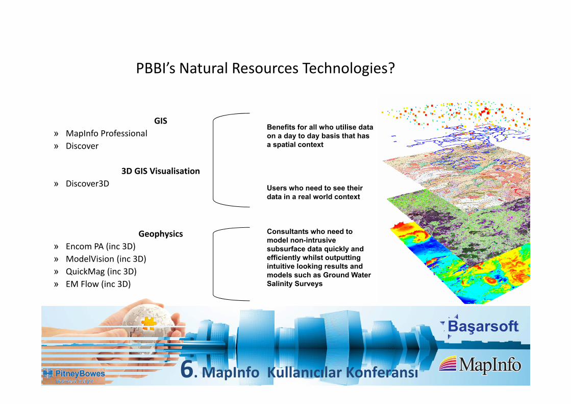
PBBI’s Natural Resources Technologies?
GIS» MapInfo Professional» Discover
3D GIS Visualisation» Discover3D
Geophysics» Encom PA (inc 3D)» ModelVision (inc 3D)» QuickMag (inc 3D)» EM Flow (inc 3D)
Benefits for all who utilise data on a day to day basis that has a spatial context
Users who need to see their data in a real world context
Consultants who need to model non-intrusive subsurface data quickly and efficiently whilst outputting intuitive looking results and models such as Ground Water Salinity Surveys
6. MapInfo Kullanıcılar Konferansı
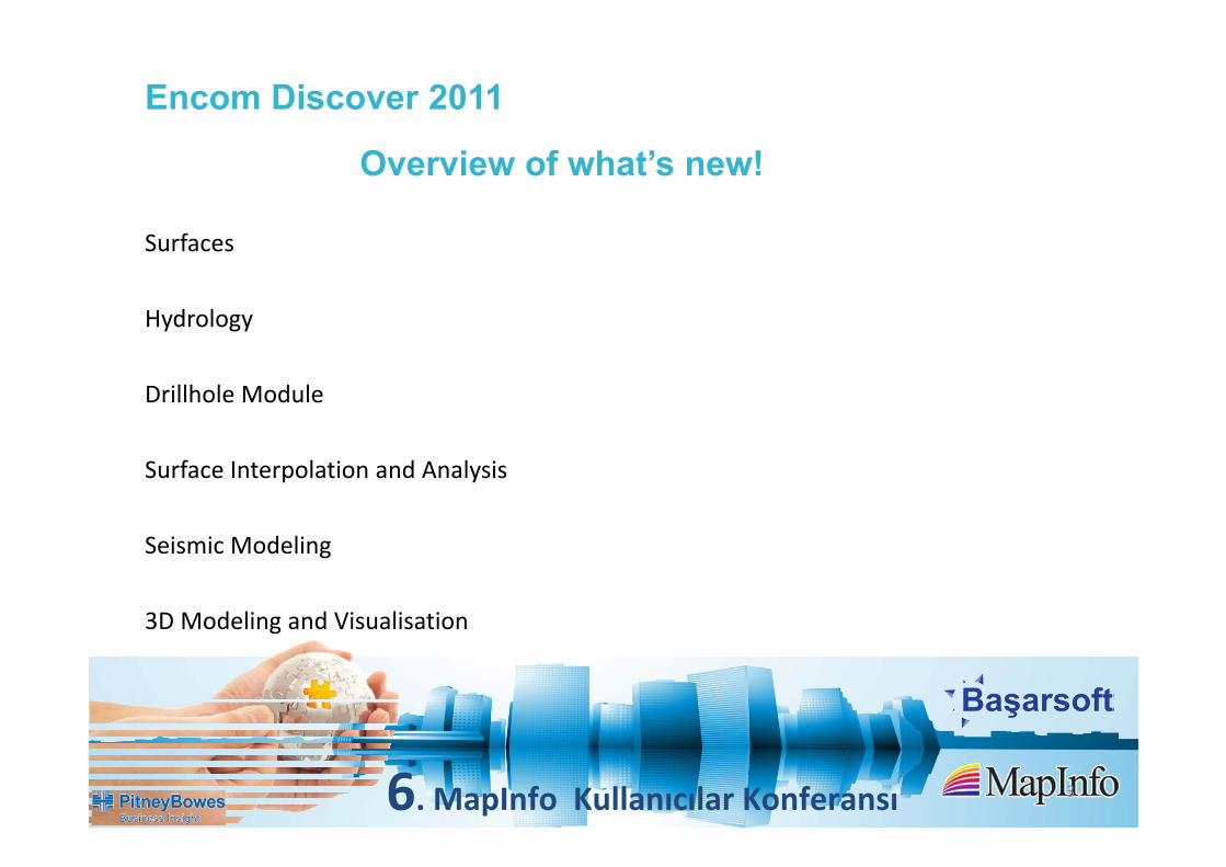
Overview of what’s new!
Surfaces
Hydrology
Drillhole Module
Surface Interpolation and Analysis
Seismic Modeling
3D Modeling and Visualisation
3
Encom Discover 2011
6. MapInfo Kullanıcılar Konferansı 4
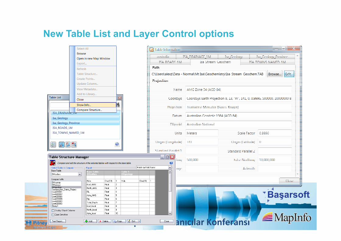
New Table List and Layer Control options

6. MapInfo Kullanıcılar Konferansı
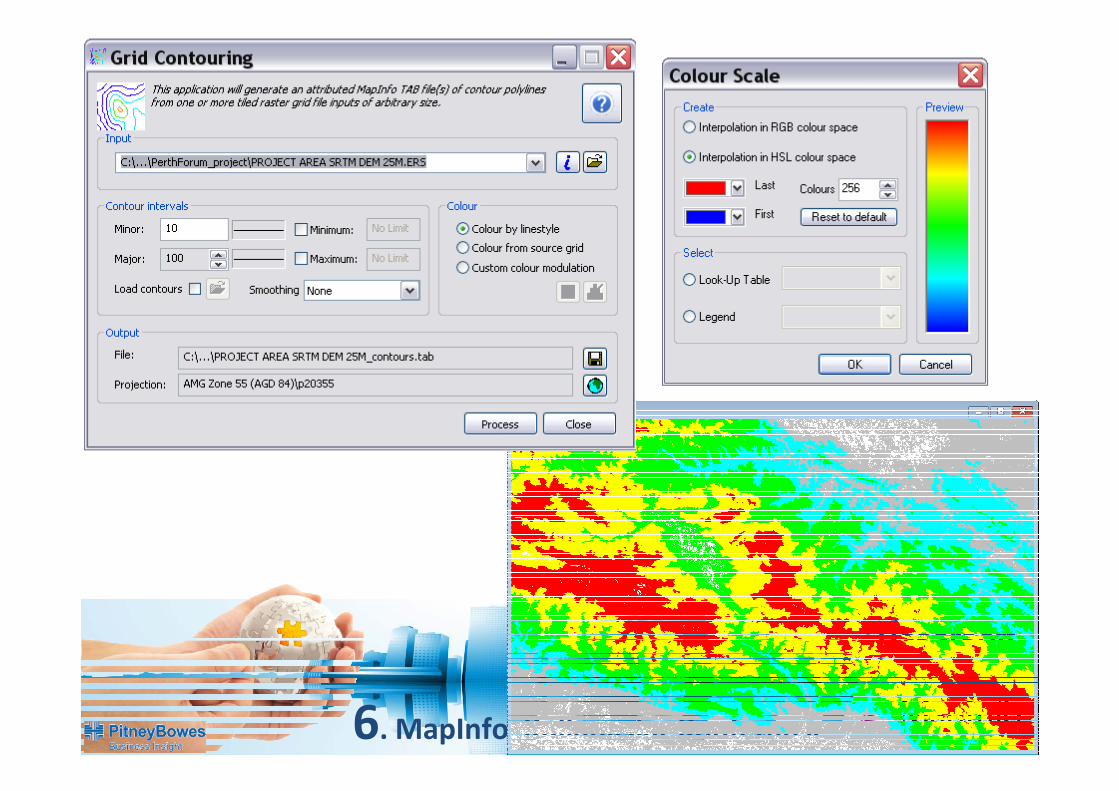
Surface Contouring
Completely new grid contouring engine supports very large (multi‐gigabyte) grid datasets (such as continental scale LIDAR and SRTM data)
Supports multiple input grids i.e. tiled datasets
Can apply a user specified legend
5

6. MapInfo Kullanıcılar Konferansı
6

6. MapInfo Kullanıcılar Konferansı
7
6. MapInfo Kullanıcılar Konferansı
8
6. MapInfo Kullanıcılar Konferansı
9

6. MapInfo Kullanıcılar Konferansı 10
Batch Grid Processing
6. MapInfo Kullanıcılar Konferansı
11
6. MapInfo Kullanıcılar Konferansı
12

6. MapInfo Kullanıcılar Konferansı
13

6. MapInfo Kullanıcılar Konferansı
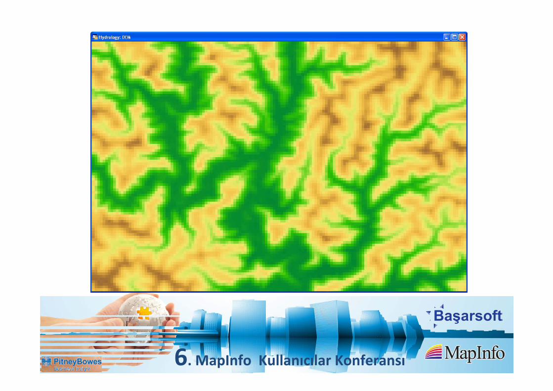
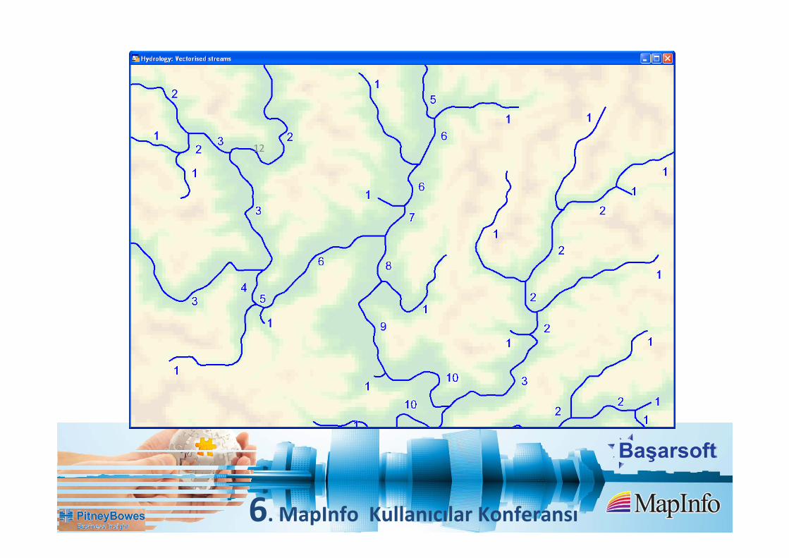
Hydrological Analysis Improvements
• Lakes and dams can be filtered out of the processing based on their area and/or depth
• Lakes and dams are also now incorporated into the stream generation process
• Catchments and streams can now be saved as grids, allowing further advanced
processing within the Surfaces module
• Generate multiple catchments per stream, via either specified locations or for each stream segment
• Significant performance gains through the re‐use of intermediary grid files.
14

6. MapInfo Kullanıcılar Konferansı
DrillholesAnalyze and visualize salinity/pollution monitoring boreholes, geotechnical drilling and
mineral exploration programs
Generate level plans and striplogs, as well as non‐linear, long‐ and cross‐sections.
Seamless integration with 3D for more advanced modeling
15

6. MapInfo Kullanıcılar Konferansı 16
6. MapInfo Kullanıcılar Konferansı
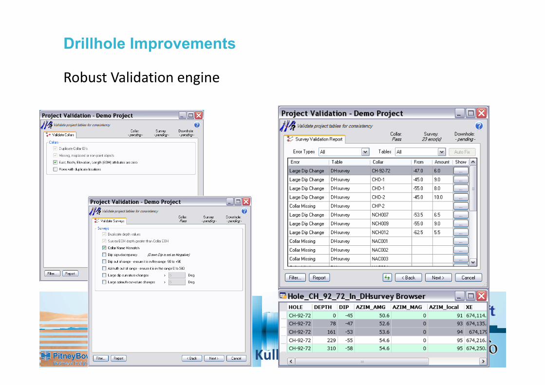
Robust Validation engine
Drillhole Improvements

6. MapInfo Kullanıcılar Konferansı
SQL database ‐ Providing significant data access and section rendering efficiencies
6. MapInfo Kullanıcılar Konferansı
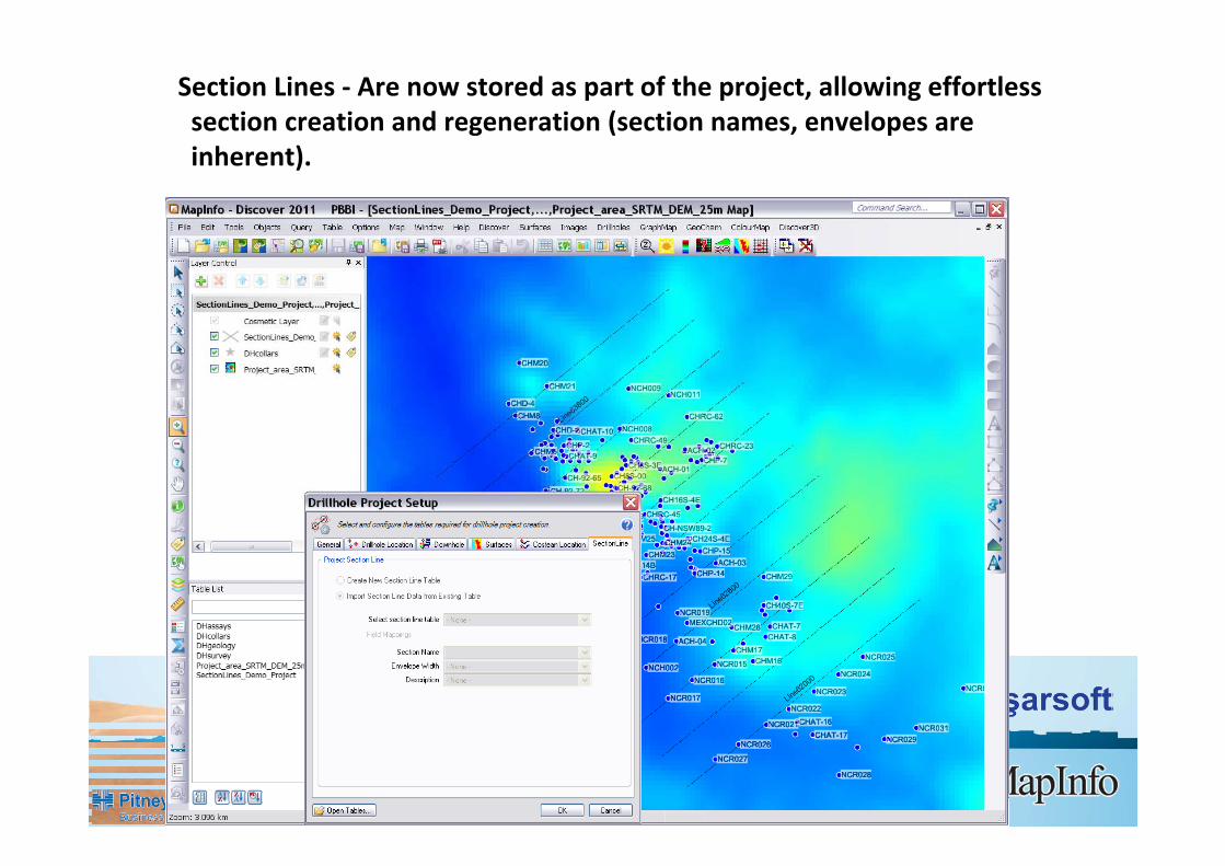
Section Lines - Are now stored as part of the project, allowing effortless section creation and regeneration (section names, envelopes are inherent).

6. MapInfo Kullanıcılar Konferansı
Depth labels can be refined/altered in Display Downhole Data tool, preventing overprinting etc.
6. MapInfo Kullanıcılar Konferansı
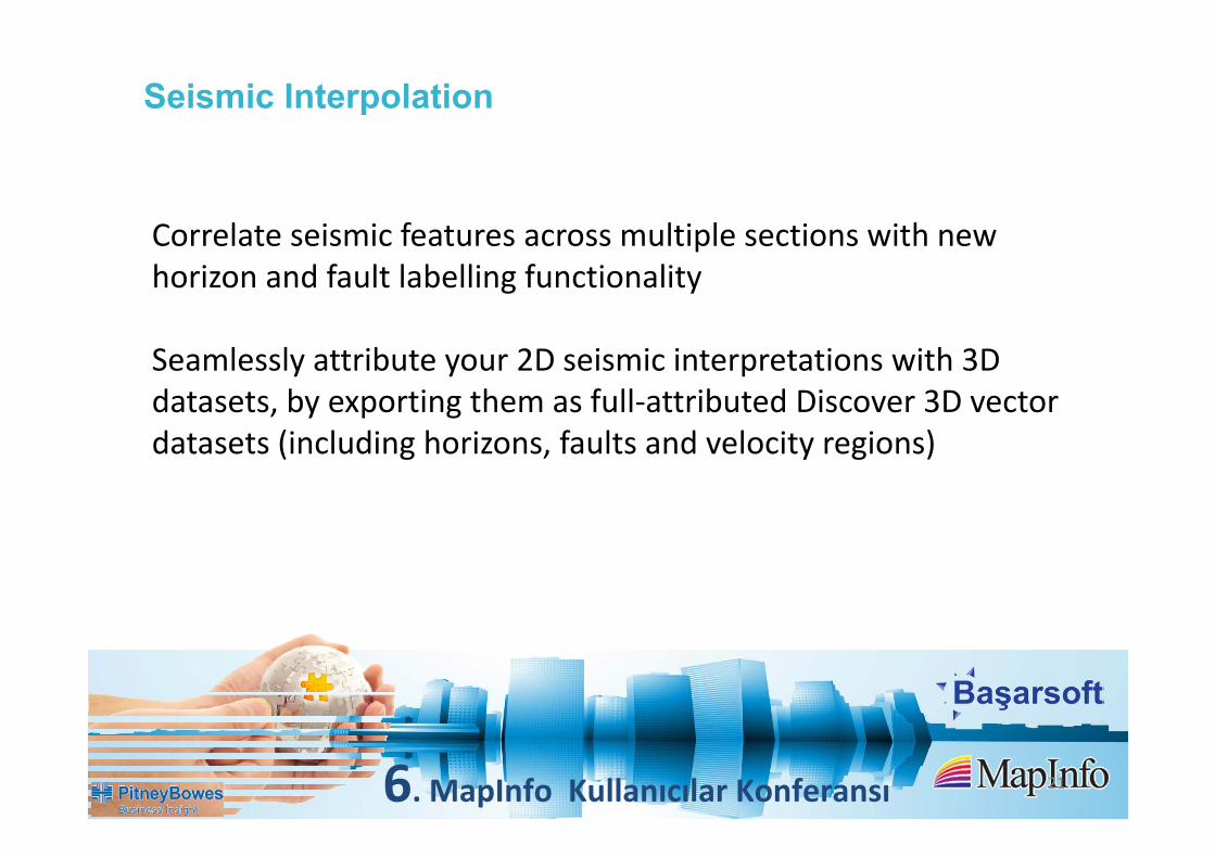
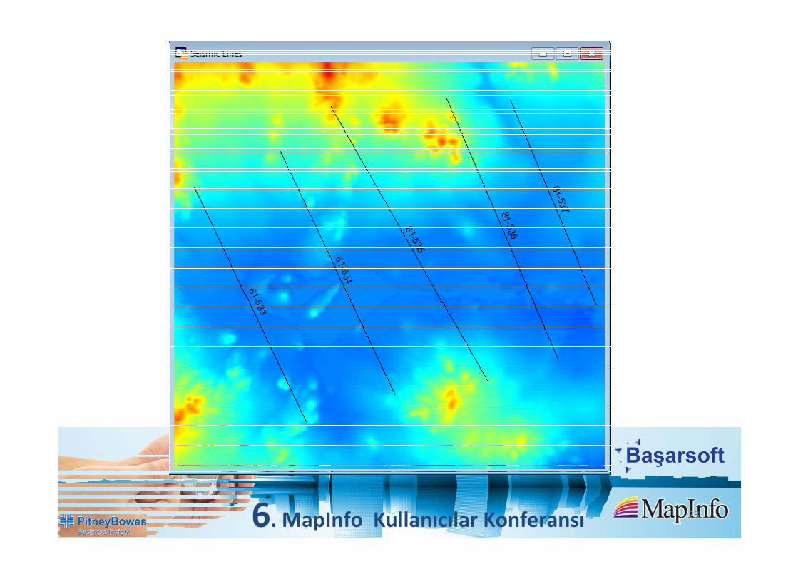
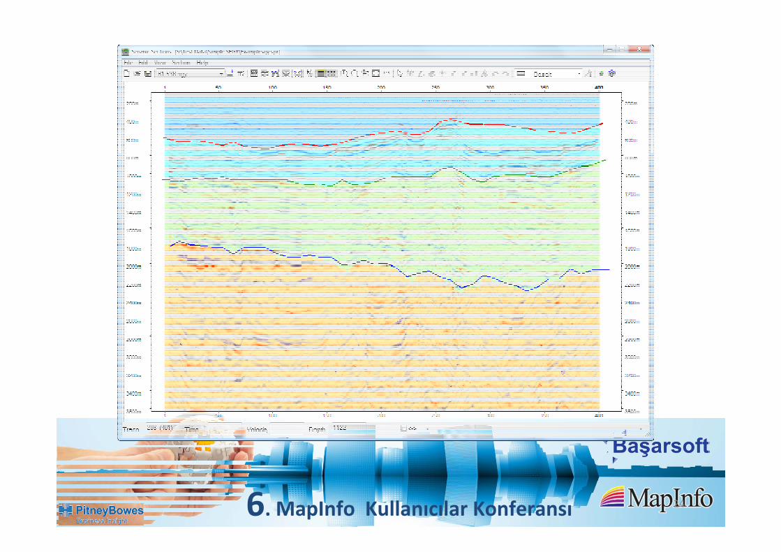
Seismic Interpolation
21
Correlate seismic features across multiple sections with new horizon and fault labelling functionality
Seamlessly attribute your 2D seismic interpretations with 3Ddatasets, by exporting them as full‐attributed Discover 3D vectordatasets (including horizons, faults and velocity regions)

6. MapInfo Kullanıcılar Konferansı 22
6. MapInfo Kullanıcılar Konferansı 23
6. MapInfo Kullanıcılar Konferansı 24
6. MapInfo Kullanıcılar Konferansı 25

6. MapInfo Kullanıcılar Konferansı 26

6. MapInfo Kullanıcılar Konferansı 27

6. MapInfo Kullanıcılar Konferansı
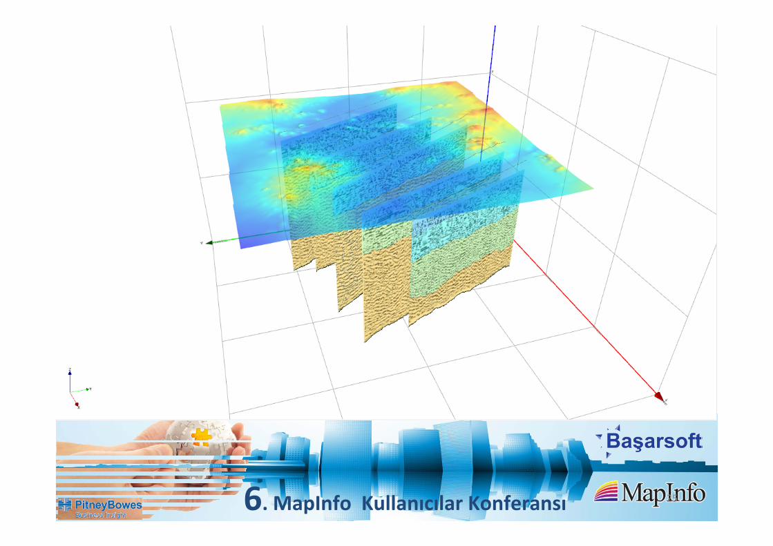
3D Modeling
Wireframing
Surface interpolation in 3D
3D Grid/Voxel model Interpolation
28

6. MapInfo Kullanıcılar Konferansı
New Voxel Utilities
29
Assign Values to Vector
Clip to Surface
Clip Voxel to Volume
Convert Vector to Voxel

6. MapInfo Kullanıcılar Konferansı
Voxel slices as georeferenced images
30

6. MapInfo Kullanıcılar Konferansı