chapter 9 oceans: the last frontier. the vast world ocean earth is often referred to as the blue...
Post on 20-Dec-2015
214 views
TRANSCRIPT

Chapter 9 Oceans: The Last
Frontier

The Vast World Ocean
Earth is often referred to as the blue planet Seventy-one percent of Earth’s
surface is represented by oceans and marginal seas
Continents and islands comprise the remaining 29
Northern Hemisphere is called the land hemisphere, and the Southern Hemisphere the water hemisphere
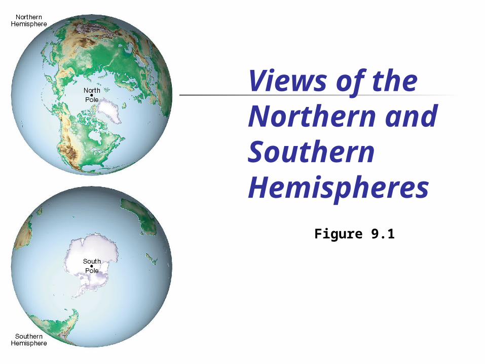
Views of the Northern and Southern Hemispheres
Figure 9.1
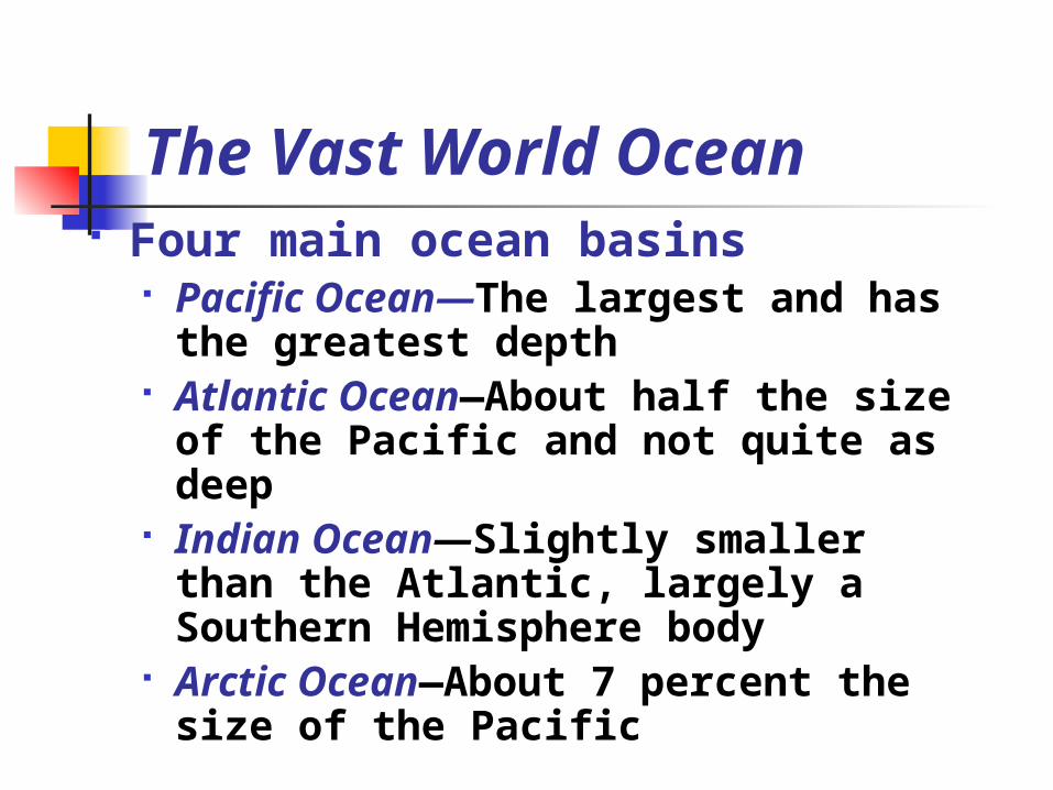
The Vast World Ocean Four main ocean basins
Pacific Ocean—The largest and has the greatest depth
Atlantic Ocean—About half the size of the Pacific and not quite as deep
Indian Ocean—Slightly smaller than the Atlantic, largely a Southern Hemisphere body
Arctic Ocean—About 7 percent the size of the Pacific
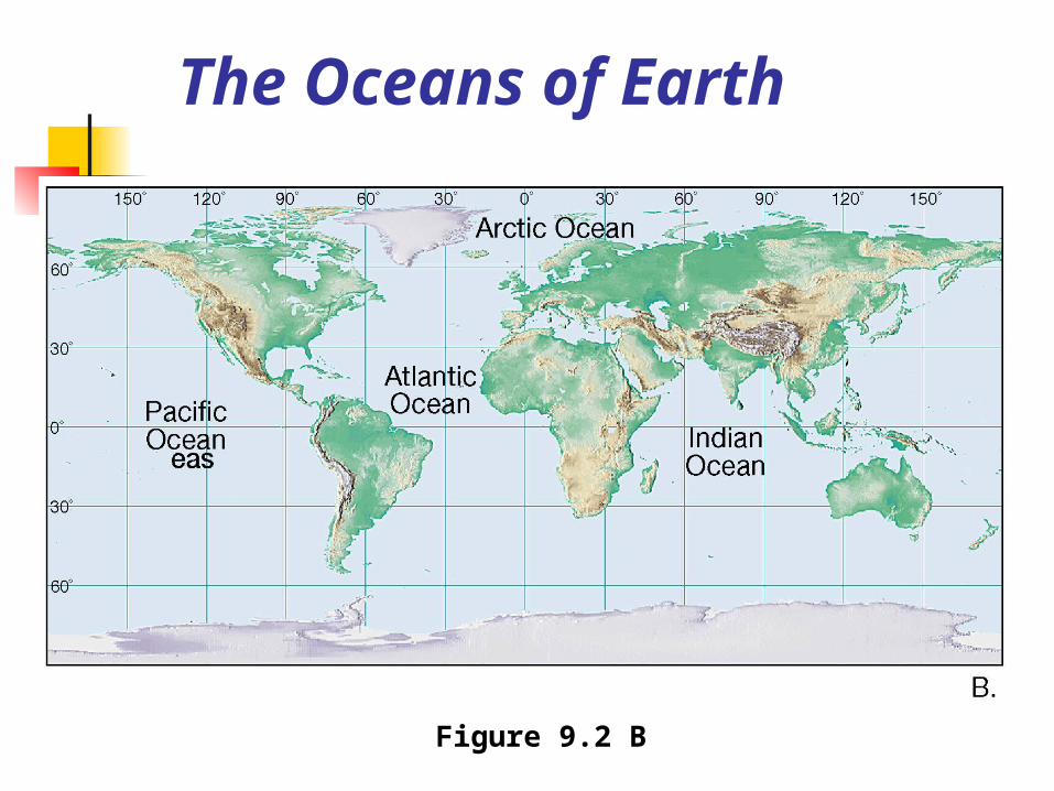
The Oceans of Earth
Figure 9.2 B


Composition of Seawater
Salinity Salinity is the total amount of
solid material dissolved in water Typically expressed as a % Dissolved substances in seawater
are small numbers and therefore expressed in parts per thousand
Most of the salt in seawater is sodium chloride (table salt)
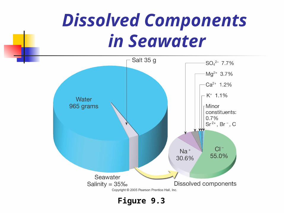
Dissolved Components in Seawater
Figure 9.3
Composition of Seawater
Salinity Sources of sea salts
Chemical weathering of rocks on continents is one source
Second major source is Earth’s interior through volcanic eruptions
Process called outgassing Composition of seawater has been
relatively stable for millions of years
Material is removed just as rapidly as it is added

Composition of Seawater
Salinity Processes affecting seawater
salinity Primarily due to changes in the
water content of the solution These include the addition of fresh
water due to precipitation, runoff, icebergs melting, and sea-ice melting
The removal of fresh water by evaporation and the formation of sea ice also affect salinity
The Ocean’s Layered Structure
Temperature and salinity change with depth in the oceans A three-layered structure exists in
the open ocean Shallow surface mixed zone Transition zone Deep zone
A layer of rapid temperature change below the zone or mixing is known as the thermocline

The Ocean’s Layered Structure
Temperature and salinity change with depth in the oceans Salinity variations with depth
correspond to the general three-layered structure described for temperature
A zone of rapidly changing salinity, called the halocline, corresponds to the thermocline

Mapping the Ocean Floor
Bathymetry—Measurement of ocean depths and the charting of the shape or topography of the ocean floor
Echo sounder (also called sonar) Invented in the 1920s Primary instrument for
measuring depth Reflects sound from ocean floor

Echo Sounder
Figure 9.6 A
Mapping the Ocean Floor
Multibeam sonar Employs and array of sound
sources and listening devices Obtains a profile of a narrow strip
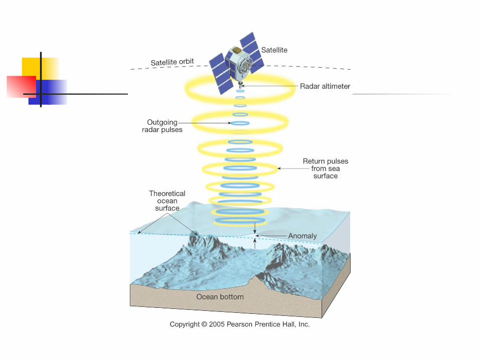
of seafloor Measuring the shape of the
ocean surface from space Employs satellites equipped with
radar altimeters

Multibeam Sonar
Figure 9.6 B
Mapping the Ocean Floor
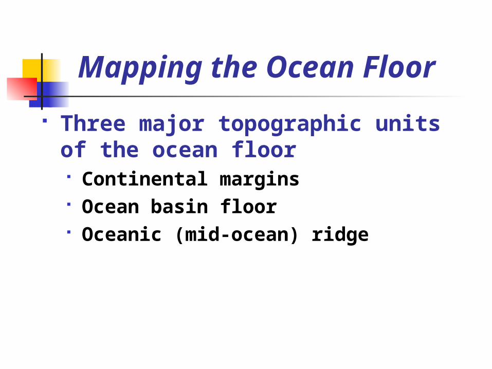
Three major topographic units of the ocean floor Continental margins Ocean basin floor Oceanic (mid-ocean) ridge

Major Topographic Divisions of the North Atlantic Ocean
Figure 9.9

Continental Margins Passive continental margins
Found along most coastal area that surround the Atlantic Ocean
Not associated with plate boundaries
Experience little volcanism and Few earthquakes
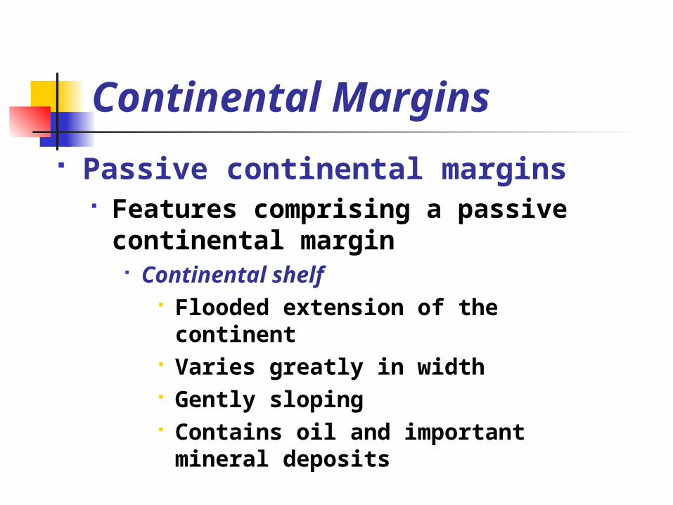
Continental Margins Passive continental margins
Features comprising a passive continental margin
Continental shelf Flooded extension of the
continent Varies greatly in width Gently sloping Contains oil and important
mineral deposits
Continental Margins Passive continental margins
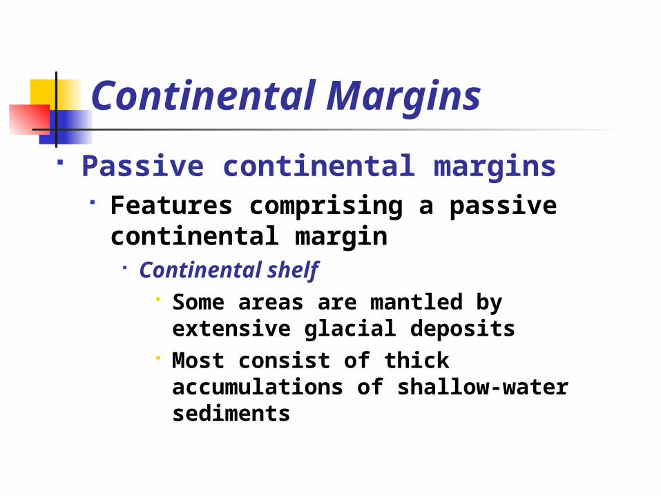
Features comprising a passive continental margin
Continental shelf Some areas are mantled by
extensive glacial deposits Most consist of thick
accumulations of shallow-water sediments
Continental Margins Passive continental margins
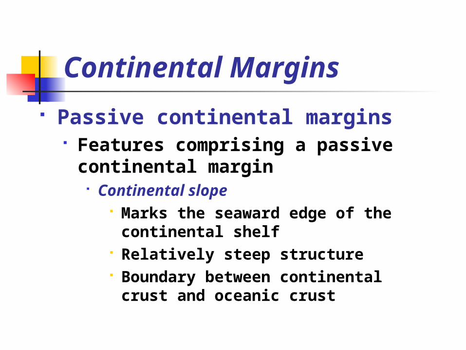
Features comprising a passive continental margin
Continental slope Marks the seaward edge of the
continental shelf Relatively steep structure Boundary between continental
crust and oceanic crust

Continental Margins Passive continental margins
Features comprising a passive continental margin
Submarine canyons and turbidity currents
Submarine canyons Deep, steep-sided valleys cut
into the continental slope Some are seaward extensions
of river valleys Most appear to have been
eroded by turbidity currents

Continental Margins Passive continental margins
Features comprising a passive continental margin
Submarine canyons and turbidity currents
Turbidity currents Downslope movements of
dense, sediment-laden water Deposits are called turbidites
Continental Margins Passive continental margins
Features comprising a passive continental margin
Continental rise Found in regions where trenches are
absent Continental slope merges into a
more gradual incline—The continental rise
At the base of the continental slope turbidity currents that follow submarine canyons deposit sediment that forms deep-sea fans
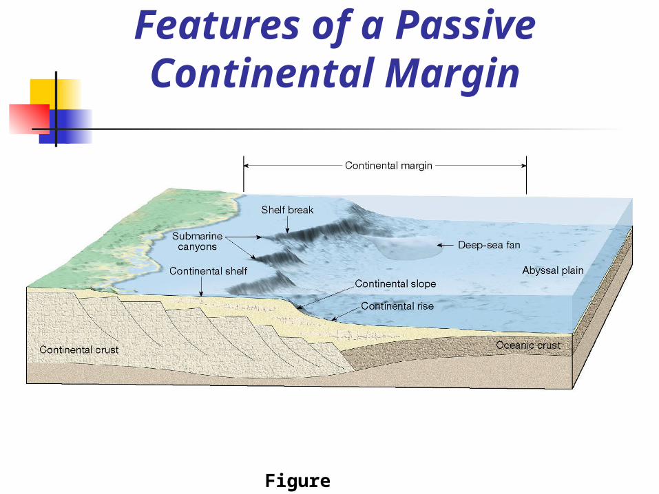
Features of a Passive Continental Margin
Figure 9.10
Continental Margins Active continental margins
Continental slope descends abruptly into a deep-ocean trench
Located primarily around the Pacific Ocean
Accumulations of deformed sediment and scraps of ocean crust form accretionary wedges
Some subduction zones have little or no accumulation of sediments
Deep-Ocean Basin
Deep-ocean trenches Long, relatively narrow features Deepest parts of ocean Most are located in the Pacific
Ocean Sites where moving lithospheric
plates plunge into the mantle Associated with volcanic activity
Volcanic islands arcs Continental volcanic arcs
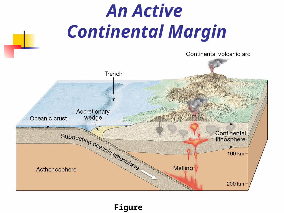
An Active Continental Margin
Figure 9.11
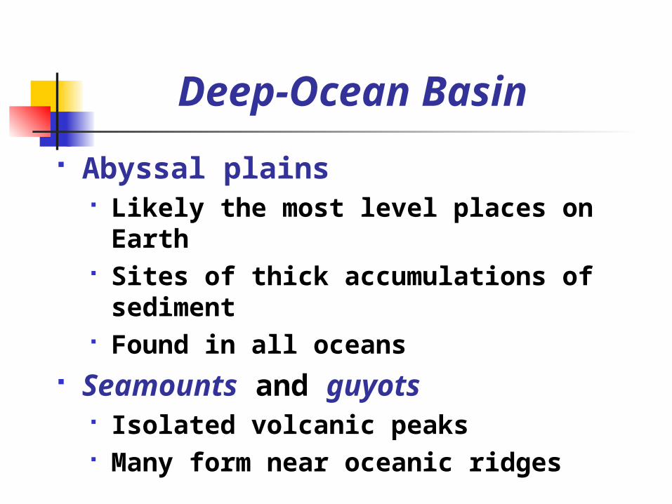
Deep-Ocean Basin
Abyssal plains Likely the most level places on
Earth Sites of thick accumulations of
sediment Found in all oceans
Seamounts and guyots Isolated volcanic peaks Many form near oceanic ridges

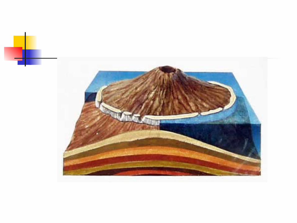
Deep-Ocean Basin
Seamounts and guyots May emerge as an island May sink and form flat-topped seamounts
called guyots or tablemounts Mid-ocean ridge
Characterized by An elevated position Extensive faulting Numerous volcanic structures that
have developed on newly formed crust
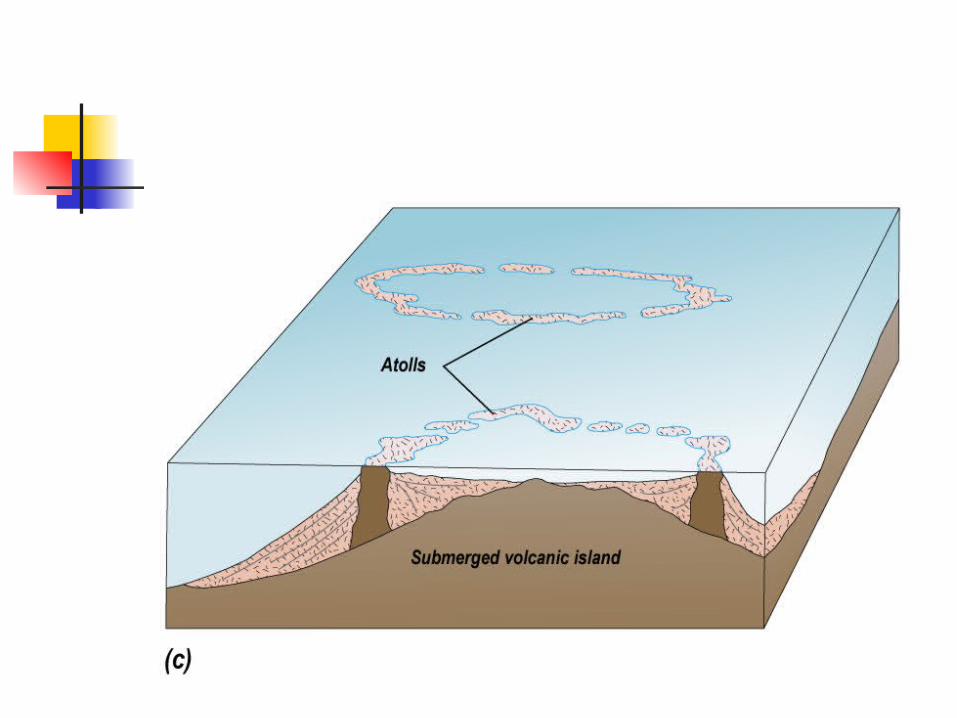
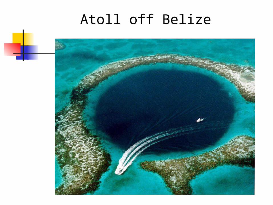
Atoll off Belize

Deep-Ocean Basin
Mid-ocean ridge Interconnected ridge system is the
longest topographic feature on Earth’s surface
Over 70,000 kilometers (43,000 miles) in length
Twenty-three percent of Earth’s surface
Winds through all major oceans Along the axis of some segments
are deep downfaulted structures called rift valleys
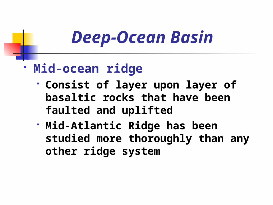
Deep-Ocean Basin
Mid-ocean ridge Consist of layer upon layer of
basaltic rocks that have been faulted and uplifted
Mid-Atlantic Ridge has been studied more thoroughly than any other ridge system

Seafloor Sediments
Ocean floor is mantled with sediment
Sources Turbidity currents Sediment that slowly settles to the
bottom from above Thickness varies
Thickest in trenches—Accumulations may approach 10 kilometers
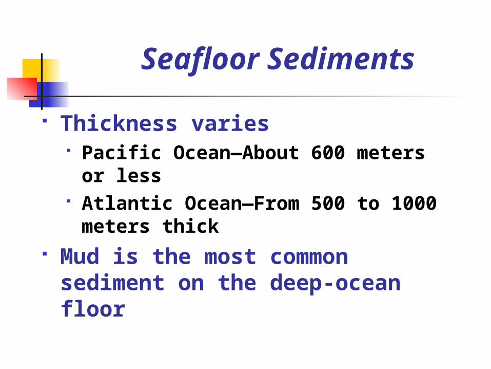
Seafloor Sediments
Thickness varies Pacific Ocean—About 600 meters
or less Atlantic Ocean—From 500 to 1000
meters thick Mud is the most common
sediment on the deep-ocean floor

Seafloor Sediments
Types of seafloor sediments Terrigenous sediment
Material weathered from continental rocks
Virtually every part of the ocean receives some
Fine particles remain suspended for a long time
Oxidation often produces red and brown colored sediments
Seafloor Sediments
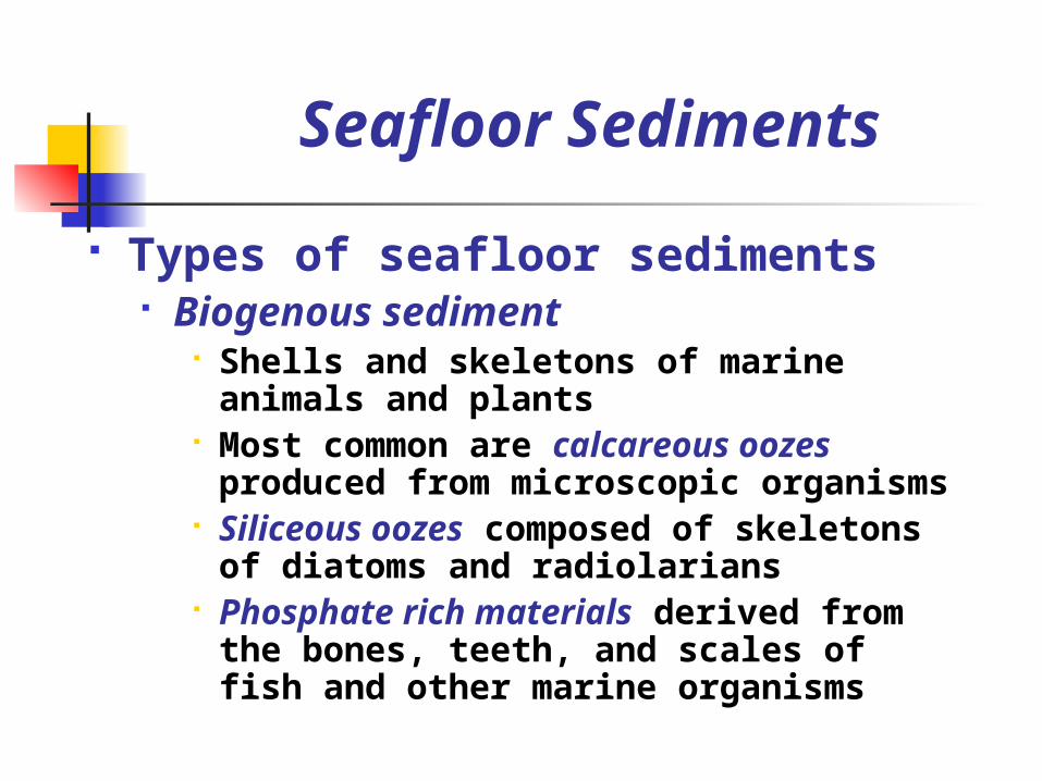
Types of seafloor sediments Biogenous sediment
Shells and skeletons of marine animals and plants
Most common are calcareous oozes produced from microscopic organisms
Siliceous oozes composed of skeletons of diatoms and radiolarians
Phosphate rich materials derived from the bones, teeth, and scales of fish and other marine organisms
Seafloor Sediments
Types of seafloor sediments Hydrogenous sediment
Minerals that crystallize directly from seawater
Most common types include Manganese nodules Calcium carbonates Metal sulfides Evaporites
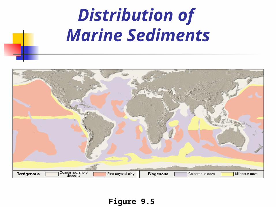
Distribution of Marine Sediments
Figure 9.5
Seafloor Sediments
Distribution Coarse terrigenous deposits
dominate continental margin areas
Fine-grained terrigenous material is common in deeper areas of the ocean basin

Seafloor Sediments
Distribution Hydrogenous sediment comprises
only a small portion of deposits in the ocean
There are a few places where very little sediment accumulates (mid-ocean ridges)

End of Chapter 9