changes in the lake sediment composition caused by short … · changes in the lake sediment...
TRANSCRIPT
197
CHANGES IN THE LAKE SEDIMENT COMPOSITION CAUSED BY SHORT-TERM WATER-LEVEL FLUCTUATION
Tiit Vaasma, Jaanus Terasmaa, Egert Vandel, Marko Vainu, Tiiu Koff
Institute of Ecology, Tallinn University Uus-Sadama 5, Tallinn, Estonia; Tel: +3726199828
Email: [email protected]
Abstract In order to comprehend and interpret the palaeoecological signal it is highly essential to understand the processes and extent how the historically recorded changes are stored in sediments. This study compares the eight short-core sediment records of Lake Martiska (Estonia) with documented historical changes in human impact to identify the water-level fluctuation signal in the lake sediment. Lake Martiska (Natura 2000 Network habitat lake) is situated in northeastern Estonia, in the central part of the Kurtna Kame Field. This small closed lake (area ca 3 ha) with a maximum depth of 7.8 m is fed by groundwater and atmospheric precipitation. The lake lies in a deep kettle hole. Lake Martiska water budget has been under strong anthropological pressure for the last half-century due to groundwater abstraction and mining. The water level of Lake Martiska decreased 3.4 m from 1946 to 1987 and only 29% of lake area and 21% of total volume remained. As a result of the water-level fluctuation and human impact the previously oligotrophic lake is now mesotrophic and the characteristic species for oligotrophic lakes (Isoëtes lacustris L. and Lobelia dortmanna L.) have disappeared. Since the 1990s to 2013 the water level rose ca 2 m. The rise of water level was caused not only by a decrease in groundwater abstraction, but also by an increase in precipitation, runoff and a decrease in evaporation. During the regression and transgression of the lake’s water level, the displacement of the erosion-transport-accumulation zones in the lake took place, depending on the bottom topography. The sediments newly accumulated during the regressive–transgressive period originate from two main sources: previously accumulated lacustrine sediments and the glaciolacustrine nearshore sands. The comparison of the grain-size distribution of the siliciclastic mineral matter pattern and documented water level changes suggests that signs of regression and transgression are well-distinguishable in the sediments of the accumulation area and also clearly reflected in grain-size variations in cores from the transportation area. While during the regression also coarse-grained sediments are transported to the deepest part of the lake, the transgression leaves a different pattern. When the lake level recovers, the connection with the previously available near-shore sand is still missing and only the previously reworked material can be transported deeper. Keywords: water-level fluctuation, grain size, human impact, lake sediment, sedimentology,
palaeolimnology, Estonia
1. INTRODUCTION
Water-level fluctuations may cause changes in a lake ecosystem and especially its trophic status, as
well as lake morphometry and characteristics of the sedimentation zones (erosion, transportation,
accumulation; Håkanson, 1977) of the lake bed. Several studies investigating water-level variations in small
lakes have been successful (Digerfeldt, 1986; Dearing, 1997; Punning et al., 2006; 2007; Terasmaa et al.,
2013). The amount of mineral matter and grain-size composition of sediment are the indicators of processes
in the lake basin (Digerfeldt, 1986; Dearing, 1997; Boyle, 2001; Sun et al., 2002; Terasmaa, 2005; Vaasma
2010) and changes in water level, which enable reconstruction of the hydrological balance of the lake. Due to
fractionation of sediment (Hilton et al., 1986; Gilbert, 2003) the mean grain size of mineral deposits
decreases with increasing distance from the shore at which the sediment originate (Allen, 1970).
Lakes of the Kurtna Kame Field (Kurtna Lake District) in Estonia have been previously actively
researched (Mäemets, 1977, Pallo, 1977; Varvas & Punning, 1993; Koff, 1994; Punning, 1994, Ott et al.,
1995; Marzecova et al., 2011; Vainu & Terasmaa, 2014). From 1985 to 1989 a complex research was carried
out on the Kurtna Kame Field including hydrology and hydrobiology of the area, regional ecosystem
development, geochemical analyses, mining impact on hydrological conditions, etc. These studies have been
published in two comprehensive collections of articles (Ilomets, 1987; 1989).
In the Kurtna Lake District large scale water-level changes have occurred in last sixty years. The
previous studies of the area and documented water-level fluctuation make the site suitable for calibrating the
paleolimnological methods. In order to comprehend and interpret the palaeoecological signal it is highly
essential to understand the processes and extent how the historically recorded changes are stored in
2nd International Conference - Water resources and wetlands. 11-13 September, 2014 Tulcea (Romania); Available online at http://www.limnology.ro/water2014/proceedings.html Editors: Petre Gâştescu ; Włodzimierz Marszelewski ; Petre Bretcan; ISSN: 2285-7923; Pages: 197-203; Open access under CC BY-NC-ND license ;

198
sediments. Our dataset creates an opportunity to assess the effect of water-level changes for the lithological
and chemical composition of the sediment - whether and how this signal is preserved in the lake sediment,
how much the position of the sampling point from the shoreline and slope inclination affects the information
signal.
The main aim of this research was to compare eight short-core (up to 36 cm) sediment records of small Lake
Martiska (Estonia) with documented historical changes in human impact to identify the water-level
fluctuation signal in the lake sediment and its consequences for the lake environment.
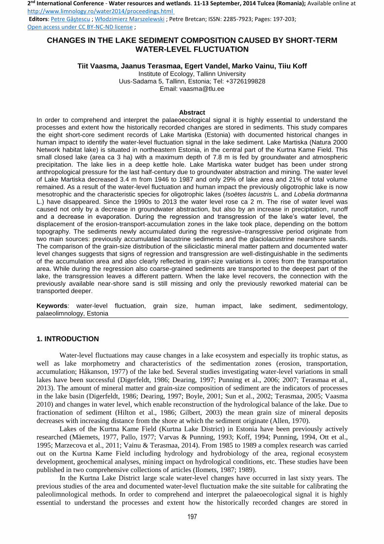
2. STUDY AREA Lake Martiska (L Martiska) is located in northeastern Estonia (57°38´07´´ N, 27°05´06´´ E) (Figure 1) in the
area of the Kurtna Kame Field, where about 40 lakes with different shape, size, drainage area, hydrological
regime and trophic status form the Kurtna Lake District.
Figure 1. Location of Kurtna Lake District and L Martiska in northeastern Estonia.

199
The Kurtna Lake District is an area with the highest lake density in Estonia and it is also under
protection as Kurtna Landscape Conservation Area. L Martiska formed during the Preboreal (ca 10,000-
9,500 years ago) and lies in a deep kettle hole. The lake is small (area 3.0 ha, maximum depth 7.8 m), closed,
fed by groundwater and atmospheric precipitation, north-south elongated with a weakly indented shoreline.
Its dynamic ratio is 0.08, which means that sedimentation is very weakly influenced by wind/wave activities
(Håkanson & Jansson, 1983). The lake is dimictic and strongly stratified in summertime. The anoxia occurs
in hypolimnion throughout the year, except during the spring and autumn overturn periods.
The western catchment area is steep sandy kame which is up to 20 m in relative height. The eastern
kame field area is gentler and up to 6 m in relative height. The northern part on the lake is a popular
swimming area with sandy shore. The southern area of the lake is rich in vegetation and there are old stumps
and trunks of trees in the lake. On the catchment area pine forests dominate; soils are poor and well-sorted
mostly fine-grain sands (Vares, 1987; Kont & Arold, 1987).
The Kurtna Lake District is located between heavily industrialised oil shale mining and processing
region (Figure 1) and natural territory with large forests and mires. It is very popular recreation area for
tourists and local people. The Kurtna area is strongly affected by oil shale mining and processing (Punning,
1994). The Natura 2000 Network habitat lake L Martiska is also affected by groundwater abstraction since
1972 from Vasavere wells. By the end of the 1980s the water level had dropped more than 3 m (Erg &
Ilomets, 1989). In the 1990s the groundwater pumping rate decreased and caused a partial water-level
recovery but it has not reached the pre-disturbance level. Due to the direct and indirect human impacts
(Punning, 1994) the previously oligotrophic (Riikoja, 1940) lake is now mesotrophic.
3. METHODS
Eight short sediment cores (18-36 cm) were collected in winter on ice using a modified Livingstone-
Vallentyne piston corer. The lithology of the cores was visually recorded in the field. The cores were taken
from different depths (2.2, 4.0, 5.9, 7.75, 6.5, 4.5, 3.4, 2.5 m; Figure 2) on transect from west to east through
the deepest part of the lake (Figure 2).
Figure 2. Lake Martiska and the locations of the sampling points (left) and the profile view of the sampling
transect with water levels during the period (right). The number in the name of the sampling point shows the
water depth at the point.
The sediment cores were sliced with intervals of 1 cm and stored in the plastic boxes and analysed in
the laboratory immediately. The concentration of dry matter in the sediment was measured after drying the

200
samples at 105°C to constant weight. Organic matter was determined from the dried sample after heating at
550°C for 3.5 h (Heiri et al., 2001). The residual amount was taken as mineral matter. Before grain-size
measurements the sediment was pre-treated with hydrogen peroxide for removing the organic matter. Then
the grain size was determined using Fritsch Laser Particle Sizer “Analysette 22”.
For the age-depth model one core was radiometrically dated (210Pb method and CRS 210Pb model was
used) at the Centre for Environmental Monitoring and Technology, Ukrainian Hydrometeorological
Research Institute in Kiev.
4. RESULTS AND DISCUSSION
Lake Martiska feeds from precipitation directly and through the surface and groundwater. The lake
loses the water by evaporation from the lake surface and by seepage to groundwater. The main input of L
Martiska water is from catchment runoff and the main output of water is seepage into groundwater. In L
Martiska the water-level started to decline already since the end of the 1940s caused by the growth of a pine
forest (before the 1950s the vicinty of the lake was treeless) on the lake catchments, due to this
evapotranspiration and subsequently runoff from the catchment decreased. Also meteorological changes
(drier climate) played an important role (Vainu & Terasmaa, 2014). The main reason for the water-level drop
between the 1970s and 1987 was the beginning of groundwater abstraction from the Vasavere wells in 1972.
The result of the water-level drop was a decrease in the lake area from 4.5 to 1.3 ha and volume from
124,000 to 26,000 m3. Due to this the trophicity of L Martiska has increased and the previously oligotrophic
lake is now mesotrophic and the characteristic species for oligotrophic lakes like Isoëtes lacustris L. and
Lobelia dortmanna L. have disappeared. Also atmospheric pollution and recreation on the lake shore played
an important role in this. The water-level rise since the beginning of the 1990s has been caused by the
change of meteorological conditions and the rise of groundwater level – the abstraction of groundwater from
Vasavere wells decreased.
According to the data, three phases could be distinguished in the water level and sedimentation
process in L Martiska:
(1) water-level declining since the end of the 1940s;
(2) minimum lake level phase in 1988-1992;
(3) water-level rising since 1992.
The water-level fluctuation causes erosion and redeposition of sediments (due to this nutrients in
muddy sediments may return to the food chain). Such changes affect the mineral content and the grain-size
distribution of the sediment (Shteinman & Parparov, 1997). In L Martiska the eroded matter originates from
limnoglacial sands that surround the lake and previously accumulated lacustrine sediments. The mineral
matter concentration values of eight studied short cores show that the variations are marginal in the
lowermost part (deeper than 14 cm) of the cores (Figure 3). This means that the sedimentation conditions
were stable. Above ca 14 cm the concentration of mineral matter increases steadily except in the core M2.5.
During the water level decline the mineral matter content in the deeper area of the lake increases because
these areas are then closer to the shoreline and sand is eroded to deeper down compared to the higher water
period. During the regression period, the mineral matter content reached the maximum value (Figure 3),
which reflects the addition of eroded material.
Figure 3. Median values of grain-size distribution (red line) and concentrations of mineral matter (blue area)
in short cores from L Martiska.

201
The high mineral matter content of the sites M2.2 and M2.5 (Figure 3) is caused by the location of
the samples’ position: in shallow water and close to the shore. Comparing the sites M2.2 and M2.5, the
impact of different slope inclinations (36.3% and 11.3% respectively) and distances from the shore (6 and 20
m respectively) can clearly be seen in the sedimentation. On the steeper slope, closer to the shore the core
M2.2 has somewhat larger mineral matter content in the sediment than the site M2.5. Håkanson & Jansson
(1983) demonstrated the mineral matter content is considerably higher in shallow areas of the lake with steep
slopes than in deeper areas that are further away from the shore.
In L Martiska the signal of the water level fluctuation is stronger in the deeper part of the lake (in
sites M5.9, M6.5 and M7.75; Figure 3). In the deeper part of the core M7.75 the median values of grain size
vary from 7.0 to 9.9 µm, corresponding to fine and medium silt. The data suggest that during the regression
phase (sediment layers from depths of 14-15 cm up to 6-7 cm) mainly medium and coarse silt accumulated.
Above 14 cm in the core M7.75 the content of the coarser fraction increases, reaching a sharp maximum at 7
cm (median value 16.1 µm; coarse silt). This layer is probably accumulated in the beginning of the 1990s
when the water level was the lowest. It describes the situation when main source of the mineral matter was
well-sorted sediments that accumulated in the lake before the water-level drop. The mineral matter is carried
into the lake from the catchment area by erosion. It starts to focus and fraction in a way that leaves the
coarse-grained material in the shallower areas and finer-grained material in the deeper areas of the lake
(Dearing, 1997; Terasmaa, 2005). The increase in the grain size median value that took place at the site M5.9
between 12 and 4 cm was caused by the increasing domination of coarse-grained silt. When the water level
gradually declined, coarse-grained material could move towards the deeper areas (Blazevic et al., 2009).
When the regressive water level reached the minimum state the sites M2.2 and M2.5 were higher
than the lake level (Figure 2) and a hiatus had formed. In these cores the grain size of sediment is close to
sands around the lake.
In the transgression period the sedimentation regime stabilised and sediments became better sorted
and more fine-grained. During the transgression (sediment layers above 6-7 cm) the proportion of fine grain
silt increases but the median grain size (in the core M7.75 median grain size 10.8 to 12.8 µm) remains
greater than in the deeper layers. The earlier regression conformed the top layer of the sediment (certain
fraction intervals were carried away), and as water level rose the material that had already been processed
once was processed again. The water line had no direct contact with the shore from where new coarse-
grained mineral material could be eroded.
5. CONCLUSION
The collected data and relevant analysis show that the regression and transgression periods (since
end of the 1940s) in L Martiska have significant impacts on the concentration of mineral matter and its grain-
size composition in sediment. During regression the concentration of mineral matter was rising and the
sediment became coarser in the deeper area of the lake and vice versa in transgression period. The lake-level
fluctuation was responsible for essential changes in the composition and structure of sediments and
consequently in the trophic status and biodiversity.
Acknowledgements
The authors thank the Environmental Conservation and Environmental Technology R&D Programme Project
“EDULOOD” and colleagues from the Institute of Ecology at Tallinn University.
REFERENCES Allen, J.R.L. 1970, Physical processes of sedimentation: an introduction, In: Sutton, J. (ed.) Earth Science
Series, vol. 1, Edit. George Allen and Unwin, 248p.
Blazevic, M.A., Kirby, M.E., Woods, A.D., Browne, B.L. & Bowman, D.D. 2009, A sedimentary facies
model for glacial-age sediments in Baldwin Lake, Southern California, Sedimentary Geology, 219, 151-
168.

202
Boyle, J.F. 2001, Inorganic geochemical methods in palaeolimnology, In: Last, M. L. & Smol, J. B. (eds.)
Tracking Environmental Change Using Lake Sediments. Volume 2: Physical and Geochemical Methods,
Edit. Kluwer Academic Publishers, Dordrecht/Boston/London, 83-141.
Dearing, J.A. 1997, Sedimentary indicators of lake-level changes in the humid temperate zone: a critical
review, Journal of Paleolimnology, 18, 1-4.
Digerfeldt, G. 1986, Studies on past lake-level fluctuations, In: Berglund, B.E. (ed.) Handbook of Holocene
Palaeoecology and Palaeohydrology, Edit. John Wiley and Sons, Chichester – New York, pp. 127-143.
Erg, K. & Ilomets, M. 1989, Mäetööde mõju Kurtna järvede veetasemele seisund ja prognoos (The effect of
mining on the water level of Kurtna lakes current state and prognoosis), In: Ilomets, M. (ed.) Kurtna
järvestiku looduslik seisund ja selle areng II (Natural Status and Development of Kurtna Lake District II),
Valgus, Tallinn, pp. 47-54 [in Estonian].
Gilbert, R. 2003, Spatially irregular sedimentation in a small, morphologically complex lake: implication for
paleoenvironmental studies, Journal of Paleolimnology, 29, 209-220.
Heiri, O., Lotter, A.F. & Lemcke, M.-J. 2001, Loss on ignition as a method for estimating organic and
carbonate content in sediments: reproducibility and comparability of results, Journal of Paleolimnology,
25, 101-110.
Hilton, J., lishman, J.P. & Allen, P.V. 1986, The dominant processes of sediment distribution and focusing in
a small, eutrophic, monomictic lake, Limnology and Oceanography, 31, 125-133.
Håkanson, L. 1977, The influence of wind, fetch and water depth on the distribution of sediments in Lake
Vänern, Sweden, Canadian J. Earth Sci. 14, 397-412.
Håkanson, L. & Jansson, M. 1983, Principles of Lake Sedimentology, Edit. Springer-Verlag, Berlin, 316p.
Ilomets, M. (ed.) 1987, Kurtna järvestiku looduslik seisund ja selle areng. 3-8. november 1986. a. toimunud
ametkondadevahelise nõupidamise ettekannete kogumik (Natural Status and Development of the Kurtna
Lake District I), Edit. Valgus, Tallinn, 234p [in Estonian].
Ilomets, M. (ed.) 1989, Kurtna järvestiku looduslik seisund ja selle areng. 7. ja 8. aprillil 1988. a. toimunud
II ametkondadevahelise nõupidamise ettekannete kogumik (Natural Status and Development of the
Kurtna Lake District II), Edit. Valgus, Tallinn, 169p [in Estonian].
Koff, T. 1994, The development of vegetation, In: Punning, J.-M. (ed.) The influence of natural and
anthropogenic factors on the development of landscapes. The results of a comprehensive study in NE
Estonia, Edit. Institute of Ecology, Estonian Academy of Science, Publication 2, 24-57.
Kont, A. & Arold, I. 1987, Kurtna mõhnastiku reljeefi põhijooni (Topography of Kurtna Kame Field), In:
Ilomets, M. (ed.) Kurtna järvestiku looduslik seisund ja selle areng II (Natural Status and Development of
Kurtna Lake District I), Valgus, Tallinn, pp. 25-31 [in Estonian].
Marzecová, A., Mikomagi, A., Koff, A. & Martma, T. 2011, Sedimentary geochemical response to human
impact on Lake Nõmmejärv, Estonia, Estonian Journal of Ecology, 60:1, 54-69.
Mäemets, A. (ed.) 1977, Eesti NSV järved ja nende kaitse (Lakes of Estonian SSR and the protection), Edit.
Valgus, Tallinn, 263p [in Estonian].
Pallo, S. 1977, Kurtna järvestik (Kurtna Lake District), diploma, Tartu Riiklik Ülikool, Füüsilise geograafia
kateeder [manuscript in Estonian].
Punning, J.-M. (ed) 1994, The influence of natural and anthropogenic factors on the development of
landscapes. The results of a comprehensive study in NE Estonia, Edit. Institute of Ecology, Estonian
Academy of Science, Publication 2, 227p.
Punning, J.-M., Terasmaa, J. & Vaasma, T. 2006, The impact of lake-level fluctuations on the sediment
composition, Water, Air, and Soil Pollution: Focus, 6:5-6, 515-521.
Punning, J.-M., Boyle, J.F., Terasmaa, J., Vaasma, T. & Mikomägi, A. 2007, Changes in lake sediment
structure and composition caused by human impact: repeated studies of Lake Martiska, Estonia, The
Holocene, 17:1, 145-151.
Riikoja, H. 1940, Zur Kenntnis einiger Seen Ost-Eestis, insbesondere ihrer Wasserchemie, In: Eesti Teaduste
Akadeemia juures oleva Loodusuurijate seltsi aruanded, XLVI, Tartu, 1-167.
Shteinman, B.S. & Parparov, A.S. 1997, An approach to particulate matter transfer studies in littoral zones of
lakes with changing morphometry, Water Science and Technology, 36, 199-205.
Sun, D., Bloemendal. J., Rea, D.K., Vandenberghe, J., Jiang, F., An, Z. & Su, R. 2002, Grain-size
distribution function of polymodal sediments in hydraulic and aeolian environments, and numerical
partitioning of the sedimentary components, Sedimentary Geology, 152:3-4.
Terasmaa, J. 2005, Bottom topography and sediment lithology in two small lakes in Estonia, Proc. Estonian
Acad. Sci. Biol. Ecol. 54:3, 171-189.

203
Terasmaa, J., Puusepp, L., Marzecová, A., Vandel, E., Vaasma, T. & Koff, T. 2013, Natural and human-
induced environmental changes in Eastern Europe during the Holocene: a multi-proxy palaeolimnological
study of a small Latvian lake in a humid temperate zone, Journal of Paleolimnology, 49:4, 663-678.
Ott, I., Laugaste, R., Mäemets, A., Mäemets, A, Kaup, E., Künnis, K., Heinsalu, A., Toom, A., Lokk, S. &
Põder, T. 1995, Kurtna järvestiku limnoloogiline ekspertiis (Limnological assessment of Kurtna Lake District), [manuscript in Estonian].
Vaasma, T. 2010, Grain-size Analysis of Lake Sediments: Research Methods and Applications, PhD theses,
Edit. Tallinna University, 130p.
Vainu, M. & Terasmaa, J. 2014, Changes in climate, catchment vegetation and hydrogeology as the causes
of dramatic lake-level fluctuations in the Kurtna Lake District, NE Estonia, Estonian Journal of Earth
Sciences, 63:1, 45-61.
Vares, K. 1987, Kurtna mõhnastiku pinnasetete geoloogiast (Geology of the sediment of Kurtna Kame
Field), In: Ilomets, M. (ed.) Kurtna järvestiku looduslik seisund ja selle areng II (Natural Status and
Development of Kurtna Lake District I), Valgus, Tallinn, pp. 32-36 [in Estonian].
Varvas, M. & Punning, J.-M. 1993, Use of the 210Pb method in studies of the development and human impact
history of some Estonian lakes, The Holocene, 3, 34-44.