ceqa findings of fact and statement of...
TRANSCRIPT

CEQA FINDINGS OF FACT AND STATEMENT OF OVERRIDING CONSIDERATIONS
OF THE BOARD OF SUPERVISORS OF SACRAMENTO COUNTY
FOR THE
FLORIN VINEYARD GAP COMMUNITY PLAN PROJECT
CONTROL NUMBER: 04-GPB-CPB-0096
STATE CLEARINGHOUSE NUMBER: 2005082045
DECEMBER 2010
1
INTRODUCTION
The Draft Environmental Impact Report (DEIR) and the Final Environmental Impact Report (FEIR) prepared for this project address the environmental effects associated with the approval of the project known as the Florin Vineyard Gap Community Plan Project, which will guide the development of approximately 3,766 acres of land located in south central Sacramento County, generally south of Elder Creek Road and the Sacramento City limits, west of Bradshaw Road, excluding the North Vineyard Station Specific Plan area, north of Vintage Park Drive and the developed neighborhoods of Churchill Downs and Vintage Park, and east of the Union Pacific Railroad tracks and the developed neighborhoods of Tiogawoods, Florin Town and Sunrise Florin. (FEIR, p.2-1.) These findings have been prepared to comply with the requirements of the California Environmental Quality Act (CEQA) (Pub.Res. Code section 21000 et seq.) and the CEQA Guidelines (14 Cal. Code Regs. Section 15000 et seq.). These findings are supported by information and analysis from the DEIR, the responses to all public comments, and technical appendices, together comprising the FEIR, and other evidence in the administrative record.
ACRONYMS AND ABBREVIATIONS
These Findings of Fact and Statement of Overriding Considerations (Findings) contain anumber of acronyms and abbreviations. The acronyms and abbreviations used in thesefindings are the same as the definitions and acronyms set forth in the FEIR.
PROJECT DESCRIPTION
The Project consists of the adoption of the Florin-Vineyard Gap Community Plan, General Plan Amendments and Community Plan Amendment that will guide the development of approximately 3,766 acres of land located in both the South Sacramento and Vineyard community plan areas in a comprehensive and coordinated manner. (Plate PD-1, FEIR, Vol. 1, p. 2-2)
A. Project Objectives.
The stated objectives of this Project are as follows:2

1. Establish a coordinated and comprehensive approach towards land use development.
2. Provide for a mix of land uses and a variety of housing types.
3. Provide a circulation system that connects uses with roadways, bicycle and pedestrian pathways, as well as linkages to public transportation.
4. Ensure that infrastructure is provided in a logical and efficient manner.
5. Provide for a pattern of development that will complement existing neighborhoods, and build upon infill opportunities.
6. Prove each landowner the opportunity to develop and/or redevelop their property, consistent with the objectives of the Florin-Vineyard Plan. (FEIR,Vol.1, p. 2-17)
B. Project Entitlements.
The Project includes requests for the following entitlements:
1. General Plan Amendments to:
a) Move the Urban Policy Area (UPA) boundary north and east to include approximately 1,077 acres of the Florin Vineyard Gap Community Plan area.
b) Amend the General Plan Land Use Designations from Agricultural-Urban Reserve, Agricultural-Urban Reserve/Aggregate Resources Area, General Agriculture (20 Acres), General Agriculture (20 Acres)/Aggregate Resources Area, Intensive Industrial, Intensive Industrial/Aggregate Resources Area, Low Density Residential, Recreation and Urban Development Area (as depicted in the FEIR, Plate PD-2) to Commercial and Office, Intensive Industrial, Intensive Industrial/Aggregate Resources Area, Low Density Residential, and Medium Density Residential (as depicted in the FEIR, Plate PD-3).
2. Community Plan Amendments to:
a) Amend the South Sacramento Community Plan land use designations for properties within the Florin Vineyard Gap Community Plan area from those reflected in the Existing Zoning/Community Plan Designations diagram (FEIR, Plate PD-4)
3
to those presented in the proposed CAC Land Use Plan (FEIR, Plate PD-5), or the proposed Planning Department Land Use Plan (FEIR, PlatePD-6), or the CPAC Hybrid Land Use Plan (FEIR, PlatePRE-1), or the Planning Department Hybrid Land Use Plan (FEIR, Plate PRE-2), or the Planning Commission Recommended Land Use Plan (FEIR, Plate PRE-3).
b) Amend the Vineyard Community Plan land use designations for properties within the Florin Vineyard Gap Community Plan area from those reflected in the Existing Zoning/Community Plan Designations diagram (FEIR, Plate PD-4) to those presented in the proposed CAC Land Use Plan (FEIR, Plate PD-5), or the proposed Planning Department Land Use Plan (FEIR, PlatePD-6), or the CPAC Hybrid Land Use Plan (FEIR, Plate PRE-1), or the Planning Department Hybrid Land Use Plan (FEIR, Plate PRE-2), or the Planning Commission Recommended Land Use Plan (FEIR, Plate PRE-3).
3. Adoption of a Public Facilities Financing Plan for the Florin-Vineyard Gap Community Plan project area:
a) Identifies public facilities and infrastructure improvements required to support the proposed land uses;
b) Defines proposed methods of financing required public facilities andinfrastructure; and
c) Provides a description of infrastructure phasing. Separate actions will be necessary to establish assessment districts, fee programs, and/or other financing programs.
BACKGROUND
The FVGCP Project consists of approximately 3,766 acres, located in south central Sacramento County. The Project is in both the South Sacramento and Vineyard community planning areas and the location may be generally described as follows: south of Elder Creek Road and the Sacramento city limits, west of Bradshaw Road, excluding the North Vineyard Station Specific Plan area; north of Vintage Park Drive and the developed neighborhoods of Churchill Downs and Vintage Park; and east of theUnion Pacific tracks, and those developed neighborhoods of Tiogawoods, Florin Town,
4

and Sunrise Florin. (FEIR, p. 4-1) In addition, the Project area is largely bounded by the City of Sacramento, City of Elk Grove, Community of South Sacramento, the North Vineyard Station Specific Plan, and the Vineyard Springs Comprehensive Plan. (FEIR, Vol. 1, p. 4-34)
Surrounding land uses include light manufacturing to the north, residential development to the west, south and southwest and agricultural uses to the northeast. The North Vineyard Station Specific Plan and Vineyard Springs Comprehensive Plan areas are to the east and southeast. (FEIR, Vol. 1, p. 2-16)
Elk Grove-Florin Road provides regional access from the west by way of South Watt Avenue, Elder Creek Road and Florin Road. Bradshaw Road provides regional access from the east, and Elk Grove-Florin Road and Gerber Road provide access from the south. The Union Pacific Railroad traverses the area in a northwesterly direction. (FEIR,Vol. 1, pp. 2-16, 17)
The General Plan designations for the Project area include Urban Development Area, Low Density Residential, Industrial Intensive, Recreation, General Agriculture-20 acres, Agricultural-Urban Reserve, as well as Aggregate Resource Area. (FEIR, Vol. 1, pp. 4-1—4)
The Board of Supervisors initiated the community planning program for the Project area in October, 2002. The area is also known as the “Gap” because of its location between the existing urban area west of Elk Grove-Florin Road and an area to the east having two approved comprehensive plans – the North Vineyard Station Specific Plan and the Vineyard Springs Comprehensive Plan areas. (FEIR, Vol.1, p. 2-3)
Board Resolution 2002-1312 expresses the Board’s support for “a comprehensive approach known as the Florin-Vineyard Gap Community Plan to address regional and community planning issues and infrastructure/service issues in the [Florin-Vineyard Gap] area, rather than reacting to issues as they may be presented on a project-by-project basis,” and the Board’s support for “the Florin-Vineyard Gap Community Plan asthe appropriate tool to comprehensively plan the entirety of the [Florin-Vineyard Gap] study area.” (FEIR, Vol. 1, p. 2-3)
The Board appointed a Citizen’s Advisory Committee (CAC) to work the County Planning Department and the community to prepare a draft comprehensive land use plan for the Board’s consideration. In December, 2003, the Board endorsed two draft land use plans for further analysis and environmental review. The two draft plans included the CAC recommendation, dated December 4, 2003, and six optional amendments to the draft CAC plan that were proposed by the Planning Department that
5
result in greater residential density than was proposed by the CAC. (FEIR, Vol. 1, p. 2-30)
As a result of extensive meetings of the Community Planning Advisory Council’s (CPACs) for the South Sacramento and Vineyard areas, sitting in joint session, and hearings before the Planning Commission, three additional plans were produced: the CPAC Hybrid Land Use Plan, the Planning Department Hybrid Land Use Plan, and the Planning Commission Recommended Land Use Plan. The three modified plans are expected to result in similar environmental impacts, for all subject areas, as the original CAC and Planning Department land use plans, and the determinations contained within the Final EIR apply to all five land use plans. (FEIR, Vol. 1, p. i-vi)
RECORD OF PROCEEDINGS
The record of proceedings for the Board’s decision on the Project consists of, at a minimum:
Notice of Preparation (NOP) and all other public notices issued by the County in conjunction with the Florin Vineyard Gap Community Plan Project.
The Final Environmental Impact Report for the Florin Vineyard Gap Community Plan Project, all appendices to the FEIR, and all documents cited or referenced therein.
The Draft Environmental Impact Report for the Florin Vineyard Gap Community Plan Project, all appendices to the DEIR, and all documents cited or referenced therein.
All comments submitted by agencies or members of the public during the 45-day comment periods on the DEIR.
All comments and correspondence submitted to the County with respect to the Project, in addition to comments on the DEIR.
The mitigation monitoring and reporting program for the Project.
All findings and resolutions adopted by the Board in connection with the Florin Vineyard Gap Community Plan Project and all documents cited or referenced therein.
All reports, studies, memoranda, maps, staff reports or other planning documentsrelating to the Project prepared by the County, consultants to the County, or responsible or trustee agencies with respect to the County’s compliance with the
6
requirements of CEQA and with respect to the County’s action on the Florin Vineyard Gap Community Plan Project.
All documents submitted to the County, including the Board of Supervisors and County commissions, boards and committees, by other public agencies or members of the public in connection with the Florin Vineyard Gap Community Plan Project up through the final approval of the Project.
All minutes and transcripts of all public meetings and hearing held in conjunction with the Florin Vineyard Gap Community Plan Project.
All documentary or other evidence submitted to the County at information sessions, public meetings and hearings.
Matters of common knowledge to the County, including but not limited to Federal,State and Local laws and regulations.
Any documents cited in these findings, in addition to those documents cited above.
Any other materials required for the record of proceedings by Public Resources Code section 21167.6(e) and applicable case law.
The official custodian of the record is the Clerk of the Sacramento County Board of Supervisors, 700 H Street, Sacramento, CA 95814.
FINDINGS REQUIRED BY CEQA
Pursuant to sections 21002 and 21002.1 of the Public Resources Code, no public agency shall approve or carry out a project for which an environmental impact report has been certified which identifies one or more significant effects on the environment that would occur if the project is approved or carried out unless both of the following occur:
(a) The public agency makes one or more of the following findings with respect toeach significant effect:
(1) Changes or alterations have been required in, or incorporated into, the project which mitigate or avoid the significant effects on the environment.
(2) Those changes or alterations are within the responsibility and jurisdiction of another public agency and have been, or can and should be,adopted by that other agency.
7

(3) Specific economic, legal, social, technological, or other considerations,including considerations for the provision of employment opportunities for highly trained workers, make infeasible the mitigation measures or alternatives identified in the environmental impact report.
(b) With respect to significant effects which were subject to a finding under paragraph (3) of subdivision (a), the public agency finds that specific overriding economic, legal, social, technological, or other benefits of the project outweigh the significant effects on the environment.
CEQA Guidelines section15091 requires the following:
(a) No public agency shall approve or carry out a project for which an EIR has been certified which identifies one or more significant environmental effects of the project unless the public agency makes one or more written findings for each of those significant effects, accompanied by a brief explanation of the rationale for each finding. The possible findings are:
(1) Changes or alterations have been required in, or incorporated into, the project which avoid or substantially lessen the significant environmental effect as identified in the final EIR.
(2) Such changes or alterations are within the responsibility and jurisdiction of another public agency and not the agency making the finding. Such changes have been adopted by such other agency or can and should be adopted by such other agency.
(3) Specific economic, legal, social, technological, or other considerations,including provision of employment opportunities for highly trained workers,make infeasible the mitigation measures or project alternatives identified in the final EIR.
Accordingly, for each significant impact identified herein, a finding has been made as to one or more of the following, as appropriate in accordance with Public Resources Code section 21081 and State CEQA Guidelines section 15091:
A. Changes or alterations have been required in, or incorporated into, the Projectwhich avoid or substantially lessen the significant environmental effect as identified in the FEIR. Such changes or alterations reduce the significant environmental effect identified in the FEIR to a level of less than significant;
B. Such changes or alterations are within the responsibility and jurisdiction of another public agency and not the agency making the finding. Such changes
8

have been adopted by such other agency or can and should be adopted by such other agency; and/or
C. Specific economic, legal, social, technological or other considerations, including provision of employment opportunities for highly trained workers, make infeasible the mitigation measures or Project alternatives identified in the FEIR.
A narrative of supporting facts follows the appropriate finding. For many of the impacts, one or more of the findings above have been made. Finding (B) appears because, although the County is the lead agency, it has limitations on its power to require or enforce certain mitigation. Whenever finding (B) occurs, agencies with jurisdiction to impose certain mitigation measures have been identified. It is these agencies, within their respective scopes of authority, which would have the ultimate responsibilities to adopt, implement, and enforce the mitigation discussed within each type of impact that could result from Project implementation.
Whenever finding (C) was made, the County has determined that there will be, even after mitigation, an unavoidable significant level of impact due to the Project, and sufficient mitigation is not feasible to reduce the impact to a level of less than significant.Such impacts are always specifically identified in the supporting discussions. The Statement of Overriding Considerations applies to all such unavoidable significant impacts, as required by sections 15092 and 15093 of the CEQA Guidelines.
The concept of “feasibility” also encompasses the question of whether a particular alternative or mitigation measure promotes the underlying goals and objectives of a project. (City of Del Mar v. City of San Diego (1982) 133 Cal.App.3d 410, 417.) “’Feasibility’ under CEQA encompasses ‘desirability’ to the extent that desirability is based on a reasonable balancing of the relevant economic, environmental, social, and technological factors.” (Ibid. See also Sequoyah Hills Homeowners Assn. v. City of Oakland (1993) 23 Cal.App.4th 704, 715.)
The CEQA Guidelines do not define the difference between “avoiding” a significant environmental effect and merely “substantially lessening” such an effect. The County must therefore glean the meaning of these terms from the other context in which the terms are used. Public Resources Code section 21081, on which CEQA Guidelines section 15091 is based, uses the term “mitigate’ rather than “substantially lessen.” The CEQA Guidelines therefore equate “mitigating” with “substantially lessening.” Such an understanding of the statutory term is consistent with the policies underlying CEQA, which include the policy that “public agencies should not approve projects as proposed if there are feasible alternatives or feasible mitigation measures available which would substantially lessen the significant environmental effects of such projects.” (Pub. Resources Code section 21002.)
9

For purposes of these findings, the term “avoid” refers to the effectiveness of one or more mitigation measures to reduce an otherwise significant effect to a less than significant level. In contract, the term “substantially lessen” refers to the effectiveness of such measure or measures to substantially reduce the severity of a significant effect, but not to reduce that effect to a less than significant level. These interpretations appearto be mandated by the holding in Laurel Hills Homeowners Assn. v. City Council (1978) 83 Cal.App.3d 515, 519-521, in which the Court of Appeal held that an agency had satisfied its obligation to substantially lessen or avoid significant effects by adopting numerous mitigation measures, not all of which rendered the significant impacts in question less than significant.
Although CEQA Guidelines section 15091 requires only that approving agencies specifythat a particular significant effect is “avoid(ed) or substantially lessen(ed),” these findings, for purposes of clarity, in each case will specify whether the effect in question has been reduced to a less than significant level, or has simply been substantially lessened but remains significant.
Moreover, although section 15091, read literally, does not require findings to address environmental effects that an EIR identifies as merely “potentially significant,” these findings will nevertheless fully account for all such effects identified in the Final EIR.
CEQA requires that the lead agency adopt mitigation measures or alternatives, where feasible, to substantially lessen or avoid significant environmental impacts that would otherwise occur. Project modification or alternatives are not required, however, where such changes are infeasible or where the responsibility for modifying the project lies with some other agency. (CEQA Guidelines section 15091(a) and (b).)
With respect to a project for which significant impacts are not avoided or substantially lessened, a public agency, after adopting proper findings, may nevertheless approve the project if the agency first adopts a statement of overriding considerations setting forth the specific reasons why the agency found that the project’s “benefits” rendered “acceptable” its “unavoidable adverse environmental effects.” (CEQA Guidelines sections 15093 and 15043(d). See also Pub. Resources Code section 21080(b).) The California Supreme Court has stated, “(t)he wisdom of approving…any development project, a delicate task which requires a balancing of interests, is necessarily left to the sound discretion of the local officials and their constituents who are responsible for suchdecisions. The law as we interpret and apply it simply requires that those decisions be informed, and therefore, balanced.” (Goleta II, 52 Cal.3d at p. 576.)
These findings constitute the Board of Supervisors’ best efforts to set forth the evidentiary and policy bases for its decision to approve the Project in a manner consistent with the requirements of CEQA. To the extent that these findings conclude
10
that various proposed mitigation measures outlined in the Final EIR are feasible and have not been modified, superseded or withdrawn, the County hereby binds itself to implement these measures. These findings, in other words, are not merely informational, but rather constitute a binding set of obligations that will come into effect with the Board adopts a resolution approving the Project.
MITIGATION MONITORING AND REPORTING PROGRAMS
The mitigation measures identified in the Final EIR will be incorporated into the text of the Florin Vineyard Gap Community Plan and will apply to all development occurring within the plan area. Consequently, there is not a separate Mitigation Monitoring and Reporting Program (MMRP) for the Project. As individual applications are submitted in the future and are subject to CEQA review, individual MMRPs will be prepared. Those applications being considered coincident with the Project, and which are subject to project level review within this same Final EIR, have individual MMRPs associated with them.
SIGNIFICANT EFFECTS AND MITIGATION MEASURES
The FEIR identified a number of significant and potentially significant environmental effects (or impacts) that the Florin Vineyard Gap Community Plan Project will cause. Some of these significant effects can be fully avoided through the adoption of feasible mitigation measures. Other effects cannot be avoided by the adoption of feasible mitigation measures or alternatives, and thus will be lessened by the adoption of feasible mitigation measures. Other significant, unavoidable effects cannot be substantially lessened or avoided. For reasons set forth below, however, the Board hasdetermined that the significant, unavoidable effects of the Project are outweighed by overriding economic, social and other considerations.
HYDROLOGY AND DRAINAGE
Impacts Related to Flooding
Impact:
Completion of all facilities included in the Drainage Master Plan would provide detentionof floodwaters. However, should development occur within a drainage basin prior to the
11

completion of the drainage infrastructure flood risks within the FVGCP would have the potential to adversely impact the proposed project. (FEIR, Vol. 1, p. 1-7)
Findings:
Changes or alterations have been required in, or incorporated into, the project which mitigate or avoid the potentially significant environmental effects identified in the FEIR.
Mitigation:
HY-1a Florin Vineyard Community Plan (FVGCP) development shall implement the proposed FVGCP Drainage Master Plan (DMP) [FVGCP Drainage Study, Civil Engineering Solutions, Inc. (October 12, 2007) as amended and accepted by the County Department of Water Resources (DWR) on May 19, 2008], or any subsequent amendments to the DMP that are reviewed and approved by the DWR. Detailed plans for the design and construction of all proposed drainage, flood control and water quality improvements, consistent with the FVGCP DMP, shall be submitted to the DWR for review and approval. (FEIR, Vol. 1, p. 8-30)
b Comply with one of the following measures, as applicable:
Projects within the Elder and Gerber Creek Watersheds
Construction of the FVGCP DMP improvements may be phased, subject to the approval of the DWR, so long as hydrologic/hydraulic analyses are provided that demonstrate the phased improvements will provide adequate (100-year) flood protection to proposed development areas and will not increase flood risks in downstream and upstream areas, and that such phased improvements are consistent with the County’s 404 permit and the proposed phasing is submitted for approval to the Corps of Engineers as required by the conditions set forth in the County’s 404 permit. Such analysesshall verify that the phased improvements will mitigate post-development peak flows and water surface elevations in accordance with County standards, and will provide water quality treatment of post-development runoffin compliance with County stormwater quality requirements. (FEIR, Vol. 1, p. 8-31)
Projects within the Unionhouse and Florin Creek Watersheds
Construction of the FVGCP DMP improvements may be phased, subject to the approval of the DWR, so long as hydrologic/hydraulic analyses are provided that demonstrate the phased improvements will provide adequate (100-year) flood protection to proposed development areas and will not
12
increase flood risks in downstream areas, and that such improvements are consistent with requirements of state and federal environmental regulators. Such analyses shall verify that the phased improvements will reduce post-development peak flows and water surface elevations to at least pre-development levels, and will provide water quality treatment of post-development runoff in compliance with County stormwater quality requirements. (FEIR, Vol. 1, p. 8-31)
HY-2 Prior to the approval of improvement plans for individual development projects within the FVGCP area, the project proponent shall demonstrate to the satisfaction of DWR that all FVGCP DMP improvements necessary to provide adequate flood protection to the project, and necessary to provide adequate mitigation for the project’s downstream drainage/flooding and water quality impacts, have been implemented. (FEIR, Vol. 1, p. 8-31)
HY-3 Comply with one of the following measures, as applicable:
Residential Projects within the Elder and Gerber Creek Watersheds
No residential final maps shall be recorded, no residential improvement plans shall be approved, and no residential building permits shall be issued until supplemental drainage fees are paid pursuant to an approved “Implementation Plan” that implements the financing mechanisms recommended in the approved Florin Vineyard Gap Community Plan Public Facilities Financing Plan (FVGCP Financing Plan). In addition to those financing mechanisms, the “Implementation Plan” shall specifically include theblending of the FVGCP Financing Plan and the North Vineyard Station Specific Plan Finance Plan (NVSSP). This blended plan shall include fair share funding and construction obligations by the FVGCP for those NVSSP Finance Plan drainage improvements and rights-of-way which are of shared benefit to developments in the Elder and Gerber Creek watersheds of the FVCGP. (FEIR, Vol. 1, p. 8-32)
Commercial Projects within the Elder and Gerber Creek Watersheds
For commercial development, all drainage fees required by the FVGCP PFFPand a fair share contribution, for NVSSP drainage improvements and rights-of-way which are of shared benefit to developments in the Elder and Gerber Creek watersheds of the FVGCP, shall be paid prior to approval of any commercial improvement plans for projects in the Elder and Gerber Creek watersheds of the FVGCP. Payment of fees pursuant to an interim fee agreement, that is adopted by the Board of Supervisors and which includes fair share contributions for the FVGCP and NVSSP drainage improvements
13

and right of way acquisitions, shall satisfy the intent of this condition. (FEIR, Vol. 1, 8-32)
Projects within the Unionhouse and Florin Creek Watersheds
Prior to the issuance of grading permits, project applicants shall pay the drainage fee identified in the Florin Vineyard Community Plan Public FacilitiesFinancing Plan for the implementation of drainage improvements within the FVGCP. (FEIR, Vol. 1, p. 8-32)
Explanation:
A Drainage Master Plan was developed to provide flood protection within the FVGCP, and in the adjacent Vineyard Springs and Vineyard Station areas. The proposed Drainage Master Plan would include the use of trunk lines connected to regional detention basins to arrest stormwater flow; however, each development would be responsible for constructing onsite drainage facilities that would connect to the trunk lines, as well as drainage facilities that are intended to improve water quality, such as vegetated swales. (FEIR, Vol. 1p. 20-5)
Following implementation of the Drainage Master Plan post-project flows at the FVGCP boundary would be less than the existing conditions. While completion of all facilities included in the Drainage Master Plan would provide detention of floodwaters, should development occur within a drainage basin prior to the completion of the drainage infrastructure or implementation of required flood-protection measures for commercial development a potentially significant impact to drainage would occur. Recommended mitigation measures would reduce impacts to a less-than-significant level. (FEIR, Vol. 1,20-5)
Significance Level After Mitigation: Less than Significant. (FEIR, Vol. 1, p. 20-5)
TRAFFIC AND CIRCULATION:
Impacts to Roadway Segments Under Existing Plus Project Conditions
Impact:
Overall, implementation of either the CAC Land Use Plan or the PD Land Use Plan would result in 32 and 36 potentially significant primary and secondary impacts, respectively, to the study roadway segments. Implementation of the required mitigation measures would reduce impacts to many of the adversely impacted roadway segments.However, four of the roadway improvements proposed as mitigation for impacts under
14

the CAC Land Use Plan would not reduce the impact to a less-than-significant level, and five (consisting of four CAC improvements and one additional roadway improvement) of the roadway improvements proposed as mitigation under the PD Land Use Plan would not reduce impacts to a less-than-significant level. In addition, several of the proposed improvements are not located within the jurisdiction of Sacramento County, and mitigation of impacts outside of County jurisdictions may not be feasible. Therefore, impacts to roadway segments under both the CAC Land Use Plan and the PD Land Use Plan would remain significant and unavoidable. (FEIR, Vol. 1, pp. 1-11, 12)
Finding:
Changes or alterations have been required in, or incorporated into, the project that substantially lessen, but do not avoid, the potentially significant environmental impacts to designated roadway segments. In some instances, no mitigation is available to render the effects less than significant. Although the proposed improvements would reduce the project’s traffic impacts, some roadway segments would continue to operate at an unacceptable LOS. The effects, or some of the effects, remain significant and unavoidable.
Mitigation Measures:
TC-1 All development projects within the FVGCP shall participate in the FVGCP Capital Improvement Program for the installation of roadway improvements. Pursuant to the Program the following improvements shall be implemented subject to the approval of the controlling jurisdiction. (FEIR, Vol.1, p. 9-50)
CAC Land Use Plan/PD Land Use Plan (FEIR, Vol. 1, pp. 9-50—52)
TC-1(a) Widen the section of SR 16 between Folsom Boulevard and South Watt Avenue from one to two lanes in each direction.
TC-1(b) Widen the section of SR 16 between South Watt Avenue and Bradshaw Roadfrom one to two lanes in each direction.
TC-1(c) Widen the section of Fruitridge Road between Florin-Perkins Road and SouthWatt Avenue from one to two lanes in each direction.
TC-1(d) Widen the section of South Watt Avenue between Elder Creek Road and SR 16 from one to three lanes in each direction.
TC-1(e) Widen the section of Elder Creek Road between Power Inn Road and Florin-Perkins Road from one to two lanes in each direction.
TC-1(f) Widen the section of Elder Creek Road between Florin-Perkins Road and South Watt Avenue from one to two lanes in each direction.
15
TC-1(g) Widen the section of Florin Road between Stockton Boulevard and Power InnRoad from two to three lanes in each direction.
TC-1(h) Widen the section of Florin Road between South Watt Avenue and Hedge Avenue from one to two lanes in each direction.
TC-1(i) Widen the section of Gerber Road between Elk Grove-Florin Road and Bradshaw Road from one to two lanes in each direction.
TC-1(j) Widen the four-lane section of Calvine Road between Power Inn Road and Elk Grove-Florin Road from two to three lanes in each direction.
TC-1(k) Widen the section of Florin-Perkins Road between SR 16 and Fruitridge Roadfrom two to three lanes in each direction.
TC-1(l) Widen the section of French Road between Florin Road and Gerber Road from one to two lanes in each direction.
TC-1(m) Widen the section of South Watt Avenue between Kiefer Boulevard and SR 16 from one lane to three lanes in each direction.
TC-1(n) Widen the section of South Watt Avenue between SR 16 and Fruitridge Road from one to three lanes in each direction.
TC-1(o) Widen the section of South Watt Avenue between Fruitridge Road and Elder Creek Road from one to three lanes in each direction.
TC-1(p) Widen the section of South Watt Avenue between Elder Creek Road and Florin Road from one to three lanes in each direction.
TC-1(q) Widen the section of Elk Grove-Florin Road between Florin Road and Gerber Road from one to three lanes in each direction.
TC-1(r) Widen the section of Elk Grove-Florin Road between Gerber Road and Carlisle Avenue from two to three lanes in each direction.
TC-1(s) Widen the four-lane section of Elk Grove-Florin Road between Vintage Park Drive and Calvine Road from two to three lanes in each direction and construct Waterman Road as a two-lane roadway between Gerber Road and its current terminus.
TC-1(t) Widen the section of South Watt Avenue between Elder Creek Road and SR 16 from one to three lanes in each direction.
TC-1(u) Widen the section of Bradshaw Road between Kiefer Boulevard and SR 16 from two to three lanes in each direction.
TC-1(v) Widen the section of Bradshaw Road between Florin Road and Gerber Road from one to two lanes in each direction.
16

TC-1(w) Widen the section of Elder Creek Road between South Watt Avenue and Hedge Avenue from one to two lanes in each direction.
TC-1(x) Widen the section of Bradshaw Road between SR 16 and Elder Creek Road from two to three lanes in each direction.
TC-1(y) Widen the section of Bradshaw Road between Gerber Road and Vintage Park Drive from one to two lanes in each direction.
TC-1(z) Widen the section of Bradshaw Road between Vintage Park Drive and Calvine Road from one to two lanes in each direction.
TC-1(aa) Widen the section of Florin Road between Florin-Perkins Road to Gardner Avenue from two to three lanes in each direction.
TC-1(bb) Widen the section of Florin Road between Gardner Avenue and South Watt Avenue from two to three lanes in each direction.
PD Land Use Plan (FEIR, Vol. 1, pp. 9-52, 53)
TC-1(cc) Widen the section of French Road between Florin Road and Gerber Road from one to two lanes in each direction.
TC-1(dd) Widen the section of SR 16 between Folsom Boulevard and South Watt Avenue from one to two lanes in each direction.
TC-1(ee) Widen the section of Elder Creek Road between Hedge Avenue and Bradshaw Road from one to two lanes in each direction.
Explanation:
Implementation of the proposed project would result in the addition of substantial traffic to the FVGCP area. As such, the Traffic Impact Analysis identified the necessary roadway network required to accommodate the increase in traffic. A total of 27 and 29 roadway segments would operate unacceptably with the addition of project traffic under the CAC and PD Land Use Plans, respectively. It is important to note that six additional traffic impacts, referred to as “secondary impacts,” would occur to roadways as a result of implementation of the 27 recommended system-wide roadway mitigation measures. Overall, implementation of either the CAC Land Use Plan or the PD Land Use Plan would result in 32 and 36 potentially significant primary and secondary impacts, respectively, to the study roadway segments. Implementation of the required mitigation measures would reduce impacts to many of the adversely impacted roadway segments.However, four of the roadway improvements proposed as mitigation for impacts under the CAC Land Use Plan wound not reduce the impact to a less-than-significant level, and five (consisting of four CAC improvements and one additional roadway improvement) of the roadway improvements proposed as mitigation under the PD Land Use Plan would not reduce impacts to a less-than-significant level. In addition, several
17

of the proposed improvements are not located within the jurisdiction of Sacramento County, and mitigation of impacts outside of County jurisdictions may not be feasible. Therefore, impacts to roadway segments under both the CAC Land Use Plan and the PD Land Use Plan would remain significant and unavoidable. (FEIR, Vol. 1, p. 20-1)
Significance After Mitigation: Significant and Unavoidable. (FEIR, Vol. 1, p. 9-54, 20-1)
Impacts to Intersections Under Existing Plus Project Conditions
Impact:
The CAC Land Use Plan would result in 33 potentially significant impacts to intersections and the PD Land Use Plan would result in 35 potentially significant impacts to intersections. The proposed mitigation would reduce the impacts to 28 of the 33 intersections adversely affected by implementation of the CAC Land Use Plan and 29 of the 35 intersections adversely affected by the PD Land Use Plan to a less-than-significant level. However, the required improvements for five intersections under the CAC Land Use Plan and six of the intersections under the PD Land Use Plan would not reduce impacts to a less-than-significant level and/or are infeasible. Therefore, impacts to intersections would remain significant and unavoidable. (FEIR, Vol. 1, p. 1-14)
Finding:
Changes or alterations have been required in, or incorporated into, the project that substantially lessen, but do not avoid, the potentially significant environmental impacts to designated intersections. In some instances, no mitigation is available to render the effects less than significant. Although the proposed improvements would reduce the project’s traffic impacts, some intersections would continue to operate at an unacceptable LOS. The effects, or some of the effects, remain significant and unavoidable.
Mitigation:
TC-2 All development projects within the FVGCP shall participate in the FVGCP Capital Improvement Program for the installation of roadway improvements. Pursuant to the Program the following improvements shall be implemented subject to the approval of the controlling jurisdiction. (FEIR, Vol. 1, p. 9-69)
CAC Land Use Plan/PD Land Use Plan (FEIR, Vol. 1, pp. 9-69—74)
18

TC-2(a) Modify the traffic signal timings at the Folsom Boulevard/SR 16 intersection toaccommodate the projected PM peak hour traffic volumes, which would require reallocating traffic signal green time to critical turning movements.
TC-2(b) Widen the northbound and southbound approaches to the Folsom Boulevard/South Watt Avenue intersection to provide the following lane configurations:
Two left-turn lanes, three through lanes, and one right-turn lane on the northbound approach.
Two left-turn lanes, three through lanes, and one right-turn lane on the southbound approach (with overlap phasing).
TC-2(c) Widen the northbound and southbound approaches to the Kiefer Boulevard/Bradshaw Road intersection to provide the following lane configurations:
One left-turn lane, three through lanes, and one right-turn lane on the northbound approach.
One left-turn lane, three through lanes, and one right-turn lane on the southbound approach.
TC-2(d) Widen the northbound, southbound, and eastbound approaches to the SR 16/Florin-Perkins Road intersection to provide the following lane configurations:
One left-turn lane, three through lanes, and one right-turn lane on the northbound approach.
One left-turn lane, two through lanes, and a shared through/right-turn lane on the southbound approach.
One left-turn lane, two through lanes, and a right-turn lane on the eastbound approach with overlap phasing.
TC-2(e) Widen the northbound, southbound, eastbound, and westbound approaches to the SR 16/South Watt Avenue intersection to provide the following lane configurations:
One left-turn lanes, three through lanes, and a right-turn lane on the northbound approach.
One left-turn lanes, three through lanes, and a right-turn lane on the southbound approach.
19
One left-turn lane, one through lane, and a shared through/right-turn lane on the eastbound approach.
On left-turn lane, two through lanes, and one right-turn lane on the westbound approach.
TC-2(f) Widen the northbound, southbound, eastbound, and westbound approaches to the SR 16/Bradshaw Road intersection to provide the following lane configurations:
One left-turn lane, three through lanes, and a right-turn lane on the northbound approach.
One left-turn lane, three through lanes, and a right-turn lane on the southbound approach.
One left-turn lane, two through lanes, and a right-turn lane on the eastbound approach.
One left-turn lane, two through lanes, and a right-turn lane on the westbound approach.
TC-2(g) Widen the northbound, southbound, and westbound approaches to the Fruitridge Road/Florin-Perkins Road intersection to provide the following lane configurations:
Two left-turn lane, three through lanes, and right-turn lane on the northbound approach.
One left-turn lane, three through lanes, and right-turn lane on the southbound approach.
Two left-turn lane, two through lanes, and right-turn lane on the westbound approach.
TC-2(h) Install a traffic signal and widen the northbound, southbound, eastbound, and westbound approaches to the Fruitridge Road/South Watt Avenue intersection to provide the following lane configurations:
One left-turn lane, three through lanes, and a right-turn lane on the northbound approach.
One left-turn lane, three through lanes, and a right-turn lane on the southbound approach.
One left-turn lane, one through lane, and a shared through/right-turn lane on the eastbound approach.
20

One left-turn lane, one through lane, and a shared through/right-turn lane on the westbound approach.
TC-2(i) Install a traffic signal and widen the northbound, southbound, eastbound, and westbound approaches to the Fruitridge Road/Hedge Avenue intersection to provide the following lane configurations:
One left-turn lane and a shared through/right-turn lane on the northbound approach.
One left-turn lane and a shared through/right-turn lane on the southbound approach.
One left-turn lane and a shared through/right-turn lane on the eastbound approach.
One left-turn lane and a shared through/right-turn lane on the westbound approach.
TC-2(j) Widen South Watt Avenue between Florin Road and Fruitridge Road from twoto three lanes in each direction.
TC-2(k) Install a traffic signal and widen the northbound, southbound, eastbound, and westbound approaches to the Elder Creek Road/Hedge Avenue intersection to provide the following lane configurations:
One left-turn lane and a shared through/right-turn lane on the northbound approach.
One left-turn lane and a shared through/right-turn lane on the southbound approach.
One left-turn lane, one through lane, and a shared through/right-turn lane on the eastbound approach.
One left-turn lane, one through lane, and a shared through/right-turn lane on the westbound approach.
TC-2(l) Widen the westbound approach to the Florin Road/Power Inn Road intersection to provide one left-turn lane, two through lanes, and a shared through/right-turn lane.
TC-2(m) Install a traffic signal and widen the northbound and southbound approaches and modify the eastbound, and westbound approaches to the Florin Road/Gardner Avenue intersection to provide the following lane configurations:
21
One left-turn lane and a shared through/right-turn lane on the northbound approach.
One left-turn lane and a shared through/right-turn lane on the southbound approach.
One left-turn lane, two through lanes, and a shared through/right-turn lane on the eastbound approach.
One left-turn lane, two through lanes, and a shared through/right-turn lane on the westbound approach.
TC-2(n) Install a traffic signal and widen the northbound, southbound, eastbound, and westbound approaches to the Florin Road/Hedge Avenue intersection to provide the following lane configurations:
One left-turn lane and a shared through/right-turn lane on the northbound approach.
One left-turn lane and a shared through/right-turn lane on the southbound approach.
One left-turn lane, one through lane, and a shared through/right-turn lane on the eastbound approach.
One left-turn lane, one through lane, and a shared through/right-turn lane on the westbound approach.
TC-2(o) Implement the system-wide study area roadway improvements identified in Mitigation Measure TC-1. (Note: mitigation is for the Florin Road/Bradshaw Road intersection impact.)
TC-2(p) Install a traffic signal and widen the northbound, southbound, eastbound, and westbound approaches to the Florin Road/Excelsior Road intersection to provide the following lane configurations:
One left-turn lane and a shared through/right-turn lane on the northbound approach.
One left-turn lane and a shared through/right-turn lane on the southbound approach.
One left-turn lane and a shared through/right-turn lane on the eastbound approach.
One left-turn lane and a shared through/right-turn lane on the westbound approach.
22
TC-2(q) Implement the system-wide study area roadway improvements identified in Mitigation Measure TC-1. (Note: mitigation measure is for the Gerber Road/Power Inn Road intersection impact.)
TC-2(r) Install a traffic signal and widen the eastbound approach to the Gerber Road/Waterman Road intersection to provide one through lane and a shared through/ right-turn lane, widen the westbound approach to one left-turn lane and two through lanes, and widen the northbound approach to provide one left-turn lane and one right-turn lane.
TC-2(s) Install a traffic signal and widen the intersection approaches to the Gerber Road/Bar Du Lane intersection to include the following lane configurations:
One left-turn lane and a shared through/right-turn lane on the northbound approach.
One left-turn lane and a shared through/right-turn lane on the southbound approach.
One left-turn lane, one through lane, and a shared through/right-turn lane on the eastbound approach.
One left-turn lane, one through lane, and a shared through/right-turn lane on the westbound approach.
TC-2(t) Widen the northbound, southbound, eastbound, and westbound approaches to the Gerber Road/Bradshaw Road intersection to provide the following lane configurations:
One left-turn lane, one through lane, and a shared through/right-turn lane on the northbound approach.
One left-turn lane, one through lane, and a shared through/right-turn lane on the southbound approach.
Two left-turn lanes, one through lane, and a shared through/right-turn laneon the eastbound approach.
One left-turn lane, one through lane, and a shared through/right-turn lane on the westbound approach.
TC-2(u) Install a traffic signal at the Gerber Road/Vineyard Road intersection.
TC-2(v) Widen the southbound approach to the Gerber Road/Excelsior Road intersection to provide a shared through/left-turn lane and a right-turn lane.
23
TC-2(w) Widen the northbound approach to the Tiogawoods Drive/Elk Grove-Florin Road intersection to provide a one left-turn lane, two through lanes, and a shared through/right-turn lane.
TC-2(x) Install a traffic signal, provide full access, and widen the northbound, southbound, eastbound, and westbound approaches to the Caselman Road/Elk Grove-Florin Road intersection to provide the following lane configurations:
One left-turn lane, two through lanes, and a shared through/right-turn lane on the northbound approach.
One left-turn lane, two through lanes, and a shared through/right-turn lane on the southbound approach.
One left-turn lane and a shared through/right-turn lane on the eastbound approach.
One left-turn lane and a shared through/right-turn lane on the westbound approach.
TC-2(y) Widen the northbound and southbound approaches to the Calvine Road/Elk Grove-Florin Road intersection to provide the following lane configurations:
Two left-turn lanes, three through lanes, and a right-turn lane on the northbound approach.
Two left-turn lanes, three through lanes, and a right-turn lane (with overlapphasing) on the southbound approach.
TC-2(z) Widen the eastbound and westbound approaches to the Calvine Road/Waterman Road intersection to provide the following lane configurations:
One left-turn lane, three through lanes, and a right-turn lane on the eastbound approach.
One left-turn lane, two through lanes, and a shared through/right-turn lane on the westbound approach.
Provide right-turn overlap phasing for the westbound right-turn lane at the Vintage Park Drive/Elk Grove-Florin Road intersection, which would require prohibiting southbound u-turn movements.
PD Land Use Plan (FEIR, Vol. 1, pp. 9-75)
24

TC-2(bb) Widen the northbound and southbound approach to the Kiefer Boulevard/South Watt Avenue intersection to provide two left-turn lanes, two through lanes, and a shared through/right-turn lane.
TC-2(cc) Widen the northbound and southbound approaches to the Elder Creek Road/Bradshaw Road intersection to provide one left-turn lane, two through lanes, and shared through/right-turn lane.
TC-2(dd) Widen the northbound, southbound, eastbound, and westbound approaches to the Elder Creek Road/South Watt Avenue intersection to provide the following lane configurations:
One left-turn lane, three through lanes, and a right-turn lane on the northbound approach.
One left-turn lane, three through lanes, and a right-turn lane on the southbound approach.
One left-turn lane, two through lanes, and right-turn lane on the eastboundapproach.
One left-turn lane, two through lanes, and right-turn lane on the westbound approach.
CAC Land Use Plan/PD Land Use Plan (FEIR, Vol. 1, pp. 9-75—77)
TC-2(ee) Widen the westbound approach to the Florin Road/Florin-Perkins Road intersection to provide the following lane configuration:
One left-turn lane, two through lanes, and a right-turn lane (with overlap phasing) on the westbound approach.
TC-2(ff) Widen the eastbound approach to the Gerber Road/French Road intersection to provide the following lane configurations:
Two left-turn lanes, one through lane, and a shared through/right-turn laneon the eastbound approach.
TC-2(gg) Widen the northbound and southbound approaches to the Gerber Road/Elk Grove-Florin Road intersection to provide the following lane configurations in addition to right-turn overlap phasing for the eastbound right-turn lane:
Two left-turn lanes, three through lanes, and a right-turn lane on the northbound approach.
Two left-turn lanes, three through lanes, and a right-turn lane on the southbound approach.
Explanation:
25

Implementation of the CAC Land Use Plan or PD Land Use Plan would cause traffic volumes to increase, which would result in potentially significant impacts to intersection service levels. Thirty-two (32) of the 45 intersections (21 signalized and 11 unsignalized) would operate unacceptably with the addition of the CAC Land Use Plan. Thirty-four (34) of the 45 intersections (23 signalized and 11 unsignalized) would operate unacceptably with the addition of the PD Land Use Plan. It should be noted thata secondary impact would occur for both the CAC and PD Land Use Plans as a result ofthe recommended system-wide mitigation for the Vintage Park Drive / Elk Grove-Florin Road intersection impacts. Therefore, in total, the CAC Land Use Plan would result in 33 potentially significant impacts to intersections and the PD Land Use Plan would result in 35 potentially significant impacts to intersections. (FEIR, Vol. 1, pp. 20-1, 2)
The proposed mitigation would reduce the impacts to 28 of the 33 intersections adversely affected by implementation of the CAC Land Use Plan and 29 of the 35 intersections adversely affected by the PD Land Use Plan to a less-than-significant level. However, the required improvements for five intersections under the CAC Land Use Plan and six of the intersections under the PD Land Use Plan would not reduce impacts to a less-than-significant level. Therefore, impacts to intersections would remainsignificant and unavoidable.(FEIR, Vol. 1, p. 20-2)
Significance After Mitigation: Significant and Unavoidable. (FEIR, Vol. 1, pp. 9-77, 20-2)
Impacts to Roadway Segments Under Cumulative Conditions
Impact:
Implementation of the CAC Land Use Plan would result in potential impacts to 34 study roadway segments. In addition, the PD Land Use Plan would result in potential impacts to 35 roadway segments. The proposed mitigation measures would reduce the significance of 26 of the 34 project impacts under the CAC Land Use Plan and 27 of the35 project impacts under the PD Land Use Plan to a less-than-significant level. However, the required improvements for seven of the roadway segments would not reduce the impacts to a less-than-significant level, and one improvement would exacerbate conditions at another intersection; therefore, cumulative impacts to roadway segments would remain significant and unavoidable. (FEIR, Vol. 1, p. 1-24)
Finding:
Changes or alterations have been required in, or incorporated into, the project that substantially lessen, but do not avoid, the potentially significant environmental impacts
26

to designated roadway segments. In some instances, no mitigation is available to render the effects less than significant. Although the proposed improvements would reduce the project’s traffic impacts, some roadway segments would continue to operate at an unacceptable LOS. The effects, or some of the effects, remain significant and unavoidable.
Mitigation Measures:
TC-3 All development projects within the FVGCP shall participate in the FVGCP Capital Improvement Program for the installation of roadway improvements. Pursuant to the Program the following improvements shall be implemented subject to the approval of the controlling jurisdiction. (FEIR, Vol. 1, p. 9-85)
CAC Land Use Plan/PD Land Use Plan (FEIR, Vol. 1, pp. 9-85—87)
TC-3(b) Widen the two-lane section of SR 16 between Folsom Boulevard and South Watt Avenue from one to two lanes in each direction.
TC-3(c) Widen the section of SR 16 between South Watt Avenue and Bradshaw Roadfrom one to three lanes in each direction.
TC-3(d) Widen the section of SR 16 between Bradshaw Road and Sunrise Boulevard from one to two lanes in each direction.
TC-3(g) Widen the section of Elder Creek Road between Hedge Avenue and Bradshaw Road from one to two lanes in each direction.
TC-3(h) Widen the section of Florin Road between Stockton Boulevard and Power InnRoad from two to three lanes in each direction.
TC-3(j) Widen the section of Florin Road between Florin-Perkins Road and Gardner Avenue from two to three lanes in each direction.
TC-3(k) Widen the section of Florin Road between Gardner Avenue and South Watt Avenue from two to three lanes in each direction.
TC-3(l) Widen the section of Florin Road between South Watt Avenue and Hedge Avenue from one to two lanes in each direction.
TC-3(O) WIDEN THE FOUR-LANE SECTION OF CALVINE ROAD BETWEEN POWER INN ROAD AND ELK GROVE-FLORIN ROAD FROM TWO TO THREE LANES IN EACH DIRECTION.
TC-3(p) Widen the four-lane section of Calvine Road between Elk Grove-Florin Road and Grand Cru Drive from two to three lanes in each direction.
TC-3(s) Widen the section of South Watt Avenue between SR 16 and Fruitridge Road from two to three lanes in each direction.
27

TC-3(v) Widen the section of French Road between Florin Road and Gerber Road from one to two lanes in each direction.
TC-3(w) Widen the section of South Watt Avenue between Kiefer Boulevard and SR 16 from three lanes (northbound) and two lanes (southbound) to three lanes (northbound) and three lanes (southbound).
TC-3(x) Widen the section of South Watt Avenue between SR 16 and Fruitridge Road from two to three lanes in each direction.
TC-3(y) Widen the section of South Watt Avenue between Fruitridge Road and Elder Creek Road from two to three lanes in each direction.
TC-3(z) Widen the section of South Watt Avenue between Elder Creek Road and Florin Road from two to three lanes in each direction.
TC-3(aa) Widen the section of Elk Grove-Florin Road between Florin Road and Gerber Road from two to three lanes in each direction.
TC-3(bb) Widen the section of Elk Grove-Florin Road between Gerber Road and Carlisle Avenue from two to three lanes in each direction.
TC-3(cc) Widen the four-lane section of Elk Grove-Florin Road between Vintage Park Drive and Calvine Road from two to three lanes in each direction.
TC-3(dd) Widen the section of South Watt Avenue between Elder Creek Road and SR 16 from two to three lanes in each direction.
TC-3(ff) Widen the section of Bradshaw Road between Kiefer Boulevard and SR 16 from two to three lanes in each direction.
TC-3(hh) Widen the section of Waterman Road between Vintage Park Drive and Gerber Road from one to two lanes in each direction.
TC-3(ii) Widen the section of Elder Creek Road between South Watt Avenue and Hedge Avenue from one to two lanes in each direction.
TC-3(jj) Widen the section of Florin Road between Bradshaw Road and Excelsior Road from one to two lanes in each direction.
TC-3(kk) Widen the section of Bradshaw Road between Florin Road and Gerber Road from two to three lanes in each direction.
PD Land Use Plan (FEIR, Vol. 1, 9-87)
TC-3(ff) Widen the section of Bradshaw Road between SR 16 and Elder Creek Road from two to three lanes in each direction.
TC-3(gg) Widen the section of Bradshaw Road between Elder Creek Road and Florin Road from two to three lanes in each direction.
28
CAC Land Use Plan (FEIR, Vol. 1, 9-87)
TC-3(r) Widen the section of French Road between Florin Road and Gerber Road from one to two lanes in each direction.
TC-3(u) Widen the section of South Watt Avenue between Elder Creek Road and Florin Road from two to three lanes in each direction.
CAC Land Use Plan/PD Land Use Plan (FEIR, Vol. 1, p. 9-88)
TC-3(i) Construct Alta Florin Road north of Florin Road between Power Inn Road andFlorin-Perkins Road.
Explanation:
Implementation of the CAC Land Use Plan would result in potential impacts to 34 study roadway segments. In addition, the PD Land Use Plan would result potential impacts to 35 roadway segments. The proposed mitigation measures would reduce the significance of 26 of the 34 project impacts under the CAC Land Use Plan and 27 of the35 project impacts under the PD Land Use Plan to a less-than-significant level. However, the required improvements for seven of the roadway segments would not reduce the impacts to a less-than-significant level, and one improvement would exacerbate conditions at another intersection; therefore, cumulative impacts to roadway segments would remain significant and unavoidable. (FEIR, Vol. 1, p. 20-2)
Significance After Mitigation: Significant and Unavoidable. (FEIR, Vol. 1, pp. 9-90, 20-2)
Impacts to Study Intersections Under Cumulative Conditions
Impact:
Implementation of the cumulative plus CAC Land Use Plan would result in adverse impacts to 34 intersections, and the PD Land Use Plan would result in adverse impacts to 35 intersections. The proposed mitigation would reduce the impacts to the majority of the adversely affected intersections; however, the mitigation for four intersections wouldnot reduce impacts to a less-than-significant level under either Land Use Plan. In addition, right-of-way constraints render the mitigation proposed for two intersections infeasible for both the CAC and PD Land Use Plans. As a result, impacts to intersections under the cumulative scenario would remain significant and unavoidable. (FEIR, Vol. 1, p. 1-27)
Finding:
29

Changes or alterations have been required in, or incorporated into, the project that substantially lessen, but do not avoid, the potentially significant environmental impacts to designated intersections. In some instances, no mitigation is available to render the effects less than significant. Although the proposed improvements would reduce the project’s traffic impacts, some intersections would continue to operate at an unacceptable LOS. The effects, or some of the effects, remain significant and unavoidable.
Mitigation Measures:
TC-4 All development projects within the FVGCP shall participate in the FVGCP Capital Improvement Program for the installation of roadway improvements. Pursuant to the Program the following improvements shall be implemented subject to the approval of the controlling jurisdiction. (FEIR, Vol. 1, p. 9-105)
CAC LAND USE PLAN/PD LAND USE PLAN (FEIR, VOL. 1, PP. 9-105—112)
TC-4(c) Widen the northbound and southbound approaches to the Folsom Boulevard/South Watt Avenue intersection to provide the following lane configurations:
Two left-turn lanes, three through lanes, and one right-turn lane on the northbound approach.
Two left-turn lanes, three through lanes, and one right-turn lane on the southbound approach (with overlap phasing).
TC-4(d) Widen the Kiefer Boulevard/South Watt Avenue intersection northbound approach to provide two left-turn lanes, three through lanes, and a right-turn lane.
TC-4(e) Widen the northbound, southbound, eastbound, and westbound approaches to the Kiefer Boulevard/Bradshaw Road intersection to provide the following lane configurations:
One left-turn lane, three through lanes, and one right-turn lane on the northbound approach.
One left-turn lane, three through lanes, and one right-turn lane on the southbound approach.
Two left-turn lanes, two through lanes, and one right-turn lane (with overlap phasing) on the eastbound approach.
Two left-turn lanes, one through lane, and a shared through/right-turn laneon the westbound approach.
30
TC-4(f) Widen the southbound and westbound approaches to the SR 16 /Florin Perkins Road Intersection and modify the lane configurations on the eastbound approach to provide the following lane configurations:
Two left-turn lanes, three through lanes, and a right-turn lane on the southbound approach.
One left-turn lane, two through lanes, and one right-turn lane (with overlapphasing) on the eastbound approach.
Two left-turn lanes, two through lanes, and one right-turn lane (with overlap phasing) on the westbound approach.
TC-4(g) Widen the northbound, southbound, eastbound, and westbound approaches to the SR 16/South Watt Avenue intersection to provide the following lane configurations:
One left-turn lane, three through lanes, and a right-turn lane on the northbound approach.
Two left-turn lanes, three through lanes, and a right-turn lane on the southbound approach.
One left-turn lane, three through lanes, and a right-turn lane on the eastbound approach.
One left-turn lane, three through lanes, and a right-turn lane (with overlap phasing) on the westbound approach.
TC-4(h) Widen the northbound, southbound, eastbound, and westbound approaches to the Fruitridge Road/South Watt Avenue intersection to provide the followinglane configurations:
Two left-turn lanes, two through lanes, and a shared through/right-turn lane on the northbound approach.
One left-turn lane, three through lanes, and one right-turn lane (with overlap phasing) on the southbound approach.
One left-turn lane, two through lanes, and one right-turn lane (with overlapphasing) on the eastbound approach.
One left-turn lane, one through lane, and a shared through/right-turn lane on the westbound approach.
TC-4(l) Install a traffic signal and widen the northbound, southbound, eastbound, and westbound approaches to the Fruitridge Road/Hedge Avenue intersection to provide the following lane configurations:
31

One left-turn lane and a shared through/right-turn lane on the northbound approach.
One left-turn lane and a shared through/right-turn lane on the southbound approach.
One left-turn lane, one through lane, and a right-turn lane on the eastbound approach.
One left-turn lane and a shared through/right-turn lane on the westbound approach.
TC-4(n) Widen the northbound, southbound, eastbound, and westbound approaches to the Elder Creek Road/South Watt Avenue intersection to provide the following lane configurations:
Two left-turn lanes, three through lanes, and a right-turn lane on the northbound approach.
Two left-turn lanes, three through lane, and a right-turn lane on the southbound approach.
One left-turn lane, two through lanes, and a right-turn lane (with overlap phasing) on the eastbound approach.
One left-turn lane, two through lanes, and a right-turn lane on the westbound approach.
TC-4(o)EITHER:
A. Install a traffic signal and widen the northbound, southbound, eastbound, and westbound approaches to the Elder Creek Road/Hedge Avenue intersection to provide the following lane configurations:
One left-turn lane, one through lane, and a shared through/right-turn lane on the northbound approach (This improvement would require a lane transition north of Elder Creek Road).
One left-turn lane, one through lane, and a shared through/right-turn lane on the southbound approach (This improvement would require a lane transition south of Elder Creek Road).
One left-turn lane, one through lane, and a shared through/right-turn lane on the eastbound approach.
One left-turn lane, one through lane, and a shared through/right-turn lane on the westbound approach.
32

OR
B. Construct a four-lane extension of Waterman Road between Florin Road and Elder Creek Road in the plan area;
-and-
Install a traffic signal and widen the northbound, southbound, eastbound, and westbound approaches to the Elder Creek Road/Hedge Avenue intersection to provide the following lane configurations:
One left-turn lane and a shared through/right-turn lane on the northbound approach.
One left-turn lane and a shared through/right-turn lane on the southbound approach.
One left-turn lane, one through lane, and a shared through/right-turn lane on the eastbound approach.
One left-turn lane, one through lane, and a shared through/right-turn lane on the westbound approach.
-and-
Install a traffic signal and provide the following lane configurations at the ElderCreek Road/Waterman Road intersection:
Two left-turn lanes, one through lane, and a shared through/right-turn laneon the northbound approach.
Two left-turn lanes, one through lane, and a shared through/right-turn laneon the southbound approach.
One left-turn lane, one through lane, and a shared through/right-turn lane on the eastbound approach.
One left-turn lane, one through lane, and a shared through/right-turn lane on the westbound approach.
TC-4(q) Install a traffic signal and widen the northbound and eastbound approaches tothe Elder Creek Road/Excelsior Road intersection to provide the following lane configurations:
One left-turn lane and one through lane on the northbound approach.
One left-turn lane and one right-turn lane on the eastbound approach.
TC-4(s) Widen the westbound approach to the Florin Road/Florin-Perkins Road intersection to provide the following lane configurations:
33

One left-turn lane, two through lanes, and right-turn lane (with overlap phasing) on the westbound approach.
TC-4(t) Install a traffic signal and widen the northbound, southbound, eastbound, and westbound approaches to the Florin Road/Gardner Avenue intersection to provide the following lane configurations:
One left-turn lane and a shared through/right-turn lane on the northbound approach.
One left-turn lane and a shared through/right-turn lane on the southbound approach.
One left-turn lane, two through lanes, and a shared through/right-turn lane on the eastbound approach.
One left-turn lane, two through lanes, and a shared through/right-turn lane on the westbound approach.
TC-4(u) Widen the northbound, southbound, eastbound, and westbound approaches to the Florin Road/South Watt Avenue intersection to provide the following lane configurations:
Two left-turn lanes, three through lanes, and a right-turn lane on the northbound approach.
Two left-turn lanes, three through lanes, and right-turn (with overlap phasing) on the southbound approach.
Two left-turn lanes, three through lanes, and a right-turn lane (with overlapphasing) on the eastbound approach.
Two left-turn lanes, three through lanes, and a right-turn lane on the westbound approach.
TC-4(v) EITHER:
C. Widen the northbound, southbound, eastbound, and westbound approaches to the Florin Road/Hedge Avenue intersection to provide the following lane configurations:
One left-turn lane and a shared through/right-turn lane on the northbound approach.
Two left-turn lanes and a shared through/right-turn lane on the southbound approach.
34
Two left-turn lanes, one through lane, and a shared through/right-turn laneon the eastbound approach (this improvement will require a northbound transition lane north of Florin Road).
One left-turn lane, two through lanes, and a right-turn lane on the westbound approach.
OR
D. Construct a four-lane extension of Waterman Road between Florin Road and Elder Creek Road in the plan area
-and-
Widen the Florin Road/Hedge Avenue intersection to provide the following lane configurations:
One left-turn lane and a shared through/right-turn lane on the northbound approach.
One left-turn lane and a shared through/right-turn lane on the southbound approach.
One left-turn lane, one through lane, and a shared through/right-turn lane on the eastbound approach.
One left-turn lane, two through lanes, and a right-turn lane on the westbound approach.
-and-
Construct the north leg and widen the northbound, eastbound, and westbound approaches of the Florin Road/Waterman Road intersection to provide the following lane configurations:
Two left-turn lanes, one through lane, and a shared through/right-turn laneon the northbound approach.
Two left-turn lanes, one through lane, and a shared through/right-turn laneon the southbound approach.
One left-turn lane, one through lane, and a shared through/right-turn lane on the eastbound approach.
One left-turn lane, one through lane, and a shared through/right-turn lane on the westbound approach.
-and-
35

Install a traffic signal at the Elder Creek Road/Waterman Road intersection and provide the following lane configurations:
Two left-turn lanes, one through lane, and a shared through/right-turn laneon the northbound approach.
Two left-turn lanes, one through lane, and a shared through/right-turn laneon the southbound approach.
One left-turn lane, one through lane, and a shared through/right-turn lane on the eastbound approach.
One left-turn lane, one through lane, and a shared through/right-turn lane on the westbound approach.
TC-4(x) Install a traffic signal at the Florin Road/Vineyard Road intersection and widenthe eastbound and westbound approaches to the intersection to provide the following lane configurations:
One left-turn lane, one through lane, and a shared through/right-turn lane on the eastbound approach.
One left-turn lane, one through lane, and a shared through/right-turn lane on the westbound approach.
TC-4(z) Widen the eastbound and westbound approaches to the Gerber Road/FrenchRoad intersection to provide the following lane configurations:
Two left-turn lane, one through lane, and a shared through/right-turn lane on the eastbound approach.
One left-turn lane, two through lanes, and a right-turn lane (with overlap phasing) on the westbound approach.
TC-4(aa) Widen the northbound, southbound, eastbound, and westbound approaches to the Gerber Road/Elk Grove-Florin Road intersection to provide the following lane configurations:
Two left-turn lanes, three through lanes, and a right-turn lane on the northbound approach.
Two left-turn lanes, three through lanes, and a right-turn lane on the southbound approach.
Two left-turn lanes, two through lanes, and a right-turn lane (with overlap phasing) on the eastbound approach.
Two left-turn lanes, two through lanes, and a right-turn lane (with overlap phasing) on the westbound approach.
36

TC-4(cc) Install a traffic signal and at the Gerber Road/Bar Du Lane intersection.
TC-4(dd) Widen the northbound, southbound, eastbound, and westbound approaches to the Gerber Road/Bradshaw Road intersection to provide the following lane configurations:
One left-turn lane, three through lanes, and a right-turn lane on the northbound approach.
One left-turn lane, three through lanes, and a right-turn lane on the southbound approach.
Two left-turn lanes, two through lanes, and a right-turn lane on the eastbound approach.
Two left-turn lanes, two through lanes, and a right-turn lane on the westbound approach.
TC-4(ee) Install a traffic signal and widen the northbound approach to the Gerber Road/Vineyard Road intersection to provide two left-turn lanes, one through lane, and a shared through/right-turn lane.
TC-4(ff) Widen the southbound approach to the Gerber Road/Excelsior Road intersection to provide one left-turn lane, one through lane and right-turn lane.
TC-4(gg) Improve the northbound, southbound, eastbound, and westbound approaches to the Calvine Road/Elk Grove-Florin Road intersection to provide the following lane configurations:
Two left-turn lanes, three through lanes, and a right-turn lane on the northbound approach.
Two left-turn lanes, three through lanes, and a right-turn lane (with overlapphasing) on the southbound approach.
Two left-turn lanes, three through lanes, and a right-turn lane on the eastbound approach.
Two left-turn lanes, three through lanes, and a right-turn lane on the westbound approach.
CAC LAND USE PLAN (FEIR, VOL.1, PP. 9-112—114)
TC-4(h) Widen the northbound, eastbound, and westbound approaches to the SR 16/Bradshaw Road intersection to provide the following lane configurations:
Two left-turn lanes, three through lanes, and a right-turn lane on the northbound approach.
37

Two left-turn lanes, three through lanes, and a right-turn lane on the southbound approach.
Two left-turn lanes, three through lanes, and a right-turn lane on the eastbound approach.
One left-turn lane, three through lanes, and a right-turn lane (with overlap phasing) on the westbound approach.
TC-4(i) Widen the northbound, southbound, and eastbound, and westbound approaches to the SR 16/Excelsior Road intersection to provide the following lane configurations:
One left-turn lane and a shared through/right-turn lane on the northbound approach.
One left-turn lane and a shared through/right-turn lane on the southbound approach.
One left-turn lane, two through lanes, and a right-turn lane on the eastbound approach.
ONE LEFT-TURN LANE, ONE THROUGH LANE, AND A SHARED THROUGH/RIGHT-TURN LANE ON THE WESTBOUND APPROACH.
TC-4(p) Widen the northbound, southbound, eastbound, and westbound approaches to the Elder Creek Road/Bradshaw Road intersection to provide the following lane configurations:
One left-turn lane, three through lanes, and a right-turn lane on the northbound approach.
One left-turn lane, three through lanes, and a right-turn lane on the southbound approach.
Two left-turn lanes, two through lanes, and a right-turn lane on the eastbound approach (this will require a lane transition east of Bradshaw Road).
Two left-turn lanes, one through lane, and a shared through/right-turn laneon the westbound approach.
TC-4(dd) Widen the westbound approach to the Florin Road/Bradshaw Road intersection to provide the following lane configurations in addition to through lane improvements associated with roadway mitigation:
Two left-turn lanes and two through lanes and a right-turn lane (with overlap phasing) on the westbound approach.
38
TC-4(gg) Install a traffic signal and widen the northbound, southbound, eastbound, and westbound approaches to the Caselman Road/Elk Grove-Florin Road intersection to provide the following lane configurations:
One left-turn lane, two through lanes, and a shared through/right-turn lane on the northbound approach.
One left-turn lane, two through lanes, and a shared through/right-turn lane on the southbound approach.
One left-turn lane and a shared through/right-turn lane on the eastbound approach.
ONE LEFT-TURN LANE AND A SHARED THROUGH/RIGHT-TURN LANE ON THE WESTBOUND APPROACH.
TC-4(kk) Install a traffic signal and widen the northbound, southbound, eastbound, and westbound approach to the Calvine Road/Excelsior Road intersection to provide the following lane configurations:
One left-turn lane and a shared through/right-turn lane on all approaches.
PD LAND USE PLAN (FEIR, VOL. 1, PP. 9-114, 115)
TC-4(i) Widen the northbound, southbound, eastbound, and westbound approaches to the SR 16/Excelsior Road intersection to provide the following lane configurations:
One left-turn lane and a shared through/right-turn lane on the northbound approach.
One left-turn lane, one through lane, and a right-turn lane on the southbound approach.
One left-turn lane, two through lanes, and a right-turn lane on the eastbound approach.
One left-turn lane, one through lane, and a shared through/right-turn lane on the westbound approach.
TC-4(p) Widen the northbound, southbound, eastbound, and westbound approaches to the Elder Creek Road/Bradshaw Road intersection to provide the following lane configurations:
One left-turn lane, three through lanes, and a right-turn lane on the northbound approach.
One left-turn lane, three through lanes, and a right-turn lane on the southbound approach.
39

Two left-turn lanes, two through lanes, and a right-turn lane on the eastbound approach (this will require a lane transition east of Bradshaw Road).
Two left-turn lanes, two through lanes, and a right-turn lane on the westbound approach.
TC-4(y) Widen the northbound, eastbound, and westbound approaches to the Florin Road/Excelsior Road intersection to provide the following lane configurations:
One left-turn lane, one through lane, and a right-turn lane on the northbound approach.
One left-turn lane, one through lane, and a shared through/right-turn lane on the eastbound approach.
TWO LEFT-TURN LANES, ONE THROUGH LANE, AND A SHARED THROUGH/RIGHT-TURN LANE ON THE WESTBOUND APPROACH.
TC-4(gg) Install a traffic signal and widen the northbound, southbound, eastbound, and westbound approaches to the Caselman Road/Elk Grove-Florin Road intersection to provide the following lane configurations:
One left-turn lane, two through lanes, and a shared through/right-turn lane on the northbound approach.
One left-turn lane, two through lanes, and a shared through/right-turn lane on the southbound approach.
Two left-turn lanes and a shared through/right-turn lane on the eastbound approach.
One left-turn lane and a shared through/right-turn lane on the westbound approach.
TC-4(hh) Modify the traffic signal to include right-turn overlap phasing on the westbound approach to the Vintage Park Drive/Elk Grove-Florin Road intersection.
TC-4(jj) Widen the northbound, southbound, eastbound, and westbound approaches to the Calvine Road/Waterman Road intersection to provide the following laneconfigurations:
One left-turn lane, one through lane, and a shared through/right-turn lane on the northbound approach.
Two left-turn lanes, two through lanes, and a right-turn lane on the southbound approach.
40

One left-turn lane, three through lanes, and a right-turn lane on the eastbound approach.
One left-turn lane, three through lanes, and a right-turn lane on the westbound approach.
CAC Land Use Plan/PD Land Use Plan (FEIR, Vol. 1, pp. 9-115—117)
TC-4(b) Widen the westbound approach to the Folsom Boulevard/Florin-Perkins Roadintersection to provide two left-turn lanes, one through lane, and one shared through/right-turn lane
TC-4(j) Widen the northbound, southbound, eastbound, and westbound approaches to the Fruitridge Road/Florin-Perkins Road intersection to provide the following lane configurations:
Two left-turn lanes, two through lanes, and right-turn lane on the northbound approach.
Two left-turn lanes, two through lanes, and right-turn lane on the southbound approach.
Two left-turn lanes, two through lanes, and right-turn lane on the eastbound approach.
Two left-turn lanes, two through lanes, and right-turn lane (with overlap phasing) on the westbound approach.
TC-4(m) Widen the northbound, southbound, and eastbound approaches to the Elder Creek Road/Florin-Perkins Road intersection to provide the following lane configurations:
Two left-turn lanes, two through lanes, and one right-turn lane on the northbound approach.
One left-turn lane, two through lanes, and one right-turn lane (with overlapphasing) on the southbound approach.
Two left-turn lanes, two through lanes, and one right-turn lane (with overlap phasing) on the eastbound approach.
TC-4(r) Widen the southbound approach to the Florin Road/Power Inn Road intersection to provide the following lane configurations:
One left-turn lane, two through lanes, and a shared through/right-turn lane on the southbound approach.
Explanation:
41
Implementation of the cumulative plus CAC Land Use Plan would result in adverse impacts to 34 intersections, and the PD Land Use Plan would result in adverse impacts to 35 intersections. Therefore, implementation of either land use plan would cause potentially significant impacts to intersections. The proposed mitigation would reduce the impacts to the majority of the adversely affected intersections; however, the mitigation for four intersections would not reduce impacts to a less-than-significant level under either Land Use Plan. In addition, right-of-way constraints render the mitigation proposed for two intersections infeasible for both the CAC and PD Land Use Plans. As a result, impacts to intersections under the cumulative scenario would remain significantand unavoidable. (FEIR, Vol. 1, p. 20-2)
Significance After Mitigation: Significant and Unavoidable. (FEIR, Vol. 1, pp. 9-118, 20-2)
Impacts to State Route 99 and U.S. 50 Under Cumulative Conditions
Impact:
Buildout of the FVGCP would increase demand for travel on SR 99 and U.S. 50, which would exacerbate LOS F conditions, which is considered a significant impact. Implementation of the proposed mitigation would contribute to improvements to both SR99 and U.S. 50; however, both routes would continue to operate at LOS F conditions during peak hours. Therefore, the impact would remain significant and unavoidable. (FEIR, Vol. 1, p. 1-43)
Finding:
Implementation of the proposed mitigation measures would contribute to improvements to and a lessening of the impacts to both SR 99 and U.S. Highway 50, although both routes would continue to operate at LOS F conditions during peak hours. In addition, theconstruction of the improvements falls under the jurisdiction of agencies outside of Sacramento County and, consequently, the implementation of the mitigation measures cannot be guaranteed. The effects, or some of the effects, remain significant and unavoidable.
Mitigation Measures:
TC-5 All projects within the FVGCP shall pay a fair share contribution towards SR 99 and U.S. 50 corridor improvements. Improvements could include the following:
42

SR 99
Installation of ramp metering at interchange on-ramps on southbound SR 99
U.S. 50
The extension of HOV lanes from Watt Avenue to Downtown Sacramento (FEIR, Vol. 1, pp. 9-124, 125)
Explanation:
The addition of the proposed project will increase demand for travel on SR 99 and U.S. 50, which will exacerbate LOS F conditions, which is considered a significant impact. Implementation of the proposed mitigation would contribute to improvements to both SR99 and U.S. 50; however, both routes would continue to operate at LOS F conditions during peak hours. Furthermore, the proposed project’s incremental contribution to traffic levels would be cumulatively considerable. Therefore, the impact would remain significant and unavoidable. (FEIR, Vol. 1, p. 20-2)
Significance After Mitigation: Significant and Unavoidable. (FEIR, Vol. 1, pp. 9-125, 20-2)
Impacts to Roadway Segments Under Cumulative Plus Project With Density Bonus Conditions
Impact:
The addition of traffic resulting from the density bonus would result in an additional impact under the PD Land Use Plan (with density bonus). Mitigation of the impact wouldbe infeasible. Therefore, implementation of the PD Land Use Plan (with density bonus) would result in an additional significant and unavoidable impact to intersections. (FEIR, Vol. 1, pp. 1-44, 45)
Finding:
Implementation of the mitigation measure required for the Planning Department Land Use Plan (with density bonus) would require expanding roadways beyond their General Plan designated widths. Such mitigation measures are considered infeasible. The effects, or some of the effects, remain significant and unavoidable.
Mitigation Measure:
No feasible mitigation available. (FEIR, Vol. 1, p. 1-44)43

Explanation:
The addition of traffic resulting from the density bonus would result in an additional impact beyond what is anticipated for the cumulative without density bonus scenario at one intersection. The additional adverse impact would occur with implementation of the PD Land Use Plan (with density bonus). All other impacts would be substantially similar to the impacts identified for the cumulative (without density bonus) scenarios. Implementation of the mitigation measure required for the PD Land Use Plan (with density bonus) would require expanding roadways beyond their General Plan designated widths. Such mitigation measures are considered to be infeasible. Therefore, implementation of the PD Land Use Plan (with density bonus) would result inan additional significant and unavoidable impact to intersections. (FEIR, Vol. 1, p. 20-3)
Significance After Mitigation: Significant and Unavoidable. (FEIR, Vol. 1, pp. 9-131, 20-3)
AIR QUALITY
Impacts To Air Quality Resulting from Fugitive Dust During Construction Activities.
Impact:
Construction activities would temporarily affect local air quality, causing a temporary increase in particulate matter and dust emissions. Dust abatement practices are required pursuant to SMAQMD Rule 403 and California Code of Regulations, Title 13, sections 2449(d)(3) and 2485; the SMAQMD Guide lays out the basic practices needed to comply. Application of the SMAQMD-recommended dust control measures would reduce emissions; however, dust emissions are projected to exceed district standards resulting in a significant and unavoidable impact. (FEIR, Vol. 1, p. 1-45)
Finding:
Changes or alterations have been required in, or incorporated into, the project that substantially lessen, but do not avoid, the potentially significant environmental impacts. No mitigation is available to render the effects less than significant. The effects, or someof the effects, remain significant and unavoidable.
Mitigation:
No further feasible mitigation is available. (FEIR, Vol. 1, p.10-14)
Explanation:44

Construction activities, including grading, leveling, earthmoving and excavation, would generate fugitive dust. Although impacts would be localized and variable, construction impacts would last for a period of several months at any one location, and the potential for dust nuisance would exist during early stages of construction when soil disturbance is greatest. Although construction activities would be required to comply with SMAQMD Rule 403 and California Code of Regulations, Title 13, sections 2449(d)(3) and 2485 related to dust abatement practices, fugitive dust emissions would be considered a short-term and unavoidable impact. (FEIR, Vol. 1, pp. 10-13, 14)
Significance Level After Mitigation: Significant and unavoidable. (FEIR, Vol. 1, pp. 10-14, 20-3)
Impacts to Air Quality Resulting from Ozone Precursor Emissions and Diesel Particulate Caused by Construction Activities.
Impact:
Although the future amount of construction activity on any given day is unknown, it is reasonable to assume that construction activities for one or more developments could result in construction emissions above the SMAQMD construction threshold of significance for ozone precursors (85 pounds per day of NOx). Therefore, construction-related emissions of ozone precursors resulting from implementation of the proposed project would likely result in an adverse impact to air quality. Application of the requiredmitigation measures would ensure that construction related emissions of diesel particulate and ozone precursors would be reduced to a less-than-significant level. (FEIR, Vol. 1, pp. 1-45)
Finding:
Changes or alternatives have been required in, or incorporated into, the project which mitigate or avoid the potentially significant environmental effects as identified in the FEIR.
Mitigation:
AQ-2 Development proposals that exceed the SMAQMD NOX screening levels shown in Table AQ-3, or any similar screening standard adopted by SMAQMD at the time of project application, shall be required to prepare construction emission estimates based on projected construction timelines and equipment lists prior to approval of improvement plans. When emissions exceed the SMAQMD construction thresholds of significance (currently 85 pounds per day of NOX), the following measure shall be implemented (or the
45

current SMAQMD-recommended mitigation in effect at the time of project application):
The project shall ensure that emissions from all off-road diesel powered equipment used on the project site do not exceed 40 percent opacity for morethan three minutes in any one hour. Any equipment found to exceed 40 percent opacity (or Ringelmann 2.0) shall be repaired immediately, and SMAQMD shall be notified within 48 hours of identification of non-compliant equipment. A visual survey of all in-operation equipment shall be made at least weekly, and a monthly summary of the visual survey results shall be submitted throughout the duration of the project, except that the monthly summary shall not be required for any 30-day period in which construction activity does not occur. The monthly summary shall include the quantity and type of vehicles surveyed as well as the dates of each survey. The SMAQMD and/or other officials may conduct periodic site inspections to determine compliance;
and,
The contractor shall provide a plan for approval by SMAQMD demonstrating that the heavy-duty (> 50 horsepower) off-road vehicles to be used in the construction project, including owned, leased and subcontractor vehicles, will achieve a project wide fleet-average 20 percent NOX reduction and 45 percent particulate reduction compared to the most recent CARB fleet average at time of construction; and the project sponsor shall submit to SMAQMD a comprehensive inventory of all off-road construction equipment, equal to or greater than 50 horsepower, that will be used an aggregate of 40 or more hours during any portion of the construction project. Acceptable options for reducing emissions may include use of late model engines, low-emission diesel products, alternative fuels, engine retrofit technology, after-treatment products, and/or other options as they become available. The inventory shall include the horsepower rating, engine production year, and projected hours of use or fuel throughput for each piece of equipment. The inventory shall be updated and submitted monthly throughout the duration of the project, except that an inventory shall not be required for any 30-day period in which no construction activity occurs. At least 48 hours prior to the use of subject heavy-duty off-road equipment, the project representative shall provide SMAQMD with the anticipated construction timeline including start date, and name and phone number of the project manager and on-site foreman.
If at the time of construction, the District has adopted a regulation applicable to construction emissions, compliance with the regulation may completely or
46

partially replace this mitigation. Consultation with the District prior to construction will be necessary to make this determination.
If, after the 20 percent NOX reduction afforded by implementation of the above, the SMAQMD thresholds of significance are still exceeded, then that development shall pay SMAQMD off-site air quality mitigation fees to reduce the project’s net construction NOX emissions below the significance threshold.The off-site mitigation fees shall be paid to SMAQMD prior to the approval of improvement plans or the issuance of grading permits. Developers should contact the SMAQMD for assistance in assessing the fee, based on the current rate of $16,000/ton of NOX or the prevailing rate in effect at the time ofconstruction. (FEIR, Vol. 1, pp. 10-15—18)
Explanation:
Implementation of the mitigation measure would reduce impacts associated with construction emissions of ozone precursors and diesel particulate matter to a less-than-significant level. (FEIR, p. 10-15)
Significance Level After Mitigation: Less than Significant. (FEIR, p. 10-15)
Impacts Resulting from Increases in Emissions of Ozone Precursors from Operational Sources.
Impact:
Operational emissions of ozone precursors would exceed significance thresholds. Projected emissions of approximately 1,315 pounds per day of ROG and 571 pounds per day of NOx are anticipated under the CAC Land Use Plan, while emissions of approximately 1649 pounds per day of ROG and 682 pounds per day of NOx are anticipated under the PD Land Use Plan as compared with the SMAQMD significance thresholds of 65 pounds per day for each pollutant. Compliance with the Sacramento Metropolitan Air Quality Management District endorsed Air Quality Mitigation Program (AQ-15 Plan) would reduce emissions, but feasible mitigation is not available to reduce emissions to less-than-significant levels. (FEIR, Vol. 1, pp. 1-47, 48)
Finding:
Changes or alterations have been required in, or incorporated into, the project that substantially lessen, but do not avoid, the potentially significant environmental impacts. No mitigation is available to render the effects less than significant. The effects, or someof the effects, remain significant and unavoidable.
47
Mitigation:
AQ-3 All development projects within the FVGCP shall comply with the SMAQMD endorsed Florin Vineyard Gap Community Plan Air Quality Mitigation Program (March 26, 2007), which requires implementation of a combination of Plan-wide and project-specific emission reduction measures that will achieve a minimum of 15 percent reduction in operational and area source emissions, consistent with General Plan Policy AQ-15. (FEIR, p. 10-21)
Explanation:
Operational emissions of ozone precursors far exceed significance thresholds. Compliance with the Sacramento Metropolitan Air Quality Management District approved Air Quality Mitigation Program (AQ-15 Plan) would reduce emissions, but feasible mitigation is not available to reduce emissions to less-than-significant levels. Operational emissions would contribute to the significant cumulative impact to air quality; as mitigation is not available to reduce operational emissions to a less-than-significant level, cumulative impacts would also be significant and unavoidable. (FEIR, Vol. 1, pp. 10-21, 20-3)
Significance Level After Mitigation: Significant and unavoidable. (FEIR, Vol. 1, pp. 10-15, 20-3)
Impacts to Regional Air Quality Resulting from the Proposed Project in Combination with Other Reasonably Foreseeable Projects in the Sacramento Air Basin.
Impact:
Operational emissions of the project would contribute to the significant cumulative impact to air quality; as mitigation is not available to reduce operational emissions to a less-than-significant level, cumulative impacts would also be significant and unavoidable. (FEIR, Vol. 1, p. 1-48)
Finding:
Changes or alterations have been required in, or incorporated into, the project that substantially lessen, but do not avoid, the potentially significant environmental impacts. No mitigation is available to render the effects less than significant. The effects, or someof the effects, remain significant and unavoidable.
Mitigation:
48

AQ-4 Implement Mitigation Measure AQ-3. (FEIR, Vol. 1, p. 10-23)
Explanation:
The Sacramento Air Basin is a non-attainment area for ozone. As shown in Table AQ-5,the CAC land use plan would pro\duce approximately 1,315 pounds per day of ROX and 571 pounds per day of NOx at project build out. The Planning Department land use plan would produce approximately 1,649 pounds per day of ROG and 682 pound per day of NOx at project build out. Ongoing development in the Sacramento Air Basin is anticipated to produce long-term mobile and area source emissions of ozone precursorswhich would contribute to the ongoing non-attainment status. (FEIR, pp. 10-22, 23)
Significance Level After Mitigation: Significant and. (FEIR, p. 10-23)
CLIMATE CHANGE
Impacts to the Project from Climate Change.
Impact:
Changes resulting from climate change could have an adverse impact on the proposed project. (FEIR, Vol. 1, p. 1-48)
Finding:
Changes or alterations have been required in, or incorporated into, the project that substantially lessen, but do not avoid, the potentially significant environmental impacts. The effects, or some of the effects, remain potentially significant.
Mitigation:
No further feasible mitigation available. (FEIR, Vol. 1, p. 11-29)
Explanation:
The effects of climatic changes on the Sacramento region are potentially-significant andcan only be mitigated through both adaptive and mitigation strategies. Sacramento County is requiring that this project, as well as other projects in the County, mitigate for their emissions. By requiring mitigation of projects that may result in significant greenhouse gas emissions, and by adopting County programs and changes in government operations, the County is implementing all feasible strategies to reduce the effects of climate change on the region. (FEIR, Vol. 1, p. 11-28)
Significance Level After Mitigation: Potentially Significant. (FEIR, Vol.1, p. 11-29)
49
Construction Activities Associated with Buildout of the FVGCP Would Generate a Substantial Increase in GHC Emissions When Compared with Existing Conditions.
Impact:
Construction of the project would result in short-term CO2 emissions throughout buildoutof the FVGCP. The project applicants would be required to comply with the greenhouse gas reduction plan prepared for the FVGCP; however, construction impacts to climate change would remain significant and unavoidable because construction-related CO2 emissions would still be substantial compared with existing conditions. (FEIR, Vol.1, pp. 1-48, 49)
Finding:
Changes or alterations have been required in, or incorporated into, the project that substantially lessen, but do not avoid, the potentially significant environmental impacts. No mitigation is available to render the effects less than significant. The effects, or someof the effects, remain significant and unavoidable.
Mitigation:
Implement Mitigation Measure CC-1. (FEIR, Vol. 1, p. 1-48)
Explanation:
Construction of the project would result in short-term CO2 emissions from construction equipment exhaust and haul truck exhaust throughout buildout of the FVGCP. The project applicants would be required to comply with the greenhouse gas reduction plan prepared for the FVGCP throughout the design, construction, and operation of projects within the FVGCP. The plan includes FVGCP-wide measures and project-specific measures that award points for various actions and design elements. Even in the case that all applicants select the construction-related GHG reduction measures, constructionimpacts to climate change would remain significant and unavoidable because construction related CO2 emissions would still be substantial compared with existing conditions. (FEIR, Vol.1, pp. 11-29, 20-3, 4)
Significance Level After Mitigation: Significant and. (FEIR, p. 11-29, 20-3,4)
50

Operational Emissions Resulting from Development of the FVGCP Would Generate a Substantial Increase in GHC Emissions when Compared With ExistingConditions.
Impact:
Implementation of the proposed project would result in the emission of substantial amounts of greenhouse gases. It is estimated that the project would produce approximately 303,307 and 355,432 metric tons per year of greenhouse gases under the CAC and PD Land Use Plans, respectively. The required mitigation would offset approximately 52 percent of the project emissions. However, this project’s cumulative climate change impacts are considered significant and unavoidable. (FEIR, Vol. 1, p. 1-49)
Finding:
Changes or alterations have been required in, or incorporated into, the project that substantially lessen, but do not avoid, the potentially significant environmental impacts. No mitigation is available to render the effects less than significant. The effects, or someof the effects, remain significant and unavoidable.
Mitigation:
CC-1 All development projects within the FVGCP shall comply with the requirements ofthe SMAQMD-endorsed FVGCP Climate Change Plan, dated January 28, 2010. Individual development projects shall provide the County of Sacramento Department of Environmental Review and Assessment with written documentation demonstrating compliance with the FVGCP-wide greenhouse gasreduction measures and incorporation of project-specific measures that achieve a minimum of ten points selected in consultation with SMAQMD from the list of approved greenhouse gas reduction measures. Written evidence of SMAQMD consultation shall be required at the time of plan submittal for individual development projects. (FEIR, Vol. 1, 11-51)
Explanation:
Implementation of the proposed project would result in the emission of substantial amounts of greenhouse gases. The Sacramento Metropolitan Air Quality Management District approved AQ-15 plan in combination with FVGCP-wide design elements, project-specific design features selected by the applicant, and participation in programsto offset carbon emissions, as required by mitigation measures would offset approximately 52 percent of the project emissions. However, this project’s cumulative
51
climate change impacts are considered significant and unavoidable. (FEIR, Vol. 1, p. 20-4)
Significance Level After Mitigation: Significant and unavoidable. (FEIR, pp. 11-51, 20-4)
BIOLOGICAL RESOURCES
Impacts Related to Jurisdictional Waters of the U.S. and Waters of the State.
Impact:
Approximately 106.1 acres of water features occur within the FVGCP, consisting of approximately 8.0 acres of channel/drainage/ditch, 1.5 acres of emergent marsh, 8.3 acres of pond, 43.7 acres of seasonal wetland, and 44.6 acres of vernal pools Grading and construction activities in the plan area would have a significant adverse effect on channels, seasonal wetlands, vernal pools, and ponds. (FEIR, Vol. 1, p. 1-49)
Finding:
Changes or alternatives have been required in, or incorporated into, the project which mitigate or avoid the potentially significant environmental effects as identified in the FEIR.
Mitigation:
BR-1 Development projects within the Florin-Vineyard Gap Community Plan that have the potential to impact wetland habitat shall provide a wetland delineation of the proposed development area verified by the U.S. Army Corps of Engineers, and shall provide a detailed plan that describes the specific methods that will be implemented to mitigate any project impacts upon wetlands such that no net loss in wetland habitat acreage and values is achieved. (FEIR, Vol. 1, p. 12-34)
BR-2 Development projects within the Florin-Vineyard Gap Community Plan shall obtain all necessary U.S. Army Corps of Engineers permits pursuant to Section 404 of the Clean Water Act, and all necessary Streambed Alteration Agreements from the California Department of Fish and Game, pursuant to the Fish and Game Code. (FEIR, Vol. 1, pp. 12-34, 35)
Explanation:
52

Based on detailed delineation reports and aerial photo interpretation, approximately 106.1 acres of water features occur within the FVGCP. The water feature total includes 8.0 acres of channel/drainage/ditch, 1.5 acres of emergent marsh, 8.3 acres of pond, 43.7 acres of seasonal wetland, and 44.6 acres of vernal pools. Grading and construction activities in the plan area would have a significant adverse effect on channels, seasonal wetlands, vernal pools, and ponds. The emergent marsh areas do not appear to be in developable areas; however, without site specific review, impacts to emergent marsh should also be assumed. Therefore, because grading and constructionactivities would eliminate wetlands and other water features a potentially significant impact would occur. Implementation of recommended mitigation measures would reduce impacts to a less-than-significant level. (FEIR, Vol. 1, p. 20-6)
Significance Level After Mitigation: Less than Significant. (FEIR, p. 12-34, 20-6)
Native or Landmark Trees.
Impact:
Depending on the design of the individual development projects, implementation of either the CAC or PR Land Use Plan could require the removal of a substantial number of native and landmark trees. (FEIR, Vol. 1, p. 1-50)
Finding:
Changes or alternatives have been required in, or incorporated into, the project which mitigate or avoid the potentially significant environmental effects as identified in the FEIR.
Mitigation:
BR-3 In conjunction with the submittal of tentative maps or development applications for project sites containing landmark trees or native trees, the applicant shall submit an arborist report that identifies the size, location, and condition of all on-site trees. If protected trees are not located on the project site, further mitigation is not required. If protected trees are located on the project site, building structure and yard design, along with construction activities, shall be required to retain existing protected trees (native oaks or native black walnuts six inches or greater dbh (or measuring 10 inches or greater in aggregate dbh for multi-trunked trees)), any native California sycamore trees 19 inches dbh or greater, or landmark trees (to be determinedon a case-by-case basis) on the project area to the maximum extent practicable. Any trees that must be removed or are damaged during
53
construction shall be compensated for with an in-kind species on an inch-for-inch basis. (FEIR, Vol. 1, p. 12-35)
Explanation:
Biological surveys have identified trees throughout the FVGCP that are native to the area and/or that have attained landmark status. Depending on the design of individual projects, implementation could require the removal of substantial numbers of native andlandmark trees. As a result, implementation of either land use plan would result in a potentially significant impact to protected native or landmark trees. Implementation of the recommended mitigation would reduce impacts to trees to a less-than-significant level. (FEIR, Vol. 1, p. 20-6)
Significance Level After Mitigation: Less than Significant. (FEIR, p. 12-35, 20-6)
Impacts to Special Status Species.
Impact:
Buildout of the FVGCP under either the CAC Land Use Plan or PD Land Use Plan would result in the displacement of protected species potentially including vernal pool fairy shrimp, midvalley fairy shrimp, vernal pool tadpole shrimp, California linderiella, valley elderberry longhorn beetle, giant garter snake, northwest pond turtle, western spadefoot toad, Swainson’s hawk, burrowing owl, California tiger salamander, dwarf downingia, Bogg’s Lake hedge-hyssop, northern California black walnut, Ahart’s dwarf rush, legenere, slender orcutt grass, Sacramento orcutt grass, and Sanford’s arrowheadthrough the elimination of existing habitat and foraging areas. (FEIR, Vol. 1, p. 1-50)
Finding:
Changes or alternatives have been required in, or incorporated into, the project which mitigate or avoid the potentially significant environmental effects as identified in the FEIR.
Mitigation:
BR-4 Buildout of the FVGCP could result in the loss of up to 1,214.5 acres of Swainson’s hawk foraging habitat. Mitigation of the loss will be the responsibility of the developers of lands identified as Swainson’s hawk foraging habitat (properties currently zoned AR-10 or greater), and shall occurat the time the property is rezoned. For properties currently zoned AG-40 or larger, habitat loss is determined to be 100% of the acreage rezoned. For properties currently zoned AG-20, IR, or UR, habitat loss is determined to be
54

75% of the acreage rezoned. For properties zoned A-10 or AR-10, habitat loss is determined to be 25% of the acreage rezoned.
Prior to the approval of improvement plans, building permits, or recordation ofthe final map, whichever occurs first, or, if only a rezone is requested, prior to final adoption of the zoning agreement, the project applicant shall implement one of the following options to mitigate for the loss of Swainson’s hawk foraging habitat on the project site:
The project proponent shall utilize one or more of the mitigation options (land dedication and/or fee payment) established in Sacramento County’s Swainson’s Hawk Impact Mitigation Program (Chapter 16.130 of the Sacramento County Code); or
The project proponent shall, to the satisfaction of the California Department of Fish and Game, prepare and implement a Swainson’s hawk mitigation plan that will include preservation of Swainson’s hawk foraging habitat.
Should the County Board of Supervisors adopt a Swainson’s hawk mitigation policy/program (which may include a mitigation fee payable prior to issuance of building permits) prior to the implementation of one of the measures above, the project proponent may be subject to that program instead. (FEIR, Vol. 1, p. 12-38)
BR-5 Development projects within the FVGCP that have the potential to impact special status species (including, but not limited to: vernal pool fairy shrimp, midvalley fairy shrimp, vernal pool tadpole shrimp, California linderiella, valleyelderberry longhorn beetle, giant garter snake, northwest pond turtle, western spadefoot toad, Swainson’s hawk, burrowing owl, and California tiger salamander, dwarf downingia, Bogg’s Lake hedge-hyssop, northern Californiablack walnut, Ahart’s dwarf rush, legenere, slender orcutt grass, Sacramento orcutt grass, and Sanford’s arrowhead) shall conduct (or update) determinate surveys for potentially occurring special status species using protocol acceptable to the regulatory agencies with authority over the species. For anyspecial status species identified by the determinate surveys, provide a detailed plan developed in consultation with the regulatory resource agencies (U.S. Army Corps of Engineers, U.S. Fish and Wildlife Service, and California Department of Fish and Game) that describes the measures that will be implemented to avoid or reduce project impacts on any identified special status species. The detailed plan shall emphasize a multi-species approach to the maximum extent possible.
55
Where project impacts include taking of a federally-listed species, a Section 10 Incidental Take Permit or a Biological Opinion resulting from Section 7 Consultation with another federal agency shall be obtained from the U.S. Fishand Wildlife Service and permit conditions implemented, pursuant to the federal Endangered Species Act.
Where project impacts include taking of a State-listed species, an Incidental Take Permit shall be obtained from the California Department of Fish and Game and permit conditions implemented, pursuant to the California Endangered Species Act.
Should the County Board of Supervisors adopt a special status species mitigation policy/program (which may include a mitigation fee payable prior to issuance of building permits) prior to the implementation of the measures above, the project proponent may be subject to that program instead. (FEIR, Vol. 1, pp. 12-38, 39)
Explanation:
Implementation of either the CAC Land Use Plan or the PD Land Use Plan would result in grading, tree removal, and increased urban development in the Plan area. Development of the Plan area has the potential to impact the over 100-acres of water features that exist within the Plan area. Many species of special-status wildlife are dependent on channels, wetlands, vernal pools, and the associated plant communities for their habitat. (FEIR, Vol. 1, p. 20-6)
As a result, buildout of the FVGCP under either the CAC Land Use Plan or PD Land Use Plan would result in the displacement of protected species potentially including vernal pool fairy shrimp, midvalley fairy shrimp, vernal pool tadpole shrimp, California linderiella, Valley elderberry longhorn beetle, giant garter snake, northwest pond turtle, western spadefoot toad, Swainson’s hawk, burrowing owl, California tiger salamander, dwarf downingia, Bogg’s Lake hedge-hyssop, northern California black walnut, Ahart’s dwarf rush, legenere, slender orcutt grass, Sacramento orcutt grass, and Sanford’s arrowhead through the elimination of existing habitat and foraging areas. Because development of the FVGCP area would eliminate habitat and potentially result in “take” of special status-species, implementation of the proposed project would have a potentially significant impact on special status-species. Implementation of recommended mitigation measures would reduce impacts to a less-than-significant level. (FEIR, Vol. 1, pp. 20-6, 7)
Significance Level After Mitigation: Less than Significant. (FEIR, Vol. 1, pp. 12-38, 20-6, 7)
56

Impacts Related to the Cumulative Loss of Biological Resources in Sacramento County and the Effects of Ongoing Utilization in the Region.
Impact:
Impacts likely to result from the implementation of the proposed project include disturbance of Jurisdictional Waters of the U.S., riparian habitat, habitat for listed invertebrate species, special-status plant species, aquatic amphibians, special-status reptiles, and listed bird species. Development projects within the FVGCP would be required to mitigate impacts to natural resources. However, while individual impacts to species would be mitigated to a less-than-significant level, the project’s incremental contribution to the cumulative biological impacts would be cumulatively considerable. (FEIR, Vol. 1, pp. 1-52, 53)
Finding:
Changes or alterations have been required in, or incorporated into, the project that substantially lessen, but do not avoid, the potentially significant environmental impacts. No mitigation is available to render the effects less than significant. The effects, or someof the effects, remain significant and unavoidable.
Mitigation:
Mitigation Measure BR-6: Implement Mitigation Measures BR-1 through BR-5. (FEIR, Vol. 1, pp. 1-52, 12-40)
Explanation:
The proposed project area consists of various habitat types including cropland, developed/landscaped areas, and a variety of wetland features (seasonal wetlands, marshes, open water, and riparian corridors). Impacts likely to result from the implementation of the proposed project include disturbance of Jurisdictional Waters of the U.S., riparian habitat, habitat for listed invertebrate species, special-status plant species, aquatic amphibians, special-status reptiles, and listed bird species. Similarly, the project impacts would combine with related impacts resulting from the implementation of other projects within Sacramento County, thereby creating a significant cumulative impact to biological species. (FEIR, Vol. 1, p. 20-4)
Development of any discretionary project within the FVGCP would be required to mitigate impacts to natural resources. However, while individual impacts to species would be mitigated to a less-than-significant level, the project’s incremental contribution to the cumulative biological impacts would be cumulatively considerable. Cumulative
57
impacts to biological resources are therefore considered significant and unavoidable. (FEIR, Vol. 1, p. 20-4)
Significance Level After Mitigation: Significant and unavoidable. (FEIR, p. 12-40, 20-4)
NOISE
Impacts Associated with Traffic and Railroad Noise Levels at Future Noise-Sensitive Uses Proposed Within the FVGCP.
Impact:
The predicted 65 dB Ldn noise contours for 63 of the 73 roadway segments extend 100 feet or more from the street centerline. Similarly, the 65 dB Ldn noise contour would extend 423 feet from the UPRR tracks. Any residential or noise sensitive development along these corridors would have exterior noise levels that exceed County standards.
Interior noise level impacts would be most likely along SR 16, Calvine Road, Watt Avenue/South Watt Avenue, Elk Grove-Florin Road, and Bradshaw Road where the 70 dB Ldn noise contour exceeds 100 feet; however, adverse impacts along smaller roads could occur depending on the placement and orientation of buildings. Construction of residential uses within 100 feet of the UPRR tracks could also result in the exceedance of County interior standards. (FEIR, Vol. 1, p. 1-55)
Finding:
Changes or alternatives have been required in, or incorporated into, the project which mitigate or avoid the potentially significant environmental effects as identified in the FEIR.
Mitigation:
N-1 All residential development projects within the identified 65 dB Ldn noise contour (as identified in Tables N-3 and N-10 of this EIR) shall be designed and constructed to reduce noise levels to within General Plan Noise Element standards for exterior activity areas. Potential options for achieving compliance with noise standards include, but are not limited to, noise barriers,increased setbacks, and/or strategic placement of structures. Rubberized asphalt may be considered as mitigation for traffic noise where appropriate, subject to coordination with and approval by the County Department of Transportation. An acoustical analysis substantiating the required noise level reduction, prepared by a qualified acoustical consultant shall be submitted to
58
and verified by the Department of Environmental Review and Assessment prior to the issuance of any building permits for the site. (FEIR, Vol. 1, p. 14-32)
N-2 All residential development projects within the identified 70 dB Ldn noise contour (as identified in Tables N-3 and N-10 of this EIR) shall be designed and constructed to achieve an interior noise level of 45 dB Ldn or less. An acoustical analysis substantiating the required noise level reduction, preparedby a qualified acoustical consultant, shall be submitted to and verified by the Department of Environmental Review and Assessment prior to the issuance of any building permits for the site. (FEIR, Vol. 1, p. 14-32)
Explanation:
Traffic along roadways and railroad tracks within the FVGCP would result in noise levelsthat exceed the acceptable residential standards. In addition, commercial, office, and industrial standards could be exceeded for uses directly adjacent to the UPRR tracks or major roadways.
The predicted 65 dB Ldn noise contours for the FVGCP roadways following buildout of the either Land Use Plan (with and without density bonus) for 63 of the 73 roadway segments exceed 100 feet in distance. The smallest 65 dB Ldn noise contour, 49 feet along Hedge Avenue, is along a two-lane roadway; therefore, the noise contour would likely extend into the private areas of any residences placed alongside the roadway. The largest 65 dB Ldn noise contour extends 320 feet from Elk Grove-Florin Road, even though the roadway would be four lanes wide, such a noise contour would extend well into any adjacent developments. In addition, the interior noise standards could be exceeded within noise-sensitive uses located within the 70 dB Ldn noise contour, assuming a 25 dB attenuation from standard construction. Interior noise level impacts would be most likely along SR 16, Calvine Road, Watt Avenue/South Watt Avenue, Elk Grove-Florin Road, and Bradshaw Road where the 70 dB Ldn noise contour exceeds 100 feet; however, adverse impacts along smaller roads could occur depending on the placement and orientation of buildings.
In addition, the 65 dB Ldn noise contour would extend 423 feet from the UPRR tracks. Therefore, any residential or noise sensitive development within 423 feet of the tracks would have exterior noise levels that exceed County standards. Measurements indicate that the noise level at 100 feet is approximately 74 dB Ldn; therefore, interior noise standards, assuming a 25 dB attenuation from standard construction, would be exceeded within any residences constructed within 100 feet of the UPRR tracks. Therefore, the development of private exterior spaces within 423 feet of the tracks, or the construction or residential uses within 100 feet of the tracks could result in the exceedance of County interior and exterior noise standards.
59

Therefore, implementation of either the CAC Land Use Plan or the PD Land Use Plan would result in potentially significant impacts related to noise. Implementation of recommended mitigation measures would reduce impacts to a less-than-significant level. (FEIR, Vol. 1, pp. 20-7, 8)
Significance Level After Mitigation: Less than Significant because mitigation measures would minimize noise impacts. (FEIR, Vol. 1, p. 14-32, 20-7, 8)
Impacts Associated with the Development of Noise Producing Uses Within the FVGCP.
Impact:
Noise producing aspects of certain land uses which would be developed within the FVGCP such as industry, commercial loading docks, aggregate mining etc. could generate noise at levels that exceed County standards in the vicinity of existing or proposed noise-sensitive land uses. (FEIR, Vol. 1, p. 1-56)
Finding:
Changes or alternatives have been required in, or incorporated into, the project which mitigate or avoid the potentially significant environmental effects as identified in the FEIR.
Mitigation:
N-3 All industrial or commercial development projects located adjacent to residentially designated properties shall be designed and constructed to ensure that noise levels generated by the uses do not result in General Plan Noise Element standards being exceeded on adjacent properties. An acoustical analysis substantiating the required noise level reduction, preparedby a qualified acoustical consultant shall be submitted to and verified by the Department of Environmental Review and Assessment prior to the issuance of any building permits for the site. The acoustical analysis shall include, but not be limited to, consideration of potential noise conflicts due to operation of the following items:
Mechanical building equipment, including HVAC systems;
Loading docks and associated truck routes;
Refuse pick up locations; and
Refuse or recycling compactor units.
60

Specific designs for proposed facilities will be submitted to Sacramento County for approval prior to issuance of building permits to ensure compliance with noisestandards. (FEIR, Vol. 1, p. 14-33)
Explanation:
Noise-producing aspects of certain land uses which would be developed within the FVGCP such as industry, commercial loading docks, aggregate mining etc., developed within the appropriately zoned land use areas could generate elevated noise levels in the vicinity of existing or proposed noise-sensitive land uses which could result in potentially significant noise impacts. Implementation of recommended mitigation would ensure that impacts are less-than-significant. (FEIR, Vol. 1, p. 14-33)
Significance Level After Mitigation: Less than Significant because mitigation measures would minimize noise impacts. (FEIR, Vol. 1, p. 14-33)
CULTURAL RESOURCES
Impacts to Important Historical Resources.
Impact:
Archival research and field survey of the participating properties did not identify any significant resources under the criteria of the National Register of Historic Places or under the criteria of the California Register of Historical Resources. However, not all structures and properties within the FVGCP were surveyed. While the surveyed properties are representative of the resources that are located in the area, the potential exists that other properties within the FVGCP could contain properties that meet the criteria for listing in the California Register of Historical Resources. Development of properties containing eligible resources would result in adverse impacts to historic resources. (FEIR, Vol. 1, p. 1-57)
Finding:
Changes or alternatives have been required in, or incorporated into, the project which mitigate or avoid the potentially significant environmental effects as identified in the FEIR.
Mitigation:
Implement Mitigation Measures CR-1 through CR-3. (FEIR, Vol.1, p. 1-57)
Explanation:
61
None of the residential complexes or former residential complexes surveyed for the project are significant resources under the criteria of the National Register of Historic Places or under the criteria of the California Register of Historical Resources. However, not all structures and properties within the FVGCP were surveyed. While the surveyed properties are representative of the resources that are located in the area, the potential exists that other properties within the FVGCP could contain properties that meet the criteria for listing in the California Register of Historical Resources and that developmentof properties containing eligible resources would result in adverse impacts to historic resources. As a result, implementation of the proposed project could have a potentially significant impact on historic resources. Implementation of recommended mitigation measures would ensure that impacts are reduced to a less-than-significant level. (FEIR,Vol. 1, p. 20-8)
Significance Level After Mitigation: Less than Significant. (FEIR, Vol. 1, p. 15-20, 20-8).
Impacts to Important Archaeological Resources.
Impact:
The project area has a history of Native American habitation. Native peoples would have hunted and gathered in the project area, and may have established temporary camps along project drainages. Although surveys of the participating properties did not find any significant resources, construction activities associated with the proposed project may uncover previously unknown significant resources or human remains. (FEIR, Vol. 1, p. 1-57)
Finding:
Changes or alternatives have been required in, or incorporated into, the project which mitigate or avoid the potentially significant environmental effects as identified in the FEIR.
Mitigation:
CR-1 Cultural resources surveys will be required in areas not previously subject to intensive investigation (see Plate CR-1). If ground disturbing activities are planned within or adjacent to the boundaries of any identified archeological site, the following shall be required:
62

1. The site area will be inspected by a qualified, professional archaeologist toassess the condition of the property and determine the current status of the deposit.
2. Based on this review and, as appropriate, a subsurface testing program will be developed and implemented to determine if the property meets criteria to be listed on the California Register of Historic Resources or the National Register of Historical Places. The course of the testing program should be clearly delineated in a research design which outlines prehistoryof the area; research domains, questions, and data requirements; research methods inclusive of field and laboratory studies; report preparation; and significance criteria.
3. Following field investigations, a technical report describing the evaluation program should be prepared. At a minimum this report shall include the elements discussed in the research design, as well as a description of the recovered site assemblage and a significance evaluation. If, based on the results of the testing program, a site is not determined to be an important archaeological resource, than effects to it would have been reduced to less than significant.
4. If, based on the results of the field investigations, resources were identified as being significant the following mitigation would apply:
a. Total Avoidance: Redesign the proposed project as to preserveand protect all significant cultural resources. This would reduce impacts to less than significant levels.
OR, if a redesign is determined infeasible by the Department of Environmental Review and Assessment, then,
b. Data Recovery: After all design options have been exhausted that would result in the preservation of significant resources, institute a data recovery program to the satisfaction of the Department of Environmental Review and Assessment. (FEIR, Vol. 1, pp. 15-20, 21)
CR-2 An historic architectural study shall be performed by a qualified, professional architectural historian if historic structures or buildings are present on the project site subject to development. The resulting report should include results of a background literature search and field survey, an historic context statement, and analysis of the potential significance of the noted resource, adrecommendations for their preservation and/or mitigation. (FEIR, Vol. 1, p. 15-21)
63

CR-3 Should any cultural resources, such as structural features, unusual amounts of bone or shell, artifacts, human remains, or architectural remains be encountered during any development activities, work shall be suspended and the Department of Environmental Review and Assessment shall be immediately notified at (916) 874-7914.
At that time, the Department of Environmental Review and Assessment will coordinate any necessary investigation of the find with appropriate specialists as needed. The project proponent shall be required to implement any mitigation deemed necessary for the protection of the cultural resources. In addition, pursuant to Section 5097.97 of the State Public Resources Code and Section 7050.5 of the State Health and Safety Code, in the event of the discovery of human remains, all work is to stop and the County Coroner shall be immediately notified. If the remains are determined to be Native American,guidelines of the Native American Heritage Commission shall be adhered to in the treatment and disposition of the remains. (FEIR, Vol. 1, p. 15-21)
Explanation:
Based on the historical understanding of Native American settlement patterns in the project area, and communication with the Native American Heritage Commission, the project area is considered unlikely to contain significant archaeological resources. However, the project area has a history of Native American habitation. Native peoples would have hunted and gathered in the project area, and may have established temporary camps along project drainages. As a result, the potential exists for grading and excavation associated with buildout of the FVGCP area to unearth subsurface resources. Therefore, because construction activities associated with the proposed project may uncover previously unknown significant resources or human remains, a potentially significant impact would result. Implementation of recommended mitigation measures would ensure that impacts are reduced to a less-than-significant level. (FEIR,Vol. 1, p. 20-8)
Significance Level After Mitigation: Less than Significant. (FEIR, Vol. 1, pp. 15-20, 20-8).
HAZARDOUS MATERIALS
Impacts Due to Past Chemical Usage in the Project Area.
Impact:
64

Agricultural and related businesses often stockpile pesticides, petroleum products, fertilizers, paints, and other chemicals. Additionally, the Phase 1 reports indicated the extensive presence of 55-gallon drums, petroleum tanks, abandoned vehicles, and vehicle work areas within the FVGCP area. The combination of uses that have historically occurred within the FVGCP has a substantial likelihood to have resulted in chemicals being intentionally applied or accidentally spilled on the ground. (FEIR, Vol. 1, p. 1-60)
Finding:
Changes or alternatives have been required in, or incorporated into, the project which mitigate or avoid the potentially significant environmental effects as identified in the FEIR.
Mitigation:
HM-1 All future development proposals on portions of the Florin-Vineyard Gap Community Plan area that are known to have supported livestock (cattle, hogs, poultry, etc.) holding areas prior to the 1970’s, shall implement a soil sampling and analysis program for organochlorine pesticides. Prior to implementation, the soil sampling and analysis program shall be approved by the Sacramento County Environmental Management Department (EMD). Thesoil sampling results shall be submitted to EMD for determination of whether detected concentrations of the sampled substances fall within acceptable health risk guidelines and, if they do not, the remedial measures that must be implemented to ensure the protection of human health. Prior to construction activities, individual project proponents shall provide documentation demonstrating implementation of any measures required by EMD for the remediation of contaminated soils to protect human health. (FEIR, Vol. 1, pp. 16-9, 10)
HM-2 Prior to future development on individual parcels within the Florin Vineyard Cap Community Plan area, any/all active and inactive storage tanks and storage drums, both below and above ground, shall be removed from the property by a licensed contractor and all contents disposed of in accordance with local, state, and federal regulations. If any stained soil related to storage tanks is identified, a soil sampling and analysis program shall be implementedto identify the substance(s) and the potential environmental effects. Prior to implementation, the soil sampling and analysis program shall be approved by the Sacramento County Environmental Management Department (EMD). Thesoil sampling results shall be submitted to EMD for determination of whether detected concentrations of the sampled substance(s) fall within acceptable health risk guidelines and, if they do not, the remedial measures that must be
65

implemented to ensure the protection of human health. Prior to grading or construction activities, individual project proponents shall implement any measures required by EMD for the remediation of contaminated soils to protect human health. (FEIR, Vol. 1, p. 16-10)
Explanation:
Agricultural use of parcels within the FVGCP may have involved the use of pesticides. Agricultural and related businesses often stockpile pesticides, petroleum products, fertilizers, paints, and other chemicals. The Phase 1 reports conducted on the participating properties indicated the extensive presence of 55-gallon drums, petroleum tanks, abandoned vehicles, and vehicle work areas within the FVGCP area. Some of the surrounding areas exhibited what may have been chemical-related ground staining. (FEIR, Vol. 1, 20-9)
The combination of uses that have historically occurred within the FVGCP has a substantial likelihood to have resulted in chemicals being intentionally applied or accidentally spilled on the ground. Therefore, a potentially significant impact related to chemical residues on individual parcels within the FVGCP would result. Implementation of the recommended mitigation measures would reduce potential impacts due to the presence of chemical residues to a less-than-significant level. (FEIR, Vol. 1, 20-9)
Significance Level After Mitigation: Less than Significant. (FEIR, Vol. 1, p. 16-9, 20-9)
Impacts Associated with Water Supply Wells.
Impact:
Improper abandonment of wells or cisterns would result in a potentially significant impact. (FEIR, Vol. 1, p. 1-61)
Finding:
Changes or alternatives have been required in, or incorporated into, the project which mitigate or avoid the potentially significant environmental effects as identified in the FEIR.
Mitigation:
HM-3 Prior to future development on individual parcels within the Florin Vineyard Gap Community Plan area, including preliminary grading and trenching for infrastructure, any on-site groundwater wells that are not intended for the use
66

of the proposed development shall be abandoned in accordance with State and County regulations; this procedure requires a well abandonment permit (issued on a per-well basis) from the Sacramento County Environmental Management Department, Environmental Health Division. Any large-diameter(old hand excavated) wells and/or cisterns shall be removed and the holes backfilled in accordance with the recommendations of a geotechnical engineer. (FEIR, Vol. 1, p. 16-11)
Explanation:
In the past, the primary source of potable and agricultural water within the FVGCP was groundwater wells. As a result, numerous wells are located within the FVGCP. Old, hand-dug wells also exist in the FVGCP. The large diameter of hand-dug wells requires additional care, and should be backfilled in accordance with the recommendations of a geotechnical engineer. In addition, cisterns may be associated with the water supply systems. If wells or cisterns are not properly abandoned a potentially significant impact would result. Implementation of recommended mitigation would ensure that impacts related to wells and cisterns are less-than-significant. (FEIR, Vol. 1, p. 20-9)
Significance Level After Mitigation: Less than Significant. (FEIR, Vol. 1, pp. 16-11, 20-9)
Impacts Associated with Septic Systems.
Impact:
Failure to remove septic systems, or improper removal of septic systems would result ina potentially significant impact to individual parcels. (FEIR, Vol. 1, p. 1-61)
Finding:
Changes or alternatives have been required in, or incorporated into, the project which mitigate or avoid the potentially significant environmental effects as identified in the FEIR.
Mitigation:
HM-4 Prior to future development on individual parcels within the Florin Vineyard Gap Community Plan area, any on-site septic system(s) and associated leachfields that are not intended for the use of the proposed development shall be abandoned in compliance with the standards of the Environmental Management Department. (FEIR, Vol. 1, p. 16-12)
67

Explanation:
The FVGCP area has not been served by municipal sewer service in the past. Therefore, existing residences are served by septic systems. Future development withinthe FVGCP would be required to connect to the municipal sewage system. Failure to remove septic systems, or improper removal of septic systems would result in a potentially significant impact to individual parcels. Implementation of recommended mitigation would ensure that septic systems would have a less-than-significant impact on the proposed project. (FEIR, Vol. 1, p. 20-9)
Significance Level After Mitigation: Less than Significant. (FEIR, Vol. 1, pp. 16-12, 20-9)
AGRICULTURAL AND MINERAL RESOURCES
Conversion of Prime Farmland and Farmland of Statewide Importance to Non-Agricultural Use.
Impact:
The proposed project would convert over 50 acres of agriculturally zoned lands that are designated as Prime Farmland and Farmland of Statewide Importance to non-agricultural uses. 320 acres located north of Florin Road and east of Bradshaw Road are designated as agricultural land (AG-20 and AG-80, with approximately one-third of this area designated as either Prime Farmland or Farmland of Statewide Importance perthe 2006 Sacramento County Important Farmland map. The proposed project would expand the Urban Policy Area to include these agricultural lands. (FEIR, Vol. 1, p. 1-64)
Finding:
Changes or alterations have been required in, or incorporated into, the project that substantially lessen, but do not avoid, the potentially significant environmental impacts. No mitigation is available to render the effects less than significant. The effects, or someof the effects, remain significant and unavoidable.
Mitigation:
AG-1 The applicants for all future development proposals shall compensate for the loss of Prime Farmland and Farmland of Statewide Importance by preserving permanent agricultural land through land dedication at a 1:1 ratio. The land dedication shall be provided by an in-perpetuity conservation easement or in fee title to be provided to the County or third party conservation organization acceptable to the County. The land dedication shall be located in eastern
68

Sacramento County, outside of the Urban Planning Area and shall include at a minimum the following provisions:
Statement of purpose, including that the land is to remain in productive agricultural and open space use;
List of prohibited uses, including but not limited to, mining, resort facilities, golf courses, public airstrips, or other structures and improvements that donot contribute to the agricultural production on the property;
Annual monitoring program;
Enforcement procedures; and
Statement of perpetual duration.
The land dedication shall be accompanied with an applicant provided monetary endowment to cover the operations and maintenance of the dedicated land in-perpetuity. The endowment shall be calculated using an industry standard, attribute based system for calculating financial endowments such as the Property Analysis Record (PAR).
Should the County Board of Supervisors adopt an agricultural lands mitigationpolicy/program (which may include a mitigation fee) prior to the implementation of the above measure, the project proponent may be subject to that program instead. (FEIR, Vol. 1, p. 18-16)
Explanation:
320 acres located north of Florin Road and east of Bradshaw Road are designated as agricultural land (AG-20 and AG-80). Approximately one-third of this area is designatedas either Prime Farmland or Farmland of Statewide Importance. The proposed project would expand the Urban Policy Area to include these agricultural lands, creating impacts not anticipated in the County General Plan. Therefore, as the proposed project would convert over 50 acres of agriculturally zoned lands that are designated as Prime Farmland and Farmland of Statewide Importance to non-agricultural uses, a significant and unavoidable impact to agricultural resources would occur. (FEIR, Vol. 1, p. 20-4)
Furthermore, both the County and cities throughout the County are continuing to expand on to lands formerly used for agricultural production. While the proposed projectis part of a comprehensive planning process, the project would convert Prime Farmland,Farmland of Statewide Importance, and land that is currently in agricultural use to non-agricultural uses. Therefore, the project would contribute to the significant and unavoidable cumulative impact to farmland. (FEIR, Vol. 1, p. 20-5)
69
Significance Level After Mitigation: Significant and Unavoidable. (FEIR, Vol. 1, pp. 18-16, 20-4, 5)
Loss of Availability of Known Mineral Resources.
Impact:
Removal of the SM designation from substantial areas of Sector I-3 under the CAC Land Use Plan would result in a significant impact to mineral resources. The PD Land Use Plan would retain the SM designation and the protections it provides to mineral resources. (FEIR, Vol. 1, p. 1-65)
Finding:
Changes or alterations have been required in, or incorporated into, the project that substantially lessen, but do not avoid, the potentially significant environmental impacts. No mitigation is available to render the effects less than significant. The effects, or someof the effects, remain significant and unavoidable.
Mitigation:
CAC Land Use Plan
No feasible mitigation available. (FEIR, Vol. 1, pp. 1-65, 18-20)
Explanation:
Implementation of the CAC Land Use Plan would change the land use designations for areas covering MRZ-2 Sectors I-1, -2, -3, and -4, and portions of I-5. Development prior to resource extraction from the previously mentioned MRZ-2 sectors could result in adverse impacts to the availability of aggregate resources, as the urban development ofland would preclude the future mining of the aggregate resources. In addition, most residential and commercial uses are considered to be incompatible with ongoing aggregate mining for reasons of dust and noise. The CAC Land Use Plan would remove the SM designation from substantial areas of Sector I-3, thereby eliminating existing protection of the mineral resource; this is considered a significant and unavoidable impact to mineral resources, both singularly and cumulatively. (FEIR, Vol. 1, p. 20-5)
Significance Level After Mitigation: Significant and Unavoidable. (FEIR, Vol.1, pp. 18-20, 20-5)
70

Cumulative Conversion of Prime Farmland and Farmland of Statewide Importanceon a Regional Basis.
Impact:
The project-level conversion of farmland is considered to be a cumulatively considerable contribution to the cumulative impact to farmland. (FEIR, Vol. 1, p. 1-65)
Finding:
Changes or alterations have been required in, or incorporated into, the project that substantially lessen, but do not avoid, the potentially significant environmental impacts. No mitigation is available to render the effects less than significant. The effects, or someof the effects, remain significant and unavoidable.
Mitigation:
AG-2 Implement Mitigation Measure AG-1. (FEIR, Vol. 1, p. 1-65)
Explanation:
Both the County and cities throughout the County are continuing to expand on to lands formerly used for agricultural production. While the proposed project is part of a comprehensive planning process, the project would convert Prime Farmland, Farmland of Statewide Importance, and land that is currently in agricultural use to non-agricultural uses. Therefore, the project would contribute to the significant impact that would result from the cumulative development of farmland. Feasible mitigation does not exist to reduce cumulative impacts to farmland. Therefore, the implementation of the proposed project would have a significant and unavoidable impact on cumulative loss of farmland.(FEIR, Vol. 1, p. 18-21)
Significance Level After Mitigation: Significant and Unavoidable. (FEIR, p. 18-21)
Cumulative Loss of Access to Mineral Resources.
Impact:
The project-level impact to mineral resources is considered to be a cumulatively considerable contribution to the cumulative impact to mineral resources. (FEIR, Vol. 1, p. 1-66)
Finding:
71

Changes or alterations have been required in, or incorporated into, the project that substantially lessen, but do not avoid, the potentially significant environmental impacts. No mitigation is available to render the effects less than significant. The effects, or someof the effects, remain significant and unavoidable.
Mitigation:
CAC Land Use Plan
No feasible mitigation available. (FEIR, Vol. 1, pp. 1-66, 18-22)
Explanation:
Implementation of the CAC land use plan is considered to be a cumulatively considerable contribution to the significant cumulative impact. (FEIR, Vol. 1, p. 18-22)
Significance Level After Mitigation: Significant and Unavoidable. (FEIR, Vol. 1, p. 18-22)
INDIVIDUAL PROJECT APPLICATIONS
Volume 1 of the Final EIR describes the Florin-Vineyard Gap Community Plan and associated environmental impacts. Volume 2 identifies the 17 individual project applications that are concurrently proposed with the Land Use Plan and contains project-specific analyses of environmental impacts associated with each of the developments. While they are not specifically called out within the following chapters of Volume 2, all mitigation measures identified in Volume 1 for the Florin-Vineyard Gap Community Plan are also needed for each of the individual projects. In addition, mitigation measures for the impacts associated with each of the individual projects are identified below and, in each instance, will reduce the project specific impacts to a less-than-significant level.
Champion Oaks Commercial (fka Elk Grove Reserve)
CONTROL NUMBER: 04-RZB-PMR-ABE-0139
Project Description:
1. Rezone of approximately 18.4 acres from AR-10 agricultural residential and AR-10(F) to SC shopping center.
72

2. A Tentative Parcel Map to divide approximately 18.4 acres into five (5) parcels: Parcel 1 at 12.52+ gross acres, Parcel 2 at 1.78+ gross acres, Parcel 3 at 1.20+ gross acres; Parcel 4 at 0.82+ gross acres, and Parcel 5 at 0.13+ gross acres. (Plate EGR-3, FEIR, Vol. 2, p. 1-6)
3. An Abandonment of excess right-of-way along Elk Grove-Florin Road and Gerber Road.
Impacts:
Construction of the project may result in potentially significant impacts related to the County drainage system, identified special status species and cultural resources.
Finding:
Changes or alterations have been required in, or incorporated into, the project which mitigate or avoid the potentially significant environmental effects identified in the FEIR.
Mitigation: (FEIR, Vol. 2, pp. 1-47—49)
EGR-1. Prior to the approval of improvement plans for individual development projects within the FVGCP area, the project proponent shall demonstrate to the satisfaction of DWR that all FVGCP DMP improvements necessary to provide adequate flood protection to the project, and necessary to provide adequate mitigation for the project’s downstream drainage/flooding and water quality impacts, have been implemented. (FEIR, Vol. 2, p. 1-47)
EGR-3. Prior to the approval of Improvement Plans, Building Permits, or recordation of the final map, whichever occurs first, implement one of the following options to mitigate for the loss of 4.6± acres of Swainson’s hawk foraging habitat on the project site:
a. The project proponent shall, to the satisfaction of the California Department of Fish and Game, prepare and implement a Swainson’s hawk mitigation plan that will include preservation of Swainson’s hawk foraging habitat.
b. The project proponent shall utilize one or more of the mitigation options (land dedication and/or fee payment) established in Sacramento County’s Swainson’s Hawk Impact Mitigation Program (Chapter 16.130 of the Sacramento County Code).
73

c. Should the County Board of Supervisors adopt a Swainson’s hawk mitigation policy/program (which may include a mitigation fee payable prior to issuance of building permits) prior to the implementation of one of the measures above, which may exempt this project, the project proponent may be subject to that program instead. (FEIR, Vol. 2, pp. 1-47,48)
EGR-4. If construction, grading, or project-related improvements are to occur betweenMarch 1 and September 15, a focused survey for Swainson’s hawk nests on the site and on nearby trees within ¼ mile of the site shall take place, and shall be conducted by a qualified biologist within 14 days prior to the start of construction work (including clearing and grubbing). If active nests are found,the California Department of Fish and Game (CDFG) shall be contacted to determine appropriate protective measures. If no active nests are found during the focused survey, no further mitigation will be required. (FEIR, Vol. 2,p. 1-48)
EGR-5. The following shall be required for any construction activities within 300 feet of marsh or other wetland habitat that includes stands of bulrush, cattail, or blackberry bushes: In order to mitigate potential impacts to tricolor blackbird, two pre-construction surveys of suitable habitat shall be performed by a qualified biologist. The surveys shall be done during the months of March and April (one each month) the year of project construction. If tricolor blackbirds are found nesting within the survey area, project construction shall be postponed until fledging of all nestlings (about July 15), If no active nests are found during the survey, submit a written report with date and the name ofthe biologist to the Department of Environmental Review and Assessment; nofurther mitigation will be required. If construction is proposed outside the nesting season (the nesting season is March 1-July 15), no pre-construction surveys will be required. (FEIR, Vol. 2, p. 1-48)
EGR-6. Should any cultural resources, such as structural features, unusual amounts of bone or shell, artifacts, human remains, or architectural remains be encountered during any development activities, work shall be suspended and the Department of Environmental Review and Assessment shall be immediately notified at (916) 874-7914.
At that time, the Department of Environmental Review and Assessment will coordinate any necessary investigation of the find with appropriate specialists as needed. The project proponent shall be required to implement any mitigation deemed necessary for the protection of the cultural resources. In
74

addition, pursuant to Section 5097.97 of the State Public Resources Code and Section 7050.5 of the State Health and Safety Code, in the event of the discovery of human remains, all work is to stop and the County Coroner shall be immediately notified. If the remains are determined to be Native American, guidelines of the Native American Heritage Commission shall be adhered to in the treatment and disposition of the remains. (FEIR, Vol. 2, pp. 1-48, 49)
Significance Level After Mitigation: Less than significant, for those impacts and mitigation measures identified in these project specific Findings.
Florin Vineyard Retail Center
Control Number: 04-RZB-0143
Project Description:
A Rezone of approximately 6.63 acres from A-10 agricultural holding zone to SC shopping center (Plate FVR-2, FEIR, Vol. 2, p. 2-24).
Impacts:
Construction of the project may result in potentially significant impacts related to the County drainage system, identified special status species and cultural resources.
Finding:
Changes or alterations have been required in, or incorporated into, the project which mitigate or avoid the potentially significant environmental effects identified in the FEIR.
Mitigation: (FEIR, Vol. 2, pp. 2-28, 29)
FVR-1. Prior to the approval of improvement plans for individual development projects within the FVCP area, the project proponent shall demonstrate to the satisfaction of DWR that all FVCP DMP improvements necessary to provide adequate flood protection to the project, and necessary to provide adequate mitigation for the project’s downstream drainage/flooding and water quality impacts, have been implemented.
FVR-3. Prior to the approval of improvement plans, building permits, or recordation of the final map, whichever occurs first, or, if only a rezone is requested, prior to final adoption of the zoning agreement, implement one of the following options
75
to mitigate for the loss of 1.7 acres of Swainson’s hawk foraging habitat on the project site:
A. The project proponent shall utilize one or more of the mitigation options (land dedication and/or fee payment) established in Sacramento County’s Swainson’s Hawk Impact Mitigation Program (Chapter 16.130 of the Sacramento County Code).
B. The project proponent shall, to the satisfaction of the California Department of Fish and Game, prepare and implement a Swainson’s hawk mitigation plan that will include preservation of Swainson’s hawk foraging habitat.
C. Should the County Board of Supervisors adopt a Swainson’s hawk mitigation policy/program (which may include a mitigation fee payable prior to issuance of building permits) prior to the implementation of one of the measures above, the project proponent may be subject to that program instead.
FVR-4. Should any cultural resources, such as structural features, unusual amounts of bone or shell, artifacts, human remains, or architectural remains be encountered during any development activities, work shall be suspended and the Department of Environmental Review and Assessment shall be immediatelynotified at (916) 874-7914.
At that time, the Department of Environmental Review and Assessment will coordinate any necessary investigation of the find with appropriate specialists as needed. The project proponent shall be required to implement any mitigation deemed necessary for the protection of the cultural resources. In addition, pursuant to Section 5097.97 of the State Public Resources Code and Section 7050.5 of the State Health and Safety Code, in the event of the discovery of human remains, all work is to stop and the County Coroner shall be immediately notified. If the remains are determined to be Native American, guidelines of the Native American Heritage Commission shall be adhered to in the treatment and disposition of the remains.
Significance Level After Mitigation: Less than significant, for those impacts and mitigation measures identified in these project specific Findings.
Gerber Creek
CONTROL NUMBER: 04-RZB-SDP-SPP-AHS-0187
76
Project Description:
1. A Rezone of approximately 30.3 acres from A-10 agricultural holding and A-10(F) agricultural holding (flood combining) to RD-4 residential (15.3 acres), and RD-7 residential ( 15 acres) (see Plate GC 2, FEIR, Vol. 2, p. 4-5).
2. A Tentative Subdivision Map to divide 30.3 acres into 184 residential lots (24 half-plex lots and 160 single-family lots) and 2 landscape corridor lots (Lots A and B) (see GC-3, FEIR, Vol. 2, p. 4-7).
3. A Special Development Permit (see GC-4, FEIR, Vol. 2, p. 4-9) to allow deviations from the lot size, width and setback standards.
4. A Special Development Permit to allow an affordable housing density bonus of 24 lots as permitted by the Affordable Housing Ordinance to off-set those units lost to affordable housing.
5. An Affordable Housing Plan consisting of on-site construction of single-family dwellings to be dispersed throughout the project.
Impacts:
Construction of the project may result in potentially significant impacts related to the County drainage system, noise, identified special status species and cultural resources.
Finding:
Changes or alterations have been required in, or incorporated into, the project which mitigate or avoid the potentially significant environmental effects identified in the FEIR.
Mitigation: (FEIR, Vol. 2, pp. 4-60—63)
GC-1. Prior to the approval of improvement plans for individual development projects within the FVGCP area, the project proponent shall demonstrate to the satisfaction of DWR that all FVGCP DMP improvements necessary to provide adequate flood protection to the project, and necessary to provide adequate mitigation for the project’s downstream drainage/flooding and water quality impacts, have been implemented.
GC-3. Provide, at a minimum, a 7-foot combination berm and solid masonry soundwall behind the landscape corridors along the Elk Grove-Florin Road frontage.
GC-4. The applicant shall adhere to one of the following options:
77

A. No second story shall be permitted within 110 feet of the centerline of Elk Grove-Florin Road.
OR
B. For all second stories within 110 feet of the centerline of Elk Grove-Florin Road, an acoustical study shall be required which documents that the interior noise levels in such second stories will not exceed the General Plan standard of 45 dB Ldn/CNEL.
GC-5. Prior to any grading, grubbing, or excavation within 50 feet of the on-site ditch wetland or within 250 feet of the on-site seasonal wetlands, the applicant or owner shall obtain any/all applicable permits from the U.S. Fish and Wildlife Service (USFWS), U.S. Army Corps of Engineers, California Department of Fish and Game and the Central Valley Regional Water Quality Control Board for the proposed modifications to on-site wetlands and incidental take of federally listed fairy shrimp species. In addition, the project applicant or property owner shall comply with General Plan Conservation Element Policy No. CO-96 as it pertains to no net loss of wetlands. If mitigation occurring through the state and federal permitting processes results in less than 1:1 compensation for the loss of wetland habitat, the applicant or owner shall be required to pay to the County of Sacramento an amount based on a rate of $35,000 per acre for the unmitigated/uncompensated wetlands. The payment shall be submitted to the Department of Planning and Community Developmentand shall be deposited in the Wetlands Restoration Trust Fund. A copy of any required permits, or written notification from the applicant that the permit authority has determined that a permit is not required, and verification of compliance with General Plan Conservation Element Policy No. CO-96 regarding no net loss of wetlands shall be submitted to the Department of Environmental Review and Assessment.
GC-6. If construction, grading, or project-related improvements are to occur between March 1 and September 15, a focused survey for Swainson’s hawk and other raptor nests in nearby trees (within ½ mile of the site) shall be conducted by a qualified biologist within 14 days prior to the start of construction work (including clearing and grubbing). If any active nests are located within ½ mile of proposed heavy equipment operations or construction activities, the project proponent shall then consult with CDFG to determine the appropriate course of action to reduce potential impacts upon nesting raptors and to determine under what circumstances equipment operation and construction activities can occur.
78

If no active nests are found during the focused survey, no further mitigation will be required.
GC-7. Prior to the approval of improvement plans, building permits, or recordation of the final map, whichever occurs first, implement one of the following options to mitigate for the loss of 7.6 acres of Swainson’s hawk foraging habitat on the project site:
A. The project proponent shall utilize one or more of the mitigation options (land dedication and/or fee payment) established in Sacramento County’s Swainson’s Hawk Impact Mitigation Program (Chapter 16.130 of the Sacramento County Code).
B. The project proponent shall, to the satisfaction of the California Department of Fish and Game, prepare and implement a Swainson’s hawk mitigation plan that will include preservation of Swainson’s hawk foraging habitat.
C. Should the County Board of Supervisors adopt a Swainson’s hawk mitigation policy/program (which may include a mitigation fee payable prior to issuance of building permits) prior to the implementation of one of the measures above, the project proponent may be subject to that program instead.
GC-8. Prior to construction activity (including site improvements, and building construction) a focused survey shall be conducted by a qualified biologist for burrowing owls where suitable habitat is present in the project area.Suitable habitat includes agricultural field margins, drainage ditches, and fallow fields. Surveys shall be conducted no less than 14 days and no more than 30 days prior to commencement of construction activities. Surveys shall be conducted in accordance with CDFG protocol (CDFG 1995).
A. If no occupied burrows are found in the survey area, a letter report documenting survey methods and findings shall be submitted to the County and no further mitigation is necessary.
B. If an occupied burrow is found the applicant shall contact the Department of Environmental Review and Assessment and consult with the California Department of Fish and Game (CDFG), prior to construction, to determine if avoidance is possible or if burrow relocation will be required.
79
C. If owls are to remain on-site, a minimum of 6.5 acres of foraging habitat foreach occupied burrow needs to be permanently preserved according to CDFG guidelines.
D. In order to avoid direct impacts to owls, no activity shall take within 160 feet of an active burrow from September 1 to January 31 (wintering season) or 250 feet from February 1 through August 31 (breeding season). Protective fencing shall be in place, at the distances above, around the active burrows and no activity shall occur within the protected buffer areas.
E. Any impact to active owl burrows, relocation of owls or mitigation for habitat loss shall be done in accordance with CDFG guidelines. Written evidence from CDFG staff shall be provided to DERA attesting to the permission to remove burrows, relocate owls, mitigate for lost habitat, and provide a method for preservation of habitat in perpetuity.
GC-9. Should any cultural resources, such as structural features, unusual amounts of bone or shell, artifacts, human remains, or architectural remains be encountered during any development activities, work shall be suspended and the Department of Environmental Review and Assessment shall be immediatelynotified at (916) 874-7914.
At that time, the Department of Environmental Review and Assessment will coordinate any necessary investigation of the find with appropriate specialists as needed. The project proponent shall be required to implement any mitigation deemed necessary for the protection of the cultural resources. In addition, pursuant to Section 5097.97 of the State Public Resources Code and Section 7050.5 of the State Health and Safety Code, in the event of the discovery of human remains, all work is to stop and the County Coroner shall be immediately notified. If the remains are determined to be Native American, guidelines of the Native American Heritage Commission shall be adhered to in the treatment and disposition of the remains.
Significance Level After Mitigation: Less than significant, for those impacts and mitigation measures identified in these project specific Findings.
Florin/Bradshaw NE
CONTROL NUMBER: 04-RZB-PMR-0204
80

Project Description:
1. A Rezone to change the zoning of 47.4 gross acres from AG-80 to SC (Plate FBN-2Error: Reference source not found, FEIR, Vol. 2, p. 5-3).
2. A Tentative Parcel Map to subdivide said 47.4 acre parcel into four (4) lots (Plate FBN-3, FEIR, Vol. 2, p. 5-4).
Impacts:
Construction of the project may result in potentially significant impacts related to the County drainage system, noise, identified special status species and cultural resources.
Finding:
Changes or alterations have been required in, or incorporated into, the project which mitigate or avoid the potentially significant environmental effects identified in the FEIR.
Mitigation: (FEIR, Vol. 2, pp. 5-48—53)
FBN-1. Prior to the approval of improvement plans for individual development projects within the Florin Vineyard Gap Community Plan (FVGCP) area, the project proponent shall demonstrate to the satisfaction of Department of Water Resources (DWR) that all FVGCP drainage master plan (DMP) improvements necessary to provide adequate flood protection to the project, and necessary to provide adequate mitigation for the project’s downstream and/or upstream drainage/flooding and water quality impacts, have been implemented.
FBN-3. If multi-family residential units are developed on the eastern portion of the site, consistent with the Planning Department or Planning Department Hybrid Land Use Plan option, then the following shall apply:
A. Any common residential outdoor activity area(s) shall be placed a minimum of 122 feet from the centerline of Florin Road. If the setback requirement is not met, the project shall include design features that attenuate noise at the outdoor activity areas to 65 dB Ldn or less, as substantiated by an acoustical analysis, prepared by a qualified acoustical consultant and verified by the Department of Environmental Review and Assessment. The acoustical analysis shall use cumulative-plus-project traffic conditions as described in the Traffic Impact Study for the Florin Vineyard Gap Community Plan project.
81
FBN-4. Prior to any grading, grubbing, or excavation within 250 feet of on-site wetlands and 50 feet of jurisdictional waters, the applicant or owner shall obtain any/all applicable permits from the U.S. Fish and Wildlife Service (USFWS), U.S. ArmyCorps of Engineers, California Department of Fish and Game and the Central Valley Regional Water Quality Control Board for the proposed modifications to on-site wetlands. In addition, the project applicant or property owner shall comply with General Plan Conservation Element Policy No. CO-96 as it pertains to no net loss of wetlands. If mitigation occurring through the state andfederal permitting processes results in less than 1:1 compensation for the loss of wetland habitat, the applicant or owner shall be required to pay to the Countyof Sacramento an amount based on a rate of $35,000 per acre for the unmitigated/uncompensated wetlands. The payment shall be submitted to the Department of Planning and Community Development and shall be deposited inthe Wetlands Restoration Trust Fund. A copy of any required permits, or written notification from the applicant that the permit authority has determined that a permit is not required, and verification of compliance with General Plan Conservation Element Policy No. CO-96 regarding no net loss of wetlands shallbe submitted to the Department of Environmental Review and Assessment.
FBN-5. Prior to approval of Improvement Plans, Building permits, or recordation of the final map, whichever occurs first, implement one of the following options to mitigate for the loss of 47.4+ acres of Swainson’s hawk habitat on the projects site:
A. The project proponent shall, to the satisfaction of the California Department of Fish and Game, prepare and implement a Swainson’s hawk mitigation plan that will include preservation of Swainson’s hawk foraging habitat.
B. The project proponent shall utilize one or more of the mitigation options (land dedication and/or fee payment) established in Sacramento County’s Swainson’s Hawk Impact Mitigation Program (Chapter 16.130 of the Sacramento County Code).
C. Should the County Board of Supervisors adopt a Swainson’s hawk mitigation policy/program (which may include a mitigation fee payable prior to issuance of building permits) prior to the implementation of the one of the measures above, the project proponent may be subject to that program instead.
FBN-6. If construction occurs between March 1 and July 31 pre-construction surveys for nesting tricolored blackbirds (TBB) shall be performed by a qualified
82

biologist. Surveys shall include the project site and areas of appropriate habitatwithin 300 feet of the site. Surveys shall be conducted no less than 14 days and no more than 30 days prior to commencement of construction activities.
If no TBB are found during the pre-construction survey, no further mitigation is required. If an active TBB colony is found on-site or within 300 feet of the project site the project proponent shall do the following:
1. Consult with the California Department of Fish and Game (CDFG) to determine if project activity will impact the TBB colony(s). Provide the Department of Environmental Review and Assessment (DERA) with written evidence of the consult or a contact name and number for CDFG.
2. With CDFG permission, the applicant may avoid impacts to TBB by establishing 300-foot temporary setbacks with fencing that prevents any project activity within 300 feet of the colony. A qualified biologist shall verify that setbacks and fencing are adequate and will determine when the colonies are no longer dependent on the nesting habitat (i.e. nestlings have fledged and are no longer using habitat). The breeding season typically ends in July.
3. If TBB habitat is permanently destroyed follow CDFG procedure, if any, to mitigate for habitat loss.
FBN-7. If construction, grading, or project-related improvements are to occur between March 1 and September 15, a focused survey for raptor nests on the site and on nearby trees (within one half mile [rural] of the site) shall be conducted by a qualified biologist within 14 days prior to the start of construction work (includingclearing and grubbing). If no active nests are found during the focused survey, no further mitigation will be required.
If an active nest(s) is found, the Department of Environmental Review and Assessment and the California Department of Fish and Game shall be contacted to determine appropriate protective measures.
FBN-8. Prior to construction activity (including site improvements, and building construction) a focused surveys shall be conducted by a qualified biologist for burrowing owls where suitable habitat is present in the project area. Suitable habitat includes agricultural field margins, drainage ditches, and fallow fields. Surveys shall be conducted no less than 14 days and no more than 30 days prior to commencement of construction activities. Surveys shall be conducted in accordance with CDFG protocol (CDFG 1995).
83

a. If no occupied burrows are found in the survey area, a letter report documenting survey methods and findings shall be submitted to the Department of Environmental Review and Assessment and no further mitigation is necessary.
b. If an occupied burrow is found the applicant shall contact the Department of Environmental Review and Assessment and consult with the California Department of Fish (CDFG), prior to construction, to determine if avoidance is possible or if burrow relocation will be required.
c. If owls are to remain on-site, a minimum of 6.5 acres of foraging habitat for each occupied burrow needs to be permanently preserved according to CDFG guidelines.
d. In order to avoid direct impacts to owls, no activity shall take place within 160 feet of an active burrow from September 1 to January 31 (wintering season) or 250 feet from February 1 through August 31 (breeding season). Protective fencing shall be place, at the distances above, around the active burrows and no activity shall occur within the protected buffer areas.
e. Any impact to active owl burrows, relocation of owls or mitigation for habitat loss shall be done in accordance with CDFG guidelines. Written evidence from CDFG staff shall be provided to DERA attesting to the permission to remove burrows, relocate owls, mitigate for lost habitat, and provided a method for preservation habitat in perpetuity.
FBN-9. To avoid impacts to giant garter snake the following guidelines should be followed:
a. The applicant shall consult with the US Fish and Wildlife Service(USFWS) and California Department of Fish and Game regarding thegiant garter snake (this may occur during the U.S. Army Corps Section404 permitting process.)
b. Confine any ground disturbing activity (i.e. clearing, grubbing, grading,and excavation) in giant garter snake habitat to May 1 to October 1, whichis the snake’s active period.
c. Construction personnel should receive USFWS approved workerenvironmental awareness training. Prior to construction activities, aqualified biologist approved by the Service shall instruct all constructionpersonnel about 1) the life history of the giant garter snake; 2) the
84

importance of the habitat to the giant garter snake; and 3) the terms andconditions of the biological opinion. Proof of this instruction shall besubmitted to the Sacramento Fish and Wildlife Office.
d. Twenty-four hours prior to construction activities, a qualified biologist whois approved by the USFWS’s Sacramento Office shall survey the projectarea. The biologist will provide the Service with a field report formdocumenting the monitoring efforts within 24-hours of commencement ofconstruction activities. The monitoring biologist needs to be availablethereafter; if a snake is encountered during construction activities themonitoring biologist shall have the authority to stop construction activitiesuntil appropriate corrective measures have been completed or it isdetermined that the snake will not be harmed. Giant garter snakesencountered during construction activities should be allowed to moveaway from construction activities on their own. Capture and relocation oftrapped or injured individuals can only be attempted by personnel orindividuals with current Service recovery permits pursuant to section 10(a) 1(A) of the Act. A biologist shall be required to report any incidentaltake to the Service immediately by telephone (916) 979-2725 and bywritten letter addressed to the Chief, Endangered Species Division, withinone working day. The project area shall be re-inspected whenever a lapsein construction activity of two week or greater has occurred.
e. If this project is subject to any permits from the USFWS all conditions ofthe approval from the agency shall supersede all of the above GGSmitigation and monitoring.
FBN-10. In an effort to prevent impacts to pond turtles the following shall be performed:
a. Areas within the project site having suitable northwestern pond turtle habitat shall be surveyed for northwestern pond turtles by a qualified biologist within 24 hours prior to the start of construction activities (including clearing and grubbing) located within 200 feet of suitable habitat. Survey of the area shall be repeated if a lapse in construction activity of two weeks or greater occurs. If no active turtles are found during the focused survey, submit a written report with date, name of biologist to the Department of Environmental Review and Assessment. Upon receiving the report, no further mitigation will be required.
85
b. If a northwestern pond turtle is encountered during construction, activities shall cease until appropriate corrective measures have been completed orit has been determined that the turtle will not be harmed.
c. Northwestern pond turtles encountered during construction should be allowed to move away on their own. Trapped or injured individuals shall be move out of harms way outside of the construction zone but within suitable turtle habitat (wetland).
d. Any incidental take shall be reported to the Department of Environmental Review and Assessment at (916) 874-7914 within one working day.
FBN-11. Should any cultural sources, such as structural features, unusual amounts of bone or shell, artifacts, human remains, or architectural remains be encountered during any development activities, work shall be suspended andthe Department of Environmental Review and Assessment shall be immediately notified at (916) 874-7914.
At that time, the Department of Environmental Review and Assessment will coordinate any necessary investigation of the find with appropriate specialistsas needed. The project proponent shall be required to implement any mitigation deemed necessary for the protection of the cultural resources. In addition, pursuant to Section 5097.97 of the State Public Resources Code and Section 7050.5 of the State Health and Safety Code, in the event of the discovery of human remains, all work is to stop and the County Coroner shall be immediately notified. If the remains are determined to be Native American, guidelines of the Native American Heritage Commission shall be adhered to in the treatment and disposition of the remains.
Significance Level After Mitigation: Less than significant, for those impacts and mitigation measures identified in these project specific Findings.
Portico Acres
CONTROL NUMBER: 04-RZB-SDP-AHS-0205
Project Description:
1. A Rezone of approximately 9.48 gross acres from AR-10 agricultural-residential to RD-5 residential (see Plate PA-2, FEIR, Vol. 2, p 6-4)).
86

2. A Tentative Subdivision Map to divide 9.48± acres into 47 single-family lots (Plate PA-3, FEIR, Vol. 2, p. 6-6).
3. An Affordable Housing Plan consisting of payment of fees.
Impacts:
Construction of the project may result in potentially significant impacts related to the County drainage system, noise, identified special status species and cultural resources.
Finding:
Changes or alterations have been required in, or incorporated into, the project which mitigate or avoid the potentially significant environmental effects identified in the FEIR.
Mitigation: (FEIR, Vol. 2, pp. 6-51—54)
PA-1 Prior to the approval of improvement plans for individual development projects within the FVGCP area, the project proponent shall demonstrate to the satisfaction of DWR that all FVGCP DMP improvements necessary to provide adequate flood protection to the project, and necessary to provide adequate mitigation for the project’s downstream drainage/flooding and water quality impacts, have been implemented.
PA-3 Provide, at a minimum, a 6-foot combination berm and solid masonry soundwallalong the Bradshaw Road frontage.
PA-4 The applicant shall adhere to one of the following options:
A. No second story shall be permitted within 86 feet of the centerline of Bradshaw Road.
OR
B. For all second stories within 86 feet of the centerline of Bradshaw Road, an acoustical study shall be required which documents that the interior noise levels in such second stories will not exceed the General Plan standard of 45 dB.
PA-5 Prior to any grading, grubbing, or excavation within 50 feet of on-site wetlands, the applicant or owner shall obtain any/all applicable permits from the U.S. Fish and Wildlife Service (USFWS), U.S. Army Corps of Engineers, California Department of Fish and Game and the Central Valley Regional Water Quality
87
Control Board for the proposed modifications to on-site wetlands. In addition, the project applicant or property owner shall comply with General Plan Conservation Element Policy No. CO-96 as it pertains to no net loss of wetlands. If mitigation occurring through the state and federal permitting processes results in less than 1:1 compensation for the loss of wetland habitat, the applicant or owner shall be required to pay to the County of Sacramento an amount based on a rate of $35,000 per acre for the unmitigated/ uncompensated wetlands. The payment shall be submitted to the Department of Planning and Community Development and shall be deposited in the Wetlands Restoration Trust Fund. A copy of any required permits, or written notification from the applicant that the permit authority has determined that a permit is not required, and verification of compliance with General Plan Conservation Element Policy No. CO-96 regarding no net loss of wetlands shallbe submitted to the Department of Environmental Review and Assessment.
PA-6 Prior to the approval of Improvement Plans, Building Permits, or recordation of the final map, whichever occurs first, implement one of the following options to mitigate for the loss of 2.5 acres of Swainson’s hawk foraging habitat on the project site:
d. The project proponent shall, to the satisfaction of the California Department of Fish and Game, prepare and implement a Swainson’s hawk mitigation plan that will include preservation of Swainson’s hawk foraging habitat.
e. The project proponent shall utilize one or more of the mitigation options (land dedication and/or fee payment) established in Sacramento County’s Swainson’s Hawk Impact Mitigation Program (Chapter 16.130 of the Sacramento County Code).
f. Should the County Board of Supervisors adopt a Swainson’s hawk mitigation policy/program (which may include a mitigation fee payable prior to issuance of building permits) prior to the implementation of one of the measures above, which may exempt this project, the project proponent may be subject to that program instead.
PA-7 If construction, grading, or project-related improvements are to occur between March 1 and September 15, a focused survey for Swainson’s hawk and other raptor nests on the site and on nearby trees shall take place within ½ mile of theproject site and shall be conducted by a qualified biologist within 14 days prior to the start of construction work (including clearing and grubbing). If active
88
nests are found, the California Department of Fish and Game (CDFG) shall be contacted to determine appropriate protective measures. If no active nests are found during the focused survey, no further mitigation will be required.
PA-8 Prior to construction activity (including site improvements, and building construction) a focused surveys shall be conducted by a qualified biologist for burrowing owls where suitable habitat is present in the project area. Suitable habitat includes agricultural field margins, drainage ditches, and fallow fields. Surveys shall be conducted no less than 14 days and no more than 30 days prior to commencement of construction activities. Surveys shall be conducted in accordance with CDFG protocol (CDFG 1995).
If no occupied burrows are found in the survey area, a letter report documentingsurvey methods and findings shall be submitted to the County and no further mitigation is necessary.
If an occupied burrow is found the applicant shall contact the Department of Environmental Review and Assessment and consult with the California Department of Fish (CDFG), prior to construction, to determine if avoidance is possible or if burrow relocation will be required.
If owls are to remain on-site, a minimum of 6.5 acres of foraging habitat for each occupied burrow needs to be permanently preserved according to CDFG guidelines.
In order to avoid direct impacts to owls, no activity shall take within 160 feet of an active burrow from September 1 to January 31 (wintering season) or 250 feet from February 1 through August 31 (breeding season). Protective fencing shall be place, at the distances above, around the active burrows and no activity shall occur within the protected buffer areas.
Any impact to active owl burrows, relocation of owls or mitigation for habitat lossshall be done in accordance with CDFG guidelines. Written evidence from CDFG staff shall be provided to DERA attesting to the permission to remove burrows, relocate owls, mitigate for lost habitat, and provided a method for preservation habitat in perpetuity.
PA-9 Rare plant surveys will be required in vernal pool habitats prior to any grading, grubbing, or excavation within 250 feet of a vernal pool or other suitable habitat.The rare plant surveyor shall have experience as a botanical field investigator and familiarity with the local flora and potential rare plants in the habitats to be surveyed.
89

The surveys shall be conducted when the rare plants at the site will be easiest to identify (i.e. flowering stage), and when the plants reach that stage of maturity. A minimum of three site visit shall be required, during the plants flowering period in order to determine absence. Each site visit must be no less than 7 days apart.
Submit a written report to the Department of Environmental Review and Assessment. The survey report should include a brief description of the vegetation, survey results, photographs, time spent surveying, date of surveys, a map showing the location of the survey route and any rare plant populations and copies of any rare plant occurrence forms. Notify DFG and USFWS if species are found and apply for “take” authorization (state law section 2081 of the Fish and Game Code and federal Endangered Species Act) prior to construction.
PA-10 Should any cultural resources, such as structural features, unusual amounts of bone or shell, artifacts, human remains, or architectural remains be encountered during any development activities, work shall be suspended and the Department of Environmental Review and Assessment shall be immediatelynotified at (916) 874-7914.
At that time, the Department of Environmental Review and Assessment will coordinate any necessary investigation of the find with appropriate specialists as needed. The project proponent shall be required to implement any mitigation deemed necessary for the protection of the cultural resources. In addition, pursuant to Section 5097.97 of the State Public Resources Code and Section 7050.5 of the State Health and Safety Code, in the event of the discovery of human remains, all work is to stop and the County Coroner shall be immediately notified. If the remains are determined to be Native American, guidelines of the Native American Heritage Commission shall be adhered to in the treatment and disposition of the remains.
Significance Level After Mitigation: Less than significant, for those impacts and mitigation measures identified in these project specific Findings.
Lelani Village
CONTROL NUMBER: 04-RZB-SDP-AHS-0206
Project Description:
90

1. A Rezone of 9.8 gross acres from AR-10 agricultural-residential to RD-7 residential (see LV-2, FEIR, Vol. 2, p. 7-4).
2. A Tentative Subdivision Map to divide 9.8 gross acres into 62 dwelling units (see Plate LV-3, FEIR, Vol. 2, p.7-5).
3. An Affordable Housing Plan consisting of the payment of in-lieu and affordability fees.
Impacts:
Construction of the project may result in potentially significant impacts related to the County drainage system, noise, identified special status species and cultural resources.
Finding:
Changes or alterations have been required in, or incorporated into, the project which mitigate or avoid the potentially significant environmental effects identified in the FEIR.
Mitigation: (FEIR, Vol. 2, pp. 7-36—38)
LV-2. Provide, at a minimum, a 7-foot combination berm and solid masonry soundwallalong the Elk Grove-Florin Road frontage.
LV-3. The applicant shall adhere to one of the following options:
A. No second story shall be permitted within 110 feet of the centerline of Elk Grove-Florin Road.
OR
B. For all second stories within 110 feet of the centerline of Elk Grove-Florin Road, an acoustical study shall be required which documents that the interior noise levels in such second stories will not exceed the General Planstandard of 45 dB.
LV-4. Prior to the approval of improvement plans for individual development projects within the FVCP area, the project proponent shall demonstrate to the satisfaction of DWR that all FVCP DMP improvements necessary to provide adequate flood protection to the project, and necessary to provide adequate mitigation for the project’s downstream drainage/flooding and water quality impacts, have been implemented.
91

LV-5. Prior to any grading, grubbing, or excavation within 50 feet of on-site wetlands, the applicant or owner shall obtain any/all applicable permits from the U.S. Fish and Wildlife Service (USFWS), U.S. Army Corps of Engineers, California Department of Fish and Game and the Central Valley Regional Water Quality Control Board for the proposed modifications to on-site wetlands. In addition, the project applicant or property owner shall comply with General Plan Conservation Element Policy No. CO-96 as it pertains to no net loss of wetlands. If mitigation occurring through the state and federal permitting processes results in less than 1:1 compensation for the loss of wetland habitat, the applicant or owner shall be required to pay to the County of Sacramento an amount based on a rate of $35,000 per acre for the unmitigated wetlands. The payment shall be submitted to the Department of Planning and Community Development and shall be deposited in the Wetlands Restoration Trust Fund. Acopy of any required permits, or written notification from the applicant that the permit authority has determined that a permit is not required, and verification of compliance with General Plan Conservation Element Policy No. CO-96 regarding no net loss of wetlands shall be submitted to the Department of Environmental Review and Assessment.
LV-6. Prior to the approval of improvement plans, building permits, or recordation of the final map, whichever occurs first, or, if only a rezone is requested, prior to final adoption of the zoning agreement, implement one of the following options to mitigate for the loss of 2.45 acres of Swainson’s hawk foraging habitat on the project site:
A. The project proponent shall utilize one or more of the mitigation options (land dedication and/or fee payment) established in Sacramento County’s Swainson’s Hawk Impact Mitigation Program (Chapter 16.130 of the Sacramento County Code).
B. The project proponent shall, to the satisfaction of the California Department of Fish and Game, prepare and implement a Swainson’s hawk mitigation plan that will include preservation of Swainson’s hawk foraging habitat.
C. Should the County Board of Supervisors adopt a Swainson’s hawk mitigation policy/program (which may include a mitigation fee payable prior to issuance of building permits) prior to the implementation of one of the measures above, the project proponent may be subject to that program instead.
92

LV-7. Should any cultural resources, such as structural features, unusual amounts of bone or shell, artifacts, human remains, or architectural remains be encountered during any development activities, work shall be suspended and the Department of Environmental Review and Assessment shall be immediatelynotified at (916) 874-7914.
At that time, the Department of Environmental Review and Assessment will coordinate any necessary investigation of the find with appropriate specialists as needed. The project proponent shall be required to implement any mitigation deemed necessary for the protection of the cultural resources. In addition, pursuant to Section 5097.97 of the State Public Resources Code and Section 7050.5 of the State Health and Safety Code, in the event of the discovery of human remains, all work is to stop and the County Coroner shall be immediately notified. If the remains are determined to be Native American, guidelines of the Native American Heritage Commission shall be adhered to in the treatment and disposition of the remains.
Significance Level After Mitigation: Less than significant, for those impacts and mitigation measures identified in these project specific Findings.
Florin Vineyards
CONTROL NUMBER: 04-RZB-SDP-SPP-ABE-AHS-0207
Project Description:
1. A Rezone of101.6± gross acres from A-10 Interim Agricultural and IR Industrial Reserve to RD-2 residential (26.7± acres), RD-4 (16.8± acres), RD-5 (28.2±acres), RD-7 (12.9± acres), RD-20 (9.5± acres), and O (7.5± acres) park/recreation/open space (Plate FVN-2, FEIR, Vol. 2, p. 8-7).
2. A Tentative Subdivision Map to subdivide 101.6± gross acres into 372 single-family residential lots, one multiple-family affordable residential lot, one church site lot, one park site lot, and two landscape corridor lots. Included on the Map are requests for abandonment of easement(s). (Plate FVN-3, FEIR, Vol. 2, p. 8-8).
3. A Special Development Permit to allow deviations from the lot size and width standards applicable to lots created in RD-4, RD-5, and RD-7 zones.
93
4. A Special Development Permit to allow an affordable housing density bonus of 84 single family lots as permitted by the Affordable Housing Ordinance to off-set those units lost to affordable housing.
5. An Exception to Title 22 to allow lots less than 95 feet deep and to allow the depth of the lots to exceed three times its width.
6. An Affordable Housing Plan with options for construction of onsite rental multi-family units or land dedication. (FEIR, Vol. 2, p. 8-4)
Impacts:
Construction of the project may result in potentially significant impacts related to the County drainage system, air quality, noise, identified special status species, cultural resources, and land use compatibility.
Finding:
Changes or alterations have been required in, or incorporated into, the project which mitigate or avoid the potentially significant environmental effects identified in the FEIR.
Mitigation: (FEIR, Vol. 2, pp. 8-61—69)
FVN-1. Prior to the approval of improvement plans for individual development projects within the FVGCP area, the project proponent shall demonstrate to the satisfaction of DWR that all FVGCP Drainage Master Plan improvements necessary to provide adequate flood protection to the project, and necessary toprovide adequate mitigation for the project’s downstream drainage/flooding andwater quality impacts, have been implemented. (FEIR, Vol. 2, p. 8-61)
FVN-2. Those lots occurring within the area designated for detention basin DETF4C on the FVGCP Drainage Master Plan as shown on Plate FVN-10 of this EIR (proposed lots 296-303, 330-338, and 358-372) shall not be recorded, and the area shall be reserved for said basin, unless and until the off-site alternative basin location for DETF4C has been acquired and that basin constructed to thesatisfaction of the Department of Water Resources. (FEIR, Vol. 2, p. 8-61)
FVN-4. To reduce the project impacts of NOx construction emissions to acceptable levels, the project applicant shall implement the following measures:
Category 1: Reducing NOx emissions from off-road diesel powered equipment
The project shall provide a plan, for approval by the lead agency and AQMD, demonstrating that the heavy-duty (>50 horsepower) off-road vehicles to be
94

used in the construction project, including owned, leased and subcontractor vehicles, will achieve a project wide fleet-average 20 percent NOx reduction and 45 percent particulate reduction1 compared to the most recent CARB fleet average at time of construction; and
The project representative shall submit to the lead agency and AQMD a comprehensive inventory of all off-road construction equipment, equal to or greater than 50 horsepower, that will be used an aggregate of 40 or more hours during any portion of the construction project. The inventory shall include the horsepower rating, engine production year and projected hours of use or fuel throughout for each piece of equipment. The inventory shall be updated and submitted monthly throughout the duration of the project, except that an inventory shall not be required for any 30-day period in which no construction activity occurs. At least 48 hours prior to the use of subject heavy-duty off-road equipment, the project representative shall provide AQMD with the anticipated construction timeline including start date, and name and phone number of the project manager and on-site foreman.
And
Category 2: Controlling visible emissions from off-road diesel powered equipment
The project shall ensure that emissions from all off-road diesel powered equipment used on the project site do not exceed 40 percent opacity for more than three minutes in any one hour. Any equipment found to exceed 40 percent opacity (or Ringlemann 2.0) shall be repaired immediately, and the lead agency and AQMD shall be notified within 48 hours of identification on non-compliant equipment. A visual survey of all in-operation equipment shall be made at least weekly, and a monthly summary of the visual survey results shall be submitted throughout the duration of the project, except that the monthly summary shall not be required for any 30-day period in which no construction activity occurs. The monthly summary shall include the quantity and type of vehicles surveyed as well as the dates of each survey. The AQMDand/or other officials may conduct periodic site inspections to determine compliance. Nothing in this section shall supersede other AQMD or state rulesor regulations. (FEIR, Vol. 2, pp. 8-61, 62)
1 Acceptable options for reducing emissions may include use of late model engines, low-emission diesel products, alternative fuels, engine retrofit technology, after-treatment products, and/or other options as they become available.
95
FVN-5. For the NOx emissions over the 85 lb/day threshold that remain after application of Mitigation Measure FV-4, above, the applicant shall pay to SMAQMD an air quality mitigation fee of $16,400/ton of NOx over the thresholdor the prevailing rate in effect at the time of construction. The fee shall be paid prior to the approval of improvement plans or the issuance of grading permits. (FEIR, Vol. 2, pp. 8-62, 63)
FVN-6. The applicant shall adhere to one of the following options:
A. Construct a minimum 6-foot tall, combination earthen berm and masonry wall noise barrier along the Florin Road and South Watt Avenue frontages, between the landscape corridor and residential lots.
B. The outdoor activity area of all residential backyards within 235 feet of thecenterline of Florin Road and 210 feet of the centerline of South Watt Avenue shall be shielded from traffic noise, either through strategic placement of the houses, usage of a backyard courtyard concept, or otherattenuation method. An acoustical analysis shall be submitted to the Department of Environmental Review and Assessment which demonstrates that a noise level of 65 dB Ldn or less (under cumulative traffic conditions) is attained within the outdoor activity areas of all affected properties. (FEIR, Vol. 2, p. 8-63)
FVN-7. Either no second-story construction shall be permissible within 109 feet of the centerline of Florin Road or 98 of the centerline of South Watt Avenue or an acoustical study shall be submitted to the Environmental Coordinator demonstrating that the interior noise levels within such second-stories can be attenuated to 45 dB. (FEIR, Vol. 2, p. 8-63)
FVN-8. Prior to any grading, grubbing, or excavation within 50 feet of on-site wetlands, the applicant or owner shall obtain any/all applicable permits from the U.S. Fishand Wildlife Service (USFWS), U.S. Army Corps of Engineers, California Department of Fish and Game and the Central Valley Regional Water Quality Control Board for the proposed modifications to on-site wetlands. In addition, the project applicant or property owner shall comply with General Plan Conservation Element Policy No. CO-96 as it pertains to no net loss of wetlands. If mitigation occurring through the state and federal permitting processes results in less than 1:1 compensation for the loss of wetland habitat,the applicant or owner shall be required to pay to the County of Sacramento anamount based on a rate of $35,000 per acre for the unmitigated/uncompensated wetlands. The payment shall be submitted to the
96

Department of Planning and Community Development and shall be deposited in the Wetlands Restoration Trust Fund. A copy of any required permits, or written notification from the applicant that the permit authority has determined that a permit is not required, and verification of compliance with General Plan Conservation Element Policy No. CO-96 regarding no net loss of wetlands shall be submitted to the Department of Environmental Review and Assessment. (FEIR, Vol. 2, pp. 8-63, 64)
FVN-9. Prior to approval of Improvement Plans, Building permits, or recordation of the final map, whichever occurs first, implement one of the following options to mitigate for the loss of 30.1+ acres of Swainson’s hawk habitat on the projects site:
A. The project proponent shall, to the satisfaction of the California Departmentof Fish and Game, prepare and implement a Swainson’s hawk mitigation plan that will include preservation of Swainson’s hawk foraging habitat.
B. The project proponent shall utilize one or more of the mitigation options (land dedication and/or fee payment) established in Sacramento County’s Swainson’s Hawk Impact Mitigation Program (Chapter 16.130 of the Sacramento County Code).
C. Should the County Board of Supervisors adopt a Swainson’s hawk mitigation policy/program (which may include a mitigation fee payable prior to issuance of building permits) prior to the implementation of the one of the measures above, the project proponent may be subject to that programinstead. (FEIR, Vol. 2, p. 8-64)
FVN-10. If construction, grading, or project-related improvements are to occur between March 1 and September 15, a focused survey for raptor nests on the site and on nearby trees (within one half mile [rural] of the site) shall be conducted by a qualified biologist within 14 days prior to the start of construction work (including clearing and grubbing). If no active nests are found during the focused survey, no further mitigation will be required.
If an active nest(s) is found, the Department of Environmental Review and Assessment and the California Department of Fish and Game shall be contacted to determine appropriate protective measures. (FEIR, Vol. 2, p. 8-64)
FVN-11. Prior to construction activity (including site improvements, and building construction) a focused surveys shall be conducted by a qualified biologist for burrowing owls where suitable habitat is present in the project area. Suitable
97

habitat includes agricultural field margins, drainage ditches, and fallow fields. Surveys shall be conducted no less than 14 days and no more than 30 days prior to commencement of construction activities. Surveys shall be conducted in accordance with CDFG protocol (CDFG 1995).
a. If no occupied burrows are found in the survey area, a letter report documenting survey methods and findings shall be submitted to the County and no further mitigation is necessary.
b. If an occupied burrow is found the applicant shall contact the Department of Environmental Review and Assessment and consult with the California Department of Fish (CDFG), prior to construction, to determine if avoidance is possible or if burrow relocation will be required.
c. If owls are to remain on-site, a minimum of 6.5 acres of foraging habitat for each occupied burrow needs to be permanently preserved according to CDFG guidelines.
d. In order to avoid direct impacts to owls, no activity shall take within 160 feet of an active burrow from September 1 to January 31 (wintering season) or 250 feet from February 1 through August 31 (breeding season). Protective fencing shall be place, at the distances above, around the active burrows and no activity shall occur within the protected buffer areas.
e. Any impact to active owl burrows, relocation of owls or mitigation for habitat loss shall be done in accordance with CDFG guidelines. Written evidence from CDFG staff shall be provided to DERA attesting to the permission to remove burrows, relocate owls, mitigate for lost habitat, and provided a method for preservation habitat in perpetuity. (FEIR, Vol. 2, p. 8-65)
FVN-12. Should any cultural resources, such as structural features, unusual amounts of bone or shell, artifacts, human remains, or architectural remains be encountered during any development activities, work shall be suspended and the Department of Environmental Review and Assessment shall be immediately notified at (916) 874-7914.
At that time, the Department of Environmental Review and Assessment will coordinate any necessary investigation of the find with appropriate specialists as needed. The project proponent shall be required to implement any mitigation deemed necessary for the protection of the cultural resources. In addition, pursuant to Section 5097.97 of the State Public Resources Code and Section 7050.5 of the State Health and Safety Code, in the event of the
98

discovery of human remains, all work is to stop and the County Coroner shall be immediately notified. If the remains are determined to be Native American, guidelines of the Native American Heritage Commission shall be adhered to in the treatment and disposition of the remains. (FEIR, Vol. 2, pp. 8-65, 66)
FVN-13: Provide an 8-foot high masonry wall along the interface with adjacent industrial property to the west. (FEIR, Vol. 2, p. 8-66)
FVN-14: The removal of 33 inches dbh of native California black walnut trees (Trees #23, 59 and 192) and 40 inches of valley oak (Tree #56) shall becompensated by planting native trees (valley oak/Quercus lobata, interior liveoak/Quercus wislizenii, blue oak/Quercus douglasii, and California black walnut) equivalent to the dbh inches lost, based on the ratios listed below, at locations that are authorized by the Department of Environmental Review and Assessment. On-site preservation of native California black walnut/oak trees that are less than 6 inches (<6 inches) dbh, may also be used to meet this compensation requirement. A total of 73 inches will require compensation.
Equivalent compensation based on the following ratio is required:
one preserved native walnut/oak tree < 6 inches dbh on-site = 1 inch dbh
one D-pot seedling (40 cubic inches or larger) = 1 inch dbh
one 15-gallon tree = 1 inch dbh
one 24-inch box tree = 2 inches dbh
one 36-inch box tree = 3 inches dbh
Replacement tree planting shall be completed prior to the issuance of building permits or a bond shall be posted by the applicant in order to providefunding for purchase, planting, irrigation, and 3-year maintenance period, should the applicant default on replacement tree mitigation. The bond shall be in an amount equal to the prevailing rate of the County Tree Preservation Fund and will be due within one year of posting the bond.
Prior to the approval of Improvement Plans or Building Permits, whichever occurs first, a Replacement Native Tree Planting Plan shall be prepared by a certified arborist or licensed landscape architect and shall be submitted to theEnvironmental Coordinator for approval. The Replacement Native Tree Planting Plan(s) shall include the following minimum elements:
99

a. Species, size and locations of all replacement plantings and < 6-inch dbh trees to be preserved;
b. Method of irrigation;
c. If planting in soils with a hardpan/duripan or claypan layer, include the Sacramento County Standard Tree Planting Detail L-1, including the 10-foot deep boring hole to provide for adequate drainage;
d. Planting, irrigation, and maintenance schedules;
e. Identification of the maintenance entity and a written agreement with that entity to provide care and irrigation of the trees for a 3-year establishment period, and to replace any of the replacement California black walnut/oak trees which do not survive during that period; and
f. Designation of 20 foot root zone radius and landscaping to occur within the radius of California black walnut/oak trees < 6-inches dbh to be preserved on-site.
No replacement tree shall be planted within 15 feet of the driplines of existingCalifornia black walnut/oak trees that are retained on-site, or within 15 feet ofa building foundation or swimming pool excavation. The minimum spacing for replacement oak trees shall be 20 feet on-center. Examples of acceptable planting locations are publicly owned lands, common areas, and landscaped frontages (with adequate spacing). Generally unacceptable locations are utility easements (PUE, sewer, storm drains), under overhead utility lines, private yards of single family lots (including front yards), and roadway medians.
California black walnut/oak trees <6 inches dbh to be retained on-site shall have at least a 20-foot radius suitable root zone. The suitable root zone shall not have impermeable surfaces, turf/lawn, dense plantings, soil compaction, drainage conditions that create ponding, utility easements, or other overstory tree(s) within 20 feet of the tree to be preserved. Trees to be retained shall be determined to be healthy and structurally sound for future growth, by an ISA Certified Arborist subject to Department of Environmental Review and Assessment approval.
If California black walnut/oak tree replacement plantings are demonstrated tothe satisfaction of the Environmental Coordinator to be infeasible for any or all trees removed, then compensation shall be through payment into the
100

County Tree Preservation Fund. Payment shall be made at a rate of $325.00 per dbh inch removed but not otherwise compensated, or at the prevailing rate at the time payment into the fund is made. (FEIR, Vol. 2, pp, 8-66—68)
FVN-15: All native oak and California black walnut trees located on the church site lot that are 6 inches dbh or larger, all portions of adjacent off-site native trees which have driplines that extend onto the project site, and all off-site native trees which may be impacted by utility installation and/or improvements associated with this project, shall be preserved and protected as follows:
a. A circle with a radius measurement from the trunk of the tree to the tip of its longest limb shall constitute the dripline protection area of the tree.Limbs must not be cut back in order to change the dripline. The area beneath the dripline is a critical portion of the root zone and defines the minimum protected area of the tree. Removing limbs which make up the dripline does not change the protected area.
b. Chain link fencing or a similar protective barrier shall be installed one foot outside the driplines of the protedted trees prior to initiating project construction, in order to avoid damage to the trees and their root system.
c. No signs, ropes, cables (except cables which may be installed by a certified arborist to provide limb support) or any other items shall be attached to the protected trees.
d. No vehicles, construction equipment, mobile home/office, supplies, materials or facilities shall be driven, parked, stockpiled or located withinthe driplines of the protected trees.
e. Any soil disturbance (scraping, grading, trenching, and excavation) is to be avoided within the driplines of the protected trees. Where this is necessary, an ISA Certified Arborist will provide specifications for this work, including methods for root pruning, backfill specifications and irrigation management guidelines.
f. All underground utilities and drain or irrigation lines shall be routed outside the driplines of protected trees. Trenching within protected tree driplines is not permitted. If utility or irrigation lines must encroach upon
101
the dripline, they should be tunneled or bored under the tree under the supervision of an ISA Certified Arborist.
g. Drainage patterns on the site shall not be modified so that water collectsor stands within, or is diverted across, the dripline of the protected trees.
h. No sprinkler or irrigation system shall be installed in such a manner that it sprays water within the driplines of the protected trees.
i. Tree pruning that may be required for clearance during construction must be performed by an ISA Certified Arborist or Tree Worker and in accordance with the American National Standards Institute (ANSI) A300pruning standards and the International Society of Arboriculture (ISA) “Tree Pruning Guidelines”.
j. Landscaping beneath the protected trees may include non-plant materials such as boulders, decorative rock, wood chips, organic mulch,non-compacted decomposed granite, etc. Landscape materials shall bekept two (2) feet away from the base of the trunk. The only plant species which shall be planted within the driplines of the protected treesare those which are tolerant of the natural semi-arid environs of the trees. Limited drip irrigation approximately twice per summer is recommended for the understory plants.
k. Any fence/wall that will encroach into the dripline protection area of any protected tree shall be constructed using grade beam wall panels and posts or piers set no closer than 10 feet on center. Posts or piers shall be spaced in such a manner as to maximize the separation between thetree trunks and the posts or piers in order to reduce impacts to the trees. (FEIR, Vol. 2, pp. 8-68, 69)
Significance Level After Mitigation: Less than significant, for those impacts and mitigation measures identified in these project specific Findings.
Villages at Elder Creek Estates
CONTROL NUMBER: 04-RZB-SDP-SPP-ABE-EXP-AHS-0208
Project Description:
102
1. A Rezone of approximately 86.3 acres from AR-10 agricultural-residential, AR-10 (F) agricultural-residential flood combining, and AR-2 agricultural-residential,
to RD-20 residential (±5.4 acres), RD-10 residential (8.0 acres), RD-7 residential (±38.9 acres), RD-5 residential (±26.9 acres), and O recreation (±7.0 acres). See Plate ECE-2, FEIR, Vol. 2, p. 9-6).
2. A Tentative Subdivision Map to divide approximately 86.3 gross acres into 494 single-family residential lots, 1 RD-10 lot, 1 RD-20 lot, 1park lot, 2 common area lots, 3 landscape corridor lots, and 1 water quality treatment lot (see Plate ECE-3, FEIR, Vol. 2, p. 9-8).
3. A Large Lot Tentative Subdivision Map to divide ±86.3 gross acres into 11 large lots as follows: Lot 1 – 7.6 gross acres, Lot 2 – 6.1 gross acres, Lot 3 – 9.1 gross acres, Lot 4 – 13.1 gross acres, Lot 5 – 13.1 gross acres, Lot 6 – 9.1 gross acres, Lot 7 – 9.1 gross acres, Lot 8 - 16.4 gross acres, Lot 9 – 8.8 gross acres, Lot 10 –8.0 gross acres, and Lot 11 –5.4 gross acres (see Plate ECE-4, FEIR, Vol. 2, p. 9-10).
4. A Special Development Permit to reduce the RD-5 and RD-7 zone lot area, lot width, and public street frontage requirements.
5. A Special Development Permit to reduce the required single-family residential front, side, and rear setback requirements.
6. A Special Development Permit to allow an affordable housing density bonus of 87single-family lots as permitted by the Affordable Housing Ordinance to off-set thoseunits lost to affordable housing.
7. An Exception from Title 22 of the Sacramento County Land Development Ordinance to allow lots of less than 95 feet in depth.
8. An Abandonment of easements as shown on the Tentative Subdivision Map.
9. An Affordable Housing Plan consisting of off-site construction or dedication of land. (FEIR, Vol. 2, p. 9-4)
Impacts:
Construction of the project may result in potentially significant impacts related to the County drainage system, air quality, noise, wetlands, identified special status species and cultural resources.
Finding:
103
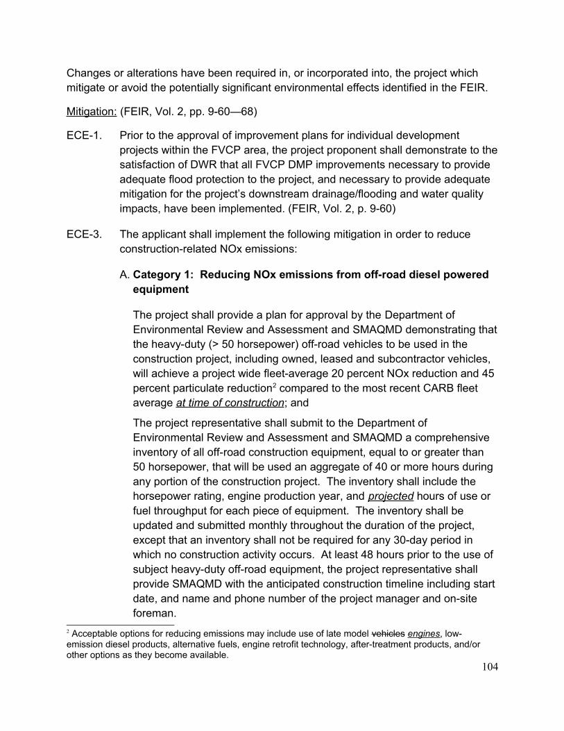
Changes or alterations have been required in, or incorporated into, the project which mitigate or avoid the potentially significant environmental effects identified in the FEIR.
Mitigation: (FEIR, Vol. 2, pp. 9-60—68)
ECE-1. Prior to the approval of improvement plans for individual development projects within the FVCP area, the project proponent shall demonstrate to thesatisfaction of DWR that all FVCP DMP improvements necessary to provide adequate flood protection to the project, and necessary to provide adequate mitigation for the project’s downstream drainage/flooding and water quality impacts, have been implemented. (FEIR, Vol. 2, p. 9-60)
ECE-3. The applicant shall implement the following mitigation in order to reduce construction-related NOx emissions:
A. Category 1: Reducing NOx emissions from off-road diesel powered equipment
The project shall provide a plan for approval by the Department of Environmental Review and Assessment and SMAQMD demonstrating thatthe heavy-duty (> 50 horsepower) off-road vehicles to be used in the construction project, including owned, leased and subcontractor vehicles, will achieve a project wide fleet-average 20 percent NOx reduction and 45 percent particulate reduction2 compared to the most recent CARB fleet average at time of construction; and
The project representative shall submit to the Department of Environmental Review and Assessment and SMAQMD a comprehensive inventory of all off-road construction equipment, equal to or greater than 50 horsepower, that will be used an aggregate of 40 or more hours during any portion of the construction project. The inventory shall include the horsepower rating, engine production year, and projected hours of use or fuel throughput for each piece of equipment. The inventory shall be updated and submitted monthly throughout the duration of the project, except that an inventory shall not be required for any 30-day period in which no construction activity occurs. At least 48 hours prior to the use of subject heavy-duty off-road equipment, the project representative shall provide SMAQMD with the anticipated construction timeline including startdate, and name and phone number of the project manager and on-site foreman.
2 Acceptable options for reducing emissions may include use of late model vehicles engines, low-emission diesel products, alternative fuels, engine retrofit technology, after-treatment products, and/or other options as they become available.
104

and:
B. Category 2: Controlling visible emissions from off-road diesel powered equipment
The project shall ensure that emissions from all off-road diesel powered equipment used on the project site do not exceed 40 percent opacity for more than three minutes in any one hour. Any equipment found to exceed40 percent opacity (or Ringelmann 2.0) shall be repaired immediately, andthe Department of Environmental Review and Assessment and SMAQMD shall be notified within 48 hours of identification of non-compliant equipment. A visual survey of all in-operation equipment shall be made atleast weekly, and a monthly summary of the visual survey results shall be submitted throughout the duration of the project, except that the monthly summary shall not be required for any 30-day period in which no construction activity occurs. The monthly summary shall include the quantity and type of vehicles surveyed as well as the dates of each survey. The SMAQMD and/or other officials may conduct periodic site inspections to determine compliance. Nothing in this section shall supersede other SMAQMD or state rules or regulations. (FEIR, Vol. 2, pp. 9-61, 62)
ECE-4. For the NOx emissions over the 85 lb/day threshold that remain after application of Mitigation Measure ECE-3, above, the applicant shall pay to SMAQMD an air quality mitigation fee of $16,000/ton of NOx over the threshold or the prevailing rate in effect at the time of construction. The fee shall be paid prior to the approval of improvement plans or the issuance of grading permits. (FEIR, Vol. 2, p. 9-62)
ECE-5. The applicant shall adhere to one of the following options:
A. Construct a minimum 7-foot tall, combination earthen berm and masonry wall noise barrier along the Elk Grove-Florin Road frontage.
B. The outdoor activity area of all residential backyards within 237 feet of the centerline of Elk Grove-Florin Road shall be shielded from traffic noise, either through strategic placement of the houses, usage of a backyard courtyard concept, or other attenuation method. An acoustical analysis shall be submitted to the Department of Environmental Review and Assessment which demonstrates that a noise level of 65 dB Ldn or less (under cumulative traffic conditions) is attained within the outdoor activity areas of all affected properties. (FEIR, Vol. 2, p. 9-62)
105

ECE-6. An acoustical study shall be submitted to the Environmental Coordinator demonstrating that interior noise levels can be attenuated to 45 dB or less forany second-story residential construction proposed within 110 feet of the centerline of Elk Grove-Florin Road and, if mitigation option ECE-5.B is chosen, for any first story residential construction proposed within 110 feet ofthe centerline of Elk Grove-Florin Road. Any second story construction within 110 feet of the centerline of Elk Grove-Florin Road, and/or first story construction within 110 feet of the centerline of Elk Grove-Florin Road under option ECE-5.B, shall be built using the construction materials and techniques outlined in the acoustical analysis. (FEIR, Vol. 2, p. 9-62)
ECE-7. Prior to any grading, grubbing, or excavation within 50 feet of on-site wetlands, the applicant or owner shall obtain any/all applicable permits from the U.S. Fish and Wildlife Service (USFWS), U.S. Army Corps of Engineers, California Department of Fish and Game and the Central Valley Regional Water Quality Control Board for the proposed modifications to on-site wetlands. In addition, the project applicant or property owner shall comply with General Plan Conservation Element Policy No. CO-96 as it pertains to no net loss of wetlands. If mitigation occurring through the state and federal permitting processes results in less than 1:1 compensation for the loss of wetland habitat, the applicant or owner shall be required to pay to the Countyof Sacramento an amount based on a rate of $35,000 per acre for the unmitigated/uncompensated wetlands. The payment shall be submitted to the Department of Planning and Community Development and shall be deposited in the Wetlands Restoration Trust Fund. A copy of any required permits, or written notification from the applicant that the permit authority has determined that a permit is not required, and verification of compliance with General Plan Conservation Element Policy No. CO-96 regarding no net loss of wetlands shall be submitted to the Department of Environmental Review and Assessment. (FEIR, Vol. 2, pp. 9-62, 63)
ECE-8. Prior to the approval of improvement plans, building permits, or recordation of the final map, whichever occurs first, or, if only a rezone is requested, priorto final adoption of the zoning agreement, implement one of the following options to mitigate for the loss of 18.9 acres of Swainson’s hawk foraging habitat on the project site:
A. The project proponent shall utilize one or more of the mitigation options (land dedication and/or fee payment) established in Sacramento County’s Swainson’s Hawk Impact Mitigation Program (Chapter 16.130 of the Sacramento County Code).
106

B. The project proponent shall, to the satisfaction of the California Department of Fish and Game, prepare and implement a Swainson’s hawk mitigation plan that will include preservation of Swainson’s hawk foraging habitat.
C. Should the County Board of Supervisors adopt a Swainson’s hawk mitigation policy/program (which may include a mitigation fee payable prior to issuance of building permits) prior to the implementation of one of the measures above, the project proponent may be subject to that program instead. (FEIR, Vol. 2, p. 9-63)
ECE-9. Prior to construction activity (including site improvements, and building construction) a focused surveys shall be conducted by a qualified biologist for burrowing owls where suitable habitat is present in the project area. Suitable habitat includes agricultural field margins, drainage ditches, and fallow fields. Surveys shall be conducted no less than 14 days and no more than 30 days prior to commencement of construction activities. Surveys shallbe conducted in accordance with CDFG protocol (CDFG 1995).
A. If no occupied burrows are found in the survey area, a letter report documenting survey methods and findings shall be submitted to the County and no further mitigation is necessary.
B. If an occupied burrow is found the applicant shall contact the Department of Environmental Review and Assessment and consult with the California Department of Fish (CDFG), prior to construction, to determine if avoidance is possible or if burrow relocation will be required.
C. If owls are to remain on-site, a minimum of 6.5 acres of foraging habitat foreach occupied burrow needs to be permanently preserved according to CDFG guidelines.
D. In order to avoid direct impacts to owls, no activity shall take within 160 feet of an active burrow from September 1 to January 31 (wintering season) or 250 feet from February 1 through August 31 (breeding season). Protective fencing shall be place, at the distances above, aroundthe active burrows and no activity shall occur within the protected buffer areas.
E. Any impact to active owl burrows, relocation of owls or mitigation for habitat loss shall be done in accordance with CDFG guidelines. Written evidence from CDFG staff shall be provided to DERA attesting to the
107
permission to remove burrows, relocate owls, mitigate for lost habitat, and provided a method for preservation habitat in perpetuity. (FEIR, Vol. 2, pp.9-63, 64)
ECE-10. If construction occurs between March 1 and September 15, pre-construction surveys for Swainson's hawk and other raptor nesting sites shall be conducted by a qualified raptor biologist. If any active nests are located within a half mile of proposed heavy equipment operations or construction activities, the project proponent shall then consult with the California Department of Fish and Game to determine the appropriate course of action to reduce potential impacts upon nesting raptors and to determine under what circumstances equipment operation and construction activities can occur. (FEIR, Vol. 2, p. 9-64)
ECE-11. Rare plant surveys will be required in vernal pool habitats prior to any grading, grubbing, or excavation within 250 feet of a vernal pool or other suitable habitat. The rare plant surveyor shall have experience as a botanical field investigator and familiarity with the local flora and potential rare plants in the habitats to be surveyed.
The surveys shall be conducted when the rare plants at the site will be easiest to identify (i.e. flowering stage), and when the plants reach that stageof maturity. A minimum of three site visit shall be required, during the plants flowering period in order to determine absence. Each site visit must be no less than 7 days apart.
Submit a written report to the Department of Environmental Review and Assessment. The survey report should include a brief description of the vegetation, survey results, photographs, time spent surveying, date of surveys, a map showing the location of the survey route and any rare plant populations and copies of any rare plant occurrence forms. Notify DFG and USFWS if species are found and apply for “take” authorization (state law section 2081 of the Fish and Game Code and federal Endangered Species Act) prior construction. (FEIR, Vol. 2, pp. 9-64, 65)
ECE-12. The removal of 59 inches dbh of native California black walnut trees (#81, #94, and #152) shall be compensated by planting native California black walnut trees equivalent to the dbh inches lost, based on the ratios listed below, at locations that are authorized by the Department of Environmental Review and Assessment. On-site preservation of native California black walnut that are less than 6 inches (<6 inches) dbh, may also be used to meet
108

this compensation requirement. A total of 59 inches will require compensation. If trees #165 and #166 cannot be protected pursuant to ECE-13, below, additional compensation will be required for these trees on the following basis: full compensation for encroachment of 50% or greater and partial compensation (% encroachment x dbh) for dripline encroachment of atleast 20% but less than 50.
Equivalent compensation based on the following ratio is required:
one preserved native walnut tree < 6 inches dbh on-site = 1 inch dbh
one D-pot seedling (40 cubic inches or larger) = 1 inch dbh
one 15-gallon tree = 1 inch dbh
one 24-inch box tree = 2 inches dbh
one 36-inch box tree = 3 inches dbh
Replacement tree planting shall be completed prior to the issuance of building permits or a bond shall be posted by the applicant in order to provide funding for purchase, planting, irrigation, and 3-year maintenance period, should the applicant default on replacement tree mitigation. The bond shall be in an amount equal to the prevailing rate of the County Tree Preservation Fund and will be due within one year of posting the bond.
Prior to the approval of Improvement Plans or Building Permits, whichever occurs first, a Replacement California black walnut Tree Planting Plan shall be prepared by a certified arborist or licensed landscape architect and shall be submitted to the Environmental Coordinator for approval. The Replacement California black walnut Planting Plan(s) shall include the following minimum elements:
1. Species, size and locations of all replacement plantings and < 6-inch dbh trees to be preserved;
2. Method of irrigation;
3. If planting in soils with a hardpan/duripan or claypan layer, include theSacramento County Standard Tree Planting Detail L-1, including the 10-foot deep boring hole to provide for adequate drainage;
4. Planting, irrigation, and maintenance schedules;
109

5. Identification of the maintenance entity and a written agreement with that entity to provide care and irrigation of the trees for a 3-year establishment period, and to replace any of the replacement California black walnut trees which do not survive during that period; and
6. Designation of 20 foot root zone radius and landscaping to occur within the radius of California black walnut trees < 6-inches dbh to be preserved on-site.
No replacement tree shall be planted within 15 feet of the driplines of existingCalifornia black walnut trees or landmark size trees that are retained on-site, or within 15 feet of a building foundation or swimming pool excavation. The minimum spacing for replacement oak trees shall be 20 feet on-center. Examples of acceptable planting locations are publicly owned lands, common areas, and landscaped frontages (with adequate spacing). Generally unacceptable locations are utility easements (PUE, sewer, storm drains), under overhead utility lines, private yards of single family lots (including front yards), and roadway medians.
California black walnut trees <6 inches dbh to be retained on-site shall have at least a 20-foot radius suitable root zone. The suitable root zone shall not have impermeable surfaces, turf/lawn, dense plantings, soil compaction, drainage conditions that create ponding, utility easements, or other overstorytree(s) within 20 feet of the tree to be preserved. Trees to be retained shall be determined to be healthy and structurally sound for future growth, by an ISA Certified Arborist subject to Department of Environmental Review and Assessment approval.
If California black walnut tree replacement plantings are demonstrated to the satisfaction of the Environmental Coordinator to be infeasible for any or all trees removed, then compensation shall be through payment into the CountyTree Preservation Fund. Payment shall be made at a rate of $325.00 per dbh inch removed but not otherwise compensated, or at the prevailing rate atthe time payment into the fund is made. (FEIR, Vol. 2, pp. 9-65—67)
ECE-13. Unless determined to be infeasible by the Department of Environmental Review and Assessment, trees #165 and #166 shall be preserved and protected as follows:
A. A circle with a radius measurement from the trunk of the tree to the tip of its longest limb shall constitute the dripline protection area of the tree. Limbs must not be cut back in order to change the dripline. The area beneath the
110

dripline is a critical portion of the root zone and defines the minimum protected area of the tree. Removing limbs which make up the dripline does not change the protected area.
B. Chain link fencing or a similar protective barrier shall be installed one foot outside the driplines of the trees prior to initiating project construction, in order to avoid damage to the trees and their root system. This protected area can be shifted with the approval of the Department of Environmental Review and Assessment, but if it results in encroachment of 20% or more, compensatory mitigation consistent with the provisions of Mitigation Measure ECE-12 shall apply.
C. No signs, ropes, cables (except cables which may be installed by a certifiedarborist to provide limb support) or any other items shall be attached to the oak trees.
D. No vehicles, construction equipment, mobile home/office, supplies, materials or facilities shall be driven, parked, stockpiled or located within thedriplines of the trees.
E. Any soil disturbance (scraping, grading, trenching, and excavation) is to be avoided within the driplines of the trees. Where this is necessary, an ISA Certified Arborist will provide specifications for this work, including methods for root pruning, backfill specifications and irrigation management guidelines.
F.Except as modified by ECE-13.B, all underground utilities and drain or irrigation lines shall be routed outside the driplines of trees. Trenching within protected tree driplines is not permitted. If utility or irrigation lines must encroach upon the dripline, they should be tunneled or bored under the tree under the supervision of an ISA Certified Arborist.
G. Any herbicides placed under paving materials within driplines of trees must be safe for use around trees and labeled for that use. Any pesticides used on site must be tree-safe and not easily transported by water.
H. Drainage patterns on the site shall not be modified so that water collects or stands within, or is diverted across, the dripline of the trees.
I. No sprinkler or irrigation system shall be installed in such a manner that it sprays water within the driplines of the trees.
111
J.Tree pruning that may be required for clearance during construction must be performed by an ISA Certified Arborist or Tree Worker and in accordance with the American National Standards Institute (ANSI) A300 pruning standards and the International Society of Arboriculture (ISA) “Tree PruningGuidelines”.
K. Landscaping beneath the oak trees may include non-plant materials such as boulders, decorative rock, wood chips, organic mulch, non-compacted decomposed granite, etc. Landscape materials shall be kept two (2) feet away from the base of the trunk. The only plant species which shall be planted within the driplines of the oak trees are those which are tolerant of the natural semi-arid environs of the trees. Limited drip irrigation approximately twice per summer is recommended for the understory plants.
L.Any fence/wall that will encroach into the dripline protection area of any protected tree shall be constructed using grade beam wall panels and postsor piers set no closer than 10 feet on center. Posts or piers shall be spacedin such a manner as to maximize the separation between the tree trunks and the posts or piers in order to reduce impacts to the trees. (FEIR, Vol. 2, pp. 9-67, 68)
ECE-14. Should any cultural resources, such as structural features, unusual amounts of bone or shell, artifacts, human remains, or architectural remains be encountered during any development activities, work shall be suspended andthe Department of Environmental Review and Assessment shall be immediately notified at (916) 874-7914.
At that time, the Department of Environmental Review and Assessment will coordinate any necessary investigation of the find with appropriate specialists as needed. The project proponent shall be required to implementany mitigation deemed necessary for the protection of the cultural resources.In addition, pursuant to Section 5097.97 of the State Public Resources Code and Section 7050.5 of the State Health and Safety Code, in the event of the discovery of human remains, all work is to stop and the County Coroner shallbe immediately notified. If the remains are determined to be Native American, guidelines of the Native American Heritage Commission shall be adhered to in the treatment and disposition of the remains. (FEIR, Vol. 2, p. 9-68)
Significance Level After Mitigation: Less than significant, for those impacts and mitigation measures identified in these project specific Findings.
112

Vineyard Market Square
CONTROL NUMBER: 04-RZB-PMR-AHS-0209
Project Description:
1. A Rezone of approximately 37 acres from AR-10 agricultural-residential to SC shopping center (Plate VMS-2, FEIR, Vol. 2, p. 10-5).
2. A Tentative Parcel Map to divide approximately 37+ gross acres into 7 parcels (Plate VMS-2Error: Reference source not found, FEIR, Vol. 2, p. 10-5).
Impacts:
Construction of the project may result in potentially significant impacts related to the County drainage system, noise, wetlands, identified special status species, cultural resources and hazardous materials.
Finding:
Changes or alterations have been required in, or incorporated into, the project which mitigate or avoid the potentially significant environmental effects identified in the FEIR.
Mitigation: (FEIR, Vol. 2, pp. 10-54—60)
VMS-1. Prior to the approval of improvement plans for individual development projects within the FVGCP area, the project proponent shall demonstrate to the satisfaction of DWR that all FVGCP DMP improvements necessary to provide adequate flood protection to the project, and necessary to provide adequate mitigation for the project’s downstream drainage/flooding and water quality impacts, have been implemented. (FEIR, Vol. 2, p. 10-54)
VMS-3. If multi-family residential units are developed on the eastern portion of the site, consistent with the Planning Department or CAC Land Use Plan option, then the applicant shall adhere to one of the following options:
A. All residential units shall be placed a minimum of 79 feet away from the Gerber Road centerline.
B. An acoustical analysis shall be submitted to the Department of Environmental Review and Assessment which demonstrates that a noise level of 45 dB Ldn or less (under cumulative traffic conditions) is attained
113

within the indoor areas of all affected properties (any residential units located within 79 feet of the Gerber Road centerline). Any construction within 79 feet of the centerline of Gerber Road shall be built using the construction materials and techniques outlined in the acoustical analysis.(FEIR, Vol. 2, p. 10-54)
VMS-4. Prior to any grading, grubbing, or excavation within 50 feet of on-site wetlands, the applicant or owner shall obtain any/all applicable permits from the U.S. Fish and Wildlife Service (USFWS), U.S. Army Corps of Engineers, California Department of Fish and Game and the Central Valley Regional Water Quality Control Board for the proposed modifications to on-site wetlands. In addition, the project applicant or property owner shall comply with General Plan Conservation Element Policy No. CO-96 as it pertains to no net loss of wetlands. If mitigation occurring through the state and federal permitting processes results in less than 1:1 compensation for the loss of wetland habitat, the applicant or owner shall be required to pay to the County of Sacramento an amount based on a rate of $35,000 per acre for the unmitigated/ uncompensated wetlands. The payment shall be submitted to the Department of Planning and Community Development and shall be deposited in the Wetlands Restoration Trust Fund. A copy of any required permits, or written notification from the applicant that the permit authority has determined that a permit is not required, and verification of compliance with General Plan Conservation Element Policy No. CO-96 regarding no net loss of wetlands shallbe submitted to the Department of Environmental Review and Assessment. (FEIR, Vol. 2, p. 10-55)
VMS-5. Prior to the approval of improvement plans, building permits, or recordation of the final map, whichever occurs first, implement one of the following options to mitigate for the loss of 9.25 acres of Swainson’s hawk foraging habitat on the project site:
A. The project proponent shall utilize one or more of the mitigation options (land dedication and/or fee payment) established in Sacramento County’s Swainson’s Hawk Impact Mitigation Program (Chapter 16.130 of the Sacramento County Code).
B. The project proponent shall, to the satisfaction of the California Department of Fish and Game, prepare and implement a Swainson’s hawk mitigation plan that will include preservation of Swainson’s hawk foraging habitat.
114

C. Should the County Board of Supervisors adopt a Swainson’s hawk mitigation policy/program (which may include a mitigation fee payable prior to issuance of building permits) prior to the implementation of one of the measures above, the project proponent may be subject to that program instead. (FEIR, Vol. 2, p. 10-55)
VMS-6. If construction, grading, or project-related improvements are to occur between March 1 and September 15, a focused survey for raptor nests on the site andon nearby trees (within 500 feet of the site) shall be conducted by a qualified biologist within 14 days prior to the start of construction work (including clearing and grubbing). If no active nests are found during the focused survey, no further mitigation will be required. If an active nest(s) is found, theDepartment of Environmental Review and Assessment and the CDFG shall be contacted to determine appropriate protective measures. (FEIR, Vol. 2, pp. 10-55, 56)
VMS-7. Prior to construction activity (including site improvements, and building construction) a focused surveys shall be conducted by a qualified biologist for burrowing owls where suitable habitat is present in the project area. Suitable habitat includes agricultural field margins, drainage ditches, and fallow fields. Surveys shall be conducted no less than 14 days and no more than 30 days prior to commencement of construction activities. Surveys shallbe conducted in accordance with CDFG protocol (CDFG 1995).
A. If no occupied burrows are found in the survey area, a letter report documenting survey methods and findings shall be submitted to the County and no further mitigation is necessary.
B. If an occupied burrow is found the applicant shall contact the Department of Environmental Review and Assessment and consult with the California Department of Fish (CDFG), prior to construction, to determine if avoidance is possible or if burrow relocation will be required.
C. If owls are to remain on-site, a minimum of 6.5 acres of foraging habitat foreach occupied burrow needs to be permanently preserved according to CDFG guidelines.
D. In order to avoid direct impacts to owls, no activity shall take within 160 feet of an active burrow from September 1 to January 31 (wintering season) or 250 feet from February 1 through August 31 (breeding season). Protective fencing shall be place, at the distances above, around
115

the active burrows and no activity shall occur within the protected buffer areas.
E. Any impact to active owl burrows, relocation of owls or mitigation for habitat loss shall be done in accordance with CDFG guidelines. Written evidence from CDFG staff shall be provided to DERA attesting to the permission to remove burrows, relocate owls, mitigate for lost habitat, and provided a method for preservation habitat in perpetuity. (FEIR, Vol. 2, p. 10-56)
VMS-8. Prior to construction within 250 feet of the seasonal wetlands on the project site,the applicant shall either conduct determinate surveys, according to U.S. Fish and Wildlife Service approved protocol, for listed vernal pool branchiopods or presence of these species shall be assumed.
A. If determinate surveys show that no listed vernal pool branchiopods are present in the seasonal wetlands, no further mitigation is required.
B. If presence is assumed or confirmed, total avoidance requires establishment of minimum 250 feet buffers with fencing around the perimeter of shrimp habitat to be preserved. There shall be no construction activity within fenced area(s).
C. A request for consultation with the U.S. Fish and Wildlife Service and DERA will be required if the applicant requires a reduction in the 250 feet buffer.
D. If direct impacts (fill or excavation) to the wetlands are to occur, the applicant shall consult with the U.S. Fish and Wildlife Service and U.S. Army Corps of Engineers to obtain permits and establish compensatory mitigation for impacts to vernal pool species. (FEIR, Vol. 2, pp. 10-56, 57)
VMS-9. Rare plant surveys will be required in vernal pool habitats prior to any grading, grubbing, or excavation within 250 feet of a vernal pool or other suitable habitat. The rare plant surveyor shall have experience as a botanical field investigator and familiarity with the local flora and potential rare plants in the habitats to be surveyed.
The surveys shall be conducted when the rare plants at the site will be easiest to identify (i.e. flowering stage), and when the plants reach that stageof maturity. A minimum of three site visits shall be required, during the plants
116
flowering period in order to determine absence. Each site visit must be no less than 7 days apart.
Submit a written report to the Department of Environmental Review and Assessment. The survey report should include a brief description of the vegetation, survey results, photographs, time spent surveying, date of surveys, a map showing the location of the survey route and any rare plant populations and copies of any rare plant occurrence forms. Notify DFG and USFWS if species are found and apply for “take” authorization (state law section 2081 of the Fish and Game Code and federal Endangered Species Act) prior construction. (FEIR, Vol. 2, p. 10-57)
VMS-10. The removal of 90 inches dbh of native California black walnut trees (#3 through #10) and 40 inches of interior live oak (#12) shall be compensated by planting native trees (valley oak/Quercus lobata, interior live oak/Quercus wislizenii, blue oak/Quercus douglasii, and California black walnut) equivalent to the dbh inches lost, based on the ratios listed below, at locations that are authorized by the Department of Environmental Review and Assessment. On-site preservation of native California black walnut/oak trees that are less than 6 inches (<6 inches) dbh, may also be used to meet this compensation requirement. A total of 130 inches will require compensation.
Equivalent compensation based on the following ratio is required:
one preserved native walnut/oak tree < 6 inches dbh on-site = 1 inch dbh
one D-pot seedling (40 cubic inches or larger) = 1 inch dbh
one 15-gallon tree = 1 inch dbh
one 24-inch box tree = 2 inches dbh
one 36-inch box tree = 3 inches dbh
Replacement tree planting shall be completed prior to the issuance of building permits or a bond shall be posted by the applicant in order to provide funding for purchase, planting, irrigation, and 3-year maintenance period, should the applicant default on replacement tree mitigation. The bond shall be in an amount equal to the prevailing rate of the County Tree Preservation Fund and will be due within one year of posting the bond.
117
Prior to the approval of Improvement Plans or Building Permits, whichever occurs first, a Replacement Native Tree Planting Plan shall be prepared by acertified arborist or licensed landscape architect and shall be submitted to the Environmental Coordinator for approval. The Replacement Native Tree Planting Plan(s) shall include the following minimum elements:
1. Species, size and locations of all replacement plantings and < 6-inch dbh trees to be preserved;
2. Method of irrigation;
3. If planting in soils with a hardpan/duripan or claypan layer, include theSacramento County Standard Tree Planting Detail L-1, including the 10-foot deep boring hole to provide for adequate drainage;
4. Planting, irrigation, and maintenance schedules;
5. Identification of the maintenance entity and a written agreement with that entity to provide care and irrigation of the trees for a 3-year establishment period, and to replace any of the replacement California black walnut/oak trees which do not survive during that period; and
6. Designation of 20 foot root zone radius and landscaping to occur within the radius of California black walnut/oak trees < 6-inches dbh to be preserved on-site.
No replacement tree shall be planted within 15 feet of the driplines of existingCalifornia black walnut/oak trees that are retained on-site, or within 15 feet ofa building foundation or swimming pool excavation. The minimum spacing for replacement oak trees shall be 20 feet on-center. Examples of acceptable planting locations are publicly owned lands, common areas, and landscaped frontages (with adequate spacing). Generally unacceptable locations are utility easements (PUE, sewer, storm drains), under overhead utility lines, private yards of single family lots (including front yards), and roadway medians.
California black walnut/oak trees <6 inches dbh to be retained on-site shall have at least a 20-foot radius suitable root zone. The suitable root zone shall not have impermeable surfaces, turf/lawn, dense plantings, soil compaction, drainage conditions that create ponding, utility easements, or other overstory tree(s) within 20 feet of the tree to be preserved. Trees to be retained shall be determined to be healthy and structurally sound for future
118

growth, by an ISA Certified Arborist subject to Department of Environmental Review and Assessment approval.
If California black walnut/oak tree replacement plantings are demonstrated tothe satisfaction of the Environmental Coordinator to be infeasible for any or all trees removed, then compensation shall be through payment into the County Tree Preservation Fund. Payment shall be made at a rate of $325.00 per dbh inch removed but not otherwise compensated, or at the prevailing rate at the time payment into the fund is made. (FEIR, Vol. 2, pp. 10-57—59)
VMS-11. Should any cultural resources, such as structural features, unusual amounts of bone or shell, artifacts, human remains, or architectural remains be encountered during any development activities, work shall be suspended andthe Department of Environmental Review and Assessment shall be immediately notified at (916) 874-7914.
At that time, the Department of Environmental Review and Assessment will coordinate any necessary investigation of the find with appropriate specialistsas needed. The project proponent shall be required to implement any mitigation deemed necessary for the protection of the cultural resources. In addition, pursuant to Section 5097.97 of the State Public Resources Code and Section 7050.5 of the State Health and Safety Code, in the event of the discovery of human remains, all work is to stop and the County Coroner shallbe immediately notified. If the remains are determined to be Native American, guidelines of the Native American Heritage Commission shall be adhered to in the treatment and disposition of the remains. (FEIR, Vol. 2, p. 10-59)
VMS-12. Prior to the approval of Improvement Plans or Building Permits, whichever occurs first, consult with the Sacramento County Environmental ManagementDepartment and prepare all documentation, as prescribed by local, State andFederal regulations, necessary to determine the extent and degree of potential hazardous conditions on the project site. Identified hazardous conditions will require proper remediation prior to the commencement of any grading or construction activity on the project site. All remedial activity shall be to the satisfaction of the Environmental Management Department. (FEIR, Vol. 2, p. 10-60)
Significance Level After Mitigation: Less than significant, for those impacts and mitigation measures identified in these project specific Findings.
119
Gardner Parke
CONTROL NUMBER: 04-RZB-SDP-SPP -AHS-0218
Project Description:
Taylor Properties at Gerber and Bradshaw Roads
CONTROL NUMBER: 04-RZB-PMR-ABE-0226
Project Description:
1. A Rezone of approximately 19.7± acres from AR-10 agricultural-residential and AR-10(F) agricultural residential flood combining to SC shopping center.(Plate TGB-2, FEIR, Vol. 2, p. 14-4)
2. A Tentative Parcel Map to divide 19.7+ acres into 7 parcels (including Parcel A) (Plate TGB-3, FEIR, Vol. 2, p. 14-5).
3. An Abandonment and Relocation of existing drainage easement.
4. An Abandonment of right-of-way on Bradshaw Road and Gerber Road. (FEIR, Vol. 2, p. 14-3)
Impacts:
Construction of the project may result in potentially significant impacts related to the County drainage system, noise, wetlands, identified special status species, and cultural resources.
Finding:
Changes or alterations have been required in, or incorporated into, the project which mitigate or avoid the potentially significant environmental effects identified in the FEIR.
Mitigation: (FEIR, Vol. 2, pp. 14-51—60)
TGB-1. Prior to the approval of improvement plans for individual development projects within the FVGCP area, the project proponent shall demonstrate to the satisfaction of DWR that all FVGCP DMP improvements necessary to provide adequate flood protection to the project, and necessary to provide adequate
120

mitigation for the project’s downstream drainage/flooding and water quality impacts, have been implemented. (FEIR, Vol. 2, p. 14-51)
TGB-3. If multi-family residential units are developed on the western portion of the site, consistent with the Planning Department or Planning Department Hybrid Land Use Plan option, then the following shall apply:
a. Any common residential outdoor activity area(s) shall be placed a minimumof 144 feet from the centerline of Gerber Road. If the setback requirement is not met, the project shall include design features that attenuate noise at the outdoor activity areas to 65 dB Ldn or less, as substantiated by an acoustical analysis, prepared by a qualified acoustical consultant and verified by the Department of Environmental Review and Assessment. Theacoustical analysis shall use cumulative-plus-project traffic conditions as described in the Traffic Impact Study for the Florin Vineyard Gap Community Plan project.
b. Any residential units placed less than 67 feet from the centerline of Gerber Road shall be designed and constructed to achieve an interior noise level of 45 dB Ldn or less. An acoustical analysis substantiating the required noise level reduction, prepared by a qualified acoustical consultant, shall be submitted to and verified by the Department of Environmental Review and Assessment prior to the issuance of any residential building permits for the site. The acoustical analysis shall use cumulative-plus-project traffic conditions as described in the Traffic Impact Study for the Florin Vineyard Gap Community Plan project. (FEIR, Vol. 2, p. 14-52)
TGB-4. Prior to any grading, grubbing, or excavation within 50 feet of on-site wetlands, the applicant or owner shall obtain any/all applicable permits from the U.S. Fish and Wildlife Service (USFWS), U.S. Army Corps of Engineers, California Department of Fish and Game and the Central Valley Regional Water Quality Control Board for the proposed modifications to on-site wetlands. In addition, the project applicant or property owner shall comply with General Plan Conservation Element Policy No. CO-96 as it pertains to no net loss of wetlands. If mitigation occurring through the state and federal permitting processes results in less than 1:1 compensation for the loss of wetland habitat, the applicant or owner shall be required to pay to the County of Sacramento an amount based on a rate of $35,000 per acre for the unmitigated/ uncompensated wetlands. The payment shall be submitted to the Department of Planning and Community Development and shall be deposited in the Wetlands Restoration Trust Fund. A copy of any required permits, or written
121

notification from the applicant that the permit authority has determined that a permit is not required, and verification of compliance with General Plan Conservation Element Policy No. CO-96 regarding no net loss of wetlands shallbe submitted to the Department of Environmental Review and Assessment. (FEIR, Vol. 2, pp. 14-52, 53)
TGB-5. Prior to construction within 250 feet of the vernal pools on the project site, the applicant shall either conduct determinate surveys, according to U.S. Fish and Wildlife Service approved protocol, for listed vernal pool branchiopods or presence of these species shall be assumed.
a. If determinate surveys show that no listed vernal pool branchiopods are present in the vernal pool(s), no further mitigation is required.
b. If presence is assumed or confirmed, total avoidance requires establishment of minimum 250 feet buffers with fencing around the perimeter of shrimp habitat to be preserved. There shall be no construction activity within fenced area(s).
c. A request for consultation with the U.S. Fish and Wildlife Service and DERA will be required if the applicant requires a reduction in the 250 feet buffer.
d. If direct impacts (fill or excavation) to the pools are to occur, the applicant shall consult with the U.S. Fish and Wildlife Service and U.S. Army Corps of Engineers to obtain permits and establish compensatory mitigation for impacts to vernal pool species. (FEIR, Vol. 2, p. 14-53)
TGB-6. Prior to the approval of Improvement Plans, Building Permits, or recordation of the final map, whichever occurs first, implement one of the following options to mitigate for the loss of 5± acres of Swainson’s hawk foraging habitat on the project site:
g. The project proponent shall, to the satisfaction of the California Department of Fish and Game, prepare and implement a Swainson’s hawk mitigation plan that will include preservation of Swainson’s hawk foraging habitat.
h. The project proponent shall utilize one or more of the mitigation options (land dedication and/or fee payment) established in Sacramento County’s Swainson’s Hawk Impact Mitigation Program (Chapter 16.130 of the Sacramento County Code).
122

i. Should the County Board of Supervisors adopt a Swainson’s hawk mitigation policy/program (which may include a mitigation fee payable prior to issuance of building permits) prior to the implementation of one of the measures above, which may exempt this project, the project proponent may be subject to that program instead. (FEIR, Vol. 2, pp. 14-53, 54)
TGB-7. If construction, grading, or project-related improvements are to occur between March 1 and September 15, a focused survey for raptor nests on the site and on nearby trees (within one half mile [rural] of the site) shall be conducted by a qualified biologist within 14 days prior to the start of construction work (includingclearing and grubbing). If no active nests are found during the focused survey, no further mitigation will be required.
If an active nest(s) is found, the Department of Environmental Review and Assessment and the California Department of Fish and Game shall be contacted to determine appropriate protective measures. (FEIR, Vol. 2, p. 14-54)
TGB-8. Prior to construction activity (including site improvements, and building construction) a focused survey(s) shall be conducted by a qualified biologist for burrowing owls where suitable habitat is present in the project area. Suitable habitat includes agricultural field margins, drainage ditches, and fallow fields. Surveys shall be conducted no less than 14 days and no more than 30 days prior to commencement of construction activities. Surveys shall be conducted in accordance with CDFG protocol (CDFG 1995).
a. If no occupied burrows are found in the survey area, a letter report documenting survey methods and findings shall be submitted to the Department of Environmental Review and Assessment and no further mitigation is necessary.
b. If an occupied burrow is found the applicant shall contact the Department of Environmental Review and Assessment and consult with the California Department of Fish (CDFG), prior to construction, to determine if avoidance is possible or if burrow relocation will be required.
c. If owls are to remain on-site, a minimum of 6.5 acres of foraging habitat for each occupied burrow needs to be permanently preserved according to CDFG guidelines.
d. In order to avoid direct impacts to owls, no activity shall take place within 160 feet of an active burrow from September 1 to January 31 (wintering
123
season) or 250 feet from February 1 through August 31 (breeding season). Protective fencing shall be place, at the distances above, around the active burrows and no activity shall occur within the protected buffer areas.
e. Any impact to active owl burrows, relocation of owls or mitigation for habitat loss shall be done in accordance with CDFG guidelines. Written evidence from CDFG staff shall be provided to DERA attesting to the permission to remove burrows, relocate owls, mitigate for lost habitat, and provided a method for preservation habitat in perpetuity. (FEIR, Vol. 2, pp. 14-54, 55)
TGB-9. To avoid impacts to giant garter snake the following guidelines should be followed:
a. The applicant shall consult with the US Fish and Wildlife Service (USFWS)and California Department of Fish and Game regarding the giant gartersnake (this may occur during the U.S. Army Corps Section 404 permittingprocess.)
b. Confine any ground disturbing activity (i.e. clearing, grubbing, grading, andexcavation) in giant garter snake habitat to May 1 to October 1, which isthe snake’s active period.
c. Construction personnel should receive USFWS approved workerenvironmental awareness training. Prior to construction activities, aqualified biologist approved by the Service shall instruct all constructionpersonnel about 1) the life history of the giant garter snake; 2) theimportance of the habitat to the giant garter snake; and 3) the terms andconditions of the biological opinion. Proof of this instruction shall besubmitted to the Sacramento Fish and Wildlife Office.
d. Twenty-four hours prior to construction activities, a qualified biologist whois approved by the USFWS’s Sacramento Office shall survey the projectarea. The biologist will provide the Service with a field report formdocumenting the monitoring efforts within 24-hours of commencement ofconstruction activities. The monitoring biologist needs to be availablethereafter; if a snake is encountered during construction activities themonitoring biologist shall have the authority to stop construction activitiesuntil appropriate corrective measures have been completed or it isdetermined that the snake will not be harmed. Giant garter snakesencountered during construction activities should be allowed to moveaway from construction activities on their own. Capture and relocation oftrapped or injured individuals can only be attempted by personnel or
124
individuals with current Service recovery permits pursuant to section 10(a) 1(A) of the Act. A biologist shall be required to report any incidentaltake to the Service immediately by telephone (916) 979-2725 and bywritten letter addressed to the Chief, Endangered Species Division, withinone working day. The project area shall be re-inspected whenever a lapsein construction activity of two week or greater has occurred.
e. If this project is subject to any permits from the USFWS all conditions ofthe approval from the agency shall supersede all of the above GGSmitigation and monitoring. (FEIR, Vol. 2, pp. 14-55, 56)
TGB-10. In an effort to prevent impacts to pond turtles the following shall be performed:
a. Areas within the project site having suitable northwestern pond turtle habitat shall be surveyed for northwestern pond turtles by a qualified biologist within 24 hours prior to the start of construction activities (including clearing and grubbing) located within 200 feet of suitable habitat. Survey of the area shall be repeated if a lapse in construction activity of two weeks or greater occurs. If no active turtles are found during the focused survey, submit a written report with date, name of biologist to the Department of Environmental Review and Assessment. Upon receiving the report, no further mitigation will be required.
b. If a northwestern pond turtle is encountered during construction, activities shall cease until appropriate corrective measures have been completed orit has been determined that the turtle will not be harmed.
c. Northwestern pond turtles encountered during construction should be allowed to move away on their own. Trapped or injured individuals shall be move out of harms way outside of the construction zone but within suitable turtle habitat (wetland).
d. Any incidental take shall be reported to the Department of Environmental Review and Assessment at (916) 874-7914 within one working day. (FEIR, Vol. 2, p. 14-56)
TGB-11. Rare plant surveys will be required in vernal pool habitats prior to any grading, grubbing, or excavation within 250 feet of a vernal pool or other suitable habitat. The rare plant surveyor shall have experience as a botanical field investigator and familiarity with the local flora and potential rare plants in the habitats to be surveyed.
125

The surveys shall be conducted when the rare plants at the site will be easiest to identify (i.e. flowering stage), and when the plants reach that stage of maturity. A minimum of three site visit shall be required, during the plants flowering period in order to determine absence. Each site visit must be no lessthan 7 days apart.
Submit a written report to the Department of Environmental Review and Assessment. The survey report should include a brief description of the vegetation, survey results, photographs, time spent surveying, date of surveys, a map showing the location of the survey route and any rare plant populations and copies of any rare plant occurrence forms. Notify DFG and USFWS if species are found and apply for “take” authorization (state law section 2081 of the Fish and Game Code and federal Endangered Species Act) prior construction. (FEIR, Vol. 2, pp. 14-56, 57)
TGB-12. The removal of 66 inches dbh of the on-site native oak trees (Tree #s 76, 96, 97, 98, 101, 102, and 103) shall be compensated by planting native oak trees (valley oak/Quercus lobata, interior live oak/Quercus wislizenii, blue oak/Quercus douglasii) equivalent to the dbh inches lost based on the ratios listed below, at locations that are authorized by the Department of Environmental Review and Assessment. On-site preservation of native oak trees that are less than 6 inches (<6 inches) may also be used to meet this compensation requirement.
Equivalent compensation based on the following ratio is required:
One preserved native oak tree <6 inches dbh on site= 1 inch dbh
One depot seedling (40 cubic inches or larger)=1 inch dbh
One 15-gallon tree= 1 inch dbh
One 24-inch box tree= 2 inches dbh
One 36-inch box tree= 3 inches dbh
Replacement tree planting shall be completed prior to the issuance of building permits or a bond shall be posted by the applicant in order to provide funding for purchase, planting, irrigation, and 3-year maintenance period, should the applicant default on replacement tree mitigation. The bond shall be in an amount equal to the prevailing rate of the County Tree Preservation Fund.
126

Prior to the approval of Improvement Plans or building permits, a Replacement Tree Planting Plan shall be submitted to the Environmental Coordinator for approval. The Replacement Tree Planting Plan(s) shall include the following elements:
1. Species, size and locations of all replacement plantings and <6-inch dbh trees to be preserved
2. Method of irrigation
3. If planting in soils with a hardpan/duripan or claypan layer, include the Sacramento County Standard Tree planting Detail L-1, including the 10-foot deep boring hole to provide for adequate drainage;
4. Planting, irrigation, and maintenance schedules;
5. Identification of the maintenance entity and a written agreement with that entity to provide care and irrigation of the trees for a 3-year establishment period, and to replace any of the replacement trees which do not survive during that period.
6. Designation of 20 foot root zone radius and landscaping to occur withinthe radius of oak trees <6-inches dbh to be preserved on-site.
No replacement tree shall be planted within 15 feet of the driplines of existing oak trees or landmark size trees that are retained on-site, or within 15 feet of a building foundation or swimming pool excavation. The minimum spacing for replacement trees shall be 20 feet on-center. Examples of acceptable planting locations are publicly owned lands, common areas, and landscaped frontages (with adequate spacing). Generally unacceptable locations are utility easements (PUE, sewer, storm drains), under overhead utility lines, private yards of single family lots (including front yards), and roadway medians.
If tree replacement plantings are demonstrated to the satisfaction of the Environmental Coordinator to be infeasible for any or all trees removed, then compensation shall be through payment into the County Tree Preservation Fund. Payment shall be made at a rate of $325.00 per dbh inch removed but not otherwise compensated, or at the prevailing rate at the time payment into the fund is made. (FEIR, Vol. 2, pp. 14-57, 58)
TGB-13. All native walnut that are 6 inches dbh or larger on the project site, all portions of adjacent off-site native walnut and oak trees that are 6 inches dbh or larger which have driplines that extend onto the project site, and all off-site native
127

walnut and oak trees that are 6 inches dbh or larger which may be impacted byutility installation and/or improvements associated with this project, shall be preserved and protected as follows:
a. A circle with a radius measurement from the trunk of the tree to the tip of itslongest limb shall constitute the dripline protection area of each tree. Limbs must not be cut back in order to change the dripline. The area beneath the dripline is a critical portion of the root zone and defines the minimum protected area of each tree. Removing limbs that make up the dripline does not change the protected area.
b. Any protected trees on the site that require pruning shall be pruned by a certified arborist prior to the start of construction work. All pruning shall be in accordance with the American National Standards Institute (ANSI) A300 pruning standards and the International Society of Arboriculture (ISA) “TreePruning Guidelines.”
c. Prior to initiating construction, temporary protective fencing shall be installed at least one foot outside the driplines of the protected trees within 100-feet of construction related activities, in order to avoid damage to the tree canopies and root systems.
d. No signs, ropes, cables (except those which may be installed by a certified arborist to provide limb support) or any other items shall be attached to the protected trees. Small metallic numbering tags for the purpose of preparing tree reports and inventories shall be allowed.
e. No vehicles, construction equipment, mobile home/office, supplies, materials or facilities shall be driven, parked, stockpiled or located within the driplines of protected trees.
f. No grading (grade cuts or fills) shall be allowed within the driplines of protected trees.
g. Drainage patterns on the site shall not be modified so that water collects orstands within, or is diverted across, the dripline of any protected tree.
h. No trenching shall be allowed within the driplines of protected trees. If it is absolutely necessary to install underground utilities within the dripline of a protected tree, the utility line shall be bored and jacked under the supervision of a certified arborist.
128

i. The construction of impervious surfaces within the driplines of protected trees shall be stringently minimized. When it is absolutely necessary, a piped aeration system per County standard detail shall be installed under the supervision of a certified arborist.
j. All portions of any required masonry wall that will encroach into the driplineprotection area of any protected tree shall be constructed using grade beam wall panels and posts set no closer than 10 feet on center. Any wrought iron fencing shall be similarly installed, with posts set no closer than 10 feet on center. Posts shall be spaced in such a manner as to maximize the separation between the tree trunks and the posts in order to reduce impacts to the trees.
k. Trunk protection measures, per Sacramento County standards, shall be used for all protected trees where development/construction activity, including installation of any required masonry wall and wrought iron fence, occurs within 10 feet of the trunk of a tree.
l. No sprinkler or irrigation system shall be installed in such a manner that sprays water or requires trenching within the driplines of protected trees. An above ground drip irrigation system is recommended.
m. Landscaping beneath oak trees may include non-plant materials such as bark mulch, wood chips, boulders, etc. The only plant species which shall be planted within the driplines of oak trees are those which are tolerant of the natural semi-arid environs of the trees. A list of such drought-tolerant plant species is available at the Department of Environmental Review and Assessment. Limited drip irrigation approximately twice per summer is recommended for the understory plants. (FEIR, Vol. 2, pp. 14-58—60)
TGB-14. Should any cultural resources, such as structural features, unusual amounts of bone or shell, artifacts, human remains, or architectural remains be encountered during any development activities, work shall be suspended and the Department of Environmental Review and Assessment shall be immediately notified at (916) 874-7914.
At that time, the Department of Environmental Review and Assessment will coordinate any necessary investigation of the find with appropriate specialists as needed. The project proponent shall be required to implement any mitigation deemed necessary for the protection of the cultural resources. In addition, pursuant to Section 5097.97 of the State Public Resources Code and Section 7050.5 of the State Health and Safety Code, in the event of the
129
discovery of human remains, all work is to stop and the County Coroner shall be immediately notified. If the remains are determined to be Native American, guidelines of the Native American Heritage Commission shall be adhered to in the treatment and disposition of the remains. (FEIR, Vol. 2, p. 14-60)
Significance Level After Mitigation: Less than significant, for those impacts and mitigation measures identified in these project specific Findings.
Caselman Ranch
CONTROL NUMBER: 04-RZB-SDP-SPP-UPP-AHS-0233
Project Description:
1. A Rezone of a total of 50+ acres from A-10 agricultural-residential to RD-5 (30+ acres) and to RD-7 (20+ acres) residential (see Plate CSR-2, FEIR, Vol. 2, p. 15-8).
2. A Tentative Subdivision Map to divide the 50+ acres into 181 single-family lots, 80 half-plex lots, 1 park site lot (Lot D), 1 treatment basin lot (Lot C), and 2 landscape lots (lots adjacent to Elk Grove-Florin Road) (see Plate CSR-3, FEIR, Vol. 2, p. 15-9).
3. A Special Development Permit to deviate from the development standards for minimum lot area and public street frontage for the half-plex lots.
4. A Use Permit to create 80 half-plex lots.
5. An Affordable Housing Plan consisting of on-site construction of affordable lots distributed throughout the project.
Impacts:
Construction of the project may result in potentially significant impacts related to the County drainage system, noise, wetlands, identified special status species, and cultural resources.
Finding:
Changes or alterations have been required in, or incorporated into, the project which mitigate or avoid the potentially significant environmental effects identified in the FEIR.
Mitigation: (FEIR, Vol. 2, pp. 15-51—57)130

CSR-1. Prior to the approval of improvement plans for individual development projects within the FVCP area, the project proponent shall demonstrate to the satisfaction of DWR that all FVCP DMP improvements necessary to provide adequate flood protection to the project, and necessary to provide adequate mitigation for the project’s downstream drainage/flooding and water quality impacts, have been implemented. (FEIR, Vol. 2, p. 15-51)
GCE-1. One of the following shall apply for exterior noise attenuation:
A. Construct a minimum 8-foot tall, combination earthen berm and masonry wall noise barrier along the Elk Grove-Florin Road frontage.
B. The outdoor activity area of all residential backyards within 238 feet of the centerline of Florin Road shall be shielded from traffic noise, either through strategic placement of the houses, usage of a backyard courtyard concept, or other attenuation method. An acoustical analysis shall be submitted to the Department of Environmental Review and Assessment which demonstrates that a noise level of 65 dB Ldn or less (under cumulative traffic conditions) is attained within the outdoor activity areas ofall affected properties. (FEIR, Vol. 2, p. 15-51)
GCE-2. One of the following shall apply for interior noise attenuation:
A. All residences shall be at least 110 feet from the centerline of Elk Grove-Florin Road.
B. If a minimum 6-foot soundwall is constructed, there will be no restriction on single-story homes, but all second stories shall be at least 110 feet from the centerline of Elk Grove-Florin Road.
C. An acoustical study shall be submitted to the Environmental Coordinator demonstrating that the interior noise levels within residences within 110 feet of the centerline of Elk Grove-Florin Road will be attenuated to 45 dB. Any construction within 110 feet of the centerline of Elk Grove-Florin Road shall be built using the construction materials and techniques outlined in the acoustical analysis. (FEIR, Vol. 2, p. 15-52)
GCE-3. Prior to any grading, grubbing, or excavation within 50 feet of on-site wetlands, the applicant or owner shall obtain any/all applicable permits from the U.S. Fishand Wildlife Service (USFWS), U.S. Army Corps of Engineers, California Department of Fish and Game and the Central Valley Regional Water Quality Control Board for the proposed modifications to on-site wetlands. In addition,
131

the project applicant or property owner shall comply with General Plan Conservation Element Policy No. CO-96 as it pertains to no net loss of wetlands. If mitigation occurring through the state and federal permitting processes results in less than 1:1 compensation for the loss of wetland habitat, the applicant or owner shall be required to pay to the County of Sacramento an amount based on a rate of $35,000 per acre for the unmitigated/uncompensated wetlands. The payment shall be submitted to the Department of Planning and Community Development and shall be deposited in the Wetlands Restoration Trust Fund. A copy of any required permits, or written notification from the applicant that the permit authority has determined that a permit is not required, and verification of compliance with General Plan Conservation Element Policy No. CO-96 regarding no net loss of wetlands shallbe submitted to the Department of Environmental Review and Assessment. (FEIR, Vol. 2, p. 15-52)
GCE-4. Prior to the approval of improvement plans, building permits, or recordation of the final map, whichever occurs first, or, if only a rezone is requested, prior to final adoption of the zoning agreement, implement one of the following options to mitigate for the loss of 12.5 acres of Swainson’s hawk foraging habitat on the project site:
A. The project proponent shall utilize one or more of the mitigation options (land dedication and/or fee payment) established in Sacramento County’s Swainson’s Hawk Impact Mitigation Program (Chapter 16.130 of the Sacramento County Code).
B. The project proponent shall, to the satisfaction of the California Department of Fish and Game, prepare and implement a Swainson’s hawk mitigation plan that will include preservation of Swainson’s hawk foraging habitat.
C. Should the County Board of Supervisors adopt a Swainson’s hawk mitigation policy/program (which may include a mitigation fee payable prior to issuance of building permits) prior to the implementation of one of the measures above, the project proponent may be subject to that program instead. (FEIR, Vol. 2, pp. 15-52, 53)
GCE-5. Prior to construction activity (including site improvements, and building construction) a focused surveys shall be conducted by a qualified biologist for burrowing owls where suitable habitat is present in the project area. Suitable habitat includes agricultural field margins, drainage ditches, and fallow fields. Surveys shall be conducted no less than 14 days and no more than 30 days
132

prior to commencement of construction activities. Surveys shall be conducted in accordance with CDFG protocol (CDFG 1995).
A. If no occupied burrows are found in the survey area, a letter report documenting survey methods and findings shall be submitted to the County and no further mitigation is necessary.
B. If an occupied burrow is found the applicant shall contact the Department ofEnvironmental Review and Assessment and consult with the California Department of Fish (CDFG), prior to construction, to determine if avoidanceis possible or if burrow relocation will be required.
C. If owls are to remain on-site, a minimum of 6.5 acres of foraging habitat for each occupied burrow needs to be permanently preserved according to CDFG guidelines.
D. In order to avoid direct impacts to owls, no activity shall take within 160 feet of an active burrow from September 1 to January 31 (wintering season) or 250 feet from February 1 through August 31 (breeding season). Protective fencing shall be place, at the distances above, around the active burrows and no activity shall occur within the protected buffer areas.
E. Any impact to active owl burrows, relocation of owls or mitigation for habitat loss shall be done in accordance with CDFG guidelines. Written evidence from CDFG staff shall be provided to DERA attesting to the permission to remove burrows, relocate owls, mitigate for lost habitat, and provided a method for preservation habitat in perpetuity. (FEIR, Vol. 2, pp. 15-53, 54)
GCE-6. If construction occurs between March 1 and September 15, pre-construction surveys for Swainson's hawk and other raptor nesting sites shall be conducted by a qualified raptor biologist. If any active nests are located within a half mile of proposed heavy equipment operations or construction activities, the project proponent shall then consult with the California Department of Fish and Game to determine the appropriate course of action to reduce potential impacts upon nesting raptors and to determine under what circumstances equipment operation and construction activities can occur. (FEIR, Vol. 2, p. 15-54)
GCE-7. The removal of 21 inches dbh of on-site native oaks (tree #21) shall be compensated by planting native oak trees (valley oak/Quercus lobata, interior live oak/Quercus wislizenii, and blue oak/Quercus douglasii) equivalent to the dbh inches lost, based on the ratios listed below, at locations that are authorized by the Department of Environmental Review and Assessment. The
133
removal of native California Black Walnut Trees and 91 inches dbh of on-site native black walnuts (tree #12, #18, #26, #31, and #55) shall be compensated by planting native black walnuts (Juglans hindsii) equivalent to the dbh inches lost, based on the ratios listed below, at locations that are authorized by the Department of Environmental Review and Assessment.
Equivalent compensation based on the following ratio is required:
• one deepot seedling (40 cubic inches or larger) = 1 inch dbh
• one 15-gallon tree = 1 inch dbh
• one 24-inch box tree = 2 inches dbh
• one 36-inch box tree = 3 inches dbh
Prior to the approval of Improvement Plans or building permits, a Replacement Oak/Black Walnut Tree Planting Plan shall be prepared by a certified arborist orlicensed landscape architect and shall be submitted to the Environmental Coordinator for approval. The Replacement Oak/Black Walnut Tree Planting Plan(s) shall include the following minimum elements:
1. Species, size and locations of all replacement plantings;
2. Method of irrigation;
3. The Sacramento County Standard Tree Planting Detail L-1, including the 10-foot deep boring hole to provide for adequate drainage;
4. Planting, irrigation, and maintenance schedules;
5. Identification of the maintenance entity and a written agreement with that entity to provide care and irrigation of the trees for a 3-year establishment period, and to replace any of the replacement oak trees which do not survive during that period.
No replacement tree shall be planted within 15 feet of the driplines of existing oak trees, black walnuts or landmark size trees that are retained on-site, or within 15 feet of a building foundation or swimming pool excavation. The minimum spacing for replacement trees shall be 20 feet on-center. Examples of acceptable planting locations are publicly owned lands, common areas, and landscaped frontages (with adequate spacing). Generally unacceptable locations are utility easements (PUE, sewer, storm drains), under overhead
134
utility lines, private yards of single family lots (including front yards), and roadway medians.
If tree replacement plantings are demonstrated to the satisfaction of the Environmental Coordinator to be infeasible for any or all trees removed, then compensation shall be through payment into the County Tree Preservation Fund. Payment shall be made at a rate of $325.00 per dbh inch removed but not otherwise compensated, or at the prevailing rate at the time payment into the fund is made. (FEIR, Vol. 2, pp. 15-54, 55)
GCE-8. project site, all healthy landmark trees on the site, all portions of adjacent off-site trees which have driplines that extend onto the project site, and all off-site oak trees which may be impacted by utility installation and/or improvements associated with this project, shall be preserved and protected as follows:
A. A circle with a radius measurement from the trunk of the tree to the tip of its longest limb shall constitute the dripline protection area of the tree. Limbs must not be cut back in order to change the dripline. The area beneath the dripline is a critical portion of the root zone and defines the minimum protected area of the tree. Removing limbs which make up the dripline does not change the protected area.
B. Chain link fencing or a similar protective barrier shall be installed one foot outside the driplines of the oak tree prior to initiating of project construction, in order to avoid damage to the trees and their root system.
C. No signs, ropes, cables (except cables which may be installed by a certifiedarborist to provide limb support) or any other items shall be attached to the oak trees.
D. No vehicles, construction equipment, mobile home/office, supplies, materials or facilities shall be driven, parked, stockpiled or located within thedripline of the oak trees.
E. Any soil disturbance (scraping, grading, trenching, and excavation) is to be avoided within the dripline of the oak trees. Where this is necessary, an ISA Certified Arborist will provide specifications for this work, including methods for root pruning, backfill specifications and irrigation management guidelines.
F.Before grading or excavation for footings, walls, or trenching within five feet outside the driplines of protected oak trees, root pruning shall be required at
135

the limits of grading or excavation to cut roots cleanly to a depth of the excavation or 36 inches (whichever is less). Roots shall be cut by manuallydigging a trench and cutting exposed roots with a saw, vibrating knife, rock saw, narrow trencher with sharp blades or other approved root-pruning equipment under the supervision of an ISA Certified Arborist.
G. All underground utilities and drain or irrigation lines shall be routed outside the driplines of oak trees. If lines must encroach upon the dripline, they should be tunneled or bored under the tree.
H. If temporary haul or access roads must pass within the driplines of oak trees, a roadbed of six inches of mulch or gravel shall be created to protect the soil. The roadbed shall be installed from outside of the dripline and while the soil is in a dry condition, if possible. The roadbed material shall be replenished as necessary to maintain a six-inch depth.
I. Any herbicides placed under paving materials must be safe for use around trees and labeled for that use. Any pesticides used on site must be tree-safe and not easily transported by water.
J.Drainage patterns on the site shall not be modified so that water collects or stands within, or is diverted across, the dripline of the oak tree.
K. No sprinkler or irrigation system shall be installed in such a manner that it sprays water within the dripline of the oak tree.
L.Tree pruning required for clearance during construction must be performed byan ISA Certified Arborist or Tree Worker.
M. Landscaping beneath the oak tree may include non-plant materials such as boulders, decorative rock, wood chips, organic mulch, non-compacted decomposed granite, etc. Landscape materials shall be kept two (2) feet away from the base of the trunk. The only plant species which shall be planted within the dripline of the oak tree are those which are tolerant of thenatural semi-arid environs of the trees. Limited drip irrigation approximatelytwice per summer is recommended for the understory plants. (FEIR, Vol. 2, pp. 15-55—57)
GCE-9. Should any cultural resources, such as structural features, unusual amounts of bone or shell, artifacts, human remains, or architectural remains be encountered during any development activities, work shall be suspended and
136
the Department of Environmental Review and Assessment shall be immediatelynotified at (916) 874-7914.
At that time, the Department of Environmental Review and Assessment will coordinate any necessary investigation of the find with appropriate specialists as needed. The project proponent shall be required to implement any mitigation deemed necessary for the protection of the cultural resources. In addition, pursuant to Section 5097.97 of the State Public Resources Code and Section 7050.5 of the State Health and Safety Code, in the event of the discovery of human remains, all work is to stop and the County Coroner shall be immediately notified. If the remains are determined to be Native American, guidelines of the Native American Heritage Commission shall be adhered to in the treatment and disposition of the remains. (FEIR, Vol. 2, p. 15-57)
Significance Level After Mitigation: Less than significant, for those impacts and mitigation measures identified in these project specific Findings.
Gardner Country Estates
CONTROL NUMBER: 04-RZB-SDP-AHS-0234
Project Description:
1. A Rezone of approximately 5 acres from AR-5 agricultural-residential to RD-5 residential and LC limited commercial (see Plate GCE-2, FEIR, Vol. 2, p. 16-6).
2. A Tentative Subdivision Map to divide approximately 5 acres into 26 residentiallots (16 single-family lots and 10 half-plex lots), 4 live work lots and one landscaping lot (see Plate GCE-3 FEIR, Vol. 2, p. 16-7).
3. A Special Development Permit to allow an affordable housing density bonus of five single-family lots as permitted by the Affordable Housing Ordinance to off-setthose units lost to affordable housing.
4. A Special Development Permit to reduce the RD-5 zone lot area, lot width, lot depth and public street frontage requirements.
5. An Affordable Housing Plan consisting of on-site construction of affordable housing.
Impacts:
137

Construction of the project may result in potentially significant impacts related to the County drainage system, noise, and cultural resources.
Finding:
Changes or alterations have been required in, or incorporated into, the project which mitigate or avoid the potentially significant environmental effects identified in the FEIR.
Mitigation: (FEIR, Vol. 2, pp. 16-34, 35)
GCE-2. One of the following shall apply to all lots where the residential backyard is located within 115 feet of the centerline of Gardner Avenue, unless the backyard is located behind a house or commercial structure on the lot that faces Gardner Avenue:
A. A 6-foot soundwall shall be installed at the rear of the landscape easement or parcel along Gardner Avenue. Once the soundwall passses the wall of ahouse on each lot, the soundwall may be stepped down and/or ended.
B. Each residential backyard shall include a shielded courtyard area or similar shielded outdoor living space. An acoustical study shall be provided to demonstrate that cumulative noise levels will be reduced to at 65 dB Ldn or less. (FEIR, Vol. 2, p. 16-34)
GCE-3. Prior to the approval of improvement plans for individual development projects within the FVCP area, the project proponent shall demonstrate to the satisfaction of DWR that all FVCP DMP improvements necessary to provide adequate flood protection to the project, and necessary to provide adequate mitigation for the project’s downstream drainage/flooding and water quality impacts, have been implemented. (FEIR, Vol. 2, p. 16-35)
GCE-4. Should any cultural resources, such as structural features, unusual amounts of bone or shell, artifacts, human remains, or architectural remains be encountered during any development activities, work shall be suspended and the Department of Environmental Review and Assessment shall be immediatelynotified at (916) 874-7914.
At that time, the Department of Environmental Review and Assessment will coordinate any necessary investigation of the find with appropriate specialists as needed. The project proponent shall be required to implement any mitigation deemed necessary for the protection of the cultural resources. In addition, pursuant to Section 5097.97 of the State Public Resources Code and Section 7050.5 of the State Health and Safety Code, in the event of the
138
discovery of human remains, all work is to stop and the County Coroner shall be immediately notified. If the remains are determined to be Native American, guidelines of the Native American Heritage Commission shall be adhered to in the treatment and disposition of the remains. (FEIR, Vol. 2, p. 16-35)
Significance Level After Mitigation: Less than significant, for those impacts and mitigation measures identified in these project specific Findings.
Martin
CONTROL NUMBER: 04- -RZB-PMR-EXP-0423
Project Description:
1. A Rezone of approximately 10 acres from AR-10 to AR-2(see Plate MRT-2, FEIR, Vol. 2, p. 20-4).
2. A Tentative Parcel Map to divide a 10-acre parcel into 4 parcels (see Plate MRT-3, FEIR, Vol. 2, p. 20-5).
3. An Exception from Title 22.24.630(2) (the County Land Development Ordinance) to allow private wells rather than a public water supply. (FEIR, Vol. 2, p. 20-3)
Impacts:
Construction of the project may result in potentially significant impacts related to the County drainage system, wetlands, identified special status species, and cultural resources.
Finding:
Changes or alterations have been required in, or incorporated into, the project which mitigate or avoid the potentially significant environmental effects identified in the FEIR.
Mitigation: (FEIR, Vol. 2, pp. 20-34—37)
MRT-1 Prior to the approval of improvement plans for individual development projects within the FVGCP area, the project proponent shall demonstrate to the satisfaction of DWR that all FVGCP DMP improvements necessary to provide adequate flood protection to the project, and necessary to provide adequate mitigation for the project’s downstream drainage/flooding and water quality impacts, have been implemented. (FEIR, Vol. 2, p. 20-34)
139
MRT-3 Prior to any grading, grubbing, or excavation within 50 feet of on-site wetlands, the applicant or owner shall obtain any/all applicable permits from the U.S. Fish and Wildlife Service (USFWS), U.S. Army Corps of Engineers, California Department of Fish and Game and the Central Valley Regional Water Quality Control Board for the proposed modifications to on-site wetlands. In addition, the project applicant or property owner shall comply with General Plan Conservation Element Policy No. CO-96 as it pertains to no net loss of wetlands. If mitigation occurring through the state and federal permitting processes results in less than 1:1 compensation for the loss of wetland habitat, the applicant or owner shall be required to pay to the County of Sacramento an amount based on a rate of $35,000 per acre for the unmitigated/ uncompensated wetlands. The payment shall be submitted to the Department of Planning and Community Development and shall be deposited in the Wetlands Restoration Trust Fund. A copy of any required permits, or written notification from the applicant that the permit authority has determined that a permit is not required, and verification of compliance with General Plan Conservation Element Policy No. CO-96 regarding no net loss of wetlands shallbe submitted to the Department of Environmental Review and Assessment. (FEIR, Vol. 2, p. 20-35)
MRT-4 Prior to the approval of Improvement Plans, Building Permits, or recordation of the final map, whichever occurs first, implement one of the following options to mitigate for the loss of 2.5 acres of Swainson’s hawk foraging habitat on the project site:
j. The project proponent shall, to the satisfaction of the California Department of Fish and Game, prepare and implement a Swainson’s hawk mitigation plan that will include preservation of Swainson’s hawk foraging habitat.
k. The project proponent shall utilize one or more of the mitigation options (land dedication and/or fee payment) established in Sacramento County’s Swainson’s Hawk Impact Mitigation Program (Chapter 16.130 of the Sacramento County Code).
l. Should the County Board of Supervisors adopt a Swainson’s hawk mitigation policy/program (which may include a mitigation fee payable prior to issuance of building permits) prior to the implementation of one of the measures above, which may exempt this project, the project proponent may be subject to that program instead. (FEIR, Vol. 2, p. 20-35)
140
MRT-5 If construction, grading, or project-related improvements are to occur between March 1 and September 15, a focused survey for Swainson’s hawk and other raptor nests on the site and on nearby trees shall take place within ½ mile of the project site and shall be conducted by a qualified biologist within 14 days prior to the start of construction work (including clearing and grubbing). If activenests are found, the California Department of Fish and Game (CDFG) shall be contacted to determine appropriate protective measures. If no active nests are found during the focused survey, no further mitigation will be required. (FEIR, Vol. 2, p. 20-36)
MRT-6 Rare plant surveys will be required in vernal pool habitats prior to any grading, grubbing, or excavation within 250 feet of a vernal pool or other suitable habitat.The rare plant surveyor shall have experience as a botanical field investigator and familiarity with the local flora and potential rare plants in the habitats to be surveyed.
The surveys shall be conducted when the rare plants at the site will be easiest to identify (i.e. flowering stage), and when the plants reach that stage of maturity. A minimum of three site visit shall be required, during the plants flowering period in order to determine absence. Each site visit must be no less than 7 days apart.
Submit a written report to the Department of Environmental Review and Assessment. The survey report should include a brief description of the vegetation, survey results, photographs, time spent surveying, date of surveys, a map showing the location of the survey route and any rare plant populations and copies of any rare plant occurrence forms. Notify DFG and USFWS if species are found and apply for “take” authorization (state law section 2081 of the Fish and Game Code and federal Endangered Species Act) prior construction. (FEIR, Vol. 2, p.20-36)
MRT-7 Should any cultural resources, such as structural features, unusual amounts of bone or shell, artifacts, human remains, or architectural remains be encountered during any development activities, work shall be suspended and the Department of Environmental Review and Assessment shall be immediatelynotified at (916) 874-7914.
At that time, the Department of Environmental Review and Assessment will coordinate any necessary investigation of the find with appropriate specialists as needed. The project proponent shall be required to implement any mitigation deemed necessary for the protection of the cultural resources. In
141
addition, pursuant to Section 5097.97 of the State Public Resources Code and Section 7050.5 of the State Health and Safety Code, in the event of the discovery of human remains, all work is to stop and the County Coroner shall be immediately notified. If the remains are determined to be Native American, guidelines of the Native American Heritage Commission shall be adhered to in the treatment and disposition of the remains. (FEIR, Vol. 2, pp. 20-36, 37)
Significance Level After Mitigation: Less than significant, for those impacts and mitigation measures identified in these Findings.
Black
CONTROL NUMBER: 04-RZB-PMR-0450
Project Description:
1. A Rezone of 10.0± acres from AR-10 to AR-1 (see Plate BLK-2, FEIR, Vol. 2, p.22-4).
3. A Tentative Parcel Map to divide 10± acres into three (3) parcels (see Plate BLK-3, FEIR, Vol. 2, p. 22-5).
4. An Exception from Title 22.24.630(2) (the County Land Development Ordinance) to allow private wells rather than a public water supply. (FEIR, Vol. 2, p. 22-2)
Impacts:
Construction of the project may result in potentially significant impacts related to the County drainage system, wetlands, identified special status species, and cultural resources.
Finding:
Changes or alterations have been required in, or incorporated into, the project which mitigate or avoid the potentially significant environmental effects identified in the FEIR.
Mitigation: (FEIR, Vol. 2, pp. 22-36—38)
BLK-1. Prior to the approval of improvement plans for individual development projects within the FVGCP area, the project proponent shall demonstrate to the satisfaction of DWR that all FVGCP DMP improvements necessary to provide adequate flood protection to the project, and necessary to provide adequate
142

mitigation for the project’s downstream drainage/flooding and water quality impacts, have been implemented. (FEIR, Vol. 2, p. 22-36)
BLK-2. Prior to any grading, grubbing, or excavation within 50 feet of on-site wetlands, the applicant or owner shall obtain any/all applicable permits from the U.S. Fish and Wildlife Service (USFWS), U.S. Army Corps of Engineers, California Department of Fish and Game and the Central Valley Regional Water Quality Control Board for the proposed modifications to on-site wetlands. In addition, the project applicant or property owner shall comply with General Plan Conservation Element Policy No. CO-96 as it pertains to no net loss of wetlands. If mitigation occurring through the state and federal permitting processes results in less than 1:1 compensation for the loss of wetland habitat, the applicant or owner shall be required to pay to the County of Sacramento an amount based on a rate of $35,000 per acre for the unmitigated/uncompensated wetlands. The payment shall be submitted to the Department of Planning and Community Development and shall be deposited inthe Wetlands Restoration Trust Fund. A copy of any required permits, or written notification from the applicant that the permit authority has determined that a permit is not required, and verification of compliance with General Plan Conservation Element Policy No. CO-96 regarding no net loss of wetlands shallbe submitted to the Department of Environmental Review and Assessment. (FEIR, Vol. 2, p. 22-36)
BLK-3. Prior to the approval of improvement plans, building permits, or recordation of the final map, whichever occurs first, implement one of the following options to mitigate for the loss of 2.5 acres of Swainson’s hawk foraging habitat on the project site:
A. The project proponent shall utilize one or more of the mitigation options (landdedication and/or fee payment) established in Sacramento County’s Swainson’s Hawk Impact Mitigation Program (Chapter 16.130 of the Sacramento County Code).
B. The project proponent shall, to the satisfaction of the California Department of Fish and Game, prepare and implement a Swainson’s hawk mitigation plan that will include preservation of Swainson’s hawk foraging habitat.
C. Should the County Board of Supervisors adopt a Swainson’s hawk mitigationpolicy/program (which may include a mitigation fee payable prior to issuance of building permits) prior to the implementation of one of the measures
143

above, the project proponent may be subject to that program instead. (FEIR, Vol. 2, pp. 22-36, 37)
BLK-4. If construction, grading, or project-related improvements are to occur between March 1 and September 15, a focused survey for raptor nests on the site and on nearby trees (within 500 feet of the site) shall be conducted by a qualified biologist within 14 days prior to the start of construction work (including clearing and grubbing). If no active nests are found during the focused survey, no further mitigation will be required. If an active nest(s) is found, the Department of Environmental Review and Assessment and the CDFG shall be contacted to determine appropriate protective measures. (FEIR, Vol. 2, p. 22-37)
BLK-5. Prior to construction within 250 feet of the vernal pools on the project site, the applicant shall either conduct determinate surveys, according to U.S. Fish and Wildlife Service approved protocol, for listed vernal pool branchiopods or presence of these species shall be assumed. (FEIR, Vol. 2, p. 22-37)
A. If determinate surveys show that no listed vernal pool branchiopods are present in the vernal pool(s), no further mitigation is required.
B. If presence is assumed or confirmed, total avoidance requires establishment of minimum 250 feet buffers with fencing around the perimeter of shrimp habitat to be preserved. There shall be no construction activity within fenced area(s).
C. A request for consultation with the U.S. Fish and Wildlife Service and DERA will be required if the applicant requires a reduction in the 250 feet buffer.
D. If direct impacts (fill or excavation) to the pools are to occur, the applicant shall consultation with the U.S. Fish and Wildlife Service and U.S. Army Corps of Engineers to obtain permits and establish compensatory mitigation for impacts to vernal pool species.
BLK-6. Rare plant surveys will be required in vernal pool habitats prior to any grading, grubbing, or excavation within 250 feet of a vernal pool or other suitable habitat.The rare plant surveyor shall have experience as a botanical field investigator and familiarity with the local flora and potential rare plants in the habitats to be surveyed.
The surveys shall be conducted when the rare plants at the site will be easiest to identify (i.e. flowering stage), and when the plants reach that stage of maturity. A minimum of three site visit shall be required, during the plants
144
flowering period in order to determine absence. Each site visit must be no less than 7 days apart.
Submit a written report to the Department of Environmental Review and Assessment. The survey report should include a brief description of the vegetation, survey results, photographs, time spent surveying, date of surveys, a map showing the location of the survey route and any rare plant populations and copies of any rare plant occurrence forms. Notify DFG and USFWS if species are found and apply for “take” authorization (state law section 2081 of the Fish and Game Code and federal Endangered Species Act) prior construction. (FEIR, Vol. 2, p. 22-37, 38)
BLK-7. Should any cultural resources, such as structural features, unusual amounts of bone or shell, artifacts, human remains, or architectural remains be encountered during any development activities, work shall be suspended and the Department of Environmental Review and Assessment shall be immediatelynotified at (916) 874-7914.
At that time, the Department of Environmental Review and Assessment will coordinate any necessary investigation of the find with appropriate specialists as needed. The project proponent shall be required to implement any mitigation deemed necessary for the protection of the cultural resources. In addition, pursuant to Section 5097.97 of the State Public Resources Code and Section 7050.5 of the State Health and Safety Code, in the event of the discovery of human remains, all work is to stop and the County Coroner shall be immediately notified. If the remains are determined to be Native American, guidelines of the Native American Heritage Commission shall be adhered to in the treatment and disposition of the remains. (FEIR, Vol. 2, p. 22-38)
Significance Level After Mitigation: Less than significant, for those impacts and mitigation measures identified in these project specific Findings.
Rancho Siesta
CONTROL NUMBER: 04-RZB-SDP-AHS-0457
Champion Oaks Residential (fka Centex)
145

CONTROL NUMBER: 06-RZB -ABE- 0709
Project Description:
1. A Rezone of approximately 42.6+ gross acres from AR-10 agricultural residentialand AR-10(F) agricultural residential (flood combining) to RD-5 (approximately 33.4 gross acres), RD-20 (approximately 5.0 gross acres), and O recreation (approximately 4.2 net acres) [see Plate CTX-1, FEIR, Vol. 2, p. 25-2]).
2. An Abandonment of excess right-of-way along Elk Grove-Florin Road and Gerber Road.
3. An Affordable Housing Plan (Rezone Only) which requires the applicant/developer to provide a more detailed revised affordable housing plan as part of the submittal of a future subdivision map or other entitlements. (FEIR, Vol. 2, pp. 25-3, 4)
Impacts:
Construction of the project may result in potentially significant impacts related to the County drainage system, noise, wetlands, identified special status species, and cultural resources.
Finding:
Changes or alterations have been required in, or incorporated into, the project which mitigate or avoid the potentially significant environmental effects identified in the FEIR.
Mitigation: (FEIR, Vol. 2, pp. 25-62—70)
CTX-1. Prior to the approval of improvement plans for individual development projects within the FVCP area, the project proponent shall demonstrate to thesatisfaction of DWR that all FVCP DMP improvements necessary to provide adequate flood protection to the project, and necessary to provide adequate mitigation for the project’s downstream drainage/flooding and water quality impacts, have been implemented. (FEIR, Vol. 2, p. 25-62)
CTX-3a. The applicant shall adhere to one of the following options to mitigate noise levels on the RD-5 zoned portion of the property:
A. Construct a minimum 6-foot tall masonry wall noise barrier along the Gerber Road frontage between the required landscape corridor and singlefamily residential lots.
146
B. The outdoor activity area of all residential backyards within 70 feet of the centerline of Gerber Road shall be shielded from traffic noise, either through strategic placement of the houses, usage of a backyard courtyard concept, or other attenuation method. An acoustical analysis shall be submitted to the Department of Environmental Review and Assessment which demonstrates that a noise level of 65 dB Ldn or less (under cumulative traffic conditions) is attained within the outdoor activity areas ofall affected properties. (FEIR, Vol. 2, pp. 25-62, 63)
CTX-3b. Any/all common outdoor activity area(s) within the RD-20 portion of the property that are located within 170 feet from the centerline of Gerber Road shall be shielded from traffic noise, either through strategic placement of structures, usage of a courtyard concept, or other attenuation method. An acoustical analysis shall be submitted to the Department of Environmental Review and Assessment which demonstrates that a noise level of 65 dB Ldn or less (under cumulative traffic conditions) is attained within the common outdoor activity areas. (FEIR, Vol. 2, p. 25-63)
CTX-4. Prior to any grading, grubbing, or excavation within 50 feet of on-site wetlands (excluding features P2, P3, and P4), the applicant or owner shall obtain any/all applicable permits from the U.S. Fish and Wildlife Service (USFWS), U.S. Army Corps of Engineers, California Department of Fish and Game and the Central Valley Regional Water Quality Control Board for the proposed modifications to on-site wetlands. In addition, the project applicant or property owner shall comply with General Plan Conservation Element Policy No. CO-96 as it pertains to no net loss of wetlands. If mitigation occurring through the state and federal permitting processes results in less than 1:1 compensation for the loss of wetland habitat, the applicant or owner shall be required to pay to the County of Sacramento an amount based on a rate of $35,000 per acre for the unmitigated/uncompensated wetlands. The payment shall be submitted to the Department of Planning and Community Development and shall be deposited in the Wetlands Restoration Trust Fund.A copy of any required permits, or written notification from the applicant that the permit authority has determined that a permit is not required, and verification of compliance with General Plan Conservation Element Policy No. CO-96 regarding no net loss of wetlands shall be submitted to the Department of Environmental Review and Assessment. (FEIR, Vol. 2, p. 25-63)
CTX-5. Prior to the approval of improvement plans, building permits, or recordation of the final map, whichever occurs first, or, if only a rezone is requested, prior
147

to final adoption of the zoning agreement, implement one of the following options to mitigate for the loss of 10.65 acres of Swainson’s hawk foraging habitat on the project site:
A. The project proponent shall utilize one or more of the mitigation options (land dedication and/or fee payment) established in Sacramento County’s Swainson’s Hawk Impact Mitigation Program (Chapter 16.130 of the Sacramento County Code).
B. The project proponent shall, to the satisfaction of the California Department of Fish and Game, prepare and implement a Swainson’s hawk mitigation plan that will include preservation of Swainson’s hawk foraging habitat.
C. Should the County Board of Supervisors adopt a Swainson’s hawk mitigation policy/program (which may include a mitigation fee payable prior to issuance of building permits) prior to the implementation of one of the measures above, the project proponent may be subject to that program instead. (FEIR, Vol. 2, pp. 25-63, 64)
CTX-6. In order to mitigate potential impacts to tricolored blackbird (TBB), two pre-construction surveys of the project impact area and areas of appropriate habitat within 100 yards of the site shall be performed by a qualified biologist.The surveys shall be done during the months of March and April (one each month) the year of project construction. If tricolored blackbirds are found nesting within the survey area, project construction shall be postponed until fledging of all nestlings (about July 15). If no tricolored blackbirds are found during the pre-construction survey, no further mitigation would be required.
If breeding or nesting tricolored black birds are found the following will need to be performed. Prior to improvement Plan or Building Permit approval, whichever comes first, the project proponent will need to submit a TBB Mitigation Plan to the CDFG for review and approval. The plan should include the following measures:
1. Perform preconstruction surveys to determine the number of nesting or breeding TBB and amount of nesting habitat onsite.
2. Avoidance of active nesting colonies should be practiced through establishment of temporary setbacks and fencing. A qualified biologist shall verifies that the setbacks and fencing are adequate and will determine when the colonies are no longer dependent on the nesting
148
habitat (i.e. nestling have fledged and are no longer using habitat). Breeding season typically last from April to July.
If existing TBB habitat is to be permanently destroyed it will be necessary to recreate nesting habitat on or adjacent to the site in wetland or riparian habitat by planting tules, cattails, native blackberries, etc, at an appropriate location. Open accessible water, foraging habitat with adequate insect prey nearby (0-2 km from nests) and nesting substrate protected from predators should be present and adequately preserved and protected from future destruction. Habitat needs to be of adequate size (according to CDFG biologist) to support a breeding colony of similar or greater size to the one destroyed by construction. (FEIR, Vol. 2, pp. 25-64, 65)
CTX-7. The following mitigation is required to ensure avoidance of impacts to the northwestern pond turtle:
A. Prior to any construction activity within 200 feet of either Elder or Gerber Creeks, the creek and the 200-foot buffer area shall be surveyed for northwestern pond turtles by a qualified biologist within 24 hours prior to the start of construction activities (including clearing and grubbing). Survey of the area shall be repeated if a lapse in construction activity of two weeks or greater occurs. If no active turtles are found during the focused survey, submit a written report with date, name of biologist to the Department of Environmental Review and Assessment. Upon receiving the report, no further mitigation will be required.
B. If a northwestern pond turtle is encountered during construction, activities shall cease until appropriate corrective measures have been completed orit has been determined that the turtle will not be harmed.
C. Northwestern pond turtles encountered during construction should be allowed to move away on their own. Trapped or injured individuals shall be move out of harms way outside of the construction zone but within suitable turtle habitat (wetland).
D. Any incidental take shall be reported to the Department of Environmental Review and Assessment at (916) 874-7914 within one working day. (FEIR, Vol. 2, p. 25-65)
CTX-8. For the protection of the giant garter snake, construction within 200 feet of either Elder Creek or Gerber Creek shall be prohibited until all mitigation for
149

impacts to the snake has been completed under the Drainage Master Plan, or the following shall apply:
150
a. The applicant shall consult with the US Fish and Wildlife Service (USFWS)and California Department of Fish and Game regarding the giant garter snake (this may occur during the U.S. Army Corps Section 404 permittingprocess.)
b. Confine any ground disturbing activity (i.e. clearing, grubbing, grading, andexcavation) in giant garter snake habitat to May 1 to October 1, which is the snake’s active period.
c. Construction personnel should receive USFWS approved worker environmental awareness training. Prior to construction activities, a qualified biologist approved by the Service shall instruct all construction personnel about 1) the life history of the giant garter snake; 2) the importance of the habitat to the giant garter snake; and 3) the terms and conditions of the biological opinion. Proof of this instruction shall be submitted to the Sacramento Fish and Wildlife Office.
d. Twenty-four hours prior to construction activities, a qualified biologist who is approved by the USFWS’s Sacramento Office shall survey the project area. The biologist will provide the Service with a field report form documenting the monitoring efforts within 24-hours of commencement of construction activities. The monitoring biologist needs to be available thereafter; if a snake is encountered during construction activities the monitoring biologist shall have the authority to stop construction activities until appropriate corrective measures have been completed or it is determined that the snake will not be harmed. Giant garter snakes encountered during construction activities should be allowed to move away from construction activities on their own. Capture and relocation of trapped or injured individuals can only be attempted by personnel or individuals with current Service recovery permits pursuant to section 10 (a) 1(A) of the Act. A biologist shall be required to report any incidental take to the Service immediately by telephone (916) 979-2725 and by written letter addressed to the Chief, Endangered Species Division, withinone working day. The project area shall be re-inspected whenever a lapse in construction activity of two week or greater has occurred.
e. If this project is subject to any permits from the USFWS all conditions of the approval from the agency shall supersede all of the above GGS mitigation and monitoring. (FEIR, Vol. 2, pp. 25-65, 66)
151

CTX-9. Any riparian habitat removed along the Elder or Gerber Creek corridors require compensation at a 1:1 ratio. If the habitat is removed due to activitiesconsistent with the North Vineyard Station Specific Plan or Florin Vineyard Gap Community Plan Drainage Master Plans, the mitigation required as part of those plans shall satisfy this requirement. If the habitat is removed as a result of modifications to the creeks that are inconsistent with the Drainage Master Plans, then the applicant shall be 100% responsible for compensationfor the loss of this habitat. Restoration within the modified creek channel may satisfy the 1:1 mitigation requirement. (FEIR, Vol. 2, p. 25-66)
CTX-10. The removal of up to 939 inches dbh of native California black walnut trees shall be compensated by planting native California black walnut trees equivalent to the dbh inches lost, based on the ratios listed below, at locations that are authorized by the Department of Environmental Review and Assessment. On-site preservation of native California black walnut that are less than 6 inches (<6 inches) dbh, may also be used to meet this compensation requirement.
Equivalent compensation based on the following ratio is required:
one preserved native walnut tree < 6 inches dbh on-site = 1 inch dbh
one D-pot seedling (40 cubic inches or larger) = 1 inch dbh
one 15-gallon tree = 1 inch dbh
one 24-inch box tree = 2 inches dbh
one 36-inch box tree = 3 inches dbh
Replacement tree planting shall be completed prior to the issuance of building permits or a bond shall be posted by the applicant in order to provide funding for purchase, planting, irrigation, and 3-year maintenance period, should the applicant default on replacement tree mitigation. The bond shall be in an amount equal to the prevailing rate of the County Tree Preservation Fund and will be due within one year of posting the bond.
Prior to the approval of Improvement Plans or Building Permits, whichever occurs first, a Replacement California black walnut Tree Planting Plan shall be prepared by a certified arborist or licensed landscape architect and shall be submitted to the Environmental Coordinator for approval. The
152

Replacement California black walnut Planting Plan(s) shall include the following minimum elements:
1. Species, size and locations of all replacement plantings and < 6-inch dbh trees to be preserved;
2. Method of irrigation;
3. If planting in soils with a hardpan/duripan or claypan layer, include the Sacramento County Standard Tree Planting Detail L-1, including the 10-foot deep boring hole to provide for adequate drainage;
4. Planting, irrigation, and maintenance schedules;
5. Identification of the maintenance entity and a written agreement with that entity to provide care and irrigation of the trees for a 3-year establishmentperiod, and to replace any of the replacement California black walnut trees which do not survive during that period; and
6. Designation of 20 foot root zone radius and landscaping to occur within the radius of California black walnut trees < 6-inches dbh to be preservedon-site.
No replacement tree shall be planted within 15 feet of the driplines of existingCalifornia black walnut trees or landmark size trees that are retained on-site, or within 15 feet of a building foundation or swimming pool excavation. The minimum spacing for replacement oak trees shall be 20 feet on-center. Examples of acceptable planting locations are publicly owned lands, common areas, and landscaped frontages (with adequate spacing). Generally unacceptable locations are utility easements (PUE, sewer, storm drains), under overhead utility lines, private yards of single family lots (including front yards), and roadway medians.
California black walnut trees <6 inches dbh to be retained on-site shall have at least a 20-foot radius suitable root zone. The suitable root zone shall not have impermeable surfaces, turf/lawn, dense plantings, soil compaction, drainage conditions that create ponding, utility easements, or other overstorytree(s) within 20 feet of the tree to be preserved. Trees to be retained shall be determined to be healthy and structurally sound for future growth, by an ISA Certified Arborist subject to Department of Environmental Review and Assessment approval.
153

If California black walnut tree replacement plantings are demonstrated to the satisfaction of the Environmental Coordinator to be infeasible for any or all trees removed, then compensation shall be through payment into the CountyTree Preservation Fund. Payment shall be made at a rate of $325.00 per dbh inch removed but not otherwise compensated, or at the prevailing rate atthe time payment into the fund is made. (FEIR, Vol. 2, pp. 25-66—68)
CTX-12. With the exception of those trees compensated through Mitigation Measure CTX-10, above, all native California black walnut trees located on the site that are 6 inches dbh or larger, all portions of adjacent off-site native trees which have driplines that extend onto the project site, and all off-site native trees which may be impacted by utility installation and/or improvements associated with this project, shall be preserved and protected as follows:
a. A circle with a radius measurement from the trunk of the tree to the tip of its longest limb shall constitute the dripline protection area of the tree. Limbs must not be cut back in order to change the dripline. The area beneath the dripline is a critical portion of the root zone and defines the minimum protected area of the tree. Removing limbs which make up the dripline does not change the protected area.
b. Chain link fencing or a similar protective barrier shall be installed one footoutside the driplines of the protedted trees prior to initiating project construction, in order to avoid damage to the trees and their root system.
c. No signs, ropes, cables (except cables which may be installed by a certified arborist to provide limb support) or any other items shall be attached to the protected trees.
d. No vehicles, construction equipment, mobile home/office, supplies, materials or facilities shall be driven, parked, stockpiled or located within the driplines of the protected trees.
e. Any soil disturbance (scraping, grading, trenching, and excavation) is to be avoided within the driplines of the protected trees. Where this is necessary, an ISA Certified Arborist will provide specifications for this work, including methods for root pruning, backfill specifications and irrigation management guidelines.
f. All underground utilities and drain or irrigation lines shall be routed outside the driplines of protected trees. Trenching within protected tree
154
driplines is not permitted. If utility or irrigation lines must encroach upon the dripline, they should be tunneled or bored under the tree under the supervision of an ISA Certified Arborist.
g. Drainage patterns on the site shall not be modified so that water collects or stands within, or is diverted across, the dripline of the protected trees.
h. No sprinkler or irrigation system shall be installed in such a manner that itsprays water within the driplines of the protected trees.
i. Tree pruning that may be required for clearance during construction must be performed by an ISA Certified Arborist or Tree Worker and in accordance with the American National Standards Institute (ANSI) A300 pruning standards and the International Society of Arboriculture (ISA) “Tree Pruning Guidelines”.
j. Landscaping beneath the protected trees may include non-plant materialssuch as boulders, decorative rock, wood chips, organic mulch, non-compacted decomposed granite, etc. Landscape materials shall be kept two (2) feet away from the base of the trunk. The only plant species which shall be planted within the driplines of the protected trees are thosewhich are tolerant of the natural semi-arid environs of the trees. Limited drip irrigation approximately twice per summer is recommended for the understory plants.
k. Any fence/wall that will encroach into the dripline protection area of any protected tree shall be constructed using grade beam wall panels and posts or piers set no closer than 10 feet on center. Posts or piers shall bespaced in such a manner as to maximize the separation between the treetrunks and the posts or piers in order to reduce impacts to the trees. (FEIR, Vol. 2, pp. 25-68—70)
CTX-11. Should any cultural resources, such as structural features, unusual amounts of bone or shell, artifacts, human remains, or architectural remains be encountered during any development activities, work shall be suspended and the Department of Environmental Review and Assessment shall be immediately notified at (916) 874-7914.
At that time, the Department of Environmental Review and Assessment will coordinate any necessary investigation of the find with appropriate specialists as needed. The project proponent shall be required to implementany mitigation deemed necessary for the protection of the cultural resources.
155

In addition, pursuant to Section 5097.97 of the State Public Resources Code and Section 7050.5 of the State Health and Safety Code, in the event of the discovery of human remains, all work is to stop and the County Coroner shallbe immediately notified. If the remains are determined to be Native American, guidelines of the Native American Heritage Commission shall be adhered to in the treatment and disposition of the remains. (FEIR, Vol. 2, p. 25-70)
Significance Level After Mitigation: Less than significant, for those impacts and mitigation measures identified in these project specific Findings.
PROJECT ALTERNATIVES
Under the CEQA Guidelines, an EIR must describe a reasonable range of alternatives to the project which would feasibly attain most of the basic project objectives but would avoid or substantially lessen any of the significant effects of the project. Under CEQA, “(f)easible means capable of being accomplished in a successful manner within a reasonable period of time, taking into account economic, environmental, legal, social, and technological factors.” (CEQA Guidelines, Section 15364) The concept of feasibility permits agency decision-makers to consider the extent to which an alternative is able to meet some or all of a project’s objectives. In addition, the definition of feasibility encompasses “desirability” to the extent an agency’s determination of feasibility represents a reasonable balancing of competing economic, environmental, social and technological factors supported by substantial evidence. (City of Del Mar v. City of San Diego (1982) 133 Cal.App.3d 410, 417. See also Sequoyah Hills Homeowners Assn. v. City of Oakland (1993) 23 Cal.App.4th 704, 715.)
The objectives of the Florin Vineyard Gap Community Plan Project (“Project”) are as follows:
1. Establish a coordinated and comprehensive approach towards land use development.
2. Provide for a mix of land uses and a variety of housing types.
3. Provide a circulation system that connects uses with roadways, bicycle and pedestrian pathways, as well as linkages to public transportation.
4. Ensure that infrastructure is provided in a logical and efficient manner.
156
5. Provide for a pattern of development that will complement existing neighborhoods, and build upon infill opportunities.
6. Prove each landowner the opportunity to develop and/or redevelop their property, consistent with the objectives of the Florin-Vineyard Plan. (FEIR,p. 2-17)
Project Alternatives
Two project alternatives were evaluated for the Project: the No Project – Buildout Pursuant to Existing Zoning Designations Alternative and the Wetland Avoidance and Smart Growth Alternative. These alternatives were considered with the intent of assessing the potential for reducing significant environmental impacts of the Project. (FEIR, pp. 3-2, 3-6)
One additional alternative, the Off-Site Alternative, was considered and rejected from further analysis. The purpose of the planning effort is to establish a comprehensive landuse plan for the Florin-Vineyard Gap area. Analysis of an off-site location would fundamentally fail to address the primary objective of the Project. Accordingly, off-site alternatives were dismissed from further consideration. (FEIR, p. 3-2)
Equal-level analysis of the CAC Land Use Plan and the Planning Department Land Use Plan was conducted throughout the Draft EIR and Final EIR, and the results of that equal-level analysis are addressed elsewhere in these Findings. In addition, as a result of the extensive public hearing process for the Project, several additional alternative land use plans were proffered by the Vineyard and South Sacramento Community Planning Advisory Councils (CPACs) sitting in joint session, the Planning Department, and the Planning Commission. In general, the two “hybrid” plans resulted in minor increases in commercial areas, with a corresponding reduction in multi-family uses, as compared to the two original proposals. Additionally, the two hybrid plans introduced a “Mixed Use Center Overlay” at key nodes, particularly at Florin and Bradshaw and at Gerber and Elk Grove-Florin roads, with the intent of encouraging office and employment at these nodes. The CPAC hybrid also resulted in a decrease in agricultural-residential uses as compared with the CAC plan, with a corresponding increase in low density residential uses. The CPAC hybrid also replaced a portion of theM-1 uses shown on the CAC plan with IR uses, consistent with the uses shown on the two Planning Department plans. The Planning Commission recommendation is midway between the two hybrid plans, generally echoing the Planning Department hybrid exceptto include more SC and less RD-2, consistent with the CPAC hybrid plan. (FEIR, pp. i—vi)
157

A traffic analysis of the CPAC and Planning Department hybrid plans was conducted to determine whether implementation of either would result in any new impacts not identified in the Draft EIR. The complete analysis is included in Appendix P of the Final EIR. It was concluded that the traffic impacts of the hybrid plans would be similar to that of the original plans. (FEIR, p. vi)
Overall, the modified plans would be expected to result in similar environmental impacts, for all subject areas, as compared with the original CAC and Planning Department plans analyzed in the Draft EIR. The determinations of impact contained within the text of the Final EIR apply to all five Land Use Plan configurations. (FEIR, p. vi)
No Project-Buildout Pursuant to Existing Zoning Regulations
Description
Under this alternative, the FVGCP area would be assumed to develop at the highest density allowed by existing zoning regulations. As shown in Table Alt-1 in the FEIR, buildout of the FVGCP under existing designations could result in a total of 595 residential units, 5.25 acres of commercial uses and 486 acres of light industrial uses. Currently, there are approximately 556 residential units within the FVGCP area. Consequently, implementation of this alternative would result in an increase of approximately 39 residential units. (FEIR, p. 3-3)
Environmental Impacts
This alternative would have fewer or reduced impacts from those associated withthe CAC and Planning Department land use plans in all subject areas except Populationand Housing. (FEIR, pp. 3-6, 10) This alternative would not contribute to ensuring a housing balance or the provision of affordable housing. The reduction in housing units as a result of this Alternative would adversely impact the ability of the County to reach goals associated with housing balance and affordable housing at both the project and cumulative levels. (FEIR, pp. 3-10, 11)
Relationship to Project Objectives
The Board rejects this alternative because it does not meet the General Plan andVineyard Community Plan objectives and strategies for efficient growth management. The majority of the FVGCP area is included within the Urban Policy Area and designated as an Urban Growth Area, signaling the intent to efficiently accommodate, atthe site, a portion of the growth that is projected to occur within Sacramento County. If designated growth areas are not developed to their full potential, direct, adverse
158
physical impacts to the environment could occur through the further loss of agricultural lands and open space/natural habitat areas. By not accommodating projected growth at this site, the growth needs are likely to be displaced elsewhere to another location that may not as appropriately situated. The environmental implications of displacing growth may be greater than those impacts associated with the proposed project. This would be particularly true if the displaced development were to occur outside of the Urban Policy Area or outside the Urban Service Boundary, where no development is envisioned during the planning horizon of the General Plan. Furthermore, this alternative does not meet the project objective of guiding the formulation of a comprehensive land use plan for an identified growth area.
Wetland Avoidance and Smart Growth Alternative
Description
As shown in Plate Alt-1, the Wetland Avoidance and Smart Growth Alternative would expand the open space area along Elder Creek, and would designate as open space substantial areas of the industrial lands located in the Planning Option D area. Substantial wetland and vernal pool resources are located in the Planning Option D area and along Elder Creek in the Option B area. Increasing the open space areas would allow for preservation of the biological resources.
The smart growth portion of the Alternative would involve the reallocation of the proposed development near Elder Creek to areas located near the intersections of Elk-Grove Florin Road and Bradshaw Road with Florin Road. The areas would be designated as multi-family sites at a minimum of 30 units per acre. The increased zoning density would be done in part to address State Housing Element law and the potential future requirements that occur if Sacramento County is considered a metropolitan jurisdiction under State law. If so, land included in the County's adequate land use inventory must be designated at a minimum of 30 units per acre, or the Countymust demonstrate that the sites can accommodate the required low income housing.
Redistributing, and increasing densities for the housing units that are currently proposed in this Open Space area would support the County’s efforts to pursue smart growth. As shown in Plate Alt-1, moving proposed dwelling units from biological resource areas to the intersections of Elk Grove-Florin Road/Gerber Road and Bradshaw Road/Gerber Road will create dense nodes of mixed-use development. Services will be within close proximity of residences, and public transit would be easier to access.
Environmental Impacts
159

The Wetland Avoidance and Smart Growth Alternative would result in a mixture of increased and decreased impact levels. Overall, the Wetland Avoidance and Smart Growth Alternative would reduce more impacts than would be increased as compared to the PD Land Use Plan, and the increased impacts identified with respect to the CAC Plan are in those areas which are most strongly affected by increasing population densities (public services, sewer service, etc.). However, increased land use densities isconsidered to be one of the primary ways of reducing overall environmental impacts by reducing the total area affected by urban development and creating living environments that are more conducive to alternative transportation methods. As a result, the Wetland Avoidance and Smart Growth Alternative is the Environmentally Superior Alternative. (FEIR, p. 3-17)
Relationship to Project Objectives
The Board rejects this alternative because development of the designated multi-family sites at a minimum density of 30 units per acre is significantly greater than and in sharp contrast with existing residential development to the west and south of the Project, and is also greater than the highest density contemplated in the immediately adjacent plan area. The multi-family residential density in this alternative is much more consistent with central city development than with moderate density suburban in-fill development. The long-term regional environmental benefits anticipated with this alternative will likely occur to their fullest extent, if at all, only if a similar regional approach to growth and residential densities is actually implemented throughout the balance of the unincorporated county and in all jurisdictions proximate to the Project area, which is a speculative scenario.
Furthermore, the housing market in and for the proximate area has shown no evidence of support for residential densities approaching the 30 units per acre contemplated by this alternative, giving rise to the possibility that such residential densities either would not be achieved or, if achieved at all, would be achieved many years in the future, resulting in vacant and underutilized land and frustrating the County’s intent to efficiently accommodate, at this site, a portion of the growth that is projected to occur within Sacramento County.
If this alternative is not built out, or if buildout is extended indefinitely, a significantportion of road and infrastructure funding supported by the high density multi-family uses might be eliminated, making the funding of needed infrastructure improvements forthe area less feasible or infeasible without burdening other development within the Project area with a disproportionate share of the costs.
In addition, although the multi-family residential densities contemplated by this alternative are generally thought to be necessary to support the growth and expansion of transit alternatives in urban areas, a link between the three high density multi-family
160

areas depicted in this alternative and the timely delivery of expanded transit service to the Project area is speculative.
STATEMENT OF OVERRIDING CONSIDERATIONS
As set forth in the preceding sections, the Board of Supervisor’s approval of the FVGCPwill result in significant adverse environmental effects that cannot be avoided, even with the adoption of all feasible mitigation measures. Despite the occurrence of these effects, however, the Board of Supervisors chooses to approve the Project because, in its view, the economic, social, and other benefits that the Project will produce will renderthe significant effects acceptable.
The following statement identifies the reasons why, in the Board’s judgment, the benefits of the Project as approved outweigh the significant environmental effects. Any one of these reasons is sufficient to justify the approval of the Project. Thus, even if a Court were to conclude that not every reason is supported by substantial evidence, the Board would stand by its determination that each individual reason is sufficient. The substantial evidence supporting the various benefits can be found in the preceding findings and in the documents found in the Record of Proceedings, all of which are incorporated by reference into this section.
The Board finds that the FVGCP would have the following economic, social and environmental benefits:
The Project is Consistent with the County General Plan.
As set forth in these Findings of Fact and in the Board’s actions approving the FVGCP Project, the Project is consistent with various policies found in the General Plan.
First, the current General Plan designation for vast portions of the area is Urban Development Area (UDA), signaling the County’s intent to efficiently accommodate, at this site, a portion of the growth that is projected to occur within Sacramento County. (FEIR, pp. 3-6, 4-1) The planning effort and public participation in the development of both the CAC land use plan and the hybrid plans prepared by the Vineyard and South Sacramento CPACs sitting in joint session, as well as the plans preferred by the Planning Department and the Planning Commission, are all consistent with the UDA policy of conducting studies leading to appropriate configurations of more urban uses for the area. (FEIR, p. 4-1) In addition, the Project, adjacent to the City of Sacramento, City of Elk Grove, the Community of South Sacramento, the North Vineyard Station Specific Plan area and the Vineyard Station Comprehensive Plan area, allows for a
161

contiguous form of urban development, consistent with County General Plan policy LU-7. Leapfrog development will not occur. (FEIR, pp. 4-23, 34)
Second, County General Plan Policy LU-13 provides that development projects are to be designed to promote pedestrian movement through direct routes that connect destinations inside and outside the plan or project area. The FVGCP Project has a well defined system of bicycle and pedestrian trails that connect neighborhoods, parks, schools, commercial areas within the Project area while also providing connections to destinations outside the Project area.
Third, the Project complies with General Plan Policies LU-10 and LU-11 by including a balance of employment opportunities, neighborhood services, and different housing types. The Project provides between 147 and 185 acres designated for commercial andoffice development, in addition to between 1,102 and 1,123 acres designated for industrial uses. The Project also accommodates between 8,950 and 12,064 residential units in a mix of residential unit types and densities.
The Board’s approval of the FVGCP Project complies with and implements the policies of the Sacramento County General Plan.
The Project is Consistent with Smart Growth Principles.
The FVGCP Project will create a diverse community with a variety of land uses and practical amenities:
The project includes a wide array of housing options to meet the needs of arange of household incomes. Higher density housing has been concentrated near shopping, schools, civic uses and major activity nodes tofacilitate access.
Affordable housing will be developed consistent with the County’s Affordable Housing Ordinance as individual development projects are approved.
The Project offers an interconnected and clearly defined system of roads, trails and bike lanes to accommodate various travel modes, including automobiles, bicyclists, pedestrians and bus transit. The Project provides asafe and efficient circulation system that interconnects uses and encourages pedestrian and bicycle circulation.
The Project will provide a network of pedestrian and bicycle lanes that will connect parks, open space areas, residential and commercial areas,
162

schools, and other civic amenities, consistent with County General Plan policy LU-13.
The Board’s approval of the FVGCP Project is consistent with Smart Growth principles.
The Board of Supervisors hereby recognizes and adopts the Findings of Fact and Statement of Overriding Considerations for the Florin Vineyard Gap Community Plan Project and each of the identified Individual Projects.
DATE:_____________________ By _______________________________
CHAIR OF THE BOARD OF SUPERVISORS OF THE COUNTY OF SACRAMENTO, STATEOF CALIFORNIA
ATTEST:
_______________________________________
CLERK OF THE BOARD
163