central asia mountain ecosystems - … · 4 1. overview of central asia mountainous ecosystem...
TRANSCRIPT

Convention on Protection and Use of Transboundary Watercourses and International Lakes
SEMINAR ON THE ROLE OF ECOSYSTEMS AS WATER SUPPLIERS (Geneva, 13-14 December 2004)
CENTRAL ASIA MOUNTAIN ECOSYSTEMS
REGIONAL ENVIRONMENTAL CENTRE FOR CENTRAL ASIA

1
REGIONAL ENVIRONMENTAL CENTRE FOR CENTRAL ASIA
TABLE OF CONTENTS INTRODUCTION ..................................................................................................................................2 Definitions ...............................................................................................................................................3 1. OVERVIEW OF CENTRAL ASIA MOUNTAINOUS ECOSYSTEM STATUS AND HISTORICAL TRENDS........................................................................................................................4 1.1. Importance of Mountainous Ecosystems ......................................................................................4 1.2. Social and Economic Factors of Mountainous Ecosystem Destabilization in the Sub-Region....5 1.3. Natural and Man-Caused Processes of Mountainous Ecosystem Destabilization in the Sub-Region 6 1.4. Initiatives to Improve the Status of Mountainous Ecosystems and Their Role in Sustainable Development ..........................................................................................................................................7 2. ASSESSMENT METHODOLOGY FEATURES..............................................................................8 Assessment Scales..................................................................................................................................9 3. CLASSIFICATION OF THE CENTRAL ASIA MOUNTAIN ECOSYSTEMS. CHOICE CRITERIA FOR THE GLOBAL ASSESSMENT................................................................................ 10 3.1. Classifications of the mountain ecosystems ...............................................................................10 Picture 1. Map of mountain and piedmont ecosystems of Central Asia ....................................................... 12 Table 1. Classification of the Central Asia mountain ecosystems .................................................13 Table 2. Classification of natural mountain ecosystems of Central Asia ......................................14 1. Desert ecosystems .......................................................................................................................15 3. Steppe ecosystems .......................................................................................................................16 4. Forest ecosystems .......................................................................................................................17 5. Meadow ecosystems ...................................................................................................................19 6. High mountain cushion plant formation .....................................................................................19 4. GOODS AND SERVICES OF SUB-GLOBAL MOUNTAIN ECOSYSTEMS................................ 20 4.1. Mountain ecosystems for sub-global assessment, which are more important for human activity/biotas.......................................................................................................................................20 Picture 2. Ecosystem Goods and Services .......................................................................................21 Table 3. Reduction of Environmental Goods/Resources and Services List ..................................22 4.2. Changes in Ecosystem Services and Impact upon Human Well-Being .....................................23 4.3. Potential Future Ecosystem Capacity for Poverty Alleviation ...................................................24 5. SELECTING PILOT AREAS AND DEVELOPING SCENARIOS FOR SUSTAINABLE OPERATION OF MOUNTAINOUS ECOSYSTEMS.......................................................................... 25 6. ? ? ? ? ? ACTION PLAN ............................................................................................................... 28 6.1. Central Asia Mountainous Ecosystem Assessment Regional Action Plan.................................28 Table 4. Assessment of Central Asia Mountainous Ecosystem (? ? ? ? ?)........................................29 Regional Action Plan...........................................................................................................................29 Identifying benefits received by the community as a result of biodiversity preservation ...............................32 6.2. Project Implementation...............................................................................................................34 BIBLIOGRAPHY................................................................................................................................. 37

2
INTRODUCTION Progressive growth of population on Earth is coupled with a steady growth of human demand
for natural resources. Increasing man-made pressure threatens regular functioning of natural ecosys-tems and entails the development of global adverse effects.
In this connection, in June 2001 UN Secretary-General Kofi Annan launched the interna-tional program “Millennium Ecosystem Assessment” (MA). The MA Program is primarily focused on assessing the status of the system «human being-biosphere» and addresses the following issues:
?) how changes in ecosystem services affect human well-being; b) what changes may affect people in future decades; c) what response should be provided locally, nationally and globally to improve the system of
nature management to promote conservation and restoration of ecosystems and to ensure their sustainable contribution to human well-being and poverty alleviation.
Following the initiative of the Regional Environmental Center for Central Asia (CAREC), the Millennium Ecosystem Assessment Secretariat included the Central Asia sub-region (CAR) as a Sub-Global Millenium Ecosystem Assessment candidate. As mountains play an important role in ensuring CAR’s vital functions and as there is a need to develop a relevant chapter for the Millen-nium Assessment Overview, the CAREC with support from the Millennium Assessment Secretariat and in cooperation with the World Fish Center developed this Program “Assessment of Central Asia Mountainous Ecosystems” (? ? ? ? ?, hereinafter the “Program”.)
Program Goal
To ensure conservation of mountainous ecosystems and sustainable development of the Cen-tral Asian sub-region on the basis of continuos effective regional policy efforts designed to improve interaction of the society with ecosystems.
Major Program Objectives:
• To generate the Global Assessment of Mountainous Ecosystems
• To develop recommendations for decision-making and planning related to conservation and restoration of Central Asia mountainous ecosystems
• To modify ecosystem assessment methodology based on the specific features of the sub-region
In accordance with the major objectives of the Millennium Ecosystem Assessment, the Pro-gram is expected to:
• analyze the current status and magnitude of man-caused transformation of the CA mountain-ous ecosystems at the local, national and sub-global levels;
• characterize changes occurring in ecosystem services and assess their impact upon human well-being;
• identify causes and effects;
• assess capacity of mountainous ecosystems to provide goods and services;
• develop scenarios of possible ecosystem changes depending on adopted decisions;
• define major activities to achieve ACAME objectives.
Following the priorities of CA nations development and recommendations of the interna-tional Great Asia Mountain Assessment (GAMA) participants’ meeting in Nepal (2003), the main emphasis in the process of Program development was placed upon assessment of biodiversity, water and land resources of Central Asia mountainous ecosystems, providing for the essential environ-mental mountain goods and services in the sub-region. Environmental water resource related moun-

3
tain services assessment is also expected to be performed in the basin context, which will allow to account for the linkages among ecosystems and to analyze “mountain-valley” services.
The whole range of assessments to be performed in the course of Program implementation will be selected based on requests and brought into effect with direct involvement of the fo llowing users:
• Governments of the Central Asian states
• International and national public organizations
• Nature users and persons using ecosystem recreational and aesthetic services
• Population of mountainous areas.
• Mass media.
• Educational, scientific, cultural and health institutions.
• Local self-government.
• Environmental organizations.
The expected Program activities are meant to facilitate fulfillment of obligations by the CA countries under a number of international conventions and programs, such as the Convention on Biodiversity (CBD), Convention to Combat Desertification (CCD), UN Framework Convention on Climate Change (UN FCCC), Convention on Environmental Impact Assessment in a Transboundary Context (CEIA TC), Convention on the Protection and Use of Transboundary Watercourses and In-ternational Lakes (ECE Water Convention).
The Program was developed with involvement of the leading scientists and experts from the Republic of Kazakhstan, the Kyrgyz Republic, the Republic of Uzbekistan, as well as NGO and lo-cal community representatives. It makes use of official statistics, materials from the local action plans for sustainable development of mountainous areas in the CA states, other published programs, overviews and reports. Definitions
Ecosystem. As used in the ACAME Program, ecosystem shall mean a combination of living organisms and their habitat. Ecosystem and landscape are very similar in terms of their components; however, there is a significant difference, which is their intersystem linkages direction. In the «eco-system» model the linkages are directed from the environmental factors to the main element – host (biota, living organisms), while in the MA - to the human being. The ecosystem approach, underpin-ning the Program, allows to develop measures that would ensure a balanced interaction of humans with other ecosystem components.
Ecosystem Resources/Goods and Services. The definition of ecosystem services, as used in
? ? , refers to benefits and values received by people from the ecosystems. As used in the Program, services shall mean «conditions and processes through which natural ecosystems enable and provide for human life. They maintain biodiversity and generation of ecosystem resources, such as sea food, animal feed, timber, organic fuel, natural fibers, many medicinal agents and manufactured and semi-finished goods». Ecosystem resources (or goods) shall respectively mean «benefits that people get, either directly or indirectly, from operational ecosystems».

4
1. OVERVIEW OF CENTRAL ASIA MOUNTAINOUS ECOSYSTEM STATUS AND HIS-TORICAL TRENDS 1.1. Importance of Mountainous Ecosystems
The region of Central Asia (CA) is located in the heart of the Eurasian continent, occupies the area of 3882 thousand square km with a population of over 53 mln people. It includes such states as the Republic of Kazakhstan, the Kyrgyz Republic, the Republic of Tajikistan, Turkmenistan and the Republic of Uzbekistan, which used to by a part of the USSR until 1991. It borders Afghanistan and Iran in the south, China in the east and Russia in the west and north.
Over 10% of the area in Central Asia area covered with mountains. Kyrgyzstan and Tajik i-stan are fully located in the mountains. The mountain systems of Pamirs-Altai and Tien Shan are the
most ancient and highest on the planet.
The mountains of Central Asia, due to their geographic location in the heart of the sub-region and a comprehensive range of altitude belts, are characterized by extreme biological diversity at the ecosystem, cenosis, population and species levels. Mountain ecosystems serve as the place of origin for many cultivated plants and animal breeds, refu-giums of plants and animal breed species, gene and cenosis pool of globally important species.
There is a great diversity of historic, ethnical and cultural sites in the mountains of Central Asia. The population is represented by over 50 ethnic groups belonging to various religious confes-sions. The nature of the mountains represents their spiritual values, is used for worshipping and serves as a source of inspiration and spiritual development. Relative spatial isolation, difficult ap-proachability and the need to adjust to vertical movement contributed to a specific lifestyle devel-oped by people populating the mountains, including various crafts, cultures and centennial traditions of non-exhaustive nature management, which have been loosing their uniqueness throughout the last decades as an effect of globalization processes.
The mountains of Central Asia are a unique source of fresh water. Runoff of the large rivers in the regions, such as the Ili, Shu, Talas, Syrdarya, Amudarya, Zeravshan, Atrek, Karatal, Aksu, Lepsa, etc., is formed in the high altitude mountains. A cascade of water reservoirs used for irriga-tion and power generation controls the runoff. Many small rivers start in the foothills as a result of underground runoff discharge. Their water is used to irrigate agricultural land in the piedmont valleys.
The main forestry resources of the region are concentrated in the mountains of Central Asia. They are the source of timber and fuel wood, fruits, berries, medicinal plants and a habitat of various wild animals. The Tien Shan Mountains have a unique spruce forest belt formed by the relic species of Tien Shan spruce. Western Tien Shan still has a lot of Zeravshan juniper open wood-lands. Considerable areas are under wild fruit bearing forests and represent the genetic centers of origin for cultivated varieties of apple, pear, pomegranate, apricot, etc.
Mountainous forests play an important role in water saving, landscape control, oxygen pro-duction and carbon dioxide absorption.
The Central Asia mountains are surrounded by a desert zone, therefore, they are somewhat specific, if compared to the mountain systems of other latitudes:

5
1. Foothills and low altitude areas are overpopulated due to more favorable climatic conditions and a better supply of water, land, pasture, forest and other resources.
2. Mountain ecosystems play a leading role in sustaining livelihood of population in the moun-tains and adjacent valleys (water, fuel, feed for domestic animals, treatment and recreational facili-ties, etc.)
Mountain ecosystems appear to be highly vulnerable and sensitive to man-made pressures due to a high speed of top-bottom substance and energy transfer, which contributes to the threat of
natural and man-caused disasters. Increasing ex-ploitation of mountain ecosystems and degradation of biota result in disruption of ecosystem linkages and, as a consequence, reduction of their self-regulating function. The negative effects of human activities in the mountains at the threshold of mil-lenniums are demonstrated by an increased occur-rence of natural disasters (mudflows, landslides, floods), extremely fast biodiversity losses, water resource reduction and soil degradation. This, in turn, makes the mountains less appealing in terms of tourism and recreation, negatively affects the
revenues of the people populating both the mountains and surrounding valleys (deserts) and pro-motes the processes of ecosystem destruction. The low living standard and population growth often force the CA governments and population to compromise, accepting progressive environmental deg-radation to satisfy the urgent needs of life. People are depleting natural resources without leaving anything to the future generations. Such resource depletion ultimately results in a severer impover-ishment of the population. This is a pressing issue to be addressed by the governments in the region jointly with international financial institutions by selecting the appropriate political tools. 1.2. Social and Economic Factors of Mountainous Ecosystem Destabilization in the Sub-Region Negative:
• Economies in transition – replacing directive and planning regulation system for market self-regulation with state involvement of recommendatory nature.
• Mountains have not yet become an independent element of territorial planning. Priority short-term objectives are public planning and private busi-ness interests.
• There is a lack of Integrated Regional Develop-ment Projects and Programs; nature management is chaotic and unregulated.
• Flawed and ineffective enforcement of the exis t-ing environmental laws.
• The law «On Mountainous Areas» was adopted only in Kyrgyzstan.
• No clear distinction between the property rights for natural resources and sites for the states and other entities.
• Small volume of state funding for environmental and social Programs.
• Weak state control and supervision in the area of nature protection, nature management and natu-ral resource use.

6
• No state system to monitor environmental status of natural ecosystems and resources.
• No standards for natural resource withdrawal and assessing damage as a result of inefficient na-ture management.
• Dramatic increase of poaching, illegal procurement of medicinal raw materials, fuel wood, wild fruits, berries, ornamental flowers and plants for commercial purposes.
• Increasing number of natural and man-caused disasters (mudflows, land slides, floods) and their impact upon community.
• Prevailing consumer attitude to wild nature, low level of environmental education, lack of ele-mentary knowledge of negative (disastrous) consequences of inefficient nature management.
• Natural bioresources are the main economic determinant of livelihood for people populating the mountains.
• Excessive exploitation of ecosystem resources caused by unavailability of realistic economic and environmental assessment of their current status.
• Lack of effective economic and financial mechanisms to promote resource and energy saving technologies.
• Heterogeneous social and economic conditions and uneven distribution of population.
• Multinational population and varying traditional methods of management and attitude to biore-sources.
Positive:
• Solid scientific traditions and quite good knowledge of nature.
• Established network of specially protected natural areas.
• Availability of a language for interethnic communications (post-Soviet countries).
• High level of general competence and qualification of specialists. 1.3. Natural and Man-Caused Processes of Mountainous Ecosystem Destabilization in the Sub-Region
Natural:
• Extreme natural conditions of ecosystem development.
• Strong seasonal and annual changes of moisture and heat supply conditions.
• Spatial heterogeneity of ecosystems causing various degrees of dependence on environment and, consequently, exposure to destructive impacts of neighboring ecosystems.
• Very fast development of erosion processes and slow accumulation processes resulting from surface gradient.
• Heterogeneity and heterochrony of morphostructural ecosystem parts and components, espe-cially of land and vegetation cover.
• Glaciations, perpetual snow, moraines of various generation, permafrost soil in high altitude mountains, posing a threat for the lower belt ecosystems.
• Active denudation processes as a result of strong topographic fragmentation.
• Extensive intermountain hollows and depressions.
• Combination of such mutually exclusive processes as aridization and cryogenesis, contribut-ing to development of solefluction and thermokarst.

7
• Strong aridization processes. Man-Caused:
Intensive and long-lasting single type activity burdens (grazing, recreation, forest cutting) contribute to such negative processes as:
• Desertification and soil degradation;
• Development of man-caused longstanding derived ecosystem modifications with a trans-formed mode of functioning;
• Convergence of ecosystems and their components caused by replacement of natural species with alien and ruderal species, simplification of community structure and composition, de-velopment of single-type destructive dynamics;
• Modification of evolutionary development trend (degrading evolution);
• Low tolerance and adaptation of natural species and communities to rapidly changing habitat conditions and loss of ecosystem self- regulation processes;
• Environmental instability as a result of induced changes in habitat conditions or modified factors of human activity;
• Rapid pace of negative processes development, frequently entailing rearrangement of func-tional inter-component and inter-ecosystem linkages;
• Negative process development pace is not correlated with the length or periodicity of types of man-caused effects;
• Active mechanogenic processes: surface washout, linear erosion, shifts of soil and slope de-posits of gravitational and cryogenic-gravitational type, deflation, aerial melkozem and sand accumulation, cryoturbation, etc.;
• Development of erosion processes, including ravine formation as a result of overgrazing, road digression, forest cutting, shrub grubbing, slope ploughing, etc.;
• Modification or destruction of lithogenic foundation through creation of man-made ecosys-tems (quarries, mines, dumps);
• Aeoline accumulation in the foothills and low altitude mountains, sandification of intermoun-tain hollows.
1.4. Initiatives to Improve the Status of Mountainous Ecosystems and Their Role in Sustain-able Development
The UN Conference of 1992 in Rio-de-Janeiro recognized the importance of mountainous ecosystems for the future of the humanity, which facilitated a change in the perception and attitude to mountainous areas in the following years. Chapter 13 of the «Agenda for the 21 Century» stresses, that the efforts of governmental, public, non-governmental and international organizations should be aimed at achieving the goals of sustainable development of mountainous areas. In 1994, in line with this chapter, the Interdepartmental Group was established to include representatives not just from the UN agencies, but also from international non-governmental organizations. In 1995 the Mountain Forum was established to unite a global network of organizations and institutions interested in sus-tainable development of mountainous areas. Information centers, coordinating regional activities, are a part of this network (CONDESAN, ICIMOD, CDE).
International cooperation for mountain research in CA grew stronger in mid 1990-ies. As a result of several international conferences («High Mountain Research: Changes and Prospects in the 21st Century», Bishkek, Kyrgyzstan, 1996; «Central Asia Mountains» (Bishkek, Kyrgyzstan, 2000) the Central Asian Mountain Information Network (CAMIN) was established with the headquarters

8
in Bishkek. The main goal of CAMIN is to encourage and establish regional relations and coopera-tion for sustainable development of mountainous areas in Central Asia.
There is a number of projects focused on mountain ranges and biodiversity preservation be-ing currently implemented: GEF Western Tien-Shan Biodiversity Preservation Project (launched in 1998), GEF Nuratau-Kyzylkum Project (since 2002), ISLT Projects – International Fund Snow Leopard Saving, SLN, NABU – Issyk-Kul and other forestry projects run by the Swiss Government in Kyrgyzstan, INTAS Project– 99-1384 (2000-2003) «Correlation of Biodiversity Loss Risk in Central Asia”, etc.
There is a Regional Project, “Central Asian Mountain Partnership” (? ? ? ?), currently being implemented. This is a long-term program supported by the Swiss Development and Cooperation Agency (SDC), designed to involve local organizations and community in the activities for sustain-able mountain development in Kyrgyzstan, Kazakhstan and Tajikistan with further coverage of Uz-bekistan and Turkmenistan.
The project “Regional Cooperation for Sustainable Development of Mountainous Areas in Central Asia” was implemented in 2000-2001 with support from the ADB and the Swiss Govern-ment to establish cross-sectoral cooperation and to develop a strategic vision of joint actions in CA. In 2002 the CAREC provided its expert and financial support to develop a draft of the «Regional Strategy for Sustainable Development of Mountainous Areas in CA». Concerted strategic activities are expected to facilitate implementation of sustainable development objectives, WSSD resolutions and the Mountain Charter.
The UN General Assembly Resolution declared 2002 the International Year of Mountains demonstrates that the world community is concerned about the destiny of mountainous areas and the people populating them. 2. ASSESSMENT METHODOLOGY FEATURES
Mountainous ecosystem assessment methodology in the Central Asian sub-region is based on the approaches and principles developed and used in the MA Program. Its core element is the multi-scale assessment, which will be conducted in line with the objectives identified at various scales. Content-wise, the ME Sub-Global Assessment methodology approaches comply with the Global As-sessment Methodology; however, they are seen through the prism of natural, social and economic conditions of the sub-region.
The specific features of the CA mountainous areas are their vertical belts, transboundary sub-global MEs, considerable gradients and lateral («horizontal») migration of substance and energy. Mountains are open ecosystems. Powerful solar en-ergy flows and considerable rainfall provide for the great productivity of mountain ecosystems and their goods and services provision capacity. However, the volume of product withdrawal in the mountains is limited by ecosystem instability caused by fast top-bottom substance and energy transfer.
The mountains form cascade systems, con-sisting of dynamically connected and directed flows of ecosystem substance and energy. Absolute preva-
lence of gradient surfaces provides for gravitational movement of water and solids (organic and in-organic components of sediment runoff) from high altitude to low altitude ecosystems. Any mass or energy coming out of one ecosystem enters the ecosystem adjacent to it. Biota is a part of the proc-ess of bio-geochemical and mechanical barrier formation, conserving certain mass and energy as a reserve (of products) in the ecosystem.

9
As the sub-global CA mountain ecosystems provide varied contributions to human well-being and varied responses to man-caused pressures, there is a need to select the major mountain ecosystems (MMEs) for the purposes of research. The following served as the selection criteria:
(i) Scope and range of environmental goods and services provided by a mountainous ecosystem to ?) the mountain community and b) valleys
(ii) Magnitude of disturbance of mountainous ecosystems and need for their restoration
(iii) Scope and effectiveness of regulation services (climate change, hydrological regime, status of soil and vegetation cover, etc.)
(iv) Current ecosystem resource capacity.
Some of the issues that may require methodology development include the following: • Improving the conceptual assessment framework based on the model «source –impact (direct
factors) – ME status - implications – community reaction (response)» with an emphasis upon as-sessing the effectiveness of the response.
• Differentiating between environmental resources/services provided to satisfy human needs and services provided for biotic regulation of the environment in the classification of environmental resources/services.
• Assessing needs of humans as a biological and social species • Developing the transboundary aspects of assessment. CA mountainous ecosystems of sub-global
scale stretch across the state borders and their assessment requires coordination of methodologi-cal approaches by the experts, as well as interaction of decision-makers in the CA countries.
• Unifying assessment methods and criteria. Assessment Scales
Mountainous Ecosystem Assessment is expected to be performed in line with the Program objectives at the sub-global/regional, national or local level. Conjugate multi-scale assessments are especially important when the effectiveness of decisions related to ecosystem resource use and hu-man response to their changes are considered.
1) Sub-Global Level – all mountainous areas of the CA sub-region. The purpose of assessment at this scale is to provide information for the Global Mountain Ecosystem Assessment through the prism of natural and socio-economic conditions of the Central Asia sub-region.
2) National Level – all major mountain ecosystems within the administrative border of the CA countries. The national level assessment is geared towards meeting users’ needs in addressing the following objectives:
- Identifying effective and ineffective nature management methods implemented within the national legal and regulatory framework;
- Developing qualitative and quantitative criteria for the current ecosystem status and trans-formation magnitude, as well as correlation of these data with poverty or sustainable devel-opment indicators based on history records.
- Analyzing alternatives (scenarios) of probable sustainable co-existence of community and natural ecosystems in the context of national legal and institutional environment;
- Identifying the capacity of ecosystems, which are essential for the nation’s development and developing a plan of actions to conserve and restore them;
- Ensuring effective state and institutional nature management administration and supplies of goods and services.
3) Local Level – mountainous ecosystem assessment within administrative units, natural and geographic districts or specific localities. Such assessment is required to extrapolate the data ob-tained at the local level into an aggregate national and sub-global assessment. An assessment at this scale provides an opportunity to create a clear picture demonstrating the mechanisms of human in-

10
teraction with various ecosystem components and to experimentally evaluate the effectiveness of managerial decisions related to the use of natural ecosystem goods and services.
4) The Basin Scale of mountain ecosystem assessment is required to understand the process of formation of the main environmental good – water resources in the upper sections of the river basins, which is important for developing a set of integrated actions to manage interaction of humans and the environment. Mountain ecosystems of catchment areas may be quite sens itive indicators of cli-mate change. Ecosystem linkages analysis, including nival systems in the basin catchment area, al-lows to identify the causes of the river runoff changes, which is significant, as the mountains provide water resources for the valleys. This is of special importance to Central Asia, as the trends of hydro-logical regime change and river runoff reduction aggravate the interstate regional and local water use problems. The occurrence interval of such extreme hydrological phenomena as disastrous floods and water shortages has decreased. The consequences of river runoff changes pose a real threat to sus-tainable development of the Central Asian states. The results of ecosystem assessment at the basin level will be required to establish an information and analytical base for integrated natural resource management.
3. CLASSIFICATION OF THE CENTRAL ASIA MOUNTAIN ECOSYSTEMS. CHOICE CRITERIA FOR THE GLOBAL ASSESSMENT 3.1. Classifications of the mountain ecosystems
There are many approaches to ecosystem classification. In view of the necessity of integra-tion and coordination of results of an assessment with other projects, which are carried out within the framework of the international Programmes on the UN, WWF, and GEF Nature Protection Conven-tions, the decision to use the classification for the Central Asian eco-systems approbated in other projects has been adopted. This classification in the greatest degree takes into accounts the physico-bio-geographic characteristics and rules of zoning.
Ecosystem approach is a base for classification of the Global Land Cover Characterization developed by the US centre for geological studies (USGS), Earth resources observation system (EROS) and the European Commission united research centre ( http://edcdaac.usgs.gov/glcc.html ) and use the data processing of AVHRR NOAA satellite (resolution is 1 km). Methodical approach developed by Jerri Olson and called as ‘Global Ecosystem Framework’ is a base for this system. It includes a principal conception about ecosystem as a biosphere, i.e. a set of biosphere types subordi-nated to the certain hierarchy and having a typological nature. Global Framework includes a three-level description for ecosystem types, for example:
1. Forest 1.1. Subtropical 1.1.1. Evergreen broad- leaved 1.1.2. Defoliation broad- leaved. 1.1.3. Mixed forest
The highest level of hierarchy automatically means, that all types of habitats of the lowest levels are subordinated to the highest one. This classification is accepted by the Species Survival Commission of the International Union for Conservation of Nature (SSC/IUCN) as a standard sys-tem for description of the global types of habitats of taxons, included into the IUCN Red list and Species Information Service (SIS). At present this classification system is completed with consider-ing of the regional specifics. The completion includes the additional habitats.
We accept this approach as a base for assessment of the mountain ecosystems. But according to the Programme purposes we have been limited to two-level ecosystem clas-

11
sification (Table 1). The highest level of hierarchy corresponds to the sub-global/sub-regional scale, the second one – to the national. By development of actions at a local level, within units of the sec-ond classification level, it is possible to separate ecosystems of a local level with taking into account their specificity for concrete territory.
It is necessary to note, that a distribution of ecosystems presented in species classification is not equivalent and depends on a complex of the physico-geographical parameters of the mountain systems and some ridges (picture 1).
Ecosystems of a local scale can be separated at meso-structural level on a base of geo-morphological, edaphic and geo-botanical criteria. For sub-global assessment they are combined by zone types (piedmont deserts, semi-savannas, steppes, forests etc.) in view of their high-altitude dis-tribution, lithogenous base and hydrothermal parameters of their formation.

12
Picture 1. Map of mountain and piedmont ecosystems of Central Asia Legend
Piedmont and mountain desert ecosystems Piedmont and mountain savannoid ecosystems Mountain steppe ecosystems Mountain forest ecosystems Mountain meadow ecosystems Niveal and subniveal ecosystems Glaciers and snow patches
Legend Piedmont and mountain desert ecosystems Piedmont and mountain savannoid ecosystems Mountain steppe ecosystems Mountain forest ecosystems Mountain meadow ecosystems Niveal and subniveal ecosystems Glaciers and snow patches

13
Table 1. Classification of the Central Asia mountain ecosystems 1. Desert ecosystems
1.1. Piedmont desert ecosystems (Northern Tien Shan) 1.2. High mountain desert ecosystems (Eastern Pamir)
2. Semisavanna ecosystems 2.1. Piedmont short grass-ephemerous-ephemeroid semisavanna ecosystems (Western Tien
Shan) 2.2. Piedmont and low mountain tall forb and tall grass ephemerous-ephemeroid ecosys-
tems (Western Tien Shan, Kopet-Dag) 2.3. Mid-altitude mountain ephemeroid-sagebrush (Western Pamir, Badakhshan)
3. Steppe ecosystems 3.1. Low mountain ecosystems (Northern Tien Shan) 3.2. Mid-altitude mountain steppe ecosystems (Northern and Central Tien Shan) 3.3. Mountainous-xerophyte-steppe ecosystems of mid altitude mountain belt (Western
Pamir, Badakhshan, Kopet-Dag) 3.4. High mountain steppe ecosystems (Central Tien Shan, Syrty of Internal Tien Shan,
Eastern Pamir). 4. Forest ecosystems
4.1. Piedmont and low mountain xerophyte open woodland ecosystems (Western Tien Shan, Kopet-Dag, Western Pamir)
4.2. Wild fruit-bearing (apple, apricot) tree groves and bushes (Northern and Western Tien Shan)
4.3. Open woodland haw and pistachio ecosystems (Western Tien Shan) 4.4. Small- leaved (birch and aspen) ecosystems (Northern Tien Shan) 4.5. Maple (Western Tien Shan) 4.6. Walnut ecosystems (Western Tien Shan) 4.7. Spruce forest ecosystems (Northern Tien Shan) 4.8. Juniper forests and open woodlands (Western Tien Shan, Kopet-Dag, Western Pamir) 4.9. Mountain tugai ecosystems (in river valleys)
5. Meadow ecosystems 5.1. Mid- and tall grass meadows of mid-altitude mountain belt (Northern and Western
Tien Shan) 5.2. Sub-alpine meadows and juniper elfin wood (Northern and Western Tien Shan) 5.3. Alpine short grass and Cobresia meadows (Northern, Western and Central Tien Shan)
and Cobresia meadows (Northern Tien Shan) 6. High mountain cushion plant formation
6.1. Continental cold-temperate ecosystems (Western Pamir, Badakhshan, Central Tien Shan)
6.2. Ultra-continental warm-temperate ecosystems (Eastern Pamir) 7. Nival ecosystems
7.1. Moraines 7.2. Eternal snow 7.3. Glaciers
8. Water ecosystems 8.1. Rivers 8.2. Mid-altitude mountain lakes 8.3. High mountain lakes 8.4. Artificial reservoirs
9. Agro-ecosystems

14
9.1. Agricultural grounds 9.2. Dacha sites
10. Urban-ecosystems 10.1. Mountain auls and villages up to 500 habitants 10.2. Mountain auls and villages with more than 500 habitants 10.3. Cities 10.4. Sanatoriums, rest homes etc.
Nival systems, especially glaciers, play the important role in formation of a river drain and climatic conditions in CA. The degradation of these systems observable during the last years de-mands their study directly connected with water ecosystems assessment (rivers, mid-altitude moun-tain and high mountain lakes).
The analysis of capacity of mountain ecosystems to give the goods and services to the popu-lation at different variants of an anthropogenous influence is one of the basic aspects of the assess-ment In this connection the characteristic of anthropogenous ecosystems is important for agro-ecosystems (agricultural grounds, dachas sites), urban-ecosystems (mountain auls and villages with up to and more than 300 inhabitants, city, sanatorium, house of rest etc.), and artificial reservoirs.
To understand the spatial differentiation of the Central Asian mountain ecosystems the zon-ing spectra and their distribution at the certain ridges is presented in Table 2. Table 2. Classification of natural mountain ecosystems of Central Asia
Classification of natural mountain ecosystems of Central Asia Continental mountain ecosystems Ultra-continental mountain ecosystems
Cold-temperate eco-systems
Warm-temperate eco-systems
Cold-temperate eco-systems
Warm-temperate eco-systems
Zoning spectra of eco-systems: piedmont de-serts, steppes, dark-coniferous forests and meadows, sub-alpine meadows and juniper elfin wood, alpine meadows and cobresia
Zoning spectra of eco-systems: piedmont short grass and ephem-erous-ephemeroid (semisavanna), tall grass ephemeroid and xerophyte open wood-land, deciduous for-ests, juniper elfin open woodland, alpine meadows, and moun-tainous xerophyte eco-systems
Zoning spectra of eco-systems: deserts of low and mid-altitude mountain level (China), high moun-tain steppes, high mountain meadows, high mountain cush-ions
Zoning spectra of eco-systems: High moun-tain deserts, high mountain steppes, high mountain cushions
Ecosystems of the Northern and Internal Tien Shan (ridges: Zailiiskii, Djungarskii, Kyrgyz, Ketmenskii, Kungey-Ala-Too, Ter-skei Ala-Too (North-ern macro- slope), Susymar, Msoldo-Too, Dzhaman-Too, Son-Kul-Too, Naryn-Too)
Mountain ecosystems of the Western Tien Shan (Talas Alatau, Karatau, Korzhantau, Ugamskii, Pskemskii, Chatkalskii, Kura-minskii, Ferganskii), and Pamir-Alai (Gis-sarskii, Darvazkii, Tukestanskii, and Ze-rafshan ridges), Kopet-Dag, Western Pamir
Mountain ecosystems of Central Tien-Shan (South macro-slope of Terskei Alatau, Kak-shaal-Too ridge, Syrty of Internal Tien Shan)
Mountain ecosystems of the Eastern Pamir

15
(Badakhshan)
The significant help in development of the scenarios can be rendered by an indexation of mountain ecosystems state and goods and services given by them. It is offered to indicate the follow-ing basic features in an index:
The continental degree (ultra- and continental ME – Mountain Ecosystems) - is indicated firstly in index by capital letters U and C respectively.
Thermodynamic conditions (warm and cold-temperate ME) – are designated in index sec-ondly by letters w or c, respectively.
Zoning spectra of ecosystems – are designated thirdly by combination of figures meaning bio-geographic characteristics (1. Desert, see table.1) and appropriate high-altitude position of ME (1.1 Piedmont deserts, 1.2 High mountain deserts).
Physico-geographical parameters of mountain systems and of some ridges are designated in index fourthly by capital letters in brackets (Northern Tien Shan, Eastern Pamir or others according to legend).
The additional development and coordination between national working groups during sce-narios development is required for the indication of a damage degree of ME, volume and set of goods and services in index.
3.2. Characteristic of the Central Asian mountain ecosystems
1. Desert ecosystems
1.1. Piedmont desert ecosystems: continental and cold-temperate ecosystems are presented on pe-riphery of mountain Northern Tien Shan in a range of heights from 400 up to 800 m. Vegetation: ephemeroid-dwarf semishrub deserts (basically - sagebrush) (Artemisia terrae-albae, A. semiarida, A. sublessingiana, Poa bulbosa), which are changed with height and with moving to mountain steppe deserts with participation of grasses and ephemeroids (Stipa sareptana, S. Richteriana, Poa bulbosa). There is habitats of many rare decorative kinds of spring flora of tulips, irises etc. Soils: light, northern and usual sierozems. Good spring and autumn-winter pastures for all kinds of cattle. Piedmont deserts are characterized by the highest density of the population, and in this connection they are transformed by the greater degree in result of over-pasturing, ploughing up, recreation and creation of the cultural landscapes.
1.2. High mountain desert ecosystems are connected with ultra-continental warm-temperate re-gions of Eastern Pamir at heights of 3500—4200 m. Vegetation: sagebrush-eurotia and grass-sagebrush-eurotia (Krascheninnikovia ceratoides, Artemisia skorniakowii, Stipa glareosa, S. orientalis,), as well communities from Xylanthemum pamiricum, Christolea crassifolia.
High mountain desert soils. Summer pastures for wild and domestic animals are not practically oc-cupied and are transformed in lowest degree in result of pasturing.
2. Semisavanna ecosystems
2.1. Piedmont short grass-ephemerous-ephemeroid ecosystems on high piedmont flats usually with loess cover are distributed on mountain periphery of Western Tien Shan, Pamir-Alai, Kopet-Dag, and on Badhyz and Karabil at heights of (350—600-700 m). Vegetation: low grass ephemer-ous-sedge-Poa and Poa-sedge savannoids with prevalence of Poa bulbosa, Carex pachystylis, with participation of ephemerous forb communities (species: Malkolmia, Vulpia, Astragalus, Alyssum), and sometimes of annual saltwort (species: Salsola, Suaeda, Halocharis). At higher hypsometric levels the participation of perennial forbs communities (genus species: Phlomis, Cousinia, Eremo-

16
stachys) or tall forb communities (gigantic umbellate) (endemic species: Ferula Dorema on Badhys) are presented.
Soils: south light sierozems. Winter-summer pastures are densely populated and are transformed in the highest degree.
2.2. Piedmont and low mountain tall forb and tall grass ephemerous -ephemeroid ecosystems of Western Tien Shan and Pamir-Alai on high flats and dismembered by pied-monts in range of heights of 700-1200 m. Vegetation: tall forb with domination of (Agropyron trichophorum, Hordeum bulbosum) and participation of tall grass (Phlomis, Cousinia, Eremostachys, Ferula), in low mountain - tall forb and bushes (species: Rosa, Spiraea, Cerasus, Calophaca). Soils: pied mountain green-brown and brown. Ecosystems of this type are unique and are distributed only in this region. They are distinguished by an original floristic composition and abundance of rare and endemic species. They are destroyed and are trans-formed by anthropogenous factors on the most part of natural habitat. Good high productive winter-spring pastures. Piedmont semisavannas are densely occupied.
2.3. Mid- altitude mountain ephemeroid-sagebrush ecosystems of Western Pamir, (Badahshan) at heights of 1800-2200 m. Vegetation are presented by ephemeroid-sagebrush communities (Ar-temisia vachanica Poa bulbosa, Carex pachystylis) with participation of savannoid tall forbs (Ere-murus fuscus, Ferula foetidissima, Crambe schugnana) nummularia and others). The distribution of many southern endemic and rare species is connected with these original ecosystems.
Pastures are spring and autumn-winter. Basically they are transformed in a strong degree in result of over-pasturing.
3. Steppe ecosystems
3.1. Low mountain desert-steppe ecosystems of Northern Tien Shan in range of heights of 400-600 (800) m with ephemeroid-sagebrush-feather-grass steppes with domination of Stipa sareptana, S. lessingiana, S. caucasica, Festuca valesiaca, with species of feather grasses (Artemisia) from sub-genus of Seriphidium and bushes: genera -Spiraea, Atraphaxis, Rosa. There are habitats of many rare decorative species of early spring flora of tulips and irises. Soils: light chestnut coloured moun-tain and piedmont. Pastures are spring-autumn-winter for all kinds of cattle, densely occupied and basically ploughed up.
3.2. Mid-altitude mountain steppe ecosystems of Northern and Central Tien Shan (1600-2400 m). Vegetation is presented by dry steppe kinds from Festuca valesiaca, Stipa capillata, S. kirghisorum, Koeleria cristata, motleygrass-feathergrass-fescue steppes with domination of Stipa zalesskii, Stipa capillata, S. lessingiana, Festuca valesiaca, Koeleria cristata, often with bushes: species: Rosa, Spiraea, Cotoneaster, Atraphaxis, as well as with meadow steppes, which consist of steppe and meadow species: Festuca valesiaca, Stipa zalesskii, Poa stepposa, Phleum phleoides, Dactylis glomerata, genera - Thalictrum, Hedysarum, Galium, Medicago. Soils: chestnut mountain and mountain chernozems. Ground protection ecosystems. Pastures for wild and domestic animals
are summer-autumn. The basic part of mid-altitude mountain is used as recreation zone; also a ploughing-up takes a place.
3.3. Mountain xerophyte-steppe ecosystems of mid altitude mountain belt ecosystems of Western Pamir (Badakhshan) in range of heights of 2700-4000 m with domination of sage-brush, which are original by composition, from Artemisia korshinskyi and Artemisia lehmanniana with participation of

17
mountain xerophyte Acantholimon pamiricum, A. Parviflorum and steppe forbs: Festuca valesiaca, Stipa turkestanica, and S. caucasica. Soils: high mountain steppe soils. Original ecosystems with rare and endemic species of plants are transformed in a low degree; the population is locally placed.
3.4. High mountain steppe continental and ultracontinental ecosystems basically of Central Tien Shan, Syrty of Internal Tien Shan, Eastern Pamir (2800-3200 m). Vegetation: cushion-small-cespitose-cereals and small-cespitose-cereals of Eastern Pamir and Tien Shan (Stipa subsessiliflora, Festuca musbelica, Hor-deum turkestanicum, Stipa breviflora, genus species Acan-tholimon).
Ecosystems of cryophitic motley-grass-cespitose-cereal steppes are partly distributed by south slopes of Western Tien Shan and Pamir-Alai (Festuca musbelica, F. Olgae, Helicto-trichon hookeri) with participation of various cryophitic motley grasses.
Soils: high mountain meadow-steppe. Pastures for wild and domestic animals. The basic part of them is transformed in a result of over-pasturing.
4. Forest ecosystems
4.1. Piedmont and low mountain warm-temperate xerophyte haw and pistachio open wood-land ecosystems of Western Tien Shan, Kopet-Dag, Pamir-Alai on slopes of low mountain and high mountains. Xerophyte open woodlands from haw Crataegus pontica, C. turkestanica with high ce-real savannoid cover are distributed on mountain periphery of Western Tien Shan in height ampli-tude of 1000-1500 m on grey-brown soils.
In pre-agricultural time this type of arid open woodlands covered the large territories.
Open woodlands from Pistacia vera are pre-sented by small regions in south part of Western Tien Shan, in south Tajikistan, Badhyz (at height of 700—800 m). Pistachio real is one of the high value walnuts of wild and cultural flora. Pistachio open woodlands form communities, which are unique by their composi-tion. In particular the significant part of world genetic
pool of a wild pistachio is concentrated in these ecosystems. Pistachio open woodlands of Badhys are characterised by a motley- low-grass ephemerous-ephemeroid cover (Poa bulbosa, Carex pachystylis, kinds Merendera, Corydalis, Tulipa, Cousinia raddeana, Crambe kotschiana) In Badhyz they are placed in the dark sierozems. All-the-year-round, mainly winter and winter-spring pastures for wild and domestic animals. On a significant part the territories are transformed into cul-tural landscapes (summer residence, house of rest etc.).
4.2. Wild fruit-bearing (apple, apricot) tree groves and bushes Ecosystems of apple fruit forests from (Malus sieversii) are sporadically distributed in North-
ern and Western Tien Shan, Gisaro-Darval (900-1200 m). Sivers apple tree is a high valuable mate-rial for selection. The fruits are characterized by the large variety of the forms, sizes and flavouring qualities. Soils: mountain leached chernozems and mountain wood grounds. Apricot forests from (Armeniaca vulgaris) are met on southern slopes of low mountain tier of Northern Tien Shan. The apricot ordinary by its flavouring qualities does not concede to cultural grades. Bush thickets from species are distributed in combination with wild fruit-bearing forests.
Wild fruit-bearing ecosystems. Wild fruit-bearing ecosystems have the great resource significance. In structure of these forests a significant amount of wild congeners of cultural plants (apple tree, ap-

18
ricot, haw) are met. It is required the strengthened protection and restoration. On a significant part the territories are transformed into cultural landscapes (summer residence, house of rest etc.).
4.3. Small-leaved (birch and aspen) forests of Northern Tien Shan (Populus tremula, Betula tian-schanica) are distributed in height amplitude of 1400-1600 m.
Soils: mountain-forest dark-grey. Small- leaved ecosystems have soil and water protection significance. They are transformed and presented by second communities in result of cutting down and fires.
4.4. Maple forests are sporadically distributed in Western Tien Shan, Pamir-Alai, Fergan and Gissar-Darvaz ridges and are formed by Acer turkestanicum. There are the close maple (Acer se-menovii, Malus sieversii, Crataegus pontica, C. Turkestanica), walnut-maple forests and thin maple forests at height of 1000-1400 m. There is a significant amount of rare and disappearing species of flora and fauna in these forests. Forests have soil and water protection significance. The forest area is annually decreased in result of cutting down and fires.
4.5. Walnut forests of Western Tien Shan, Pamir-Alai, Gissaro-Darvas (1000-1400 m). Ecosys-tems of relict (pre-old-Mediterranean) broad- leaved walnuts forests from (Juglans regia) are sporadically distributed in more humid and habitats of region. Comparatively large missives of walnut forests are distributed at Ugamskii, Chatkalskii, Fergan and Gissaro-Darvaz ridges. Original fruit-bearing-walnut forests with Sivers apple tree, maple-walnut (Acer turkestanica), haw-pistachio (Crataegus turkestanica) forests are pre-sented.
Soils: mountain black-fulvous. They have a high resource potential and tend to reduction of areas.
4.6. Spruce forest of Northern Tien Shan. Ecosystems of continental cold-temperate mid-altitude mountain forests from Picea schrenkiana are distributed in height amplitude of 1600 –2400 (2800) m. Vegetation: various deciduous-spruce forest and open wood-land (deciduous-spruce, grass and mossy fir-plantation, juniper elfin-spruce), rare silver fir-spruce forests with Siberian silver fir (Djungarian Alatau) and endemic Semenov’s silver fir (south of Western Tien Shan).
Soils: mountain-forest dark colour, mountain forest-meadow. Habitats of many plants and animals are located in spruce forests and open-wood-lands. Spruce forests and open-wood-lands have a water regulation, water protection and anti-mudflow significance. It is necessary to provide measures on conservation and reduction of these ecosystems. Ecosystems are transformed over significant area in result of fires, cutting, and recreation, especially the grass tier.
4.7. Juniper forests and open woodlands of Western Tien Shan (Chatkalskii, Pskemskii, Ugam-skii, western part of Talas ridges), Pamir-? lai (Turkestan ridge is a region of the best development of juniper in Central Asia), and Kopet-Dag are distributed in mid-altitude mountain in a range of 1500—1800 (2000) m.
The communities with domination of evergreen trees and bushes from genus of Juniperus: thermophilic juniper from Juniperus seravschanica, J. turcomanica (Kopet-Dag) and micro-thermic juniper from J. Semiglobosa are concerned in this type of ecosystems. Soils: mountain-forest dark-brown and mountain-forest brown. Type of vegetation is of Mediterranean origin. At present juniper are destroyed on a large territory. Juniper forests and open woodlands have significance for water regulation, water protection, soil protection
and anti-mudflow. It is necessary to provide measures on conservation and reduction of these eco-

19
systems. Ecosystems are transformed over significant area in result of fires, cutting, and over-pasturing, especially the grass tier.
4.8. Mountain tugai ecosystems of valleys of the mountain rivers. Vegetation: broad- leaved ash-tree (species of genus Fraxinus), poplar (species of genus Populus), willow-birch, juniper-birch for-ests at water meadow and meadow-alluvial soils. They are habitats for many rare animals and plants. They have water regulation and protection significance, and are transformed in low levels in a result of recreation.
5. Meadow ecosystems
5.1. Mid- and tall grass meadows of mid-altitude mountain belt of Northern and Western Tien Shan, Pamir-Alai (1600-2600 m). Vegetation: mesophyte forb poa (Poa angustifolia), foxtail (Alopecurus pratensis), timothy-grass (Phleum phleoides), pile (Bromopsis inermis) and tall grass meadows (species: Heracleum, Polygonum).
Soils: mountain-meadow, mid-altitude mountain and leached chernozems.
Haymaking and pastures for wild and domestic animals are transformed over significant terri-tory and are presented by secondary communities in a result of over-exploitation (haymaking, pas-turing) and of herb preparation.
5.2. Subalpine meadows on mountain-meadow subalpine soils and juniper elfin wood on high mountain dark-colour soils of Northern and Western Tien Shan (2400-3000 m). Sub-alpine mid-grass meadows, which are alternated with juniper elfin wood (Juniperus pseudosabina). The most widely distributed types: (Alchemilla vulgaris, A. retropilosa) and geranium (Geranium saxatile, G. albiflorum), and motley-grass-cereal meadows (Pleum phleoides, Alopecurus pratensis, Helicto-trichon pubescens).
Soils: mountain-meadow-sub-alpine. Good summer pastures for wild and domestic animals, melli-ferous and medicinal. They are locally transformed in a result of over-pasturing (high mountain pas-tures – jailow). There is background state of the rest territories.
5.3. Alpine short grass and Cobresia meadows of Northern, Western and Central Tien Shan and Pamir-Alai at height of 2800 (3000)-3400 (3600) m. Vegetation - Cryophytic alpine short grass meadows of various composition: cobresian-motley-grass (Alchemilla retropilosa, Leontopodium campestre, Aster alpinus, Gentiana falcate, Kobresia capilliformis, K. humilis), sedge (?arex steno-carpa), cobresia (Cobresia cappiliformis K. Stenocarpa, K. humilis), puccinellia (Puccinella subspi-cata), fescue (Festuca kryloviana), (Poa alpina), trisetum (Trisetum spicatum), and also onion Al-lium semenovii, A. Kaufmannii meadow and many others.
Soils: mountain-meadow-alpine.
Productive summer pasture for wild and domestic animals are locally transformed; basically they have the background state.
6. High mountain cushion plant formation
6.1. Cryophytic cushion plant formation. Cont i-nental warm-temperate ecosystems of the Western Pamir, (Badakhshan) (3800-5000 m). Cryophytic cushions are formed by grassy species (Oxytropis savellanica, Potentilla flabellate), and also bushes (Sibbaldia tetrandra, S. olgae) with participation of mountainous xerophytes.
High mountain desert soils. Pastures for wild ani-mals are not broken and have a background state.

20
6.2. Cryophytic cushion plant formation. Ultra-continental warm-temperate ecosystems of the Eastern Pamir and Central Tien Shan are distributed at the height of 4200-4600 m with prevalence of such vegetation as cryophytic cushions, which combine the communities with domination of micro-thermic grassy, shrub and semishrub species of cushion forms with predominance of Potentilla pa-mirica, Ajania tibetica, Acantholimon diapensioides, Sibbaldia tetrandra, Thylacospermum caespi-tosum, species of genus Oxytropis (Oxytropis chionobia, O.Humifusa O.immersa O tianschanica,).
High mountain desert skeletal soils. Pastures for the wild animals are not broken and have a back-ground state. 4. GOODS AND SERVICES OF SUB-GLOBAL MOUNTAIN ECOSYSTEMS
4.1. Mountain ecosystems for sub-global assessment, which are more important for human activity/biotas
The conditions for life of about 50 % of the world population directly or indirectly depend on a state of mountain ecosystems and resources. In Central Asia this amount of the population can be much higher if take into account a role of water resources for providing of living in arid conditions. The basic part of natural, in particular of mountain water resources, is used in flat regions, which are incomparably more economically developed. In conditions of increasing water deficiency the as-sessment of renewable mountain water resources and their changes caused by climate and human induced influence is one of the main tasks for transition to sustainable development in the countries of Central Asia.
The expert assessment of volume and character of ecological goods and services allows separating the most significant ecosystems for the human activity and, consequently, for the main mountain ecosystems assessment (MME):
The following ecosystems have the high valuable resources and play an important role in life support of the basic part of mountain population (food, fodder grounds for domestic animals, fertile agricultural lands, tourist com-plexes etc.):
• Desert piedmont ecosystems (everywhere);
• Semisavanna piedmont and low mountain ecosystems (Western Tien Shan, Pamir-Alai, Ko-pet-Dag);
• Low mountain desert-steppe ecosystems (Northern Tien Shan);
• Wild fruit-bearing and walnut forest ecosystems (Northern and Western Tien Shan, Djun-garian Alatau);
• Open woodland haw and pistachio (Western Tien Shan, Pamir-Alai);
• Sub-alpine and alpine (eternal snows and glaciers).
The following has an importance for water and climate regulation, water conservation, soil protection and anti-mudflow mesures:
• Spruce forests of Northern Tien Shan;
• Small- leaved forests (Northern Tien Shan and Djungarian Alatau);

Picture 2. Ecosystem Goods and Services*
* The emphasis is put on ensuring human well-being
Ecosystem Resources (End Product)
- Provisioning
Soil Decomposers
Biotic Ecosystem Part
Producers Consumers/Humans
Abiotic Ecosystem Part Water Gases Soil
HUMANS as a Social Species
NEEDS: Secure «ethological scenery» Ethnic «flourishing area» Employment needs Economic needs (food, clothing, housing, …, recreation)
HUMANS as a Biological Species
NEEDS: Possibility for physical existence Thermal comfort Balanced food Clean drinking water Clean air Spatial comfort Reproduction of human race
- Regulating
- Cultural
- Sustaining
Climatic Conditions Protection against Natural Dis-astersasters
Energy extracted from the ES (bioenergy, hydroenergy)
Food (resources, producers, consumers)
Drinking Water Air
Ecosystem Services:
(glaciers – deposited resources)
Landscape (scenery, …) and biological diversity
Furs Construction Materials

22
Table 3. Reduction of Environmental Goods/Resources and Services List
Abb
revi
a-ti
ons1 Provisioning
Goods produced or provided by ecosystems
Abb
revi
a-ti
ons
Regulating
Benefits obtained from regulation of ecosystem
processes Abb
revi
a-ti
ons
Cultural
Non-material benefits obtained from ecosystems
Abb
revi
a-ti
ons
Supporting Services that maintain the con-
ditions for life on earth
Pp Pk
F
• Food (biological resources - plant Pp and animal Pk comp o-nents)
CR • Climate regulation S • Spiritual and religious-historical
NC • Nutrient Cycling
W • Fresh water DC • Disease control R • Recreational Sf • Soil formation
HP • Hydraulic Power Resources (Potential and kinetic energy of water)
FC • Flood protection and other natural disaster pro-tection
A • Aesthetical Sr • Self-reproduction
FW • Fuel wood (Bioenergy) DT • Detoxification Insp • Inspirational
Fp • Non-timber forest products (mushrooms, berries, nuts, etc.)
BR • Bioregulation and self-restoration of bio prod-ucts
Edu • Educational
Bc • Biochemical compounds Symb • Symbolic
GR • Genetic resources
RR • Water regime and runoff formation
Com • Community
Pes Slc
• Production and sustaining the flow of substances and en-ergy
• Sustaining human living and
livelihood conditions
Cm • Construction materials • • •
D • Derivatives (furs, wool, pants (horns), etc.)
• • •
1 The index of any significant good or service is followed by the index of consumption/use intensity: 3 – significant, 2 – moderate, 1 – insignificant, 0 – none (SPNA)

• Open woodland juniper forests (Pamir-Alai, Kopet-Dag, Western Tien Shan);
• Mountain tugai forests (in river valleys);
• Nival high mountain ecosystems (everywhere).
For goals of recreation and tourism it is important to evaluate:
• Mountain tugai ecosystems (valley of mountain rivers);
• Open woodland juniper forests;
• Spruce forests (Tien Shan);
• Alpine meadows (Tien Shan);
• High mountain cushions (Pamir);
• Mid-altitude mountain belt and high mountain lake.
For conservation of the global important genetic resources and agro-biodiversity:
• Wild fruit-bearing (apple, apricot) forests (Northern and Western Tien Shan);
• Open woodland haw and pistachio forests (Western Tien Shan, Pamir-Alai, Kopet-Dag);
• Walnut forests (Western Tien Shan, Pamir-Alai).
Practically all mountain ecosystems provide supporting services, but within frameworks of the programme the following requires a prime attention:
• Forests;
• Nival;
• Water;
• Agro-ecosystems;
• Urban-ecosystems.
4.2. Changes in Ecosystem Services and Impact upon Human Well-Being
CA mountain ecosystems display more and more pronounced degradation signs. As can be seen from the above ecosystem description, degradation appears to be so severe in many regions that it is impossible to reverse the changes only through the mechanisms of ecosystem self-regulation. For instance, the Central Asian glaciers shrank by 19% from 1957 to 1980. The glaciers surrounding Issyl-Kul shrank by about 8%. If melting process continues at the same pace, these glaciers may completely disappear at some point in the middle of the 21st century.
Soil water erosion is the main negative process in the mountainous areas of CA. Almost all arable lands lost from 20 to 50% of humus and productivity. This has a tremendous adverse effect upon the environment: silting of ponds and water reservoirs, washouts of fields and other agricul-tural lands, buildups in the rivers, deterioration of environment in the mountains and areas adjacent to them. There is a need to develop soil conservation, erosion control and resource saving agricul-tural crop production technologies to ensure soil fertility maintenance and replenishment, increased yields and environmental protection.
Unregulated grazing with very heavy pressure, highly exceeding the productivity of moun-tainous pastures, is the main cause of soil and vegetation cover degradation in the Central Asia mountains. A dramatic reduction of forest and vegetation resources has an adverse effect upon eco-system regulatory services and, consequently, entails disruption of hydrological regime (seasonal and long-term) of the Central Asian rivers.
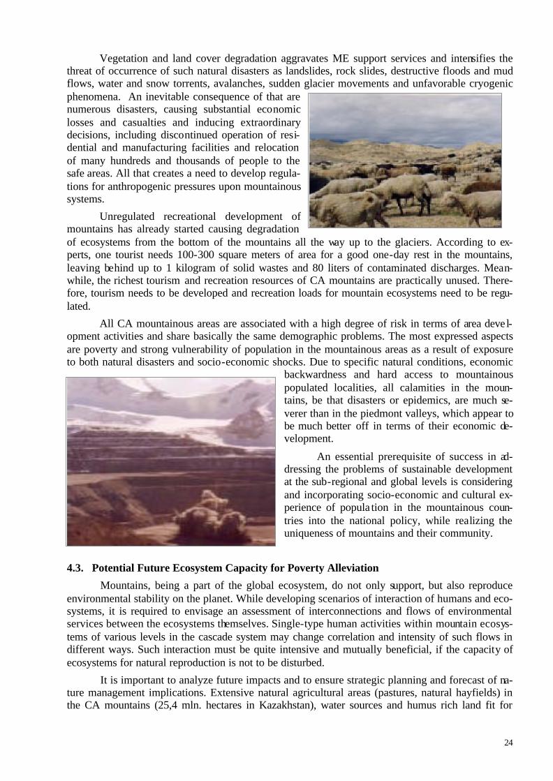
24
Vegetation and land cover degradation aggravates ME support services and intensifies the threat of occurrence of such natural disasters as landslides, rock slides, destructive floods and mud flows, water and snow torrents, avalanches, sudden glacier movements and unfavorable cryogenic phenomena. An inevitable consequence of that are numerous disasters, causing substantial economic losses and casualties and inducing extraordinary decisions, including discontinued operation of resi-dential and manufacturing facilities and relocation of many hundreds and thousands of people to the safe areas. All that creates a need to develop regula-tions for anthropogenic pressures upon mountainous systems.
Unregulated recreational development of mountains has already started causing degradation of ecosystems from the bottom of the mountains all the way up to the glaciers. According to ex-perts, one tourist needs 100-300 square meters of area for a good one-day rest in the mountains, leaving behind up to 1 kilogram of solid wastes and 80 liters of contaminated discharges. Mean-while, the richest tourism and recreation resources of CA mountains are practically unused. There-fore, tourism needs to be developed and recreation loads for mountain ecosystems need to be regu-lated.
All CA mountainous areas are associated with a high degree of risk in terms of area devel-opment activities and share basically the same demographic problems. The most expressed aspects are poverty and strong vulnerability of population in the mountainous areas as a result of exposure to both natural disasters and socio-economic shocks. Due to specific natural conditions, economic
backwardness and hard access to mountainous populated localities, all calamities in the moun-tains, be that disasters or epidemics, are much se-verer than in the piedmont valleys, which appear to be much better off in terms of their economic de-velopment.
An essential prerequisite of success in ad-dressing the problems of sustainable development at the sub-regional and global levels is considering and incorporating socio-economic and cultural ex-perience of popula tion in the mountainous coun-tries into the national policy, while realizing the uniqueness of mountains and their community.
4.3. Potential Future Ecosystem Capacity for Poverty Alleviation
Mountains, being a part of the global ecosystem, do not only support, but also reproduce environmental stability on the planet. While developing scenarios of interaction of humans and eco-systems, it is required to envisage an assessment of interconnections and flows of environmental services between the ecosystems themselves. Single-type human activities within mountain ecosys-tems of various levels in the cascade system may change correlation and intensity of such flows in different ways. Such interaction must be quite intensive and mutually beneficial, if the capacity of ecosystems for natural reproduction is not to be disturbed.
It is important to analyze future impacts and to ensure strategic planning and forecast of na-ture management implications. Extensive natural agricultural areas (pastures, natural hayfields) in the CA mountains (25,4 mln. hectares in Kazakhstan), water sources and humus rich land fit for

25
cultivation provide for successful meat livestock production, meat and wool sheep production, meat horse production, kumys production and goat production, which lay the foundation of public econ-omy and social protection.
Sustainability of forest ecosystems is a priority objective of the states in conserving the flows of all resources and services provided by forests. This implies the need to maintain integrity of natu-ral forests, their structure, compositionand envi-ronmental characteristics in line with their specific features. The goal can be achieved only when the benefits of forests and their sustainable use will outweigh the costs incurred by the people residing nearby. The assessment should provide for the clear realization of direct and indirect values of
forests and requirements for their protection. The State Forestry Agency and local community should agree upon the respective rights and responsibilities, provided that the communities will have the appropriate opportunities to influence forest management.
Population in the mountains needs reliable and affordable power supplies. Decentralization of power supply based on renewable resources (small hydro-power stations, wind stations, geothermal stations and solar energy collectors, biogas) allows to resolve this problem. In this situation the main objective for the power generation sector in the mountains is to optimize the use of mountain power capacity, while minimizing its de-structive impact upon the environment.
SPNA development should be the major focus in the area of sus-taining and regula ting services. Environmental activities within or outside of protected areas in the mountains is an important sector of environ-mental conservation, in particular, biological diversity preservation. Mobi-lizing local community for environmental protection on the basis of clear conditions for resource ownership and use through local community empowerment is an important factor in this area. The results of scientific research indicate that specially protected areas should be expanded and inter-connected.
Population in the mountains can improve its well-being within a short period of time, at the same time improving the status of mountainous ecosystems. This requires that a niche for mountain ecosystem goods and services be defined in the local action plans alongside with their competitive-ness (tourism and recreation, collection of medicinal herbs, high altitude agr iculture, forest and non-forest products and mining industry). This will help to use the potential of mountain natural resources to secure well-being of people populating the mountains, as well as the whole sub-region.
5. SELECTING PILOT AREAS AND DEVELOPING SCENARIOS FOR SUSTAINABLE OPERATION OF MOUNTAINOUS ECOSYSTEMS
In line with the Program Objectives and generally accepted standard procedure (5), all as-sessment process stages will be implemented in the model (pilot) areas of various research scales.
Sub-Global Scale Pilot Areas:
Biosphere reservation within the boundaries of the GEF «Western Tien Shan» Project (Kazakhstan, Kyrgyzstan, Uzbekistan)
The Pamirs-Altai mountainous region (Tajikistan, Kyrgyzstan)
26
Mountains spur of Kopetdag (Turkmenistan)
National Level Pilot Areas:
Kazakhstan: Northern part of Western Tien-Shan. Aksu-Dzhabagly reservation within the bounda-ries of the GEF «Western Tien Shan» Project
Kyrgyzstan: Issyk-Kul biosphere reservation within the boundaries of the GTZ «Support Issyk-Kul Biosphere Areas» Project
Tajikistan: Tajik (Pamirs) National Park
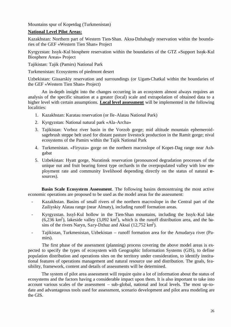
Turkmenistan: Ecosystems of piedmont desert
Uzbekistan: Gissarskiy reservation and surroundings (or Ugam-Chatkal within the boundaries of the GEF «Western Tien Shan» Project)
An in-depth insight into the changes occurring in an ecosystem almost always requires an analysis of the specific situation at a greater (local) scale and extrapolation of obtained data to a higher level with certain assumptions. Local level assessment will be implemented in the following localities:
1. Kazakhstan: Karatau reservation (or Ile-Alatau National Park)
2. Kyrgyzstan: National natural park «Ala-Archa»
3. Tajikistan: Vorboz river basin in the Vorzob gorge; mid altitude mountain ephemeroid-sagebrush steppe belt used for distant pasture livestock production in the Ramit gorge; nival ecosystems of the Pamirs within the Tajik National Park
4. Turkmenistan. «Firyuza» gorge on the northern macroslope of Kopet-Dag range near Ash-gabat
5. Uzbekistan: Hyatt gorge, Nuratinsk reservation (pronounced degradation processes of the unique nut and fruit bearing forest type orchards in the overpopulated valley with low em-ployment rate and community livelihood depending directly on the status of natural re-sources).
Basin Scale Ecosystem Assessment. The following basins demosntraing the most active economic operations are proposed to be used as the model areas for the assessment:
- Kazakhstan. Basins of small rivers of the northern macroslope in the Central part of the Zailiyskiy Alatau range (near Almaty), including runoff formation areas.
- Kyrgyzstan. Issyl-Kul hollow in the Tien-Shan mountains, including the Issyk-Kul lake (6,236 km2), lakeside valley (3,092 km2), which is the runoff distribution area, and the ba-sins of the rivers Naryn, Sary-Dzhaz and Aksai (12,752 km2).
- Tajikistan, Turkmenistan, Uzbekistan – runoff formation area for the Amudarya river (Pa-mirs).
The first phase of the assessment (planning) process covering the above model areas is ex-pected to specify the types of ecosystem with Geographic Information Systems (GIS), to define population distribution and operations sites on the territory under consideration, to identify institu-tional features of operations management and natural resource use and distribution. The goals, fea-sibility, framework, content and details of assessments will be determined.
The system of pilot area assessment will require quite a lot of information about the status of ecosystems and the factors having a considerable impact upon them. It is also important to take into account various scales of the assessment – sub-global, national and local levels. The most up-to-date and advantageous tools used for assessment, scenario development and pilot area modeling are the GIS.

27
One of the main objectives at the beginning of the assessment is to gather as much information as possible about mountainous ecosystems and processes affecting them. GIS may be used to map the basic pa-rameters of the environment and objects subjected to assessment. In the future, when the new data have been collected, these maps will be used to identify the scale and pace of degradation of flora and fauna or other objects subjected to assessment. Entry of dis-tance, in particular, satellite and regular field survey
data will allow to monitor local and large-scale anthropogenic impacts. The data pertaining to an-thropogenic loads will be incorporated into the area zoning maps, marking those objects that are of special environmental interest, for instance, parks, reservations and sanctuaries. All this will allow to assess the status and pace of natural environment degradation in each test (background) section marked on all map layers. This tool will also enable trans itioning to a quite effective management of pilot areas based on assessment outcomes and development scenario.
GIS development activities for the selected model areas can be divided into three main stages by the scale of assessment. At the first stage, it is necessary to generate a set of spatial data for the sub-global assessment level, at the next stage - for the national level followed by the local level. Various scales of generated spatial data sets will allow to use GIS tool effectively in the proc-ess of addressing the identified issues through integrated solutions. River basin GIS is required to be generated to implement the basin management system in the CA countries.
ArcGIS software will likely be used to generate GIS. An important element for creat-ing the CA Mountainous Ecosystem Assessment Tool will be providing software training for the specialists. The specialists of various back-grounds involved in the area assessment will receive training in using spatial tools to develop territorial and social development scenarios.
During the second phase (assessment and dissemination of outcomes), the assessment will be performed for each of the subject-matter areas defined in the Program Action Plan. Medium and long-term ecosystem future scenarios will be developed alongside with possible consequences of ecosystem changes for human well-being; possible community responses to unfavorable ecosystem changes will also be considered.
The strategy of scenario analysis will be used for the Program development. Scenarios are plausible future alternatives; each of them may develop under certain assumptions. The strategies will be developed on the basis of the generated GIS tool and spatial data or factors affecting situ-ational development. They will allow to demonstrate dynamic processes and causal relations result-ing in various outcomes depending on decisions that have been made. In this case the scenarios may not provide for the accurate probabilities of future developments. That is why they may be used as an idea of possible future. The generated scenarios will help understand nature management problems that we will run into in the future and will demonstrate possible actions for the present. The most important scenarios are the ones reflecting changes of environmental resources and ser-vices and their impact upon human well-being. Besides that, using GIS as a scenario development tool will allow to conduct an integrated assessment of alternative human and societal responses to the negative changes in services and resources provided by ecosystems. The assessment of possible ecosystem responses to various area development alternatives influences the need for financial and human resources required for such responses. The scenarios will allow to assess the effectiveness of

28
the policy in the area of nature management and plan for the optimal actions to satisfy the needs of the society without any destruction of mountainous ecosystems.
6. ? ? ? ? ? ACTION PLAN 6.1. Central Asia Mountainous Ecosystem Assessment Regional Action Plan
The proposed ? ? ? ? ? Action Plan is a short-term (18 months) action plan and the first stage in developing a long-term CA Mountainous Areas Assessment and Development Program. Its implementation is expected to involve interdepartmental and interstate interaction to implement CA Mountainous Ecosystem Assessment activities, carefully selected and thought out by the national working groups (tab. 4). The action plan inc ludes only the most compelling and feasible activities,
as this is a short-term program and there are always certain difficul-ties related to solution of environmental issues at the transition stage. Information contained in the table provides a general idea of the ac-tivities, specifies timeframes and implementers that are proposed in order to ensure the best contribution to the CA ME Assessment. A special emphasis is placed on developing recommendations and pro-ject proposals for ME conservation and restoration, including “win-to-win” strategy for the sectors of economy providing for both eco-nomic and environmental benefits.
Detailed organisational structure of the project and all the-matic subprojects will be formulated during the planning phase of the project. Thematic subprojects will be of two major types: 1. Subprojects focused on the assessments of different ecosystem types and their specific resources and services. These subprojects will include assessment on different scales and further integration of the obtained results. Particular goals, main methodological approaches,
phases and time tables, intermediate and final report forms, coordinated forms and terms for the submission of the subproject progress information, of necessary resources will be defined for each subproject. 2. Subprojects associated with specific resource or ecosystem service studies. They are desirable and reflects the interest of potential users to organize a special subproject, for instance on ‘water’ services provided by ecosystems of the CA. This type of subprojects will be focused on assessment of resources and services for the Subregion at all scales and ecosystem types.
? ? ? ? ? is a set of interconnected gradual actions that may be implemented by the inter-ested parties using resources from budgetary, private and international sources.

Table 4. Assessment of Central Asia Mountainous Ecosystem (? ? ? ? ? ) Regional Action Plan
Project/Activity Expected Outcome Users Imple-menters Date
Organizational Activities
Project institutional structure development: Coordinating Committee, Consultative Council, Working Group (WG), Technical Implementation Unit
Sustainable project management CAREC 2004
Specifying major Program goals and priority objectives /issues and its conceptual approaches. Developing Program structure proposals
Project implementation coordination plan. Concerted Pro-gram structure with the list of priorities issues
Program im-plementers WG 2004-
2005
Developing thematic sub-projects for the assessment of the Main Mountain Ecosystems (MMEs) or significant environ-mental goods and services
Thematic sub-projects with clearly defined objectives and expected outcomes to achieve Program goals. Specified MME list.
Sub-project managers WG 2004-
2005
Regional workshop for experts and sub-project managers to discuss Program implementation plan
Program Implementation Operations Plan with specified responsible persons WG, experts WG 2004-
2005 Information support for Program participants and stakeholders through the Internet, publications, radio and television.
CAREC site based web-page. Publication of information sheets, booklet or brochure about the Program.
Stakeholders WG, CAREC
2004-2005
Supporting continuous multi-lateral dialogue among interested participants and disseminating information
Consistent multi-lateral dialogue among interested partic i-pants, delivering lectures. Information and communications network established. Free access to ME assessment information provided.
Stakeholders WG, CAREC
2004-2005
Mountain Ecosystem Assessment (Expert Process) Adapting MA ecosystem assessment tools and methods to the specific features of mountain ecosystems (MEs)
Modified mountain ecosystem assessment methodology Interested MA participants WG 2004
Summarizing and systematizing data on social, economic and envi-ronmental situation in the CA mountains GIS Database (mapping matrix) Sub-project
managers WG 2004

30
Preliminary assessment of the main mountainous ecosystems and their resource capacity in accordance with the MA standard proce-dure
Assess the current status, resource potential limits and sustain-ability thresholds of CA MMEs. CA ME disturbance assessment
Experts WG 2004
Summarize the materials of the preliminary assessment of ecosys-tems and changes in them caused by human operations
Statement of the preliminary assessment outcomes for the MA Secretariat (contribution to the global assessment)
MA Secre-tariat CAREC 2004-
2005 Integrated/comprehensive CA ME assessment at various scales in pilot areas; improving assessments through interaction with users Integrated MME assessments based on discussions with users Users WG 2004-
2005 Working meetings, workshops, roundtables to discuss ecosystem assessments with users and stakeholders
Mutual understanding between the project team interested us-ers and all stakeholders
User and all stakeholders
WG,CAREC
2004-2005
Providing GIS technology software training to specialists
Specialists involved in area assessment are trained in spa-tial tools use in developing area and societal development scenarios
Users, WG WG 2004-2005
Analyzing change trends of MME environmental goods and ser-vices; identifying major causes and factors
Description of change trends for environmental goods and services. Chart of causes and effects of MME changes (socio-economic and environmental aspects). Recommendations for rehabilitation and restoration of disturbed ecosystems.
Decision - makers, ex-perts
WG 2004-2005
Assessing the links between mountain ecosystem goods and ser-vices and human well-being. Developing a system of indicators.
System of indicators reflecting cause and effect relations of human well-being and change of ME goods and services flow
Decision - makers, ex-perts
WG 2004-2005
Researching social, political, institutional and legal drivers, defining regulatory measures/responses of local communities to ME changes in the sub-region
Assessment of community organization adequacy (institu-tional, legislative, legal and psychological aspects) in terms of current ME change nature and scale. Recommendations to improve the system.
Ddecision - makers WG 2004-
2005
Identifying gains and losses of possible anthropogenic ecosystem changes in the future Economic assessment of gains and losses Ddecision -
makers WG 2004-2005
Projecting CA MME changes based on alternative decisions
Probable CA MME development scenarios. Recommenda-tions to prevent and reduce the consequences of undesirable development. Project proposals to conserve catchment area ecosystems
Ddecision - makers WG 2004-
2005
Justifying and specifying measurable goals of mountainous area development to achieve a concerted vision.
Goals of mountainous area development and indicators of effi-ciency of adopted decisions and achieved objectives, indica-tors of the worldwide management implementation
Ddecision - makers WG 2004-
2005
Regional conference for sub-project managers, Consultative Council members and experts to discuss preliminary assessment outcomes, coordinate assessment outcomes for the ME of the selected scales
Stakeholder Review Draft. Draft Executive Summary. Stakeholders CAREC 2005

31
Independent evaluation of the Stakeholder Review Draft with the involvement of interested users and stakeholders.
Reviewed version of the Stakeholders Review Draft, incorpo-rating generated comments and suggestions Stakeholders Experts 2005
Considering the final draft of the report by the Advisory council members Approval of the final draft CAREC Advisory
council 2005
Final report formatting and editing Final version of the report for the MA Secretariat ? ? Secre-tariat
WG, CAREC 2005
Summarizing, publishing and disseminating assessment outcomes Publications in view of the interests of various users Users CAREC 2005 Working meeting of the WG members and project experts, donor and stakeholder representatives to discuss advantages and disadvan-tages of the performed assessment
Decisions of meeting participants regarding implementation of the assessment outcomes, including project proposals for re-habilitation and restoration of disturbed ecosystems
Users, donors CAREC 2005
Goods and Services Assessment (Thematic Sub-Projects) 1. Water Resource Assessment
Assessing the status of water resources and the trends of runoff change in the pilot areas
Review of Water Resource Status and River Runoff Change Trends Users WG 2004
Assessing and projecting climatically and anthropogenically in-duced changes in runoff formation conditions in the catchment areas of mountain ecosystems based on GIS technologies
Scenarios of runoff formation conditions change, science-based behavioral scenarios for the regional climatic system. Recommendation to regulate anthropogenic loads.
Users WG 2004
Assessing vulnerability of mountainous regions as a result of possi-ble climatic changes. Developing science-based scenarios
Regional climate behavior and ME response scenarios. Users WG 2004-
2005
Ecological and hydrochemical assessment of water quality change and variability
Improved water quality in the rivers. Improved environmental situation downstream the rivers Users WG 2004
Developing new regional water resource management model and strategy taking into account the “weight of the mountains” Users WG 2004-
2005 2. Biodiversity
Promoting establishment of the system of protected areas in CA Assessment and recommendations regarding undisturbed areas of MEs, providing for their self-regulation and bio-diversity preservation
Users, Do-nors WG 2004
Identifying incentives to encourage community involvement in biodiversity conservation and sustainable use efforts
Sustainable use of bio-resources, development of trophy hunting and ecotourism. Establishing medicinal and or-namental plants farms
Users WG 2004
Facilitating development of environmentally friendly produc-tion to preserve regional biodiversity
Market analysis and local community development around SPPAs. Introducing production based on sustainable bio-resource use.
Users WG 2004-2005
32
Identifying benefits received by the community as a result of biodiversity preservation
Project proposal - Biodiversity Restoration through Farm Development (Plant Production) and Nurseries
Users, Do-nors WG 2005
3. Land Resources
Developing agri-ecological zoning of arable and agricultural land
Agri-ecological zoning maps of arable and agricultural land
Users WG 2004-2005
Developing practical measures to improve productivity of natu-ral feed production areas
Recommendations to improve productivity of natural feed production areas Users WG 2004-
2005 4. Recreational Resources
Assessing the reserves of mineral and thermal sources to de-velop of a network of sanatoriums, resorts and recreational fa-cilities in the mountainous areas
Assessment of mineral and thermal sources and recom-mendations for their use
Decision makers WG 2004-
2005
Natural Phenomena
Assessing the risk of occurrence of dangerous natural phenom-ena at the regional and local level
Maps of the risk of dangerous natural phenomena at vari-ous scales
Users WG 2005
Recommendations for Resource Saving Operations Supporting resource saving operations in the mountains and preserv-ing the best folk traditions related to environment
Justification of activities designed to develop traditional crafts and souvenir production for tourists
Users, Do-nors WG 200
Putting hydro-power resources of small rivers on the energy balance sheet of the mountainous areas and constructing demonstration mini-HPSs
Project proposal Reduced fuel wood consumption.
Users, Do-nors WG 2004-
2005
Using solar energy in the heat supply systems of mountainous lo-calities
Project proposal
Users, Do-nors WG 2004-
2005 Developing horticulture and viticulture, restoring apple and apricot forests in the mountains, preserving commercial nut and fruit bear-ing forests
Project proposal Users, Do-nors WG 2004-
2005
Establishing small enterprises to process fruits and berries and pro-duce dried fruits Project proposal Users, Do-
nors WG 2004-2005
Improving the system of procurement and purchase prices Recommendation Users WG 2004-2005
Developing bee-keeping, including wild bee-keeping for plant polli-nation Project proposal Users, Do-
nors WG 2004-2005
Assessing recreational resources
Recommendations on developing tourist sites in the mountains with the appropriate infrastructure and ecotourism develop-ment
Users, Do-nors WG 2004-
2005

33
Empowering local communities to own resources and generating revenue through enhancing the natural capacity of ecosystems Draft law Users WG 2004-
2005
Promoting environmental education and environmental knowledge Local community has a better understanding of the environ-mental problems of mountainous areas and actions required to address them
Users WG, CAREC
2004-2005
Participating in development of a multi-lateral partnership agree-ment of all interested parties to create a legal framework geared to-wards achieving the priority goals of mountainous area development
Section of the Multi-lateral Partnership Agreement with obli-gation of all interested parties
Decision makers
WG, De-cision makers
2004-2005
Resource Process of Mountain Ecosystem Assessment Support Capacity building for sustainable development CA mountain areas - trainings by an ecosystems assessment - seminars - ….
Institutional potential for realization the programs of develop-ment Central Asian mountain areas is created. The basis for effective participation of civil sector in accep-tance of the decisions is created Achievement of the SD goals in subregion.
Stakeholders (Decision makers, NGO, busi-ness)
CAREC 2004-2005
Developing financial and economic mechanisms to support devel-opment of mountainous areas
Mountainous Ecosystem Development Program is provided with the appropriate financial, logistical, technical and infor-mation resources
Users WG 2004-2005
Getting the business sector involved in addressing the MA devel-opment issues Cross-sectoral partnership and business involvement ensured Users CAREC 2004-
2005 Developing a cross-sectoral framework project to improve the mechanism of environmental conventions implementation Cross-sectoral Framework Project Users, Do-
nors WG, CAREC
2004-2005
Developing the mechanism and improving interaction between ? ? ? ? ? and programs and project under implementation in the Central Asia region, Central and Eastern Europe and international organizations.
Support to implementation of Conventions, Issyl-Kul, Nukuss and Almaty Declarations. Central Asia Regional EAP
Decision makers, Us-ers
Decision makers, CAREC
2004-2005

6.2. Project Implementation
Project management will be provided through the Regional Environmental Center for Central Asia (CAREC), founded in accordance with the resolution of the Forth Pan-European Conference (1998) in Aarhus (Denmark) following the initiative of the Central Asia states. The CAREC Head-quarters is located in Almaty, Kazakhstan. There is also a network of branches covering all CA Re-publics.
Experts and specialists from science and research institutes and other CA organizations will be involved in data and material analysis, as well as collating the results. If required, experts from other countries will also be involved.
Project managers will specifically focus on involving potential users and representatives of other interested parties at all stages of the assessment. The CAREC has sufficient skills and experi-ence of working with public administration agencies at various levels, governmental and non-governmental organizations and institutions, NGOs, local communities, etc.
Potential users will be involved in all project implementation activities, including identifying the framework and content of the assessments, performing sub-project activities and summarizing the final project outcomes.
The overall structure of project implementation and supervision is illustrated in picture. One of the major components in the project structure is the Coordination Board and Advisory Council and the Working Group.
The Coordination Board will include CAREC management representatives, administrative and research project managers, public administration agencies of various levels, NGOs, businesses and some experts. It will be responsible for identifying assessment framework and content, consider-ing project program implementation process and its outcomes and approving the final reports.
The Working Group will include the program manager (research director) of the project, sub-project managers, experts in specific areas and representatives of potential users.
All reviewed reports officially approved by the Advisory Council will form End Results, which will be sent to the MEA Secretariat and published. The End Results will ensure a foundation for preparing further materials presenting specific information upon requests of different users or the MEA Secretariat. One of the main means of control over the project would be constant monitoring of the implementa-tion of the working plan by technical means of the Internet, other media and Gantt charts for each task. Broad communication with all stakeholders throughout the course of project implementation will be conducted via a CAREC website (http://www.carec.kz).
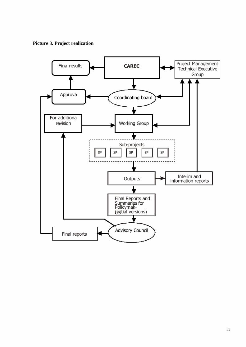
35
Picture 3. Project realization
Advisory Council
Project Management Technical Executive
Group
CAREC
Coordinating board
Working Group
Outputs
Final Reports andSummaries for Policymak-ers (initial versions)
For additional revision
Final reports
Interim and information reports
Sub-projects
SP SP SPSPSP
Approval
Final results

36
CONCLUSION The CA Governments defined sustainable operations of water basin ecosystems, essential for human life and activities, as a priority sustainable development goal for the sub-region. This Program is geared towards achieving this goal. The outcomes of the assessment will facilitate consolidation of ef-forts by the interested participants in achieving the main goal of sustainable development of CA moun-tainous areas: «Natural resources of mountainous areas are used in a sustainable manner in view of the environmental, social and economic interests to ensure the optimal benefit for the population in Central Asia». A clear-cut mountainous ecosystem assessment, specifically designed to meet the needs of users and all interested parties, is expected to promote political stability and security in the sub-region, facilitate preservation of mountainous ecosystems and poverty alleviation in the moun-tainous areas, contribute to efficient use of public, natural and economic resources of mountainous regions and boost civil, public and democratic development in the Central Asian countries.

BIBLIOGRAPHY 1. Alcamo J., N.J. Ash, E. Bennet et al. People and Ecosystems: A Framework for Assessment and Action. Second Review Draft. October 1, 2002. 2. Costanza R., D’Arge R., de Groot R., Farber S., Grasso M., Hannon B., Limburg K., Naeem S., O’Neil R.V., Raskin R.G., Sutton P. and M. van den Belt. The value of the world’s ecosystem services and natural capital. Nature. 1997. 3. Central Asian Mountain Information Network (CAMIN) Kazakh Working Group. National Strategy and Action Plan for Sustainable Mountain Area Development of Kazakhstan. 2001. 4. Central Asian Mountain Information Network (CAMIN) Kyrgyz Working Group. National Strategy and Action Plan for Sustainable Mountain Area Development of The Kyrgyz Republic. 2001 5. Central Asian Mountain Information Network (CAMIN) Tajik Working Group. National Strategy and Action Plan for Sustainable Mountain Area Development of Tajikistan. 2001 6. Central Asian Mountain Information Network (CAMIN) Uzbek Working Group. National Strategy and Action Plan for Sustainable Mountain Area Development of Uzbekistan. 2001 7. Central Asian Mountain Information Network (CAMIN) Kazakh, Kyrgyz, Tajik, Uzbek, and Xinjiang Working Groups. Regional Strategy and Action Plan for Sustainable Mountain Area Development. 2001. 8. Daily G.C. Introduction: what are ecosystem services? In: Nature’s services: societal dependence on natu-ral ecosystems. [Daily G.C. (ed.)]. Island Press, Washington D.C., USA, 1997. 9. Global Land Cover Characterization. U.S Geological Survey (USGS), Earth Resources Observation Sys-tems (EROS) Data Center (USGS/EDC). 1997. 10. International Union for Conservation of Nature and Natural Resources (IUSN). Red List of Threatened Animals. 1996. 11. Millennium Ecosystem Assessment (2002). Millennium Ecosystem Assessment. Procedures for the Preparations, Peer Review, Approval and Publication of Millennium Assessment Reports. Approved by MA Board on January 16, 2002. Revised May 16, 2002 and September 28. 12. Millennium Ecosystem Assessment. Millennium Ecosystem Assessment. Sub-Global Component: Pur-
pose, Structure and Protocols. 2001January 5. 13. Millennium Ecosystem Assessment. Sub-Global Assessment Selection Process. Draft for Board and Panel Review. 2001 November 22. 14. Reid W., N. Ash, E. Bennet, P. Kumar, M. Lee, N. Lukas, H. Simons, V. Thompson, M. Zurek . Millen-nium Ecosystem Assessment Methods. October 18, 2002. 15. The complex environmental monitoring of high mountain systems of Central Asia. Bishkek, 1998. 16. The Governments of Kazakhstan, Kyrgyzstan, Tajikistan, Turkmenistan and Uzbekistan through the Ad Hoc Working Group of Senior Officials. Invitation to Partnership on implementation of the Central Asian Sustainable Development Initiative. Kiev. 21-23 May 2003. 17. The Regional Environmental Centre for Central Asia (CAREC). Methodological Recommendations on Preparation of the Central Asian Sustainable Development Strategy (CA Agenda 21). Almaty 2002. 18. The Regional Environmental Centre for Central Asia (CAREC). Central Asian Initiative «Subregional Agenda 21». Central Asian Interstate Commission on Sustainable Development (CA ICSD). 2003. 19. The Regional Environmental Centre for Central Asia (CAREC).The Regional Strategy of the CA Moun-tain Areas Sustainable Development. Almaty 2002. 20. The report of a Regional meeting behind a Round table of Central and Southern Asia. Bishkek, July - Au-gust 2001. 21. United Nations Conference on Environment and Development (UNCED).Agenda 21, the Rio Declaration on Environment and Development, and the Statement of principles for the Sustainable Management of For-ests. Rio de Janerio, Brazil, 3 to 14 June 1992. 22. UNEP-GRIDA, regional working group. Condition of an environment in the countries Central Asia. - Electronic reports on a disk .1999. www.grida.no/ 23. UNDP/UNEP-GRIDA. Central Asia: The environment and development. - Electronic report on compact a disk. 1999. www.grida.no/ 24. UNEP/GRIDA. «Central Asia: Environment and Development» (in maps and diagrams). 2002. 25. UNESCO's Environmental Monitoring of Central Asian High-Allilude Mountain Systems as exemplified

38
by the Tien-Shan (1995) 26. WWF Russia and WWF Mongolia Programme Office. Millennium Ecosystem Assessment in the Altai-Sayan Ecoregion. 2003.