cardio #4 text book page 34 1.location: look at the map. what major battle did alexander the great...
TRANSCRIPT

CARDIO #4Text Book page 341. Location: look at the map. what
major battle did Alexander the great win before heading to Babylon?
2. Critical thinking: why do you think Alexander the great circled the Mediterranean sea but did not cross it?

Hemispheres: are used to refer to one-half of the globe.
Chapter 2Lesson 1: Studying Geography

• The Equator (is a line of latitude halfway between the poles).
• The Tropic of Cancer is a line of latitude north of the Equator.
• Tropic of Capricorn is a line of latitude north and south of the Equator.
• The Arctic Circle: it is located in the north
• The Antarctic Circle: it is located in the south.
Latitude: runs east-west

Lines of longitude” run north-south. The Prime Meridian, which runs through Greenwich, England, is at 0 degrees longitude.

The Equator and Prime Meridian are the 0° imaginary lines They cross one another, forming a pattern called a grid system
latitude is X and longitude is Y

CLOSURE
3-2-1 chart
3 Things You Found Out2 Interesting Things1 Question You Still Have

Physical map: Shows land and water features. It uses colors to show elevation.
Types of Map

Political Map: show the names and borders of countries. They also show location of cities

Special-Purpose Maps: they usually shows patters such as climate, natural resources or population. Road maps are another example.
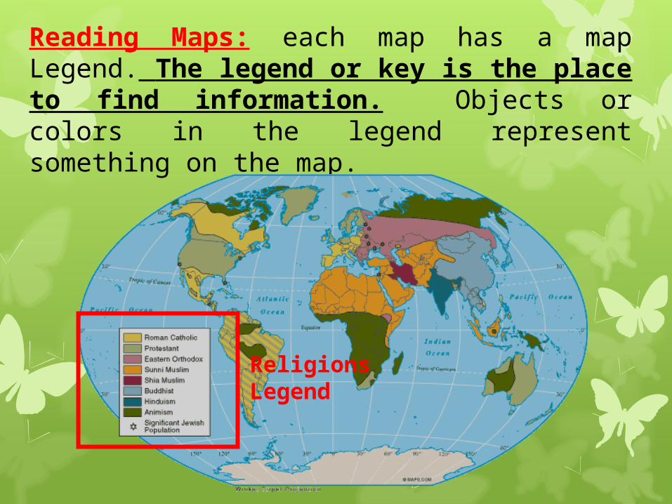
Reading Maps: each map has a map Legend. The legend or key is the place to find information. Objects or colors in the legend represent something on the map.
Religions Legend

Scale: it tells you the distance represented on a map.

It is a model of a compass that shows the cardinal directions, north, south, east, and west.
compass rose
The intermediate directions are: northeast, southeast, southwest and northwest.

CLASS WORK 1. Guided Reading: hand
out page 11What continents or ocean are on A. 0° and 20°EB. 60°S and 80°WC. 20°N and 140°E
2. Draw the globe and label the 5 line of latitudes and the line of longitude

CLOSURE
3-2-1 chart
3 Things You Found Out2 Interesting Things1 Question You Still Have

Home learning1. Bring a news paper.2. Find the ocean or continent located
on the map attached on my websiteA. 20°N and 0°B. 20°S and 60°WC. 0° and 180°3. Vocabulary Quiz4. Bring contract signed (print out only the signing paper)