canada physical geography. political features 10 provinces 3 territories 2 nd largest country in the...
TRANSCRIPT
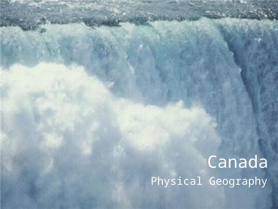
CanadaPhysical Geography

Political Features• 10 Provinces• 3 Territories
• 2nd largest country in the world.
• Population – Approximately 33 million
• Mexico has 3x the population
• USA has 9x
• Shares over 3,000 miles of border with the USA. . . Makes trade easier between the 2 nations.
Land
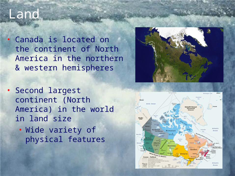
• Canada is located on the continent of North America in the northern & western hemispheres
• Second largest continent (North America) in the world in land size• Wide variety of physical
features
Land
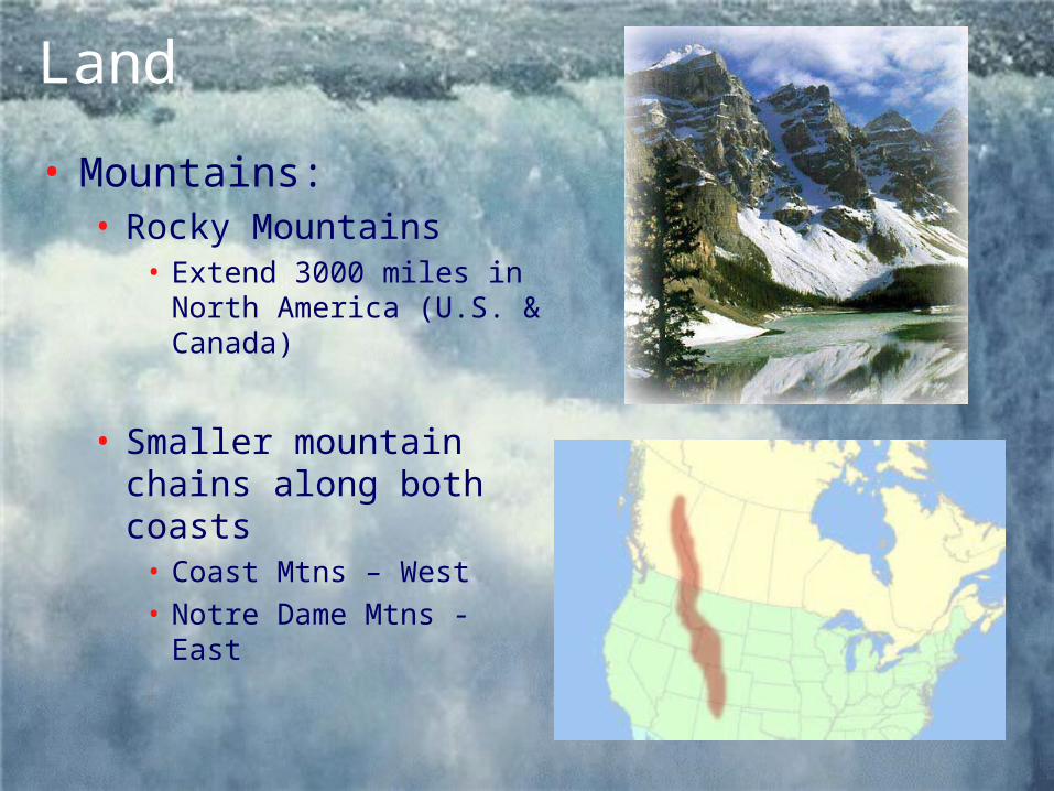
• Mountains: • Rocky Mountains
• Extend 3000 miles in North America (U.S. & Canada)
• Smaller mountain chains along both coasts
• Coast Mtns – West• Notre Dame Mtns - East

Land
• Prairie: • Interior Plains
• Located east of the Rockies (western Canada)
• Northern extension of Great Plains in US
• Flat land used mostly for farming

Land
• Other landforms:• Canadian Shield
• Covers nearly ½ of Canada’s land area• Circles Hudson Bay in eastern Canada• Area of ancient rock - Very rugged• Rich in natural resources – trees,
minerals & water• Mining is an important industry along the
Canadian Shield (1.5 million people)
Water
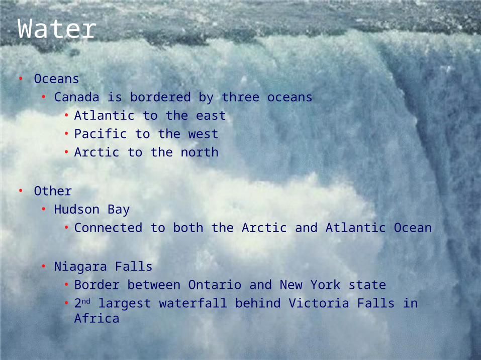
• Oceans• Canada is bordered by three oceans
• Atlantic to the east• Pacific to the west• Arctic to the north
• Other• Hudson Bay
• Connected to both the Arctic and Atlantic Ocean
• Niagara Falls• Border between Ontario and New York state• 2nd largest waterfall behind Victoria Falls in Africa
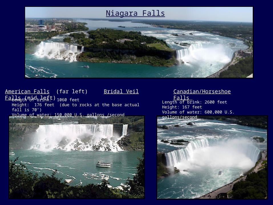
American Falls (far left) Bridal Veil Falls (mid left) Canadian/Horseshoe Falls
Niagara Falls
Length of brink: 1060 feetHeight: 176 feet (due to rocks at the base actual fall is 70’)Volume of water: 150,000 U.S. gallons /second
Length of brink: 2600 feetHeight: 167 feetVolume of water: 600,000 U.S. gallons/second
Does Niagara Falls Freeze Over in Winter?
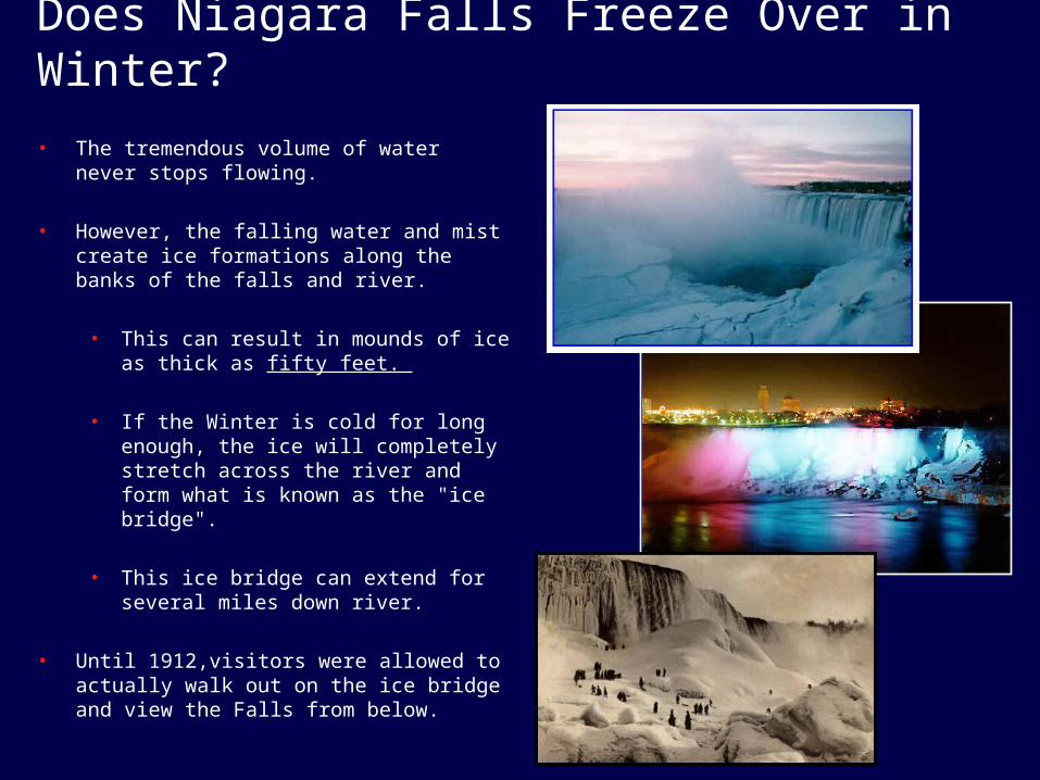
• The tremendous volume of water never stops flowing.
• However, the falling water and mist create ice formations along the banks of the falls and river.
• This can result in mounds of ice as thick as fifty feet.
• If the Winter is cold for long enough, the ice will completely stretch across the river and form what is known as the "ice bridge".
• This ice bridge can extend for several miles down river.
• Until 1912,visitors were allowed to actually walk out on the ice bridge and view the Falls from below.
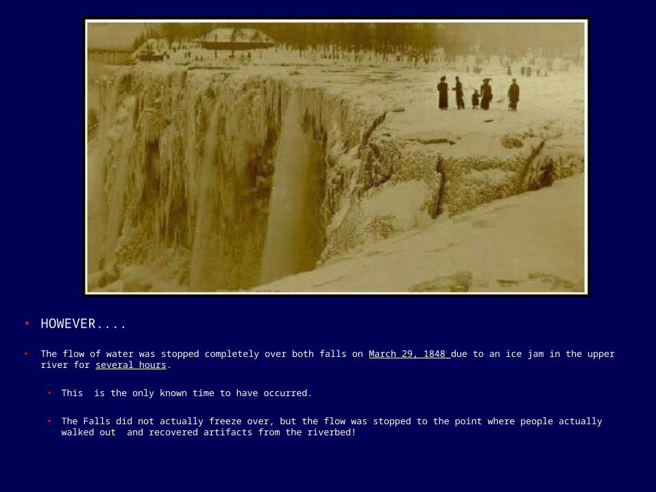
• HOWEVER....
• The flow of water was stopped completely over both falls on March 29, 1848 due to an ice jam in the upper river for several hours.
• This is the only known time to have occurred.
• The Falls did not actually freeze over, but the flow was stopped to the point where people actually walked out and recovered artifacts from the riverbed!

June to November 1969
• The American Falls were dewatered.
• Most of the diverted water was either sent over the Horseshoe Falls or diverted to the Robert Moses generating plant's upriver intakes.
• Purpose was to do on-the-spot inspections and aerial photographs of the river bed's rock formation.
• Part of a plan to reduce erosion to the Falls.
Water
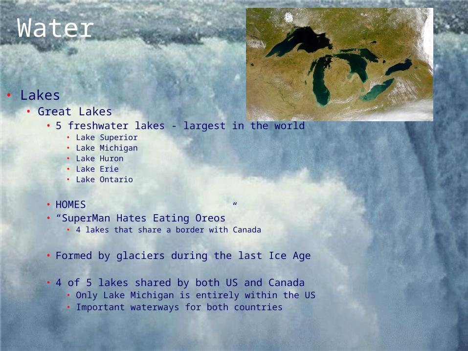
• Lakes• Great Lakes
• 5 freshwater lakes - largest in the world• Lake Superior• Lake Michigan• Lake Huron• Lake Erie• Lake Ontario
• HOMES• “SuperMan Hates Eating Oreos”
• 4 lakes that share a border with Canada
• Formed by glaciers during the last Ice Age
• 4 of 5 lakes shared by both US and Canada• Only Lake Michigan is entirely within the US• Important waterways for both countries
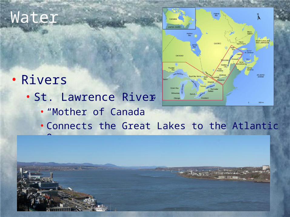
Water
• Rivers• St. Lawrence River
• “Mother of Canada”• Connects the Great Lakes to the Atlantic Ocean

Water• St. Lawrence Seaway
• One of North America’s most important transportation routes• Built by both the USA and Canada
• Locks are used to allow ships to navigate through elevation changes (like Panama Canal)

• Distance from the Atlantic Ocean to Duluth, Minnesota on Lake Superior = 2,038 nautical miles (2,342 statute miles)
• 8.5 sailing days.

Climate
• Because of its size, Canada has many climate zones
• Most of Canada is very cold…why?
• Areas along the coasts enjoy milder climates…why?
• Inland areas have more extreme climates (very cold winters & very warm summers)…why?
• Some areas of eastern Canada can exceed 100 inches of snowfall EACH year! . . . Any ideas why?
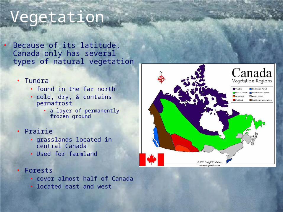
Vegetation
• Because of its latitude, Canada only has several types of natural vegetation
• Tundra• found in the far north• cold, dry, & contains
permafrost• a layer of permanently frozen
ground
• Prairie• grasslands located in central
Canada• Used for farmland
• Forests• cover almost half of Canada• located east and west
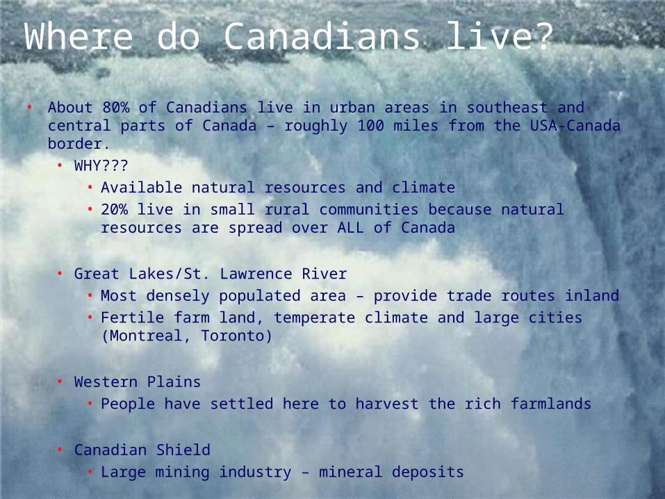
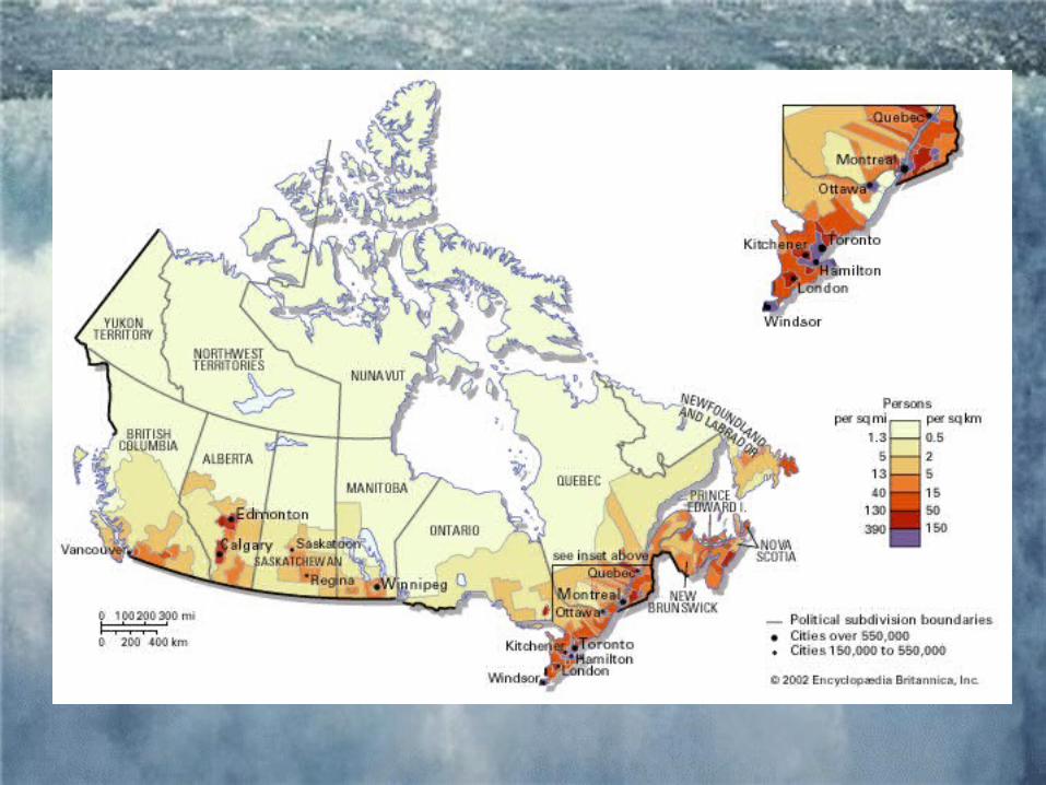
Where do Canadians live?
• About 80% of Canadians live in urban areas in southeast and central parts of Canada – roughly 100 miles from the USA-Canada border. • WHY???
• Available natural resources and climate • 20% live in small rural communities because natural resources
are spread over ALL of Canada
• Great Lakes/St. Lawrence River• Most densely populated area – provide trade routes inland• Fertile farm land, temperate climate and large cities (Montreal,
Toronto)
• Western Plains• People have settled here to harvest the rich farmlands
• Canadian Shield• Large mining industry – mineral deposits

Let’s Talk About Trade . . .
• Canada’s trade is impacted by location, climate and natural resources.• Location = major trading partners• Climate & Natural resources = what they trade
• Major Trading partners . . . • 70% of manufactured goods are produced in the Great
Lakes region• Lakes, rivers & St. Lawrence Seaway are used to
transport goods to other countries.

• Due to Canada’s location north of the USA, the U.S. is Canada’s major trading partner• Imports and Exports
• Both countries are interdependent on each other• They need each other to be successful economically
• NAFTA was established (North American Free Trade Agreement)
• Since 1994, US, Canada and Mexico have free trade between their countries
• 80% of exports go to the USA• Including . . . Hydroelectric power, oil, natural gas, fish,
agricultural products and timber.
Natural Resources• Farmland:
• 12% of Canada’s land is used for farming• Most farmland located in the interior plains• Most important agricultural product produced
is wheat
• Minerals/Energy Resources: • Nickel, copper, gold, silver, zinc and uranium
– found in the Canadian Shield• Oil and natural resources – western plains
• Fishing: • Mostly along the Pacific coast
• also along the Atlantic coast
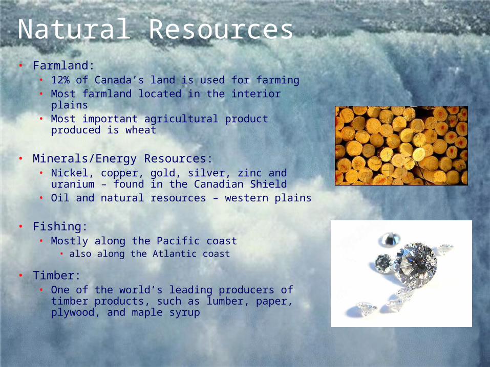
• Timber: • One of the world’s leading producers of
timber products, such as lumber, paper, plywood, and maple syrup
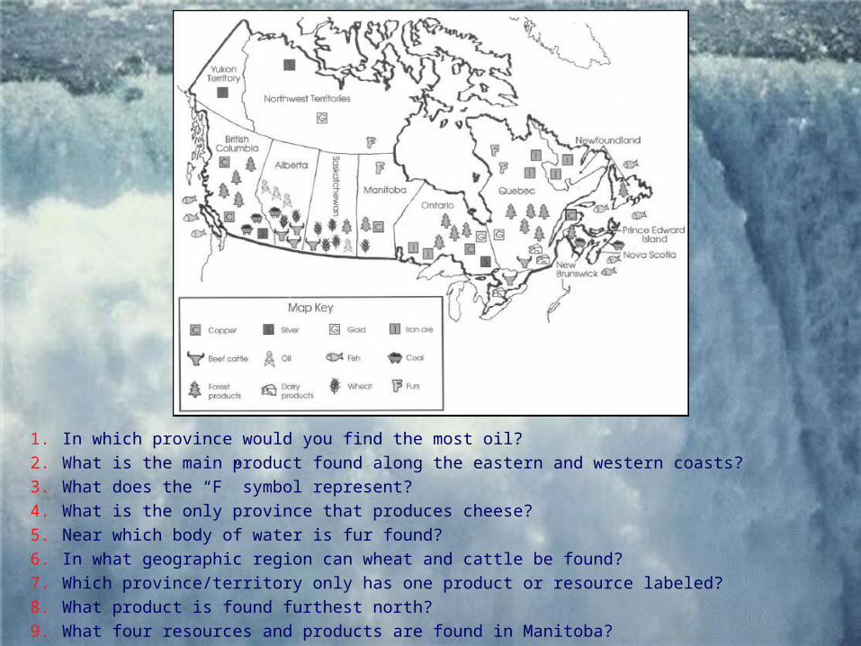
1. In which province would you find the most oil? 2. What is the main product found along the eastern and western coasts? 3. What does the “F” symbol represent? 4. What is the only province that produces cheese? 5. Near which body of water is fur found? 6. In what geographic region can wheat and cattle be found? 7. Which province/territory only has one product or resource labeled? 8. What product is found furthest north? 9. What four resources and products are found in Manitoba?
Answers to Natural Resources Map
1. In which province would you find the most oil? Alberta2. What is the main product found along the eastern and western
coasts? Fish3. What does the “F” symbol represent? Furs4. What is the only province that produces cheese? Quebec5. Near which body of water is fur found? Hudson Bay6. In what geographic region can wheat and cattle be found?
West/Southwest7. Which province/territory only has one product or resource
labeled? Yukon Territory8. What product is found furthest north? Silver9. What four resources and products are found in Manitoba?
Furs, Forest Products, Copper, Wheat

Environmental Concerns
• Overfishing:• Too many fish being caught has led to a reduction in fish
populations off both Atlantic & Pacific coasts
• Canada’s government has banned fishing in some areas to allow the fish to repopulate

Environmental Concerns• Canadian Shield
• Major natural resources – minerals, water & forests• Extraction and use of these natural resources can cause pollution
• Canada is trying to balance the economic growth from these resources as well as the environmental and conservation concerns.
• Minerals• Valuable exports and help fuel
the country’s industries • Concerns:
• Toxic waste can seep in ground water and water sources
• Habitat loss• Emissions can cause acid rain (sulfur dioxide)

• Rivers• Produce hydroelectricity
– largest producer in the world
• Concerns:• Creation of dams,
reservoirs and change in river flow
• Habitat loss
• Shoreline erosion and change in aquatic food chain
• Flooding of farmland
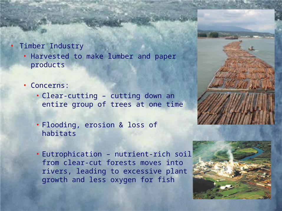
• Timber Industry• Harvested to make lumber and paper
products
• Concerns:• Clear-cutting – cutting down an
entire group of trees at one time
• Flooding, erosion & loss of habitats
• Eutrophication – nutrient-rich soil from clear-cut forests moves into rivers, leading to excessive plant growth and less oxygen for fish

Environmental Concerns
• Acid rain: • Caused by air pollution from burning coal or oil
• Sulfur dioxide, carbon dioxide, nitrogen oxides• Acid levels can become similar to acid levels in vinegar
• Primarily a result from power plant emissions, factories that process minerals & vehicles
• Great Lakes region in eastern Canada & the USA• How does the pollution from the USA impact Canada?
• Wind patterns move the pollution from the USA to Canada . . . 50-75%
• Major Problem in Quebec and Ontario• Bedrock prevents the water and soil from neutralizing the
acid• Seeps into the ground water – poisioning lakes, forests
and soil

Environmental Concerns• Effects of Acid Rain
• Polluted farmland and dying trees in eastern Canada• Dead plants and fish in thousands of lakes – including the
Great Lakes• Damage to buildings
• Especially those made of granite, marble and limestone• Lower profits in vital industries such as fishing, forestry and
agriculture
• Solutions:• Regulating industries and car manufactureres • Replace coal-fired power plants with gas-powered power
plants• Adding lime to lakes, rivers and soil to neutralize acid• Encourage citizens to walk, ride bikes or carpool
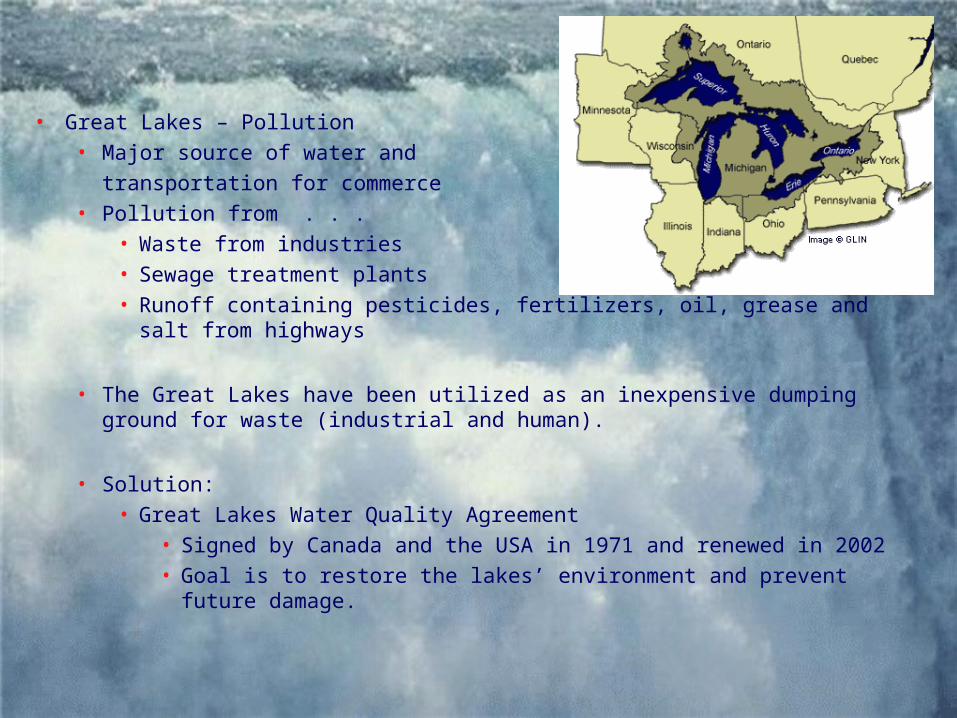
• Great Lakes – Pollution• Major source of water and
transportation for commerce• Pollution from . . .
• Waste from industries• Sewage treatment plants• Runoff containing pesticides, fertilizers, oil, grease and salt from
highways
• The Great Lakes have been utilized as an inexpensive dumping ground for waste (industrial and human).
• Solution:• Great Lakes Water Quality Agreement
• Signed by Canada and the USA in 1971 and renewed in 2002• Goal is to restore the lakes’ environment and prevent future
damage.
Summarizing Activity