camera point #4 photomonitoring project coal creek 10/14/08
Post on 20-Dec-2015
213 views
TRANSCRIPT

Camera Point #4Photomonitoring Project
Coal Creek10/14/08
Insert Photo HereAnd mark any obvious features in the photo
that are discussed in the camera point description
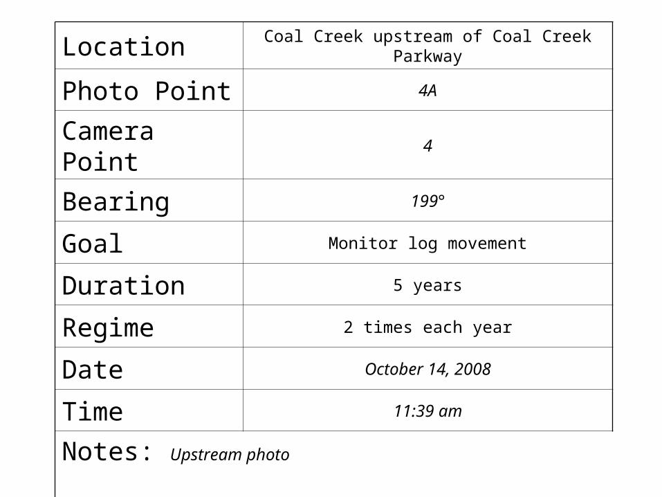
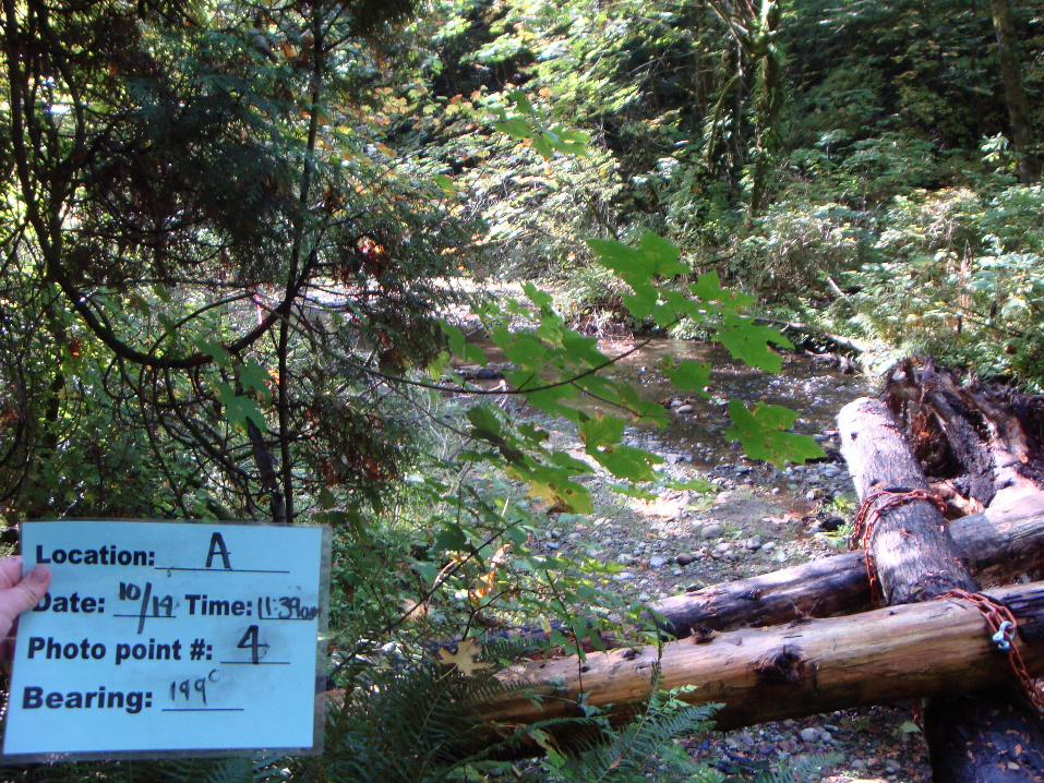
Location Coal Creek upstream of Coal Creek Parkway
Photo Point 4A
Camera Point 4
Bearing 199°
Goal Monitor log movement
Duration 5 years
Regime 2 times each year
Date October 14, 2008
Time 11:39 am
Notes: Upstream photo
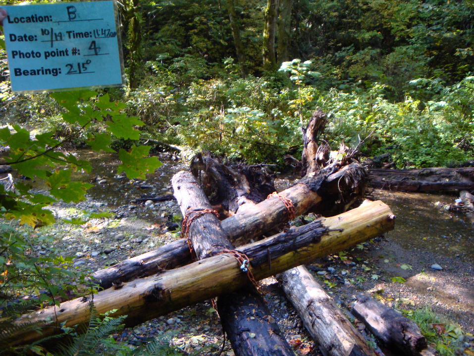

Location Coal Creek upstream of Coal Creek Parkway
Photo Point 4B
Camera Point 4
Bearing 215°
Goal Monitor log movement
Duration 5 years
Regime 2 times each year
Date October 14, 2008
Time 11:47 am
Notes: Across photo


Location Coal Creek upstream of Coal Creek Parkway
Photo Point 4C
Camera Point 4
Bearing 260°
Goal Monitor log movement
Duration 5 years
Regime 2 times each year
Date October 14, 2008
Time 11:50 am
Notes: Downstream photo

Directions to Camera Point:From the trailhead, walk 207.2 meters until you come to a sewer drain that is on the left side of the little bridge. From the center of the sewer drain take a bearing of 149.5°. Walk 14.3 meters to Camera Point 4,
which is at the edge of the trail, closest to the stream.
Camera Point #4Sewer Drain

Photo of Camera Point Photo Point Map
1A
Key
Starting Point
Photo Point
Camera Point1
*Map shows 2nd sewer cover as starting point
North
44B
4C
4A199°
215°
260°
Elevation: 234ftLat: N 47°33.12”Long: 122°9.88”