by dwayne scott electronic technician. the national meteorological service (nms) of belize is a...
TRANSCRIPT
National Meteorological Service of Belize
The use of Satellite Systems for Daily Operation
ByDwayne Scott
Electronic Technician

The National Meteorological Service (NMS) of Belize is a small department within the Government of Belize that provides meteorological and climate-based products and services to the Belizean public and is a necessary support to the operation of the only international Airport in the country the Phillip Goldson International Airport.
The products and services are provided through accurate monitoring and data collection, reliable data analyses and timely dissemination of user-friendly information on regular and emergency events and processes.

THE PLOT
SYNOPTIC SECTION
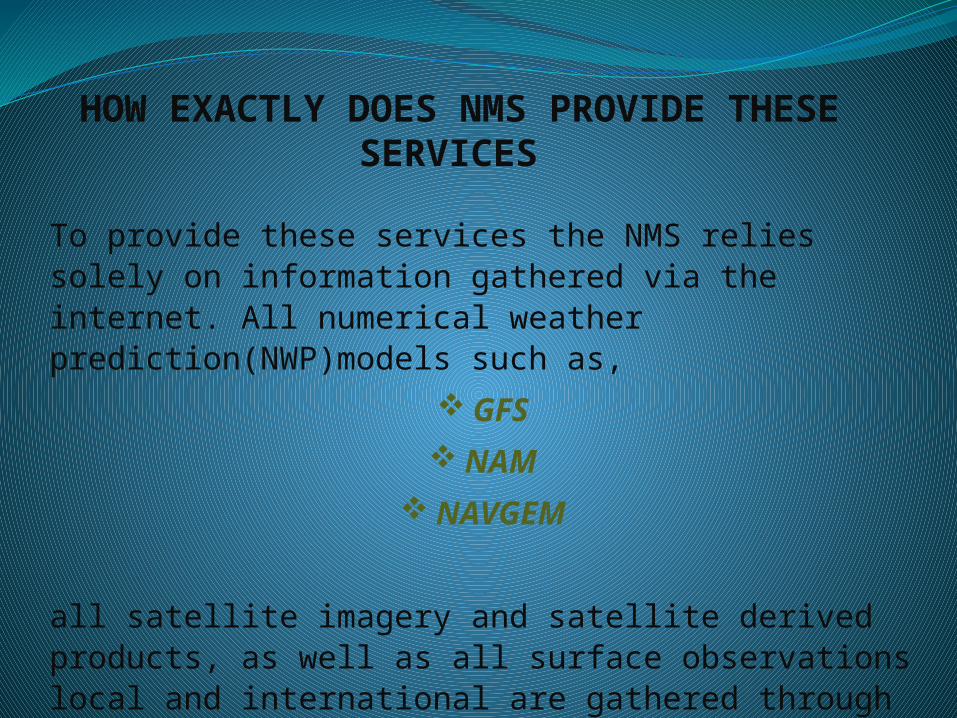
HOW EXACTLY DOES NMS PROVIDE THESE SERVICES
To provide these services the NMS relies solely on information gathered via the internet. All numerical weather prediction(NWP)models such as,
GFS
NAM
NAVGEM
all satellite imagery and satellite derived products, as well as all surface observations local and international are gathered through our internet service.

Example of these satellite image

CON’t Example of these satellite image
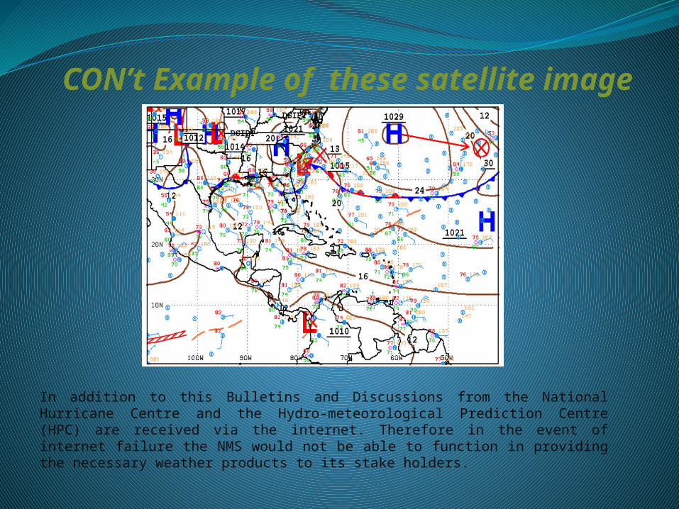
In addition to this Bulletins and Discussions from the National Hurricane Centre and the Hydro-meteorological Prediction Centre (HPC) are received via the internet. Therefore in the event of internet failure the NMS would not be able to function in providing the necessary weather products to its stake holders.
CON’t Example of these satellite image
Over the past 10 years the NMS has suffered periodical internet disruptions varying from a couple hours to 1-3 days which have severely hampered operations. However during those times the NMS had a means of gathering data via Satellite through METLAB. However with METLAB now becoming an internet based system the need for reliable Satellite systems able to gather all data needed for daily operation has become extremely important.
As a result we have implemented 2 satellite systems for backup purposes.

EMWIN – Emergency Managers Weather Information Network

GEONETCAST
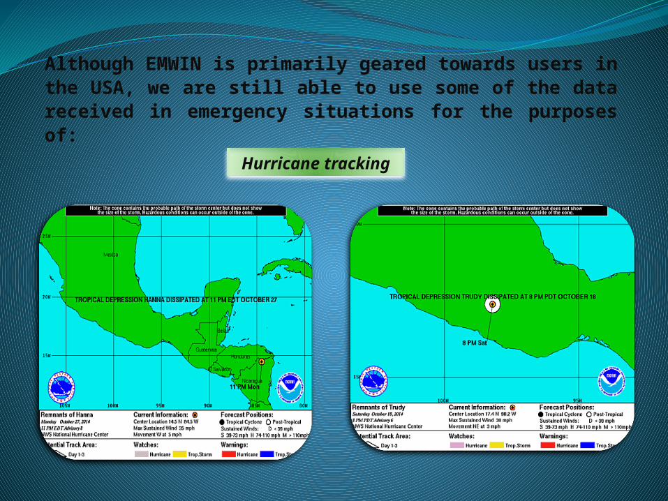
Although EMWIN is primarily geared towards users in the USA, we are still able to use some of the data received in emergency situations for the purposes of:
Hurricane tracking

Surface Charts
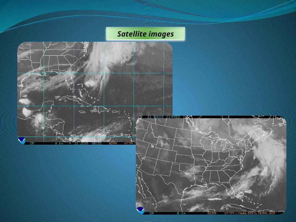
Satellite images

Various Weather related Messages

GEONETCAST is used primarily for
Infrared Imaging water vapour imaging
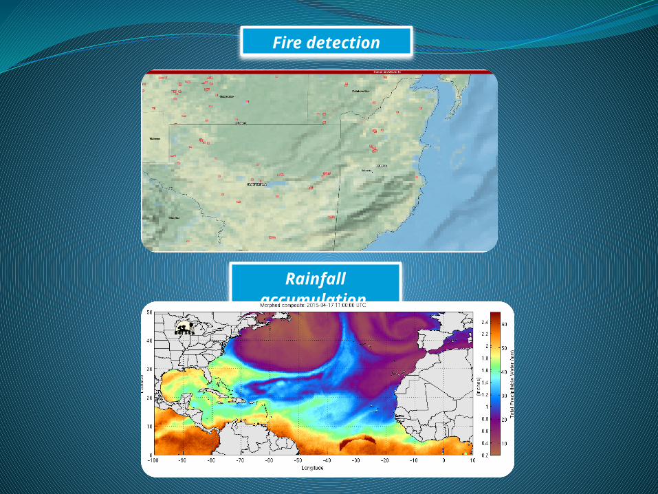
Fire detection
Rainfall accumulation
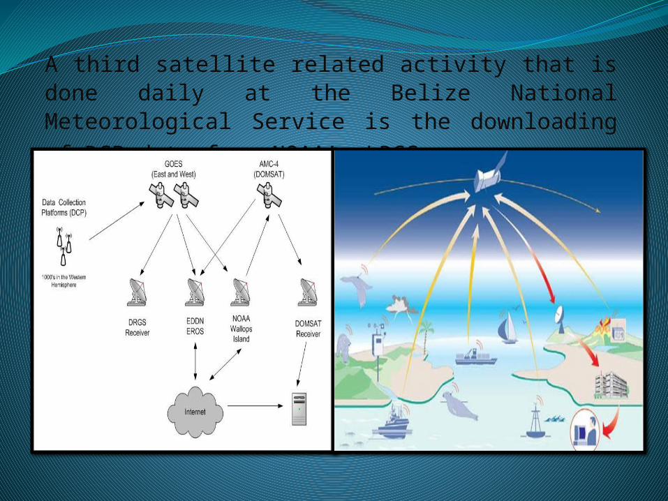
A third satellite related activity that is done daily at the Belize National Meteorological Service is the downloading of DCP
data from NOAA’s LRGS.
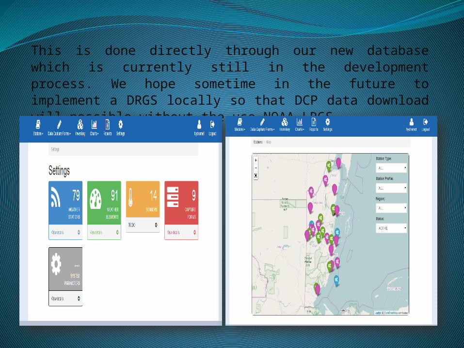
This is done directly through our new database which is currently still in the development process. We hope sometime in the future to implement a DRGS locally so that DCP data download will possible without the use NOAA LRGS.

The hydrometdb user configures each station based on the DCP address in the administration section of the database
Once this is done the system runs on a scheduler and automatically ingests data based on the DCP transmission time

The data goes through a series of processes before it is stored in the PostgreSQL database.
All DCP data can then be easily viewed quickly for near real time analysis, forecasting and validation through our web based interface.

Graphical output from DCP data
Our desire now is to develop standard operating procedures particularly with our GEONETCAST Americas system so that our Meteorologists and Forecasters can use this service as a primary means of data gathering.

THE END