bulgarian common sector of the lower danube and ... ro mot...bulgarian common sector of the lower...
TRANSCRIPT

Navigation and Ecology can live together
Improvement of navigation conditions on the Romanian -Bulgarian common sector of the Lower Danube
and accompanying studies
Rousse, 15.09.2009
Ministry of
Transport and
Infrastructure

BUDAPESTBUDAPEST
LINZLINZREGENSBURGREGENSBURG
ISMAILISMAIL
RUSSERUSSE
NOVI SADNOVI SAD
WIENWIEN
CONSTANTACONSTANTA
ROTTERDAMROTTERDAM
European Inland Navigation Route Rotterdam – Constantza

Integrated planning process
• April 2007 – contract signing between RoMoT and
Consortium consisting of TECHNUM N.V. Belgium,
TRAPEC S.A. Romania, TRACTEBEL DEVELOPMENT
ENGINEERING S.A. Belgium, COMPAGNIE NATIONALEDU RHONE France and SAFEGE France
• since 2007 – studies
• Jan 2008 – workshop
• Oct 2008 – workshop
• Nov 2008 – workshop
• 2009 - elaboration of FS and EIA Report
• Jan/Feb 2010 – workshop
• Public consultation Jan – March 2010
Ministry of
Transport and
Infrastructure
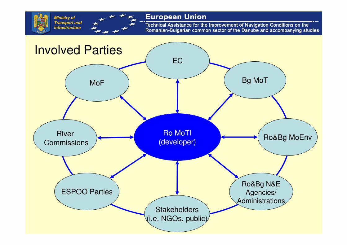
Involved Parties
Ro MoTI
(developer)
MoF
ESPOO Parties
EC
Ro&Bg MoEnvRiver
Commissions
Ro&Bg N&EAgencies/
Administrations
Stakeholders
(i.e. NGOs, public)
Bg MoT
Ministry of
Transport and
Infrastructure

EU and International legislation
• Belgrade Convention
• AGN
• TEN-T
• Danube River Protection Convention
• EIA Directive
• Water Framework Directive
• Birds and Habitat Directive
• ESPOO Convention
• Ramsar Convention, etc.
Ministry of
Transport and
Infrastructure

Other relevant documents
• NAIADES
• Joint Statement
• RBMP, etc.
Ministry of
Transport and
Infrastructure

Methodology
• Assessment of the current situation
– Field investigations (topo-bathymetry, hydrographic and sediment investigations, morphology and banks, climate change, ice, dredging, flooding, environment)
– Navigational constraints
• Methodology followed during the Study (still ongoing):
– Traffic studies;
– Numerical modeling of Hydrodynamic & morphological patterns (per Scenarios);
– Engineer Concept Designs;
– Environmental Baseline Studies, Impacts, Mitigation.
• Partial results
– General principles of preliminary proposed strategies
– Definition of scenarios
– Alternative Development Strategies
Ministry of
Transport and
Infrastructure
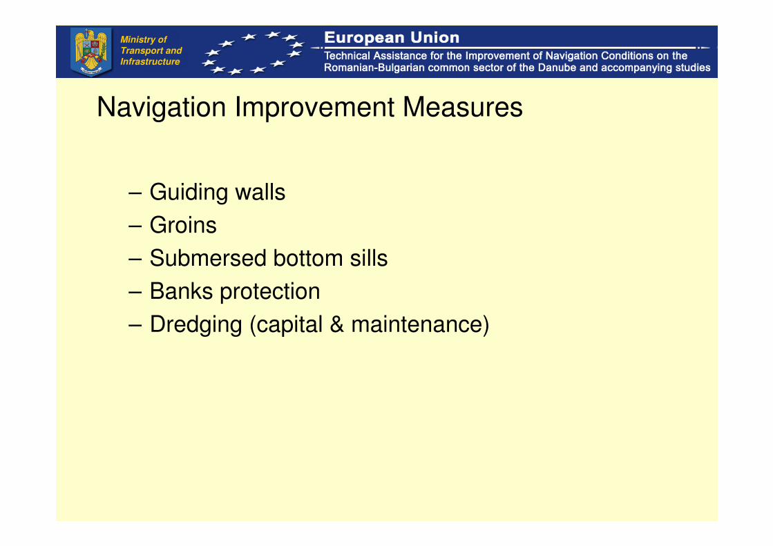
Navigation Improvement Measures
– Guiding walls
– Groins
– Submersed bottom sills
– Banks protection
– Dredging (capital & maintenance)
Ministry of
Transport and
Infrastructure

1. Precautionary principle
2. Integrated planning approach
3. Sustainable Balance between Navigation and Ecology –works from the water, smart dredging and disposal, alternative techniques and materials
4. Measures prioritization
5. Efficient Monitoring
6. Lower Danube is more than a transport corridor
7. Least Influence on river morphology in side river branches
Main principles applied
Ministry of
Transport and
Infrastructure

• Aspects taken into account
– Phasing of Dredging Operations, taking into account fish spawning /migration, birds nesting, other;
– Prioritization of decided River Interventions
– Implementation Phasing for larger river training works, mitigation;
– Restrict Impacts on deep areas (ex. current velocities, sediment deposition) as low as possible (spawning sites);
– Applied Dredging Technique in line with best available
technology, in order to minimize environmental effects (i.e. turbidity)
– Efficient Use of dredged material
Type of measures
Ministry of
Transport and
Infrastructure

• Autonomous Scenario (AS)
– Present conditions
• No Over-depth Scenario (NOS)
– ENR-2.5m and no over-depth of 0.50m
– Capital dredging 0.9 million m3
• Basic scenario (BS)
– ENR-2.5m and foresee an over-depth of 0.50m
– Capital dredging 2.2 million m3
Scenarios
Ministry of
Transport and
Infrastructure

• Enhanced Depth Scenario (EDS)
– ENR-3.0m and foresee an over-depth of 0.50m
– 9.0 million m3
• Enhanced Engineering Scenario (EES)
– ENR-2.5m and no overdepth of 0.50m
– Capital dredging 0.9 million m3
– 3 Alternative engineering measures (i.e. length, height).
• Climate Change Scenario (ACC)
– ENR-2.5m and no overdepth of 0.50m
– Capital dredging 0.9 million m3
– Predicted boundary conditions for 2071-2100
Scenarios
Ministry of
Transport and
Infrastructure
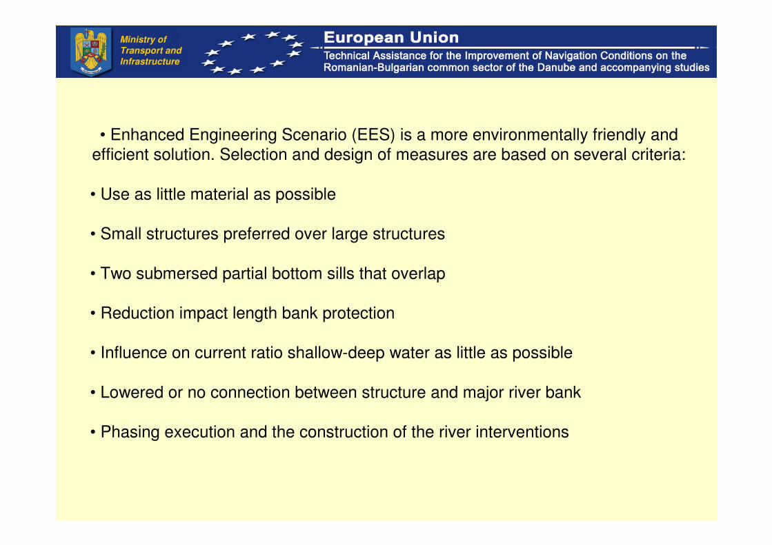
• Enhanced Engineering Scenario (EES) is a more environmentally friendly and
efficient solution. Selection and design of measures are based on several criteria:
• Use as little material as possible
• Small structures preferred over large structures
• Two submersed partial bottom sills that overlap
• Reduction impact length bank protection
• Influence on current ratio shallow-deep water as little as possible
• Lowered or no connection between structure and major river bank
• Phasing execution and the construction of the river interventions
Ministry of
Transport and
Infrastructure

EES variants
• Variant 1:
– Larger river structures avoided
– optimise for reduction of maintenance dredging
– potential for lateral reconnection (eg wetlands, side branches,...)
Present conditions
EES V1
Ministry of
Transport and
Infrastructure
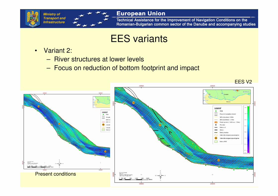
EES variants• Variant 2:
– River structures at lower levels
– Focus on reduction of bottom footprint and impact
Present conditions
EES V2
Ministry of
Transport and
Infrastructure
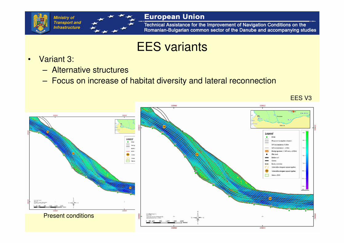
EES variants• Variant 3:
– Alternative structures
– Focus on increase of habitat diversity and lateral reconnection
Present conditions
EES V3
Ministry of
Transport and
Infrastructure
17
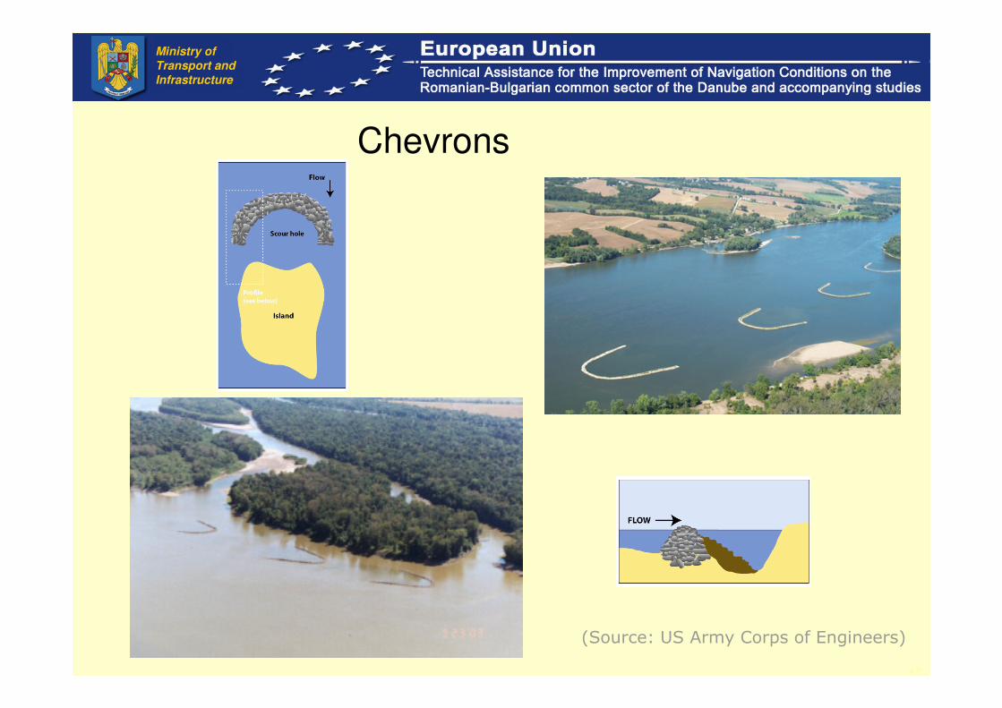
Chevrons
(Source: US Army Corps of Engineers)
Ministry of
Transport and
Infrastructure

18
• Alternative L-shaped groins
(L-shaped groins with island creation St. Louis, USA)
Groins
Ministry of
Transport and
Infrastructure
Phasing and timing
• Fish migration
• Fish spawning
• Bird nesting
• Overwintering birds
• Other temporarily aspects
Ministry of
Transport and
Infrastructure

Techniques
• Off bank groins and guiding walls
• Shorter and lower groins with reduced impact on high water levels and optimisation of impact on lower water levels
• Chevrons in combination with increase of habitat diversity
• Submersed partial bottom sill with optimisation of water velocity and no closure of side river branches
• Feasible Options to replace submersed bottom sills with groins
• Reduce length of bank protection and alternative techniques and materials
Ministry of
Transport and
Infrastructure

Smart dredging
• Reduce dredging volumes as much as possible (realignment navigation channel)
• Optimal dredging technique for Lower Danube
• Timing of activities
• Useful application of volumes of dredged material
• Environmentally-approved River Disposal sites
• Aim for reduction of frequency of maintenance dredging
• Good field monitoring and reporting
– Effects on fish, birds, turbidity, water levels, maintenance dredging
– Evaluation and adaptation
Ministry of
Transport and
Infrastructure

Contents of the
EIA Report• General Information
• Technological processes
• Waste
• Potential impact, including transboundary
• Analysis of the alternatives
• Monitoring
• Risk cases
• Description of the difficulties
• Non technical summary
• Annexes
Ministry of
Transport and
Infrastructure

General Information
• Description of the project
• Project stages
• Duration of the construction
• Pollutants
• Description of the main alternatives studied
• Description of the methodology for EIA
• Other relevant general information
Ministry of
Transport and
Infrastructure

Technological processes
• Proposed technological process
– Energy consumption
– Water consumption
– Emissions of atmospheric pollutants
• Equipments
• Installations
• Facilities
Ministry of
Transport and
Infrastructure

Waste
• Production
• Management
• Discharge
• Recycling
Ministry of
Transport and
Infrastructure

Potential impact
• During and after construction
• Each sector, proposed Alternative
• Direct/Indirect
• Cumulative
• Spatial
• Permanent/Temporary
• Reversible/ irreversible
• Positive/ negative
Ministry of
Transport and
Infrastructure

Potential impact
• Transboundary impacts
– Serbia
– Bulgaria
– Ukraine
– Moldavia
Ministry of
Transport and
Infrastructure
Potential impacts
• Water
– Water supply
– Waste water management
– Impact prognosis
– Mitigation measures
– Integrated Basin Management, along Lower
Danube
Ministry of
Transport and
Infrastructure

Potential impacts
• Air
– Sources and produced pollutants
– Pollutants groups
– Cumulative effect
– Air pollution prognosis
– Mitigation measures
Ministry of
Transport and
Infrastructure

Potential impacts
• Soil, subsoil
– Characteristics
– Chemical conditions in soil
– Vulnerability and resistance
– Existing pollution
– Pollution sources
– Impact prognosis
– Mitigation measures
Ministry of
Transport and
Infrastructure

Potential impacts
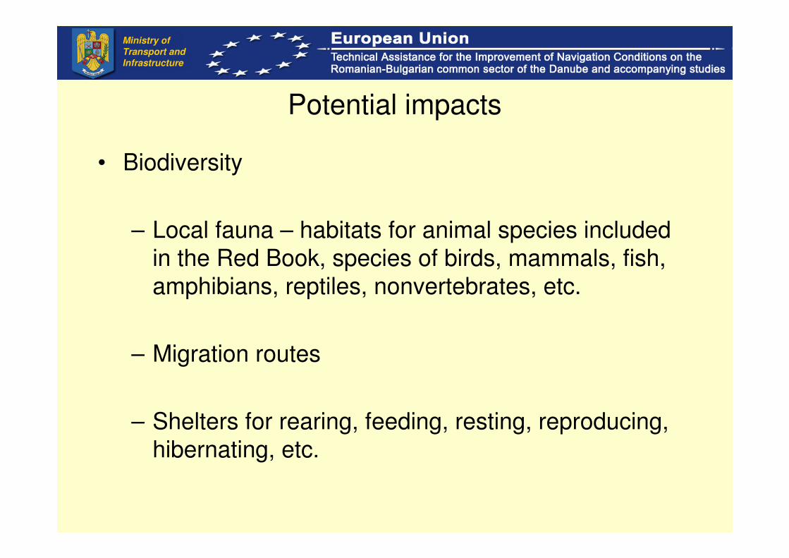
• Biodiversity
– Biotopes – forests, wetlands, surface water, sands
– Local flora – age and type of forest, composition of
species; Habitats of plant species included in the
Red Book, local and acclimatized species, plant
species, etc.
Ministry of
Transport and
Infrastructure
Potential impacts
• Biodiversity
– Local fauna – habitats for animal species included
in the Red Book, species of birds, mammals, fish,
amphibians, reptiles, nonvertebrates, etc.
– Migration routes
– Shelters for rearing, feeding, resting, reproducing,
hibernating, etc.
Ministry of
Transport and
Infrastructure

Potential impacts
• Impact prognosis
– Forest
– Swamp
– Wetlands
– Flora and fauna, etc.
• Measures for reducing the impacts
– Protection
– Reconstruction
– Re-plantation
– Repopulation, etc.
Ministry of
Transport and
Infrastructure
Potential impacts
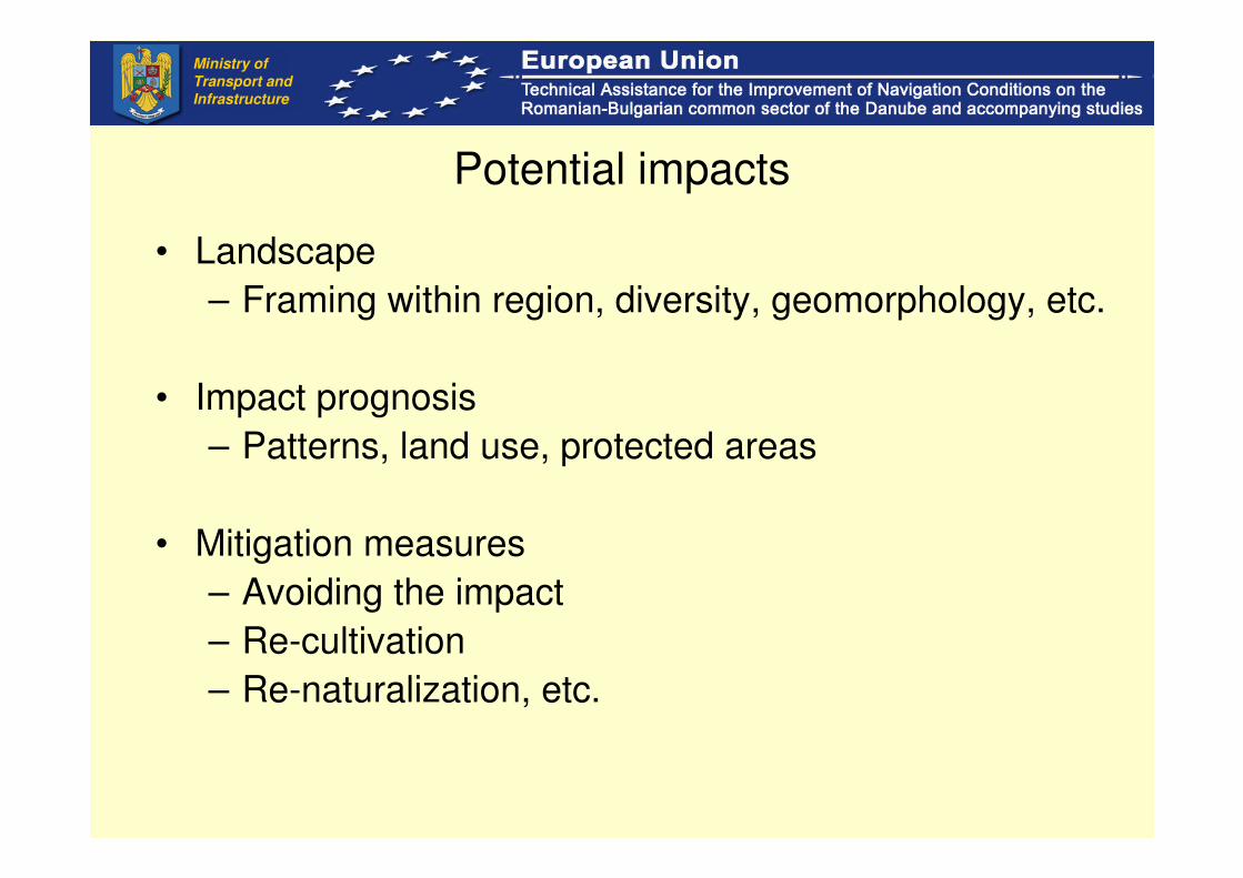
• Landscape
– Framing within region, diversity, geomorphology, etc.
• Impact prognosis
– Patterns, land use, protected areas
• Mitigation measures
– Avoiding the impact
– Re-cultivation
– Re-naturalization, etc.
Ministry of
Transport and
Infrastructure

Potential impacts
• Social and economical environment
– Demographic local population
– Characteristics of the local population
– Local labor market
– Local investment and their dynamics
– Living conditions
• Mitigation measures
• Cultural and ethnical conditions, cultural heritage
Ministry of
Transport and
Infrastructure

Analysis of the alternatives
• Alternative
– site
– technical/technological solutions
– Mitigation measures, etc.
• Comparing methods
– checklists
– maps
– mathematical modeling, etc.
Ministry of
Transport and
Infrastructure

Monitoring
• Components
• Parameters
• Methods
• Sites
• Periodicity
• Stages
• Estimation of costs
Ministry of
Transport and
Infrastructure

Risk cases
• Natural risks
• Potential accidents (during construction, during
operation)
• Measures to prevent accidents
• Comparison
Ministry of
Transport and
Infrastructure

Description of the difficulties
Met by the developer during the carrying out of the EIA
Ministry of
Transport and
Infrastructure

Flora
Left bank, degraded - the presence of adventitious species
(Xanthium italicum, Amorpha fruticosa) (May 2009)
Ministry of
Transport and
Infrastructure
Advantages
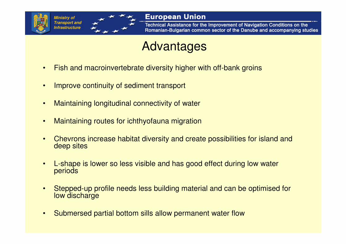
• Fish and macroinvertebrate diversity higher with off-bank groins
• Improve continuity of sediment transport
• Maintaining longitudinal connectivity of water
• Maintaining routes for ichthyofauna migration
• Chevrons increase habitat diversity and create possibilities for island and deep sites
• L-shape is lower so less visible and has good effect during low water periods
• Stepped-up profile needs less building material and can be optimised forlow discharge
• Submersed partial bottom sills allow permanent water flow
Ministry of
Transport and
Infrastructure

Environmental balance
• Restoration might require more material and can cost more
• Lower and L-shape groins might require deeper positioning in river and thus more material
• Less technical measures might cause increase in maintenance dredging
• More dynamics require more monitoring and surveys
• Adaptive measures can require more maintenance and control
• Flexible disposal of dredged material might require more transport and higher costs
• Limitations on timing might cause extra costs• Limitations on navigation might cause extra environmental
and economic cost
Ministry of
Transport and
Infrastructure

Conclusions
• A technical study has been made using the updated information (bathymetry 2008) and the state-of-the-art techniques (numerical modeling, GIS).
• 38 critical sectors analyzed:
– 5 sectors need no measures
– 5 sectors need realignment of the navigation channel
– 17 sectors need realignment + dredging
– 11 sectors need realignment + dredging + measures
• The effect of the measures during high water levels periods is being studied a the moment taking into account the effect on other studies (i.e. study of floodplains/ Ministry of Environment).
• Several alternative development strategies are considered for the improvement of the navigation conditions.
• Environmental friendly engineering measures are proposed.
• The FS and EIA studies are ongoing at present.
Ministry of
Transport and
Infrastructure

Cristina Cuc
Ministry of Transport and Infrastructure
38, Dinicu Golescu Blvd, Bucharest, [email protected]
Ministry of
Transport and
Infrastructure
Thank you for your attention!