building better and smarter suburbs: strategic … better and smarter suburbs: strategic directions...
TRANSCRIPT
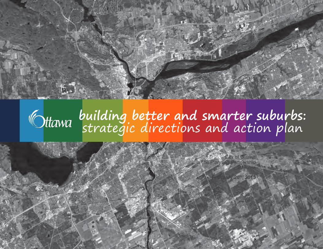
building better and smarter suburbs: strategic directions and action plan
City of Ottawa The Planning Partnership
Parsons
February 20th, 2015

This page intentionally left blank
table of contents
1. introduction 5 2. study background 6 3. vision and principles 11 4. recommendations 14
strategies for building better and smarter suburbs better and smarter community plans 17 .1 Street Network and Land Use 18 .2 Parks and Open Space 24 .3 Stormwater Management 28 .4 School Sites 32
better and smarter streets 37 .5 Parking 38 .6 Road Right-of-way 44 .7 Rear Lanes 50 .8 Trees 54 .9 Utility Placement 58
5. implementation strategies 62 6. appendix: suburban design framework 70
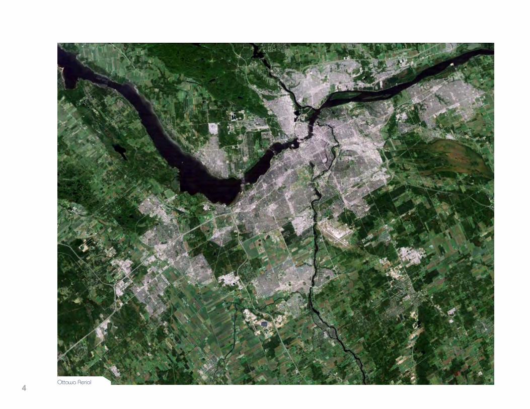
4Ottawa Aerial
5
build
ing
bett
er a
nd s
mar
ter
subu
rbs : st
rate
gic
dire
ctio
ns a
nd a
ctio
n pl
an /
pre
pare
d by
City
of O
ttaw
a an
d Th
e Pl
anni
ng P
artn
ersh
ip
1 introduction
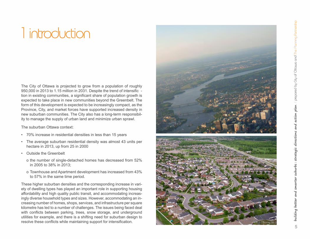
The City of Ottawa is projected to grow from a population of roughly 950,000 in 2013 to 1.15 million in 2031. Despite the trend of intensific -tion in existing communities, a significant share of population growth is expected to take place in new communities beyond the Greenbelt. The form of this development is expected to be increasingly compact, as the Province, City, and market forces have supported increased density in new suburban communities. The City also has a long-term responsibil-ity to manage the supply of urban land and minimize urban sprawl.
The suburban Ottawa context:
• 70% increase in residential densities in less than 15 years
• The average suburban residential density was almost 43 units per hectare in 2013, up from 25 in 2000
• Outside the Greenbelt
o the number of single-detached homes has decreased from 52% in 2005 to 38% in 2013;
o Townhouse and Apartment development has increased from 43% to 57% in the same time period.
These higher suburban densities and the corresponding increase in vari-ety of dwelling types has played an important role in supporting housing affordability and high quality public transit, and accommodating increas-ingly diverse household types and sizes. However, accommodating an in-creasing number of homes, shops, services, and infrastructure per square kilometre has led to a number of challenges. The issues being faced deal with conflicts between parking, trees, snow storage, and underground utilities for example, and there is a shifting need for suburban design to resolve these conflicts while maintaining support for intensification.

6
2 study background
Study Scope, Team and Timeline
The challenge to Building Better and Smarter Suburbs is not unique to the City of Ottawa but common to many North American municipalities. In this, the City is considered an innovative and progressive leader in new community design. And, in embarking on this study, it became clear that the task at hand was not as much one of adding an addi-tional set of guidelines, but providing clarity and revisions to existing policies, plans, and practices.
On this basis, the scope of work for this study has been adjusted and this final report has been shaped largely through a process of infor-mation distillation and collaborative conversations that engaged all stakeholders.
This study was led by the Intensification Implementation Group (IIG) in the Planning and Growth Management Department, which was es-tablished by City Council after the adoption of the 2008 Official Plan (OP) to remove regulatory barriers to intensification and the type of urban city-building contemplated by the OP. The IIG was also directed to examine suburban subdivision design and in so doing, oversee the preparation of new municipal guidelines and strategies with the over-arching goals and objectives of:
• Ensuring that the increase in suburban density is accompanied by good subdivision design;
• Promoting complete, walkable and transit-supportive communities;
• Creating residential communities that are attractive, efficient and able to accommodate competing priorities including the reality of multiple-car ownership;
7
build
ing
bett
er a
nd s
mar
ter
subu
rbs : st
rate
gic
dire
ctio
ns a
nd a
ctio
n pl
an /
pre
pare
d by
City
of O
ttaw
a an
d Th
e Pl
anni
ng P
artn
ersh
ip
• Accommodating a variety of safe and reliable transportation options;
• Encouraging communities that are land and infrastructure efficient
• Balancing good urban design with long-term maintenance and op-erational costs.
The study was overseen by a project Steering Committee and a Project Management Group comprised of City Staff and Councillor Sponsors. The Study also benefitted from a large and diverse Technical Working Group (TWG) which included representatives from City departments, school boards, utility companies and the development industry.
The study began in the spring of 2013 with a tour of existing suburban communities, followed by a series of workshops, focused conversa-tions, and a Suburban Councillors Forum, which are briefly described below. These efforts provided the study background and resulted in the Vision and Principles, which were approved in the spring of 2014. This report was prepared with significant input from the TWG during the summer and fall of 2014.
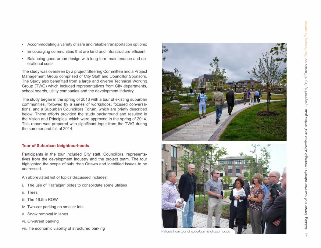
Tour of Suburban Neighbourhoods
Participants in the tour included City staff, Councillors, representa-tives from the development industry and the project team. The tour highlighted the scope of suburban Ottawa and identified issues to be addressed.
An abbreviated list of topics discussed includes:
i. The use of ‘Trafalgar’ poles to consolidate some utilities
ii. Trees
iii. The 16.5m ROW
iv. Two-car parking on smaller lots
v. Snow removal in lanes
vi. On-street parking
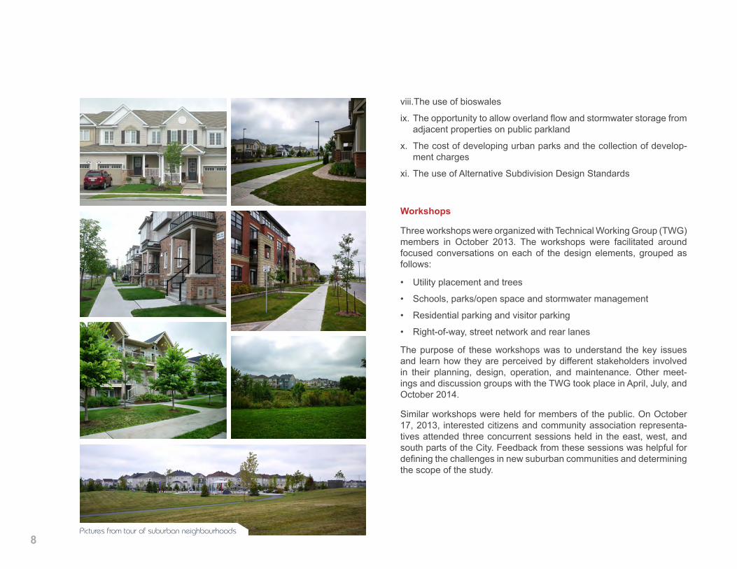
vii.The economic viability of structured parking Pictures from tour of suburban neighbourhoods
8
viii.The use of bioswales
ix. The opportunity to allow overland flow and stormwater storage from adjacent properties on public parkland
x. The cost of developing urban parks and the collection of develop-ment charges
xi. The use of Alternative Subdivision Design Standards
Pictures from tour of suburban neighbourhoods
Workshops
Three workshops were organized with Technical Working Group (TWG) members in October 2013. The workshops were facilitated around focused conversations on each of the design elements, grouped as follows:
• Utility placement and trees
• Schools, parks/open space and stormwater management
• Residential parking and visitor parking
• Right-of-way, street network and rear lanes
The purpose of these workshops was to understand the key issues and learn how they are perceived by different stakeholders involved in their planning, design, operation, and maintenance. Other meet-ings and discussion groups with the TWG took place in April, July, and October 2014.
Similar workshops were held for members of the public. On October 17, 2013, interested citizens and community association representa-tives attended three concurrent sessions held in the east, west, and south parts of the City. Feedback from these sessions was helpful for defining the challenges in new suburban communities and determining the scope of the study.
9
build
ing
bett
er a
nd s
mar
ter
subu
rbs : st
rate
gic
dire
ctio
ns a
nd a
ctio
n pl
an /
pre
pare
d by
City
of O
ttaw
a an
d Th
e Pl
anni
ng P
artn
ersh
ip
Focused Conversations
Following the analysis of input received at the October 2013 work-shops, a second round of conversations were convened with the Technical Working Group in January 2014 on eight key issues:
• better integration of schools and parks
• better use of parkland for stormwater function
• better provisions for trees
• better provision of on-site and on-street parking
• better use of rear lanes
• better traffic calming
• better details in street cross sections
• better harmonization of design standards and processes
Suburban Councillors Forum
The next stage of the study involved small group conversations with sub-urban Councillors and members of the development industry in March and April 2014. This culminated in the Suburban Councillors Forum on April 24, 2014, which provided suburban Councillors and members of the development industry a forum to publicly discuss the challenges and opportunities of development in new greenfield neighbourhoods. Highlights of some of the questions and answers are provided below:
What’s working well?
• Modified grid street network
• Recessed garages (garages further into the house)
• Updated zoning
• Public spaces on the street
• Front ending of parks by developers
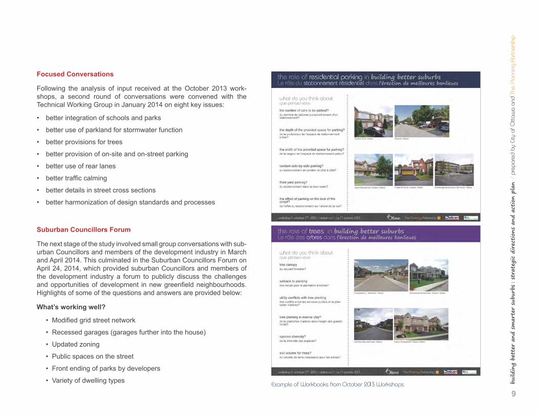
• Variety of dwelling types Example of Workbooks from October 2013 Workshops
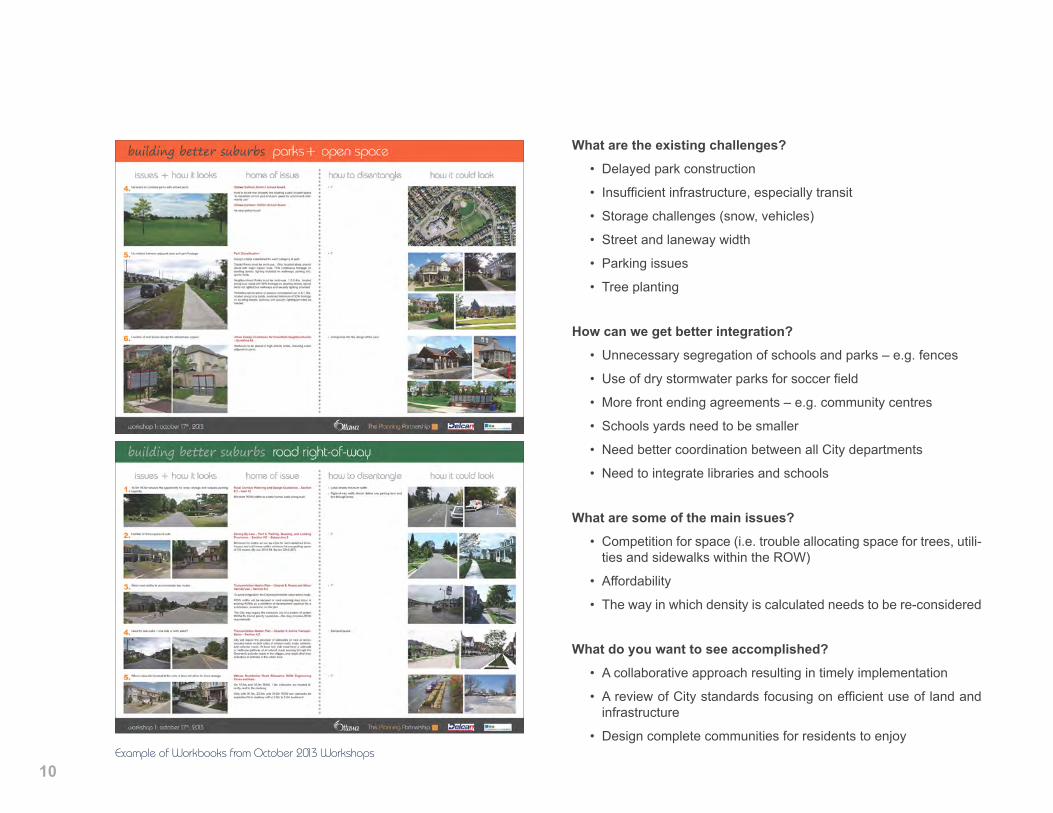
10Example of Workbooks from October 2013 Workshops
What are the existing challenges? • Delayed park construction
• Insufficient infrastructure, especially transit
• Storage challenges (snow, vehicles)
• Street and laneway width
• Parking issues
• Tree planting
How can we get better integration? • Unnecessary segregation of schools and parks – e.g. fences
• Use of dry stormwater parks for soccer field
• More front ending agreements – e.g. community centres
• Schools yards need to be smaller
• Need better coordination between all City departments
• Need to integrate libraries and schools
What are some of the main issues?
• Competition for space (i.e. trouble allocating space for trees, utili-ties and sidewalks within the ROW)
• Affordability
• The way in which density is calculated needs to be re-considered
What do you want to see accomplished? • A collaborative approach resulting in timely implementation
• A review of City standards focusing on efficient use of land and infrastructure
• Design complete communities for residents to enjoy
11
build
ing
bett
er a
nd s
mar
ter
subu
rbs : st
rate
gic
dire
ctio
ns a
nd a
ctio
n pl
an /
pre
pare
d by
City
of O
ttaw
a an
d Th
e Pl
anni
ng P
artn
ersh
ip
3 vision and principles
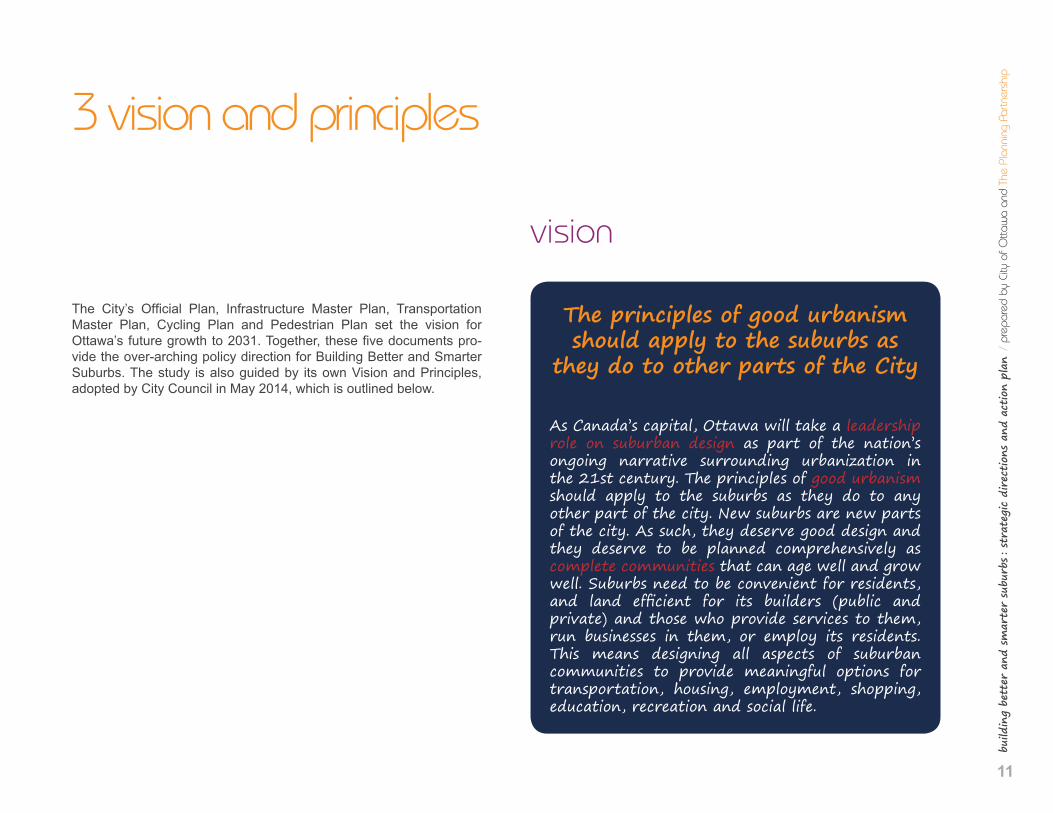
The City’s Official Plan, Infrastructure Master Plan, Transportation Master Plan, Cycling Plan and Pedestrian Plan set the vision for Ottawa’s future growth to 2031. Together, these five documents pro-vide the over-arching policy direction for Building Better and Smarter Suburbs. The study is also guided by its own Vision and Principles, adopted by City Council in May 2014, which is outlined below.
vision
The principles of good urbanism should apply to the suburbs as
they do to other parts of the City
As Canada’s capital, Ottawa will take a leadership role on suburban design as part of the nation’s ongoing narrative surrounding urbanization in the 21st century. The principles of good urbanism should apply to the suburbs as they do to any other part of the city. New suburbs are new parts of the city. As such, they deserve good design and they deserve to be planned comprehensively as complete communities that can age well and grow well. Suburbs need to be convenient for residents, and land efficient for its builders (public and private) and those who provide services to them, run businesses in them, or employ its residents. This means designing all aspects of suburban communities to provide meaningful options for transportation, housing, employment, shopping, education, recreation and social life.
12
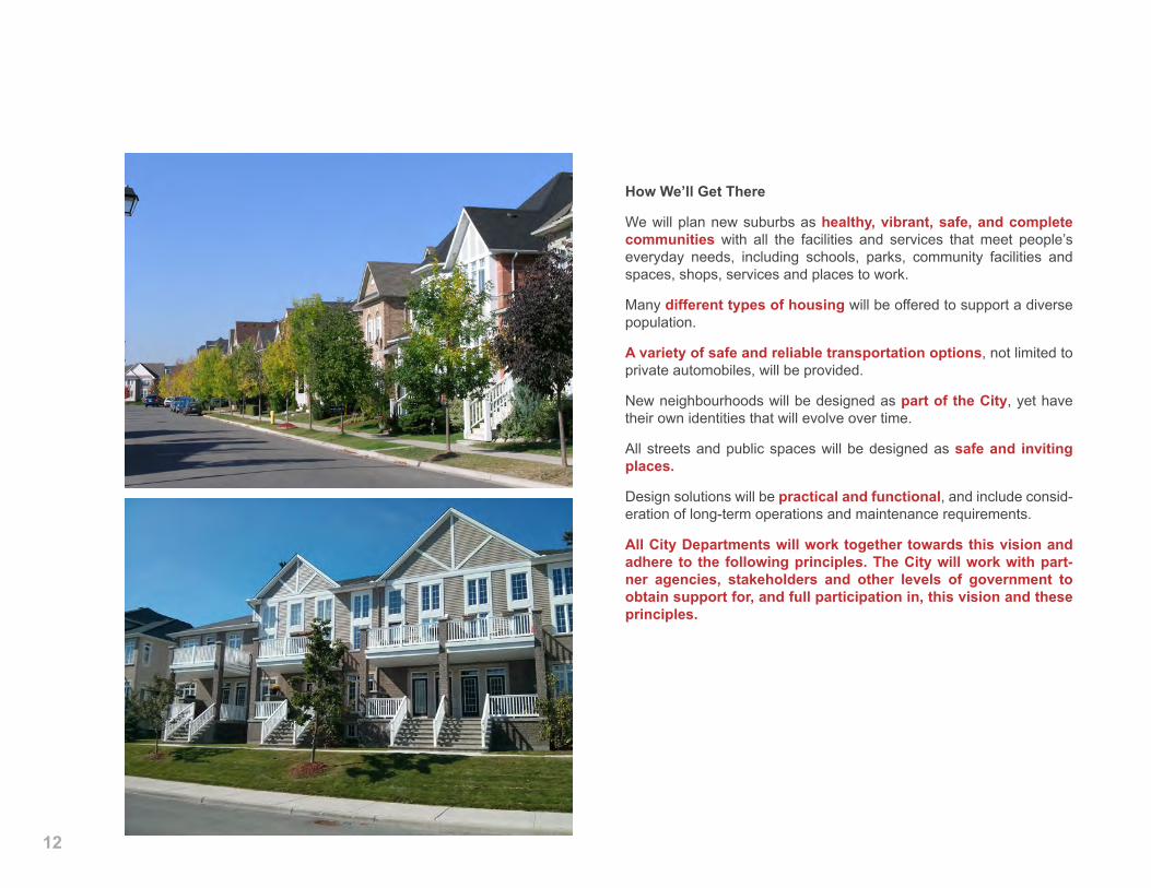
How We’ll Get There
We will plan new suburbs as healthy, vibrant, safe, and complete communities with all the facilities and services that meet people’s everyday needs, including schools, parks, community facilities and spaces, shops, services and places to work.
Many different types of housing will be offered to support a diverse population.
A variety of safe and reliable transportation options, not limited to private automobiles, will be provided.
New neighbourhoods will be designed as part of the City, yet have their own identities that will evolve over time.
All streets and public spaces will be designed as safe and inviting places.
Design solutions will be practical and functional, and include consid-eration of long-term operations and maintenance requirements.
All City Departments will work together towards this vision and adhere to the following principles. The City will work with part-ner agencies, stakeholders and other levels of government to obtain support for, and full participation in, this vision and these principles.
13
build
ing
bett
er a
nd s
mar
ter
subu
rbs : st
rate
gic
dire
ctio
ns a
nd a
ctio
n pl
an /
pre
pare
d by
City
of O
ttaw
a an
d Th
e Pl
anni
ng P
artn
ersh
ip
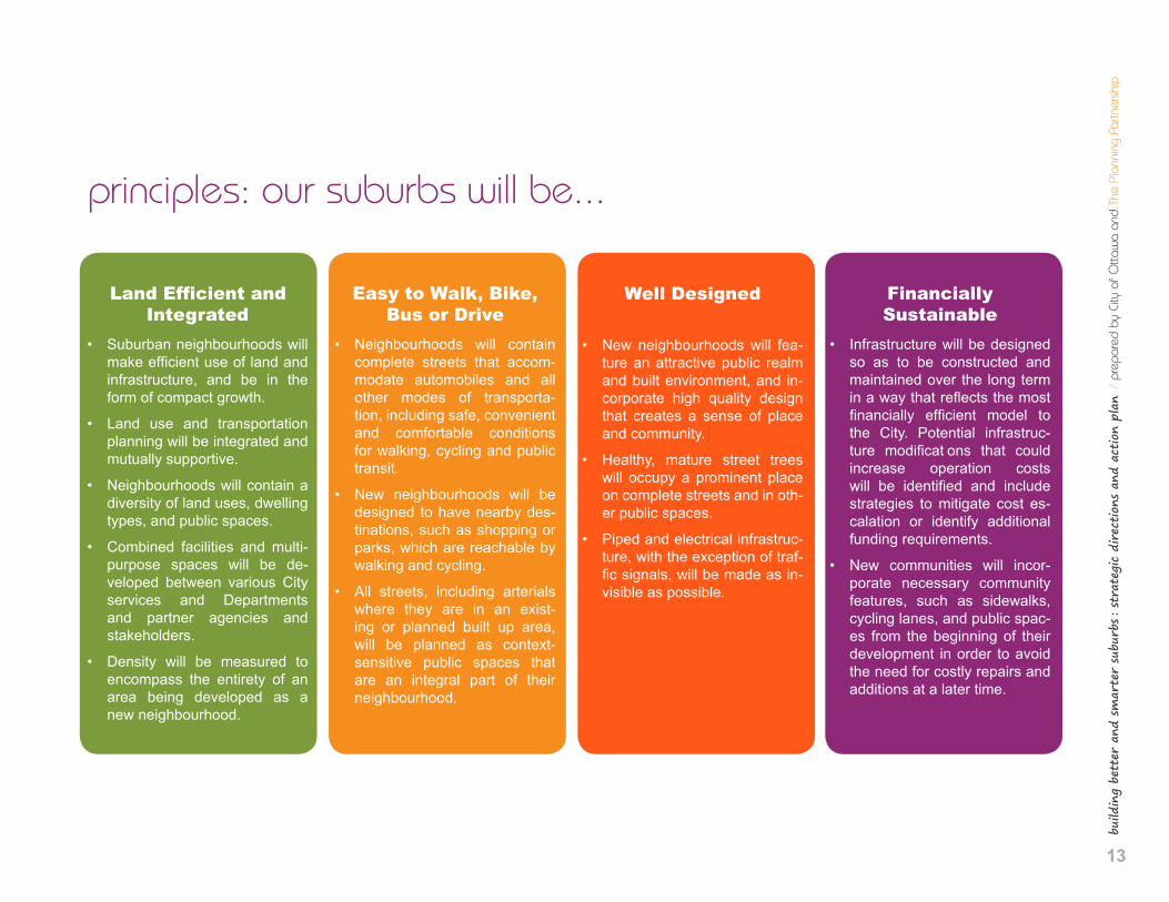
principles: our suburbs will be...
Land Efficient and Integrated
• Suburban neighbourhoods will make efficient use of land and infrastructure, and be in the form of compact growth.
• Land use and transportation planning will be integrated and mutually supportive.
• Neighbourhoods will contain a diversity of land uses, dwelling types, and public spaces.
• Combined facilities and multi-purpose spaces will be de-veloped between various City services and Departments and partner agencies and stakeholders.
• Density will be measured to encompass the entirety of an area being developed as a new neighbourhood.
Easy to Walk, Bike, Bus or Drive
• Neighbourhoods will contain complete streets that accom-modate automobiles and all other modes of transporta-tion, including safe, convenient and comfortable conditions for walking, cycling and public transit.
• New neighbourhoods will be designed to have nearby des-tinations, such as shopping or parks, which are reachable by walking and cycling.
• All streets, including arterials where they are in an exist-ing or planned built up area, will be planned as context-sensitive public spaces that are an integral part of their neighbourhood.
Well Designed
• New neighbourhoods will fea-ture an attractive public realm and built environment, and in-corporate high quality design that creates a sense of place and community.
• Healthy, mature street trees will occupy a prominent place on complete streets and in oth-er public spaces.
• Piped and electrical infrastruc-ture, with the exception of traf-fic signals, will be made as in-visible as possible.
Financially Sustainable
• Infrastructure will be designed so as to be constructed and maintained over the long term in a way that reflects the most financially efficient model to the City. Potential infrastruc-ture modificat ons that could increase operation costs will be identified and include strategies to mitigate cost es-calation or identify additional funding requirements.
• New communities will incor-porate necessary community features, such as sidewalks, cycling lanes, and public spac-es from the beginning of their development in order to avoid the need for costly repairs and additions at a later time.
14
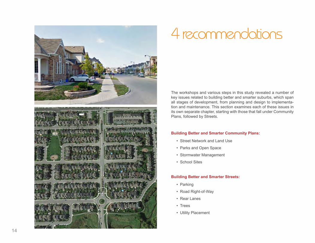
4 recommendations
The workshops and various steps in this study revealed a number of key issues related to building better and smarter suburbs, which span all stages of development, from planning and design to implementa-tion and maintenance. This section examines each of these issues in its own separate chapter, starting with those that fall under Community Plans, followed by Streets.
Building Better and Smarter Community Plans:
• Street Network and Land Use
• Parks and Open Space
• Stormwater Management
• School Sites
Building Better and Smarter Streets:
• Parking
• Road Right-of-Way
• Rear Lanes
• Trees
• Utility Placement
15
build
ing
bett
er a
nd s
mar
ter
subu
rbs : st
rate
gic
dire
ctio
ns a
nd a
ctio
n pl
an /
pre
pare
d by
City
of O
ttaw
a an
d Th
e Pl
anni
ng P
artn
ersh
ip
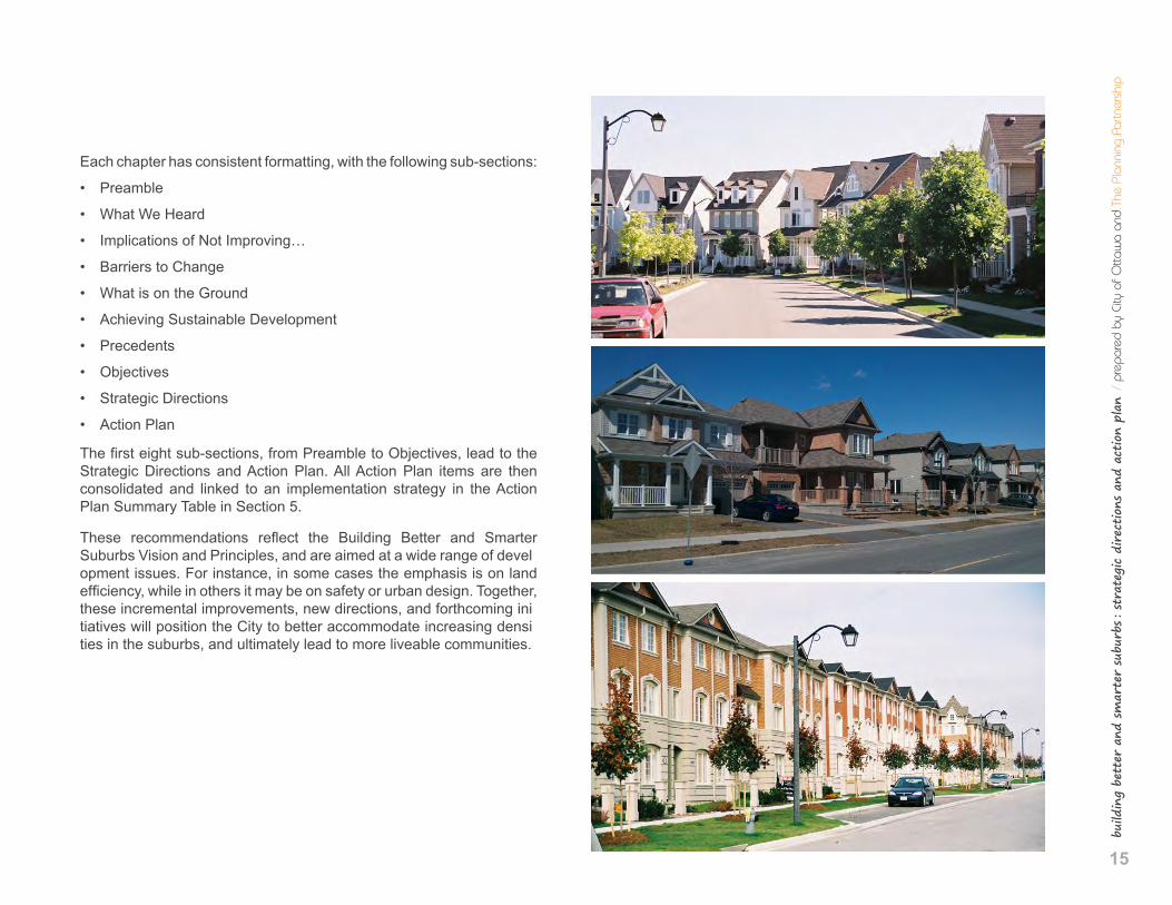
Each chapter has consistent formatting, with the following sub-sections:
• Preamble
• What We Heard
• Implications of Not Improving…
• Barriers to Change
• What is on the Ground
• Achieving Sustainable Development
• Precedents
• Objectives
• Strategic Directions
• Action Plan
The first eight sub-sections, from Preamble to Objectives, lead to the Strategic Directions and Action Plan. All Action Plan items are then consolidated and linked to an implementation strategy in the Action Plan Summary Table in Section 5.
These recommendations reflect the Building Better and Smarter Suburbs Vision and Principles, and are aimed at a wide range of devel opment issues. For instance, in some cases the emphasis is on land efficiency, while in others it may be on safety or urban design. Together, these incremental improvements, new directions, and forthcoming ini tiatives will position the City to better accommodate increasing densi ties in the suburbs, and ultimately lead to more liveable communities.
16
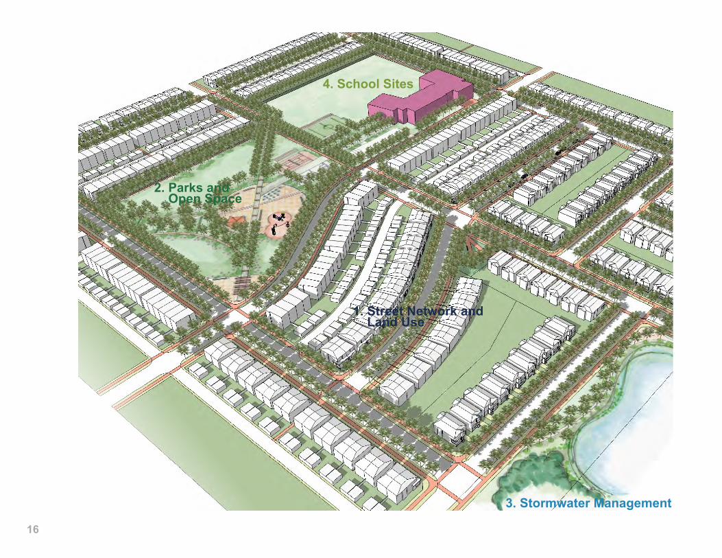
1. Street Network and Land Use
2. Parks and Open Space
3. Stormwater Management
4. School Sites
17
build
ing
bett
er a
nd s
mar
ter
subu
rbs : st
rate
gic
dire
ctio
ns a
nd a
ctio
n pl
an /
pre
pare
d by
City
of O
ttaw
a an
d Th
e Pl
anni
ng P
artn
ersh
ipstrategies for building better and smarter suburbs
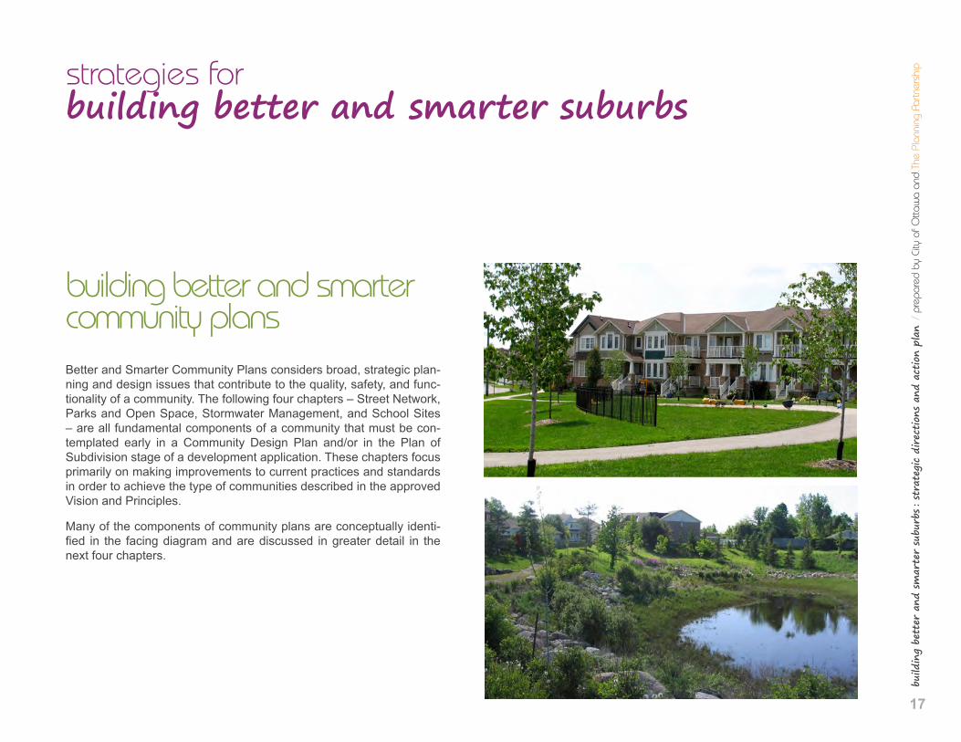
building better and smarter community plans Better and Smarter Community Plans considers broad, strategic plan-ning and design issues that contribute to the quality, safety, and func-tionality of a community. The following four chapters – Street Network, Parks and Open Space, Stormwater Management, and School Sites – are all fundamental components of a community that must be con-templated early in a Community Design Plan and/or in the Plan of Subdivision stage of a development application. These chapters focus primarily on making improvements to current practices and standards in order to achieve the type of communities described in the approved Vision and Principles.
Many of the components of community plans are conceptually identi-fied in the facing diagram and are discussed in greater detail in the next four chapters.
18
.1 st
reet
net
wor
k an
d la
nd u
se
preamble
The history of suburbs has often resulted in curvilinear streets with relatively isolated residential land uses. In recent years, suburban de-sign has shifted from this approach because it tends to be incompat-ible with many community objectives such as promoting active trans-portation and transit, facilitating multi-modal access to other land uses and community amenities, efficient infrastructure servicing, and easy wayfinding.
New suburban communities are once again drawing on more tradi-tional community design models. Street networks with crescents and cul-de-sacs are being set aside in favour of the modified and offset grid, with opportunities for a mix of land uses within walking distance from homes. This strategy provides more direct routes through neigh-bourhoods, particularly for pedestrians and cyclists, and improves ac-cess to transit and other community amenities, such as parks, shops, and services. These improvements to street connectivity also support more reliable water servicing and better fire protection for residents and businesses.
It is not a coincidence that the most desirable neighbourhoods tend to have a grid-like street network and pedestrian access to local shops and services. However, applying this type of street and land use pat-tern to new suburban communities does present some challenges, including the potential for cut-through traffic and the need for traffic calming, and questions around the market absorption and viability of small local retail spaces. While it is recognized that no built form fits all contexts, a grid-like street network is encouraged.
what we heard
Comments captured from workshops: • Blocks are too long, resulting in visual monotony, speeding, and a
future need for traffic calming measures.
• Disconnected street system works against achieving permeability and improved opportunity for active transportation.
• Disconnected street system is more difficult to serve by public transit.
• Disconnected street system leads to fewer connection points for piped utilities, which may result in the need to oversize some infrastructure.
• Limited connection between local and regional networks.
• Excessive traffic and vehicle speeds on local streets
• Single loaded roads are an inefficient use of land that create a vi-sual dominance of paving.
• Eyebrow roads create parking issues for homeowners.
• Need to minimize driveways on lots facing schools sites and bring buildings closer to the street.
• Noise attenuation measures for properties abutting major collec-tor or arterial roads result in no ‘eyes on the street’ and unsafe conditions.
• Arterial roads are spaced too far apart, resulting in the need for wide, disruptive arterials that divide neighbourhoods.
• Street network and transportation improvements are not enough -need nearby shops and services to give people places to walk or cycle to.
build
ing
bett
er a
nd s
mar
ter
subu
rbs : st
rate
gic
dire
ctio
ns a
nd a
ctio
n pl
an /
pre
pare
d by
City
of O
ttaw
a an
d Th
e Pl
anni
ng P
artn
ersh
ip
19
implications of not improving the street network and land use patterns • Disconnected neighbourhoods with isolated land uses result in lon-
ger trip distances, which favour vehicular mode choices.
• Diminished access to transit.
barriers to change
• Reliance on outdated models of community design.
• Expectation that developers can establish general street network concept through plan of subdivision.
• Competition from big box stores makes it more difficult to attract lo-cal commercial uses.
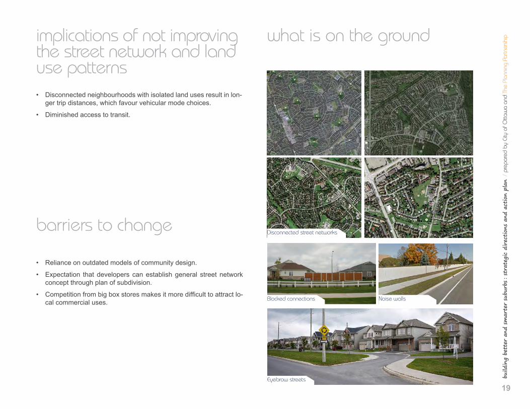
what is on the ground
Disconnected street networks
Blocked connections Noise walls
Eyebrow streets
.1 s
treet
net
wor
k an
d la
nd u
se
20
achieving sustainable development • A grid-like street network improves access to transit routes and sup-
ports active transportation, while reducing vehicular travel distanc-es and emissions.
• A highly connected street network supports adequate water supply servicing and fire protection
• Appropriately designed streetscapes become a signifi ant compo-nent of the public realm, improving quality of life in front of every home.
• A mix of land uses improves opportunities for walking and cycling for utilitarian trips and supports local employment.
• Homes with second dwelling units (e.g. basement apartments) sup-port housing affordability – both for renters as it increases the sup-ply of rental units, and for owners who receive an additional source of income to help pay the mortgage.
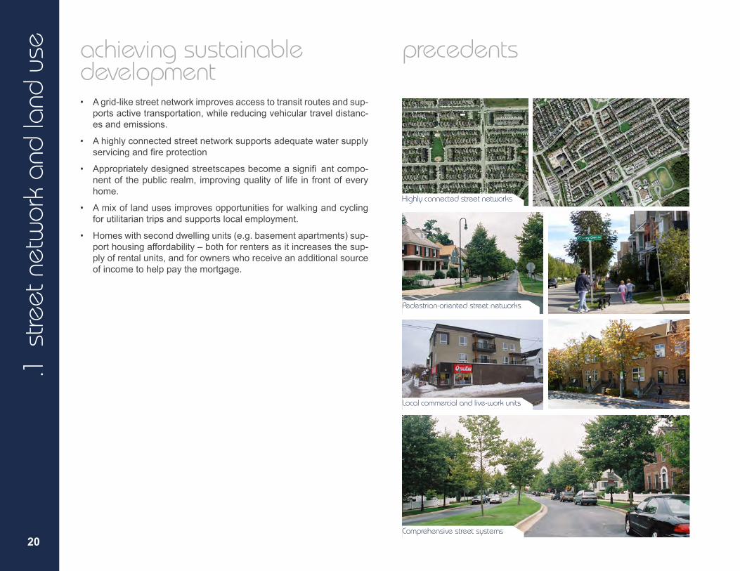
precedents
Highly connected street networks
Pedestrian-oriented street networks
Local commercial and live-work units
Comprehensive street systems

build
ing
bett
er a
nd s
mar
ter
subu
rbs : st
rate
gic
dire
ctio
ns a
nd a
ctio
n pl
an /
pre
pare
d by
City
of O
ttaw
a an
d Th
e Pl
anni
ng P
artn
ersh
ip
21
objectives
• Implementanetworkofstreettypologiesthatcomplementstheland uses, densities and built form within a community.
• Createahighlyconnectedstreetandblockpatternwithshortblocks tosupportefficient routingoftransit,shortdistancestotransitstops andstations,andintuitivewayfinding.
• Designthestreetnetworktorespondtoandrespectnaturalandcul-tural features.
• Designthestreetnetworktoenhanceaccesstopublicfacilitiesand services; prioritize pedestrian and cycling access for short trips, and walking/cycling connections to transit stations and Park and Ride lots for longer distance trips.
• Integratethestreetnetworkwiththeparkandopenspacesystem. • Designthestreetnetworkandblocklengthstoincludeadiversityof
routes for vehicular and active transportation in order to minimize bottleneck locations.
• Provideopportunitiesforsmall localretailorcommercialspacesin new neighbourhoods, where appropriate.
• Reducevehicleoperatingspeeds,particularlyonlocalstreets,inor-der to improve safety be reducing vehicular and pedestrian/cyclist conflicts
• Createastreetsystemthatpromotespassivetraffic calmingandin-cludestraffic calmingfeaturesbuiltintotheinitialdesignsforlocal and collector roads.
.1 s
treet
net
wor
k an
d la
nd u
se
22
strategic directions
1. Design the street network as an integral part and extension of the municipal grid, taking into consideration its future ad-justments and evolution.
2. Designthestreetnetworkbasedonamodified oroffsetgrid to maximize choices of travel routes and opportunities for utility connections.
3. Design the street network in conjunction with the land use and open space system to ensure direct pedestrian and cycling connectivity to key destinations in the community (schools, shops, bus stops and stations, etc).
4. Examine opportunities to design the street network with more closely spaced arterial roads in order to minimize the need for very wide ROWs that can be perceived as commu-nity dividers and barriers to active transportation.
5. Ensure that a range of appropriate sized roadways comple-ments the character and functional needs of each commu-nity area.
6. Implementtraffic calmingmeasuresattheoutsetofroadde-sign for local and collector streets.
7. Use roundabouts that prioritize pedestrian and cyclist safety in appropriate functional locations.
8. Implement prescribed facilities from the 2013 Ottawa Pedestrian Plan (Section 4.1) and 2013 Ottawa Cycling Plan with development.
9. Avoid reverse frontage lots (rear yards abutting public streets) within a community.
10. Encourage representation from OC Transpo at pre-con-sultation meetings for plans of subdivision in order to incorporate transit planning into initial subdivision design.
11. Provideflexibility inzoningtoaccommodateamixofland uses within a community, such as areas that allow live-work units or local commercial land uses.
12. To support housing affordability, encourage developers to “rough-in” utilities in basements in order to facilitate their future conversion to second dwelling units in single, semi-detached, and townhouse units.
23
build
ing
bett
er a
nd s
mar
ter
subu
rbs : st
rate
gic
dire
ctio
ns a
nd a
ctio
n pl
an /
pre
pare
d by
City
of O
ttaw
a an
d Th
e Pl
anni
ng P
artn
ersh
ipaction plan
1. Revise Urban Design Guidelines for Greenfield Neighbourhoods to promote the following in all new Community Design Plans and Plans of Subdivision, where appropriate:
• A modified or offset grid street network is encouraged, in accor-dance with the Strategic Directions above;
• Appropriate block lengths, in accordance with Strategic Directions;
• Opportunities for live-work units and local commercial land uses.
2. Staff will work with applicants to identify pedestrian and cycling fa-cilities and locations of traffic calming measures at the pre-consul-tation and circulation stage of new plans of subdivision, prior to draft plan approval. The agreed upon pedestrian and cycling facilities and traffic calming measures will be identified as draft plan of subdi-vision approval conditions. This way, the detailed designs can occur together, at the same time as the streets, and be approved prior to registration of plan of subdivision.
3. Work with OC Transpo to identify future transit routes, stops and stations in the initial design of new plans of subdivision.
4. Ensure zoning has the necessary flexibility to allow live-work and local commercial land uses, as identified in Strategic Direction 1.
24
.2 p
arks
and
ope
n sp
ace preamble
As suburban communities become more dense, it is increasingly im-portant to design neighbourhoods that give residents access to an appropriate range of parks and open space. This is fundamentally important to the health and well-being of residents, for the ability to protect trees and natural features, to support biodiversity, and to man-age stormwater. Some challenges to improving parks and open space in new communities include:
• Determining the appropriate size, location, and distribution of parks and open space.
• Combining large open spaces with other uses such as schoolyards, to minimize land consumption.
• Using parts of open space for emergency stormwater management purposes.
what we heard
Comments captured from workshops: • Smaller, more ‘urban’ type parks are more costly to maintain.
• There are no City standards for parks smaller than 0.4 ha in size.
• The City typically does not give parkland credit for parks that are less than 0.4 ha in size.
• Plan for a built form that takes advantage of amenities and views resulting from adjacency to parks, open spaces, and stormwater management facilities.
• Plan for parks so they act as the focal points of their communities.
• Need for better integration between planning for natural systems, parks, and stormwater management facilities.
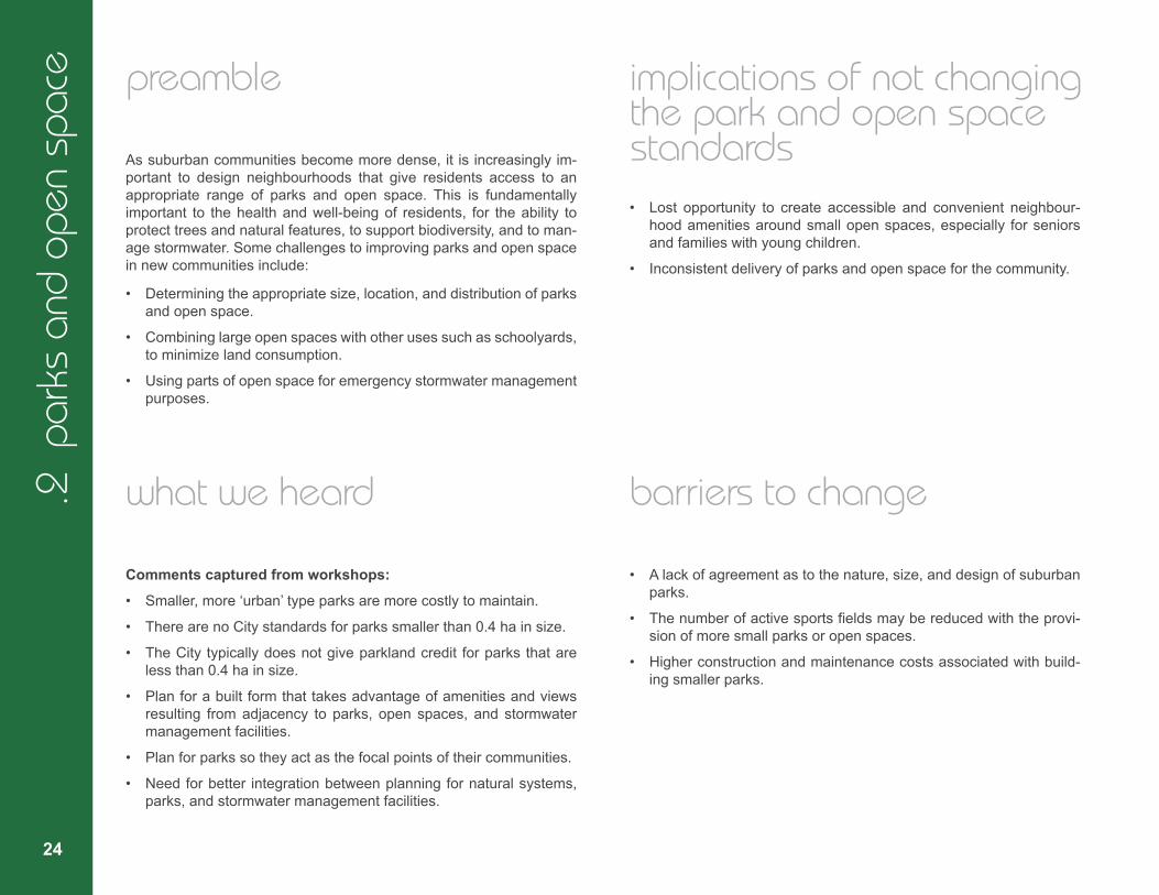
implications of not changing the park and open space standards • Lost opportunity to create accessible and convenient neighbour-
hood amenities around small open spaces, especially for seniors and families with young children.
• Inconsistent delivery of parks and open space for the community.
barriers to change
• A lack of agreement as to the nature, size, and design of suburban parks.
• The number of active sports fields may be reduced with the provi-sion of more small parks or open spaces.
• Higher construction and maintenance costs associated with build-ing smaller parks.
build
ing
bett
er a
nd s
mar
ter
subu
rbs : st
rate
gic
dire
ctio
ns a
nd a
ctio
n pl
an /
pre
pare
d by
City
of O
ttaw
a an
d Th
e Pl
anni
ng P
artn
ersh
ip
25
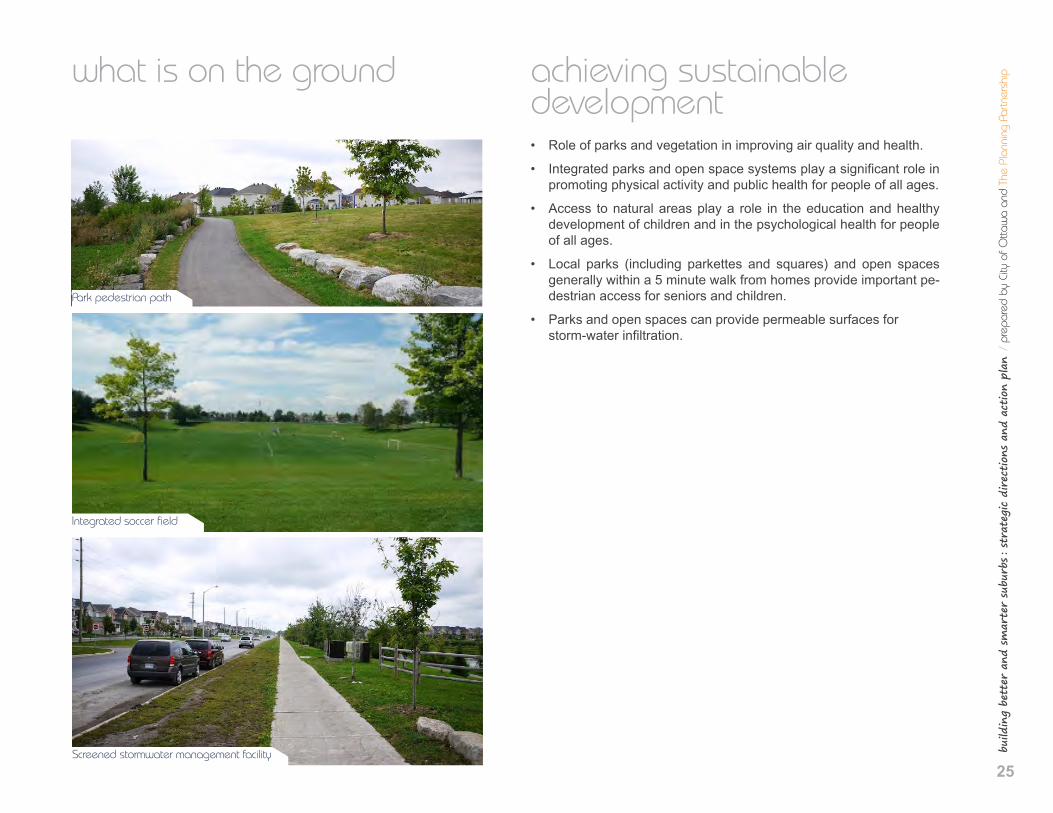
what is on the ground
Park pedestrian path
Integrated soccer field
Screened stormwater management facility
achieving sustainable development • Role of parks and vegetation in improving air quality and health.
• Integrated parks and open space systems play a significant role in promoting physical activity and public health for people of all ages.
• Access to natural areas play a role in the education and healthy development of children and in the psychological health for people of all ages.
• Local parks (including parkettes and squares) and open spaces generally within a 5 minute walk from homes provide important pe-destrian access for seniors and children.
• Parks and open spaces can provide permeable surfaces for storm-water infiltration.
.2 p
arks
and
ope
n sp
ace
26
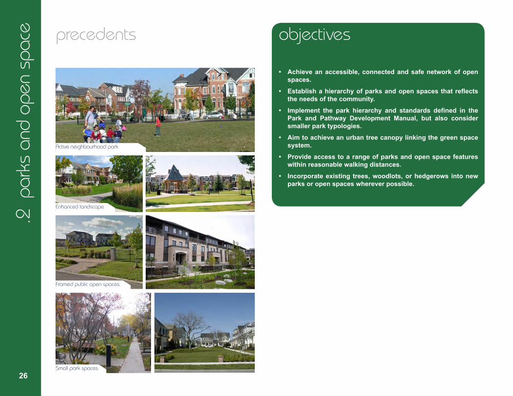
precedents
Active neighbourhood park
Enhanced landscape
Framed public open spaces
Small park spaces
objectives
• Achieveanaccessible,connectedandsafenetworkofopen spaces.
• Establishahierarchyofparksandopenspacesthatreflects the needs of the community.
• Implement the park hierarchy and standards defined in the Park and Pathway Development Manual, but also consider smaller park typologies.
• Aimtoachieveanurbantreecanopylinkingthegreenspace system.
• Provideaccesstoarangeofparksandopenspacefeatures within reasonable walking distances.
• Incorporateexisting trees,woodlots,orhedgerows intonew parks or open spaces wherever possible.
27
build
ing
bett
er a
nd s
mar
ter
subu
rbs : st
rate
gic
dire
ctio
ns a
nd a
ctio
n pl
an /
pre
pare
d by
City
of O
ttaw
a an
d Th
e Pl
anni
ng P
artn
ersh
ipstrategic directions
1. Investigate the conditions and criteria around adding new smaller park typologies to the Park and Pathway Development Manual.
2. Review existing metrics for accessibility/walking distance to all parks and open spaces that take into consideration health and age of residents.
3. Create street and lot patterns and building orientations that frame and enhance the presence of all parks, regardless of size.
4. Identify opportunities to connect separate features of the open space network (e.g. a park to a nearby woodlot) with streets that support canopy trees.
action plan
1.Following the investigation of Strategic Direction #1, revise the Park and Pathway Development Manual to add an appropriate range of new smaller park typologies.
28
.3 s
torm
wat
er m
anag
emen
t preamble
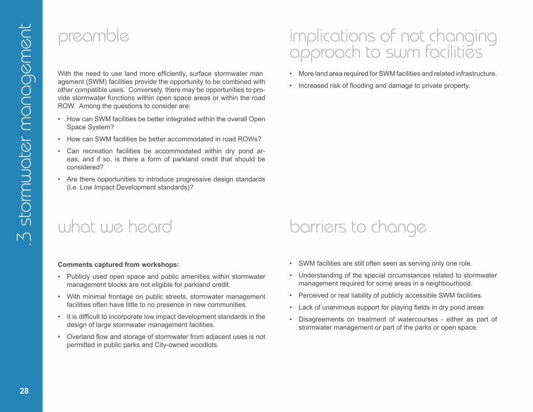
With the need to use land more efficiently, surface stormwater man agement (SWM) facilities provide the opportunity to be combined with other compatible uses. Conversely, there may be opportunities to pro-vide stormwater functions within open space areas or within the road ROW. Among the questions to consider are:
• How can SWM facilities be better integrated within the overall Open Space System?
• How can SWM facilities be better accommodated in road ROWs?
• Can recreation facilities be accommodated within dry pond ar-eas, and if so, is there a form of parkland credit that should be considered?
• Are there opportunities to introduce progressive design standards (i.e. Low Impact Development standards)?
what we heard
Comments captured from workshops: • Publicly used open space and public amenities within stormwater
management blocks are not eligible for parkland credit.
• With minimal frontage on public streets, stormwater management facilities often have little to no presence in new communities.
• It is difficult to incorporate low impact development standards in the design of large stormwater management facilities.
• Overland flow and storage of stormwater from adjacent uses is not permitted in public parks and City-owned woodlots.
implications of not changing approach to swm facilities • More land area required for SWM facilities and related infrastructure.
• Increased risk of flooding and damage to private property.
barriers to change
• SWM facilities are still often seen as serving only one role.
• Understanding of the special circumstances related to stormwater management required for some areas in a neighbourhood.
• Perceived or real liability of publicly accessible SWM facilities.
• Lack of unanimous support for playing fields in dry pond areas
• Disagreements on treatment of watercourses - either as part of stormwater management or part of the parks or open space.
build
ing
bett
er a
nd s
mar
ter
subu
rbs : st
rate
gic
dire
ctio
ns a
nd a
ctio
n pl
an /
pre
pare
d by
City
of O
ttaw
a an
d Th
e Pl
anni
ng P
artn
ersh
ip
29
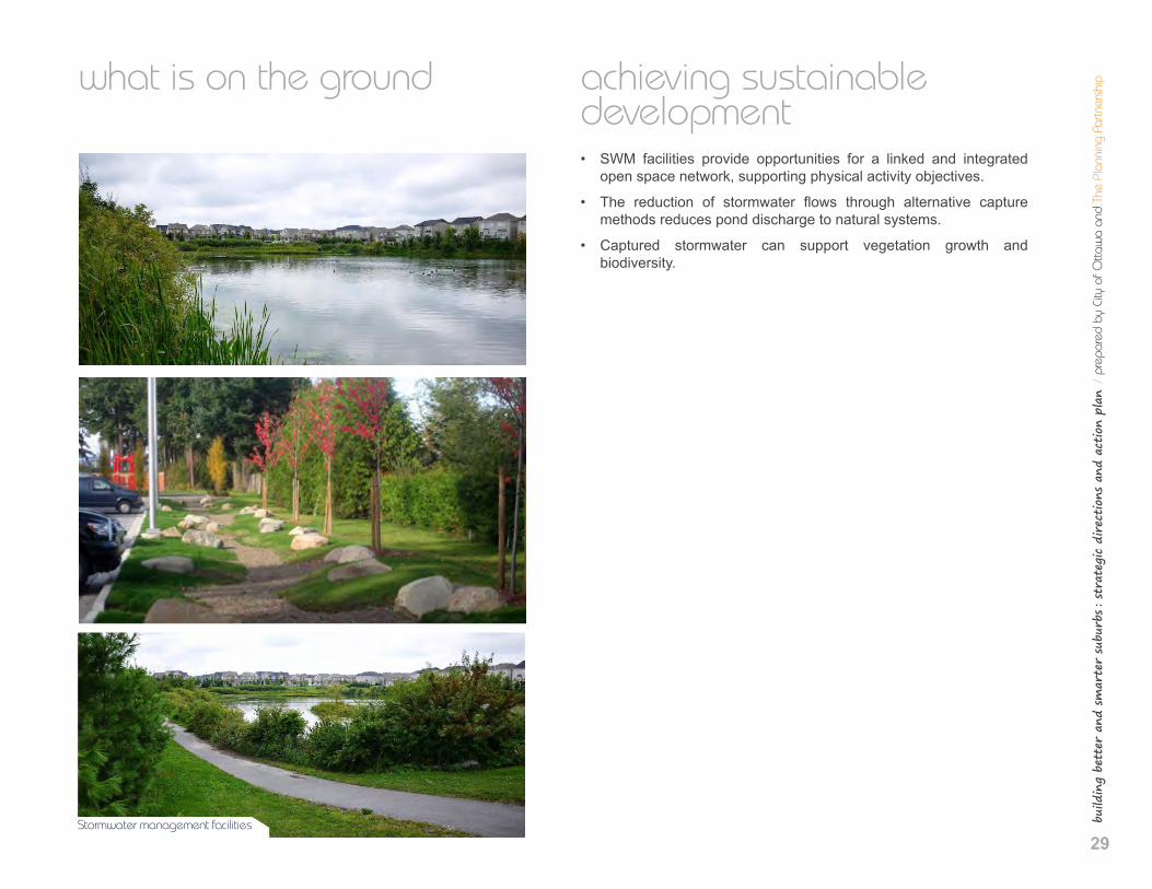
what is on the ground
Stormwater management facilities
achieving sustainable development • SWM facilities provide opportunities for a linked and integrated
open space network, supporting physical activity objectives.
• The reduction of stormwater flows through alternative capture methods reduces pond discharge to natural systems.
• Captured stormwater can support vegetation growth and biodiversity.
.3 s
torm
wat
er m
anag
emen
t
30
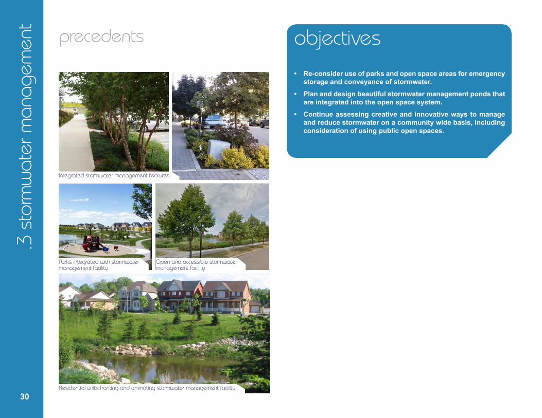
precedents
Integrated stormwater management features
Parks integrated with stormwater management facility
Open and accessible stormwater management facility
Residential units fronting and animating stormwater management facility
objectives • Re-consideruseofparksandopenspaceareasforemergency
storage and conveyance of stormwater. • Plananddesignbeautifulstormwatermanagementpondsthat
are integrated into the open space system. • Continueassessingcreativeandinnovativewaystomanage
and reduce stormwater on a community wide basis, including consideration of using public open spaces.
31
build
ing
bett
er a
nd s
mar
ter
subu
rbs : st
rate
gic
dire
ctio
ns a
nd a
ctio
n pl
an /
pre
pare
d by
City
of O
ttaw
a an
d Th
e Pl
anni
ng P
artn
ersh
ipstrategic directions
1. Investigate ways of minimizing space attributed to SWM facilities.
2. Provide street frontage for sites that contain stormwater management ponds.
3. Ensure that land attributed to large SWM facilities can serve additional functions, such as recreation trails or multi-use paths as part of the open space system, and support the con-nection of trails in SWM facilities to parks and open spaces, and to pedestrian and cycling facilities.
4. Examine opportunities to reduce ‘end of pipe’ water volume discharge.
5. Examine opportunities for innovative stormwater manage-ment in new road ROW cross-sections, such as bioswales and integrated systems that support tree hydration.
6. Review best practices from former municipalities to deter-mine improved stormwater management practices, and ex-amine opportunities for emergency stormwater management in public open spaces and parks, where available.
action plan
1. Consider the use of portions of parks and open space systems for emergency stormwater conveyance and storage, where appropriate.
2. Evaluate options for reducing land requirements associated with SWM functions.

32
.4 s
choo
l site
s preamble
School sites tend to be community hubs of activity and play an impor-tant role in contributing to the character and transportation patterns of a neighbourhood. The discussion around school sites is linked to that of parks and streets, and is grounded by principles such as the efficient use of land and the need to support active transportation.
There are four different school boards that operate in Ottawa, resulting in a number of different policies, regulations, agreements, and practic-es. This study provides an opportunity to review some of these issues and consider improvements that could lead to better neighbourhoods. Some of the questions to be considered include:
• How to design school sites to support the development of communi-ties that are compact, walkable, attractive and safe for cycling, and transit-supportive?
• What is the appropriate relationship of school sites to parks?
• How to coordinate the planning, maintenance and operations of both schools and parks for maximum efficiency and community benefit?
• How to improve pedestrian and cycling safety to encourage active transportation trips to school?
• How to expand on existing agreements between the school boards and the City in order to reduce duplicate amenities and services and increase efficiencies?
what we heard
Comments captured from workshops: • Too much land required for schools.
• Too much space required for drop-off areas.
• Need to implement greater greening of school yards and buildings.
• School sites need to promote active transportation.
• School sites and building designs need to support pedestrian friendly, compact communities.
• Trend towards larger schools with larger catchment areas.
• Trend towards separation of school and park blocks, due to various cost, maintenance, and operational issues.
• Diminished opportunity for walking requires more busing and driving.
• Opportunity to make temporary use of vacant school sites that have been optioned by school boards.
build
ing
bett
er a
nd s
mar
ter
subu
rbs : st
rate
gic
dire
ctio
ns a
nd a
ctio
n pl
an /
pre
pare
d by
City
of O
ttaw
a an
d Th
e Pl
anni
ng P
artn
ersh
ip
33
implications of not revising policies for school sites • Potentially inefficient use of land
• Perpetuated silos of activity and duplication of facilities and amenities.
• Pedestrian and cyclist safety concerns around schools.
barriers to change • Separate policies and practices of each school board.
• Lack of consensus around the benefits of combining schools and parks.
• Lack of ownership of the role of schools sites in supporting a child’s daily physical activity needs.
• Liability issues of sharing facilities (e.g. playgrounds).
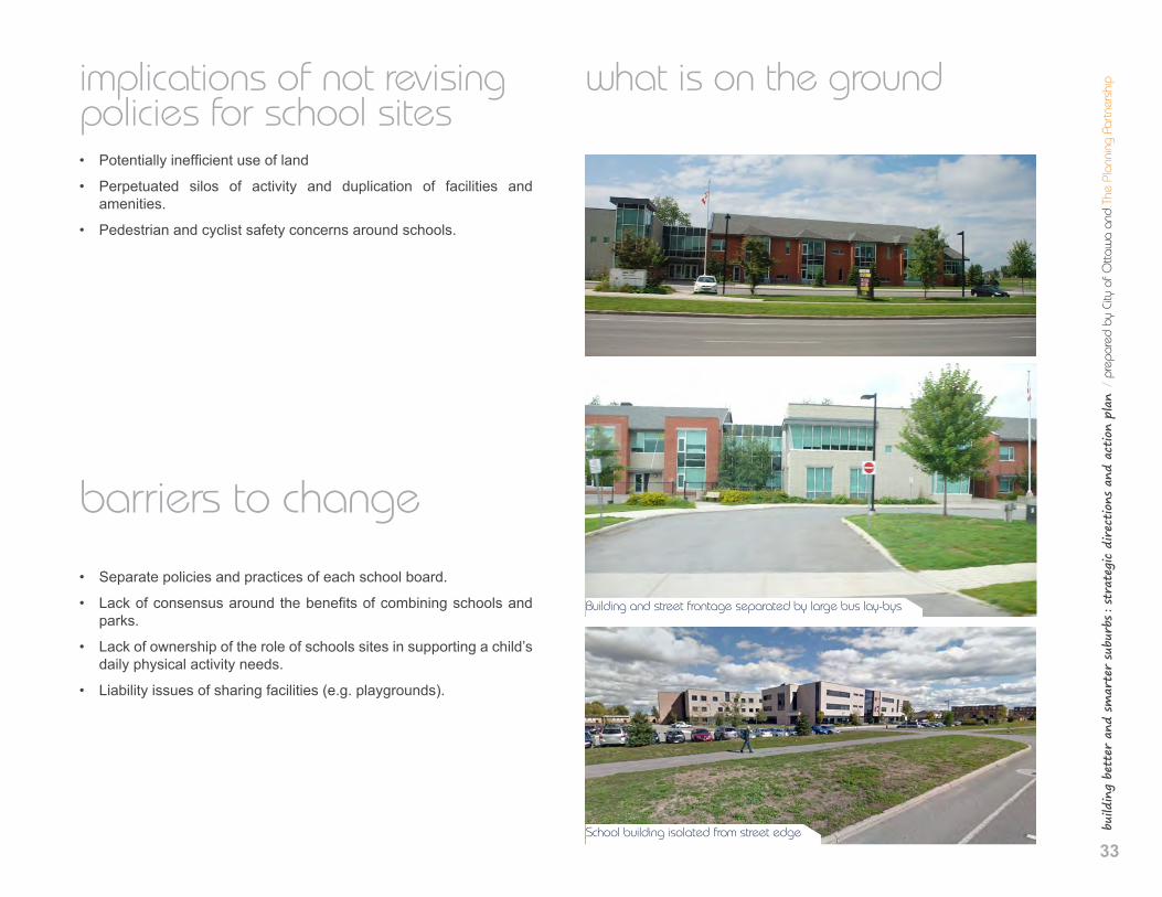
what is on the ground
Building and street frontage separated by large bus lay-bys
School building isolated from street edge
.4 s
choo
l site
s
34
achieving sustainable development • Schools that are safe and attractive for walking and cycling provide
an important part of a child’s daily exercise needs.
• Schools provide multiple uses and act as community hubs.
• Neighbourhood parks linked to schools provide both formal and in-formal sport and exercise opportunities.
• Shared facilities may reduce pressure on operations budgets.
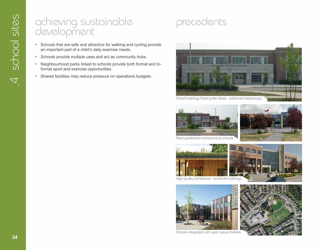
precedents
School buildings framing the street - enhanced streetscape
Direct pedestrian connections to schools
High quality architecture - landmark buildings
Schools integrated with open space facilities
build
ing
bett
er a
nd s
mar
ter
subu
rbs : st
rate
gic
dire
ctio
ns a
nd a
ctio
n pl
an /
pre
pare
d by
City
of O
ttaw
a an
d Th
e Pl
anni
ng P
artn
ersh
ip
35
objectives
• Promotetheefficientuseoflandandcompactbuiltform.
• Prioritize pedestrian and cycling safety on streets around schools.
• Plan and design schools sites as part of the open space system.
• Considerexpandingsharedfacilityagreementsthatleadtoim-provedefficiencies.
strategic directions
1. Encourage the planning and design of school and park blocks as one comprehensive site and part of a neighbour-hood’s grid of streets and blocks.
2. Examine opportunities and best practices for incorporating existing trees or woodlots into functional spaces (e.g. natu-ral play areas or outdoor classrooms) on school sites.
3. Work with school boards to minimize land requirements for school sites, including:
- Promote adjoining school and park sites where possible.
- Proactively seek out partners for facility partnerships and com-bined use agreements between the City and school boards (e.g. playgrounds, libraries, sports fields).
- Consider the requirement for multi-storey school buildings (mini-mum 2 storeys).
- Investigate options for more efficient bus lay-bys and student pick up / drop off areas.
4. Prioritizepedestrianandcyclingsafetyby including traffic calming measures on streets abutting school sites at the outset of school and street design.
5. Review best practices for bicycle parking on school sites.
6. Consider ways to make temporary use of optioned school sites thatwillbenefit the communitywhile these sites are vacant.
action plan
1. Prioritize safe walking and cycling for children around schools by ensuring that plans of subdivision identify pedestrian and cycling facilities and traffic calming measures in appropriate locations in proximity to schools.
2. Review bicycle parking requirements for schools.
3. Develop a protocol to allow developers the opportunity to make temporary use of optioned school sites.
4. Work with school boards to develop new school site, location, and building policies and practices and/or guidelines, in accordance with the Strategic Directions above.
36
5. Parking
6. Road Right-of-way
7. Rear Lanes
8. Trees
9. Utility Placement
37
build
ing
bett
er a
nd s
mar
ter
subu
rbs : st
rate
gic
dire
ctio
ns a
nd a
ctio
n pl
an /
pre
pare
d by
City
of O
ttaw
a an
d Th
e Pl
anni
ng P
artn
ersh
ip
strategies for building better and smarter suburbs
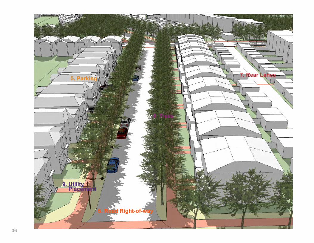
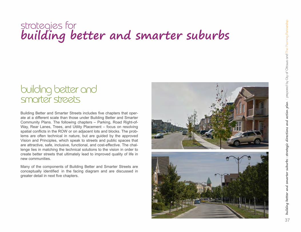
building better and smarter streets Building Better and Smarter Streets includes five chapters that oper-ate at a different scale than those under Building Better and Smarter Community Plans. The following chapters – Parking, Road Right-of-Way, Rear Lanes, Trees, and Utility Placement – focus on resolving spatial conflicts in the ROW or on adjacent lots and blocks. The prob-lems are often technical in nature, but are guided by the approved Vision and Principles, which speak to streets and public spaces that are attractive, safe, inclusive, functional, and cost-effective. The chal-lenge lies in matching the technical solutions to the vision in order to create better streets that ultimately lead to improved quality of life in new communities.
Many of the components of Building Better and Smarter Streets are conceptually identified in the facing diagram and are discussed in greater detail in next five chapters.
38
.5 p
arkin
g preamble
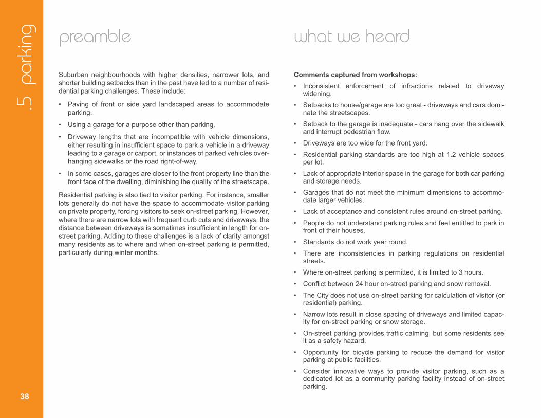
Suburban neighbourhoods with higher densities, narrower lots, and shorter building setbacks than in the past have led to a number of resi-dential parking challenges. These include:
• Paving of front or side yard landscaped areas to accommodate parking.
• Using a garage for a purpose other than parking.
• Driveway lengths that are incompatible with vehicle dimensions, either resulting in insufficient space to park a vehicle in a driveway leading to a garage or carport, or instances of parked vehicles over-hanging sidewalks or the road right-of-way.
• In some cases, garages are closer to the front property line than the front face of the dwelling, diminishing the quality of the streetscape.
Residential parking is also tied to visitor parking. For instance, smaller lots generally do not have the space to accommodate visitor parking on private property, forcing visitors to seek on-street parking. However, where there are narrow lots with frequent curb cuts and driveways, the distance between driveways is sometimes insufficient in length for on-street parking. Adding to these challenges is a lack of clarity amongst many residents as to where and when on-street parking is permitted, particularly during winter months.
what we heard
Comments captured from workshops: • Inconsistent enforcement of infractions related to driveway
widening. • Setbacks to house/garage are too great - driveways and cars domi-
nate the streetscapes. • Setback to the garage is inadequate - cars hang over the sidewalk
and interrupt pedestrian flow. • Driveways are too wide for the front yard. • Residential parking standards are too high at 1.2 vehicle spaces
per lot. • Lack of appropriate interior space in the garage for both car parking
and storage needs. • Garages that do not meet the minimum dimensions to accommo-
date larger vehicles. • Lack of acceptance and consistent rules around on-street parking. • People do not understand parking rules and feel entitled to park in
front of their houses. • Standards do not work year round. • There are inconsistencies in parking regulations on residential
streets. • Where on-street parking is permitted, it is limited to 3 hours. • Conflict between 24 hour on-street parking and snow removal. • The City does not use on-street parking for calculation of visitor (or
residential) parking. • Narrow lots result in close spacing of driveways and limited capac-
ity for on-street parking or snow storage. • On-street parking provides traffic calming, but some residents see
it as a safety hazard. • Opportunity for bicycle parking to reduce the demand for visitor
parking at public facilities. • Consider innovative ways to provide visitor parking, such as a
dedicated lot as a community parking facility instead of on-street parking.
build
ing
bett
er a
nd s
mar
ter
subu
rbs : st
rate
gic
dire
ctio
ns a
nd a
ctio
n pl
an /
pre
pare
d by
City
of O
ttaw
a an
d Th
e Pl
anni
ng P
artn
ersh
ip
39
implications of not changing approach to parking • Short driveways can create conflicts with sidewalk users and con-
tribute to pressure from residents to not build sidewalks.
• Front yard green space may be compromised.
• Wide driveways and curb-cuts limit on-street parking opportunities.
• Wide driveways diminish opportunities for tree planting and storm-water retention.
• Wide garages limit possibilities for habitable rooms in the front of the house which provide visual surveillance on the street (eyes on the street).
• Garage-dominated front building elevations diminish the quality of the streetscape.
• Roadway widths that anticipate on-street parking can end up hav-ing little or none, resulting in a wider street than necessary, which encourages speeding.
• Residents will continue to illegally pave the front lawn to be able to park second and third cars.
• Limits to on-street parking opportunities also limit potential traffic calming benefits.
barriers to change
• Demand for parking 2-3 cars on small lots.
• Public transit is not currently a convenient option in many suburban areas outside peak periods for commuter trips.
• Garages are used for storage, pushing parking to the driveway or street.
• On-street parking is occasionally not permitted overnight, and is limited during the day.
• Perception of inconsistent signage, interpretation, and enforcement of on-street parking.
• Managing parking demand transitions while moving from auto-dominated to transit-oriented suburbs.
• Resistance to accept and adopt permit parking and the associated rules, enforcement, and signage required.
• Resources required for implementing and enforcing new parking solutions.
.5 p
arkin
g
40
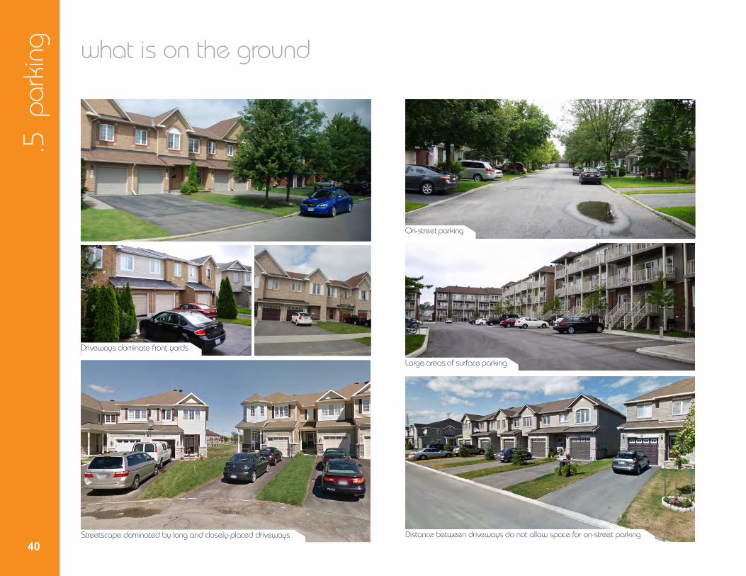
what is on the ground
Driveways dominate front yards
Streetscape dominated by long and closely-placed driveways
On-street parking
Large areas of surface parking
Distance between driveways do not allow space for on-street parking

41
build
ing
bett
er a
nd s
mar
ter
subu
rbs : st
rate
gic
dire
ctio
ns a
nd a
ctio
n pl
an /
pre
pare
d by
City
of O
ttaw
a an
d Th
e Pl
anni
ng P
artn
ersh
ipachieving sustainable development • Appropriate driveway lengths and sidewalk locations reduce con-
flicts with pedestrians on the sidewalk, which supports active transportation.
• Controlling driveway widths increases permeable surfaces, increas-es stormwater retention, allows space for tree planting, and permits more habitable space in the front of the house which results in more eyes on the street and safer neighbourhoods.
• Controlling garage dominance on the front elevation encour-ages higher quality architecture to face the street and enhances streetscape quality.
• Traffic calming enhances safety and promotes active transportation.
• On-street parking can help maintain green space in front yards.
precedents
Enhanced front yard landscaping and shallow front yard setbacks Paired driveways allow larger green areas
Enhanced pedestrian-oriented streetscapes
Maximized on-street parking On-street parking coordinated with driveways
.5 p
arkin
g
42
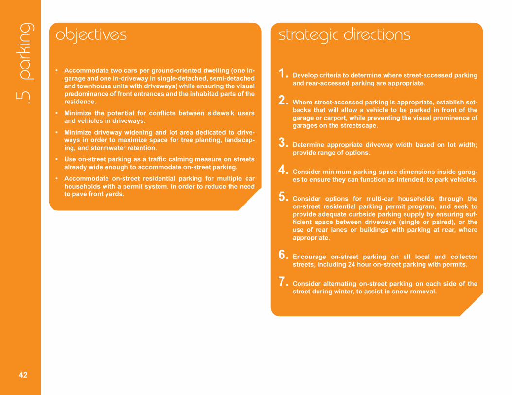
objectives
• Accommodatetwocarsperground-orienteddwelling(onein-garage and one in-driveway in single-detached, semi-detached and townhouse units with driveways) while ensuring the visual predominance of front entrances and the inhabited parts of the residence.
• Minimize the potential for conflicts between sidewalk users and vehicles in driveways.
• Minimizedrivewaywideningand lotareadedicated todrive-ways in order to maximize space for tree planting, landscap-ing, and stormwater retention.
• Useon-streetparkingasatraffic calmingmeasureonstreets already wide enough to accommodate on-street parking.
• Accommodate on-street residential parking for multiple car households with a permit system, in order to reduce the need to pave front yards.
strategic directions
1. Develop criteria to determine where street-accessed parking and rear-accessed parking are appropriate.
2. Where street-accessed parking is appropriate, establish set-backs that will allow a vehicle to be parked in front of the garage or carport, while preventing the visual prominence of garages on the streetscape.
3. Determine appropriate driveway width based on lot width; provide range of options.
4. Consider minimum parking space dimensions inside garag-es to ensure they can function as intended, to park vehicles.
5. Consider options for multi-car households through the on-street residential parking permit program, and seek to provide adequate curbside parking supply by ensuring suf-ficient space between driveways (single or paired), or the use of rear lanes or buildings with parking at rear, where appropriate.
6. Encourage on-street parking on all local and collector streets, including 24 hour on-street parking with permits.
7. Consider alternating on-street parking on each side of the street during winter, to assist in snow removal.

build
ing
bett
er a
nd s
mar
ter
subu
rbs : st
rate
gic
dire
ctio
ns a
nd a
ctio
n pl
an /
pre
pare
d by
City
of O
ttaw
a an
d Th
e Pl
anni
ng P
artn
ersh
ip
43
action plan
1. Revise parking and setback provisions in the zoning by-law:
• Minimum setback between garage or carport and sidewalk (or curb where there will be no sidewalk) to ensure sufficient parking space for one vehicle in a driveway leading to a garage or carport;
• Consider minimum parking space dimensions inside garages, in consultation with the development industry.
• Consider reducing garage projections where the zoning by-law allows a garage or carport to be closer to the front lot line than the front wall of a dwelling. This will include a consideration of linking the permission for such projections to the provision of architec-tural features that can mitigate the impact of garage projections on the quality of the streetscape.
2. Consider the introduction of new zoning regulations:
• Link lot width to front parking access permission, which may re-quire very narrow townhouse lots to have rear lane or rear-access parking.
• Minimum spacing between driveways and curb-cuts in order to allow at least one on-street parking space between driveways or paired driveways.
3. Include in the purchase/sale agreement an information package to provide awareness and clarity of expectations regarding parking, transit, and pedestrian and cycling facilities.
4. Complete On-Street Permit Parking Policy Review and make recommendations to revise on-street permit parking program if appropriate.

44
.6 r
oad
right
-of-w
ay
preamble
Roads are an integral component of new communities. They are a ma-jor component of the public realm, serve as vehicular and active trans-portation routes, and accommodate key infrastructure. As such, the design of the right-of-way (ROW) should support multiple community objectives, such as multi-modal transportation, provision of utilities, and space for trees and stormwater management. However, there is increased competition for space in the ROW, and pressure to minimize the amount of infrastructure that needs to be maintained by the City. As a result, there is a need to re-examine space requirements in the ROW and consider opportunities for new efficiencies. ROW elements to consider include:
• Accommodation of utilities.
• Appropriate space for snow storage.
• On-street parking.
• Sufficient space for healthy trees.
• Width requirements for vehicle travel lanes.
• Accommodation of all modes of transportation.
• Traffic calming.
• Stormwater management.
what we heard
Comments captured from workshops: • The City’s 16.5m right-of-way, as currently configured, is too narrow
and reduces the opportunity for snow storage, on-street parking, and street trees.
• Wider right-of-ways are required on some roads to accommodate bus routes.
• No consistent approach to the provision and location of sidewalks.
• Where sidewalks are located at the curb, snow storage is not accommodated.
• Lack of a large enough palette of right-of-ways to choose the most appropriate road type to suit the context of the local neighbourhood.
• Building setbacks accentuate the perception of wider roads.
• Speeding is a recurring issue on many local streets.
• Curb radii on local streets is often excessive and encourages speeding.
build
ing
bett
er a
nd s
mar
ter
subu
rbs : st
rate
gic
dire
ctio
ns a
nd a
ctio
n pl
an /
pre
pare
d by
City
of O
ttaw
a an
d Th
e Pl
anni
ng P
artn
ersh
ip
45
implications of not building better road ROWs • Lost opportunity to use streets as a component of the public realm
with trees and sidewalks.
• Lack of trees, sidewalks and cycling facilities discourage active transportation.
• Excessive road width encourages speeding and increases snow clearing costs.
barriers to change
• Limited selection of existing approved street types.
• Alignment of road standards with new higher density and compact communities.
• Trend towards wider vehicle lane widths and resistance to change back to narrower widths.
• More space-efficient designs for utilities may result in higher main-tenance costs for some utility providers.
• Inherent difficulty of working with multiple parties that have different jurisdictions and safety standards in order to determine acceptable compromises on setbacks and utility clearances.
.6 r
oad
right
-of-w
ay
46
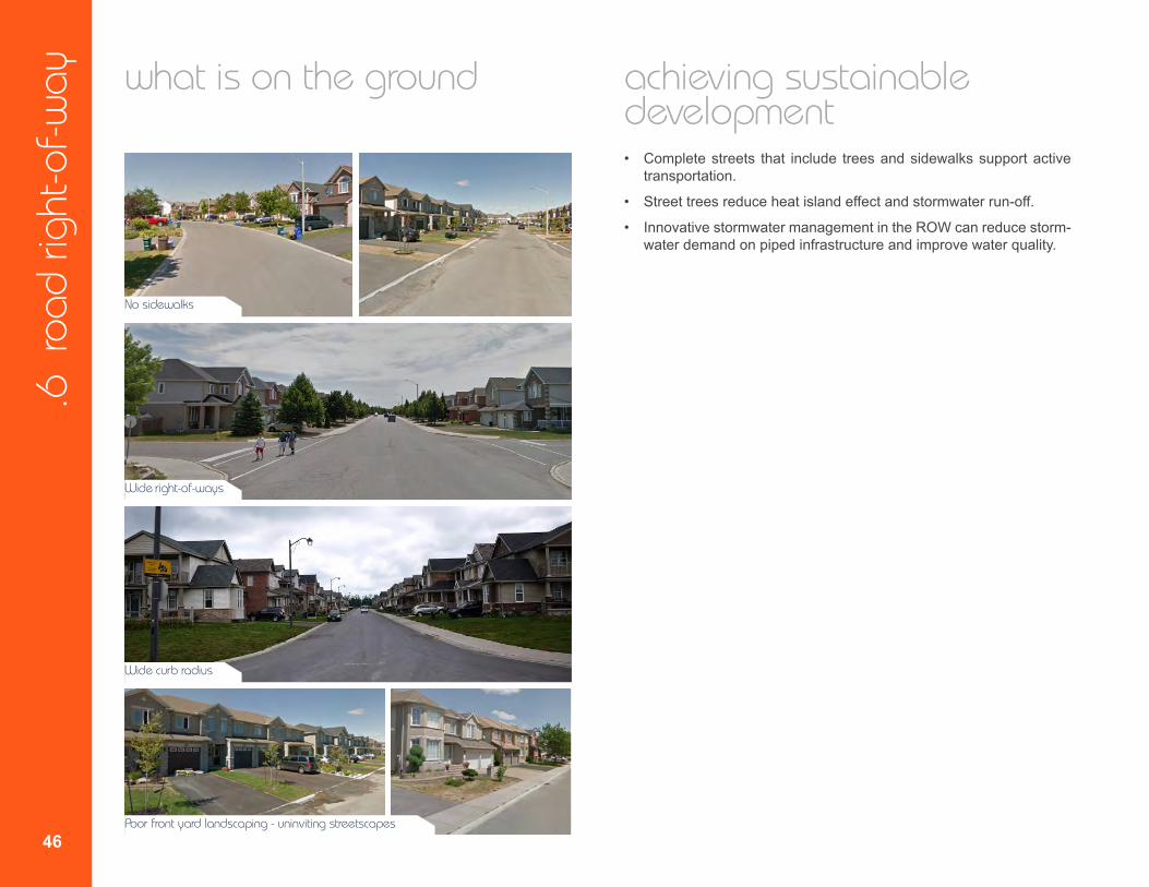
what is on the ground
No sidewalks
Wide right-of-ways
Wide curb radius
Poor front yard landscaping - uninviting streetscapes
achieving sustainable development • Complete streets that include trees and sidewalks support active
transportation.
• Street trees reduce heat island effect and stormwater run-off.
• Innovative stormwater management in the ROW can reduce storm-water demand on piped infrastructure and improve water quality.

47
build
ing
bett
er a
nd s
mar
ter
subu
rbs : st
rate
gic
dire
ctio
ns a
nd a
ctio
n pl
an /
pre
pare
d by
City
of O
ttaw
a an
d Th
e Pl
anni
ng P
artn
ersh
ipprecedents
Sustainable streetscapes
Inclusive streetscapes
Pedestrian-oriented streetscapes
Complete street: trees, sidewalk, enhanced front yards and lighting
objectives • Balancetheneedsofallelementswithinthestreetright-of-way. • Ensurea rangeofstreetcross-sections thatareappropriate
for the application, area, and community design context. • Create complete streets that accommodate all modes of
transportation. • Createstreetenvironmentsthatenhancesafetyandlivability. • Createbeautifultree-linedstreetsasakeycomponentofthe
public realm. • AccommodatestormwatermanagementstrategiesintheROW.
.6 r
oad
right
-of-w
ay
48
strategic directions
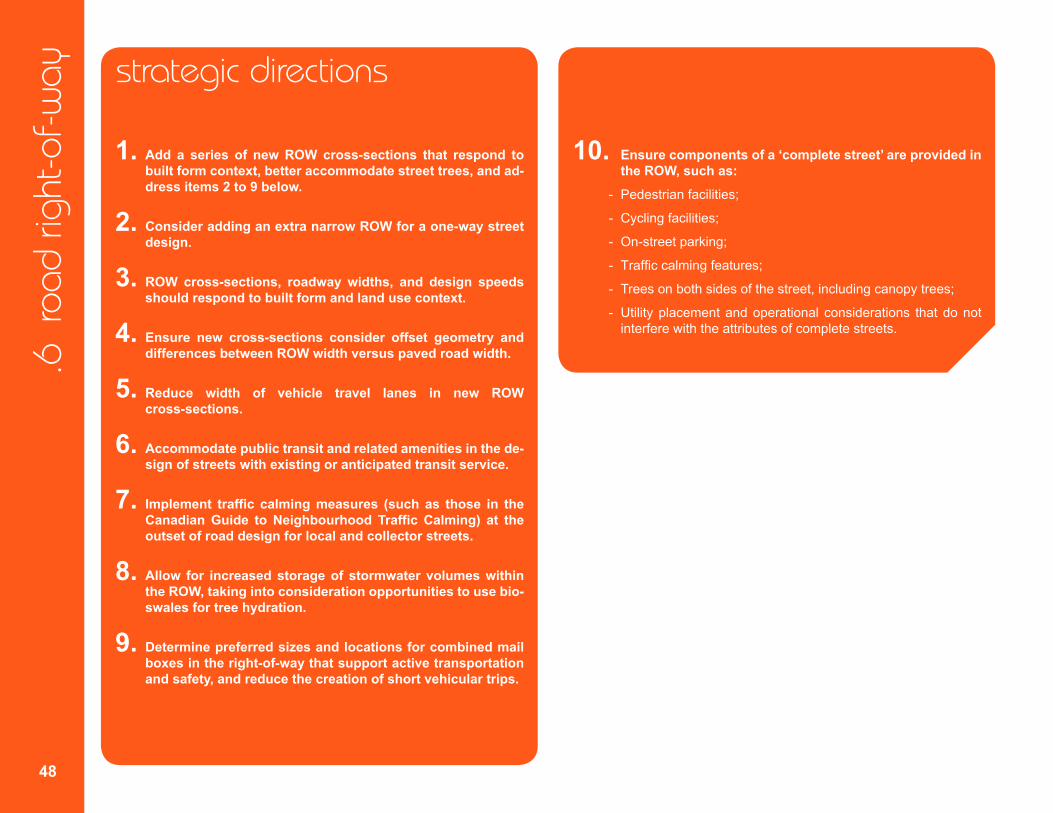
1. Add a series of new ROW cross-sections that respond to built form context, better accommodate street trees, and ad-dress items 2 to 9 below.
2. Consider adding an extra narrow ROW for a one-way street design.
3. ROW cross-sections, roadway widths, and design speeds should respond to built form and land use context.
4. Ensure new cross-sections consider offset geometry and differences between ROW width versus paved road width.
5. Reduce width of vehicle travel lanes in new ROW cross-sections.
6. Accommodate public transit and related amenities in the de-sign of streets with existing or anticipated transit service.
7. Implement traffic calmingmeasures (such as those in the CanadianGuide toNeighbourhoodTraffic Calming) at the outset of road design for local and collector streets.
8. Allow for increased storage of stormwater volumes within the ROW, taking into consideration opportunities to use bio-swales for tree hydration.
9. Determine preferred sizes and locations for combined mail boxes in the right-of-way that support active transportation and safety, and reduce the creation of short vehicular trips.
10. Ensure components of a ‘complete street’ are provided in the ROW, such as:
- Pedestrian facilities;
- Cycling facilities;
- On-street parking;
- Traffic calming features;
- Trees on both sides of the street, including canopy trees;
- Utility placement and operational considerations that do not interfere with the attributes of complete streets.
49
build
ing
bett
er a
nd s
mar
ter
subu
rbs : st
rate
gic
dire
ctio
ns a
nd a
ctio
n pl
an /
pre
pare
d by
City
of O
ttaw
a an
d Th
e Pl
anni
ng P
artn
ersh
ipaction plan
1. Develop a series of new right-of-way cross sections that will expand the menu of approved street types in order to give additional options for street designs in new plans of subdivision. New street types to consider include:
• Local and collector streets that accommodate street trees on both sides of the street within the right-of-way.
• Streets that accommodate canopy trees.
• Local street or street segment with a reduced design speed to discourage speeding and improve safety.
• Local and collector streets with reduced vehicle lane widths and traffic calming measures
• Local and collector streets with innovative stormwater manage-ment strategies.
• Local and collector Green Streets, used to connect components of the Urban Greenspace Network, as described in the approved Greenspace Master Plan and Road Corridor Planning and Design Guidelines.
• Arterial roads designed for street-front retail uses that accommo-date on-street parking and cycling facilities.
• Complete Streets that best accommodate all road users, where appropriate, as recommended by the Complete Streets policies in the Transportation Master Plan.
2. Determine design speed of all new ROW cross-sections based on adjacent future land use so that vehicle operation speeds are ap-propriate for all users of the street.
3. Implement Ottawa Pedestrian Plan 2013 policy requiring a low speed street design for streets where pedestrian facilities are not provided.
4. Develop new illustrations for each road type to show cross sections as plans and 3D images, to reinforce the relation among all consid-erations (e.g. building, driveway, landscape, utilities, etc).
5. Revise the Urban Design Guidelines for Greenfield Neighbourhoods to identify preferred criteria for community mailboxes in accordance with Strategic Direction 9.
6. Update Greenspace Master Plan to include more detailed specifi-cations for Green Streets.
50
.7 r
ear l
anes
preamble
Rear lanes are a traditional yet innovative street option that creates greater opportunity for on-street parking and street tree planting with-out the interruption of driveways. Rear lanes support the location of buildings closer to the street, which can result in attractive, tree-lined, pedestrian streetscapes. The lack of driveways directly onto the streets also improves safety by reducing the number of vehicles entering and exiting driveways, which is especially important on transit corridors and streets with busy public facilities. However, challenges include:
• Whether lanes should be City-owned or privately-owned (mainte-nance and operations).
• Perceived safety issue.
• Loss of amenity space in rear yard.
• Parking procedures in rear lanes and resulting parking enforcement.
• Snow and stormwater storage and clearing/conveyance.
• Potential for increased maintenance costs.
• Increase in impermeable surfaces.
• Location of utilities in rear lanes.
what we heard
Comments captured from workshops: • Parking in the rear lanes hinders circulation/access.
• Rear lanes are used as ‘short-cuts’.
• Speeding occurs in rear lanes.
• Rear lanes are too wide, feel like roads.
• Rear lanes are too narrow.
• Garbage handling/collection is safer from a rear lane.
• City acceptance of rear lanes has been hindered by questions around cost and maintenance.
• City does not have the resources to pay for snow removal in rear lanes.
• Need to resolve stormwater and snow storage issues in rear lanes.
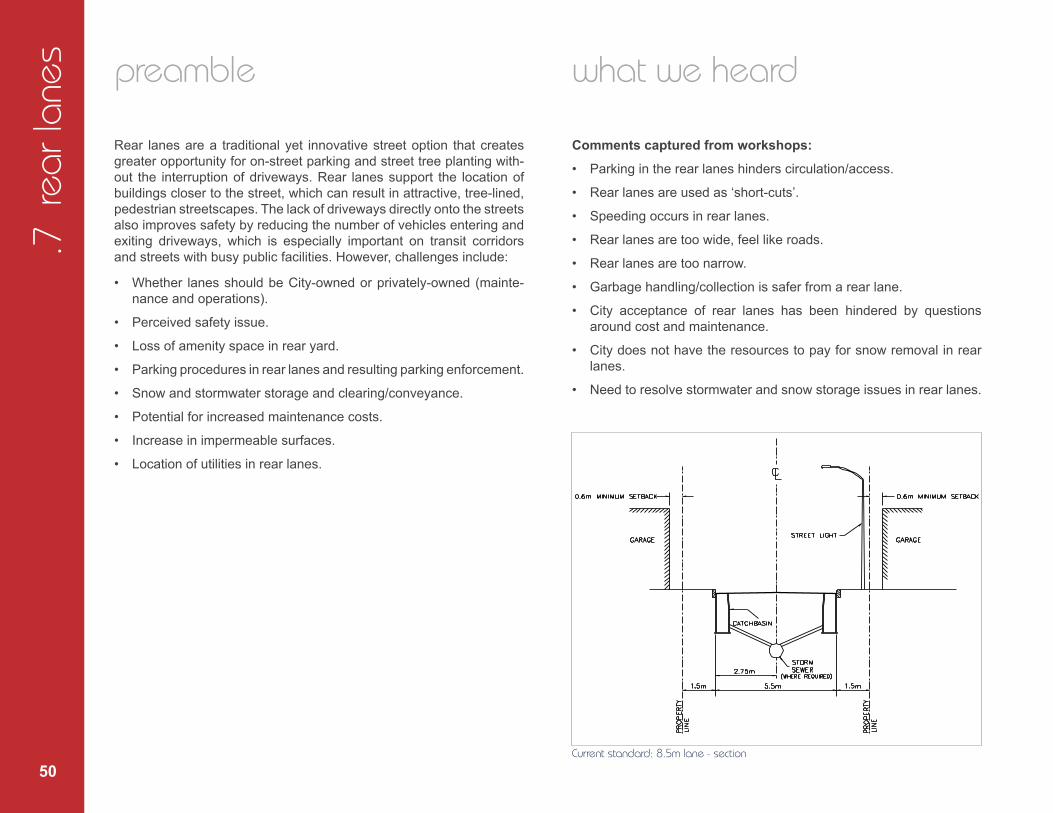
Current standard: 8.5m lane - section
build
ing
bett
er a
nd s
mar
ter
subu
rbs : st
rate
gic
dire
ctio
ns a
nd a
ctio
n pl
an /
pre
pare
d by
City
of O
ttaw
a an
d Th
e Pl
anni
ng P
artn
ersh
ip
51
implications of not changing approach to rear lanes • On townhouse blocks and smaller lots, driveways dominate the front
yard and reduce habitable rooms facing the street.
• Front yard driveways reduce supply of on-street parking.
• Tree planting areas within the boulevard are limited.
• Excessive car parking in the front yard diminishes the quality of the streetscape.
barriers to change
• Resistance due to lack of understanding that rear lanes are site/ block specific solutions based on need, and may not necessarily be applied neighbourhood wide.
• Snow removal will require storage areas or trucking snow after ma-jor snowfalls.
• Utility companies may have to consider revised standards.
• Lack of consensus on standards and their application across the City.
• Concern about the cost of maintenance without consideration of benefits of lanes.
• Where rear lanes are private: concerns around additional mainte-nance costs for homeowners.
• Differing interpretations by builders on the use of lanes and uncer-tainties around market acceptance.
what is on the ground
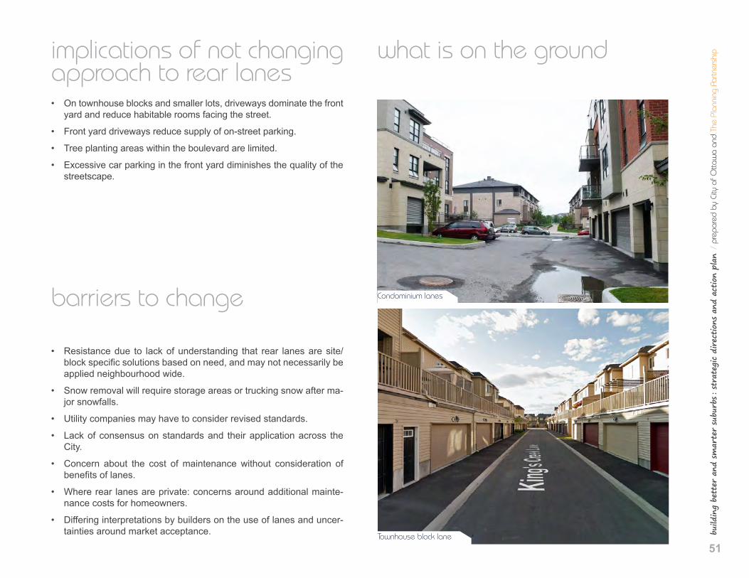
Condominium lanes
Townhouse block lane
.7 r
ear l
anes
52
achieving sustainable development • Lanes are an important component of building complete communi-
ties and better suburbs.
• Lanes support safer sidewalks, which promote walkability and healthier lifestyles.
• Lanes enable more efficient use of front yards for enhanced perme-ability and more opportunities to create urban tree canopy.
• Lanes free up the home’s front elevation and permit habitable rooms to face the street.
precedents
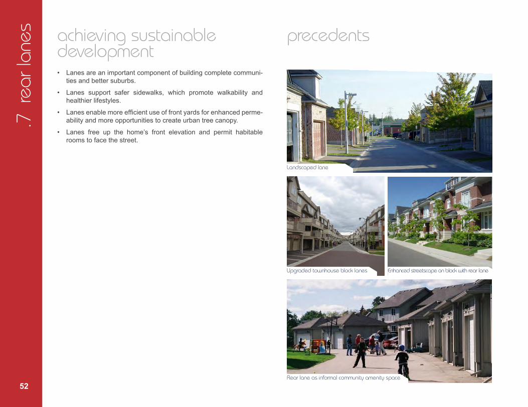
Landscaped lane
Upgraded townhouse block lanes Enhanced streetscape on block with rear lane
Rear lane as informal community amenity space

build
ing
bett
er a
nd s
mar
ter
subu
rbs : st
rate
gic
dire
ctio
ns a
nd a
ctio
n pl
an /
pre
pare
d by
City
of O
ttaw
a an
d Th
e Pl
anni
ng P
artn
ersh
ip
53
objectives
• Promotehigherdensitydevelopmentandcompactformwithless impact on the streetscape.
• Enhance the streetscape by removing cars from the front face ofthe house and maximize the living space overlooking the street.
• Considerrearlanesinareaswherefrontyarddrivewayscouldconflictwithadjacentlanduses,suchasschoolsites.
• Resolve snow and stormwater storage and conveyanceconcerns.
• Examinepotentialtoplacesomeundergroundutilitiesinrearlanes. • Maximizegreenspaceandopportunitiesfortreeplantingand
landscaping.
strategic directions
1. Determine locations where rear lanes or development withrear-access parking (e.g. townhouse or stacked townhouseblocks with limited curb-cuts and driveway access, and park-ing at the rear of each dwelling unit) are appropriate. For ex-ample, locations may include lots facing schools, parks, com-munity centres, and on major collector and arterial roads.
2. Analyze budgetary implications and community design ben-efits ofCityownershipof lanes; evaluatemodelofprivatelane ownership with public pedestrian easement.
3. Determine which utilities can and should be located in rear lanes.
4. Revisit design for rear lane blocks in order to improve snowand stormwater storage and conveyance issues.
action plan
1. Revise Urban Design Guidelines for Greenfield Neighbourhoods and Zoning By-law to provide a framework for rear lanes or de-velopment with rear-access parking, according to findings from Strategic Directions.
2. Develop longitudinal ROW cross-sections, block design standards,and zoning regulations for lanes that incorporate functional require-ments for utilities and maintenance and design specifications forlow speeds, maximum block lengths, rear setbacks and off-laneparking, stormwater management, and snow storage.
3. Develop new lane cross-section based on a narrower width than8.5 metres (potentially one-way) for use where feasible.
54
.8 t
rees
preamble
Trees contribute to the sustainability and beauty of our communities. They provide environmental benefits and are fundamental elements of great streetscapes. There have been challenges in the past to planting trees in new communities which have resulted in ‘tree-less’ streetscapes and uninviting neighbourhoods. The factors contributing to this condition include:
• Competition for space within the ROW.
• Ongoing geotechnical issues related to soils.
• Limited options for planting large canopy trees.
what we heard
Comments captured from workshops: • There is diminished tree canopy and species diversity throughout
Ottawa, partly due to invasive species, disease and development.
• Trees are not being planted in appropriate growing conditions or soil volume.
• Restrictions are imposed on tree planting regarding setbacks and utility placement.
• Tree planting in suburban areas has been limited or put on hold for too long due to the ongoing assessment on the effect of trees on marine clay soils.
• Predominantly small trees or large shrubs are used in areas of ma-rine clay soils in the City of Ottawa; these will never achieve a con-nected canopy.
• Marine clay soils are located throughout much of Ottawa. They have been blamed for causing soil subsistence, which has resulted in damage to building foundations.
• The City has developed tree planting guidelines based on recom-mendations from geotechnical engineers.
• Developers do not get credit for trees on private property if they are not planted in the road right-of-way.
• Although aesthetically better to plant trees in boulevards, it results in higher maintenance costs and reduces health and survival of trees.
• Need to prioritize tree retention before new tree planting.
• Place more emphasis on tree maintenance, especially watering of young trees, rather than planting a specific number of trees.
build
ing
bett
er a
nd s
mar
ter
subu
rbs : st
rate
gic
dire
ctio
ns a
nd a
ctio
n pl
an /
pre
pare
d by
City
of O
ttaw
a an
d Th
e Pl
anni
ng P
artn
ersh
ip
55
implications of not improving tree planting • Important aesthetic, environmental and psychological benefits of
trees are lost or reduced for new communities.
• Microclimates susceptible to the urban heat island effect are not improved.
• Increased stormwater flows to catch basins, with reduced ground infiltration
• Unmitigated wind corridors.
• Decreased wildlife habitat.
barriers to change
• Plans of Subdivision frequently lack sufficiently detailed geotechni-cal information on clay soils to determine applicability of Clay Soils Policy.
• Lack of flexibility in current Clay Soils Policy to account for varia-tions in plasticity and sensitivity of clay soils in different parts of the City.
• Misunderstanding of importance of both soil quality and soil quantity in supporting trees.
• Misunderstanding of the impact of reduced lot size, narrowing of ROW widths and the Clay Soils Policy on ability to achieve Official Plan and Design Guidelines objectives regarding the planting of street trees.
• Inability to have a balanced discussion on the significant benefits of tree canopies in neighbourhoods versus competition for other uses within the ROW.
• Large complete tree canopies could limit street lighting levels on the roadways.
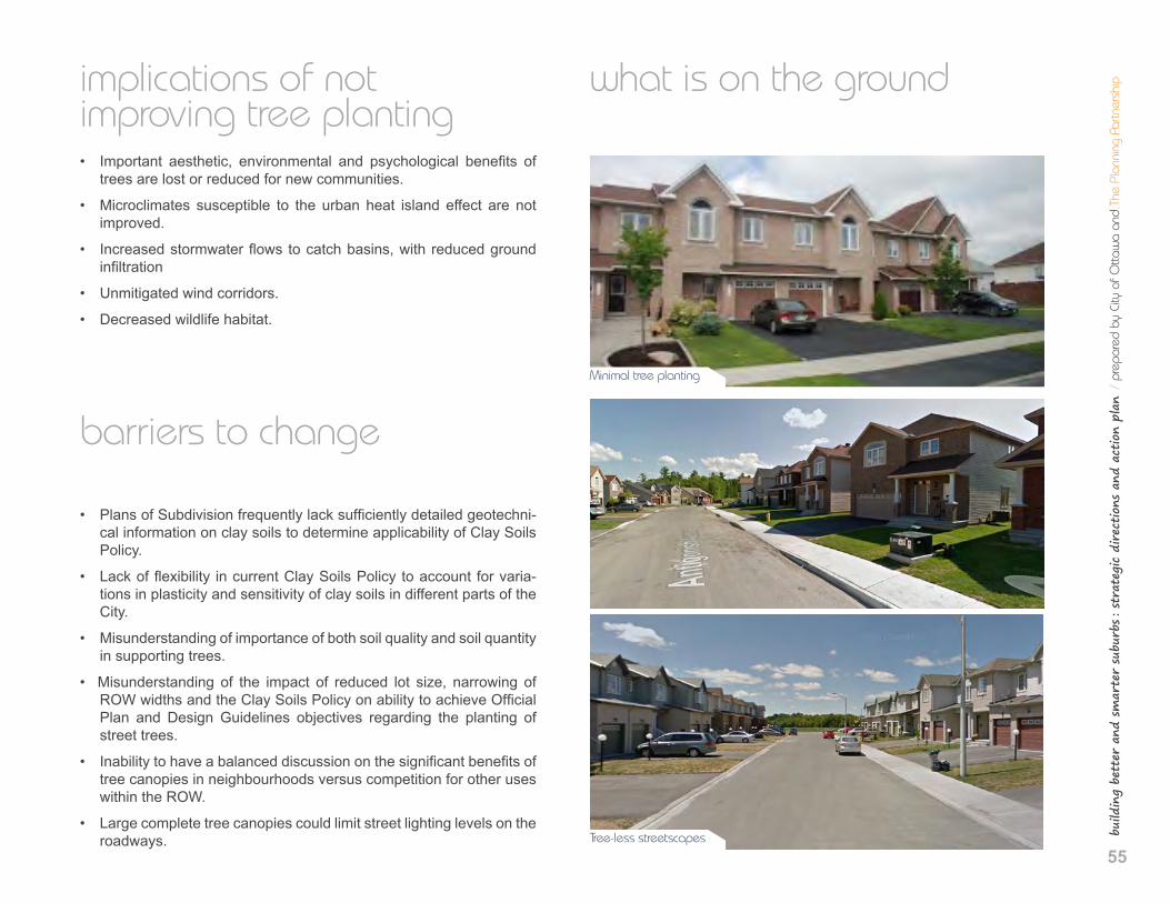
what is on the ground
Minimal tree planting
Tree-less streetscapes
.8 t
rees
56
achieving sustainable development • Trees and landscaped areas absorb water runoff that is otherwise
directed to road surfaces and into piped infrastructure.
• Mature trees enhance property values.
• Tree canopies reduce heat island effect and improve energy conservation.
• Street trees enhance active transportation opportunities and con-tribute to traffic calming.
• Trees improve air quality and public health.
• Appropriate tree species planting improves passive solar opportunities.
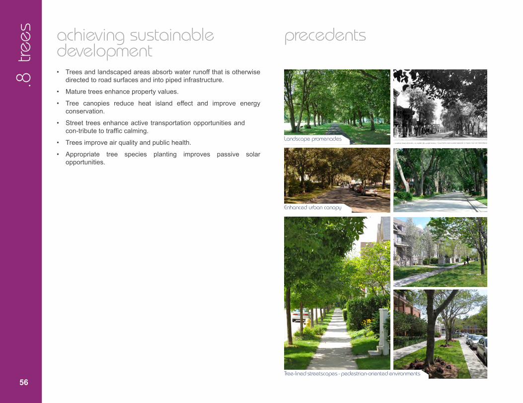
precedents
Landscape promenades
Enhanced urban canopy
Tree-lined streetscapes - pedestrian-oriented environments
57
build
ing
bett
er a
nd s
mar
ter
subu
rbs : st
rate
gic
dire
ctio
ns a
nd a
ctio
n pl
an /
pre
pare
d by
City
of O
ttaw
a an
d Th
e Pl
anni
ng P
artn
ersh
ipobjectives
• EnsuresufficientspaceforhealthytreesintheROW. • Resolve the issue of tree planting inmarine clay soils with
technical solutions that will allow larger and more diverse street trees.
• Expandtheurbanforestandenhanceitsbiodiversity. • Selectappropriatetreespeciesforthelocalenvironment.
• Achievesuitableconditionstoensurematuretreedevelopment.
strategic directions
Street Trees
1. In newROWcross-sections, ensure conditions to support healthy street trees, including canopy trees, in the ROW.
2. Implement tree planting strategies identified in the Street TreeManualforGreenfield Neighbourhoods(tobeapproved in early 2015).
Preservation of Existing Trees
3. Where appropriate, incorporate retained tree stands or wood-lots in parks and open spaces.
4. Improve retention of healthy trees and treed areas in new neighbourhoods.
action plan
1. Finalize design options that will consolidate utilities in new ROW cross-sections in order to provide greater space for trees.
2. Update the submission requirements for geotechnical assessments for Plans of Subdivisions to include more precise parameters for determining the type (plasticity and sensitivity) of clay soil that may be present.
3. Investigate options to revise the existing Clay Soils Policy once more precise geotechnical information on clay soils becomes avail-able (Action Plan 2). Use this information to bring flexibil ty to the Clay Soils Policy where less sensitive clay soils are present in order to expand the allowed tree species and reduce minimum setbacks between trees and building foundations. This may include the use of soil cells and/or root barriers.
4. In the development of new ROW cross-sections, include consider-ation of new street tree species recommended in the Street Tree Manual for Greenfield Neighbourhoods (to be approved in early 2015).
5. Review options for giving developers credit for retaining and/or transplanting mature trees in new plans of subdivision.
58
.9 u
tility
pla
cem
ent
preamble
The placement of above and below ground utilities is influenced by many factors, including available space in the ROW, the required clearances between utilities, and the design of utility trenches and re-lated infrastructure. With increasing densities and compact develop-ment, the accommodation and coordination of all elements within the ROW present many challenges, including:
• Competing space requirements for sidewalks, trees and utilities.
• Setbacks and minimum clearances from utilities and the prioritiza-tion of space for utilities over other features such as street trees.
• Design standards for some utilities have not been updated to reflect higher densities.
what we heard
Comments captured from workshops: • Trees are losing out to infrastructure for above and below ground
utilities.
• Above-ground utilities have a negative visual impact on the streetscape.
• Developers would like to plant more trees along the streets, if the utility alignments allow it.
• There is a potential to have differing cross-sections along a single road depending on land use.
• The City’s current requirements typically result in providing 18m road right-of-ways, despite the desire for higher densities and more compact developments.
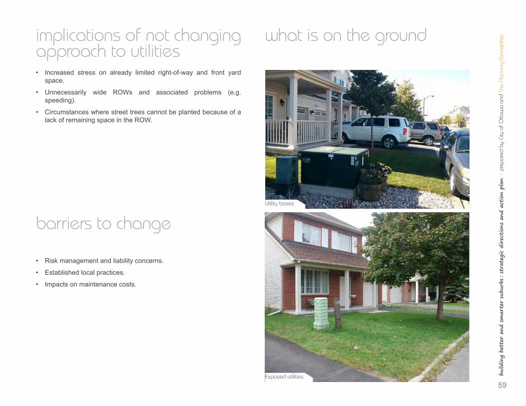
build
ing
bett
er a
nd s
mar
ter
subu
rbs : st
rate
gic
dire
ctio
ns a
nd a
ctio
n pl
an /
pre
pare
d by
City
of O
ttaw
a an
d Th
e Pl
anni
ng P
artn
ersh
ip
59
implications of not changing approach to utilities • Increased stress on already limited right-of-way and front yard
space.
• Unnecessarily wide ROWs and associated problems (e.g. speeding).
• Circumstances where street trees cannot be planted because of a lack of remaining space in the ROW.
barriers to change
• Risk management and liability concerns.
• Established local practices.
• Impacts on maintenance costs.
what is on the ground
Utility boxes
Exposed utilities
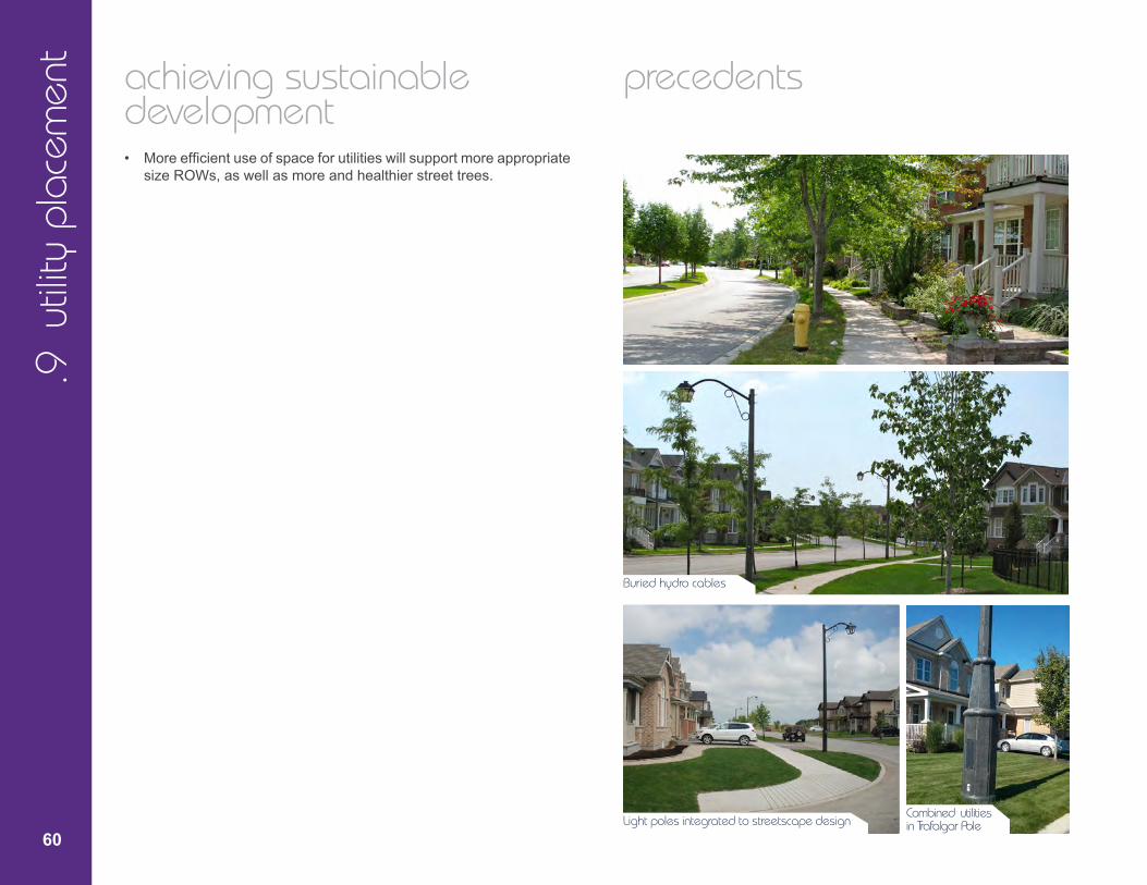
.9 u
tility
pla
cem
ent
60
achieving sustainable development • More efficient use of space for utilities will support more appropriate
size ROWs, as well as more and healthier street trees.
precedents
Buried hydro cables
Light poles integrated to streetscape design Combined utilities in Trafalgar Pole

61
build
ing
bett
er a
nd s
mar
ter
subu
rbs : st
rate
gic
dire
ctio
ns a
nd a
ctio
n pl
an /
pre
pare
d by
City
of O
ttaw
a an
d Th
e Pl
anni
ng P
artn
ersh
ipobjectives
• Balancetheneedsofallelementswithinthestreetright-of-way. • Whereverpossible,combinelocationofservicestominimize
space requirements in ROW. • Locateutilitiestobecompatiblewithurbandesignobjectives. • Minimizetheimpactofutilitiesonthestreetscape.
strategic directions
1. Favour design solutions that make all utilities and infrastruc-ture(excepttraffic signalsandfire hydrants)asinvisibleas possible.
2. Find design solutions that accommodate all utilities using less space in the ROW (e.g. joint utility trench) while ensur-ingsufficientspaceforstreettrees.
3. Minimize the numbers of utilities crossing soil trenches for trees.
4. Ensure utility placement and network design can accom-modate increasing densities without compromising service quality and safety standards.
5. Combine above-ground utilities to reduce their visual impact on the streetscape.
6. Continue to support the burial of overhead wires on new roads.
action plan
1. Establish Working Group that will produce new ROW cross-sec-tions that accommodate all infrastructure within the ROW, including trees and all utilities.
2. Determine the minimum achievable clearances for all utilities.
62
5 implementation strategies
Building better and smarter suburbs is the shared responsibility of:
• The City of Ottawa
• Public agencies
• The community and residents
• The development industry
action plan The Building Better and Smarter Suburbs Action Plan ensures that the ideas in this report lead to tangible action items and deliverables. It ties every Action Plan item in each of the nine chapters in Section 4 to one or more specific implementation strategies outlined below and identified in the Action Plan Summary Table at the end of this report.
The Action Plan contains four different types of implementation strategies:
• QuickWins
• RevisionstoGuidelinesorPolicies
• ZoningStudies
• WorkingGroups
This Action Plan recommends Quick Wins to be completed throughout 2015, while the Revisions to Policies and Guidelines, Zoning Studies, and Working Groups are larger collaborative endeavors that have a Term of Council timeline (2015-2018). Each one of the implementa-tion strategies will take into account the City’s Comprehensive Asset Management Policy and seek to balance the long-term affordability of City-owned assets with the City-building objectives in the Official Plan.
63
build
ing
bett
er a
nd s
mar
ter
subu
rbs : st
rate
gic
dire
ctio
ns a
nd a
ctio
n pl
an /
pre
pare
d by
City
of O
ttaw
a an
d Th
e Pl
anni
ng P
artn
ersh
ip
QuickWins(2015)
Update submission requirements for new plans of subdivision:
• Build traffic calming measures as part of initial road construction
• Update on-street parking policies to make it easier to apply for spe-cial parking permits.
• Revise Zoning By-law to better accommodate residential parking.
• Add information to purchase/sale agreements of new homes to clar-ify parking regulations and transportation options.
• Involve OC Transpo earlier in the design of new plans of subdivision.
• Require better analysis of marine clay soils in order to bring fleibility to tree planting restrictions.
• Incorporate dry ponds into park design.
Revisions to Guidelines or Policies
Some of the Action Plan items are important high level principles that require some flexibility to be applied on a site by site basis. These concepts are best introduced through revisions to existing guide-lines, which are applied to Community Design Plans and Plans of Subdivision. Most relevant will be revisions or additions to the Urban Design Guidelines for Greenfield Neighbourhoods, the Marine Clay Soils Policy, and the Park and Pathway Development Manual. Some of the topics to address include:
• Modified or offset grid.
• Spacing of arterial roads and block sizes.
• Rear lanes or buildings with parking at rear.
• Reverse frontage lots.
• Locations for community mail boxes.
• Tree planting restrictions in marine clay soils.
• Smaller park typologies (<0.4 ha).
ZoningStudies
The Action Plan items recommend a review of certain zoning issues that require separate study and consultation, which include:
• Flexible zoning in new subdivisions to allow live-work and localcommercial land uses
• Minimum parking space dimensions inside garages
• Maximum garage projections
• Minimum distance between driveways
• New block designs for rear lanes
Working Groups
1. Streets: Road ROW Cross-Sections, Street Trees, and Utilities.
• Chair: Phil Landry, Manager, Traffic Services Branch, PublicWorks Department.
• Develop new ROW cross-sections that reconcile numerous el-ements, including: utility placement, street trees, stormwatermanagement, snow storage, design speeds, vehicle lane widths,traffic calming
64
2. Parks: Parks, Stormwater Management and Tree Retention.
• Chair: Fel Petti, Manager, Development Review, Suburban Services Unit, Planning and Growth Management.
• Issues include: emergency stormwater conveyance and storage in parks and open spaces, improved retention of existing trees, new typologies for smaller parks, and increased flexibility to the Clay Soils Policy where soil conditions allow it.
3. Schools: School sites.
• Chair: Lee Ann Snedden, Manager, Policy Development and Urban Design, Planning and Growth Management.
• Timeline: 2015-2016.
• Some of the challenges and opportunities to discuss with school boards include: multi-storey schools, pedestrian and cycling facili-ties, traffic calming, temporary use of optioned school sites, Shared Facilities and Community Use agreements, bus lay-bys and student pick-up/drop off areas, tree and woodlot retention in school sites.
Timing and Terms of Reference for Working Groups
The Terms of Reference and the technical solutions to be recom-mended by each Working Group will adhere to the Strategic Directions and Action Plan items contained in this document and the approved Building Better and Smarter Suburbs Vision and Principles. Each Terms of Reference will receive input from group members and be approved by the Building Better and Smarter Suburbs Steering Committee and Councillor Sponsors. Any competing interests between members of a Working Group will be resolved by the Chair (in accordance with the Vision and Principles and Strategic Directions and Action Plans), and if necessary, in consultation with the Project Steering Committee and Councillor Sponsors.
The Terms of Reference for each Working Group will clearly outline the following:
• Chair and membership
• Background, Purpose, Objectives
• Time commitments (meeting frequency and duration)
• Project timeline
• Deliverables
• Resource requests
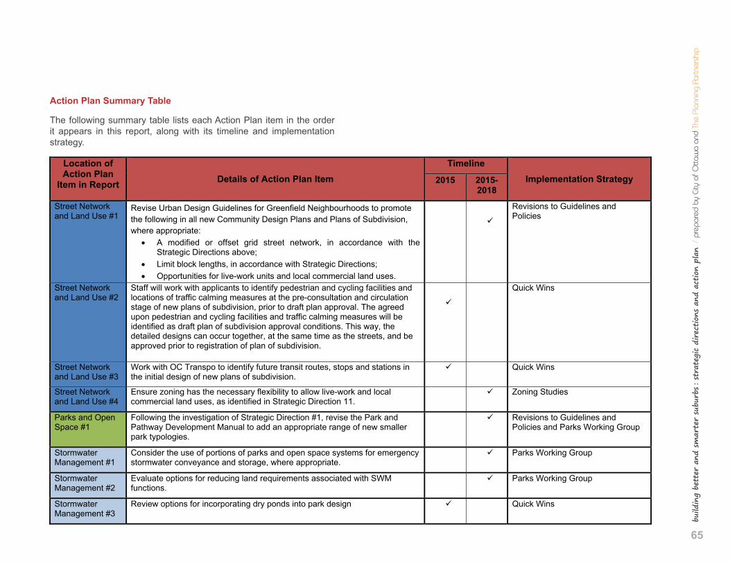
65
build
ing
bett
er a
nd s
mar
ter
subu
rbs : st
rate
gic
dire
ctio
ns a
nd a
ctio
n pl
an /
pre
pare
d by
City
of O
ttaw
a an
d Th
e Pl
anni
ng P
artn
ersh
ip
1
Building Better and Smarter Suburbs SummaryofActionPlanItemsandImplementationDetails
Action Plan Summary Table
The following summary table lists each Action Plan item in the order it appears in this report, along with its timeline and implementation strategy.
Location of Action Plan
IteminReport DetailsofActionPlanItem Timeline
ImplementationStrategy2015 2015-2018
Street Network and Land Use #1
Revise Urban Design Guidelines for Greenfield Neighbourhoods to promote the following in all new Community Design Plans and Plans of Subdivision, where appropriate:
A modified or offset grid street network, in accordance with the Strategic Directions above;
Limit block lengths, in accordance with Strategic Directions; Opportunities for live-work units and local commercial land uses.
Revisions to Guidelines and Policies
Street Network and Land Use #2
Staff will work with applicants to identify pedestrian and cycling facilities and locations of traffic calming measures at the pre-consultation and circulation stage of new plans of subdivision, prior to draft plan approval. The agreed upon pedestrian and cycling facilities and traffic calming measures will be identified as draft plan of subdivision approval conditions. This way, the detailed designs can occur together, at the same time as the streets, and be approved prior to registration of plan of subdivision.
Quick Wins
Street Network and Land Use #3
Work with OC Transpo to identify future transit routes, stops and stations in the initial design of new plans of subdivision.
Quick Wins
Street Network and Land Use #4
Ensure zoning has the necessary flexibility to allow live-work and local commercial land uses, as identified in Strategic Direction 11.
Zoning Studies
Parks and Open Space #1
Following the investigation of Strategic Direction #1, revise the Park and Pathway Development Manual to add an appropriate range of new smaller park typologies.
Revisions to Guidelines and Policies and Parks Working Group
Stormwater Management #1
Consider the use of portions of parks and open space systems for emergency stormwater conveyance and storage, where appropriate.
Parks Working Group
Stormwater Management #2
Evaluate options for reducing land requirements associated with SWM functions.
Parks Working Group
Stormwater Management #3
Review options for incorporating dry ponds into park design Quick Wins
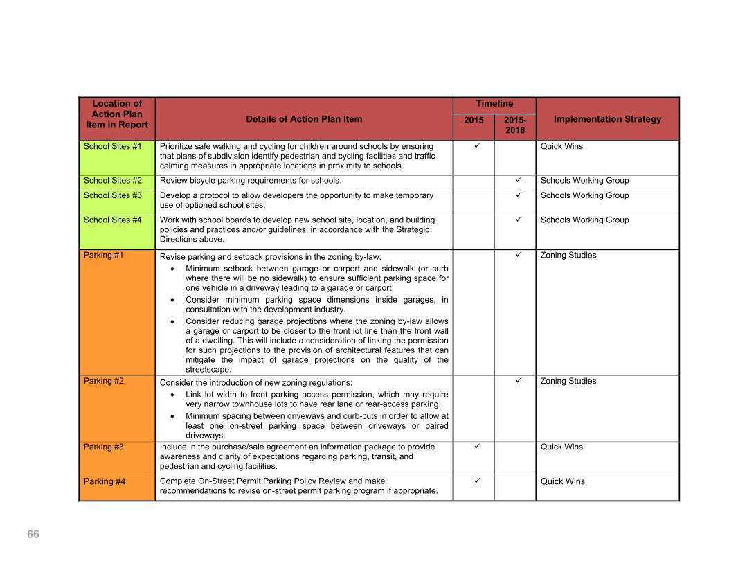
66 2
Location of Action Plan
IteminReport DetailsofActionPlanItemTimeline
ImplementationStrategy2015 2015-2018
School Sites #1 Prioritize safe walking and cycling for children around schools by ensuring that plans of subdivision identify pedestrian and cycling facilities and traffic calming measures in appropriate locations in proximity to schools.
Quick Wins
School Sites #2 Review bicycle parking requirements for schools. Schools Working Group
School Sites #3 Develop a protocol to allow developers the opportunity to make temporary use of optioned school sites.
Schools Working Group
School Sites #4 Work with school boards to develop new school site, location, and building policies and practices and/or guidelines, in accordance with the Strategic Directions above.
Schools Working Group
Parking #1 Revise parking and setback provisions in the zoning by-law: Minimum setback between garage or carport and sidewalk (or curb
where there will be no sidewalk) to ensure sufficient parking space for one vehicle in a driveway leading to a garage or carport;
Consider minimum parking space dimensions inside garages, in consultation with the development industry.
Consider reducing garage projections where the zoning by-law allows a garage or carport to be closer to the front lot line than the front wall of a dwelling. This will include a consideration of linking the permission for such projections to the provision of architectural features that can mitigate the impact of garage projections on the quality of the streetscape.
Zoning Studies
Parking #2 Consider the introduction of new zoning regulations: Link lot width to front parking access permission, which may require
very narrow townhouse lots to have rear lane or rear-access parking. Minimum spacing between driveways and curb-cuts in order to allow at
least one on-street parking space between driveways or paired driveways.
Zoning Studies
Parking #3 Include in the purchase/sale agreement an information package to provide awareness and clarity of expectations regarding parking, transit, and pedestrian and cycling facilities.
Quick Wins
Parking #4 Complete On-Street Permit Parking Policy Review and make recommendations to revise on-street permit parking program if appropriate.
Quick Wins

67
build
ing
bett
er a
nd s
mar
ter
subu
rbs : st
rate
gic
dire
ctio
ns a
nd a
ctio
n pl
an /
pre
pare
d by
City
of O
ttaw
a an
d Th
e Pl
anni
ng P
artn
ersh
ip
3
Location of Action Plan
IteminReport DetailsofActionPlanItemTimeline
ImplementationStrategy2015 2015-2018
Road Right-of-Way #1
Develop a series of new right-of-way cross sections that will expand the menu of approved street types in order to give additional options for street designs in new plans of subdivision. New street types to consider include:
Local and collector streets that accommodate street trees on both sides of the street within the right-of-way.
Streets that accommodate canopy trees. Local street or street segment with a reduced design speed to
discourage speeding and improve safety. Local and collector streets with reduced vehicle lane widths and traffic
calming measures. Local and collector streets with innovative stormwater management
strategies. Local and collector Green Streets, used to connect components of the
Urban Greenspace Network, as described in the approved Greenspace Master Plan and Road Corridor Planning and Design Guidelines.
Arterial roads designed for street-front retail uses that accommodate on-street parking and cycling facilities.
Complete Streets that best accommodate all road users, where appropriate, as recommended by the Complete Streets policies in the Transportation Master Plan.
Streets Working Group
Road Right-of-Way #2
Determine design speed of all new ROW cross-sections based on adjacent future land use so that vehicle operation speeds are appropriate for all users of the street.
Streets Working Group
Road Right-of-Way #3
Implement Ottawa Pedestrian Plan 2013 policy requiring a low speed street design for streets where pedestrian facilities are not provided.
Streets Working Group
Road Right-of-Way #4
Develop new illustrations for each road type to show cross sections as plans and 3D images, to reinforce the relation among all considerations (e.g. building, driveway, landscape, utilities, etc).
Streets Working Group
Road Right-of-Way #5
Revise the Urban Design Guidelines for Greenfield Neighbourhoods to identify preferred criteria for community mailboxes in accordance with Strategic Direction 9.
Revisions to Guidelines and Policies
Road Right-of-Way #6
Update Greenspace Master Plan to include more detailed specifications for Green Streets.
Revisions to Guidelines and Policies
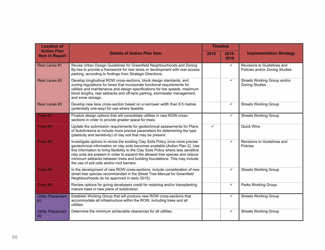
68 4
Location of Action Plan
IteminReport DetailsofActionPlanItemTimeline
ImplementationStrategy2015 2015-2018
Rear Lanes #1 Revise Urban Design Guidelines for Greenfield Neighbourhoods and Zoning By-law to provide a framework for rear lanes or development with rear-access parking, according to findings from Strategic Directions.
Revisions to Guidelines and Policies and/or Zoning Studies
Rear Lanes #2 Develop longitudinal ROW cross-sections, block design standards, and zoning regulations for lanes that incorporate functional requirements for utilities and maintenance and design specifications for low speeds, maximum block lengths, rear setbacks and off-lane parking, stormwater management, and snow storage.
Streets Working Group and/or Zoning Studies
Rear Lanes #3 Develop new lane cross-section based on a narrower width than 8.5 metres (potentially one-way) for use where feasible.
Streets Working Group
Trees #1 Finalize design options that will consolidate utilities in new ROW cross-sections in order to provide greater space for trees.
Streets Working Group
Trees #2 Update the submission requirements for geotechnical assessments for Plans of Subdivisions to include more precise parameters for determining the type (plasticity and sensitivity) of clay soil that may be present.
Quick Wins
Trees #3 Investigate options to revise the existing Clay Soils Policy once more precise geotechnical information on clay soils becomes available (Action Plan 2). Use this information to bring flexibility to the Clay Soils Policy where less sensitive clay soils are present in order to expand the allowed tree species and reduce minimum setbacks between trees and building foundations. This may include the use of soil cells and/or root barriers.
Revisions to Guidelines and Policies
Trees #4 In the development of new ROW cross-sections, include consideration of new street tree species recommended in the Street Tree Manual for Greenfield Neighbourhoods (to be approved in early 2015).
Streets Working Group
Trees #5 Review options for giving developers credit for retaining and/or transplanting mature trees in new plans of subdivision.
Parks Working Group
Utility Placement #1
Establish Working Group that will produce new ROW cross-sections that accommodate all infrastructure within the ROW, including trees and all utilities.
Streets Working Group
Utility Placement #2
Determine the minimum achievable clearances for all utilities. Streets Working Group

69
build
ing
bett
er a
nd s
mar
ter
subu
rbs : st
rate
gic
dire
ctio
ns a
nd a
ctio
n pl
an /
pre
pare
d by
City
of O
ttaw
a an
d Th
e Pl
anni
ng P
artn
ersh
ip
This page intentionally left blank
70
6 appendix: suburban design framework
background documents The design of new suburban communities is guided by a long list of ex-isting policies, plans, by-laws, guidelines, and master plans, as well as important stakeholders with their own policies and regulations. Other ongoing initiatives may come into play as developers anticipate new regulations and guidelines. To appreciate the breadth of this design framework, a sample of relevant documents, studies, and list of key stakeholders is provided below.
Policies and Plans • Official Plan• Secondary Plans• Community Design Plans• Comprehensive Asset Management Policy
By-laws • Zoning By-law• Private Approach By-law• Traffic and Parking By-law• Residential On-Street Parking Permit Policy• Winter Parking Restrictions• Driveway Zoning Study (ongoing)• Encroachment and Management Policies for Urban Lanes
Master Plans / Design Guidelines • Transportation Master Plan• Ottawa Pedestrian Plan• Ottawa Cycling Plan• Infrastructure Master Plan• Greenspace Master Plan• Urban Design Guidelines for Greenfield Neighbourhood• Park and Pathway Development Manual• Road Corridor Planning and Design Guidelines• Sewer Design Guidelines
71
build
ing
bett
er a
nd s
mar
ter
subu
rbs : st
rate
gic
dire
ctio
ns a
nd a
ctio
n pl
an /
pre
pare
d by
City
of O
ttaw
a an
d Th
e Pl
anni
ng P
artn
ersh
ip
• Water Design Guidelines• Traffic Calming and Management• Construction Details• Street Cross Sections• Urban Tree Conservation By-Law• Trees and Sensitive Marine Clay• Tree Planting Details• Subwatershed Studies• Environmental Management Plans• Environmental Impact Statement Guidelines• Water Environment Strategy• Air Quality and Climate Change Management Plan• Slope Stability Guidelines for Development Applications
Subdivision Agreements • Standard Conditions and Legal Requirements• Approved plans and reports: Landscape Plans, Servicing
Plans, Geotechnical Reports, Tree Conservation Reports,etc.
OtherOngoingInitiatives • Joint Utility Trench / Four Party Trench• Street Tree Manual for Greenfield Neighbourhood• On-Street Permit Parking Policy Review• Road Design Guidelines
Stakeholders • Development industry• Conseil des écoles publique de l’Est de l’Ontario• Conseil des écoles catholique du Centre-Est• Ottawa Carleton District School Board• Ottawa Catholic School Board• Hydro Ottawa• Enbridge• Bell, Rogers, and other telecommunications
72
directions already provided The following is a relevant but not exhaustive list of applicable existing policies, by-laws or guidelines.
.1 Street Network and Land Use
Road Corridor Planning and Design Guidelines
Guidelines allow blocks with intersecting side streets every 150-200m along a Collector Road, as opposed to every 50m-100m in non-Green-field areas
Guidelines to establish “frequent connections of Collector Roads to Arterial Roads…locate these intersections between 250m to 400m apart to enable efficient traffic flow along the Arterial Road”.
Guidelines to create a connected network of block patterns that al-low “frequent Local Road intersections with Collector Roads to pro-mote accessibility, connectivity, and continuity along and across the Collector Road corridor”.
Provide on-street parking to calm traffic along Collector Roads
Minimize ROW widths.
Minimize frequent driveways on collector roads.
Avoid rear-lotting along collector and arterial roads and avoid condi-tions where sound attenuation fences would be needed.
Regional Road Corridor Design Guidelines
Block length and intersection spacing along regional road corridors should be designed to accommodate all transportation modes includ-ing walking, cycling, and public transit.
Ensure that regional road corridors will act as community “integrators” rather than “dividers” by having land uses and built form relate to the road and avoid back-lotting (reverse frontage). Consider subdivision and site plan design for adjacent lands, which includes parallel local streets, frequent intersections, short blocks, sidelotting, and front-lot-ting with rear access.
Encourage a grid street and block pattern with frequent intersections to promote accessibility, connectivity and continuity along and across the corridor. To achieve a highly urban corridor, design blocks with intersecting side streets every 50 to 100m and signalized intersections every 100 to 150m.
73
build
ing
bett
er a
nd s
mar
ter
subu
rbs : st
rate
gic
dire
ctio
ns a
nd a
ctio
n pl
an /
pre
pare
d by
City
of O
ttaw
a an
d Th
e Pl
anni
ng P
artn
ersh
ip
UrbanDesignGuidelinesforGreenfieldNeighbourhoods
Concentrate higher density residential units around neighbourhood fo-cal points that include transit stops, commercial areas, schools, com-munity facilities, parks, and multi-use pathways.
Create a walkable neighbourhood with pathways, trails, and sidewalks that connect destinations such as transit stops, commercial areas, schools, community facilities and parks.
Connect new streets to existing streets in adjacent development and plan for future connections to land that has yet to be developed.
Layout collector streets that are direct and continuous through the neighbourhood so that homes are within 400 metres of transit and other destinations along them.
Layout local street patterns so that development blocks are easily walkable – between 150 and 250 metres in length.
Incorporate mid-block walkways where long blocks cannot be avoided.
Environmental Noise Control Guidelines
Guidelines to provide noise attenuation in noise-sensitive development without the use of noise barriers along roads and transit corridors.
New developments must undertake noise studies and include noise attenuation measures in the development agreement.
City of Ottawa Design Guidelines – Sewer
City of Ottawa Design Guidelines – Water Distribution
.2 Parks and Open Space
OfficialPlan2.4.5and4.10
Greenspace Master Plan and Parkland Dedication.
City of Ottawa Parkland Dedication By-law 2009-95
City will not accept unsuitable lands such as that prone to flooding, hazards, etc.
Park and Pathway Development Manual, March 2012
Standardizes the park and pathway development process for both City-built and Developer-front-ended projects, and identifies the types and sizes of different parks:
• District Park (+10.0 ha)
• Community Park (3.2 – 10.0 ha)
• Neighbourhood Park (1.2 – 3.2 ha)
• Parkette (0.4 – 1.2 ha)
Also lists the facilities to be accommodated and design criteria for such things as target canopy cover and naturalization percentages.
Design criteria established for each category of park can be found in the Park and Pathway Development Manual.
City of Ottawa Parkland Dedication By-law 2009-95
For >18uph (net) = 1ha/300 units and for apartments not to exceed 10% of site area.
For <18uph (net) = 5% of gross land area.
UrbanDesignGuidelinesforGreenfieldNeighbourhoods
The Urban Design Guidelines for Green Neighbourhoods list a number of key guidelines for protecting natural areas and enhancing parks and open space in new communities, such as:
• Create a connected network of parks, greenspaces and public lands that is structured by existing natural features and connected by pathways and sidewalks.
74
• Conserve natural features such as woodlots, wetlands, and creeks, and the natural connections between them, to sustain healthy habi-tats for plants and animals.
• Design streetscapes with open accessible frontages along greens-paces, such as woodlots and stormwater management ponds.
• Locate parks so that they front onto at least two streets, or have their longest edge front onto the street.
• Locate parks at ‘T’-intersections to terminate streetscape views.
• Mailboxes to be placed in high activity areas, including areas adja-cent to parks.
.3 Stormwater Management
OfficialPlan4.8.1
Stormwater management ponds not permitted in floodplains
OfficialPlan2.4.5Policy5
Target for open spaces and leisure lands include stormwater manage-ment facilities.
UrbanDesignGuidelinesforGreenfieldNeighbourhoods
Locate stormwater management areas to be an integral part of the overall greenspace and pedestrian network within the neighbourhood.
Design stormwater management areas with the majority of their frontage onto public roads to make a visible contribution to the neighbourhood.
Naturalize the edges of stormwater management areas to deter public access and to create wildlife habitats.
InfrastructureMasterPlan4.5.3
Greenfield developments are required to be designed with sewers that can convey five year events and 100 year events, and to meet treat-ment facility requirements for mitigating flooding, erosion and water quality degradation.
InfrastructureMasterPlan5.4
The City will adopt low impact development design standards, priori-tize stream restoration projects and complete a Stormwater Retrofit Master Plan.
City of Ottawa Design Guidelines – Sewer
City of Ottawa Design Guidelines – Water Distribution
Ministry of Environment Stormwater Management Planning and Design Manual
Provides guidance on the planning, design and review of stormwater management practices.

75
build
ing
bett
er a
nd s
mar
ter
subu
rbs : st
rate
gic
dire
ctio
ns a
nd a
ctio
n pl
an /
pre
pare
d by
City
of O
ttaw
a an
d Th
e Pl
anni
ng P
artn
ersh
ip.4 School Sites
Ottawa Catholic School Board
• Community Use of School Facilities policy
• Facility Partnership policy
• School siting policies, including:
- Elementary schools between 2.4 – 2.8 ha.
- Secondary schools require a minimum of 8 ha.
Ottawa-Carleton District School Board
• Community Use of School Facilities policy
• Facility Partnership policy
• School siting policies, including:
- Elementary schools between 2.8 – 3.2 ha, subject to the avail-ability of adjacent parkland.
- Secondary schools between 6.5 – 7.3 ha.
- School site size depends on whether or not the school site is ad-jacent to parkland that is available for school program use.
- Preference for school sites located adjacent to parkland in order to facilitate joint use opportunities with municipal agencies.
- Locate elementary schools on sites with at least one road frontage on a local road or a minor collector road and secondary schools on sites with at least one road frontage on or near a major collec-tor road or arterial road.
- For Secondary schools, preference for sites with access to major OC Transpo routes.
- Builds multi-storey schools in order to maximize available play area/green space.
Conseil des écoles catholiques du Centre-Est
• Partenariats pour le partage des installations
• School siting policies include:
- Elementary schools: minimum 2 - 2.4 ha.
- Secondary schools: minimum 5.7 ha.
- Requirement for two storey schools.
- Preference for school sites located adjacent to a park, which could reduce school site size requirement and increase likelihood of sharing facilities.
- Bus lay-bys that are separate from mixed traffic
Conseil des écoles publique de l’Est de l’Ontario
• Examen des installation scolaires destinées aux élèves
• Location des locaux d’école
• School siting policies include:
- If located adjacent to a park:
o Elementary schools: minimum 2 ha.
o Secondary schools: minimum 3.6 ha.
o JK to 12 schools: minimum 4 ha.
- If not located adjacent to a park:
o Elementary schools: 2.4 ha.
o Secondary schools: minimum 4 ha.
o JK to 12 schools: minimum 4.86 ha.
- Locate school in centralized part of residential area to maximize pedestrian access.
- Preference for a square or rectangular school site adjacent to a park with minimum frontage of 50 metres and depth of 100 metres.
- Requires geotechnical conditions that would permit a two storey elementary school.
City of Ottawa Schoolyard Tree Planting Program
Provides funding for tree planting programs on school property.

76
.5 Parking
ZoningBy-Law–Part4:Parking,Queuing,andLoadingProvisions – Section 101, Table 101
Low, Mid, and High-rise apartment buildings in Suburban Areas not within 600m of a rapid transit station require 1.2 parking spaces per dwelling unit.
ZoningBy-Law–Part4:Parking,Queuing,andLoadingProvisions – Section 107 – Subsection 2
A driveway providing access to parking spaces for detached, linked detached, semi-detached, duplex, townhouse or stacked dwellings must have a minimum width of 2.6 metres (the minimum required width of one parking space under Section 106) (By-law 2013-54, By-law 2010-307).
ZoningBy-Law–Part4:Parking,Queuing,andLoadingProvisions –Section109–Item12
In R1-R5 Zones, a maximum of 50% of the area of a front or corner side yard or the required minimum width of one parking space (which-ever is greater) may be used for a driveway, the remainder of which must be landscaped with soft landscaping (By-law 2010-307).
ZoningBy-LawPart6–ResidentialZonesSectionR2(Sec.157-158)
The City of Ottawa Zoning By-law specifies minimum front yard set-backs for the various Sub Zones based on unit type and lot size. This includes 6.0m, 4.5m and 3.0m.
Additional zoning provision note #8 (R3), #10 (R4) and #11 (R1, R2) specifies that for some of the zones that have 3.0m setback, the mini-mum setback from the entrance to a private garage or carport to an existing or planned sidewalk is 6.2m.
TrafficandParkingBy-lawNo.2003-530
Cars not permitted to park on driveways within 0.5m of a sidewalk or 1.5m of the roadway if there is no sidewalk.
UrbanDesignGuidelinesforGreenfieldNeighbourhoods
Provide shared driveways for ground-oriented attached dwellings to maximize areas for trees, utilities, on-street parking, and snow storage.
TrafficandParkingBy-lawNo.2003–530
On-street permit parking only allowed in certain residential zones, al-lowing residents to park for up to 48 hours in the same spot and to be exempt from winter overnight parking restrictions. Elsewhere, on-street parking is not allowed for periods of over 3 hours between 7am and 7pm or anytime between 1am and 7am from November 15-April 1st during publicly announced overnight restrictions for snow removal. Only in certain residential zones with on-street permit parking are cars allowed to park for periods of up to 48 hours in one spot. Restrictions also in effect for parking near intersections, fire hydrants, laneways, driveways, schools and parks.
Transportation Master Plan – Chapter 6: Roads and Motor Vehicle Use – Section 6.11
The City will support the availability of short-term on-street parking for residential uses, providing short-term parking that meets the needs of residents but limiting the supply of long-term parking (to balance needs of auto drivers with those of transit riders).
Winter Parking Restrictions
On-street parking permit holders are exempt from winter overnight parking restrictions, but are not permitted to park their car on streets with temporary “no parking” signs during planned overnight snow removal.
ZoningBy-law–Part4:Parking,Queuing,andLoadingProvisions – Section 101/102 – Subsection 1 and Table 101/102
All R1-R5 areas must provide off-street parking at their respective re-quired rates of 0.5 - 1.2 spaces per dwelling unit.
Low, Mid-, and High Rise apartment buildings, townhouse lots contain-ing more than 12 units, and stacked dwelling units containing more than 12 units must provide off-street visitor parking.
77
build
ing
bett
er a
nd s
mar
ter
subu
rbs : st
rate
gic
dire
ctio
ns a
nd a
ctio
n pl
an /
pre
pare
d by
City
of O
ttaw
a an
d Th
e Pl
anni
ng P
artn
ersh
ip
ZoningBy-law–Part4:Zoning,Queuing,andLoadingProvisions – Section 101 – Table 1
Apartment buildings (Low, Mid-, or High Rise) require 0.5-1.2 off-street parking spaces per dwelling unit.
ZoningBy-Law–Part4:Parking,Queuing,andLoadingProvisions – Section 107 – Subsection 2 / Section 109 – Subsection 11 (By-law 2010-307)
In R1-R5 zones, a maximum of 50% of the area of a front or corner side yard may be used for a driveway, the rest of which must be land-scaped with soft landscaping.
Minimum lot widths as low as 4.5m for townhouses and a driveway width minimum for one parking space of 2.6 meters (By-law 2013-54, By-law 2010-307).
Road Corridor Planning and Design Guidelines
Guidelines to avoid locating detached homes or townhouses with nar-row lots and front driveways along Collector Roads to avoid excessive driveways.
.6 Road Right-of-way
Road Corridor Planning and Design Guidelines
Minimize ROW widths to create human scale along road.
Guidelines for tree planting at least 2.0m - 2.5m from the curb for snow management and 1.0m behind and 2.0m laterally from street lights to minimize interference.
Regional Road Corridor Design Guidelines
For wider roads in suburban contexts, the road edge should be a mini-mum of 6 to 7m wide to accommodate a 2m wide clear pedestrian travel route, a 2 to 3m wide landscape buffer and a 2 to 3m wide inner boulevard.
Separate the sidewalk from vehicle lanes by trees, landscape strips, light standards, utility poles, parking meters, signage, transit shelters, etc., to enhance the sense of security for pedestrians and to improve splash protection.
Transportation Master Plan – Chapter 6: Roads and Motor Vehicle Use – Section 6.3
ROW widths will be secured or road widening may occur in existing ROWs as a condition of development approval for a subdivision, sev-erance, or site plan.
The City may require the exclusive use of a portion of certain ROWs for transit priority operations—this may increase ROW requirements.
Ottawa Pedestrian Plan 2013 - Section 4.1: Policy for Pedestrian Facilities
City requirements for the provision of sidewalks and other pedestrian facilities, including:
• On both sides of arterial and collector roads in the Urban Area and Villages.
• On at least one side of all arterial and collector roads passing through the Greenbelt.

78
• On both sides of all roads that serve transit in the Urban Area and Villages.
• On local roads that lead directly to transit stations, schools, public parks, recreation centers, public buildings and institutions, neigh-bourhood and regional commercial/retail/employment centres.
• Within and between neighbourhoods and from neighbourhood streets (including cul-de-sacs, P streets and crescents) to connect to arterial and collector roads at sufficient intervals to create porous walkable communities.
• On all new and reconstructed urban local roads where pedestrian facilities are required in accordance with these policies but no dedi-cated pedestrian facility is provided, require that roads be designed for a speed of 30 km/h or lower (pending development of a new 30 km/h roadway design standard).
• Consider a multi-use pathway in the right-of-way in lieu of a side-walk if determined to be appropriate for the urban context. Such multi-use pathways that function in lieu of a sidewalk should be con-sidered as a sidewalk for winter maintenance in accordance with appropriate winter maintenance standards.
Ottawa Residential Road Allowance ROW Engineering Cross-sections
On 16.5m and 18.0m ROW, 1.8m sidewalks are located directly next to the roadway.
Only with 20.0m, 22.0m, and 24.0m ROW can sidewalks be separated from roadway with a 2.0m to 3.0m boulevard.
12 ROW options exist, ranging in widths from 8.5m to 24m, with and without sidewalks and boulevards.
16.5m ROW leaves 1.5m to accommodate trees, but trunks must be 0.6m from the property line and in certain situations, this 1.5m must also accommodate hydro transformer/telecom hardware.
8.5m lanes include catch basins at edges.
.7 Rear Lanes
ZoningBy-Law–Part6:ResidentialZones–Section155-168
Rear lanes permitted in residential areas with minimum width of 8.5m and minimum setback is reduced to 1.0m.
UrbanDesignGuidelinesforGreenfieldNeighbourhoods
Plan development based on rear lanes or rear parking areas at im-portant neighbourhood focal points such as mixed-use activity areas, surrounding parks, greenspaces, and entrances to the community.
Urban Lanes Management Policies and Encroachment Policies for Urban Lanes
Encroachment into lanes receiving municipal maintenance is subject to enforcement through the Encroachment By-law. Encroachment into lanes not receiving municipal services, such as lanes that provide sole vehicular access to a property fronting on the lane, to private garages or rear yards, or that provide alternate access to an existing property or garage are also subject to enforcement through the Encroachment By-law.
Urban lanes classified as Class A, receiving municipal maintenance, or Class B, without municipal maintenance. The City has sole discre-tion in classifying and reclassifying lanes.
Road Corridor Planning and Design Guidelines
Guidelines allow blocks with intersecting side streets every 150-200m along a Collector Road, as opposed to every 50m-100m in non-Green-field areas. Length of the block could contribute to length of rear lanes parallel to the street.
79
build
ing
bett
er a
nd s
mar
ter
subu
rbs : st
rate
gic
dire
ctio
ns a
nd a
ctio
n pl
an /
pre
pare
d by
City
of O
ttaw
a an
d Th
e Pl
anni
ng P
artn
ersh
ip.8 Trees
City of Ottawa document: “TreesAnd Foundations Strategy In AreasOfSensitiveMarineClayInTheCityOfOttawa”
Identifies trees as a source of moisture depletion in silty clay soil in Ottawa, potentially leading to differential soil settlement and associ-ated foundation damage.
“Trees should be planted no nearer to the foundations than their ultimate(mature)height”.OfficialPlanSection3.11and3.12
Requires the identification of a site’s natural heritage system, indepen-dent of the potential developable area.
OfficialPlanSection4.7.2
“Development proposals will be required to preserve vegetative cover or propose compensation measures, through a set of policies including specific requirements for a Tree Conservation Report and a landscape plan as part of applications for subdivision.”
Geotechnical Investigation and Reporting for Development Applications in the City of Ottawa
Restrictions on planting trees and preservation of existing trees in ar-eas of new development to address moisture depletion of clay and potential distress to building foundations.
Municipal Trees and Natural Areas Protection By-law No.2006-279 -PartII:TreesonMunicipalProperty–Section5
Protects all trees on City-owned lands, details methods of protection, and compensation requirements for trees which cannot be retained.
ZoningBy-lawPart6:ResidentialZones–Section155-156
R1-R5 areas have a minimum front yard setback as low as 3m.
Urban Tree Conservation By-law 2009-200
Includes requirement for a Tree Permit to remove existing trees.
Tree Conservation Report Guidelines
Outlines how vegetation must be protected on development sites.
.9 Utility Placement
Residential Road Allowance Engineering Cross-Sections
Hydro transformers and telecommunications pedestals placed be-tween sidewalk and property line (where sidewalks are present). Fire hydrants placed on either side of sidewalk. Street lights placed be-tween sidewalk and curb or roadway.
ROW guidelines for utility placement leave between 1.25 and 2.25m for trees, dependent on the presence of hydro transformers, telecom-munications pedestals, and sidewalks. Trees can be no closer than 0.5 to the property line.
In ROW guidelines for utility placement, utility trenches for light ducts, hydro, traffic, or telecommunication ducts, and gas mains are placed 0.65-1.0m below ground level. Potential interference with tree root systems.
City of Ottawa Design Guidelines – Sewer
City of Ottawa Design Guidelines – Water Distribution
City of Ottawa ISD Standard Tender Documents for Unit Price Contracts-Volume2MaterialSpecifications andStandardDetail Drawings

building better and smarter suburbs